Embed Size (px)
Citation preview

April 2016 www.epa.gov/smartgrowth
PLANNING FRAMEWORK FOR A CLIMATE-RESILIENT ECONOMY

Planning Framework for a Climate-Resilient Economy
Project Planning Team
U.S. Environmental Protection Agency
Megan Susman Rosemary Monahan Office of Sustainable Communities EPA Region 1
1200 Pennsylvania Avenue, NW (MC 1807T) 5 Post Office Square
Washington, DC 20460 Boston, MA 02109-3912
[email protected] [email protected]
State of Rhode Island
Caitlin Greeley, Principal Planner
Statewide Planning Program
One Capitol Hill
Providence, RI 02908
Consultant Team
Trevor Clements (Project lead)
Tetra Tech
1 Park Drive Suite 200
Research Triangle Park, NC 27709
Hope Herron, Tetra Tech
John Mizerak, Tetra Tech
Bill Bohn, Tetra Tech
Mason McClellan, Tetra Tech
Kimberly Brewer, Tetra Tech
Heather Fisher, Tetra Tech
All photos courtesy of EPA unless otherwise noted.
Cover images: Left, flooding in North Kingstown, courtesy of Melissa
Devine for URI Coastal Resources Center. Top right, Rain garden. Bottom
right, solar panel installation, courtesy of U.S. Department of Energy.

Planning Framework for a Climate-Resilient Economy
Acknowledgments
The following people provided helpful suggestions and comments on this document at various
stages:
EPA: Trish Garrigan and Roy Crystal, Region 1; Ken Munis, Office of Policy; Michael
Schmeltz, Office of Research and Development; John Thomas, Office of Sustainable
Communities
State of Rhode Island: Elizabeth Stone, Department of Emergency Management; Laura
Sullivan, Office of Housing and Community Development; Mike Walker, Rhode Island
Commerce Corporation; Amanda Martin (formerly with Rhode Island Statewide Planning)
Rhode Island Sea Grant: Teresa Crean and Pam Rubinoff
Economic Development Administration: David Ives
Federal Emergency Management Agency: Bruce Brodoff, Marilyn Hilliard, and Melissa
Surette, Region 1
National Oceanic and Atmospheric Administration: Heidi Stiller
U.S. Department of Housing and Urban Development: Lynsey Johnson; Suzanne Piacentini,
Connecticut Field Office
U.S. Department of Transportation: Nick Garcia, Federal Transit Administration
City of Boston, Massachusetts: Mia Goldwasser
The Town of North Kingstown municipal staff and stakeholders were instrumental in shaping,
piloting, and refining this framework, including:
Shaun Lacey, Nicole LaFontaine, and Maura Harrington, Planning Department
Jon Reiner and Paige Bronk, formerly with the town
Conservation Commission
Planning Board
Economic Development Advisory Board
Wickford Economic Development Advisory Board
Quonset Development Corporation

Planning Framework for a Climate-Resilient Economy
i
Executive Summary
Projected greenhouse gas emissions over the coming decades are likely to contribute to shifts in
precipitation patterns, higher temperatures, rising sea levels, and more frequent extreme weather
events. These changes will likely add to the economic challenges that many communities already
face. Having a climate-resilient economy—one that can withstand or recover quickly from
climate impacts in the short and long terms—is essential to a community’s well-being.
Starting to plan now with climate and economic resilience in mind will help the community and
its businesses protect themselves against short-term shocks such as storms, reduce the need (and
cost) to recover from a shock, incorporate economic resilience into other planning efforts, and
get a jump-start on pursuing new opportunities that might arise as the climate changes. Local
governments have many planning requirements, and some communities might hesitate to take on
another planning effort. Planning for a climate-resilient economy, however, can fit with and
enhance many other planning efforts, including comprehensive economic development, capital
improvement, transportation improvement, master stormwater, and other plans that will affect
business vitality for decades to come.
Many community, business, and government leaders recognize the problem and are calling for
action to prepare for and adapt to the potential effects of a changing climate. However, even with
tools to estimate a community’s vulnerability to specific climate-related threats, it can be
difficult to translate these threats into an economic bottom line and identify ways to become
more resilient and take advantage of new opportunities.
To address this gap, the U.S. Environmental Protection Agency worked with the Rhode Island
Division of Planning to develop a framework to help communities assess their economic
vulnerability to climate change and improve their economic resilience. A pilot community, North
Kingstown, Rhode Island, tested and refined the framework. The framework can be adapted by
communities anywhere in the country for their context and can be modified to cover small or
large geographic areas and their economies. Communities’ existing plans can inform this
framework, since issues such as vulnerability to floods will have been addressed in the local
hazard mitigation plan and perhaps the comprehensive plan. Conversely, the results of this
framework analysis can be folded into updates of other plans, such as incorporating flood
resilience projects into capital improvement plans and encouraging new development in safer
areas in the comprehensive plan.
The framework can help communities ask the right questions to recognize their economic
vulnerabilities and identify ways to be more climate resilient, with a focus on helping the
business community prepare for and adapt to projected changes and think creatively about ways
to prosper in a changing climate. It is designed to be flexible so communities with varying levels
of analytical expertise, time, and funds can use it. Some communities can use it to get a “big
picture” assessment of their vulnerabilities. Others could use more sophisticated tools such as
GIS and other computer-based models and a team of experts to map out specific economic
impacts or threats and business opportunities.

Planning Framework for a Climate-Resilient Economy
ii
The framework consists of five basic steps, shown in Figure ES-1.
Figure ES-1: Steps in the framework to plan for a climate-resilient economy.
In step 1, the user determines who will be on the assessment team, the geographic area and
economic activities the team will examine, and the objectives for the assessment. Engaging the
right partners is critical, particularly in the private sector, as economic resilience will depend in
large part on what individual business and property owners do.
In step 2, the team evaluates which climate change impacts could affect the community and
where might they occur. The framework’s flexibility allows the assessment team to opt for a
basic, moderate, or more advanced approach. A basic approach could use regional climate
change scenarios to get a general sense of what impacts are likely to occur in the community. A
more advanced approach could include working with climate change specialists and assessment
tools such as GIS and hazard impact models. Either way, the goal is to determine what portion(s)
of the community’s geographic area are projected to be affected by climate-related hazards (e.g.,
flooding, drought, extreme heat).
Step 1: Organize
1.1 Establish the assessment team1.2 Define the community of interest1.3 Set objectives for the assessment
Step 2: Evaluate Projected Climate Change Impacts and Hazards
2.1 Select climate change scenarios2.2 Assess hazards2.3 Select a method for spatial analysis
Step 3: Identify Community Assets and Their Vulnerability3.1 Develop an assessment methodology3.2 Identify community assets at risk3.3 Define and apply a local vulnerability scale3.4 Assess potential positive and negative impacts on economic activity
Step 4: Analyze Overall Economic Implications for the Community
Step 5: Explore Options to Enhance Resilience and Pursue Opportunities
5.1 Raise public awareness and garner support5.2 Identify actions to enhance economic resilience and pursue opportunities

Planning Framework for a Climate-Resilient Economy
iii
In step 3, the team identifies critical local economic assets that might be at risk and how
vulnerable they are to climate hazards. A sample table shows how the team could organize the
information to make the risks and opportunities easier to identify. After identifying the assets, the
team determines each asset’s vulnerability by looking at the asset’s exposure to the threat, the
effect on operations, and the ability to adapt or protect itself. The team also summarizes potential
positive and negative impacts on the economy if the asset is affected by a climate hazard.
In step 4, the assessment team uses the information in the table to analyze the overall economic
implications for the community. In this step, the team develops a comprehensive picture of local
economic risks and opportunities associated with climate change.
Finally, in step 5, the team explores options to enhance resilience and pursue economic
opportunities that could come with climate change. The team works with the community to
identify actions that the public and private sectors can take to increase resilience. The actions
included in this step are a sample of actions communities might choose to take and were selected
because they bring multiple benefits in addition to building resilience or adapting to climate
change.
Being resilient to climate change is essential for a community’s long-term well-being.
Understanding climate-related impacts and preparing for new opportunities can improve the
community’s overall economic success and might even help attract new investment and new
businesses.

Planning Framework for a Climate-Resilient Economy
iv
Table of Contents
Executive Summary ......................................................................................................................... i
I. Introduction ..................................................................................................................................1
II. Using the Framework ..................................................................................................................6
Step 1: Organize ..............................................................................................................................8
1.1 Establish the Assessment Team ............................................................................................ 8
1.2 Define the Community of Interest ...................................................................................... 11
1.3 Set Objectives for the Assessment ...................................................................................... 12
Step 2: Evaluate Projected Climate Change Impacts and Hazards................................................13
2.1 Select Climate Change Scenarios ....................................................................................... 13
2.2 Assess Hazards.................................................................................................................... 14
2.3 Select a Method for Spatial Analysis .................................................................................. 15
Step 3: Identify Community Assets and Their Vulnerability ........................................................17
3.1 Develop an Assessment Methodology ................................................................................ 17
3.2 Identify Community Assets at Risk .................................................................................... 21
3.3 Define and Apply a Local Vulnerability Scale ................................................................... 25
3.4 Assess Potential Positive and Negative Impacts on Economic Activity ........................... 26
Step 4: Analyze Overall Economic Implications for the Community ...........................................32
Step 5: Explore Options to Enhance Resilience and Pursue Opportunities...................................35
5.1 Raise Public Awareness and Garner Support ..................................................................... 35
5.2 Identify Actions to Enhance Economic Resilience and Pursue Opportunities ................... 36
III. Conclusion ...............................................................................................................................62
Appendix A: EPA Smart Growth Implementation Assistance Program .......................................63
Appendix B: Resources on Climate Change, Smart Growth, and Economic Resilience ..............64
Appendix C: Supplemental Information on Hazard Exposure Assessment ..................................66
Appendix D: Sample Economic Vulnerability Assessment Questions .........................................74

Planning Framework for a Climate-Resilient Economy
1
I. Introduction
All businesses, irrespective of size, location, and products or services offered, are affected by
weather and climate. While climate change is creating a more uncertain and challenging
environment, it also can create opportunities to develop new products and services and build
more resilient communities and economies. Businesses depend on their local communities for
their workforce, customer base, supplies, and reliable transportation and utility infrastructure.
Likewise, communities depend on businesses for goods and services, tax revenue, and
employment. Having a climate-resilient economyone that can withstand or recover quickly
and efficiently from climate impacts in the short and long termsis essential to a community’s
well-being. Business and industry leaders can work with community leaders to develop
resilience strategies that make them more competitive. Community leaders can use resilience
strategies to design smarter and more prosperous communities that better protect human health
and property and attract business and tourism.
The framework described in this document
can help communities assess their economic
vulnerability to climate change and explore
options to become more economically
resilient and take advantage of new business
opportunities.
Who should use this framework?
The most likely primary users of this
framework are local government staff,
particularly planning and economic
development staff, because of the breadth of
expertise and information required.
However, many private businesses,
commercial property owners, and business
associations also are thinking about how to
improve their resilience and capitalize on
new opportunities as the climate changes.
Business leaders could use this framework to
engage other community leaders and
encourage the local government to convene a
team to work through the assessment.
Having private-sector representatives on that
team is essential to the success of this
assessment.
Figure 1: Smart Growth Strategies and Resilience
Where and how communities develop profoundly affects their resilience to extreme events. Smart growth strategies, which promote compact, mixed-use, walkable communities that protect ecologically and economically valuable open space and offer housing and transportation options, can help communities develop in ways that also make them better prepared for climate change. For example:
Development in areas more vulnerable to stormsurges, sea level rise, or riverine flooding putspeople and property at risk. Property owners ortenants have to protect their property andsometimes evacuate. The community often hasto take expensive measures to protect the areaor rescue people stranded there in a disaster.
Compact communities use water moreefficiently, as they have shorter pipe networks todistribute the water and less water is lost toleaks. Water efficiency is particularly important inthe face of projected increases in droughts.
Development patterns influence transportationoptions, and transportation networks are vital toevacuating people before a natural disaster,rescuing them during the disaster, and rebuildingafter the disaster. Businesses rely ontransportation networks every day to bring inemployees, customers, and supplies and to sendout goods. Before, during, and after a disaster,businesses want reliable access to their facilitiesto make sure their staff, buildings, equipment,and inventory are safe.

Planning Framework for a Climate-Resilient Economy
2
Interested members of the business community
also can consider the options in step 5.2 to make
individual businesses and properties more
resilient to climate hazards.
How can the framework fit with other planning efforts?
Local governments already have numerous plans
and planning efforts that guide development and
affect business vitality, including comprehensive,
economic development, capital improvement,
transportation improvement, strategic, sector, and
stormwater plans. The framework can both
inform and be informed by those plans.
Communities can use their existing plans as they
work through the framework, since issues such as
vulnerability to floods will have been addressed
in the local hazard mitigation plan and perhaps
the comprehensive plan. Conversely, the results
of this framework analysis can be folded into
updates of other plans, such as incorporating
flood resilience projects in capital improvement
plans and encouraging new development in safer
areas in the comprehensive plan. The framework
assessment also can be conducted as a stand-
alone process to inform ongoing and future
community planning.
Coordinating the framework with the
comprehensive plan can provide a mechanism for
implementing the policies and actions that would
enhance resilience in the local economy. For
example, a community could use its
comprehensive plan (and possibly its capital
improvement plan) to encourage reinforcing
infrastructure important to local businesses if the
framework reveals those assets are vulnerable.
North Kingstown, the community that tested this
framework, was in the process of updating its
comprehensive plan while it was undertaking the
framework assessment. Many of the
vulnerabilities identified through the framework process
Figure 2: Key Concepts and Terms
Adapt, adaptation: “Adjustment in natural or human systems to a new or changing environment that exploits beneficial opportunities or moderates negative effect.”*
Climate: The weather averaged over a long period of time, typically 30 years or more.**
Climate change: “A change in the state of the climate that can be identified (e.g., using statistical tests) by changes in the mean and/or the variability of its properties that persist for an extended period, typically decades or longer.”**
Hazard: “The potential occurrence of a natural or human-induced physical event or trend or physical impact that may cause loss of life, injury, or other health impacts, as well as damage and loss to property, infrastructure, livelihoods, service provision, ecosystems, and environmental resources.”**
Resilience: “A capability to anticipate, prepare for, respond to, and recover from significant multi-hazard threats with minimum damage to social well-being, the economy, and the environment.”*
Risk: “A combination of the magnitude of the potential consequence(s) of climate change impact(s) and the likelihood that the consequence(s) will occur.”*
Vulnerability: “The degree to which a system is susceptible to, or unable to cope with, adverse effects of climate change, including climate variability and extremes. Vulnerability is a function of the character, magnitude, and rate of climate variation to which a system is exposed, its sensitivity, and its ability to adapt.”*
Weather: The atmospheric conditions at a particular place in terms of air temperature, barometric pressure, humidity, wind speed, and rainfall. Weather is what is happening now or is likely to happen in the very near future.
* National Research Council. America's ClimateChoices: Panel on Adapting to the Impacts of Climate Change. National Academy of Sciences, 2010. p. 19.
** Agard, J., et al, Eds. “Annex II: Glossary”. In IPCC, 2014: Climate Change 2014: Impacts,
Adaptation, and Vulnerability. (Field, C.B., et al Eds.). Cambridge University Press, Cambridge, UK, and New York. 2014.

Planning Framework for a Climate-Resilient Economy
3
required action that only the planning board or town council
could authorize. The framework helped identify the ways in
which the local economy is vulnerable, giving those issues
visibility in the community and in town hall. By including
actions to address these issues in the comprehensive plan,
local officials take responsibility for improving the
resilience of the community’s economic assets.
A. How the Framework Was Developed
As part of Rhode Island’s effort to write a new economic
development plan, the state’s Division of Planning
recognized the need to help communities build resilience
into their economic development planning, decision-
making, and implementation. The division requested help
from the U.S. Environmental Protection Agency (EPA)
Smart Growth Implementation Assistance Program (see
appendix A for more information on the program) to
develop a framework to help communities analyze major
Source: Tetra Tech
Figure 3: Rhode Island with North Kingstown highlighted.
climate change impacts (both negative and positive) on
local economic activity and identify actions that the
local government and private businesses could
undertake to build resilience. EPA hired a consultant
team that included Renaissance Planning Group and
Tetra Tech, Inc.
The Division of Planning selected the town of North
Kingstown as a pilot location to test and refine the
process and results (Figures 3 and 4). North
Kingstown had already done some work on climate
change adaptation, including working with Rhode
Island Sea Grant to map sea level rise and storm
surge scenarios, identify vulnerable transportation
and real estate assets, and incorporate hazard
mitigation strategies into its comprehensive plan.
More than 14,000 people work in North Kingstown
at a variety of scales and sectors of economic
activity. The Quonset Business Park, the state’s
largest employer, houses 164 businesses with more
than 10,000 employees and has the state’s most
active deep-water port. In historic Wickford Village,
a variety of small businesses rely on tourism.
Manufacturing employs about 4,400 people. Because
Source: Tetra Tech Figure 4: North Kingstown.

Planning Framework for a Climate-Resilient Economy
4
of this variety of industries and types of businesses, North Kingstown is a useful model for not
only the rest of the state, but other communities around the country as well.
The North Kingstown pilot of the framework was undertaken by volunteers from several local
boards, the Quonset Development Corporation, and town staff. These participants applied the
framework to local conditions and identified the aspects of their economy that are most
vulnerable to climate change hazards. Their experience is described in more detail as examples
to illustrate some of the framework steps.
In developing the framework, the consultant team examined projected climate change impacts
and considered how those impacts affect local economies.
B. Climate Change Impacts
The 2014 National Climate Assessment
summarizes changes to the global climate and
observed and projected impacts in the United
States. For the country as a whole, temperatures
are projected to continue to rise. The higher
temperatures contribute to shifts in precipitation
patterns, rising sea levels, and changes in
extreme weather events, which vary by region.
For example, in the Northeast region, the
assessment notes that, “Between 1895 and 2011,
temperatures in the Northeast increased by
almost 2˚F (0.16˚F per decade), and precipitation
increased by approximately five inches, or more
than 10 percent (0.4 inches per decade). Coastal
flooding has increased due to a rise in sea level
of approximately 1 foot since 1900.”1 These
trends are projected to continue (Figure 5).
The assessment also describes how extreme
weather is likely to strain many regions’
transportation, communications, energy, and
water and waste infrastructure. Flooding and sea
Source: Melillo, J.M., Terese (T.C.) Richmond, and G.W. Yohe, Eds. Climate Change Impacts in the United States: The Third National Climate Assessment. Ch. 16: Northeast. U.S. Global Change Research Program, 2014.
Figure 5: Projected climate change impacts for the Northeastern United States.
level rise can put infrastructure and equipment
out of commission by inundating them, and
repeated flooding and saltwater corrosion can
cause longer-term problems by requiring more
frequent maintenance. Aging infrastructure is
1 Melillo, J.M., Terese (T.C.) Richmond, and G.W. Yohe, Eds. Climate Change Impacts in the United States: The
Third National Climate Assessment. Ch. 16: Northeast. U.S. Global Change Research Program,. 2014. p. 373.
nca2014.globalchange.gov/report/regions/northeast.

Planning Framework for a Climate-Resilient Economy
5
particularly vulnerable. Extreme heat can increase energy demand for cooling. Storms can
disrupt electricity and water service. These disruptions of infrastructure and services can have
severe financial consequences for local businesses and economies. The National Climate
Assessment notes the interconnectedness of U.S. infrastructure systems, saying that, “The links
between and among energy, water, and land sectors mean that they are susceptible to cascading
effects from one sector to the next.”2
C. Climate Change Impacts on Local Economies
Communities can face many stressors, such as rapid population increases or losses, aging public
infrastructure, economic fluctuations, volatile or unpredictable energy prices, and natural
hazards. Climate change is likely to exacerbate many of these challenges—for example, by
damaging infrastructure, which requires more frequent repair and maintenance and costs local
and state governments more money, or changing environmental conditions in ways that affect
local industries such as fisheries or tourism. A resilient community will continue to thrive in the
face of those stressors.
A resilient community will also find ways to adapt its economy to opportunities that arise from
the changing climate. Opportunities could come from changing consumer preferences,
consumption patterns, demands for new products and services (including those that are climate
resilient), major public infrastructure engineering and construction, and alternative supply chain
services.
Businesses that can operate with minimal interruption during and after extreme weather events
could have a competitive advantage over less-prepared companies. Similarly, communities that
help their businesses prepare and protect their transportation, utilities, and other essential assets
and services could be more attractive to businesses looking for more secure locations.
2 Hibbard, K., et al. Ch. 10: Energy, Water, and Land Use. Climate Change Impacts in the United States: The Third
National Climate Assessment. J.M. Melillo, Terese (T.C.) Richmond, and G.W. Yohe, Eds., U.S. Global Change
Research Program, 2014. p. 259.

Planning Framework for a Climate-Resilient Economy
6
II. Using the Framework
The planning framework is intended to help communities recognize their economic vulnerabilities
and identify ways to become more climate resilient, with a focus on helping the business community
to prepare for and adapt to projected changes and prosper in a changing climate. The framework
assesses a specified area such as a town, municipality, or larger region. It recognizes the
interdependencies of municipalities and local businesses, and the role of both as critical elements in
economic resilience and growth. It can help identify climate-resilient strategies to incorporate into
other local land use, revitalization, and economic development plans.
The framework is designed to be flexible and adaptable. Communities can use all or portions of
the framework as appropriate. For example, some communities might already have conducted a
climate change vulnerability assessment and would be able to skip some steps. Communities
with varying levels of expertise, time, and funds can adapt the framework to the resources they
have. If a community has a geographic information system (GIS) that maps its infrastructure
assets, it can conduct a more robust mapping exercise.3 If a community does not have GIS or a
GIS specialist, a local college or university, state agency, or regional entity might be able to
provide assistance, or the community might have the resources to hire a private firm. Otherwise,
the community can use existing data and resources to make assumptions and explore how
climate-related impacts could affect its economic future.
Figure 6 compares the qualitative and quantitative approaches. With the qualitative approach,
users would rely on existing maps, interviews, and desktop research to identify vulnerabilities.
3 GIS provides a computerized assessment tool that integrates, stores, edits, analyzes, shares, and displays
geographic information to inform decision-making. GIS software allows users to create searches, analyze spatial
information, edit data in maps, and present results.
• Less intensive
• Provides general idea of impact
• Best for community with fewerresources or no access to GIS specialist
• Sample result: Approximately 30businesses worth $60 million arelocated along the shoreline and willprobably be affected by coastal storms.
Qualitative Approach
• More intensive
• Provides detailed information aboutimpact
• Requires more resources and access toa GIS specialist
• Sample result: Twenty-two businessesare projected to be in inundation areaswith a water depth of at least 3 feet,exposing $42 million of value topotential damage and losses.
Quantitative Approach
Figure 6: Comparison of qualitative and quantitative approaches to the framework.

Planning Framework for a Climate-Resilient Economy
7
With the quantitative approach, users would use GIS and community asset information to
identify vulnerabilities, which would provide flood depth, infrastructure loss estimates, and other
quantitative information. GIS also is helpful as a visualization tool that can help stakeholders
better understand climate change impacts and identify adaptation options.
The framework is designed to leverage previous community assessment efforts. For example,
communities that have already conducted a climate vulnerability analysis and know which local
assets are most at risk can likely spend fewer resources on step 2, which is designed to highlight
exposed assets. Information from the comprehensive plan or hazard mitigation plan can also help
with conducting the assessment or developing options to increase economic resilience.
This chapter walks users through applying the framework using the steps illustrated in Figure 7.
Figure 7: Steps in the framework to plan for a climate-resilient economy.
Step 1: Organize
1.1 Establish the assessment team1.2 Define the community of interest1.3 Set objectives for the assessment
Step 2: Evaluate Projected Climate Change Impacts and Hazards
2.1 Select climate change scenarios2.2 Assess hazards2.3 Select a method for spatial analysis
Step 3: Identify Community Assets and Their Vulnerability
3.1 Develop an assessment methodology3.2 Identify community assets at risk3.3 Define and apply a local vulnerability scale3.4 Assess potential positive and negative impacts on economic activity
Step 4: Analyze Overall Economic Implications for the Community
Step 5: Explore Options to Enhance Resilience and Pursue Opportunities
5.1 Raise public awareness and garner support5.2 Identify actions to enhance economic resilience and pursue opportunities

Planning Framework for a Climate-Resilient Economy
8
Step 1: Organize
Getting the right team members involved from the beginning and having clearly defined
boundaries and goals will help the assessment succeed. Initial, organizational actions are:
1.1. Establish the assessment team.
1.2. Define the community of interest.
1.3. Set objectives for the assessment.
1.1 Establish the Assessment Team
The first step is to determine who will lead the assessment effort and identify the team that will
work through the framework. This guide assumes that a municipal staff person, most likely from
the planning or economic development department, will lead the effort. Although others in the
community could take this role, they would likely need support from the local government to
convene the necessary stakeholders and gather data.
The person or entity taking the lead on the tool will need to put together a team. The economic
assessment will likely touch on many community assets and economic sectors. Therefore, the
assessment team will need members with specialized technical expertise and sector-specific
knowledge, as well as members who understand climate hazards. Planning climate-resilient
economic measures will require integrated strategies with multiple sectors working together to
identify gaps and opportunities to integrate climate adaptation into economic development; land
use; and other community plans, programs, and policies. Consider recruiting staff and agencies
that will need to incorporate the strategies developed through this framework into the
community’s comprehensive, economic development, capital improvement, transportation
improvement, strategic, sector, stormwater, and other relevant plans, as well as local ordinances
such as the building code, zoning ordinance, flood plain regulations, and subdivision regulations.
Ensure also that the team includes members who have a good understanding of environmental
justice issues and can help the team incorporate the needs of low-income, minority, or
overburdened communities and maximize opportunities for those communities.
Appropriate team members might include:
Municipal department staff, including:
o Planning staff: Can provide the master plan, land use data, community asset data,
transportation data, population data, and other information.
o Emergency management staff: Can provide the hazard mitigation plan and other
emergency preparedness and response information.
Sub-step objective: Assemble a team to conduct the assessment representing all the necessary stakeholders and expertise.

Planning Framework for a Climate-Resilient Economy
9
o Economic development staff: Can provide economic development plan, economic
data, understanding of the area’s economic strengths and weaknesses, and knowledge
of businesses and infrastructure on which they rely. Staff could come from a local,
county, or multijurisdictional economic development agency.
o GIS specialist: Can provide maps and data on elevation, flood plains, land use,
critical facilities, demographics, environmental assets, and other elements.
o Public works and transportation staff: Can provide information on utility and
transportation assets and identify building vulnerability characteristics such as
foundation type and first-floor elevation.
o Tax assessor, finance, or budget staff: Can provide parcel information to help
identify property owners who will be affected.
o Public health staff: Often play a role in land use planning and permitting
commercial properties and can provide information on public health needs during and
after an emergency.
Elected officials: Could become champions for the effort and help build the political will
to implement adaptation strategies developed through this assessment.
Business community: Might have knowledge of potential impacts of climate change on
business and can provide a business perspective on the assessment. Engaging the
business community, including commercial property owners, business owners, and
associations or trade groups, helps ensure that results are relevant and useful. Business
leaders could also become champions for the effort.
Chamber of commerce: Could facilitate contacts with businesses that might be
interested in participating in the assessment and identifying new economic opportunities.
The chamber could also help build awareness and advocate for resilience.
Members of local boards and other community leaders: Bring insight from experience
with local government and specific issues that their boards deal with, such as natural
resources, transportation, planning, emergency management, and economic development.
Insurance companies: Have the expertise to look at buildings and properties and assess
risks. They can also help identify mitigation actions that can help a business make
changes to its facility to better withstand and recover from hazards, as well as lower the
insurance premium because risks are reduced.
Transit agency staff: Have information on transit routes, ridership, resilience of
infrastructure, transit system’s ability to function in an emergency, and other information.
Regional planning staff: Could include staff from councils of governments,
metropolitan planning organizations, and similar entities that have information on
regional economic, transportation, land use, health, environmental, emergency response,
infrastructure, and other issues.
State agency staff: Could have experts and data on climate-related impacts, government
facilities, debris management plans, historical impacts, smart growth and economic

Planning Framework for a Climate-Resilient Economy
10
development resources, state hazard mitigation plans, transportation infrastructure and
data, and other information.
Federal agency staff: Might be able to identify experts and data on smart growth
strategies and climate assessment and adaptation, flood plains, surge inundation areas,
elevation data, sea level rise data, hazardous materials facilities, repetitive loss facility
data, historical impacts, and other information. Relevant agencies could include EPA,
Department of Transportation, Federal Emergency Management Agency (FEMA),
Economic Development Administration, Small Business Administration, and Department
of Housing and Urban Development (HUD).
Nonprofit organizations: Might have specialized expertise and tools to support the
effort; knowledge of the community that could help assess impacts; or good relationships
with businesses, populations, or interests from which the team needs to hear.
University faculty or students: Might provide downscaled climate data and analysis,
student volunteers, subject matter experts, advanced modeling, or data collection.
Regardless of who is on the assessment team, it should stay in contact with the business
community, local associations, elected officials, municipal staff, and the public throughout the
process of applying the framework. Their input at different stages can provide crucial
information for the assessment. Just as importantly, the team’s process should be transparent.
The team could create a web page to track progress on the assessment, provide updates at
regularly scheduled meetings like chamber of commerce events or city council meetings, host
public discussions, and meet individually with stakeholders.
NORTH KINGSTOWN EXAMPLE
The assessment team consisted of members of local boards (Conservation Commission, Econo-
mic Development Advisory Board [EDAB], and Wickford Economic Development Advisory
Board), the strategic planning manager of Quonset Development Corporation, and town staff.
One advantage of tapping the expertise of local volunteer board members was their knowledge
from their “day jobs” and other experience. One participant from EDAB works for the Coastal
Resources Center and Rhode Island Sea Grant at the University of Rhode Island. She conducted
much of the work on sea level rise, storm surge, and municipal adaptation that served as a
foundation for the town’s use of the framework. Another participant from EDAB is the
membership coordinator of the North Kingstown Chamber of Commerce, a key group for
reaching out to local businesses. One participant from the Conservation Commission previously
worked for the Parks and Recreation Division of Rhode Island’s Department of Environmental
Management, and another serves on the town’s Ground Water Committee.
These board members, along with senior staff from Quonset Development Corporation and the
town’s Planning Department, brought a wealth of local knowledge and technical expertise to the
analysis. The challenge for the local board members, not surprisingly, was that they already
volunteer significant amounts of their free time to serve on the boards, so participating in this
pilot took time above and beyond their normal responsibilities, which they graciously did.

Planning Framework for a Climate-Resilient Economy
11
1.2 Define the Community of Interest
Sub-step objective: Establish the geographic area and economic sectors the team will examine.
Basic information about the community can help define the assessment’s parameters.
Geographic area The geographic boundary will determine the business establishments and assets that the team
will consider in the assessment. While municipal boundaries might be the simplest and most
obvious choice, other considerations can help determine the assessment’s geographic scale. For
instance, the team might want to assess critical infrastructure (e.g., airports, utilities, or industrial
complexes) or natural resources (e.g., water sources, wetlands, or flood plains) that are outside
municipal boundaries. The framework can work at local, regional, and broader scales, but it is
important to determine the scale from the beginning to understand the magnitude of the
undertaking. The scale will influence the goals of the assessment.
NORTH KINGSTOWN EXAMPLE
The assessment team used the town boundaries to define the geographic area.
Primary economic activities The assessment needs a general economic profile of the community. The assessment team should
identify the community’s major economic sectors and primary economic development priorities
and determine which of them are relevant to the assessment. This analysis will help identify
businesses to engage in the process and help ensure that the assessment aligns with the
community’s economic development objectives. Market sectors might include:
Agriculture and landscaping.
Defense industries and military installations.
Energy and utilities.
Engineering, planning, and design.
Retail, restaurants, and consumer services.
Fisheries and aquaculture.
Innovation industries such as biosciences and information technology.
Insurance and real estate.
Manufacturing.
Ports and marine trades and transportation.
Tourism.
The team might also find it helpful to categorize economic activity based on characteristics that
could put businesses at particular risk or position them to capitalize on opportunities, such as:

Planning Framework for a Climate-Resilient Economy
12
Businesses with significant inventory on site.
Businesses that design, build, and maintain structures and infrastructure.
Businesses that rely mainly on natural resources like the ocean or land.
Businesses that provide critical functions to other businesses (e.g., utilities or freight).
Small and/or locally serving businesses.
Tourism-based businesses.
Businesses that rely on constant flow of materials and goods by truck or rail or have a
significant electric or gas load. Disruptions to transportation or utilities could force
businesses to close until service is restored.
The team would use whatever method works best to help the community understand its current
economic base.
NORTH KINGSTOWN EXAMPLE
The team examined sectors important to the town’s economy and character: transportation,
industrial operations (by geographic area), commercial operations (by geographic area),
agriculture and fisheries operations, and natural resources.
1.3 Set Objectives for the Assessment
Sub-step objective: Establish objectives for the assessment to help ensure a clear and common purpose among team members.
The framework’s intent is to help the community understand important implications of climate-
related impacts on its economy. The team can clarify its purpose and provide the foundation for
using the assessment by answering questions such as:
How will the assessment help the community and its economy?
What specific questions does the team hope to answer by working through the
assessment? Examples could include, “Which businesses are most at risk?” or “In which
areas should the community prioritize investments or policy changes?”
What level of effort (i.e., funding and time commitment) can the team put forth? Is this
level of effort sufficient to answer the questions the team wants answered?
What is the target date for finishing the assessment? Is there any forcing event such as an
upcoming election or a deadline for completing a comprehensive plan update? What are
realistic milestones to achieve objectives?
How can this assessment be integrated with other community plans, including the
comprehensive, hazard mitigation, capital improvement, transportation, and economic
development plans?

Planning Framework for a Climate-Resilient Economy
13
Step 2: Evaluate Projected Climate Change Impacts and Hazards
Once the team is organized, the next step is to evaluate which climate change impacts, such as
flooding, sea level rise, storm surge, drought, and extreme heat, could affect the community and
over what time period. In this step, the team will:
2.1. Select climate change scenarios.
2.2. Assess hazards.
2.3. Select a method for spatial analysis.
The assessment team can choose to use a basic, moderate, or more advanced approach for this
step, depending on available resources (Figure 8). The factors include the team’s level of
technical expertise in impact assessment (e.g., climate change, hazard, and spatial analysis),
available resources (e.g., computer equipment, funding, and time), and the type of hazard maps
that are available.
Basic Approach Moderate Approach Advanced Approach
Team includes
No technical specialists for climate and spatial analysis
Technical specialists for climate and spatial analysis (minimum of GIS specialist)
Technical specialists for climate and spatial analysis (climate and/or risk modeler)
Funding Limited Moderate to high Moderate to high
Computers Basic, no mapping GIS software GIS software
Maps Hard copy only Digital Digital
Figure 8: Guide to help the team choose an approach to assessing projected climate change impacts and hazards.
If the community has completed a climate vulnerability analysis, the team should review the
analysis to make sure it meets the needs of this assessment. If it does, the team can follow the
basic approach and summarize the vulnerability analysis results in step 2 to set the stage for the
economic assessment in step 3.
If the community has not yet conducted a climate vulnerability analysis, step 2 can help establish
which parts of the community are likely to be affected by climate-related impacts and which
assets in or related to those areas could affect the economy if hit by a hazard. The community
could still use the basic approach to evaluate impacts.
2.1 Select Climate Change Scenarios
Sub-step objective: Establish which climate scenario projections to use for context in the economic assessment.
Least time required Most time required

Planning Framework for a Climate-Resilient Economy
14
Climate change scenarios show how the world might look in the future depending on how global
greenhouse gas emissions increase or decrease. If the community has already conducted a
climate vulnerability assessment, the team can select projections from that analysis to use for
economic assessment. Community economic development leaders are often interested in longer
range projections to have time to plan for anticipated trends, while individual businesses might
want to look 15 or 30 years into the future, depending on their product or service and lease or
ownership status. The team can consider the objectives and resources that it established in step 1
and select the most appropriate scenarios.
If the community does not have a completed climate vulnerability assessment or other related
studies from which to draw, the team will need to determine what it will use based on how it
intends to obtain climate impact information and what is available.
For the basic approach, communities with no climate change projections for their geographic
area can use regional scenarios developed for the National Climate Assessment and tools from
federal agencies and nongovernmental groups to get a general sense of impacts likely to occur in
their region (see appendix C for links to resources). Some states have more regionally specific
climate change projections, and some regions have also developed finer-grained projections. For
the moderate or advanced approach, the team can work with climate change specialists to
develop finer-grained projections for the community. Many universities have climate change
specialists who could help conduct more in-depth analyses of local climate change projections.
To ensure it can explain and defend the assumptions underlying the assessment, the team should
document the climate change scenarios it selected and why (e.g., data availability or relationship
to the community goals and objectives). The team should keep in mind, however, that just as
communities use demographic, economic, and other estimates and projections in planning and
decision-making, it can use a plausible future scenario such as those described in the National
Climate Assessment as a reasonable basis for the assessment. It does not need to narrow down
projections to precise numbers, simply to a plausible range for future conditions.
2.2 Assess Hazards
Once the assessment team has selected the climate change scenarios, it will assess hazards
considered under those scenarios. This document focuses on the economic assessment
methodology and assumes the team will be able to access climate hazard assessment results and
use them in the economic impact analysis.
The experts on the assessment team or other partners can provide information such as results
from hard-copy maps (for the basic approach), GIS analysis results (for the moderate
approach), or web tool applications (for the advanced approach) for each hazard type. A
community without immediate access to existing hazard assessments can refer to appendix C for
Sub-step objective: For each climate hazard of concern, determine which portion or portions of the community’s geographic area are projected to be affected.

Planning Framework for a Climate-Resilient Economy
15
some ideas on obtaining assessments. The team also can run a preliminary analysis using
EJSCREEN to identify existing environmental impacts.4 The climate hazard impact areas to
locate will depend on the hazards of greatest concern to the community. The following examples
are based on projected hazards for the northeastern United States, but other hazards such as
wildfires can be included where appropriate:
Sea level rise: For coastal communities affected by sea level rise, the team can
generate a map of the area expected to be inundated at high tide under the
selected climate change scenarios. The team can summarize the projections of
the depth of the water and the geographic boundary of the inundation area from
the various tools or studies it uses for the selected scenarios.
Flood and storm surge: The team can determine the boundaries of the areas
where water is expected to temporarily inundate land to a specific, problematic
depth during or immediately after a storm.
Extreme heat and drought: In most cases, the spatial gradient for temperature
and drought conditions will be very low or unnoticeable at the local scale.
Unless assessment tool results suggest otherwise, the team can assume that the
entire community will have approximately the same changes in the number of
extreme heat days or drought frequency under the selected climate scenarios.
2.3 Select a Method for Spatial Analysis
The basic approach gives the team a general sense of the impacts the community might
experience using online tools and hard-copy maps. Although a community might use this
approach as a starting point to raise awareness of potential impacts and vulnerabilities, the basic
approach is not sufficient for developing land use regulations or making infrastructure siting or
other engineering decisions. For team planning purposes, analysis of each climate-induced
hazard (e.g., storm, flood, drought) for a community the size of North Kingstown could take
approximately eight to 24 hours. The team can approximate affected areas and identify the assets
to create a general consequence assessment that estimates what would be affected and how that
might affect the community.
The moderate approach gives the team a better sense of the location and magnitude of potential
impacts. The team would use digital data and GIS tools for this approach. This analysis might
take more time and resources, depending on the availability of GIS data, but it can provide a
more accurate depiction of the assets exposed to climate-related hazards and help the community
identify appropriate adaptation strategies. For a community the size of North Kingstown,
analysis of each climate-induced hazard could take from four to 80 hours, depending on the level
4 EJSCREEN is EPA’s environmental justice mapping and screening tool that lets users access high-resolution
environmental and demographic information. It is available at www.epa.gov/ejscreen.
Sub-step objective: Establish how the location of community assets affected by the various climate-related hazards will be identified, analyzed, and communicated.

Planning Framework for a Climate-Resilient Economy
16
of data available and analysis required. The team can map affected assets and areas and create a
more detailed consequence assessment that maps community impacts. The team could also
conduct an exposure estimate using the value of the assets in the affected areas.
The advanced approach allows the team to
estimate detailed potential economic losses in a
GIS format. This approach gives the community a
better sense of the magnitude of potential impacts
and could help justify any adaptation strategies the
community eventually chooses. However, it
requires Hazus modeling expertise and sufficient
resources to conduct the more detailed analysis.
Hazus is a free, nationally applicable standardized
methodology that contains models for estimating
potential losses from earthquakes, floods, and
hurricanes.5 Hazus uses GIS technology to
estimate physical, economic, and social impacts of
disasters and graphically illustrates the boundaries
of locations at high risk. For a community the size
of North Kingstown, analysis of each climate-
induced hazard could take from eight to 80 hours,
Source: Tetra Tech Figure 9: Sample Hazus map developed for North Kingstown.
depending on the level of data available and
analysis required. The team can map affected
assets and areas, including direct and business
interruption losses. This methodology produces a
loss estimate based on the severity of the climate-induced hazard along with the exposure
estimate. The team can conduct a functionality assessment to identify the critical assets and
lifelines that will be functional, which can lead to a very detailed consequence assessment.
5 Hazus can be downloaded from FEMA’s Map Service Center at msc.fema.gov/portal/resources/hazus. This web
page includes links to Hazus training and user groups.
NORTH KINGSTOWN EXAMPLE
North Kingstown took a hybrid approach and used hard-copy maps (basic approach) that
depicted land use, transportation infrastructure, flood plains, and other features as well as maps
generated by Hazus modeling (advanced approach). The Hazus-generated maps showed flood
inundation depths as well as locations of affected businesses and utilities with and without sea
level rise. The Hazus output also included maps that showed the economic value of the assets
that would be affected by flooding, with and without sea level rise. The Hazus analysis,
however, did not address all of the hazards expected to occur in North Kingstown as the
climate changes, such as wind damage and drought, so the participants in the pilot also
considered land use maps and other information in their assessments, such as the state of the
town’s aquifers, which provide water for drinking and irrigation and are susceptible to drought.

Planning Framework for a Climate-Resilient Economy
17
Step 3: Identify Community Assets and Their Vulnerability
In this step, the team identifies critical local economic assets that might be at risk from climate
change impacts and how vulnerable they are. The actions are:
3.1. Develop an assessment methodology.
3.2. Identify community assets at risk.
3.3. Define and apply a local vulnerability scale.
3.4. Assess potential positive and negative impacts on economic activity.
3.1 Develop an Assessment Methodology
The components of a local economy that might be most affected by climate change, and to what
extent, will depend on multiple factors such as the amount of each type of local asset at risk, the
characteristics of each asset, the type of hazard, and the overall nature of the community’s
economy. Users can modify the methodology presented in this document to reflect local realities,
capture the significance of specific economic assets, and determine their relative climate-related
vulnerability for the purposes of this assessment. The methodology’s basic goal is to answer the
following questions for each economic asset:
Is it exposed?
If it is, what would be the effect on operations?
How adaptable is it?
Many options exist for evaluating and organizing information during this process. Table 1
provides a sample assessment form that users can adapt as needed; steps 3.2 through 3.4 walk
through filling out this form. Table 2 shows how the North Kingstown team filled out the form.
Using the assessment form, the team inventories locally important economic assets and creates a
starting point for assessing each asset’s vulnerability to better understand the potential collective
threat of climate-related hazards to the local economy. The team can also begin to identify
opportunities and activities that could mitigate the impacts and make the community more
resilient. For teams using Hazus, potential relevant output from the model is listed in Table 1.
Examining all the elements of a community related to its economy can be an overwhelming task.
The team will likely need to prioritize which assets to examine in depth by selecting the ones that
are the most critical to the community’s economy—meaning that their failure would severely
affect the local economy. Formal assessment tools exist,6 but the team could informally
6 For example, see: Federal Highway Administration. “Assessing Criticality in Transportation Adaptation Planning.” 2014. www.fhwa.dot.gov/environment/climate_change/adaptation/adaptation_framework/modules/criticality_guidance.
This guidance was developed for transportation assets, but the basic concepts are relevant to economic considerations.
Sub-step objective: Create, select, and/or adapt a methodology for conducting the assessment that best fits the community’s context, needs, and capacity.

Planning Framework for a Climate-Resilient Economy
18
determine assets that are critical to the community’s economy by reviewing economic data and
talking to key stakeholders. Some critical components might be obvious, like a road that is
essential for getting goods in and out, a company that is the largest employer in the community,
or utilities that supply power and water. Others might be less evident, like a supplier that other
companies rely on for raw materials.
As the changes and risks become clearer, the assessment team can work to identify how those
changes open up new economic opportunities. By focusing on the ways in which climate-related
impacts might affect the essential drivers of a local economy, the team can begin to pinpoint
where the most severe threats or best opportunities might exist.

Planning Framework for a Climate-Resilient Economy
19
Table 1: Sample form to assess economic effects of climate impacts
Vulnerability Rating as Defined by the Team (see step 3.3)—for example, High (H), Moderate (M), Low (L), or None (N)
Community Assets (see step 3.2) Sea L
eve
l R
ise
Flo
od
Sto
rm S
urg
e
Dro
ug
ht
Extr
em
e H
eat
Description of Potential Impacts on Economic Activity (see step 3.4)
Transportation
Describe transportation infrastructure affected: names and locations of street segments; bridges; transit, bike, and pedestrian facilities; etc. Note routes with no viable alternatives that would cause major disruption if damaged. Level of detail depends on scale of community being assessed.
E.g., estimated number of users affected and how they are affected, such as employees being unable to get to work or customers to businesses or an inability to receive supplies or ship goods out. (Hazus outputs: bridge damage, loss, and functionality)
Utilities and Emergency Response Operations
Describe types and locations of affected utility infrastructure and critical emergency response functions.
E.g., estimated number or percentage of customers affected by utility outages and how they are likely to be affected, such as businesses unable to operate without power, communications, water, or sewer service, and facilities for fire, police, medical, and other critical services that need to operate in an emergency. (Hazus outputs: potable water, wastewater, electric, gas, and oil facility damage and functionality)
Industrial Operations
List names and locations of affected industrial areas or facilities.
To extent possible, describe types or percentage of industries affected (e.g., 10 percent of manufacturing facilities in the community) and how they are likely to be affected, such as being unable to open because of damage to the facility or inaccessibility to employees, suppliers, and customers; impacts to employees and customers; loss of inventory; or interruptions in supply chain. (Hazus outputs: industrial facility damage and loss including business interruption losses)

Planning Framework for a Climate-Resilient Economy
20
Vulnerability Rating as Defined by the Team (see step 3.3)—for example, High (H), Moderate (M), Low (L), or None (N)
Community Assets (see step 3.2) Sea L
eve
l R
ise
Flo
od
Sto
rm S
urg
e
Dro
ug
ht
Extr
em
e H
eat
Description of Potential Impacts on Economic Activity (see step 3.4)
Commercial Operations
List names and locations of affected areas.
To extent possible, describe types or percentage of commercial businesses affected and how they are likely to be affected, such as inability to open because of damage to the facility or inaccessibility to employees, suppliers, and customers; impacts to workers and customers; loss of inventory; or interruptions in supply chain. (Hazus outputs: commercial facility damage and loss, including business interruption losses)
Agricultural Operations
List names and locations of affected areas.
To extent possible, describe types or percentage of agricultural operations affected and how they are likely to be affected, such as damage to fields or equipment; lack of access; loss of inventory; and impacts to workers, suppliers, and customers. (Hazus outputs: agricultural facility damage and loss, including business interruption losses and crop loss)
Natural Resources
List names, descriptions, and locations of affected areas.
To extent possible, describe types of resources affected and how impacts to them might affect the local economy, such as loss of tourism or damage to harvestable natural resources such as fish.
Other
Describe. Describe.

Planning Framework for a Climate-Resilient Economy
21
3.2 Identify Community Assets at Risk
To determine the community’s economic vulnerability to climate change, the team first needs to
identify which assets are significant contributors to the local economy. On the sample assessment
form in Table 1, this information would go in the “Community Assets” column.
The team’s local knowledge and information gathered in previous steps can help them determine
which asset categories to include on the assessment form. For example, priorities might include
basic community operations that support all economic activity (e.g., infrastructure and utilities),
as well as sectors that are particularly important to the community (e.g., large employers, tourist
attractions, or natural assets).
The community’s hazard mitigation plan, if it has one, should identify assets at risk. To make
sure they are getting a complete picture of the community’s assets, the assessment team should
also try to contact key stakeholders and community representatives who are not on the team. The
team could hold public discussions, solicit input online, or go door to door to make sure they
reach key commercial property owners, business owners and operators, and others.
Asset categories that are likely to apply to every community include:
Transportation
Utilities and emergency response operations
Industrial operations
Commercial operations
Agricultural operations
Natural resources
The assessment team could include additional asset categories, as appropriate, that are important
to their community’s local economy, such as:
Historic areas and assets
Natural and cultural assets
Specific business sectors
Health and social services
Residential areas
Below is guidance on the asset categories on the sample assessment form.
Sub-step objective: Identify asset categories to examine and assets in each category that are critical to the local economy.
Planning Framework for a Climate-Resilient Economy
22
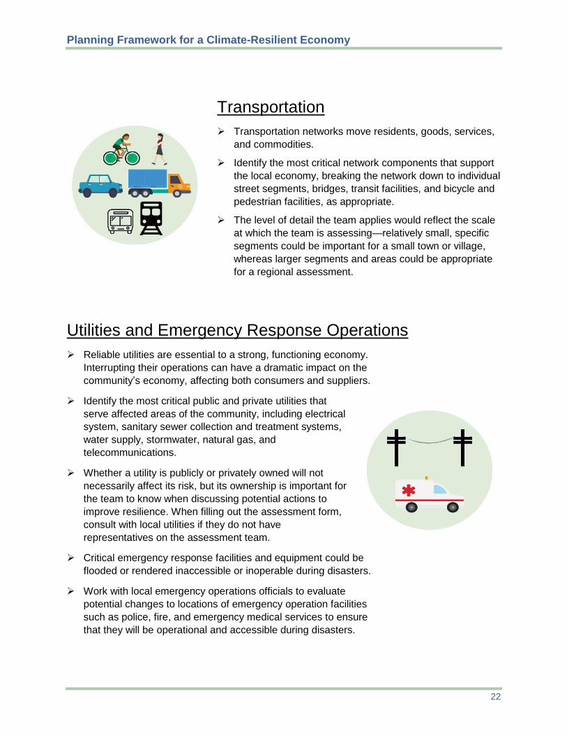
Transportation
Transportation networks move residents, goods, services,
and commodities.
Identify the most critical network components that support
the local economy, breaking the network down to individual
street segments, bridges, transit facilities, and bicycle and
pedestrian facilities, as appropriate.
The level of detail the team applies would reflect the scale
at which the team is assessing—relatively small, specific
segments could be important for a small town or village,
whereas larger segments and areas could be appropriate
for a regional assessment.
Utilities and Emergency Response Operations
Reliable utilities are essential to a strong, functioning economy.
Interrupting their operations can have a dramatic impact on the
community’s economy, affecting both consumers and suppliers.
Identify the most critical public and private utilities that
serve affected areas of the community, including electrical
system, sanitary sewer collection and treatment systems,
water supply, stormwater, natural gas, and
telecommunications.
Whether a utility is publicly or privately owned will not
necessarily affect its risk, but its ownership is important for
the team to know when discussing potential actions to
improve resilience. When filling out the assessment form,
consult with local utilities if they do not have
representatives on the assessment team.
Critical emergency response facilities and equipment could be
flooded or rendered inaccessible or inoperable during disasters.
Work with local emergency operations officials to evaluate
potential changes to locations of emergency operation facilities
such as police, fire, and emergency medical services to ensure
that they will be operational and accessible during disasters.
Planning Framework for a Climate-Resilient Economy
23
Industrial Operations
Industrial operations create jobs and inject money into the
community.
Industrial operations might be important parts of local and
regional supply chains, providing essential goods and
services to other businesses. Understanding how one
facility affects other businesses will be important in
evaluating the local economy’s true vulnerability to climate
change.
Key information to identify for each operation might include
name of the operation, types of goods and/or services it
manufactures and/or provides, and how many people it
employs.
Get relevant information by working with the local chamber
of commerce, business association, business district, or
county or regional economic development organization.
Use resources such as the community land use map, local
tax records, and walking or windshield surveys (gathering
information by walking or driving around).
Commercial Operations
Commercial operations (e.g., retail, restaurants, and
professional offices) create jobs, pay taxes, and could be
important links in local and regional supply chains.
Commercial assets might also contribute to unique
aspects of a local economy such as tourism or synergies
with other local businesses.
Key information to identify for each commercial operation
might include the types of goods and/or services it
provides, its relationship to other local businesses, and
how many people it employs.
To get relevant information, work with the local chamber
of commerce, business association, business district, or
county or regional economic development organization. Use
resources such as local tax records and walking or windshield
surveys.
Planning Framework for a Climate-Resilient Economy
24
Agricultural Operations
Farms are directly affected by climate (operations often
choose locations based on temperature and precipitation).
Change in the climate could dramatically affect operations
(e.g., too much rain could wash away soil or spoil crops,
while drought or extreme heat or cold could reduce the
quality and amount of the harvest).
Key information to gather might include the climate
conditions that make the community a good location, what
each operation produces, and the operation’s relationship
to businesses inside and outside the community.
Work with the individual operations’ managers and owners
and local agricultural extension staff to get the necessary
information.
Natural Resources
Streams, lakes, aquifers, and coastal waters support
agriculture, fishing, energy production, shipping and
navigation, manufacturing, and recreation.
Climate-related impacts include erosion, flooding, increased
water pollution, warmer water temperatures, and ocean
acidification. Drought can reduce water supplies while
economic growth might be increasing demand.
Green spaces, including wetlands, salt marshes, flood
plains, meadows, and woods, naturally filter and store
rainfall. Trees provide shade, reduce ambient air
temperatures, sequester carbon dioxide, and increase
property values and commercial activity.
Climate change puts city tree canopies and local forests used
for production at more risk from fire, drought, and pest
infestation.
Climate change can shift the range of where certain species
live, affecting local fishing, hunting, tourism, and agriculture.

Planning Framework for a Climate-Resilient Economy
25
3.3 Define and Apply a Local Vulnerability Scale
A vulnerability scale lets the team distill diverse factors for each asset into a representative
vulnerability designation where possible. It is not necessary to spend a great deal of time refining
this scale. The important thing is to have a consistent basis for distinguishing where climate-
related hazards pose the greatest risk to the local economy.
The sample assessment form uses “high,” “moderate,” “low,” and “none” as a scale to help
estimate and compare assets’ vulnerability to various climate impacts. The team could establish
ranges for each level; for example, a low level of risk might be that 1 to 5 percent of the asset
category could be affected by the climate hazard, a moderate level could be 5 to 20 percent, and
a high level could be more than 20 percent. To bracket the ranges, the team could consider
factors such as value of the assets, potential for collateral impact (i.e., dependence of other
economic activities on those assets), or similar concerns. Ultimately, the team can use whatever
scale it wants based on the community’s context and threats.
Once the team has defined a scale, it can apply it to each identified asset for each climate
change-related hazard. Some hazards (e.g., sea level rise, flood, and storm surge) affect only
specific areas of the community, while others such as drought and extreme heat might affect the
entire community. The team can rely on information and resources gathered during earlier steps
of this process to determine which assets are vulnerable to which threats. Figure 10 shows an
example of how a community might rate some of its assets.
Sub-step objective: Determine the comparative vulnerability of each asset to each climate stressor.
An asset’s vulnerability
Exposure to the threat
Effect the threat would have on its operations
Its ability to adapt to or protect against the threat

Planning Framework for a Climate-Resilient Economy
26
Figure 10: Sample rating of comparative vulnerability of assets based on each asset’s exposure to a threat, the effect the threat would have on the asset, and the asset’s ability to protect against the threat.
3.4 Assess Potential Positive and Negative Impacts on Economic Activity
Once each asset has a vulnerability designation for each hazard, the team can describe the
collective potential impacts of all threats for each asset in the “Description of Potential Impacts
on Economic Activity” column of the assessment form. This step distills all previous information
and findings into a clear connection between threat and economic impact for each asset and the
community as a whole. Based on local conditions and the identified hazards from step 2, the
team will determine which factors it will consider when evaluating economic impacts.
Particularly if it has limited time and resources, the team might want to focus on vulnerabilities
and potential economic impacts on critical local economic drivers.
The team would explore how each category and/or individual asset affects the local economy.
For example, a community with a manufacturing- and distribution-based economy might
None Low HighModerate
Asset: Business in floodplain with HVAC on theroof
Exposed to floods
Flood that damagesHVAC could shut downbusiness and requireexpensive repairs
Moved HVAC to roof toprotect against flooding
Asset: Business in floodplain with HVAC inbasement
Exposed to floods
Flood that damagesHVAC could shut downbusiness and requireexpensive repairs
Might be able to protectwith barriers
Asset: Monumentthat attracts tourists
Exposed to drought
No ill effects fromdrought
No need to protectagainst drought
Comparing Assets’ Relative Vulnerability
Sub-step objective: Determine how potential climate change impacts could affect each asset’s economic effect on the community, both positively and negatively.

Planning Framework for a Climate-Resilient Economy
27
consider how impacts to roads might affect supply chains, shipping, and other elements
important to creating and moving goods. If a storm surge shuts down the local transit system and
floods the main road to a factory, what might the local economic impacts be during the storm,
immediately after it, and in the long term (Figure 11)? To find indirect impacts in particular, the
team might need to conduct extensive interviews with local businesspeople, who might not be
aware themselves of these potential effects. Including this information in the assessment form
helps illustrate the interconnection of potential economic vulnerabilities among asset categories
and can help communities explore solutions—in this case, perhaps having a public transit system
that is less vulnerable to flooding could encourage more businesses to locate in the community
because it offers more reliable transportation.
Figure 11: Sample impacts to consider in assessing effects on economic activity.
To get a complete picture of potential effects on the economy, the assessment team should try to
identify both negative (Figure 12) and positive (Figure 13) impacts. Appendix D provides some
sample questions for the common asset categories to help the team estimate the relative
magnitude of potential negative and positive economic impacts. Engaging stakeholders who
understand environmental justice issues, if they are not already on the team, can help identify
impacts that disproportionately affect low-income, minority, and overburdened communities, as
well as positive impacts that might be leveraged to create broader benefits.

Planning Framework for a Climate-Resilient Economy
28
Figure 12: Sample negative impacts to consider.
Figure 13: Sample positive impacts or potential opportunities to consider.
Potential positive impacts might include:
Climate change impacts Businesses and residents Local businesses could
might affect spending might need climate-resilient provide goods and services
patterns, economic drivers, products and services such that might be in greater and consumer preferences in as drought- and salinity- demand after a natural ways that could create new resistant crops, water- disaster (e.g., building local business sectors or efficient technologies, storm-
materials or landscaping that synergies. resistant building materials,
might be needed to rebuild and renewable energy
after a storm). For example, rainier weather manufacturing and
or hotter days might make installation. Rezoning and infrastructure people want more indoor improvements that build activities. Businesses that Which of these new products
resilience could help the depend on warm weather and services could the local
community attract more could see longer seasons business community
businesses. with milder autumns and provide? How might the local
springs extending the government support
summer season. businesses that want to experiment with climate-
resilient goods and services?
Potential negative impacts on:
ALL ASSETS JOBS BUSINESSES
Some assets might be at risk Problems might arise for Production capacity or of complete loss (i.e., inability commuting to work. efficiency in doing business to access or use the asset). might be reduced or disrupted.
Work might take longer or What would this mean for cost more because outdoor Capital or operations and businesses, residents, workers have to work maintenance costs might workers, visitors, and the shorter hours in extreme increase. economy? heat.
Demand for goods and
NATURAL RESOURCES Which workers are more services might drop.
likely to be affected by Climate impacts could harm work interruptions or Workers or jobs might be lost. natural flood protection, layoffs? ecosystem services, wildlife Climate change might lead to habitat, and tourist attractions. Which jobs might be changes in consumer
disrupted temporarily? preferences, consumption How might these impacts Where might permanent patterns, and length of prime affect specific business layoffs occur? consumption periods for sectors? seasonal businesses.

Planning Framework for a Climate-Resilient Economy
29
NORTH KINGSTOWN EXAMPLE
Table 2 shows how the North Kingstown team assessed the likely impacts of
climate change on the town’s local economic assets, including transportation,
commercial and industrial operations, agriculture and fisheries operations, and
natural resources. Holding separate meetings with each group of local experts to fill
out the table made the most efficient use of their time, since members of each board
have knowledge of different assets. Specifically, the Conservation Commission
considered agricultural and natural resource assets, and the economic boards
considered transportation infrastructure and commercial operations. The
representative from Quonset Development Corporation considered industrial
operations, and town planning staff participated in all meetings and assessed the
vulnerability of assets not addressed by the other participants.
In the meetings, it quickly became clear that the number of hazards
needed to be expanded from those shown in the sample form in Table 1.
In North Kingstown, participants evaluated the impacts from not only sea
level rise, floods, storm surge, drought, and extreme heat, but also from
wind damage, blizzards, an increase in pests and diseases, and ocean
acidification. Likely impacts were ranked as “high,” “moderate,” or
“low,” with discussion of the location of impacts (some of which would
be felt townwide, while others would be felt only in particular areas along
the coast). Some opportunities for economic development associated with
climate change were discussed, but the focus was on impacts. Completing
the table provided the foundation for a discussion of which hazards and
opportunities the town was most interested in addressing. (Because of
space constraints, not all of the impacts or community assets that the team
assessed are shown in Table 2.)
Figure 14: Wickford Village in North Kingstown.
Figure 15: Lobster traps at Wickford Harbor.

Planning Framework for a Climate-Resilient Economy
30
Table 2: Sample of the North Kingstown team’s preliminary evaluation of key community assets
Vulnerability Rating: High (H), Moderate (M), Low (L)
Community assets Flo
od
ing
(in
lan
d)
Se
a l
eve
l ri
se
Sto
rm s
urg
e
Win
d d
am
ag
e
Bli
zza
rd
Dro
ug
ht
Te
mp
era
ture
ch
an
ges
Description of potential impacts on economy
Transportation
Roads L L L L M
Bridges L L L L M
Bicycle path L M M L L
Passenger rail L L L L M
Freight rail M L M L M L/M Freight rail line into Quonset susceptible to flooding. High temperatures can affect rail.
Bus service M M M L H
Airport (on Quonset) L M M M L L L Airport run by Rhode Island Airport Corporation, which retrofitted new terminal and hanger with a 3’ wall to reduce flooding potential.
Industrial Operations (by area)
Quonset and Davisville waterfront L H H L/M L M L
Quonset has its own water system, and a couple of industrial operations with high water use could be affected by a drought. Potential for additional business at Quonset if other ports shut down by storms (e.g., Port of Halifax closed in March 2015, and 6 ships were diverted to Quonset). Sea level rise may provide temporary opportunity if port can accept larger ships with deeper drafts.
Commercial Operations (by area)
Wickford Village M/H H H H H
At the confluence of inland and coastal flooding. Roads into and out of the village very vulnerable to sea level rise, storm surge, and flooding. Water supply restrictions might affect restaurants.
Davisville L L L M M May be opportunities to reduce stormwater with porous paving in parking lots.
Saunderstown L L L H M
Post Road south of 403 M L L/M H/M M Flooding in big storms since the road doesn’t drain well.
Wickford Junction L L L M M

Planning Framework for a Climate-Resilient Economy
31
Vulnerability Rating: High (H), Moderate (M), Low (L)
Community assets Flo
od
ing
(in
lan
d)
Se
a l
eve
l ri
se
Sto
rm s
urg
e
Win
d d
am
ag
e
Bli
zza
rd
Dro
ug
ht
Te
mp
era
ture
ch
an
ges
Description of potential impacts on economy
Agriculture and Fisheries Operations
All irrigation water is from ground water wells and farm ponds. Restrictions on water use every summer. Need to do more recharge through green infrastructure. Excessive or heavy rain can prevent planting in spring or lead to crop failure. May be opportunities in growing new, more heat-tolerant crops (e.g., plums) or multiple crops in a single growing season (e.g., hay).
Annual crops (e.g., vegetables) H H H
Livestock/hobby H M L M M
Orchards H M L M M H H
Turf farms H M L M M H Established turf can probably withstand some flooding, but prolonged drought is a threat.
Fisheries L L H H L L H
Oysters and mussels are grown locally. Few fishing boats operate out of Wickford Harbor. Black sea bass and tautog are migrating north as the ocean warms—may be opportunity to harvest new species.
Natural Resources
Parks/golf courses M/H Coastal ones: H
Coastal ones: H M L H
Wilson Park most prized recreational asset. A few golf courses. Tick-borne diseases are public health threat.
Beaches L H Coastal one: H L L
Wickford Harbor n/a H H L L
Wetlands and watercourses H
Coastal ones: H
Coastal ones: H L L H
The Narrow River is ecologically important and vulnerable to storm surge.
Protected open space/trails L
Coastal ones: H
Coastal ones: H M L
State owns land on Gilbert Stuart Road (next to Carr Pond/Gilbert Stuart Pond) and there is a state park at Rome Point. Tick-borne diseases are public health threat.
Ground water L L H L L H
Forests L L M M L Largest area is Cocumscussoc State Park. Tick-borne diseases are public health threat.

Planning Framework for a Climate-Resilient Economy
32
Step 4: Analyze Overall Economic Implications for the Community
To gain a comprehensive understanding of climate-related economic vulnerability and
opportunity, the team should analyze each asset not only individually but also as a component of
an interconnected economy. The goal of this step is to develop a comprehensive picture of the
local economic risks and opportunities associated with climate change.
Damage to transportation or utility assets, for example, could have far-reaching impacts on all
sectors of the economy, including businesses, homes, and tourist attractions. Exploring these
connections provides a picture of the potential communitywide economic impacts, positive and
negative, of climate change.
The team will likely find it useful to gather public and stakeholder input—beyond what it has
already done—to make sure it is finding the relevant connections and considering the
implications for all parts of the community. The information gathered in prior steps, along with
local knowledge, can help the team make connections between various asset categories, climate-
related risks, and the local economy. To make this task more manageable, the team could analyze
economic implications from the business perspective, real estate and residential demographics,
and public-sector support.
Analyze business perspective and resources
Business stability: How will the community’s major economic drivers (i.e., core
businesses and business sectors) likely fare if no mitigation or adaptation measures are
taken? For example, in the short term, would businesses be able to survive an event like
Hurricane Sandy, or would that kind of severe, one-time event drive them out of
business? Consider how strong businesses or sectors might be over the long term (e.g., if
the community’s economy relies on shellfish, which are getting scarcer because of ocean
acidification and shifting habitat, what will happen to the local economy over time?).
Which businesses will need the most help to recover from short-term impacts and prepare
for long-term changes?
Finance (public and private): How might climate change and its impact on the
community affect public and private financing sources that have traditionally supported
development? How might climate change impacts affect the nature and amount of
financing that industries or businesses need? Does the community rely on financing
sources that might experience financial stress due to climate change? Would any of the
community’s existing financing sources be reluctant to continue investing in high-hazard
areas? What kind of public financing would be available if a major natural disaster (e.g.,
flood, storm, or wildfire) occurred? Is public financing available for upgrades to
individual businesses or public infrastructure to make them more resilient? Could the
community’s current financial resources support efforts to build community-level
resilience over time?
Planning Framework for a Climate-Resilient Economy
33
Insurance cost and availability: How do residents and business owners perceive the
burden of insurance cost (e.g., high or low) for the relevant climatic factors (e.g., fire,
flood, or storm damage)? Is the cost of insurance likely to increase in the community due
to climate change? Will increasing insurance rates significantly raise the cost of doing
business? Could the public sector help to decrease or maintain insurance rates (e.g.,
through the National Flood Insurance Program Community Rating System)? Is it possible
that insurance will no longer be available for some climate hazards, and if so, what would
be the consequences?
Competitive advantage: What competitive advantage does the community already enjoy
(e.g., a distinctive character or a location close to major transportation routes), and how
might the potential economic impacts, negative or positive, affect that advantage? Is the
community already well positioned to encourage climate-resilient businesses? Could the
community market itself as better-prepared for climate change and thus safer for long-
term investment? Would businesses that offer climate-resilient products or services or
that meet changing consumer demands be more competitive? Would the gains from
climate-resilient offerings be enough to offset expected economic losses?
Analyze real estate and residential demographics
Residential areas and socioeconomic conditions: Threats to residential areas can have
profound impacts on overall economic health because a community without a healthy
residential population will not support a functioning economy. What overall
repercussions, such as reduced services, amenities, or tax revenue, might projected
climate change impacts bring? Might those repercussions drive residents and businesses
to leave the community? On the other hand, might climate change create significant
economic opportunities (and if so, how)? What are the community’s overall population
demographics, and which populations are most vulnerable to climate change impacts
because of their location, income level, age, health, or other factors? Where do
employees of various sectors live, and how do they commute to and from work? What
might be the economic impacts of a severe weather event that mainly affects a residential
area? For example, if a flood hits a low-lying residential neighborhood where many local
workers live, the workers might not be able to get to work, which could affect businesses.
Real estate: What types of residences does the community have (e.g., single-family
homes, multifamily buildings, and vacation rental or second homes)? If vacation rental or
second-home properties are in particularly vulnerable areas or depend on the weather
(e.g., snow for skiing or pleasant weather for beaches), how might that affect the
community’s tourism and real estate market? Are particular parcels or neighborhoods at
much higher risk due to climate change? Which businesses and industries rely on them?
Are there less risky or problematic locations that would be viable for those businesses or
industries? If relocation becomes necessary, would an individual business-by-business
approach work, or would the community need a comprehensive strategy to relocate?
Could changes to building codes make new development less risky for businesses and

Planning Framework for a Climate-Resilient Economy
34
industry? How much of a financial burden might these changes be for developers and
buyers? What kinds of upgrades might be required to make existing development less
risky or to decrease the impact of climate change? Are rising maintenance costs as a
result of climate change going to increase the cost of development? Does vulnerable real
estate play a major role in generating public revenue?
Analyze public-sector support and private-sector leadership
Postdisaster rebuilding: If the community has recently experienced a disaster, is
rebuilding occurring with an awareness of current and future climate-related hazards?
Are there opportunities to rebuild in a more resilient way than previously? Are local or
regional businesses supporting the rebuilding? Have major contracts for rebuilding gone
to local businesses?
Business and economic development support: What actors and systems support
businesses currently, and how might those actors or systems change under the identified
climate change impacts? Have leaders in industries that could help advance resilience in
economic development, either through products, services, or leadership, recognized those
opportunities? In the case of a natural hazard, are the public and private sectors aware of
who can assist with emergency management, response, and rebuilding? In the public
sector, are there major economic development priorities that might compete with
increasing resilience? Are there ways in which those priorities and resilience could
complement each other?
Municipal finance: How might climate change impacts influence the community’s
primary sources of municipal revenue (e.g., real estate tax, sales tax, or other source)?
How might climate change impacts affect real estate tax revenue (e.g., consider the
number and value of parcels and structures that are especially vulnerable to hazards)?
How might extreme events, more frequent events, or permanent changes such as sea level
rise affect the value of parcels and structures, including estimates of the costs of damages
and adaptive strategies such as elevating, relocating, or abandoning structures? If the
municipality receives sales or hotel taxes, how might climate change affect those revenue
streams? How have prior extreme weather events affected those sources of revenue? How
vulnerable are the industries and individual businesses that generate significant
percentages of those revenues, and how might climate change affect their business in the
long term (e.g., is a ski resort likely to lose significant business because of a shorter snow
season, or could it become a year-round business by adding warm-weather activities)?
Are municipal assets likely to require significant capital investment to become resilient or
adapt to climate impacts (e.g., relocating, elevating, or replacing municipal buildings and
infrastructure)? How are municipal operating costs likely to change as a result of climate
change (e.g., more frequent replacement or repair of stormwater and transportation
infrastructure, additional emergency response costs)?

Planning Framework for a Climate-Resilient Economy
35
Step 5: Explore Options to Enhance Resilience and Pursue
Opportunities
The final step of the framework is to help the community explore options for improving its
resilience based on the results of the assessment. Actions include:
5.1 Raise public awareness and garner support.
5.2 Identify actions to enhance economic resilience and pursue opportunities.
5.1 Raise Public Awareness and Garner Support
The results of the assessment, including the climate projections and implications, are key
messages to convey to stakeholders and the public. Public outreach and buy-in will be critical, as
the community will ultimately be responsible for implementing or approving funding for public
actions to enhance economic resilience. Stakeholder and community engagement conducted
during the assessment phases can suggest the values and priorities that frame community
perspectives on climate change and economic prosperity. These values and priorities will play a
major role in continuing to build public awareness after the assessment is complete.
To communicate effectively, the team should create a consistent message emphasizing
opportunities to improve resilience. The team should support an ongoing exchange of
information and feedback between the team, key stakeholders, and the public about the
assessment and subsequent strategies.
Create a consistent, positive message: Messages that steer away from “doom and
gloom” and emphasize opportunities, such as “building a resilient economy,” are
generally more effective. The team can share its assessment of what could help maintain
business stability, attract customers and investments, and improve the community’s
reputation for supporting a healthy, climate-resilient economy. If the community has
recently suffered a severe weather event, referencing this event as a sign of a long-term
trend, not a once-in-a-lifetime occurrence, can help stakeholders make the connection
between climate and their economic well-being. Memories of a severe weather event
could trigger strong emotional responses from the community, so the team will want to
be sensitive to people’s reactions.
While it can be important to show the negative consequences of inaction, emphasizing
the multiple benefits of taking action can galvanize the community to take advantage of
opportunities. Any connection the team can make between the community’s shared
values, such as fiscal prudence or natural resource protection, and potential solutions can
help build support.
Sub-step objective: Present the assessment results to the broader community and solicit ongoing input as a foundation for taking action to become more economically resilient.

Planning Framework for a Climate-Resilient Economy
36
Inform and get input from the community: To inform the broader community and
begin developing ideas for actions to enhance resilience and pursue opportunities, the
team will need to reach out to key stakeholders and the public. The team can build on
engagement and communication that happened in previous steps of the assessment to
explore ideas for putting the assessment results to use. The team could host an interactive
public event on climate change and economic resilience to educate the community and
explore solutions and opportunities. Partnering with neighborhood groups can be an
effective way to bring new faces into a community engagement event.
Key stakeholders to reach include individuals or groups who are affected by projected
climate impacts, those who have influence or power over implementing policy changes,
and those who contribute to the community’s economic development vision (e.g.,
chamber of commerce, trade organizations, or prominent firms). Outreach could be
incorporated into existing community forums and activities, or the assessment team could
hold strategic small group or one-on-one meetings. For example, the team could meet
with businesses that led or helped recovery after past severe events to share the
assessment findings, discuss their experiences, and solicit their ideas about next steps for
the public and private sectors. The team could also ask the stakeholders and businesses
that returned after the severe event if they would consider using their experience to
mentor other businesses. The team might also want to reach out to neighboring
jurisdictions and other governmental entities in the region that might be interested in the
assessment results.
5.2 Identify Actions to Enhance Economic Resilience and Pursue Opportunities
The assessment results and the public engagement should help start discussions, publicly and
privately, about how the community and individual properties and businesses can become more
resilient. These discussions can also explore how to take advantage of potential opportunities and
position the community and its businesses to thrive even as the climate changes.
The assessment results will help the community determine where to focus its economic resilience
efforts and choose actions to improve resilience and bring other benefits. For example, if the
community’s major economic assets are most at risk from sea level rise, the community might
want to explore policy options that reduce businesses’ exposure to storm surges, encourage new
and expanding businesses to locate away from the coast, create alternatives for transportation
modes and routes that are likely to be disrupted by a storm surge, and preserve or create natural
areas that can absorb flooding.
Sub-step objective: Develop public- and private-sector actions that can help the community make its economy more resilient to climate-related threats and help businesses take advantage of climate-related opportunities.

Planning Framework for a Climate-Resilient Economy
37
To help communities start thinking about potential actions to pursue, this section includes several
policies for the public and private sectors that can bring multiple benefits in addition to building
resilience (summarized in Table 3).
Table 3: List of public- and private-sector policies and actions
A. Public-Sector Actions 1. Convene partners to build capacity and share effective practices.
Convene businesses involved in recovery efforts in past natural disasters to share their experience.Discuss a potential business-to-business mentoring program on resilience.
Encourage networking opportunities for businesses in the community and the region interested inenhancing resilience.
Explore opportunities for local and regional collaboration on resilience with regional governmentalentities, chambers of commerce, or regional industry associations.
Work with business and economic development groups poised to take advantage of new resilience-related market opportunities to find out how the local government could help.
Convene local businesses to help identify the town’s assets that could become the basis for economicgrowth, and consider integrating these assets into the economic development plan.
2. Incorporate projected climate impacts into policies and regulations, such as land use, hazard mitigation,and economic development plans and related ordinances such as building and zoning codes.
Update the local comprehensive plan to identify areas that are—or are projected to become—morevulnerable to climate change impacts, and protect those areas.
To implement the updated comprehensive plan, adopt zoning that promotes the safety and longevity ofdevelopment.
Consider incentives to encourage development in more desirable locations.
Incorporate measures into hazard mitigation and other plans to rebuild in stronger and more resilientways should a disaster occur.
Use economic development and land use planning to support economic diversification.
Use economic development planning and funding to support resilience innovation in the area’s mostcompetitive sectors.
Create (before a disaster) a postdisaster redevelopment plan that includes a section on economicredevelopment.
3. Strengthen the resilience of infrastructure on which businesses rely (e.g., stormwater, wastewater,drinking water, utilities, and transportation).
Incorporate backup electricity generation and resilience in the grid—for example, through on-siterenewable energy or a micro-grid.
Work with utility providers to improve resilience of critical systems.
Implement green infrastructure techniques, which use soils, vegetation, and natural processes toreduce polluted stormwater, to reduce flooding and protect water quality.
Develop transportation networks with multimodal options that improve everyday transportation butalso can operate in emergencies.
Relocate or demolish at-risk municipal facilities that cannot be made resilient, and consider establishingan acquisition or buyout plan for at-risk commercial properties.
4. Help businesses plan and invest for climate hazards and opportunities.
Develop financing and technical assistance programs to help businesses improve the resilience of theirinfrastructure and operations.

Planning Framework for a Climate-Resilient Economy
38
Incorporate into the community’s marketing to business the public-sector’s commitments to resilienceand private-sector leaders who are preparing for climate change.
Promote development patterns that make it easier for businesses to be flexible and experiment withnew ideas.
B. Private-Sector Actions 1. Improve resilience.
Build human resources capacity to manage climate hazards, including by sharing the assessment resultswith firm leadership, managers, and employees; training staff in emergency response; and assigningclimate hazard management to a specific employee.
Plan for climate change-related vulnerabilities and opportunities by incorporating relevant findingsfrom the assessment into strategic planning, creating or updating a continuity-of-operations plan,identifying where the firm needs to enhance its resilience, incorporating resilience into strategicplanning and values statements, and sharing assessment findings with business groups.
Make structural investments such as floodproofing measures and green infrastructure practices, andconsider where it makes sense to locate or expand a business.
Make operational investments, such as in water- and energy-efficient equipment and practices.
2. Pursue opportunities to move into climate-related and/or climate-resilient markets.
Conduct formal market research that considers growth projections, and identify areas in which the firmcould compete in this market.
Identify regional innovation hubs working on vulnerabilities in your industry, and explore opportunitiesto partner or pilot technologies or practices.
Build relationships with firms doing complementary work in climate-related markets.
Build relationships with institutions that provide workforce training.
For tourism-related businesses, consider what amenities might make it possible to sustain—orchange—business given anticipated changes in weather patterns.
Explore opportunities to develop onsite renewable energy generation and energy- and water-efficiencytechnologies, and train workers to install and maintain them.
A. Public-Sector Actions
Public-sector actions could include convening partners, changing regulations or policies,
strengthening infrastructure, and helping businesses plan and invest for climate hazards and
opportunities.
1. Convene partners to build capacity and share effective practices.
Convene businesses that have helped or led recovery efforts in past natural disasters to
share findings of the team’s assessment, discuss their experiences, and solicit
recommendations about next steps for the public and private sectors. Discuss the
potential for establishing a business-to-business mentoring program on resilience. The
Louisiana Disaster Recovery Unit’s Big Business–Small Business Emergency
Management Mentorship Program offers resources that might be useful, including a
sample mentor-protégé partnership agreement and a mentorship program guide.7
7 NIMSAT Institute. “Big Business–Small Business Emergency Management Mentorship Program.”
www.disasterb2bmentor.org/BBSB/Home.aspx. Accessed Nov. 4, 2015.

Planning Framework for a Climate-Resilient Economy
39
Encourage networking opportunities for businesses in the community and the region
interested in enhancing resilience. For example, develop a listserv or host regular
workshops for area businesses that wish to integrate resilience into business practices.
Reach out to existing business networks such as industry groups and chambers of
commerce to help convene businesses. Through these channels, seek to understand the
ongoing needs and challenges of businesses in the community with regard to climate
impacts and climate-related opportunities.
Explore opportunities for local and regional collaboration on resilience. The regional
council of governments or metropolitan planning organization could help convene
municipalities. Chambers of commerce or regional industry associations could help bring
together private-sector entities.
EXAMPLE
Clinton County, Ohio, suffered an economic disaster rather than a natural one when its major
employer shut down. County leaders worked with the state to create a task force made up of
state, local, business, labor, educational, and other representatives. The task force worked with
Energize Clinton County, a nonprofit created by the regional planning commission, to hold
public meetings about the county’s economic future. The resulting strategy focused on
supporting and diversifying local businesses, attracting and retaining young people, and
encouraging renewable energy and energy efficiency, among other things. Energize Clinton
County worked with the University of Cincinnati’s planning school to help villages in the
county develop their first-ever comprehensive plans.8 This model of regional collaboration
could apply to economic resilience to climate change as well. Developing strategies to diversify
the economy, create more opportunities, and prepare for climate change can help communities
and regions avoid major disruptions instead of waiting until they occur and responding to them.
Work with business and economic development groups that are poised to take advantage
of new market opportunities related to resilience to find out how the local government
could assist them—for example, by helping to identify commercial spaces, train or recruit
workers, or streamline permitting.
Convene local businesses to help identify the town’s particular assets that could become
the basis for economic growth and potential changes (e.g., seasonal, annual, long-term),
and consider integrating these assets into the local economic development plan.9 The
economic development plan could take into account projected climate changes and how
they might affect local assets. For example, if the town relies on tourism based on nearby
8 Schock, Christian, et al. “Growing Forward in Response to an Economic Disaster.” Economic Development
Journal. International Economic Development Council. Winter 2014. 13, No. 1. energizecc.com/wp-
content/uploads/2014/03/EDJ_Winter14_final.pdf. 9 For examples of how towns have used their existing assets to strengthen their economies, see: EPA. How Small
Towns and Cities Can Use Local Assets to Rebuild Their Economies. 2015. www.epa.gov/smartgrowth/how-small-
towns-and-cities-can-use-local-assets-rebuild-their-economies.

Planning Framework for a Climate-Resilient Economy
40
parks, rivers, and other natural resources, climatic changes might cause more floods,
make outdoor activities less appealing in hotter temperatures, or increase the chances of
wildfires. The town might need to think about how to protect those local assets or shift its
economy to less climate-dependent assets.
Convene stakeholders experienced in leveraging resources across different levels of
government, building communities’ capacity to handle complex challenges, and working
with vulnerable communities. These stakeholders might not necessarily be involved in
either economic development or resilience but might have experience in other fields that
can translate into building economic resilience.
2. Incorporate projected climate impacts into policies and regulations, such as land use,
hazard mitigation, and economic development plans and related ordinances such as building
and zoning codes.
Update the local comprehensive plan to identify areas that currently are—or are projected
to become—more vulnerable to climate change impacts such as flooding, and target those
areas for additional protection. The local hazard mitigation plan can be helpful if it takes
into account climate change projections. Rhode Island requires local comprehensive
plans to have a chapter dedicated to hazard mitigation10 and provides guidance for
municipalities on planning for climate change.11 Identify areas where growth should be
encouraged—places that are in or well-connected to already-developed areas and that are
less vulnerable to flooding and other hazards—and consider ways to encourage it.
Encouraging development and redevelopment in these areas not only keeps people and
property safe, it also takes development pressure off of undeveloped land that can protect
the community from hazards such as flooding and avoids costly new infrastructure and
utility extensions. Incorporate this information into the economic development plan as
well to determine where economic growth should be encouraged—for example, centrally
located, walkable districts.
To implement the updated comprehensive plan, adopt zoning that promotes the safety
and longevity of development. Zoning strategies can make the cost of development in
hazardous areas more reflective of the cost of mitigating flood hazard risks, encourage
development in appropriate locations, discourage it in more vulnerable areas, or establish
performance standards to reduce risks.12 For example:
10 Rhode Island Comprehensive Planning and Land Use Act. §45-22.2-6 Required content of a comprehensive plan.
Amended 2011. webserver.rilin.state.ri.us/Statutes/TITLE45/45-22.2/45-22.2-6.HTM. 11 The Rhode Island Comprehensive Planning Standards Guidance Handbook Series: Guidance Handbook #12:
Planning for Natural Hazards & Climate Change. Approved by the Rhode Island State Planning Council Jan. 14,
2016. www.planning.ri.gov/statewideplanning/compplanning/handbook.php. 12 For more information on zoning strategies to encourage development in less-vulnerable places and discourage or
protect it in more-vulnerable places, including the strategies described here and others, see:
EPA. Using Smart Growth Strategies to Create More Resilient Communities in the Washington, D.C., Region.
2013. www.epa.gov/smartgrowth/using-smart-growth-strategies-create-more-resilient-communities-washington-dc-region.
EPA. Planning for Flood Recovery and Long-Term Resilience in Vermont: Smart Growth Approaches for Disaster-
Resilient Communities. 2014. www.epa.gov/smartgrowth/planning-flood-recovery-and-long-term-resilience-vermont.

Planning Framework for a Climate-Resilient Economy
41
o Infill and mixed-use zoning: Encourage growth in already-developed locations that
are less vulnerable to natural hazards, and consider incentives such as streamlined
development approvals for infill development. Where it is not possible to encourage
growth in or connected to already-developed areas, communities can build new
mixed-use centers compactly, which reduces the cost of new infrastructure and makes
it easier for people to walk or bike to destinations.
o Flood plain and flood way regulations:
Implement flood plain development limits
that exceed FEMA requirements, essentially
prohibiting new development in flood plains
or flood ways unless a variance is granted.
For example, Northampton, Massachusetts,
changed its regulated flood plain boundaries
from FEMA’s 100-year flood plain to the
500-year flood plain as a proxy for climate
change.13 Some local governments have a
stream buffer zoning ordinance in addition
to flood plain and flood way regulations.
For example, Chapel Hill, North Carolina,
requires a 150-foot vegetated stream buffer
on each side of perennial streams and 50
feet on each side of intermittent streams.
o Agricultural or open space zoning: In the comprehensive plan, identify active
farmland and valuable open space areas that should be preserved, then create zoning
districts delineating these areas. Communities can work with farmers to reduce flood
risk in the community by buying conservation easements from willing sellers or
providing incentives for farmers to implement predisaster mitigation measures.
o Transfer of development rights program: Some communities, such as Montgomery
County, Maryland, require agricultural or open space zoning to be linked to areas
designated for higher-intensity development through a transfer of development rights
program. In this program, developers in the growth area buy development rights or
credits from the agricultural areas.
o Conservation design: A conservation design ordinance requires new development to
protect 40 percent or more of the tract’s buildable land in intact open space, including
sensitive natural areas. A few local governments require conservation design in
sensitive areas such as drinking water supply watersheds or agricultural districts.
Where development is concentrated in another part of the site, it should be well
linked internally and to adjacent development.
13 City of Northampton, MA. “Multi-Hazard Mitigation and Climate Adaptation.”
www.northamptonma.gov/1415/Hazard-Mitigation. Accessed Feb. 2, 2016.
Figure 16: Flood Resilience Checklist
EPA’s Flood Resilience Checklist (www.epa.gov/smartgrowth/flood-resilience-checklist) can help communities identify ways to improve their resilience to floods by assessing policies and regulations such as the comprehensive plan, hazard mitigation plan, land use codes, and non-regulatory programs. It includes overall strategies to improve flood resilience as well as specific strategies to conserve land and discourage development in river corridors; protect people, businesses, and facilities in vulnerable settlements; direct development to safer areas; and implement and coordinate stormwater management practices throughout the watershed.

Planning Framework for a Climate-Resilient Economy
42
The Georgetown Climate Center developed a model zoning ordinance for sea level rise
that could be used for shorelines, river corridors, or any climate hazard area.14 The
ordinance, tested in communities in Connecticut and Maryland, “extends the boundaries
of the areas subject to flood plain regulations to protect development that will become
increasingly vulnerable to impacts as sea level rise drives flooding further inland.” It
includes two districts:
o Conservation zone: This zone, designed to gradually relocate development out of
highly vulnerable areas and protect natural resources, could allow only low-intensity
or low-density uses such as agriculture or recreation, keep buildings away from the
water with larger setbacks, limit structures’ size to let them be more easily relocated,
and prohibit rebuilding storm-damaged structures in highly vulnerable areas or
structures that have been repeatedly damaged.
o Accommodation zone: This zone, designed to allow continued development while
requiring structures to be more resilient to floods, could downzone permitted uses to
limit development of critical facilities or require more intense uses to receive a
special use permit, increase setbacks to account for erosion or create tiered setbacks
based on the structure’s size, require structures to be elevated to account for projected
sea level rise, or limit structures’ size or height.
Consider incentives to encourage development in more desirable locations—places that
are both less vulnerable to climate-related impacts and well-connected to existing
development, infrastructure, and transportation options. Incentives can be financial, such
as tax credits for protecting natural resources, or procedural, such as height or floor area
bonuses for designs that are more resilient to hazards.
Incorporate measures into hazard mitigation and other plans to rebuild in stronger and
more resilient ways should a disaster occur. Identifying and assessing hazards as they
relate to infrastructure, capital improvement, and/or transportation improvement plans
lets a community prioritize projects and pursue funding from state and federal sources.
Communities that upgrade local plans are also in a better position to request postdisaster
assistance when the next disaster occurs because they already have projects identified and
know where and how to direct rebuilding.
Communities can align their capital improvement plans with hazard mitigation plans to
identify infrastructure and critical facility vulnerabilities or deficiencies and plan for needed
improvements. They can inventory infrastructure and facilities and document how well the
infrastructure can handle known and projected hazards (e.g., culvert capacity relative to 500-
year stormwater flows). Incorporating hazard information into long-term capital
improvement planning can help prioritize projects such as upgrading roads and utilities in
safer development areas; improving stormwater infrastructure; restoring streams and habitat;
14 Grannis, Jessica. Zoning for Sea-Level Rise: A Model Sea-Level Rise Ordinance and Case Study of
Implementation Barriers in Maryland. Executive Summary. Georgetown Climate Center. 2012.
www.georgetownclimate.org/zoning-for-sea-level-rise.

Planning Framework for a Climate-Resilient Economy
43
elevating roads to protect infrastructure and evacuation routes; upgrading culverts and
bridges to accommodate anticipated 500-year flood levels (where cost-effective, and 100-
year flood levels at a minimum); and elevating, relocating, or floodproofing critical facilities.
EXAMPLES
Oregon promotes integration of diverse planning resources with hazard mitigation. Statewide
planning goals pass along safety and resilience requirements and/or suggestions to each
municipality on a range of topics, including requiring inventories of hazard risk areas in
comprehensive plans; adopting land use plans that reduce vulnerabilities to hazards; updating
building codes with requirements related to earthquake, wind, wildfire, and flood hazards;
requiring new critical facilities to undergo hazard-specific site analysis; and encouraging
overlay zoning and transfer of development rights to restrict unsafe development.15
After a severe tornado in 2007 destroyed
more than 90 percent of its buildings,
Greensburg, Kansas, committed to rebuilding
a green, resilient community. As of 2015, it
has the most LEED buildings per capita of
any place in the country, all of the electricity
used in the city comes from wind energy, and
green stormwater management practices
collect rainwater for irrigation and other
uses.16 The city updated and integrated hazard
mitigation into its local planning and building
requirements. It included requirements for
safer, more sustainable development practices, such as required burying of power lines,
required backup generators for critical facilities, an updated building code to reduce wind
damage, and building safe rooms using FEMA guidelines.
Use economic development and land use planning to support diversification, particularly
in communities that rely heavily on a single, climate-vulnerable industry. Ensure that
plans and codes allow economic growth in new directions while supporting the local
economy’s traditional base. For example, codes could allow a mix of uses in zoning
districts to encourage home-based businesses and eliminate any minimum size
requirements for commercial properties to help entrepreneurs find small, inexpensive
spaces to start a business. Economic development plans can explore how to diversify the
economy, taking into account how climate change projections might affect current and
prospective local industries.
15 FEMA. Integrating Hazard Mitigation Into Local Planning: Case Studies and Tools for Community Officials.
2013. http://www.fema.gov/media-library/assets/documents/31372. 16 Greensburg, Kansas. “5 Ways We Put the ‘Green’ in Greensburg.” www.greensburgks.org/sustainability/how-we-
put-the-green-in-greensburg. Accessed Nov. 10, 2015.
FEM
A/S
teve
Zu
mw
alt
Figure 17: Greensburg rebuilt after the tornado with an emphasis on green building, renewable energy, and resilience to future disasters.

Planning Framework for a Climate-Resilient Economy
44
Use economic development planning and funding to support resilience innovation in the
area’s most competitive sectors. Local governments can encourage business incubators
that explore resilience-related technologies by offering technical and financial assistance
or helping to find a location for an incubator. Not only do new businesses generally
benefit the local economy, but the products and services developed by the incubated
companies can help a community become safer and more resilient.
17 Bethesda Green. “Join the Bethesda Green Incubator.” bethesdagreen.org/index.php/join-the-bethesda-green-
incubator. Accessed Nov. 17, 2015. 18 NYCEDC. “RISE: NYC.” rise-nyc.com. Accessed Nov. 17, 2015. 19 NYCEDC. “Finalists: Bright Power.” rise-nyc.com/finalists/bright-power. Accessed Nov. 17, 2015.
EXAMPLES
The Bethesda Green Incubator was started in 2009 by Bethesda Green, a public-private
partnership in Bethesda, Maryland, working to provide sustainable solutions to improve the
economy, environmental stewardship, and overall quality of life. The incubator provides
financial and technical assistance to startup businesses that provide innovative, sustainable
products and services. It offers office space; legal, accounting, and marketing assistance; access
to funding, mentoring, and collaboration opportunities; and other financial and operating
benefits. The businesses supported by Bethesda Green work in fields including renewable
energy, energy conservation, sustainable agriculture, and environmental science.17
Figure 18: Rendering of the Newport TechWorks Innovation Center.
The New York City Economic Development Corporation’s Resiliency Innovations for a
Stronger Economy was a competition in early 2014 for ideas and projects that would help
businesses in the city become more resilient in the wake of Superstorm Sandy. Using $30
million in funding from the Community Development Block Grant–Disaster Recovery (CDBG-
DR) Program, the city will install winning technologies at small businesses throughout the
city.18 For example, one of the winning projects, Bright Power’s Resilient Power Hub,
integrates solar power, battery storage, and cogeneration to reduce energy costs and provide
backup power in an emergency.19
Newport, Rhode Island, working with the
Newport County Chamber of Commerce and
the Economic Development Foundation of
Rhode Island, received a grant from the U.S.
Department of Commerce to convert a city-
owned, vacant school into a technology
business incubator (Figure 18). Called the
Newport TechWorks Innovation Center, it is
No
rth
east
Co
llab
ora
tive
A
rch
itec
ts

Planning Framework for a Climate-Resilient Economy
45
Create (before a disaster) a postdisaster redevelopment plan that includes a section on
economic redevelopment.22 Engaging business groups and individual business owners in
developing the plan helps make sure that it meets their needs and gives them more of a
connection to the community, but also reassures them that the community is preparing for
disasters and is committed to helping businesses stay.
3. Strengthen the resilience of infrastructure on which businesses rely (e.g., stormwater,
wastewater, drinking water, telecommunications, utilities, and transportation). Reducing
climate change impacts to communities and businesses might require investing in
infrastructure and services, but some actions have no additional cost beyond business as
usual. Many can even save the local government, businesses, and residents money over the
long term and benefit the community every day as well as in emergencies. Upgrading and
improving transportation, water, and energy infrastructure to better withstand climate-related
20 Flynn, Sean. “$1.7M Grant Will Allow City to Move Ahead With Business Incubator Project.” Newport Daily
News. Sep. 22, 2014. 21 Engage Newport. “Technology Business Incubator and Accelerator.” engagenewport.com/projects/newport-
techworks. Accessed Nov. 24, 2015. 22 Florida Department of Community Affairs and Florida Division of Emergency Management. Post-Disaster
Redevelopment Planning: A Guide for Florida Communities. 2010. www.floridajobs.org/docs/default-source/2015-
community-development/community-planning/pdr/pdrpguide.pdf?sfvrsn=2. 23 Hollywood, Florida. “Open for Business Program.” www.hollywoodfl.org/index.aspx?NID=529. Accessed Sep. 3,
2015.
expected to be operational in late fall 2016. Startup businesses in this incubator are expected to
include climate change-related companies.20,21
EXAMPLES
The postdisaster redevelopment plan can include incentives and assistance for businesses. For
example, Hollywood, Florida’s Open for Business Program gives businesses free marketing
after a disaster, both to drive business to the company and to let people know which businesses
are open.23 This marketing does not have to cost much; Hollywood’s marketing efforts include
posting on the city website lists of businesses that are open and giving those lists to local news
media. The city also gives businesses decals and door hangers that they can display to show
they are open.
FEMA’s New England region has a pilot program called Open Store, in which FEMA engages
private-sector critical commodity retailers and service providers in disaster preparedness efforts
to help ensure that they can open for business and serve their communities as soon as possible
after a disaster. Through this program, FEMA also works with state and local emergency
management agencies to help with any operational and/or resupply issues businesses might
have and provide immediate and accurate information on local retailer services and critical
commodities available to the public after a disaster strikes.

Planning Framework for a Climate-Resilient Economy
46
hazards generates jobs, better prepares communities for disasters, and improves regular
service to residents and businesses.
Incorporate backup electricity
generation and resilience in the grid—
for example, through onsite renewable
energy or a microgrid. These
strategies can provide critical
redundancy if power from the grid is
disrupted, but they can also save users
money on energy costs every day.
Renewable energy reduces greenhouse
gas emissions from burning fossil
fuels for energy, which ultimately
reduces the degree of climate change
to which we will have to adapt.
Work with utility providers to
improve resilience of critical systems.
Frequent and/or prolonged utility
disruptions and significant price
increases affecting electricity, heating,
cooling, drinking water, wastewater,
stormwater management, and
telecommunications services disrupt
home, business, and medical
operations—often with serious
implications for a community’s
economic health and its residents’
safety. Communities and utilities can
work together to prevent service
interruptions, quickly restore service
if an outage does occur, and improve
the resilience of critical systems.
Listing strategies that publicly or
privately owned utilities could take is
outside this document’s scope, but the
resources in Figures 19 and 20 can
help communities and utilities that
want to improve everyday operations and resilience.
Figure 19: Resources for water utilities to improve resilience
EPA’s Climate Ready Water Utilities Program has many resources, including:
Adaptation Strategies Guide for Water Utilities(www.epa.gov/crwu/learn-how-plan-climate-change-adaptation-strategies-guide-water-utilities), which offers specific strategies thatutilities can consider adopting to cope withdrought, water quality degradation, floods,ecosystem changes, and service demand and use.
The Climate Resilience Evaluation & AwarenessTool (CREAT) (www.epa.gov/crwu/assess-water-utility-climate-risks-climate-resilience-evaluation-and-awareness-tool), a software tool that canhelp drinking water and wastewater utilitiesunderstand climate change impacts and assessrisks.
The Drinking Water and Wastewater Resilienceweb area (www.epa.gov/waterresilience), whichincludes more resilience resources for waterinfrastructure.
Figure 20: Resources for energy utilities to improve resilience
U.S. Department of Energy resources include:
“Community Guidelines for Energy Emergencies”(energy.gov/oe/services/energy-assurance/emergency-preparedness/community-guidelines-energy-emergencies), which helps communities andbusiness owners prepare for and respond to anenergy-related emergency.
Climate Change and the U.S. Energy Sector(energy.gov/epsa/downloads/climate-change-and-us-energy-sector-regional-vulnerabilities-and-resilience-solutions), which discussesprojected climate change impacts, vulnerabilities,and resilience solutions for the energy sector ineach geographic region of the United States.

Planning Framework for a Climate-Resilient Economy
47
Implement green infrastructure techniques, which use soils, vegetation, and natural
processes to reduce polluted stormwater, to reduce flooding and protect water quality.
Green infrastructure can save local governments money by allowing them to spend less
on conventional “gray” infrastructure
such as storm sewers. In addition, it can
bring multiple community benefits,
including beautifying streets, parking
lots, and other paved areas; reducing
ambient air temperatures; and even
increasing property values.24,25
Retrofitting an existing site can include
adding artistic amenities or new
landscape areas that also capture, store,
and treat stormwater from roofs and
paved areas (Figure 21).
Many communities integrate green
infrastructure into other community
planning efforts to make sure they get
multiple benefits from green
infrastructure strategies. Incorporating
green infrastructure into land use and
development plans can help
communities protect open space and
create parks, encourage redevelopment
that will reduce impervious area in a
neighborhood, and design streets with
elements that reduce flooding and
stormwater runoff while making the
street safer and more pleasant for
pedestrians, bicyclists, and drivers
(Figure 22). Green infrastructure
elements such as green roofs can be
part of green building policies.26
Communities can offer incentives to businesses and commercial property owners to
install green infrastructure elements. Incentives could include grants, reimbursements, tax
credits, or other financial help to encourage them to install green infrastructure projects;
24 EPA. “Green Infrastructure.” www.epa.gov/green-infrastructure. 25 EPA. Enhancing Sustainable Communities with Green Infrastructure. 2014.
www.epa.gov/smartgrowth/enhancing-sustainable-communities-green-infrastructure. 26 EPA Enhancing Sustainable Communities with Green Infrastructure.
Figure 21: Stormwater-capture devices, such as these in Seattle, can be artistic as well as functional.
Figure 22: This street in Edmonston, Maryland, incorporates green infrastructure elements, including pervious paving in the bike lane, while making the street pleasant and safe for all users.

Planning Framework for a Climate-Resilient Economy
48
awards or other public recognition; or, if the municipality has a stormwater fee, reduced
fees.27 In addition, FEMA’s Community Rating System (CRS) gives credit for
stormwater management strategies, and properties in a community that has a CRS
classification have lower flood insurance premiums, another incentive for businesses.28
A resilient stormwater management system will be more than pipes, ponds, and culverts.
It will achieve mutiple goals: mitigating drainage, water quality, and flood impacts;
providing mutifunctional landscaping, open space, and recreation; improving air quality;
connecting people; and creating a greater sense of place and beauty—or the kind of
places we want to live, work, and visit.29
Develop transportation networks with multimodal options that improve everyday
transportation but also can operate in emergencies (including redundant transportation
options so that if, for example, a road is closed due to flooding, people can take a
different route or take public transit to reach their destinations). A well-connected
transportation network that makes it safe and convenient to walk, bike, take public transit,
or drive shorter distances gives people more choices in how to get around and lets them
find alternate routes if their usual path is blocked. Making it easy for people to choose
other options besides driving reduces traffic congestion and air pollution, including
greenhouse gas emissions. Businesses in compact, centrally located places are easier for
customers and employees to reach, particularly if the region has public transit, and
employees can save money on commuting costs if walking, biking, or transit are safe and
convenient alternatives to driving.30
Well-connected networks also make it easier to evacuate quickly and safely by offering
multiple routes. Communities can further help with emergency evacuations by properly
signing routes, ensuring fuel availability by working with gasoline stations to make sure
that they have backup power, using solar power and batteries for traffic lights to prevent
power outages at critical intersections, and working with local social services and
medical providers to identify and assist people who cannot get themselves to safety.
27 EPA. Managing Wet Weather With Green Infrastructure Municipal Handbook: Incentive Mechanisms. 2009.
www.epa.gov/green-infrastructure/green-infrastructure-municipal-handbook. 28 FEMA. Reducing Damage from Localized Flooding: A Guide for Communities. 2005. www.fema.gov/media-
library/assets/documents/1012. 29 For more information about the estimated costs and benefits of green infrastructure practices, see:
Center for Neighborhood Technology. “Green Values Stormwater Management Calculator.”
greenvalues.cnt.org/calculator/calculator.php. Accessed Nov. 17, 2015.
EPA. Reducing Stormwater Costs through Low Impact Development (LID) Strategies and Practices. EPA 841-F-07-
006. 2007. www.epa.gov/green-infrastructure/stormwater-costs.
Odefey, Jeffrey, et al. Banking on Green: A Look at How Green Infrastructure Can Save Municipalities Money and
Provide Economic Benefits Community-Wide. American Rivers, Water Environment Federation, American Society
of Landscape Architects, and ECONorthwest. 2012. www.americanrivers.org/assets/pdfs/reports-and-
publications/banking-on-green-report.pdf. 30 EPA. Smart Growth and Economic Success: The Business Case. 2013. www.epa.gov/smartgrowth/smart-growth-
and-economic-success-business-case.

Planning Framework for a Climate-Resilient Economy
49
Relocate or demolish at-risk municipal
facilities that cannot be made resilient.
In addition, consider establishing an
acquisition or buyout plan for at-risk
commercial properties. Local hazard
mitigation programs can receive
funding from FEMA to relocate or buy
buildings that cannot be made
resilient. Buyout programs pay the
property owner a fair market value for
the property based on its preflood
value. FEMA provides 75 percent of
the funding, and the remaining funds
must come from the locality, state, or
another source.31 Buyout programs
offer a permanent solution to the risks
and damages of repetitive flooding and
reduce future emergency response
costs. Buyout properties can also be
used for flood storage and conveyance
and permanent open space that provides an everyday amenity.
Property owner participation in FEMA buyout programs is voluntary. Some buildings are
demolished, and the land is used as open space or as part of a larger flood control facility.
If a building has historic value, it could be relocated or redeveloped with floodproofing to
maintain the community’s character while mitigating future hazards. Local governments
can apply to FEMA for funding to repair, relocate, or demolish public properties
damaged by floods.
While these programs often focus on residential properties, some buyout programs
include business properties, especially when recent disasters severely affected business
districts. When considering whether to include business property owners in a buyout
program, a community needs to weigh the total benefits of the buyout with total costs,
including the loss of tax revenue if that business relocates outside of the community. The
community would want to consider whether the businesses will ever come back, and if
not, if the buyout program could help them find another place in the community. Another
consideration is that local governments are responsible for the property after purchase,
and quick decisions on the future use of the property can minimize maintenance costs.
These decisions involve weighing the costs and benefits of potential property uses,
including redevelopment or use as flood control or open space. Any consideration of
31 FEMA. “Hazard Mitigation Grant Program.” www.fema.gov/hazard-mitigation-grant-program. Accessed Jan. 21,
2016.
Figure 23: Resources to improve transportation infrastructure resilience
The Federal Transit Administration (FTA) and Federal Highway Administration (FHWA) have several resources to help communities, transportation departments, and transportation system operators make transportation networks more resilient.
FTA resources are available on its “ClimateChange Adaptation Initiatives” web page atwww.fta.dot.gov/regulations-and-guidance/environmental-programs/fta-climate-change-adaptation-initiative. The FTA reportFlooded Bus Barns and Buckled Rails has toolsand strategies that public transit agencies canuse to prepare for and adapt to climate change.
FHWA resources are available on its “Adaptation”web page atwww.fhwa.dot.gov/environment/climate_change/adaptation. FHWA’s Adaptation Frameworkhelps local and regional transportation agenciesassess “the vulnerability of transportation assetsto climate change and extreme weather events.”

Planning Framework for a Climate-Resilient Economy
50
redevelopment should include a careful assessment of current flood insurance policies
and requirements.
EXAMPLE
In 1997, the Red River of the North flooded Grand Forks, North Dakota. The flood destroyed
751 commercial buildings, and a fire that broke out during the flood damaged several historic
downtown buildings. After the flood, the city bought and demolished about 1,500 properties,
two-thirds of which were residences. Many of these properties became the Greenway, a 2,200-
acre recreational area in the flood plain that can hold flood water when the river is running high
and is a much-valued amenity for the community the rest of the time. The city used HUD
CDBG-DR funds to rebuild the downtown.32 Three-quarters of downtown businesses returned
to refurbished locations in downtown, and the others relocated to other parts of the city or
FEM
A/
Bre
nd
a R
iske
y/U
ND
closed.33
4. Help businesses plan and invest for climate hazards and opportunities. Communities can
look at climate change creatively and find ways to use their assets to help businesses pursue
opportunities.
Promote development patterns that make it easier for businesses to be flexible and
experiment with new ideas. For example, allowing a mix of uses and building sizes in a
single district creates smaller, more affordable spaces for an entrepreneur to test a new
business idea or an existing business to try a new venture. Allowing home-based
32 HUD. “Preparing for the Next Disaster: Three Models of Building Resilient Communities.” Evidence Matters.
Winter 2015. www.huduser.org/portal/periodicals/em/winter15/highlight3.html. 33 North Dakota Division of Emergency Management and FEMA. “A River Runs Through It–Grand Forks’ Journey
from Heartache to Hope.” From Journeys–North Dakota’s Trail Towards Disaster Resistance. 2000.
www.fema.gov/region-viii-journeys-north-dakotas-trail-towards-disaster-resistance.
FEM
A/M
ich
ael R
iege
r
Figure 24: Flood and fire damage in Grand Forks’ downtown after the 1997 flood (left). The rebuilt downtown in 2006 (right), with the Greenway along the river, flood gates at the entrance to downtown, and a levee being built between the Greenway and the downtown.

Planning Framework for a Climate-Resilient Economy
51
businesses and live-work spaces means that a business owner does not have to pay rent or
make mortgage payments on a separate workplace.
Develop educational, financing, and technical assistance programs to help businesses
improve the resilience of their infrastructure and operations (e.g., upgrade floodproofing,
rebuild more resilient structures, learn how to develop business continuity plans, or
switch to more resilient machinery or materials). State and local programs that finance
energy-efficiency upgrades could provide helpful examples. Depending on the funding
source, funding programs can be administered by a variety of entities, including state and
local governments and nonprofit organizations. The goal of these programs is to reduce
impacts to businesses over the long term and, when businesses are affected, to help them
reduce their recovery time and avoid further financial losses.
Federal funding for these programs is widely available for disaster-prone areas. The U.S.
Economic Development Administration (EDA) funds programs in communities where
the federal government has declared major disasters during a recent time period. Eligible
applicants include states, tribes, and local governments, and a 20 percent nonfederal
match is required.34 The following examples were funded through this program.
34 U.S. Economic Development Administration. “Announcement of Federal Funding Opportunity: FY 2012 Disaster
Relief Opportunity.” Mar. 28, 2012. www.eda.gov/pdf/FY2012_Disaster_Relief_Opportunity_FFO_FINAL.pdf. 35 Crater, Dana, et al. Case Studies in Small Business Finance Following a Disaster. International Economic
Development Council. 2014. restoreyoureconomy.org/case-studies-small-business-finance-following-disaster.
EXAMPLES
The Pennsylvania Small Business Development Center received an $879,000 EDA grant,
which it used to create Operation Disaster Resiliency. This program provides free consulting
services to small businesses to develop web strategies and continuity plans that will help them
be more resilient after a disaster. For example, businesses can get help with search engine
optimization and other upgrades that can increase online sales. The continuity plans include
ways to minimize disruption of business operations during disasters, including cloud-based
information storage and communication plans.35 Helping small businesses improve online
operations builds resilience because, during a disaster, business owners and staff can
temporarily relocate out of the disaster zone and continue their operations online. Even if a
company requires access to a warehouse affected by a disaster, enhanced online operations can
improve communication with customers and employees, potentially minimizing interruptions
and delays.

Planning Framework for a Climate-Resilient Economy
52
36 Vermont Agency of Commerce & Community Development. “Vermont Economic Resiliency Initiative.”
accd.vermont.gov/strong_communities/opportunities/planning/resiliency/VERI. Accessed Nov. 24, 2015. 37 Vermont Agency of Commerce & Community Development. “Living With Roaring Branch: Bennington Case
Study.” Undated. Accessed Feb. 8, 2016.
accd.vermont.gov/sites/accd/files/Documents/strongcommunities/cpr/VERI_Bennington_CaseStudy.pdf. 38 McConville, Megan. “East Central Iowa: On-the-Ground Assistance and Business Loans Support Recovery and
Economic Competitiveness.” National Association of Development Organizations. Nov. 7, 2013.
www.nado.org/east-central-iowa-on-the-ground-assistance-and-business-loans-support-recovery-and-economic-
competitiveness.
The Vermont Economic Resiliency
Initiative was initiated by the
Vermont Department of Housing
and Community Development,
working with the Natural Resources
and Transportation agencies and the
state’s regional planning
commissions. With $500,000 in
EDA funding, the state worked with
five communities—Barre, Brandon,
Brattleboro, Enosburg, and
Woodstock—to develop local
action plans to minimize future
damage to infrastructure, reduce the number of businesses affected by disasters, speed business
recovery, ensure supply chain continuity, and facilitate residents’ return to work.36 Vermont
modeled the initiative on a very successful program in Bennington, Vermont, to break the cycle
of business closures, job losses, and costly repairs following flooding of the Roaring Branch
River, which flows through downtown. The town improved its economic resilience by taking a
different approach to flood control that involved updating policies and regulations and
reconnecting the river with its flood plain instead of walling it off with levees and other
structural solutions. This approach paid off after Tropical Storm Irene; it is estimated that for
the $725,000 invested in flood plain restoration and similar measures, the town avoided $93
million in damages likely to have been incurred by Irene.37
The East Central Iowa Council of Governments received a $1.5 million EDA grant to establish
a revolving loan fund and a $300,000 EDA grant to fund two disaster recovery coordinators.
While the first coordinator focused on housing, the second helped business owners apply for
disaster recovery funding. As of September 2013, the revolving loan fund had administered
more than $3 million in loans. These loans leveraged an estimated $29.5 million from other
sources. The coordinator also administered the Jumpstart Business Program, a state-funded
forgivable loan program that provided loans to 80 businesses affected by flooding in east
central Iowa. The council of governments estimates that investments related to its funding
programs created 325 private-sector jobs and saved 327 private-sector jobs.38
Ric
har
d A
mo
re, V
erm
on
t D
epar
tmen
t o
fH
ou
sin
g an
d C
om
mu
nit
y D
evel
op
men
t
Figure 25: The success of Bennington’s efforts to protect its downtown from flooding inspired the state to offer similar assistance to other towns.

Planning Framework for a Climate-Resilient Economy
53
If the community or region uses marketing to attract and retain employers, incorporate a
climate resilience component into the marketing campaign that highlights public-sector
commitments to resilience and private-sector leaders that are preparing for climate
change. Communities that are better prepared for disasters than neighboring communities
could have a competitive edge in attracting business investment.
EXAMPLES
Chula Vista, California’s CLEAN Business Program gives member businesses networking
opportunities, workshops, resources such as a free energy audit, and public recognition.
Businesses can join for free but have to fill out a scorecard of the actions they are taking to use
energy more efficiently, subject to verification by city staff.39 A community emphasizing
resilience could use this model to identify, support, and promote businesses that are preparing
for natural disasters and climate change impacts.
An Urban Land Institute report found that individual private developments can differentiate
themselves from the rest of the market with resilience features. For example, an office building
in Miami that was fortified against hurricanes with a lobby elevated to avoid flooding, impact-
resistant glass, and a second backup generator to ensure adequate power proved attractive to
companies that wanted to be sure their operations could continue through a storm.40
39 Chula Vista. “CLEAN Business Program.” www.chulavistaca.gov/departments/clean/clean-business-program.
Accessed Oct. 13, 2015. 40 Urban Land Institute. Returns on Resilience: The Business Case. ULI Center for Sustainability. 2015. uli.org/wp-
content/uploads/ULI-Documents/Returns-on-Resilience-The-Business-Case.pdf.
NORTH KINGSTOWN EXAMPLE
After the assessment of likely impacts of climate change on the local economy was completed,
the town’s principal planner met with staff from EPA and Rhode Island Statewide Planning to
discuss options for actions the town might take to enhance economic resilience. Among the
options discussed were creating a clear, consistent message about challenges and opportunities
associated with climate change; working with the chamber of commerce, EDAB, and others to
help local businesses develop continuity-of-operations plans; networking with other Rhode
Island municipalities facing similar challenges and opportunities; and strengthening the
resilience of local utilities, including drinking water and wastewater.
Other options for improving resilience are already underway, including incorporation of hazards
in the ongoing update of the town’s comprehensive plan and a pilot project with the University
of Rhode Island on green infrastructure to reduce flooding. Town staff noted that although the
framework focuses on businesses, residential properties also are very important to the local
economy, since revenue from local property taxes supports a significant portion of the town’s
operations, including schools and other municipal services.

Planning Framework for a Climate-Resilient Economy
54
B. Private-Sector Actions
Businesses that can operate with minimal interruption during and after storms and from other
climate stressors will have a competitive advantage. In addition, some industries are positioned
to provide services and products that will enhance the resilience of clients’ assets and operations.
Individual business or property owners could consider taking action to improve their (and their
community’s) resilience and explore opportunities that could arise as the climate changes.
1. Improve resilience.
Build human resources capacity to manage climate hazards.
o Share the results or key findings of the assessment with firm leadership to gain insight
into how company leaders think about risk and resilience and to start or continue a
conversation about improving resilience to climate hazards.
o Share the results or key findings of the assessment with operational managers as well
as with employees. Skilled, semi-skilled, unskilled, and managerial employees each
have distinct and keen understandings of a firm’s processes, current constraints, and
current opportunities. Many industries use small groups of “factory floor” employees
to innovate on processes or products; a working group of employees involved in day-
to-day operations will have a strong knowledge base from which to propose strategies
that improve the firm’s climate resilience.
o Train managers and employees in emergency response, and provide guidance to
workers on how they can prepare their households for an emergency.
o Depending on the size of your firm, incorporate climate hazard management into the
role of an existing employee or create a position to take this role. If this human
resource investment is a difficult sell, keep in mind that the cost of inaction might be
much higher than the cost of action.
Building on capacity-building efforts, plan for the vulnerabilities and opportunities
that accompany climate change hazards.
o Incorporate relevant findings from the assessment and the needs of the firm into your
strategic planning. Incorporate the concept of resilience—focused on flexibility,
strength, and learning—into strategic planning and values statements.
o Identify areas where additional products, processes, and relationships are needed to
enhance the resilience of the firm. Identify the sources of these assets and build them
into short- or long-term plans for the firm.
o Share key findings of the assessment with the chamber of commerce, trade
organizations, or other groups, and strategize about opportunities to improve
resilience while supporting and enhancing profitability. Networks with common
interests can promote improved outcomes for all, even if individual firms or
organizations are competing with each other. This strategy could be particularly
relevant if a climate hazard poses a specific and common concern for the area.

Planning Framework for a Climate-Resilient Economy
55
o Create or update a continuity-of-
operations plan, which helps businesses
determine potential risks and how they
might affect the business and, in an
emergency, determine which activities
need to continue and how to resume
operations as soon as possible (Figure 26).
o Take a close look at any chemicals on site
that could create a risk in the event of a
flood or storm surge, and how they are
stored. Ensure that the firm complies with
state and federal requirements for
hazardous waste management. If your
facility is in a flood-prone area, elevate
chemical storage areas above flood level
or eliminate outside storage if possible. Tie down and secure all containers and
anything else that could be dislodged by floodwaters, including emergency
generators. Consider pollution prevention to eliminate or reduce use of hazardous
chemicals or materials.
Make structural investments.
o Implement floodproofing measures (e.g., install watertight shields over doors,
windows and other openings; raise elevation of electrical boxes, heating and
ventilation systems, generators, and other utilities above projected flood elevations;
and anchor the foundation). Project work might include a combination of structural
elevations to raise a building above flood levels and wet or dry floodproofing,
depending on the site conditions and the building design.41
Wet floodproofing methods allow water inside the building but minimize damage.
Strategies include raising first floors above the flood plain and allowing the basement
to flood during times of high water, relocating the building’s major mechanical
systems (e.g., HVAC, electrical boxes, generators) and occupied spaces above the
flood waters, and installing engineered flood vents that allow hydrostatic pressure on
the walls to equalize, preventing wall collapse.
Dry floodproofing prevents water from infiltrating the building envelope by
waterproofing exterior walls, openings, and basements. This approach is better suited
for buildings without basements due to under seepage (i.e., water seeping up from the
floor slab) and hydrostatic pressure on the basement walls. Dry floodproofing systems
can be used in buildings with basements but might require a system to pump out
water that does seep into the buildings. Actions include installing flood-resistant or
41 FEMA offers extensive guidance on floodproofing options; see: FEMA. Floodproofing Non-Residential
Buildings. 2013. www.fema.gov/media-library/assets/documents/34270.
Figure 26: Resources for continuity-of-operations planning
Ready.gov has resources to help withbusiness continuity planning(www.ready.gov/business).
The Insurance Institute for Business &Home Safety offers the free OFB-EZ®tool, designed for small businesseswith limited resources(www.disastersafety.org/disastersafety/open-for-business-ez).
The Red Cross’ Ready Rating Programoffers self-assessments for businessesto determine how prepared they arefor emergencies, as well as otherresources (www.readyrating.org).

Planning Framework for a Climate-Resilient Economy
56
watertight doors, windows, and openings; waterproofing exterior walls and masonry
joints in the foundation; upgrading access doors from the basement to the outside;
reinforcing walls; upgrading and elevating flooring materials; and installing backflow
valves to prevent water from entering the building through sanitary sewer systems.
Benefits include reduced rebuilding costs, reduced insurance premiums, continuity of
operations in an emergency, and supply chain resilience. Several federal funding
sources can help pay for these improvements, including FEMA programs such as the
Hazard Mitigation Grant Program, Flood Mitigation Assistance Program, and Pre-
Disaster Mitigation Grant Program, and HUD’s CDBG-DR program. Some local and
state government agencies can help with funding as well; benefits to communities
include retaining local businesses, jobs, and the tax base; protecting historic character
(if the floodproofing is done carefully); and preserving a healthy business district that
provides services and amenities that attract visitors, residents, and investment.
o Implement green infrastructure practices such as porous paving in parking lots and
sidewalks, green roofs, and rain gardens to manage stormwater runoff on site. These
practices can be retrofitted into already-developed property or can be a central design
feature in new development and redevelopment. Section 5.2A has more
comprehensive information on green infrastructure; this section deals only with
private property owners implementing these strategies.
42 FEMA. “Multiple Mitigation Measures Give Darlington an Elevating Experience.” Undated.
emergencymanagement.wi.gov/mitigation/stories/BP_Darlington.pdf.
EXAMPLE
Darlington, Wisconsin, like many communities, has a historic downtown that is the
community’s economic hub and a significant contributor to the city’s sense of place. However,
the Pecatonica River, which curves around the downtown, frequently floods. Downtown
businesses suffered structural damage as a result, and property values dropped. While
businesses could have moved out of the downtown area to reduce their risks, their relocation
would harm the city’s character and economic health. A coalition of local officials, residents,
and business owners developed a mitigation plan to protect downtown businesses and the
economy from future damage while maintaining the historic district designation. Local business
owners paid for improvements to their own properties to bring them up to code and incorporate
resilience measures, while the city used grants from federal and state agencies to pay for
community projects. Floodproofing for many Main Street businesses included filling basements
with concrete, elevating first floors, installing flood-resistant materials, flood protection for
mechanical systems, and ramps to provide access for people with disabilities. After these
investments, downtown businesses successfully withstood major flooding in 2007 and 2008,
and property values in the downtown nearly doubled compared to before the improvements.42

Planning Framework for a Climate-Resilient Economy
57
Green infrastructure techniques can save
property and business owners money while
helping to protect their property from
flooding, reduce ambient air temperatures,
and add attractive plants and design
elements. Cisterns capture rainwater to reuse
for irrigation, saving money on water bills
(Figures 27 and 28). Green roofs also
capture runoff and insulate the building,
helping to reduce heating and cooling bills
(Figure 29). Adding green infrastructure
elements to parking lots, which along with
roofs are often the largest expanses of
impervious area on a development site, can
reduce stormwater runoff significantly while
also making the lot more attractive and
cooler (Figure 30). Preserving and planting
trees in new development or redevelopment
sites can similarly slow rainfall while
cooling and cleaning the air.
Sometimes, incorporating these practices
into a site design can add time and money;
however, it could save both in the event of a
heavy rain storm by reducing runoff,
ponding, and local flooding. Often, if
incorporated into the early site design, green
infrastructure practices can reduce overall
infrastructure development costs. Some
local governments have cost-share and
technical assistance programs to install
green infrastructure on private property.43
43 For examples of communities that help private landowners install green infrastructure, see the “Incentive
Mechanisms” chapter of EPA’s Green Infrastructure Municipal Handbook. 2009. www.epa.gov/green-
infrastructure/green-infrastructure-municipal-handbook.
Figure 27: Cisterns can capture runoff from roofs and store it to be used or irrigation or other nonpotable uses
Figure 28: The 11,000-gallon cistern behind the white screen at the Langston-Brown Community Center in Arlington, Virginia, stores rainwater to reuse for onsite irrigation.
Figure 29: Lightweight and easy-to-maintain green roofs can be added to existing roofs.
Tetr
a Te
ch
Milw
auke
e M
etro
po
litan
Sew
erag
e
Dis
tric
t

Planning Framework for a Climate-Resilient Economy
58
Tetr
a Te
ch o Consider where it makes sense to locate
or expand your business, taking into
account projected climate change
impacts, connections to public transit
and walking and biking facilities as well
as roads, and proximity to customers
and workers. More comprehensive and
sustainable approaches to business siting
take into account factors that help the
business during daily operations and
improve its resilience during and after a
natural disaster—for example, good
connections to multiple transportation
options and proximity to customers and workers. Diverse transportation options can
improve a business’ access to suppliers or distributors and reduce the risk of supply
chain interruptions. More sustainable, comprehensive siting approaches can also help
businesses attract employees and customers who value those amenities, providing a
competitive edge.
Some businesses, such as those that work with hazardous materials, might be required
to site locations outside of flood plains or other hazardous areas. For other businesses,
like day care facilities, siting outside hazardous areas can ensure safety for their
customers. Considering projected climate change impacts when determining a safer
location helps a business protect the safety of its employees and customers and reduce
the risk of property damage in the long term.
If a business is not already considering these factors during siting, adding them could
increase the time and cost of siting new locations or expansions. These costs vary
depending on the individual business but are likely to be only a small increase (if any)
in siting costs, especially if data on hazards, projected climate change impacts, and
transportation networks are readily available. However, the land or rent might be
more expensive at sites in safer locations well connected to transportation options. In
that case, when determining where it makes the most sense to locate, the business
might want to consider the costs of protecting, repairing or rebuilding, or even
shutting down its facility if it locates in a more hazardous area.
Make operational investments. Investing in water- and energy-efficient equipment and
practices to reduce resource consumption can increase a business’ climate resilience.
Future climate change impacts, as well as changing legislation and societal awareness,
might affect the cost and availability of resources necessary for everyday functions.
Using resources more efficiently protects the individual business from disruptions and
saves it money. If done by the industry collectively, it can lessen the strain on that
resource. Businesses that rely on a resource that is likely to become scarcer and/or more
Figure 30: Existing developments can retrofit parking lots to add green infrastructure elements in medians and perimeter landscape areas.

Planning Framework for a Climate-Resilient Economy
59
expensive as the climate changes could promote themselves as “climate ready” to
potential customers by showing how they are using that resource more efficiently.
Businesses could participate in industry-specific outreach, training, and coordination
(e.g., conferences, online training, or informal informational exchanges) to share
successes in operational investments to reduce their industry’s risks from resource
limitations, supply chain concerns, or other factors. These efforts can also lead to better
training to help staff understand, prepare for, and manage hazardous events. These types
of informational events can be encouraged by individual businesses and coordinated by
regional chambers of commerce, trade associations, or other industry groups.
Companies can ask their suppliers and distributors how they are preparing for climate
change and discuss building secure, flexible, geographically diverse networks. Businesses
could also take this opportunity to explore products, processes, and relationships that
would provide mutual benefits to customers and suppliers.
EXAMPLE
Nokia, maker of cell phones and communication equipment, shows how adjustments to a
company’s supply chain and operational investments can improve economic resilience. In
2000, severe thunderstorms in Albuquerque, New Mexico, set fire to a production plant that
supplied two essential components of Nokia’s cellphone manufacturing. Fire and smoke
damage shut down production. Without these components, Nokia stood to delay the production
of 4 million cellphones, approximately 5 percent of the company’s annual production. At the
time, the New Mexico supplier was Nokia’s only manufacturer of these two essential parts.
After navigating the crisis by acquiring parts from the supplier’s alternate facilities, Nokia
invested in its supply-chain management and operations to ensure the situation did not happen
again. Many of these investments improved management of its suppliers, including
implementing an advanced tracking system for major shipments, establishing a risk
management assessment for each of its major suppliers accompanied by contingency plans, and
training its major suppliers to better understand the new systems. Nokia also invested in
improvements to its entire supply chain to diversify the number and location of its suppliers to
avoid single-sourcing key parts. These investments help Nokia better withstand supply-chain
impacts from natural disasters and other causes.44
2. Pursue opportunities to move into climate-related and/or climate-resilient markets. Climate-
resilient markets are relatively less dependent on a particular climate outcome. Examples of
climate-related markets include engineering services; designing, installing, and maintaining
green infrastructure; developing climate projections; weather-related insurance; designing,
building, or retrofitting homes to be flood-resistant; developing material innovations such as
saltwater-resistant materials; developing drought-resistant crops; and installing and
maintaining renewable energy and energy- and water-efficiency technology and practices
44 Handfield, Rob. “Reducing the Impact of Disruptions to the Supply Chain.” Sascom Magazine. 2007.
www.sas.com/resources/asset/sascom.pdf.

Planning Framework for a Climate-Resilient Economy
60
that conserve resources and allow buildings to remain habitable if they lose external power.
For example, Recover Green Roofs, a small business in Somerville, Massachusetts, designs,
installs, and maintains green roofs.45
Companies that might be able to move into a climate-related market could conduct
formal market research that considers not just past demand but growth projections.
Analyze local markets or markets in which the firm already works for entry opportunities.
Firms that do not work in a sector that serves a climate market could assess the soft
returns on leadership in resilience, such as community or national recognition.
Identify regional innovation hubs working on vulnerabilities in your industry (e.g.,
materials or shipping solutions), and explore opportunities to partner or pilot technologies
or practices. These collaborations could occur with universities, private incubators and
accelerators, and small business technology initiatives.
Build relationships with firms doing complementary work in climate-related markets to
build a base for partnerships (e.g., through networking events among entities working in
this area). A regional cluster in a field of interest provides agglomeration benefits, like
innovation opportunities and workforce availability, that can help firms become
competitive, particularly firms that are poised to be “first to market.”
Build relationships with institutions that provide workforce training, such as community
colleges, four-year colleges, and vocational high schools, to develop a talent pipeline and
improve the overall talent pool for the climate-related market.
Work with nonprofit partners who train workers for careers that help build economic and
community resilience, such as weatherizing homes, installing green infrastructure, or
rehabilitating structures to both bring them back to productive use and make them better
able to withstand climate-related impacts. Businesses could work with those programs to
help identify the most-sought skills, offer internships, and agree to hire graduates of the
program. These job-training programs benefit businesses by giving them local workers
with the skills they need, and they benefit workers by helping them get a job, build a
career, and perhaps even open their own business.
45 Reynolds, Lea. Climate Change Preparedness and the Small Business Sector. Small Business Majority and the
American Sustainable Business Council. 2013. www.smallbusinessmajority.org/small-business-research/clean-
energy/climate-change-preparedness-and-small-business.php. 46 PUSH Buffalo. “How to Grow a Green Economy.” greendevelopmentzone.org. Accessed Mar. 25, 2016.
EXAMPLE
The nonprofit PUSH Buffalo works with local building contractors to revitalize a disinvested
neighborhood in Buffalo, New York, by rehabilitating and weatherizing homes and putting
vacant lots back into productive use as rain gardens or community gardens. It helps the
contractors find qualified local workers by creating a “job training pipeline” with organizations
that train low-income workers in needed skills.46

Planning Framework for a Climate-Resilient Economy
61
Tourism-related businesses could consider what amenities might make it possible to
sustain—or change—their business given anticipated changes in weather patterns. For
example, beachside businesses that are likely to see hotter days might want to invest in
shaded patios, while ski areas might want to offer summer or indoor activities. Changing
weather patterns could bring new opportunities, such as a longer beach season.
Incorporating onsite renewable energy
generation and energy- and water-efficient
technology and practices into buildings helps
occupants of those buildings save money and
remain comfortable even if external power is
lost. These technologies also fit well with
many companies and communities’ efforts to
reduce greenhouse gas emissions, save
money on energy and water, and adapt to a
future with more drought. Companies can
explore opportunities to develop these
technologies and practices and train workers
to install and maintain them.
Figure 31: Solar panel installation creates jobs while making recipients more resilient to power outages.
U.S
. Dep
artm
ent
of
Ener
gy

Planning Framework for a Climate-Resilient Economy
62
III. Conclusion
This planning framework is designed to be adaptable to a variety of contexts and circumstances.
It can be scaled down to examine an individual district or neighborhood or scaled up for a
metropolitan region or even a state. Different economic sectors and climate-related impacts can
be added or removed, depending on the user’s needs.
Ultimately, the framework can help a community, region, or state think about how its local
economy could prepare for the threats and opportunities that climate change might bring. It can
also help local governments and businesses think about how improving underlying land use and
development practices can better position them to prepare for extreme weather conditions and
take advantage of evolving opportunities while improving quality of life and local economic
development in the short term.

Planning Framework for a Climate-Resilient Economy
63
Appendix A: EPA Smart Growth Implementation Assistance Program
Communities around the country are looking to get the most from new development and to
maximize their investments. Frustrated by development that gives residents no choice but to
drive long distances between jobs and housing, many communities are bringing workplaces,
homes, and services closer together. Communities are examining and changing zoning codes that
make it impossible to build neighborhoods with a variety of housing types. They are questioning
the fiscal wisdom of neglecting existing infrastructure while expanding new sewers, roads, and
services into the fringe. Many places that have been successful in ensuring that development
improves their community, economy, and environment have used smart growth principles to do
so. Smart growth describes development patterns that create attractive, distinctive, and walkable
communities that give people of varying age, wealth, and physical ability a range of safe,
convenient choices in where they live and how they get around. Growing smart also means that
we use our existing resources efficiently and preserve the lands, buildings, and environmental
features that shape our neighborhoods, towns, and cities.
However, communities often need additional
tools, resources, or information to achieve
these goals. In response to this need, EPA
launched the Smart Growth Implementation
Assistance Program to provide technical
assistance—through contractor services—to
selected communities.
The goals of this assistance are to improve the
overall climate for infill, brownfields
redevelopment, and revitalization—as well as
to promote development that meets economic,
community, public health, and environmental
goals. EPA and its contractor assemble teams
whose members have expertise that meets
community needs. While engaging community
participants on their aspirations for
development, the team can bring their
experiences from working in other parts of the
country to provide best practices for the
community to consider.
For more information on the program, including reports from communities that have received
assistance, see www.epa.gov/smartgrowth/smart-growth-implementation-assistance.
Figure A-1: Smart Growth Principles
Based on the experience of communities around the nation, the Smart Growth Network developed a set of 10 basic principles:
Mix land uses.
Take advantage of compact building design.
Create a range of housing opportunities andchoices.
Create walkable neighborhoods.
Foster distinctive, attractive communities witha strong sense of place.
Preserve open space, farmland, naturalbeauty, and critical environmental areas.
Strengthen and direct development towardsexisting communities.
Provide a variety of transportation choices.
Make development decisions predictable, fair,and cost effective.
Encourage community and stakeholdercollaboration in development decisions.
Source: Smart Growth Network. “Why Smart Growth?” www.smartgrowth.org/why.php.

Planning Framework for a Climate-Resilient Economy
64
Appendix B: Resources on Climate Change, Smart Growth, and Economic Resilience
Amado, Jean-Christophe, and Peter Adams. PREP Value Chain Climate Resilience: A Guide to
Managing Climate Impacts in Companies and Communities. Partnership for Resilience and
Environmental Preparedness (PREP). 2012. www.oxfamamerica.org/explore/research-
publications/prep-value-chain-climate-resilience. Introduces the Business ADAPT (analyze,
develop, assess, prioritize, and tackle) tool, a step-by-step climate resilience framework inspired
by existing good practice risk management models.
American Planning Association. Policy Guide on Planning & Climate Change. Adopted 2008,
updated 2011. www.planning.org/policy/guides/pdf/climatechange.pdf. Explains the role of
planners in addressing climate change and offers policy recommendations for federal, state, and
local actions on climate change.
British Standards Institution and Climate Ready. Adapting to Climate Change using your
Business Continuity Management System. 2014. www.bsigroup.com/en-GB/forms/Adapting-to-
Climate-Change-using-your-Business-Continuity-Management-System. Practical guide to help
business continuity professionals understand and manage severe weather risks as part of their
existing business continuity management system.
Crawford, Meg, and Stephen Seidel. Weathering the Storm: Building Business Resilience to
Climate Change. Center for Climate and Energy Solutions. 2013.
www.c2es.org/publications/weathering-storm-building-business-resilience-climate-change.
Looks at how multinational companies are assessing and addressing the risks of extreme weather
and other climate change impacts.
EPA Smart Growth Program. www.epa.gov/smartgrowth. Resources on a variety of smart
growth topics. See particularly:
Planning for Flood Recovery and Long-Term Resilience in Vermont: Smart Growth
Approaches for Disaster-Resilient Communities. 2014.
www.epa.gov/smartgrowth/planning-flood-recovery-and-long-term-resilience-vermont.
Using Smart Growth Strategies to Create More Resilient Communities in the
Washington, D.C., Region. 2013. www.epa.gov/smartgrowth/using-smart-growth-
strategies-create-more-resilient-communities-washington-dc-region. Guidebook of policy
options for local governments that help prepare for climate risks while also meeting other
environmental, economic, and social goals.
Smart Growth and Economic Success series. 2012-2014.
www.epa.gov/smartgrowth/smart-growth-and-economic-success-benefits-real-estate-
developers-investors-business-and. Reports exploring the economic advantages of smart
growth for businesses, real estate developers and investors, and local governments.
FEMA. Plan Integration: Linking Local Planning Efforts. 2015. www.fema.gov/media-
library/assets/documents/108893. Can help communities integrate hazard mitigation principles
into other local planning mechanisms.
Planning Framework for a Climate-Resilient Economy
65
FHWA. Virtual Framework for Vulnerability Assessment. Undated.
www.fhwa.dot.gov/environment/climate_change/adaptation/adaptation_framework. Tool to help
assess the vulnerability of transportation assets to climate change and extreme weather.
Hoffman, Andrew J. “Climate Science as Culture War.” Stanford Social Innovation Review. Fall
2012. Frames the social issues of climate change.
National Institute of Standards and Technology. Community Resilience Economic Decision
Guide for Buildings and Infrastructure Systems. 2015. www.nist.gov/manuscript-publication-
search.cfm?pub_id=919223. Provides a standard economic methodology for evaluating
investment decisions to improve communities’ ability to adapt to, withstand, and quickly recover
from disasters.
National Institute of Standards and Technology. Community Resilience Planning Guide for
Buildings and Infrastructure Systems. 2015. www.nist.gov/el/resilience/guide.cfm. Presents a
six-step process to help communities think through and plan for their social and economic needs,
their hazard risks, and recovery of the built environment.
National Oceanic and Atmospheric Administration (NOAA). “Climate.” www.noaa.gov/climate.
Links to NOAA resources on climate change impacts and projections.
NOAA Sea Grant. “National Sea Grant Resilience Toolkit.”
seagrant.noaa.gov/WhatWeDo/ResilienceToolkit.aspx. A compilation of tools and resources that
the Sea Grant Network has developed to help communities become more resilient.
Reynolds, Lea. Climate Change Preparedness and the Small Business Sector. Small Business
Majority and the American Sustainable Business Council. 2013.
www.smallbusinessmajority.org/small-business-research/clean-energy/climate-change-
preparedness-and-small-business.php. Includes case studies from a variety of sectors and policy
recommendations to help small businesses better prepare for extreme weather events.
Rhode Island Commerce Corporation. Understanding the Economic Development Opportunity &
Impact of Climate Change. April 2014 (draft).
www.planning.ri.gov/documents/climate/CommerceRI_EDandClimate_1.pdf. Framework for
planning and preparing for the economic development opportunities and impacts related to
climate change.
U.S. Climate Resilience Toolkit. toolkit.climate.gov. Brings together climate resilience resources
from across the federal government.
University of Rhode Island’s Coastal Resources Center and Rhode Island Sea Grant. Catalog of
Adaptation Techniques for Coastal and Waterfront Businesses: Options to help deal with the
impacts of storms & sea level rise. 2015. www.beachsamp.org/wp-
content/uploads/2015/05/adaptation_catalogue.pdf. Guide to help business owners understand
their exposure and risks from climate change, with information on adaptation techniques.
Vermont Small Business Development Center. Disaster Recovery Guide for Business. Undated.
www.vtsbdc.org/programs/irene-business-recovery. Guide with worksheets and checklists to
help businesses figure out how to proceed after a disaster.

Planning Framework for a Climate-Resilient Economy
66
Appendix C: Supplemental Information on Hazard Exposure Assessment
This appendix provides additional information on conducting climate-related hazard exposure
assessments for communities that might not have completed an assessment or that want to build
on their current assessment. This information focuses on some of the primary sources of data and
tools to support assessment and is not meant to be a detailed, step-by-step guide. It is organized
by the three levels outlined in step 2.3:
1. Basic approach.
2. Moderate approach (using GIS).
3. Advanced approach (using Hazus).
1. Basic Approach
A basic climate hazard exposure assessment can give the team a general sense of the potential
impacts the community might experience. The team can use online tools and maps discussing
regional climate changes as a reasonable starting point to help raise awareness and for general
planning purposes. This section provides information for flooding, sea level rise, storm surge,
drought, and extreme heat.
Many communities in the United States have hazard mitigation plans, and if the local community
does not have one, the region or state might have one that would be useful. Flooding, storm
surges, drought, and extreme heat are all likely to be included in hazard mitigation plans. Many
of these plans have a chapter on climate change, but it is not required at the federal level. A
hazard mitigation plan might be a good starting point to identify the multihazard risks that
climate change could exacerbate and analyze them against climate change projections, keeping
in mind that climate change could introduce new stressors that are not covered in the plan. For
more information on hazard mitigation plans, see the FEMA Hazard Mitigation Planning web
page at www.fema.gov/hazard-mitigation-planning.
Several resources can help identify potential climate hazards:
The 2014 National Climate Assessment Report includes observed changes and projected
impacts on regions and sectors at nca2014.globalchange.gov.
Regional climate scenarios developed for the National Climate Assessment are available
at scenarios.globalchange.gov.
The U.S. Climate Resilience Toolkit links to resources from across the federal
government at toolkit.climate.gov.
NOAA’s Regional Integrated Sciences and Assessment program provides detailed
climate change scenarios and project impacts at
cpo.noaa.gov/ClimatePrograms/ClimateandSocietalInteractions/RISAProgram.aspx.

Planning Framework for a Climate-Resilient Economy
67
EPA’s Scenario-Based
Projected Changes Map, an
easy-to-use mapping tool,
provides local projected
changes in annual total
precipitation, precipitation
intensity, annual average
temperature, 100-year
storm events, and sea level
rise at www.epa.gov/crwu/
view-your-water-utilitys-
climate-projection-
scenario-based-projected-
changes-map.
NOAA’s Coastal Flood
Exposure Mapper tool for
the East Coast and Gulf of Mexico allows a user to quickly generate and share maps that
show shallow coastal flooding areas, FEMA flood zones, storm surge, and sea level rise
at coast.noaa.gov/digitalcoast/tools/flood-exposure.
Flooding
Low-lying areas can be at risk from flooding, and where climate change is projected to bring
more intense rainfall events, flood plain boundaries could expand. FEMA has mapped the flood
risk throughout much of the United States. These maps are available at the Flood Map Service
Center at msc.fema.gov. These flood plains have been developed using historical data and do not
consider climate change. Therefore, many communities have decided to add a factor of safety
expressed in feet above the base flood, often called “excess freeboard.”
If the community lies in an unmapped part of the United States, the community’s hazard
mitigation plan should include flood maps. If the plan is not available, the community’s
emergency management department or town planner might be able to provide useful materials.
Sea Level Rise
As sea levels rise, a community’s low-lying areas might flood more frequently during high tides,
and some areas will become permanently submerged. NOAA has a sea level rise viewer, which
shows how coastal areas could be affected by various rates of sea level rise, at
coast.noaa.gov/digitalcoast/tools/slr. The U.S. Army Corps of Engineers has a calculator that lets
a user select the nearest tide gauge to his or her community and get sea level rise projections at
www.corpsclimate.us/ccaceslcurves.cfm.
Several states have climate change reports with sea level rise estimates. These estimates can be
combined with the NOAA sea level rise viewer information to see the most likely projections for
Figure C-1: Screenshot of a sample map and projections fromEPA’s Scenario-Based Projected Changes Map.

Planning Framework for a Climate-Resilient Economy
68
inundation areas in the community or region for different climate change scenarios. Make sure
that the projections incorporate climate change and not simply historical trends.
Storm Surge
In addition to the heavy precipitation from strong coastal storms such as hurricanes and
nor’easters that causes flooding, the winds can generate a storm surge that temporarily inundates
low-lying areas. Mapping these surge zones lets the team better understand which community
assets are at risk.
EPA’s Storm Surge Inundation and
Hurricane Strike Frequency Map,
at www.epa.gov/crwu/see-coastal-
storm-surge-scenarios-water-
utilities, is an easy-to-use mapping
tool that illustrates coastal storm
surge and inundation scenarios
based on NOAA’s Sea, Lake, and
Overland Surge from Hurricanes
(SLOSH) models, FEMA’s 100-
and 500-year flood plains, and the
National Hurricane Center’s
hurricane strike data set.
A community can see how many
coastal storms have occurred in the
area by viewing historical storm
tracks and characteristics at the
National Hurricane Center’s archives at www.nhc.noaa.gov/data/#tracks_us. The storm reports
on that site include more information than the EPA mapping tool, including wind speeds,
pressures, surge, total losses, and locations.
Another source of information is the Applied Technology Council’s wind speed website at
windspeed.atcouncil.org. A community can identify its 10-, 25-, 50-, and 100-year wind speed.
Wind speeds have been developed using historical data including hurricane information. Users
might need to type in addresses across the community to better understand the range of current
100-year wind speeds.
Drought
The Drought Risk Atlas, at droughtatlas.unl.edu, can help identify drought risk based on
historical events. To help determine if the community might experience drought conditions in the
future, the team can see information about projected future precipitation and temperature at the
Climate Wizard website at www.climatewizard.org.
Figure C-2: Screenshot of a sample map from EPA’s Storm Surge Inundation and Hurricane Strike Frequency Map.

Planning Framework for a Climate-Resilient Economy
69
Extreme Heat
To help determine if the community might experience extreme heat conditions in the future, the
team can see information about projected future temperatures at the Climate Wizard website.
2. Moderate Approach
The moderate, GIS-based approach can
give the community a better sense of the
likelihood and magnitude of potential
impacts. The team will need to identify
online data and GIS tools for this approach.
This analysis typically takes considerably
more time and resources than the basic
approach but could more accurately depict
the impacts, which might help the
community more forcefully justify
adaptation strategies. See the list of
resources in section 1 of this appendix
(Basic Approach) for sites that can provide
regional climate change projections as well
as GIS data that can be downloaded and
analyzed. This section provides information
for flooding, sea level rise, storm surge,
drought, and extreme heat.
Flooding
The moderate approach involves identifying and using flood data in GIS or modeling projections
of future flood conditions using hydrologic and hydraulic modeling for river flooding or a
hydrodynamic model for coastal flooding.
The team can download the National Flood Hazard Layer from FEMA’s Flood Map Service
Center at msc.fema.gov. This layer includes existing flood plains developed using historical data.
To model flooding in the mid- and late-century scenarios, the team can use U.S. Geological
Survey (USGS) regression equations that calculate a river’s flow based on watershed and
climatic characteristics and are provided by state at water.usgs.gov/osw/programs/nss/pubs.html.
If the user knows the mid- and late-century watershed and climatic characteristics, he or she can
calculate the river’s flow for these scenarios. To understand these characteristics, the team can
look at the peak-flow annual exceedance probabilities at the USGS national climate change
viewer website (see Figure C-3). The site provides an equation that relates the peak flow to the
watershed and climatic characteristics. If the user knows the future characteristics, he or she can
calculate the future peak flow. See Figure C-3 for other sources for future climate characteristics.
Figure C-3: Resources for projected climate characteristics
Communities can find projected future climate characteristics at:
The Bias-Correction Spatial Disaggregation (BCSD) climate and hydrology downscaled data for the Coupled Model Intercomparison Project phase 5 (CMIP5) at gdo-dcp.ucllnl.org/downscaled_cmip_projections.
North American Regional Climate Change Assessment Program (NARCCAP) dynamically downscaled Coupled Model Intercomparison Project phase 3 (CMIP3) at www.narccap.ucar.edu.
The USGS national climate change viewer at www.usgs.gov/climate_landuse/clu_rd/nex-dcp30.asp.
The Climate Change, Agriculture and Food Security global downscaled data (see the MarkSim spatial downscaling for finer resolution) at www.ccafs-climate.org.

Planning Framework for a Climate-Resilient Economy
70
Sea Level Rise
To determine sea level rise in the community, the team can find local sea level trends on
NOAA’s Tides and Currents website at tidesandcurrents.noaa.gov/sltrends/sltrends.html. For
guidance on using and mapping the sea level rise data, see: NOAA. Technical Considerations for
Use of Geospatial Data in Sea Level Change Mapping and Assessment. NOAA Technical Report
NOS 2010-01. 2010.
www.ngs.noaa.gov/PUBS_LIB/Technical_Use_of_Geospatial_Data_2010_TM_NOS_01.pdf.
To quantify the sea level rise, the team can use the global projections in conjunction with the
local trends from the Tides and Currents website.
Once the team identifies sea level rise estimate(s), it can get a digital elevation model for the
community or state. For a coastal area, see NOAA’s Digital Coast website at
coast.noaa.gov/digitalcoast/dataregistry/?redirect=301ocm#; otherwise, see the USGS National
Map Viewer at viewer.nationalmap.gov/viewer. For guidance on creating inundation models in
GIS software, see: NOAA. Detailed Methodology for Mapping Sea Level Rise Inundation. 2012.
www.coast.noaa.gov/slr/assets/pdfs/Inundation_Methods.pdf.
Storm Surge
If the team can better understand and quantify the storm surge risk, it will have a more accurate
picture of potential impacts to the community. The effect of climate change on the frequency and
strength of coastal storms is somewhat dependent on regional location, but the team should keep
in mind that sea level rise will add to the extent of storm surges.
Along with the resources identified in the storm surge section of section 1 of this appendix, the
National Hurricane Center provides several storm surge products for response, readiness, or
planning and mitigation at www.nhc.noaa.gov/surge. The team can download the Maximum of
MEOWs (MOMs), where “MEOWs” are maximum envelopes of water, at
www.nhc.noaa.gov/surge/momOverview.php. The team can use these data in conjunction with
the historical storm tracks to help determine for which category of storm the community should
prepare and where the inundation would occur. If most of the storms in the region are category 3
or below, consider looking at a category 4 inundation area for the late-century climate scenario.
Drought
The team can download downscaled climate precipitation and temperature data and analyze the
trends. Consider reviewing consecutive dry days, number of days with temperatures over a
critical value, and change in precipitation. Downscaled data for mid- and late-century climate
scenarios are available at the Climate Wizard website and at the websites listed in Figure C-3.
Extreme Heat
The team can download downscaled climate temperature data and analyze the trends. Consider
reviewing number of days with temperatures over a critical value, average temperatures shown
seasonally, and change in maximum temperatures. Downscaled data for the mid- and late-

Planning Framework for a Climate-Resilient Economy
71
century climate scenarios are available at the Climate Wizard website and at the websites listed
in Figure C-3.
3. Advanced Approach
Hazus is a free, nationally applicable standardized methodology that contains models for
estimating potential losses from earthquakes, floods, and hurricanes.47 Hazus uses GIS
technology to estimate physical, economic, and social impacts of disasters. It graphically
illustrates the boundaries of locations at high risk from earthquakes, hurricanes, and floods. If the
team is considering Hazus modeling to support vulnerability analysis, it should take the
following steps:
1. Identify exposure.
2. Determine sensitivity.
Step 1: Identify Exposure
Riverine Flooding
The team can use Hazus to model mid- and late-century riverine flood conditions using the
USGS regression equations described in the Advanced GIS-Based section to estimate the future
hydrology and the Hazus hydraulic model to delineate the flood plain.
Run the Hazus model with the mid- and late-century 100- and 500-year peak flows to produce
the corresponding flood plains. To do this, do not run the hydrology step in Hazus, but instead
skip to Delineate flood plain and enter the peak flow values. Hazus will create the flood depth
grid for this event, which can be used in step 1.4. Alternatively, run another hydraulic model
with the results of the hydrologic model, and bring the results into Hazus.
Coastal Flooding
To use Hazus to assess future coastal flooding, the team would consider modeled precipitation,
future storm events, sea level rise, and long-term erosion. All of these factors can help produce
flood plains for mid- and late-century climate scenarios. To use Hazus for the analysis, the team
can use the sea level rise analysis results from the moderate approach, a long-term erosion
model, and the Hazus coastal flood model.
The digital elevation model (DEM) used in the Hazus coastal model will need to incorporate
rates of erosion if long-term shoreline erosion is an issue. Local erosion data are usually
available from the state emergency management or coastal resources management agency. The
team can use local erosion rates, with a focus on recent trends and corresponding sea level rise,
to model future erosion rates for mid- and late-century climate scenarios. If these data do not
exist, this article describes different ways to model erosion due to sea level rise: Leatherman,
Stephen P., Keqi Zhang, and Bruce C. Douglas. “Sea Level Rise Shown to Drive Coastal
47 Hazus can be downloaded from FEMA’s Map Service Center at msc.fema.gov/portal/resources/hazus. This web
page includes links to Hazus training and user groups.

Planning Framework for a Climate-Resilient Economy
72
Erosion.” Eos. Vol. 81, No. 6. 2000:55-57.
http://onlinelibrary.wiley.com/doi/10.1029/00EO00034/pdf. A DEM that has undergone erosion
could be added to the Hazus model in the user data and DEM tabs.
Another requirement to run the Hazus coastal model is the Flood Insurance Study (FIS), which
can be downloaded at FEMA’s Flood Map Service Center at msc.fema.gov. The FIS provides
the still water elevation (SWEL) for current return period events (e.g., 100- and 500-year events).
The current SWEL should be added to the sea level rise estimate for the mid- and late-century
climate scenarios to get the future SWEL. If the number of hurricanes, nor’easters, and other
storms is expected to increase in the area, the sea level rise estimate can be added to the 500-year
SWEL, which might better represent a late-century 100-year event.
Run the Hazus model with the mid- and late-century SWELs and eroded DEM to get the flood
depth grid for this event.
Storm Surge
To use Hazus to assess future storm surge, the team can consider future storm events, sea level
rise, and long-term erosion. All of these factors can help produce inundation areas for mid- and
late-century climate scenarios. To use Hazus to model future storm surge conditions, the team
will need the sea level rise analysis results from the moderate approach for the mid- and late-
century climate scenarios, a long-term erosion model, and the Hazus surge model, which
includes NOAA’s SLOSH and Delft University of Technology’s Simulating WAves Nearshore
(SWAN) models.
The DEM used in the Hazus storm surge model could incorporate rates of erosion if long-term
shoreline erosion is an issue. Local erosion data are usually available from the state emergency
management or coastal resources management agency. The team can use local erosion rates, with
a focus on recent trends and corresponding sea level rise, to model future erosion rates for storm
surge for mid- and late-century climate scenarios. If these data do not exist, the Eos article
referenced under “Coastal Flooding” describes ways to model erosion due to sea level rise. A
DEM that has undergone erosion could be added to the Hazus model in the user data and DEM
tabs.
The sea level rise for the mid- and late-century climate scenarios could be added to the water
level boundary conditions at the beginning of the analysis. Historical events, “hurrevac” events
(a hurricane decision support tool administered by FEMA, the U.S. Army Corps of Engineers,
and NOAA, available at www.hurrevac.com), and manual events can be modeled in Hazus. If
the community is expecting more intense storms in the late-century climate scenario, increase the
wind speeds of historical events or create a customized storm to reflect this change. The result of
the analysis will be a storm surge inundation zone.
Step 2: Determine Sensitivity
Hazus can help support the potential impact analysis by producing a detailed loss estimate for
future riverine and coastal flooding and storm surge. Because Hazus was created in a GIS-based

Planning Framework for a Climate-Resilient Economy
73
environment, all of the outputs can be mapped to identify areas of higher risk. Once the team has
set up the climate hazard as described in step 1 of this section (Identify Exposure), the team can
simply run the analysis.
Hazus provides a set of community inventory data that communities should update with local
GIS data. Demographic data, community assets, commercial and industrial values, utilities,
bridges, agricultural products, building elevation values, and economic modeling parameters can
all be updated in Hazus’ Inventory. Once the hazard and inventory models have been set up,
users can model and map the following in Hazus:
Economic loss including direct building loss and business interruption loss for each
occupancy type, which provides losses at the census block level in flood plains and surge
inundation areas.
Utility and bridge damage, loss, and functionality, which provides damage, loss, and a
yes/no functionality assessment at the site level.
Community asset damage and loss, which estimates damage and loss at the site level.
Debris estimates and costs to remove debris, which estimates building debris in different
categories for floods and hurricanes and provides tree debris estimates for hurricanes.
The number of displaced households, which provides the number of displaced households
for floods and hurricanes.
Shelter requirements, which provides short-term shelter requirements based on displaced
households and demographic information.

Planning Framework for a Climate-Resilient Economy
74
Appendix D: Sample Economic Vulnerability Assessment Questions
This appendix offers examples of questions a community assessment team could consider when
examining the vulnerability of certain economic assets and their potential impact on the
community. The team could select the most relevant questions and add to or modify them to
reflect the size of the community, its major economic sectors, level of detail desired (e.g., a
smaller village might examine impacts for individual parcels, whereas a regional assessment
might focus on neighborhoods, corridors, or districts), and the goals the team selected for the
economic assessment. The assets discussed in this appendix are:
1. Transportation
2. Utilities and Emergency Response Operations
3. Industrial Operations
4. Commercial Operations
5. Agricultural Operations
6. Natural Resources
1. Transportation
a. What are the major transportation network components in the community (e.g., roads;
public transit such as buses, trains, subways, or streetcars; airport; bicycle and pedestrian
trails, paths, and lanes; water-based transportation such as ferries and water taxis; or
freight)?
b. Who owns, operates, and maintains the transportation network components (e.g., the
community, a transit authority, the state, or the federal government)? What is the
geographic scale of each component? How many people does each component serve? Are
there peak times of year for each component? How many people are employed by each
component?
c. What are the impacts of a changing climate on critical transportation network
components? Consider incremental changes in climatic conditions (e.g., rising
temperatures or changing rainfall patterns), increased extreme weather (e.g., heat waves,
droughts, heavy downpours, floods, or storms), more permanent changes (e.g., sea level
rise), and indirect implications (e.g., increased exposure to water or saltwater, soil
erosion, or fires). Approximately what proportion of the transportation network
components described in response to question 1a are vulnerable to these changes?
Approximately what proportion of people using the transportation components could be
affected by temporary shutdowns of the networks in these vulnerable areas? Have there
already been extreme weather events that give some indication of potential economic
consequences? Some specific examples:

Planning Framework for a Climate-Resilient Economy
75
i. Could disruption in the electrical grid due to high temperatures result in train
delays or even a system shutdown?
ii. Could damage from natural hazards or other climate-related impacts to train
tracks, bridges, or the road system disrupt or shut down the entire network or
significant portions of it? If so, are there alternative routes or transportation
modes that could continue to provide access to key places?
iii. Could weather-related damage to bicycle and pedestrian paths and trails and
bicycle lanes prevent them from being used? Alternatively, could these routes
continue to provide access if other routes or modes are blocked?
d. Do residents rely on the public transit system to access employment outside of the
community? Do businesses rely on it to bring their workers in?
e. Does the public transit system serve multiple places in the community (to estimate the
potential number of people and spatial area affected)?
f. Of the transportation components in particularly vulnerable areas, which corridors or
components are considered most important to the community’s economy? Consider
connectivity to economic assets and areas that could be cut off, amount of traffic, portion
of community residents, residents’ characteristics (e.g., income level, age, disability, or
other factors that could make residents more vulnerable), and businesses affected (e.g.,
customers, employees, or distributors relying on the transportation component to reach
the business).
g. What opportunities might there be to mitigate the various types of impacts from the
climate change scenarios that were evaluated to the transportation components? Would
these opportunities translate to new types of business for the community?
h. Are there opportunities to make the transportation components more resilient to projected
climate change impacts or to offer new transportation options that are more resilient?
What economic opportunities (e.g., new businesses, products, or services) might be
associated with these changes?
2. Utilities and Emergency Response Operations
a. What utilities serve the community (e.g., sewer, water, electricity, natural gas, telephone
and cellphone, internet or Wi-Fi, or cable TV)? Who owns them? What percentage of the
community consumes these utility services?
b. What are the potential impacts of a changing climate on the utilities? Consider
incremental changes in climatic conditions (e.g., rising temperatures and changing
rainfall patterns), increases in extreme weather (e.g., heat waves, droughts, heavy
downpours, floods, and storms), more permanent changes (e.g., sea level rise), and
indirect implications (e.g., increased exposure to water or saltwater, wind damage, soil
erosion, or fires). Approximately what proportion of the customers for the various

Planning Framework for a Climate-Resilient Economy
76
utilities are predicted to be affected in vulnerable areas? Have there already been extreme
weather events that give some indication of potential economic consequences?
c. Do any of the utilities need cooling to function and would loss of cooling result in
damage to other systems and potentially inability to operate?
d. Does each utility have redundant power sources? Does the need for a redundant power
source create economic opportunities?
e. How do these utilities relate to other major assets in the community?
i. Are there operations that use a significant amount of electricity?
ii. Are there operations that use a significant amount of potable water for drinking,
cleaning, swimming, or other uses?
iii. Are there operations that use a significant amount of natural gas?
iv. Are there commercial or industrial operations that use large amounts of certain
utilities (e.g., water or electricity)?
v. Are there critical community assets (e.g., hospitals) that require an uninterrupted
supply of electricity, natural gas, and/or potable water?
f. Have any of the utilities implemented any mitigation or resilience measures to eliminate
or reduce harm from climate change impacts? What business opportunities might these
strategies create?
g. Where are critical fire, police, medical, and other emergency response facilities located?
How much area does each facility cover?
h. In the event of an emergency, can emergency response personnel get to and from the
critical facilities?
3. Industrial Operations
a. What industrial operations are located in the community? Are they locally, regionally,
nationally, or internationally owned, and what is the scale of their operations? What is the
estimated number of employees? Approximately what proportion of the local tax base do
industrial operations comprise?
b. What are the potential impacts of a changing climate on industrial operations? Consider
incremental changes in climatic conditions (e.g., rising temperatures and changing
rainfall patterns), increases in extreme weather (e.g., heat waves, droughts, heavy
downpours, floods, and storms), more permanent changes (e.g., sea level rise), and
indirect implications (e.g., increased exposure to water or saltwater, wind damage, soil
erosion, or fires). Approximately what proportion of the total number of industrial
employees or tax base could be affected by impacts to industries in these vulnerable
areas? Have there already been extreme weather events that give some indication of
potential economic consequences?

Planning Framework for a Climate-Resilient Economy
77
c. What are the potential impacts of a changing climate on the transport and logistics of
industrial products? What connected businesses might be affected (e.g., transporters,
warehouses, retailers, or end users)?
d. Do the industrial operations depend on water supplies for their operations?
i. If significant, what is the risk of a reduction in available water?
ii. Are the industrial operations served by public or private water supplies?
iii. What opportunities might there be to improve water efficiency or use alternative
water sources? Is there an opportunity for new businesses to meet this need?
e. What is the approximate (rough order of magnitude) potential value of the industrial
products that are produced or stored on-site that could be lost due to projected climate
impacts for the scenarios evaluated?
f. Do any parts of the operation take place outside and, if so, might they be directly affected
by weather? Could extreme heat or severe storms negatively affect the operation’s
products or supplies stored outside? What alternative types of operations might be
economically successful under the changed conditions (i.e., reflecting changes in
preferences and material needs)?
g. Do industrial operations’ employees work outside? Will extreme heat negatively affect
employees and prevent them from effectively and efficiently completing their work?
h. Are there strategies to reduce or eliminate impacts of climate change? What business
opportunities might these strategies create?
4. Commercial Operations
a. What primary types of commercial operations are located in the community? Are they
locally, regionally, nationally, or internationally owned, and how does their scale relate to
the community’s economy? Approximately what proportion of the local tax base do
commercial operations comprise?
b. What are the potential impacts of a changing climate on preparation, transportation,
and/or delivery of the products produced at these operations? Consider incremental
changes in climatic conditions (e.g., rising temperatures and changing rainfall patterns),
increases in extreme weather (e.g., heat waves, droughts, heavy downpours, floods, and
storms), more permanent changes (e.g., sea level rise), and indirect implications (e.g.,
increased exposure to water or saltwater, wind damage, soil erosion, or fires).
Approximately what proportion of the total number of employees work for commercial
operations in these vulnerable areas, and what is the approximate collective local tax base
for those vulnerable operations? Have there already been extreme weather events that
give some indication of potential economic consequences?
c. Do the commercial operations depend on water supplies for their operations?
i. If significant, what is the risk of a reduction in available water?

Planning Framework for a Climate-Resilient Economy
78
ii. Are the commercial operations served by public or private water supplies?
iii. What opportunities might there be to improve water efficiency or use alternative
water sources? Is there an opportunity for new businesses to meet this need?
d. Do the commercial operations depend on cooling systems to function effectively or at
all—for example, to make, store, or preserve their product or for operations (e.g., ice
rink, restaurants, offices, retail)? If the need for cooling is significant, do the operations
need it for customers or the production of goods and products, and what is the
approximate potential for cost of repairing damages and lost revenue?
e. What are the potential impacts of a changing climate on the transportation and logistics of
commercial products produced on site? What connected businesses might be affected
(e.g., transporters, warehouses, retailers, or end users)?
f. What is the approximate (rough order of magnitude) potential value of the commercial
products that are either produced or stored on site that could be lost due to projected
climate impacts?
g. Are there strategies to reduce or eliminate climate change impacts? What business
opportunities might these strategies bring?
h. Do the commercial operations involve activities outside? Would the projected climate
change impacts affect these outside activities? Could extreme heat negatively affect the
operation? What alternative types of operations might be economically successful under
the changed conditions (i.e., reflecting changes in preferences or consumer product or
service needs)?
i. Do the commercial operations’ employees work outside? Will extreme heat negatively
affect employees and prevent them from effectively and efficiently completing their work?
5. Agricultural Operations
a. What is the total number of these operations in the community? What is the estimated
number of employees for each? Consider breaking down the total numbers by the type of
operation (e.g., livestock, crops, or nurseries), as each type might be affected differently
by climate-related impacts.
b. What are the impacts of a changing climate on primary types of livestock, crops, or
nurseries in the community? Consider incremental changes in climatic conditions (e.g.,
rising temperatures or changing rainfall patterns), increases in extreme weather (e.g., heat
waves, droughts, heavy downpours, flooding, or storms), more permanent changes (e.g.,
sea level rise), and indirect implications (e.g., increased exposure to water or saltwater,
wind damage, soil erosion, or fires). Approximately what proportion of agricultural
operations are located in the vulnerable areas? Do agricultural extension experts have
insight as to how these changes could potentially affect agricultural economic factors
such as yield reliability, quality, and price? Have there already been extreme weather
events that give some indication of potential economic consequences?

Planning Framework for a Climate-Resilient Economy
79
c. How dependent are the community’s agricultural and landscaping operations on a reliable
freshwater supply? What is the risk of a reduction in available water? What opportunities
might there be to improve water efficiency or use alternative water sources?
d. What is the approximate (rough order of magnitude) potential value of agricultural or
landscaping products that could be lost due to projected climate impacts?
e. What are the potential impacts of a changing climate on transportation and logistics of
agricultural and nursery products? What connected businesses might be affected (e.g.,
transporters, warehouses, or retailers)?
f. What opportunities might there be to test new strains of crops or animals in the most
vulnerable product lines or regions of agricultural and landscaping operations in the
community?
6. Natural Resources
a. What are the major natural resource network components in the community (e.g.,
streams, rivers, flood plains, lakes, coastal areas, parks, street trees, greenways, and
forests and silviculture areas)?
b. What are the potential impacts of a changing climate on these natural resources?
Consider incremental changes in climatic conditions (e.g., rising temperatures and
changing rainfall patterns), increases in extreme weather (e.g., heat waves, droughts,
heavy downpours, floods, and storms), more permanent changes (e.g., sea level rise), and
indirect implications (e.g., increased exposure to water or saltwater, wind damage, soil
erosion, or fires).
c. Do industrial or agricultural operations depend on these resources as water supplies for
their operations (e.g., direct withdrawals of water), particularly in meeting certain water
quantity or quality requirements?
i. If significant, what is the risk of a reduction in available water or reduced water
quality?
ii. What opportunities might there be to improve water efficiency or use alternative
water sources?
d. What connected local businesses might be affected by impacts on these natural resources
(other than water supply)? What is the approximate (rough order of magnitude) potential
loss to these businesses? Businesses outside the community?
e. What is the approximate (rough order of magnitude) potential value of the natural
resource ecosystem functions (e.g., floodwater storage, carbon sequestration, cooling, or
water supply) that could be lost due to projected climate impacts?
f. Are there strategies to reduce or eliminate climate change impacts? What business
opportunities might these strategies bring? Consider breaking this down by different
natural resource elements, then considering the elements as a whole.