Embed Size (px)
Citation preview


Oceans

Ocean Topography

Physical Structureof the Ocean

Littoral Zone

Wave Formation


WavelengthDistance from one wave crest to the next
Wave heightThe distance between trough and crest
Wave periodThe time taken for two crests to pass a given point (remains almost constant)
= V * P The wavelength, , is the product of its velocity and period.
Wave Properties
The energy source for both coastal erosion and sediment transport are the ocean waves generated by the frictional effect of the winds incident on the ocean surface
(1) Kinetic Energy:The motion of the water within the wave.
(2) Potential Energy:Due to the position of water above the wave trough.
Wave energy increases with wind speed and fetch

Wave motion(a)Ocean depth > ½ wavelength
- waves not affected by ocean floor
(b) Ocean depth < ½ wavelength- wave height increases and wavelength decreases
The wave becomes more peaked“Breakers” form
Breaking of waves: conversion of potential to kinetic energy
Work done on the shoreline
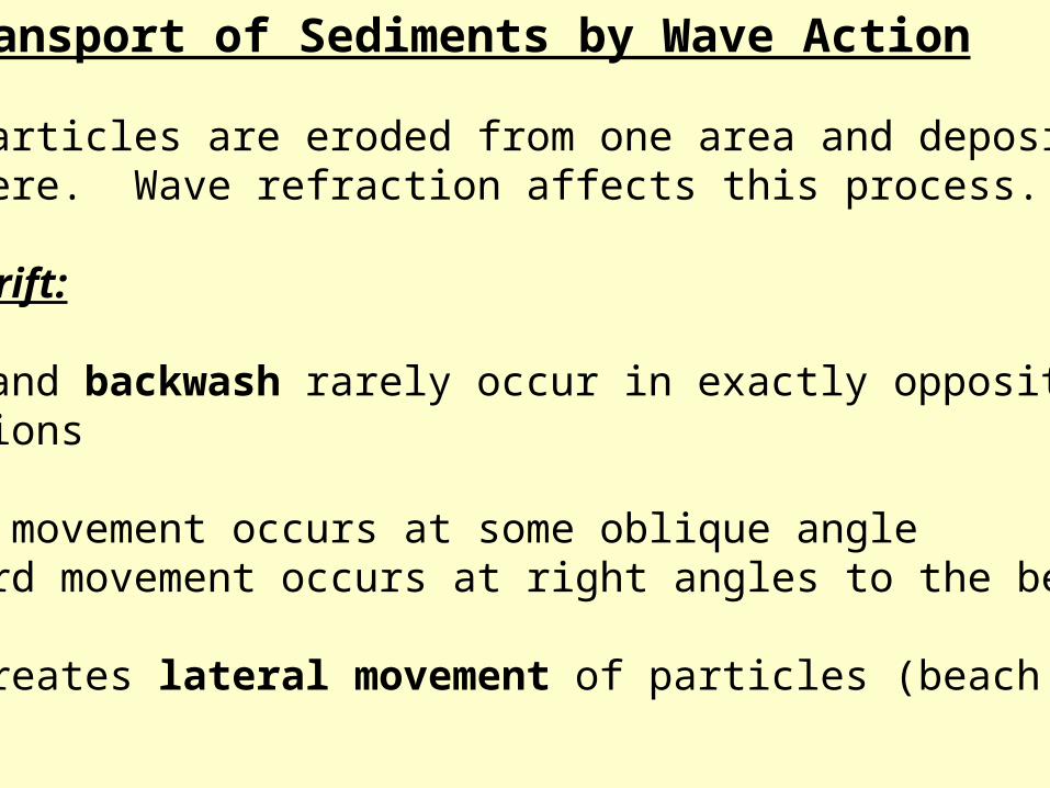
Transport of Sediments by Wave Action
Rock particles are eroded from one area and depositedelsewhere. Wave refraction affects this process.
Beach Drift:
Swash and backwash rarely occur in exactly opposite directions
Upward movement occurs at some oblique angleBackward movement occurs at right angles to the beach.
This creates lateral movement of particles (beach drift)

Decrease inwavelength aswaves approach a shoreline

Wave Refraction
Straight shoreline- drag exerted by the ocean floor causes waves to
break parallel with the shoreline.
The direction of travel of a wave varies as it approaches an indented coast.
Crests approaching the headlands experience the drag of the ocean floor first, which causes:
1. Increase in wave height2. Decrease in wavelength3. Decrease in velocity
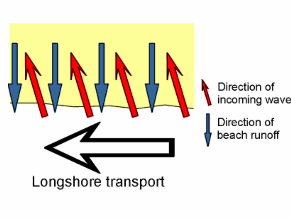

Longshore Current and Beach Drift

Longshore Currents


Rip currents form whenwaves are pushed over sandbars.
The weight of excess water near the shore can ‘rip’ an opening in the sandbar, causing water to rush seaward.
Rip Currents
Source: NOAA

Rip Current


Tidal forces
Tides enhanced during full Moon and new MoonSun-Moon-Earth closely aligned

Influence of Perigee, Apogee, Perihelion and Aphelion on the Earth’s Tides
Stronger for perigee and perihelion

Annapolis Tidal Power Generating Station

Hopewell Rocks, New Brunswick
“flower pot rocks”

Coastal Processes and Landforms
Erosional and depositional landforms of coastal areas are the result of the action of ocean waves.
Erosional Landforms Depositional landformsSea Cliffs BeachesWave-cut Notches Barrier SpitCaves Baymouth BarSea stacks LagoonSea arches Tombolo

Erosional Coastal Landforms
Along rugged, high-relief, tectonically-active coastlines
Sea cliffsA tall, steep rock face, formed by the undercuttingaction of the sea
Wave-cut notchesA rock recess at the foot of a sea cliff where the energy of waves is concentrated
Sea Caves Caves form in more erosive sediment when the rock does notfully collapse in a deeply-notched environment


Wave-cut platform
Horizontal benches in the tidal zone extending from the sea cliff out into the sea
If the sea level relative to the land changes over time(becoming lower with respect to the land due to uplift),multiple wave cut platforms (terraces) result
1 32
54 6
http://www.rgs.edu.sg/events/geotrip/cliff.html

Erosional Features

Depositional Coastal Features

Littoral Drift

Barrier Spit
Material transported by littoral drift deposited along ridge, extending outward from a coast in an area with weak offshore currents
If the spit grows to completely block an embayment, it is called a bay barrier or baymouth bar
A lagoon is a body of water behind the barrier

Puget Sound, WA

Bay Barrier

Near Eureka, CA


Coastal Straightening
Figure 13.8
Copyright © 2010 Pearson Education, Inc.Christopherson, Elemental Geosystems, Sixth Edition


Frost Island, WA

A tombolo occurs when sediment deposits connect the shoreline with an offshore sea stack or island

Rebounding Coastisostatic rebound

Barrier Islands

Chandeleur Islands


Coral Reef Distribution
Figure 13.17

Coral Reef Formation and Forms

Coral Reef Formations

Coastal Salt Marsh


Mangroves