Embed Size (px)
Citation preview
Page 5 June 2014
2014 has
been a great
year for
virtual
soaring
enthusiasts in
the
Southwest
USA. The
month of
March
brought us
the stark
beauty of
Southern
Nevada
scenery and
now May has
given us the
splendor of
Utah.
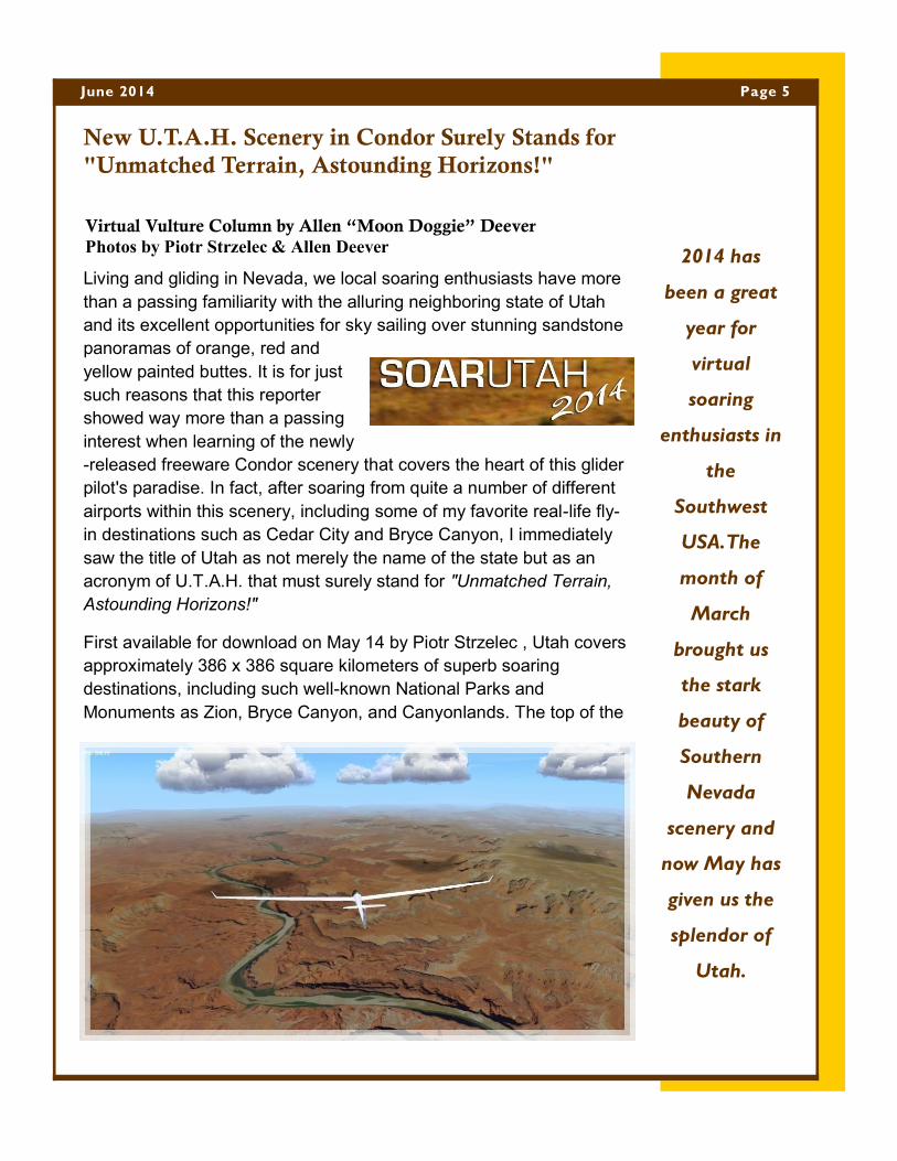
New U.T.A.H. Scenery in Condor Surely Stands for
"Unmatched Terrain, Astounding Horizons!"
Living and gliding in Nevada, we local soaring enthusiasts have more
than a passing familiarity with the alluring neighboring state of Utah
and its excellent opportunities for sky sailing over stunning sandstone
panoramas of orange, red and
yellow painted buttes. It is for just
such reasons that this reporter
showed way more than a passing
interest when learning of the newly
-released freeware Condor scenery that covers the heart of this glider
pilot's paradise. In fact, after soaring from quite a number of different
airports within this scenery, including some of my favorite real-life fly-
in destinations such as Cedar City and Bryce Canyon, I immediately
saw the title of Utah as not merely the name of the state but as an
acronym of U.T.A.H. that must surely stand for "Unmatched Terrain,
Astounding Horizons!"
First available for download on May 14 by Piotr Strzelec , Utah covers
approximately 386 x 386 square kilometers of superb soaring
destinations, including such well-known National Parks and
Monuments as Zion, Bryce Canyon, and Canyonlands. The top of the
(Continued on page 6)
Virtual Vulture Column by Allen “Moon Doggie” Deever
Photos by Piotr Strzelec & Allen Deever
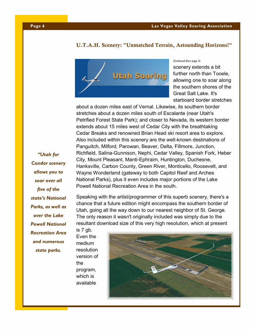
scenery extends a bit
further north than Tooele,
allowing one to soar along
the southern shores of the
Great Salt Lake. It's
starboard border stretches
about a dozen miles east of Vernal. Likewise, its southern border
stretches about a dozen miles south of Escalante (near Utah's
Petrified Forest State Park); and closer to Nevada, its western border
extends about 15 miles west of Cedar City with the breathtaking
Cedar Breaks and renowned Brian Head ski resort area to explore.
Also included within this scenery are the well-known destinations of
Panguitch, Milford, Parowan, Beaver, Delta, Fillmore, Junction,
Richfield, Salina-Gunnison, Nephi, Cedar Valley, Spanish Fork, Heber
City, Mount Pleasant, Manti-Ephraim, Huntington, Duchesne,
Hanksville, Carbon County, Green River, Monticello, Roosevelt, and
Wayne Wonderland (gateway to both Capitol Reef and Arches
National Parks), plus it even includes major portions of the Lake
Powell National Recreation Area in the south.
Speaking with the artist/programmer of this superb scenery, there's a
chance that a future edition might encompass the southern border of
Utah, going all the way down to our nearest neighbor of St. George.
The only reason it wasn't originally included was simply due to the
resultant download size of this very high resolution, which at present
is 7 gb.
Even the
medium
resolution
version of
the
program,
which is
available
(Continued from page 5)
(Continued on page 7)
U.T.A.H. Scenery: "Unmatched Terrain, Astounding Horizons!"
Page 6 Las Vegas Valley Soaring Association
“Utah for
Condor scenery
allows you to
soar over all
five of the
state’s National
Parks, as well as
over the Lake
Powell National
Recreation Area
and numerous
state parks.
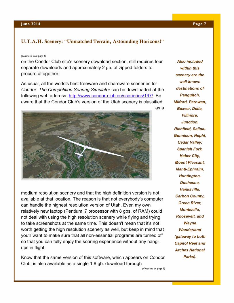
on the Condor Club site's scenery download section, still requires four
separate downloads and approximately 2 gb. of zipped folders to
procure altogether.
As usual, all the world's best freeware and shareware sceneries for
Condor: The Competition Soaring Simulator can be downloaded at the
following web address: http://www.condor-club.eu/sceneries/197/. Be
aware that the Condor Club’s version of the Utah scenery is classified
as a
medium resolution scenery and that the high definition version is not
available at that location. The reason is that not everybody's computer
can handle the highest resolution version of Utah. Even my own
relatively new laptop (Pentium i7 processor with 8 gbs. of RAM) could
not deal with using the high resolution scenery while flying and trying
to take screenshots at the same time. This doesn't mean that it's not
worth getting the high resolution scenery as well, but keep in mind that
you'll want to make sure that all non-essential programs are turned off
so that you can fully enjoy the soaring experience without any hang-
ups in flight.
Know that the same version of this software, which appears on Condor
Club, is also available as a single 1.8 gb. download through
(Continued from page 6)
(Continued on page 8)
U.T.A.H. Scenery: "Unmatched Terrain, Astounding Horizons!"
Page 7 June 2014
Also included
within this
scenery are the
well-known
destinations of
Panguitch,
Milford, Parowan,
Beaver, Delta,
Fillmore,
Junction,
Richfield, Salina-
Gunnison, Nephi,
Cedar Valley,
Spanish Fork,
Heber City,
Mount Pleasant,
Manti-Ephraim,
Huntington,
Duchesne,
Hanksville,
Carbon County,
Green River,
Monticello,
Roosevelt, and
Wayne
Wonderland
(gateway to both
Capitol Reef and
Arches National
Parks).
www.gliderracing.com, a site that is definitely worth visiting for any
glider pilot interested in improving their competition soaring skills.
For those with newer computers and plenty of space (terrabytes) on
their hard drive, who want to see Utah in all of its glory, you can
download the high definition texture files from Piotr's Google Drive
account at the following address:
https://drive.google.com/folderview?
id=0BxvG7U4FJfbrOUczenhzOTZUVFU&usp=sharing
If doing so, please contact the author to send your heartfelt thanks for
this great gift to the virtual and real-life soaring community at his email
address: [email protected]. Your thoughtful consideration will be
greatly appreciated by the genius behind this awesome contribution,
who spent untold hours throughout the long winter nights asking,
posting, Googling, downloading, and pulling his hair out to make this
lonely project a reality for your enjoyment.
Recently, as LVVSA club members will recall, we've had some
excellent articles from our club's own general and board members
detailing the great lengths that our dedicated members have gone
(Continued from page 7)
(Continued on page 9)
U.T.A.H. Scenery: "Unmatched Terrain, Astounding Horizons!"
Page 8 Las Vegas Valley Soaring Association
“I thought it
would be
instructive this
month to offer
some insight into
just how much
work goes into
producing an
amazing Condor
scenery.”
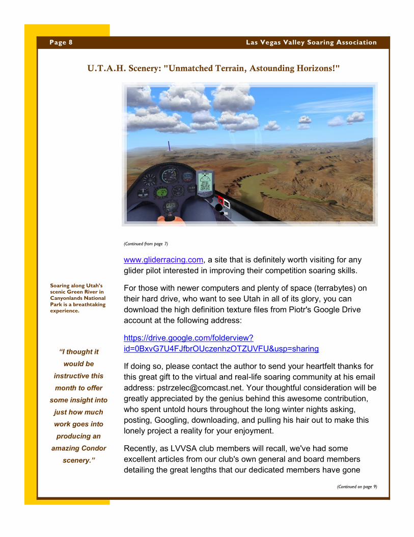
Soaring along Utah’s scenic Green River in Canyonlands National
Park is a breathtaking experience.
through to keep everybody up and flying. Likewise, I thought it would
be instructive this month to offer some insight into just how much work
goes into producing an amazing Condor scenery such as this recent
Utah edition, not to mention a similar amount of work that was
accomplished by our previously-featured Southern Nevada scenery
that was created by Andy Souter.
To get as much of a real insight into this process as possible, I
explored the various threads found on the Condor Club scenery-
maker's forum to discover just when this gargantuan project began
and what all was involved in the process. To my surprise and
admiration, I found out that this scenery required months of learning,
reconnaissance, and decision-making just to get the idea off the
ground (pardon the pun), and then another six months of gut-
wrenching development to make it a reality. The Utah scenery officially
began on November 11, 2013, when Piotr Strzelec announced to the
scenery-maker community the following message:
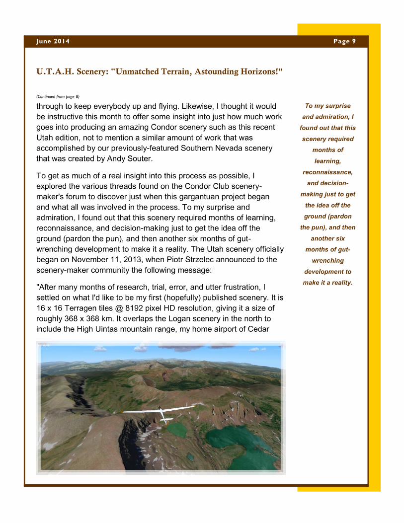
"After many months of research, trial, error, and utter frustration, I
settled on what I'd like to be my first (hopefully) published scenery. It is
16 x 16 Terragen tiles @ 8192 pixel HD resolution, giving it a size of
roughly 368 x 368 km. It overlaps the Logan scenery in the north to
include the High Uintas mountain range, my home airport of Cedar
(Continued from page 8)
(Continued on page 10)
U.T.A.H. Scenery: "Unmatched Terrain, Astounding Horizons!"
Page 9 June 2014
To my surprise
and admiration, I
found out that this
scenery required
months of
learning,
reconnaissance,
and decision-
making just to get
the idea off the
ground (pardon
the pun), and then
another six
months of gut-
wrenching
development to
make it a reality.
Valley, but most importantly my house. I used 1 meter resolution 2011
aerial photographs of Utah and down-sampled them to 2.8 meters. It
will still be a big download with over 10 GB of DDS textures alone, so I
may need to include a low-resolution version."
In case anyone mistakenly thinks that a Condor scenery developer
can simply download aerial photographs, press a button, and compile
such scenery for inclusion into Condor's landscape folder, they have a
lot to learn. Just the act of compiling the graphic files can easily take
an entire day. On that same date, Piotr mentions having to “mosaic,
sample, and slice the aerial photographs,” not to mention fixing certain
aberrations found in the original photographs, and finally exporting the
lot as a large set of BMP files. Although it might sound to neophytes
like the majority of the work had been accomplished, so many tasks
still remained to be tackled, such as the "fun" of creating airports and
texturing their runways, adding a world of virtual objects such as
hangars, houses and trees, plus creating maps for choosing departure
airports from within the Condor program.
After accomplishing the act of putting together all the aerial
photographs, Piotr found himself to be the owner of a file that was
(Continued from page 9)
(Continued on page 11)
U.T.A.H. Scenery: "Unmatched Terrain, Astounding Horizons!"
Page 10 Las Vegas Valley Soaring Association
Stunning
freeware
sceneries such
as Utah for
Condor, don’t
just design
themselves.
Such sceneries
require many
months of
intensive labor
to produce.
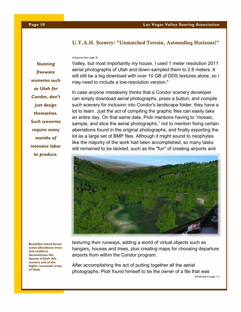
Beautiful mixed forest scene (deciduous trees and conifers)
demonstrate the beauty of both this
scenery and of the higher mountain areas
of Utah.
over 50 gb. He next had to slice the scenery into vertical strips as an
intermediate step before creating the collection of scenery tiles. At this
point, if you're wondering where the aerial photos come from for such
a program, many developers rely on lower resolution Landsat photos
that are available to the public for free. Why not use Google Earth, one
might ask? Simply because doing so would cost the developer a small
fortune for the privilege. Being resourceful, however, Piotr used aerial
photography of Utah that is available for free from the National
Agriculture Imaging Program (NAIP). Under that program, the Utah
government regularly photographs the state and makes the images
available to the public, provided that proper credit is given when
applications are developed from them. To access the source of the
aerial photos used to create this scenery, visit the following site: http://
gis.utah.gov/
Continuing to follow the Herculean effort that goes into making these
great sceneries, on January 10, it could be seen that Piotr was pulling
his hair out trying to make vegetation maps line up with the scenery,
since they unfortunately use different projections to portray them. In
the end, Piotr had to scale non-uniformly by providing a different factor
in X and Y, and by having to stretch corners to make it work.
According to Piotr, "It's a good thing that Utah has a lot of lakes and a
(Continued from page 10)
(Continued on page 12)
U.T.A.H. Scenery: "Unmatched Terrain, Astounding Horizons!"
Page 11 June 2014
This beautiful, new
Utah scenery
couldn’t have
come at a better
time considering
that our LVVSA
Summer Soaring
Safari is to be held
at Parowan this
season. Club
members will now
have a chance to
perform
reconnaissance
around the area a
month before they
arrive to fly in it.
(See three
Parowan
screenshots on the
following pages.)
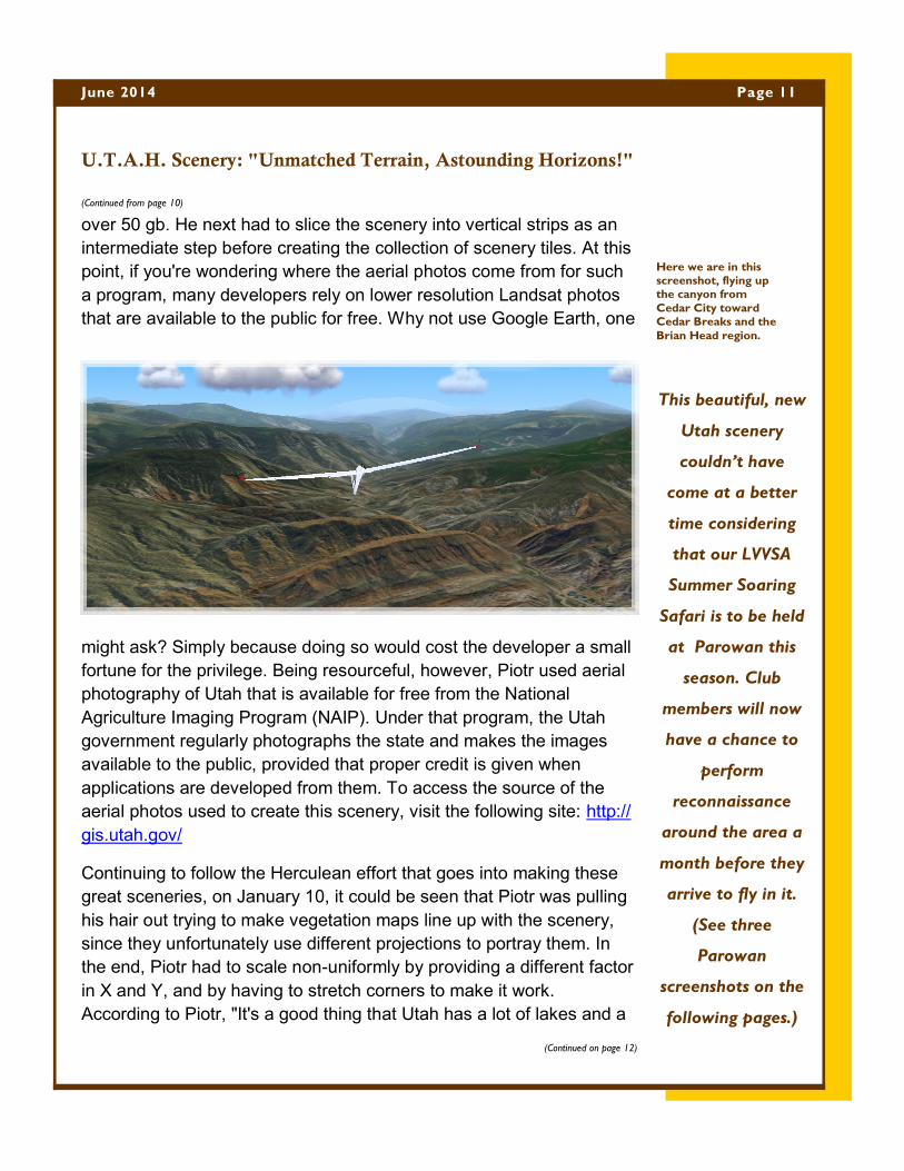
Here we are in this screenshot, flying up the canyon from
Cedar City toward Cedar Breaks and the
Brian Head region.

Page 12 Las Vegas Valley Soaring Association
U.T.A.H. Scenery: "Unmatched Terrain, Astounding Horizons!"
long river, which I used as references. I think I got it to within 50 m or so." At that same
time, he also reported having successfully improved the colors of his aerial scenes, as well
as having started the work of creating nearly 30 airports.
After overcoming those great hurdles, it was obvious by January 12 that Piotr was having
difficulties with the building of the airports, which could be seen in the words of his posting,
"I think I will stick with just outlines for runways for now. I'm starting to get burned out..."
After eight more days of
perseverance, he reported on
January 20, "Well, it took just a bit
more ambition and diligence but
the runways will be properly
rendered after all." Another eight
days later, Piotr was still working
on the runways as can be seen in
his January 28 post, "All runways
will now be rendered as asphalt
(one runway is packed gravel). Some of our Utah runways are only 18 meters wide." As
can be seen, simply putting in realistic runways is not a task for the faint of heart.
In the continuing saga of this scenery making episode, it wasn't until February 10 that
Piotr's local gliding haunt of Cedar Valley was reported as starting to take shape, including
the placement of orange safety cones on the runway to help in practicing precision
landings. More than a month later, on March 18, Piotr reported that his scenery was in the
beta-testing stage, and that all 29 airports in the scenery now had custom runways, plus
four of the airports were populated with custom-built objects while the rest would sport
Condor's default airport objects. At that time, Piotr was still looking at a couple days work
to update the .cup files with
turnpoints (he included 160
turnpoints altogether) for use in
virtual soaring competitions.
Finally, after two more months of
extensive beta testing and
tweaking, on May 14, at least
nine months after the original
(Continued from page 11)
(Continued on page 13)
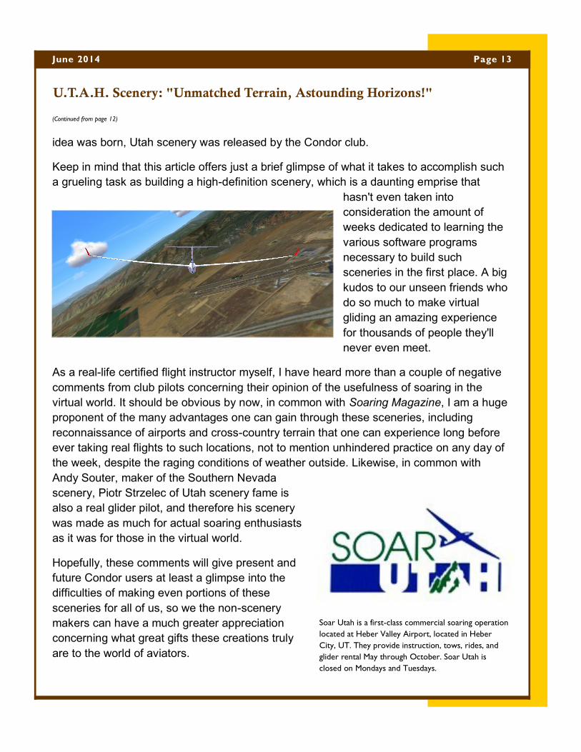
idea was born, Utah scenery was released by the Condor club.
Keep in mind that this article offers just a brief glimpse of what it takes to accomplish such
a grueling task as building a high-definition scenery, which is a daunting emprise that
hasn't even taken into
consideration the amount of
weeks dedicated to learning the
various software programs
necessary to build such
sceneries in the first place. A big
kudos to our unseen friends who
do so much to make virtual
gliding an amazing experience
for thousands of people they'll
never even meet.
As a real-life certified flight instructor myself, I have heard more than a couple of negative
comments from club pilots concerning their opinion of the usefulness of soaring in the
virtual world. It should be obvious by now, in common with Soaring Magazine, I am a huge
proponent of the many advantages one can gain through these sceneries, including
reconnaissance of airports and cross-country terrain that one can experience long before
ever taking real flights to such locations, not to mention unhindered practice on any day of
the week, despite the raging conditions of weather outside. Likewise, in common with
Andy Souter, maker of the Southern Nevada
scenery, Piotr Strzelec of Utah scenery fame is
also a real glider pilot, and therefore his scenery
was made as much for actual soaring enthusiasts
as it was for those in the virtual world.
Hopefully, these comments will give present and
future Condor users at least a glimpse into the
difficulties of making even portions of these
sceneries for all of us, so we the non-scenery
makers can have a much greater appreciation
concerning what great gifts these creations truly
are to the world of aviators.
(Continued from page 12)
Page 13 June 2014
U.T.A.H. Scenery: "Unmatched Terrain, Astounding Horizons!"
Soar Utah is a first-class commercial soaring operation
located at Heber Valley Airport, located in Heber
City, UT. They provide instruction, tows, rides, and
glider rental May through October. Soar Utah is
closed on Mondays and Tuesdays.