Embed Size (px)
Citation preview
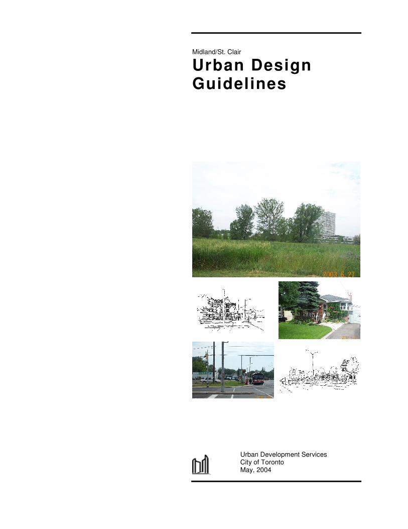
Midland/St. Clair
Urban Design Guidelines
Urban Development Services
City of Toronto May, 2004
Midland/St. Clair Urban Design Guidelines 2 City of Toronto, May, 2004
TABLE OF CONTENTS 1. INTRODUCTION 3 1.1 Role of Urban Design Guidelines 4 1.2 St. Clair/ Midland Urban Design Guidelines 4 1.3 Visions and Design Principles 9 2. SITE ORGANIZATION 12 3. BUILT FORM 14 3.1 Built Form Principles 15 3.2 Building Types and Setbacks 15 3.3 Single Detached and Semi-detached Houses 15 4. STREETSCAPE AND LANDSCAPE 18 5. COMMUNITY PARK 20 6. SPECIAL TREATMENT AREAS 22 6.1 Area West of Brimley Rd. 23 6.2 Area East of Midland Ave. 24 6.3 Corner of Midland and St. Clair 25 6.4 Area behind Comrie Terrace 26 7. IMPLEMENTATION 27
Midland/St. Clair Urban Design Guidelines 3 City of Toronto, May, 2004
1. INTRODUCTION
1.1 Role of Urban Design Guidelines 1.2 St. Clair / Midland Urban Design Guidelines 1.3 Visions and Design Principles
1. SITE ORGANIZATION
Midland/St. Clair Urban Design Guidelines 4 City of Toronto, May, 2004
1.1 Role of Urban Design Guidelines
In the City of Toronto, urban design policies and guidelines are established to provide a comprehensive framework aimed at enhancing the physical form of an area or neighbourhood. Urban Design Guidelines are intended to:
Promote the highest quality of design,
Describe the anticipated or preferred approach to site planning, built form, landscape, and amenities; and
Provide a co-ordinated approach to the design and definition of the public space while allowing for a range of development scenarios, and architectural and landscape architectural expressions.
1.2 St. Clair/ Midland Urban Design Guidelines
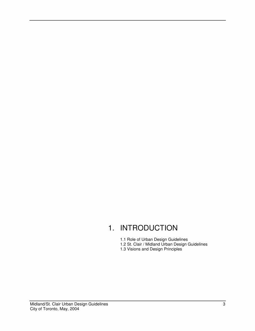
Planning Context The St. Clair/Midland Urban Design Guidelines have been developed as a component of the Phase 3 Scarborough Transportation Corridor (STC) Land Use Study.
Eglinton Ave.
Brimley Rd.
St. Clair Ave.
Midland
Ave.
STC Phase III Study Area
1. SITE ORGANIZATION
Midland/St. Clair Urban Design Guidelines 5 City of Toronto, May, 2004
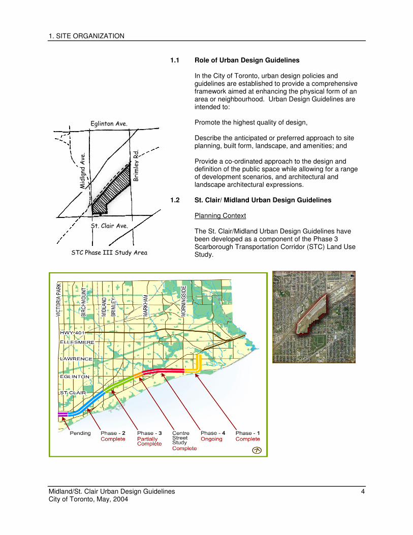
The Scarborough Transportation Corridor (STC) is a stretch of land extending through southern Scarborough that was once intended for an extension of the Gardiner Expressway. It was designated as an expressway in Scarborough’s first Official Plan in 1957. Since that time, several studies of the STC led to a decision that no major transportation facility be constructed in the corridor. In 1995 the lands were designated in the Scarborough Official Plan as a Special Study Area and the City then initiated a series of land use studies for the STC. The Phase 3 study commenced in 1996. The Working Group for the Phase 3 STC Land Use Study initiated the process of establishing the St.Clair/Midland Urban Design Guidelines. This group included area residents, representatives of the local community association and the Ward Councillor. Through a series of workshops, with City staff, members of the Working Group identified their vision for the area and general design principles for future development. These ideas and principles form the basis of the Urban Design Guidelines.
Community Context
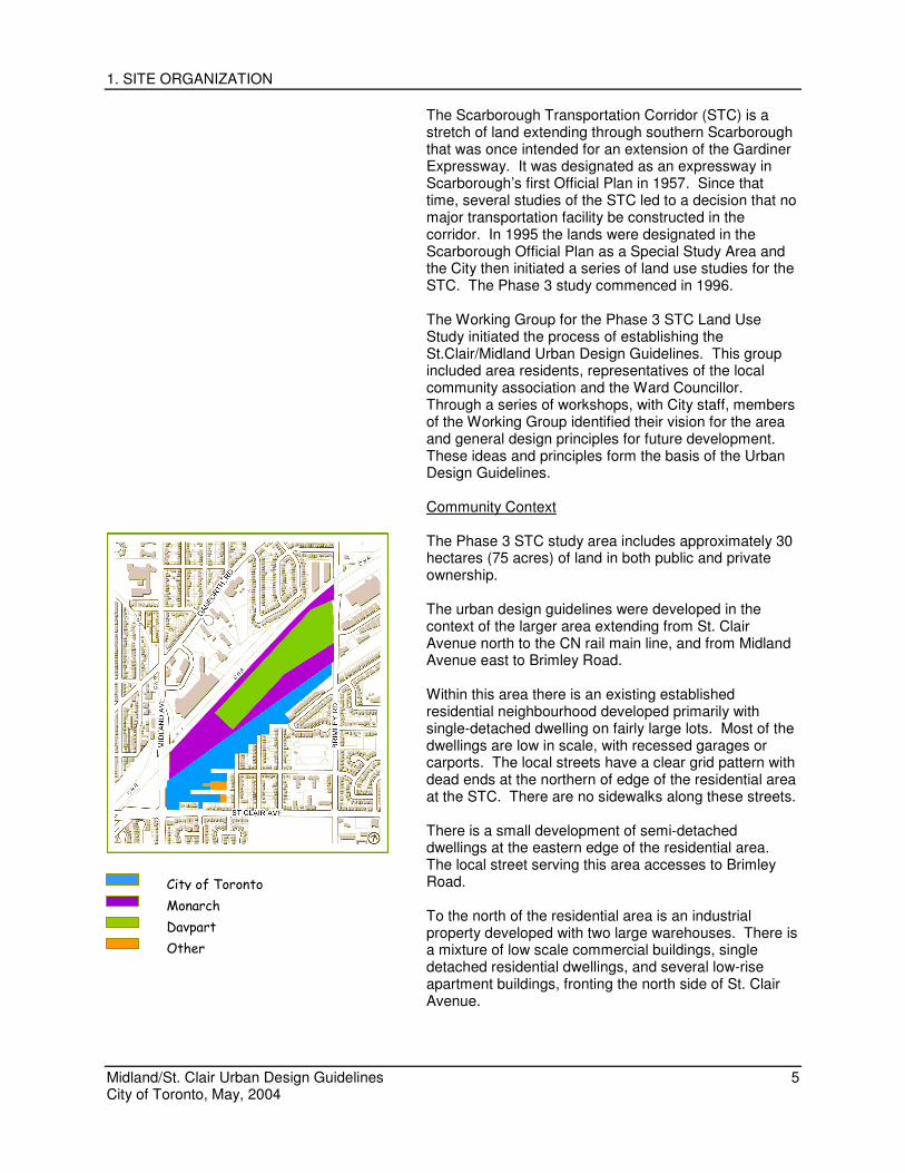
The Phase 3 STC study area includes approximately 30 hectares (75 acres) of land in both public and private ownership. The urban design guidelines were developed in the context of the larger area extending from St. Clair Avenue north to the CN rail main line, and from Midland Avenue east to Brimley Road. Within this area there is an existing established residential neighbourhood developed primarily with single-detached dwelling on fairly large lots. Most of the dwellings are low in scale, with recessed garages or carports. The local streets have a clear grid pattern with dead ends at the northern of edge of the residential area at the STC. There are no sidewalks along these streets. There is a small development of semi-detached dwellings at the eastern edge of the residential area. The local street serving this area accesses to Brimley Road. To the north of the residential area is an industrial property developed with two large warehouses. There is a mixture of low scale commercial buildings, single detached residential dwellings, and several low-rise apartment buildings, fronting the north side of St. Clair Avenue.
City of Toronto
Monarch
Davpart
Other
1. SITE ORGANIZATION
Midland/St. Clair Urban Design Guidelines 6 City of Toronto, May, 2004
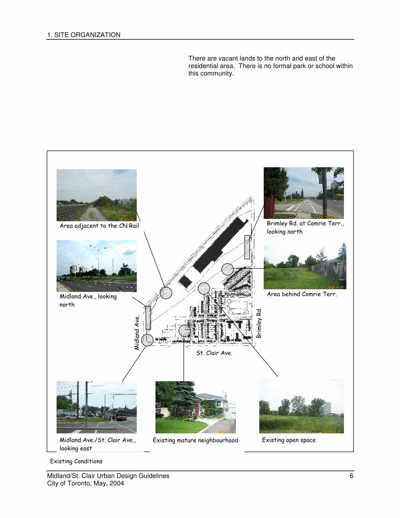
There are vacant lands to the north and east of the residential area. There is no formal park or school within this community.
Existing open space Midland Ave./St. Clair Ave.,
looking east
Brimley Rd. at Comrie Terr.,
looking north
Area behind Comrie Terr. Midland Ave., looking
north
Area adjacent to the CN Rail
Existing mature neighbourhood
Brimley Rd.
St. Clair Ave.
Midland
Ave.
Existing Conditions
1. SITE ORGANIZATION
Midland/St. Clair Urban Design Guidelines 7 City of Toronto, May, 2004
Historical Context This area of Scarborough was settled in the early and mid 1800’s when these lands were granted to European settlers for farming. Farming was the mainstay of life in this area of Scarborough into the early 1900’s. Despite the long rural history, these lands were influenced by the pressures for change that accompanied advances in technology and periods of rapid growth throughout Scarborough’s history. These influences have resulted in the mix of residential and industrial uses found here today. The most significant change to affect this area was the opening of the Grand Trunk Railway (now CN) through this area in 1859 and the Toronto Nippissing Railway in 1871. Initially these railways spurred the growth of residential communities centered at the junction of the two rail lines on the west side of Midland Avenue. The development of residential communities in the Scarborough Junction on the east side of Midland Avenue began when residential plans of subdivision were laid out in this area in the early 1900’s in response to a period of rapid growth in southern Scarborough leading up to and after the First World War. The depression brought a drastic halt to growth in Scarborough and most of these subdivisions were not built. The exception is a portion of the Walton Heights subdivision, named for the original family who settled the land and includes Jeannette Street, Waltonice Road, Andrew Avenue and Minerva Avenue. The view of Scarborough as “country” came to an end with the explosion of suburban development after the Second World War with returning vets and new immigrants eager to build a life in Scarborough. Thousands of houses, new roads, and shopping plazas were built to keep pace with this demand. Expressways were needed to connect and move people and goods throughout the rapidly expanding centres around Toronto including the new suburb of Scarborough. The lands south of the railway presented an opportunity for a connecting expressway to link the Gardiner with Highway 401. The expressway corridor in this area was then promoted as an industrial centre. Although some industrial development did occur, the vision of the area as an industrial centre was never fully realized. With the abandonment of the expressway an opportunity has been created to continue the process of building a more complete residential community. The
1. SITE ORGANIZATION
Midland/St. Clair Urban Design Guidelines 8 City of Toronto, May, 2004
Midland/St. Clair Urban Design Guidelines have been prepared as a part of this process. Purpose of the Midland/St. Clair Urban Design Guidelines The purpose of the Urban Design Guidelines is to establish a common vision for the future development of the area and create a framework for the planning policies that apply to this area. The guidelines build on the general design and planning principles established through the community consultation process, and are developed within the context of the City’s New Official Plan. They provide guidance, standards, and general concepts in the areas of site planning, architectural design, landscape and open space design.
The guidelines are intended for the use of developers in the preparation of development proposals, and by the City of Toronto to review and assess the design aspects of development proposals within this area.
1. SITE ORGANIZATION
Midland/St. Clair Urban Design Guidelines 9 City of Toronto, May, 2004
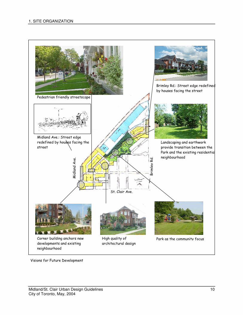
1.3 Visions and Design Principles
Through the community consultation process, main issues and themes emerged about the existing area and the prospects for future development. The legacy of the STC has left a large amount of vacant undeveloped land within this area. This vacant land is considered a valuable open space resource to the residents. As a result, the retention of lands for open space or park purposes was considered important for this community. There is an established residential area of primarily low scale housing developed adjacent to the subject lands. Streets within this area dead-end at the STC. As a result, there is an opportunity through future development to build on the existing development pattern in this area. New development should be compatible with and compliment the surrounding neighbourhood. With arterial roads surrounding this area, there are also opportunities to enhance and improve the quality of these streetscapes. Special attention to the design of future developments along St. Clair Avenue, Midland Avenue and Brimley Road were considered important to promote a positive image of this community. From these visions for the community, several design principles were developed as following:
Park as the Focus of the Community As the “outdoor living room”, the Park should be the focus of the new and old communities. Ideally, the park should be centrally located within the triangular area bounded by Midland Ave., St. Clair Ave., Brimley Rd., and the CN Rail, Local residents and potential future residents should have easy access to the Park from all areas in the existing community and new development sites.
Compatible Development The new community should be planned and designed to be an extension of the existing neighbourhood. New developments should be compatible with the surrounding existing community in relation to site planning, architectural design, and streetscape design.
1. SITE ORGANIZATION
Midland/St. Clair Urban Design Guidelines 10 City of Toronto, May, 2004
Landscaping and earthwork
provide transition between the
Park and the existing residential
neighbourhood
Park as the community focus High quality of
architectural design
Corner building anchors new
developments and existing
neighbourhood
Midland Ave.: Street edge
redefined by houses facing the
street
Brimley Rd.: Street edge redefined
by houses facing the street
Pedestrian friendly streetscape
Brimley Rd.
St. Clair Ave.
Midland
Ave.
Visions for Future Development
1. SITE ORGANIZATION
Midland/St. Clair Urban Design Guidelines 11 City of Toronto, May, 2004
Proposed new developments shall not have negative impacts on the existing community.
Pedestrian Friendly Streetscapes
Well-designed streetscapes will provide a comfortable pedestrian walking environment and serve as a transition from the private space to the public space.
Enhanced Streetscape for the Arterial Roads
New developments along Midland Ave. and Brimley Rd. will re-define the street edge. Enhanced architectural and landscape treatments will significantly improve the overall image of the streetscape along the two major arterial roads.
A “Signature Building” at Midland Ave. and St. Clair Ave.
A well designed mixed-use or residential building at the corner of Midland Ave. and St. Clair Ave. will anchor the new developments and enhance the community identity. It will also help to establish a high standard of design for the potential re-development of the commercial buildings along St. Clair Ave. The above vision will be realized through the application of the guidelines in the following sections.
1. SITE ORGANIZATION
Midland/St. Clair Urban Design Guidelines 12 City of Toronto, May, 2004
2. SITE ORGANIZATION
2. SITE ORGANIZATION
Midland/St. Clair Urban Design Guidelines 13 City of Toronto, May, 2004
The existing community has a clear grid street pattern. A modified grid pattern is encouraged to create strong physical and visual connections to the existing community.
The community park should be centrally located within
the triangular area bounded by Midland Ave, St. Clair Ave., Brimley Rd., and the CN Rail.
Front buildings onto public rather than private streets
where possible. New streets are encouraged to be connected to the
existing streets. However, they shall not be designed to encourage shortcuts from Brimley Road to St. Clair Ave.
In areas adjacent to the Park, the front faces of the
buildings of the new developments should face the community park, where possible.
Pedestrian connections and linkages should be provided
so that the community park and other green open spaces can be easily accessed from all areas within the community.
3. BUILTFORM
Midland/St. Clair Urban Design Guidelines 14 City of Toronto, May, 2004
3. BUILT FORM
Built Form is an important element in the streetscape and has a major impact on the image, character, and quality of the community as a whole. Individual buildings should be well designed and sited so that they are integrated into the streetscape. To achieve this objective, guidelines are provided in the following areas:
3.1 Built Form Principles 3.2 Building Types and Setbacks 3.3 Single Detached and Semi-detached Houses 3.4 Townhouses
Midland/St. Clair Urban Design Guidelines 15 City of Toronto, May, 2004
3.1 Built Form Principles
Building massing should be compatible with the adjacent buildings in areas near the existing neighbourhood
Neighbouring new buildings are encouraged to share a
similar scale and setbacks to promote harmony and continuity
Flexible design expressions are encouraged through
varieties of building types, elevations, and treatment of building edges.
3.2 Building Types and Setbacks Different house types and designs are encouraged to provide visual interest and enhance the quality of the streetscape. Building types include single detached houses, semi-detached houses, townhouses, and walk-up apartment buildings at certain locations
Buildings should be located close to the street and should provide a strong architectural presence
Front yard setbacks should be modulated to provide
visual interest and streetscape variety while conforming to relevant design guidelines.
3.3 Single Detached and Semi-detached Houses
Roofs
A variety of ridge orientations and massing, including front gable and side gable roofs are encouraged
Roof vents and gas vents should be located so as not to
be visible from street views, or located close to the ridgeline. All roof and gas vents should be coloured or painted to match the roof colour Main Entrance
The main entrance should be visually dominant on the
front façade of the building. A porch or balcony is encouraged as part of the main entry.
Covered porches, overhangs, or recesses are encouraged to provide shelter from the weather.
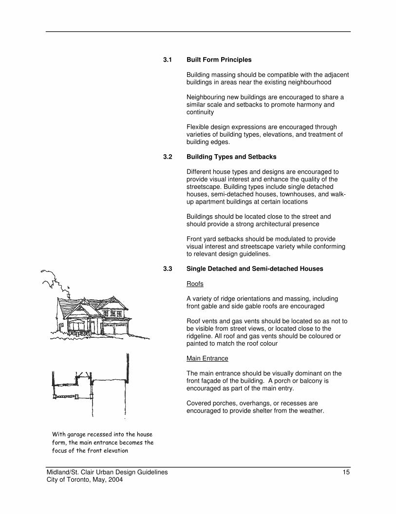
With garage recessed into the house
form, the main entrance becomes the
focus of the front elevation
Midland/St. Clair Urban Design Guidelines 16 City of Toronto, May, 2004
The use of transoms, sidelights or door glazing are encouraged to provide natural light to the interior of the house.
Porches and Verandas
Porches and verandas deep enough for seating, should be integrated in the front elevation to provide a connection between the house and the street, and to add to community safety by promoting “eyes on the street”.
Exterior colours and materials
Brick with warm, earth tones should be considered as
the primary cladding material. Other materials, such as siding and stone, can be incorporated as secondary materials.
Window Detailing
Scale and proportion of windows should compliment the
massing of the building Building Projections
Projecting elements are encouraged to add detail and variety to the building elevation. These items include: bay windows, bow windows, entry stoops, porches, porticoes, roof extensions, cantilevered elements, buttresses, roof dormers, balconies, chimney projections, and alcoves.
Utility Service Meters and Mechanical Equipment
Utility service meters and mechanical equipment, such as meters for gas, hydro, and water, and cable and telephone connection boxes, should be carefully located and screened. These units shall not be visible from the street. Integral Front Garages
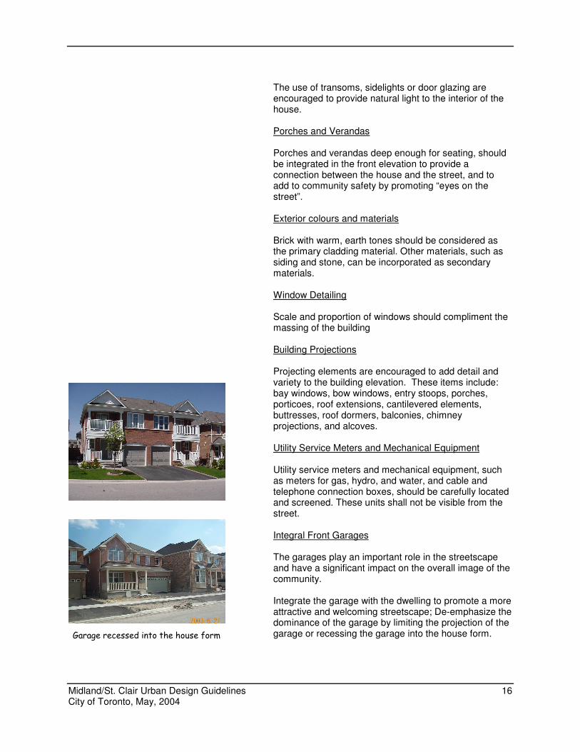
The garages play an important role in the streetscape and have a significant impact on the overall image of the community.
Integrate the garage with the dwelling to promote a more attractive and welcoming streetscape; De-emphasize the dominance of the garage by limiting the projection of the garage or recessing the garage into the house form. Garage recessed into the house form
Midland/St. Clair Urban Design Guidelines 17 City of Toronto, May, 2004
Garages Accessed from a Rear Laneway
Where laneways are provided to access garages located at the back of the houses: Garages should be setback from the lot line separating
the rear yard from the laneway Garage sitings are encouraged to be staggered to avoid
creating a long, flat building edge along the laneway A variety of roof designs are encouraged for the garages
in order to create an interesting lanescape
Width of Driveways
The width of driveways leading to garages shall not exceed the exterior width of the private garage Corner Lot
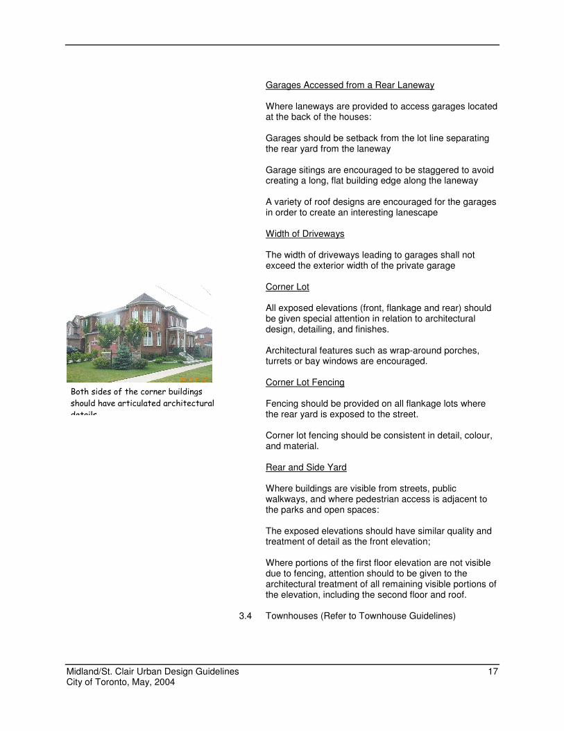
All exposed elevations (front, flankage and rear) should be given special attention in relation to architectural design, detailing, and finishes.
Architectural features such as wrap-around porches, turrets or bay windows are encouraged.
Corner Lot Fencing
Fencing should be provided on all flankage lots where the rear yard is exposed to the street.
Corner lot fencing should be consistent in detail, colour, and material. Rear and Side Yard Where buildings are visible from streets, public walkways, and where pedestrian access is adjacent to the parks and open spaces:
The exposed elevations should have similar quality and treatment of detail as the front elevation;
Where portions of the first floor elevation are not visible
due to fencing, attention should to be given to the architectural treatment of all remaining visible portions of the elevation, including the second floor and roof.
3.4 Townhouses (Refer to Townhouse Guidelines)
Both sides of the corner buildings
should have articulated architectural
details
Midland/St. Clair Urban Design Guidelines 18 City of Toronto, May, 2004
4. STREETSCAPE AND LANDSCAPE
4. STREETSCAPE AND LANDSCAPE
Midland/St. Clair Urban Design Guidelines 19 City of Toronto, May, 2004
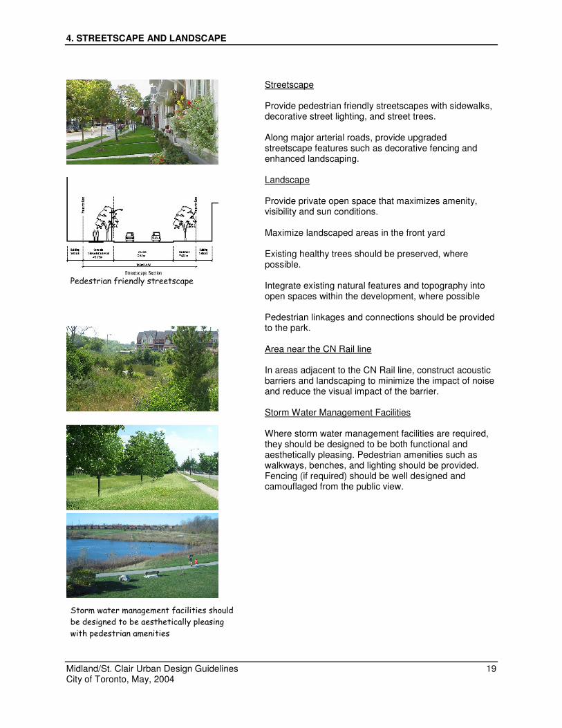
Streetscape Provide pedestrian friendly streetscapes with sidewalks,
decorative street lighting, and street trees. Along major arterial roads, provide upgraded
streetscape features such as decorative fencing and enhanced landscaping.
Landscape
Provide private open space that maximizes amenity,
visibility and sun conditions. Maximize landscaped areas in the front yard Existing healthy trees should be preserved, where
possible. Integrate existing natural features and topography into
open spaces within the development, where possible
Pedestrian linkages and connections should be provided to the park.
Area near the CN Rail line
In areas adjacent to the CN Rail line, construct acoustic
barriers and landscaping to minimize the impact of noise and reduce the visual impact of the barrier.
Storm Water Management Facilities
Where storm water management facilities are required,
they should be designed to be both functional and aesthetically pleasing. Pedestrian amenities such as walkways, benches, and lighting should be provided. Fencing (if required) should be well designed and camouflaged from the public view.
Storm water management facilities should
be designed to be aesthetically pleasing
with pedestrian amenities
Pedestrian friendly streetscape
Midland/St. Clair Urban Design Guidelines 20 City of Toronto, May, 2004
5. COMMUNITY PARK
5. COMMUNITY PARK
Midland/St. Clair Urban Design Guidelines 21 City of Toronto, May, 2004
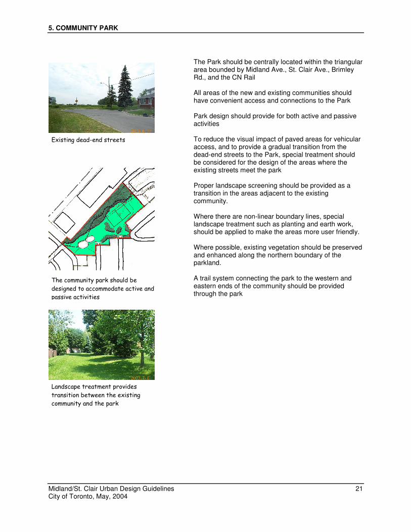
The Park should be centrally located within the triangular area bounded by Midland Ave., St. Clair Ave., Brimley Rd., and the CN Rail
All areas of the new and existing communities should
have convenient access and connections to the Park Park design should provide for both active and passive
activities To reduce the visual impact of paved areas for vehicular
access, and to provide a gradual transition from the dead-end streets to the Park, special treatment should be considered for the design of the areas where the existing streets meet the park
Proper landscape screening should be provided as a
transition in the areas adjacent to the existing community.
Where there are non-linear boundary lines, special
landscape treatment such as planting and earth work, should be applied to make the areas more user friendly.
Where possible, existing vegetation should be preserved
and enhanced along the northern boundary of the parkland.
A trail system connecting the park to the western and
eastern ends of the community should be provided through the park
Existing dead-end streets
The community park should be
designed to accommodate active and
passive activities
Landscape treatment provides
transition between the existing
community and the park
Midland/St. Clair Urban Design Guidelines 22 City of Toronto, May, 2004
6. SPECIAL TREATMENT AREAS
6.1 Area west of Brimley Rd. 6.2 Area east of Midland Ave. 6.3 Corner of Midland Ave. and St. Clair Ave. 6.4 Area behind Comrie Terrace
6. SPECIAL TREATMENT AREAS
Midland/St. Clair Urban Design Guidelines 23 City of Toronto, May, 2004
6.1 Area West of Brimley Rd.
Street patterns in this area shall be designed to
discourage shortcuts to St. Clair Ave. Locate buildings close to the street to provide a defined
street edge. Front elevations facing the arterial road and the flankage
elevations should have strong articulation of architectural details.
Garages should be located at the rear of the houses to
minimize the visual impact. Upgraded streetscape treatment should be provided to
create a pleasant pedestrian walking environment. These include decorative fences and enhanced landscaping.
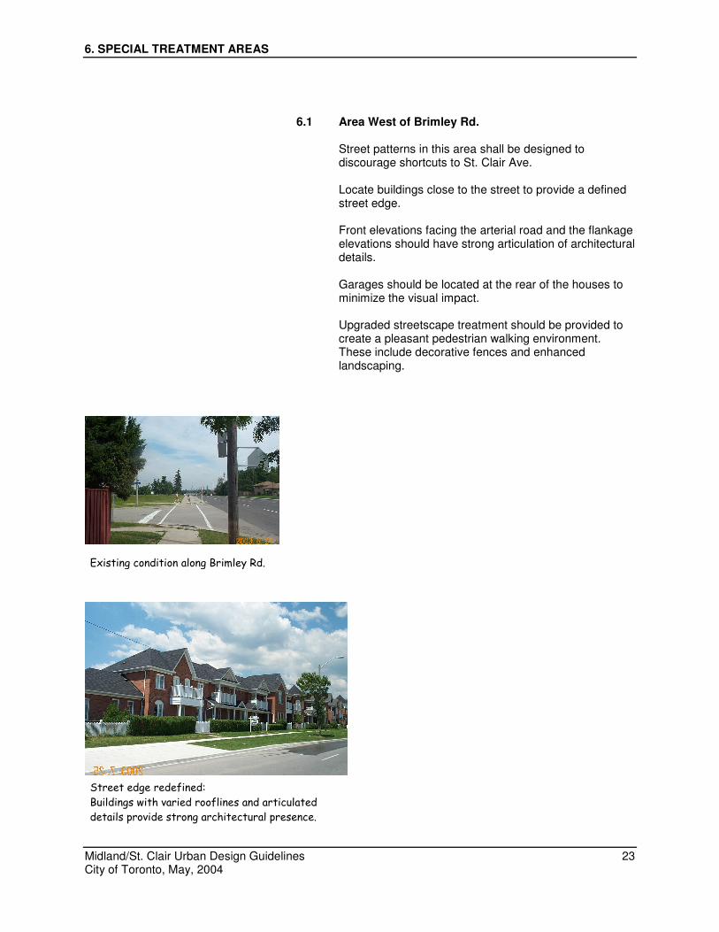
Existing condition along Brimley Rd.
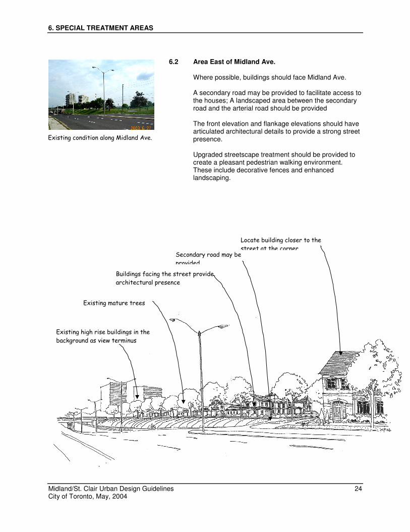
Street edge redefined:
Buildings with varied rooflines and articulated
details provide strong architectural presence.
6. SPECIAL TREATMENT AREAS
Midland/St. Clair Urban Design Guidelines 24 City of Toronto, May, 2004
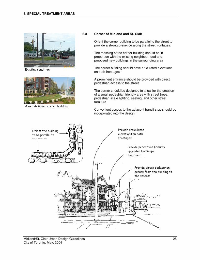
6.2 Area East of Midland Ave.
Where possible, buildings should face Midland Ave.
A secondary road may be provided to facilitate access to the houses; A landscaped area between the secondary road and the arterial road should be provided
The front elevation and flankage elevations should have
articulated architectural details to provide a strong street presence.
Upgraded streetscape treatment should be provided to create a pleasant pedestrian walking environment. These include decorative fences and enhanced landscaping.
Existing condition along Midland Ave.
Existing mature trees
Secondary road may be
provided
Locate building closer to the
street at the corner
Buildings facing the street provide
architectural presence
Existing high rise buildings in the
background as view terminus
6. SPECIAL TREATMENT AREAS
Midland/St. Clair Urban Design Guidelines 25 City of Toronto, May, 2004
6.3 Corner of Midland and St. Clair
Orient the corner building to be parallel to the street to
provide a strong presence along the street frontages. The massing of the corner building should be in
proportion with the existing neighbourhood and proposed new buildings in the surrounding area
The corner building should have articulated elevations
on both frontages. A prominent entrance should be provided with direct
pedestrian access to the street The corner should be designed to allow for the creation
of a small pedestrian friendly area with street trees, pedestrian scale lighting, seating, and other street furniture.
Convenient access to the adjacent transit stop should be
incorporated into the design.
Existing condition
A well designed corner building
Orient the building
to be parallel to
the street
Provide articulated
elevations on both
frontages
Provide pedestrian friendly
upgraded landscape
treatment
Provide direct pedestrian
access from the building to
the streets
6. SPECIAL TREATMENT AREAS
Midland/St. Clair Urban Design Guidelines 26 City of Toronto, May, 2004
6.4 Area behind Comrie Terrace
Landscaping and a trail should be provided behind the existing houses to provide a transition zone between the houses and the park.
The design of the trail should promote pedestrian safety
by incorporating adequate lighting and appropriate landscaping.
Where the trail meets Brimley Rd., special landscaping
and gateway features should be provided to promote community identity.
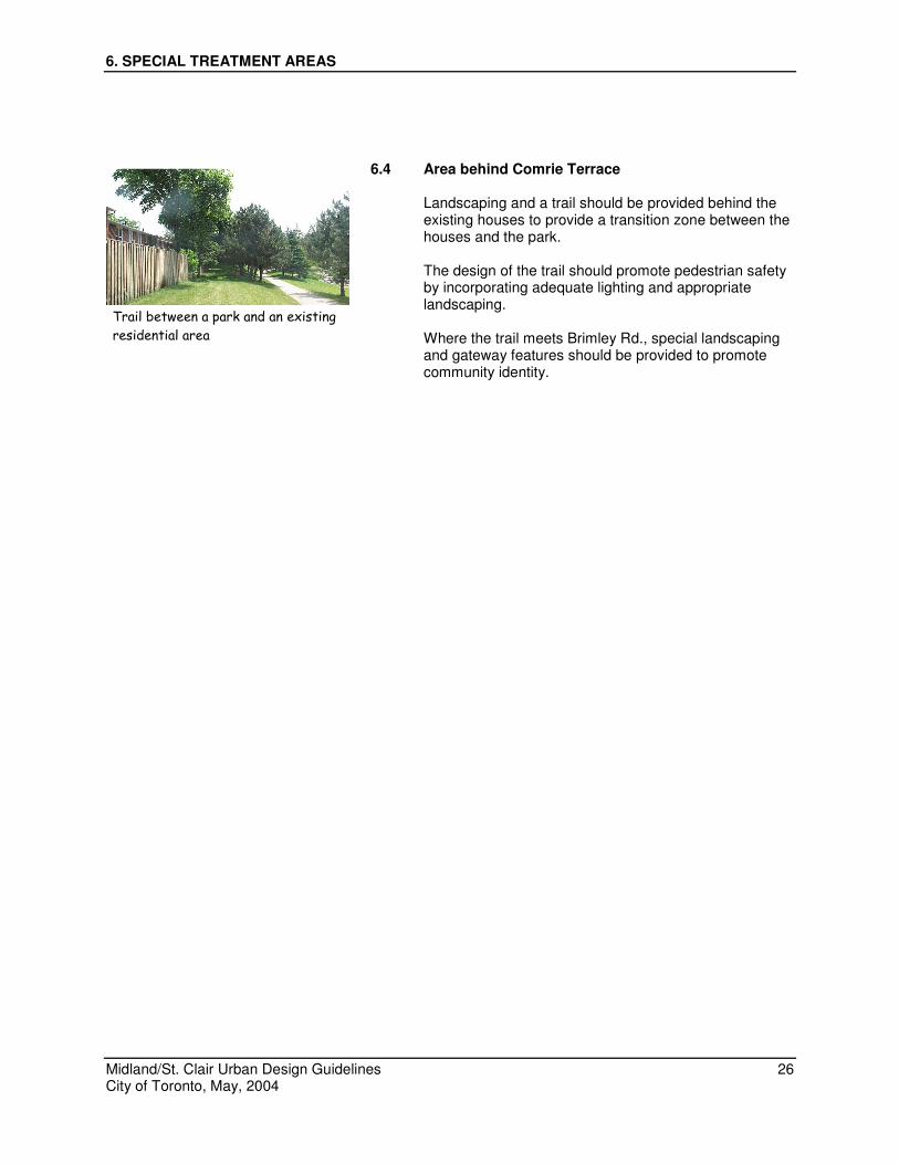
Trail between a park and an existing
residential area
7. IMPLEMENTATION
Midland/St. Clair Urban Design Guidelines 27 City of Toronto, May, 2004
7. IMPLEMENTATION
7. IMPLEMENTATION
Midland/St. Clair Urban Design Guidelines 28 City of Toronto, May, 2004
The guidelines are intended for the use of developers in the preparation of development proposals, and by the City of Toronto to review and assess the design aspects of development proposals within this area. The guidelines will be implemented through the review of planning applications such as; Site Plan Control Approval applications, Subdivision application, Consent applications and Zoning Amendment applications.
The City will review plans that show the location, design and massing of buildings, the relationship to adjacent streets and buildings, public access areas, the layout of parking and service areas, site landscaping and other aspects of the development to ensure compliance with the guidelines. For the areas and types of development where site plan control is applied, Council or delegated staff may approve the plans and drawings and the owner may be required to enter into an agreement to secure the construction of the project as shown in the plans. A holding symbol may be placed on lands within the study area where the ultimate use of the land is specified but development cannot take place until conditions set out in the Official Plan and Zoning By-law are satisfied.