Embed Size (px)
Citation preview
1
11
Mass WastingMass Wasting
�������������� ��� ����������������������������������������� ������������������������������� ��!��"
22Mass WastingMass Wasting
�� DownDown--slope movement of rock, loose material & soil slope movement of rock, loose material & soil under direct influence of gravity.under direct influence of gravity.
33
EarthEarth��s External Processess External Processes�� Weathering, mass wasting, and erosion are all Weathering, mass wasting, and erosion are all
called external processes because they occur at called external processes because they occur at or near Earthor near Earth��s surfaces surface
�� Internal processes, such as mountain building Internal processes, such as mountain building and volcanic activity, derive their energy from and volcanic activity, derive their energy from EarthEarth��s interiors interior
2
44
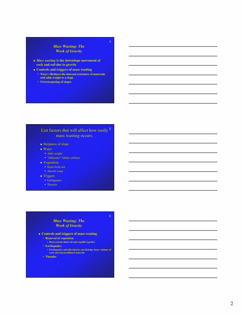
Mass Wasting: The Mass Wasting: The Work of GravityWork of Gravity
�� Mass wastingMass wasting is the downslope movement of is the downslope movement of rock and soil due to gravityrock and soil due to gravity
�� Controls and triggers of mass wastingControls and triggers of mass wasting�� WaterWater��Reduces the internal resistance of materials Reduces the internal resistance of materials
and adds weight to a slopeand adds weight to a slope�� Oversteepening of slopesOversteepening of slopes
55List factors that will affect how easily List factors that will affect how easily mass wasting occurs.mass wasting occurs.
�� Steepness of slopeSteepness of slope�� WaterWater
�� Adds weightAdds weight�� “lubricates” failure surfaces“lubricates” failure surfaces
�� VegetationVegetation�� Roots hold soilRoots hold soil�� Absorb waterAbsorb water
�� TriggersTriggers�� EarthquakesEarthquakes�� ThunderThunder
66
Mass Wasting: The Mass Wasting: The Work of GravityWork of Gravity
�� Controls and triggers of mass wastingControls and triggers of mass wasting�� Removal of vegetationRemoval of vegetation## Root systems bind soil and regolith togetherRoot systems bind soil and regolith together
�� EarthquakesEarthquakes## Earthquakes and aftershocks can dislodge large volumes of Earthquakes and aftershocks can dislodge large volumes of
rock and unconsolidated materialrock and unconsolidated material
�� ThunderThunder
3
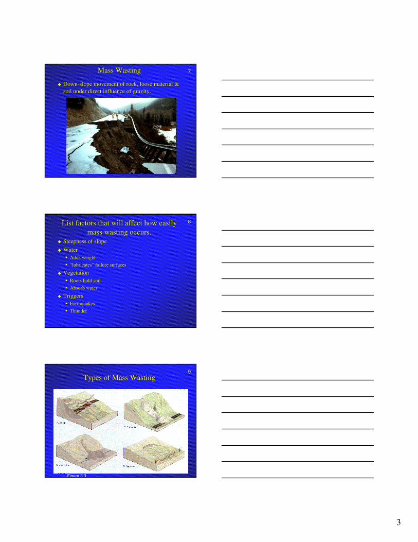
77Mass WastingMass Wasting
�� DownDown--slope movement of rock, loose material & slope movement of rock, loose material & soil under direct influence of gravity.soil under direct influence of gravity.
88List factors that will affect how easily List factors that will affect how easily mass wasting occurs.mass wasting occurs.
�� Steepness of slopeSteepness of slope�� WaterWater
�� Adds weightAdds weight�� “lubricates” failure surfaces“lubricates” failure surfaces
�� VegetationVegetation�� Roots hold soilRoots hold soil�� Absorb waterAbsorb water
�� TriggersTriggers�� EarthquakesEarthquakes�� ThunderThunder
99Types of Mass WastingTypes of Mass Wasting
Figure 3.3
4
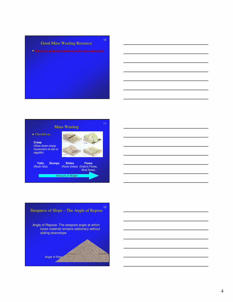
1010Good Mass Wasting ResourceGood Mass Wasting Resource
�� http://www.tulane.edu/~sanelson/geol204/masswastproc.htmhttp://www.tulane.edu/~sanelson/geol204/masswastproc.htm
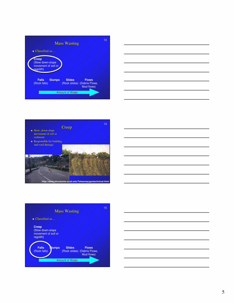
1111Mass WastingMass Wasting
�� Classified as…Classified as…
Amount of WaterAmount of Water
Falls(Rock falls)
Slides(Rock slides)
Flows(Debris Flows,
Mud flows)
Slumps
Creep(Slow down-slope movement of soil or regolith)
1212Steepness of Slope Steepness of Slope –– The Angle of ReposeThe Angle of Repose
Angle of ReposeAngle of Repose
Angle of Repose: The steepest angle at which Angle of Repose: The steepest angle at which loose material remains stationary without loose material remains stationary without sliding sliding downslopedownslope. .
5
1313Mass WastingMass Wasting
�� Classified as…Classified as…
Amount of WaterAmount of Water
Falls(Rock falls)
Slides(Rock slides)
Flows(Debris Flows,
Mud flows)
Slumps
Creep(Slow down-slope movement of soil or regolith)
1414CreepCreep
�� Slow, downSlow, down--slope slope movement of soil or movement of soil or sediment.sediment.
�� Responsible for building Responsible for building and road damage.and road damage.
http://www.structures.ucsd.edu/Taiwaneq/geotechnical.html
1515Mass WastingMass Wasting
�� Classified as…Classified as…
Amount of WaterAmount of Water
Falls(Rock falls)
Slides(Rock slides)
Flows(Debris Flows,
Mud flows)
Slumps
Creep(Slow down-slope movement of soil or regolith)
6
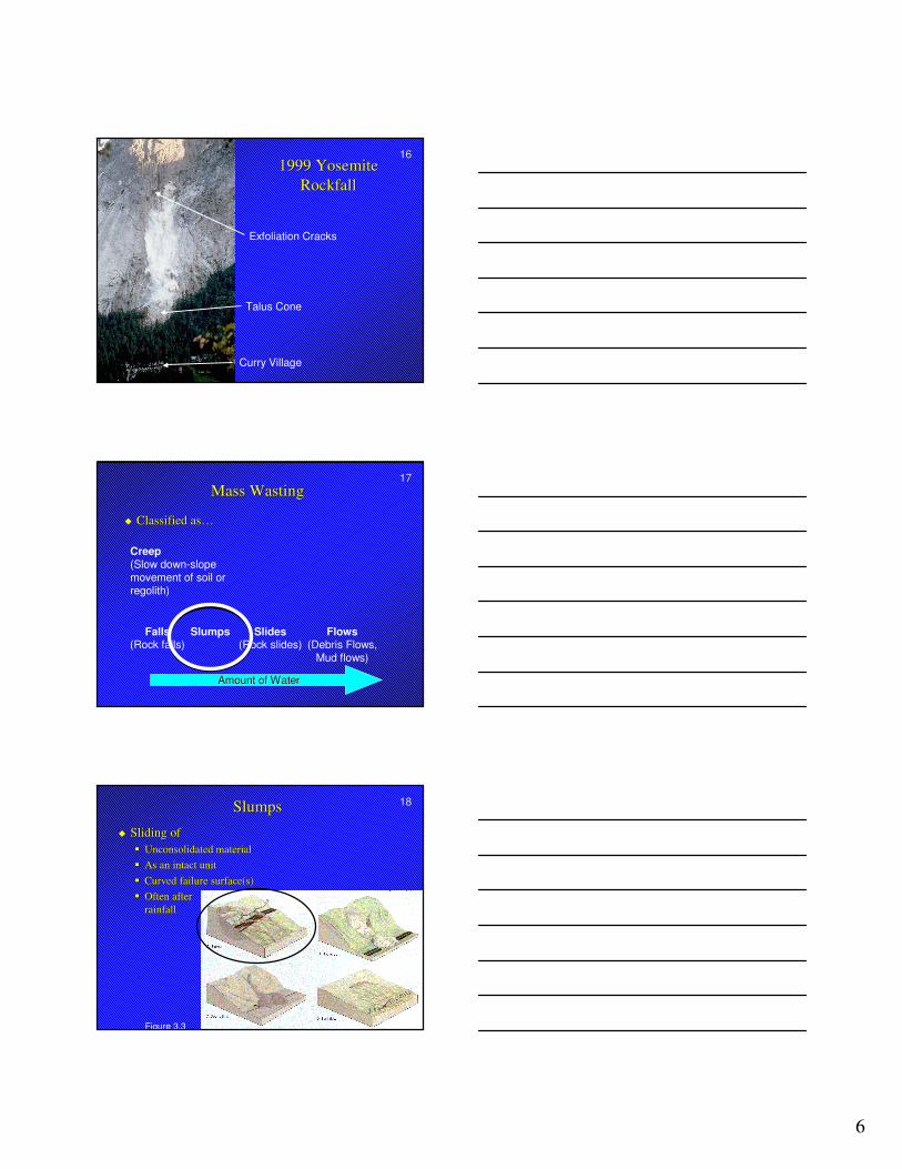
16161999 Yosemite 1999 Yosemite
RockfallRockfall
Talus Cone
Curry Village
Exfoliation Cracks
1717Mass WastingMass Wasting
�� Classified as…Classified as…
Amount of WaterAmount of Water
Falls(Rock falls)
Slides(Rock slides)
Flows(Debris Flows,
Mud flows)
Slumps
Creep(Slow down-slope movement of soil or regolith)
1818SlumpsSlumps
�� Sliding ofSliding of�� Unconsolidated materialUnconsolidated material�� As an intact unitAs an intact unit�� Curved failure surface(s)Curved failure surface(s)�� Often after Often after
rainfallrainfall
Figure 3.3
7
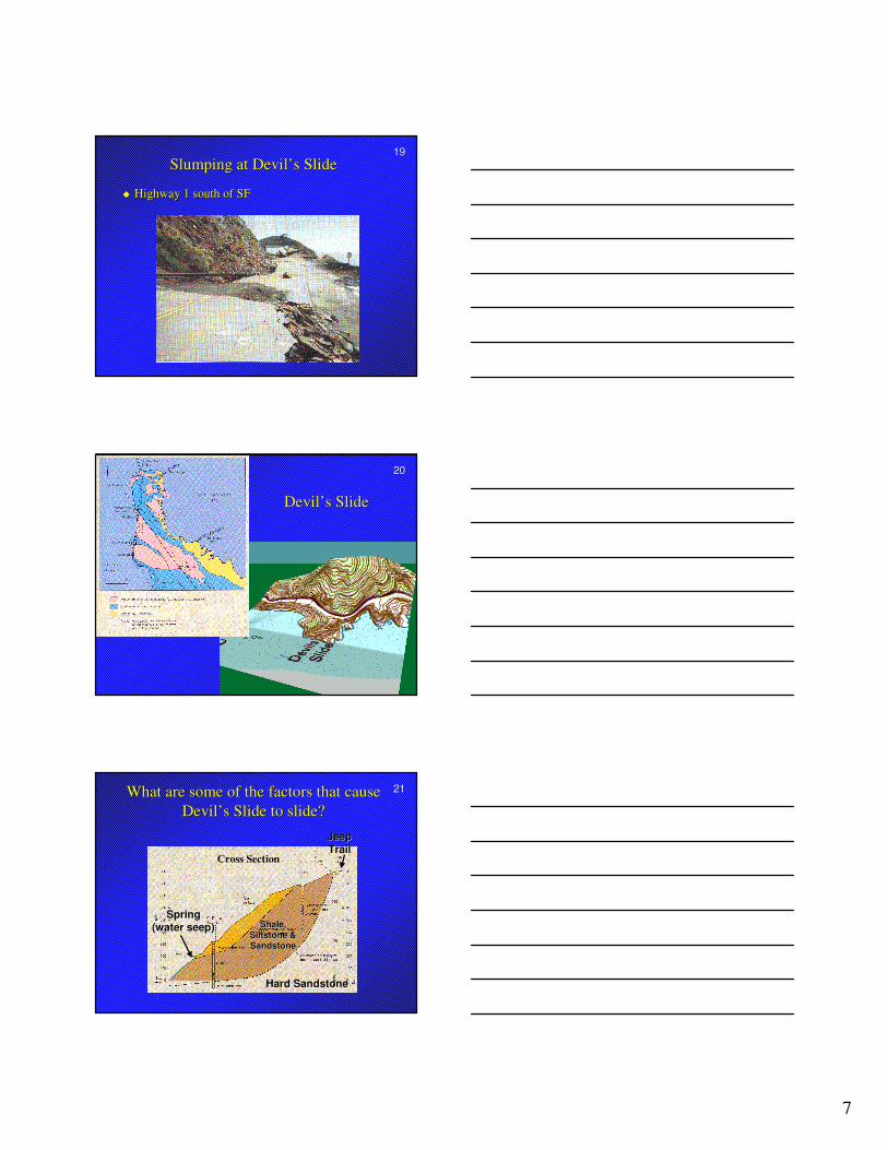
1919Slumping at Devil’s SlideSlumping at Devil’s Slide
�� Highway 1 south of SFHighway 1 south of SF
2020
Devil’s SlideDevil’s Slide
2121What are some of the factors that cause What are some of the factors that cause Devil’s Slide to slide?Devil’s Slide to slide?
Cross Section
JeepJeepTrailTrail
SpringSpring(water seep)(water seep)
Hard SandstoneHard Sandstone
Shale,Shale,Siltstone &Siltstone &SandstoneSandstone
8
2222Mass WastingMass Wasting
�� Classified as…Classified as…
Amount of WaterAmount of Water
Falls(Rock falls)
Slides(Rock slides)
Flows(Debris Flows,
Mud flows)
Slumps
Creep(Slow down-slope movement of soil or regolith)
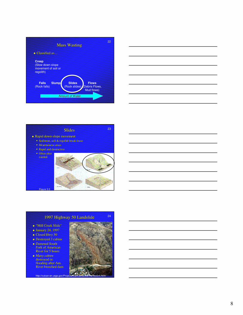
2323SlidesSlides�� Rapid downRapid down--slope movementslope movement
�� Sediment, soil & Sediment, soil & regolithregolith break loosebreak loose�� Mountainous areasMountainous areas�� Rapid and destructiveRapid and destructive�� Often after Often after
rainfallrainfall
Figure 3.3
24241997 Highway 50 Landslide1997 Highway 50 Landslide
�� “Mill Creek Slide”“Mill Creek Slide”�� January 24, 1997January 24, 1997�� Closed Hwy 50Closed Hwy 50�� Destroyed 3 cabinsDestroyed 3 cabins�� Dammed South Dammed South
Fork of American Fork of American River for 5 hoursRiver for 5 hours
�� Many cabins Many cabins destroyed in destroyed in flooding after Am. flooding after Am. River breeched damRiver breeched dam
http://vulcan.wr.usgs.gov/Projects/CalifLandslide/framework.html
9
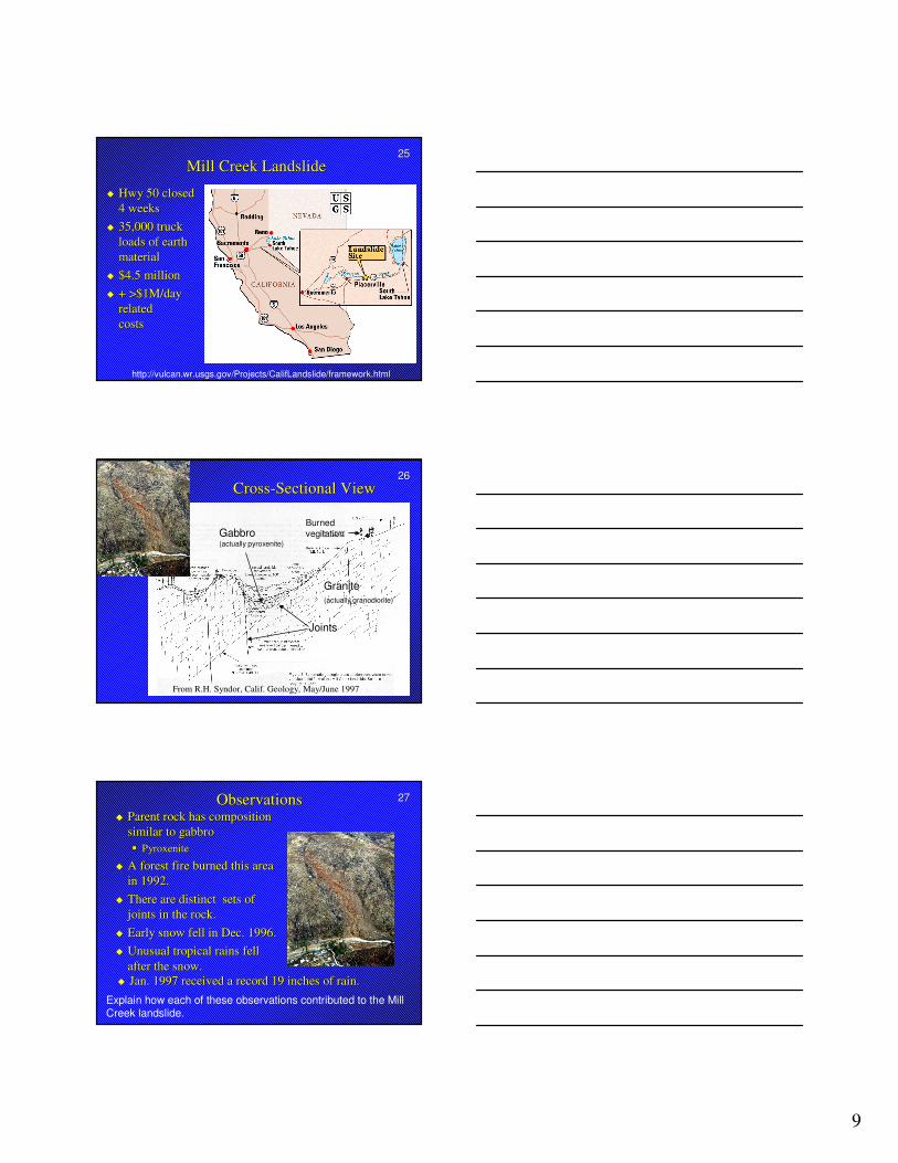
2525Mill Creek LandslideMill Creek Landslide
�� Hwy 50 closed Hwy 50 closed 4 weeks4 weeks
�� 35,000 truck 35,000 truck loads of earth loads of earth materialmaterial
�� $4.5 million$4.5 million�� + >$1M/day + >$1M/day
relatedrelatedcostscosts
http://vulcan.wr.usgs.gov/Projects/CalifLandslide/framework.html
2626CrossCross--Sectional ViewSectional View
Joints Joints
GraniteGranite(actually (actually granodioritegranodiorite))
GabbroGabbro(actually (actually pyroxenitepyroxenite))
Burned Burned vegitation vegitation
From R.H. Syndor, Calif. Geology, May/June 1997
2727ObservationsObservations�� Parent rock has composition Parent rock has composition
similar to similar to gabbrogabbro�� PyroxenitePyroxenite
�� A forest fire burned this area A forest fire burned this area in 1992.in 1992.
�� There are distinct sets of There are distinct sets of joints in the rock.joints in the rock.
�� Early snow fell in Dec. 1996.Early snow fell in Dec. 1996.�� Unusual tropical rains fell Unusual tropical rains fell
after the snow.after the snow.�� Jan. 1997 received a record 19 inches of rain.Jan. 1997 received a record 19 inches of rain.
Explain how each of these observations contributed to the Mill Creek landslide.
10
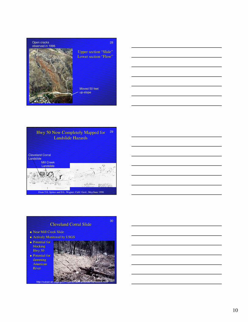
2828
Upper section “Slide”Upper section “Slide”Lower section “Flow”Lower section “Flow”SlideSlide
FlowFlow
Open cracksOpen cracksobserved in 1996observed in 1996
Moved 50 feetMoved 50 feetupup--slopeslope
2929Hwy 50 Now Completely Mapped for Hwy 50 Now Completely Mapped for Landslide HazardsLandslide Hazards
Mill Creek Mill Creek LandslideLandslide
Cleveland Corral Cleveland Corral LandslideLandslide
From T.E. Spitter and D.L. Wagner, Calif. Geol., May/June 1998
3030Cleveland Corral SlideCleveland Corral Slide
�� Near Mill Creek SlideNear Mill Creek Slide�� Actively Monitored by USGSActively Monitored by USGS�� Potential for Potential for
blockingblockingHwy 50Hwy 50
�� Potential forPotential fordamming damming American American RiverRiver
http://vulcan.wr.usgs.gov/Projects/CalifLandslide/framework.html
11
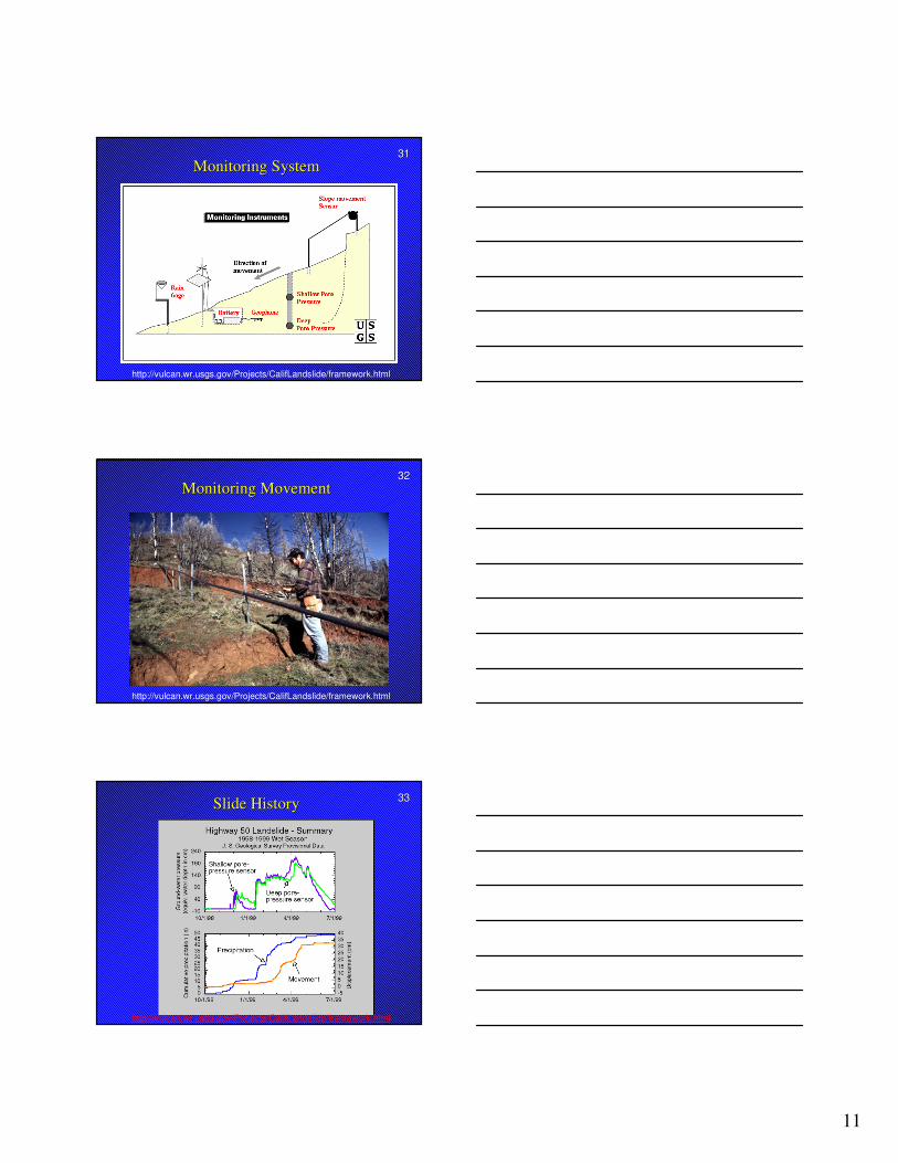
3131Monitoring SystemMonitoring System
http://vulcan.wr.usgs.gov/Projects/CalifLandslide/framework.html
3232Monitoring MovementMonitoring Movement
http://vulcan.wr.usgs.gov/Projects/CalifLandslide/framework.html
3333Slide HistorySlide History
http://vulcan.wr.usgs.gov/Projects/CalifLandslide/framework.html