Embed Size (px)
Citation preview

7/22/2019 Los 6.000 de Chile - Banco de Chile
http://slidepdf.com/reader/full/los-6000-de-chile-banco-de-chile 1/288
7/22/2019 Los 6.000 de Chile - Banco de Chile
http://slidepdf.com/reader/full/los-6000-de-chile-banco-de-chile 2/288

7/22/2019 Los 6.000 de Chile - Banco de Chile
http://slidepdf.com/reader/full/los-6000-de-chile-banco-de-chile 3/288
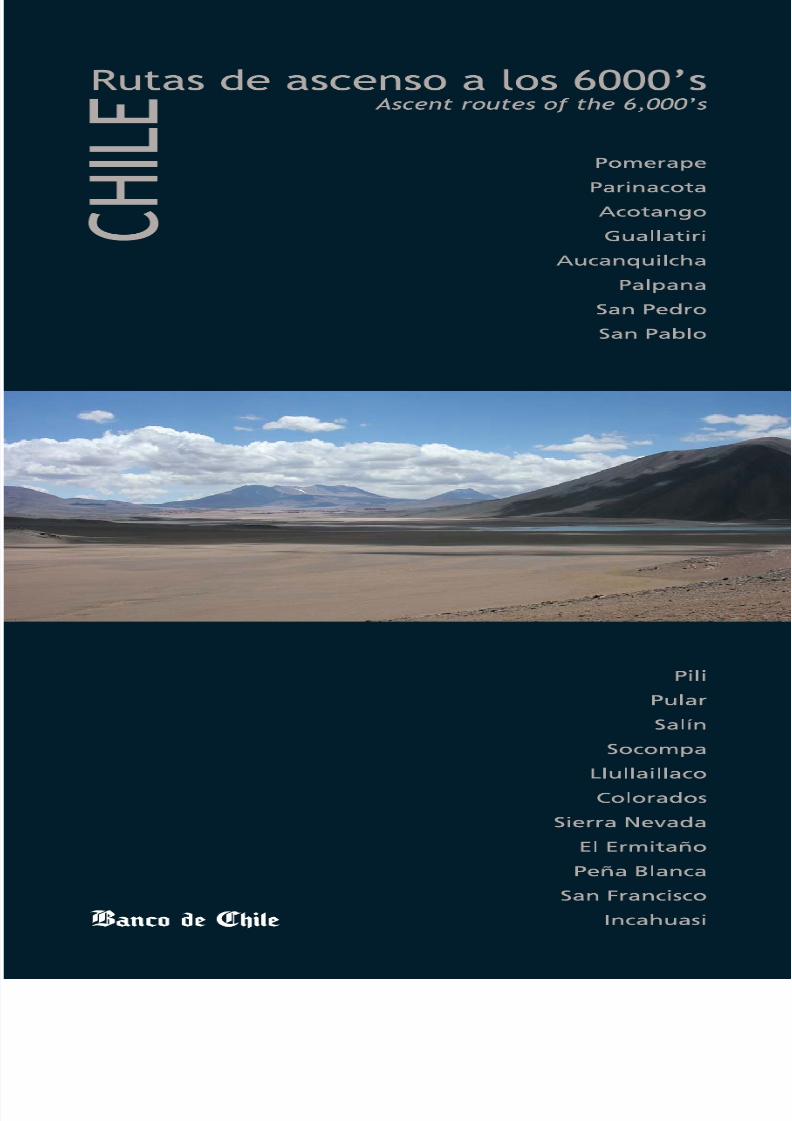
Ascent routes for the summits over 6,000 m
Rutas de ascenso a las cumbres sobre m

7/22/2019 Los 6.000 de Chile - Banco de Chile
http://slidepdf.com/reader/full/los-6000-de-chile-banco-de-chile 4/288
Presentación
Vivimos en un país de montañas. Tenemos
mucho más territorio terrestre montañoso
que de cualquier otro tipo. Desde donde
estemos podemos ubicarnos por las
montañas, podemos verlas y admirarlas; sin
embargo las conocemos poco y no somos
muchos los que tratamos de llegar a ellas.
Gracias a las ganas, al entusiasmo, a la pasión por la montaña y a
la apropiada preparación de avezadas expediciones que aceptaron
nuestro reto hace un año, el Banco de Chile logró realizar un gran
desafío, llevar un testimonio a todas las cumbres chilenas de más
de 6000 metros, “la Caja Cumbre”, en cuyo interior pusimos los
elementos necesarios para que los montañistas que vendrán puedan
dejar la huella de su propio testimonio.
Hoy nos sentimos orgullosos de plasmar en estas páginas toda la
experiencia, vivencias y emociones de cada una de estas expediciones,
especialmente porque en el testimonio del camino recorrido, fueron
dejando la huella y trazando rutas para que muchos otros, que
atraídos por nuestra majestuosa montaña puedan alcanzar las
cumbres más altas de Chile.
La montaña permite diversos niveles de desafíos. Permite vivir muchos
de los principales conceptos que definen las formas por excelencia
de enfrentar tanto la vida como la empresa.
Permite, a diferencia de muchas otras actividades, experiment
intensamente el valor de poner a prueba la capacidad individu
del trabajo en equipo.
Permite poner en práctica el espíritu emprendedor con las may
posibilidades de éxito, a través de la planificación, de la definic
de metas, del uso apropiado de la tecnología, la comprensión
respeto por la naturaleza y el medio ambiente.
Permite también el desarrollo del espíritu de aventura, de la búsqde lo que hay más allá, de las rutas desconocidas, de los lugares
nadie antes pisó.
Y permite por sobretodo, mirar desde arriba y ver mucho más
el mundo transcurrir desde otra perspectiva, ver cómo se form
crecen y desembocan los ríos, apreciar las heridas que ha deja
mano del hombre, admirar cómo hay obras humanas que han
mejorado nuestra calidad de vida conviviendo mágica y sanam
con la naturaleza; mirar cómo hemos desarrollado nuestras ciud
y vernos a nosotros mismos, apreciando nuestros valores y capacid
aceptando con sencillez nuestras limitaciones. Sólo hay que su
cumbre y darse el tiempo para mirarnos honestamente.
Con este proyecto editorial queremos motivar a otros a experime
la montaña y hacer que la pericia sea segura, precisa y respetu

7/22/2019 Los 6.000 de Chile - Banco de Chile
http://slidepdf.com/reader/full/los-6000-de-chile-banco-de-chile 5/288
Queremos que quienes se maravillen con su vivencia de montaña
puedan, estando allí, dejar constancia de lo que viven, de lo que
sienten, de lo que les pasa y queremos que lo puedan hacer con
gratitud por lo que han conocido. Es por eso que hemos dejado en
los lugares sagrados de nuestras altas cimas la “Caja Cumbre” como
testigo de ese trozo de vida que compartieron con la inmensidad de
esa montaña,
Queremos dejar un mensaje para los que vendrán, un recuerdo de
un objetivo realizado con esfuerzo, con ilusión y emprendimiento,
contando así la historia de nuestras montañas, escrita por quienes
tuvieron la determinación de alcanzarlas, se prepararon para
conseguirlo y disfrutaron al conquistarlas.
We live in a country of mountains. We have much more mounta
territory than any other type of land. Anywhere we are in Chi
can orientate ourselves by the mountains. We can view and a
them. However, we know little of them and few of us try to r
them.
Thanks to the desire, enthusiasm, passion for the mountains
appropriate preparation of the skilled teams who accepted ou
challenge a year ago, Banco de Chile managed to complete a
challenge; bringing a testimony to all the Chilean summits ov
6,000 metres, the “Summit Box”, which contain the necessa
elements to allow the mountaineers that will come to leave t
own testimony.Today, we feel proud to display the experiences and emotions
each of these expeditions in the following pages. Especially bec
in the testimony of each climb, they defined routes and direc
that will allow many others, attracted by our majestic mounta
to reach the highest peaks in Chile.
Mountains allow diverse levels of challenge. The skils involved
climb echo those needed to face the challenges of life and of
business.
They allow us, in contrast with many other activities, to show
courage and to put our individual capacity and teamwork to
test.
It allows us to put an enterprising spirit into practice with the gr
possibility of success, through planning, defining goals, an appro
use of technology and the respect and understanding of natur
the environment.
It also allows the development of the spirit of adventure, of t
search for what is beyond what we know; of the unknown ro
to the places where no one has set foot before.
And it allows us, above all, to look from above and see much m
View the world from another perspective, see how the rivers
grow and meet each other. Appreciate the wounds that have
left by the hand of man, admire how human works have impr
our quality of life, living magically and healthily alongside nat
See how we have developed our cities and look at ourselves,
appreciating our courage and capacities, accepting our limita
with modesty. All we have to do is climb the summit and take
time to look at ourselves honestly.
With this editorial project, we want to motivate others to exper
the mountain and make sure that the experience is safe, precis
respectful.
We want those who can marvel with their mountaineering exper
to leave testimony of what they lived, what they felt and wha
happened to them. And we want them to feel grateful for w
they have learnt. It is because of this that we have left, in the s
places of our high peaks, the “Summit Box”, as a testimony t
piece of life that they shared with the immensity of that moun
We want to leave a message for those who will come, a mem
of an objective achieved with effort, with hope and with dedic
telling the history of our mountains, written by whoever had
determination to reach them, and were well-prepared enoug
succeed in and enjoy the conquest.
P r e s e n t a t i o n
Los 6000’s de Chile / The 6,000’s of Chile
2 3
Andrónico Luksic C.VicepresidenteBanco de Chile
Andrónico Luk
VicepresidenBanco de Ch

7/22/2019 Los 6.000 de Chile - Banco de Chile
http://slidepdf.com/reader/full/los-6000-de-chile-banco-de-chile 6/288
“¿Hemos vencido a un enemigo? A ninguno,
excepto a nosotros mismos. ¿Hemos ganado
un reino? No, y no obstante sí. Hemos logra-
do una satisfacción completa, hemos materiali-
zado. Luchar y comprender, nunca el uno sin
el otro, ésta es la ley…” (Mallory).
La montaña es una presencia que reúne en sí misma la magia y el
milagro, el misterio y la revelación. Ella tiene un mensaje que entre-
garnos en su lenguaje pétreo y metálico, y los que hemos descifrado
ese lenguaje tenemos la misión de difundirlo a todos los vientos para
que otros, junto a nosotros y después de nosotros, suban a recibirlo
y a empaparse de la sabiduría y simplicidad que nos brinda la dimen-
sión vertical.
No es fácil la montaña. Al revés del camino que se tiende frente a
nosotros invitándonos a seguirlo, ella es enhiesta y bárbara y su
grandeza nos cohíbe. Para entrar en su reino es necesario ser iniciado.
Por ello, los que hemos recorrido el áspero costillar de la tierra, debe-
mos compensar ese privilegio despertando en otros el encantamiento
por el arte de ascender, que no sólo significa ganar metros verticales,
sino compartir la experiencia, hacerla llegar a la humanidad entera,ensanchando así nuestros propios horizontes.
Esta necesidad de compartir la emoción de llegar a la cima es innata
en el hombre, y a lo largo del tiempo se ha transformado en una tra-
dición dentro del mundo de montaña. Alcanzar una cumbre y buscar
bajo las piedras hasta dar con una pequeña vasija que guarda en su
interior historias y testimonios dejados allí como herencia para la
Introducción
historia, es una emoción de tal profundidad que se hace difíci
transmitir y sin embargo siempre triunfa el imperioso impulso
compartirla.
Los montañistas cumbreros, junto con recordar y nombrar allá
la altura a los integrantes del equipo patrocinador para que su
espíritu esté también presente en la cúspide, deben reservar en
para realizar el amistoso gesto de dejar en la cumbre ese men
para los que vendrán. Es un acto de gratitud hacia la vida por
oportunidad de haber realizado la proeza de escalar, al tiempo
de acercamiento y amistad hacia el próximo equipo que lo log
Hay dos formas de ascensión, a cual más válida: el ascenso gan
terreno metro a metro, y el apoyo solidario de quien, con fe y
confianza en la capacidad del montañista, le ofrece el apoyo ec
mico que le permita realizar su sueño de altura. Este concurso
vital importancia para el éxito de la empresa pues, cuando log
unirse dos voluntades, surge de esa unión la energía de la cual
rá y se irá fraguando la victoria. Y se consolidan así, el equipo
montaña y el de apoyo, como los artífices de la aventura, com
realizadores de la hazaña.
Siendo Chile un país con tanta presencia de montañas y con u
cultura de montañismo cada vez más fuerte, formar parte de
proyecto que busca impulsar el montañismo apoyando a quie
quieren ir al encuentro de las cumbres; pujar para que sean ca
vez más las cumbres chilenas visitadas; y lograr que la bella trad
del testimonio contribuya a que se continúe tejiendo la histor
las cumbres, es un verdadero placer.

7/22/2019 Los 6.000 de Chile - Banco de Chile
http://slidepdf.com/reader/full/los-6000-de-chile-banco-de-chile 7/288
VERTICAL
I n t r o d u c t i o n
Rodrigo Jordan
Los 6000’s de Chile / The 6,000’s of Chile
4 5
Ver que una empresa como el Banco de Chile esté interesada en
apoyar esta pasión considerando nuestras montañas no como meros
límites sino como fuentes de sueños, nos provoca una alegría
inmensa. Y poder transformar este proyecto en un vehículo de
difusión del montañismo, es algo con lo que muchas veces hemos
soñado.
Hoy presentamos este sueño hecho realidad. Así como para alcanzar
la cima de una montaña se requirió del trabajo y esfuerzo a toda
prueba de un gran equipo de personas, así también fue necesario
e imprescindible contar con el apoyo prestado por el equipo que se
decidió a respaldar y a sostener en todo momento esta iniciativa.
Comenzamos por los montañistas que participaron en el proyecto
Cajas Cumbre, cuyo aporte ha quedado estampado en cada uno de
los relatos e informes que en este libro se presentan, y continuamos
con los que lograron plasmar su experiencia en este libro que servirá
de referencia. Quiero agradecer especialmente a Andrea Gabriel,
Eugenio Guzmán, Eduardo Urtubia, Héctor Millar, Camilo Rada,
Teresa Pérez, Iain Mitchell, Darren Moss, Misael Alvial y Enrique Larenas.
Un verdadero legado para los montañistas que vendrán.
"Have we vanquished an enemy? None but ourselves. Have w
gained success? That word means nothing here. Have we wo
kingdom? No...and yes. We have achieved an ultimate satisfac
fulfilled a destiny.... To struggle and to understand—never th
without the other; such is the law..." (Mallory).
The mountain has a message to give us in its rocky and meta
language. Those of us who understand this language have th
mission of spreading the message so that others can also sha
The mountain is not easy. It is hard to reach, barbaric and its gra
can inhibit. Those who have had the privilege of entering its do
often feel they should share the experience and therefore bro
others’ horizons as well as their own.
The need of sharing the excitement of reaching the summit is n
in man and through time it has become a tradition in the
mountaineering world. It is thrill to reach a summit and search
the stones until finding a small container that holds the storie
testimonies of other climbers.
The summit mountaineers, as well as remembering the other me
of their team that helped them reach the summit, should also
some energy for leaving their own message for those who will
after them. It is an act of gratitude for the opportunity to clim
mountain and an act of friendship towards the next successful
Climbers would not be able to ascend without the economic su
of those who place faith and trust in their abilities. This is of v
importance as only the consolidation of the support team wit
mountain team can lead to a successful enterprise.
As Chile is a country with so many mountains and such a rap
growing mountaineering culture, it is a real pleasure to be pa
a project that looks to encourage mountaineering and continu
beautiful tradition of the summit testimony.
To see that institutions like Banco de Chile are interested in supp
the passion for mountaineering makes us very happy. To be a
transform the 6,000 Summit Box Project into a vehicle for spre
mountaineering is something that we have often dreamed ab
Today we present this dream made reality. Just as reaching a su
requires the effort and work of a large number of people we
also needed the support of an extensive team that has suppo
this project through every stage. It started with the mountain
who took part in the Summit Box Project and whose work has
imprinted in each of this book’s testimonies and continued with
who turned those experiences into a book that acts as a refe
for climbers. I would especially like to thank Andrea Gabriel, EuGuzmán, Eduardo Urtubia, Héctor Millar, Camilo Rada, Teresa
Iain Mitchell, Darren Moss, Misael Alvial, y Enrique Larenas.
They have produced a real legacy for the mountaineers of the f

7/22/2019 Los 6.000 de Chile - Banco de Chile
http://slidepdf.com/reader/full/los-6000-de-chile-banco-de-chile 8/288

7/22/2019 Los 6.000 de Chile - Banco de Chile
http://slidepdf.com/reader/full/los-6000-de-chile-banco-de-chile 9/288
Contenido / ContentsPresentación
Introducción
Contenido
El país de las montañas
Una larga historia de montaña
Nota del editor
2
4
7
8
16
23
Pomerape
Parinacota
Acotango
Guallatiri
Aucanquilcha
Palpana
San Pedro
San Pablo
PiliPular
Salín
Socompa
Llullaillaco
Colorados
Sierra Nevada
El Ermitaño
Peña Blanca
San Francisco
Incahuasi
El Muerto
Ojos del Salado
El Fraile
Vicuñas
Barrancas Blancas
Tres Cruces Sur
Tres Cruces Central
Solo
Los PatosCopiapó
El Toro
Las Tórtolas
Olivares
Juncal
El Plomo
Tupungato
Alto San Juan
Piuquenes
Marmolejo
Cerros / Mountains24
30
36
42
48
54
60
66
7278
84
92
98
106
114
120
126
132
138
144
150
156
162
168
174
180
186
192200
208
214
220
226
234
242
250
258
264
Recomendaciones generales
Información
Glosario de términos geográficos y montañistas
Proyecto “Cajas Cumbre” los protagonistas
Bibliografía
General recommendations
Information
Glossary of geographic and mountaineering terms
The Summit Box Project: protagonists
Bibliography
270
274
276
278
282
Presentation
Introduction
Contents
The land of mountains
A long history of mountaineering
Editor’s note
Rutas de ascenso a los ’s de Chile / Ascent routes for Chile’s 6,000’s

7/22/2019 Los 6.000 de Chile - Banco de Chile
http://slidepdf.com/reader/full/los-6000-de-chile-banco-de-chile 10/288
EL
MONTAÑASPaísDE LAS

7/22/2019 Los 6.000 de Chile - Banco de Chile
http://slidepdf.com/reader/full/los-6000-de-chile-banco-de-chile 11/288
Chile, país de montañas. Quizás ésta sea una de las frases que mejor
nos describa. Y cómo no, si prácticamente no existen lugares ennuestro territorio desde donde no veamos algún monte, o dibujo
de niño chileno sin la cordillera como parte del paisaje.
Cerca del 80% de nuestro territorio está compuesto por zonasmontañosas, impresionante cifra si se considera que sólo el 20% de
la superficie terrestre corresponde a montañas, pero comprensiblesi se piensa que, además de cordones transversales y pequeñossistemas cordilleranos, existen dos grandes cordilleras que recorren
el país de Norte a Sur: la de la Costa, la más antigua, extendida alo largo de 3000 kilómetros, que se presenta hoy como una sucesión
de lomajes redondeados por la erosión, sorprendiendo cada ciertostramos con uno que otro monte o macizo escarpado que puede
llegar hasta los 3000 m. Y la de Los Andes, mítico símbolo de puebloslatinoamericanos, y soberbia presencia que recorre la impresionante
longitud de 10000 kilómetros, desde el Mar del Caribe hasta el Cabode Hornos. De éstos, aproximadamente 4200 kilómetros se sitúan
en Chile, luciendo diversas formas y ostentando edades, climas yecosistemas diferentes a lo largo de su extensión. En esta cordillera
destacan altitudes que superan los 6000 m y se asientan más de2000 volcanes, de los cuales cerca de 60 se encuentran activos.
Pero ¿cuál es la magia que encierran las montañas? ¿Es sólo el
desafío de las grandes cimas lo que ha atraído y encantado la miradade tantos? Si bien para muchos esto puede ser cierto, para otros la
respuesta es un rotundo no, ya que saben que el goce de escalarlasse triplica cuando se las conoce más profundamente.
Mucho más que macizos de roca, hielo y tierra, las montañas sonfuentes de vida. No por nada la Asamblea General de las NacionesUnidas declaró el año 2002 como Año Internacional de las Montañas,
reconociéndolas como “ecosistemas frágiles, mundialmenteimportantes como depósitos de agua, áreas de diversidad biológica
y de recreación, y centros de integridad y patrimonio cultural”. Y laverdad es que más allá de representar un sustento clave para la vidade al menos la mitad de la población humana de la Tierra, las
montañas son fascinantes.
T h e l a n d o f m o u n t a i n s
Los 6000’s de Chile / The 6,000’s of Chile
8 9
Chile, the Land of Mountains. Perhaps that is one of the phra
that best describes the country. And with good reason. There
practically no place in Chile from where you cannot see a mou
and hardly a Chilean child’s drawing that doesn’t feature the A
as part of the scenery.
Close to 80% of Chilean territory is made up of mountainous
an impressive figure, considering that only 20% of the earth’s s
is mountains. But it is understandable when you think that, a
as transverse mountain chains and smaller mountain systems
are two large ranges that run the length of the country from
to south. The Cordillera de la Costa (Coastal Range) is the old
range and is over 3,000 km long. Today it is a succession of shills rounded by erosion over time, punctuated every now and
by larger mountains that can reach over 3,000 m. The other r
the Andes is a mythical symbol of Latin America. It is a majes
presence that runs the impressive distance of 10,000 km, fro
Caribbean Sea until Cape Horn. Of those, approximately 4,20
are in Chile. The Chilean Andes show diverse shapes, ages, cli
and eco-systems along their length, including altitudes over 6
m and more than 2,000 volcanoes, of which nearly 60 are still
today.
But, what is the magic that these mountains hold? Is it just th
challenge of the high summits which attract and charm so m
For many this could be true. But for many others the answer
resounding no, as they know the pleasure of climbing the mou
multiplies when you know them more deeply.
Much more than massifs of rock, ice and earth, mountains ar
sources of life. This is why the United Nations General Assemdeclared 2002 the International Year of Mountains, recognisi
them as “fragile eco-systems, important worldwide as source
fresh water, areas of biological diversity and recreation, and as c
of integrity and cultural diversity”.

7/22/2019 Los 6.000 de Chile - Banco de Chile
http://slidepdf.com/reader/full/los-6000-de-chile-banco-de-chile 12/288
Observar detenidamente sus líneas, colores, formas rocosas
y secretos fosilizados ya es un indicio para imaginar cómo
comenzó su historia hace millones de años, historia que enel caso de Los Andes parte bajo el mar. Lo que hoy es nuestragran cordillera alguna vez fue una enorme depresión en el
fondo marino, que recibía a diario el aporte de sedimentos.Fueron los largos procesos de deslizamiento de la placa de
Nazca bajo la placa Sudamericana, con presiones y movimientostectónicos que lograban el plegamiento de la superficie,
sumados a períodos concentrados de fuertes procesosorogénicos o de formación de montañas, los que alzaron este
fondo rebasando el nivel de las aguas. El mayor levantamiento
habría producido hace alrededor de 20 millones de años,especialmente en la parte Norte de nuestro país, y han sido lo
temblores, el volcanismo, el viento, el agua y la oscilación térmlos que han continuado esculpiendo nuestros macizos. A esto
fenómenos hay que añadir otros procesos que contr ibuyeronpoderosamente a la forma que actualmente lucen nuestras mont
las grandes glaciaciones, que socavaron superficies, rediseñarpaisaje y desplazaron flora y fauna, y la gran secuencia de erupcvolcánicas ocurridas hace 12000 años, erupciones que arrojar
enormes cantidades de cenizas, cubriendo Los Andes desde su
¿Cómo no maravillarse entonces cuando en plena cordillera nencontramos con rastros de lo que fue una rica vida marina h
millones de años? ¿O con líneas y figuras en paredes rocosas invitan a imaginar cómo fueron los procesos de plegamiento?
Y lo fascinante continúa. Cada montaña que se alza sobre la T
acoge un intrincado mosaico de climas, hábitat, adaptacionesperfectas y luchas por la subsistencia. Prácticamente ningún m
cuadrado en una montaña es exactamente igual a otro porque vla pendiente, la orientación, el relieve, la radiación, la presión
atmosférica, la temperatura. El descenso en la temperatura quexperimenta al ascender 100 m (0,5º C en promedio) equivale
acercarse 150 kilómetros en línea recta al polo más cercano. Nmenor. A estos factores se suma la constante y frontal exposic
El País delas Montañas

7/22/2019 Los 6.000 de Chile - Banco de Chile
http://slidepdf.com/reader/full/los-6000-de-chile-banco-de-chile 13/288Los 6000’s de Chile / The 6,000’s of Chile
10 11
And there are yet more wonders that the mountains hold. Ev
mountain is an intricate mosaic of climates, habitat, perfect adapt
and fights for survival. Practically no square metre in a mount
exactly the same as another due to the variation in slope, orient
relief, radiation, atmospheric pressure and temperature. The
temperature that a climber experiences every 100 metres (0.5º
average) is the equivalent to approaching 150 km in a straigh
towards the nearest pole.
T h e l a n d o f m o u n t a i n s But, beyond being vital to the survival of at least half of the popu
of the Earth, mountains also hold a deep fascination. Looking ca
at their lines, colours, rock formations and fossilised secrets is
beginning of an imaginary trip to witness how their history b
millions of years ago. A history, in the case of the Andes, beg
under the sea. What today is a great mountain range was on
enormous depression at the bottom of the sea. Various proce
led to the bottom of the sea being raised higher than the leve
the water. These processes included the slipping of the Nazca
under the South American plate, tectonic movements that ca
the folding of the earth’s crust and concentrated periods of s
orogenic processes that cause the formation of mountains. T
biggest period of uplifting occurred about 20 million years agespecially in the north of Chile. Since then, earthquakes, volca
wind, water and thermal oscillation have continued to sculpt
massifs. Other natural phenomena have also contributed enorm
to the shape of the mountains today, such as the glacial perio
which undermined areas, re-structured the landscape and disp
flora and fauna. There was also a great sequence of volcanic eru
that occurred 12,000 years ago. These eruptions threw up enor
quantities of ash, covering the Andes from its base upwards.
It is therefore difficult not to be amazed when in the middle o
Andes we find remains of what used to be rich marine life m
of years ago. Or when we imagine the processes of folding w
looking at the lines and shapes in the rock walls.

7/22/2019 Los 6.000 de Chile - Banco de Chile
http://slidepdf.com/reader/full/los-6000-de-chile-banco-de-chile 14/288
de las montañas a la erosión. Con estos antecedentes, nos damos
cuenta de que aquellos que logran hacer de las montañas su hogar,son verdaderos triunfadores. Las especies que habitan sistemas
montañosos presentan por lo general un alto nivel de adaptaciónexclusiva al ambiente logrando sobrevivir contra todo pronóstico,
generando ecosistemas de una riqueza única en el planeta.
Si bien sobre los 6000 m desaparece la vida, el tipo de vida que sepuede encontrar a lo largo de las 38 grandes alturas andinas a las
que se refiere este libro están abarcadas por dos de las ecorregionesdescritas por Quintanilla (unidades biogeográficas que poseen ciertas
características climáticas y biológicas). La ecorregión AltiplánicaAndina es una de ellas.
Por sobre los 3500 m y extendida desde la Región de Tarapacá hasta
el Salar de Maricunga en la Región de Atacama, esta ecorregiónaloja formaciones vegetacionales compuestas por varias especiesconocidas como Tolar (arbustos), Pradera Andina Perenne (arbustos
enanos y pajonales) y Bofedal (cojines verdes de hierbas enanas enzonas húmedas). Son plantas perfectamente adaptadas al clima de
la puna que presenta grandes diferencias de temperatura entre eldía y la noche, períodos muy secos, y fuertes lluvias y nevazones en
los meses de verano durante el denominado Invierno Altiplánico,especies que permiten la subsistencia de animales también altamente
adaptados a estas condiciones. Los anfibios que viven aquí tienen
pieles muy resistentes que impiden la deshidratación, o prácticam
habitan todo el tiempo bajo el agua; mientras que los escasos reque se pueden encontrar estarán exclusivamente en las laderas
soleadas, ya que esto junto a otras adaptaciones les permite libedel sopor y la torpeza que les causa el fr ío. Para las aves tal ve
mayor problema no sean el frío y la sequedad, sino la falta de luapropiados para anidar. ¿Cómo lo resolvieron? Adaptándose
magistralmente al suelo y a las rocas, o simplemente migrandomamíferos, en tanto, sortean el frío con un pelaje exquisitametérmico. Dentro de los fascinantes animales que se pueden obs
en estos parajes están el Flamenco Chileno (Phoenicopterus chile
la Chinchilla de Cola Corta (Abrocoma cinerea), el Lauchón dePuna (Phyllotis arenarius), la Llama (Lama glama), la Alpaca (Lapacos), el Puma (Felis concolor) y el Gato Montés Andino (Feli
jacobita).
La segunda ecorregión es la llamada Altoandina, característicalas altas montañas de nuestros Andes, que agrupa los tipos
vegetacionales y comunidades de especies que viven por sobr4500 m. Siendo las condiciones reinantes de gran adversidad, c
temperaturas promedio de 0ºC, baja concentración de oxígenprecipitaciones en forma de nieve o granizo (lo que para las pla
significa escasez de agua) y alta exposición al viento, son

7/22/2019 Los 6.000 de Chile - Banco de Chile
http://slidepdf.com/reader/full/los-6000-de-chile-banco-de-chile 15/288Los 6000’s de Chile / The 6,000’s of Chile
12 13
Added to these factors is the constant exposure of the moun
to erosion. With these facts, we realize that those who mana
make the mountains their home are true survivors. The specie
inhabit mountain systems generally show a high level of adap
exclusive to their environment; managing to survive against a
expectations and generating eco-systems of a unique richnes
Even though species cannot survive at over 6,000 m, the type
life that can be found along the length of the 38 highest And
mountains which this book describes are covered by two of th
regions described by Quintanilla (bio-geographic units that ha
certain climatic and biological characteristics). The Andean Alti-
eco-region is one of these.Over 3,500 m high and extending from the Tarapacá region
the Maricunga Salt Lake in the Atacama region, the Andean
Planic eco-region has vegetational formations that are compos
several species. Among these are Tolar (shrublands), Pradera A
Perenne (dwarf bushes and scrubland) and Bofedal (green cus
formed by dwarf plants in humid areas). These are plants tha
perfectly adapted to the climate of the Puna, which has a hug
range in temperature between day and night, very dry period
strong rain and snow falls in the summer months during the
called Alti-Planic winter. These species also allow the existenc
animals, who are also highly adapted to these conditions.
The amphibians that live here either have resistant skin that s
dehydration, or have become adapted to live under the wate
the time. The rare reptiles are found exclusively in the sunnier s
which prevents them becoming drowsy and slow due to the
For birds, perhaps the biggest problem is not the cold or the dbut the lack of appropriate places to nest. They resolve this b
adapting their nests to the ground and the rocks or by simply
migrating.
The mammals, meanwhile, overcome the cold with exquisitel
adapted thermal fur. Amongst the fascinating animals that ca
observed in these places are the Chilean Flamingo (Phoenicop
chilensis), the Short-Tailed Chinchilla (Abrocoma cinerea), the
Mouse (Phyllotis arenarius), the Llama (Lama glama), the Alpa
(Lama pacos), the Puma (Felis concolor) and the Andean Mou
Cat (Felis jacobita).
The second eco-region, called Altoandina (the High Andes) g
the types of vegetation and communities of species that live o
4,500 m. As the prevailing conditions offer great adversity, su
temperatures averaging 0ºC, low oxygen levels, precipitation
form of snow or hail (which for the plants means a scarcity of wand high exposure to the wind, the species which live in these p
are truly admirable. The type of vegetation is largely scrub an
some wet areas it is possible to see some bofedales.
T h e l a n d
o f m o u n t a i n s

7/22/2019 Los 6.000 de Chile - Banco de Chile
http://slidepdf.com/reader/full/los-6000-de-chile-banco-de-chile 16/288

7/22/2019 Los 6.000 de Chile - Banco de Chile
http://slidepdf.com/reader/full/los-6000-de-chile-banco-de-chile 17/288
Amongst all these species, there are two that stand out due to
impressive adaptations: Llareta (Azorella compacta) and Queñ
(Polylepis tarapacana). Llareta is a plant so compact that it rese
a green rock. Its slow growth forms concave protuberances w
hard small resinous leaves, that impede the loss of water and p
total adaptation to the dryness of the environment. Queñoa, o
other hand, is a twisted tree that can reach up to 3 metres in h
It is unmistakable due to its strong and tightly-spaced branch
resin-covered leaves and the waxy layer of dense, yellowy hai
the underside of the leaf. It is one of the trees that grows at t
highest altitudes in the world, being found in woods and gorg
to 4,700 m. Queñoa is found principally in the Andes in the f
and second region, while Llareta is present up until the CentrAndes. Both have had conservation problems due to their po
use as a source of fuel.
The High Andean fauna is less diverse than in the Andean Alti-
region but it is equally rich in endemism. Of the mammals, th
Guanaco (Lama guanicoe) is one of the few that live at these alti
along with the Andean Fox (Dusicyon culpaeus). Among the
apart from the symbolic Condor (Vultur griphus), it is possible
the small Andean Goldfinch (Spinus atratus), the Juarjual And
Duck (Lophonetta specularioides) and the Andean Hawk (But
poecilochrous).
If to all of this is added the fact that mountains are our source
reserves of fresh water, scenarios for processes that are vital t
subsistence, agents of great influence over the climate and a s
of inspiration for cultures and peoples, it becomes easy to unde
why so many are fascinated and moved by them. We can see
there was so many that worshipped them and why now ther
so many of us who fight for their protection, why there is so
magic in exploring and climbing them and why so many of u
consider them to be exquisite and perfectly sculpted works o
Hopefully every day more of us will feel the same.
Los 6000’s de Chile / The 6,000’s of Chile
14 15
T h e l a n d o f m o u n t a i n sverdaderamente admirables las especies que habitan estos espacios.
El tipo de vegetación es mayoritariamente pajonal y sobre algunoque otro suelo húmedo aún es posible ver algunos bofedales. Pero
existen dos especies que destacan por su impresionante adaptación:la Llareta (Azorella compacta) y la Queñoa (Polylepis tarapacana). La
llareta es una planta tan compacta que semeja una roca verde; sulento crecimiento forma cóncavas protuberancias con pequeñas
hojas resinosas muy duras, que impiden al máximo la pérdida deagua y le permiten adaptarse totalmente a la sequedad del ambiente.La queñoa, por otra parte, es un árbol retorcido que puede alcanzar
una altura de hasta tres metros y es inconfundible por su ramificación
fuerte y apretada, por sus hojas cubiertas de resina y por tener unacapa serosa, densa y amarillenta, de pelos en el revés. Es uno de losárboles que crece a mayor altitud en el mundo, pudiéndosele
encontrar en bosquetes de quebradas hasta los 4700 m. Si bien laqueñoa está presente principalmente en Los Andes de la Primera y
Segunda Región, mientras que la llareta llega hasta Los AndesCentrales, ambas se encuentran con problemas de conservación
debido al alto uso que se les ha dado como combustible.
La fauna altoandina es menos diversa que la altiplánicoandina, peroes igualmente rica en endemismo. De los mamíferos, el Guanaco
(Lama guanicoe) es uno de los pocos que vive en estas altitudes,acompañado por el Zorro Andino (Dusicyon culpaeus). Entre las aves,
además del simbólico Cóndor (Vultur griphus) es posible tener lacompañía del pequeño Jilguero Cordillerano (Spinus atratus), el Pato
Juarjual Cordillerano (Lophonetta specularioides) y el AguiluchoCordillerano (Buteo poecilochrous).
Si a todo esto sumamos el hecho de que las montañas y la vida que
ellas cobijan son nuestras fuentes y reservas de agua dulce, escenariosde procesos vitales para nuestra subsistencia, agentes de gran
influencia sobre el clima y fuente de inspiración para culturas ehistorias de pueblos, se hace fácil entender por qué hay tantos que
se fascinan y movilizan por ellas. Por qué hubo tantos que lasveneraron y por qué habemos actualmente tantos que luchamospor su protección, por qué hay tanta magia en explorarlas y escalarlas,
y por qué habemos tantos que las consideramos verdaderas obrasde arte exquisita y perfectamente esculpidas.
Ojalá cada día seamos más.

7/22/2019 Los 6.000 de Chile - Banco de Chile
http://slidepdf.com/reader/full/los-6000-de-chile-banco-de-chile 18/288
Una larga
HISTORIAMontaña
La inexplicable atracción que las montañasejercen sobre el ser humano lleva cientos de
años escribiendo una historia de pasiones.
Sueños, deseos de aventura, afán por explorar
y ampliar el conocimiento, conexión con lo
sagrado, desafío personal, necesidad de ir más
allá… diversos son los motivos, pero es un
mismo proceso: hombres y mujeres movilizados
por sobre sus fuerzas, haciendo lo posible por alcanzar sus cumbres.
Para el mundo occidental el inicio del montañismo como práctica
se remonta a 1786, cuando el cientista y aristócrata francés Horace
Benoit de Saussure alcanzó la deseada cumbre del Mont Blanc, de
4810 m. Con él se desmitifican las historias asociadas a las altas
cumbres y se impulsa con más fuerza la necesidad de explicar yentender el mundo a través de la razón. Con él toma fuerza el
“alpinismo” como pasión, disciplina y forma de vida.
Sin embargo, en Sudamérica, y específicamente en Chile y los países
andinos, la historia ligada a las montañas y sus cumbres se escribía
silenciosamente desde mucho antes. Las altas cimas de Los Andes,
tan ligadas a la vida y cultura de los pueblos originarios, venían
siendo alcanzadas unos 400 años antes de la simbólica conquista
del Mont Blanc.
DE
Fotografía: Expedición ChilenoJaponesa a LAndes Centrales Gentileza de Claudio Lucer
Photography: Chilean-Japanese expedition to Central Andes. Courtesy of Claudio Lucero.
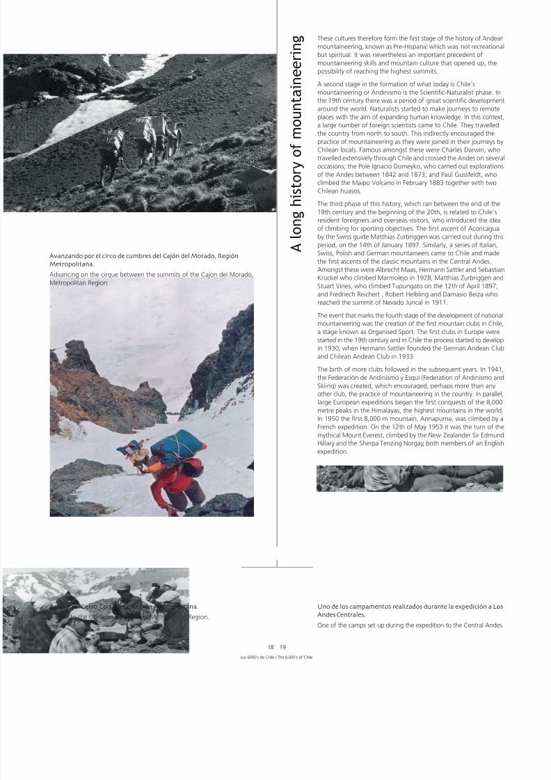
Campamento a la entrada del Cajón del Morado Región Metropol
Camp at entrance to the Cajón del Morado, Metropolitan Region.

7/22/2019 Los 6.000 de Chile - Banco de Chile
http://slidepdf.com/reader/full/los-6000-de-chile-banco-de-chile 19/288
16 17
The attraction that mountains hold for people has been a hist
passions, hundreds of years in the writing. Dreams, desire for
adventure, the longing to explore and expand knowledge, conn
with the sacred, personal challenge, the need to go further…
are many diverse motives, but the same process: men and wo
surpassing their limits, doing whatever possible to reach their sum
For the western world, mountaineering began in 1786 when
French scientist and aristocrat Horace Benoít de Saussure reac
the long-desired summit of Mont Blanc (4,810 m). This ascent m
that the reputation of high altitude mountains was de-mystif
contributing to the growing movement towards explaining a
exploring the world through reason. Because of Saussure, ‘alpbecame much more popular as a passion, discipline and a wa
life.
However, in South America, and specifically Chile and the An
countries, the history of mountains and their summits was be
written silently from many years earlier. The high summits of
Andes, so linked to the life and culture of the aboriginal peop
were reached about 400 years before the symbolic conquest
Mont Blanc.
For centuries, the Andes were considered a divine protection b
peoples who adapted so impressively to living at high altitude
in adverse conditions. Peoples that, thanks to their ability for
observation and connection with the environment, managed
understand the secrets of the land and made the Andes their h
Peoples that knew and respected the high mountains, consid
them to be the source from where their communities came.
Aymaras and Atacameños, or Likán Antai, are among the peo
that managed to live sustainably and harmonically in the high
But it is the Incan culture that shows the strongest ties with t
mountains, giving them the role of oratories and burial groun
which would later lead to the discovery of famous mummies,
testament to the culture they once belonged to.
It is thanks to the expansion of the Incan Empire that today we
so many vestiges of their culture and so much evidence of th
mountaineering abilities, despite the quality of equipment and c
that they had. More than 70 sites classified as high sanctuaries
been discovered up till the present day. Two in Bolivia, nine in
south of Peru and the rest distributed equally in Chilean and Arg
territory. All these sanctuaries are undisputed signs of the vene
that these aboriginal peoples gave to the Gods through the moun
Por siglos, Los Andes fueron telón de fondo y protección divina depueblos impresionantemente adaptados a vivir en altura y condiciones
adversas. Pueblos que, gracias a su capacidad de observación y
conexión con el medio, lograron desentrañar los secretos de la tierra
haciendo de Los Andes su hogar y su espacio. Pueblos que conocían
y respetaban las altas cumbres considerándolas la fuente desde
donde descendía la comunidad.
Aymaras y atacameños, o Likán Antai, se cuentan entre estos pueblos
que lograron vivir sustentable y armónicamente en las altas tierras.
Pero es la cultura Inca la que mostró un vínculo más fuerte con las
montañas, dándoles categoría de oratorios y enterratorios de cuerpos,
que posteriormente se transformarían en famosas momias testigos
de la cultura a la que pertenecieron.
Es gracias a la extensión del imperio Inca que hoy contamos con
tanto vestigio de su cultura y tanta evidencia de su capacidad monta-
ñística pese a la precariedad del equipo y vestuario con que contaban.
Hasta ahora se han constatado más de 70 sitios considerados santua-
rios de altura: dos en Bolivia, nueve al Sur del Perú, y los restantes
distribuidos equitativamente en territorio chileno y argentino. Todos
estos santuarios constituyen rastros indiscutibles de la veneración
que rendían nuestros pueblos originarios a los dioses a través de las
montañas.
A l o n g h i s t o r y o f m
o u n t a i n e e r i n g
Los 6000’s de Chile / The 6,000’s of Chile
Camino hacia la cumbre por el filo del Cerro Lomalarga Región Metropolitana
On the way to the summit along the ridge of the Lomalarga Mountain.
Metropolitan Region.
Cruzando el Glaciar del Cortadera Región Metropol
Crossing the Cortadera Glacier, Metropolitan Region

7/22/2019 Los 6.000 de Chile - Banco de Chile
http://slidepdf.com/reader/full/los-6000-de-chile-banco-de-chile 20/288
Así, estas culturas conforman lo que es la primera etapa de la historiadel montañismo andino, conocida como Pre-Hispánica, la que sin
ser deportiva sino espiritual, nos lega un importante precedente de
destrezas y cultura de montaña, abriendo posibilidades de acceder
a las más altas cumbres.
Una segunda etapa en la conformación de lo que hoy es el montañis-
mo o andinismo en Chile es la Científico-Naturalista. En el siglo XIX
se vive una etapa de gran desarrollo y expansión de las ciencias a
nivel mundial. Los naturalistas comienzan a realizar viajes a los lugares
más remotos con el claro afán de hacer más profuso el conocimiento
humano. En este contexto llega a Chile un gran número de científicos
extranjeros que recorren el país de Norte a Sur, movilizando gente
e impulsando de manera indirecta la práctica del montañismo. Dentro
de ellos destacan Charles Darwin, quien recorrió extensamente Chiley cruzó la Cordillera de los Andes en varias ocasiones; el polaco
Ignacio Domeyko, quien realizó exploraciones a Los Andes entre
1842 y 1873; y Paul Gussfeldt, quien ascendió el Volcán Maipo en
febrero de 1883 en compañía de algunos huasos chilenos.
La tercera etapa de esta historia es la relacionada con los extran
residentes y visitantes, etapa en la cual nace la motivación del ob
deportivo, que se enmarca temporalmente entre fines del sigl
y comienzos del XX. Es en esta época cuando se realiza la prim
ascensión al Aconcagua, el 14 de enero de 1897, alcanzada p
guía suizo Matthias Zurbriggen. De la misma manera, una ser
montañistas italianos, suizos, polacos y alemanes visitan Chile
realizan las primeras ascensiones de las montañas clásicas de
Andes Centrales. Dentro de ellos destacan Albrecht Maas, Herm
Sattler y Sebastián Kruckel, quienes ascendieron el Marmolejo
1928; Matthias Zurbriggen y Stuart Vines, quienes escalaron e
Tupungato el 12 de abril de 1897; y Federico Reichert, Robert He
y Damasio Beíza, quienes alcanzaron la cumbre del Nevado Ju
en 1911.
El hecho que marca la cuarta etapa del desarrollo del montañ
nacional es la creación de los primeros clubes de montaña en C
etapa conocida como del Deporte Organizado. Así como en Eu
nacían los primeros clubes en el siglo XIX, en Chile este proce
comenzó a desarrollarse en 1930, cuando Hermann Sattler fu
el Club Alemán Andino, y posteriormente el Club Andino de C
en 1933. Al nacimiento de más clubes en los años posteriores
suma un hito fundamental en 1941 cuando se crea la Federac
de Andinismo y Esquí, hecho que impulsa sobremanera la prá
del andinismo en el país. Paralelamente, grandes expedicione
europeas se encuentran tratando de conseguir las primeras conq
de los ochomiles en los Himalaya, las montañas más altas del pla
en una no declarada carrera internacional. En 1950 es conquis
el primero, el Annapurna, bajo la bandera francesa en tanto q
29 de mayo de 1953 es el turno del mítico Monte Everest, alcan
por el neozelandés Sir Edmund Hillary y el sherpa Tenzing Nor
ambos integrantes de una expedición inglesa.
Parte del equipo de la expedición
Part of the expedition team.
7/22/2019 Los 6.000 de Chile - Banco de Chile
http://slidepdf.com/reader/full/los-6000-de-chile-banco-de-chile 21/288
A l o n g h i s t o r y o f m
o u n t a i n e e r i n g These cultures therefore form the first stage of the history of An
mountaineering, known as Pre-Hispanic which was not recrea
but spiritual. It was nevertheless an important precedent of
mountaineering skills and mountain culture that opened up,
possibility of reaching the highest summits.
A second stage in the formation of what today is Chile’s
mountaineering or Andinismo is the Scientific-Naturalist phas
the 19th century there was a period of great scientific develop
around the world. Naturalists started to make journeys to rem
places with the aim of expanding human knowledge. In this co
a large number of foreign scientists came to Chile. They trave
the country from north to south. This indirectly encouraged tpractice of mountaineering as they were joined in their journe
Chilean locals. Famous amongst these were Charles Darwin,
travelled extensively through Chile and crossed the Andes on s
occasions; the Pole Ignacio Domeyko, who carried out explora
of the Andes between 1842 and 1873; and Paul Gussfeldt, w
climbed the Maipo Volcano in February 1883 together with t
Chilean huasos.
The third phase of this history, which ran between the end of
19th century and the beginning of the 20th, is related to Chi
resident foreigners and overseas visitors, who introduced the
of climbing for sporting objectives. The first ascent of Aconca
by the Swiss guide Matthias Zurbriggen was carried out durin
period, on the 14th of January 1897. Similarly, a series of Ital
Swiss, Polish and German mountaineers came to Chile and m
the first ascents of the classic mountains in the Central Andes
Amongst these were Albrecht Maas, Hermann Sattler and Seb
Kruckel who climbed Marmolejo in 1928; Matthias Zurbrigge
Stuart Vines, who climbed Tupungato on the 12th of April 18
and Fredriech Reichert , Robert Helbling and Damasio Beíza w
reached the summit of Nevado Juncal in 1911.
The event that marks the fourth stage of the development of na
mountaineering was the creation of the first mountain clubs in
a stage known as Organised Sport. The first clubs in Europe w
started in the 19th century and in Chile the process started to de
in 1930, when Hermann Sattler founded the German Andean
and Chilean Andean Club in 1933.
The birth of more clubs followed in the subsequent years. In
the Federación de Andinismo y Esquí (Federation of Andinism
Skiing) was created, which encouraged, perhaps more than a
other club, the practice of mountaineering in the country. In pa
large European expeditions began the first conquests of the 8
metre peaks in the Himalayas, the highest mountains in the wIn 1950 the first 8,000 m mountain, Annapurna, was climbed
French expedition. On the 12th of May 1953 it was the turn
mythical Mount Everest, climbed by the New Zealander Sir Ed
Hillary and the Sherpa Tenzing Norgay, both members of an E
expedition.
Los 6000’s de Chile / The 6,000’s of Chile
18 19
Avanzando por el circo de cumbres del Cajón del Morado Región
Metropolitana
Advancing on the cirque between the summits of the Cajon del Morado,Metropolitan Region.
Ascenso al Cerro Cortadera Región Metropolitana
Ascent to the Cortadera Mountain, Metropolitan Region.
Uno de los campamentos realizados durante la expedición
Andes Centrales
One of the camps set up during the expedition to the Central A

7/22/2019 Los 6.000 de Chile - Banco de Chile
http://slidepdf.com/reader/full/los-6000-de-chile-banco-de-chile 22/288
La quinta y penúltima etapa es la denominada del Montañismo
Moderno. A principios de la década de los 70, los reconocidos
montañistas Claudio Lucero y Gastón Oyarzún viajan a la U.R.S.S.
para capacitarse en las escuelas de montaña de ese país, transformán-
dose en los primeros instructores de montaña en Chile. A su regreso
hacen historia al crear el 4 de septiembre de 1970 la Escuela Nacional
de Montaña (ENAM), dependiente de la Federación de Andinismo.
El objetivo de la ENAM es la unificación de técnicas y criterios
aplicados, con el fin de formar nuevos instructores y monitores del
montañismo en Chile. Se origina también en esta época la asignación
de recursos financieros al montañismo, por medio del concurso depronósticos deportivos Polla Gol, lo que permite que este deporte
se masifique e intensifique el espíritu de montaña y la enseñanza
de técnicas.
Finalmente, la actual etapa es la llamada Deporte Empresa en la cual
los montañistas chilenos sienten la necesidad de desarrollar el
montañismo en el mundo. Entendiendo Los Andes como una gran
escuela, comienzan a realizarse grandes expediciones al exterior,
que cuentan con una gran logística e ingentes sumas de dinero.
Durante esta etapa, y gracias a las grandes destrezas y habilidades
que ha alcanzado el montañismo nacional, se han conseguido
importantes logros como el ascenso al Gasherbrum II en 1979 (
m, Claudio Lucero y Gastón Oyarzún), siendo ésta la primera asce
sudamericana a un ochomil; la conquista del Everest en 1992
parte de dos expediciones chilenas; el K2, la segunda montaña
alta del mundo, en 1996; el Monte Lhotse, la cuarta montaña
alta del mundo, alcanzada el 2006 por el mayor número de
montañistas chilenos en una expedición; entre muchos otros lo
En esta última etapa, de las 14 montañas más altas del planet
Chile ha conseguido ascender 9, dentro de las cuales existen algrepeticiones, como es el caso del Everest, ascendido en total p
cuatro expediciones chilenas, lo que da cuenta de la excelenc
montañismo nacional, y augura que la historia del montañism
Chile se seguirá escribiendo. Y en grande.

7/22/2019 Los 6.000 de Chile - Banco de Chile
http://slidepdf.com/reader/full/los-6000-de-chile-banco-de-chile 23/288
20 21
A l o n g h i s t o r y o f m
o u n t a i n e e r i n g The fifth stage is Modern Mountaineering. At the beginning
1970s, the famous mountaineers Claudio Lucero and Gastón Oy
studied in the mountain schools in the USSR, transforming them
into the first mountain instructors in Chile. On their return they
history by creating the National Mountain School (ENAM) on
4th of September, 1970, a dependent of the Andean Mountain
Federation. ENAM was set up to train new climbing instructo
establish a uniformity in teaching methods for the latest
mountaineering techniques. They received funding through t
national lottery, allowing the continued growth of the sport’s
popularity.
Finally, the present stage is called Sporting Business in which Cmountaineers are helping to develop mountaineering around
world. Understanding that the Andes are a great school, they st
to make large expeditions abroad that involved considerable log
operations and large sums of money. During this period, than
the great level of skills and abilities reached in national mountaine
important achievements have followed, including: Gasherbrum
1979 (8,035 m, Claudio Lucero and Gastón Oyarzún), the con
of Everest in 1992 by two Chilean expeditions; K2, the second h
mountain in the world, in 1996; Lhotse, the fourth highest mou
in the world, climbed by the largest number of Chilean mounta
in one expedition, among many other achievements.
In this last stage, out of the 14 highest mountains on the pla
Chileans have climbed nine of them, among which some have
climbed more than once, as is the case with Everest, climbed b
Chilean expeditions in total. This shows the excellence of nat
mountaineering, and assures that the story of mountaineerin
Chile will continue to be written. And written large.
Grieta en el Glaciar Cortadera, Región Metropolitana.
Crevasse in the Cortadera Glacier, Metropolitan Region.
Una de las tantas magníficas vistas obtenidas en la expedición
One of the many magnificent views obtained in the expeditio
Los 6000’s de Chile / The 6,000’s of Chile

7/22/2019 Los 6.000 de Chile - Banco de Chile
http://slidepdf.com/reader/full/los-6000-de-chile-banco-de-chile 24/288

7/22/2019 Los 6.000 de Chile - Banco de Chile
http://slidepdf.com/reader/full/los-6000-de-chile-banco-de-chile 25/288
Los itinerarios que a continuación se describen se basan en la
experiencia de cada una de las expediciones que participó en elproyecto “Cajas Cumbre” del Banco de Chile. Se recomienda por
tanto tomarlos como guía para ser adaptada al nivel de aclimatacióny preparación física que se tenga.
De la misma manera, los waypoints entregados son datos tomados
por cada expedición participante y por tanto son referenciales y nooficiales. Para efectos de este libro toda la información fue
transformada al DATUM WGS 84.
La época del año sugerida para el ascenso de cada montaña es sólo
una referencia sujeta a las condiciones climáticas de cada año y algusto personal del montañista.
La altitud entregada al inicio de cada capítulo es la oficial acorde alIGM, así como la posición geográfica y la carta referencial
(escala 1:50000).
Debido a la inexistencia de cartas 1:50000 para las montañas de laRegión de Tarapacá que este libro abarca, se mencionan como
referencia las cartas 1:250000.
Acrónimos utilizados
CAp: Campamento de Aproximación
CAp1, 2, etc.: Campamento de Aproximación 1, 2, etcétera
CB: Campamento Base
CBAvanzado: Campamento Base Avanzado
C1, 2, etc.: Campamento 1, 2, etcétera
CA: Campamento Alto
CONAF: Corporación Nacional Forestal
IGM: Instituto Geográfico Militar
Nota del Editor / Editor’s NoteThe descriptions that follow are based on the experience of ea
the expeditions that participated in the Banco de Chile’s "SumBox" project. It is recommended to take them as a guide to b
adapted to your level of acclimatisation and physical preparat
In the same way, the given waypoints are information taken by of these expeditions and therefore are referential and not offi
information. For this book, all the information was transformeDATUM WGS 84.
The suggested climbing seasons are only a reference, subjectiv
the climactic conditions of each year and the personal taste ofclimber.
The height given at the start of each chapter is the official altiaccording to IGM, as is the geographical position and the mapreference (scale 1:50,000).
As there are no 1:50,000 maps for the mountains of the Tara
Region that this book describes, the references are from 1:250maps.
Acronyms used
ApC: Approach Camp
ApC1, 2, etc: Approach Camp 1, 2, etc
BC: Base Camp
AdvancedBC: Advanced Base Camp
C1, 2, etc: Camp 1, 2, etc
HC: High Camp
CONAF: Corporación Nacional Forestal (National Forestry Corpor
IGM: Instituto Geográfico Militar (Government Mapping Offic
Exención de ResponsabilidadEl libro Los 6000’s de Chile es un documento desarrollado por Vertical S.A. en base al contenido de los informes y testimonios entregados por los equipos expedicionarios que particidel proyecto Cajas Cumbre del Banco de Chile. Su elaboración contempló la recopilación, revisión y complementación del material, empleando el mayor rigor de veracidad durant
proceso, con el objeto de entregar al lector un libro de carácter sólo referencial como guía para la práctica del montañismo.
Dado que el montañismo es una actividad que conlleva cierto grado de riesgo, es necesario declarar que ni Vertical S.A., ni el Banco de Chile ni los autores se hacen responsablemuertes, accidentes o inconvenientes causados por el solo uso de este libro.
Recordamos que las condiciones de montaña, especialmente en rutas sobre glaciares, pueden variar drásticamente en el tiempo, por lo que recomendamos enfáticamente complemla presente información entregada y analizar las condiciones del momento antes de realizar cualquier actividad en montaña y/o en condiciones extremas.
Disclaimer
The book The 6000’s of Chile was developed by Vertical S.A. based on the reports and testimony of the expedition teams that took part in the Banco de Chile’s Summit Box proThese reports were analysed, revised and complemented, employing the strictest rigor, with the object of giving the reader a book that acts as a reference and guide for the pract
mountaineering.
Given that mountaineering is an activity that carries a certain degree of risk, it is necessary to declare that neither Vertical S.A., Banco de Chile nor the authors take responsibility fdeath, loss, injury or inconvenience resulting from the use of this book.
Remember that mountain conditions, especially in routes over glaciers, can vary drastically over time, for which it is emphatically recommended to complement the given informaand analyse the current conditions before carrying out any activity on a mountain and/or in extreme conditions.

7/22/2019 Los 6.000 de Chile - Banco de Chile
http://slidepdf.com/reader/full/los-6000-de-chile-banco-de-chile 26/288
Volcán
6 2 8 2 m
s n m
PomerapeCara Sur / South

7/22/2019 Los 6.000 de Chile - Banco de Chile
http://slidepdf.com/reader/full/los-6000-de-chile-banco-de-chile 27/288
El Volcán Pomerape (Cumbre del Puma en aymará), situado en pleno altiplano chileno, es la segunda montaña más altade la Región de Tarapacá y el seismil más septentrional de Chile, siendo limítrofe con Bolivia. Geológicamente es másantiguo que su vecino el Volcán Parinacota situado inmediatamente al Suroeste. Juntos conforman los Nevados dePayachata (Dos Hermanos en aymará), ubicados al Norte del Lago Chungará y al Este de las Lagunas de Cotacotani.
Ambos están insertos en el Parque Nacional Lauca, que desde 1981 forma parte de la Reserva de la Biósfera Lauca, delPrograma Hombre y Biósfera de la UNESCO, junto con la Reserva Nacional Las Vicuñas y el Monumento Natural Salarde Surire. Esta importante designación se hizo en razón del alto valor florístico de esta zona, de las comunidades aymarásque aún la habitan, y gracias a que el conjunto de estos parques logra representar una buena parte de la frágil y exclusivabiodiversidad andina.
La belleza de estos volcanes se debe además a las historias que los envuelven. La leyenda más conocida de los Payachatascuenta que un príncipe y una princesa de tribus rivales se amaban profundamente pero como su unión era impensablepara las tribus, ellos fueron asesinados. En respuesta a ese crimen la naturaleza hizo llover intensamente durante díasy noches produciendo grandes inundaciones que arrasaron con el asentamiento de las tribus en cuyo lugar se formaronel Lago Chungará y las Lagunas de Cotacotani, en tanto que en la tumba de los príncipes se elevaron dos hermososvolcanes: el Parinacota y el Pomerape.
INTRODUCCIÓNINTRODUCCIÓN
Los 6000’s en Chile / The 6,000’s of Chile
24 25
The Pomerape Volcano, (Summit of the Puma in Aymara) is situated in the middle of the Chilean Alti-Plano. It is the second highest
mountain in the Tarapacá Region and, being on the border with Bolivia, is the northernmost Six Thousand Metre Peak in Chile.
Geologically, it is older than its neighbour, the Parinacota Volcano which is situated immediately to its south-west. Together, they form
the Nevados de Payachata (Two Brothers in Aymara) which lie to the north of Lake Chungará and to the east of the Cotacotani Lagoons.
Both mountains are in the Lauca National Park which, together with the National Reserve Las Vicuñas and the Natural Monument Salar
de Surire, has been part of the Lauca Biosphere Reserve since 1981. The reserva is part of the UNESCO program Man and Biosphere.
This important designation was made due to the high floristic value of the area, the fact that there are still Aymaran communities living
there and that, together, these parks are a good representation of the fragile and unique Andean biodiversity.
The beauty of these volcanos is also due to the stories that surround them.The best-known legend of the Payachatas tells of a prince
and a princess from rival tribes who fell deeply in love. However, as their union was unthinkable for the two tribes, they were killed.
As revenge for this crime, nature made it rain intensely for many days and nights, producing great floods that washed away the tribes’
villages. In their place were formed Lake Chungará and the Cotacotani Lagoons. In the place the prince and princess were buried, two
beautiful volcanoes rose from the ground: Parinacota and Pomerape.

7/22/2019 Los 6.000 de Chile - Banco de Chile
http://slidepdf.com/reader/full/los-6000-de-chile-banco-de-chile 28/288
AccesoPor la carretera internacional Arica - La Paz (Ruta 11) dirigirse Putre que es la localidad más grande cercana al Pomerape, de
interés ya que data desde 1580 y es generalmente uno de los lurecomendados para el proceso de aclimatación. Desde Putre sprosigue por la Ruta 11 unos 44 kilómetros hasta el desvío que al poblado de Caquena (Ruta A-165). Después de unos 26 kilómpor este camino se encontrará un desvío en dirección Sur el qunecesario tomar para el acercamiento al volcán. El ingreso se hbordeando el bofedal de Caquena por su parte Oeste para lo es necesario utilizar un vehículo 4x4 ya que el camino es arenode difícil tránsito. Se debe tener especial cuidado en hallar la hexistente y transitar por ella, de manera de impactar lo menos poel bofedal.
Después de dejar atrás el bofedal, se llega a una localidad llamRinconada, formada básicamente por varias pircas y una sola vivi
habitada por un hombre que cr ía ganado. Desde allí se prosigulínea recta hasta la base del volcán, lugar donde se puede estabel CB (4840 m).
I N F O R M E6282 m
a l t i t u d
V o l c á nPomerape
Posición Geográfica según Carta: 18º 07’ 41,1’’ S69º 07’ 44,7’’ W
Carta IGM: Arica 1:250000
Primera Ascensión Deportiva: E. García y R. Zalles, 1946
Época más Adecuada para Ascender: Entre abril y diciembre

7/22/2019 Los 6.000 de Chile - Banco de Chile
http://slidepdf.com/reader/full/los-6000-de-chile-banco-de-chile 29/288
Ruta deAscenso/Descenso
Desde el CB se inicia el ascenso al CA por los faldeos del VolcánParinacota que se caracterizan por la presencia de arena volcánicay viento. El CA (5330 m) se ubica en el paso que une el Parinacotacon el Pomerape, casi en el límite fronterizo con Bolivia, desde dondese debe ascender por el acarreo durante aproximadamente 45minutos para luego continuar por una progresión en glaciar. Losprimeros 300 metros son de una pendiente no superior a los 45º,exceptuando un paso de 20 metros de alto que tiene alrededor de60º. Posteriormente hay que atravesar un sector de grietas quegeneralmente se encuentran cubiertas de nieve. En este sector esimperioso poner jalones marcando las grietas para el descenso.
Hasta la rimaya (5900 m), el avance es rápido acompañado por nievedura en la mayor parte del tramo. Sólo en ciertos lugares hay que
estar alerta ya que la nieve es acartonada y existen frágiles puentesde nieve. A un costado de la rimaya se encuentra una formación dehielo que se puede pasar con una breve escalada. Una vez superada,la pendiente del glaciar cambia a no más de 60º para finalmentellegar a la salida del hongo con una pendiente no superior a 70º.
Unos metros más arriba de la r imaya la pared Sur se vuelve másexpuesta, por lo que generalmente habrá viento que puede levantarnieve. En la primera parte se puede caminar con un piolet y unbastón para abrir la ruta en zig-zag, tratando de abrir casi siemprea la derecha, ya que hacia la izquierda la nieve y el viento golpeandirectamente a la cara.
Antes de llegar al hongo ya se empieza a sentir el cambio en lapendiente, por lo que a partir de ese momento se inicia una escaladadirecta hacia la cumbre.
El descenso es lento debido a la pendiente y estructura del hielo yla nieve que se encuentra sobre la rimaya, por lo que se hace necesariousar rapeles para descender los primeros 1000 metros. En el primerrapel hay que poner una estaca de nieve y luego unas nueve setas.Posteriormente, los jalones puestos durante la subida serán unabuena guía para encontrar los lugares precisos por donde cruzar lasgrietas.
R E P O R T
Access
Taking the international highway from Arica to La Paz (Ruta 1you head to Putre, the largest town close to Pomerape. It is ointerest as it dates from 1580 and is recommended as one ofplaces for the process of acclimitisation. From Putre you follow11 for about 44 km until the turning that leads to the town oCaquena (A-165). After about 26 km, there is a turning that south towards the volcano. The approach should be made skaround the western side of the Caquena bofedal. A 4x4 vehicneeded as the route is sandy and difficult to negotiate. Speciashould be taken to follow the existing track, in order to have least possible detrimental impact on the bofedal.
After leaving the bofedal, you arrive at a settlement called Rincowhich consists of a few dry stone walls and the house of a mwho breeds cattle. From there you follow a straight line until base of the volcano where you can set up BC (4,840 m).
Route of Ascent/Descent
From BC start the ascent to the HC through the foothills of thParinacota Volcano which are characterised by the presence ovolcanic sand and strong winds. The HC (5,330 m) is located ipass between Parinacota and Pomerape which is nearly on thborder with Bolivia. From here you should ascend using the sslope for approximately 45 minutes and then continue ascendon the glacier. The first 300 metres are on a gradient of no mthan 45º except for a 20 metre-high pass with a gradient of ar60º. Following this, there is an area of crevasses that are normcovered in snow. It is very important to leave wands marking crevasses in this area for the descent.
Progress is quick until the bergshrund at 5,900 m as there is h
snow throughout the entire route, although in certain places must be wary of corn snow and fragile snow bridges. At one of the bergschrund is a wall of ice that can be passed with a climb. Once this is overcome, the gradient of the glaciar chanto no more than 60º until you finally arrive at the approach tosummit mushroom which has a gradient of no more than 70º
A few metres above the bergshrund the south face becomes exposed which often leads to spindrift. The first part should bclimbed in a zig-zag with an ice axe and a walking pole. Try to the route keeping to the right. To the left, the snow and the hit you directly in the face.
Before arriving at the summit mushroom you will start to feelchange in the gradient. From this point you start a direct climtowards the summit.
The descent follows the same route as the ascent but should
done slowly due to the gradient and formation of the ice thaabove the bergschrund. Because of this it is necessary to abseil the first thousand metres. For the first abseil you should use a picket and then about nine snow bollards. Afterwards, the wfixed during the ascent will be a good guide for finding the eplaces to cross the crevasses.
Los 6000’s en Chile / The 6,000’s of Chile
26 27
Geographical Position 18º 07’ 41.1’’ S According to Map: 69º 07’ 44.7’’ W
IGM Map: Arica 1:250,000
First Recreational Ascent: E. García and R. Zalles,
Best Time of Year for Climbing: From April to December

7/22/2019 Los 6.000 de Chile - Banco de Chile
http://slidepdf.com/reader/full/los-6000-de-chile-banco-de-chile 30/288
Las llamas (Lama glama) son parte de los pocos habitantesque gozan diariamente este impresionante paisajeThe lamas (Lama glama) are part of the fiew inhabitantsthat can enjoy this impressive view day after day.

7/22/2019 Los 6.000 de Chile - Banco de Chile
http://slidepdf.com/reader/full/los-6000-de-chile-banco-de-chile 31/288
Registered Waypoints (WGS 84)
Base Camp 18º 08’ 18.69º 10’ 08.altitude 4,8
High Camp 18º 08’ 11.69º 08’ 18.altitude 5,3
Summit and Location of Box 18º 07’ 39.69º 07’ 45.altitude 6,2
(WGS 84)Campamento Base 18º 08’ 18,8’’ S
69º 10’ 08,6’’ Waltitud 4840 m
Campamento Alto 18º 08’ 11,8’’ S69º 08’ 18,8’’ Waltitud 5330 m
Cumbre y Localización de Caja 18º 07’ 39,3’’ S69º 07’ 45,9’’ Waltitud 6282 m
Waypoints Registrados
Tips and Reccomendations
• No special permits are required to climb Pomerape but you sinform the police in Putre of your expedition, giving them a showing participants, nationalities, passport or ID numbers, dof activities and specific itineraries, dates, route and a map oarea. As the mountain is on the border, foreigners must as
permission from DIFROL (Dirección Nacional de Fronteras y Ldel Estado, Border Authority, www.difrol.cl).
• The best transport option is to take a 4x4 vehicle. See appfor recommendations.
• If you do not have your own transport, it is recommended you contact the Huamachuco Regiment in Putre a month iadvance of your expedition. This is done through the 6th diof the Army in Iquique. The Army can offer support with transaccommodation and mountain guides.
• It is recommended to take equipment and clothing suitablhigh altitude mountaineering. As part of the equipment, it recommended to take snow and ice anchor equipment, roharness, ice axe and crampons.
• Take sufficient water for the whole expedition as there are
permanent sources of water. In cases of extreme necessity possible to find potable water in Rinconada.
• This area is affected by the so-called “Alti-Planic winter”, wunstable climate and intense precipitation between the moof December and March. It is strongly recommended that yonot climb during this period. The winter months (June - Auare more stable but overnight temperatures are close to -3The spring months (September – December) are the mostrecommended as the climate remains stable and the temperaare higher.
Los 6000’s en Chile / The 6,000’s of Chile
28 29
Datos y
RecomendacionesPara ascender el Pomerape no se requiere de permisos especiales,pero se debe dar aviso a Carabineros de Putre. Indicar en un escritonómina completa de participantes, nacionalidad, número de pasa-porte o cédula de identidad; incluyendo un detalle de la actividady especificando itinerarios, fechas, ruta y un mapa de la zona. Porser montaña fronteriza, en el caso de extranjeros se requiere per-miso especial otorgado por DIFROL (Dirección Nacional de Fronterasy Límites del Estado, www.difrol.cl).
Contar con vehículo 4x4 es lo óptimo. Ver anexo pararecomendaciones.
Si no se tiene movilización propia, se recomienda contactar conun mes de anticipación al Regimiento Huamachuco de Putre, loque se realiza a través de la VI División del Ejército, en Iquique. ElEjército puede apoyar además con alojamiento y los servicios deguías de montaña.
Se recomienda contar con equipo y vestuario de alta montaña.Como parte del equipo técnico es importante llevar estacas denieve, tornillos de hielo, cuerdas, arnés, ferretería, equipo paraanclajes, piolet y crampones.
Se recomienda llevar agua suficiente para toda la expedición yaque no existen fuentes permanentes de agua. En caso de extremanecesidad es posible encontrar agua potable en Rinconada.
Esta zona se ve afectada por el llamado Invierno Altiplánico entrelos meses de diciembre a marzo, con clima inestable y precipitacionesintensas. Se recomienda firmemente no ascender en dicho período.Los meses de invierno (junio - agosto) presentan mayor estabilidadpero pueden darse temperaturas nocturnas cercanas a los -30º Cpor lo que es recomendable ascender durante los meses deprimavera ya que el clima aún se mantiene estable y las temperaturasson más altas.

7/22/2019 Los 6.000 de Chile - Banco de Chile
http://slidepdf.com/reader/full/los-6000-de-chile-banco-de-chile 32/288
Volcán
6 3 4 2 m
s n m
ParinacotaCara Norte / N

7/22/2019 Los 6.000 de Chile - Banco de Chile
http://slidepdf.com/reader/full/los-6000-de-chile-banco-de-chile 33/288
El Parinacota, que en lengua aymará significa Laguna de Parinas es, con sus 6342 metros de altitud, la montaña másalta de la Región de Tarapacá. Es uno de los volcanes iconos de postales e imágenes referentes a Chile y muy especialmentedel Norte de nuestro país, y junto con el Volcán Pomerape forma parte de los Nevados de Payachata. Geológicamentees más joven que éste, y por sus características eruptivas, su forma, su historia geológica y una gran cubierta glaciar,
se le sindica como una fuente potencial de alto peligro volcánico.Su actividad volcánica es muy interesante por el impacto que ha tenido en el paisaje. Han sido identificados al menoscinco ciclos eruptivos en su evolución, pero fue hace 13500 años cuando ocurrió el mayor impacto. Avalanchas de lavacubrieron un área que se estima en 110 km2, rellenando el valle del curso superior del Río Lauca y embalsando las aguasque dieron origen al Lago Chungará y a las Lagunas de Cotacotani, las que se convirtieron en refugio y hogar de diversasespecies que hoy conforman una rica y exclusiva biodiversidad.
Otra particularidad del Parinacota son sus fumarolas, las que son visibles desde lejos, dándole un mayor atractivo alvolcán. Debe recordarse sin embargo, que la belleza de las fumarolas no está exenta de peligro, ya que contienen unalto porcentaje de azufre, elemento nocivo para la salud si uno se expone por cierto tiempo.
INTRODUCCIÓNINTRODUCCIÓN
Los 6000’s en Chile / The 6,000’s of Chile
30 31
Parinacota means Lagoon of the Flamingos in the Aymara language. It is, at 6,342 m, the highest mountain in the Tarapacá Region.
It is one of the iconic images of Chile, especially the north of the country, and is often used in postcards. Together with the Pomerape
Volcano, it forms part of the Nevados de Payachata. Geologically, it is younger than its neighbour and because of its eruptive
characteristics, its shape, its geological history and its large glacier it is a potential source of great volcanic danger.
Its volcanic activity is very interesting because of the impact it has had on the scenery. At least five eruptive cycles have been identified
in its evolution but it has been 13,500 years since the eruption that had the largest impact. Avalanches of lava covered an area estimated
to be 110 km2, filling the valley of the upper course of the Lauca River and damming the waters which led to the birth of Lake Chungará
and the Cotacotani Lagoons . These turned into a refuge and home for diverse species and today have a rich and unique biodiversity.
Another peculiarity of Parinacota is its fumaroles, which are visible from a long distance away and are one of the volcano’s main
attractions. While beautiful, the fumaroles can also be dangerous. They contain a high percentage of sulphur which can be harmful
to the health if one is in close proximity them for long periods.

7/22/2019 Los 6.000 de Chile - Banco de Chile
http://slidepdf.com/reader/full/los-6000-de-chile-banco-de-chile 34/288
AccesoLa ruta de acceso es la misma que para el Volcán Pomerape. Pcarretera internacional Arica - La Paz (Ruta 11) dirigirse hacia Pque es la localidad más grande de las que existen cerca al Pome
de alto interés ya que data desde 1580 y generalmente uno dlugares recomendados para el proceso de aclimatación. Desde se prosigue por la Ruta 11 unos 44 kilómetros hasta el desvío lleva al poblado de Caquena (Ruta A-165). Después de unos 2kilómetros por este camino se encontrará un desvío en direcciónel que es necesario tomar para el acercamiento al volcán. El ingse hace bordeando el bofedal de Caquena por su parte Oeste lo cual es necesario utilizar un vehículo 4x4 ya que el camino earenoso y de difícil tránsito. Se debe tener especial cuidado en hla huella existente y transitar por ella, de manera de impactar menos posible el bofedal.
Después de dejar atrás el bofedal se llega a una localidad llamRinconada, la que básicamente consiste en pircas y una sola vivie
Desde allí se prosigue hasta la base del volcán en su cara Nortlugar donde se puede establecer el CB (4850 m).
I N F O R M E6342 m
a l t i t u d
V o l c á nParinacota
Posición Geográfica según Carta: 18º 09’ 59,4” S69º 08’ 35,9” W
Carta IGM: Arica 1:250.000 de la zona
Primera Ascensión Deportiva: J. Prem y C. Terán, 1928
Época más Adecuada para Ascender: Entre abril y diciembre

7/22/2019 Los 6.000 de Chile - Banco de Chile
http://slidepdf.com/reader/full/los-6000-de-chile-banco-de-chile 35/288
Ruta deAscenso/DescensoDesde el CB remontar un pequeño acarreo y luego torcer hacia elNorte siguiendo el sendero existente, el que va por un terreno pesadocompuesto principalmente de arena volcánica. El volcán es un conocasi perfecto y por lo tanto la ruta se presenta bastante clara, siendodifícil perderse si se asciende en dirección Sur. Luego de bordear el
volcán por su parte Noroeste, se asciende por el costado de unapequeña quebrada hasta encontrarse a unos 200 metros de la líneade nieve donde se instalará el CA (5470 m) el cual se encontraráexpuesto al viento, por lo que se debe asegurar un correcto armadoy anclaje de las carpas.
El ascenso al Parinacota es largo y pueden encontrarse grietas en eltrayecto, especialmente en el área cercana al cráter, por lo que hayque programar una salida temprana para asegurar un descenso conluz de día. Ascender en línea recta desde el CA, bordeando por laizquierda un campo de penitentes próximo a la línea de nieve.Sorteado éste, se asciende por el gran nevero a través de un zig-zagque permite llegar a una pequeña “isla de tierra” desde la cual seasciende directo hasta la cumbre. En un inicio la pendiente es cercana
a 30º y al final se empina llegando a 45 - 50º. Posteriormente sellega al borde de un inmenso cráter, el que se rodea hacia la derechahasta el punto más alto.
Si bien la forma cónica del volcán tiene la ventaja de ofrecer unavista clara hacia el CA y el bofedal durante el descenso, es necesariotomar en cuenta que es muy fácil perderse en condiciones de malavisibilidad, por lo que no hay que desestimar poner jalones y/o marcarcon GPS durante el ascenso.
R E P O R T Geographical Position 18º 09’ 59.4’’ S
According to Map: 69º 08’ 35.9’’ W
IGM Map: Arica 1:250,000
First Recreational Ascent: J. Prem and C. Terán,
Best Time of Year for Climbing: From April to Decem
Los 6000’s en Chile / The 6,000’s of Chile
32 33
Access
Taking the international highway from Arica to La Paz (Ruta 1you head to Putre, the largest town close to Pomerape. It is ointerest as it dates from 1580 and is recommended as one ofplaces for the process of acclimatisation. From Putre you follow11 for about 44 km until the turning that leads to the town oCaquena (A-165). After about 26 km there is a turning that lesouth towards the volcano. The approach should be made skaround the western side of the Caquena bofedal. A 4x4 vehicneeded as the route is sandy and difficult to negotiate. Speciashould be used to follow the existing track, in order to have tleast possible detrimental impact on the bofedal.
After leaving the bofedal, you arrive at a settlement called Rincowhich consists of a few dry stone walls and the house of a mwho breeds cattle. From there, you continue until the base ofvolcano’s north face where you can set up BC (4,850 m).
Route of Ascent/Descent
From BC go up a small scree slope and then turn northwardsfollowing the existing path which is composed mainly of volcsand. The volcano is a nearly perfect cone and therefore makeroute quite clear. It is difficult to get lost if you ascend in a soudirection. You skirt the volcano through its north-west sectiothen ascend up the side of a small gorge until reaching the snline at about 200 metres. You can set up HC here (5,470 m) althit is exposed to the wind, and you therefore need to make surtents are set up and anchored properly.
The ascent of Parinacota is long and you can encounter crevaen route, especially in the area close to the crater. Because of you should plan an early start to ensure a descent during dayAscend in a straight line from the HC, skirting a field of penitclose to the snow line on the left. Avoiding this, you ascend,
zagging, on the large snow-field which allows you to arrive asmall ‘island’ of bare ground from which you can ascend directhe summit. To begin with, the gradient is near 30º but towardend increases to 45º-50º. You then arrive at the edge of an enorcrater. You should circle it to the right until the highest point.
Even though the conical shape of the volcano has the advantaoffering a clear view of the HC and the bofedal during the desit is necessary to take into account that it is easy to get lost inconditions of bad visibility. You should not, therefore, discounmarking the route with wands or a GPS during the ascent.

7/22/2019 Los 6.000 de Chile - Banco de Chile
http://slidepdf.com/reader/full/los-6000-de-chile-banco-de-chile 36/288
La magnífica presencia de los Nevados de Payachatada pie a numerosas leyendas
The magnificent presence of the Nevados de Payachatagives rise to numerous legends.

7/22/2019 Los 6.000 de Chile - Banco de Chile
http://slidepdf.com/reader/full/los-6000-de-chile-banco-de-chile 37/288
Registered Waypoints (WGS 84)
Base Camp 18º 08’ 18.869º 10’ 08.6altitude 4,85
High Camp 18º 08’ 55.069º 09’ 02.2altitude 5,46
Summit and Location of Box 18º 09’ 42.369º 08’ 42.2altitude 6,34
(WGS 84)
Campamento Base 18º 08’ 18,8’’ S69º 10’ 08,6’’ Waltitud 4850 m
Campamento Alto 18º 08’ 55,0’’ S69º 09’ 02,2’’ Waltitud 5466 m
Cumbre y Localización de Caja 18º 09’ 42,3’’ S69º 08’ 42,2’’ Waltitud 6342 m
Waypoints Registrados
Tips and Recommendations
• No special permits are required to climb Parinacota but you sinform the police in Putre of your expedition, giving them a showing participants, nationalities, passport or ID numbers, dof activities and specific itineraries, dates, route and a map oarea. As the mountain is on the border, foreigners must aspermission from DIFROL (www.difrol.cl).
• The best transport option is to take a 4x4 vehicle. See appfor recommendations.
• If you do not have your own transport, it is recommended you contact the Huamachuco Regiment in Putre a month iadvance of your expedition. This is done through the 6th diof the Army in Iquique. The Army can offer support with transaccommodation and mountain guides.
• The crossing of the crevasse near the summit must be done a fixed rope, given that the condition of the snow is not saenough for crossing without extra security.
• It is recommended to take equipment and clothing suitablhigh altitude mountaineering. As part of the equipment it recommended to take ropes, harness, ice axe and crampon
• Take sufficient water for the whole expedition as there are
permanent sources of water. In cases of extreme necessity possible to find potable water in Rinconada.
• This area is affected by the so-called “Alti-Planic winter”, wunstable climate and intense precipitation between the moof December and March. It is strongly recommended that yonot climb during this period. The winter months (June - Auare more stable but overnight temperatures are close to -3The spring months (September – December) are the mostrecommended as the climate remains stable and the temperaare higher.
Los 6000’s en Chile / The 6,000’s of Chile
34 35
Datos yRecomendaciones
Para ascender el Parinacota no se requiere de permisos especiales,pero se debe dar aviso a Carabineros de Putre. Indicar en un escritonómina completa de participantes, nacionalidad, número depasaporte o cédula de identidad; incluyendo un detalle de laactividad y especificando itinerarios, fechas, ruta y un mapa de lazona. Por ser montaña fronteriza, en el caso de extranjeros serequiere permiso especial otorgado por DIFROL (www.difrol.cl).
Contar con vehículo 4x4 es lo óptimo. Ver anexo pararecomendaciones.
Si no se tiene movilización propia, se recomienda contactar conun mes de anticipación al Regimiento Huamachuco de Putre, loque se realiza a través de la VI División del Ejército, en Iquique. El
Ejército puede apoyar además con alojamiento y los servicios deguías de montaña.
El cruce de la grieta que se encuentra cercana a la cumbre debeser superada utilizando cuerda fija, debido a que las condicionesde la nieve sobre ésta no dan la seguridad suficiente como paracruzarla sin aseguramiento.
Es necesario contar con equipo y vestuario de alta montaña. Comoparte del equipo técnico se recomienda llevar cuerdas, arnés,ferretería mínima, piolet y crampones.
Se recomienda llevar agua suficiente para toda la expedición yaque no existen fuentes permanentes de agua. En Rinconada esposible encontrar agua potable en caso de extrema necesidad.
Esta zona se ve afectada por el llamado Invierno Altiplánico entrelos meses de diciembre a marzo, con clima inestable y precipitacionesintensas. Se recomienda firmemente no ascender en dicho período.Los meses de invierno (junio - agosto) presentan mayor estabilidadpero pueden darse temperaturas nocturnas cercanas a los -30º Cpor lo que es recomendable ascender durante los meses deprimavera ya que el clima aún se mantiene estable y las temperaturasson más altas.

7/22/2019 Los 6.000 de Chile - Banco de Chile
http://slidepdf.com/reader/full/los-6000-de-chile-banco-de-chile 38/288
Volcán
6 0 5 2 m
s n m
Acotango Cara Sur / South Fa

7/22/2019 Los 6.000 de Chile - Banco de Chile
http://slidepdf.com/reader/full/los-6000-de-chile-banco-de-chile 39/288
El Volcán Acotango, otro de los atractivos del Parque Nacional Lauca, corresponde a la mayor altura de los Nevados de
Quimsachata que en aymará significa Tres Hermanos, formación de tres estrato volcanes fronterizos con Bolivia que van
de Norte a Sur, donde el Acotango es rodeado por el Humarata y el Capurata.
Desde la cota 5400 hacia arriba corresponde a un antiguo volcán cuya máxima actividad se estima ocurrió hace 10000
años, mostrando actualmente en su cima el borde erosionado de lo que fue un gran cráter abierto hacia el Norte, a
modo de anfiteatro, producto de una gran explosión lateral. Considerado un volcán activo, se caracteriza por poseer
un glaciar que cubre todo su flanco Sur, el que constituye un peligro debido a que siempre está latente la posibilidad
de que, de producirse alguna erupción, haya desprendimientos y derretimientos.
Se cree que Pedro Rosende, antiguo explorador andino de nacionalidad chilena, habría observado restos de leña en su
cumbre, por lo que se piensa que el Acotango puede haber constituido uno de los tantos santuarios incas de altura de
Los Andes, pero evidentemente faltan más exploraciones para verificar dicha información.
INTRODUCCIÓNINTRODUCCIÓN
Los 6000’s en Chile / The 6,000’s of Chile
36 37
The Acotango Volcano, another of the attractions of the Lauca National Park, is the highest of the Nevados de Quimsachata (Three
Brothers in Aymara). This is a formation of three strata volcanoes running north to south on the border with Bolivia. The group also
includes the Humarata and Capurata mountains.
From 5,400 m upwards, Acotango is an ancient volcano whose period of maximum activity is estimated to have been 10,000 years
ago. The summit is now the eroded edge of what was a great crater, open towards the north, in the shape of an amphitheatre. This
was the product of a great lateral explosion. It is considered to be an active volcano and has a glacier that covers its entire southern
flank. This constitutes a danger due to the ever-present latent possibility of an eruption, which could lead to landslides and floods.
It is believed that Pedro Rosende, a Chilean explorer, found the remains of firewood at Acotango’s summit. Because of this, it is thought
that the mountain might have been one of the high Incan Andean sanctuaries. However, more exploration is needed to verify this
information.

7/22/2019 Los 6.000 de Chile - Banco de Chile
http://slidepdf.com/reader/full/los-6000-de-chile-banco-de-chile 40/288
AccesoPor la carretera internacional Arica - La Paz (Ruta 11) dirigirse la localidad de Putre, generalmente uno de los lugares recomend
para el proceso de aclimatación ya que se encuentra enclavad
3600 m. Desde Putre se prosigue por la misma ruta en direccióLago Chungará. Hay dos posibilidades de acceso que conducecaserío de Churiguaya (4438 m) lugar donde existe la posibilidareabastecerse de agua potable. Este caserío sirve de referencia
acceder a los respectivos CB del Acotango, sus dos acompañay el Guallatiri. Aquí se describe una opción. La segunda se des
para el Guallatiri.
Aproximadamente en el kilómetro 147 de la Ruta 11, a la altuLas Cuevas, es posible internarse por un camino ripiado muy u
por los vehículos de la mina Choquelimpe, en el Salar de SurireTomar este punto como kilómetro cero. Por este acceso se lleg
directo al poblado de Guallatire donde además de ser posible pernse debe dar aviso sobre la expedición a Carabineros. Para dirig
al Acotango es necesario devolverse desde Guallatire hasta el kilóm
36 desde el desvío Las Cuevas, lugar donde se encuentra un leque indica el camino hacia Churiguaya en dirección Norte. Tomaesta ruta, en el kilómetro 44 desde Las Cuevas, existe una seg
señalética a la derecha del camino e inmediatamente después apla soberbia panorámica de los volcanes con el mencionado cas
de Churiguaya cercano a un bofedal, alineado con el Volcán Guade fondo.
El camino ascendente se bifurca una vez que se ha cruzado Churig
Tomando la vía de la izquierda se avanza por una huella angosregular estado de conservación, que corresponde a antiguas la
mineras dedicadas a la extracción de azufre. Este es un camino solamente para vehículos 4x4, y conduce a una planicie arenos
donde, cerca del kilómetro 56, la huella se bifurca hacia los CBAcotango y del Guallatiri. El camino hacia el Acotango continúa el Norte para girar después hacia el Este, internándose por la Queb
Plazuela, donde se interrumpe por derrumbes en el kilómetro 6CB se puede instalar en una planicie del lugar (5050 m).
I N F O R M E6052 m
a l t i t u d
V o l c á nAcotango
Posición Geográfica según Carta: 18º 23’ 00,4” S69º 02’ 48,9” W
Carta IGM: Arica 1:250000
Primera Ascensión Deportiva: Club Andino de Chile, 1965
Época más Adecuada para Ascender: Entre abril y diciembre

7/22/2019 Los 6.000 de Chile - Banco de Chile
http://slidepdf.com/reader/full/los-6000-de-chile-banco-de-chile 41/288
Ruta deAscenso/DescensoCaminando por la huella en desuso, interrumpida por derrumbes,
se desciende hasta la cabecera Este de la Quebrada Plazuela, para
remontar nuevamente a través de un acarreo, avanzando de frentehasta una quebrada profunda situada aproximadamente en la mitad
de la montaña. Sin llegar precisamente al fondo de ésta, la huellaremonta hacia el filo izquierdo que conducirá al límite del glaciar
(5400 m).
La primera sección del glaciar presenta penitentes cuyo tamaño varíadependiendo de la época del año. Sin embargo, con algún esfuerzo
es posible sortearlos, ascendiendo unos 150 metros por una pendientepromedio de 30 a 40º. Luego la ruta tuerce en diagonal a la derecha
hasta alcanzar un filo a 5680 m. Desde este emplazamiento seaprecia la cima principal, siguiendo el filo que sube serpenteando
y que permite alcanzar la cima.
El descenso se realiza por la misma ruta de ascenso.
R E P O R T Geographical Position 118º 23’ 00.4’’ S
According to Map: 69º 02’ 48.9’’ W
IGM Map: Arica 1:250,000
First Recreational Ascent: Club Andino de Chile,
Best Time of Year for Climbing: From April to Decembe
Los 6000’s en Chile / The 6,000’s of Chile
38 39
Access
Taking the international highway from Arica to La Paz (Ruta 11
head to the town of Putre which, at 3,600 m, is one of the precommended for the process of acclimatisation. From Putre
follow the same road towards Lake Chungará. There are two dif
possible routes to take from here to the settlement of Churig
(4,438 m), where it is possible to re-stock on potable water. T
settlement can be used as a reference point to get to the resp
BCs of Acotango, its two companions and also Guallatiri. One
to Churiguaya is described here. The second is described in th
Guallatiri section.
Approximately 147 km along Ruta 11, around Las Cuevas, it
possible to leave the main road on a dust road that is mainly
by vehicles going to the Choquelimpe mine at the Surire Salt
Take this point as km 0. Via this route, you arrive directly at the
of Guallatire, where it is possible to spend the night. The police
should be informed about your expedition. To head towards Aco
it is necessary to go back from Guallatire until you are 36 km
Las Cuevas, where there is a sign that indicates the road nortChuriguaya. Taking this route, at km 44 from Las Cuevas the
sign on the right of the road and, immediately after it, it is po
to see a stunning view of the volcanoes as well as Churiguaya
is close to a bofedal. The Guallatiri Volcano is directly behind
Churiguaya.
The ascending road forks after passing through Churiguaya. T
the left hand route you continue on a narrow track that was
for access to the old sulphur mines. This road is in a reasonable
of repair but can only be used by 4x4 vehicles. It leads to a fla
sandy area where, at approximately km 56, the route forks to
BCs of Acotango and Guallatiri. The road to Acotango goes n
and then turns east into the Plazuela Gully until it is blocked b
landslide at km 62. The BC for Acotango can be set up in a fla
here (5,050 m).
Route of Ascent/Descent Walking on the disused track, which is sometimes blocked by land
you descend until the eastern end of the Plazuela Gully. From
you ascend again, straight on up a scree slope until a deep go
situated approximately in the middle of the mountain. Before g
to the very bottom of the gorge the track rises again towards
left ridge which leads to the edge of the glacier (5,400 m).
The first section of the glacier has penitentes, whose size vari
depending on the time of year. However, with some effort, it
possible to overcome them, ascending about 150 metres on a
gradient averaging between 30º and 40º. Then the route turn
diagonally to the right until reaching a ridge at 5,680 metres.
this point you can see the main summit. Follow the ridge whi
snakes upwards and from which the summit can be reached.
The descent follows the same route as the ascent.

7/22/2019 Los 6.000 de Chile - Banco de Chile
http://slidepdf.com/reader/full/los-6000-de-chile-banco-de-chile 42/288
Majestuoso el Volcán Acotango se eleva siendo la altura máximade los Nevados de Quimsachata
Rising majestically, the Acotango Volcano is the highest of theNevados de Quimsachata.

7/22/2019 Los 6.000 de Chile - Banco de Chile
http://slidepdf.com/reader/full/los-6000-de-chile-banco-de-chile 43/288
(WGS 84)
Campamento Base 18º 23’ 53,7’’ S69º 04’ 00,6’’ W
altitud 5120 m
Cumbre y Localización de Caja 18º 22’ 57,2’’ S69º 02’ 51,1’’ Waltitud 6050 m
Waypoints Registrados
Tips and Recommendations
• No special permits are required to climb Acotango but you s
inform the police in Guallatire or in the Chungará border p
your expedition, giving them a letter showing participants,
nationalities, passport or ID numbers, details of activities an
specific itineraries, dates, route and a map of the area. As t
mountain is on the border, foreigners must ask for permiss
from DIFROL (www.difrol.cl).
• The best transport option is to take a 4x4 vehicle. See app
for recommendations.
• If you do not have you own transport, it is recommended t
you contact the Huamachuco Regiment in Putre a month i
advance of your expedition. This is done through the 6th di
of the Army in Iquique. The Army can offer support with trans
accommodation and mountain guides.
• To advance on the glacier it is recommended to rope up an
use crampons.
• The official maps of the area give the name of the settlem
Churiguaya. However, the road sign says Chirigualla. They
however, describing the same place, where you can also fin
springs.
• It is recommended to take equipment and clothing suitabl
high altitude mountaineering. As part of the equipment it
recommended to take ropes, harness, ice axe and crampon
• Take sufficient water for the whole expedition as the possi
water sources in Acotango are contaminated by the fumarof Guallatiri.
• This area is affected by the so-called 'Alti-Planic winter', w
unstable climate and intense precipitation between the mo
of December and March. It is strongly recommended that yo
not climb during this period. The winter months (June - Au
are more stable but overnight temperatures are close to -3
The spring months (September – December) are the most
recommended as the climate remains stable and the tempera
are higher.
Los 6000’s en Chile / The 6,000’s of Chile
40 41
Datos yRecomendaciones
Para ascender el Acotango no se requiere de permisos especiales,
pero se debe dar aviso a Carabineros de Guallatire en el complejofronterizo Chungará. Indicar en un escrito nómina completa de
participantes, nacionalidad, número de pasaporte o cédula deidentidad; incluyendo un detalle de la actividad y especificando
itinerarios, fechas, ruta y un mapa de la zona. Por ser montañafronteriza, en el caso de extranjeros se requiere permiso especialotorgado por DIFROL (www.difrol.cl).
Contar con vehículo 4x4 es lo óptimo. Ver anexo pararecomendaciones.
Si no se tiene movilización propia, se recomienda contactar con
un mes de anticipación al Regimiento Huamachuco de Putre, lo
que se realiza a través de la VI División del Ejército, en Iquique. ElEjército puede apoyar además con alojamiento y el servicio de
guías de montaña.
Al avanzar por el glaciar es conveniente utilizar crampones y estarencordados.
La cartografía oficial menciona el caserío con el nombre deChuriguaya. Sin embargo, la señalética caminera indica Chirigualla,pero se trata del mismo lugar, lo mismo que las aguas termales.
Es necesario contar con equipo y vestuario de alta montaña. Comoparte del equipo técnico se recomienda llevar cuerdas, arnés,ferretería mínima, piolet y crampones.
Se recomienda llevar agua suficiente para toda la expedición ya
que las fumarolas del vecino Guallatiri contaminan las posiblesfuentes de agua del Acotango.
Esta zona se ve afectada por el llamado Invierno Altiplánico entrelos meses de diciembre a marzo, con clima inestable y precipitacionesintensas. Se recomienda firmemente no ascender en dicho período.
Los meses de invierno (junio - agosto) presentan mayor estabilidadpero la temperatura nocturna puede llegar a los -30 C por lo que
es recomendable ascender durante los meses de primavera ya queel clima aún se mantiene estable y las temperaturas son más altas.
Registered Waypoints (WGS 84)
Base Camp 18º 23’ 53.
69º 04’ 00.
altitude 5,1
Summit and Location of Box 18º 22’ 57.
69º 02’ 51.
altitude 6,0

7/22/2019 Los 6.000 de Chile - Banco de Chile
http://slidepdf.com/reader/full/los-6000-de-chile-banco-de-chile 44/288
Volcán
6 0 6 3 m
s n m
Guallatiri Cara Norte / North F

7/22/2019 Los 6.000 de Chile - Banco de Chile
http://slidepdf.com/reader/full/los-6000-de-chile-banco-de-chile 45/288
El Volcán Guallatiri (La Gran Costura en aymará) está ubicado en la comuna de Putre, en pleno territorio nacional. Es
vecino de los Nevados de Quimsachata, separado de ellos por la Quebrada Plazuela, y es uno de los volcanes más activosde la región.
Desde 1825 el Guallatiri ha hecho erupción en al menos cuatro ocasiones, habiendo presentado la última en 1985. Es
posible apreciar sus fumarolas hasta el día de hoy, las que pueden ser vistas desde varios puntos de la Provincia deParinacota, siendo la más activa la que se ubica a unos 100 metros de la cumbre. Existen otros cinco puntos en la ladera
Sur del cono Central desde donde también suelen escapar fumarolas.
Volcanes tan activos e interesantes como éste obviamente están envueltos en leyendas. Algunos cuentan que el Guallatiri junto con los volcanes Sajama y Tacora, en algún momento fueron galanes que pretendían de amores a dos hermosas
mellizas. Sajama raptó a una de ellas y Tacora lo enfrentó, pero Sajama le acuchilló el vientre dejándole una llagapurulenta. Después de sostener una larga lucha, el dios Pachacamac los convierte en volcanes a ellos y a las mellizas
que en esta leyenda son los Payachatas. Dicen que el Guallatiri sigue enamorado de ellas y si uno las mira mucho seenoja y lanza fumarolas por su cráter, en tanto que Sajama continúa con su soberbia y el vientre de Tacora sigue
supurando (la veta de azufre del volcán).
INTRODUCCIÓNINTRODUCCIÓN
Los 6000’s en Chile / The 6,000’s of Chile
42 43
The Guallatiri Volcano (The Great Seam in Aymara) is located in the Putre area, entirely in Chilean territory. It is a neighbour of the
Nevados de Quimsachata, separated from them by the Plazuela Gully, and is one of the most active volcanoes in the region.
Since 1825, Guallatiri has erupted at least four times, the last time in 1985. Today it is still possible to see its fumaroles from several
places in the Parinacota area, the most active fumarole is located about 100 metres from the summit. There are five other points on
the southern slope of the central cone from where fumaroles also regularly escape.
Volcanoes that are as active and interesting as Guallatiri are enveloped in legends. Some say that Guallatiri and the Sajama and Tacora
volcanoes were handsome young men who wanted to be lovers with two beautiful twins. Sajama kidnapped one of the twins and
was confronted by Tacora. Sajama stabbed him in the stomach, leaving a spurting wound. After a long struggle, the God Pachacamac
turned them all into volcanoes, including the twins who in this legend are the Payachatas. It is said that Guallatiri remained in love
with the twins and if anyone looks at them for too long he becomes angry and fumaroles emanate from his crater. Sajama continues
to be arrogant and Tacora’s wound continues to spurt (the volcano’s deposits of sulphur).

7/22/2019 Los 6.000 de Chile - Banco de Chile
http://slidepdf.com/reader/full/los-6000-de-chile-banco-de-chile 46/288
Posición Geográfica según Carta: 18º 25’ 26,8” S
69º 05’ 25,7” W
Carta IGM: Arica 1:250000
Primera Ascensión Deportiva: F. Ahlfeld, 1926
Época más Adecuada para Ascender: Entre abril y diciembre
AccesoAl igual que para el Volcán Acotango, por la carretera internac
Arica - La Paz (Ruta 11) dirigirse hacia la localidad de Putre,
generalmente uno de los lugares recomendados para el proces
aclimatación ya que se encuentra enclavado a 3600 m. Desde
se prosigue por la misma ruta hacia el Lago Chungará. Hay do
posibilidades de acceso que conducen al caserío de Churiguay
(4438 m) lugar donde es posible reabastecerse de agua potab
Este caserío sirve, además, de referencia para acceder a los respec
CB del Acotango, sus dos acompañantes y el Guallatiri. Cabe se
que aquí se describe una opción distinta a la descrita para el Acota
Acceder por la Ruta 11 hasta el Lago Chungará a 4600 m, en do
es posible hospedarse en el refugio de CONAF, punto desde e
se continúa por la ruta hasta el complejo fronterizo Chungará, d
se deja en Carabineros aviso y registro de los integrantes de la
expedición. Desde aquí hay que tomar un camino secundario
un sector denominado Chungará Viejo que conduce a la local
de Churiguaya. El camino ripiado bordea un extenso bofedal
internándose hacia el Sur, con los Nevados de Quimsachata vis
durante buena parte del trayecto.
Sin desviarse del camino se encuentran las Termas de Churigu
las que suponen una gran tentación al paso. Un poco más ade
aparecen las señaléticas indicando el mencionado caserío.
Seguir hacia el Sureste, avanzando por una huella angosta en re
estado que corresponde a antiguas labores mineras dedicadas
extracción de azufre. Es un camino apto solamente para vehíc
4x4, y conduce a una planicie arenosa donde la huella se sepa
hacia los CB del Guallatiri y del Acotango. Continuar hacia los fa
del Volcán Guallatiri, donde se instala CB a 5210 m.
I N F O R M E6063 m
a l t i t u d
V o l c á nGuallatiri

7/22/2019 Los 6.000 de Chile - Banco de Chile
http://slidepdf.com/reader/full/los-6000-de-chile-banco-de-chile 47/288
Ruta deAscenso/DescensoEl ascenso comienza desde el CB en dirección Sureste hacia la cima
distante 2,8 kilómetros, ascendiendo por un acarreo de pendiente
de 45º aproximadamente. Este trayecto debe llegar a la primera
punta que está marcada con una pirca, desde donde se puede divisar
la cumbre. En este punto hay que girar al Este y seguir ascendiendo
por el costado derecho de una banda rocosa, vía que ofrece protección
contra el viento y señala la ruta de ascenso.
Una vez terminada esta banda rocosa se divisa en pleno el domo de
nieve y hielo con presencia de seracs. Cuando se llega al borde del
domo que está ubicado a 5800 m puede bordearse una banda rocosa
por una pendiente de acarreo de una inclinación de 50º aproximada-
mente, por donde hay que tratar de llegar lo más alto posible.
La caminata sobre el domo requiere el uso de crampones debido a
que se dificulta el ascenso por la presencia de pequeñas grietas. En
esta parte el tipo de nieve es de penitentes y huecos de fusión que
dificultan el avance, pero una vez en la cúpula del domo se puede
apreciar el campo de nieve. También se puede observar la cumbre
y la fumarola. Aquí es necesario observar la dirección del viento debido
a que si sopla del Norte la fumarola dificultará la respiración y afectará
el avance. Desde este punto empieza un último ascenso de 80 metros
en un acarreo con una pendiente de 50º, pasando a una distanciade 200 metros de la fumarola. Terminado este ascenso por el acarreo
comienza la cima, compuesta de rocas volcánicas.
Respecto del descenso, éste se realiza por la misma zona utilizada
para el ascenso, pero debe hacerse con extremo cuidado y precaución,
debido a la pronunciada pendiente de la ruta, y siempre teniendo
en cuenta la dirección del viento para evitar los efectos nocivos de
la fumarola.
R E P O R T
Access
The same as for the Acotango Volcano, taking the internation
highway from Arica to La Paz (Ruta 11) you head towards the of Putre which, at 3,600 m, is one of the places recommende
the process of acclimatisation. From Putre you continue on the
road towards Lake Chungará. There are two possible ways to
the settlement of Churiguaya (4,338 m), where it is possible t
replenish stocks of potable water. Churiguaya serves as a refe
for access to the respective BCs of Acotango, its two compan
and Guallatiri. It should be noted that a different route to Churig
is described here than is described for Acotango.
Take Ruta 11 until Lake Chungará, where it is possible to stay
CONAF refugio at 4,600 m. From the refugio, you continue o
road until the Chungará border post where you must alert the
to your presence and register the members of your expedition.
here, you take a secondary road to the area known as Chung
Viejo (Old Chungará) which leads to the town of Churiguaya
dirt road heads south, skirting extensive bofedal, and the Nev
de Quimsachata are visible for a large part of the journey.
Without leaving the road you arrive at the Churiguaya Hot Sp
which offer a great temptation to stop. A little further on, yo
see some road signs indicating Churiguaya.
Carrying on south-east, continue along a narrow track that w
used for the sulphur mines. The road is in a passable state bu
only suitable for 4x4s. It leads to a flat sandy area where the
forks and separate roads lead to the BCs of Guallairtri and Acot
Continue until the base of the volcano where you can set up
5,210 m.
Route of Ascent/Descent
The ascent starts from the BC in a south-easterly direction tow
the summit, 2.8 km away. You ascend through a scree slope w
a gradient of approximately 45º. This route should lead to the
high point which is marked with a cairn. From here it is possisee the summit. At this point you must turn east and ascend
the right side of a band of rock which offers protection agains
wind and marks out the route of the ascent.
Having left the rocky band, you can see the entire dome whic
composed of snow and seracs. When you arrive at the edge o
dome, located at 5,800 m, you can skirt around a band of ro
using a scree slope with a gradient of approximately 50º. You s
try to keep climbing on the scree slope to as high an altitude
possible.
Walking on the dome requires the use of crampons as the as
is made more difficult by the presence of small crevasses. The
combination of penitentes and sun cups in this area makes pro
difficult, but once at the top of the dome you can see the snow
You can also see the summit and the fumarole. Be aware that
wind is coming from the north, the climb could be affected b
smoke from the fumarole.
Once the snow ends, the final ascent of 80 metres begins. It
a scree slope with a 50º angle and passes about 200 metres f
the fumarole. At the end of the scree slope you begin the sum
ascent through volcanic rocks.
The descent is through the same zone used for the ascent, bu
should be carried out with extreme care and precaution due t
steepness of the route and the need to check the direction of
wind in order to avoid the effects of the fumarole.
Los 6000’s en Chile / The 6,000’s of Chile
44 45
Geographical Position 18º 25’ 26.8’’ S
According to Map: 69º 05’ 25.7’’ W
IGM Map: Arica 1:250,000
First Recreational Ascent: F. Ahfield, 1926
Best Time of Year for Climbing: From April to December

7/22/2019 Los 6.000 de Chile - Banco de Chile
http://slidepdf.com/reader/full/los-6000-de-chile-banco-de-chile 48/288
Intrincadas adaptaciones permiten la subsistencia de la vegetación altoandina
Intrincate adaptations allow the survival of High Andean vegetation

7/22/2019 Los 6.000 de Chile - Banco de Chile
http://slidepdf.com/reader/full/los-6000-de-chile-banco-de-chile 49/288
Registered Waypoints (WGS 84)
Base Camp 18º 24’ 13
69º 05’ 59.
altitude 5,2
Summit and Location of Box 18º 25’ 27
69º 05’ 25.
altitude 6,0
(WGS 84)
Campamento Base 18º 24’ 13,1’’ S69º 05’ 59,7’’ W
altitud 5206 m
Cumbre y Localización de Caja 18º 25’ 27,0’’ S
69º 05’ 25,7’’ Waltitud 6085 m
Waypoints Registrados
Tips and Recommendations
• No special permits are required to climb Guallatiri but you s
inform the police in Guallatire or in the Chungará border p
your expedition, giving them a letter showing participants,
nationalities, passport or ID numbers, details of activities an
specific itineraries, dates, route and a map of the area.
• The best transport option is to take a 4x4 vehicle. See app
for recommendations.
• If you do not have you own transport, it is recommended t
you contact the Huamachuco Regiment in Putre a month i
advance of your expedition. This is done through the 6th di
of the Army in Iquique. The Army can offer support with trans
accommodation and mountain guides.
• The official maps of the area give the name of the settlem
Churiguaya. However, the road sign says Chirigualla. They
however, describing the same place, where you can also fin
springs.
• It is recommended to take equipment and clothing suitab
high altitude mountaineering. As part of the equipment it
recommended to take ropes, ice axe, crampons and trekkin
poles.
• This area is affected by the so-called 'Alti-Planic winter', w
unstable climate and intense precipitation between the mo
of December and March. It is strongly recommended that yo
not climb during this period. The winter months (June - Au
are more stable but overnight temperatures are close to -3
The spring months (September – December) are the most
recommended as the climate remains stable and the tempera
are higher.
Los 6000’s en Chile / The 6,000’s of Chile
46 47
Datos y
RecomendacionesPara ascender el Guallatiri no se requiere de permisos especiales,
pero se debe dar aviso a Carabineros en Guallatire o en el complejo
fronterizo Chungará. Indicar en un escrito nómina completa de
participantes, nacionalidad, número de pasaporte o cédula de
identidad; incluyendo un detalle de la actividad y especificando
itinerarios, fechas, ruta y un mapa de la zona.
Contar con vehículo 4x4 es lo óptimo. Ver anexo para
recomendaciones.
Si no se tiene movilización propia, se recomienda contactar con
un mes de anticipación Al Regimiento Huamachuco de Putre, lo
que se realiza a través de la VI División del Ejército, en Iquique. ElEjército puede apoyar además con alojamiento y los servicios de
guías de montaña.
La cartografía oficial menciona el caserío con el nombre de
Churiguaya. La señalética caminera indica Chirigualla, pero se
trata del mismo lugar, igual que las aguas termales.
Es necesario contar con equipo y vestuario de alta montaña. Como
parte del equipo técnico se recomienda llevar cuerda, piolet,
crampones y bastones de trekking.
Se recomienda llevar agua suficiente para toda la expedición ya
que la constante emanación de las fumarolas contamina las posibles
fuentes de agua.
Esta zona se ve afectada por el llamado Invierno Altiplánico entre
los meses de diciembre a marzo, con clima inestable y precipitaciones
intensas. Se recomienda firmemente no ascender en dicho período.
Los meses de invierno (junio - agosto) presentan mayor estabilidad
pero la temperatura nocturna puede bajar hasta cerca de -30º C
por lo que es recomendable ascender durante los meses de
primavera ya que el clima aún se mantiene estable y las temperaturas
son más altas.

7/22/2019 Los 6.000 de Chile - Banco de Chile
http://slidepdf.com/reader/full/los-6000-de-chile-banco-de-chile 50/288
Volcán
6 1 7 6 m
s n m
AucanquilchaCara Norte / North Fa

7/22/2019 Los 6.000 de Chile - Banco de Chile
http://slidepdf.com/reader/full/los-6000-de-chile-banco-de-chile 51/288
El Aucanquilcha, ubicado en las cercanías del pueblo de Ollagüe, es el seismil más septentrional de la Región de Antofagasta.
Esta gran montaña es conocida por poseer en sus laderas la mina más alta del mundo, a una altitud de 5580 m, en la
cual se explotaron depósitos de azufre hasta su cierre en 1983. La localidad minera de Aucanquilcha es, a su vez, la de
mayor altitud en el mundo ubicándose a 5334 m y al Noreste de la montaña.
Este macizo de cuatro cumbres es un estrato volcán que despierta el interés científico por su persistente actividad fumarolita,
la que se asocia a los depósitos de azufre existentes. En su parte Sur se aprecia además un casquete permanente de
hielo, el que junto a los extensos depósitos morrénicos en las cercanías de la cota 4600 ayudan a visualizar el efecto
que las glaciaciones han tenido sobre las montañas.
Lo interesante de este volcán, sin embargo, no reside solamente en ese aspecto. El Aucanquilcha ostenta el mérito de
haber sido un santuario inca de alta montaña, habiéndose encontrado en su cumbre dos círculos ceremoniales y restos
de leña de llareta.
INTRODUCCIÓNINTRODUCCIÓN
Los 6000’s en Chile / The 6,000’s of Chile
48 49
Aucanquilcha, located in the surrounding area of the town of Ollagüe, is the northernmost Six Thousand Metre Peak in the Antofagasta
Region. It is famous for having the highest mine in the world, located in its slopes at 5,580 m. Sulphur was extracted here until themine was closed in 1983. The town of Aucanquilcha is, at the same time, the highest mining town in the world, located to the north-
east of the mountain at 5,334 m.
This range of four peaks is a strata volcano. It is of scientific interest for its persistent fumarole activity which leaves large deposits of
sulphur. In its southern slopes there is a permanent covering of ice which, together with extensive moraine deposits at around 4,600
m, demonstrates the effect that glaciation has had on the mountains.
But the interest in this volcano does not end there. Aucanquilcha was also one of the high mountain sanctuaries for the Incas. Two
ceremonial circles have been found at its summit as well as remains of llareta.

7/22/2019 Los 6.000 de Chile - Banco de Chile
http://slidepdf.com/reader/full/los-6000-de-chile-banco-de-chile 52/288
AccesoDesde Calama tomar la carretera internacional a Bolivia vía Oll(Ruta 21) en dirección a Chiu-Chiu. Una vez pasado Chiu-Chiu
camino es de ripio, pero está en buenas condiciones e irá por
costado Este del Río Loa. Aproximadamente a 100 kilómetros Calama, siguiendo por la ruta hacia Ollagüe, se encuentra la vAscotán (3900 m) en cuyo retén es necesario registrar a los integrde la expedición.
Llegando a Ollagüe se debe tomar un camino secundario con ruOeste que lleva a Amincha, la estación de transferencia de la azude Aucanquilcha. Si bien existen otras vías de aproximación, p
motivos de seguridad es mejor efectuar este rodeo de 30 kilómecon la finalidad de tener la certeza de ir en la ruta correcta.
En Amincha se recomienda caminar desde la estación hacia un
montículo de piedras existente unos 100 metros al Norte, ya qdesde allí puede verse en perspectiva la ruta que va hacia la cum
El trazado se aprecia claramente e inclusive es posible ver los rde un camión a mitad de camino y apreciar nítidamente los andar
de la minera.
El camino que va desde Amincha hacia las faenas de la azufremuy poco transitado desde el cierre de ésta y pueden advertirs
efectos del Invierno Altiplánico en el grave deterioro de algunotramos. Idealmente hay que avanzar en vehículo lo más posible
la estación de andariveles de la faena, pero debido a los frecuedeslizamientos de material es muy probable que sólo se pueda l
hasta algún punto intermedio. En este caso se avanzó aproximmente13 kilómetros desde Amincha hasta los 5110 m donde s
tableció el CB, habiéndose tenido especial cuidado con los deslizamtos procedentes de la ladera. En caso de que este avance por el ca
no fuera posible, Amincha es un buen lugar para establecer el
I N F O R M E6176 m
a l t i t u d
V o l c á nAucanquilcha
Posición Geográfica según Carta: 21º 13’ 15,8’’ S 68º 28’ 06,7’’ W
Carta IGM: B8
Primera Ascensión Deportiva: E. Christensen, D. Hill,H. Edwards, W. Forbes,E. Guzmán, F. Hall, A. Keys,
R. McFarlnad, O. Puebla yS.Talbott, 1935
Época más Adecuada para Ascender: Entre abril y diciembre

7/22/2019 Los 6.000 de Chile - Banco de Chile
http://slidepdf.com/reader/full/los-6000-de-chile-banco-de-chile 53/288
Geographical Position 21º 13’ 15.
According to Map: 68º 28’ 06.
IGM Map: B8
First Recreational Ascent: E. Christensen, D. Hill, H. Edward
W. Forbes, E. Guzmán, F. Hall, A.
R. McFarlnad, O. Puebla and S.Ta
1935
Best Time of Year for Climbing: From April to Decem
Access
From Calama, take the international highway that leads to Bo
via Ollagüe (Ruta 21) in the direction of Chiu-Chiu. After Chiu
the road changes into a dust road. It is in good condition and fo
the eastern side of the Loa River. Approximately 100 km from Ca
following the road towards Ollagüe, is the village of Ascotán (3
m) where it is necessary to register expedition members at the
station.
Arriving at Ollagüe, it is necessary to take a secondary road in
westerly direction which leads to Amincha, the station used t
transfer Aucanquilcha’s sulphur. Even though there are other
to approach the mountain, for safety reasons it is better to tak
longer route so as to be sure not to become lost.
In Amincha, it is recommended to walk from the station to a
of stones which is about 100 metres north. From there, it is poto view the route which leads towards the summit. The route
be seen clearly and you can even see the remains of a truck ha
up the road and the mine’s chair-lift.
The route which leads from Amincha towards the sulphur wo
has not been well used since the works were closed and the e
of the Alti-Planic winter have led to a marked deterioration in
sections. Ideally, you should take your vehicle as far as possibl
towards the work’s chair-lift station b ut due to frequent land
it is very likely that you will only be able to reach an intermed
point. The climbers on our expedition continued for approxim
13 km until 5,110 m where they established BC, taking specia
regarding landslides from the slopes. If it is not possible to tak
road at all, Amincha is a good place to establish BC.
Route of Ascent/Descent
The ascent starts from BC, going up the gully parallel to the l
the chair-lift until you reach the shoulder of the gully at 5,800
From here, it is possible to check that the real summit is in view
false summit has an area of frozen sulphur that might slow d
the climb but, in general, the route towards the summit is qu
clear.
The descent is quite fast and fluid, using the steep scree slope
the north face which allows you to return to BC before sunse
Ruta deAscenso/DescensoEl ascenso se inicia desde el CB remontando la quebrada paralela
a la línea de los andariveles hasta torcer el hombro de la misma y
acceder a la línea de los 5800 m, desde donde se puede comprobarque la cumbre definitiva está a la vista. La antecumbre se presenta
con un tramo de azufre congelado que puede demorar la marcha,pero en general la ruta hacia la cumbre es bastante obvia.
El descenso es rápido y fluido por el acarreo pronunciado de la cara
Norte, lo que permite estar de regreso en el CB antes del atardecer.
R E P O R T
50 51
Los 6000’s en Chile / The 6,000’s of Chile

7/22/2019 Los 6.000 de Chile - Banco de Chile
http://slidepdf.com/reader/full/los-6000-de-chile-banco-de-chile 54/288
Camino a la cumbre la inmensidad del Nortechileno se percibe más fuerte
On route to the summit, the enormity of the north of Chile can be seen more clearly.

7/22/2019 Los 6.000 de Chile - Banco de Chile
http://slidepdf.com/reader/full/los-6000-de-chile-banco-de-chile 55/288
Registered Waypoints (WGS 84)
Base Camp 21º 11’ 49.
68º 27’ 26.9
altitude 5,11
Summit and Location of Box 21º 13’ 01.
68º 28’ 01.8
altitude 6,17
(WGS 84)
Campamento Base 21º 11’ 49,7’’ S
68º 27’ 26,9’’ Waltitud 5112 m
Cumbre y Localización de Caja 21º 13’ 01,5” S
68º 28’ 01,8’’ Waltitud 6176 m
Waypoints Registrados
Los 6000’s en Chile / The 6,000’s of Chile
52 53
Datos yRecomendaciones
Para ascender el Aucanquilcha no se requiere de permisos especiales,
pero se debe dar aviso a Carabineros en el retén de Ascotán. Indicaren un escrito nómina completa de participantes, nacionalidad,
número de pasaporte o cédula de identidad; incluyendo un detallede la actividad y especificando itinerarios, fechas, ruta y un mapa
de la zona.
Contar con vehículo 4x4 es lo óptimo. Ver anexo pararecomendaciones.
Si no se cuenta con movilización propia, se recomienda contactar
al Regimiento Reforzado Nº1 Topater de Calama, y a los respectivosPARME (Patrulla de Rescate de Montaña del Ejército) para solicitar
apoyo. En el regimiento Topater existe además la posibilidad de
conseguir alojamiento.
Una buena opción de transporte es la que ofrece Manuel González,
de Calama (celular: 87439321), quien posee gran conocimientode la zona y de la actividad de montaña.
Existe cobertura de celular en el CB a 5100 m, derivada de la señal
de la minera Doña Inés de Coyahuasi.
Se recomienda contar con equipo y vestuario de alta montaña.Como parte del equipo técnico es necesario llevar piolet y crampones.
Se enfatiza la necesidad de llevar agua suficiente para toda la
expedición ya que la nieve que se puede advertir está contaminadacon azufre. Además, no existen fuentes de agua potable en
Ollagüe, Ascotán, Cebollar, ni señales de escurrimiento permanente
en Amincha.
Esta zona se ve afectada por el llamado Invierno Altiplánico entre
los meses de diciembre a marzo, con clima inestable y precipitacionesintensas. Se recomienda firmemente no ascender en dicho período.Los meses de invierno (junio - agosto) presentan mayor estabilidad
pero la temperatura nocturna puede llegar a cerca de -30º C porlo que es recomendable ascender durante los meses de primavera
ya que el clima aún se mantiene estable y las temperaturas sonmás altas.
Tips and Recommendations
• No special permits are required to climb Aucanquilcha but
should inform the police in the station in Ascotán of your exped
giving them a letter showing participants, nationalities, pas
or ID numbers, details of activities and specific itineraries, d
route and a map of the area.
• The best transport option is to take a 4x4 vehicle. See app
for recommendations.
• If you do not have your own transport it is recommended t
you contact Regimiento Reforzado No 1 Topater in Calama
the respective PARME (Patrulla de Rescate de Montaña del Ejé
Army Mountain Rescue Patrol) to ask for support. It is also po
to get accommodation at the Topater Regiment.
• A good transport option is offered by Manuel González in C
(mobile: 87439321), who has a great knowledge of the are
mountain activities.
• There is mobile phone coverage available at BC (5,100 m).
comes from the signal of the Doña Inés mine in Coyahuasi
• It is recommended to take equipment and clothing suitabl
high altitude mountaineering. As part of the equipment it
recommended to take an ice axe and crampons.
• Take sufficient water for the whole expedition as the limited
is contaminated with sulphur. There are no sources of pota
water in Ollagüe, Ascotán or Cebollar and there are no sigpermanent water in Amincha.
• This area is affected by the so-called 'Alti-Planic winter', w
unstable climate and intense precipitation between the mo
of December and March. It is strongly recommended that yo
not climb during this period. The winter months (June - Au
are more stable but overnight temperatures are close to -3
The spring months (September – December) are the most
recommended as the climate remains stable and the tempera
are higher.

7/22/2019 Los 6.000 de Chile - Banco de Chile
http://slidepdf.com/reader/full/los-6000-de-chile-banco-de-chile 56/288
Volcán
6 0 2 3 m
s n m
Palpana Cara Oeste / West Face

7/22/2019 Los 6.000 de Chile - Banco de Chile
http://slidepdf.com/reader/full/los-6000-de-chile-banco-de-chile 57/288
El Palpana, que pertenece a la cuenca del Río Loa en su curso superior, es uno de los volcanes que aún guarda celosamente
su misterio ya que no ha entregado mayor información sobre su nacimiento y desarrollo. Se ubica en la precordillera
andina de la Puna de Atacama en pleno territorio chileno, y pertenece a un lineamiento cordillerano que corre de Norte
a Sur, paralelo a la frontera con Bolivia. Tiene como referencia Oeste el Río Loa y al Este los salares de Carcote y de
Ascotán, y es parte de la Reserva Nacional Alto Loa, la cuarta reserva natural más grande del país. El paisaje que puedeapreciarse desde la cumbre es sobrecogedor, con una perspectiva que se extiende hasta el nacimiento del Río Loa,
emplazado en las faldas del Cerro Miño.
La línea ferroviaria que une Calama con La Paz tiene muy cerca del Palpana dos estaciones llamadas Carcote y Cebollar,
que corresponden a pequeños poblados cuya actividad más importante es la extracción de borax, el principal mineral
para la extracción de ácido bórico. Otras localidades interesantes, un poco más lejanas al volcán, son el poblado de Chiu-
Chiu donde se erige una de las iglesias más antiguas de Chile, y el Pukará de Lasana, construcciones ambas que muestran
vestigios de la cultura Atacameña o Likan Antay. Estos lugares, por otra parte, develan la forma actual de subsistencia
de los pequeños agricultores que forman la reducida población de la zona. Visitar estos parajes es una interesante
actividad mientras se realiza el proceso de aclimatación.
INTRODUCCIÓNINTRODUCCIÓN
Los 6000’s en Chile / The 6,000’s of Chile
54 55
Palpana, located in the upper part of the Loa River valley, remains something of a mystery as it has not offered much information about
its birth and development. It is located in the Andes of the Puna de Atacama, completely in Chilean territory, and forms part of a linear
mountain range that runs from north to south, parallel with the Bolivian border. To its west lies the Loa River and to its east the salt
lakes of Carcote and Ascotán. It is part of the National Reserve Alto Loa, the fourth largest natural park in the country. The landscape
that can be seen from the summit is breath-taking, with a view that extends to the source of the Loa River in the foothills of the Miño
Mountain.
The railway line from Calama to La Paz runs very close to Palapana. There are two stations, Carcote and Cebollar, that serve the small
towns of the same names. The towns’ main activity is the extraction of borax, the main mineral used in the extraction of boric acid.
Other interesting towns to visit, a little further from the volcano, are the settlement of Chiu-Chiu, which has one of the oldest churches
in Chile, and Pukará de Lasana which has remnants of the Atacameña or Likan Antay culture. Chiu-Chiu also gives an idea of the
present means of subsistence for the small farms that make up the population of the region. These activities are, at the same time, a
good way to carry out the process of acclimatisation.

7/22/2019 Los 6.000 de Chile - Banco de Chile
http://slidepdf.com/reader/full/los-6000-de-chile-banco-de-chile 58/288

7/22/2019 Los 6.000 de Chile - Banco de Chile
http://slidepdf.com/reader/full/los-6000-de-chile-banco-de-chile 59/288
Ruta deAscenso/DescensoLa ruta inicial desde el CB es bastante obvia dada la forma del
Palpana. Se recomienda instalar un CA a la altura de los 5000 m
para facilitar el ascenso y desde este punto, continuar en búsqueda
del filo que lleva al farellón superior de roca que corona la salida de
la falda Oeste.
La escalada por el farellón de roca debe hacerse de manera directa.
Desde la parte superior de este farellón se divisa la cumbre y una
pirca en medio del portezuelo que une esta cumbre con la del Cerro
El Mercurio, objetivo secundario para quienes desean llegar a la cima
del Palpana. Desde este punto, el ascenso hasta la cima es muy
viable y no hay posibilidad de error.
El descenso se realiza por la misma ruta elegida para el ascenso.
R E P O R T
Access
From Calama, take the international highway that leads to Bo
via Ollagüe (Ruta 21) in the direction of Chiu-Chiu. After Chiu
the road changes into a dust road. It is in good condition and fo
the eastern side of the Loa River. Approximately 100 km from Ca
following the road towards Ollagüe, is the village of Ascotán (3
m) where it necessary to register the expedition at the police st
Approximately 168 km from Calama, further along the interna
highway there is an intersection with an interior road. It is nece
to take this road in a westerly direction until reaching the pas
between the Chela and Palpana mountains. After the pass, yo
enter the wide Loa Valley. Continue on a winding, soft Incan
(which can be identified by the type of rock construction), he
towards the south-west slope of the mountain until you com
a cairn. This is a good place to set up BC (no registered waypo
Route of Ascent/Descent Due to Palpana’s shape, the initial route from BC is quite obv
It is recommended to facilitate the climb by establishing a HC
5,000 m. From here, continue the ascent looking for the ridge
leads to the highest rock cliff that is at the top of the west fa
The cliff should be climbed straight up from the ridge. From th
of this cliff you can see the summit. You can also see a cairn
middle of the pass that joins this summit with the El Mercurio
Mountain, a possible secondary objective for teams that climb
Palpana. From this point, the ascent to the summit is very clea
will be difficult to miss.
The descent follows the same route as the ascent.
Los 6000’s en Chile / The 6,000’s of Chile
56 57
Geographical Position 21º 32’ 59’’ S
According to Map: 68º 31’ 28.6’’ W
IGM Map: B24
First Recreational Ascent: J. Ambrus and J. Sepúlveda,
Best Time of Year for Climbing: From April to Dece

7/22/2019 Los 6.000 de Chile - Banco de Chile
http://slidepdf.com/reader/full/los-6000-de-chile-banco-de-chile 60/288
Las plantas que logran hacer de este complejo ambiente su hogar asombran la miradacubriendo con sus doradas tonalidades los pies del Volcán Palpana
The plants that succeed in making this complex environment their home are astonishing to view,covering the foothills of the Palpana Volcano with its golden colours.

7/22/2019 Los 6.000 de Chile - Banco de Chile
http://slidepdf.com/reader/full/los-6000-de-chile-banco-de-chile 61/288
Tips and Recommendations
• No special permits are required to climb Palpana but you s
inform the police in the station in Ascotán of your expediti
giving them a letter showing participants, nationalities, pas
or ID numbers, details of activities and specific itineraries, d
route and a map of the area.
• The best transport option is to take a 4x4 vehicle. See app
for recommendations.
• If you do not have your own transport it is recommended t
you contact Regimiento Reforzado No 1 Topater in Calama
the respective PARME (Patrulla de Rescate de Montaña del Ejé
Army Mountain Rescue Patrol) to ask for support. It is also po
to get accommodation at the Topater Regiment.
• A good transport option is offered by Manuel González in C
(mobile: 87439321), who has a great knowledge of the are
mountain activities.
• It is recommended to take equipment and clothes suitable
high altitude mountaineering. As part of the equipment it
recommended to take an ice axe and crampons.
• Take sufficient water for the whole expedition as there are
permanent sources of potable water in Ollagüe, Ascotán o
Cebollar and there are no signs of permanent water in Am
• This area is affected by the so-called 'Alti-Planic winter', w
unstable climate and intense precipitation between the mo
of December and March. It is strongly recommended that yo
not climb during this period. The winter months (June - Au
are more stable but overnight temperatures are close to -3
The spring months (September – December) are the most
recommended as the climate remains stable and the tempera
are higher.
Registered Waypoints (WGS 84)
Turning off Road 21º 28’ 53
68º 23’ 50.
altitude 3,7
Summit and Location of Box 21º 32’ 14.
68º 31’ 42.
altitude 6,0
(WGS 84)
Desvío Camino 21º 28’ 53,2’’ S
68º 23’ 50,6’’ Waltitud 3739 m
Cumbre y Localización de Caja 21º 32’ 14,5’’ S
68º 31’ 42,8’’ Waltitud 6078 m
Waypoints Registrados
Los 6000’s en Chile / The 6,000’s of Chile
58 59
Datos yRecomendacionesPara ascender el Palpana no se requiere de permisos especiales,
pero se debe dar aviso a Carabineros en el retén de Ascotán.Indicar en un escrito nómina completa de participantes, nacionalidad,
número de pasaporte o cédula de identidad; incluyendo un detallede la actividad y especificando itinerarios, fechas, ruta y un mapa
de la zona.
Contar con vehículo 4x4 es lo óptimo. Ver anexo pararecomendaciones.
Si no se cuenta con movilización propia, se recomienda contactaral Regimiento Reforzado Nº1 Topater de Calama, y a los respectivosPARME (Patrulla de Rescate de Montaña del Ejército) para solicitar
apoyo. En el regimiento Topater existe además la posibilidad deconseguir alojamiento.
Una buena opción de transporte es la que ofrece Manuel González,
de Calama (celular: 87439321), quien posee gran conocimientode la zona y de la actividad de montaña.
Se recomienda contar con equipo y vestuario de alta montaña.
Como parte del equipo técnico es necesario llevar piolet y crampones.
Se enfatiza la importancia de llevar agua suficiente para toda laexpedición ya que no existen fuentes permanentes de agua potable
en Ollagüe, Ascotán o Cebollar, ni señales de escurrimiento perma-
nente en Amincha.
Esta zona se ve afectada por el llamado Invierno Altiplánico entre
los meses de diciembre a marzo, con clima inestable y precipitacionesintensas. Se recomienda firmemente no ascender en dicho período.Los meses de invierno (junio - agosto) presentan mayor estabilidad
pero la temperatura nocturna puede llegar a cerca de -30º C porlo que es recomendable ascender durante los meses de primavera
ya que el clima aún se mantiene estable y las temperaturas sonmás altas.
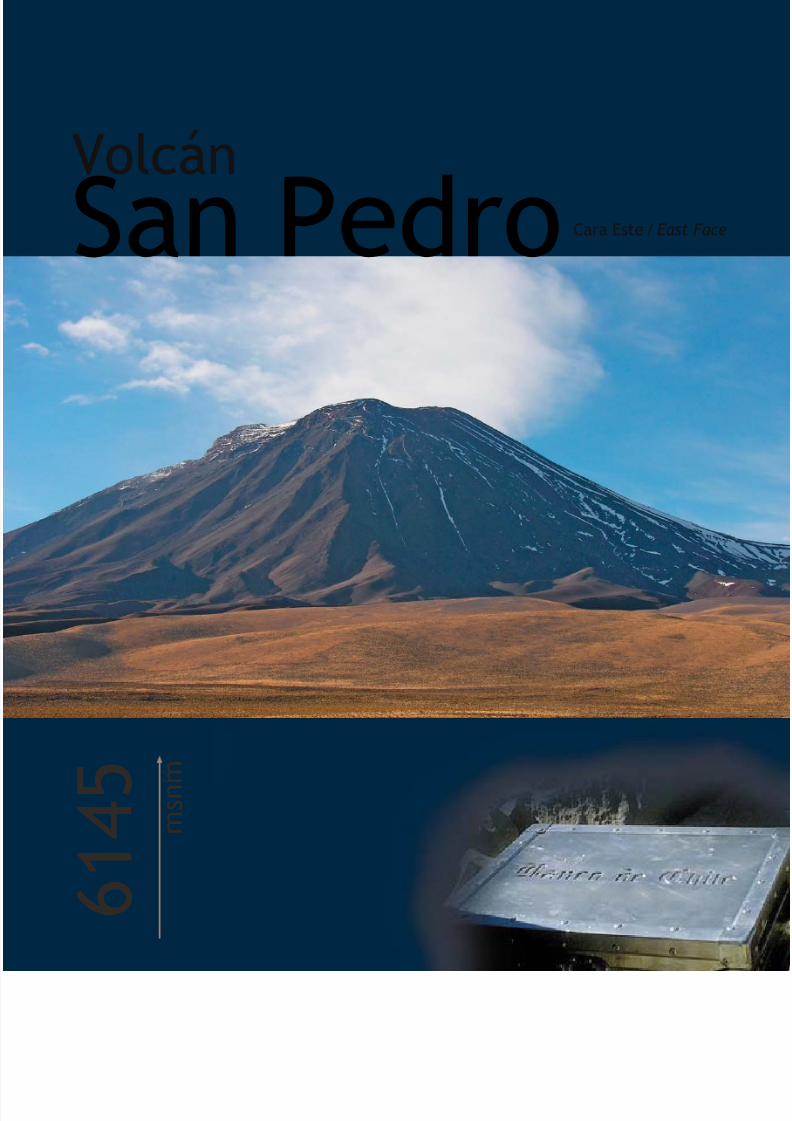
7/22/2019 Los 6.000 de Chile - Banco de Chile
http://slidepdf.com/reader/full/los-6000-de-chile-banco-de-chile 62/288
Volcán
6 1 4 5 m
s n m
San PedroCara Este / East F

7/22/2019 Los 6.000 de Chile - Banco de Chile
http://slidepdf.com/reader/full/los-6000-de-chile-banco-de-chile 63/288
Este gran volcán, al igual que su hermano menor el San Pablo, es una visita obligada para quienes buscan grandes
altitudes del sistema altiplánico en la Cordillera de Los Andes. Se encuentra en la Segunda Región más o menos a 75
kilómetros de Calama, siendo visible desde esta ciudad. Pertenece a la cuenca del Río Loa y se halla íntegramente dentro
del territorio nacional.
Geológicamente es muy interesante ya que se compone de dos conos que muestran distintas etapas de formación al
resto del volcán en cuanto a su composición y estructura. El cono más antiguo (que conforma la actual cumbre) fue
afectado por erosión glaciar por lo que es un poco más abrupto que el más joven, en tanto que éste es post glacial y
se encuentra dentro del anfiteatro del primero. Se han registrado varias erupciones, una en 1877, otra en 1891 y una
en 1901, cuyas avalanchas dañaron el ferrocarril que va hacia la ciudad de La Paz. Pese a que el último registro data
de poco más de 100 años, hoy en día es posible apreciar fumarolas ricas en azufre provenientes del cráter del cono más
joven. Existe además un cono parásito en la base Oeste, a ocho kilómetros del San Pedro, que se conoce como La Poruña.
Este cono es de pequeñas dimensiones, y se identifica como parásito ya que de él sale material proveniente de la misma
fuente del San Pedro.
INTRODUCCIÓNINTRODUCCIÓN
Los 6000’s en Chile / The 6,000’s of Chile
60 61
This great volcano, like its younger brother San Pablo, is an essential trip for anyone looking for high altitude in the Andean Alti-Planicsystem. It is found in Chile’s Second Region and is visible from Calama, being situated roughly 75 km from the city. It is located entirely
within Chilean territory, in the basin of the Loa River.
It is geologically very interesting that San Pedro has two cones that show different stages of formation than the rest of the volcano
in terms of their composition and structure. The older cone (that forms the actual summit) was affected by glacial erosion and is
therefore a little steeper than the younger one which was formed during the post-glacial period and is located inside the amphitheatre
of the first cone. They have had several recorded eruptions, in 1877, in 1891, and again in 1901. The avalanches from the 1901
eruption damaged the railway to La Paz. Even though the last registered eruption was over 100 years ago, it is still possible to see
fumaroles coming from the crater of the younger cone. There is also a parasitical cone at the western side of the base, eight kilometres
from San Pedro, which is known as La Poruña. This is a smaller cone and is described as parasitical as it gives out material from the
same source as San Pedro.

7/22/2019 Los 6.000 de Chile - Banco de Chile
http://slidepdf.com/reader/full/los-6000-de-chile-banco-de-chile 64/288
AccesoDebido a que el San Pedro y el San Pablo están unidos por un
portezuelo desde donde se puede enfilar hacia una u otra cum
se ha unificado la información de acceso y ascenso hasta el porte
para ambas cumbres.
Considerando la ciudad de Calama como punto de partida, tom
camino internacional a Bolivia vía Ollagüe (Ruta 21) en direcció
Chiu-Chiu. Una vez pasado Chiu-Chiu el camino es de ripio per
encuentra en buen estado e irá por el costado Este del Río Loa, d
donde a unos pocos kilómetros ya se pueden divisar con facilid
los volcanes San Pedro y San Pablo.
A unos 30 kilómetros de Chiu-Chiu existe una intersección co
camino interior, el que es necesario tomar en dirección Este hac
localidad de Incaliri. Tras unos kilómetros el camino se junta co
Río San Pedro por su ribera Sur, y es necesario seguir hasta da
un pequeño puente que cruza el río y permite transitar por los fa
del Volcán San Pedro rumbo al portezuelo. El camino es areno
de difícil tránsito. Se debe proseguir hasta donde se pueda, teni
especial cuidado de hallar la huella y transitar por ella, de man
de impactar lo menos posible la vegetación existente. En este c
el CB se estableció cerca de unas pircas ubicadas a una altitud
4000 m, pero con un buen vehículo uno puede llegar cerca de
4500 m.
I N F O R M E6145 m
a l t i t u d
V o l c á nSan Pedro
Posición Geográfica según Carta: 21º 53’ 27,5’’ S68º 23’ 36,4” W
Carta IGM: B34
Primera Ascensión Deportiva: G. Courty y F. Morales, 1903
Época más Adecuada para Ascender: Entre abril y diciembre

7/22/2019 Los 6.000 de Chile - Banco de Chile
http://slidepdf.com/reader/full/los-6000-de-chile-banco-de-chile 65/288
Ruta deAscenso/Descenso
Desde el CB la ruta sigue por una huella que va pegada al San Pedro,
remontando por su ladera Sureste y se dirige hacia el portezuelo
entre los dos volcanes. Cerca de los 4500 m hay que procurar
mantenerse a la izquierda de la Quebrada San Pedro que baja desde
el portezuelo y no alejarse demasiado de la huella que han dejado
otras expediciones.
Para facilitar el ascenso se recomienda establecer un C1 cercano a
los 4600 m, lo que divide la ascensión en tres jornadas y la hace
menos exigente. Antes de llegar al portezuelo es necesario sortear
unos pequeños farellones que a veces presentan cascadas de hielo
a los que la huella rodea por la izquierda, luego de lo cual cruza
hacia la derecha para finalmente llegar al portezuelo (5300 m),
donde puede montarse el CA.
Desde el CA se divisa con claridad en dirección Oeste, la ladera que
permite acceder a la cumbre. En el último tramo hay unos pasos en
roca y acarreo suelto. La cima se encuentra al Este del cráter. Debido
a que éste está activo, presenta tonalidades verdes y amarillentas y
despide un fuerte olor a azufre.
El descenso se realiza por la misma ruta de ascenso.
R E P O R T
Los 6000’s en Chile / The 6,000’s of Chile
62 63
Access
As San Pedro and San Pablo are linked by a pass from where
possible to access either summit, the access information will b
same for both mountains until this pass.
From Calama, take the international highway that leads to Bo
via Ollagüe (Ruta 21) in the direction of Chiu-Chiu. After Chiu
the road changes into a dust road. It is in good condition and fo
the eastern side of the Loa River. From there, it is only a few kilom
until it is possible to see the San Pedro and San Pablo volcano
About 30 km from Chiu-Chiu, there is an intersection with an in
road which you must take in an easterly direction towards the
of Incaliri. The road meets the San Pedro River on its southern
and you should follow it until you reach a small bridge that cr
the river and allows you to continue driving through the foot
of the San Pedro Volcano towards the pass. The road is sandy
difficult to negotiate. You should follow it as far as you can, t
special care to find the existing route and to follow it, in orde
have the least possible impact on the vegetation. On our exped
BC was set up close to some cairns located at 4,000 m, but w
good vehicle it is possible to reach close to 4,500 m.
Route of Ascent/Descent
From BC, the route follows a track that stays close to San Ped
ascending its south-east slope and heading towards the pass bet
the two volcanoes. Close to 4,500 m, you have to try to stay t
left of the San Pedro Gully that descends from the pass and n
deviate too much from the existing path.
To facilitate the ascent it is recommended to set up a C1 close
4,600 m, which will divide the ascent into three days and ma
less strenuous. Before arriving at the pass it is necessary to av
some small cliffs that sometimes have ice cascades. The route
to the left, then crosses to the right to finally arrive at the pas(5,300 m), where you can set up HC.
Looking from the HC in a westerly direction you can clearly se
slope that allows you to access the summit. In the final stretch
are some rocks you will have to climb and a loose scree slope
summit lies east of the crater. Due to the fact that the crater is a
there are green and gold colours and a strong smell of sulphu
The descent follows the same route as the ascent.
Geographical Position 21º 53’ 27.
According to Map: 68º 23’ 36
IGM Map: B34
First Recreational Ascent: G. Courty and F. Morales,
Best Time of Year for Climbing: From April to Dece

7/22/2019 Los 6.000 de Chile - Banco de Chile
http://slidepdf.com/reader/full/los-6000-de-chile-banco-de-chile 66/288
La luz del atardecer evidencia la gran diversidad decolores que componen al imponente Volcán San Pedro
The light of the sunset shows the great diversity incolour that makes up the imposing San Pedro Volcano.

7/22/2019 Los 6.000 de Chile - Banco de Chile
http://slidepdf.com/reader/full/los-6000-de-chile-banco-de-chile 67/288
Registered Waypoints (WGS 84)
Base Camp 21º 56’ 48.
68º 21’ 31.
altitude 4,0
Camp 1 21º 54’ 33.
68º 21’ 56.
altitude 4,6
High Camp 21º 53’ 00.
68º 22’ 17.
altitude 5,3
Summit and Location of Box 21º 53’ 16.
68º 23’ 28.
altitude 6,1
Waypoints Registrados
Los 6000’s en Chile / The 6,000’s of Chile
64 65
Datos yRecomendacionesPara ascender el San Pedro no se requiere de permisos especiales,
pero se debe dar aviso a Carabineros en Calama. Indicar en un
escrito nómina completa de participantes, nacionalidad, número
de pasaporte o cédula de identidad; incluyendo un detalle de la
actividad y especificando itinerarios, fechas, ruta y un mapa de la
zona.
Contar con vehículo 4x4 es lo óptimo. Ver anexo para
recomendaciones.
Si no se cuenta con movilización propia, se recomienda contactar
al Regimiento Reforzado Nº1 Topater de Calama, y a los respectivosPARME (Patrulla de Rescate de Montaña del Ejército) para solicitar
apoyo. En el regimiento Topater existe además la posibilidad de
conseguir alojamiento.
Una buena opción de transporte es la que ofrece Manuel González,
de Calama (celular: 87439321), quien posee gran conocimiento
de la zona y de la actividad de montaña.
Se recomienda contar con equipo y vestuario de alta montaña.
Como parte del equipo técnico se recomienda llevar piolet y
crampones.
El agua del Río San Pedro es potable. Antes de cruzar el río se
debe observar si existe suficiente nieve en la zona del CB y C1
para evaluar si es necesario o no portar agua.
Esta zona se ve afectada por el llamado Invierno Altiplánico entre
los meses de diciembre a marzo, con clima inestable y precipitaciones
intensas. Se recomienda firmemente no ascender en dicho período.
Los meses de invierno (junio - agosto) presentan mayor estabilidad
pero la temperatura nocturna puede llegar a -30º C por lo que es
recomendable ascender durante los meses de primavera ya que
el clima aún se mantiene estable y las temperaturas son más altas.
(WGS 84)
Campamento Base 21º 56’ 48,5’’ S
68º 21’ 31,3’’ Waltitud 4007 m
Campamento 1 21º 54’ 33,4’’ S
68º 21’ 56,0’’ Waltitud 4617 m
Campamento Alto 21º 53’ 00,8’’ S
68º 22’ 17,4’’ Waltitud 5321 m
Cumbre y Localización de Caja 21º 53’ 16,6’’ S
68º 23’ 28,6’’ Waltitud 6162 m
Tips and Recommendations
• No special permits are required to climb San Pedro but you s
inform the police in Calama of your expedition, giving them
letter showing participants, nationalities, passport or ID num
details of activities and specific itineraries, dates, route and a
of the area.
• The best transport option is to take a 4x4 vehicle. See app
for recommendations.
• If you do not have your own transport it is recommended t
you contact Regimiento Reforzado No 1 Topater in Calama
the respective PARME (Patrulla de Rescate de Montaña del Ejé
Army Mountain Rescue Patrol) to ask for support. It is also po
to get accommodation at the Topater Regiment.
• A good transport option is offered by Manuel González in C
(mobile: 87439321), who has a great knowledge of the are
mountain activities.
• It is recommended to take equipment and clothing suitabl
high altitude mountaineering. As part of the equipment it
recommended to take an ice axe and crampons.
• The water in the San Pedro River is potable. Before crossin
river you should look to see if there is sufficient snow in the
of BC and C1 to evaluate whether it is necessary or not to water.
• This area is affected by the so-called 'Alti-Planic winter', w
unstable climate and intense precipitation between the mo
of December and March. It is strongly recommended that yo
not climb during this period. The winter months (June - Au
are more stable but overnight temperatures are close to -3
The spring months (September - December) are the most
recommended as the climate remains stable and the tempera
are higher.

7/22/2019 Los 6.000 de Chile - Banco de Chile
http://slidepdf.com/reader/full/los-6000-de-chile-banco-de-chile 68/288
Volcán
6 0 9 2 m
s n m
San PabloCara Norte / North

7/22/2019 Los 6.000 de Chile - Banco de Chile
http://slidepdf.com/reader/full/los-6000-de-chile-banco-de-chile 69/288
El Volcán San Pablo, con sus 6092 metros de altitud, es una montaña que junto a su hermano mayor el Volcán San
Pedro, domina simbólicamente el Desierto de Atacama ya que se alzan majestuosamente sobre el plano sin otras
montañas que se les comparen. Ambos están unidos por un portezuelo a 5000 m, siendo el San Pablo la cumbre más
oriental.
Situado al Noreste de la ciudad de Calama, este gigante del altiplano que se caracteriza por poseer un enorme cráter
en la cumbre, es un estrato volcán dormido del cual no se tienen registros de actividad. Sin embargo, es evidente que
en alguna época estuvo activo ya que el color oscuro de sus paredes se debe a que están cubiertas de lava. La o las
erupciones derramaron la lava en forma de abanico por las laderas del volcán.
Pese a su esbelta figura y al hecho de encontrarse situado en un lugar de influencia incaica, no se han hallado vestigios
de esta cultura ni en sus laderas ni en su cumbre.
INTRODUCCIÓNINTRODUCCIÓN
Los 6000’s en Chile / The 6,000’s of Chile
66 67
The San Pablo Volcano, 6,092 m, together with its older brother, dominates the Atacama Desert, rising majestically over the plain
without other mountains to compare with them. Both mountains are linked by a pass at 5,000 m where San Pablo is the summit to
the east.
Situated to the north-east of the city of Calama, this Alti-Planic mountain is characterised by the enormous crater at its summit. It is a
dormant strata volcano with no registered signs of activity. This would not always have been the case as its dark colour is due to the
fields of lava originating at its large cols, which extend, fan-shaped, on its slopes.
Despite its beautiful shape and the fact that is situated in a place of Incan influence, no vestiges of Incan culture have been found on
its slopes or at its summit.

7/22/2019 Los 6.000 de Chile - Banco de Chile
http://slidepdf.com/reader/full/los-6000-de-chile-banco-de-chile 70/288
AccesoDebido a que el San Pedro y el San Pablo están unidos por un
portezuelo desde donde se puede enfilar hacia una u otra cum
se ha unificado la información de acceso y ascenso hasta el porte
para ambas cumbres.
Considerando la ciudad de Calama como punto de partida, to
el camino internacional a Bolivia vía Ollagüe (Ruta 21) en direc
a Chiu-Chiu. Una vez pasado Chiu-Chiu el camino es de ripio
se encuentra en buen estado e irá por el costado Este del Río
desde donde a unos pocos kilómetros ya se pueden divisar co
facilidad los volcanes San Pedro y San Pablo.
A unos 30 kilómetros de Chiu-Chiu existe una intersección co
camino interior, el que es necesario tomar en dirección Este ha
la localidad de Incaliri. Tras unos kilómetros el camino se junta
el Río San Pedro por su ribera Sur, y es necesario seguir hasta
con un pequeño puente que cruza el río y permite transitar po
faldeos del Volcán San Pedro rumbo al portezuelo. El camino earenoso y de difícil tránsito. Se debe proseguir hasta donde se pu
teniendo especial cuidado en hallar la huella y transitar por ell
manera de impactar lo menos posible la vegetación existente.
este caso el CB se estableció cerca de unas pircas ubicadas a u
altitud de 4000 m, pero con un buen vehículo uno puede lleg
cerca de los 4500 m.
I N F O R M E
Posición Geográfica según Carta: 21º 53’ 12,9’’ S
68º 20’ 41,7’’ W
Carta IGM: B34
Primera Ascensión Deportiva: 1910
Época más Adecuada para Ascender: Entre abril y diciembre
6092 m
a l t i t u d
V o l c á nSan Pablo

7/22/2019 Los 6.000 de Chile - Banco de Chile
http://slidepdf.com/reader/full/los-6000-de-chile-banco-de-chile 71/288
Ruta deAscenso/DescensoDesde el CB la ruta sigue por una huella que va pegada al San Pedro,remontando por su ladera Sureste y se dirige hacia el portezuelo
entre los dos volcanes. Cerca de los 4500 m hay que procurarmantenerse a la izquierda de la Quebrada San Pedro que baja desde
el portezuelo y no alejarse demasiado de la huella que han dejadootras expediciones.
Para facilitar el ascenso se recomienda establecer un C1 cercano a
los 4600 m, lo que divide la ascensión en tres jornadas y la hacemenos exigente. Antes de llegar al portezuelo es necesario sortear
unos pequeños farellones que a veces presentan cascadas de hielo.La huella los rodea por la izquierda, luego de lo cual cruza hacia la
derecha para finalmente llegar al portezuelo (5300 m), donde puedemontarse el CA.
Desde el CA es necesario seguir el único filo que sale del portezuelo
hacia el Este, el que se va angostando a medida que gana altitud.Se avanza por éste hasta quedar debajo de la gran franja de farellones
de color rojo, donde comienza el ascenso por acarreos hasta la basede una canaleta que se introduce en la roca dando la impresión de
que no tiene salida. Casi al final del canalón, antes de llegar a lasparedes verticales, se debe torcer hacia la izquierda buscando los
escalones rocosos que permiten, en una delicada pero sencillaescalada, alcanzar la arista cimera. Debido a lo suelto y vertical del
terreno, en esta zona se debe llevar casco.
Una vez alcanzada la arista (5900 m) donde el viento golpea confuerza, se asciende por acarreos en pendiente moderada pudiendo
distinguirse cierta huella. Si se levanta la vista por encima de uno,se puede observar un sector rocoso de color rojo, el cual se rodea
por la izquierda para luego ascender suavemente por una laderacon roca de color pálido. Acá se notan claramente tres escalones oniveles en una distancia aproximada de 400 metros. Superado este
tramo, la pendiente comienza a disminuir y el terreno cambia a unasuave y fina arena clara.
Luego de este esforzado intento se llega a lo que podría ser la
cumbre, pero se trata sólo de la antecumbre y conviene rodearla porla izquierda. A continuación viene la última loma y la cima, donde
hay una estaca de fierro.
El descenso conviene hacerlo por toda la arista hasta casi el final delportezuelo, donde las pendientes son más suaves y se ve claramente
la ruta de bajada, porque bajar por el farellón requiere de granseguridad de movimientos y de claridad en la ruta.
R E P O R T
Access
As San Pedro and San Pablo are linked by a pass from where possible to access either summit, the access information will b
same for both mountains until this pass.
From Calama, take the international highway that leads to Bo
via Ollagüe (Ruta 21) in the direction of Chiu-Chiu. After Chiu
the road changes into a dust road. It is in good condition and fo
the eastern side of the Loa River. From there, it is only a few kilom
until it is possible to see the San Pedro and San Pablo volcano
About 30 km from Chiu-Chiu, there is an intersection with an in
road which you must take in an easterly direction towards the
of Incaliri. The road meets the San Pedro River on its southern
and you should follow it until you reach a small bridge that cr
the river and allows you to continue driving through the foot
of the San Pedro Volcano towards the pass. The road is sandy
difficult to negotiate. You should follow this road as far as you
taking special care to find the existing path and to follow it, in
to have the least possible impact on the vegetation. On our exped
BC was set up close to some cairns located at 4,000 m, but w
good vehicle it is possible to reach close to 4,500 m.
Route of Ascent/Descent
From BC, the route follows a track that stays close to San Ped
ascending its south-east slope and heading towards the pass bet
the two volcanoes. Close to 4,500 m, you have to try to stay t
left of the San Pedro Gully that descends from the pass and n
deviate too much from the existing path.
To facilitate the ascent it is recommended to set up a C1 close
4,600 m, which will divide the ascent into three days and ma
less strenuous. Before arriving at the pass it is necessary to av
some small cliffs that sometimes have ice cascades. The route
to the left, then crosses to the right to finally arrive at the pas
(5,300 m), where you can set up HC.
From HC it is necessary to follow the only ridge that emerges c
from the pass towards the east, and that rises and narrows u
stopping underneath the large band of red cliffs where the as
starts through scree slopes until the base of a couloir in the ro
that, from here, seems to have no exit point. Near the end of
couloir, before arriving at the vertical walls, you should turn le
looking for rocky steps that allow you, in a delicate but simple c
to reach the summit ridge. Due to the looseness and steepne
the terrain you should wear a helmet in this area.
Once you have reached the ridge (5,900 m), where the wind
strong, you ascend through scree slopes with moderate grad
sometimes being able to distinguish a track. If you look up yo
see a rocky red area which you skirt to the left and then climb
slope with pale-coloured rocks. Here you can see clearly three
at a distance of approximately 400 metres. Passing this stretch
slope starts to ease and the terrain becomes a soft and fine p
sand.
After this intense effort, you arrive at the false summit which
skirt on the left. You then come to the final hill and the summ
where there is an iron stake.
The descent should be carried out completely on the ridge un
nearly reaching the pass, where the slopes are gentler and yo
clearly see the route of descent. This avoids descending the c
which would require you to be very confident and sure of the r
Los 6000’s en Chile / The 6,000’s of Chile
68 69
Geographical Position 21º 53’ 12.
According to Map: 68º 20’ 41.
IGM Map: B34
First Recreational Ascent: 1910
Best Time of Year for Climbing: From April to Dece

7/22/2019 Los 6.000 de Chile - Banco de Chile
http://slidepdf.com/reader/full/los-6000-de-chile-banco-de-chile 72/288
Una vez alcanzada la cima viene la compleja tarea del descenso y la verdadera foto decumbre: la del equipo tras la tarea cumplida
Once the summit is reached, there comes the complex task of the descent and thetrue photo of the summit: that of the whole team after the job has been completed.

7/22/2019 Los 6.000 de Chile - Banco de Chile
http://slidepdf.com/reader/full/los-6000-de-chile-banco-de-chile 73/288
Registered Waypoints (WGS 84)
Base Camp 21º 56’ 48.
68º 21’ 31.
altitude 4,0
Camp 1 21º 54’ 33.
68º 21’ 56.
altitude 4,6
High Camp 21º 53’ 00.
68º 22’ 17.
altitude 5,3
Summit and Location of Box 21º 52’ 56.68º 20’ 36.
altitude 6,1
Datos yRecomendaciones
Para ascender el San Pablo no se requiere de permisos especiales,pero se debe dar aviso a Carabineros en Calama. Indicar en unescrito nómina completa de participantes, nacionalidad, número
de pasaporte o cédula de identidad; incluyendo un detalle de laactividad y especificando itinerarios, fechas, ruta y un mapa de la
zona.
Contar con vehículo 4x4 es lo óptimo. Ver anexo pararecomendaciones.
Si no se cuenta con movilización propia, se recomienda contactar
al Regimiento Reforzado Nº1 Topater de Calama, y a los respectivosPARME (Patrulla de Rescate de Montaña del Ejército) para solicitar
apoyo. En el regimiento Topater existe además la posibilidad deconseguir alojamiento.
Una buena opción de transporte es la que ofrece Manuel González,de Calama (celular: 87439321), quien posee gran conocimientode la zona y de la actividad de montaña.
El paso clave de esta ruta es la pasada de roca del farellón. Si no
se tiene la confianza para escalar por roca a esa altitud, existe laopción de ir hasta el final del portezuelo para tomar la arista. Claro
que es una ruta bastante larga y pesada, debido a la cantidad deacarreos y falsas cumbres.
Se recomienda contar con equipo y vestuario de alta montaña.
Como parte del equipo técnico se recomienda llevar piolet ycrampones.
El agua del Río San Pedro es potable. Antes de cruzar el río se
debe observar si existe suficiente nieve en la zona del CB y C1
para evaluar si es necesario o no portar agua.
Esta zona se ve afectada por el llamado Invierno Altiplánico entre
los meses de diciembre a marzo, con clima inestable y precipitacionesintensas. Se recomienda firmemente no ascender en dicho período.
Los meses de invierno (junio - agosto) presentan mayor estabilidadpero la temperatura nocturna puede descender hasta los -30º C
por lo que es recomendable ascender durante los meses deprimavera ya que el clima aún se mantiene estable y las temperaturas
son más altas.
(WGS 84)
Campamento Base 21º 56’ 48,5’’ S
68º 21’ 31,3’’ Waltitud 4007 m
Campamento 1 21º 54’ 33,4’’ S68º 21’ 56,0’’ W
altitud 4617 m
Campamento Alto 21º 53’ 00,8’’ S68º 22’ 17,4’’ W
altitud 5321 m
Cumbre y Localización de Caja 21º 52’ 56,7’’ S68º 20’ 36,5’’ W
altitud 6126 m
Waypoints Registrados
Tips and Recommendations
• No special permits are required to climb San Pablo but you s
inform the police in Calama of your expedition, giving them
letter showing participants, nationalities, passport or ID num
details of activities and specific itineraries, dates, route and a
of the area.
• The best transport option is to take a 4x4 vehicle. See app
for recommendations.
• If you do not have your own transport it is recommended t
you contact Regimiento Reforzado No 1 Topater in Calama
the respective PARME (Patrulla de Rescate de Montaña del EjéArmy Mountain Rescue Patrol) to ask for support. It is also po
to get accommodation at the Topater Regiment.
• A good transport option is offered by Manuel González in C
(mobile: 87439321), who has a great knowledge of the are
mountain activities.
• The key stretch of the route is the cliff. If you don’t have th
confidence to climb on rock at this altitude there is the opt
go to the bottom of the pass to take the ridge. Obviously,
route is quite long and hard, due to the number of scree sl
and false summits.
• It is recommended to take equipment and clothing suitabl
high altitude mountaineering. As part of the equipment it
recommended to take an ice axe and crampons.
• The water in the San Pedro River is potable. Before crossin
river you should look to see if there is sufficient snow in the
of BC and C1 to evaluate whether it is necessary or not to
water.
• This area is affected by the so-called 'Alti-Planic winter', w
unstable climate and intense precipitation between the mo
of December and March. It is strongly recommended that yo
not climb during this period. The winter months (June - Au
are more stable but overnight temperatures are close to -3
The spring months (September – December) are the most
recommended as the climate remains stable and the tempera
are higher.
Los 6000’s en Chile / The 6,000’s of Chile
70 71

7/22/2019 Los 6.000 de Chile - Banco de Chile
http://slidepdf.com/reader/full/los-6000-de-chile-banco-de-chile 74/288
Volcán
6 0 4 6 m
s n m
PiliCara Norte / North Face

7/22/2019 Los 6.000 de Chile - Banco de Chile
http://slidepdf.com/reader/full/los-6000-de-chile-banco-de-chile 75/288
El nombre original del Volcán Pili, ubicado en la Región de Antofagasta, es Acamarachi (Caracol de Piedra en aymará).Desde sus faldas se puede observar el hermoso y poco conocido Salar de Pujsa, habitado en ciertas épocas del año porcolonias de flamencos y grupos de vicuñas, mientras la cumbre ofrece una vista impresionante y sobrecogedora de losvolcanes Láscar, Aguas Calientes y Licancabur.
De imponente y esbelta figura, se estima que este estrato volcán inactivo no tiene más de 15000 años de edad, y secaracteriza por sus laderas simétricas que alcanzan y superan los 45º de inclinación. Hacia el Sureste se desprende laQuebrada Pili, por donde avanza el río homónimo en su camino hacia el Salar de Aguas Calientes, uno de los salarescaracterísticos que se extienden a sus anchas en la Puna de Atacama.
Hace 500 años este cerro formaba parte de los santuarios incas de alta montaña y su cumbre fue escenario de ceremoniassagradas, hecho que quedó plenamente confirmado al haber sido encontradas dos estatuillas con forma humana consus respectivos ajuares (una de las cuales se encuentra en el Museo Británico de Londres) además de restos de madera,mechones de cabello y hasta mariposas.
Sin embargo, a pesar de su pasado histórico y su belleza y no obstante ofrecer la más generosa y espléndida vista panorá-mica, el Pili no es muy visitado en la actualidad.
INTRODUCCIÓNINTRODUCCIÓN
Los 6000’s miles de Chile / The 6,000’s of Chile
72 73
The original name of the Pili Volcano, located in the Antofagasta region, was Acamarachi (Stone Snail in Aymara). From its foothills,
you can see the beautiful and little-known Salt Lake of Pujsa which is inhabited at certain times of the year by colonies of flamingos
and groups of vicuñas. The summit offers an impressive view of the Láscar, Aguas Calientes and Licancabur volcanoes.
Of an imposing and beautiful shape, it is estimated that this inactive strata volcano is less than 15,000 years old. It is characterised by
its symmetrical slopes that in places are steeper than 45º. The Pili River, inside the gully of the same name, runs from the south-east
of the mountain towards the Aguas Calientes Salt Lake.
500 years ago, this mountain was one of the Incan high mountain sanctuaries and the summit was the scene of sacred ceremonies.
Two human-shaped statuttes have been found with their respective trousseaus, one of which is now in the British Museum in London.
The remains of firewood, locks of hair and even butterflies have also been found.
However, despite its history, its beauty and the splendid panoramic views that it offers, Pili is not visited very often these days.

7/22/2019 Los 6.000 de Chile - Banco de Chile
http://slidepdf.com/reader/full/los-6000-de-chile-banco-de-chile 76/288
AccesoDesde Calama tomar el camino internacional a Argentina (Rutque lleva hacia San Pedro de Atacama, desde donde se debe prospor la Ruta 27 que lleva hacia Argentina a través del paso internac
Jama. Tras una hora de trayecto desde San Pedro se puede divel Pili a cuyos pies se encuentra el Salar de Pujsa, a mano derede la ruta.
Al final del salar, justo donde puede observarse la presencia degaseoducto, el camino se desvía a la izquierda y es necesario sde la vía en dirección Sur para dirigirse hacia el salar y bordearlosu lado izquierdo. El trayecto desde este punto hasta el CB tomaproximadamente una hora. El recorrido debe hacerse bordeasiempre las montañas hasta cruzar la primera quebrada.
Esta quebrada es muy engañosa ya que al fondo se observa ele induce a pensar que éste es el punto de ingreso, pero hay qignorarla, cruzando en cambio el río y bordeando el Cerro Negpor abajo hasta entrar en la siguiente quebrada en dirección al voSi bien es posible llegar en vehículo hasta los 4900 m aproximadam
se recomienda establecer el CB al final de esta quebrada (458donde se encuentra una gran piedra y rocas que denotan con tclaridad que en ese lugar se han instalado carpas con anteriorEl día de cumbre se recomienda realizar en vehículo el tramo que
I N F O R M E6046 m
a l t i t u d
V o l c á nPili
Posición Geográfica según Carta: 23º 17’ 44,7’’ S67º 37’ 02,3’’ W
Carta IGM: B108
Primera Ascensión Deportiva: A. Bonacossa y R. Gerard, 1939
Época más Adecuada para Ascender: Entre abril y diciembre

7/22/2019 Los 6.000 de Chile - Banco de Chile
http://slidepdf.com/reader/full/los-6000-de-chile-banco-de-chile 77/288
Ruta deAscenso/DescensoDesde el punto donde llega el vehículo (4900 m), iniciar la marchahacia el hombro lo más temprano posible teniendo en consideración
que no hay huellas y que se debe avanzar en zig-zag. En el hombro,donde se observan dos lagunas secas, es necesario cambiar dedirección tomando la ladera Oeste.
Lo primero que salta a la vista es un gran acarreo que cae por uncanalón. Se puede llegar a creer que la ruta va por el filo de laizquierda, pero es exactamente lo contrario: va directamente por elacarreo pegado a la derecha.
Posteriormente surgen grandes rocas que facilitan el ascenso, peroluego se pone extremadamente blando y el avance se hace lento ydificultoso. Al final, la pendiente cede un poco y se puede avanzarhasta observar la cima que se encuentra a mano izquierda en lacumbre Norte. En este lugar es posible encontrar un buen lugar paradescansar e hidratarse antes de iniciar el ascenso final.
El descenso se realiza en forma rápida, siguiendo la misma rutaempleada en el ascenso.
R E P O R T
Access
From Calama, take the international road to Argentina (Ruta until San Pedro de Atacama. From here you should take Rutawhich leads to Argentina via the Jama border crossing. An hofrom San Pedro you can make out Pili, at whose feet lies the Salt Lake, on the right hand side of the road.
At the end of the salt lake, just where you can see a gas pipethe road turns to the left. It is necessary to leave the road in asoutherly direction to make your way towards the salt lake anskirt around it on its left-hand side. The journey from this pointBC takes approximately an hour. You should skirt around themountains until crossing the first gully.
This gully is deceptive as you can see Pili at its end which leadto believe that this is the point of entry, but you should ignorInstead, cross the river and skirt around the bottom of Cerro Nuntil you enter the next gully that leads towards the volcano. W
it is possible to reach approximately 4,900 m by vehicle, it isrecommended to set up BC at the end of this gully (4,580 m)specifically in a place with a large erratic block and rocks wheis possible to tell that camp has been set up before. On the dthe summit ascent it is recommended to drive the remaining sin your vehicle.
Route of Ascent/Descent
From where you leave the vehicle (4,900 m), you should startwalk towards the shoulder as early as possible, taking intoconsideraton that there are no tracks and that you need to proin a zig-zag due to the steepness of the slope. At the shoulder,where you can see two dry lagoons, it is necessary to changedirection, following the western slope.
The first thing that you will notice is a large scree-slope that f
from a couloir. It would seem that the route goes up the left of the couloir, but in fact you should go straight up through tscree slope, keeping to its right hand side.
Following this, there are some large rocks that ease the climbthen the ground becomes extremely soft and the ascent becoslow and laborious. Finally, the slope eases off a little and youadvance until observing the summit which is the left hand sidthe north peak. Here it is possible to find a good place to restre-hydrate before beginning the final ascent.
The descent is fast, following the same route used in the asce
Los 6000’s miles de Chile / The 6,000’s of Chile
74 75
Geographical Position 23º 17’ 44 According to Map: 67º 37’ 02.
IGM Map: B108
First Recreational Ascent: A. Bonacossa and R. Gerard,
Best Time of Year for Climbing: From April to Dece

7/22/2019 Los 6.000 de Chile - Banco de Chile
http://slidepdf.com/reader/full/los-6000-de-chile-banco-de-chile 78/288
La hermosa forma piramidal del Volcán Piliresalta en el Desierto de Atacama
The beautiful pyramid shape of the Pili Volcanorises up from the Atacama Desert

7/22/2019 Los 6.000 de Chile - Banco de Chile
http://slidepdf.com/reader/full/los-6000-de-chile-banco-de-chile 79/288
Registered Waypoints (WGS 84)
Base Camp 23º 14’ 20.67º 35’ 43.altitude 4,5
Start of Walk 23º 16’ 34.67º 36’ 13.altitude 4,8
Summit and Location of Box 23º 17’ 33.67º 37’ 04.altitude 6,0
(WGS 84)
Campamento Base 23º 14’ 20,0’’ S67º 35’ 43,0’’ Waltitud 4586 m
Inicio Marcha 23º 16’ 34,0’’ S
67º 36’ 13,9’’ Waltitud 4890 m
Cumbre y Localización de Caja 23º 17’ 33,0’’ S67º 37’ 04,0’’ Waltitud 6026 m
Waypoints Registrados
Tips and Recommendations
• No special permits are required to climb Pili but you should inthe police in San Pedro de Atacama of your expedition, givthem a letter showing participants, nationalities, passport onumbers, details of activities and specific itineraries, dates, and a map of the area.
• The best transport option is to take a 4x4 vehicle. See appfor recommendations. Take sufficient fuel in Calama as the sin San Pedro is not always assured.
• If you do not have your own transport it is recommended tyou contact Regimiento Reforzado No 1 Topater in Calamathe respective PARME (Patrulla de Rescate de Montaña del EjéArmy Mountain Rescue Patrol) to ask for support. It is also poto get accommodation at the Topater Regiment.
• A good transport option is offered by Manuel González in C(mobile: 87439321), who has a great knowledge of the aremountain activities.
• You should buy provisions in Calama as San Pedro is the oother place where small quantities of provisions can be bou
• It is recommended to take equipment and clothing suitablhigh altitude mountaineering. As part of the equipment it recommended to take an ice axe and crampons.
• Take sufficient water for the whole expedition as the strea
BC is contaminated with arsenic and there are no permanesources of potable water.
• This area is affected by the so-called 'Alti-Planic winter', wunstable climate and intense precipitation between the moof December and March. It is strongly recommended that yonot climb during this period. The winter months (June - Auare more stable but overnight temperatures are close to -3The spring months (September – December) are the mostrecommended as the climate remains stable and the temperaare higher.
Los 6000’s miles de Chile / The 6,000’s of Chile
76 77
Datos yRecomendaciones
Para ascender el Pili no se requiere de permisos especiales, perose debe dar aviso a Carabineros en San Pedro de Atacama. Indicaren un escrito nómina completa de participantes, nacionalidad,número de pasaporte o cédula de identidad; incluyendo un detallede la actividad y especificando itinerarios, fechas, ruta y un mapade la zona.
Contar con vehículo 4x4 es lo óptimo. Ver anexo pararecomendaciones. Cargar suficiente combustible en Calama yaque el suministro en San Pedro no siempre está asegurado.
Si no se cuenta con movilización propia se recomienda contactaral Regimiento Reforzado Nº1 Topater de Calama, y a los respectivosPARME (Patrulla de Rescate de Montaña del Ejército) para solicitarapoyo. En el regimiento Topater existe además la posibilidad de
conseguir alojamiento.
Una buena opción de transporte es la que ofrece Manuel González,de Calama (celular: 87439321), quien posee gran conocimientode la zona y de la actividad de montaña.
Se recomienda comprar provisiones en Calama ya que San Pedrosólo es alternativa para adquirir pequeñas cantidades.
Es importante contar con equipo y vestuario de alta montaña.Como parte del equipo técnico se recomienda llevar piolet ycrampones.
Se enfatiza la importancia de llevar agua suficiente para toda laexpedición ya que el arroyo que se halla en la zona del CB seencuentra contaminado con arsénico, y no existen más fuentes
permanentes de agua potable.
Esta zona se ve afectada por el llamado Invierno Altiplánico entrelos meses de diciembre a marzo, con clima inestable y precipitacionesintensas. Se recomienda firmemente no ascender en dicho período.Los meses de invierno (junio - agosto) presentan mayor estabilidadpero la temperatura nocturna puede descender hasta los -30º Cpor lo que es recomendable ascender durante los meses deprimavera ya que el clima aún se mantiene estable y las temperaturasson más altas.

7/22/2019 Los 6.000 de Chile - Banco de Chile
http://slidepdf.com/reader/full/los-6000-de-chile-banco-de-chile 80/288
Volcán
6 2 3 3 m
s n m
PularCara Noroeste / North-West Face

7/22/2019 Los 6.000 de Chile - Banco de Chile
http://slidepdf.com/reader/full/los-6000-de-chile-banco-de-chile 81/288
Esta montaña, la segunda más alta de la Región de Antofagasta, es un macizo geográficamente aislado que se yergueimponente al Sur del Salar de Atacama, sin ningún vecino que se le iguale en altitud. Durante el período Inca fue unsantuario en cuya cumbre se realizaban ceremonias, lo que es evidenciado por vestigios de esa cultura encontrados enla cima, tales como una estructura que servía de habitación para sacerdotes, una pirca circular de gran tamaño, estatuillas,
restos de leña y restos de ratones.Es un estrato volcán generado hace aproximadamente 13000 años. Junto con los volcanes Pajonales Sur y PajonalesNorte, genera un cordón volcánico con dirección Noreste a Suroeste de unos 12 kilómetros de longitud, cuyo centrode actividad actual está situado en las laderas del Volcán Pajonales Norte.
Sólo se ha registrado una pequeña y explosiva erupción del Pular en 1990, de la cual no se tiene mucha informacióndebido al aislamiento en el que se encuentra esta montaña.
INTRODUCCIÓNINTRODUCCIÓN
Los 6000’s miles de Chile / The 6,000’s of Chile
78 79
This imposing mountain, the second highest in the Antofagasta Region, is a geographically-isolated massif south of the Atacama Salt
Lake. During the Incan period it was a sanctuary and ceremonies were carried out at its summit. This is evident in the remains found
at its peak. There is a structure that was used as a bedroom by priests, a large circular cairn, and evidence of the ceremonies carried
out there such as firewood, statues and the remains of mice.
Pular is a strata volcano that was created approximately 13,000 years ago. Together with the Pajonales Sur and Pajonales Norte
volcanoes, it forms a volcanic cordon of about 12 km in length running from north-east to south-west. This cordon’s centre of volcanic
activity is now situated on the slopes of the Pajonales Norte Volcano.
Pular has had one small, explosive eruption which was in 1990. Due to the mountain’s isolation there is not much information on this
eruption.

7/22/2019 Los 6.000 de Chile - Banco de Chile
http://slidepdf.com/reader/full/los-6000-de-chile-banco-de-chile 82/288
AccesoDesde Calama tomar el camino internacional a Argentina (Rutcon destino a San Pedro de Atacama el que se tomará como kilómcero. Continuando por la Ruta 23 se atraviesa el pueblo de Toco(2485 m) en el kilómetro 38. A la salida del pueblo, en el kilóm40, desviar al Oeste en dirección al Salar de Atacama, indicadouna señalética caminera.
Se continúa por esta ruta rumbo al poblado de Peine, que se sen el kilómetro 100 del recorrido. Desde dicha localidad hay qcontinuar por un camino arenoso en dirección Sureste hacia epoblado de Tilomonte. Unos 300 metros antes de entrar al castomar la bifurcación de la derecha rumbo a las Lomas de Tilocen dirección Sur. En el kilómetro 123 aparece nuevamente unabifurcación de caminos. Tomar el de la derecha que asciendezigzagueante a la parte alta de las Lomas de Tilocalar, atraviesextenso llano y continúa en dirección Sur, mirando el Volcán Llullacomo referencia.
El camino, que se encuentra en excelente estado gracias a lamantención que hace el personal de la minera Zaldívar, lleva apozos de extracción de agua de la mina, en la llamada Estació
Negrillar. Continuar por el camino hasta dar con un tendido elécque discurre en dirección Oeste - Este junto a un camino de manción, el que es necesario tomar con rumbo Este. Siguiendo porcamino se notará que cada torre tiene un número de registro. llegar a la torre 123 se puede observar la Pampa Quilvar en todextensión. Es necesario descender a la planicie para tomar rumSur tratando de dar con las escasas huellas del lugar hasta llegmás cerca posible del volcán, distancia que en este caso fue de cde 20 kilómetros.
Desde este punto comienza la caminata de aproximación al Puldirección Sureste, la que demanda bastante tiempo debido a lacantidad de quebradas y madrigueras de roedores que dificultpaso. En este caso se instaló el CB a unas cuatro horas de cam
(3500 m) y se continuó el acercamiento en una segunda jornasiempre dirigiendo el rumbo hacia enfrentar la cara Noroeste dcerro, instalándose un C1 a 4280 m.
I N F O R M E6233 m
a l t i t u d
V o l c á nPular
Posición Geográfica según Carta: 24º 11’ 42,7’’ S68º 03’ 31,2’’ W
Carta IGM: B147
Primera Ascensión Deportiva: P. Rosende, I. Morlansy G. Challe, 1972
Época más Adecuada para Ascender: Entre abril y diciembre

7/22/2019 Los 6.000 de Chile - Banco de Chile
http://slidepdf.com/reader/full/los-6000-de-chile-banco-de-chile 83/288
Geographical Position 24º 11’ 42. According to Map: 68º 03’ 31.
IGM Map: B147
First Recreational Ascent: P. Rosende, I. MorlanG. Challe, 1972
Best Time of Year for Climbing: From April to Dece
Ruta de
Ascenso/DescensoDesde el C1 se continúa el acercamiento, dirigiendo la marcha haciael Sureste para comenzar a ascender el macizo por su extremoderecho e instalar un CA, el que en este caso se hizo a 5080 m.
Desde el CA la jornada de cumbre comienza por un acarreo quepuede ser tomado tanto por la derecha como por la izquierda, y quees la vía de acceso a una gran planicie a 5300 m. Ésta se encuentraexpuesta a vientos muy fuertes, lo que dificulta en gran manera elavance. Tras cruzar la planicie la ruta hacia la cumbre es bastantedirecta, pasando por un portezuelo entre dos falsas cumbres. Lacumbre verdadera se encuentra hacia la derecha del portezuelo,unos metros más atrás.
El descenso se realiza por la misma ruta de ascenso.
R E P O R T
Los 6000’s miles de Chile / The 6,000’s of Chile
80 81
Access
From Calama, take the international road that leads to Argen(Ruta 23) until San Pedro de Atacama which should be taken a0. Continuing on Ruta 23, you go through the town of Tocon(2,485 m) at km 38. Leaving the town at km 40, turn west towthe Atacama Salt Lake which is indicated with a road sign.
Continue along this route to the village of Peine, which is situat km 100 on the route. From Peine you continue on a sandyin a south-easterly direction towards the settlement of TilomoAbout 300 metres before entering Tilomonte, take the right fthe road that leads in a southerly direction towards the TilocaHills. At km 123, there is another fork in the road. Take the rothe right that ascends zig-zagging to the highest part of the TiloHills and then through a large plain. Continue south, using thLlullaillaco Volcano as a reference.
The road, which is in excellent condition due to the maintenacarried out by the personnel at the Zaldívar mine, leads to theNegrillar station where there are wells that are used to supply wto the mine. Continue on the road until reaching a line of pylthat runs from west to east alongside a maintanence road whyou should take in an easterly direction. Following this road, ywill see that each pylon has a registration number. At pylon 1you can see the whole of the Pampa Quilvar, into which it is neceto descend. Once on the flat ground you should head south, tto follow the few existing tracks, until arriving as close as youto the volcano, which in our expedition was roughly 20 km a
From this point, start the approach in a south-easterly directionrequires quite a long time due to the high number of gullies aholes made by rodents that make the route more difficult. Onexpedition, BC was set up four hours from the road (3,500 mthe approach was continued the next day, always heading towthe north-west face of the mountain, setting up C1 at 4,280
Route of Ascent/Descent
From C1 the approach continues, heading south-east to startascent of the massif on its extreme right and set up HC, whicour expedition was at 5,080 m.
From HC, the route to the summit starts on a scree slope thatbe climbed on its right or left hand side and which is the acceroute to a large plateau at 5,300 m. It is exposed to very strowinds which make the advance very difficult. After crossing tplateau the route to the summit is quite direct, via a pass in bettwo false summits. The real summit is to the right of the pass, metres behind.
The descent follows the same route as the ascent.

7/22/2019 Los 6.000 de Chile - Banco de Chile
http://slidepdf.com/reader/full/los-6000-de-chile-banco-de-chile 84/288
Pese a los rayos del sol la temperatura en las cercaníasdel Volcán Pular pueden llegar a ser muy bajas
Despite the sun’s rays, the temperature in the area surrounding the Pular Volcano can be very low.

7/22/2019 Los 6.000 de Chile - Banco de Chile
http://slidepdf.com/reader/full/los-6000-de-chile-banco-de-chile 85/288
(WGS 84)Campamento Base 24º 06’ 14,2’’ S
68º 06’ 50,0’’ Waltitud 3500 m
Campamento 1 24º 08’ 53,8’’ S68º 04’ 44,7’’ W
altitud 4200 m
Campamento Alto 24º 10’ 42,7’’ S68º 04’ 33,0’’ Waltitud 5080 m
Cumbre y Localización de Caja 24º 11’ 56,0’’ S68º 03’ 51,4’’ Waltitud 6233 m
Waypoints Registrados Registered Waypoints (WGS 84)
Base Camp 24º 06’ 14.268º 06’ 50.0altitude 3,50
Camp 1 24º 08’ 53.868º 04’ 44.7altitude 4,20
High Camp 24º 10’ 42.768º 04’ 33.0altitude 5,08
Summit and Location of Box 24º 11’ 56.068º 03’ 51.4altitude 6,23
Tips and Recommendations
• No special permits are required to climb Pular but you shoinform the police in San Pedro de Atacama of your expeditgiving them a letter showing participants, nationalities, pasor ID numbers, details of activities and specific itineraries, droute and a map of the area.
• It is recommended to contact the Club Social Andino in San de Atacama, who can help with contacts and information foapproach and at the Negrillar station (minera Zaldívar).
• The best transport option is to take a 4x4 vehicle. See appfor recommendations. Take sufficient fuel in Calama as you c
be assured of fuel in San Pedro.• If you do not have your own transport it is recommended t
you contact Regimiento Reforzado No 1 Topater in Calamathe respective PARME (Patrulla de Rescate de Montaña del EjéArmy Mountain Rescue Patrol) to ask for support. It is also poto get accommodation at the Topater Regiment.
• A good transport option is offered by Manuel González in C(mobile: 87439321), who has a great knowledge of the aremountain activities.
• You should buy provisions in Calama as San Pedro is the oother place where small quantities of provisions can be bou
• It is recommended to take equipment and clothing suitablhigh altitude mountaineering. As part of the equipment it recommended to take an ice axe and crampons.
• Take sufficient water for the whole expedition as there arepermanent sources of water.
• This area is affected by the so-called 'Alti-Planic winter', wunstable climate and intense precipitation between the moof December and March. It is strongly recommended that yonot climb during this period. The winter months (June - Auare more stable but overnight temperatures are close to -3The spring months (September – December) are the mostrecommended as the climate remains stable and the temperaare higher.
Los 6000’s miles de Chile / The 6,000’s of Chile
82 83
Datos yRecomendaciones
Para ascender el Pular no se requiere de permisos especiales, perose debe dar aviso a Carabineros de San Pedro de Atacama. Indicaren un escrito nómina completa de participantes, nacionalidad,número de pasaporte o cédula de identidad; incluyendo un detallede la actividad y especificando itinerarios, fechas, ruta y un mapade la zona.
Para la aproximación es recomendable ponerse en contacto conel Club Social Andino de San Pedro de Atacama, y con la estaciónNegrillar (minera Zaldívar) quienes pueden ayudar con contactose información.
Contar con vehículo 4x4 es lo óptimo. Ver anexo para recomendacio-nes. Cargar suficiente combustible en Calama ya que el suministroen San Pedro no siempre está asegurado.
Si no se cuenta con movilización propia, se recomienda contactaral Regimiento Reforzado Nº1 Topater de Calama, y a los respectivosPARME (Patrulla de Rescate de Montaña del Ejército) para solicitarapoyo. En el regimiento Topater existe además la posibilidad deconseguir alojamiento.
Una buena opción de transporte es la que ofrece Manuel González,de Calama (celular: 87439321), quien posee gran conocimientode la zona y de la actividad de montaña.
Se recomienda comprar provisiones en Calama ya que San Pedrosólo es alternativa para adquirir pequeñas cantidades.
Se recomienda contar con equipo y vestuario de alta montaña.Como parte del equipo técnico es importante llevar piolet ycrampones.
Se recomienda llevar agua suficiente para toda la expedición yaque no existen fuentes permanentes de agua.
Esta zona se ve afectada por el llamado Invierno Altiplánico entrelos meses de diciembre a marzo, con clima inestable y precipitacionesintensas. Se recomienda firmemente no ascender en dicho período.Los meses de invierno (junio - agosto) presentan mayor estabilidadpero la temperatura nocturna puede llegar a los -30º C por lo quees recomendable ascender durante los meses de primavera ya queel clima aún se mantiene estable y las temperaturas son más altas.

7/22/2019 Los 6.000 de Chile - Banco de Chile
http://slidepdf.com/reader/full/los-6000-de-chile-banco-de-chile 86/288
6 0 2 9 m
s n m
Volcán
Salín Cara Noroeste / North-West Face

7/22/2019 Los 6.000 de Chile - Banco de Chile
http://slidepdf.com/reader/full/los-6000-de-chile-banco-de-chile 87/288
El Salín, volcán limítrofe con Argentina, que en la extinta lengua kunza o diaguita atacameña significa Hermano o
Hermana, es otro de los gigantes de la Puna de Atacama. Su aislamiento geográfico es en gran medida causante de la
escasa concurrencia de montañistas y visitantes a la zona. Antiguamente se explotó azufre en su caldera volcánica, pero
esta actividad dejó de ser económicamente rentable, y hoy sólo quedan vestigios de aquellas extracciones.
Solitario en plena puna, no presenta ningún registro de antigua actividad. Al Norte de la montaña, y a pocos kilómetros
de distancia, se localiza una pequeña cordillera compuesta por los volcanes Pular, Pajonales Norte y Sur y Socompa, los
que constituyen la única referencia de montañas de gran altitud cercanas a este olvidado de la puna. Una segunda
referencia es que al Noreste se ubica el Salar Pular, de una considerable superficie y digno se ser v isitado.
INTRODUCCIÓNINTRODUCCIÓN
Los 6000’s miles de Chile / The 6,000’s of Chile
84 85
Salín is on the border with Argentina. Its name, in the extinct Kunza (or Diaguita-Atacameña) language means Brother or Sister. Its
geographical isolation is the main reason for the scarcity of mountaineers and visitors to the area. Sulphur used to be extracted for
commercial purposes from its volcanic caldera but this stopped being economically viable and today the only trace of this activity are
the marks made by the extractions.
Standing alone in the Puna de Atacama, it has no registered past activity. At the north of the mountain, only a few kilometres away,
is the small mountain range made up of the Pular, Pajoneles Norte, Pajonales Sur and Socompa volcanoes. These are the only high
mountain reference points near to Salín. A second reference is that the Pular Salt Lake lies to the north-east. It has a large surface
area and is well worth a visit.

7/22/2019 Los 6.000 de Chile - Banco de Chile
http://slidepdf.com/reader/full/los-6000-de-chile-banco-de-chile 88/288
Acceso
La ruta de acceso al Salín es muy similar a la del Pular. Desde Ca
tomar el camino internacional a Argentina (Ruta 23) con desti
San Pedro de Atacama el que se tomará como kilómetro cero.
Continuando por la Ruta 23 se atraviesa el pueblo de Toconao
el kilómetro 38. A la salida del pueblo, en el kilómetro 40, des
al Oeste en dirección al Salar de Atacama, indicado con una seña
caminera.
Se continúa por esta ruta rumbo al poblado de Peine, situado
kilómetro 100 del recorrido. Desde dicha localidad hay que cont
por un camino arenoso en dirección Sureste hacia el poblado
Tilomonte. Unos 300 metros antes de entrar al caserío, tomar
bifurcación de la derecha rumbo a las Lomas de Tilocalar en dire
Sur. En el kilómetro 123 aparece nuevamente una bifurcación
caminos. Tomar el de la derecha que asciende zigzagueante a
parte alta de las Lomas de Tilocalar, atraviesa un extenso llano
continúa en dirección Sur, mirando el Volcán Llullaillaco como
referencia.
I N F O R M E6029 m
a l t i t u d
V o l c á nSalín
Posición Geográfica Según Carta: 24º 19’ 40,5’’ S
68º 04’ 04,2’’ W
Carta IGM: B108
Primera Ascensión Deportiva: S. Bossini y C. Mass, 1960
Época más Adecuada para Ascender: Entre abril y diciembre

7/22/2019 Los 6.000 de Chile - Banco de Chile
http://slidepdf.com/reader/full/los-6000-de-chile-banco-de-chile 89/288
Geographical Position 24º 19’ 40.
According to Map: 68º 04’ 04.
IGM Map: B108
First Recreational Ascent: S. Bossini and C. Mass,
Best Time of Year for Climbing: From April to Dece R E P O R T
Access
The access route for Salín is very similar to the access for Pular.
Calama, take the international road that leads to Argentina (R
23) until San Pedro de Atacama which should be taken as km
Continuing on Ruta 23, you go through the town of Toconao (
m) at km 38. Leaving the town at km 40, turn west towards t
Atacama Salt Lake, which is indicated with a road sign.
Continue along this route to the village of Peine, which is situ
at km 100 on the route. From Peine you continue on a sandy
in a south-easterly direction towards the settlement of Tilomo
About 300 metres before entering Tilomonte, take the right f
the road that leads in a southerly direction towards the Tiloca
Hills. At km 123, there is another fork in the road. Take the ro
the right that ascends zig-zagging to the highest part of the Tilo
Hills and then through a large plain. Continue south, using th
Llullaillaco Volcano as a reference.
The road, which is in excellent condition due to the maintenacarried out by the personnel at the Zaldívar mine, leads to the
Negrillar station where there are wells that are used to supply w
to the mine. The road is crossed by electrical pylons which run
west to east. Further on, where the road is of a red colour, it i
necessary to turn east at km 152 which has for reference large
buildings which contain the pumps and machinery belonging
Estación Negrillar. About 200 metres before these buildings you
east on a straight road in front of the Pajonales Sur Volcano.
ascend until the base of the volcano and continue on a track
is in good condition until reaching a pass on the right-hand s
It is very important not to venture off the roads or tracks as th
are many poorly-marked MINE-FIELDS (CAMPOS MINADOS) i
area. It is therefore strongly recommended to use the given wayp
From Estación Negrillar there is 22 km until the end of the ve
track which skirts a MINE FIELD (CAMPO MINADO). Once you
reached the end of the road and ascended to the highest part
is a fork marked with a sign “CC MM INCA”. Take the right
road towards the south-east. At km 171 it is necessary to use
vehicle’s double traction because of the softness of the terrain
are large areas of pumice stone). Due to the type of terrain a
gradient, it is recommended to take a vehicle only until km 17
from there to set out on the walk towards the base of the vo
where BC can be set up (4,400 m). The distance to BC is approxim
7.2 km.
Los 6000’s miles de Chile / The 6,000’s of Chile
86 87
El camino, que se encuentra en excelente estado gracias a la
mantención que hace el personal de la minera Zaldívar, lleva a los
pozos de extracción de agua de la mina en la estación Negrillar, y
es cruzado por un tendido eléctrico que discurre en dirección
Oeste - Este. Más adelante, donde el camino presenta una coloración
roja, es necesario desviar al Este en el kilómetro 152, que tiene como
referencia las construcciones de un gran galpón azul correspondientes
a la estación de bombeo y sala de máquinas de Negrillar. Unos 200
metros antes de estas construcciones se desvía hacia el Este,
encontrándose un camino en línea recta que enfrenta al Volcán
Pajonales Sur, remonta hasta su base y continúa hacia un portezuelo
a la derecha, por una huella en buen estado.
Es muy importante no aventurarse fuera de los caminos o huellas
de estas latitudes, puesto que la zona está rudimentariamente
señalizada con letreros que indican CAMPOS MINADOS. Por tal
motivo es de vital importancia tomar en cuenta los waypoints que
se entregan más adelante.
Desde la estación de bombeo hay 22 kilómetros hasta el final de la
huella vehicular, obstaculizada por un CAMPO MINADO. Una vez
transitando por dicho camino y remontado en la parte alta, apareceuna bifurcación señalada con un letrero “CC MM INCA”. Tomar a
la derecha en dirección Sureste. Desde el kilómetro 171 es necesario
utilizar la doble tracción del vehículo por lo blando del terreno
(grandes zonas de piedra pómez). Por el tipo de terreno y su
inclinación, se recomienda llegar en vehículo sólo hasta el kilómetro
177 y desde allí emprender la caminata hacia la base del volcán,
lugar donde se puede establecer el CB (4400 m). La caminata hasta
el CB es aproximadamente de 7,2 kilómetros.

7/22/2019 Los 6.000 de Chile - Banco de Chile
http://slidepdf.com/reader/full/los-6000-de-chile-banco-de-chile 90/288
Los colores del atardecer hacen recordar lafuerza volcánica que se esconde bajo el Salín
The colours of sunset are a reminder of the volcanic force under Salín.

7/22/2019 Los 6.000 de Chile - Banco de Chile
http://slidepdf.com/reader/full/los-6000-de-chile-banco-de-chile 91/288
Ruta deAscenso/DescensoDesde la base del Salín donde se ubica el CB hay una distancia de
6,2 kilómetros hasta la cumbre. El ascenso comienza en dirección
Sureste a la primera terraza anterior del volcán, desde donde hay
que continuar en ascención bordeando una segunda terraza anterior.
Tras esta segunda terraza, la marcha hacia la cumbre se realiza por
el filo Noroeste.
Alrededor del kilómetro cuatro de ascenso es necesario tener cuidado
con las grietas, teniendo doble precaución si la montaña se encuentra
particularmente nevada, ya que pueden encontrarse ocultas por unacapa de nieve.
Los últimos dos kilómetros de ascenso son más complicados porque
la pendiente tiende a ser bastante más empinada, aunque nunca
supera los 60º. A esta altura la cumbre ya está a la vista y el camino
es bastante directo. Cerca de 800 metros antes de la cumbre hay
una grieta que puede generar cierto retraso, pero un par de crampones
son suficientes para superarla.
El descenso se realiza por la cara Noreste del volcán, es más fácil y
puede hacerse a mayor velocidad.
Los 6000’s miles de Chile / The 6,000’s of Chile
88 89
Route of Ascent/Descent
From Salín’s base, where BC is located, there is a distance of
km, as the crow flies, to the summit. The ascent begins in a s
easterly direction to the first terrace at the front of the volcan
From here you must continue the ascent skirting around a sec
terrace. After this second terrace the route to the summit is a
the north-west ridge.
Care should be taken with the crevasses at around km 4, tak
extra precautions if there are very snowy conditions, when th
could be hidden by a layer of snow.
The last two kilometres of the ascent are more complicated agradient tends to quite a bit steeper, although never more than
From here, the summit is already in sight and the route is quite str
One crevasse, close to 800 metres before the summit, can slow
progress, but a pair of crampons are sufficient to overcome it
The descent is via the north-east face. It is easier than the asc
and therefore can be done at greater speed.
R E P O R T

7/22/2019 Los 6.000 de Chile - Banco de Chile
http://slidepdf.com/reader/full/los-6000-de-chile-banco-de-chile 92/288
Tras el término de la extracción de salitre pocosson los que visitan a este gran Hermano
Few have visited this big Brother since theextraction of sulphur was stopped.

7/22/2019 Los 6.000 de Chile - Banco de Chile
http://slidepdf.com/reader/full/los-6000-de-chile-banco-de-chile 93/288
Registered Waypoints (WGS 84)
Turning off Mine Road 24º 05’ 23
68º 15’ 08
altitude 2,9
Road through Mine Field 24º 06’ 51
68º 13’ 26
altitude 3,0
24º 08’ 56
68º 12’ 07
altitude 3,4
Turning Sign-Posted “CC MM INCA” 24º 09’ 3468º 11’ 25
altitude 3,5
End of Vehicle Route 24º 14’ 20
68º 11’ 14
altitude 3,8
Base Camp 24º 18’ 09
68º 07’ 24
altitude 4,3
Summit and Location of Box 24º 19’ 43
68º 04’ 03
altitude 6,0
(WGS 84)Cruce desde Camino Minero 24º 05’ 23,0’’ S
68º 15’ 08,0’’ Waltitud 2938 m
Camino en Campo Minado 24º 06’ 51,0’’ S68º 13’ 26,0” Waltitud 3086 m24º 08’ 56,0’’ S68º 12’ 07,0’’ Waltitud 3401 m
Desvío Señalética “CC MM INCA” 24º 09’ 34,0’’ S68º 11’ 25,0’’ Waltitud 3513 m
Final de Huella Vehicular, 24º 14’ 20,0’’ SObstaculizada por Campo Minado 68º 11’ 14,0’’ W
altitud 3856 mCampamento Base 24º 18’ 09,0’’ S
68º 07’ 24,0’’ Waltitud 4394 m
Cumbre y Localización de Caja 24º 19’ 43,5’’ S68º 04’ 03,2’’ Waltitud 6032 m
Waypoints Registrados
Tips and Recommendations• No special permits are required to climb Salín but you shou
inform the police in San Pedro de Atacama of your expedit
giving them a letter showing participants, nationalities, pas
or ID numbers, details of activities and specific itineraries, d
route and a map of the area. As the mountain is on the bo
foreigners must ask for permission from DIFROL (www.difr
• It is recommended to contact the Club Social Andino in Sa
Pedro de Atacama, who can help with contacts and inform
for the approach and at the Negrillar station (minera Zaldiv
• The best transport option is to take a 4x4 vehicle. See app
for recommendations. Take sufficient fuel in Calama as the s
in San Pedro is not always assured.
• If you do not have your own transport, it is recommended
you contact Regimiento Reforzado No 1 Topater in Calamathe respective PARME (Patrulla de Rescate de Montaña del Ejé
Army Mountain Rescue Patrol) to ask for support. It is also po
to get accommodation at the Topater Regiment.
• A good transport option is offered by Manuel González in C
(mobile: 87439321), who has a great knowledge of the are
mountain activities.
• The number of un-marked mine fields on the route until the
Pass should be a reason for special care.
• You should buy provisions in Calama as San Pedro is the o
other place where small quantities of provisions can be bou
• It is recommended to take equipment and clothing suitabl
high altitude mountaineering. As part of the equipment it
recommended to take an ice axe and crampons.
• Take sufficient water for the whole expedition as there arepermanent sources of water.
• This area is affected by the so-called 'Alti-Planic winter', w
unstable climate and intense precipitation between the mo
of December and March. It is strongly recommended that yo
not climb during this period. The winter months (June - Au
are more stable but overnight temperatures are close to -3
The spring months (September – December) are the most
recommended as the climate remains stable and the tempera
are higher.
Los 6000’s miles de Chile / The 6,000’s of Chile
90 91
Datos yRecomendaciones
Para ascender el Salín no se requiere de permisos especiales, perose debe dar aviso a Carabineros de San Pedro de Atacama. Indicaren un escrito nómina completa de participantes, nacionalidad,número de pasaporte o cédula de identidad; incluyendo un detallede la actividad y especificando itinerarios, fechas, ruta y un mapade la zona. Por ser montaña fronteriza, en el caso de extranjerosse requiere permiso especial otorgado por DIFROL (www.difrol.cl).
Para la aproximación es recomendable contactar al Club SocialAndino de San Pedro de Atacama y a la estación Negrillar (mineraZaldívar) quienes pueden ayudar con contactos e información.
Contar con vehículo 4x4 es lo óptimo. Ver anexo para recomenda-ciones. Cargar suficiente combustible en Calama ya que el suministroen San Pedro no siempre está asegurado.
Si no se cuenta con movilización propia, se recomienda contactaral Regimiento Reforzado Nº1 Topater de Calama, y a los respectivosPARME (Patrulla de Rescate de Montaña del Ejército) para solicitarapoyo. En el regimiento Topater existe además la posibilidad deconseguir alojamiento.
Una buena opción de transporte es la que ofrece Manuel González,de Calama (celular: 87439321), quien posee gran conocimientode la zona y de la actividad de montaña.
La cantidad de campos minados no señalizados en el camino hastael portezuelo del Salín son y deben ser motivo de especialpreocupación durante una expedición.
Se recomienda comprar provisiones en Calama ya que San Pedrosólo es alternativa para adquirir pequeñas cantidades.
Se recomienda contar con equipo y vestuario de alta montaña.Como parte del equipo técnico es importante llevar piolet y
crampones.Se recomienda llevar agua suficiente para toda la expedición yaque no existen fuentes permanentes de agua.
Esta zona se ve afectada por el llamado Invierno Altiplánico entrelos meses de diciembre a marzo, con clima inestable y precipitacionesintensas. Se recomienda firmemente no ascender en dicho período.Los meses de invierno (junio - agosto) presentan mayor estabilidadpero la temperatura nocturna puede llegar a los -30º C por lo quees recomendable ascender durante los meses de primavera ya queel clima aún se mantiene estable y las temperaturas son más altas.

7/22/2019 Los 6.000 de Chile - Banco de Chile
http://slidepdf.com/reader/full/los-6000-de-chile-banco-de-chile 94/288
Volcán
6 0 5 1 m
s n m
Socompa Cara Suroeste / South-We

7/22/2019 Los 6.000 de Chile - Banco de Chile
http://slidepdf.com/reader/full/los-6000-de-chile-banco-de-chile 95/288
Este gran volcán fronterizo con Argentina se caracteriza por poseer un ancho anfiteatro abierto al Noreste formado
después de una erupción catastrófica ocurrida hace unos 7200 años, la que es comparable con la que en 1980 descabezó
el Monte Santa Helena en los Estados Unidos. Según expertos, esta erupción redujo la altura del Socompa en 300 metros,
generando uno de los depósitos de detritos más extenso que se conozca hasta ahora en el mundo, el que alcanza una
superficie aproximada de 600 km
2
.
El Socompa se ubica al Noreste de la estación de trenes del mismo nombre, perteneciente al ferrocarril que cruza la
frontera con Argentina. Asoma con un suelo eminentemente proclive a los terremotos y todavía es posible detectar
fumarolas a unos 100 metros bajo su cumbre.
Al igual que muchos de sus vecinos, el Socompa constituye un gran tesoro arqueológico, habiendo sido testigo y
protagonista de numerosas ceremonias incas. A lo largo de sus ascensos se han encontrado vestigios como pircas
semicirculares a 5000 metros de altitud, leña, tres grupos de pircas en un portezuelo a 5700 m y lo más destacable es
que probablemente exista un cementerio sobre la ladera Norte.
INTRODUCCIÓNINTRODUCCIÓN
Los 6000’s miles de Chile / The 6,000’s of Chile
92 93
This large volcano on the border with Argentina has a wide, open amphitheatre facing north-east. It was formed after a catastrophic
eruption about 7,200 years ago, comparable to the eruption that decapitated Mount Saint Helen in the United States. According to
experts, this eruption reduced the height of Socompa by 300 metres, generating one of the most extensive deposits of detritus in the
world, over an area of approximately 600 km2.
Socompa is located to the north-east of the train station of the same name which is on the line that crosses the border with Argentina.
It is an area especially prone to earthquakes and it is still possible to see fumaroles about 100 metres below the summit.
As with many of its neighbours, Socompa is a great archaeological treasure, having been the site of numerous Incan ceremonies.
Remains have been found during ascents of the mountain, including semicircular stone walls at 5,000 m, firewood, three groups of
cairns in a pass at 5,700 m and, most interestingly, there is probably a cemetery on its north slope.

7/22/2019 Los 6.000 de Chile - Banco de Chile
http://slidepdf.com/reader/full/los-6000-de-chile-banco-de-chile 96/288
AccesoDesde Antofagasta tomar el camino que lleva hacia la mina LaEscondida en dirección Sureste. Unos 700 metros al Este de La
Escondida se ubica el P-12, garita de seguridad de la mina, de
donde hay que continuar hacia el paso internacional Socompala Ruta B-55. A partir de este punto el camino es de tierra, en regestado de conservación y va bordeando la vía de trenes Antofa- Socompa.
Durante este trayecto se atraviesa por CAMPOS MINADOS demente señalizados, y por una hermosa y abandonada estacióntrenes llamada Monturaqui, donde es posible descansar bajo l
sombra de los pocos árboles existentes.
El acercamiento al Socompa se inicia a pie desde el retén en el internacional (3880 m), donde también se puede establecer
campamento de aclimatación. El volcán se encuentra ubicado Noreste de este punto y su cumbre está a una distancia aproxim
de ocho kilómetros en línea recta hacia la cima.
Para llegar al punto donde se establece el CB hay que caminarbastante, siempre en dirección Norte hasta una altitud cercana
5000 m, lugar en que los vientos pueden alcanzar 80 kilómetros/La pendiente hasta aquí no sobrepasa los 25º y no hay presenc
agua potable.
I N F O R M E6051 m
a l t i t u d
V o l c á nSocompa
Posición Geográfica según Carta: 24º 23’ 45,3’’ S68º 14’ 45,7’’ W
Carta IGM: B161
Primera Ascensión Deportiva: F. Reichter, 1905
Época más Adecuada para Ascender: Entre abril y diciembre

7/22/2019 Los 6.000 de Chile - Banco de Chile
http://slidepdf.com/reader/full/los-6000-de-chile-banco-de-chile 97/288
Geographical Position 24º 23’ 45. According to Map: 68º 14’ 45.
IGM Map: B161
First Recreational Ascent: F. Reichter,
Best Time of Year for Climbing: From April to Dece
Ruta de
Ascenso/DescensoDesde el CB se continúa en dirección Norte hasta montar un falsofilo cumbrero en el cual es posible ver claramente un monolito
compuesto de rocas y un madero atado con una cinta blanca. Desdeesta posición se descienden unos 60 metros por entre rocas en
dirección Noreste, para entrar a un pequeño valle en “V” condirección Este.
Luego de 1,5 kilómetros se llega al filo cumbrero a una altitud de
5400 m y una pendiente de nieve dura y hielo de unos 50º, quehace obligatorio el uso de crampones para vadear el gran acarreo.
Esto se hace con dirección Norte, desde donde se aprecia claramentela cumbre.
El regreso es relativamente fácil si se hace con buena cantidad dehoras luz y utilizando la misma ruta de ascenso. Una vez que se llega
al retén, el personal de Carabineros ofrece traslado desde el pasofronterizo hasta las instalaciones de la mina La Escondida.
R E P O R T
Access
From Antofagasta take the road that leads in a south-easterly
direction towards the La Escondida mine. About 700 metres eof La Escondida is P-12, the mine’s security guard office. From
you should continue towards the Socompa border post on Ro
B-55. After leaving the security office, the road becomes a dust
that is in passable condition and follows the train line from Antofa
to Socompa.
This road goes through well-signed MINE FIELDS, and passes
beautiful, abandoned train station called Monturaqui where i
possible to rest in the shade of the few trees that are there.
The approach to Socompa starts on foot from the border pos
(3,880 m) where it is also possible to set up a camp site for th
process of acclimatisation. The volcano is situated north-east o
point and its summit is approximately eight km in a straight li
from the border post.
It is quite a long walk to the place where you can set up BC. T
there you should keep walking in a northerly direction, until a hof about 5,000 m, a place where the wind can reach up to 80
The slope until this point doesn’t exceed 25º and there is no po
water.
Route of Ascent/Descent
From BC, continue in a northerly direction until climbing a fal
summit ridge from where you can see clearly a pile of rocks a
piece of wood tied with a white strap. From this point you de
about 60 metres, between rocks, towards the north-east, in o
to enter a small V-shaped valley that runs in an easterly direct
After 1.5 km you arrive at the slope that leads to the summit
starts at an altitude of 5,400 m and has a slope of hard snow
ice of about 50º. Climb this slope in a northerly direction usin
crampons in order to avoid going up the scree. From this poin
have a clear view of the summit.The descent is relatively easy if there is a sufficient number of
of daylight remaining. It is carried out using the same route a
ascent. Once you are at the border post the police offer trans
to the La Escondida mine.
Los 6000’s miles de Chile / The 6,000’s of Chile
94 95

7/22/2019 Los 6.000 de Chile - Banco de Chile
http://slidepdf.com/reader/full/los-6000-de-chile-banco-de-chile 98/288
Imponente y marcado por enormes erupciones el VolcánSocompa cobija silencioso el paso ceremonial de los incas
Imposing and marked by enormous eruptions, the Socompa Volcano silently shelters the Incan ceremonial pass.

7/22/2019 Los 6.000 de Chile - Banco de Chile
http://slidepdf.com/reader/full/los-6000-de-chile-banco-de-chile 99/288
Tips and Recommendations
• No special permits are required to climb Socompa but you s
inform the police in Antofagasta of your expedition, giving
a letter showing participants, nationalities, passport or ID num
details of activities and specific itineraries, dates, route and a
of the area. As the mountain is on the border, foreigners m
ask for permission from DIFROL (www.difrol.cl).
• The police in the Socompa station are a very important sou
information regarding the ascent route.
• The best transport option is to take a 4x4 vehicle. See app
for recommendations. Buy sufficient fuel in Antofagasta or
crossing with Ruta 5 as there are no other places to buy it d
the rest of the journey.
• If you do not have your own transport the police in Antofa
can arrange transport between the La Escondida mine and
police station at the Socompa border crossing. There is also
possibility of accommodation in the police station.
• It is recommended to take equipment and clothing suitabl
high altitude mountaineering. As part of the equipment it
recommended to take ropes, harness, ice axe and crampon
• Take sufficient water for the whole expedition as there arepermanent sources of water.
• This area is affected by the so-called 'Alti-Planic winter', w
unstable climate and intense precipitation between the mo
of December and March. It is strongly recommended that yo
not climb during this period. The winter months (June - Au
are more stable but overnight temperatures are close to -3
The spring months (September – December) are the most
recommended as the climate remains stable and the tempera
are higher.
Los 6000’s miles de Chile / The 6,000’s of Chile
96 97
Datos y
RecomendacionesPara ascender el Socompa no se requiere de permisos especiales,pero se debe dar aviso a Carabineros de Antofagasta. Indicar enun escrito nómina completa de participantes, nacionalidad, número
de pasaporte o cédula de identidad; incluyendo un detalle de laactividad y especificando itinerarios, fechas, ruta y un mapa de la
zona. Por ser montaña fronteriza, en el caso de extranjeros serequiere permiso especial otorgado por DIFROL (www.difrol.cl).
Los carabineros del retén Socompa son una fuente muy importante
de información para tomar la ruta normal de ascenso.
Contar con vehículo 4x4 es lo óptimo. Ver anexo para recomendacio-
nes. Cargar suficiente combustible en Antofagasta o en el cruce
con la Ruta 5 ya que no existen suministros en el resto del camino.
Si no se cuenta con movilización propia, Carabineros de Antofagasta
puede gestionar transporte entre la minera La Escondida y el retén
del paso internacional Socompa, además de facilitar alojamiento
en el retén.
Se recomienda contar con equipo y vestuario de alta montaña. Es
importante llevar cuerdas, arnés, ferretería, piolet y crampones
como parte del equipo técnico.
Se enfatiza la importancia de llevar agua suficiente desde
Antofagasta para toda la expedición ya que no existen fuentes
permanentes de agua potable.
Esta zona se ve afectada por el llamado Invierno Altiplánico entre
los meses de diciembre a marzo, con clima inestable y precipitaciones
intensas. Se recomienda firmemente no ascender en dicho período.
Los meses de invierno (junio - agosto) presentan mayor estabilidad
pero la temperatura nocturna puede alcanzar hasta los -30º C
por lo que es recomendable ascender durante los meses de primavera
ya que el clima aún se mantiene estable y las temperaturas son
más altas.
Waypoints no registrados
Registered Waypoints (WGS 84)
No registered waypoints
(WGS 84)
Waypoints Registrados

7/22/2019 Los 6.000 de Chile - Banco de Chile
http://slidepdf.com/reader/full/los-6000-de-chile-banco-de-chile 100/288
6 7 3 9 m
s n m
Cara Oeste / West Fa
Volcán
Llullaillaco

7/22/2019 Los 6.000 de Chile - Banco de Chile
http://slidepdf.com/reader/full/los-6000-de-chile-banco-de-chile 101/288
El Volcán Llullaillaco, de 6739 metros de altitud, es la tercera montaña más alta de Chile y el segundo volcán activo más alto del mundo, antece
sólo por el Volcán Ojos del Salado. Su nombre alberga distintos significados, ya que en lengua aymará quiere decir Agua Caliente, y en quesignifica Aguada del Engaño.
Este gigante de la Región de Antofagasta comenzó su evolución hace 1,8 millones de años. En su formación se reconocen dos fases que so
distinguibles en su estructura actual. La fase ancestral está presente en dos conos profundamente erosionados que aún muestran rastros de fde lava. En tanto, la fase más joven data de la época postglacial y puede apreciarse a través del pequeño y bien conservado cono que confo
su cumbre.
Inserto en el Parque Nacional Llullaillaco que se encuentra a 275 kilómetros al Sureste de la ciudad de Antofagasta, este fascinante macizo sencuentra en un aislamiento que dificulta su visita, lo que lo mantiene con un relativo bajo perfil a pesar del gran número de importantes
yacimientos arqueológicos que se han descubierto en él.
Restos de chozas, caminos, escalinatas hacia la cumbre, y un cementerio son parte de los rastros incas encontrados a diferentes altitudes de
volcán. Pero sin lugar a dudas, la fama que hoy tiene el Llullaillaco proviene de ser el poseedor de las ruinas ceremoniales a mayor altitud enmundo, y del hallazgo de tres cadáveres momificados. En 1999 una expedición argentina apoyada por la National Geographic Society realiz
hallazgo en los alrededores de una plataforma ceremonial ubicada a 6710 m. Los cuerpos corresponden a una adolescente de 15 años, un de siete y una niña de seis años de edad, siendo los dos últimos miembros de familias nobles, a juzgar por sus atuendos. Junto a los cuerpo
encontraron 36 estatuillas de oro y plata, que se exhiben en el Museo de Arqueología de Alta Montaña de la ciudad argentina de Salta. Loscuerpos, en tanto, se encuentran en laboratorios especialmente acondicionados en la Universidad Católica de esa urbe.
INTRODUCCIÓNINTRODUCCIÓN
Los 6000’s de Chile / The 6,000’s of Chile
98 99
The Llullaillaco Volcano, 6,739 m, is the third highest mountain in Chile and the second highest active volcano in the world behind the Ojos del Salado. Its na
has different meanings depending on the language. In the Aymara tongue it means Hot Water, in Quechua it means Lying Water.
Located in the Antofagasta Region, this volcano started its evolution 1.8 million years ago. There were two recognised phases in its formation that can be distingu
in its present structure. The ancestral phase can be seen in the presence of two deep, eroded cones that still show traces of their lava flows. The more recent p
dates from the post glacial period and can be seen in the small and well conserved cone that constitutes the summit.
Situated in the Llullaillaco National Park, 275 km south-east of the city of Antofagasta, this fascinating massif sits in an isolation that makes visiting it difficult
This has meant that in spite of the great number of important archeological finds, the mountain still has a relatively low profile.
The remains of huts, roads, steps to the summit and a cemetery are part of the traces of Incan culture found at different heights on the volcano. But, withou
doubt, the fame that Llullaillaco enjoys today comes from being the owner of the highest ceremonial ruins in the world and from the discovery of three mumm
bodies. In 1999 an Argentinian expedition, supported by the National Geographic Society, made the discovery in the surroundings of a ceremonial platform lo
at 6,710 m. The bodies were of a 15 year old adolescent, a boy of seven and a girl of six. Judging by their belongings, the last two were members of noble fam
36 gold and silver statuettes were found together with the bodies. They are now exhibited in the Museo de Arqueología de Alta Montaña in the Argentinianof Salta. The bodies are in especially conditioned laboratories in the Universidad Católica in Salta.

7/22/2019 Los 6.000 de Chile - Banco de Chile
http://slidepdf.com/reader/full/los-6000-de-chile-banco-de-chile 102/288
AccesoDesde Antofagasta tomar el camino que lleva hacia la mina LaEscondida en dirección Sureste. A unos 700 metros al Este de
Escondida se ubica el P-12, garita de seguridad de la mina, de
donde hay que continuar hacia el paso internacional Socompala Ruta B-55 a 80 kilómetros de distancia. A partir de este puncamino que es de tierra, en regular estado de conservación y cbuena señalética, va bordeando la vía de trenes Antofagasta -
Socompa.
En el trayecto se atraviesa por campos minados debidamenteseñalizados y se visualizan sectores de La Escondida con apilamie
de material o “tortas” que sombrean el camino, desde dondeveces es visible el imponente Llullaillaco.
Aproximadamente dos kilómetros después de haber pasado p
estación de trenes Imilac hay que doblar en dirección Sur rumbSalar Punta Negra. Como este salar es utilizado por La Escond
para extraer agua, existe una gran red de caminos, postes elécty tuberías que podrían llevar fácilmente a confusión, por lo qu
necesario recalcar que se debe recorrer el salar en dirección Surobservando que los postes que acompañan el camino se encue
numerados. Como punto de referencia, en el poste 200 el campasará entre dos construcciones de unos 100 m2 cada una.
Entre los postes 306 y 307, a 183 kilómetros de Antofagasta
aproximadamente, es necesario doblar a la izquierda en direccEste rumbo al Llullaillaco. El camino está en mal estado y la hu
se encuentra débilmente marcada. Poco después, en el kilóme186, se encuentra un desvío en el que hay monolitos demarcato
I N F O R M E6739 m
a l t i t u d
V o l c á nLlullaillaco
Posición Geográfica según Carta: 24º 43’ 12,4’’ S68º 32’ 11,9’’ W
Carta IGM: B171
Primera Ascensión Deportiva: B. González y J. Harseim, 1952
Época más Adecuada para Ascender: Entre abril y diciembre

7/22/2019 Los 6.000 de Chile - Banco de Chile
http://slidepdf.com/reader/full/los-6000-de-chile-banco-de-chile 103/288
Geographical Position 24º 43’ 12.4’’ S According to Map: 68º 32’ 11.9’’ W
IGM Map: B171
First Recreational Ascent: B. González and J. Harseim,
Best Time of Year for Climbing: From April to Decem R E P O R T
Access
From Antofagasta, take the road that leads in a south-easterl
direction towards the La Escondida mine. About 700 metres e
of La Escondida is P-12, the mine’s security guard office. From
you should continue towards the Socompa border post on Ru
55. After leaving the security office the road becomes a dust
that is in passable condition and relatively well signed. It follow
train line from Antofagasta to Socompa.
The route crosses well-signposted mine fields and there are se
of La Escondida with piles of material known as ‘tortas’ (cakes
can be seen from the road. The imposing Llullaillaco is somet
also visible from the road.
Approximately two km after passing the Imilac train station, y
must turn south in the direction of the Punta Negra Salt Lake
the salt lake is used by La Escondida to extract water, there is a
network of roads, electrical pylons and pipes that can easily b
confusing. However, it is to be emphasized that you should c
the salt lake in a south-easterly direction, noting that the post
follow the road are numbered. As a point of reference, the ro
passes between two buildings of about 100 m2 each at post
Between posts 306 and 307, at approximately 183 km from
Antofagasta, it is necessary to turn left in an easterly direction
towards Llullaillaco. The road is in poor condition and the roudifficult to follow. A little after km 186 there is a marked turn
where you should turn left towards the volcano. Follow this r
for several kilometres, keeping for reference that the road go
between the gullies of La Zorra and Las Zorritas and always le
in a south-easterly direction. At km 203 you arrive at the Llulla
National Park, at the entrance of which there is a CONAF sign
A short walk from here and you arrive at a marked T junction
219. This is the intersection with the road from the Monturaq
train station which leads to the Llullaillaco Sur Pass. From this p
you should turn right in a southerly direction and descend int
small gully which leads to the Las Zorritas Valley. A few metres
the route from this point you will be able to see the CONAF Zo
refugio (4,160 m) which can be used to carry out the acclimatis
process. It has a large kitchen and three rooms for sleeping.
From the CONAF refugio you should get back on the vehicle rand follow it to the gully that lies south of the refugio. A few
kilometres further, you arrive at a crossroads of three roads (4
m). At this point you should make sure that you only continu
the main road which is on the right. Do NOT take either the r
to the left nor the one in the centre as both lead to areas of M
FIELDS. After a few kilometres following the right hand road
will see that on the right side there are erratic blocks, betwee
and two metres in height, and some planks of wood. You sho
turn left here and follow a faint path until it ends (after 3 km)
there are several possiblities for setting up BC (4,600 m).
Los 6000’s de Chile / The 6,000’s of Chile
100 101
y donde se debe doblar a la izquierda en dirección al volcán. Se sigueesta huella durante varios kilómetros, teniendo como referencia que
el camino va entre las quebradas La Zorra y Las Zorritas, y siempreen dirección Sureste. En el kilómetro 203 se llega al Parque Nacional
Llullaillaco en cuya entrada puede verse un letrero de CONAF.
A poco andar se llega a un cruce en “T” que tiene un monolito
(kilómetro 219) que corresponde a la intersección del camino queviene de la estación de trenes Monturaqui y que lleva al portezuelodel Llullaillaco Sur. Desde este punto se debe doblar a la derecha en
dirección Sur y bajar por una pequeña quebrada que lleva hasta elValle de Las Zorritas. A pocos metros de camino aparecerá el refugio
de CONAF Zorritas (4160 m) el que puede ser usado para realizarel proceso de aclimatación ya que cuenta con una gran cocina y tres
compartimentos para dormir.
Desde el refugio de CONAF se debe retomar la huella de vehículoy continuar hacia la quebrada que está al Sur del refugio. Un par de
kilómetros más adelante se llega a un cruce de tres caminos (4280m). En este punto es particularmente importante prestar atención
a la ruta ya que sólo se debe continuar por la huella principal quese encuentra a la derecha. NO se deben tomar ni el camino a la
izquierda ni el del centro, ya que ambos conducen a sectores deCAMPOS MINADOS. Continuando entonces por el camino de laderecha se observa después de unos kilómetros que al lado derecho
del camino hay un par de rocas que miden entre uno y dos metrosde alto y unos palos botados. En este lugar se debe doblar a la
izquierda siguiendo una débil huella hasta donde termina (treskilómetros aproximadamente). Aquí existen varias posibilidades para
establecer el CB (4600 m).

7/22/2019 Los 6.000 de Chile - Banco de Chile
http://slidepdf.com/reader/full/los-6000-de-chile-banco-de-chile 104/288
Ruta deAscenso/DescensoDesde el CB se puede emprender la marcha siguiendo el curso deun arroyo que allí existe, observándose de vez en cuando señas de
alguna huella. Después de un par de horas de ascenso, se acaba elarroyo y se topa con una gran morrena. Acá es necesario desviarse
tomando la morrena por la parte derecha de su base (Suroeste). Eneste punto se termina la subida pronunciada y se empieza a subir
con menos intensidad, existiendo numerosos lugares aptos paraestablecer un CA (5300 m).
Desde este punto el ascenso puede continuar directo hacia el nevero
a través del acarreo si éste estuviera cubierto con nieve. Si existepoca nieve se recomienda seguir bordeando la morrena por la base,
ruta que lleva a una canaleta de nieve dura de unos 30 a 40º dependiente que finalmente desemboca en el nevero a unos 6100 m.
El nevero debe enfrentarse por su borde izquierdo, llegando a una
especie de portezuelo a unos 6350 m que marca la entrada a un
circo entre la cumbre principal al lado izquierdo y la cumbre Sura la derecha. El ascenso debe continuarse derecho hacia el portez
tomando en cuenta que existen dos o tres falsos portezuelos.
A 6596 m existe otro portezuelo en donde se debe doblar porcanaleta hacia la izquierda en dirección Noreste para ascender
una ladera de rocas y acarreo desprovista de nieve hacia la cumprincipal. Tras un ascenso por nieve se llega a una falsa cumbre d
donde es posible ver la cruz de la verdadera cima. Desde ese phay 20 minutos de ascenso por rocas desprovistas de nieve, pa
cual es imprescindible usar las manos.
El descenso se efectúa por la misma vía de ascenso.

7/22/2019 Los 6.000 de Chile - Banco de Chile
http://slidepdf.com/reader/full/los-6000-de-chile-banco-de-chile 105/288Los 6000’s de Chile / The 6,000’s of Chile
102 103
Route of Ascent/Descent
From BC you can set out on the ascent following the course o
stream that is there.
From time to time you will be able to see signs of a path. Afte
couple of hours of ascent, the stream ends and is replaced by
large moraine. Here it is necessary to go off course, skirting ro
the right hand side (south-west) of the base of the moraine. A
point the ascent becomes less steep. There are numerous pla
here suitable for establishing HC (5,300 m).
At this point there is a slope. If it is covered in snow you can con
the ascent up it directly to the snow field. If there is not much it is recommended to keep on skirting around the base of the mo
a route that leads to a couloir of hard snow with a slope of betw
30º-40º that finally joins the snow field at about 6,100 m.
The snow field should be tackled on its left hand side, arriving
kind of pass at about 6,350 m that marks the entrance to a c
between the main summit on the left hand side and the south
summit on the right. The ascent should continue on the right tow
the pass, taking into account that there are two or three false p
At 6,596 m there is another pass where you should take the c
to the left in a north-easterly direction in order to ascend a slo
of rocks and then a scree slope that has no snow and that ta
you towards the main summit. After an ascent through some
you arrive at a false summit from where it is possible to see th
summit. From this point there is a 20 minute ascent through
rocks for which it is essential to use your hands.The descent takes the same route as the ascent.

7/22/2019 Los 6.000 de Chile - Banco de Chile
http://slidepdf.com/reader/full/los-6000-de-chile-banco-de-chile 106/288
Cientos de años pasaron antes de que el Llullaillaco revelara su más grandetesoro: los cuerpos momificados de una joven y dos niños incas
Hundreds of years passed before Llullaillaco revealed its greatest treasure:the mummified bodies of a young Incan girl and two Incan boys.

7/22/2019 Los 6.000 de Chile - Banco de Chile
http://slidepdf.com/reader/full/los-6000-de-chile-banco-de-chile 107/288
Registered Waypoints (WGS 84)
Base Camp 24º 19’ 43.
68º 04’ 03.
altitude 4,5
High Camp 24º 41’ 36.
68º 33’ 12.
altitude 5,3
Summit and Location of Box 24º 43’ 11.
68º 32’ 11.
altitude 6,7
Waypoints Registrados
Datos yRecomendaciones
Para ascender el Llullaillaco no se requiere de permisos especiales,
pero se debe dar aviso a Carabineros de Antofagasta. Indicar enun escrito nómina completa de participantes, nacionalidad, número
de pasaporte o cédula de identidad; incluyendo un detalle de laactividad y especificando itinerarios, fechas, ruta y un mapa de la
zona. Por ser montaña fronteriza, en el caso de extranjeros serequiere permiso especial otorgado por DIFROL (www.difrol.cl).
Se recomienda acercarse a la oficina de CONAF en Antofagasta
(Av. Argentina 2510), quienes pueden entregar información deta-llada del acceso al Parque Nacional Llullaillaco.
Contar con vehículo 4x4 es lo óptimo. Ver anexo para recomenda-
ciones. Cargar suficiente combustible en Antofagasta o en el crucecon la Ruta 5 ya que no existen suministros en el resto del camino.
Es vital tener muy presente que alejarse de las rutas usuales de
ascensión puede significar un peligro dada la cantidad de minasantipersonales que existen en la zona, especialmente en el portezuelo
del Llullaillaco Norte. Si bien la mayoría de las zonas están señalizadas
con carteles, no hay que olvidar que avalanchas y aluviones lasdesplazan de sus ubicaciones originales.
Existen dos rutas de ascenso por Chile que son bastante obviasy que no requieren de escalada de ningún tipo, salvo en los últimos
metros en que hay que ocupar las cuatro extremidades. La rutaNorte permite llegar a los 4600 m en vehículo, mientras que la Sur
permite alcanzar los 5000 m. En ambas es preciso cruzar grandesneveros con nieve dura, por lo que se recomienda usar cramponesy piolet de marcha.
Se recomienda contar con equipo y vestuario de alta montaña.Asimismo, es importante llevar piolet y crampones como parte delequipo técnico.
Se recomienda llevar agua desde Antofagasta por si el arroyo del
refugio de CONAF estuviere seco o congelado. Desde el CB enadelante no debería haber problemas de escasez de agua.
Esta zona se ve afectada por el llamado Invierno Altiplánico entrelos meses de diciembre a marzo, con clima inestable y precipitacionesintensas. Se recomienda firmemente no ascender en dicho período.
Los meses de invierno (junio - agosto) presentan mayor estabilidadpero la temperatura nocturna puede llegar a -30º C por lo que es
recomendable ascender durante los meses de primavera ya queel clima aún se mantiene estable y las temperaturas son más altas.
Los 6000’s de Chile / The 6,000’s of Chile
104 105
Tips and Recommendations• No special permits are required to climb Llullaillaco but you s
inform the police in Antofagasta of your expedition, giving
a letter showing participants, nationalities, passport or ID num
details of activities and specific itineraries, dates, route and a
of the area. As the mountain is on the border, foreigners m
ask for permission from DIFROL (www.difrol.cl).
• It is recommended to apprach the CONAF office in Antofa
(Av. Argentina 2510), who can give detailed information on a
to the Llullaillaco National Park.
• The best transport option is to take a 4x4 vehicle. See app
for recommendations. Buy sufficient fuel in Antofagasta or
crossing with Ruta 5 as there are no other places to buy it d
the rest of the journey.
• It is vital to be aware that straying off the usual routes candangerous due to the quantity of anti-personnel land mine
exist in the area, especially in the Llullaillaco Norte Pass. Alth
the majority of the zones are marked by signs you shouldn't f
that avalanches and landslides can move the mines from th
original locations.
• There are two ascent routes from Chile that are quite clear
do not require any climbing, except the last metres in whic
have to clamber. By the northern route you can get to 4,60
in a vehicle, while from the south you can reach 5,000 m. In
it is necessary to cross large fields of hard snow, for which
recommended to use crampons and an ice axe.
• It is recommended to take equipment and clothing suitabl
high altitude mountaineering. As part of the equipment it
recommended to take an ice axe and crampons.
• Take water from Antofagasta in case the stream at the COrefugio is dry or frozen. From the BC on you should have n
problems finding sources of water.
• This area is affected by the so-called 'Alti-Planic winter', w
unstable climate and intense precipitation between the mo
of December and March. It is strongly recommended that yo
not climb during this period. The winter months (June - Au
are more stable but overnight temperatures are close to -3
The spring months (September – December) are the most
recommended as the climate remains stable and the tempera
are higher.
(WGS 84)Campamento Base 24º 19’ 43,5’’ S
68º 04’ 03,2’’ W
altitud 4595 m
Campamento Alto 24º 41’ 36,8’’ S68º 33’ 12,4’’ W
altitud 5346 m
Cumbre y Localización de Caja 24º 43’ 11,6’’ S
68º 32’ 11,6’’ Waltitud 6739 m

7/22/2019 Los 6.000 de Chile - Banco de Chile
http://slidepdf.com/reader/full/los-6000-de-chile-banco-de-chile 108/288
Cerro
6 0 8 0 m
s n m
ColoradosCara Oeste / We

7/22/2019 Los 6.000 de Chile - Banco de Chile
http://slidepdf.com/reader/full/los-6000-de-chile-banco-de-chile 109/288
De las montañas que superan la barrera de los 6000 metros de altitud en la Región de Atacama, el Colorados (o Cerros
Colorados) es la más septentrional y está situada a unos 50 kilómetros del poblado más cercano. Pese a que su ascenso
no presenta mayores problemas, su acceso es de tal dificultad que inhibe el interés de los montañistas por subirla, de
modo que la información que se tiene de ella es muy escasa, por lo que se puede afirmar que es un seismil casi
desconocido en la región.
Pertenece a una cordillera que corre de Norte a Sur por la frontera, que se conoce como la Sierra de los Colorados.
Según algunos mapas, el Cerro Colorados -conocido también como Cumbre Negra- se ubica al Sur del hito fronterizo
nº 33, que se encuentra en una planicie de altura conocida como la Meseta de los Colorados.
INTRODUCCIÓNINTRODUCCIÓN
Los 6000’s de Chile / The 6,000’s of Chile
106 107
Cerro Colorados is the northernmost of the Six Thousand Metre Peaks in the Atacama Region. It is on the border with Argentina and
is completely isolated, being at least 50 km from the nearest town. Even though the ascent does not present any major difficulties,
not many mountaineers climb it and information about it is scarce due to its difficult access route. This means the massif is nearly
unknown compared to the other Six Thousand Metre Peaks in the region.
Colorados belongs to a mountain range that runs from north to south along the border and which is known as Sierra de los Colorados.
According to some maps, the Colorados Mountain, also known as Cumbre Negra, is located to the south of border marker number
33, which is found at a plateau known as Meseta de los Colorados.

7/22/2019 Los 6.000 de Chile - Banco de Chile
http://slidepdf.com/reader/full/los-6000-de-chile-banco-de-chile 110/288
AccesoLa ruta de acceso que a continuación se describe es el acercam
Suroeste del Colorados. Posiblemente por el Norte se podría ll
a la base del cerro, pero la que aquí se describe es la opción util
por la mayoría de las expediciones ya que es más corta y expe
Es una huella sólo para vehículos 4x4 que se encuentra en esta
regular a pésimo, con inclinaciones laterales peligrosas, zonas
estrechas y mucho material suelto, además de arenales y crucequebradas angostas y profundas. Afortunadamente no está exp
a ningún abismo, lo que hace menos riesgoso su tránsito.
Tomando la ciudad de Diego de Almagro (al Norte de Copiapó) c
punto de partida, tomar el camino que conduce a la localidad
Salvador, distante unos 50 kilómetros. Desde aquí proseguir co
rumbo Este a través de la Ruta C-177 que conduce al camino
une los salares de Pedernales y Maricunga, el que es necesario to
y enfilar en dirección Sur hasta llegar a un par de kilómetros a
del Tranque La Ola de Codelco. En este lugar se debe tomar el ca
con rumbo Este que lleva al Tranque Juncalito, también de Cod
Desde el tranque (kilómetro cero) sale una huella que va por e
costado Sur del Río Juncalito, y cruza un arenal de aproximadam
un kilómetro de largo.
En el kilómetro 3,5 se llega a la Cascada Juncalito (3900 m) y
divisa una construcción semi-derruida conocida por los habita
de La Ola y Juncalito como Casa de Piedra, donde es posible ins
campamento para el proceso de aclimatación. Desde aquí es nece
cruzar al lado Norte del río y usar el cauce como camino. A po
andar aparece un nuevo arenal y más tarde una cuesta arenos
Justo antes de llegar a un río afluente del Juncalito (Río Negro
que ingresar nuevamente al cauce principal y seguirlo hasta la
confluencia de las aguas (kilómetro ocho) para ingresar por el c
del Río Negro. Continuar por este cauce hasta enfrentar una cas
en el kilómetro nueve. Existe una garganta rellena de rocas que
para vadear el río.
I N F O R M E6080 m
a l t i t u d
C e r r oColorados
Posición Geográfica según Carta: 26º 10’ 39,5’’ S68º 22’ 53,1’’ W
Carta IGM: C48
Primera Ascensión Deportiva: Sin registro
Época más Adecuada para Ascender: Entre septiembre y abril

7/22/2019 Los 6.000 de Chile - Banco de Chile
http://slidepdf.com/reader/full/los-6000-de-chile-banco-de-chile 111/288
Geographical Position 26º 10’ 39.
According to Map: 68º 22’ 53.
IGM Map: B48
First Recreational Ascent: Not registe
Best Time of Year for Climbing: From September and R E P O R T
Access
The following access route describes the south-west approacColorados. The base of the mountain can possibly be reached
the north, but this option is used by the majority of expeditio
it is the shortest and fastest. The track is only for 4x4 vehicles
in a terrible state, with dangerous lateral inclinations, sandy a
and narrow deep gullies. Fortunately there are no steep falls o
side of the road which makes it relatively safe to drive on.
Taking the town of Diego de Almagro (to the north of Copia
a point of departure, take the road to El Salvador, about 50 km
Diego de Almagro. From here, continue in an easterly directio
Ruta C-177 which leads to the road that links the salt lakes o
Pedernales and Maricunga. Follow it in a southerly direction u
a few kilometres south of the La Ola Reservoir which is owne
Codelco. Here you should take the road east, that takes you t
Juncalito Reservoir, also owned by Codelco.
From the Juncalito Reservoir (km 0) there is a track along the s
bank of the Juncalito River which crosses a sandy area of approxima kilometre in length.
At km 3.5 you arrive at the Juncalito Waterfall (3,900 m). Her
can see a semi-demolished building, known to the locals of L
and Juncalito as Casa de Piedra (House of Rock). It is possible
up camp here for the process of acclimatisation. From here, y
need to cross the river to its northern side but continue using
riverbed as a road. A little further on there is another sandy a
and then a sandy slope. Just before arriving at one of Juncalit
tributary rivers, the Río Negro, you have to enter the main riv
of the Juncalito again and follow it until the confluence of the w
(km 8) where you turn into the Río Negro riverbed. Continue
this riverbed until you reach a waterfall at km 9. There is a gu
of rocks here that enables you to ford the river.
The route continues on the left (south-east) edge of the Río N
After a few kilometres you arrive at a crossroads with an exit from the riverbed which leads to a plain known as Llano de lo
Cuyanos (4,120 m) which is about 100 metres higher than the
at km 13. This is the only practical exit route to the plain and
quite complicated as there are some sand traps, for which it i
necessary to have some experience of driving a 4x4.
Following Llano de Los Cuyanos you continue in a northerly dire
to the Piedra Parada Salt Lake, through a pass that divides the v
At km 35 (4,150 m) you arrive at the salt lake which you skirt r
on its southern, then eastern edges. You must take care with
sandy areas on the route and with the lateral inclination of the
in a short stretch on the lake’s eastern edge.
At km 45 you leave the salt lake and start to ascend towards
north-east using a track which is in a passable condition. You
to a pass, followed by a plain and then another pass. At km 6
arrive at the Lagunas Bravas Plain and, continuing towards the n
east, you begin to make out the Colorados Massif. The route marked and advances, through some plains, without any diffic
until km 73, where the road enters the bed of a gully. This is
easy to descend into but it is difficult to exit on the opposite s
which is sandy.
From here you follow the gully, which narrows as you proceed
it opens into a plain at over 4,500 m. You leave the road at km
turning south into a gully whose course you follow for about
km. The gully has steep slopes and loose stones. Finally you a
at a place where you can establish BC (4,970 m) at km 86.
Los 6000’s de Chile / The 6,000’s of Chile
La huella continúa por la ribera izquierda del Río Negro (Sureste) y
avanzando unos kilómetros se llega al cruce con una huella de salida
al Llano de los Cuyanos (4120 m) a unos 100 metros sobre la cota
del río en el kilómetro 13. Esta es la única salida a dicho llano y es
bastante complicada debido a la presencia de trampas de arena, por
lo que es imperioso tener experiencia en el manejo de vehículos 4x4.
Por el Llano de los Cuyanos se continúa al Norte rumbo al Salar
Piedra Parada, pasando por un portezuelo que divide las cuencas.
En el kilómetro 35 se llega al salar (4150 m) el que se rodea por el
Sur y luego por el Este. En el borde Este hay que tener cuidado con
los arenales y con la inclinación lateral en un corto tramo.
En el kilómetro 45 se abandona el salar y se comienza a ascender
hacia el Noreste por una huella que se encuentra en regular estado,
hasta alcanzar un portezuelo seguido por una planicie y otro
portezuelo. En el kilómetro 63 se llega al Llano de las Lagunas Bravas
y siguiendo hacia el Noreste se comienza a divisar el Macizo de los
Colorados. La huella está marcada y avanza por llanos sin dificultad
alguna hasta el kilómetro 73, donde la ruta ingresa al lecho de una
quebrada a la que es muy fácil entrar descendiendo, pero es difícil
salir por la ladera opuesta que es arenosa.
Una vez acá se sigue por la quebrada, la que se angosta a medida
que se avanza, hasta salir a una planicie sobre los 4500 m. En el
kilómetro 82 se tuerce hacia el Sur, saliendo de la huella, cruzando
una quebrada y siguiendo su curso por unos 3,5 kilómetros en los
que se enfrentan pendientes fuertes y piedras sueltas hasta llegar
al kilómetro 86, lugar que sirve para establecer CB (4970 m).
108 109

7/22/2019 Los 6.000 de Chile - Banco de Chile
http://slidepdf.com/reader/full/los-6000-de-chile-banco-de-chile 112/288
Aislado y prácticamente desconocido el Cerro Coloradoses un fascinante destino a descubrir
Isolated and practically unknown, the ColoradosMountain is a fascinating destination to discover.

7/22/2019 Los 6.000 de Chile - Banco de Chile
http://slidepdf.com/reader/full/los-6000-de-chile-banco-de-chile 113/288
Ruta deAscenso/DescensoDesde el CB comenzar el ascenso en dirección Este. Los primeros
100 metros de desnivel son algo empinados, pero luego la ascensión
se hace más suave. Es una ladera arenosa con mucha piedra de
tamaño variable.
Después de rodear el macizo por el Sur, se sigue unos tres kilómetros
siempre rumbo al Este y se enfrenta una quebrada con exposición
Sur (5450 m) que da a un portezuelo que separa al Colorados de
sus cimas hermanas. Esta quebrada tiene un nevero que se rodea
por el Sur, ascendiendo siempre con rumbo Este por una pendiente
arenosa de 30º hasta llegar a un portezuelo, lugar en que la huella
tuerce hacia el Sureste y la ladera se torna rocosa con piedra muy
suelta y con una pendiente algo superior. Luego, a unos pocos
metros de la cumbre, se abre un plano cumbrero.
El descenso se efectúa por la misma vía de ascenso.
R E P O R T
Los 6000’s de Chile / The 6,000’s of Chile
Route of Ascent/Descent
From BC, start the ascent in an easterly direction. The first 10
metres of rise are quite steep though later the ascent becomes
gentle. It is a sandy slope with lots of stones of variable sizes.
After skirting the massif from the south, continue for about t
km, always to the east. You come to a gully facing south (5,45
which leads to a pass that separates Colorados from its sister sum
This gully has a snow field which you need to skirt on its sout
edge, while always ascending eastwards on a sandy slope of
until you reach a pass. From the pass the route turns south-eas
the slope becomes rocky with very loose stones and a steepe
gradient. Then, a few metres from the top, it opens into a pla
The descent follows the same route as the ascent.
110 111

7/22/2019 Los 6.000 de Chile - Banco de Chile
http://slidepdf.com/reader/full/los-6000-de-chile-banco-de-chile 114/288
La aridez que rodea al Colorados no es sino un atractivomás en esta zona de enorme colorido
The dryness that surrounds the Colorados is just another attraction in this incredibly colourful area.

7/22/2019 Los 6.000 de Chile - Banco de Chile
http://slidepdf.com/reader/full/los-6000-de-chile-banco-de-chile 115/288
Registered Waypoints (WGS 84)Juncalito River Waterfall 26º 30’ 39
68º 53’ 49.altitude 3,8
Exit Point from Río Negro to 26º 30’ 53Llano de los Cuyanos 68º 49’ 39
altitude 4,0
Pass to the Lagunas Bravas Plain 26º 16’ 5968º 41’ 03.altitude 4,5
Gully Crossing 26º 10’ 28
68º 27’ 37.altitude 4,6
Base Camp 26º 10’ 3968º 25’ 43.altitude 4,9
Summit and Location of Box 26º 10’ 4168º 22’ 53.altitude 6,0
(WGS 84)Cascada Río Juncalito 26º 30’ 39,3’’ S
68º 53’ 49,7’’ Waltitud 3895 m
Salida de Río Negro a 26º 30’ 53,8’’ SLlano de los Cuyanos 68º 49’ 39,2’’ W
altitud 4028 m
Portezuelo al Llano Lagunas Bravas 26º 16’ 59,8’’ S68º 41’ 03,1’’ Waltitud 4543 m
Cruce Quebrada 26º 10’ 28,4’’ S68º 27’ 37,6’’ Waltitud 4687 m
Campamento Base 26º 10’ 39,8’’ S68º 25’ 43,6’’ Waltitud 4974 m
Cumbre y Localización de Caja 26º 10’ 41,6’’ S68º 22’ 53,7’’ Waltitud 6083 m
Waypoints Registrados
Los 6000’s de Chile / The 6,000’s of Chile
Datos y
RecomendacionesPara ascender el Colorados no se requiere de permisos especiales,pero se debe dar aviso a Carabineros en el retén de Diego deAlmagro. Indicar en un escrito nómina completa de participantes,nacionalidad, número de pasaporte o cédula de identidad; incluyen-do un detalle de la actividad y especificando itinerarios, fechas,ruta y un mapa de la zona. Por ser montaña fronteriza, en el casode extranjeros se requiere permiso especial otorgado por DIFROL(www.difrol.cl).
Contar con vehículo 4x4 es lo óptimo. Ver anexo para recomendacio-nes. Cargar suficiente combustible en Diego de Almagro o ElSalvador ya que no existen suministros en el resto del camino.
Este cerro que es de difícil acceso pero fácil de ascender una vezllegado a la base, tiene poca pendiente, excepto en un corto trechoen la parte final. Hay que tener especial cuidado de seguir siemprepor el filo semirrocoso al Oeste del cerro y luego por el portezueloque separa la cima de las cumbres más al Noreste.
La huella de acceso tiene 86 kilómetros con tramos bastante com-plicados. Hay que estimar un mínimo de seis a ocho horas pararecorrerla, poniendo especial cuidado en los tramos con inclinaciónlateral y en las entradas y salidas de quebradas angostas. Además,existen dos o tres lugares muy empinados con roca suelta, en loscuales se debe transitar muy lentamente con dual y 4x4.
Es muy importante contar con equipo y vestuario de alta montañay llevar piolet y crampones como parte del equipo técnico.
Se recomienda llevar agua suficiente para toda la expedición. Los
ríos Juncalito y Negro, como también las posibles pozas de aguaen quebradas que tengan nieve, deben considerarse sólo comoalternativa de emergencia, previo hervido.
La influencia del Invierno Altiplánico alcanza hasta la zona en quese sitúa el Colorados por lo que se presentan precipitaciones inver-nales y estivales acompañadas por fuertes ráfagas y tormentas deviento. Si bien se recomienda el ascenso en los meses de primaveray verano, ya que el invierno presenta temperaturas muy bajas yprecipitaciones abundantes, es necesario informarse previamentesobre el pronóstico climático.
Tips and Recommendations
• No special permits are required to climb Colorados but you sinform the police in the Diego de Almagro station of your expedgiving them a letter showing participants, nationalities, pasor ID numbers, details of activities and specific itineraries, droute and a map of the area. As the mountain is on the boforeigners must ask for permission from DIFROL (www.difr
• The best transport option is to take a 4x4 vehicle. See appfor recommendations. Buy sufficient fuel in Diego de Almaor El Salvador as there are no other places to buy it during rest of the journey.
• This mountain is difficult to access by vehicle but easy to clonce you have arrived at its base. The gradient is gentle, exfor a short stretch in the final section. You need to take spcare to always follow the semi-rocky ridge to the west of tmountain and then the pass that separates the mountain fthe summits further north-east.
• The access route is 86 km with some quite complicated secYou need to plan for a minimum of 6 to 8 hours to cross it, taespecial care with the sections that have steep lateral inclinaand with the entrances and exits to thin gorges. There are two or three places that are very steep with loose rocks thatto be crossed very slowly with dual control 4x4.
• It is recommended to take equipment and clothing suitablhigh altitude mountaineering. As part of the equipment it recommended to take an ice axe and crampons.
• Take sufficient water for the whole expedition. The JuncalitRío Negro rivers, as well as other possible sources of water the way, should only be considered as an alternative in anemergency and must be boiled first.
• The area in which Colorados is situated has high precipitatwinter and summer, when it is slightly affected by the 'Alti-winter'. The climatic instability can also be accompanied by ssqualls and wind-storms. It is therefore strongly recommento climb during the months of spring and summer, as the wpresents very low temperatures and abundant precipitationnecessary to keep up-to-date with the weather forecast.
112 113

7/22/2019 Los 6.000 de Chile - Banco de Chile
http://slidepdf.com/reader/full/los-6000-de-chile-banco-de-chile 116/288
6 1 2 7 m
s n m
Cara Oeste / West FaVolcán
Sierra Nevad

7/22/2019 Los 6.000 de Chile - Banco de Chile
http://slidepdf.com/reader/full/los-6000-de-chile-banco-de-chile 117/288
Conocido también como Sierra Nevada de Lagunas Bravas, este complejo volcánico se encuentra ubicado al Este de la
Cordillera Claudio Gay, y es otro de los gigantes olvidados de Los Andes pues, igual que el Cerro Colorados, se localizaen uno de los lugares más inaccesibles de esta cordillera. Es limítrofe con Argentina y está al Este de las Termas del Toro.
El Sierra Nevada es un complejo que abarca unos 250 km2 y contiene múltiples centros eruptivos de diversos tamaños,
algunos de los cuales son cráteres simples que miden hasta 400 metros de diámetro, mientras que otros son fuentesde grandes flujos de lava que se extienden hasta siete kilómetros. El cráter que más destaca es uno que da hacia Argentina
y que tiene un ancho aproximado de un kilómetro. No existen registros de actividad volcánica en la era actual, peroparte del complejo presenta evidencia de actividad en el período Pleistoceno, que comprende la época que va de 1,8
millones a 10000 años atrás; mientras que otra parte del complejo presenta rastros más recientes, de hace 10000 añoso menos.
INTRODUCCIÓNINTRODUCCIÓN
Los 6000’s de Chile / The 6,000’s of Chile
114 115
Also known as Sierra Nevada de Lagunas Bravas, this volcanic complex is located to the east of the Claudio Gay range. It is another
of the forgotten giants of the Andes as, similar to the Colorados Mountain, it is located in one of the most inaccessible parts of the
range. It is on the border with Argentina and is to the east of the Toro Hot Springs.
Sierra Nevada is a volcanic complex that covers about 250 km2 and contains multiple eruptive centres of various sizes. Some are simplecraters that reach up to 400 metres in diameter. Others are sources of large lava flows that extend for up to seven kilometres. The
most renowned crater is partly in Argentina and has an approximate width of a kilometre. There has been no registered volcanic activity
in the modern era, but part of the complex shows evidence of activity in the Pleistocene period which ran between 1.8 million and
10,000 years ago. The other part of the complex shows more recent signs of activity, from 10,000 years ago or less.

7/22/2019 Los 6.000 de Chile - Banco de Chile
http://slidepdf.com/reader/full/los-6000-de-chile-banco-de-chile 118/288
AccesoAl igual que con el Colorados, tomar la ciudad de Diego de Alm(al Norte de Copiapó) como punto de partida y dirigirse hacia
localidad de El Salvador, distante a unos 50 kilómetros. Desde
proseguir con rumbo Este a través de la Ruta C-177 que condal camino que une los salares de Pedernales y Maricunga, el qnecesario seguir en dirección Sur hasta un par de kilómetros adel Tranque La Ola, de Codelco. En este lugar es necesario tom
camino con rumbo Este que lleva al Tranque Juncalito, tambiéCodelco.
Desde el tranque (kilómetro cero) sale una huella que va por e
costado Sur del Río Juncalito, y cruza un arenal de aproximadamun kilómetro de largo.
En el kilómetro 3,5 se llega a la Cascada Juncalito (3900 m) y
divisa una construcción semi-derruida conocida por los habitade La Ola y Juncalito como Casa de Piedra, donde es posible ins
campamento para el proceso de aclimatación. Desde aquí es nececruzar al lado Norte del río y usar el cauce como camino. A po
andar aparece un nuevo arenal y más tarde una cuesta arenosJusto antes de llegar a un río afluente del Juncalito (Río Negro
que ingresar nuevamente al cauce principal y seguirlo hasta laconfluencia de las aguas (kilómetro ocho) para ingresar por el c
del Río Negro. Continuar por este cauce hasta enfrentar una casen el kilómetro nueve. Existe una garganta rellena de rocas que
para vadear el río.
La huella continúa por la r ibera izquierda del Río Negro hasta Termas del Toro, lugar en que se debe tomar la dirección Este
la quebrada hasta llegar a una zona de planicies desde donde puede ver el portezuelo que lleva al Sierra Nevada, el que aún
es posible ver.
En este caso se estableció el CB en la base del portezuelo (470
y no se instalaron más campamentos por falta de tiempo, pero dlo largo del acercamiento al Sierra Nevada y lo extensa de la jorentre el CB y la cumbre, es altamente recomendable considera
instalar un CA.
I N F O R M E6127 m
a l t i t u d
V o l c á nSierra Nevada
Posición Geográfica según Carta: 26º 29’ 37,2’’ S
68º 35’ 09,8’’ W
Carta IGM: C57
Primera Ascensión Deportiva: G. Millar, 1998
Época más Adecuada para Ascender: Entre septiembre y abril

7/22/2019 Los 6.000 de Chile - Banco de Chile
http://slidepdf.com/reader/full/los-6000-de-chile-banco-de-chile 119/288
Ruta deAscenso/DescensoDesde el CB remontar la caminata hacia el portezuelo, desde donde
es necesario avanzar en traverse por la nieve, enfilando hacia elSierra Nevada hasta llegar a una planicie, a una altitud cercana a los
5000 m.
Luego se debe seguir el filo rocoso que sube en dirección Este haciala cumbre, hasta alcanzar un acarreo suelto de 40º. Es necesario
alcanzar el punto culminante del acarreo (5581 m). Desde este puntola ruta tuerce un poco hacia el Sur, sobre algunos planchones de
nieve que dificultan un poco el paso. Continuar hasta alcanzar eldomo cumbrero (se debe bajar hacia una hondonada para llegar al
pie del domo). Luego se asciende el domo de roca, que consiste enun agotador y difícil acarreo suelto en 50º.
Desde aquí se puede apreciar una profunda quebrada, pero al borde
de uno de los filos ya se puede divisar la cumbre. Es necesario llegara la base del último filo para ascender a la cima.
El descenso se realiza por la misma ruta de ascenso.
R E P O R T
Access
As with Colorados, taking the town of Diego de Almagro (to
north of Copiapó) as a point of departure, you take the road
Salvador, about 50 km from Diego de Almagro. From here, con
in an easterly direction on Ruta C-177 which leads to the road
links the salt lakes of Pedernales and Maricunga. Follow it in a
southerly direction until a few kilometres south of the La Ola Res
which is owned by Codelco. Here you should take the road e
that takes you to the Juncalito Reservoir, also owned by Code
From the Juncalito Reservoir (km 0) there is a track along the s
bank of the Juncalito River which crosses a sandy area of approxim
a kilometre in length.
At km 3.5 you arrive at the Juncalito Waterfall (3,900 m). Her
can see a semi-demolished building, known to the locals of L
and Juncalito as Casa de Piedra (House of Rock). It is possible
up camp here for the process of acclimatisation. From here you
to cross the river to its northern side but continue using the riv
as a road. A little further there is another sandy area and then
sandy slope. Just before arriving at one of Juncalito’s tributary
the Río Negro, you have to enter the main riverbed of the Jun
again and follow it until the confluence of the waters (km 8) w
you turn into the Río Negro riverbed. Continue along this rive
until you reach a waterfall at km 9. There is a gully full of rocks
that enables you to ford the river.
The track continues on the left bank of the Río Negro until the
Hot Springs, from where you should head east through the g
until arriving at an area of plains. From here you can see a pa
between two mountains. This pass leads you to Sierra Nevada, w
is still not possible to see.
On our expedition BC was set up at the base of the pass (4,7
and no more camps were set up due to lack of time, but, give
length of the approach to Sierra Nevada and the length of the a
between BC and the summit, it is highly recommended to con
setting up a HC.
Route of Ascent/Descent
From BC, continue to the pass, from where it is necessary to tra
through the snow, heading towards Sierra Nevada, until you
at a plateau at an altitude close to 5,000 m.
From here you should follow the rocky ridge that rises in an ea
direction towards the summit until reaching a loose scree slop
with a slope of about 40º. It is necessary to climb to the top o
scree slope (5,881 m). From this point the route turns a little tow
the south, on some sections of snow, which make the ascent a
more difficult. Continue until reaching the summit dome (you s
descend into a basin to arrive at the foot of the dome) and th
climb the rocky dome which has an exhausting and difficult s
scree slope of 50º.
From here you can see a deep gully and at the edge of one o
ridges you can see the summit. You have to arrive at the base
the last ridge to ascend to the summit.
The descent follows the same route as the ascent.
Los 6000’s de Chile / The 6,000’s of Chile
116 117
Geographical Position 26º 29’ 37.
According to Map: 68º 35’ 09.
IGM Map: C57
First Recreational Ascent: G. Millar, 1
Best Time of Year for Climbing: From September and A

7/22/2019 Los 6.000 de Chile - Banco de Chile
http://slidepdf.com/reader/full/los-6000-de-chile-banco-de-chile 120/288
Lagunas Bravas algunas de las maravillas que aguardana quien se aventure a visitar el lejano Sierra Nevada
The Bravas Lagoons, just some of the marvels that await those who venture to visit the distant Sierra Nevada.

7/22/2019 Los 6.000 de Chile - Banco de Chile
http://slidepdf.com/reader/full/los-6000-de-chile-banco-de-chile 121/288
Registered Waypoints (WGS 84)
Juncalito River Waterfall 26º 30’ 39
68º 53’ 49
altitude 3,8
Toro Hot Springs 26º 30’ 28
68º 49’ 03
altitude 4,1
Base Camp 26º 29’ 03
68º 43’ 38
altitude 4,7
Summit and Location of Box 26º 29’ 19
68º 35’ 09
altitude 6,1
(WGS 84)Cascada Río Juncalito 26º 30’ 39,3’’ S
68º 53’ 49,7’’ W
altitud 3895 m
Termas del Toro 26º 30’ 28,6’’ S68º 49’ 03,5’’ W
altitud 4101 m
Campamento Base 26º 29’ 03,5’’ S68º 43’ 38,5’’ W
altitud 4747 m
Cumbre y Localización de Caja 26º 29’ 19,4’’ S
68º 35’ 09,0’’ Waltitud 6151 m
Waypoints Registrados
Tips and Recommendations
• No special permits are required to climb Sierra Nevada but
should inform the police in the Diego de Almagro station of
expedition, giving them a letter showing participants, nationa
passport or ID numbers, details of activities and specific itiner
dates, route and a map of the area. As the mountain is on
border, foreigners must ask for permission from DIFROL
(www.difrol.cl).
• The best transport option is to take a 4x4 vehicle. See app
for recommendations. Buy sufficient fuel in Diego de Alma
or El Salvador as there are no other places to buy it during
rest of the journey.
• This is not a very difficult mountain but the approach is lon
the road is difficult and is therefore best negotiated in a hig
vehicle. With good driving skills it is possible to arrive at the
Hot Springs (Río Negro). There are even vehicle tracks to the
with which you can save two or three days walk (ascent an
return).
• Given the scarcity of routes and the geomorphology of the
it is recommended to make the ascent registering waypoint
can ease the descent.
• It is recommended to take equipment and clothing suitabl
high altitude mountaineering. As part of the equipment it
recommended to take an ice axe and crampons.
• Take sufficient water for the whole expedition. The Juncalit
Río Negro rivers, as well as other possible sources of water
on the way, should only be considered as an alternative in emergency and must be boiled first.
• The area in which Sierra Nevada is situated has high precipi
in winter and summer, when it is slightly affected by the 'A
Planic winter'. The climatic instability can also be accompan
by strong squalls and wind-storms. It is therefore strongly
recommended to climb during the months of spring and sum
as the winter presents very low temperatures and abundan
precipitation. It is necessary to keep up-to-date with the we
forecast.
Los 6000’s de Chile / The 6,000’s of Chile
Datos yRecomendaciones
Para ascender el Sierra Nevada no se requiere de permisos especiales,pero se debe dar aviso a Carabineros en el retén de Diego de
Almagro. Indicar en un escrito nómina completa de participantes,nacionalidad, número de pasaporte o cédula de identidad; incluyen-do un detalle de la actividad y especificando itinerarios, fechas,
ruta y un mapa de la zona. Por ser montaña fronteriza, en el casode extranjeros se requiere permiso especial otorgado por DIFROL
(www.difrol.cl).
Contar con vehículo 4x4 es lo óptimo. Ver anexo para recomendacio-nes. Cargar suficiente combustible en Diego de Almagro o El
Salvador ya que no existen suministros en el resto del camino.
Este no es un cerro de gran dificultad, pero su aproximación es
larga y el camino difícil, por lo que es ideal hacerla en un vehículoalto 4x4. Con pericia es posible llegar hasta los Baños Termalesdel Toro (Río Negro). Incluso existen huellas de vehículo hasta el
portezuelo, con lo cual se ahorran de dos a tres días de caminata(ida y vuelta).
Dada la escasez de rutas descritas y la geomorfología del lugar,
se recomienda realizar el ascenso registrando waypoints quepuedan facilitar el descenso.
Se recomienda contar con equipo y vestuario de alta montaña.
Como parte del equipo técnico se recomienda llevar piolet ycrampones.
Llevar agua suficiente para toda la expedición. Los ríos Juncalito
y Negro, como también las posibles pozas de agua en quebradas
que tengan nieve, deben considerarse sólo como alternativa deemergencia, previo hervido.
La zona en la que se sitúa el Sierra Nevada presenta precipitacionesinvernales y estivales ya que aún hay influencia del Invierno
Altiplánico. La inestabilidad climática puede verse acompañadaademás por fuertes ráfagas y tormentas de viento. Si bien se reco-
mienda el ascenso en los meses de primavera y verano, ya que elinvierno presenta temperaturas muy bajas y precipitaciones abun-
dantes, es necesario informarse previamente del pronóstico climático.
118 119

7/22/2019 Los 6.000 de Chile - Banco de Chile
http://slidepdf.com/reader/full/los-6000-de-chile-banco-de-chile 122/288
Volcán
6 1 4 6 m
s n m
El Ermitaño
Cara Sureste / South-East Fa

7/22/2019 Los 6.000 de Chile - Banco de Chile
http://slidepdf.com/reader/full/los-6000-de-chile-banco-de-chile 123/288
Este macizo es, de Norte a Sur, el comienzo de una concentración volcánica de gran altitud que caracteriza a la Región
de Atacama. Se emplaza íntegramente en Chile y es parte de la Cordillera Sundt, cadena no muy extensa que corre al
Noreste de un interesante sistema lacustre andino llamado Laguna Verde.
El Volcán El Ermitaño pertenece a lo que se conoce como “Caldera Wheelwright”. Las calderas son grandes depresiones
volcánicas con forma de cubeta originadas típicamente por el colapso de la cima de un volcán, lo que genera cráteres
que superan el kilómetro de diámetro. La Caldera Wheelwright corresponde a una de las más grandes estructuras
caldéricas de la zona, y su cráter alcanza un diámetro de 22 kilómetros, del que no sólo surge El Ermitaño sino además
cumbres como el Volcán Peña Blanca, el Pico Wheelwright y el Volcán Rex.
INTRODUCCIÓNINTRODUCCIÓN
Los 6000’s de Chile / The 6,000’s of Chile
This massif is the northernmost point of a high-altitude volcanic concentration which is one of the reasons the Atacama Region is
famous. It is located entirely in Chile and is part of the Cordillera Sundt, a short range that is to the north-east of Laguna Verde.
The El Ermitaño (The Hermit) belongs to what is known as “Caldera Wheelwright” which consists of large bucket-shaped volcanic
depressions that typically come from the collapse of the summit of a volcano. This generates craters that can be over a kilometre in
diameter. The Caldera Wheelwright is one of the largest structures in the area and its crater reaches a diameter of 22 km. Inside the
crater is not only El Ermitaño but also peaks like the Peña Blanca Volcano, the Wheelwright Peak and the Rex Volcano.
120 121

7/22/2019 Los 6.000 de Chile - Banco de Chile
http://slidepdf.com/reader/full/los-6000-de-chile-banco-de-chile 124/288
AccesoTomando la ciudad de Copiapó como punto de partida, dirigirhacia el camino internacional Ruta 31 que lleva a Argentina vía
internacional San Francisco.
El camino cruza la Cordillera de Domeyko hasta desembocar aextremo Sur del altiplano chileno, donde se encuentra el Salar
Maricunga. En este lugar se ubica el complejo fronterizo San Frandonde es necesario dar aviso de la expedición.
Para el proceso de aclimatación se recomienda continuar por la
31 rumbo a la Laguna Verde (4342 m) donde es posible estabcampamento y donde la empresa concesionaria Aventurismo cu
con radio, agua, baños y termas. En este lugar se encuentra un de Carabineros que permanece cerrado durante el invierno y sreabre a principios de octubre. Si Carabineros se encuentra pres
en el retén, debe notificarse allí del aviso dado previamente encomplejo fronterizo San Francisco.
Retomando el rumbo hacia El Ermitaño, es necesario devolvers
la Ruta 31 hasta el sector Piedra Pómez (ver waypoints) desde des necesario salirse del camino hacia la derecha y dirigir el rum
hacia el volcán tratando de dar con las huellas existentes. Se pcontinuar hasta los 4750 m aproximadamente, ya que más arr
el terreno se presenta como arena blanda con rocas grandes qimpiden el avance. Desde este punto se va directamente hacia
Ermitaño en dirección Norte sobre terreno blando de arena y rEn este caso, el CB se estableció a 5050 m en un espacio que re
ideal para protegerse del fuerte viento reinante.
I N F O R M E6146 m
a l t i t u d
V o l c á nEl Ermitaño
Posición Geográfica según Carta: 26º 47’ 13,1’’ S68º 36’ 12,8’’ W
Carta IGM: C77
Primera Ascensión Deportiva: 1965
Época más Adecuada para Ascender: Entre septiembre y abril

7/22/2019 Los 6.000 de Chile - Banco de Chile
http://slidepdf.com/reader/full/los-6000-de-chile-banco-de-chile 125/288
Ruta deAscenso/DescensoLa jornada de cumbre debe comenzar muy temprano debido aldesnivel que se debe sortear ese día.
La ascensión se realiza por un acarreo largo compuesto de piedrasde diversos tamaños, bastante sueltas en la primera parte. Esteacarreo continúa hasta los 5700 m aproximadamente, desde donde
se aprecia la verdadera cumbre, muy distante todavía. Luego, elacarreo suaviza su pendiente. Al alcanzar una falsa cumbre, aparece
la verdadera cima de El Ermitaño a escasos metros más atrás.
El descenso se efectúa por la misma ruta de ascenso.
R E P O R T
Los 6000’s de Chile / The 6,000’s of Chile
Access
Taking the city of Copiapó as a point of departure, head towand then take the international road, Ruta 31, that leads to Arge
via the San Francisco border crossing.
The road crosses the Cordillera Domeyko until it reaches the sou
end of the Chilean Alti-Plano where the Maricunga Salt Lake
located. Here you find the San Francisco border post where y
should register your expedition.
For the process of acclimatisation it is recommended to conti
along Ruta 31 to Laguna Verde (4,342 m) where it is possible
up camp and where the budget company Aventurismo can su
radios, water, bathrooms and hot springs. There is also a poli
station here that is closed during the winter and re-opens at t
beginning of October. If the station is open, you should give th
police the notice of the expedition previously given at the San
Francisco border post.
Continuing towards El Ermitaño, you must re-trace your journ
Ruta 31 until the Piedra Pómez sector (see waypoints) from w
it is necessary to leave the road to the right and head in the dire
of the volcano, trying to use the existing tracks. It is only poss
to continue on this route until approximately 4,750 m, as the t
from this point consists of soft sand and large rocks which im
the advance. From this point advance directly towards El Erm
in a northerly direction on soft sand and rocks. On our exped
the BC was set up at 5,050 m in a place that was ideal for prote
against the persistently strong wind.
Route of Ascent/Descent
The day of the summit ascent should begin very early due to
height that must be climbed that day.
The ascent is carried out using a long scree slope made up of s
of various sizes that are quite loose in the first section. This scslope continues until approximately 5,700 m, from where you
see the actual summit, still very distant. From here, the scree
becomes less steep. On reaching the false summit, the real su
of El Ermitaño appears, just a few metres behind it.
The descent follows the same route used for the ascent.
122 123
Geographical Position 26º 47’ 13.
According to Map: 68º 36’ 12.
IGM Map: C77
First Recreational Ascent: 1965
Best Time of Year for Climbing: From September to Ap

7/22/2019 Los 6.000 de Chile - Banco de Chile
http://slidepdf.com/reader/full/los-6000-de-chile-banco-de-chile 126/288
La alegría y satisfacción que produce la cumbre sonsensaciones únicas difíciles de transmitir
The joy and satisfaction produced by reaching the summit are unique sensations, difficult to articulate.

7/22/2019 Los 6.000 de Chile - Banco de Chile
http://slidepdf.com/reader/full/los-6000-de-chile-banco-de-chile 127/288
Registered Waypoints (WGS 84)Point Where You Leave the Road 26º 55’ 07
68º 34’ 53altitude 4,4
Base Camp 26º 48’ 3468º 35’ 24altitude 5,0
Summit and Location of Box 26º 47’ 0268º 36’ 04altitude 6,1
Waypoints Registrados
Los 6000’s de Chile / The 6,000’s of Chile
Datos yRecomendaciones
Para ascender El Ermitaño no se requiere de permisos especiales*,pero se debe dar aviso a Carabineros en el complejo fronterizo San
Francisco. Indicar en un escrito nómina completa de participantes,nacionalidad, número de pasaporte o cédula de identidad;
incluyendo un detalle de la actividad y especificando itinerarios,
fechas, ruta y un mapa de la zona.
Contar con vehículo 4x4 es lo óptimo. Ver anexo para recomendacio-nes. Cargar suficiente combustible en Copiapó ya que no existensuministros en el resto del camino.
Si no se cuenta con movilización propia, se recomienda enviar unapetición de apoyo a la comandancia de la I División con sede en
Antofagasta (Av. Ejército 01180, Antofagasta). De ser aprobada,ésta será remitida al Regimiento Nº 23 de Copiapó, el que finalmente
coordinará el apoyo.
Otra opción es contratar un servicio de aproximación desde Copiapó.
Dentro de las empresas que ofrecen el servicio están Aventurismo(52-235340 y celular: 99694654, quienes también ofrecen traslado
desde Laguna Verde hasta los diversos cerros), Gran Atacama Tour
Operador (52-219271, www.granatacama.cl) y Atacama ChileTour Operador (celular: 98723652, www.atacamachile.com).
Las instalaciones de la empresa Aventurismo en Laguna Verde
pueden ser usadas entre el 1º de noviembre y el 31 de marzo decada año. El costo se cancela en Laguna Verde.
Se recomienda contar con equipo y vestuario de alta montaña ypiolet y crampones como parte del equipo técnico.
Llevar agua suficiente para el total de la expedición, ya sea desde
Copiapó o cargando agua en Laguna Verde.
La zona de la Puna de Atacama presenta precipitaciones invernales
y estivales ya que la influencia del Invierno Altiplánico alcanza esazona. La inestabilidad climática puede verse acompañada además
por fuertes ráfagas y tormentas de viento. Si bien se recomienda
el ascenso en los meses de primavera y verano, ya que el inviernopresenta temperaturas muy bajas y precipitaciones abundantes,es necesario informarse previamente del pronóstico climático.
* Desde el 1º de diciembre del 2004 la empresa Aventurismo (32-235340) posee la con-cesión para el acceso a la cumbre del Volcán Ojos del Salado y cumbres vecinas de másde 6000 m, además de los refugios Atacama (5200 m) y Tejos (5800 m) y las Termasde Laguna Verde. El permiso incluye una serie de servicios y sólo se realiza si las expedicio-nes se desarrollan entre los meses de noviembre y fines de marzo. A la fecha de publica-ción de este libro, el único permiso que efectivamente se cobra es el del Volcán Ojos
del Salado, pero tarde o temprano el Volcán El Ermitaño requerirá de dicho permiso.
Tips and Recommendations• No special permits* are required to climb El Ermitaño but y
should inform the police in the San Francisco border post ofexpedition, giving them a letter showing participants, nationapassport or ID numbers, details of activities and specific itinerdates, route and a map of the area.
• The best transport option is to take a 4x4 vehicle. See appfor recommendations. Buy sufficient fuel in Copiapó as theno other places to buy it during the rest of the journey.
• If you do not have your own transport it is recommended toa letter asking for support to the headquarters of the Armydivision in Antofagasta (Av. Ejército 01180, Antofagasta). Oapproved it will be sent to the 23rd Regiment in Copiapó, wwill co-ordinate the support.
• Another option is a transport service from Copiapó. Amon
companies that offer the service are Aventurismo (52-2353mobile: 99694654, who also offers transport from Laguna Vto the various mountains), Gran Atacama Tour Operador (5219271, www.granatacama.cl) and Atacama Chile Tour Ope(mobile: 98723652, www.atacamachile.com).
• The facilities of the company Aventurismo at Laguna Verdebe used from November 1st to March 31 every year. You caat Laguna Verde.
• It is recommended to take equipment and clothing suitablhigh altitude mountaineering. As part of the equipment it recommended to take an ice axe and crampons.
• Take sufficient, water for the whole expedition. This can be from Copiapó or Laguna Verde.
• The Puna de Atacama area has high precipitation in wintersummer, when it is slightly affected by the “Alti-Planic winThe climatic instability can also be accompanied by strong s
and wind-storms. It is therefore strongly recommended to during the months of spring and summer, as the winter prevery low temperatures and abundant precipitation. It is nece
to keep up-to-date with the weather forecast.
*Since December 1st 2004 the company Aventurismo (32-235340) hathe rights for access to the summit of the Ojos del Salado Volcano andneighbouring summits over 6,000 m, also to the Atacama (5,200 m) aTejos (5,800 m) refugios and the Laguna Verde thermal springs. The pincludes a series of services that can only be used if the expeditions arbetween November and the end of March. At the date of publication book, the only permit that requires payment is for the Ojos del Saladoeventually the El Ermitaño Volcano will also require such a permit.
124 125
(WGS 84)
Desvío Camino 26º 55’ 07,4’’ S68º 34’ 53,1’’ Waltitud 4471 m
Campamento Base 26º 48’ 34,3’’ S68º 35’ 24,1’’ Waltitud 5045 m
Cumbre y Localización de Caja 26º 47’ 02,8’’ S68º 36’ 04,1’’ Waltitud 6165 m

7/22/2019 Los 6.000 de Chile - Banco de Chile
http://slidepdf.com/reader/full/los-6000-de-chile-banco-de-chile 128/288
6 0 3 0 m
s n m
Cara Suroeste / South-West FaVolcán
Peña Blanca

7/22/2019 Los 6.000 de Chile - Banco de Chile
http://slidepdf.com/reader/full/los-6000-de-chile-banco-de-chile 129/288
Compañero de El Ermitaño, este volcán se ubica en el sector Sur del cráter de la Caldera Wheelwright y es la culminación
Sur de la pequeña Cordillera Sundt. Ubicado completamente en territorio nacional, el Peña Blanca se emplaza al Oestede la Laguna Verde, famosa por su belleza y por ser el punto de partida de excursiones y ascensos a las grandes alturas
de la Región de Atacama.
Pese a que no se sabe mucho sobre este volcán, el Peña Blanca es muy atractivo para los montañistas por su accesorelativamente fácil y su bello colorido. Su forma es bastante interesante también ya que este estrato volcán posee en
su cono y cumbre al menos tres centros eruptivos de los cuales no hay registros de actividad.
INTRODUCCIÓNINTRODUCCIÓN
Los 6000’s de Chile / The 6,000’s of Chile
126 127
The eternal companion of El Ermitaño, this volcano is located in the southern sector of the Caldera Wheelwright and is the southernmost
point of the small Cordillera Sundt. Located completely in Chilean territory, Peña Blanca is to the west of Laguna Verde which is famous
for its beauty and for being the point of departure for a series of excursions and ascents of the high mountains in the Atacama region.
Although not much is known about this volcano, Peña Blanca is very attractive for mountaineers due to its relatively easy access and
beautiful colour. Its shape is also quite interesting as it has in its cone and summit at least three eruptive centres. There is no registered
activity for these centres.

7/22/2019 Los 6.000 de Chile - Banco de Chile
http://slidepdf.com/reader/full/los-6000-de-chile-banco-de-chile 130/288
AccesoLa ruta de acceso al Peña Blanca es prácticamente la misma qude El Ermitaño, pero a continuación presentamos una segunda op
que permite conocer otros atractivos de la zona. Tomando la ci
de Copiapó como punto de partida, dirigirse hacia el caminointernacional Ruta 31 que lleva a Argentina vía paso internacioSan Francisco.
A la altura de la mina San Luis se intersecta un camino secund
que lleva a La Puerta y a la Laguna Santa Rosa. Esta laguna se uen una depresión, está conectada con el Salar de Maricunga, yconstituye un hermoso lugar donde se pueden apreciar unas 4
especies de aves incluyendo flamencos, y mamíferos como guany zorros.
Desde la laguna continuar camino con rumbo Norte hacia el com
fronterizo San Francisco donde es necesario dar aviso de la expedDesde aquí retomar la Ruta 31 rumbo a la Laguna Verde, dond
recomienda pasar unos días para facilitar el proceso de aclimataAquí la empresa concesionaria Aventurismo cuenta con radio, a
baños y termas, y además existe un retén de Carabineros quepermanece cerrado durante el invierno, reabriéndose a principio
octubre. Si Carabineros se encuentra presente en el retén, debnotificarse allí del aviso dado previamente en el complejo front
San Francisco.
I N F O R M E6030 m
a l t i t u d
V o l c á nPeña Blanca
Posición Geográfica según Carta: 26º 49’ 32,5’’ S68º 38’ 58,8’’ W
Carta IGM: C77
Primera Ascensión Deportiva: 1956
Época más Adecuada para Ascender: Entre septiembre y abril

7/22/2019 Los 6.000 de Chile - Banco de Chile
http://slidepdf.com/reader/full/los-6000-de-chile-banco-de-chile 131/288
Ruta deAscenso/DescensoDada la forma del Peña Blanca, la marcha desde el CB hacia lacumbre es bastante obvia, pese a que no existen senderos ni huellas.
La primera parte del ascenso se realiza sobre cansadores acarreos
compuestos de pequeñas piedras, por lo que se sugiere que el avancese realice zigzagueando de manera directa hacia la cumbre. Esta
marcha llevará a una planicie muy próxima a la cima, la que hay queatravesar rumbo al filo que lleva a la cumbre. Para alcanzar este filo
es necesario hacer una pequeña escalada por rocas, que no presentamayor dificultad.
Una vez en el filo, se avanza por una pendiente que no supera los
40º hasta alcanzar la cumbre.
El regreso debe ser pausado y se realiza por el mismo lugar elegidopara el ascenso.
R E P O R T
Los 6000’s de Chile / The 6,000’s of Chile
Para el tramo final de acercamiento al Peña Blanca es necesario de-volverse por la Ruta 31 hasta el sector Piedra Pómez (ver waypoints)
desde donde es necesario salirse del camino hacia la derecha ydirigirse hacia el volcán siguiendo una huella de vehículo que asciende
por las laderas Suroeste. En este punto es posible contemplar el circo
de cumbres que rodea la ruta internacional: Macizo Barrancas Blancas(6119 m), Pico Wheelwright (5805 m), Peña Blanca (6030 m) y ElErmitaño (6187m), entre otros.
En este caso se continuó en vehículo hasta los 4800 m aproximada-
mente, lugar donde se estableció el CB.
128 129
Access
The access route for Peña Blanca is practically the same as for
Ermitaño, but there follows a second option for access that a
you to see other attractions in the area. Taking the city of Co
as a point of departure, head towards and then take the interna
road, Ruta 31, that leads towards the San Francisco border cro
At the San Luis mine the road intersects with a secondary road
leads to La Puerta and Santa Rosa Lagoon. This lagoon is in a
depression, connected with the Maricunga Salt Lake and is a bea
place where you can see about 40 species of birds, including
flamingos, and mammals such as guanacos and foxes.
From the lagoon, continue north towards the San Francisco b
post where you must register your expedition. From here re-t
Ruta 31 and go to Laguna Verde where it is recommended to s
a few days acclimatising. Here, the budget company Aventur
can supply radios, water, bathrooms and hot springs. There is
a police station that is closed during the winter and re-opens abeginning of October. If the station is open, you should give
police the notice of the expedition previously given at the San
Francisco border post.
For the final stretch of the approach to Peña Blanca it necessa
re-take Ruta 31 until the area of Piedra Pómez (see waypoints) w
it is necessary to leave the road and head towards the volcan
following the vehicle track that ascends the south-west foothi
this point it is possible to see the circle of summits that surrou
the international road: these include the Barrancas Blancas M
(6,119 m), Wheelwright Peak (5,805 m), Peña Blanca (6,030 m
El Ermitaño (6,187 m), among others
Our expedition continued by vehicle until approximately 4,80
where BC was established.
Route of Ascent/Descent
Given the shape of Peña Blanca, the walk from the BC toward
summit is quite clear, despite the lack of paths or tracks.
The first part of the ascent is carried out on tiring scree slopes
composed of small stones, due to which the advance should
a zig-zag directly towards the summit. The ascent leads to a pla
very close to the summit, which you have to cross to the ridge
leads to the summit. Reaching this ridge requires a small clim
through rocks that presents little difficulty.
Once on the ridge, advance on a slope that doesn’t exceed 40º
reaching the summit.
The descent should be done slowly and following the same ro
as the ascent.
Geographical Position 26º 49’ 32.5’’ S
According to Map: 68º 38’ 58.8’’ W
IGM Map: C77
First Recreational Ascent: 1956
Best Time of Year for Climbing: From September to

7/22/2019 Los 6.000 de Chile - Banco de Chile
http://slidepdf.com/reader/full/los-6000-de-chile-banco-de-chile 132/288
Volcán Peña Blanca y Volcán El Ermitaño parte de losmilenarios habitantes de un paisaje que sobrecoge
The Peña Blanca and El Ermitaño volcanoes, two of the thousandsof years old inhabitants of a starling countryside.

7/22/2019 Los 6.000 de Chile - Banco de Chile
http://slidepdf.com/reader/full/los-6000-de-chile-banco-de-chile 133/288
Registered Waypoints (WGS 84)
Piedra Pómez Area 26º 54’ 01
68º 41’ 01
altitude 4,5
Base Camp 26º 50’ 01
68º 41’ 01
altitude 4,8
Summit and Location of Box 26º 49’ 01
68º 38’ 01
altitude 6,0
(WGS 84)Sector Piedra Pómez 26º 54’ 01,5’’ S
68º 41’ 01,9’’ Waltitud 4585 m
Campamento Base 26º 50’ 01,5’’ S68º 41’ 01,9’’ Waltitud 4820 m
Cumbre y Localización de Caja 26º 49’ 01,5’’ S68º 38’ 01,9’’ Waltitud 6053 m
Waypoints Registrados
Los 6000’s de Chile / The 6,000’s of Chile
Datos yRecomendaciones
Para ascender el Peña Blanca no se requiere de permisos especiales*,pero se debe dar aviso a Carabineros en el complejo fronterizo SanFrancisco. Indicar en un escrito nómina completa de participantes,nacionalidad, número de pasaporte o cédula de identidad;
incluyendo un detalle de la actividad y especificando itinerarios,fechas, ruta y un mapa de la zona.
Contar con vehículo 4x4 es lo óptimo. Ver anexo para recomendacio-nes. Cargar suficiente combustible en Copiapó ya que no existensuministros en el resto del camino.
Si no se cuenta con movilización propia, se recomienda enviar unapetición de apoyo a la comandancia de la I División con sede enAntofagasta (Av. Ejército 01180, Antofagasta). De ser aprobada,ésta será remitida al Regimiento Nº 23 de Copiapó, el que finalmentecoordinará el apoyo.
Otra opción es contratar un servicio de aproximación desde Copiapó.Dentro de las empresas que ofrecen el servicio están Aventurismo(52-235340 y celular: 99694654, quienes también ofrecen trasladodesde Laguna Verde hasta los diversos cerros), Gran Atacama TourOperador (52-219271, www.granatacama.cl) y Atacama ChileTour Operador (celular: 98723652, www.atacamachile.com).
Las instalaciones de la empresa Aventurismo en Laguna Verdepueden ser usadas durante el 1º de noviembre y el 31 de marzode cada año. El costo se cancela en Laguna Verde.
Se recomienda contar con equipo y vestuario de alta montaña yllevar piolet y crampones como parte del equipo técnico.
Se enfatiza la importancia de llevar agua suficiente para el totalde la expedición, ya sea desde Copiapó o cargando agua enLaguna Verde.
La zona de la Puna de Atacama presenta precipitaciones invernalesy estivales ya que hay influencia del Invierno Altiplánico en esazona. La inestabilidad climática puede verse acompañada ademáspor fuertes ráfagas y tormentas de viento. Si bien se recomienda
el ascenso en los meses de primavera y verano, ya que el inviernopresenta temperaturas muy bajas y precipitaciones abundantes,es necesario informarse previamente del pronóstico climático.
Tips and Recommendations
• No special permits* are required to climb Peña Blanca but
should inform the police in the San Francisco border post ofexpedition, giving them a letter showing participants, nationa
passport or ID numbers, details of activities and specific itiner
dates, route and a map of the area.
• The best transport option is to take a 4x4 vehicle. See app
for recommendations. Buy sufficient fuel in Copiapó as the
no other places to buy it during the rest of the journey.
• If you do not have your own transport it is recommended to
a letter asking for support to the headquarters of the Army
division in Antofagasta (Av. Ejército 01180, Antofagasta). T
approved it will be sent to the 23rd Regiment in Copiapó, w
will co-ordinate the support.
• Another option is a transport service from Copiapó. Amon
companies that offer the service are Aventurismo (52-2353
mobile: 99694654, who also offer transport from Laguna V
to the various mountains), Gran Atacama Tour Operador (5219271, www.granatacama.cl) and Atacama Chile Tour Ope
(mobile: 98723652, www.atacamachile.com).
• The facilities of the company Aventurismo at Laguna Verde
be used from November 1st to March 31 every year. You ca
at Laguna Verde.
• It is recommended to take equipment and clothing suitabl
high altitude mountaineering. As part of the equipment it
recommended to take an ice axe and crampons.
• Take sufficient water for the whole expedition. This can be
from Copiapó or Laguna Verde.
• The Puna de Atacama area has high precipitation in winter
summer, when it is slightly affected by the “Alti-Planic win
The climatic instability can also be accompanied by strong s
and wind-storms. It is therefore strongly recommended to during the months of spring and summer, as the winter pre
very low temperatures and abundant precipitation. It is nece
to keep up-to-date with the weather forecast.
Since December 1st 2004 the company Aventurismo (32-235340) has the rights for access to the summit of the Ojos del Salado Volcano anneighbouring summits over 6,000 m, also to the Atacama (5,200 m) aTejos (5,800 m) refugios and the Laguna Verde thermal springs. The pincludes a series of services that can only be used if the expeditions arbetween November and the end of March. At the date of publication book, the only permit that requires payment is for the Ojos del Saladoeventually the Peña Blanca Volcano will also require such a permit.
130 131
* Desde el 1º de diciembre del 2004 la empresa Aventurismo (32-235340) posee la concesiónpara el acceso a la cumbre del Volcán Ojos del Salado y cumbres vecinas de más de 6000m, además de los refugios Atacama (5200 m) y Tejos (5800 m) y las Termas de Laguna Verde.El permiso incluye una serie de servicios y sólo se realiza si las expediciones se desarrollanentre los meses de noviembre y fines de marzo. A la fecha de publicación de este libro, elúnico permiso que efectivamente se cobra es el del Volcán Ojos del Salado, pero en el futuroseguramente el Volcán Peña Blanca requerirá también de dicho permiso.

7/22/2019 Los 6.000 de Chile - Banco de Chile
http://slidepdf.com/reader/full/los-6000-de-chile-banco-de-chile 134/288
Nevado
6 0 1 8 m
s n m
San FranciscoCara Noroeste / North-West

7/22/2019 Los 6.000 de Chile - Banco de Chile
http://slidepdf.com/reader/full/los-6000-de-chile-banco-de-chile 135/288
Ubicado inmediatamente al Sureste del paso internacional del mismo nombre, el Nevado San Francisco es un macizo
volcán fronterizo con Argentina. Pese a que es considerado uno de los seismiles más fáciles en el mundo, es aún muy
poco visitado, por lo que la excepcional vista que se obtiene desde su cima hacia los seismiles vecinos y la Laguna Verde
todavía es poco compartida.
Una particularidad digna de aprecio es que este gigante del desierto muestra en su estructura volcánica dos enormes
y notorias avalanchas de material rocoso, debido al colapso de sus vertientes Oeste y Noroeste ocurrido en algún
momento de su evolución durante el nacimiento de los domos de lava ubicados al Suroeste del cerro. La edad de este
volcán se estima en aproximadamente 1,5 millones de años, y no hay registro de actividad del macizo.
INTRODUCCIÓNINTRODUCCIÓN
Los 6000’s de Chile / The 6,000’s of Chile
Located immediately to the south-east of the border post of the same name, the Nevado San Francisco is a volcanic massif on the
border with Argentina. Despite being considered one of the easiest Six Thousand Metre Peaks in the world it is rarely climbed and
therefore few have had the chance to share the exceptional view from its summit.
Another interesting feature is that it shows in its structure two enormous and clearly visible avalanches of rocky material, due to the
collapse of its west and north-west slopes. This occurred during the birth of the lava domes located at the south-west of the mountain.
The volcano is estimated to be approximately 1.5 million years old and has no registered activity.
132 133

7/22/2019 Los 6.000 de Chile - Banco de Chile
http://slidepdf.com/reader/full/los-6000-de-chile-banco-de-chile 136/288
AccesoLa ruta de acceso es similar a la del Volcán El Ermitaño y los seis
vecinos en la zona del Ojos del Salado. Desde la ciudad de Cop
dirigirse hacia el camino internacional Ruta 31 que lleva a Arge
vía paso internacional San Francisco.
A la altura del Salar de Maricunga se ubica el complejo fronte
San Francisco donde es necesario dar aviso de la expedición.
Continuar por la Ruta 31 rumbo a la Laguna Verde (4342 m), d
se encuentra un retén de Carabineros que cierra durante el inv
y se reabre a principios de octubre. Además la empresa concesio
Aventurismo cuenta con radio, agua, baños y termas, por lo q
un lugar recomendable para el proceso de aclimatación.
Desde aquí debe continuarse el camino hasta el paso internaci
el que se encuentra a unos 19 kilómetros. El CB puede estable
en el mismo límite internacional (4770 m), a un costado de la
Como alternativa al CB existe un refugio en territorio argentin20 metros desde el hito fronterizo, pero para utilizarlo es nece
haber realizado de manera previa los trámites migratorios tant
el complejo fronterizo chileno San Francisco como en la aduan
argentina Las Grutas, a 22 kilómetros del hito.
I N F O R M E6018 m
a l t i t u d
N e v a d oSan Francisco
Posición Geográfica según Carta: 26º 55’ 06,9’’ S68º 15’ 47,6’’ W
Carta IGM: C78
Primera Ascensión Deportiva: 1913
Época más Adecuada para Ascender: Entre septiembre y abril

7/22/2019 Los 6.000 de Chile - Banco de Chile
http://slidepdf.com/reader/full/los-6000-de-chile-banco-de-chile 137/288
Ruta deAscenso/DescensoDesde el CB dirigirse en línea recta hasta donde comienza el acarreo
de ascenso, a media hora de distancia. Se asciende por una ruta con
tres grandes zig-zag sobre terreno arenoso de suave pendiente, du-
rante unas dos horas y media, hasta llegar a una pequeña altiplanicie
donde se encuentra una pirca, a 5250 m. En este lugar se puede
instalar el CA.
Para acceder a la cumbre desde el CA se debe bajar y subir una pe-
queña depresión y luego seguir por la huella existente en la cara
Norte del cerro hasta desembocar en un pequeño portezuelo ubicado
a 5750 m con dos pequeñas falsas cumbres a ambos lados. Se con-
tinúa el ascenso siguiendo lo que se nota es la huella de una peque-
ña vertiente, la que lleva a una gran altiplanicie a 5800 m, antiguo
fondo del cráter y punto desde donde ya se aprecia la cumbre. Se
marcha durante una hora sobre esta altiplanicie levemente inclinada
hasta quebrar hacia el Oeste para subir el morro cumbrero. Así sellega a la cima, la cual es bastante espaciosa.
El descenso se realiza por la misma ruta de ascenso.
R E P O R T
Los 6000’s de Chile / The 6,000’s of Chile
Access
The access route is similar to that of the El Ermitaño Volcano
the other Six Thousand Metre Peaks in the Ojos del Salado ar
Taking the city of Copiapó as a point of departure, head tow
and then take the international road, Ruta 31, that leads to Arge
via the San Francisco border crossing.
In the area of the Maricunga Salt Lake is the San Francisco bo
post where it is necessary to register your expedition.
Continue along Ruta 31 to Laguna Verde (4,342 m) where th
a police station that is closed during the winter and re-opens a
beginning of October. Here, the budget company Aventurism
supply radios, water, bathrooms and hot springs, which make
good place for the process of acclimatisation.
From here you should continue on the road until the border p
about 19 km away. BC can be set up on the international bor
at the side of the road. There is an alternative BC using a refu
in Argentine territory, 20 metres from the border marker, but t
it you have to have previously filled in transit papers. This mu
done in the Chilean San Francisco border post and in the Arge
border post Las Grutas, 22 km from the marker.
Route of Ascent/Descent
From BC, head in a straight line until the start of a scree slope
an hour away. You ascend on a path that has three large zig-
across sandy ground with a gentle slope for two and a half h
until arriving at a small high plateau where there is a cairn at
m. This is a good place to set up HC.
To reach the summit from the HC you need to go down into
come back out of a small depression. You then follow the ex
path on the north face of the mountain, until getting to a smal
located at 5,750 m which has a small false summit on each s
Continue ascending, following the course of what you can tesmall stream although it of ten does not have any water. It lea
a large high plateau at 5,800 m which used to be the bottom
the crater. From this point the summit can be seen. You walk f
hour on this high plateau, with a slight rising inclination, until tu
towards the west to climb the summit mound. From there you
at the summit, which is quite wide.
The descent follows the same route as the ascent.
134 135
Geographical Position 26º 55’ 06.
According to Map: 68º 15’ 47.
IGM Map: C78
First Recreational Ascent: 1913
Best Time of Year for Climbing: From September to

7/22/2019 Los 6.000 de Chile - Banco de Chile
http://slidepdf.com/reader/full/los-6000-de-chile-banco-de-chile 138/288
En medio de la aridez de la Puna la Laguna Verdeofrece un respiro de inigualable belleza
In the middle of the aridity of the Puna, LagunaVerde offers a restbite of un-equalled beauty.

7/22/2019 Los 6.000 de Chile - Banco de Chile
http://slidepdf.com/reader/full/los-6000-de-chile-banco-de-chile 139/288
Registered Waypoints (WGS 84)Base Camp 26º 52’ 24
68º 17’ 56altitude 4,7
High Camp 26º 53’ 5368º 16’ 47altitude 5,2
Summit and Location of Box 26º 55’ 1068º 15’ 47altitude 6,0
(WGS 84)Campamento Base 26º 52’ 24,2’’ S
68º 17’ 56,1’’ Waltitud 4770 m
Campamento Alto 26º 53’ 53,2’’ S68º 16’ 47,6’’ Waltitud 5254 m
Cumbre y Localización de Caja 26º 55’ 10,8’’ S68º 15’ 47,9’’ Waltitud 6020 m
Waypoints Registrados
Los 6000’s de Chile / The 6,000’s of Chile
Datos yRecomendaciones
Para ascender el San Francisco no se requiere de permisos espe-ciales*, pero se debe dar aviso a Carabineros en el complejo fronte-
rizo San Francisco. Indicar en un escrito nómina completa de parti-cipantes, nacionalidad, número de pasaporte o cédula de identidad;
incluyendo un detalle de la actividad y especificando itinerarios,fechas, ruta y un mapa de la zona. Por ser montaña fronteriza, en
el caso de extranjeros se requiere permiso especial otorgado porDIFROL (www.difrol.cl).
Contar con vehículo 4x4 es lo óptimo. Ver anexo para recomenda-
ciones. Cargar suficiente combustible en Copiapó ya que no existensuministros en el resto del camino.
Si no se cuenta con movilización propia, se recomienda enviar unapetición de apoyo a la comandancia de la I División con sede en
Antofagasta (Av. Ejército 01180, Antofagasta). De ser aprobada,ésta será remitida al Regimiento Nº 23 de Copiapó, el que finalmente
coordinará el apoyo.
Otra opción es contratar un servicio de aproximación desde Copiapó.Dentro de las empresas que ofrecen el servicio están Aventurismo
(52-235340 y celular: 99694654, quienes también ofrecen trasladodesde Laguna Verde hasta los diversos cerros), Gran Atacama Tour
Operador (52-219271, www.granatacama.cl) y Atacama ChileTour Operador (celular: 98723652, www.atacamachile.com).
Las instalaciones de la empresa Aventurismo en Laguna Verdepueden ser usadas entre el 1º de noviembre y el 31 de marzo de
cada año. El costo se cancela en Laguna Verde.
Se recomienda contar con equipo y vestuario de alta montaña yllevar piolet y crampones como parte del equipo técnico.
A no ser que se trate de una temporada inusual de larga sequía,
se dispone de suficientes planchones de nieve para abastecersede agua tanto en el CB como en el CA.
La zona de la Puna de Atacama presenta precipitaciones invernalesy estivales ya que sufre la influencia del Invierno Altiplánico. La
inestabilidad climática puede verse acompañada por fuertes ráfagasy tormentas de viento. Si bien se recomienda el ascenso en los
meses de primavera y verano, ya que el invierno presenta tempe-raturas muy bajas y precipitaciones abundantes, es necesario in-
formarse previamente del pronóstico climático.
* Desde el 1º de diciembre del 2004 la empresa Aventurismo (32-235340) posee la con- cesión para el acceso a la cumbre del Volcán Ojos del Salado y cumbres vecinas de másde 6000 m, además de los refugios Atacama (5200 m) y Tejos (5800 m) y las Termasde Laguna Verde. El permiso incluye una serie de servicios y sólo se realiza si las expedicio-nes se desarrollan entre los meses de noviembre y fines de marzo. A la fecha de publica-ción de este libro, el único permiso que efectivamente se cobra es el del Volcán Ojosdel Salado, pero eventualmente el Nevado San Fransisco requerirá de dicho permiso.
Tips and Recommendations
• No special permits* are required to climb San Francisco bu
should inform the police in the San Francisco border post of
expedition, giving them a letter showing participants, nationa
passport or ID numbers, details of activities and specific itiner
dates, route and a map of the area. As the mountain is on
border, foreigners must ask for permission from DIFROL
(www.difrol.cl).
• The best transport option is to take a 4x4 vehicle. See app
for recommendations. Buy sufficient fuel in Copiapó as the
no other places to buy it during the rest of the journey.
• If you do not have your own transport it is recommended to
a letter asking for support to the headquarters of the Army
division in Antofagasta (Av. Ejército 01180, Antofagasta). O
approved it will be sent to the 23rd Regiment in Copiapó, w
will co-ordinate the support.
• Another option is a transport service from Copiapó. Amon
companies that offer the service are Aventurismo (52-2353
mobile: 99694654, who also offer transport from Laguna V
to the various mountains), Gran Atacama Tour Operador
(52- 219271, www.granatacama.cl) and Atacama Chile To
Operador (mobile: 98723652, www.atacamachile.com).
• The facilities of the company Aventurismo at Laguna Verde
be used from November 1st to March 31 every year. You ca
at Laguna Verde.
• It is recommended to take equipment and clothing suitabl
high altitude mountaineering. As part of the equipment it
recommended to take an ice axe and crampons.
• Unless it is an unusually dry season you should find enough
fields to use for a water source in both BC and HC.
• The Puna de Atacama area has high precipitation in winter
summer, when it is slightly affected by the “Alti-Planic win
The climatic instability can also be accompanied by strong s
and wind-storms. It is therefore strongly recommended to during the months of spring and summer, as the winter pre
very low temperatures and abundant precipitation. It is nece
to keep up-to-date with the weather forecast.
Since December 1st 2004 the company Aventurismo (32-235340) has the rights for access to the summit of the Ojos del Salado Volcano anneighbouring summits over 6,000 m, also to the Atacama (5,200 m) aTejos (5,800 m) refugios and the Laguna Verde thermal springs. The pincludes a series of services that can only be used if the expeditions arbetween November and the end of March. At the date of publication book, the only permit that requires payment is for the Ojos del Saladoeventually the San Francisco Mountain will also require such a permit.
136 137

7/22/2019 Los 6.000 de Chile - Banco de Chile
http://slidepdf.com/reader/full/los-6000-de-chile-banco-de-chile 140/288
6 6 2 1 m
s n m
Cara Noroeste / North-West FaNevado
Incahuasi

7/22/2019 Los 6.000 de Chile - Banco de Chile
http://slidepdf.com/reader/full/los-6000-de-chile-banco-de-chile 141/288
Visible desde lejos por su imponente y hermosa f igura, este gran volcán limítrofe con Argentina es la quinta montañamás alta de Chile. El Incahuasi, que en lengua quechua significa Casa del Inca, está ubicado en una zona de absolutodesierto, muy cerca del Volcán Ojos del Salado, la mayor altura de Chile.
Estando ubicado sobre la vertiente Sureste de la inactiva Caldera Robertson, el Incahuasi se caracteriza porque su
estructura principal se compone de dos conos abiertos que forman una gran caldera de aproximadamente 3,5 kilómetrosde diámetro orientada hacia el Sur. En su base Este es posible hallar otros dos centros eruptivos, uno de los cualesmuestra rastros de actividad cercana a dos millones de años, mientras que el otro, ubicado más al Norte, representa laúltima actividad eruptiva de este volcán, hace unos 11000 años.
El Incahuasi no presenta muchas ascensiones debido a lo inestable del clima que lo rodea y a la larga aproximación através del desierto a la que se ve enfrentado el montañista. Dichas condiciones no fueron, sin embargo, impedimentopara que los incas construyeran asentamientos que fijaban estratégicamente el centro militar, político y administrativodel Inca para dirigir los planes expansionistas y de dominio del Imperio. Si bien el paso del tiempo y la acción del hombrehan deteriorado estas ruinas, aún se conserva el llamado “Asiento del Inca”, curiosa construcción que habría sidosupuestamente utilizada por el Inca o por su hijo. El respaldo de este asiento o trono está constituido por una lajaincrustada en una pared mientras que los apoyabrazos son una serie de lajas superpuestas.
INTRODUCCIÓNINTRODUCCIÓN
Los 6000’s de Chile / The 6,000’s of Chile
138 139
Visible from far away due to its imposing and beautiful figure, this great volcano on the Argentine border is the fifth highest mountainin Chile. Incahuasi, which in the Quechua language means ‘House of the Inca’, is located in a desert area, very close to the Ojos delSalado Volcano, the highest mountain in Chile.
Located on the south-east slope of the inactive Caldera Robertson, the main structure of Incahuasi is made up of two open cones whichform a great south-facing cauldron of approximately 3.5 km in diameter. At its eastern base, it is possible to find two other eruptivecentres, one of which shows signs of activity close to two million years ago. The other, located further north, represents the last eruptionactivity of the volcano, about 11,000 years ago.
There have been few ascents of Incahuasi due to the instability of its climate and its long approach across the desert. These conditions,however, were no impediment to the Incas who constructed settlements here that acted as strategic military, political and administrativecentres to direct their plans for the dominion and expansion of their empire. The passing of time and the actions of men have causedthe deterioration of these ruins, but there still exists the so-called “Seat of the Inca”, a curious construction that would supposedlyhave been used by the Inca or his son. The back of this seat or throne is made of a type of rock called laja, which is encrusted in awall. The arms of this throne are also pieces of laja stone pilled on top of each other.

7/22/2019 Los 6.000 de Chile - Banco de Chile
http://slidepdf.com/reader/full/los-6000-de-chile-banco-de-chile 142/288
AccesoLa ruta de acceso es similar a la del Volcán El Ermitaño y los seisvecinos en la zona del Ojos del Salado. Desde la ciudad de Copdirigirse hacia el camino internacional Ruta 31 que lleva a Arge
vía paso internacional San Francisco.
A la altura del Salar de Maricunga se ubica el complejo fronteSan Francisco donde es necesario dar aviso de la expedición.
Continuar por la Ruta 31 rumbo a la Laguna Verde (4342 m), dse encuentra un retén de Carabineros que cierra durante el invy se reabre a principios de octubre. La empresa concesionariaAventurismo cuenta con radio, agua, baños y termas, por lo qun lugar recomendable para el proceso de aclimatación.
El camino al Nevado Incahuasi continúa rumbo al Este hacia el fronterizo. Poco después de haber traspasado los bordes de la LaVerde surgen al lado derecho del camino (Sur) algunas huellasvehículos 4x4 y camiones. En este lugar hay que abandonar el cainternacional ingresando directamente a los arenales para segu
huellas. Las huellas avanzan paralelas al camino, en dirección Sureste por la Quebrada San Francisco. Transcurridos unos trecuatro kilómetros aparece un morro de color rojo que tiene enbase un cúmulo de rocas desprendidas de la cima.
En este punto se tuerce drásticamente hacia el Sur, ingresandola Quebrada Incahuasi. El terreno permite avanzar en vehículo los 4760 m, punto donde la quebrada se angosta y aumenta lpendiente. Dada la fuerza y constancia del viento que generalmexiste en este lugar, se recomienda establecer el CB lo más resguarposible en la estrecha quebrada (4810 m), la que además aseguna fuente de agua gracias a los penitentes que allí se levanta
I N F O R M E6621m
a l t i t u d
N e v a d oIncahuasi
Posición Geográfica según Carta: 27º 02’ 00,0’’ S68º 17’ 48,0’’ W
Carta IGM: C89
Primera Ascensión Deportiva: W. Penck, 1913
Época más Adecuada para Ascender: Entre septiembre y abril

7/22/2019 Los 6.000 de Chile - Banco de Chile
http://slidepdf.com/reader/full/los-6000-de-chile-banco-de-chile 143/288
Geographical Position 27º 02’ 00. According to Map: 68º 17’ 48.
IGM Map: C89
First Recreational Ascent: W. Penck, 1
Best Time of Year for Climbing: From September to
Ruta deAscenso/DescensoDesde el CB hay que remontar por la quebrada hasta el final, dondeexiste un pequeño cerro que cierra el paso, el que es necesariobordear hacia la izquierda (Sureste) en dirección al portezuelo. Esrecién en este punto donde se comienza a ver la cara Norte delIncahuasi. Este portezuelo conecta a un segundo portezuelo a 5130m, que lleva a la base del Incahuasi (4900 m) donde se puede montarel C1. Este es un lugar extenso y llano que, si bien no ofrece resguardocontra el viento, presenta algunas acumulaciones de nieve que
pueden proveer de agua.Desde el C1 se continúa el avance en dirección Suroeste para ingresara las laderas del Incahuasi usando una quebrada a la derecha,fácilmente identificable por su aluvial. A los 5100 m es recomendablesalir de la quebrada para tomar la base del filo que baja en direcciónNoroeste a través de acarreos de pendientes muy suaves, y desdedonde se puede apreciar la ruta de acceso final. Sin mayorescomplicaciones se puede llegar hasta los 5280 m donde, debido ala irregularidad que presenta la parte alta del cono volcánico, serecomienda montar el CA.
La ruta final avanza por las laderas desprovistas de nieve, siendoalgunos antiguos neveros que corren al interior de pequeñas quebradaslas únicas señales a las que este volcán debe la denominación deNevado. La ruta empalma con el filo de orientación Noroeste
compuesto por acarreos volcánicos de material muy fino que hacenlento el avance, con pendientes que alcanzan los 45 a 50º.
Siguiendo el filo se ingresa por la parte central entre los dos conosdel Incahuasi, hasta alcanzar un portezuelo entre el cráter principaly la verdadera cumbre, la que se ve como un hombro de rocasorientado hacia el Sur.
Para el descenso se debe utilizar la misma ruta que se empleó parael ascenso.
R E P O R T
Los 6000’s de Chile / The 6,000’s of Chile
Access
The access route is similar to that of the El Ermitaño Volcano the other Six Thousand Metre Peaks in the Ojos del Salado arTaking the city of Copiapó as a point of departure, head towand then take the international road, Ruta 31, that leads to Argevia the San Francisco border crossing.
In the area of the Maricunga Salt Lake is the San Francisco bopost where it is necessary to register your expedition.
Continue along Ruta 31 to Laguna Verde (4,342m) where thea police station that is closed during the winter and re-opens abeginning of October. Here, the budget company Aventurismsupply radios, water, bathrooms and hot springs which makegood place for the process of acclimatisation.
The road to the Incahuasi Mountain continues east towards tborder pass. A little after having gone round the edge of LagVerde, there are several tracks for 4x4 vehicles and trucks on right hand (southern) side of the road. At this point you have
leave the international road, following the tracks directly acrosandy areas. The tracks run parallel to the road, in an east-soeasterly direction through the San Francisco Gully. After threefour km there is red-cloured mound that has lots of rocks at itsthat have fallen from the summit.
At this point, you turn sharply towards the south, heading intIncahuasi Gully. The terrain allows travel in a vehicle until 4,76where the gorge narrows and the slope steepens. Due to the and constancy of the wind generally found in this area, it isrecommended that BC be established in as sheltered a place possible in the narrow gorge (4,810 m), which also provides a sof water thanks to the penitentes that are there.
Route of Ascent/Descent
From BC follow the gorge until its end, where there is a smalwhich stops the advance and which is therefore necessary to on the left towards the pass. It is only from this point that yobegin to see the north face of Incahuasi. This pass connects wsecond pass at 5,130 m which leads to the base of Incahuasi (m) where you can set up C1. This is a large, flat area, that whioffering protection against the wind, has some accumulationsnow that can provide water.
From C1 continue heading south-west to access the slopes ofIncahuasi using a gully on the right, which is easily identified discharge. At 5,100 m it is recommended to leave the gully tothe base of a ridge that descends in a north-westerly directiothrough scree slopes with very gentle slopes and from where can see the final access route. Without any serious complicatyou can arrive at 5,280 m where, due to the more irregular tethe upper part of the volcanic cone presents, it is recommendset up HC.
The final route advances through bare slopes, where you cansome old snow patches inside small gullies that are the only sof why this volcano is given the name of ‘Nevado’ (snow mounThe route connects with a ridge heading north-west which iscomposed of volcanic scree slopes of very fine material which the advance. The gradient of these scree slopes can reach 45 to
Follow the ridge on its central part in between the two conesIncahuasi, until reaching a pass between the main crater and real summit, which looks like rocky shoulder facing south.
The descent follows the same route as the ascent.
140 141

7/22/2019 Los 6.000 de Chile - Banco de Chile
http://slidepdf.com/reader/full/los-6000-de-chile-banco-de-chile 144/288
La Puna de Atacama no sólo encanta la mirada con su magnífica geografía Lasnubes son otras grandes protagonistas de este espectáculo único
The Puna de Atacama not only delights the view with its magnificent geography. Theclouds are other great protagonists in this unique spectacle.

7/22/2019 Los 6.000 de Chile - Banco de Chile
http://slidepdf.com/reader/full/los-6000-de-chile-banco-de-chile 145/288
Registered Waypoints (WGS 84)
Base Camp 26º 57’ 0868º 19’ 52altitude 4,8
Camp 1 26º 59’ 2168º 19’ 19altitude 4,8
High Camp 27º 00’ 4168º 19’ 20altitude 5,2
Summit and Location of Box 27º 02’ 05
68º 17’ 55altitude 6,3
(WGS 84)Campamento Base 26º 57’ 08,1’’ S
68º 19’ 52,0’’ Waltitud 4810 m
Campamento 1 26º 59’ 21,4’’ S68º 19’ 19,8’’ Waltitud 4898 m
Campamento Alto 27º 00’ 41,4’’ S68º 19’ 20,9’’ Waltitud 5284 m
Cumbre y Localización de Caja 27º 02’ 05,0’’ S68º 17’ 55,0’’ Waltitud 6349 m
Waypoints Registrados
Los 6000’s de Chile / The 6,000`s of Chile
142 143
Datos yRecomendaciones
Para ascender el Incahuasi no se requiere de permisos especiales*,pero se debe dar aviso a Carabineros en el complejo fronterizo SanFrancisco. Indicar en un escrito nómina completa de participantes,nacionalidad, número de pasaporte o cédula de identidad; incluyen-
do un detalle de la actividad y especificando itinerarios, fechas,ruta y un mapa de la zona. Por ser montaña fronteriza, en el casode extranjeros se requiere permiso especial otorgado por DIFROL(www.difrol.cl).
Contar con vehículo 4x4 es lo óptimo. Ver anexo para recomendacio-nes. Cargar suficiente combustible en Copiapó ya que no existensuministros en el resto del camino.
Si no se cuenta con movilización propia, se recomienda enviar unapetición de apoyo a la comandancia de la I División con sede enAntofagasta (Av. Ejército 01180, Antofagasta). De ser aprobada,ésta será remitida al Regimiento Nº 23 de Copiapó, el que finalmentecoordinará el apoyo.
Otra opción es contratar un servicio de aproximación desde Copiapó.Dentro de las empresas que ofrecen el servicio están Aventurismo
(52-235340 / celular: 99694654, quienes también ofrecen trasladodesde Laguna Verde hasta los diversos cerros), Gran Atacama TourOperador (52-219271, www.granatacama.cl) y Atacama ChileTour Operador (celular: 98723652, www.atacamachile.com).
Las instalaciones de la empresa Aventurismo en Laguna Verdepueden ser usadas entre el 1º de noviembre y el 31 de marzo decada año. El costo se cancela en Laguna Verde.
Se recomienda contar con equipo y vestuario de alta montaña yllevar piolet y crampones como parte del equipo técnico.
En condiciones de escasez de agua es muy recomendable internarsepor las quebradas, ya que durante el día mantienen un pequeñoflujo.
La zona de la Puna de Atacama presenta precipitaciones invernalesy estivales ya que aún hay influencia del Invierno Altiplánico. La
inestabilidad climática puede verse acompañada por fuertes ráfagasy tormentas de viento. Si bien se recomienda el ascenso en losmeses de primavera y verano, ya que el invierno presentatemperaturas muy bajas y precipitaciones abundantes, es necesarioinformarse adecuadamente del pronóstico climático.
* Desde el 1º de diciembre del 2004 la empresa Aventurismo (32-235340) posee la con-cesión para el acceso a la cumbre del Volcán Ojos del Salado y cumbres vecinas de másde 6000 m, además de los refugios Atacama (5200 m) y Tejos (5800 m) y las Termasde Laguna Verde. El permiso incluye una serie de servicios y sólo se realiza si las expedicionesse desarrollan entre los meses de noviembre y fines de marzo. A la fecha de publicaciónde este libro, el único permiso que efectivamente se cobra es el del Volcán Ojos delSalado, pero en el futuro seguramente el Nevado Incahuasi también requerirá de dichopermiso.
Tips and Recommendations
• No special permits* are required to climb Incahuasi but you s
inform the police in the San Francisco border post of your expedgiving them a letter showing participants, nationalities, pasor ID numbers, details of activities and specific itineraries, droute and a map of the area. As the mountain is on the boforeigners must ask for permission from DIFROL (www.difr
• The best transport option is to take a 4x4 vehicle. See appfor recommendations. Buy sufficient fuel in Copiapó as theno other places to buy it during the rest of the journey.
• If you do not have your own transport it is recommended toa letter asking for support to the headquarters of the Armydivision in Antofagasta (Av. Ejército 01180, Antofagasta). Oapproved it will be sent to the 23rd Regiment in Copiapó, wwill co-ordinate the support.
• Another option is a transport service from Copiapó. Amoncompanies that offer the service are Aventurismo (52-2353
mobile: 99694654, who also offer transport from Laguna Vto the various mountains), Gran Atacama Tour Operador(52-219271, www.granatacama.cl) and Atacama Chile TouOperador (mobile: 98723652, www.atacamachile.com).
• The facilities of the company Aventurismo at Laguna Verdebe used from November 1st to March 31 every year. You caat Laguna Verde.
• It is recommended to take equipment and clothing suitablhigh altitude mountaineering. As part of the equipment it recommended to take an ice axe and crampons.
• If water is scarce it is recommended to check the gullies wduring the day have a small flow.
• The Puna de Atacama area has high precipitation in wintersummer, when it is slightly affected by the “Alti-Planic win
The climatic instability can also be accompanied by strong sand wind-storms. It is therefore strongly recommended to during the months of spring and summer, as the winter prevery low temperatures and abundant precipitation. It is neceto keep up-to-date with the weather forecast.
*Since December 1st 2004 the company Aventurismo (32-235340) hathe rights for access to the summit of the Ojos del Salado Volcano anneighbouring summits over 6,000 m, also to the Atacama (5,200 m) aTejos (5,800 m) refugios and the Laguna Verde thermal springs. The pincludes a series of services that can only be used if the expeditions arbetween November and the end of March. At the date of publication book, the only permit that requires payment is for the Ojos del Saladoeventually the El Incahuasi Mountain wil also require such a permit.

7/22/2019 Los 6.000 de Chile - Banco de Chile
http://slidepdf.com/reader/full/los-6000-de-chile-banco-de-chile 146/288
Volcán
6 4 8 8 m
s n m
El MuertoCara Oeste / West F

7/22/2019 Los 6.000 de Chile - Banco de Chile
http://slidepdf.com/reader/full/los-6000-de-chile-banco-de-chile 147/288
Este gigante macizo volcánico se encuentra en la frontera con Argentina, y pertenece a la Cordillera Volcánica Ojos delSalado, que alberga una serie de volcanes de gran altitud. Pese a que es una montaña atractiva a la mirada del montañistapor su opulencia y su forma, su cumbre no es muy visitada debido a su ubicación tan cercana al “Ojos”.
El Muerto es un macizo compuesto en gran parte por grandes acumulaciones de lava muy viscosa sobre los cráteres,
la que se solidificó antes de derramarse formando los túmulos que se conocen como “domos de lava”. Esta montañase caracteriza por poseer en su cumbre una gran depresión elongada de aproximadamente 2,5 kilómetros de longitud,que alberga por lo menos 12 centros eruptivos. En total, todo el complejo de El Muerto está compuesto por unos 25de estos centros cuyas erupciones han cubierto una superficie aproximada de 120 Km2.
INTRODUCCIÓNINTRODUCCIÓN
Los 6000’s de Chile / The 6,000’s of Chile
144 145
This giant volcanic massif is on the border with Argentina and belongs to the Ojos del Salado volcanic range which consists of a series
of high altitude volcanoes. Despite its attractive shape, it is not often-visited due to its proximity to the “Ojos”.
The shape of El Muerto (The Dead) is due to large accumulations of viscous lava on its craters. This lava solidified before it could flow
down the slopes, creating what are known as “lava domes” over its craters. The mountain is characterized by having at its peak a large
elongated depression of approximately 2.5 km in length, which contains at least 12 eruptive centres. In total, the entire complex of
El Muerto is composed of about 25 of these centres whose eruptions have covered an area of approximately 120 km 2.

7/22/2019 Los 6.000 de Chile - Banco de Chile
http://slidepdf.com/reader/full/los-6000-de-chile-banco-de-chile 148/288
AccesoLa ruta de acceso es similar a la del Volcán El Ermitaño y los seisvecinos en la zona del Ojos del Salado. Desde la ciudad de Copdirigirse hacia el camino internacional Ruta 31 que lleva a Arge
vía paso internacional San Francisco.
A la altura del Salar de Maricunga se ubica el complejo fronteSan Francisco donde es necesario dar aviso de la expedición.
Continuar por la Ruta 31 rumbo a la Laguna Verde (4342 m), dse encuentra un retén de Carabineros que cierra durante el invy se reabre a principios de octubre. Además la empresa concesioAventurismo cuenta con radio, agua, baños y termas, por lo qun lugar recomendable para el proceso de aclimatación.
Desde la Laguna Verde es necesario regresar hasta el desvío qulleva a la antigua tenencia de Carabineros junto a la ex HosterMurray actual Refugio Claudio Lucero (4540 m) donde en estese instaló el CB.
I N F O R M E6488 m
a l t i t u d
V o l c á nEl Muerto
Posición Geográfica según Carta: 27º 03’ 26,4’’ S68º 29’ 02,6’’ W
Carta IGM: C89
Primera Ascensión Deportiva: J. Beñastino, L. Alvarado,V. Álvarez y O. Álvarez, 1950
Época más Adecuada para Ascender: Entre septiembre y abril

7/22/2019 Los 6.000 de Chile - Banco de Chile
http://slidepdf.com/reader/full/los-6000-de-chile-banco-de-chile 149/288
Geographical Position 27º 03’ 26 According to Map: 68º 29’ 02.
IGM Map: C89
First Recreational Ascent: J. Beñastino, L. Alvarado, V. Álvaand O. Álvarez, 1950
Best Time of Year for Climbing: From September to
Ruta deAscenso/DescensoDesde el CB continuar el rumbo en vehículo 4x4, por el camino quese interna en la Quebrada Ojos del Salado hacia el Refugio Atacamade la Universidad de Atacama (5300 m). El camino pasa por zonasde arena que dificultan el avance y recuerdan la importancia de laaproximación exclusivamente con un vehículo 4x4. Una vez en elrefugio, tomar la huella rumbo a El Muerto, hacia el Este, queconduce en aproximadamente tres kilómetros a la Quebrada Los
Ventisqueros, la que corre entre El Muerto y el “Ojos”. La huellaapenas es transitable y desaparece en la parte más alta de la quebrada,pero el avance puede continuarse hasta la base de El Muerto,aproximadamente a 5270 m.
Desde el punto donde se deja el vehículo se camina entre pedregaleshasta llegar a un campo de penitentes y luego a un gran arenal, singanar mucha altura (5250 m). Aquí comienza el ascenso por la laderaOeste del volcán, teniendo la precaución de seguir siempre el filosemi rocoso. El monte es muy arenoso y en el ascenso no se debenseguir huellas que vayan por sus partes arenosas, las que se usaránsólo para bajar.
A los 5500 m hay un sector plano donde es posible encontrar agua,
lugar que se puede aprovechar para el descanso. A partir de ahí elcamino se empina un poco más a medida que se asciende.
Acercándose a la cima (6200 m) se transita entre rocas de mayortamaño para acceder a una cumbre plana desde donde se caminaen dirección Noreste hasta el lugar donde se encuentran tres falsascumbres. La cima está en el borde Noroeste de esta planicie.
El descenso debe efectuarse por la misma ruta elegida para elascenso, utilizando las zonas arenosas.
R E P O R T
Los 6000’s de Chile / The 6,000’s of Chile
146 147
Access
The access route is similar to that of the El Ermitaño Volcano the other Six Thousand Metre Peaks in the Ojos del Salado arTaking the city of Copiapó as a point of departure, head towand then take the international road, Ruta 31, that leads to Argevia the San Francisco border crossing.
In the area of the Maricunga Salt Lake is the San Francisco bopost where it is necessary to register your expedition.
Continue along Ruta 31 to Laguna Verde (4,342 m) where tha police station that is closed during the winter and re-opens abeginning of October. Here, the budget company Aventurismsupply radios, water, bathrooms and hot springs which makegood place for the process of acclimatisation.
From Laguna Verde it is necessary to go back to the turning tleads to the old police station next to what was the Murray Hand is now the Claudio Lucero Refugio (4,540 m) where, on oexpedition, BC was set up.
Route of Ascent/Descent
From BC, continue by 4x4 vehicle along the route that leads ithe Ojos del Salado Gully towards the Atacama Refugio whicbelongs to the Atacama University (5,300 m). The road goes thareas of sand that make the advance difficult and emphasise importance of making the approach only in a 4x4. Once at threfugio, take the track east, towards El Muerto. After approximthree km it leads to the Los Ventisqueros Gully which runs betEl Muerto and the “Ojos”. The route is barely passable and disapin the highest part of the gorge. However, the advance can conby vehicle until the base of El Muerto at approximately 5,270
From the point where you leave the vehicle, you walk througrocky area until arriving at a field of penitentes and then a larsandy area, without gaining much altitude (5,250 m). Here yobegin the ascent, using the west slope, taking the precautionalways following the semi-rocky ridge. The mountain is very sand the ascent shouldn’t follow paths that go through the saareas. These should only be used for the descent.
At 5,500 m there is a flat section where it is possible to find wand where you can take the opportunity to rest. From here the becomes steeper the higher you climb.
Approaching the summit (6,200 m) you walk through rocks of sizes to gain access to a flat summit, from where you walk in north-easterly direction until you reach an area with three falsummits. The actual summit is on the north-west edge of this pla
The descent should follow the same route used for the ascent, the sandy areas.

7/22/2019 Los 6.000 de Chile - Banco de Chile
http://slidepdf.com/reader/full/los-6000-de-chile-banco-de-chile 150/288
Detener la marcha por un momento permite apreciar la extensión y bellezade la Puna de Atacama y sus numerosas cumbres
Halting the climb for a moment allows one to appreciate the breadthand beauty of the Puna de Atacama and its numerous summits.

7/22/2019 Los 6.000 de Chile - Banco de Chile
http://slidepdf.com/reader/full/los-6000-de-chile-banco-de-chile 151/288
Registered Waypoints (WGS 84)
Claudio Lucero Refugio (ex Murray Hostal) 26º 56’ 0068º 35’ 47altitude 4,5
Start of Walk 27º 03’ 2768º 31’ 31altitude 5,2
Summit and Location of Box 27º 03’ 2568º 28’ 57altitude 6,5
(WGS 84)Refugio Claudio Lucero (ex Murray) 26º 56’ 00,2’’ S
68º 35’ 47,2’’ Waltitud 4537 m
Inicio Marcha 27º 03’ 27,8’’ S68º 31’ 31,8’’ Waltitud 5272 m
Cumbre y Localización de Caja 27º 03’ 25,7’’ S68º 28’ 57,5’’ Waltitud 6519 m
Waypoints Registrados
Los 6000’s de Chile / The 6,000’s of Chile
148 149
Datos yRecomendaciones
Para ascender El Muerto no se requiere de permisos especiales*,pero se debe dar aviso a Carabineros en el complejo fronterizoSan Francisco. Indicar en un escrito nómina completa de participan-tes, nacionalidad, número de pasaporte o cédula de identidad;incluyendo un detalle de la actividad y especificando itinerarios,fechas, ruta y un mapa de la zona. Por ser montaña fronteriza, enel caso de extranjeros se requiere permiso especial otorgado porDIFROL (www.difrol.cl).
Contar con vehículo 4x4 es lo óptimo. Ver anexo para recomendacio-nes. Cargar suficiente combustible en Copiapó ya que no existensuministros en el resto del camino.
Si no se cuenta con movilización propia, se recomienda enviar conanticipación una petición de apoyo a la comandancia de la I Divisióncon sede en Antofagasta (Av. Ejército 01180, Antofagasta). Deser aprobada, ésta será remitida al Regimiento Nº 23 de Copiapó,el que finalmente coordinará el apoyo.
Otra opción es contratar un servicio de aproximación desde Copiapó.Dentro de las empresas que ofrecen el servicio están Aventurismo(52-235340 y celular: 99694654, quienes también ofrecen trasladodesde Laguna Verde hasta los diversos cerros), Gran Atacama TourOperador (52-219271, www.granatacama.cl) y Atacama ChileTour Operador (celular: 98723652, www.atacamachile.com).
Desde el Refugio Atacama, los últimos tres kilómetros de huella
se encuentran en muy mal estado, por lo que se debe transitarcon precaución y muy lentamente. En caso de no querer exponerel vehículo a dicho terreno, se puede comenzar la marcha desdeeste refugio.
El día de cumbre se recomienda partir a más tardar a las 6.00 AM.
Las instalaciones de la empresa Aventurismo en Laguna Verde yel refaccionado refugio Claudio Lucero se pueden usar entre el 1ºde noviembre y el 31 de marzo de cada año. El costo se cancelaen Laguna Verde.
Se recomienda contar con equipo y vestuario de alta montaña yllevar piolet y crampones como parte del equipo técnico.
Se enfatiza la importancia de llevar agua suficiente para el total dela expedición, ya sea desde Copiapó o cargando agua en LagunaVerde.
La zona de la Puna de Atacama presenta precipitaciones invernalesy estivales ya que recibe la influencia del Invierno Altiplánico. Lainestabilidad climática puede verse acompañada por fuertes ráfagasy tormentas de viento. Si bien se recomienda el ascenso en los mesesde primavera y verano, ya que el invierno presenta temperaturasmuy bajas y precipitaciones abundantes, es necesario informarsepreviamente del pronóstico climático.
* Desde el 1º de diciembre del 2004 la empresa Aventurismo (32-235340) posee la con-cesión para el acceso a la cumbre del Volcán Ojos del Salado y cumbres vecinas de másde 6000 m, además de los refugios Atacama (5200 m) y Tejos (5800 m) y las Termasde Laguna Verde. El permiso incluye una serie de servicios y sólo se realiza si las expedicionesse desarrollan entre los meses de noviembre y fines de marzo. A la fecha de publicaciónde este libro, el único permiso que efectivamente se cobra es el del Volcán Ojos delSalado, pero en el futuro seguramente el Volcán El Muerto requerirá de dicho permiso.
Tips and Recommendations
• No special permits* are required to climb El Muerto but you sinform the police in the San Francisco border post of your expedgiving them a letter showing participants, nationalities, pasor ID numbers, details of activities and specific itineraries, droute and a map of the area. As the mountain is on the boforeigners must ask for permission from DIFROL (www.difr
• The best transport option is to take a 4x4 vehicle. See appfor recommendations. Buy sufficient fuel in Copiapó as the
no other places to buy it during the rest of the journey.
• If you do not have your own transport it is recommended toa letter asking for support to the headquarters of the Armydivision in Antofagasta (Av. Ejército 01180, Antofagasta). Oapproved it will be sent to the 23rd Regiment in Copiapó, wwill co-ordinate the support.
• Another option is a transport service from Copiapó. Amoncompanies that offer the service are Aventurismo (52-2353mobile: 99694654, who also offer transport from Laguna Vto the various mountains), Gran Atacama Tour Operador (5219271, www.granatacama.cl) and Atacama Chile Tour Ope(mobile: 98723652, www.atacamachile.com).
• From the Atacama Refugio, the last three km of the track avery poor condition, so should be driven very slowly and wcare. If you do not wish to take a vehicle over this terrain, ycan start the walk from the refugio.
• The day of the summit climb, it is recommended to leave nothan 6.00 am.
• The facilities of the company Aventurismo at Laguna Verdebe used from November 1st to March 31 every year. You caat Laguna Verde.
• It is recommended to take equipment and clothing suitablhigh altitude mountaineering. As part of the equipment it recommended to take an ice axe and crampons.
• Take sufficient water for the whole expedition. This can be from Copiapó or in Laguna Verde.
• The Puna de Atacama area has high precipitation in wintersummer, when it is slightly affected by the “Alti-Planic win
The climatic instability can also be accompanied by strong sand wind-storms. It is therefore strongly recommended to during the months of spring and summer, as the winter prevery low temperatures and abundant precipitation. It is neceto keep up-to-date with the weather forecast.
From December 1st 2004 the company Aventurismo (32-235340) hasthe rights for access to the summit of the Ojos del Salado Volcano anneighbouring summits over 6,000 m, also to the Atacama (5,200 m) aTejos (5,800 m) refugios and the Laguna Verde thermal springs. The pincludes a series of services that can only be used if the expeditions arbetween November and the end of March. At the date of publication book, the only permit that requires payment is for the Ojos del Saladoeventually the El Muerto Volcano will require such a permit.

7/22/2019 Los 6.000 de Chile - Banco de Chile
http://slidepdf.com/reader/full/los-6000-de-chile-banco-de-chile 152/288
6 8 9 3 m
s n m
Cara Norte / North FaNevado
Ojos del Salado

7/22/2019 Los 6.000 de Chile - Banco de Chile
http://slidepdf.com/reader/full/los-6000-de-chile-banco-de-chile 153/288
El majestuoso Nevado Ojos del Salado es la montaña más alta de Los Andes chilenos y el volcán activo más alto delmundo, dominando imponente al gran número de seismiles que lo acompañan en esta remota zona. Pese a la controversiaque existe sobre si el volcán Pissis en Argentina o el Ojos del Salado en Chile es la segunda máxima altura de Los Andes,este último tiene los suficientes atractivos como para ser el macizo más visitado del Norte de Chile. El gran “Ojos” esfrontera natural entre Chile y Argentina en la Región de Atacama, y su nombre se debe a los enormes depósitos de sal
que, en forma de lagunas o de ojos, aparecen en sus glaciares.
Esta montaña es un complejo volcánico caldérico, con un cráter principal de grandes dimensiones que contiene en síuna totalidad de 38 cráteres, conos y domos, de los cuales uno alcanza la apreciada altitud de 6893 m. Al Noroestedel mismo, a 6500 m y en el mayor de sus cráteres, se encuentra un campo de fumarolas de donde emana un fuerteolor a azufre. Éstas representan el único síntoma de su actividad volcánica latente, e hicieron gala en 1993, cuando seobservó una columna de gases de color oscuro y pudieron escucharse pequeñas explosiones provenientes del cráter.Sin embargo el proceso duró sólo unas tres horas sin provocar daños, situación muy diferente a su última gran erupciónocurrida hace unos 1000 ó 1500 años.
Si bien no hay registros de ocupación ni de santuarios de las culturas originarias, este magnífico nevado ha sido tambiéntestigo de nuestra historia, ya que el actual paso internacional San Francisco fue inicialmente un corredor trasandinoutilizado por los incas, y es el mismo lugar por donde don Diego de Almagro habría puesto pie en Chile por primeravez en 1536. Se dice que en esta empresa habrían muerto más de 10000 indígenas y casi todos los caballos.
INTRODUCCIÓNINTRODUCCIÓN
Los 6000’s de Chile / The 6,000’s of Chile
150 151
The majestic Ojos del Salado is the highest mountain in the Chilean Andes and the highest active volcano in the world. It dominatesthe large number of Six Thousand Metre Peaks in this remote region. Despite the controversy between the Pissis Volcano in Argentinaand the Ojos del Salado over which is the second highest mountain in the Andes, the Ojos is sufficiently attractive to make it the mostvisited massif in the north of Chile. The great “Ojos” is a natural frontier between Chile and Argentina in the Atacama region. It’s namecomes from the enormous deposits of salt that, in the form of lagoons or “eyes”, appear in its glaciers.
The mountain is a calderic volcanic complex, with a main crater of huge dimensions that contains a total of 38 craters, cones anddomes, one of which reaches the notable height of 6,893 m. To the north-west of this peak, in the largest crater at 6,500 m, is a fieldof fumaroles which give off a strong sulphuric smell. These are the the only sign of the mountain’s latent volcanic activity. They puton a show in 1993, when a column of dark-coloured gases and small explosions were observed in the crater. However, the processlasted only about three hours and didn’t cause any damage, very different from its last great eruption that occurred between 1,000and 1,500 years ago.
Even though there are no signs of inhabitation or of sanctuaries of the aboriginal cultures, this magnificent mountain has still been a
witness to important parts of Chile’s history. What is now the San Francisco border crossing was initially a Trans-Andean corridor usedby the Incas. This was also where Diego de Almagro first set foot in Chile, in 1536. It is said that more than 10,000 indigenous peopleand nearly all the horses died in Almagro’s crossing.

7/22/2019 Los 6.000 de Chile - Banco de Chile
http://slidepdf.com/reader/full/los-6000-de-chile-banco-de-chile 154/288
AccesoLa ruta de acceso es similar a la del Volcán El Ermitaño y los seisvecinos en la zona de este gran macizo. Desde la ciudad de Copdirigirse hacia el camino internacional Ruta 31 que lleva a Arge
vía paso internacional San Francisco.
A la altura del Salar de Maricunga se ubica el complejo fronteSan Francisco donde es necesario dar aviso de la expedición.
Continuar por la Ruta 31 rumbo a la Laguna Verde (4342 m), dse encuentra un retén de Carabineros que cierra durante el invy se reabre a principios de octubre. La empresa concesionariaAventurismo cuenta con radio, agua, baños y termas, por lo qun lugar recomendable para el proceso de aclimatación.
Desde Laguna Verde se regresa hasta el desvío que lleva a la antenencia de Carabineros junto a la ex hostería Murray, hoy RefClaudio Lucero (4540 m) donde es posible instalar campamentocontinuar aclimatando.
Desde el Refugio Lucero continuar el rumbo por el camino quinterna en la Quebrada Ojos del Salado hacia el Refugio Atacade la Universidad de Atacama (5300 m). Esta posición es idealestablecer el CB pero no hay agua, por lo que se recomienda bidones u otros depósitos para llenarlos en Laguna Verde ytransportarlos desde allí. El camino pasa por zonas de arena qdificultan el avance y recuerdan la importancia de la aproximaexclusivamente con un vehículo 4x4.
En la zona del refugio la empresa Aventurismo ha emplazado by pircas para proteger las carpas del viento. También se encueuna estación base de radio, que permite la comunicación con expediciones que se encuentran en la montaña. Además, commedida de seguridad se cuenta con oxígeno y cámara hiperbáen caso de que algún escalador sufra mal agudo de montaña.
I N F O R M E6893 m
a l t i t u d
N e v a d oOjosdel Salado
Posición Geográfica según Carta: 27º 06’ 34,3’’ S68º 32’ 29,5’’ W
Carta IGM: C88
Primera Ascensión Deportiva: J. Wojsznis y J. Szczepanski, 1937
Época más Adecuada para Ascender: Entre septiembre y abril

7/22/2019 Los 6.000 de Chile - Banco de Chile
http://slidepdf.com/reader/full/los-6000-de-chile-banco-de-chile 155/288
Geographical Position 27º 06’ 34. According to Map: 68º 32’ 29.
IGM Map: C88
First Recreational Ascent: J. Wojsznis and J. Szczepanski,
Best Time of Year for Climbing: From September to Ap
Ruta deAscenso/DescensoLa primera parte del ascenso se puede continuar en vehículo desdeel Refugio Atacama hacia Tejos (5833 m), el refugio habitable másalto del mundo.
Desde Tejos se puede realizar el ascenso a la cumbre en una jornada,pero se recomienda realizar previamente una jornada exclusiva dereconocimiento que favorezca además la aclimatación. En la primeraparte del ataque se aconseja usar la ruta creada por la maquinariaque realizó el rescate del helicóptero siniestrado en 1984 en aquellaslatitudes.
Luego el camino va hacia la izquierda y sigue junto a una quebradaque asciende hasta que se deja ver el zig-zag previo al nevero, elque se debe cruzar con crampones. No requiere gran nivel técnicoy recorre una distancia cercana a los 100 metros. Tras el nevero elsendero se torna difuso, pero se debe continuar rumbo al cráter queya es perfectamente visible.
El cráter se debe rodear por la izquierda, siguiendo una clara huella
que lleva hasta la zona de roca. En este lugar se encuentran cuerdaspara facilitar el ascenso pero se recomienda no usarlas ya que esdifícil saber cuánto tiempo llevan o el tipo de desgaste que hantenido. Tras una sencilla escalada se llega al filo, lugar que demandamucha concentración porque está bastante expuesto. Por aquí sedebe continuar hasta la cima, en la cual se encuentran restos deantenas, cruces y cajas con testimonios de cima.
El descenso se realiza siguiendo la misma ruta de ascenso.
R E P O R T
Los 6000’s de Chile / The 6,000’s of Chile
152 153
AccessThe access route is similar to that of the El Ermitaño Volcano the other Six Thousand Metre Peaks in the Ojos del Salado arTaking the city of Copiapó as a point of departure, head towand then take the international road, Ruta 31, that leads to Argevia the San Francisco border crossing.
In the area of the Maricunga Salt Lake is the San Francisco bopost where it is necessary to register your expedition.
Continue along Ruta 31 to Laguna Verde (4,342 m) where tha police station that is closed during the winter and re-opens abeginning of October. Here, the budget company Aventurismsupply radios, water, bathrooms and hot springs which makegood place for the process of acclimatisation.
From Laguna Verde it is necessary to go back to the turning tleads to the old police station next to what was the Murray H
and is now the Claudio Lucero Refugio (4,540 m) where it is poto set up camp to continue acclimatising.
From the Lucero refugio follow the route that leads into the Odel Salado Gully until the Atacama Refugio which belongs to Atacama University (5,300 m). This is an ideal place for establBC but, as there is no water, it is recommended to bring watecontainers to fill up in Laguna Verde and transport from thereroad goes through sandy areas that make progress difficult and as a reminder of the need to make the approach only in a 4x4
The company Aventurismo has built toilets and cairns here to pthe tents from the wind. There is also a radio base station, wallows communication with the expeditions on the mountainsecurity, there is oxygen and a hyperbaric chamber in case anclimber suffers from extreme altitude sickness.
Route of Ascent/Descent
The first part of the ascent can be made by vehicle from the AtaRefugio to the Tejos Refugio (5,833 m), the highest habitable rein the world.
From Tejos you can make the ascent to the summit in a day, bis recommended to spend the day previous to the ascent justsurveying the route, which also helps with the acclimatisation prIn the first part of the ascent it is advisable to use the route crby the machinery that carried out the rescue of the pilots whocrashed a helicopter on the mountain in 1984.
The route then goes to the left and follows a gorge that asceuntil you can see the zig-zag path to the snow field, which mucrossed with crampons. A high level of technical ability is notnecessary and the snow-field only lasts for about 100 metres. the snow-field, the path becomes difficult to see, but it is posto continue towards the crater which is already perfectly visibthis altitude.
The crater should be circled from the left, following the clear that leads to a rocky area. Here there are some ropes to facilithe ascent but it is recommended that you dont use them as difficult to know how long they have been there or how mucthey have had. After a simple climb you arrive at the ridge, a that demands a lot of concentration as it is quite exposed. Frohere you should continue until the summit, where you can finremains of antennas, crosses and boxes with summit testimo
The descent follows the same route as the ascent.

7/22/2019 Los 6.000 de Chile - Banco de Chile
http://slidepdf.com/reader/full/los-6000-de-chile-banco-de-chile 156/288
Los contrastes de colores texturas y formas de la Puna de Atacamason un atractivo tan grande como sus altas cumbres
The contrast of colours, textures and shapes of the Puna de Atacama are an attraction as big as its high peaks.

7/22/2019 Los 6.000 de Chile - Banco de Chile
http://slidepdf.com/reader/full/los-6000-de-chile-banco-de-chile 157/288
Registered Waypoints (WGS 84)Claudio Lucero Refugio (ex Murray Hostal) 26º 56’ 00
68º 35’ 47altitude 4,5
Universidad de Atacama Refugio 27º 03’ 3568º 32’ 51altitude 5,3
Tejos Refugio 27º 05’ 1568º 32’ 17altitude 5,8
Summit and Location of Box 27º 06’ 3468º 32’ 32altitud 6,8
(WGS 84)Refugio Claudio Lucero (ex Murray) 26º 56’ 00,2’’ S
68º 35’ 47,2’’ Waltitud 4537 m
Refugio Universidad de Atacama 27º 03’ 35,0’’ S68º 32’ 51,4’’ Waltitud 5300 m
Refugio Tejos 27º 05’ 15,2’’ S68º 32’ 17,2’’ Waltitud 5823 m
Cumbre y Localización de Caja 27º 06’ 34,7’’ S68º 32’ 32,0’’ Waltitud 6893 m
Waypoints Registrados
Los 6000’s de Chile / The 6,000’s of Chile
154 155
Datos yRecomendaciones
Para ascender el Ojos del Salado es necesario cancelar una tasa deadmisión a la empresa Aventurismo (32-235340, www.aventurismo.cl),quienes tienen la concesión del área desde el año 2004. El pago in-
cluye una serie de servicios y acceso a instalaciones en Laguna Verdey el Refugio Claudio Lucero. Sólo se cancela si las expediciones sedesarrollan entre el 1º de noviembre y el 31 de marzo de cada año.
De igual forma, es necesario dar aviso a Carabineros en el complejofronterizo San Francisco. Indicar en un escrito nómina completade participantes, nacionalidad, número de pasaporte o cédula deidentidad; incluyendo un detalle de la actividad y especificandoitinerarios, fechas, ruta y un mapa de la zona. Por ser montañafronteriza, en el caso de extranjeros se requiere permiso especialotorgado por DIFROL (www.difrol.cl).
Contar con vehículo 4x4 es lo óptimo. Ver anexo para recomenda-ciones. Cargar suficiente combustible en Copiapó ya que no existensuministros en el resto del camino.
Si no se cuenta con movilización propia, se recomienda enviar unapetición de apoyo a la comandancia de la I División con sede enAntofagasta (Av. Ejército 01180, Antofagasta). De ser aprobada,
ésta será remitida al Regimiento Nº 23 de Copiapó, el que finalmentecoordinará el apoyo.
Otra opción es contratar un servicio de aproximación desde Copiapó.Dentro de las empresas que ofrecen el servicio están Aventurismo(52-235340 y celular: 99694654, quienes también ofrecen trasladodesde Laguna Verde hasta los diversos cerros), Gran Atacama TourOperador (52-219271, www.granatacama.cl) y Atacama ChileTour Operador (celular: 98723652, www.atacamachile.com).
Las nieves eternas que alimentan los restos de un glaciar antes dellegar al cráter no presentan muchos obstáculos, y es relativamentefácil pasarlas. Sin embargo a veces la nieve está muy dura, por loque es indispensable el uso de crampones y cuerdas para estarasegurado si llegara a producirse una caída.
Se recomienda contar con equipo y vestuario de alta montaña.Como parte del equipo técnico se recomienda llevar piolet y
crampones.Llevar agua suficiente para el total de la expedición, ya sea desdeCopiapó o cargando agua en Laguna Verde.
La zona de la Puna de Atacama presenta precipitaciones invernalesy estivales ya que recibe la influencia del Invierno Altiplánico. Lainestabilidad climática puede verse acompañada por fuertes ráfagasy tormentas de viento. Si bien se recomienda el ascenso en losmeses de primavera y verano, ya que el invierno presentatemperaturas muy bajas y precipitaciones abundantes, es necesarioinformarse previamente del pronóstico climático.
Tips and Recommendations
• To climb the Ojos del Salado it is necessary to pay an admifee to the company Aventurismo (32-235340, www.aventurismwho have had the access rights for the area since 2004. The c
includes a series of services and access to the facilities at LaVerde and the Claudio Lucero Refugio. You only have to paif the expedition is carried out between November 1st andMarch 31.
• You should also inform the police in the San Francisco bordpost of your expedition, giving them a letter showing participnationalities, passport or ID numbers, details of activities anspecific itineraries, dates, route and a map of the area. As tmountain is on the border, foreigners must ask for permissfrom DIFROL (www.difrol.cl).
• The best option is to take a 4x4 vehicle. See appendix forrecommendations. Buy sufficient fuel in Copiapó as there aother places to buy it during the rest of the journey.
• If you do not have your own transport it is recommended toa letter asking for support to the headquarters of the Armydivision in Antofagasta (Av. Ejército 01180, Antofagasta). Oapproved it will be sent to the 23rd Regiment in Copiapó, wwill co-ordinate the support.
• Another option is a transport service from Copaipó. Amoncompanies that offer the service are Aventurismo (52-2353mobile: 99694654, who also offer transport from Laguna Vto the various mountains), Gran Atacama Tour Operador (5219271, www.granatacama.cl) and Atacama Chile Tour Ope(mobile: 98723652, www.atacamachile.com).
• The permanent snow next to the remains of a glacier just barriving at the crater does not present many obstacles, andrelatively easy to negotiate it. However, at times the snow ihard and it is therefore essential to use crampons and ropebe assured of safety in case of a fall.
• It is recommended to take equipment and clothing suitablhigh altitude mountaineering. As part of the equipment it
recommended to take an ice axe and crampons.• Take sufficient water for the whole expedition. This can be
from Copiapó or Laguna Verde.
• The Puna de Atacama area has high precipitation in wintersummer, when it is slightly affected by the “Alti-Planic winThe climatic instability can also be accompanied by strong sand wind-storms. It is therefore strongly recommended to during the months of spring and summer, as the winter prevery low temperatures and abundant precipitation. It is neceto keep up-to-date with the weather forecast.

7/22/2019 Los 6.000 de Chile - Banco de Chile
http://slidepdf.com/reader/full/los-6000-de-chile-banco-de-chile 158/288
Volcán
6 0 4 0 m
s n m
El Fraile Cara Este / East Face

7/22/2019 Los 6.000 de Chile - Banco de Chile
http://slidepdf.com/reader/full/los-6000-de-chile-banco-de-chile 159/288
El Fraile es otro de los vecinos del Nevado Ojos del Salado y de los integrantes de la magnífica cadena de volcanes quese extiende por más de 80 kilómetros en Los Andes de la Región de Atacama. Ubicándose inmediatamente al Surestedel Volcán El Muerto, es poco lo que se sabe de este volcán fronterizo con Argentina ya que no recibe muchas visitasdebido a que se considera que no presenta mucha dificultad. O tal vez porque las opiniones están divididas entre
considerarlo “una de las montañas escénicamente más bellas del sector” o “el montón de arena más grande del mundo”.Pertenece a un gigantesco centro eruptivo y presenta un anfiteatro de gran dimensión abierto hacia el Norte. Esteanfiteatro fue consecuencia de una erupción explosiva lateral que lanzó un enorme flujo de lava, seguido de la generaciónde un gran domo de lava de aproximadamente tres kilómetros de diámetro, que sobrepasó en alrededor de 1,5 kilómetrosla base de este complejo volcánico.
INTRODUCCIÓNINTRODUCCIÓN
Los 6000’s de Chile / The 6,000’s of Chile
156 157
El Fraile (The Friar) is a neighbour of the Ojos del Salado and one of the inhabitants of the magnificent chain of volcanoes that extends
for more than 80 km of the Andes of the Atacama Region. Located immediately to the south-east of El Muerto, this little-known
volcano on the border with Argentina does not receive many visitors. This is perhaps due to the fact it is considered by climbers to be
too easy. Or perhaps because opinions haven’t reached agreement on whether to consider it “one of the most beautiful mountains
in the region” or “the largest pile of sand in the world”.
It belongs to a gigantic eruptive centre and has a large amphitheatre that opens towards the north. This amphitheatre was the
consequence of an explosive lateral eruption that threw up a huge flow of lava. This caused the formation of a great lava dome,
approximately three kilometres in diameter, which reached about 1.5 km further than the base of the volcanic complex.

7/22/2019 Los 6.000 de Chile - Banco de Chile
http://slidepdf.com/reader/full/los-6000-de-chile-banco-de-chile 160/288
AccesoLa ruta de acceso es similar a la del Volcán El Ermitaño y los seisvecinos en la zona del Ojos del Salado. Desde la ciudad de Cop
dirigirse hacia el camino internacional Ruta 31 que lleva a Argevía paso internacional San Francisco.
A la altura del Salar de Maricunga se ubica el complejo fronteSan Francisco donde es necesario dar aviso de la expedición.
Continuar por la Ruta 31 rumbo a la Laguna Verde (4342 m) dse encuentra un retén de Carabineros que cierra durante el invy se reabre a principios de octubre, y en donde la empresa concnaria Aventurismo cuenta con radio, agua, baños y termas. Daque el Cerro El Fraile es relativamente fácil, no sólo se recomiepasar aquí unos días para ayudar al proceso de aclimatación, sutilizar este lugar como CB.
I N F O R M E6040 m
a l t i t u d
V o l c á nEl Fraile
Posición Geográfica según Carta: 27º 02’ 55,0’’ S68º 22’ 46,4’’ W
Carta IGM: C89
Primera Ascensión Deportiva: 1956
Época más Adecuada para Ascender: Entre septiembre y abril

7/22/2019 Los 6.000 de Chile - Banco de Chile
http://slidepdf.com/reader/full/los-6000-de-chile-banco-de-chile 161/288
Geographical Position 27º 02’ 55. According to Map: 68º 22’ 46.
IGM Map: C89
First Recreational Ascent: 1956
Best Time of Year for Climbing: From September to Ap
Ruta deAscenso/DescensoEl día que se decide ascender el cerro debe comenzar muy temprano
ya que el acercamiento a la base de El Fraile desde el CB es largo ypuede tomar unas cuatro horas.
El acercamiento comienza retomando por la ruta internacional haciael Este. Aproximadamente a 10 kilómetros desde la Laguna Verdees necesario salirse del camino (ver waypoints) donde apenas seesboza una huella con rumbo Sur que accede a la quebrada El Fraile.Una vez en la quebrada se continúa por ella por terreno bastantetransitable hasta llegar a una bifurcación entre el lecho principal yuna quebrada afluente a la izquierda. Pese a que esta quebradapresenta un terreno arenoso de muy difícil tránsito, es necesario to-marla ya que el lecho principal lleva a un arenal infranqueable. Parasortear el terreno se recomienda andar en un vehículo 4x4 de altapotencia y máxima tracción, y usar cadenas si fuera necesario.
Al final de este recorrido se llega a un terreno más firme, para caerde nuevo al lecho de la quebrada donde se abre el Llano El Fraile.Desde el comienzo del llano hasta la base del cerro hay alrededor deocho kilómetros sin grandes dificultades si se avanza con tracción 4x4.
Excepto al inicio, el camino a El Fraile está muy bien marcado. Enmapas antiguos aparece una ruta que va por la quebrada hasta elportezuelo Las Losas, pero para acceder al llano por esta vía hay queexigir mucho al vehículo.
Una vez en la base de El Fraile comienza el ascenso (5000 m). Comoruta puede utilizarse una quebrada que comienza en el acarreo Estedel cerro (5400 m) y que corre en dirección Noreste. Avanzar por laquebrada hasta su fin en el acarreo y rodearlo por su borde Sur yaque es más estable. Este acarreo, que será la continuación de la vía
hasta la antecumbre, tiene una pendiente de 40 a 45º, haciéndosemás empinado cerca del final. Dado que es pedregoso y bastantesuelto, intentar el ascenso cuando El Fraile todavía conserva nievefacilita bastante la marcha.
Al llegar a la antecumbre, la pendiente es bastante suave. Luego deuna caminata entre grandes rocas por alrededor de 1,5 kilómetros,se accede a la cumbre.
El descenso se efectúa por la misma ruta.
R E P O R T
Los 6000’s de Chile / The 6,000’s of Chile
158 159
Access
The access route is similar to that of the El Ermitaño Volcano the other Six Thousand Metre Peaks in the Ojos del Salado arTaking the city of Copiapó as a point of departure, head towand then take the international road, Ruta 31, that leads to Argevia the San Francisco border crossing.
In the area of the Maricunga Salt Lake is the San Francisco bopost where it is necessary to register your expedition.
Continue along Ruta 31 to Laguna Verde (4,342 m) where tha police station that is closed during the winter and re-opens abeginning of October. Here, the budget company Aventurismsupply radios, water, bathrooms and hot springs which make
good place for the process of acclimatisation.Given that El Fraile is relatively easy, it is not just recommendespend some days here for acclimatisation, but also to use it toup BC.
Route of Ascent/Descent
The day you decide to climb the mountain should begin very as the approach to the base of El Fraile from the BC is long antake about four hours.
The approach starts by continuing along the international roatowards the east. Approximately 10 km from Laguna Verde itnecessary to leave the road (see waypoints) where you can just out a track south that leads to the El Fraile Gully. Once in thecontinue along it through terrain that is reasonably passable arriving at a fork between the main bed and a tributary gorge
the left. Although this tributary gorge has sandy terrain that idifficult to transit, it is necessary to take it as the principal goleads to an impassable sandy area. To overcome the terrain itrecommended to use a high-powered 4x4 vehicle with maximtraction, even using chains if necessary.
At the end of this route you arrive at firmer ground, and againthe bed of the main gully which opens into the El Fraile Plain.about eight km from this starting point on the plain until the of the mountain. It should not present any great difficulties ifuse 4x4 traction.
Except at the beginning, the road to El Fraile is very well-markIn old maps there is a route that goes through the gorge untiLas Losas pass, but to reach the plain on this route would putof demand on your vehicle.
Once at the base of El Fraile (5,000 m), the ascent begins. Us
gorge that starts in the eastern scree slope of the mountain (m) and leads north-east. Follow this until its end and then skiscree slope on its southern edge where it is more stable. This slope leads to the false summit and has a gradient of 40 to 4becoming steeper near its end. It is rocky and quite loose andtherefore easier to climb when there is a covering of snow.
On arriving at the false summit the slope is quite gentle. Aftewalking through big rocks for approximately 1.5 km you reacsummit.
The descent follows the same route as the ascent.
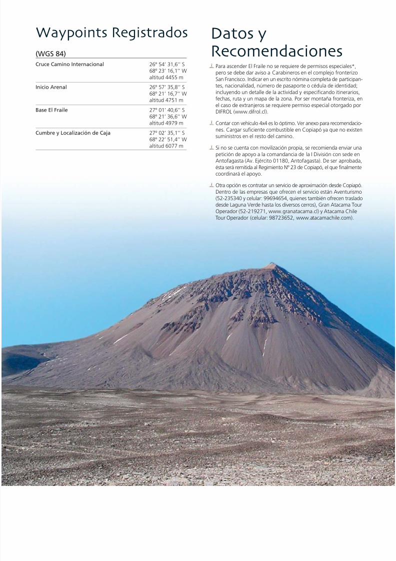
7/22/2019 Los 6.000 de Chile - Banco de Chile
http://slidepdf.com/reader/full/los-6000-de-chile-banco-de-chile 162/288
Datos yRecomendaciones
Para ascender El Fraile no se requiere de permisos especialespero se debe dar aviso a Carabineros en el complejo fronterSan Francisco. Indicar en un escrito nómina completa de partictes, nacionalidad, número de pasaporte o cédula de identidincluyendo un detalle de la actividad y especificando itinera
fechas, ruta y un mapa de la zona. Por ser montaña fronterizel caso de extranjeros se requiere permiso especial otorgadoDIFROL (www.difrol.cl).
Contar con vehículo 4x4 es lo óptimo. Ver anexo para recomendnes. Cargar suficiente combustible en Copiapó ya que no exsuministros en el resto del camino.
Si no se cuenta con movilización propia, se recomienda enviarpetición de apoyo a la comandancia de la I División con sedeAntofagasta (Av. Ejército 01180, Antofagasta). De ser aprobésta será remitida al Regimiento Nº 23 de Copiapó, el que finalmcoordinará el apoyo.
Otra opción es contratar un servicio de aproximación desde CopDentro de las empresas que ofrecen el servicio están Aventur(52-235340 y celular: 99694654, quienes también ofrecen tradesde Laguna Verde hasta los diversos cerros), Gran Atacama Operador (52-219271, www.granatacama.cl) y Atacama ChTour Operador (celular: 98723652, www.atacamachile.com
(WGS 84)Cruce Camino Internacional 26º 54’ 31,6’’ S
68º 23’ 16,1’’ Waltitud 4455 m
Inicio Arenal 26º 57’ 35,8’’ S68º 21’ 16,7’’ Waltitud 4751 m
Base El Fraile 27º 01’ 40,6’’ S68º 21’ 36,6’’ Waltitud 4979 m
Cumbre y Localización de Caja 27º 02’ 35,1’’ S68º 22’ 51,4’’ Waltitud 6077 m
Waypoints Registrados

7/22/2019 Los 6.000 de Chile - Banco de Chile
http://slidepdf.com/reader/full/los-6000-de-chile-banco-de-chile 163/288
Tips and Recommendations
• No special permits* are required to climb El Fraile but you sinform the police in the San Francisco border post of your expedgiving them a letter showing participants, nationalities, pasor ID numbers, details of activities and specific itineraries, droute and a map of the area. As the mountain is on the boforeigners must ask for permission from DIFROL (www.difr
• The best transport option is to take a 4x4 vehicle. See appfor recommendations. Buy sufficient fuel in Copiapó as theno other places to buy it during the rest of the journey.
• If you do not have your own transport it is recommended to
a letter asking for support to the headquarters of the Armydivision in Antofagasta (Av. Ejército 01180, Antofagasta). Tapproved it will be sent to the 23rd Regiment in Copiapó, wwill co-ordinate the support.
• Another option is a transport service from Copiapo. Amoncompanies that offer the service are Aventurismo (52-2353mobile: 99694654, who also offer transport from Laguna Vto the various mountains), Gran Atacama Tour Operador (5219271, www.granatacama.cl) and Atacama Chile Tour Ope(mobile: 98723652, www.atacamachile.com).
• The east scree slope of the mountain is quite loose, so it isrecommended to avoid climbing it directly. It is preferable tascend through the spurs that appear from time to time. Yhave to take special care with the loose material, advancingtogether. If there is snow you can use it to ascend more qu
• The day of the summit climb it is recommended to leave nothan 5.00 am.
• The facilities of the company Aventurismo at Laguna Verdebe used from November 1st to March 31 every year. You caat Laguna Verde.
• It is recommended to take equipment and clothing suitablhigh altitude mountaineering. As part of the equipment it recommended to take an ice axe and crampons.
• Take sufficient water for the whole expedition. This can be from Copiapó or Laguna Verde.
• The Puna de Atacama area has high precipitation in wintersummer, when it is slightly affected by the 'Alti-Planic wintThe climatic instability can also be accompanied by strong sand wind-storms. It is therefore strongly recommended to
during the months of spring and summer, as the winter prevery low temperatures and abundant precipitation. It is neceto keep up-to-date with the weather forecast.
From December 1st 2004 the company Aventurismo (32-235340) has the rights for access to the summit of the Ojos del Salado Volcano anneighbouring summits over 6,000 m, also to the Atacama (5,200 m) aTejos (5,800 m) refugios and the Laguna Verde thermal springs. The pincludes a series of services that can only be used if the expeditions arbetween November and the end of March. At the date of publication book, the only permit that requires payment is for the Ojos del Saladoeventually the El Fraile Volcano will also require such a permit.
Registered Waypoints (WGS 84)
Turning off International Road 26º 54’ 3168º 23’ 16altitude 4,4
Start of the Sandy Area 26º 57’ 3568º 21’ 16altitude 4,7
Base of El Fraile 27º 01’ 4068º 21’ 36altitude 4,9
Summit and Location of Box 27º 02’ 3568º 22’ 51altitude 6,0
Los 6000’s de Chile / The 6,000’s of Chile
160 161
* Desde el 1º de diciembre del 2004 la empresa Aventurismo (32-235340)posee la concesión para el acceso a la cumbre del Volcán Ojos del Salado ycumbres vecinas de más de 6000 m, además de los refugios Atacama (5200m) y Tejos (5800 m) y las Termas de Laguna Verde. El permiso incluye unaserie de servicios que sólo se prestan si las expediciones se desarrollan entrelos meses de noviembre y fines de marzo. A la fecha de publicación de estelibro, el único permiso que efectivamente se cobra es el del Volcán Ojos delSalado, pero en el futuro seguramente el Volcán El Fraile requerirá de dichopermiso
El acarreo Este del cerro está bastante suelto, por lo que se reco-mienda evitar subir directamente por éste, de preferencia transitarpor los espolones que aparecen de vez en cuando. Hay que tenerespecial cuidado con el material desprendido, debiendo transitarseen grupos compactos. En caso que haya nieve sobre el acarreo,hay que usarla para ascender con más facilidad.
El día de cumbre se recomienda partir a más tardar a las 5.00 AM.
Las instalaciones de la empresa Aventurismo en Laguna Verdepueden ser usadas entre el 1º de noviembre y el 31 de marzo de
cada año. El costo se cancela en Laguna Verde.Se recomienda contar con equipo y vestuario de alta montaña yllevar piolet y crampones como parte del equipo técnico.
Llevar agua suficiente para el total de la expedición, ya sea desdeCopiapó o cargando agua en Laguna Verde.
La zona de la Puna de Atacama presenta precipitaciones invernalesy estivales ya que sufre la influencia del Invierno Altiplánico. Lainestabilidad climática puede verse acompañada por fuertes ráfagasy tormentas de viento. Si bien se recomienda el ascenso en losmeses de primavera y verano, ya que el invierno presenta tempe-raturas muy bajas y precipitaciones abundantes, es necesarioinformarse previamente del pronóstico climático.

7/22/2019 Los 6.000 de Chile - Banco de Chile
http://slidepdf.com/reader/full/los-6000-de-chile-banco-de-chile 164/288
6 0 6 7 m
s n m
Cara Sur / South Face
Cerro
Vicuñas

7/22/2019 Los 6.000 de Chile - Banco de Chile
http://slidepdf.com/reader/full/los-6000-de-chile-banco-de-chile 165/288
Inmediatamente al Norte del Volcán Barrancas Blancas, y en medio del espectacular entorno andino de grandes altitudes
que acompañan al Nevado Ojos del Salado, se ubica esta discreta montaña poco visitada. Como sucede con muchoscerros del sector, se tiene muy poca información sobre el Vicuñas debido al aislamiento en que se encuentra. De hecho,
pocos lugares en el mundo se nos muestran en un estado tan salvaje e imponente como esta zona: el alejamiento, elclima y en especial la magia de la Puna de Atacama es lo que hace de esta zona un lugar único.
A diferencia de la mayoría de las montañas de la región, éste no es un volcán sino un macizo andino nacido de un
fenómeno generador de pliegues denominado diastrofismo. De todos modos, el Vicuñas no tiene mucho que envidiara sus vecinos ya que está igualmente formado por material volcánico, debido a que el proceso que lo originó se vio
enriquecido por el aporte de las grandes cantidades de material volcánico que ellos aportaron.
INTRODUCCIÓNINTRODUCCIÓN
Los 6000’s de Chile / The 6,000’s of Chile
162 163
Immediately to the north of the Barrancas Blancas Volcano and in the middle of the spectacular Andean landscape around the Ojos
del Salado, lies this discrete, rarely-visited mountain. As happens with many mountains in the area, there is very little information about
the Vicuñas due to its isolation. In fact, few areas in the world are as wild and imposing as this: the isolation, the climate and, especially,
the magic of the Puna de Atacama make this a unique area.
Unlike the majority of the mountains in the area, this is not a volcano but an Andean massif born from a geological process called
diastrophism. However, the Vicuñas doesn’t have much reason to envy its neighbours as it is also formed from volcanic material; theprocess of its origination was enriched by the great quantities of volcanic material that came from the surrounding mountains.

7/22/2019 Los 6.000 de Chile - Banco de Chile
http://slidepdf.com/reader/full/los-6000-de-chile-banco-de-chile 166/288
AccesoLa ruta de acceso es similar a la del Volcán El Ermitaño y a la dseismiles vecinos en la zona del Ojos del Salado. Desde la ciuda
Copiapó dirigirse hacia el camino internacional Ruta 31 que lle
Argentina vía paso internacional San Francisco.
A la altura del Salar de Maricunga se ubica el complejo fronte
San Francisco donde es necesario dar aviso de la expedición.
Continuar por la Ruta 31 rumbo a la Laguna Verde (4342 m), dse encuentra un retén de Carabineros que cierra durante el inv
y se reabre a principios de octubre. La empresa concesionariaAventurismo cuenta en Laguna Verde con radio, agua, baños
termas, por lo que es un lugar recomendable para el proceso daclimatación.
Desde Laguna Verde se regresa hasta el desvío que lleva hasta
antigua tenencia de Carabineros junto a la ex Hostería Murray, aRefugio Claudio Lucero (4540 m). Aquí es necesario doblar haderecha por una pequeña quebrada que tiene huellas de vehíc
y que lleva al portezuelo entre los cerros Vicuñas y Barrancas Bla
El camino asciende por unos llanos y pequeñas lomas, y dependidel vehículo se puede acceder hasta una altitud que fluctúe en
los 4700 y los 4900 m, estableciéndose el CB alrededor de los 4m. Se advierte que en caso de hacer el trayecto a pie, el acercam
resulta demasiado largo.
I N F O R M E6067m
a l t i t u d
C e r r oVicuñas
Posición Geográfica según Carta: 27º 01’ 29,6’’ S68º 36’ 53,0’’ W
Carta IGM: C88
Primera Ascensión Deportiva: Sin registro
Época más Adecuada para Ascender: Entre septiembre y abril

7/22/2019 Los 6.000 de Chile - Banco de Chile
http://slidepdf.com/reader/full/los-6000-de-chile-banco-de-chile 167/288
Geographical Position 27º 01’ 29.
According to Map: 68º 36’ 53.
IGM Map: C88
First Recreational Ascent: Not registe
Best Time of Year for Climbing: From September to
Ruta deAscenso/DescensoLa ruta que lleva a la cumbre del Vicuñas es bastante sencilla. Todo
el camino hasta la cumbre se compone de variados acarreos, desdearena, pasando por acarreos de piedra pómez, hasta basalto en algunos
tramos. La mejor condición para subirlo es cuando presenta un poco
de nieve, ya que ésta estabiliza el terreno, formando buenos escalonesy mejorando el rendimiento de la escalada.
Desde el CB hay que emprender el rumbo en línea recta en direcciónhacia la parte más alta visible a la izquierda del portezuelo, hasta
alcanzar unos roqueríos ubicados a 5700 m, lugar a partir del cualse debe dar un corto rodeo hacia la izquierda.
Posteriormente, cuando ya se bordean los 6000 m, se atraviesa una
pequeña planicie próxima a la cima. Desde el sector del roquerío hastael final de la planicie, donde se ubica el filo que conduce a la cumbre,se requiere de un poco más de una hora de caminata a ritmo constante.
Un par de grietas a los 5800 m hace que el hielo se torne un pocopeligroso. Son cerca de 50 metros en los que se debe escalar con
sumo cuidado, en una pendiente que no supera los 40º.
Una vez en el filo, girar hacia la derecha y tras algunos minutos demarcha sobre pedregales y algo de nieve (dependiendo de la época
del año) se alcanza la cumbre. El punto más alto corresponde a lasegunda cumbre de Norte a Sur.
Una vez en la cumbre es posible apreciar los seismiles que pueblan
el sector, como el imponente Ojos del Salado, el Nevado Tres Crucesy el Incahuasi, por citar sólo algunos.
El descenso se efectúa por la misma ruta usada en el ascenso.
R E P O R T
Los 6000’s de Chile / The 6,000’s of Chile
164 165
Access
The access route is similar to that of the El Ermitaño Volcano the other Six Thousand Metre Peaks in the Ojos del Salado ar
Taking the city of Copiapó as a point of departure, head tow
and then take the international road, Ruta 31, that leads to Arge
via the San Francisco border crossing.
In the area of the Maricunga Salt Lake is the San Francisco bo
post where it is necessary to register your expedition.
Continue along Ruta 31 to Laguna Verde (4,342 m) where th
a police station that is closed during the winter and re-opens a
beginning of October. Here, the budget company Aventurism
supply radios, water, bathrooms and hot springs which make
good place for the process of acclimatisation.
From Laguna Verde it is necessary to go back to the turning t
leads to the old police station next to what was the Murray H
and is now the Claudio Lucero Refugio (4,540 m). From here,
must turn right into a small gorge that has a vehicle track and wleads to the pass between the Vicuñas and Barrancas Blancas
mountains.
The road rises through some small hills and plains, and, depe
on the vehicle, you can drive until an altitude that fluctuates bet
4,700 and 4,900 m, setting up BC at around 4,900 m. Climb
should be warned that if the route is done on foot, the appro
becomes too long.
Route of Ascent/Descent
The route that leads to the summit of Vicuñas is quite simple
whole route, until the summit, is a variety of scree slopes; ma
sand, pumice stone, even basalt in some sections. The best cond
for the climb are when there is a little snow which stabilizes t
terrain, allows you to make good steps and improves the effic
of the climb.From BC you have to start the ascent in a straight line toward
highest visible part on the left of the pass until reaching some
rocks at 5,700 m where you should start heading left.
When you are at about 6,000 m, you cross a small plateau ne
summit. From an area of large rocks to the end of the plateau
where the ridge that leads to the summit begins, takes a little
than an hour, walking at a steady pace. A couple of crevasses
5,800 m mean the ice can be a little dangerous. There are 50 m
which must be climbed with the utmost care, on a slope of no
than 40º.
Once on the ridge, turn towards the right and after a few mi
of walking on rocky ground and some snow (depending on the
of year) you reach the summit. The highest point is the secon
summit from north to south.
Once at the summit it is possible to see the magnitude of the
Thousand Metre Peaks in the area, such as the imposing Ojos
Salado, the Nevado Tres Cruces and Incahuasi, to name but a
The descent follows the same route as the ascent.

7/22/2019 Los 6.000 de Chile - Banco de Chile
http://slidepdf.com/reader/full/los-6000-de-chile-banco-de-chile 168/288
Siendo la más pequeña de los cuatro camélidos sudamericanos y unade las especies que habita la región la vicuña (Vicugna vicugna) esreconocida a nivel mundial por la altísima calidad de su lana
The smallest of the four South-American camels and one of the species that inhabit the region, the vicuna (Vicugna vicugna) is known throughout theworld for the high quality of its wool.

7/22/2019 Los 6.000 de Chile - Banco de Chile
http://slidepdf.com/reader/full/los-6000-de-chile-banco-de-chile 169/288
(WGS 84)
Campamento Base 26º 59’ 45,0’’ S68º 36’ 14,9’’ Waltitud 4957 m
Cumbre y Localización de Caja 27º 01’ 17,0’’ S68º 37’ 07,9’’ W
altitud 6087 m
Waypoints Registrados
Los 6000’s de Chile / The 6,000’s of Chile
166 167
Datos yRecomendaciones
Para ascender el Vicuñas no se requiere de permisos especiales*,pero se debe dar aviso a Carabineros en el complejo fronterizo SanFrancisco. Indicar en un escrito nómina completa de participantes,nacionalidad, número de pasaporte o cédula de identidad;incluyendo un detalle de la actividad y especificando itinerarios,fechas, ruta y un mapa de la zona.
Contar con vehículo 4x4 es lo óptimo. Ver anexo para recomendacio-nes. Cargar suficiente combustible en Copiapó ya que no existensuministros en el resto del camino.
Si no se cuenta con movilización propia, se recomienda enviar unapetición de apoyo a la comandancia de la I División con sede enAntofagasta (Av. Ejército 01180, Antofagasta). De ser aprobada,ésta será remitida al Regimiento Nº 23 de Copiapó, el que finalmentecoordinará el apoyo.
Otra opción es contratar un servicio de aproximación desde Copiapó.Dentro de las empresas que ofrecen el servicio están Aventurismo(52-235340 y celular: 99694654, quienes también ofrecen trasladodesde Laguna Verde hasta los diversos cerros), Gran Atacama TourOperador (52-219271, www.granatacama.cl) y Atacama ChileTour Operador (celular: 98723652, www.atacamachile.com).
El día de cumbre se recomienda partir a más tardar a las 6.00 AM.
Las instalaciones de la empresa Aventurismo en Laguna Verde yel refaccionado refugio Claudio Lucero pueden ser usados entreel 1º de noviembre y el 31 de marzo de cada año. El costo se can-cela en Laguna Verde.
Se recomienda contar con equipo y vestuario de alta montaña yllevar piolet y crampones como parte del equipo técnico.
Llevar agua suficiente para el total de la expedición, ya sea desdeCopiapó o cargando agua en Laguna Verde.
La zona de la Puna de Atacama presenta precipitaciones invernalesy estivales ya que sufre la influencia del Invierno Altiplánico. Lainestabilidad climática puede verse acompañada por fuertes ráfagas
y tormentas de viento. Si bien se recomienda el ascenso en losmeses de primavera y verano, ya que el invierno presentatemperaturas muy bajas y precipitaciones abundantes, es necesarioinformarse adecuadamente del pronóstico climático.
* Desde el 1º de diciembre del 2004 la empresa Aventurismo (32-235340) posee laconcesión para el acceso a la cumbre del Volcán Ojos del Salado y cumbres vecinas demás de 6000 m, además de los refugios Atacama (5200 m) y Tejos (5800 m) y las Termasde Laguna Verde. El permiso incluye una serie de servicios y sólo se realiza si lasexpediciones se desarrollan entre los meses de noviembre y fines de marzo. A la fechade publicación de este libro, el único permiso que efectivamente se cobra es el delVolcán Ojos del Salado, pero en el futuro seguramente el Cerro Vicuñas requerirá dedicho permiso.
Tips and Recommendations
• No special permits* are required to climb Vicuñas but you s
inform the police in the San Francisco border post of your
expedition, giving them a letter showing participants, nationa
passport or ID numbers, details of activities and specific itinerdates, route and a map of the area.
• The best transport option is to take a 4x4 vehicle. See app
for recommendations. Buy sufficient fuel in Copiapó as the
no other places to buy it during the rest of the journey.
• If you do not have your own transport it is recommended to
a letter asking for support to the headquarters of the Army
division in Antofagasta (Av. Ejército 01180, Antofagasta). O
approved it will be sent to the 23rd Regiment in Copiapó, w
will co-ordinate the support.
• Another option is a transport service from Copiapó. Amon
companies that offer the service are Aventurismo (52-2353
mobile: 99694654, who also offer transport from Laguna V
to the various mountains), Gran Atacama Tour Operador (5
219271, www.granatacama.cl) and Atacama Chile Tour Ope
(mobile: 98723652, www.atacamachile.com).
• The day of the summit climb, it is recommended to leave no
than 6.00 am.
• The facilities of the company Aventurismo at Laguna Verde
be used from November 1st to March 31 every year. You ca
at Laguna Verde.
• It is recommended to take equipment and clothing suitabl
high altitude mountaineering. As part of the equipment it
recommended to take an ice axe and crampons.
• Take sufficient water for the whole expedition. This can be
from Copiapó or the water in Laguna Verde.
• The Puna de Atacama area has high precipitation in winter
summer, when it is slightly affected by the “Alti-Planic win
The climatic instability can also be accompanied by strong s
and wind-storms. It is therefore strongly recommended to
during the months of spring and summer, as the winter pre
very low temperatures and abundant precipitation. It is nece
to keep up-to-date with the weather forecast.
* From December 1st 2004 the company Aventurismo (32-235340) hathe rights for access to the summit of the Ojos del Salado Volcano anneighbouring summits over 6,000 m, also to the Atacama (5,200 m) aTejos (5,800 m) refugios and the Laguna Verde thermal springs. The pincludes a series of services that can only be used if the expeditions arbetween November and the end of March. At the date of publication book, the only permit that requires payment is for the Ojos del Saladoeventually the Vicuñas Mountain will also require such a permit.
Registered Waypoints (WGS 84)
Base Camp 26º 59’ 45
68º 36’ 14
altitude 4,9
Summit and Location of Box 27º 01’ 17
68º 37’ 07
altitude 6,0

7/22/2019 Los 6.000 de Chile - Banco de Chile
http://slidepdf.com/reader/full/los-6000-de-chile-banco-de-chile 170/288
Volcán
6 1 1 9 m
s n m
Barrancas BlancaCara Norte / North

7/22/2019 Los 6.000 de Chile - Banco de Chile
http://slidepdf.com/reader/full/los-6000-de-chile-banco-de-chile 171/288
Compañero silencioso del Cerro Vicuñas, el Barrancas Blancas es otro de los volcanes poco ascendidos de la zona, pero
invita, espectante, con su no despreciable altitud.
Este volcán, ubicado íntegramente en territorio chileno, es parte de un cordón volcánico llamado Cordón Foerster, que
posee en sí tres cumbres, siendo la del Barrancas Blancas la más alta. Este cordón tiene una longitud aproximada de
unos 20 kilómetros y se antepone a la cadena del Nevado Ojos del Salado. Este cordón, y en especial el Barrancas Blancas,
se caracteriza por ser de mucha más edad que el resto de los volcanes de la zona, la que se estima en tres o cuatro
millones de años.
INTRODUCCIÓNINTRODUCCIÓN
Los 6000’s de Chile / The 6,000’s of Chile
168 169
The silent companion of the Vicuñas Mountain, Barrancas Blancas is another of the volcanoes in the area that is rarely-climbed.
It is located completely in Chilean territory and is part of the volcanic range called Cordón Foerster that constitutes three summits of
which the Barrancas Blancas is the highest. This range is approximately 20 km long and is just before the Ojos del Salado range. The
range, and especially the Barrancas Blancas, is characterised by being much older than the rest of the mountains in the area, estimated
to be three or four million years old.

7/22/2019 Los 6.000 de Chile - Banco de Chile
http://slidepdf.com/reader/full/los-6000-de-chile-banco-de-chile 172/288
AccesoLa ruta de acceso es similar a la del Volcán El Ermitaño y a la d
seismiles vecinos en la zona del Ojos del Salado. Desde la ciuda
Copiapó dirigirse hacia el camino internacional Ruta 31 que lle
Argentina vía paso internacional San Francisco.
A la altura del Salar de Maricunga se ubica el complejo fronte
San Francisco donde es necesario dar aviso de la expedición.
Continuar por la Ruta 31 rumbo a la Laguna Verde (4342 m), d
se encuentra un retén de Carabineros que cierra durante el inv
y se reabre a principios de octubre. La empresa concesionaria
Aventurismo cuenta en Laguna Verde con radio, agua, baños
termas, por lo que es un lugar recomendable para el proceso d
aclimatación.
Desde Laguna Verde se regresa hacia el desvío que lleva hasta la
gua tenencia de Carabineros junto a la ex Hostería Murray, ac
Refugio Claudio Lucero, a 4540 m, donde se recomienda instalar e
I N F O R M E6119 m
a
l t i t u d
V o l c á nBarracasBlancas
Posición Geográfica según Carta: 26º 59’ 37,3” S
68º 40’ 04,7” W
Carta IGM: C77
Primera Ascensión Deportiva: 2002
Época más Adecuada para Ascender: Entre septiembre y abril

7/22/2019 Los 6.000 de Chile - Banco de Chile
http://slidepdf.com/reader/full/los-6000-de-chile-banco-de-chile 173/288
Geographical Position 26º 59’ 37.
According to Map: 68º 40’ 04.
IGM Map: C77
First Recreational Ascent: 2002
Best Time Of Year For Climbing: From September to
Ruta deAscenso/DescensoDesde el CB tomar el camino que nace hacia la derecha (Oeste) porel cual se avanza unos tres kilómetros. Luego hay que desviarse a
la izquierda (Sur), transitando por el lecho arenoso de la QuebradaBarrancas Blancas que asciende lentamente por unos llanos y
pequeñas lomas, hasta su nacimiento, en la parte central del macizomontañoso.
Al igual que para el Vicuñas, se trata de una ascensión sencilla que
no tiene requerimientos técnicos. Más bien requiere de celo yprecaución, puesto que es un área distante de cualquier tipo de
ayuda en caso de emergencia. Prestar igualmente atención a laextrema radiación que afecta a toda la zona de la Puna de Atacama.
La vía de ascenso enfrenta directamente la cima principal a través
de la quebrada central, promediando entre seis a siete horas desdedonde se deja el vehículo.
El primer tramo de la vía recorre un acarreo con una pendiente inicial
de aproximadamente 25º para luego aumentar y mantenerse en40º. La tentación de avanzar por los neveros es engañosa, ya que
pueden encontrarse penitentes que son más un obstáculo que unbeneficio. Este tramo, de unas cuatro a cinco horas de marcha, se
acaba a los 5800 m, en el filo que conecta las distintas cumbres delmacizo.
En el siguiente tramo la pendiente disminuye y es posible observar
hacia el Suroeste la cumbre principal. Alcanzada la cumbre secontempla un paisaje sobrecogedor de las montañas, planicies y
lagunas de la zona, entre las cuales sobresale el Volcán Ojos delSalado, la cumbre más alta de Chile.
La ruta para el descenso es la misma empleada para el ascenso.
R E P O R T
Los 6000’s de Chile / The 6,000’s of Chile
170 171
Access
The access route is similar to that of the El Ermitaño Volcano the other Six Thousand Metre Peaks in the Ojos del Salado ar
Taking the city of Copiapó as a point of departure, head tow
and then take the international road, Ruta 31, that leads to Arge
via the San Francisco border crossing.
In the area of the Maricunga Salt Lake is the San Francisco bo
post where it is necessary to register your expedition.
Continue along Ruta 31 to Laguna Verde (4,342 m) where th
a police station that is closed during the winter and re-opens a
beginning of October. Here, the budget company Aventurism
supply radios, water, bathrooms and hot springs which make
good place for the process of acclimatisation.
From Laguna Verde it is necessary to go back to the turning t
leads to the old police station, next to what was the Murray H
and is now the Claudio Lucero Refugio (4,540 m) where it is
recommended that you set up BC.
Route of Ascent/Descent
From the BC, take the road that leads right (west) for about t
km. Then you must turn left (south), following the sandy bed o
Barrancas Blancas Gully, which rises slowly through some sma
hills until reaching its source in the central part of the mounta
massif.
As with Vicuñas, the ascent is simple and does not have tech
requirements. Precautions, are however, necessary as it is an
far from any kind of help in the case of emergencies. Care als
needs to be taken with the extreme UV radiation that affects
whole area of the Puna de Atacama.
The access route leads directly to the main summit through th
central gorge, averaging about six or seven hours from where
vehicle is left.
The first section of the route crosses a scree slope with an init
gradient of approximately 25º which then increases and rema
40º. There is a temptation to advance by the snow fields but,
they have penitentes, they can be more of an obstacle than a be
This stretch, of about four or five hours walk, finishes at 5,80
where the ridge connects with the different summits of the m
The slope eases in the next section, and it is possible to see the
summit towards the south-west. On reaching the summit you
view an overwhelming landscape of mountains, plains and lag
amongst which rises the Ojos del Salado Volcano, the highest
in Chile.
The descent follows the same route as for the ascent.

7/22/2019 Los 6.000 de Chile - Banco de Chile
http://slidepdf.com/reader/full/los-6000-de-chile-banco-de-chile 174/288
Volcán Barrancas Blancas otra de las cumbres poco ascendidaspero altamente atractivas de la Puna de Atacama
The Barrancas Blancas Volcano, another of the rarely-ascended but most beautiful attractions of the Puna de Atacama.

7/22/2019 Los 6.000 de Chile - Banco de Chile
http://slidepdf.com/reader/full/los-6000-de-chile-banco-de-chile 175/288
Registered Waypoints (WGS 84)
Claudio Lucero Refugio (ex Murray Hostal) 26º 56’ 00
68º 35’ 47
altitude 4,5
Base of the Volcano 26º 57’ 56
68º 38’ 57
altitude 5,0
Summit and Location of Box 26º 59’ 25
68º 39’ 57
altitude 6,1
(WGS 84)
Refugio Claudio Lucero (ex Murray) 26º 56’ 00,2’’ S68º 35’ 47,2’’ Waltitud 4537 m
Base Volcán 26º 57’ 56,0’’ S68º 38’ 57,0’’ W
altitud 5000 mCumbre y Localización de Caja 26º 59’ 25,0’’ S
68º 39’ 57,0’’ Waltitud 6119 m
Waypoints Registrados
Los 6000’s de Chile / The 6,000’s of Chile
172 173
Datos yRecomendaciones
Para ascender el Barrancas Blancas no se requiere de permisos es-peciales*, pero se debe dar aviso a Carabineros en el complejofronterizo San Francisco. Indicar en un escrito nómina completade participantes, nacionalidad, número de pasaporte o cédula de
identidad; incluyendo un detalle de la actividad y especificandoitinerarios, fechas, ruta y un mapa de la zona.
Contar con vehículo 4x4 es lo óptimo. Ver anexo para recomendacio-nes. Cargar suficiente combustible en Copiapó ya que no existensuministros en el resto del camino.
Si no se cuenta con movilización propia, se recomienda enviar unapetición de apoyo a la comandancia de la I División con sede enAntofagasta (Av. Ejército 01180, Antofagasta). De ser aprobada,ésta será remitida al Regimiento Nº 23 de Copiapó, el que finalmentecoordinará el apoyo.
Otra opción es contratar un servicio de aproximación desde Copiapó.Dentro de las empresas que ofrecen el servicio están Aventurismo(52-235340 y celular. 99694654, quienes también ofrecen trasladodesde Laguna Verde hasta los diversos cerros), Gran Atacama TourOperador (52-219271, www.granatacama.cl) y Atacama ChileTour Operador (celular: 98723652, www.atacamachile.com).
Las instalaciones de la empresa Aventurismo en Laguna Verde yel refaccionado Refugio Claudio Lucero pueden ser usados entreel 1º de noviembre y el 31 de marzo de cada año. El costo se cancelaen Laguna Verde.
Se recomienda contar con equipo y vestuario de alta montaña yllevar crampones y piolet como parte del equipo técnico.
Llevar agua suficiente para el total de la expedición, ya sea desdeCopiapó o cargando agua en Laguna Verde.
La zona de la Puna de Atacama presenta precipitaciones invernalesy estivales ya que sufre la influencia del Invierno Altiplánico. Lainestabilidad climática puede verse acompañada por fuertes ráfagas
y tormentas de viento. Si bien se recomienda el ascenso en los me- ses de primavera y verano, ya que el invierno presenta temperaturas
muy bajas y precipitaciones abundantes, es necesario informarsepreviamente del pronóstico climático.
* Desde el 1º de diciembre del 2004 la empresa Aventurismo (32-235340) posee la con-cesión para el acceso a la cumbre del Volcán Ojos del Salado y cumbres vecinas de másde 6000 m, además de los refugios Atacama (5200 m) y Tejos (5800 m) y las Termasde Laguna Verde. El permiso incluye una serie de servicios y sólo se realiza si las expedicio-nes se desarrollan entre los meses de noviembre y fines de marzo. A la fecha de publica-ción de este libro, el único permiso que efectivamente se cobra es el del Volcán Ojos delSalado, pero en el futuro seguramente el Volcán Barrancas Blancas requerirá de dichopermiso.
Tips and Recommendations
• No special permits* are required to climb Barrancas Blancayou should inform the police in the San Francisco border p
your expedition, giving them a letter showing participants,
nationalities, passport or ID numbers, details of activities an
specific itineraries, dates, route and a map of the area.
• The best transport option is to take a 4x4 vehicle. See app
for recommendations. Buy sufficient fuel in Copiapó as the
no other places to buy it during the rest of the journey.
• If you do not have your own transport it is recommended to
a letter asking for support to the headquarters of the Army
division in Antofagasta (Av. Ejército 01180, Antofagasta). O
approved it will be sent to the 23rd Regiment in Copiapó, w
will co-ordinate the support.
• Another option is a transport service from Copiapó. Amon
companies that offer the service are Aventurismo (52-2353
mobile: 99694654, who also offer transport from Laguna Vto the various mountains), Gran Atacama Tour Operador (5
219271, www.granatacama.cl) and Atacama Chile Tour Ope
(mobile: 98723652, www.atacamachile.com).
• The facilities of the company Aventurismo at Laguna Verde
the Claudio Lucero Refugio can be used from November 1s
March 31 every year. You can pay at Laguna Verde.
• It is recommended to take equipment and clothing suitabl
high altitude mountaineering. As part of the equipment it
recommended to take an ice axe and crampons.
• Take sufficient water for the whole expedition. This can be
from Copiapó or Laguna Verde.
• The Puna de Atacama area has high precipitation in winter
summer, when it is slightly affected by the “Alti-Planic win
The climatic instability can also be accompanied by strong s
and wind-storms. It is therefore strongly recommended to
during the months of spring and summer, as the winter pre
very low temperatures and abundant precipitation. It is nece
to keep up-to-date with the weather forecast.
* From December 1st 2004 the company Aventurismo (32-235340) hathe rights for access to the summit of the Ojos del Salado Volcano anneighbouring summits over 6,000 m, also to the Atacama (5,200 m) aTejos (5,800 m) refugios and the Laguna Verde thermal springs. The pincludes a series of services that can only be used if the expeditions arbetween November and the end of March. At the date of publication book, the only permit that requires payment is for the Ojos del Saladoeventually the Barrancas Blancas Volcano will also require such a perm

7/22/2019 Los 6.000 de Chile - Banco de Chile
http://slidepdf.com/reader/full/los-6000-de-chile-banco-de-chile 176/288
6 7 4 8 m
s n m
Cara Sur / South FaNevado
Tres Cruces Sur

7/22/2019 Los 6.000 de Chile - Banco de Chile
http://slidepdf.com/reader/full/los-6000-de-chile-banco-de-chile 177/288
Este majestuoso nevado es la segunda montaña más alta de Chile. Se encuentra en la frontera con Argentina, dentro
del Parque Nacional Nevado Tres Cruces, de CONAF. Es la más alta de una cadena de tres montañas denominada MacizoTres Cruces.
Este gigante da nacimiento al Río Lamas que alimenta las aguas de la famosa Laguna Santa Rosa al Oeste de la montaña.
Presenta un gran nevero hacia toda su ladera Sur, y pequeños glaciares que hacen de esta vía de ascenso que discurrepor territorio argentino, una interesante opción si se desea ascender a la cima de esta inmensa atalaya alba del desierto.
INTRODUCCIÓNINTRODUCCIÓN
Los 6000’s de Chile / The 6,000’s of Chile
174 175
This majestic mountain is the second highest in Chile. It is on the border with Argentina, in the Nevado Tres Cruces National Park which
is looked after by CONAF. It is the highest of a chain of three mountains called the Tres Cruces Massif (Three Crosses ).
Tres Cruces Sur is the Source of the Lamas River which flows into the famous Santa Rosa Lagoon to the west of the mountain. It has
a large snow field on its southern slope and small glaciers that make the route of ascent, which runs through Argentine territory, very
interesting.
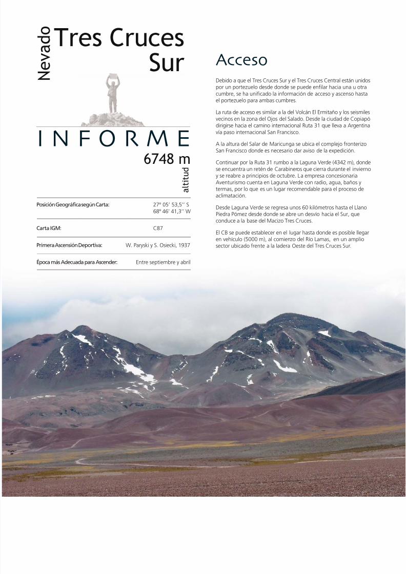
7/22/2019 Los 6.000 de Chile - Banco de Chile
http://slidepdf.com/reader/full/los-6000-de-chile-banco-de-chile 178/288
AccesoDebido a que el Tres Cruces Sur y el Tres Cruces Central están unpor un portezuelo desde donde se puede enfilar hacia una u o
cumbre, se ha unificado la información de acceso y ascenso ha
el portezuelo para ambas cumbres.
La ruta de acceso es similar a la del Volcán El Ermitaño y los seis
vecinos en la zona del Ojos del Salado. Desde la ciudad de Copdirigirse hacia el camino internacional Ruta 31 que lleva a Arge
vía paso internacional San Francisco.
A la altura del Salar de Maricunga se ubica el complejo fronteSan Francisco donde es necesario dar aviso de la expedición.
Continuar por la Ruta 31 rumbo a la Laguna Verde (4342 m), d
se encuentra un retén de Carabineros que cierra durante el invy se reabre a principios de octubre. La empresa concesionaria
Aventurismo cuenta en Laguna Verde con radio, agua, baños termas, por lo que es un lugar recomendable para el proceso daclimatación.
Desde Laguna Verde se regresa unos 60 kilómetros hasta el LlaPiedra Pómez desde donde se abre un desvío hacia el Sur, queconduce a la base del Macizo Tres Cruces.
El CB se puede establecer en el lugar hasta donde es posible llen vehículo (5000 m), al comienzo del Río Lamas, en un ampsector ubicado frente a la ladera Oeste del Tres Cruces Sur.
I N F O R M E6748 m
a l t i t u d
N e v a d oTres Cruces
Sur
Posición Geográfica según Carta: 27º 05’ 53,5’’ S
68º 46’ 41,3’’ W
Carta IGM: C87
Primera Ascensión Deportiva: W. Paryski y S. Osiecki, 1937
Época más Adecuada para Ascender: Entre septiembre y abril

7/22/2019 Los 6.000 de Chile - Banco de Chile
http://slidepdf.com/reader/full/los-6000-de-chile-banco-de-chile 179/288
Ruta deAscenso/DescensoSalir desde el CB avanzando hacia el Norte inicialmente por material
arenoso y luego por duros acarreos. Es una jornada no muy largaque lleva a un gran campo de penitentes que mira hacia el Sur, lugar
ubicado justo en medio de la quebrada que separa las cumbres Sury Central. Allí se puede establecer el C1, aproximadamente a unos
5400 m.
Desde el C1 continuar la ruta por el acarreo que se vislumbra haciael portezuelo. La pendiente que llega a los 40º y el terreno arenoso
dificultan el avance, pero llegando al final de la subida el ascensose torna más fácil y se llega a una meseta con lagunas de deshielo.
El lugar, que se encuentra bien protegido del viento, es ideal paraarmar un CA o para vivaquear, pero se recomienda esta última
opción sólo si el equipo humano y técnico está en condiciones, yaque se halla a una altitud de 6000 m.
Una vez en el portezuelo ya se está en la base de la cumbre Sur,
siendo necesario proseguir la marcha hasta el fondo por la aristamás lejana. Esta es la ruta para realizar el ascenso final. Esta última
caminata es bastante frontal por acarreos rocosos, y la cumbre espoco clara, con variadas formaciones rocosas de gran altura en unextenso territorio. Pero una vez superado este paso se puede divisar
la cumbre y acceder a ella.
El retorno se realiza por el mismo camino.
R E P O R T
Los 6000’s de Chile / The 6’000’s of Chile
176 177
Access
As the Tres Cruces Sur and Tres Cruces Central are linked by afrom which you can access either peak, the same access inform
until this pass is given for both peaks.
The access route is similar to that of the El Ermitaño Volcano
the other Six Thousand Metre Peaks in the Ojos del Salado ar
Taking the city of Copiapó as a point of departure, head tow
and then take the international road, Ruta 31, that leads to Arge
via the San Francisco border crossing.
In the area of the Maricunga Salt Lake is the San Francisco bo
post where it is necessary to register your expedition.
Continue along Ruta 31 to Laguna Verde (4,342 m) where th
a police station that is closed during the winter and re-opens a
beginning of October. Here, the budget company Aventurism
supply radios, water, bathrooms and hot springs which make
good place for the process of acclimatisation.
From Laguna Verde you have to go back about 60 km until th
Piedra Pómez plain. Here there is a turning south that takes y
the base of the Tres Cruces Massif.
BC can be set up at the place that you can reach with your ve
(5,000 m). This is at the start of the Lamas River in an open a
front of the west slope of the Tres Cruces Sur.
Route of Ascent/Descent
Leave BC heading north, going initially through sandy areas a
then through difficult scree slopes. This journey is not too lon
leads to a large field of penitentes that faces south and which
located in the middle of the gully that separates the south an
central summits. Here you can set up C1 at approximately 5,4
Continue the ascent up the scree slope that you can see from
Its gradient, which can reach 40º, and the sandy terrain makeclimb difficult but once you are approaching the end of the a
the climb becomes easier and you reach a plateau with meltw
lagoons. It is well-protected from the wind and is therefore id
set up a HC or for bivying. This last option is only recommend
the team and equipment are in the right condition, as you are
altitude of 6,000 m.
This pass is at the base of the south peak, and it is necessary
advance until its end along the ridge furthest away. This ridge
route for making the final ascent. This last climb is quite direc
through rocky scree slopes, and it is not very clear where the su
is, as there is a variety of rock formations of great height in a
area. But once you have passed this, you can see the summit
access it.
The descent follows the same route as the ascent.
Geographical Position 27º 05’ 53.
According to Map: 68º 46’ 41.
IGM Map: C87
First Recreational Ascent: W. Paryski and S. Osiecki,
Best Time of Year for Climbing: From September to

7/22/2019 Los 6.000 de Chile - Banco de Chile
http://slidepdf.com/reader/full/los-6000-de-chile-banco-de-chile 180/288
La segunda altura de Chile junto a su hermano el NevadoTres Cruces Central a la izquierda
The second highest mountain in Chile, together with its brother,the Nevado Tres Cruces Central to its left.

7/22/2019 Los 6.000 de Chile - Banco de Chile
http://slidepdf.com/reader/full/los-6000-de-chile-banco-de-chile 181/288
Registered Waypoints (WGS 84)Base Camp 27º 05’ 37
68º 50’ 54altitude 5,0
Camp 1 27º 05’ 0568º 48’ 49altitude 5,4
High Camp 27º 05’ 0068º 47’ 34altitude 5,9
Summit and Location of Box 27º 05’ 5668º 46’ 43
altitude 6,7
(WGS 84)Campamento Base 27º 05’ 37,7’’ S
68º 50’ 54,2’’ Waltitud 5000 m
Campamento 1 27º 05’ 05,1’’ S68º 48’ 49,7’’ Waltitud 5400 m
Campamento Alto 27º 05’ 00,3’’ S68º 47’ 34,0’’ Waltitud 5945 m
Cumbre y Localización de Caja 27º 05’ 56,4’’ S68º 46’ 43,7’’ Waltitud 6770 m
Waypoints Registrados
Los 6000’s de Chile / The 6,000’s of Chile
178 179
Datos yRecomendaciones
Para ascender el Tres Cruces Sur no se requiere de permisosespeciales*, pero se debe dar aviso a Carabineros en el complejo
fronterizo San Francisco. Indicar en un escrito nómina completade participantes, nacionalidad, número de pasaporte o cédula deidentidad; incluyendo un detalle de la actividad y especificandoitinerarios, fechas, ruta y un mapa de la zona. Por ser montañafronteriza, en el caso de extranjeros se requiere permiso especialotorgado por DIFROL (www.difrol.cl).
Contar con vehículo 4x4 es lo óptimo. Ver anexo para recomendacio-nes. Cargar suficiente combustible en Copiapó ya que no existensuministros en el resto del camino.
Si no se cuenta con movilización propia, se recomienda enviar unapetición de apoyo a la comandancia de la I División con sede enAntofagasta (Av. Ejército 01180, Antofagasta). De ser aprobada,ésta será remitida al Regimiento Nº 23 de Copiapó, el que finalmentecoordinará el apoyo.
Otra opción es contratar un servicio de aproximación desde Copiapó.
Dentro de las empresas que ofrecen el servicio están Aventurismo(52-235340 y celular: 99694654, quienes también ofrecen trasladodesde Laguna Verde hasta los diversos cerros), Gran Atacama TourOperador (52-219271, www.granatacama.cl) y Atacama ChileTour Operador (celular: 98723652, www.atacamachile.com).
Las instalaciones de la empresa Aventurismo en Laguna Verdepueden ser usadas entre el 1º de noviembre y el 31 de marzo decada año. El costo se cancela en Laguna Verde.
Se recomienda contar con equipo y vestuario de alta montaña yllevar piolet y crampones como parte del equipo técnico.
Sólo el lugar del CB carece de agua; en los otros campamentosse pueden derretir los hielos aledaños.
La zona de la Puna de Atacama presenta precipitaciones invernalesy estivales ya que sufre la influencia del Invierno Altiplánico. La
inestabilidad climática puede verse acompañada por fuertes ráfagasy tormentas de viento. Si bien se recomienda el ascenso en losmeses de primavera y verano, ya que el invierno presenta tempe-raturas muy bajas y precipitaciones abundantes, es necesario infor-marse previamente del pronóstico climático.
* Desde el 1º de diciembre del 2004 la empresa Aventurismo (32-235340) posee la con-cesión para el acceso a la cumbre del Volcán Ojos del Salado y cumbres vecinas de másde 6000 m, además de los refugios Atacama (5200 m) y Tejos (5800 m) y las Termas deLaguna Verde. El permiso incluye una serie de servicios y sólo se realiza si las expedicionesse desarrollan entre los meses de noviembre y fines de marzo. A la fecha de publicaciónde este libro, el único permiso que efectivamente se cobra es el del Volcán Ojos del Salado,pero en el futuro seguramente el Nevado Tres Cruces Sur requerirá de dicho permiso.
Tips and Recommendations
• No special permits* are required to climb Tres Cruces Sur bu
should inform the police in the San Francisco border post of
expedition, giving them a letter showing participants, nationapassport or ID numbers, details of activities and specific itiner
dates, route and a map of the area. As the mountain is on
border, foreigners must ask for permission from DIFROL
(www.difrol.cl).
• The best transport option is to take a 4x4 vehicle. See app
for recommendations. Buy sufficient fuel in Copiapó as the
no other places to buy it during the rest of the journey.
• If you do not have your own transport it is recommended to
a letter asking for support to the headquarters of the Army
division in Antofagasta (Av. Ejército 01180, Antofagasta). T
approved it will be sent to the 23rd Regiment in Copiapó, w
will co-ordinate the support.
• Another option is a transport service from Copiapó. Amon
companies that offer the service are Aventurismo (52-2353
mobile: 99694654, who also offer transport from Laguna Vto the various mountains), Gran Atacama Tour Operador (5
219271, www.granatacama.cl) and Atacama Chile Tour Ope
(mobile: 98723652, www.atacamachile.com).
• The facilities of the company Aventurismo at Laguna Verde
be used from November 1st to March 31 every year. You ca
at Laguna Verde.
• It is recommended to take equipment and clothing suitabl
high altitude mountaineering. As part of the equipment it
recommended to take an ice axe and crampons.
• There is no water in BC but in the other camp sites you can
the nearby ice.
• The Puna de Atacama area has high precipitation in winter
summer, when it is slightly affected by the “Alti-Planic win
The climatic instability can also be accompanied by strong s
and wind-storms. It is therefore strongly recommended to
during the months of spring and summer, as the winter pre
very low temperatures and abundant precipitation. It is nece
to keep up-to-date with the weather forecast.
* From December 1st 2004 the company Aventurismo (32-235340) hathe rights for access to the summit of the Ojos del Salado Volcano anneighbouring summits over 6,000 m, also to the Atacama (5,200 m) aTejos (5,800 m) refugios and the Laguna Verde thermal springs. The pincludes a series of services that can only be used if the expeditions arbetween November and the end of March. At the date of publication book, the only permit that requires payment is for the Ojos del Saladoeventually the Nevado Tres Cruces Sur will also require such a permit.

7/22/2019 Los 6.000 de Chile - Banco de Chile
http://slidepdf.com/reader/full/los-6000-de-chile-banco-de-chile 182/288
6 6 2 9 m
s n m
Cara Sur / South
NevadoTres Cruces Centra

7/22/2019 Los 6.000 de Chile - Banco de Chile
http://slidepdf.com/reader/full/los-6000-de-chile-banco-de-chile 183/288
Al Norte del Nevado Tres Cruces Sur y separada por un portezuelo de gran altitud, se encuentra esta montaña que
contrariamente a lo que se piensa, es un volcán. Se emplaza íntegramente en territorio chileno, y está dentro del Parque
Nacional Nevado Tres Cruces. En su ladera oriental presenta enormes neveros que lo hacen atractivo a los ojos de un
montañista.
Perteneciente al llamado Macizo Tres Cruces, esta cumbre se caracteriza por tener un cráter de un kilómetro de diámetro,
continuado por una fisura que alberga en sí unos 10 cráteres, desde los cuales hace miles de años escurrieron flujos
de lava hacia Este y Oeste.
El Macizo Tres Cruces, aparte de sus cumbres Sur, Central y Norte, engloba una serie de montañas tales como el Cráter
Rodrigo, el Cristi, Las Vicuñas, el Volcán Pissis y otros. A este macizo entero se le atribuyen unos 30 centros eruptivos
pese a lo cual sólo son conocidas las tres cumbres principales de la montaña, siendo esta cumbre Central la única con
presencia de tipo volcánico.
INTRODUCCIÓNINTRODUCCIÓN
Los 6000’s de Chile / The 6,000’s of Chile
180 181
This mountain lies to the north of the Tres Cruces Sur and is separated from it by a very high pass. Tres Cruces Central is, surprisingly
for many people, a volcano. It is completely in Chilean territory, inside the Nevado Tres Cruces National Park. On its eastern slope thereare enormous snow-fields which make it attractive to the mountaineer.
Belonging to the massif called Tres Cruces (Three Crosses), this peak has a crater a kilometre in diameter. The crater continues as a
fissure that contains about 10 craters, from which, thousands of years ago, lava flowed to both the east and west.
The Tres Cruces Massif, apart from its south, central and north summits, encompasses a series of mountains such as Rodrigo, Cristi,
Las Vicuñas, the Pissis Volcano and others. In the entire massif there are about 30 eruptive centres but the three principal peaks are
the only famous ones, from which the central summit is the only one that is volcanic.

7/22/2019 Los 6.000 de Chile - Banco de Chile
http://slidepdf.com/reader/full/los-6000-de-chile-banco-de-chile 184/288
AccesoDebido a que el Tres Cruces Sur y Tres Cruces Central están un
por un portezuelo desde donde se puede enfilar hacia una u o
cumbre, se ha unificado la información de acceso y ascenso ha
el portezuelo para ambas cumbres.
La ruta de acceso es similar a la del Volcán El Ermitaño y los seis
vecinos en la zona del Ojos del Salado. Desde la ciudad de Cop
dirigirse hacia el camino internacional Ruta 31 que lleva a Arge
vía paso internacional San Francisco.
A la altura del Salar de Maricunga se ubica el complejo fronte
San Francisco donde es necesario dar aviso de la expedición.
Continuar por la Ruta 31 rumbo a la Laguna Verde (4342 m), d
se encuentra un retén de Carabineros que cierra durante el inv
y reabre a principios de octubre. La empresa concesionaria Aventur
cuenta en Laguna Verde con radio, agua, baños y termas, por lo
es un lugar recomendable para el proceso de aclimatación.
Desde Laguna Verde se regresa unos 60 kilómetros hasta el Lla
Piedra Pómez donde se abre un desvío hacia el Sur que condu
la base del Macizo Tres Cruces.
El CB se puede establecer en el lugar hasta donde es posible ll
en vehículo (5000 m), al comienzo del Río Lamas en un amplio s
ubicado frente a la ladera Oeste del Tres Cruces Sur.
I N F O R M E6629 m
a
l t i t u d
N e v a d oTres Cruces
Central
Posición Geográfica según Carta: 27º 04’ 04,3’’ S
68º 47’ 09,6’’ W
Carta IGM: C87
Primera Ascensión Deportiva: W. Paryski y S. Osiecki, 1937
Época más Adecuada para Ascender: Entre septiembre y abril

7/22/2019 Los 6.000 de Chile - Banco de Chile
http://slidepdf.com/reader/full/los-6000-de-chile-banco-de-chile 185/288
Geographical Position 27º 04’ 04
According to Map: 68º 47’ 09
IGM Map: C87
First Recreational Ascent: W. Paryski and S. Osiecki,
Best Time of Year for Climbing: From September to
Ruta de
Ascenso/DescensoSalir desde el CB avanzando hacia el Norte inicialmente por material
arenoso y luego por duros acarreos, en una jornada no muy larga
que lleva a un gran campo de penitentes que mira hacia el Sur, lugar
ubicado justo en medio de la quebrada que separa las cumbres Sur
y Central. En ese lugar se puede establecer el C1 aproximadamente
a unos 5400 m.
Desde el C1 continuar la ruta por el acarreo que se vislumbra hacia
el portezuelo. La pendiente que llega a los 40º y el terreno arenoso
dificultan el avance, pero llegando al final de la subida el ascenso
se torna más fácil y se llega a una meseta con lagunas de deshielo.
El lugar, que se encuentra bien protegido del viento, es ideal paraarmar un CA o para vivaquear, pero se recomienda tomar esta última
opción sólo si los equipos humano y técnico están en óptimas
condiciones ya que se halla a una altitud de 6000 m.
Una vez en el portezuelo ya se vislumbra la cumbre Central sin
mayores dificultades. Para ascender a la cima, avanzar zigzagueando
por un largo acarreo que continúa por la ladera Suroeste hasta llegar
a la base de unos roqueríos, bajo la cara Oeste de la cumbre. La
cuasi escalada de estas rocas parece difícil, pero en pocos minutos
se puede sortear la primera mitad del tramo. Con un último esfuerzo
se llega hasta los 6629 m que es la parte más alta del Nevado Tres
Cruces Central.
El descenso se realiza siguiendo la misma ruta de ascenso.
R E P O R T
Los 6000’s de Chile / The 6,000’s of Chile
182 183
Access
As Tres Cruces Sur and Tres Cruces Central are linked by a pass
which you can access either peak, the same access information
this pass is given for both peaks.
The access route is similar to that of the El Ermitaño Volcano
the other Six Thousand Metre Peaks in the Ojos del Salado ar
Taking the city of Copiapó as a point of departure, head tow
and then take the international road, Ruta 31 that leads to Arge
via the San Francisco border crossing.
In the area of the Maricunga Salt Lake is the San Francisco bo
post where it is necessary to register your expedition.
Continue along Ruta 31 to Laguna Verde (4,342 m) where th
a police station that is closed during the winter and re-opens a
beginning of October. Here, the budget company Aventurism
supply radios, water, bathrooms and hot springs which make
good place for the process of acclimatisation.
From Laguna Verde you have to go back about 60 km until th
Piedra Pómez plain. Here there is a turning south that takes y
the base of the Tres Cruces Massif.
BC can be set up at the place that you can reach with your ve
(5,000 m). This is at the start of the Lamas River in an open a
front of the west slope of the Tres Cruces Sur.
Route of Ascent/Descent
Leave BC heading north, going initially through sandy areas a
then through difficult scree slopes. This journey is not too lon
leads to a large field of penitentes that faces south and which
located in the middle of the gully that separates the south an
central summits. Here you can set up C1 at approximately 5,4
Continue the ascent up the scree slope that you can see from
Its gradient, which can reach 40º, and the sandy terrain makeclimb difficult but once you are approaching the end of the a
the climb becomes easier and you reach a plateau with meltw
lagoons. It is well-protected from the wind and is therefore id
set up a HC or for bivying. This last option is only recommend
the team and equipment are in the right condition, as you are
altitude of 6,000 m.
Once you are in the pass you can see the Central summit wit
any difficulty. To ascend to the summit, advance in a zig-zag thr
a long scree slope that continues up the south-west face unti
reaching the base of some crags under the west face of the su
The first half of the scramble through these rocks seems diffic
but can be overcome in a few minutes. With a final effort you
at 6,629 m, the highest part of the Tres Cruces Central.
The descent follows the same route as the ascent.

7/22/2019 Los 6.000 de Chile - Banco de Chile
http://slidepdf.com/reader/full/los-6000-de-chile-banco-de-chile 186/288
La magnífica presencia del Macizo Tres Cruces con sus cumbres NorteCentral y Sur llena el paisaje y abraza al visitante
The magnificent presence of the Tres Cruces massif with its north, central and southern peaks fill the landscape and embrace the visitor.

7/22/2019 Los 6.000 de Chile - Banco de Chile
http://slidepdf.com/reader/full/los-6000-de-chile-banco-de-chile 187/288
Registered Waypoints (WGS 84)
Base Camp 27º 05’ 3768º 50’ 54altitude 5,0
Camp 1 27º 05’ 0568º 48’ 49altitude 5,4
High Camp 27º 05’ 0068º 47’ 34altitude 5,9
Summit and Location of Box 27º 03’ 51
68º 47’ 40altitude 6,6
(WGS 84)Campamento Base 27º 05’ 37,7’’ S
68º 50’ 54,2’’ Waltitud 5000 m
Campamento 1 27º 05’ 05,1’’ S68º 48’ 49,7’’ Waltitud 5400 m
Campamento Alto 27º 05’ 00,3’’ S68º 47’ 34,0’’ Waltitud 5945 m
Cumbre y Localización de Caja 27º 03’ 51,5’’ S68º 47’ 40,4’’ Waltitud 6632 m
Waypoints Registrados
Los 6000’s de Chile / The 6,000’s of Chile
184 185
Datos yRecomendaciones
Para ascender el Tres Cruces Central no se requiere de permisosespeciales*, pero se debe dar aviso a Carabineros en el complejofronterizo San Francisco. Indicar en un escrito nómina completade participantes, nacionalidad, número de pasaporte o cédula de
identidad; incluyendo un detalle de la actividad y especificandoitinerarios, fechas, ruta y un mapa de la zona. Por ser montañafronteriza, en el caso de extranjeros se requiere permiso especialotorgado por DIFROL (www.difrol.cl).
Contar con vehículo 4x4 es lo óptimo. Ver anexo para recomendacio-nes. Cargar suficiente combustible en Copiapó ya que no existensuministros en el resto del camino.
Si no se cuenta con movilización propia, se recomienda enviar unapetición de apoyo a la comandancia de la I División con sede enAntofagasta (Av. Ejército 01180, Antofagasta). De ser aprobada,ésta será remitida al Regimiento Nº 23 de Copiapó, el que finalmentecoordinará el apoyo.
Otra opción es contratar un servicio de aproximación desde Copiapó.Dentro de las empresas que ofrecen el servicio están Aventurismo
(52-235340 y celular: 99694654, quienes también ofrecen trasladodesde Laguna Verde hasta los diversos cerros), Gran Atacama TourOperador (52-219271, www.granatacama.cl) y Atacama ChileTour Operador (celular: 98723652, www.atacamachile.com).
Las instalaciones de la empresa Aventurismo en Laguna Verde pue-den ser usadas entre el 1º de noviembre y el 31 de marzo de cadaaño. El costo se cancela en Laguna Verde.
Se recomienda contar con equipo y vestuario de alta montaña yllevar piolet y crampones como parte del equipo técnico.
Sólo el lugar del CB carece de agua; en los otros campamentosse pueden derretir los hielos aledaños.
La zona de la Puna de Atacama presenta precipitaciones invernalesy estivales ya que sufre la influencia del Invierno Altiplánico. La
inestabilidad climática puede verse acompañada además por fuer-tes ráfagas y tormentas de viento. Si bien se recomienda el ascensoen los meses de primavera y verano, ya que el invierno presentatemperaturas muy bajas y precipitaciones abundantes, es necesarioinformarse previamente del pronóstico climático.
* Desde el 1º de diciembre del 2004 la empresa Aventurismo (32-235340) posee la con-cesión para el acceso a la cumbre del Volcán Ojos del Salado y cumbres vecinas de másde 6000 m, además de los refugios Atacama (5200 m) y Tejos (5800 m) y las Termasde Laguna Verde. El permiso incluye una serie de servicios y sólo se realiza si las expedicionesse desarrollan entre los meses de noviembre y fines de marzo. A la fecha de publicaciónde este libro, el único permiso que efectivamente se cobra es el del Volcán Ojos delSalado, pero en el futuro seguramente el Nevado Tres Cruces Central requerirá de dichopermiso.
Tips and Recommendations
• No special permits* are required to climb Tres Cruces Centr
you should inform the police in the San Francisco border pyour expedition, giving them a letter showing participants,
nationalities, passport or ID numbers, details of activities an
specific itineraries, dates, route and a map of the area. As t
mountain is on the border, foreigners must ask for permiss
from DIFROL (www.difrol.cl).
• The best transport option is to take a 4x4 vehicle. See app
for recommendations. Buy sufficient fuel in Copiapó as the
no other places to buy it during the rest of the journey.
• If you do not have your own transport it is recommended to
a letter asking for support to the headquarters of the Army
division in Antofagasta (Av. Ejército 01180, Antofagasta). O
approved it will be sent to the 23rd Regiment in Copiapó, w
will co-ordinate the support.
• Another option is a transport service from Copiapó. Amon
companies that offer the service are Aventurismo (52-2353
mobile: 99694654, who also offer transport from Laguna V
to the various mountains), Gran Atacama Tour Operador (5
219271, www.granatacama.cl) and Atacama Chile Tour Ope
(mobile: 98723652, www.atacamachile.com).
• The facilities of the company Aventurismo at Laguna Verde
be used from November 1st to March 31 every year. You ca
at Laguna Verde.
• It is recommended to take equipment and clothing suitabl
high altitude mountaineering. As part of the equipment it
recommended to take an ice axe and crampons.
• There is no water in BC but in the other camp sites you can
the nearby ice.
• The Puna de Atacama area has high precipitation in winter
summer, when it is slightly affected by the “Alti-Planic win
The climatic instability can also be accompanied by strong s
and wind-storms. It is therefore strongly recommended to
during the months of spring and summer, as the winter pre
very low temperatures and abundant precipitation. It is nece
to keep up-to-date with the weather forecast.
* From December 1st 2004 the company Aventurismo (32-235340) hathe rights for access to the summit of the Ojos del Salado Volcano anneighbouring summits over 6,000 m, also to the Atacama (5,200 m) aTejos (5,800 m) refugios and the Laguna Verde thermal springs. The pincludes a series of services that can only be used if the expeditions arbetween November and the end of March. At the date of publication book, the only permit that requires payment is for the Ojos del Saladoeventually the Nevado Tres Cruces Central will also require such a perm

7/22/2019 Los 6.000 de Chile - Banco de Chile
http://slidepdf.com/reader/full/los-6000-de-chile-banco-de-chile 188/288
6 2 0 5 m
s n m
Cara Oeste / West Face
Volcán
Solo

7/22/2019 Los 6.000 de Chile - Banco de Chile
http://slidepdf.com/reader/full/los-6000-de-chile-banco-de-chile 189/288
Situado en la frontera con Argentina, este aislado Volcán se encuentra prácticamente escondido entre los Nevados Ojos
del Salado y Tres Cruces. Pertenece a la Cordillera Volcánica Ojos del Salado, siendo el Solo la última estribación de éstahacia el Oeste.
El Solo es un estrato volcán compuesto de casi una decena de centros eruptivos, que en un lejano pasado fueron el
origen de lo que es hoy día: un cono volcánico de imponente forma. En la antigüedad su accionar cubrió de materialvolcánico grandes extensiones, que van desde el mismo volcán hasta valles y quebradas a más de 20 kilómetros de
distancia, tanto hacia el Norte como hacia el Sur.
INTRODUCCIÓNINTRODUCCIÓN
Los 6000’s de Chile / The 6,000’s of Chile
186 187
Situated on the border with Argentina, this isolated volcano is practically hidden between the Ojos del Salado and Tres Cruces mountains.
Belonging to the Ojos del Salado Volcanic Range, Solo (Alone) is the furthest west mountain in the range.
It is a strata volcano composed of nearly ten eruptive centres whose activity caused the formation of Solo and gave it its current
imposing cone shape. A long time ago its great activity covered a large area with volcanic material, stretching from the volcano to
valleys and gullies more than 20 km away, both to the north and the south.

7/22/2019 Los 6.000 de Chile - Banco de Chile
http://slidepdf.com/reader/full/los-6000-de-chile-banco-de-chile 190/288
AccesoLa ruta de acceso es similar a la del Volcán El Ermitaño y los seis
vecinos en la zona del Ojos del Salado. Desde la ciudad de Cop
dirigirse hacia el camino internacional Ruta 31 que lleva a Argevía paso internacional San Francisco.
A la altura del Salar de Maricunga se ubica el complejo fronteSan Francisco donde es necesario dar aviso de la expedición.
Continuar por la Ruta 31 rumbo a la Laguna Verde (4342 m), d
se encuentra un retén de Carabineros que cierra durante el invy reabre a principios de octubre. La empresa concesionaria Aventur
cuenta en Laguna Verde con radio, agua, baños y termas, por loes un lugar recomendable para el proceso de aclimatación.
Desde Laguna Verde se regresa hasta el desvío que lleva hasta
antigua tenencia de Carabineros junto a la ex Hostería MurrayRefugio Claudio Lucero (4540 m) donde en este caso se instal
CB ya que desde aquí tanto el acceso al cerro como su ascenso
relativamente cortos si se cuenta con vehículo 4x4.
I N F O R M E6205 m
a l t i t u d
V o l c á nSolo
Posición Geográfica según Carta: 27º 06’ 15,5’’ S
68º 42’ 47,9’’ W
Carta IGM: C88
Primera Ascensión Deportiva: 1949
Época más Adecuada para Ascender: Entre septiembre y abril

7/22/2019 Los 6.000 de Chile - Banco de Chile
http://slidepdf.com/reader/full/los-6000-de-chile-banco-de-chile 191/288
Geographical Position 27º 06’ 15.
According to Map: 68º 42’ 47.
IGM Map: C88
First Recreational Ascent: 1949
Best Time of Year for Climbing: From September to R E P O R T
Los 6000’s de Chile / The 6,000’s of Chile
188 189
Ruta deAscenso/DescensoDesde el portezuelo la ruta es bastante clara, habiendoaproximadamente 700 metros de desnivel hasta la cumbre. Realizarel ascenso por el acarreo Oeste que presenta un terreno semi blando
y una pendiente de 35 a 40º.
Dependiendo de la época, la ruta puede tornarse un poco másempinada a medida que se acerca a la cumbre en la canaleta final
sobre el acarreo (últimos 150 metros).
El descenso se efectúa por la misma ruta de ascenso.
Desde el CB el acercamiento al Solo continúa retomando el caminointernacional, dirigiéndose hacia el Oeste unos 20 kilómetros hasta
dar con la huella que llevará hacia el volcán por la quebrada PiedraPómez (ver waypoints). El Solo es visible casi todo el camino ya desdela ruta internacional, exceptuando la parte final de acercamiento.
La huella que se toma desde el camino internacional está apenas
marcada y luego de lomajes suaves se interna en una quebradapedregosa donde las condiciones de tránsito van empeorando hasta
que se sale a un portezuelo, a 4950 m. Desde el portezuelo la huellamejora y cae a un salar de altura que está en las inmediaciones del
Solo, donde hay una multitud de huellas. Recorrer el borde Oestedel salar con rumbo Sureste hasta remontar las dunas aluviales hacia
el Suroeste. Aquí ya no hay huellas, por lo cual es absolutamentenecesario tener experiencia en vehículos 4x4. El vehículo debe llegar
hasta el portezuelo fronterizo entre el Solo y el Macizo Tres Cruces,desde donde comienza el ascenso.
Access
The access route is similar to that of the El Ermitaño Volcano
the other Six Thousand Metre Peaks in the Ojos del Salado ar
Taking the city of Copiapó as a point of departure, head towand then take the international road, Ruta 31, that leads to Arge
via the San Francisco border crossing.
In the area of the Maricunga Salt Lake is the San Francisco bo
post where it is necessary to register your expedition.
Continue along Ruta 31 to Laguna Verde (4,342 m) where th
a police station that is closed during the winter and re-opens a
beginning of October. Here, the budget company Aventurism
supply radios, water, bathrooms and hot springs which make
good place for the process of acclimatisation.
From Laguna Verde it is necessary to go back to the turning t
leads to the old police station next to what was the Murray H
and is now the Claudio Lucero Refugio (4,540 m). On our expe
BC was set up at the Refugio as from here the access to the h
the ascent are relatively short if you have a 4x4 vehicle.
From BC, the approach to Solo continues, re-taking the interna
road and heading west for about 20 km until you come to a
that leads towards the volcano through the Piedra Pomez Gull
waypoints). Solo is visible for nearly all the journey from the
international road, apart from the final part of the approach.
The track you take from the international road is barely marke
after some undulating slopes you go into a stony gully where
driving conditions worsen until you come out at a pass at 4,95
From the pass, the track improves and leads to a salt lake wh
in the immediate surroundings of Solo. Here there are a mult
of trails. Follow the west edge of the salt lake towards the so
east until you go up the slopes caused by landslides, heading s
west. There are no tracks and so it is necessary to have exper
of 4x4 vehicles. The vehicle should reach the pass between Sol
the Tres Cruces massif, from where the ascent begins.
Route of Ascent/Descent
The pass is only approximately 700 metres lower than the sum
and the route is quite clear. Make the ascent by the west scree s
It has a semi-soft terrain and a gradient of between 35 and 4
Approach through the couloir that is at the end of the scree s
The last 150 metres of the couloir can be more difficult if the
snow.
The descent follows the same route as the ascent.

7/22/2019 Los 6.000 de Chile - Banco de Chile
http://slidepdf.com/reader/full/los-6000-de-chile-banco-de-chile 192/288
La vista que ofrece el Solo hacia el salar que lo acompaña permite unaverdadera lección de geografía y muestra los efectos del paso del tiempo
The view that Solo offers towards the salt lake that accompanies it offers alesson in geography and shows the effects of the passing of time.

7/22/2019 Los 6.000 de Chile - Banco de Chile
http://slidepdf.com/reader/full/los-6000-de-chile-banco-de-chile 193/288
(WGS 84)Refugio Claudio Lucero (ex Murray) 26º 56’ 00,2’’ S
68º 35’ 47,2’’ Waltitud 4537 m
Desvío Camino Internacional 26º 57’ 03,4’’ S68º 46’ 51,5’’ Waltitud 4476 m
Base Volcán 27º 06’ 02,7’’ S68º 43’ 44,8’’ Waltitud 5521 m
Cumbre y Localización de Caja 27º 06’ 17,1’’ S68º 42’ 48,4’’ Waltitud 6218 m
Registered Waypoints (WGS 84)
Claudio Lucero Refugio (ex Murray Hostal) 26º 56’ 0068º 35’ 47altitude 4,5
Turning off the International Road 26º 57’ 0368º 46’ 51altitude 4,4
Base of the Volcano 27º 06’ 0268º 43’ 44altitude 5,5
Summit and Location of Box 27º 06’ 1768º 42’ 48altitude 6,2
Waypoints Registrados
Los 6000’s de Chile / The 6,000’s of Chile
190 191
Datos yRecomendaciones
Para ascender el Solo no se requiere de permisos especiales*, perose debe dar el aviso a Carabineros en el complejo fronterizo SanFrancisco. Indicar en un escrito nómina completa de participantes,
nacionalidad, número de pasaporte o cédula de identidad; incluyen-do un detalle de la actividad y especificando itinerarios, fechas,ruta y un mapa de la zona. Por ser montaña fronteriza, en el casode extranjeros se requiere permiso especial otorgado por DIFROL(www.difrol.cl).
Contar con vehículo 4x4 es lo óptimo. Ver anexo para recomendacio-nes. Cargar suficiente combustible en Copiapó ya que no existensuministros en el resto del camino.
Si no se cuenta con movilización propia, se recomienda enviar unapetición de apoyo a la comandancia de la I División con sede enAntofagasta (Av. Ejército 01180, Antofagasta). De ser aprobada,ésta será remitida al Regimiento Nº 23 de Copiapó, el que finalmentecoordinará el apoyo.
Otra opción es contratar un servicio de aproximación desde Copiapó.
Dentro de las empresas que ofrecen el servicio están Aventurismo(52-235340 y celular: 99694654, quienes también ofrecen trasladodesde Laguna Verde hasta los diversos cerros), Gran Atacama TourOperador (52-219271, www.granatacama.cl) y Atacama ChileTour Operador (celular: 98723652, www.atacamachile.com).
Las instalaciones de la empresa Aventurismo en Laguna Verdepueden ser usadas entre el 1º de noviembre y el 31 de marzo decada año. El costo se cancela en Laguna Verde.
Se recomienda contar con equipo y vestuario de alta montaña yllevar piolet y crampones como parte del equipo técnico.
Se recomienda llevar agua suficiente para el total de la expedición,ya sea desde Copiapó o cargando agua en Laguna Verde.
La zona de la Puna de Atacama presenta precipitaciones invernalesy estivales ya que sufre la influencia del Invierno Altiplánico. La
inestabilidad climática puede verse acompañada por fuertes ráfagasy tormentas de viento. Si bien se recomienda el ascenso en losmeses de primavera y verano, ya que el invierno presenta temperatu-ras muy bajas y precipitaciones abundantes, es necesario informarsepreviamente del pronóstico climático.
* Desde el 1º de diciembre del 2004 la empresa Aventurismo (32-235340) posee la con-cesión para el acceso a la cumbre del Volcán Ojos del Salado y cumbres vecinas de másde 6000 m, además de los refugios Atacama (5200 m) y Tejos (5800 m) y las Termasde Laguna Verde. El permiso incluye una serie de servicios y sólo se realiza si las expedicio-nes se desarrollan entre los meses de noviembre y fines de marzo. A la fecha de publica-ción de este libro, el único permiso que efectivamente se cobra es el del Volcán Ojosdel Salado, pero en el futuro seguramente el Volcán Solo requerirá de dicho permiso.
Tips and Recommendations
• No special permits* are required to climb Solo but you sho
inform the police in the San Francisco border post of your
expedition, giving them a letter showing participants, nationapassport or ID numbers, details of activities and specific itiner
dates, route and a map of the area. As the mountain is on
border, foreigners must ask for permission from DIFROL
(www.difrol.cl).
• The best transport option is to take a 4x4 vehicle. See app
for recommendations. Buy sufficient fuel in Copiapó as the
no other places to buy it during the rest of the journey.
• If you do not have your own transport it is recommended to
a letter asking for support to the headquarters of the Army
division in Antofagasta (Av. Ejército 01180, Antofagasta). O
approved it will be sent to the 23rd Regiment in Copiapó, w
will co-ordinate the support.
• Another option is a transport service from Copiapó. Amon
companies that offer the service are Aventurismo (52-2353
mobile: 99694654, who also offer transport from Laguna Vto the various mountains), Gran Atacama Tour Operador (5
219271, www.granatacama.cl) and Atacama Chile Tour Ope
(mobile:98723652, www.atacamachile.com).
• The facilities of the company Aventurismo at Laguna Verde
be used from November 1st to March 31 every year. You ca
at Laguna Verde.
• It is recommended to take equipment and clothing suitabl
high altitude mountaineering. As part of the equipment it
recommended to take an ice axe and crampons.
• Take sufficient water for the whole expedition. This can be
from Copiapó or Laguna Verde.
• The Puna de Atacama area has high precipitation in winter
summer, when it is slightly affected by the “Alti-Planic win
The climatic instability can also be accompanied by strong s
and wind-storms. It is therefore strongly recommended to
during the months of spring and summer, as the winter pre
very low temperatures and abundant precipitation. It is nece
to keep up-to-date with the weather forecast.
* From December 1st 2004 the company Aventurismo (32-235340) hathe rights for access to the summit of the Ojos del Salado Volcano anneighbouring summits over 6,000 m, also to the Atacama (5,200 m) aTejos (5,800 m) refugios and the Laguna Verde thermal springs. The pincludes a series of services that can only be used if the expeditions arbetween November and the end of March. At the date of publication book, the only permit that requires payment is for the Ojos del Saladoeventually the Solo Volcano will also require such a permit.

7/22/2019 Los 6.000 de Chile - Banco de Chile
http://slidepdf.com/reader/full/los-6000-de-chile-banco-de-chile 194/288
6 2 3 9 m
s n m
Cara Sur / South Fac
Volcán
Los Patos

7/22/2019 Los 6.000 de Chile - Banco de Chile
http://slidepdf.com/reader/full/los-6000-de-chile-banco-de-chile 195/288
El Volcán Los Patos se emplaza al Este del famoso Volcán Copiapó y hacia el Sur del Nevado Tres Cruces, en el límite
con Argentina. Se caracteriza por poseer dos cumbres, una de las cuales alcanza los 6239 m, mientras que la otra seempina hasta los 5950 metros de altitud.
En las laderas de este estrato volcán se hallaron en 1936, a unos 30 metros al Noreste de la cumbre, dos pircas de origen
Inca, y en su interior algunos restos de madera, material usado en los rituales de esta cultura para la quema de ofrendasen honor a los dioses de las montañas.
INTRODUCCIÓNINTRODUCCIÓN
Los 6000’s de Chile / The 6,000’s of Chile
192 193
The Los Patos (The Ducks) Volcano lies to the east of the famous Copiapó Volcano and to the south of the Nevado Tres Cruces, on
the border with Argentina. It has two summits, one of which is 6,239 m, the other 5,950 m.
In 1936, two Incan cairns were found on the slopes of this strata volcano, about 30 metres from the summit. The remains of firewood
found inside them suggest that rituals were held here, as the Incas burnt their offerings in honour of the gods of the mountains.

7/22/2019 Los 6.000 de Chile - Banco de Chile
http://slidepdf.com/reader/full/los-6000-de-chile-banco-de-chile 196/288
AccesoTomando la ciudad de Copiapó como punto de partida, dirigirhacia el camino internacional Ruta 31 que lleva a Argentina vía
internacional San Francisco.
A la altura de la mina San Luis se intersecta un camino secundque lleva a La Puerta y a la Laguna Santa Rosa. Continuar por
camino que bordea el Salar de Maricunga en dirección Noreste hdar con otra ruta que corre en dirección Norte - Sur y que con
el Salar de Maricunga con la Laguna del Negro Francisco que tames parte del Parque Nacional Nevado Tres Cruces, ruta que se tomar en dirección Sur.
El camino pasa por la mina Marte, a cuyo costado Sur sale una hhacia el Este, que hay que tomar. Después de unos dos kilómese puede abandonar la huella atravesando hacia el Sur la Queb
Los Patos. En ese lugar hay que seguir la huella por el costadoizquierdo, transitando unos cinco kilómetros hasta el lugar en
la quebrada se encajona y estrecha, y a simple vista da la imprde que la huella se pierde. Gracias a que en el lugar hay basta
espacio entre las rocas, éste resulta ser un buen sitio para estabCB (4180 m).
I N F O R M E6239 m
a l t i t u d
V o l c á nLos Patos
Posición Geográfica según Carta: 27º 18’ 04,3’’ S
68º 48’ 31,9’’ W
Carta IGM: C98
Primera Ascensión Deportiva: S. Osiecki, J. Wojsznis, W. Paryski
y J. Szczepanski, 1937
Época más Adecuada para Ascender: Entre septiembre y abril

7/22/2019 Los 6.000 de Chile - Banco de Chile
http://slidepdf.com/reader/full/los-6000-de-chile-banco-de-chile 197/288
R E P O R T
Los 6000’s de Chile / The 6,000’s of Chile
194 195
Access
Taking the city of Copiapó as a point of departure, head tow
and then take the international road, Ruta 31, that leads to Arge
via the San Francisco border crossing.
At the San Luis mine, the road intersects with a secondary road
leads to La Puerta and Santa Rosa Lagoon. Continue on the seco
road, which borders the Maricunga Salt Lake, in a north-easte
direction, until coming to another road that runs in a north-so
direction. This road connects the Maricunga Salt Lake with the N
Francisco Lagoon, which is also part of the Nevado Tres Cruce
National Park. You should take this road south.
The road goes through the Marte mine. On the southern edg
the mine there is a track to the east that you have to take. Af
about two km you can leave the track, heading south to the Patos Gully. In the gully you follow the track along the left ha
side. Travel about five km until the place where the gully beco
deeper and narrower and a quick glance gives the impression
the path disappears. Given that there is enough space here bet
the rocks, it is a good place to set up BC (4,180 m)
From this point, continue the approach by vehicle. The slope gra
becomes more pronounced and you should drive through the
riverbed on the gully floor heading towards the east. From tim
time the ground is firm, at other times it is muddy or marshy.
about two km (4,240 m) you must turn south, moving from t
main gorge to the floor of a tributary gorge. The route is firme
steeper and with many rocks (30 to 60 cm) and it is therefore
to drive through.
The road continues south-east in this tributary gorge, which bec
progressively narrower. After five km, at 4,600 m, you should
turn north-east and ascend a very steep slope which ends one
further on at 4,730 m. You then come to a plateau from whe
is possible to see all the Atacama summits. At about 300 met
the north there is a cairn that was made by our expedition. Fr
this point you should continue south-east for about four km,
arriving without any difficulty at the base of El Manchado Mou
(4,870 m), a strange mountain full of obsidian in its slopes w
gives it a black colour.
Given the characteristics of the terrain it is recommended to l
the vehicle at this point to continue the route on foot.
Desde este punto se prosigue el acercamiento en vehículo. Lapendiente comienza a pronunciarse paulatinamente y el tránsito
debe hacerse por el lecho mismo de la quebrada hacia el Este, laque a ratos presenta terreno firme y a ratos barro o vegas. A unos
dos kilómetros (4240 m) hay que torcer hacia el Sur, apartándosede la quebrada principal por el lecho de una quebrada afluente. La
huella se hace más empinada pero firme, con mucha roca (30 a 60
centímetros) y de muy lento tránsito.
El camino continúa rumbo Sureste por esta quebrada afluente, la
que se va estrechando progresivamente. Luego de cinco kilómetros,a 4600 m, se debe torcer hacia el Noreste enfrentando una fortísima
pendiente para salir en un kilómetro más a 4730 m. Pasada estazona se accede a una planicie fronteriza desde la cual se dominan
todas las cumbres de Atacama. A unos 300 metros al Norte seencuentra una pirca confeccionada por la presente expedición. Desde
este punto se debe continuar con rumbo Sureste unos cuatrokilómetros, hasta llegar sin dificultad a la base del Cerro El Manchado
(4870 m) un curioso cerro con incrustaciones de obsidiana en susladeras, lo que le da una coloración negruzca.
Dadas las características del terreno, se recomienda dejar el vehículo
en este punto y continuar la ruta a pie.
Geographical Position 27º 18’ 04.
According to Map: 68º 48’ 31.
IGM Map: C98
First Recreational Ascent: S. Osiecki, J. Wo jsznis, W. Parysk
J. Szczepanski, 1937
Best Time of Year for Climbing: From September to A

7/22/2019 Los 6.000 de Chile - Banco de Chile
http://slidepdf.com/reader/full/los-6000-de-chile-banco-de-chile 198/288
Ruta deAscenso/DescensoDesde el punto donde se deja el auto, a 4870 m, el ascenso comienza
enfilando hacia el Sureste por una ladera areno/pedregosa de escasapendiente y fácil tránsito, hasta llegar a un filo (5100 m) desde
donde se divisa, al Sur, la quebrada del Río Lajitas. Se debe seguirpor este filo, siempre hacia el Sureste, hasta la base del volcán cuya
cumbre está oculta por una antecumbre.
A los pies de esta antecumbre (5095 m) se puede instalar el CAquedando a cinco kilómetros lineales de la cumbre.
Desde el CA tomar dirección Sureste y subir los 850 metros de
desnivel hasta la antecumbre (5990 m) por el acarreo con exposiciónNoroeste que tiene unos 40 a 45º de pendiente, acarreo que se hace
especialmente largo y cansador dado lo suelto del material rocoso.Unos 50 metros más abajo de la antecumbre se debe torcer en
dirección Norte para rodearla en traverse, accediendo a un amplioportezuelo (5830 m) después de un kilómetro de caminata.
La inclinación desde el portezuelo hasta la cumbre principal es mucho
menor que lo ya hecho (25 a 30º) lo que facilita el tránsito. El ascensofinal debe realizarse por las laderas pedregosas y arenosas de la
cumbre, y tras unos 2,5 kilómetros de camino se llega a la cumbreprincipal de Los Patos.
El descenso se efectúa por la misma ruta de ascenso.

7/22/2019 Los 6.000 de Chile - Banco de Chile
http://slidepdf.com/reader/full/los-6000-de-chile-banco-de-chile 199/288
Registered Waypoints (WGS 84)
Base Camp 27º 13’ 55
68º 53’ 19
altitude 4,
Final Point for Vehicle 27º 15’ 23
68º 52’ 21
altitude 4,8
High Camp 27º 13’ 55
68º 53’ 19
altitude 5,0
Summit and Location of Box 27º 18’ 05
68º 48’ 33
altitude 6,2
Los 6000’s de Chile / The 6,000’s of Chile
196 197
Route of Ascent / Descent
From t he point where you leave the vehicle at 4,870 m, th e a
starts tow ards the south-east on a rocky, sandy slope th at is no
steep and therefo re easy to climb. You arrive at a ridge (5,100
from where you can make out the gully of t he Lajitas River to
south. You should follow this ridge, heading south-east un til
base of t he volcano, whose summ it is hidden by a false summ
At t he base of this false summit (5,0 95 m ) you can set up HC
five kilometres from the summit, as the crow flies.
From t he HC head sout h-east and climb the 850 metres to t hesummit (5,990 m) thro ugh a scree slope that faces north-wes
a gradien t of 40º to 45º. The scree slope is especially long and
due to t he looseness of th e rocky material. About 50 metres
the false summ it you should turn north to t raverse around it.
a kilomet re you reach a wide pass (5,830 m).
The slope f rom the pass unt il the main summit is less steep (2
30º) and t he ascent should become easier. The fin al ascent sh
be carried ou t t hrough the stony and sandy slopes of the sum
mound and after about 2 .5 km you arrive at the main summi
The descent f ollow s the same rou te as the ascent.
(WGS 84)
Campamento Base 27º 13’ 55,8’’ S68º 53’ 19,1’’ Waltitud 4179 m
Punto Final Vehículo 27º 15’ 23,7’’ S68º 52’ 21,5’’ W
altitud 4871 mCampamento Alto 27º 13’ 55,8’’ S
68º 53’ 19,1’’ Waltitud 5095 m
Cumbre y Localización de Caja 27º 18’ 05,6’’ S68º 48’ 33,2’’ Waltitud 6248 m
Waypoints Registrados

7/22/2019 Los 6.000 de Chile - Banco de Chile
http://slidepdf.com/reader/full/los-6000-de-chile-banco-de-chile 200/288
Aislado y silencioso el Volcán Los Patos es otra de las alturas quecobija secretos e historias incas
Isolated and silent, the Los Patos Volcano is another of thehigh peaks that guards secrets and stories of the Incas.

7/22/2019 Los 6.000 de Chile - Banco de Chile
http://slidepdf.com/reader/full/los-6000-de-chile-banco-de-chile 201/288Los 6000’s de Chile / The 6,000’s of Chile
198 199
Datos yRecomendaciones
Para ascender el volcán Los Patos no se requiere de permisos espe-ciales, pero se debe dar aviso a Carabineros en el complejo
fronterizo San Francisco. Indicar en un escrito nómina completade participantes, nacionalidad, número de pasaporte o cédula de
identidad; incluyendo un detalle de la actividad y especificandoitinerarios, fechas, ruta y un mapa de la zona. Por ser montaña
fronteriza, en el caso de extranjeros se requiere permiso especialotorgado por DIFROL (www.difrol.cl).
Contar con vehículo 4x4 es lo óptimo. Ver anexo para recomenda-
ciones. Cargar suficiente combustible en Copiapó ya que no existensuministros en el resto del camino.
Si no se cuenta con movilización propia, se recomienda enviar una
petición de apoyo a la comandancia de la I División con sede enAntofagasta (Av. Ejército 01180, Antofagasta). De ser aprobada,ésta será remitida al Regimiento Nº 23 de Copiapó, el que finalmente
coordinará el apoyo.
Otra opción es contratar un servicio de aproximación desde Copiapó.
Dentro de las empresas que ofrecen el servicio están Aventurismo(52-235340 y celular: 99694654, www.aventurismo.cl), Gran Ata-cama Tour Operador (52-219271, www.granatacama.cl) y Atacama
Chile Tour Operador (celular: 98723652, www.atacamachile.com).
La huella de acceso tiene 12 kilómetros con tramos de fuerte incli-nación, que desafían incluso al dual 4x4, pero no representan ningún
peligro. La mayor parte de la huella recorre el lecho de la QuebradaLos Patos, para después salir a una planicie fronteriza muy fácil
de transitar.
En cuanto al ascenso en sí, el cerro es de difícil acceso en vehículopero el ascenso es corto y no muy técnico, aunque resulta bastante
fatigoso, en especial debido a los acarreos. Una vez llegado a laantecumbre subir el cerro es un trámite relativamente fácil, pero
siempre es necesario tener en cuenta las precauciones lógicas quese deben tomar frente a un cerro sobre 6000 metros de altitud.
Se recomienda contar con equipo y vestuario de alta montaña y
llevar piolet y crampones como parte del equipo técnico.
Llevar agua suficiente para el total de la expedición desde Copiapó.La Quebrada Los Patos cuenta con un curso de agua permanente
pero esto debe considerarse sólo como alternativa de emergenciay no olvidar que esta agua debe hervirse previamente. Posiblemente
se puedan encontrar pozas de agua en el curso superior de lasquebradas o áreas que tengan nieve, pero son muy pocas.
La zona de la Puna de Atacama presenta precipitaciones invernales
y estivales ya que sufre la influencia del Invierno Altiplánico. Lainestabilidad climática puede verse acompañada por fuertes ráfagas
y tormentas de viento. Si bien se recomienda el ascenso en losmeses de primavera y verano, ya que el invierno presenta temperatu-
ras muy bajas y precipitaciones abundantes, es necesario informarsepreviamente del pronóstico climático.
Tips and Recommendations
• No special permits are required to climb Los Patos but you s
inform the police in the San Francisco border post of your exped
giving them a letter showing participants, nationalities, pas
or ID numbers, details of activities and specific itineraries, d
route and a map of the area. As the mountain is on the bo
foreigners must ask for permission from DIFROL (www.difr
• The best transport option is to take a 4x4 vehicle. See app
for recommendations. Buy sufficient fuel in Copiapó as the
no other places to buy it during the rest of the journey.
• If you do not have your own transport it is recommended to
a letter asking for support to the headquarters of the Army
division in Antofagasta (Av. Ejército 01180, Antofagasta). O
approved it will be sent to the 23rd Regiment in Copiapó, w
will co-ordinate the support.
• Another option is a transport service from Copiapó. Amon
companies that offer the service are Aventurismo (52-2353
mobile: 99694654, who also offer transport from Laguna V
to the various mountains), Gran Atacama Tour Operador (5
219271, www.granatacama.cl) and Atacama Chile Tour Ope
(mobile: 98723652, www.atacamachile.com).
• The access path has 12 km of sections with steep gradientchallenge even a 4x4 but are not dangerous. The largest pa
the track runs along the Los Patos Gorge, then exits onto a
that is very easy to negotiate.
• The mountain is difficult to access by vehicle but is a short
not very technical ascent, even though it is quite tiring, espe
the scree slopes. Once having arrived at the false summit, th
of the climb is not very complicated, but it is necessary to b
in mind the logistical problems of a mountain over 6,000 m
• It is recommended to take equipment and clothing suitabl
high altitude mountaineering. As part of the equipment it
recommended to take an ice axe and crampons.
• Take water for the whole expedition from Copiapó. The Los
Gorge gives a source of permanent water, but it should be
considered as an alternative in an emergency and it must b
boiled beforehand. Possibly deposits of water can be foundthe upper course of the gorges or areas that have snow, but
are very few.
• The Puna de Atacama area has high precipitation in winter
summer, when it is slightly affected by the “Alti-Planic win
The climatic instability can also be accompanied by strong s
and wind-storms. It is therefore strongly recommended to
during the months of spring and summer, as the winter pre
very low temperatures and abundant precipitation. It is nece
to keep up-to-date with the weather forecast.

7/22/2019 Los 6.000 de Chile - Banco de Chile
http://slidepdf.com/reader/full/los-6000-de-chile-banco-de-chile 202/288
6 0 5 2 m
s n m
Cara Norte / North Face
Volcán
Copiapó

7/22/2019 Los 6.000 de Chile - Banco de Chile
http://slidepdf.com/reader/full/los-6000-de-chile-banco-de-chile 203/288
Conocido también como Cerro Azufre, este volcán ubicado íntegramente en territorio chileno y perteneciente a una
segunda área de protección del Parque Nacional Nevado Tres Cruces, se caracteriza por ser un clásico entre los montañistas
que visitan los macizos de la Tercera Región. Su fama se debe a su acceso directo, a su entorno, y a que en su cumbre
y cercanías se han encontrado vestigios de la cultura Inca, tal como una plataforma ceremonial embaldosada, además
de estatuillas de plata con formas humanas y accesorios confeccionados con plumas.
Este gigante solitario del Desierto de Atacama es un estrato volcán del cual no se tiene ningún registro de erupciones.
Sin embargo, se sabe que alguna vez estuvo muy activo, hecho que se ve claramente reflejado en la presencia de siete
conos “parásitos”, que nacieron como consecuencia de una intensa actividad que tiene que haber presentado el cráter
principal.
INTRODUCCIÓNINTRODUCCIÓN
Los 6000’s de Chile / The 6,000’s of Chile
200 201
Also known as Cerro Azufre (Sulphur Mountain) this volcano is located entirely in Chilean territory and is part of a second section of
the Nevado Tres Cruces National Park. It is very popular amongst the climbers who visit the massifs of Chile’s Third Region. Its popularity
is due to its direct access, its surroundings and that, at its summit and areas around it, vestiges of Incan culture have been found. These
include a tiled ceremonial platform and human-shaped silver statuettes with accessories made of feathers.
This solitary mountain in the Atacama Desert is a strata volcano with no registered past eruptions. However, it is known that it was
once very active. This is reflected in the presence of seven ‘parasitic’ cones, which were born as a consequence of intense activity that
must have happened in the main crater.

7/22/2019 Los 6.000 de Chile - Banco de Chile
http://slidepdf.com/reader/full/los-6000-de-chile-banco-de-chile 204/288
AccesoLa ruta de acceso al Copiapó es, en un segmento, la misma qu
de Los Patos. Tomando la ciudad de Copiapó como punto de pa
dirigirse hacia el camino internacional Ruta 31 que lleva a Arge
vía paso internacional San Francisco.
A la altura de la mina San Luis se intersecta un camino secund
que lleva a La Puerta y a la Laguna Santa Rosa. Continuar por
camino que bordea el Salar de Maricunga en dirección Noreste h
dar con otra ruta que corre en dirección Norte - Sur y que con
el Salar de Maricunga con la Laguna del Negro Francisco que tam
es parte del Parque Nacional Nevado Tres Cruces, la que se de
tomar en dirección Sur.
Avanzar aproximadamente 25 kilómetros por este camino has
encontrar una vega o laguna grande al lado derecho del cami
Inmediatamente al lado se encuentra un camino con dirección
Suroeste que lleva hacia la Quebrada de Villalobos, y que perm
I N F O R M E6052 m
a l t i t u d
V o l c á nCopiapó
Posición Geográfica según Carta: 27º 18’ 30,8’’ S
69º 07’ 58,3’’ W
Carta IGM: C97
Primera Ascensión Deportiva: S. Osiecki, J. Wojsznis, W. Paryskiy J. Szczepanski, 1937
Época más Adecuada para Ascender: Entre septiembre y abril

7/22/2019 Los 6.000 de Chile - Banco de Chile
http://slidepdf.com/reader/full/los-6000-de-chile-banco-de-chile 205/288
Geographical Position 27º 18’ 30.
According to Map: 69º 07’ 58.
IGM Map: C97
First Recreational Ascent: S. Osiecki, J. Wojsznis, W. Parysk
J. Szczepanski, 1937
Best Time of Year for Climbing: From September to Ap
R E P O R T
Los 6000’s de Chile / The 6,000’s of Chile
Access
The access rout e to Copiapó is, in part , th e same as for Los P
Taking the city of Copiapó as a point of departure, head tow a
and then t ake the international road, Ruta 31, t hat leads to A rge
via the San Francisco bo rder crossing.
At t he San Luis mine th e road int ersects wit h a secondary road
leads to La Puerta and Santa Rosa Lagoon. Cont inue on the seco
road, which borders the Maricunga Salt Lake, in a nort h-east
direction, until coming to anot her road that runs in a north-s
direction. This road connects the Maricunga Salt Lake with t he N
Francisco Lagoon w hich is also part of the Nevado Tres Cruce
National Park. You should take th is road sout h.
Continue for approximately 25 km on th is road until you find
marshland or lagoon on the right side of the road. Immediatelyto it is a road, running south -west, that leads to the Villalobos
wh ich allow s access to t he Copiapó Volcano. This road passe
abandoned mine and continues as a track for 4x4 vehicles. The
is in relatively good conditio n and goes through plains and ma
with a rich birdlife unt il the end of t he gully where you can se
Copiapó Volcano. This road is appro ximately 15 km .
BC can be set up at t he end of t he gully at 4,100 m , where the
ends.
el acceso al Volcán Copiapó. Este camino pasa por una instalaciónminera abandonada y continúa en forma de huella para vehículos
4x4 en relativamente buenas condiciones, a través de llanos y vegas
con una rica avifauna, hasta el final de la quebrada donde se puede
apreciar sin lugar a equívoco, el Volcán Copiapó. La extensión de
este camino es de aproximadamente 15 kilómetros.
El CB puede instalarse al final de la quebrada a 4100 m, lugar donde
concluye la huella.
202 203

7/22/2019 Los 6.000 de Chile - Banco de Chile
http://slidepdf.com/reader/full/los-6000-de-chile-banco-de-chile 206/288
Ruta deAscenso/DescensoDado el número de integrantes de la expedición que ascendió el
Copiapó, fue necesario establecer dos campamentos además del
CB, los que son relatados a continuación. Sin embargo, es posible
realizar el ascenso estableciendo sólo el CB y CA.
El ascenso comienza desde el CB a través de explanadas desérticas
hasta el lugar donde en este caso se estableció el C1 bajo unos
farellones, aproximadamente a 4400 m. El tiempo que demanda
esta travesía es de más o menos dos horas.
Desde el C1 se prosigue camino rumbo a los 4700 m, para lo que
es necesario sortear en primera instancia el farellón del C1 por su
lado derecho y continuar el ascenso en dirección Sur. El lugar donde
se establece el CA es fácilmente distinguible ya que existen vestigios
de expediciones pasadas como pequeñas pircas con planos para
carpas. Es un sitio muy protegido del viento que normalmente sopla
de Oeste a Este, que queda al final de un plano con grandes
pedregales. A su izquierda baja un nevero que se adelgaza hasta
desaparecer.
La ruta que continúa desde el CA parte con rumbo Oeste haci
gran canalón que es posible distinguir desde la base del volcán
cuando se estudia la ruta general. A esta altura el terreno es a
arenoso y con piedrecillas finas, raramente se presentan rocas
mayor tamaño. El canalón tiene una pendiente promedio de 4
es la vía por la cual se debe ascender hasta dar con los portezu
y terrenos previos a la cumbre. Los roqueríos que existen por el f
izquierdo del canalón y que facilitan en gran parte el ascenso s
transforman en farellones cuando se está cerca de los 5400 m
obligando a continuar la ruta por su centro y finalmente a trav
una canaleta de unos dos metros de ancho que permite un buavance.
El canalón finaliza en un anfiteatro a 5800 m desde donde la
pendiente disminuye y es posible apreciar las antecumbres y
portezuelos que llevan a la cumbre. Desde aquí, proseguir hac
derecha hasta un portezuelo que da al Suroeste y que present
pequeños neveros. A poco andar es posible divisar una de las r
de origen incaico que han dado tanta fama a este volcán, así c
el filo que conduce a la cima en dirección Sur. Este filo tiene u
sendero Inca muy marcado que además lleva al lugar donde se
encuentran las segundas ruinas incas halladas hasta la fecha e
Copiapó. El camino a la cumbre continúa claro y sin grandes
dificultades por la arista.
El descenso se realiza por la misma ruta de ascenso.

7/22/2019 Los 6.000 de Chile - Banco de Chile
http://slidepdf.com/reader/full/los-6000-de-chile-banco-de-chile 207/288Los 6000’s de Chile / The 6,000’s of Chile
204 205
Route of Ascent / Descent
Due to the large number of team members on our expedition
necessary to establish tw o camps, described later, apart f rom
But if your t eam has fewer peop le it is possible to set up only
and HC.
The ascent starts from BC, thro ugh expanses of desert unt il w
on t his expedition , C1 was set up under some cliffs at approxim
4,400 m . This hike takes roughly two hours.
From C1, follow the road up to 4,700 m, for w hich it is first nec
to skirt the C1 cliff on its right hand side and continue th e as
in a south erly direction . The place to establish HC is easily distingu ishable as there are traces of past expeditio ns, such as
cairns and f lat areas for tent s. It is a site that is well prot ected
the w ind, which normally comes from west to east, and is at
end of a plateau that has a large area of rocks. On the left, a
field descends and then narrows until petering ou t.
The route continues from t he HC in a westerly direction tow a
large couloir w hich it is possible to see from t he base of the vo
when you study th e overall route. At this height, the terrain is
sandy and w ith f ine gravel, rarely presenting rocks of a larger
The couloir has a slope of 40º and is the rou te by w hich you s
ascend unt il the passes and terrain befo re the summit. The ro
areas on the left side of the couloir, which facilitate a large p
the ascent, turn into cliff s when you approach 5,400 m . This o
you to continue the route thro ugh th e centre of the couloir,
eventually narrows to about two metres width and therefore a
you to advance more quickly.
The couloir ends in an amphitheatre at 5,800 m , from w here
slope eases and it is possible t o see the false summ its and pa
that lead to the summit. From here, turn right , tow ards a pas
leads to the south-w est and which h as small snow f ields. A li
furt her on it is possible to make out one of t he Incan ruins that
made the volcano famous, and th e ridge that leads in a south
direction to the summit. This ridge has a marked Incan path t
leads to w here you can see the second Incan ruins that were
on th e Copiapó Volcano. The rout e to the summ it cont inues c
and with out g reat difficulties along the ridge.
The descent f ollow s the same rou te as the ascent.

7/22/2019 Los 6.000 de Chile - Banco de Chile
http://slidepdf.com/reader/full/los-6000-de-chile-banco-de-chile 208/288
De una presencia imponente la gran fama del Copiapó o Cerro Azufre sedebe a los numerosos vestigios incas encontrados en su cumbre
Of imposing presence, the great fame of Copiapó or Cerro Azufre is dueto the numerous vestiges of Incan culture found at its summit.
De una presencia imponente la gran fama del Copiapó o Cerro Azufre sedebe a los numerosos vestigios incas encontrados en su cumbre
Of imposing presence, the great fame of Copiapó or Cerro Azufre is dueto the numerous vestiges of Incan culture found at its summit.

7/22/2019 Los 6.000 de Chile - Banco de Chile
http://slidepdf.com/reader/full/los-6000-de-chile-banco-de-chile 209/288
Registered Waypoints
No registered Waypoints
Waypoints no registrados
Waypoints Registrados
Los 6000’s de Chile / The 6,000’s of Chile
206 207
Datos yRecomendaciones
Para ascender el Volcán Copiapó no se requiere de permisosespeciales, pero se debe dar aviso a Carabineros en la ciudad de
Copiapó. Indicar en un escrito nómina completa de participantes,nacionalidad, número de pasaporte o cédula de identidad;
incluyendo un detalle de la actividad y especificando itinerarios,fechas, ruta y un mapa de la zona.
Contar con vehículo 4x4 es lo óptimo. Ver anexo para recomendacio-
nes. Cargar suficiente combustible en Copiapó ya que no existensuministros en el resto del camino.
Si no se cuenta con movilización propia, se recomienda enviar una
petición de apoyo a la comandancia de la I División con sede enAntofagasta (Av. Ejército 01180, Antofagasta). De ser aprobada,
ésta será remitida al Regimiento Nº 23 de Copiapó, el que finalmentecoordinará el apoyo.
Otra opción es contratar un servicio de aproximación desde Copiapó.
Dentro de las empresas que ofrecen el servicio están Aventurismo(52-235340 y celular: 99694654, www.aventurismo.cl), Gran Ata-
cama Tour Operador (52-219271, www.granatacama.cl) y AtacamaChile Tour Operador (celular: 98723652, www.atacamachile.com).
Se recomienda contar con equipo y vestuario de alta montaña y
llevar piolet y crampones como parte del equipo técnico.
Se recomienda llevar agua suficiente para el total de la expedicióndesde Copiapó.
Tips and Recommendations
• No special permits are required to climb Copiapó but you s
info rm the police in the city of Copiapó of your expedition, g
them a letter show ing participants, nationalities, passport
numbers, details of activities and specific itineraries, dates,
and a map of the area.
• The best t ransport option is to take a 4x4 vehicle. See appfor recommendations. Buy sufficient fu el in Copiapó as the
no ot her places to buy it during the rest of the journey.
• If you do not have your ow n transport it is recommended to
a letter asking fo r support to the headquarters of the Army
division in Ant of agasta (Av. Ejército 01180, Ant ofagasta). O
approved it w ill be sent to the 23rd Regiment in Copiapó,
will co-ordinate the support.
• Anot her option is a transport service from Copiapó. Among
companies that off er the service are Aventurismo (52-2353
mobile: 99694654, who also off er transport f rom Laguna
to the various mountains), Gran At acama Tour Operador (5
219271, www.g ranatacama.cl) and Atacama Chile Tour Ope
(mobile: 98723652, www.atacamachile.com).
• It is recommended to take equipment and clothing suitabl
high altitude mountaineering. As part of t he equipment it recommended t o t ake an ice axe and crampons.
• Take sufficient water for the w hole expedition from the cit
Copiapó.

7/22/2019 Los 6.000 de Chile - Banco de Chile
http://slidepdf.com/reader/full/los-6000-de-chile-banco-de-chile 210/288
6 1 6 8 m
s n m
Cara Noroeste / North-West Fa
Cerro
El Toro

7/22/2019 Los 6.000 de Chile - Banco de Chile
http://slidepdf.com/reader/full/los-6000-de-chile-banco-de-chile 211/288
El Cerro El Toro es el seismil más austral de la Región de Atacama. Fronterizo con Argentina, este inmenso solitario se
ubica aproximadamente a 150 kilómetros de la ciudad de Vallenar y se alza muy por sobre sus vecinos. Pertenece quizás
en mayor medida al sistema montañoso de la Región de Coquimbo que al de la Región de Atacama; su posición
meridional en la Región de Atacama no le permitió ser un volcán, manifestación que desaparece en esta latitud.
Pese a su lejanía con el resto de los reconocidos macizos de Atacama, El Toro ocupa un lugar muy especial dentro del
mundo de la arqueología de alta montaña. Su importancia y fama radican en que fue un oratorio y lugar de sacrificios
incaico, hecho que se descubrió en 1964 cuando dos andinistas argentinos del Club Andino Mercedario encontraron
en la cumbre el cuerpo de un joven indígena en perfecto estado de conservación, conocido como “La Momia del Cerro
El Toro”. El cuerpo del sacrificado habría correspondido, al parecer, a un “chasqui” o mensajero de 18 a 20 años de
edad, a diferencia de los cuerpos hallados en el Llullaillaco, quienes habrían pertenecido a la nobleza Inca. Debido a
esto, algunas de las hipótesis dicen que el sacrificio llevado a cabo en El Toro habría sido el de un prisionero de guerra
ofrecido al cerro en los ritos de fertilidad que se practicaban entonces. El cuerpo se conserva en el Museo Arqueológico
de San Juan en Argentina.
INTRODUCCIÓNINTRODUCCIÓN
Los 6000’s de Chile / The 6,000’s of Chile
208 209
El Toro is the southernmost Six Thousand Metre Peak in the Atacama Region. On the border with Argentina, it rises high up above itsneighbours and is located approximately 150 km from the city of Vallenar. It belongs perhaps more to the mountain system of the
Coquimbo Region than the system in the Atacama Region. Its southern position in the Atacama region does not permit it to be
considered as a volcano as this is a geographical feature that does not exist at this latitude.
Despite its distance from the rest of the well-known massifs of the Atacama, El Toro has a special place in the world of high mountain
archaeology. Its importance and fame are due to it having been an oratory and a sacrificial site for the Incas. This fact was discovered
in 1964 when two Argentine mountaineers from the Club Andino Mercedario found at the summit the body of a young indigenous
man, known as “The Mummy of El Toro”, in a perfect state of conservation. The body of the sacrificial victim was, it seems, a “chasqui”,
or messenger, aged between 18 and 20. This differentiates it from the bodies found on Llullaillaco, who appear to have been Incan
nobles. Due to this, some hypotheses say that the sacrifice carried out at the top of El Toro would have been of a prisoner of war, offered
to the mountain in fertility rites that were practiced in those times. The body is in the Museo Arqueológico de San Juan in Argentina.

7/22/2019 Los 6.000 de Chile - Banco de Chile
http://slidepdf.com/reader/full/los-6000-de-chile-banco-de-chile 212/288
Posición Geográfica según Carta: 29º 07’ 46,4’’ S
69º 07’ 58,3’’ W
Carta IGM: D38
Primera Ascensión Deportiva: E. Groch, S. Job, A. Crispin y
A. Beorchia, 1964
Época más Adecuada para Ascender: Entre septiembre y abril
AccesoLa ruta de acceso a El Toro es bastante clara, pero con una aprox
ción final que requiere de al menos dos jornadas de caminata. D
Vallenar, tomar el camino que conduce hacia el pueblo de AltoCarmen y continuar en dirección Este hacia la localidad de El Trá
donde termina el camino pavimentado. Se sigue por el camino
ripio hasta llegar al sector de Junta Valeriano, lugar donde se r
mienda dejar el vehículo y desde donde se inicia la aproximaci
través del cajón del Río Valeriano en una travesía de 50 kilóme
más o menos.
Existe un camino vehicular que continúa un trecho desde Junt
Valeriano hasta internarse hacia el Este junto al Río Valeriano,
su ribera Sur, y que eventualmente se transforma en un sendero
marcado que bordea los potreros existentes en las inmediacion
del río.
Continuando por este trayecto se llega a un punto donde el va
encajona, y donde es necesario cruzar el río por primera vez. E
sendero cambia de ribera en varias ocasiones y en algunos tra
se vuelve de peor calidad, pero es fácil de seguir.
El sendero continúa en dirección Este y pasa por el sector de la
Quebrada Laguna Chica y por un valle similar, hasta que se lle
la Quebrada Los Pozos. Este lugar es recomendado para estab
el CAp, debido a que marca la mitad del recorrido entre Junta
Valeriano y la Laguna Valeriano, próxima al destino final. A par
aquí el valle vuelve a abrirse y el sendero se pierde en el extens
lecho del Río Valeriano, pero la dirección a seguir es siempre
remontando el río.
I N F O R M E6168 m
a l t i t u d
C e r r oEl Toro

7/22/2019 Los 6.000 de Chile - Banco de Chile
http://slidepdf.com/reader/full/los-6000-de-chile-banco-de-chile 213/288
Geographical Position 29º 07’ 46. According to Map: 69º 07’ 58.
IGM Map: D38
First Recreational Ascent: E. Groch, S. Job, A. CrispinA. Beorchia, 1964
Best Time of Year for Climbing: From September to
Ruta deAscenso/DescensoDesde el CB se camina por la quebrada en dirección al macizo de
El Toro; la caminata es clara, sin mucho sendero. Cumplido un
trayecto que obliga a remontar acarreos de pendientes suaves, se
llega hasta el C1 a 4650 m. Desde aquí el camino sigue directo por
un acarreo muy suelto y de pendientes que se tornan bastante
fuertes. Se trata de un gran canalón de piedras que sube hacia el
Sur y que permite llegar a un pequeño portezuelo que se forma en
la arista Oeste. Aquí es posible montar el CA a 5400 m desde donde
se aprecia claramente la ruta hacia la cumbre.
El ascenso a la cima se hace por la arista Oeste donde hay que
superar algunos pasos de roca para luego montarse en la ladera
Oeste bastante firme y cubierta por algunos neveros, que conduce
finalmente al largo filo que corre de Norte a Sur por sobre los 6000
m. Se pasa por varias cumbres falsas para finalmente acceder a la
cumbre verdadera después de una caminata de aproximadamente
dos kilómetros.
Para el descenso se utiliza la misma ruta de ascenso.
R E P O R T
Los 6000’s de Chile / The 6,000’s of Chile
210 211
Access
The access route to El Toro is quite clear but with a final apprthat needs at least a two day walk. From Vallenar, take the ro
that leads towards the town of Alto del Carmen and continue
easterly direction towards the village of El Tránsito where the p
road ends. Follow the dust road until arriving at the Junta Vale
sector where it is recommended to leave your vehicle and fro
where the approach begins through the valley of the Valeriano
with a walk of roughly 50 km.
There is a vehicular route that continues a little further from J
Valeriano towards the east along the south bank of the Valer
River and which eventually turns into a well-marked path tha
alongside the fields in the area surrounding the ri ver.
Continuing on this path, you arrive at a point where the valley na
and deepens and where it is necessary to cross the river for th
time. The path changes banks several times and some stretche
of poorer quality, but is easy to follow.
The path continues east and passes through the area of the La
Chica Gully and through a similar valley, until you arrive at the
Pozos Gully. This place is recommended for establishing the A
as this is the middle point between Junta Valeriano and Lagu
Valeriano, which is next to the final destination. From here, th
valley opens up again and the path becomes lost in the large
bed, but the direction to follow is always along the Valeriano
After the walk from Los Pozos you arrive at Las Juntas del Enc
At this point, the river runs from south to north and it is poss
see how it forks into two gullies. If you look south, which is t
direction you have been walking, the gully to the right (west)
called Cajón del Encierro, which gives the IGM map that desc
the area its name. To the left (east) the valley of the Valeriano
continues and this is the route you should continue on.
Follow the valley until you come to a small marsh that is caus
a natural spring. From this point, the valley becomes progress
more open, the path disappears and you should continue follo
the riverbed until Laguna Valeriano. This takes approximately
a day. Continue through the valley until arriving at the Vicuñi
Gully that runs to the east until the foot of the El Toro Mount
Fresh water runs through this gully and it is a good place to s
BC at 3,800 m.
Route of Ascent/Descent
From BC, you walk up the gully in the direction of the El Toro m
The route is clear, but without any paths. After a stretch that f
you to go up through some quite gentle scree slopes, you arr
C1 at 4,650 m. From here the route goes directly up a very lo
scree slope with a gradient that becomes very steep. This scree
is a large couloir full of stones that ascends towards the south
allows you to arrive at a small pass on the west ridge. Here it
possible to set up HC at 5,400 m. From here you can clearly se
route towards the summit.
The ascent to the summit is via the west ridge where you hav
climb some large rocks to access the west slope. The terrain h
is quite firm and covered by some snow fields. The slope finally
you to a long ridge that runs north to south over 6,000 m. You
several false summits before finally reaching the real summit
a walk of approximately two km.
The descent follows the same route as the ascent.
Después de una marcha desde Los Pozos se llega a Las Juntas del
Encierro. En este punto el río corre de Sur a Norte y es posible ver
cómo se bifurca en dos cajones. Mirando hacia el Sur, que es la
dirección en la que se va caminando, el cajón de la derecha (Oeste)
es el Cajón del Encierro, que le da el nombre a la carta IGM que
describe el sector. Hacia la izquierda (Este) continúa el valle del Río
Valeriano que es por donde se prosigue la marcha.
Continuar ingresando por el valle hasta un sector en el que se forma
una pequeña vega gracias a que en este lugar surge una vertiente.
Desde este punto el valle es cada vez más abierto, el sendero
desaparece y se debe continuar por el extenso lecho hasta la Laguna
Valeriano, lo que toma media jornada. Continuar por el valle hasta
llegar a la Quebrada Vicuñitas que corre hacia el Este hasta los pies
del cerro. Por ella baja un arroyo de agua fresca y es aquí donde se
monta el CB a 3800 m.

7/22/2019 Los 6.000 de Chile - Banco de Chile
http://slidepdf.com/reader/full/los-6000-de-chile-banco-de-chile 214/288
El camino hacia la cumbre ofrece un espectacular despliegue de colores
The route to the summit offers a spectacular show of colours.

7/22/2019 Los 6.000 de Chile - Banco de Chile
http://slidepdf.com/reader/full/los-6000-de-chile-banco-de-chile 215/288
Registered Waypoints (WGS 84)Laguna Chica Gully 28º 52’ 16
69º 55’ 48altitude 2,3
Los Pozos Gully 28º 53’ 0669º 53’ 48altitude 2,5
Approach Camp 28º 59’ 2869º 49’ 47altitude 3,1
Laguna Valeriano 29º 03’ 0869º 50’ 40
altitude 3,6
Base Camp 29º 04’ 4069º 50’ 54altitude 3,7
Camp 1 29º 06’ 1769º 48’ 55altitude 4,6
High Camp 29º 06’ 3869º 48’ 18altitude 5,4
Summit and Location of Box 29º 07’ 4869º 47’ 12altitude 6,1
(WGS 84)Quebrada Laguna Chica 28º 52’ 16,0’’ S
69º 55’ 48,7’’ Waltitud 2320 m
Quebrada Los Pozos 28º 53’ 06,8’’ S69º 53’ 48,4’’ Waltitud 2556 m
Campamento de Aproximación 28º 59’ 28,4’’ S69º 49’ 47,5’’ Waltitud 3150 m
Laguna Valeriano 29º 03’ 08,2’’ S69º 50’ 40,0’’ Waltitud 3657 m
Campamento Base 29º 04’ 40,3’’ S69º 50’ 54,5’’ Waltitud 3793 m
Campamento 1 29º 06’ 17,0’’ S69º 48’ 55,4’’ Waltitud 4643 m
Campamento Alto 29º 06’ 38,1’’ S69º 48’ 18,3’’ Waltitud 5407 m
Cumbre y Localización de Caja 29º 07’ 48,1’’ S69º 47’ 12,6’’ Waltitud 6156 m
Waypoints Registrados
Los 6000’s de Chile / The 6,000’s of Chile
212 213
Datos yRecomendaciones
Para ascender el Cerro El Toro no se requiere de permisos especiales,pero se debe dar aviso a Carabineros del poblado de Conay, a 60
kilómetros al interior desde Alto del Carmen. Indicar en un escritonómina completa de participantes, nacionalidad, número de
pasaporte o cédula de identidad; incluyendo un detalle de laactividad y especificando itinerarios, fechas, ruta y un mapa de lazona. Por ser montaña fronteriza, en el caso de extranjeros se
requiere permiso especial otorgado por DIFROL (www.difrol.cl).
Contar con vehículo 4x4 es lo óptimo. Ver anexo para
recomendaciones.
El camino que va desde Vallenar a Junta Valeriano es hermoso yvale la pena dedicar un día a recorrerlo.
Se recomienda contar con equipo y vestuario de alta montaña yllevar piolet y crampones como parte del equipo técnico.
Se recomienda contratar mulas para el transporte de aproximación.
Don Jorge Campillay es un arriero que ofrece este servicio, y puedeser contactado a través de la Municipalidad de Alto del Carmen.
Tips and Recommendations
• No special permits are required to climb El Toro but you sh
inform the police in the settlement of Conay, 60 km from A
del Carmen, of your expedition, giving them a letter showi
participants, nationalities, passport or ID numbers, details o
activities and specific itineraries, dates, route and a map of
area. As the mountain is on the border, foreigners must as
permission from DIFROL (www.difrol.cl).
• The best transport option is to take a 4x4 vehicle. See app
for recommendations.
• The route from Vallenar to Junta Valeriano is beautiful and
worth leaving a day especially for visiting the area.
• It is recommended to take equipment and clothing suitabl
high altitude mountaineering. As part of the equipment it
recommended to take an ice axe and crampons.
• It is recommended to take mules to transport the equipme
during the approach. Jorge Campillay is a muleteer who of
this service. He can be contacted through the Municipalida
Alto del Carmen.

7/22/2019 Los 6.000 de Chile - Banco de Chile
http://slidepdf.com/reader/full/los-6000-de-chile-banco-de-chile 216/288
6 1 6 0 m
s n m
Cara Norte / North FaCerro
Las Tórtolas

7/22/2019 Los 6.000 de Chile - Banco de Chile
http://slidepdf.com/reader/full/los-6000-de-chile-banco-de-chile 217/288
El Cerro Las Tórtolas es la mayor altitud de la Región de Coquimbo, compartiendo sólo con el Nevado de Olivares lapreciada altitud de 6000 m. Se encuentra a 140 kilómetros de la ciudad de La Serena, en plena frontera con Argentinay destaca sobremanera entre sus vecinos ya que no hay alturas cercanas que se le comparen. Es cabecera del Río VacasHeladas, uno de los afluentes del Río Elqui, y se caracteriza por poseer portezuelos a gran altitud, como por ejemplo elPaso Vacas Heladas, a 4710 m.
Al igual que otros seismiles, el Cerro Las Tórtolas formó parte de los santuarios de altura de la cultura Inca, y de hechoconstituye uno de los mejores estudiados hasta ahora. En 1952 se encontró en su cumbre una construcción idéntica ala hallada en el Cerro Plomo: una enorme pirca de ocho metros por cuatro, con muros de contención de un metro dealtura. Además de esto, en las numerosas ascensiones arqueológicas que se han realizado se encontró, entre otrosobjetos, un atado de leña, trozos de cerámica, restos de fogones y tres estatuillas antropomorfas de plata y conchasmarinas.
INTRODUCCIÓNINTRODUCCIÓN
Los 6000’s de Chile / The 6,000’s of Chile
214 215
Las Tórtolas Mountain is the highest mountain in the Coquimbo Region in which only the Nevado de Olivares is also over 6,000 m. Itis on the border with Argentina, 140 km from the city of La Serena, and stands out from its much smaller neighbours. The VacasHeladas River, one of the tributaries of the Elqui River, begins here and the mountain is characterized by having very high passes,including the Vacas Heladas pass at 4,710 m.
The same as other Six Thousand Metre Peaks, Las Tórtolas was an Incan high sanctuary and it has been one of the best-studied. In1952, a building was found at its summit, identical to the one found on Plomo Mountain: an enormous cairn, measuring eight byfour metres with walls a meter high. Many other things have been found in the numerous archaeological ascents that have been carriedout, including a bundle of firewood, pieces of ceramics, the remains of fires and three human shaped statuettes made of silver andsea shells.

7/22/2019 Los 6.000 de Chile - Banco de Chile
http://slidepdf.com/reader/full/los-6000-de-chile-banco-de-chile 218/288
AccesoDesde la ciudad de Vicuña, ubicada a 62 kilómetros al Este deSerena, continuar por la Ruta 41 con dirección a Juntas del Totramo que en vehículo se cubre en aproximadamente una hor
media. En este lugar se encuentra la tenencia de Carabineros control fronterizo donde se debe registrar la expedición.
Desde Juntas del Toro se prosigue el avance en vehículo rumbomina El Indio, complejo minero aurífero. Tras unos siete kilómeen La Troya, es necesario desviarse hacia el Este, tomando el caque ingresa por el valle del Río Vacas Heladas hacia Las HedionContinuar por este camino pasando por una construcción quede resguardo para pastores. Unos kilómetros más adelante, a 3600 m, el camino se encuentra interrumpido y ya es posible vcara Oeste del Tórtolas.
En este lugar comienza la marcha, siguiendo un sendero que remhacia el Sureste por la Quebrada Las Hediondas y que más tartuerce hacia el Noreste cruzando tres quebradas. Durante este trel sendero va avanzando en ascenso, paralelo sobre el margenoriental del Río Vacas Heladas. Cuando ya se está a unos 4000la senda principal baja al Río Vacas Heladas, lugar donde se puinstalar el CB.
I N F O R M E6160 m
a l t i t u d
C e r r oLas Tórtolas
Posición Geográfica según Carta: 29º 56’ 20,2’’ S69º 54’ 26,3’’ W
Carta IGM: D 58
Primera Ascensión Deportiva: H. Dock y E. Kausel, 1952
Época más Adecuada para Ascender: Entre septiembre y abril

7/22/2019 Los 6.000 de Chile - Banco de Chile
http://slidepdf.com/reader/full/los-6000-de-chile-banco-de-chile 219/288
Geographical Position 29º 56’ 20. According to Map: 69º 54’ 26.
IGM Map: D 58
First Recreational Ascent: H. Dock and E. Kausel,
Best Time of Year for Climbing: From September to Ap R E P O R T
Los 6000’s de Chile / The 6,000’s of Chile
216 217
Ruta deAscenso/DescensoDesde el CB avanzar ascendiendo una loma de baja altura que seencuentra inmediatamente de frente al CB, al lado izquierdo de lavertiente de agua. Una vez arriba de la loma ya es posible distinguirla ruta hacia el portezuelo que separa el Cerro Las Tórtolas delTortolillas, lugar ideal para establecer el CA (5200 m) donde ademásexiste una laguna congelada. El avance se realiza siguiendo un
sendero que se encuentra claramente definido, que en sus comienzospasa por terrenos firmes de pendientes suaves, pero que cerca delos 4300 m adquiere una mayor pendiente.
Debido a la longitud de este tramo, en este caso fue necesarioestablecer un C1, el que se instaló dos horas antes de llegar alportezuelo. Sin embargo, se recomienda intentar alcanzar el portezueloya que ofrece mejores opciones para instalar campamento.
Se recomienda salir muy temprano del portezuelo para evitar lafuerte radiación solar a la que expone la ruta. La primera hora deavance se realiza sobre terreno relativamente fácil hasta llegar a unacarreo donde se desplaza mucho material al caminar, lo que retrasala marcha.
La ruta a la cima es en general bastante clara. El tramo que sigue
al primer acarreo es muy cansador debido a que el terreno se tornamás inestable y los acarreos que le siguen desprenden aún mayorcantidad de material. La parte final del ascenso se realiza sobreterreno más estable, y poco antes de la cumbre se requiere hacerun leve gateo en una pasada de rocas para finalmente acceder a lacumbre y al monumento que allí se levanta en honor a la poetisaGabriela Mistral. Debido a que ésta es la mayor altura de la zona,la vista que se obtiene desde su cumbre es sencillamente espectacular.
El descenso se realiza por la misma ruta utilizada para el ascenso.
Access
From the city of Vicuña, located 62 km to the east of La Sere
continue on Ruta 41 until Juntas del Toro, a stretch that takesapproximately an hour and a half in a vehicle. Here there is a p station and a border post where you must register the exped
From Juntas del Toro, continue by vehicle to the El Indio mine gold mining complex. After seven km you arrive in La Troya a
is necessary to turn east, taking the road that enters the valley
the Vacas Heladas River towards Las Hediondas. Continue onroad, passing a building that is used as a shelter by shepherds
few kilometres further on, at 3,600 m, the road stops and, it
possible to see the west face of the mountain.
From here, start the approach on foot, following a path that
to the south-east through the Las Hediondas Gully and that laturns north-east, crossing three gullies. During this stretch the
rises, remaining parallel with the east bank of the Vacas Hela
River. When you are at about 4,000 m the main path descend
the Vacas Heladas River, where you can set up BC.
Route of Ascent/Descent
From the BC, advance up a small hill that is immediately in froBC, to the left of the stream. Once on top of the hill it is poss
to see the route to the pass that separates Tórtolas from Torto
The pass is an ideal place for setting up HC (5,200 m). There ia frozen lagoon here. The advance follows a well-defined path
at the beginning has firm ground and gentle slopes but beco
steeper around 4,300 m.
Due to the length of this stretch, on our expedition it was nece
to set up a C1 two hours before the pass. However, it is recommeto try to reach the pass as it offers better options for setting u
camp-site.
It is recommended to leave the pass very early to avoid the st
UV radiation from the sun to which the route is exposed. Thehour of the advance is on relatively easy terrain until you arriva very loose scree slope which slows the ascent.
The route to the summit is generally quite clear. The stretch th
follows the first scree slope is very tiring as the terrain becom
more unstable and the following scree slopes are even looser.final part of the ascent is over more stable terrain. A little bef
the summit you need to clamber over a rocky pass that finally
you to the summit and to the monument that was put there
honour of the poet Gabriela Mistral. As this is the highest mouin the area, the view from the summit is simply spectacular.
The descent follows the same route as the ascent.

7/22/2019 Los 6.000 de Chile - Banco de Chile
http://slidepdf.com/reader/full/los-6000-de-chile-banco-de-chile 220/288
Pircas y objetos de origen inca es parte de lo que esconde esteespectacular cerro de forma piramidal
Cairns and objects of Incan origin are just part of what ishidden on this spectacular pyramid-shaped mountain.

7/22/2019 Los 6.000 de Chile - Banco de Chile
http://slidepdf.com/reader/full/los-6000-de-chile-banco-de-chile 221/288
Registered Waypoints (WGS 84)Base Camp 29º 55’ 16
69º 57’ 53altitude 3,7
High Camp 29º 55’ 0969º 54‘ 59altitude 5,2
Summit and Location of Box 29º 56’ 2269º 54’ 18altitude 6,3
(WGS 84)Campamento Base 29º 55’ 16,1’’ S
69º 57’ 53,0’’ Waltitud 3764 m
Campamento Alto 29º 55’ 09,9’’ S69º 54‘ 59,0’’ W
altitud 5200 m
Cumbre y Localización de Caja 29º 56’ 22,5’’ S69º 54’ 18,0’’ Waltitud 6332 m
Waypoints Registrados
Los 6000’s de Chile / The 6,000’s of Chile
218 219
Datos yRecomendaciones
Para ascender el Cerro Las Tórtolas no se requiere de permisos es-peciales, pero se debe dar aviso a Carabineros de Juntas del Toro.Indicar en un escrito nómina completa de participantes, nacionali-dad, número de pasaporte o cédula de identidad; incluyendo undetalle de la actividad que especifique itinerarios, fechas, ruta y unmapa de la zona. Por ser montaña fronteriza, en el caso de extranje-ros se requiere permiso especial otorgado por DIFROL (www.difrol.cl).
Contar con vehículo 4x4 es lo óptimo. Ver anexo pararecomendaciones.
Se recomienda contar con equipo y vestuario de alta montaña yllevar piolet y crampones como parte del equipo técnico.
El agua de la zona posee un alto contenido de arsénico, por loque es necesario llevar agua suficiente para toda la expedición.
Tips and Recommendations
• No special permits are required to climb Las Tórtolas but yo should inform the police in Juntas del Toro of your expedit
giving them a letter showing participants, nationalities, pas
or ID numbers, details of activities and specific itineraries, d
route and a map of the area. As the mountain is on the boforeigners must ask for permission from DIFROL (www.difr
• The best transport option is to take a 4x4 vehicle. See app
for recommendations.
• It is recommended to take equipment and clothing suitabl
high altitude mountaineering. As part of the equipment it recommended to take an ice axe and crampons.
• The water in the area has a high quantity of arsenic. It is ther
necessary to take sufficient water for the whole expedition

7/22/2019 Los 6.000 de Chile - Banco de Chile
http://slidepdf.com/reader/full/los-6000-de-chile-banco-de-chile 222/288
6 2 1 6 m
s n m
Cara Norte / North Face
Nevado de
Olivares

7/22/2019 Los 6.000 de Chile - Banco de Chile
http://slidepdf.com/reader/full/los-6000-de-chile-banco-de-chile 223/288
El Nevado de Olivares se ubica en la frontera con Argentina, a similar latitud que la costera localidad de Tongoy. Pese asu evidente acceso directo a través del camino que une La Serena con Argentina, este gigante del Norte Chico casi norecibe visitas debido a que se encuentra enclavado en una aislada posición, en un sistema montañoso más biendesconocido y poco explorado.
Esta montaña emplazada en el sistema andino de la Región de Coquimbo no presenta signo alguno de volcanismo yvierte extensos neveros hacia territorio argentino. Al igual que gran parte de Los Andes, se originó por un largo ycomplejo proceso dinámico de presiones de la corteza terrestre. Tras extensos períodos de movimientos telúricos,plegamientos de la corteza, procesos erosivos y períodos específicos de solevantamiento terrestre, se generaron lasgrandes alturas que hoy contemplamos. El gran Olivares es una montaña geológicamente joven, y su maciza formarefleja que no ha sufrido en gran manera la acción de los diversos agentes erosivos.
INTRODUCCIÓNINTRODUCCIÓN
Los 6000’s de Chile / The 6,000’s of Chile
The Nevado de Olivares is located on the border with Argentina, at a latitude similar to the coastal town of Tongoy. Despite its clear
and direct access through the road that links La Serena with Argentina, it hardly ever receives visitors due to its isolated position, in a
little-known and little explored mountain system.
Olivares is located in the Andean system of the Coquimbo Region. It doesn’t show any sign of volcanism and all its extensive snow
fields flow into Argentine territory. Just like a large part of the Andes, this mountain originated from a long, complex process of pressure
in the earth’s layers. The high massifs that can be seen today were generated by long periods of telluric movement, folding of the
earth’s crust, erosive processes and times of crustal uplift. Olivares is geologically young and its shape reflects that it hasn’t suffered
much erosion.
220 221

7/22/2019 Los 6.000 de Chile - Banco de Chile
http://slidepdf.com/reader/full/los-6000-de-chile-banco-de-chile 224/288
AccesoDesde la ciudad de Vicuña, ubicada a 62 kilómetros al Este deSerena, continuar por la Ruta 41 en dirección a Juntas del Torotramo que en vehículo se cubre en aproximadamente una hor
media. En este lugar se encuentra la tenencia de Carabineros control fronterizo donde se debe registrar la expedición.
Desde Juntas del Toro continuar camino rumbo al paso internacAguas Negras, por una ruta que se encuentra relativamente en estado y con asombrosos paisajes del embalse La Laguna. El aven vehículo puede continuar hasta los pies del Cajón de Infiernpor donde pasa un riachuelo que favorece la presencia de la esvegetación que existe en la zona. Aquí comienza el acercamiepie, siguiendo el riachuelo y un sendero bien marcado que se inpor el cajón sin presentar muchas dificultades.
El CB puede instalarse casi al final de este cajón a 4000 m, dedonde ya es posible divisar el Olivares hacia el Este y analizar la
a seguir.
I N F O R M E6216m
a l t i t u d
N
e v a d o
d eOlivares
Posición Geográfica según Carta: 30º 17’ 54,6’’ S
69º 54’ 04,5’’ W
Carta IGM: D72
Primera Ascensión Deportiva: 1964
Época más Adecuada para Ascender: Entre septiembre y abril

7/22/2019 Los 6.000 de Chile - Banco de Chile
http://slidepdf.com/reader/full/los-6000-de-chile-banco-de-chile 225/288
Geographic Position 30º 17’ 54. According to Map: 69º 54’ 04.
IGM Map: D72
First Recreational Ascent: 1964
Best Time of Year for Ascent: From November to M
Ruta deAscenso/Descenso
Desde el CB enfilar hacia el Olivares a través de una quebrada quebaja desde éste al riachuelo. Una vez en los faldeos del nevado noes posible distinguir la cumbre, pero sí el filo y la ruta hacia loscampamentos 1 y 2. Dado que el tramo a recorrer hasta el C1 eslargo y bastante exigente debido a las características del terreno,compuesto en su gran mayoría de roca suelta con algunas pendientescomplicadas, se recomienda comenzar a primera hora en la mañana.El C1 puede establecerse en una terraza a 4860 m la que, pese ahaber sido ensanchada por la presente expedición, aún puede resultarun sitio demasiado pequeño para instalar varias carpas.
La ruta que continúa desde el C1 va en su mayor parte por unterreno de mucho material rocoso suelto que dificulta el avance, ypasa por el costado de unas paredes rocosas que se distinguen desdelos faldeos del nevado. Es una jornada agotadora y el espacio dondese instala el C2 (5490 m) no es el más acogedor ya que se trata deuna terraza natural bastante pequeña. Ésta se conoce como PiedraPlana, y para llegar a ella es necesario girar el rumbo hacia el sectorrocoso que se encuentra a la derecha de las paredes que se veníansiguiendo.
Desde el C2 es necesario enfilar directo hacia arriba por un terrenocon bastante desprendimiento, hasta llegar a una pasada de rocaque se supera con un gateo leve. La ruta continúa rumbo a lascanaletas que se visualizan en lo alto, de las cuales hay que tomarla de la derecha como vía de ascenso. Al salir se divisa claramentela ruta hacia la cumbre, la que pasa por un terreno con menorpendiente que finaliza en un largo acarreo.
Una vez superado este acarreo, se pasa por un sector de rocas dondehay dos falsas cumbres. La cumbre verdadera se distingue hacia elSureste.
El descenso se realiza por la misma ruta de ascenso.
R E P O R T
Los 6000’s de Chile / The 6,000’s of Chile
222 223
Access
From the city of Vicuña, located 62 km to the east of La Sere
continue on Route 41 until Juntas del Toro, a stretch that takapproximately an hour and a half in a vehicle. Here there is a p
station and a border post where you must register the exped
From Juntas del Toro continue to the Aguas Negras border croon a road that is in relatively good state and from where you
see amazing scenery at the La Laguna reservoir. The approach
vehicle can continue until the foot of the Cajón de Infiernillos
where there is a small stream that allows the existence of the svegetation in the area. The approach on foot begins here, follo
the stream and a well-marked path which leads into the gully wi
presenting many difficulties.
BC can be set up close to the end of the gully at 4,000 m. Frohere it is possible to see Olivares towards the east and analys
route of ascent.
Route of Ascent/Descent From BC start walking towards Olivares through a gully that ex
down from the mountain to the stream. Once at the foothills o
mountain it is not possible to see the summit, but you can seridge and the route towards C1 and C2. Given that the stretc
C1 is long and quite demanding due to the characteristics of
terrain, which is composed of many loose rocks with some compli
slopes, it is recommended to start as early as possible in the moC1 can be set up at a terrace at approximately 4,860 m. This
despite having been expanded by our expedition, can still be
small to set up several tents.
The route that continues from C1 goes mainly through terrain soft rocky material that is difficult to pass. It goes along some
walls that can be seen from the foothills of the mountain. It i
strenuous day and the area where C2 (5,490 m) is set up is no
comfortable as it is quite a small natural terrace. It is known as P
Plana (Flat Stone), and to arrive here it is necessary to turn towthe rocky area on the right of the walls that you have been follow
From C2 it is necessary to start walking straight up through te
with lots of very loose rocks until arriving at a rocky pass thathave to climb using your hands. The route continues towards
couloirs that you see above you. You must take the right hand
couloir as the ascent route. On leaving the couloir you can cle
see the route towards the summit, which passes through less terrain that ends in a long scree slope.
After overcoming this scree slope, you pass through an area of
where there are two false summits from which you can see th
summit towards the south-east.
The descent is carried out using the same route as the ascent

7/22/2019 Los 6.000 de Chile - Banco de Chile
http://slidepdf.com/reader/full/los-6000-de-chile-banco-de-chile 226/288
Nevado de Olivares uno de losgigantes andinos poco visitados
Nevado de Olivares, one of the Andean giants that is rarely visited.

7/22/2019 Los 6.000 de Chile - Banco de Chile
http://slidepdf.com/reader/full/los-6000-de-chile-banco-de-chile 227/288
Registered Waypoints (WGS 84)Final Point for Vehicle 30º 16’ 24
69º 58’ 13altitude 3,3
Base Camp 30º 17’ 5769º 57’ 02altitude 4,0
Camp 1 30º 18’ 1669º 55’ 28altitude 4,8
High Camp 30º 18’ 2469º 54’ 50altitude 5,4
Summit and Location of Box 30º 17’ 5769º 54’ 02altitude 6,2
(WGS 84)Punto Final Vehículo 30º 16’ 24,8’’ S
69º 58’ 13,2’’ Waltitud 3328 m
Campamento Base 30º 17’ 57,9’’ S69º 57’ 02,8’’ Waltitud 4005 m
Campamento 1 30º 18’ 16,4’’ S69º 55’ 28,8’’ Waltitud 4850 m
Campamento Alto 30º 18’ 24,2’’ S69º 54’ 50,5’’ Waltitud 5490 m
Cumbre y Localización de Caja 30º 17’ 57,1’’ S69º 54’ 02,4’’ Waltitud 6252 m
Waypoints Registrados
Los 6000’s de Chile / The 6,000’s of Chile
224 225
Datos yRecomendaciones
Para ascender el Nevado de Olivares no se requiere de permisosespeciales, pero se debe dar aviso a Carabineros de Juntas del Toro.Indicar en un escrito nómina completa de participantes, nacionali-dad, número de pasaporte o cédula de identidad; incluyendo un
detalle de la actividad que especifique itinerarios, fechas, ruta y unmapa de la zona. Por ser montaña fronteriza, en el caso de extranje-ros se requiere permiso especial otorgado por DIFROL (www.difrol.cl).
Contar con vehículo 4x4 para el acercamiento hasta el Cajón deInfiernillos es ideal. Ver anexo para recomendaciones.
Se recomienda contar con equipo y vestuario de alta montaña.Como parte del equipo técnico se sugiere llevar jalones, cuerdas,piolet y crampones.
Tips and Recommendations
• No special permits are required to climb Olivares but you s
inform the police in Juntas del Toro of your expedition, givithem a letter showing participants, nationalities, passport o
numbers, details of activities and specific itineraries, dates,
and a map of the area. As the mountain is on the border, foremust ask for permission from DIFROL (www.difrol.cl).
• It is recommended to make the approach in a 4x4 vehicle the Cajón de Infiernillos. See appendix for recommendation
• It is recommended to take equipment and clothing suitabl
high altitude mountaineering. As part of the technical equip
it is suggested to take wands, ropes, ice axe and crampons

7/22/2019 Los 6.000 de Chile - Banco de Chile
http://slidepdf.com/reader/full/los-6000-de-chile-banco-de-chile 228/288
6 1 1 0
*
m s n m
Cara Norte / North Face
Nevado
Juncal

7/22/2019 Los 6.000 de Chile - Banco de Chile
http://slidepdf.com/reader/full/los-6000-de-chile-banco-de-chile 229/288
El Nevado Juncal es la única montaña que supera la barrera de los 6000 metros de altitud en la Región de Valparaíso.
Es un enorme macizo constituido por cuatro cumbres, de las cuales la más alta es limítrofe con Argentina. Es además
el punto de comunión de grandes sistemas glaciares que se dispersan desde sus cuatro cumbres hacia diferentes
direcciones, ostentando nieves que no tienen parangón entre los vecinos.
Su fiero e imponente aspecto, albo e impenetrable, lo convierte en una de las montañas más hermosas y a la vez
técnicamente más complejas de Los Andes Centrales. Pocos cerros, y en especial aquellos que están ubicados en Los
Andes Centrales chilenos, presentan una ladera Norte tan nevada, glaciada y empinada como el Nevado Juncal. Glaciólogos
de diversas partes del mundo han llegado hasta aquí para investigarlo en detalle.
Geológicamente hablando es una montaña antigua en relación a la edad promedio de Los Andes Centrales, lo que se
evidencia en los filosos cortes producidos por la intensa erosión a la que están expuestas sus paredes.
INTRODUCCIÓNINTRODUCCIÓN
Los 6000’s de Chile / The 6,000’s of Chile
226 227
Nevado Juncal is the only mountain over 6,000 m in the Valparaíso Region. It is an enormous massif constituting four summits of which
the highest is on the border with Argentina. It is also the meeting point for large glacier systems that come from its four summits,
creating a landscape without comparison amongst its neighbours.
Its imposing aspect, white and impenetrable, makes it one of the most beautiful and technically complex mountains in the Central
Andes. Few mountains, especially those that are located in the Central Chilean Andes, have such a snowy, glaciated and steep north
face as the Nevado Juncal. Glaciologists from different areas of the world have come here to investigate it in detail.
Geologically, it is an old mountain in relation to the average age of the Central Andes. This is evident in its sharp ridges, produced by
the intense erosion to which it has been exposed.
*Nota del Editor: Si bien históricamente el Juncal ha sido considera-
do un seismil, la altitud oficial de la cumbre principal está aún en
duda. En la carta 1:50000 del IGM el nombre del Juncal está asig-
nado al Nevado El Plomo, y en el macizo que corresponde al Juncal
sólo es posible distinguir la Cumbre Chilena (5953 m) y la Cumbre
Sur (5925 m). El sector de la Cumbre Principal se encuentra sin vi-
sión estereoscópica no aportando ninguna cota de altura. La
altitud oficial entregada en este libro se ha tomado de las cartas
de Luis Lliboutry.
*Editor’s Note: Even though Juncal has historically been considered a
Six Thousand Metre Peak, the official altitude of the summit is still not
clear. In the IGM 1:50,000 map the name of Juncal is assigned to the
Nevado El Plomo and in the mountain range where Juncal should be
it is only possible to see Cumbre Chilena (5,953 m) and Cumbre Sur
(5,925 m). The area of the main summit is without estereoscopic vision
–and therefore does not give any information on altitude. The official
altitude given in this book is according to the maps of Luis Lliboutry.

7/22/2019 Los 6.000 de Chile - Banco de Chile
http://slidepdf.com/reader/full/los-6000-de-chile-banco-de-chile 230/288
AccesoTomando la ciudad de Los Andes como punto de partida, dirig
a la frontera por el camino internacional General San Martín (
60). Diez kilómetros antes de llegar al centro invernal Portillo s
encuentra el Cajón del Juncal, al que se ingresa a través de un ca
de tierra que parte del lado derecho del camino en dirección S
antes de iniciar el ascenso hacia Portillo y justo después de un cas
Este camino puede ser transitable en vehículo de tracción simp
pero es cruzado por un río que en ocasiones permite sólo el p
de vehículos 4x4. El camino lleva hasta el sector de Los Horno
la Yesera, que se caracteriza porque hay un par de casas de pi
abandonadas junto a una pequeña vega, desde donde se goz
una increíble vista del Nevado Juncal y del Alto Los Leones. Aq
acaba el camino para vehículo, debiéndose continuar la aproxim
a pie hasta la lengua del glaciar.
La huella que continúa se dirige a un puente de madera para c
el río, desde donde prosigue con una pendiente muy suave has
sector La Chépica y luego a un sector de morrenas, donde el cam
está cortado por el Estero Monos de Agua. Dependiendo de la ép
este río puede llegar a ser bastante grande por lo que se recomi
I N F O R M E6110 m
a l t i t u d
N e v a d oJuncal
Posición Geográfica según Carta: 33º 03’ 06,4’’ S
70º 05’ 41,4’’ W
Carta IGM: E53
Primera Ascensión Deportiva: F. Reichert, R. Helbling yD. Beíza, 1911
Época más Adecuada para Ascender: Entre septiembre y marzo

7/22/2019 Los 6.000 de Chile - Banco de Chile
http://slidepdf.com/reader/full/los-6000-de-chile-banco-de-chile 231/288
Geographical Position 33º 03’ 06. According to Map: 70º 05’ 41.
IGM Map: E53
First Ascent: F. Reichert , R. Helbling and D. Beíza,
Best Time of Year for Climbing: From September to M R E P O R T
Los 6000’s de Chile / The 6,000’s of Chile
228 229
Access
Taking the city of Los Andes as a point of departure, head to
border on the international road General San Martín (Ruta 60
km before arriving at the ski centre of Portillo is the Cajon del Juwhich you enter on a dirt track that begins on the right side o
main road in a southerly direction. This road is after a small settle
and before beginning the ascent to Portillo. It can be driven innormal car but it crosses a river that at times can only be pass
a 4x4. The road leads to the sector of Los Hornos de la Yesera, w
has a couple of abandoned stone houses next to a small mars
from where you can see an incredible view of the Nevado Junand Alto Los Leones mountains. Vehicles cannot go further th
this point and you should continue the approach on foot unt glacier tongue.
The route continues to a wooden bridge that crosses the river,where you proceed on a gentle slope until the La Chépica sec
and then a sector of moraine where the track is stopped by t
Monos de Aguas Stream. Depending on the time of year, the cu
of this stream can be quite strong and it is recommended to it early in the morning. A little further on, there is a cairn nex
the road where it is advisable to set up an ApC (no registered
waypoints). This place has a complete view of the Nevado Junand the surrounding mountains and it is a good place to fami
yourself with the route.
From this point, you continue the approach in the direction of Ju
following the path, which is eventually lost in the moraine an
the ice around the Juncal Norte Glacier. Once the path disapp you should make your way to the centre of the glacier which
the flattest and safest area that permits you to advance more quYou should climb to the left of a large moraine, taking care wthe stones that can fall from the slope that borders the mora
The length of the glacier tongue is about three to four km. W
you are close to an area of seracs it is necessary to exit the gla
as quickly as possible from its left edge, taking care not to exp
yourself to possible ice falls from the seracs. BC (3,370 m) is sat the side of the seracs, under some cliffs, and you can get t
by climbing about 100 metres through a gully that is underne
the east slope of the mountain.
cruzarlo a primera hora en la mañana. Un poco más adelante se
encuentra una pirca al lado del camino donde es aconsejable instalar
el CAp (waypoints no registrados). Este lugar tiene vista completa
al Nevado Juncal y los cerros aledaños, y es un buen lugar para
familiarizarse con la ruta.
Desde este punto se prosigue la marcha en dirección al Juncal
siguiendo la huella, la que eventualmente se pierde en las morrenas
y en el hielo sucio, aledaños al Glaciar Juncal Norte. Una vez que
ésta se pierde se debe encontrar la forma de llegar al centro del
glaciar donde está la zona más plana y segura que permite un
desplazamiento más fluido, para lo cual se debe subir por la izquierda
de la gran morrena, teniendo cuidado con la caída de material desde
la ladera que limita la morrena.
El largo de la lengua es de unos tres a cuatro kilómetros. Cuando
ya se está cerca de los seracs es necesario salir lo más rápido posible,
acercándose a la orilla izquierda y cuidando de no exponerse a las
caídas de hielo que pueden desprenderse desde éstos. El CB (3370 m)
se instala a un costado de los seracs, bajo unos farellones, y se puede
llegar subiendo unos 100 metros por una quebrada que baja por la
ladera Este del cerro.

7/22/2019 Los 6.000 de Chile - Banco de Chile
http://slidepdf.com/reader/full/los-6000-de-chile-banco-de-chile 232/288
Ruta deAscenso/DescensoDesde el CB se asciende por un acarreo de pendiente moderada
para llegar al sector donde se establece el C1 a 3880 m. Una vez
en el C1 hay que recorrer con la vista el sector de Flechas Verdes,
que es el farellón de roca situado bajo la base del glaciar que corre
paralelo al Glaciar Juncal Norte. Las flechas marcan una ruta deascenso, pero existen al menos otras dos más que son posibles según
sean las condiciones climáticas y la época del año, por lo que se
recomienda observar bien para determinar cuál es la que en ese
momento ofrece más seguridad. Incluso es recomendable explorarlas
todas a fin de decidir con el mejor criterio por cual de ellas ascender.
Justo antes del farellón existe un nevero duro y empinado que
demanda el uso de crampones, el que sólo se cruza hasta la mitad
ya que desde allí es posible remontar hacia la roca. El sector es
bastante expuesto por lo que hay que tener especial cuidado.
Una vez sobrepasado este tramo se llega hasta la base del glaciar,
que está bastante expuesto a la caída de piedras y tiene una pendiente
cercana a los 50º en su parte más angosta. Si bien este paso no
requiere de mucha técnica, sí es necesario tener algo de experiencia
en hielo. Se recomienda además realizar el cruce temprano en la
mañana para evitar las horas cercanas al mediodía que son las de
mayor riesgo de desprendimiento de material. En esta zona también
hay varias rutas, pero está a la vista cual es la más segura.
Una vez arriba del glaciar hay que pasar algunas grietas angostas,
por una pendiente suave a moderada. Un poco más alto aparece
una enorme rimaya que está a los pies de la canaleta que lleva hacia
el C2 ubicado a 4700 m. En caso de que fuera necesario establecer
un campamento intermedio existe, una terraza a 4275 m que forma
parte de un espolón y que resulta ideal ya que está libre de avalanchas
y de caídas de rocas (ver waypoints).
Entre las terrazas mencionadas y el C2 la pendiente es moderada
a fuerte pero es un trayecto relativamente fácil donde la mayor
precaución que hay que tener es con la caída de rocas. La parte final
de la canaleta lleva a un acarreo extraordinariamente suelto de unos
100 metros de largo.
Desde el C2 el ascenso puede ser directo a la cumbre o contemplando
un CA a 5354 m como se hizo en este caso. La ruta va bordeando
la roca y un glaciar, y al llegar a los 5000 m hay una rimaya que
debe bordearse por la izquierda y que indica la mitad de la ruta
entre el C2 y el CA. A los 5150 m el glaciar se va haciendo menos
inclinado, facilitando la llegada al CA desde donde ya se ve la
cumbre.
Para el último tramo hay que salir del glaciar hacia la derecha a fin
de llegar al filo cumbrero desde donde el camino se hace directo y
donde también aparece una tenue huella que asciende por el f ilo,
entre piedra suelta y nieve.
El descenso se realiza por la misma ruta de ascenso.Aceñueei adr éceñuei poe éceñuarire ieiujabc darm ofluca aiñucoy xcyquxr oua aeucoy aiñ ucoyxcyq uxr

7/22/2019 Los 6.000 de Chile - Banco de Chile
http://slidepdf.com/reader/full/los-6000-de-chile-banco-de-chile 233/288
(WGS 84)Campamento Base 33º 00’ 12,2’’ S
70º 05’ 44,6’’ Waltitud 3370 m
Campamento 1 33º 00’ 39,2’’ S70º 05’ 21,6’’ Waltitud 3880 m
Campamento Intermedio 33º 01’ 03,4’’ S70º 05’ 18,1’’ Waltitud 4275 m
Campamento 2 33º 01’ 23,0’’ S70º 05’ 16,8’’ Waltitud 4709 m
Campamento Alto 33º 01’ 51,4’’ S70º 05’ 03,7’’ Waltitud 5354 m
Cumbre y Localización de Caja 33º 02’ 40,4’’ S70º 05’ 11,2’’ Waltitud 5981 m
Los 6000’s de Chile / The 6,000’s of Chile
230 231
Waypoints Registrados
R E P O R T Route of Ascent/Descent
From BC, you ascend through a scree slope of a moderate gra
until arriving at the sector where you set up C1 at 3,880 m. O
at C1, you should study the area known as Flechas Verdes (G
Arrows), which is the cliff situated under the base of the glacieruns parallel to the Juncal Norte Glacier. There are painted gre
arrows that mark the route for the ascent but there are at leas
more possible routes depending on the climatic conditions antime of year. It is therefore recommended that you establish w
is the safest route before you leave C1. It is even recommend
explore all these routes first to give yourself better criteria with w
to decide the route to take. Just before the cliff, there is a har steep snow field that needs the use of crampons, which you
cross until its middle, where it is possible to re-climb on the ro
The sector is quite exposed and therefore requires special car
Once passed this stretch, you arrive at the base of the glacier, wis very exposed to rock falls and has a slope close to 50º at its
narrowest part. While this pass does not require much techni
ability you need some experience on ice. It is, furthermore,recommended to make the crossing early in the morning to a
the hours closest to midday which have the largest risk of fall
rocks. In this area there are also several routes, but the safest
is quite obvious.
Once you are on the glacier you must pass some narrow crevathrough a soft and moderate slope. A little higher up, there is
enormous bergschrund that is at the foot of the couloir that l
towards C2, located at 4,700 m. In case it is necessary to set uintermediate camp, there is a terrace at 4,275 m which forms
of a spur and is ideal as it is free from the risk of avalanches a
rock falls (see waypoints).
Between the terraces and C2 the slope is moderate to strong
is a relatively easy stretch where the largest precaution you hatake is against rock falls. The final part of the couloir takes yo
an extraordinarily soft scree slope of about 100 metres in leng
From C2, the ascent can be direct to the summit or you can con
a HC at 5,354 m as we did on our expedition. The route skirt
rock and then a glacier. When you arrive at 5,000 m, there is bergschrund that you should skirt to the left and which mark
halfway point of the route between C2 and the HC. At 5,150 m
glacier becomes less steep, facilitating the arrival at HC from w you can see the summit.
For the last stretch you have to leave the glacier to the right, scan reach the summit ridge from where the route is direct an
where there is also a faint path that ascends the ridge betwe
loose rocks and snow.
The descent follows the same route as the ascent.
Registered Waypoints (WGS 84)
Base Camp 33º 00’ 1270º 05’ 44altitude 3,3
Camp 1 33º 00’ 3970º 05’ 21altitude 3,8
Intermediate Camp 33º 01’ 0370º 05’ 18
altitude 4,2
Camp 2 33º 01’ 2370º 05’ 16altitude 4,7
High Camp 33º 01’ 5170º 05’ 03altitude 5,3
Summit and Location of Box 33º 02’ 4070º 05’ 11altitude 5,9

7/22/2019 Los 6.000 de Chile - Banco de Chile
http://slidepdf.com/reader/full/los-6000-de-chile-banco-de-chile 234/288
Famoso dentro del mundo de la ciencia es el enormeglaciar que presenta el Nevado Juncal
Nevado Juncal’s enormous glacier is famous withinthe world of science.

7/22/2019 Los 6.000 de Chile - Banco de Chile
http://slidepdf.com/reader/full/los-6000-de-chile-banco-de-chile 235/288Los 6000’s de Chile / The 6,000’s of Chile
232 233
Datos yRecomendaciones
Para ascender el Nevado Juncal no se requiere de permisos especiales,
pero se debe dar aviso a Carabineros de Guardia Vieja. Indicar en
un escrito nómina completa de participantes, nacionalidad, número
de pasaporte o cédula de identidad; incluyendo un detalle de la
actividad y especificando itinerarios, fechas, ruta y un mapa de lazona. Por ser montaña fronteriza, en el caso de extranjeros se
requiere permiso especial otorgado por DIFROL (www.difrol.cl).
Para los cruces de ríos se recomienda llevar sandalias o zapatillas.
El cruce del Estero Monos de Agua se hace saltando a través de
unas rocas grandes que están río arriba desde el sendero. En caso
de que no sea posible cruzar saltando debido al caudal del río o
a las características del equipo humano, se sugiere avanzar aguas
arriba hasta donde la profundidad del río es menor y permite un
cruce más fácil.
La ruta que viene después del C1 es una vía empinada que se
asciende sobre nieve en las temporadas frías pero que en verano
queda descubierta, obligando a realizar una escalada en roca. Enesta zona hay posibilidades de encontrarse con grietas y rimayas,
y también pueden producirse caídas de piedras desde los farellones.
La lengua del glaciar no presenta muchos obstáculos y es
relativamente fácil de pasar. En primavera, sin embargo, las grietas
están cubiertas de nieve, lo que hace muy inseguro transitar por
la superficie.
En la zona de la cumbre el cruce del glaciar está cubierto de nieve
todo el año por lo que es indispensable el uso de cuerda, ya que
las grietas abundan y son poco visibles.
Se recomienda contar con equipo y vestuario de alta montaña.
Como parte del equipo técnico se recomienda llevar estacas de
nieve, cuerdas, arnés, ferretería, equipo para anclaje y rescate engrietas, piolet y crampones.
Se recomienda, además, contratar mulas para el transporte del
equipo. El arriero José Tobar dispone de mulas y caballos durante
los meses de verano. La única manera de contactarlo es yendo a
su casa al menos una semana antes de la expedición, en las
construcciones de la ex-Tenencia Saladillo. Otras opciones son Luis
Astudillo, quien trabaja en la zona de la estación Hermanos Clark,
y Hugo Montenegro (34-481164).
Tips and Recommendations
• No special permits are required to climb Nevado Juncal bu should inform the police in Guardia Vieja of your expeditio
giving them a letter showing participants, nationalities, pas
or ID numbers, details of activities and specific itineraries, droute and a map of the area. As the mountain is on the bo
foreigners require permission from DIFROL (www.difrol.cl).
• It is recommended to bring sandals or sports shoes for the
crossings. The crossing of the Monos de Aguas Stream can
done jumping on large rocks that are above the path. In cais not possible to cross by jumping, because of the river cur
or the characteristics of the team, it is possible to advance ups
until where the river is less deep and permits crossing.
• The route from C1 is steep and ascends on snow during co seasons but in summer it remains bare, obliging you to clim
through rock. In this area it is possible to find crevasses and
bergschrunds there is also the possibility that rocks will fall
the cliffs.
• The glacier tongue doesn’t present many obstacles and is relaeasy to pass. In spring, however, the crevasses are covered
snow and this can make it less safe to cross the surface.
• In the summit area the glacier is covered in snow all year a
is therefore necessary to use rope, as there are many creva
here and they are rarely visible.
• It is recommended to take equipment and clothing suitablhigh altitude mountaineering. As part of the equipment it
recommended to take snow and ice anchors and rescue equip
ropes, harness, ice axe and crampons.
• It is recommended to hire mules for the transport of equipm
José Tobar, the muleteer, has mules and horses available duthe summer months. The only way of contacting him is goi
his house at least a week in advance of your expedition, in
buildings of the ex-police station Saladillo. Other options ar Astudillo, who works in the area of the Hermanos Clark sta
and Hugo Montenegro (34-481164).

7/22/2019 Los 6.000 de Chile - Banco de Chile
http://slidepdf.com/reader/full/los-6000-de-chile-banco-de-chile 236/288
6 0 7 0 m
s n m
Cara Oeste / West Fa
Nevado
El Plomo

7/22/2019 Los 6.000 de Chile - Banco de Chile
http://slidepdf.com/reader/full/los-6000-de-chile-banco-de-chile 237/288
El Nevado El Plomo es, sin duda, otro de los seismiles de los que poco se sabe. Limítrofe con Argentina y situado en la
Región Metropolitana, es esquivo de ver desde los centros urbanos que están en las cercanías. Sin embargo, es reconociblea simple vista por todo montañista que se alce a una altitud considerable en Los Andes Centrales, por su forma piramidal
y sus oscuras tonalidades.
Es importante aclarar que en las cartas oficiales del IGM el Nevado El Plomo aparece bajo el nombre de Nevado Juncal.
INTRODUCCIÓNINTRODUCCIÓN
Los 6000’s de Chile / The 6,000’s of Chile
234 235
Nevado El Plomo is one of the Six Thousand Metre Peaks about which there is very little information. It is on the border with Argentina
and situated in the Metropolitan Region. Despite the fact it is hard to see from the nearby towns, it is easily recognisable for mountaineers
due to its pyramidal shape and dark tones.
It is important to note that in the official IGM maps Nevado El Plomo appears under the name Nevado Juncal.

7/22/2019 Los 6.000 de Chile - Banco de Chile
http://slidepdf.com/reader/full/los-6000-de-chile-banco-de-chile 238/288
AccesoEl Nevado El Plomo requiere de un largo acercamiento que incascensos en altura. Por esta razón en este caso se describe un
para el comienzo del ascenso, y un CBAvanzado para el comie
del ascenso del Nevado.
Desde la ciudad de Santiago dirigirse hacia el Cajón del Maipo
la Ruta G-25 hasta cruzar el puente del Río Colorado, donde hque tomar el desvío que lleva hasta la central hidroeléctrica Al
de la empresa AES Gener. El camino al Nevado continúa a travélas dependencias de la Central, para lo cual hay que contar copermiso tramitado con anterioridad, explicado en las recomendacio
Pasada la barrera de la central, seguir el camino que conduce bocatoma del Alfalfal, lugar hasta donde uno puede avanzar e
vehículo y donde además comienza uno de los tramos del proynacional “Sendero de Chile”. Desde aquí se prosigue a pie e
idealmente apoyado con mulas, servicio que también debe tramcon anterioridad.
I N F O R M E6070 m
a l t i t u d
N e v a d oEl Plomo
Posición Geográfica según Carta: 33º 06’ 10,8’’ S70º 03’ 18,5’’ W
Carta IGM: E53
Primera Ascensión Deportiva: R. Bade, F. Helbing y
F. Reichert, 1910
Época más Adecuada para Ascender: Entre septiembre y marzo

7/22/2019 Los 6.000 de Chile - Banco de Chile
http://slidepdf.com/reader/full/los-6000-de-chile-banco-de-chile 239/288
Geographical Position 33º 06’ 10. According to Map: 70º 03’ 18.
IGM Map: E53
First Recreational Ascent: R. Bade, F. Helbing and F. Reichert,
Best Time of Year for Climbing: From September to M R E P O R T
Los 6000’s de Chile / The 6,000’s of Chile
236 237
Desde este punto surge un sendero relativamente bien marcado queva por el lado Oeste del torrentoso Río Olivares, que lleva hasta el
Gran Salto del Río Olivares, distante 30 kilómetros aproximadamente.A medio camino se pasa por la Vega Honda desde donde es posible
apreciar el conocido “Paso del Cepo” que une este cajón con PiedraNumerada (lugar donde generalmente se realiza un campamento
de aproximación para el popular Cerro Plomo, en las cercanías del
centro de esquí La Parva). Desde este lugar es posible gozar además,de privilegiadas vistas de los cerros Tronco (5600 m), Esmeralda(4535 m) y a lo lejos, el Juncal Chico (5720 m).
Después de unas ocho horas de caminata con algunos cruces de
ríos no muy profundos se llega al Gran Salto del Olivares. El CB debeestablecerse antes de acceder a la unión de dos grandes ríos que
habrá que cruzar y que vienen de los glaciares Juncal Sur y Olivares(2800 m). Ambos glaciares están separados por la llamada Loma
Rabona, magnífico accidente geográfico con una caída vertical depoco más de 600 metros de roca, desde donde caen dos enormes
cascadas. Se recomienda cruzar el río a primera hora en la mañanaya que el cruce puede llegar a ser bastante peligroso por la fuerzadel caudal, el que en parte dependerá de la época del año en que
se realice la expedición y de la hora del día en que se pretenda cruzar.
En cualquier caso, dadas las condiciones del río, se recomienda quelas mulas carguen las mochilas durante el cruce, tanto a la ida comoal regreso. Es importante aclarar que las mulas sólo pueden llegar
hasta este punto.
Access
The Nevado El Plomo requires a long approach that includes as
in altitude. For this reason, for our expedition, there is a descrof a BC for the beginning of the ascent and an AdvancedBC fo
beginning of the ascent of the mountain.
From the city of Santiago head towards the Cajón del Maipo
Ruta G-25 until crossing the bridge over the Colorado River, w you have to take the turning that leads to the Alfalfal hydro-e
plant, owned by the AES Gener company. The road to the mou
continues through the grounds of the hydro-electric plant. Yo
therefore require a permit that must be organised in advanceexplained in the recommendations. After passing the plant’s ent
barrier, follow the road that leads to the Alfalfal water inlet w
you must leave your vehicle. Here begins one of the stretches
national project “Sendero de Chile”. Continue on foot and idewith mules, which should also be organised in advance.
From this point, there is a relatively well-marked path that fol
the west side of the fast-flowing Olivares River. It leads to a la
waterfall, roughly 30 km away. Halfway along the route you pthrough the Honda Marshes from where you can see the fam
“Paso del Cepo” that links this gorge with Piedra Numerada (w
an approach camp can be set up for the popular Cerro Plomothe surroundings of the La Parva ski centre). From here it is al
possible to see privileged views of the Tronco (5,600 m) and Esm
(4,535 m) mountains and, furthest away, Juncal Chico (5,720
After about eight hours walk, including some not very deep r
crossings, you arrive at the large Olivares Waterfall. BC should set up just before the point where two rivers, which come fro
glaciers of Juncal Sur and Olivares, meet. You have to cross the
before the rivers diverge. The glaciers are separated by the so-cLoma Rabona, a magnificent geographical accident with a ve
cliff of a little over 600 metres, where there are two enormou
waterfalls. It is recommended that the river crossing is done fthing in the morning as the current can be quite dangerous.
force of current depends, in part, on the time of year of the expe
and the time of day you make the crossing. In any case, given
conditions of the river, it is recommended that the mules carrrucksacks for the crossing, on the return as well as on the appr
It is important to clarify that the mules can only go until this p

7/22/2019 Los 6.000 de Chile - Banco de Chile
http://slidepdf.com/reader/full/los-6000-de-chile-banco-de-chile 240/288
La impresionante vista del Nevado y sus vecinos motivana continuar la marcha
The impressive view of the mountain and its neighboursoffers great motivation to continue the climb.
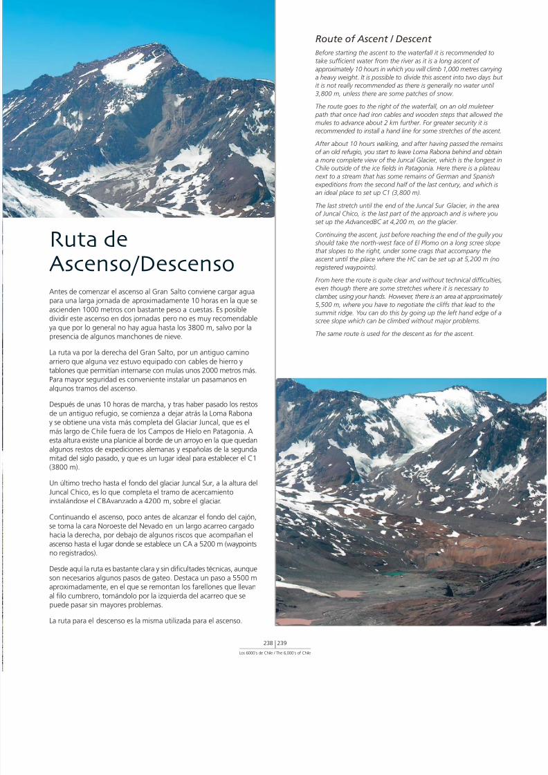
7/22/2019 Los 6.000 de Chile - Banco de Chile
http://slidepdf.com/reader/full/los-6000-de-chile-banco-de-chile 241/288Los 6000’s de Chile / The 6,000’s of Chile
238 239
Ruta de
Ascenso/DescensoAntes de comenzar el ascenso al Gran Salto conviene cargar aguapara una larga jornada de aproximadamente 10 horas en la que se
ascienden 1000 metros con bastante peso a cuestas. Es posibledividir este ascenso en dos jornadas pero no es muy recomendable
ya que por lo general no hay agua hasta los 3800 m, salvo por lapresencia de algunos manchones de nieve.
La ruta va por la derecha del Gran Salto, por un antiguo camino
arriero que alguna vez estuvo equipado con cables de hierro ytablones que permitían internarse con mulas unos 2000 metros más.
Para mayor seguridad es conveniente instalar un pasamanos enalgunos tramos del ascenso.
Después de unas 10 horas de marcha, y tras haber pasado los restosde un antiguo refugio, se comienza a dejar atrás la Loma Rabonay se obtiene una vista más completa del Glaciar Juncal, que es el
más largo de Chile fuera de los Campos de Hielo en Patagonia. Aesta altura existe una planicie al borde de un arroyo en la que quedan
algunos restos de expediciones alemanas y españolas de la segundamitad del siglo pasado, y que es un lugar ideal para establecer el C1(3800 m).
Un último trecho hasta el fondo del glaciar Juncal Sur, a la altura del
Juncal Chico, es lo que completa el tramo de acercamientoinstalándose el CBAvanzado a 4200 m, sobre el glaciar.
Continuando el ascenso, poco antes de alcanzar el fondo del cajón,
se toma la cara Noroeste del Nevado en un largo acarreo cargadohacia la derecha, por debajo de algunos riscos que acompañan el
ascenso hasta el lugar donde se establece un CA a 5200 m (waypointsno registrados).
Desde aquí la ruta es bastante clara y sin dificultades técnicas, aunque
son necesarios algunos pasos de gateo. Destaca un paso a 5500 maproximadamente, en el que se remontan los farellones que llevan
al filo cumbrero, tomándolo por la izquierda del acarreo que sepuede pasar sin mayores problemas.
La ruta para el descenso es la misma utilizada para el ascenso.
Route of Ascent / Descent
Before starting the ascent to the waterfall it is recommended
take sufficient water from the river as it is a long ascent of
approximately 10 hours in which you will climb 1,000 metres ca
a heavy weight. It is possible to divide this ascent into two dayit is not really recommended as there is generally no water un
3,800 m, unless there are some patches of snow.
The route goes to the right of the waterfall, on an old mulete
path that once had iron cables and wooden steps that allowemules to advance about 2 km further. For greater security it is
recommended to install a hand line for some stretches of the as
After about 10 hours walking, and after having passed the re
of an old refugio, you start to leave Loma Rabona behind and o
a more complete view of the Juncal Glacier, which is the longChile outside of the ice fields in Patagonia. Here there is a pla
next to a stream that has some remains of German and Span
expeditions from the second half of the last century, and whican ideal place to set up C1 (3,800 m).
The last stretch until the end of the Juncal Sur Glacier, in the of Juncal Chico, is the last part of the approach and is where
set up the AdvancedBC at 4,200 m, on the glacier.
Continuing the ascent, just before reaching the end of the gull
should take the north-west face of El Plomo on a long scree sthat slopes to the right, under some crags that accompany th
ascent until the place where the HC can be set up at 5,200 m
registered waypoints).From here the route is quite clear and without technical diffic
even though there are some stretches where it is necessary toclamber, using your hands. However, there is an area at approxim
5,500 m, where you have to negotiate the cliffs that lead to t
summit ridge. You can do this by going up the left hand edge scree slope which can be climbed without major problems.
The same route is used for the descent as for the ascent.

7/22/2019 Los 6.000 de Chile - Banco de Chile
http://slidepdf.com/reader/full/los-6000-de-chile-banco-de-chile 242/288
Su forma piramidal y coloración oscura hacen de este Nevadouna cumbre fácilmente distinguible y muy atractiva a la vista
Its pyramid shape and dark colour make this mountain easily distinguishable and very attractive.

7/22/2019 Los 6.000 de Chile - Banco de Chile
http://slidepdf.com/reader/full/los-6000-de-chile-banco-de-chile 243/288
Registered Waypoints (WGS 84)Base Camp (Waterfall) 33º 15’ 52.
70º 08’ 18.altitude 2,7
Camp 1 (Spanish) 33º 09’ 33.70º 06’ 33.altitude 3,7
Advanced Base Camp 33º 05’ 49.70º 06’ 21.altitude 4,2
Summit and Location of Box 33º 06’ 12.70º 03’ 58.altitude 6,0
(WGS 84)
Campamento Base (Gran Salto) 33º 15’ 52,5’’ S
70º 08’ 18,6’’ Waltitud 2796 m
Campamento 1 (Españoles) 33º 09’ 33,1’’ S70º 06’ 33,8’’ W
altitud 3760 m
Campamento Base Avanzado 33º 05’ 49,6’’ S
70º 06’ 21,6’’ Waltitud 4232 m
Cumbre y Localización de Caja 33º 06’ 12,1’’ S
70º 03’ 58,5’’ Waltitud 6085 m
Waypoints Registrados
Los 6000’s de Chile / The 6,000’s of Chile
240 241
Datos yRecomendaciones
Para ascender el Nevado El Plomo no se requiere de permisos
especiales, pero sí para ingresar a las instalaciones de la central
hidroeléctrica Alfalfal y para acceder a la Ruta Patrimonial RíoOlivares. Para esto, gestionar primero un permiso con el Ministerio
de Bienes Nacionales (www.bienes.cl), y enviar una copia al señor
Max Mardones de la empresa AES Gener (fono 2-6868140,
fax 2-6808131). Se recomienda hacer este trámite con algún
tiempo de anticipación.
De igual forma, es necesario dar aviso a Carabineros en San José
de Maipo. Indicar en un escrito nómina completa de participantes,
nacionalidad, número de pasaporte o cédula de identidad;
incluyendo un detalle de la actividad y especificando itinerarios,
fechas, ruta y un mapa de la zona.
Contar con vehículo 4x4 es lo óptimo. Ver anexo para
recomendaciones.
Se recomienda contar con equipo y vestuario de alta montaña.
Como parte del equipo técnico se recomienda llevar cuerdas,
arnés, ferretería, piolet y crampones.
Es recomendable contratar mulas para el transporte del equipo,
tanto a la ida como a la vuelta. Don Jacinto Ortega es el arriero
más experimentado de la zona. Vive en el poblado de Maitenes
(antes del Alfalfal) y es necesario hacer previamente el trato con él.
Tips and Recommendations
• No special permits are required to climb Nevado El Plomo b
permits are needed to go through the installations of the A
hydro-electric plant and to access the main route of the Ol
River. For this, you will need to first ask permission from thMinisterio de Bienes Nacionales (www.bienes.cl) sending a
of the permit to Max Mardones of the company AES Gene
telephone (56 2) 686 8140), fax (56 2) 680 8131. It is recommeto do this well in advance.
• You should also inform the police in San José de Maipo of
expedition, giving them a letter showing participants, nationa
passport or ID numbers, details of activities and specific itine
dates, route and a map of the area.
• The best transport option is to take a 4x4 vehicle. See appfor recommendations.
• It is recommended to take equipment and clothing suitabl
high altitude mountaineering. As part of the equipment it
recommended to take ropes, harness, ice axe and crampon
• It is recommended to take mules to transport the equipme
during the approach and the return journey. Jacinto Ortega most experienced muleteer in the area. He lives in the tow
Maitenes (before Alfalfal) and it is necessary to organise th
with him before your expedition takes place.

7/22/2019 Los 6.000 de Chile - Banco de Chile
http://slidepdf.com/reader/full/los-6000-de-chile-banco-de-chile 244/288
6 5 6 5 m
s n m
Cara Norte / North FaVolcán
Tupungato

7/22/2019 Los 6.000 de Chile - Banco de Chile
http://slidepdf.com/reader/full/los-6000-de-chile-banco-de-chile 245/288
El Tupungato se alza como la montaña más alta de Los Andes Centrales, superando en mucho a sus más cercanosvecinos. Se emplaza a 64 kilómetros al Este de Santiago, en el límite con Argentina, pero no es visible desde la ciudad.
Es ampliamente deseada por muchos montañistas, y está catalogada como una montaña clásica de Los Andes chilenos,pese a ser paradójicamente más visitada por extranjeros que por montañistas nacionales.
Este gigante es un estrato volcán extinto cuyo cráter de tres kilómetros de diámetro es fácilmente visible desde muylejos. Su cúspide, así como su ladera que cae hacia Argentina, luce extensos glaciares que la cubren parcialmente.
Si bien no encierra misterios incas, el Tupungato tiene otras historias que contar. Conocida es la de un avión de pasajerosde una empresa británica que cayó en sus faldas en 1947. Sólo 44 años después, en 1991, un par de montañistasencontró casualmente un motor, lo que provocó que se organizara una expedición de búsqueda que finalmente diocon el resto de la aeronave y sus ocupantes.
INTRODUCCIÓNINTRODUCCIÓN
Los 6000’s de Chile / The 6,000’s of Chile
242 243
Tupungato is the highest mountain in the Central Andes, much higher than its closest neighbours. It is situated 64 km to the east ofSantiago, on the border with Argentina, although it is not visible from the city.
It is popular among mountaineers and it has become known as a classic mountain of the Chilean Andes, despite paradoxically being
visited by more foreigners than Chilean climbers.It is an extinct strata volcano whose crater, three km in diameter, is easily visible from far away. It has extensive glaciers that partiallycover the top of the mountain and the slope on its Argentine side.
Although Tupungato holds no Incan mysteries, it has other tales to tell. A well-known story is that a British company’s passenger planecrashed in its foothills in 1947. It was only after 44 years, in 1991, that two mountaineers accidentally found its engine. This provokedan expedition to finally find the rest of the plane and its occupants.

7/22/2019 Los 6.000 de Chile - Banco de Chile
http://slidepdf.com/reader/full/los-6000-de-chile-banco-de-chile 246/288
AccesoDesde la ciudad de Santiago, dirigirse hacia el Cajón del Maipola Ruta G-25 hasta cruzar el puente del Río Colorado, donde hque tomar el desvío que lleva hasta la central hidroeléctrica Al
de la empresa AES Gener. El camino al Tupungato continúa a tde las dependencias de la Central, para lo cual hay que contarun permiso tramitado con anterioridad, lo que se explica en larecomendaciones. Pasada la barrera de la central, seguir el camprincipal aproximadamente por 25 kilómetros, donde se encueuna bifurcación que por la izquierda lleva a la mina La Perla. Contpor la opción de la derecha y tras un pequeño tramo se encueun desvío a la derecha señalizado como Estero Chacayes, el qunecesario tomar. El camino pasa por un caserío y luego tuerce seguir internándose en el valle. Justo antes de que el camino coma descender hacia una bocatoma es posible ver un sendero marque nace del costado derecho del camino, punto donde se pudejar el vehículo.
El acercamiento continúa a través de este sendero que va por la
Sur del Río Colorado. Tras dos horas de caminata se abre a maderecha el Valle del Museo y luego de un pequeño descenso se a la zona de Baños Azules, donde existen pozones en los que aagua mineralizada muy cerca del Río Museo. Aquí es posible estabun CAp1 (2450 m).
I N F O R M E6565 m
a l t i t u d
V o l c á nTupungato
Posición Geográfica según Carta: 33º 21’ 12,8’’ S69º 46’ 15,7’’ W
Carta IGM: E61
Primera Ascensión Deportiva: M. Zurbriggen y S. Vines, 1897
Época más Adecuada para Ascender: Entre septiembre y marzo

7/22/2019 Los 6.000 de Chile - Banco de Chile
http://slidepdf.com/reader/full/los-6000-de-chile-banco-de-chile 247/288
Geographic Position 33º 21’ 12. According to Map: 69º 46’ 15.
IGM Map: E61
First Recreational Ascent: M. Zurbriggen and S. Vines,
Best Time of Year for Ascent: From September to M R E P O R T
Los 6000’s de Chile / The 6,000’s of Chile
244 245
Desde el CAp1 iniciar la marcha temprano y cruzar el río utilizandolas grandes rocas que hay como puentes naturales. La ruta continúapor la ladera izquierda del Río Museo, elevándose hacia el filo de unpequeño cerro conocido como Pan de Azúcar y descendiendoposteriormente hacia la orilla del Río Azufre. También es necesariocruzar este río, lo cual se puede hacer por un puente que si bienestá bastante deteriorado se sigue utilizando. De todas maneras se
recomienda verificar cuidadosamente el estado en que se encuentraantes de cruzarlo.
Una vez en la otra orilla, la ruta llevará a ascender varios metros ya cruzar un murallón de roca volcánica negra que conduce a unvasto cajón. Desde aquí se puede contemplar un espectaculardespliegue de cumbres, entre las que están el Chimbote, el Pollera,el Tupungatito, el Sierra Bella y la cara Oeste del Volcán Tupungato.
Siguiendo el sendero se llega a los Baños del Tupungato, un pozónnatural de agua termal de dudoso aspecto, en donde se dobla haciala derecha y se continúa ascendiendo en algunos tramos, hasta llegara un sector conocido como “Mal Paso” debido a los numerososriachuelos que hay que cruzar. El CAp2 (3230 m) se establece en laVega de los Flojos, a los pies de la morrena del Sierra Bella, para locual es necesario subir previamente por acarreos muy resbalosos. Sibien es un sector bastante húmedo, las únicas fuentes confiablesde agua son los riachuelos y manantiales que se encuentran en laparte más alta de la vega.
Desde el CAp2 el sendero se pierde en un valle de piedras y seretoma por la ladera Sur al comienzo de la morrena del glaciar delSierra Bella. A esta altura el río es un simple arroyo que se debecruzar de vez en cuando. Luego de unas horas de marcha el senderoabandona el valle y torna hacia el Sur para remontar por los faldeosdel Volcán Tupungato siguiendo un estero sin nombre. La ruta llevaal Campamento Los Españoles (4420 m) donde se puede establecerun CAp3, pero si se está con tiempo se recomienda continuar hastala zona conocida como El Hito, donde puede establecerse elCBAvanzado (4790 m). En este lugar hay agua abundante y se tienela vista de la ruta de ascenso, lo que resulta muy motivador.
Generalmente los arrieros pueden avanzar sólo hasta aquí.
Access
From the city of Santiago head towards the Cajón del Maipo Ruta G-25 until crossing the bridge over the Colorado River, wyou have to take the turning that leads to the Alfalfal hydro-eplant, owned by the AES Gener company. The road to the moucontinues through the grounds of the hydro-electric plant. Yotherefore require a permit that must be organised in advanceexplained in the recommendations. After passing the plant’s entbarrier, follow the road for 25 km until you come to a fork wleft hand option leads to the La Perla mine. You should take tright hand option and after a short drive you come to a turnisigned for Estero Chacayes which you need to take. The road pthrough a settlement and then turns and heads into the valleybefore the road descends to a water inlet it is possible to see amarked path that begins on the right side of the road. Here yo
leave your vehicle.
The approach continues on this path that follows the south bof the Colorado River. After two hours of walking, the Museo opens up on your right and, after a small descent, you arrive aarea of Baños Azules, where there are pools, very close to the MRiver, caused by springs of mineralized water. Here it is possibset up ApC 1 (2,450 m).
Start early from ApC1, crossing the river using the large rocksnatural bridge. The route continues on the left bank of the MRiver, rising until the ridge of a small hill known as Pan de AzúAfter the ridge the route descends to the edge of the Azufre It is also necessary to cross this river, for which you can use a bwhich, while being in quite a bad state, has served for otherexpeditions. However, it is still recommended to check its statcarefully before using it.
After crossing the river, the route will ascend several metres aclimb a wall of black volcanic rock that leads to a vast gully. Fhere you can see a spectacular display of summits. Among thare Chimbote, Pollera, Tupungatito, Sierra Bella and the westof the Tupungato Volcano.
Following the path, you arrive at the Baños del Tupungato, a npool of dubious-looking thermal water. Here you turn right acontinue, ascending in some stretches, until arriving at a sectknown as “Mal Paso” due to the numerous streams that youto cross. ApC2 (3,230 m) is set up in the place known as Veglos Flojos, at the foot of the Sierra Bella moraine. To get here necessary to climb up quite loose scree slopes. While it is a quwet area, the only reliable sources of water are the streams asprings found at the highest point of the marshland.
From ApC2, the path disappears amongst stones and you re-it on the south slope at the start of the moraine of the Sierra Glacier. At this point the river is just a stream and you shouldit every once in a while. After a few hours walking, the path lethe valley, turns south and follows a nameless stream througfoothills of the Tupungato Volcano. The route arrives at the LoEspañoles camp-site (4,420 m) where you can set up ApC3. Howif you have time, it is recommended to continue until the area kas EL Hito, where you can establish the AdvancedBC (4,790 mHere there is abundant water and you can see the ascent rouwhich acts as a great motivation. Generally the muleteers canadvance only until this point.

7/22/2019 Los 6.000 de Chile - Banco de Chile
http://slidepdf.com/reader/full/los-6000-de-chile-banco-de-chile 248/288
Un clásico de clásicos el Tupungato recibe numerososmontañistas cada año
A classic among classics, Tupungato receivesnumerous mountaineers every year.

7/22/2019 Los 6.000 de Chile - Banco de Chile
http://slidepdf.com/reader/full/los-6000-de-chile-banco-de-chile 249/288Los 6000’s de Chile / The 6,000’s of Chile
246 247
Ruta deAscenso/DescensoDesde el CB Avanzado comienza el ascenso por el lado izquierdo deun campo de penitentes. Al llegar a un plano es necesario dirigirsehacia la izquierda para tomar un filo que lleva a unas terrazas conpiedras de curiosas formas, sector conocido como Piedra del Guanaco(5530 m) y en donde puede establecerse el C1.
De contar con tiempo y energías suficientes tras la dura jornada, serecomienda continuar por el filo hasta un sector de amplias terrazasconocido como Argentinos (5760 m) donde se sugiere establecer elCA. En este lugar ya se puede obtener una muy buena vista de loque será la ruta final de ascenso.
Desde el CA, comenzar a subir por el filo que está a la derecha delnevero hasta casi remontarlo, para luego caminar hasta los pies dela canaleta que se encuentra al costado izquierdo de un morro oroca cuadrada muy grande. Esta canaleta tiene una pendientepromedio de 40º, está formada por acarreo fino y resbaladizo, y esla vía por donde se continúa el ascenso. Al salir de ésta ya se puedendivisar las falsas cumbres, tanto a la izquierda como a la derecha.Continuar camino hacia el Sureste siguiendo la mayor altura, hastaalcanzar una planicie desde donde se observa la cumbre Norte conforma de loma, en dirección Sur. La cumbre Sur (principal) se alcanzabajando y subiendo la siguiente loma.
El descenso se realiza por la misma ruta y no presenta mayoresdificultades, excepto en el sector de piedras que se encuentra entreel nevero y la canaleta.
Route of Ascent/Descent
From Advanced BC, the ascent starts on the left side of a fieldpenitentes. On arriving at a plateau, it is necessary to turn leftake a ridge. This leads to an area known as Piedra del Guana(5,530 m) that has some terraces with rocks of curious shapes.you can set up C1.
If you still have time and energy after the long day’s journey, recommended to continue on the ridge until an area of wide teknown as Argentinos (5,760 m) where you can set up the HCyou have a good view of what will be the final route of the as
From the HC, start to climb on the ridge to the right of the snfield until you almost start walking on the snow field. From hgo to the couloir that is on the left side of a very tall square roContinue the ascent on the thin, loose scree slope inside this coIts gradient is an average of about 40º. Once you leave the coyou can see false summits on both the left and right hand sidContinue the route towards the south-east, staying as high apossible, until you reach a plateau from where you can see throunded north summit. The south summit (the main summit) be reached by going down and up the next hillock.
The descent can be carried out using the same route and hasmajor difficulties except for the area of rocks that is between snow field and the couloir.

7/22/2019 Los 6.000 de Chile - Banco de Chile
http://slidepdf.com/reader/full/los-6000-de-chile-banco-de-chile 250/288
Los penitentes son sin duda hermosos de mirar pero a vecespueden ser un desafío
Without any doubt penitents are beautiful to see, but sometimes can be quite a challenge.

7/22/2019 Los 6.000 de Chile - Banco de Chile
http://slidepdf.com/reader/full/los-6000-de-chile-banco-de-chile 251/288
Registered Waypoints (WGS 84)
Approach Camp 1 Baños Azules 33º 24’ 3269º 58’ 18altitude 2,4
Approach Camp 2 Vega de los Flojos 33º 20’ 1469º 51’ 55altitude 3,2
Advanced Base Camp 1 El Hito 33º 18’ 4369º 47’ 28altitude 4,7
Camp 1 Piedra del Guanaco 33º 19’ 49
69º 46’ 38altitude 5,5
High Camp Argentinos 33º 20’ 1969º 46’ 30altitude 5,7
Summit and Location of Box 33º 21’ 3069º 46’ 13altitude 6,5
Waypoints Registrados
Los 6000’s de Chile / The 6,000’s of Chile
248 249
Datos yRecomendaciones
Para ascender el Volcán Tupungato no se requiere de permisosespeciales, pero sí para ingresar a las instalaciones de la centralhidroeléctrica Alfalfal y para transitar por el predio Río Coloradoque pertenece al Ejército. Para esto, gestionar primero un permisocon la Jefatura de Propiedades del Comando de Infraestructuradel Ejército, Departamento de Predios (Santo Domingo 3317,Santiago, fono 2-3777214, fax 2-3777133). Enviar una copia al
señor Max Mardones de la empresa AES Gener (fono 2-6868140,fax 2-6808131). Se recomienda hacer estas gestiones con algúntiempo de anticipación.
De igual forma, es necesario dar aviso a Carabineros en San Joséde Maipo. Indicar en un escrito nómina completa de participantes,nacionalidad, número de pasaporte o cédula de identidad;incluyendo un detalle de la actividad y especificando itinerarios,fechas, ruta y un mapa de la zona. Por ser montaña fronteriza, enel caso de extranjeros se requiere permiso especial otorgado porDIFROL (www.difrol.cl).
Contar con vehículo 4x4 es lo óptimo. Ver anexo para recomenda-ciones.
De contar con mulas, para el CAp1 se recomienda el sitio que se
halla unos 100 metros después de Baños Azules, ya que en estelugar hay más comida para los animales.
Es necesario contar con equipo y vestuario de alta montaña. Comoparte del equipo técnico se recomienda llevar piolet y crampones.
Se recomienda contratar mulas para el transporte del equipo, tantoa la ida como a la vuelta. Don Jacinto Ortega es el arriero másexperimentado de la zona. Vive en el poblado de Maitenes (antesde Alfalfal) y es necesario hacer previamente el trato con él.
Tips and Recommendations
• No special permits are required to climb the Tupungato Vobut you do need a permit to enter the El Alfalal hydro-elecplant and to cross private land owned by the Army (called
Colorado). For this you must first ask the permission of the Jede Propiedades del Comando de Infraestructura del EjércitDepartamento de Predios (Santo Domingo 3317, Santiago, p2-3777214, fax 2-3777133). Send a copy to Max Mardonethe company AES Gener (phone 2-6868140, fax 2-680813is recommended to do this some time in advance.
• You should also inform the police in San José de Maipo of expedition, giving them a letter showing participants, nationapassport or ID numbers, details of activities and specific itinerdates, route and a map of the area. As the mountain is on border, foreigners require permission from DIFROL (www.difr
• The best transport option is to take a 4x4 vehicle. See appfor recommendations.
• If you have mules it is recommended to set up CAp1 at thefound about 100 metres after Baños Azules, where there is food for the animals.
• It is recommended to take equipment and clothing suitablhigh altitude mountaineering. As part of the equipment it recommended to take an ice axe and crampons.
• It is recommended to take mules to transport the equipmeduring the approach and the return journey. Jacinto Ortegthe most experienced muleteer in the area. He lives in the tof Maitenes (before Alfalfal) and it is necessary to organise twith him before your expedition takes place.
(WGS 84)
Campamento Aproximación 1 Baños Azules 33º 24’ 32,9’’ S69º 58’ 18,5’’ Waltitud 2450 m
Campamento Aproximación 2 33º 20’ 14,5’’ SVega de los Flojos 69º 51’ 55,4’’ W
altitud 3277 mCampamento Base Avanzado El Hito 33º 18’ 43,9’’ S
69º 47’ 28,2’’ Waltitud 4790 m
Campamento 1 Piedra del Guanaco 33º 19’ 49,7’’ S69º 46’ 38,0’’ Waltitud 5527 m
Campamento Alto Argentinos 33º 20’ 19,0’’ S69º 46’ 30,4’’ Waltitud 5761 m
Cumbre y Localización de Caja 33º 21’ 30,7’’ S69º 46’ 13,9’’ Waltitud 6564 m

7/22/2019 Los 6.000 de Chile - Banco de Chile
http://slidepdf.com/reader/full/los-6000-de-chile-banco-de-chile 252/288
6 1 4 8 m
s n m
Cerro
Alto San JuanCara Oeste / Wes

7/22/2019 Los 6.000 de Chile - Banco de Chile
http://slidepdf.com/reader/full/los-6000-de-chile-banco-de-chile 253/288
Ubicado a la misma latitud que la ciudad de Santiago, pero no visible desde ella, esta montaña limítrofe con Argentinaes una más en la lista de seismiles poco divulgados.
El “Alto”, como se le identifica en la cartografía oficial, presenta una forma poco definida, y su cumbre se distinguepor el pequeño cono al Este del farellón principal que limita con Argentina. Quien se alce a buena altura en Los Andes
Centrales, lo podrá identificar entre el inmenso sistema glaciar del Volcán Tupungatito por el Norte, y el Nevado Piuquenespor el Sur, formando parte de la cuenca del Río Tupungato.
INTRODUCCIÓNINTRODUCCIÓN
Los 6000’s de Chile / The 6,000’s of Chile
250 251
Located at the same latitude as the city of Santiago, although not visible from there, Alto San Juan is on the border with Argentina
and is another of the little known Six Thousand Metre Peaks.
“Alto”, as it is identified in the official cartography, does not have a clear shape and its summit is distinguished by the little cone to
the east of the main cliff which is on the border with Argentina. However, those who climb other high mountains in the Central Andes
will be able to identify it in between the immense glacier system of the Tupungatito Volcano to the north and the Nevado Piuquenes
to the south, forming part of the valley of the Tupungato River.

7/22/2019 Los 6.000 de Chile - Banco de Chile
http://slidepdf.com/reader/full/los-6000-de-chile-banco-de-chile 254/288
AccesoDesde la ciudad de Santiago, dirigirse hacia el Cajón del Maipola Ruta G-25 hasta cruzar el puente del Río Colorado, donde hque tomar el desvío que lleva hasta la central hidroeléctrica Al
de la empresa AES Gener. El camino al Alto continúa a través ddependencias de la central hidroeléctrica, para lo cual hay que cocon un permiso tramitado con anterioridad, lo que se explica erecomendaciones. Pasada la barrera de la central, seguir el camprincipal aproximadamente por 25 kilómetros, donde se encueuna bifurcación que por la izquierda lleva a la mina La Perla. Contpor la opción de la derecha y tras un pequeño tramo se encueun desvío a la derecha señalizado como Estero Chacayes, el qunecesario tomar. El camino pasa por un caserío y luego tuerce seguir internándose en el valle. Justo antes de que el camino coma descender hacia una bocatoma, es posible ver un sendero marque nace del costado derecho del camino, punto donde se pudejar el vehículo.
El acercamiento continúa a través de este sendero que va por la
Sur del Río Colorado. Tras dos horas de caminata se abre a maderecha el Valle del Museo y luego de un pequeño descenso se a la zona de los Baños Azules, donde existen pozones en los qaflora agua mineralizada muy cerca del Río Museo. Cruzar el rutilizando las grandes rocas que hay como puentes naturales, continuar bordeando la ladera sur de un pequeño cerro conoccomo Pan de Azúcar durante aproximadamente 15 minutos, pluego seguir en dirección Sureste a través de la “Isla” del Pan Azúcar, porción estrecha de tierra que debe su nombre al hechestar flanqueada por los ríos Museo (borde Suroeste) y Azufre (bNoreste) en casi todo su entorno. En la isla se encuentran tres lagen las cuales es posible proveerse de agua y cerca de su extremya se puede observar el Cerro Alto, su cumbre, y parte de la ruascenso.
I N F O R M E6148 m
a l t i t u d
C e r r oAlto San Juan
Posición Geográfica según Carta: 33º 28’ 07,3’’ S
69º 48’ 54,9’’ W
Carta IGM: E61
Primera Ascensión Deportiva: 1944
Época más Adecuada para Ascender: Entre septiembre y marzo

7/22/2019 Los 6.000 de Chile - Banco de Chile
http://slidepdf.com/reader/full/los-6000-de-chile-banco-de-chile 255/288
Geographic Position 33º 28’ 07. According to Map: 69º 48’ 54.
IGM Map: E61
First Recreational Ascent: 1944
Best Time of Year for Ascent: Entre septiembre y m R E P O R T
Los 6000’s de Chile / The 6,000’s of Chile
252 253
Access
From the city of Santiago head towards the Cajón del Maipo Ruta G-25 until crossing the bridge over the Colorado River, wyou have to take the turning that leads to the El Alfalfal hydroelectric plant, owned by the AES Gener company. The road tomountain continues through the grounds of the hydro-electricand you therefore require a permit that must be organised in advas explained in the recommendations. After passing the plantentrance barrier, follow the road for 25 km until you come to awhose left hand option leads to the La Perla mine. You shouldthe right hand option and after a short drive you come to a tusigned for Estero Chacayes which you need to take. The road pthrough a settlement and then turns and heads into the valleybefore the road descends to a water inlet it is possible to see amarked path that begins on the right side of the road. Here yoleave your vehicle.
The approach continues on this path that follows the south bof the Colorado River. After two hours of walking, the Museo opens up on your right and after a small descent you arrive a
area of Baños Azules, where there are pools, very close to the MRiver, caused by springs of mineralised water. Continue, skirtinsouthern slope of a small hill known as Pan de Azúcar for approxim15 minutes, then continue south-east through the “island” ode Azúcar, a thin stretch of land that owes its name to the facit is flanked by the Museo (to the south-west) and Azufre (to north-east) rivers along nearly its entire length. On the island are three lagoons which can provide water. Close to its extremsouth you can already see the Alto Mountain, its summit andof its access route.
At the end of the island you arrive at the extensive Vegas del Azpopulated in summer by numerous cattle. At this point the vadivides in two. The valley of the Museo River continues to the and leads to mountains such as Alto del Yeso, Trono, PirámidNevado de Piuquenes, amongst others. To the south-east openvalley of the Azufre River with the mountains Cerro Alto and NeSin Nombre.
Cerro Alto doesn’t have a well-defined shape and it is therefodifficult to identify its summit. It is distinguished by a small cothe east of the main cliff that borders Argentina.
The approach continues through the Azufre River valley alwafollowing its southern bank. There are several marshes with wsprings (some with a sulphur flavour) where it is possible to seApC1. From this point continue through the valley for approximtwo hours until descending to the bank of the river to cross itcontinue, following a small stream that leads directly to the bathe El Barco Mountain (4,547 m). This mountain is characterishaving a series of columns of sandy rock of about 100 metresheight on its upper section and a large scree slope at its base
Alto is behind El Barco and from this point there are three alternto arrive at its base. The first is to skirt El Barco to the north, croa large glacier that descends from the Nevado Sin Nombre andat the end of summer can have quite a lot of crystal ice. This is recommended only when there is a lot of snow. The secondskirt El Barco to the south following a small clear water stream
passing through an area of large blocks of rock and ascendinan easterly direction until the base of Alto. The third is to climBarco directly, ascending its western slope on a large scree slowith some stretches of rock formed by conglomerations of fountil a pass (the Cerro Alto view point) at 4,200 metres to theof its rocky walls. From this pass it is necessary to descend abometres until the valley that leads to the Cerro Alto Glacier.
About four hours walk from crossing the Azufre River it is poto set up BC behind El Barco, very close to the pass between mountain and Alto (4,380 m).
Al final de la isla se llega a las extensas Vegas del Azufre, pobladaspor ganado en el verano. En este punto el valle se divide: hacia elSur continúa el Cajón del Río Museo que lleva hacia cerros como elAlto del Yeso, Trono, Pirámide y Nevado de Piuquenes entre otros;y hacia el Sureste se abre el Cajón del Río Azufre con el Cerro Altoy el Nevado Sin Nombre como paisaje de fondo.
El Cerro Alto no presenta una silueta muy definida por lo que esfácil confundir su cumbre. Ésta se distingue como un pequeño conoal Este del farellón principal que limita con Argentina.
La aproximación continúa por el Cajón del Río Azufre, siguiendosiempre su ribera Sur. Existen varias vegas provistas de agua (algunascon sabor a azufre) donde es posible emplazar un CAp1 (3220 m).Desde este punto, continuar por el cajón durante aproximadamentedos horas hasta descender a la ribera misma del río para cruzarlo ycontinuar por un pequeño estero que lleva directo a la base delCerro El Barco (4547 m). Este cerro se caracteriza por presentar ensu parte superior una serie de columnas de roca (arenisca) de unos100 metros de alto y un gran acarreo en su base.
El Alto se encuentra detrás de El Barco, y para llegar a su base existentres posibilidades desde este punto. La primera es rodear El Barco
por el Norte, siendo necesario transitar por un extenso glaciar quebaja desde el Nevado Sin Nombre y que a fines del verano puedeencontrarse con bastante hielo cristal. Esta opción es recomendadasólo cuando hay mucha nieve. La segunda es rodear El Barco por elSur siguiendo un pequeño estero de aguas cristalinas, pasando porun sector de grandes bloques de roca, y ascendiendo en direcciónEste hasta la base del Alto. Y finalmente la tercera es enfrentardirectamente el Cerro El Barco ascendiendo de frente (ladera Oeste)por un gran acarreo con algunos tramos de roca formada porconglomerados de fósiles, hasta un portezuelo (mirador del Alto) a4200 m a la izquierda de sus paredes rocosas. Desde este portezueloes necesario descender unos 60 metros hasta el valle que entra haciael Glaciar del Cerro Alto.
Luego de unas cuatro horas de marcha desde el cruce del Río Azufre
es posible establecer el CB detrás de El Barco, muy cerca del portezueloque forma éste con el Alto (4380 m).

7/22/2019 Los 6.000 de Chile - Banco de Chile
http://slidepdf.com/reader/full/los-6000-de-chile-banco-de-chile 256/288
Ruta deAscenso/DescensoPara acceder a la cumbre del Alto es necesario rodear por completoel cerro. De esta manera, el ascenso se desarrolla sobre las laderasOeste, Norte y Este en este orden, pasando por la enorme calderavolcánica que existe entre el Cerro Alto y el Nevado Sin Nombre (alNorte).
La cara Oeste del cerro está caracterizada por un extenso farellónque la recorre en su extremo superior y que al Norte cae verticalmenteformando una gran pared, probablemente la estructura máscaracterística del cerro. Bajo este farellón que corta todas las víasde acceso desde el Oeste se desarrollan tres lenguas de glaciar,siendo la más corta y menos agrietada la de más a la izquierda(Norte).
Desde el CB el ascenso comienza de manera directa por esta lenguade glaciar. Las características de la ruta pueden variar un poco según
la época del año. La pendiente del glaciar varía entre 25 y 45º. Porel borde izquierdo se encuentran grietas de considerable tamañopor lo que se recomienda recorrerlo por el centro o por su costadoSur, hasta la base de la franja rocosa superior. Desde aquí realizar
una pequeña travesía hacia el Norte hasta alcanzar el portezue(5200 m) que accede al circo entre el Cerro Alto y el Nevado SNombre. Desde aquí se puede observar la pared rocosa del NeSin Nombre y los glaciares que bajan desde sus laderas así comfilo de agujas fronterizas que lo conectan con el Alto. En este
portezuelo es posible montar un CA relativamente protegido qpermite alivianar la jornada de cumbre. A fines del verano exispequeños esteros donde es factible proveerse de agua, se cueademás con el glaciar y los neveros en caso de tener que fundir npara obtenerla.

7/22/2019 Los 6.000 de Chile - Banco de Chile
http://slidepdf.com/reader/full/los-6000-de-chile-banco-de-chile 257/288
R E P O R T Route of Ascent/Descent
To reach the summit of Alto it is necessary to skirt the mountcompletely. This way, the ascent will be carried out through its north and east slopes, in that order, passing on enormous vocaldera that is between Alto and Nevado Sin Nombre (to the n
There is an extensive cliff that runs right across the upper parthe west face. On the northern edge, the cliff is very sheer, foa great wall that is probably the most recognizable feature onmountain. Below this cliff, which stops all the access routes fthe west, there are three glacier tongues, the left hand one (nbeing the shortest and with least crevasses.
From the BC the ascent starts directly on this glacier tongue. characteristics of the route can vary depending on the time ofand the gradient of the glacier ranges between 25º and 45º. the left edge there are crevasses of considerable size becausewhich it is recommended to advance through its centre and isouthern edge, until the base of a band of rocks. From here ma small traverse to the north until reaching the pass (5,200 mgives access to the cirque between Alto and Sin Nombre.
Here it is possible to see the rocky wall of Nevado Sin Nombrethe glaciers that descend from its slopes, as well as the borderidge of pinnacles that connect it to Alto. At this pass it is posto set up a relatively protected HC that makes the day of the suascent easier. At the end of summer there are small streams tcan provide water and there is also the glacier and the snow if you have to melt snow for water.
The route continues on the southern edge of this cirque, ascethrough the scree slopes towards the east until arriving at anopass on the border ridge (5,700 m). From here you have a priviview of the great glacier that runs from Alto into Argentina.
Once on the ridge you should follow the eastern slope of themountain in a southerly direction, ascending on quite steep sfields (35º to 45º) through a connected series of slopes and coconnected and some easy stretches of bare rock, depending otime of year. You then reach the Alto’s uppermost glacier whegradient eases considerably. After arriving at the base of the fcone, you make for the north-west ridge (normally without snuntil arriving at the summit.
The descent follows the same route but it is recommended towands or a GPS to mark key points.
La ruta continúa por el borde Sur de este circo, ascendiendo por losacarreos en dirección Este hasta llegar a un nuevo portezuelo en elfilo fronterizo (5700 m). Desde aquí se tiene un vista privilegiada delgran glaciar que cae desde el Alto hacia Argentina.
Una vez en el filo se debe seguir por la ladera Este del cerro conrumbo Sur, ascendiendo por neveros de bastante pendiente (35 a
45º) a través de una serie de laderas y canaletas conectadas ysorteando algunos tramos fáciles de roca descubierta según la épocadel año. Luego se accede al glaciar superior del Cerro Alto dondela pendiente disminuye considerablemente. Tras llegar a la base delcono final, se asciende por su filo Noroeste (normalmente sin nieve)hasta alcanzar la cumbre.
El descenso se hace por la misma ruta, para lo que se recomienda jalonear o marcar con GPS algunos puntos clave.
254 255
Los 6000’s de Chile / The 6,000’s of Chile

7/22/2019 Los 6.000 de Chile - Banco de Chile
http://slidepdf.com/reader/full/los-6000-de-chile-banco-de-chile 258/288
Gigante desconocido la cumbre del Alto se distingue por lapequeña punta que se levanta a la derecha del paso
An unkown giant, Alto’s summit is distinguished by a small point that rises to the right of the pass.

7/22/2019 Los 6.000 de Chile - Banco de Chile
http://slidepdf.com/reader/full/los-6000-de-chile-banco-de-chile 259/288
Registered Waypoints (WGS 84)
Azufre River Crossing 33º 26’ 57.69º 53’ 37.altitude 3,3
Approach Camp 1 33º 26’ 43.69º 55’ 08.altitude 3,2
Base Camp 33º 27’ 09.69º 50’ 50.altitude 4,3
Pass to east face (access to border ridge) 33º 26’ 58.
69º 49’ 06.altitude 5,7
Summit and Location of Box No registered Wayp
Waypoints Registrados
Los 6000’s de Chile / The 6,000’s of Chile
256 257
Datos yRecomendaciones
Para ascender el Alto San Juan no se requiere de permisos especiales,pero sí para ingresar a las instalaciones de la central hidroeléctricaAlfalfal y para transitar por el predio Río Colorado que perteneceal Ejército. Para esto, gestionar primero un permiso con la Jefaturade Propiedades del Comando de Infraestructura del Ejército, Depar-tamento de Predios (Santo Domingo 3317, Santiago, fono 2-3777214, fax 2-3777133). Enviar una copia al señor Max Mardonesde la empresa AES Gener (fono 2-6868140, fax 2-6808131). Serecomienda hacerlo con algún tiempo de anticipación.
De igual forma, es necesario dar aviso a Carabineros en San José
de Maipo. Indicar en un escrito nómina completa de participantes,nacionalidad, número de pasaporte o cédula de identidad; incluyen-do un detalle de la actividad y especificando itinerarios, fechas,ruta y un mapa de la zona. Por ser montaña fronteriza, en el casode extranjeros se requiere permiso especial otorgado por DIFROL(www.difrol.cl).
Se debe estar preparado para cruzar ríos (particularmente el RíoAzufre), pues el cruce sobre rocas no siempre es posible.
Es necesario contar con equipo y vestuario de alta montaña. Comoparte del equipo técnico se recomienda llevar cuerda y equipobásico de rescate en grietas, pues las pendientes sobre glaciar sondemasiado fuertes para recorrerlas encordados.
En verano se pueden contratar mulas para la aproximación. Los
animales deberían llegar sin problemas hasta la base del Cerro ElBarco. Don Jacinto Ortega es el arriero más experimentado de lazona. Vive en el poblado de Maitenes (antes del Alfalfal) y esnecesario hacer el trato previamente con él.
Incluso en el verano tardío es posible encontrar agua (y/o nieve)durante toda la ruta de aproximación y ascenso, aunque algunosesteros traen un alto contenido de azufre que le da mal sabor alagua y eventualmente podría causar molestias estomacales.
Tips and Recommendations
• No special permits are required to climb Alto San Juan butdo need them to enter the El Alfalal Hydro-Electric Plant ancross private land owned by the army (called Rio Colorado)this, you must first ask the permission of the Jefatura de Propiedel Comando de Infraestructura del Ejército, DepartamentoPredios (Santo Domingo 3317, Santiago, phone 2-3777214fax 2-3777133). Send a copy to Max Mardones of the Com
AES Gener (phone 2-6868140, fax 2-6808131). It is recommeto do this some time in advance.
• You should also inform the police in San José de Maipo of expedition, giving them a letter showing participants, nationapassport or ID numbers, details of activities and specific itinerdates, route and a map of the area. As the mountain is onborder, foreigners require permission from DIFROL (www.difr
• The best transport option is to take a 4x4 vehicle. See appfor recommendations.
• You should be prepared to cross rivers (particularly the AzuRiver), as crossing by the rocks is not always possible.
• It is recommended to take equipment and clothing suitablhigh altitude mountaineering. As part of the equipment it recommended to take snow and ice anchors and rescue equipas the gradients on the glacier are too steep to be climbed roped-up.
• It is recommended to take mules to transport the equipmeduring the approach and the return journey. Jacinto Ortegthe most experienced muleteer in the area. He lives in the tof Maitenes (before Alfalfal) and it is necessary to organise twith him before your expedition takes place.
• Even in late summer it is still possible to find water (and/or salong the entire route. However, some streams have high sucontent which could lead to stomach problems.
(WGS 84)Cruce Río Azufre 33º 26’ 57,8’’ S
69º 53’ 37,6’’ Waltitud 3346 m
Campamento Aproximación 1 33º 26’ 43,8’’ S69º 55’ 08,6’’ Waltitud 3221 m
Campamento Base 33º 27’ 09,7’’ S69º 50’ 50,0’’ Waltitud 4382 m
Paso a Cara Este (Acceso a Filo Fronterizo) 33º 26’ 58,7’’ S69º 49’ 06,5’’ Waltitud 5700 m
Cumbre y Localización de Caja Waypoints no registrados

7/22/2019 Los 6.000 de Chile - Banco de Chile
http://slidepdf.com/reader/full/los-6000-de-chile-banco-de-chile 260/288
6 0 1 9 m
s n m
Cara Sur / South FaNevado
Piuquenes

7/22/2019 Los 6.000 de Chile - Banco de Chile
http://slidepdf.com/reader/full/los-6000-de-chile-banco-de-chile 261/288
Ubicado en el corazón de Los Andes Centrales, el Nevado Piuquenes, o Mesón de San Juan como le llaman en Argentina,
es una de las seis montañas más altas de la Cordillera de Los Andes de Chile Central. Fronteriza con Argentina, es muyconocida entre los arrieros de la zona del Río Museo por el uso frecuente que hacen del cercano paso fronterizo del
mismo nombre.
En cuanto a su origen, corresponde a un estrato volcán con una estructura del tipo caldera, cuyo centro eruptivo seencuentra a unos 13 kilómetros al Sur del Volcán Tupungatito.
Es una montaña que se encuentra en un 70 por ciento cubierta de glaciares que vierten sus hielos hacia las cuencas
de los ríos Tunuyán por el lado argentino, y Yeso y Museo hacia el lado chileno.
INTRODUCCIÓNINTRODUCCIÓN
Los 6000’s de Chile / The 6,000’s of Chile
258 259
Located in the heart of the Central Andes, Nevado Piuquenes, or Mesón de San Juan as it is known in Argentina, is one of the six
highest mountains in the Central Chilean Andes range. It is on the border with Argentina and is well-known amongst the muleteers
of the area around the Museo River as they frequently use the border pass of the same name.
In terms of its origins, it is a strata volcano with a caldera structure, whose eruptive centre is roughly 13 km to the south of the
Tupungatitio Volcano.
70 percent of the mountain is covered with glaciers whose ice flows into the valleys of the Tunuyán River on the Argentine side andthe Yeso and Museo rivers on the Chilean side.

7/22/2019 Los 6.000 de Chile - Banco de Chile
http://slidepdf.com/reader/full/los-6000-de-chile-banco-de-chile 262/288
AccesoDesde la ciudad de Santiago, dirigirse hacia el Cajón del Maipola Ruta G-25 y continuar hasta el retén fronterizo de San Gabr
en donde se debe dar aviso de la expedición.
Desde San Gabriel proseguir rumbo a los Baños del Plomo en sector del Embalse del Yeso, lugar donde por lo general llegan
vehículos y comienza la marcha con el cruce del Río El Yeso. Estsuele tener un caudal bastante grande, por lo que se recomien
tomarse el tiempo suficiente para estudiar el mejor punto de cContinuar en dirección Este hasta dar con un sendero que se ten dirección Sureste, el que después de un tramo comienza a asce
rumbo al hito fronterizo Piuquenes (4020 m) desde donde es podivisar la cumbre del Nevado Piuquenes en dirección Noreste.
Proseguir por la ladera Sureste descendiendo unos 300 metros
territorio argentino, lugar donde se puede montar el CAp1 (37m). Como el clima es bastante impredecible, se recomienda ha
un traslado rápido desde el hito fronterizo.
I N F O R M E6019 m
a l t i t u d
N e v a d oPiuquenes
Posición Geográfica según Carta: 33º 30’ 51,6’’ S69º 50’ 07,2’’ W
Carta IGM: E69
Primera Ascensión Deportiva: O. Pfenniger y K. Walz, 1933
Época más Adecuada para Ascender: Entre septiembre y marzo

7/22/2019 Los 6.000 de Chile - Banco de Chile
http://slidepdf.com/reader/full/los-6000-de-chile-banco-de-chile 263/288
Geographic Position 33º 30’ 51. According to Map: 69º 50’ 07.
IGM Map: E69
First Recreational Ascent: O. Pfenniger and K. Walz,
Best Time of Year for Ascent: From September to M R E P O R T
Los 6000’s de Chile / The 6,000’s of Chile
260 261
Ruta deAscenso/DescensoDesde el CAp1 continuar con rumbo Noreste hacia un pequeño valleorientado de Norte a Sur. Una vez en su cabecera, retomar por suladera Este hasta llegar al filo que lo separa de otro valle paralelo y
más extenso, donde a veces es posible observar guanacos. Avanzarpor el filo en dirección Norte hasta la cabecera de este segundo
valle, donde existe un acarreo empinado y suelto que hay que subirpara alcanzar un pequeño portezuelo a 3900 m.
Siguiendo esta ruta se accede a una pequeña quebrada que corre
de Oeste a Este. Es necesario bajar al fondo de esta quebrada paracomenzar a adentrarse en la ladera Oeste del cajón principal de la
vertiente Sur del Nevado Piuquenes, lo que puede hacerse siguiendouna senda utilizada por los guanacos que allí habitan y que es fácil-
mente distinguible. Tras aproximadamente unas tres horas de descensopor pendientes suaves se accede a la base de la morrena frontal del
glaciar Sur, lugar donde puede instalarse el CAp2 (3540 m).
Desde el CAp2 es necesario cruzar el río que nace desde el glaciar,para luego ascender la morrena en dirección Noreste. Tras una hora
de avance es necesario desviarse hacia el Este para pasar por un pe-queño campo de penitentes que presenta una pendiente cercanaa los 40º, y que conduce hacia un gendarme de roca al Norte que
es ideal para establecer el CBAvanzado (4560 m). Desde este campa-mento se prosigue con dirección Este por otro campo de penitentes
que tiene una pendiente que varía entre 40 y 60º, el que lleva a unpequeño filo rocoso desde donde se puede ingresar al Glaciar San
Juan. Para montar el último campamento es necesario remontar elglaciar avanzando hacia el Noreste por una pendiente de 35º, hasta
dar con algún terreno propicio. En este caso el CA se instaló a 5290 m.
La parte final del ascenso comienza desde el CA en dirección Norte,
avanzando por el Glaciar San Juan con una pendiente cercana a los30º rumbo al borde del flanco Norte del glaciar, el que cae precipitada-mente hacia un profundo y amplio valle. Desde este punto torcer
hacia el Oeste y avanzar hasta un pequeño quiebre del glaciar quese presenta con algunos penitentes pequeños y muchas grietas
difíciles de detectar. Desde este punto la ruta a la cumbre es bastanteobvia y toma alrededor de dos horas.
El descenso desde el CA se realiza por el extremo Sureste del glaciar
para después seguir la misma ruta utilizada en el ascenso.
Access
From Santiago, head towards the Cajón del Maipo on Ruta G
and continue until the San Gabriel border post, where you sh
register your expedition.
From San Gabriel continue towards Baños del Plomo in the a
Embalse del Yeso where generally you will have to leave your ve
Start the walk with the crossing of the El Yeso River. This river
normally has quite a high water level and a strong current an
therefore recommended to take sufficient time to study the b
point for crossing. Continue east until coming to a path that
south-east. After a stretch the path starts to ascend towards
Piuquenes border marker at 4,020 m. From here it is possible t
the Nevado Piuquenes summit to the north-east.
Continue on the south-east slope, descending about 300 me
into Argentine territory where you can set up ApC1 (3,710 mthe weather is quite unpredictable, it is recommended to mov
quickly from the border marker.
Route of Ascent/Descent
From the ApC1 continue north-east towards a small valley tha
north to south. Once at its head, continue up its eastern slope
arriving at a ridge that separates it from another parallel, larg
valley where it is sometimes possible to see guanacos. Advan
along the ridge in a northerly direction until the head of this se
valley, where there is a very steep and loose scree slope that y
have to climb to reach a small pass at 3,900 m.
Following this route, you enter a small gully that runs west to
It is necessary to descend to the base of this gully to start clim
the west slope of the main valley of the south face of Nevado
Piuquenes. This can be done following an easily-distinguishedthat the guanacos use. After approximately three hours of de
on gentle slopes you reach the base of the frontal moraine of
south glacier. Here you can set up ApC2 (3,540 m).
From ApC2 cross the river that comes from the glacier in orde
then ascend the moraine in a north-easterly direction. After an h
walk it is necessary to turn east to cross a small field of penite
that has a gradient of nearly 40º and which leads to a rocky pin
to the north that is ideal for establishing AdvancedBC (4,560
From this camp continue in an easterly direction through ano
field of penitentes that has a gradient that varies between 40
60º. This field takes you to a small rocky ridge from where yo
enter the San Juan Glac ier. To set up the last camp it is necess
to re-climb the glacier, advancing towards the north-east on a
gradient of 35º, until reaching a place that is good for setting
camp. On our expedition HC was installed at 5,290 m.
The final part of the ascent begins from the HC in a northerlydirection. You advance on the San Juan Glacier on a gradient
to 30º towards the edge of the north flank of the glacier, which
sharply towards a wide deep valley. From this point, turn tow
the west and advance until a small break in the glacier that h
some small penitentes and many crevasses that are difficult to d
From this point the route to the summit is quite clear and tak
around two hours.
The descent from the HC is carried out on the extreme south
of the glacier. After this, follow the same route used for the as

7/22/2019 Los 6.000 de Chile - Banco de Chile
http://slidepdf.com/reader/full/los-6000-de-chile-banco-de-chile 264/288
El atardecer ofrece espectáculos insospechados
The sunsets can be quite spectacular.

7/22/2019 Los 6.000 de Chile - Banco de Chile
http://slidepdf.com/reader/full/los-6000-de-chile-banco-de-chile 265/288
Registered Waypoints (WGS 84)
Baños del Plomo 33º 37’ 0169º 54’ 35.altitude 2,9
Approach Camp 1 33º 37’ 3869º 51’ 42.altitude 3,7
Approach Camp 2 33º 34’ 4369º 50’ 30.altitude 3,5
Advanced Base Camp 33º 32’ 3769º 50’ 04.altitude 4,5
High Camp 33º 32’ 0169º 49’ 38.altitude 5,2
Summit and Location of Box 33º 30’ 5469º 50’ 06.altitude 6,0
Datos yRecomendaciones
Para ascender el Nevado Piuquenes no se requiere de permisos
especiales, pero se debe dar aviso a Carabineros del Retén en SanGabriel. Indicar en un escrito la nómina completa de participantes,
nacionalidad, número de pasaporte o cédula de identidad; inclu-yendo un detalle de la actividad y especificando itinerarios, fechas,
ruta y un mapa de la zona. Por ser montaña fronteriza, en el casode extranjeros se requiere permiso especial otorgado por DIFROL
(www.difrol.cl).
Contar con vehículo 4x4 es lo óptimo. Ver anexo para recomenda-ciones.
Es necesario contar con equipo y vestuario de alta montaña. Como
parte del equipo técnico se recomienda llevar estacas de nieve, jalones, arnés, ferretería, equipo para anclaje, piolet y crampones.
Se recomienda contratar mulas para el transporte del equipo,
tanto a la ida como a la vuelta. La familia Martínez, en San Gabrielpresta este servicio.
Waypoints Registrados
W A Y P O I N T
Los 6000’s de Chile / The 6,000’s of Chile
262 263
Tips and Recommendations
• No special permits are required to climb Nevado Piuquenes
you should inform the police in the San Gabriel station of y
expedition, giving them a letter showing participants, nationa
passport or ID numbers, details of activities and specific itiner
dates, route and a map of the area. As the mountain is on
border, foreigners require permission from DIFROL (www.difr
• The best transport option is to take a 4x4 vehicle. See app
for recommendations.
• It is recommended to take equipment and clothing suitabl
high mountains. As part of the equipment it is recommend
take snow and ice anchors and equipment, wands, harness
axe and crampons.
• It is recommended to take mules to transport the equipme
during the approach and the return journey. The Martínez f
in San Gabriel, offers this service.
(WGS 84)Baños del Plomo 33º 37’ 01,7’’ S
69º 54’ 35,0’’ W
altitud 2960 m
Hito Fronterizo 33º 37' 59,8'' S69º 52' 29,0” W
altitud 4020 m
Campamento Aproximación 1 33º 37’ 38,5’’ S69º 51’ 42,4’’ W
altitud 3710 m
Campamento Aproximación 2 33º 34’ 43,5’’ S
69º 50’ 30,7’’ Waltitud 3538 m
Campamento Base Avanzado 33º 32’ 37,8’’ S
69º 50’ 04,5’’ Waltitud 4564 m
Campamento Alto 33º 32’ 01,7’’ S
69º 49’ 38,9’’ Waltitud 5290 m
Cumbre y Localización de Caja 33º 30’ 54,4’’ S69º 50’ 06,6’’ W
altitud 6025 m

7/22/2019 Los 6.000 de Chile - Banco de Chile
http://slidepdf.com/reader/full/los-6000-de-chile-banco-de-chile 266/288
6 1 0 8 m
s n m
Cara Oeste / West FaVolcán
Marmolejo

7/22/2019 Los 6.000 de Chile - Banco de Chile
http://slidepdf.com/reader/full/los-6000-de-chile-banco-de-chile 267/288
El gran Marmolejo, con sus 6108 metros de altitud, es el seismil más austral del mundo. Es conocido entre los montañistas
por su larga y extenuante aproximación por el Estero Marmolejo (afluente del Río Maipo) y por su belleza escénica debido
a su enorme glaciar y su enhiesta pared Norte. Es fronterizo con Argentina, y vecino del Nevado Piuquenes, pese a que
se accede a ambos por distintos valles.
El Marmolejo es un centro volcánico compuesto por una gran estructura del tipo caldera, generado por grandes erupciones
ocurridas hace no más de dos millones de años. Las paredes de su cono superan los 2000 metros, lo que se evidencia
por su impresionante pared Norte que cae desde la misma cumbre. El fondo de su gran caldera (que da hacia Argentina)
está relleno por gruesas capas de hielo que también alcanzan las laderas Sur y Sureste de este gigante.
INTRODUCCIÓNINTRODUCCIÓN
Los 6000’s de Chile / The 6,000’s of Chile
264 265
Marmolejo, 6,108 m, is the southernmost Six Thousand Metre Peak in the world. It is known among mountaineers for its long,
exhausting approach along the Marmolejo River (a tributary of the Maipo River) and for its scenic beauty that comes from its enormous
glacier and its sheer north face. It is on the border with Argentina and is a neighbour of the Nevado Piuquenes, even though the access
for the two mountains is through different valleys.
Marmolejo is a volcanic centre composed of a large caldera-type structure, generated by large eruptions that occurred no more than
two million years ago. The walls of its cone are more than 2,000 metres high. This is shown in its impressive north face that falls from
the summit itself. The bottom of the great couldron (which faces Argentina) is full of thick layers of ice that also reach the south and
south-east slopes of the mountain.

7/22/2019 Los 6.000 de Chile - Banco de Chile
http://slidepdf.com/reader/full/los-6000-de-chile-banco-de-chile 268/288
AccesoDesde la ciudad de Santiago dirigirse hacia el Cajón del Maipo
la Ruta G-25 y continuar hasta el retén fronterizo de San Gabr
en donde se debe dar aviso de la expedición.
Desde San Gabriel proseguir unos 30 kilómetros rumbo a las fa
de una mina de yeso y un caserío conocido como Lo Valdés (187
y continuar unos cinco kilómetros por el camino que conduce
Termas de Colina. Tras cruzar el puente sobre el Río Colina (230
se encuentran algunas pircas y un cabrerío junto al denominad
“morro”. Este es un buen lugar para dejar el vehículo.
Desde el cabrerío, tomar el sendero que va en dirección Norte h
alcanzar el llamado Valle de la Engorda, desde donde se aprec
Volcán San José. Desde este valle continuar durante seis u och
horas con rumbo Norte hasta llegar al final del valle que recor
Estero Marmolejo. El camino es bastante agotador ya que se exti
sobre rocas de canto rodado muy sueltas que no permiten llev
buen ritmo.
Es recomendable comenzar temprano la jornada siguiendo un sen
que va por el lado poniente del estero lo que facilitará tanto el c
del Río de la Engorda como del estero mismo, lo que se realiza
dos horas de camino. El CB se establece en una explanada en la
es posible encontrar pircas para protección contra el viento (360
I N F O R M E6108 m
a l t i t u d
V o l c á nMarmolejo
Posición Geográfica según Carta : 33º 44’ 03,4’’ S
69º 52’ 40,4’’ W
Carta IGM: E69
Primera Ascensión Deportiva: M. Zurbriggen y S. Vines, 1897
Época más Adecuada para Ascender: Entre septiembre y marzo

7/22/2019 Los 6.000 de Chile - Banco de Chile
http://slidepdf.com/reader/full/los-6000-de-chile-banco-de-chile 269/288
Geographic Position 33º 44’ 03. According to Map: 69º 52’ 40,
IGM Map: E69
First Recreational Ascent: M. Zurbriggen and S. Vines,
Best Time of Year for Ascent: From September to M
Ruta deAscenso/DescensoDesde el CB se debe remontar por un filo en ascenso que se destacapor su color rojizo. El ascenso es desgastador y si el equipo no está
bien aclimatado es recomendable realizar un porteo al CA (4900 m).
En caso contrario, la tarea se puede realizar en una jornada que de-
manda alrededor de nueve horas. Al finalizar la ascensión de este
filo se llega a una zona rocosa donde se emplaza el CA y desde donde
pueden apreciarse tanto el glaciar como la cima del Marmolejo.
Desde el CA se cruza por un glaciar que, dependiendo de la temporada
y del mes en que se intente, puede estar plano o con penitentes que
compliquen el avance. No hay presencia clara de grietas, pero como
en todo campo glaciar, se recomienda encordar al grupo.
La pendiente desde el CA hasta el final del glaciar es de unos 15º
y se debe seguir en dirección Este hacia la cima, la que permanecevisible.
La parte final requiere remontar un terreno muy blando y arenoso
para luego superar tramos de roca en caso de que sea una temporada
seca. Es recomendable protegerse del viento Norte, que en ocasiones
hace de esta montaña un gélido desafío.
La cumbre del Marmolejo está muy expuesta al viento y resulta ser
bastante aérea. Se debe poner especial atención a las rachas de
viento si las hubiere, ya que éstas pueden desestabilizar y exponer
a caídas.
R E P O R T
Los 6000’s de Chile / The 6,000’s of Chile
266 267
Access
From Santiago, head towards the Cajón del Maipo on Ruta G
and continue until the San Gabriel border post, where you sh
register your expedition.
From San Gabriel go about 30 km towards a gypsum mine w
and a settlement known as Lo Valdés (1,875 m). Continue ab
five km on the road that leads to the Colina hot springs. Afte
crossing the bridge over the Colina River (2,300 m) there are
cairns and a goat shed next to a hill known as “morro”. This
good place for leaving your vehicle.
From the goat shed, take the path that goes in a northerly dire
until reaching the valley known as La Engorda from where yo
see the San José Volcano. From this valley, continue for 6-8 h
towards the north until you get to the end of the valley that fo
the Marmolejo River. The road is quite exhausting as it goes ove
loose rounded rocks that do not allow you to establish a good rh
It is recommended to begin early in the morning following the
on the west side of the river which will facilitate the crossing oEngorda River and the Marmolejo River itself which is done af
hours walk. BC can be set up on a small plateau in which it is po
to find some cairns for protection from the wind (3,600 m).
Route of Ascent/Descent
From BC, you should start ascending along a ridge that stand
due to its red colour. The ascent is exhausting and if the team
well-acclimatised it is recommendable to remain camped at B
additional night and spend the day taking equipment to the H
(4,900 m). If you decide to climb straight to HC it takes approxim
nine hours. At the end of the ascent along this ridge you arriv
a rocky area where you can set up HC and from where you ca
both the glacier and the summit of Marmolejo.
From the HC you cross a glacier that, depending on the seaso
month, can be either flat or with penitentes that complicate tadvance. There are no obvious crevasses but, just as with eve
glacier field, it is recommended to rope-up.
The slope from the HC until the end of the glacier is about 15
you should advance in an easterly direction towards the summ
which always remains visible.
The final part requires you to climb on soft and sandy terrain
then negotiate some areas of rocks, if the season in which yo
climbing is dry. It is recommended to protect yourself from the
wind which can sometimes make the mountain a freezing chall
The summit of Marmolejo is very exposed to the wind and has
standing room. You should pay special attention if there are g
of wind, as these can destabilize you and cause you to fall.

7/22/2019 Los 6.000 de Chile - Banco de Chile
http://slidepdf.com/reader/full/los-6000-de-chile-banco-de-chile 270/288
La vista que se obtiene de Los Andes Centrales desde las alturases un premio al esfuerzo
The view of the Central Andes from the high peaks offers a prize for the effort of the climb.

7/22/2019 Los 6.000 de Chile - Banco de Chile
http://slidepdf.com/reader/full/los-6000-de-chile-banco-de-chile 271/288
Registered Waypoints (WGS 84)
Base Camp 33º 43’ 2369º 57’ 26altitude 3,5
High Camp 33º 43’ 2469º 55’ 38altitude 4,8
Summit and Location of Box 33º 44’ 1569º 52’ 34altitude 6,1
Waypoints Registrados
Los 6000’s de Chile / The 6,000’s of Chile
268 269
Datos yRecomendacionesPara ascender el Volcán Marmolejo no se requiere de permisos
especiales, pero se debe dar aviso a Carabineros del Retén en SanGabriel. Se debe indicar en un escrito la nómina completa de los
participantes, nacionalidad, número de pasaporte o cédula deidentidad; incluyendo un detalle de la actividad y especificando
itinerarios, fechas, ruta y un mapa de la zona. Por ser montañafronteriza, en el caso de extranjeros se requiere permiso especial
otorgado por DIFROL (www.difrol.cl).
Contar con vehículo 4x4 es lo óptimo. Ver anexo para recomenda-ciones.
Es necesario contar con equipo y vestuario de alta montaña. Como
parte del equipo técnico se recomienda llevar cuerdas, arnés, ferre-tería, equipo para anclaje y rescate en grietas, piolet y crampones.
Se recomienda contratar mulas para el transporte del equipo,
tanto a la ida como a la vuelta. En San Gabriel la familia Martínez,presta este servicio, y una segunda opción se puede buscar en
Baños Morales, donde también habitan arrieros.
Tips and Recommendations
• No special permits are required to climb Marmolejo but you s
inform the police in the San Gabriel station of your expedit
giving them a letter showing participants, nationalities, pas
or ID numbers, details of activities and specific itineraries, d
route and a map of the area. As the mountain is on the bo
foreigners require permission from DIFROL (www.difrol.cl).
• The best transport option is to take a 4x4 vehicle. See app
for recommendations.
• It is recommended to take equipment and clothing suitabl
high altitude mountaineering. As part of the equipment it
recommended to take snow and ice anchors and rescue equip
ropes, harness, ice axe and crampons.
• It is recommended to take mules to transport the equipmeduring the approach and the return journey. The Martínez f
in San Gabriel, offers this service. As a second option you c
look in Baños Morales, where some other muleteers live.
(WGS 84)
Campamento Base 33º 43’ 23,6’’ S
69º 57’ 26,7’’ Waltitud 3593 m
Campamento Alto 33º 43’ 24,9’’ S
69º 55’ 38,1’’ Waltitud 4896 m
Cumbre y Localización de Caja 33º 44’ 15,6’’ S
69º 52’ 34,5’’ Waltitud 6100 m

7/22/2019 Los 6.000 de Chile - Banco de Chile
http://slidepdf.com/reader/full/los-6000-de-chile-banco-de-chile 272/288
RECOMENDACIONESGENERALES
Recomendaciones para Equipo yVestuarioLos 10 Puntos Esenciales a Considerar para Todo Tipo de Salida
• Orientación: Mapa o alguna referencia gráfica del lugar, GPS
u otro instrumento de navegación.
• Protección solar: Bloqueador o pantalla solar, bálsamo labial,anteojos para el sol con filtro UV, gorro para el sol.
• Protección térmica: Ropa de abrigo, cortavientos, gorro,guantes, etc.
• Iluminación: Linterna frontal.
• Sets de auxilio: Botiquín de primeros auxilios, set de
reparaciones para el equipo y vestuario, e idealmente algúnsistema de comunicación (teléfono satelital, teléfono celular,
radio VHF, etc.).
• Anafe y fuego.
• Nutrición.
• Hidratación.
• Cobijo o protección de emergencia.
• Dinero y documentos de identificación.
Vestuario de Alta Montaña• Poleras de manga corta y larga de polipropileno o simila
• Polerón o chaqueta térmica (polar o similar).
• Calzoncillos largos de polipropileno o similar.
• Pantalón térmico (polar o similar).
• Pantalón o pantalón corto de trekking.
• Chaqueta de plumas (opcional).
• Chaqueta cortavientos (Gore-Tex o similar).
• Cubrepantalón cortavientos (Gore-Tex o similar).
• Calcetines de polipropileno o similar.
• Guantes de polipropileno o similar.
• Guantes térmicos o mitones (polar o similar).
• Cubre guantes.
• Pasamontañas y gorro térmico (polar o similar).
• Gorro para el sol con protección para el cuello.
• Polainas.
• Bototos de trekking.
• Zapatos de recambio (zapatillas, sandalias).
• Zapatos de montaña (plásticos o similar).

7/22/2019 Los 6.000 de Chile - Banco de Chile
http://slidepdf.com/reader/full/los-6000-de-chile-banco-de-chile 273/288Los 6000’s de Chile / The 6,000’s of Chile
270 271
Recommendations for Equipment and ClothiThe Ten Essentials to Consider for Every Type of Expediti
• Navigation: Map or any illustration that can be used as areference, GPS or other navigation instrument.
• Sun protection: Sun block or sun screen, lip balm, sun glawith UV filter, sun hat.
• Insulation: Thermal clothing, hat, gloves, etc.
• Illumination: Head torch.
• Rescue kits: First aid kit, repair kits (for equipment and clotand ideally some system of communication (satellite phoncellular phone, VHF radio, etc).
• Stove and fire.• Nutrition.
• Hydration.
• Shelter or emergency protection.
• Money and identification documents.
High Altitude Mountaineering Clothing
• T-shirts and long-sleeved t-shirts (polypropylene or simila
• Insulating sweaters or jacket (polyester or similar).
• Long underwear (polypropylene or similar).
• Insulating trousers (polyester or similar).
• Trekking trousers or shorts.
• Down jacket (optional).
• Windbreaker/waterproof jacket (Gore-Tex or similar).
• Windbreaker/waterproof trousers (Gore-Tex or similar).
• Socks (polypropylene or similar).
• Gloves and/or mittens (polyester or similar).
• Overmitts.
• Balaclava and insulating hat (polyester o similar).
• Sun-protection hat, with especial protection for the neck
• Gaiters.
• Trekking boots.
• Spare shoes (sports shoes, sandals).
• Plastic boots.
High Altitude Mountaineering Personal Equipm• Sleeping bag for -10º C or less.
• Sleeping mat.
• Expedition rucksack, 70 to 90 litres.
• Sunglasses with UV filter, ideally two pairs.
• Goggles.
• Sun block, SPF 40 or more.
• Water bottles and/or containers (e.g. Camel bag), 3 litres in
• Walking poles.
• Head torch.
• Personal first aid kit.
• Repair kit and personal toiletries.
• Bowl, cutlery, mug.
Basic Group Equipment for High AltitudeMountaineering
• Four seasons/expedition tent.
• Stove for fuel suitable for high altitude (e.g. white gas).
• Sufficient fuel.
• Set of pans.• Water containers.
• Thermos bottle (recommended).
• GPS.
• Altimeter / barometer (opcional).
• Official map of the area, scale 1:100,000 or 1:50,000.
• Group first aid kit.
• Signalling devices (satellite phone, handheld radio, or cell pif conditions are suitable).
• Sufficient batteries.
G E N E R A L R E C O
M M E N D A T I O N SEquipo Personal de Alta Montaña
• Saco de dormir para -10º C o temperaturas menores.
• Colchoneta.
• Mochila de expedición, de 70 a 90 litros.
• Anteojos para el sol con filtro UV, idealmente dos pares.
• Antiparras.
• Bloqueador solar factor 40 o más.
• Botellas de agua y/o bolsa de agua (Camel bag por ejemplo),
3 litros en total.
• Bastones de caminata.
• Linterna frontal.
• Botiquín personal.
• Set de reparaciones y set de aseo personal.
• Plato, servicio, tazón.
Equipo Básico por Cordada para AltaMontaña
• Carpa de alta montaña.
• Cocinilla para combustibles óptimos para alta montaña (bencina
blanca, kerosene, isobutano).
• Combustible suficiente.
• Set de ollas.
• Termo (recomendado).
• GPS.
• Altímetro barométrico (opcional).
• Cartografía oficial del lugar, escala 1:100000 o 1:50000.
• Botiquín grupal.
• Equipo de comunicación (satelital, radial o celular si se dan
las condiciones).
• Pilas y baterías suficientes.

7/22/2019 Los 6.000 de Chile - Banco de Chile
http://slidepdf.com/reader/full/los-6000-de-chile-banco-de-chile 274/288
Recomendaciones para el Vehículo
Algunas recomendaciones para cuando se conduzca en lugaresremotos o a gran altitud:
• Contar con un completo equipo para atender cualquier tipo
de desperfectos.
• Llevar dos ruedas de repuesto.
• Llevar pala.
• Llevar cadenas.
• Reforzar la mezcla de líquido refrigerante del motor con
anticongelante.
• Llevar líquido anticongelante.
• Por las noches dejar el radiador destapado ya que en caso de
congelamiento el líquido se expandirá sin dañar el radiador.
• También por las noches, dejar los limpia parabrisas levantados.
• Hacer una completa revisión al vehículo antes de partir y a lavuelta del viaje.
Algunas Recomendaciones Especialepara Alta Montaña
• La aclimatación es un aspecto clave, por lo que se recomiendascender más de 600 a 1000 m diarios y programar al meno
cuatro días de aclimatación sobre los 4000 m.
• Contar con al menos 2,5 litros de agua por persona por día
Recordar que el mal de altura está directamente relacionadoel estado de hidratación de una persona.
• Los colores brillantes o fuertes en la ropa y carpas ofrecen mseguridad ya que favorecen la visualización a distancia o encondiciones climáticas adversas.
• Dada la fragilidad de la vegetación de montaña, se enfatizaimportancia de acampar en sitios que ya hayan sido utilizados
anterioridad, o de lo contrario escoger superficies resistentes csuelo mineral, rocas, nieve o hielo.
• Procurar acampar o construir iglúes o cuevas de nieve por lo m
a 60 metros de un curso de agua porque de este modo dismla probabilidad de contaminar las aguas.
• Al igual que en desiertos, las condiciones ambientales en altmontaña disminuyen la tasa de descomposición de desecho
orgánicos y heces, por lo que el manejo de desperdicios es vPara los restos de comida y desechos orgánicos, disminuir la
cantidad de desperdicios llevando y cocinando cantidades exaasí como embolsar y traer de vuelta toda la basura.
RECOMENDACIONESGENERALES
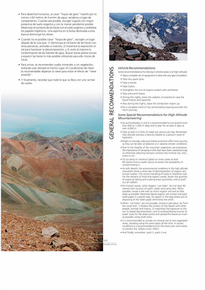
7/22/2019 Los 6.000 de Chile - Banco de Chile
http://slidepdf.com/reader/full/los-6000-de-chile-banco-de-chile 275/288Los 6000’s de Chile / The 6,000’s of Chile
272 273
G E N E R A L R E C O M
M E N D A T I O N S
• Para desechos humanos, al cavar “hoyos de gato” hacerlo por lo
menos a 60 metros de fuentes de agua, senderos y lugar decampamento. Cuando sea posible, escoger lugares con mayorpresencia de suelo orgánico y con la menor pendiente posible.
Maximizar el contacto de las heces con el suelo orgánico y embolsarlos papeles higiénicos. Una aspirina en la bolsa destinada a esta
basura disminuye los olores.
• Cuando no es posible cavar “hoyos de gato”, escoger un lugaralejado de la ruta que: 1) disminuya el contacto de las heces con
otras personas, animales e insectos; 2) maximice la exposición al
sol para favorecer la descomposición; y 3) evite al máximo lacontaminación de las fuentes de agua. Buscar zonas planas (rocas)y esparcir las heces lo más posible utilizando para ello trozos de
rocas.
• Para orinar, se recomiendan suelos minerales o sin vegetación,
evitando usar siempre el mismo lugar. En condiciones de nievees recomendable dispersar la nieve para evitar el efecto de “nieve
amarilla”.
• Y finalmente, recordar que todo lo que se lleva con uno se traede vuelta.
Vehicle RecommendationsSome recommendations for driving in remote areas or at high alt
• Take a complete set of equipment to deal with any type of pro
• Take two spare tyres.
• Take a shovel.
• Take chains.
• Strengthen the mix of engine coolant with antifreeze.
• Take extra anti-freeze.
• During the nights, leave the radiator uncovered (in case t
liquid freezes and expands).• Also during the nights, leave the windscreen wipers up.
• Do a complete check of the vehicle before leaving and aftreturn journey.
Some Special Recommendations for High AltitMountaineering
• As acclimatisation is vital it is recommended to not ascendthan 600 to 1,000 m daily and to plan for at least 4 daysover 4,000 m.
• Take at least 2.5 litres of water per person per day. Remethat altitude sickness is directly related to a person’s levelhydration.
• Bright or strongly-coloured clothes and tents offer more seas they can be seen at distance or in adverse climatic cond
• Due to the fragility of the mountain vegetation we emphthe importance of camping in sites that have been used prevor otherwise selecting resistant surfaces like mineral soil, snow or ice.
• Try to camp or construct igloos or snow caves at least60 metres from a water source to lessen the probability ocontaminating it.
• As with deserts, the environmental conditions in the high amountains show a slow rate of decomposition of organichuman wastes. The correct handling of waste is thereforeFor the remains of food and organic waste, lessen the quof waste by taking and cooking exact quantities, and to pout all rubbish.
• For human waste, when diggins “cat holes” do it at leastmetres from sources of water, paths and camp sites. Whepossible, locate a site with as much organic soil and as litslope as possible. Maximise faeces-organic soil contact andtoilet paper in a plastic bag. An aspirin in the bag where ydisposing of the toilet paper diminishes the smell.
• When “cat holes” are not possible, choose a safe place, fathe route that: 1) lessens the contact of the faeces with opeople, animals and insects; 2) maximises the exposure tosun to speed decomposition; and 3) avoid polluting sourcwater. Look for flat areas (rocks) and spread the faeces as as possible using small rocks.
• It is recommended to urinate on mineral soil or non-vegeareas, avoiding using the same place all the time. In snowconditions it is recommended to kick the snow over urine to prevent the ‘yellow snow’ effect.
• And finally, remember: pack it, pack it out.

7/22/2019 Los 6.000 de Chile - Banco de Chile
http://slidepdf.com/reader/full/los-6000-de-chile-banco-de-chile 276/288
Contactos ImportantesAventurismo
Empresa que posee la concesión para el acceso a la cumbre delNevado Ojos del Salado y cumbres vecinas de más de 6000 m.
Edificio Plaza Real Colipí 484 local B212, Copiapó.
F: 32-235340
www.aventurismo.cl
Carabineros de ChileInformación de caminos, trámites fronterizos, rescate, etc.
F: 139
www.carabineros.cl
Corporación Nacional Forestal, CONAF
Administración e información sobre parques nacionales.
Av. Bulnes 285, Santiago.
F: 2-3900125 (Sede Central).
www.conaf.cl
Cuerpo de Socorro Andino
Organización voluntaria especializada en búsqueda, salvataje yrescate en montañas y zonas de difícil acceso.
Av. Ricardo Cumming 329, Santiago.
F: 2-6994764
www.socorroandino.cl
INFORMACIÓN
Dirección Meteorológica de Chile
F: 2-4364538
www.meteochile.cl
Dirección Nacional de Fronteras yLímites del Estado, DIFROL
Permisos de ascensión a montañas fronterizas para extranjeros
F: 2-6714110 (Dirección de Fronteras) y 2-6713382 (DirecciónLímites).
Bandera 52, piso 5º, Santiago.www.difrol.cl
Ejército de Chile
F: 600 600 3586 (Mesa Central).
www.ejercito.cl
Federación de Andinismo de Chile
Almirante Simpson 77, Providencia, Santiago.
F: 2-2220888
www.feach.cl
Instituto Geográfico Militar, IGM
Cartografía topográfica terrestre 1:50.000 y 1:250.000
Dieciocho 369, Santiago.
F: 2-4109363
www.igm.cl
Servicio de Búsqueda y Salvataje, SAR
Servicio de la Fuerza Aérea de Chile dispuesta para la búsqued
aeronaves, salvataje de sus ocupantes, y en la medida que su funprimaria y medios lo permitan, búsqueda y salvataje de person
otro tipo de emergencias.
F: 138
www.fach.cl/sar/index.htm
Sitios Web RecomendablesAndes Handbook. Guía chilena de las montañas de la Cordilde Los Andes y sus rutas de escalada. Disponible en castellano
inglés.
www.andeshandbook.cl

7/22/2019 Los 6.000 de Chile - Banco de Chile
http://slidepdf.com/reader/full/los-6000-de-chile-banco-de-chile 277/288
Los 6000’s de Chile / The 6,000’s of Chile
274 275
Chile Climbing Page. Sitio chileno de información sobre áreas,
rutas y alternativas de escalada, montañismo y trekking en LosAndes de Chile y alrededores. Disponible en castellano e inglés.
www.escalando.cl
Climbing in Patagonia. Excelente página argentina que describerutas de ascenso y escalada de los cerros ubicados en la zona del
Fitz Roy, del Cerro Torre y del Cerro Pier Giorgio. Disponible encastellano e inglés.
www.climbinginpatagonia.freeservers.com
Club Andino Alemán de Santiago. Página del Club Andino Alemánde Santiago que describe los pasos y contactos a realizar para
ascender montañas en Chile. Disponible en castellano y alemán.
www.dav.cl/Castellano/Como_subir_montanas_en_chile-cont.htm
Cumbres Australes. Sitio chileno que describe rutas de expediciones
realizadas en Patagonia. Disponible en castellano.
www.cumbresaustrales.cl
Danza en Piedra. Sitio argentino con descripciones de rutas de
escalada en roca en Argentina y Chile. Disponible en castellano einglés.
www.danzaenpiedra.com
Montipedia. Sitio hispanoargentino con documentación para elexcursionismo, senderismo, montañismo, trekking, alpinismo, escalada
y todo tipo de actividades en contacto con las montañas. Disponibleen castellano.
www.montipedia.com
Rock Climbing. Sitio estadounidense con numerosas descripciones
de rutas de escalada en roca a lo largo del mundo. Incluye 66 enChile. Disponible en inglés.
www.rockclimbing.com
Summit Post. Sitio web internacional que describe rutas de ascensode montañas alrededor del mundo. Disponible en inglés.
www.summitpost.org
Trekking and Kayaking in Chile. Página elaborada por extranjerosresidentes en Chile con amplias descripciones de rutas, datos para
viajeros y tours guiados. Disponible en castellano, inglés y alemán.
www.trekkingchile.com
Tricúspide. Página chilena con noticias, rutas e información paramontañistas y escaladores. Disponible en castellano.
www.tricuspide.com/portada/default.asp
Volcanes de Los Andes Centrales. Información científica de lazona volcánica Central de Los Andes y sus volcanes. Disponible en
inglés.
http://volcano.space.edu/cvz/index.html
Aventurismo
The company that allows access to the summit of the Ojos del SVolcano and the neighbouring summits over 6000 m.Edificio PlazColipí 484 of. B212, Copiapó. / Phone: 32-235340 www.aventuri
Carabineros de Chile (Chilean Police)
Information about roads, border crossings, rescue, etc.Phone: 139 / www.carabineros.cl
Corporación Nacional Forestal, CONAF (National ForestrCorporation)
Administration of, and information on, national parks.Av. Bulnes 285, Santiago. / Phone: 2-3900125 (Central Officewww.conaf.cl
Cuerpo de Socorro Andino (Body of Andean Assistance)
Voluntary organisation, specialising in search and rescue in mouand areas of difficult access.Av. Ricardo Cumming 329, Santiago. / Phone: 2-6994764www.socorroandino.cl
Dirección Meteorológica de Chile (Chilean Department Meteorology)
Phone: 2-4364538 / www.meteochile.cl
Dirección Nacional de Fronteras y Límites del Estado, DIF(Borders Authority)
Permits for foreigners wishing to climb border peaks.Phone: 2-6714110 (Dirección de Fronteras) and 2-6713382 (Direde Límites). Bandera 52, 5th floor, Santiago. / www.difrol.cl
Ejército de Chile (Chilean Army)
Phone: 600 600 3586 / www.ejercito.cl
Federación de Andinismo de Chile (Chilean Federation o Andean Climbing)
Almirante Simpson 77, Providencia, Santiago. / Phone: 2-222www.feach.cl
Instituto Geográfico Militar, IGM (Government Mapping OMaps and topographic information.Dieciocho 369, Santiago. / Phone: 2-4109363 / www.igm.cl
Servicio de Búsqueda y Salvamento Aéreo, SAR (Air Searand Rescue Service)
A service of the Chilean Air Force whose primary function is tsearch and rescue of airplanes’ occupants and when circumstpermit, the search and rescue of people in other types of emergePhone: 138 / www.fach.cl/sar/index.htm
Recommended Web Sites Andes Handbook. Chilean guide to the mountains in the Anrange and their routes of ascent. Available in Spanish and Enwww.andeshandbook.cl
Chile Climbing Page. Chilean site of information on areas aroutes for climbing and trekking in the Chilean Andes and thsurroundings. Available in Spanish and English. www.escalan
Climbing in Patagonia. Excellent Argentine web page that desascent and rock-climbing routes of the mountains near Fitz RCerro Torre and Cerro Pier Giorgio mountains. Available in Spand English. www.climbinginpatagonia.freeservers.com
Club Andino Alemán de Santiago. Web page of the GermAndean Climbing Club of Santiago that describes routes and cofor climbing mountains in Chile. Available in Spanish and Gerwww.dav.cl/Castellano/Como_subir_montanas_en_chile-con
Cumbres Australes. Chilean site with descriptions of expeditin Patagonia. Available in Spanish. www.cumbresaustrales.
Danza en Piedra. Argentine site with descriptions of routes rock-climbing in Argentina and Chile. Available in Spanish anEnglish. www.danzaenpiedra.com
Montipedia. Spanish-Argentine site with information on hikmountaineering, climbing and all kinds of mountain activitiesAvailable in Spanish. www.montipedia.com
Rock Climbing. United States site with numerous descriptionroutes for rock climbing all over the world, including 66 in ChAvailable in English. www.rockclimbing.com
Summit Post. International web site that describes ascent ro
for mountains around the world. Available in English.www.summitpost.org
Trekking and Kayaking in Chile. Site created by foreigners in Chile with wide-ranging descriptions of routes, informationtravellers and tour guides. Available in Spanish, English and Gewww.trekkingchile.com
Tricúspide. Chilean page with news, routes and information mountaineers and climbers. Available in Spanish.www.tricuspide.com/portada/default.asp
Volcanoes of the Central Andes. Scientific information abocentral volcanic zone of the Andes and its volcanoes. AvailabEnglish. http://volcano.space.edu/cvz/index.html
I N F O R M A T I O N I m p o r t a n t C o n t a c t s

7/22/2019 Los 6.000 de Chile - Banco de Chile
http://slidepdf.com/reader/full/los-6000-de-chile-banco-de-chile 278/288
Acarreo: Acumulación generalmente inestable de piedrasen las laderas de la montaña, producto de la
erosión y la fuerza de gravedad.
Aclimatar: Acostumbrar el organismo a una altitud que nole es habitual y para la que no está preparado,
debido a la disminución de la presión atmosféricay la consecuente disminución de la cantidad de
oxígeno disponible.
Basalto: Roca volcánica de color negro. Es el tipo de rocamás común sobre la corteza terrestre.
Bofedal: Prados turbosos de origen infraacuático, com-
puestos principalmente por plantas de las familiasCyperaceae y Juncaceae, a menudo de crecimien-
to compacto o en cojín, que se encuentran en
áreas pantanosas del altiplano y la puna.
Caldera: Enorme depresión generada por el colapso de
la cima de un volcán por sobre su cámara magmá-tica, que adopta la forma de un cráter y que
puede superar el kilómetro de diámetro.
G L O S A R I O
Chimenea: Estructura de roca en la que las paredes roc
se encuentran en dos planos opuestos y paraEl tamaño de la chimenea es mayor que el
fisura: en la chimenea cabe un hombre.
Cono Parásito: Cono volcánico de pequeñas dimensiones desale a través de un conducto secundario, ma
proveniente del mismo lugar de donde provel material del cono principal.
Cornisa: Masa nivosa que se inclina por sobre una a
hacia el valle, formada por la acción del viesobre la nieve. El tránsito sobre ellas es muy
groso ya que pueden desplomarse muy fácilmTransitar bajo ellas tampoco es recomenda
Domo Volcánico: Es una gran acumulación de lava espesa, q
genera montículos empinados y que usualmaparecen al término de un evento volcánico
Estrato Volcán: Tipo de volcán que se caracteriza por la altern
en su formación de coladas de lava (erupciósiva) y material piroclástico (violenta erupci
Son los que tienen mayor altitud, y presentun cono típico y cráter volcánico.
Fumarola: Emisión tranquila y regular de gases, que em
de un volcán por fisuras o agujeros.
Gendarme: Pináculo o cilindro de roca vertical que se leva semejanza de un hombre erguido.
Glaciar: Gruesa masa de hielo originada en la super
terrestre por compactación y cristalización nieve. Es dinámica y se mueve lentamente gen
do a su paso una gran erosión.
Grieta: Es una gran discontinuidad en un glaciar, genmente escondida bajo capas de nieve.
Hongo: Tipo de cornisa; capa de nieve y/o hielo qu
bre la cima de una montaña y tiene la formatacada de un hongo. Normalmente está form
por material poco consistente e inestable qupoco sustento para la escalada.
de TérminosGeográficos yMontañistas

7/22/2019 Los 6.000 de Chile - Banco de Chile
http://slidepdf.com/reader/full/los-6000-de-chile-banco-de-chile 279/288
Mal de Altura o Trastorno ocasionado por la escasez de oxígenoMal de a causa de la altitud produciendo asfixia cerebral.Montaña: Se manifiesta por dolor de cabeza, aceleración
del pulso, fatiga respiratoria, náuseas y trastornosdel sueño. Se combate bajando a cotas inferiores.
Morrena: Acumulación de material rocoso a los pies de un
glaciar, debido a la erosión y transporte de mate-rial originado por el dinamismo de un glaciar.
Normalmente aparecen como sistemas de filosy montículos de piedras a veces inestables.
Nevero: Descripción genérica de cualquier cuerpo de
nieve independiente.
Nieve Tipo de nieve que se forma cuando el agua deAcartonada: fusión superficial se vuelve a congelar y fusiona
los cristales de nieve en un estrato firme. Confrecuencia esta capa se rompe haciendo muy
incómodo el avance.
Paso o Depresión entre dos altitudes, por lo general dosPortezuelo: montañas. También llamado collado o
simplemente col.
Penitentes: Puntiagudas formaciones de nieve de diversostamaños, generadas por la acción conjunta del
viento y del sol, que se encuentran agrupadasen extensas áreas, formando campos de peniten-tes que pueden dificultar enormemente el avance.
Rimaya: Grieta final de la cabecera de un glaciar, general-mente donde nace una pared de roca o hielo.
Sérac: Bloque de hielo en un glaciar, potencialmente
peligroso por su periódico desprendimiento.
Seta: Marca en el hielo o nieve en forma de seta o gotade agua invertida que se hace con el objeto de
pasar una cuerda por ella a fin de hacer un rapelo un aseguramiento.
Traverse: Tipo de avance en que el desplazamiento es prin-
cipalmente horizontal, usualmente a través deuna ladera sobre la que se marcha sin ganar altura.
Vivaquear: Pernoctar a la intemperie, usualmente provisto
sólo de un saco de dormir y un cubre saco.
Los 6000’s de Chile / The 6,000’s of Chile
276 277
Acclimatisation: The progressive adaptation of the human bothe rarified air occurring at altitude.
Altitude Disorder caused by the lack of oxygen at altSickness: that can produce brain asphyxia. It manifes
head-aches, nauseas, shortness of breath ainterrupted sleep.
Basalt: Black, volcanic rock. The most common typrock on the earth’s surface.
Bergshrund: Final crevasse at the head of a glacier, genewhere there is a wall of rock or ice.
Bivouac: To sleep outside without a tent, usually onlya sleeping bag and a bivy bag. Also called bbivi.
Bofedal: Wet-marshy highland meadow, composedprincipally of plants of the Cyperaceae andJuncaceae families, often of compact growin a cushion, found in marshy areas of the APlano and the Puna.
Caldera Enormous depression generated by the subsi(Spanish word of a volcano into its magma chamber whichfor Cauldron): adopts the shape of a basin. Can be wider
a kilometre in diameter.
Chimney: A crack wide enough to fit a climber’s bodynarrow enough to allow for opposing force applied to both walls.
Corn Snow: Crystals of snow formed by the melting andfreezing of a surface layer of snow. This layer bfrequently making the advance very uncomfo
Cornice: An overhanging mass of snow on a ridge, foby wind action on newly deposited snow. Waon them is very dangerous as they can collapseasily. Walking or climbing underneath them
also not recommended.Crevasse: A huge split in a glacier, frequently hidden
overlying snow cover.
Fumarole: Safe, regular gas emission, that emerges thrfissures or holes in a volcano.
Gendarme: Pinnacle or cylinder of vertical rock that looks sto a policeman standing to attention.
Glacier: A dynamic mass of ice formed by the compaand crystallization of snow that moves slowgenerating great erosion.
Moraine: Accumulation of rocky material at the feet glacier caused by the erosion and subsequetransport of material due to the movement oglacier.
Parasitic Small vent structure on the flank of a large voCone: Volcanic cone of small dimensions from wh
comes lava from the same source as the macone through a secondary channel.
Pass: A depression between two high points, gentwo mountains. Also known as a col.
Penitentes: Pointed formations of snow of various sizesgenerated by the joint action of the wind andThey are found grouped in extensive areas, fofields of penitentes that make the advanceenormously more difficult.
Scree Slope: Loose slope of rock fragments smaller than
Seracs: Large ice blocks or towers in a glacier, whicpotentially dangerous due to their periodicdetachment.
Snow or ice An anchor in snow or ice created by cuttingBollard: shaping the surface so a rope or sling can sec
encircle the feature.
Snow Field: General description of any independent-lyingof snow.
Strata Volcano: A volcano composed of both lava flows (paeruptions) and pyroclastic material (violenteruptions).
Summit Type of cornice, layer of snow or ice that coMushroom: summit of a mountain and has the overhan
shape of a mushroom. They are normally mof unstable and inconsistent material that isadvisable to climb on.
Traverse: Type of advance in which the route is mainlhorizontal, usually across a slope on which walk without gaining altitude.
Volcanic A steep-sided mass of viscous lava extrudedDome: a volcanic vent (often circular in plane view
spiny, rounded, or flat on top. It is usually crat the end of a volcanic event.
G l o s s a r y o
f G e o
g r a p
h i c a n
d M o u n
t a i n e e r i n g
T e r m s
7/22/2019 Los 6.000 de Chile - Banco de Chile
http://slidepdf.com/reader/full/los-6000-de-chile-banco-de-chile 280/288
Proyecto “Cajas Cumbre” los Protagonistas
Volcán Pomerape
Jefe de Expedición: Patricio Uribe
Claudio AllardRodrigo Meunier
Volcán Parinacota
Curso de Montañismo, Pontificia Universidad Católica de ChileJefe de Expedición: Juan Francisco Bustos
Danilo Briones
Francisca Caballero
Margarita Godoy
Francisca Jiménez
Ana Luisa Madinagoitía
Catalina Marín
David Molina
Hans Moller
Nicolás Moreno
Felipe Ochsenius
Sandra Pérez
Cristián Rodríguez
Isabel Rojas
Francisco Santelices
Cristián Stephens
Valentina Strappa
Nicolás Vergara
Daniel Wurman
Volcán Acotango
Jefe de Expedición: Misael Alvial
Walter Cifuentes
Cristián Silva
Volcán Guallatiri
Cordada Señores del AltiplanoJefe de Expedición: Constantino Romero
Rigoberto Candia
Luis Lizama
Volcán Aucanquilcha
Club de Montaña CENITJefe de Expedición: Raúl Osorio
Carlos Ruiz
Jorge PiradtRicardo Candia
Mauricio Morales
Volcán Palpana
Club de Montaña CENITJefe de Expedición: Raúl Osorio
Carlos Ruiz
Jorge Piradt
Ricardo Candia
Osvaldo Tejeda
Mauricio Morales
Volcán San Pedro
Jefe de Expedición: Damián Tomic
Pelayo Santa María
José Tomás Ibarra
“Summit Box” Project Protagonists

7/22/2019 Los 6.000 de Chile - Banco de Chile
http://slidepdf.com/reader/full/los-6000-de-chile-banco-de-chile 281/288
Los 6000’s de Chile / The 6,000’s of Chile
278 279
Volcán San Pablo
Rama de Andinismo Universidad de Santiago de ChileJefe de Expedición: Andrés Jorquera
Luz María Bravo
Coyailen Chacón
Mauricio Cornejo
María Fajardo
Roberto Gómez
José Lobos
Christian LoeweFernando Millar
Mauricio Orellana
Mario Sepúlveda
Rodrigo Zapata
Volcán Pili
Jefe de Expedición: Marlen Suil
Pablo Rebolledo
Patricia Soto
Volcán Pular
Club de Montaña LACJefe de Expedición: Christian Cayuqueo
Elvis Acevedo
Nolberto Alarcón
Freddy Grey
Volcán Salín
Jefe de Expedición: Jorge Espinoza
Christian Fernández
Pablo Ormazábal
Volcán Socompa
Jefe de Expedición: Rodney González
César Galaz
Germán Madrid
Volcán Llullaillaco
Club Andino Giuseppe BortoluzziJefe de Expedición: Daniel González
Rodney González
Eliecer Rojas
José González
Oscar Orellana
Carlos Salazar
Pier Todorovic
Cerro Colorados
Club Andino PAMIRJefe de Expedición: Claudio Lois
Carlos Anabalón
Eduardo Espinoza
Jorge Espinoza
Gabriela Gallardo
Carlos Gatica
Carolina Palma
Milton Saldivia
Volcán Sierra Nevada
Club Andino Giuseppe BortoluzziJefe de Expedición: Daniel González
Eugenio Bahamondes
Fernando González
José González
Rodney González
Eliecer Rojas
Volcán El Ermitaño
Jefe de Expedición: Gabriel Corral
Juan Andrés Covarrubias
Rubén Gennero
Volcán Peña Blanca
Jefe de Expedición: Manuela Méndez
Gastón Oyarzún
Sebastián Rosende
Nevado San Francisco
Club Andino Universitario, Pontificia Universidad CatólicChileJefe de Expedición: Juan Francisco Bustos
Loreto Calisto
Rodrigo Ponce
Nevado Incahuasi
Club Andino Universitario, Selección de Montañismo PontUniversidad Católica de ChileJefe de Expedición: Abdo Fernández
María Cecilia Sepúlveda
Cristián Vásquez

7/22/2019 Los 6.000 de Chile - Banco de Chile
http://slidepdf.com/reader/full/los-6000-de-chile-banco-de-chile 282/288
Volcán El Muerto
Club Andino PAMIRJefe de Expedición: Claudio Lois
Carlos Anabalón
Eduardo Espinoza
Jorge Espinoza
Carlos Gatica
Milton Saldivia
Nevado Ojos del Salado
Club de Montaña ARARATJefe de Expedición: Abner Astudillo
Diego Galleguillos
Guillermo del Valle
Ernesto Olivares
Oscar Torres
Volcán El Fraile
Club Andino PAMIRJefe de Expedición: Claudio Lois
Carlos Anabalón
Eduardo Espinoza
Jorge Espinoza
Carlos Gatica
Milton Saldivia
Cerro Vicuñas
Rama de Andinismo Universidad de Santiago de ChileJefe de Expedición: María Fajardo
Arturo Cáceres
Mauricio Cornejo
Carlos Durán
Manuel Huentelau
José Lobos
Alberto Pérez
Rodrigo Zapata
Volcán Barrancas BlancasJefe de Expedición: María Paz Ibarra
Misael Alvial
Macarena Sánchez
Nevado Tres Cruces Sur
Rama de Andinismo de IngenieríaJefe de Expedición: David Muñoz
Francisco Delgado
Gustavo Donoso
Alejandro López
José Meneses
Cristóbal Ramírez
Nicolás Reyes
José Valdivieso
Nevado Tres Cruces Central
Club Andino Universitario, Cursos de Montañismo I, II, Selecde Montañismo Pontificia Universidad Católica de ChileJefe de Expedición: Valentina Strappa
Mauro Avello
Claudio Bertín
Juan Francisco Bustos
Francisca Caballero
José Manuel Correa
Felipe del RealFrancisca Díaz
Diego Guzmán
Matías Irarrázaval
Catalina Marín
Juan Pablo Meza
Héctor Millar
David Molina
Alejandra Muñoz
Felipe Ochsenius
Ernesto Olivares
Sandra Pérez
Marcela Roberts
José Rodríguez
Carolina SalasAlejandra Salgado
Andrea Salvatierra
Juan Manuel Santa Cruz
Cecilia Sepúlveda
Cristián Vásquez
Daniel Wurman
Volcán Solo
Club Andino PAMIRJefe de Expedición: Claudio Lois
Carlos Anabalón
Eduardo Espinoza
Jorge Espinoza
Carlos Gatica
Milton Saldivia

7/22/2019 Los 6.000 de Chile - Banco de Chile
http://slidepdf.com/reader/full/los-6000-de-chile-banco-de-chile 283/288
Los 6000’s de Chile / The 6,000’s of Chile
280 281
Volcán Los Patos
Club Andino PAMIRJefe de Expedición: Claudio Lois
Carlos Anabalón
Eduardo Espinoza
Jorge Espinoza
Gabriela Gallardo
Carlos Gatica
Carolina Palma
Milton Saldivia
Volcán Copiapó
Club Andino RancaguaJefe de Expedición: Marcelo Salfate
Nelson Alvarado
Iván Escobar
Luis Mora
Franco Rodríguez
Patricio Vásquez
Raúl Valderrama
Roberto Toro
Cerro El Toro
Jefe de Expedición: Damián Tomic
Pelayo Santa María
José Tomás Ibarra
Cerro Las Tórtolas
Club CUMANCHIJefe de Expedición: Miguel Infante R.
Pablo García
Andrés González
Alejandro Guzmán
Miguel Infante G.
Nevado de Olivares
Club CUMANCHIJefe de Expedición: Miguel Infante R.
Juan Carlos Díaz
Manuel Estay
Pablo García
Andrés González
Alejandro Guzmán
Miguel Infante G.
Nevado Juncal
Club de Montaña ARARATJefe de Expedición: Abner Astudillo
Sebastián Bulo
José Ibacache
Javier Navia
Nevado El Plomo
Jefe de Expedición: David Muñoz
Abraham BittelmanJosé Castro
Benjamín Herrera
José Meneses
Cristóbal Ramírez de Arellano
Bruno Saldías
Volcán Tupungato
Club Andino WechupúnJefe de Expedición: Carolina Flores
Jorge Cartagena
Paulo Melivilu
Cerro Alto San Juan
Jefe de Expedición: María Paz Ibarra
Camilo Rada
Nevado Piuquenes
Club de Andinismo y Excursionismo Internacional Macul y de Montaña CENITJefe de Expedición: Mauricio Orellana
Luz María Bravo
Ricardo Candia
Roberto Gómez
Aldo Ramos
José Ríos
Mario Sepúlveda
Cerro Marmolejo
Jefe de Expedición: Ernesto Olivares
Misael Alvial
Anabelle Bond
Andróniko Luksic

7/22/2019 Los 6.000 de Chile - Banco de Chile
http://slidepdf.com/reader/full/los-6000-de-chile-banco-de-chile 284/288
Aldunate, C. y Cornejo, L. (ed.) (2001) Tras la Huella del Inka enChile. Museo Chileno de Arte Precolombino. Santiago, Chile.
Baumann, M. (ed.) (1996) Cosmología y Música en los Andes.Vervuert & Iberoamericana. Frankfurt, Madrid.
Beorchia, A. (1985) El Enigma de los Santuarios Indígenas deAlta Montaña. Centro de Investigaciones Arqueológicas de
Alta Montaña. San Juan, Argentina.
Biggar, J. (2005) The Andes. A Guide for Climbers. Editorial Andes.Escocia.
Cox, S. y Fulsaas, K. (ed.) (2003) Mountaineering. The Freedomof the Hills. The Mountaineers Books. Seattle, Estados Unidos.
Echevarría, E. (1999) Chile Andinista: Su Historia. Ediciones ElMercurio. Santiago, Chile.
Gabriel, A. y Jordan, R. (2004) Serie Aventurero. Manual deCampamento. Ediciones Vertical. Santiago, Chile.
BIBLIOGRAFÍA
Gabriel, A. y Jordan, R. (2006) Serie Aventurero. Equipo y VestuEdiciones Vertical. Santiago, Chile.
González, O. (1995) Volcanes de Chile. Instituto Geográfico MSantiago, Chile.
Hampton, B. y Cole, D. (1995) Soft Paths. National Outdoor
Leadership School, Satckpole Books. Mechanicsburg, Estados Un
Hattingh, G. (1998) The Climbers Handbook. New Holland PublLtd. Singapore.
Instituto Geográfico Militar. (2005) Atlas de la República de CSantiago, Chile.
Instituto Geográfico Militar. (1985) Enciclopedia Geográfica Chile. Tomo I Región de Tarapacá. Santiago, Chile.
Instituto Geográfico Militar. (1990) Enciclopedia Geográfica Chile. Tomo II Región de Antofagasta. Santiago, Chile.
Instituto Geográfico Militar. (1989) Enciclopedia Geográfica Chile. Tomo III Región de Atacama. Santiago, Chile.
Instituto Geográfico Militar. (1988) Enciclopedia Geográfica Chile. Tomo IV Región de Coquimbo. Santiago, Chile.
BIBLIOGRAPHY

7/22/2019 Los 6.000 de Chile - Banco de Chile
http://slidepdf.com/reader/full/los-6000-de-chile-banco-de-chile 285/288
Los 6000’s de Chile / The 6,000’s of Chile
282 283
Instituto Geográfico Militar. (1996) Enciclopedia Geográfica deChile. Tomo V Región de Valparaíso. Santiago, Chile.
Instituto Geográfico Militar. (1986) Enciclopedia Geográfica deChile. Tomo Región Metropolitana. Santiago, Chile.
Larraín, I. (1987) Etnogeografía. Instituto Geográfico Militar.
Santiago, Chile.Martínez, G. (1983) Los Dioses de los Cerros de los Andes. Journal
de la Société des Américanistes Vol 69, pp 85-115. París, Francia.
Neate, J. (1994) Mountaineering in the Andes. A Sourcebookfor Climbers. Expedition Advisory Centre, Royal Geographical Society.
Londres, Inglaterra.
Plath, O. (1973) Geografía del Mito y la Leyenda. EditorialNascimento. Santiago, Chile.
Raggi, L (2000) El Altiplano Chileno. Guía para el TurismoAventura y el Turismo Científico. Documento Preparado pa
IV Congreso Mundial de Medicina de Montaña, Fisiología de ADepósito legal: 109.005 S.E. Centro Internacional de Estudios And
Universidad de Chile.
Quintanilla, V. (1983) Biogeografía. Instituto Geográfico Mili
Santiago, Chile.
Romero, H. (1987) Geografía de los Climas. Instituto Geográ
Militar. Santiago, Chile.
Saffer, G. (2000) ¿Qué son las Montañas? Documento Protedisponible en www.protege.cl
Sánchez, A. y Morales, R. (2002) Las Regiones de Chile. Edit
Universitaria. Santiago, Chile.
Scanu, M. (1986) Santuarios de Altura en los Andes. RevistNacional de Lima. Tomo XLVIII, pp 213-249. Lima, Perú.

7/22/2019 Los 6.000 de Chile - Banco de Chile
http://slidepdf.com/reader/full/los-6000-de-chile-banco-de-chile 286/288
VERTICAL
Los 6000’s de Chile / The 6,000’s of Chile
Texto Principal / Main Text
Andrea GabrielRodrigo JordanHéctor Millar
Teresa PérezEduardo Urtubia
Edición / Editors
Andrea Gabriel
Iain MitchellTeresa Pérez
Asesoría Técnica / Technical Consultants
Eugenio GuzmánHéctor Millar
Darren MossCamilo Rada
Producción / Production
Andrea GabrielEugenio Guzmán
Vertical S.A.
Traducción / Translation
Iain Mitchell
Diseño y Conceptualización / Design and Concept
Enrique Larenas
Fotografías / Photography
La mayor parte de las fotos empleadas fueron tomadas por Misael Alvial. Como complemento se usaron además los
archivos fotográficos entregados por cada expedición participante.
The majority of the photographs used in this book were taken by Misael Alvial. To complement them, photographs havebeen used from the photographic archives of each participating expedition.
Impresión / Printing
Fyrma Gráfica
Derechos Reservados / Copiright
Vertical S.A.
5 de diciembre del 2006
Inscripción / Registration
Nº 159.604 - 2006
ISBN: 956-8333-04-5
Primera edición de 1.000 ejemplares / Firtst edition 1.000 copies
Reservados todos los derechos. Queda prohibida la reproducción total o parcial de esta obra por cualquier medio oprocedimiento sin la debida autorización escrita de los autores y titulares del copyright.
All rights reserved. The total or partial reproduction of this work by any means or procedures without the correspondingwritten authorisation of the authors and owners of the copyrights are forbidden.

7/22/2019 Los 6.000 de Chile - Banco de Chile
http://slidepdf.com/reader/full/los-6000-de-chile-banco-de-chile 287/288

7/22/2019 Los 6.000 de Chile - Banco de Chile
http://slidepdf.com/reader/full/los-6000-de-chile-banco-de-chile 288/288


![El Banco Central de Chile[1]](https://img.dokumen.tips/doc/110x75/55cf8e90550346703b937795/el-banco-central-de-chile1.jpg)