Embed Size (px)
Citation preview
1
Science You Can Use Bulletin May/June 2016 • ISSUE 19
Forest Service Rocky Mountain Research Station
United States Department of Agriculture
Rocky Mountain Research Station
Science You Can Use BulletinMay/June 2016 | Issue 19
SUMMARY
Reducing wildfire risk to lives and property is a critical issue for policy makers, land managers, and citizens who reside in high-risk fire areas of the United States—this is especially the case in the Rocky Mountain region and other western states. In order for a wildfire risk reduction effort to be effective in a U.S. wildland-urban interface (WUI) community, the risk reduction effort must include community support and engagement.
However, WUI communities have a wide range of social, political and economic characteristics that make a “cookie-cutter” approach to wildfire management planning unrealistic and ultimately ineffective. WUI community differences include communication networks, community identities and attachments, degree of trust in government, and the actions already taken to mitigate risk.
To provide guidance on collaboration in fire and fuel management as advocated by the Healthy Forest Restoration Act of 2003, scientists at the USDA Forest Service’s Rocky Mountain Research Station studied social factors and the diversity of U.S. WUI community types. Their ongoing research continues to be effective in developing tools and strategies that improve collaboration between agencies, organizations, communities, and citizens, and is enhancing WUI communities’ long-term social capacity to address wildfire risk.
Wildfire risk has always been part of living in the western United States, but today’s wildfires are bigger and have proven more devastating to human communities than ever before. Consider this statistic from the National Interagency Coordination Center: The eight biggest years for U.S. wildfires in recorded history have all occurred in the last 15 years.
Scientists attribute increased fire activity to at least four factors: increasingly hot
and dry summers, stronger winds, insect infestations, and human population growth near wilderness areas. All of these conditions are expected to continue. Not only is California currently experiencing the worst drought in its recorded history, scientists from NASA, Columbia University and Cornell University expect a 21st Century “megadrought” lasting 35 years or more in the Great Plains and southwestern states. As western U.S. droughts continue, wildfire risk is expected to
Living With Fire: How Social Scientists are Helping Wildland-Urban Interface Communities Reduce Wildfire Risk
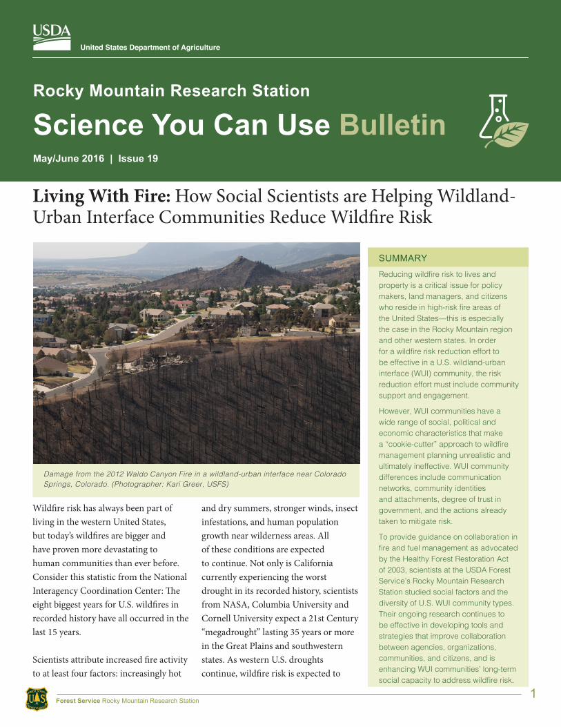
Damage from the 2012 Waldo Canyon Fire in a wildland-urban interface near Colorado Springs, Colorado. (Photographer: Kari Greer, USFS)
2
Science You Can Use Bulletin May/June 2016 • ISSUE 19
Forest Service Rocky Mountain Research Station
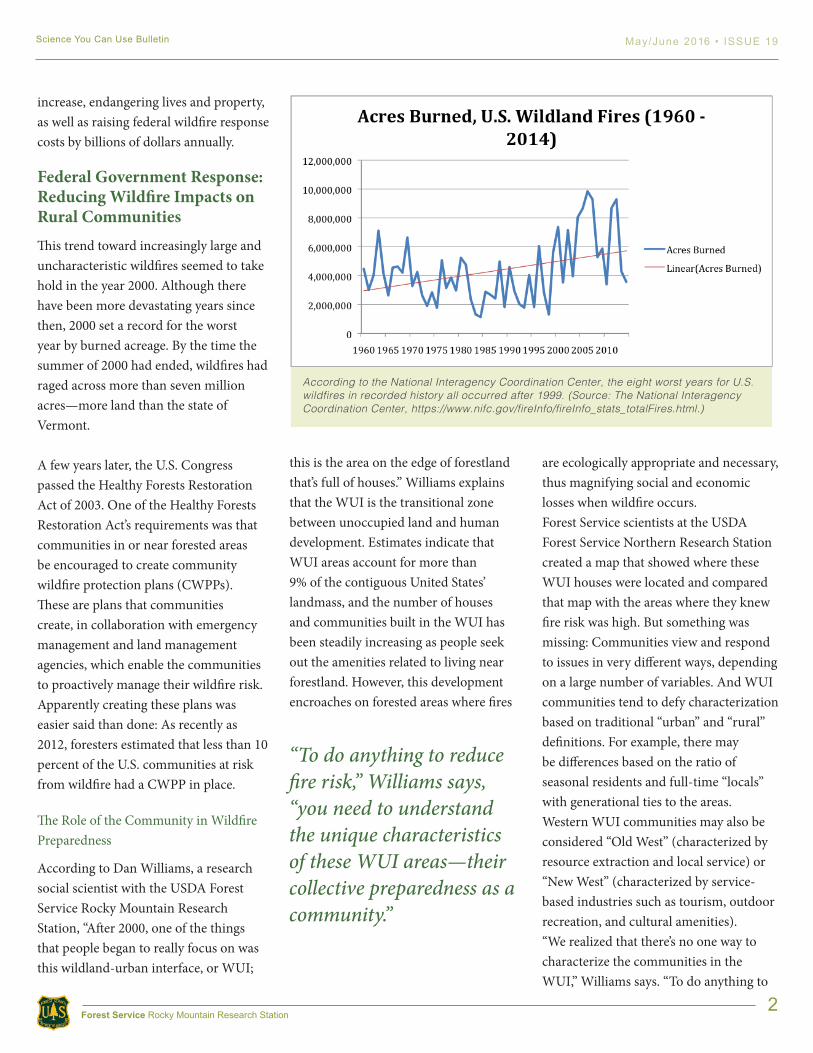
increase, endangering lives and property, as well as raising federal wildfire response costs by billions of dollars annually.
Federal Government Response: Reducing Wildfire Impacts on Rural CommunitiesThis trend toward increasingly large and uncharacteristic wildfires seemed to take hold in the year 2000. Although there have been more devastating years since then, 2000 set a record for the worst year by burned acreage. By the time the summer of 2000 had ended, wildfires had raged across more than seven million acres—more land than the state of Vermont.
A few years later, the U.S. Congress passed the Healthy Forests Restoration Act of 2003. One of the Healthy Forests Restoration Act’s requirements was that communities in or near forested areas be encouraged to create community wildfire protection plans (CWPPs). These are plans that communities create, in collaboration with emergency management and land management agencies, which enable the communities to proactively manage their wildfire risk.Apparently creating these plans was easier said than done: As recently as 2012, foresters estimated that less than 10 percent of the U.S. communities at risk from wildfire had a CWPP in place.
The Role of the Community in Wildfire Preparedness
According to Dan Williams, a research social scientist with the USDA Forest Service Rocky Mountain Research Station, “After 2000, one of the things that people began to really focus on was this wildland-urban interface, or WUI;
this is the area on the edge of forestland that’s full of houses.” Williams explains that the WUI is the transitional zone between unoccupied land and human development. Estimates indicate that WUI areas account for more than 9% of the contiguous United States’ landmass, and the number of houses and communities built in the WUI has been steadily increasing as people seek out the amenities related to living near forestland. However, this development encroaches on forested areas where fires
are ecologically appropriate and necessary, thus magnifying social and economic losses when wildfire occurs.Forest Service scientists at the USDA Forest Service Northern Research Station created a map that showed where these WUI houses were located and compared that map with the areas where they knew fire risk was high. But something was missing: Communities view and respond to issues in very different ways, depending on a large number of variables. And WUI communities tend to defy characterization based on traditional “urban” and “rural” definitions. For example, there may be differences based on the ratio of seasonal residents and full-time “locals” with generational ties to the areas. Western WUI communities may also be considered “Old West” (characterized by resource extraction and local service) or “New West” (characterized by service-based industries such as tourism, outdoor recreation, and cultural amenities).“We realized that there’s no one way to characterize the communities in the WUI,” Williams says. “To do anything to
According to the National Interagency Coordination Center, the eight worst years for U.S. wildfires in recorded history all occurred after 1999. (Source: The National Interagency Coordination Center, https://www.nifc.gov/fireInfo/fireInfo_stats_totalFires.html.)
“To do anything to reduce fire risk,” Williams says, “you need to understand the unique characteristics of these WUI areas—their collective preparedness as a community.”

3
Science You Can Use Bulletin May/June 2016 • ISSUE 19
Forest Service Rocky Mountain Research Station
reduce fire risk, you need to understand the unique characteristics of these WUI areas—their collective preparedness as a community. Our priority was to describe the communities based on their social and community characteristics and identify the collective actions that need to happen in order to protect homes and lives and communities.”
To help at-risk communities establish procedures that will save lives and property, Williams and other scientists took a close look at 18 U.S. WUI communities in seven states to identify ways that different communities had adjusted to the risk of wildfire. These communities represented a wide range of demographic, social and ecological characteristics.
Two Very Different California CommunitiesTwo of these communities—Auburn Lake Trails and Grizzly Flats, California—are only 50 miles from each other. Both are in California’s El Dorado County, between Sacramento and Lake Tahoe. Both have been identified as having a high risk of wildfire, with heavy fuel loads and steep topography.
The similarities stop there. Auburn Lake Trails is a gated community with a high percentage of retirees and typical leisure activities of horseback riding and golf, while Grizzly Flats is what Pat Dwyer of the El Dorado County Fire Safe Council describes as an “informal community” of less than 500 households in a heavily wooded area. Named after a bear encountered by miners in 1850, Grizzly Flats neighbors the Eldorado National
Forest and is a great place to “get away from it all,” Dwyer says, adding: “It’s remote. There’s one road in and one road out.” While Auburn Lake Trails already had infrastructure in place to develop support for a CWPP, in Grizzly Flats the support for creating a CWPP grew out of weekly Burger Nights that started in 2007 and continue today at the local fire station. It was a big step for a community that was considered largely anti-establishment little more than a decade ago.
“Here in El Dorado County most of the communities are unincorporated. Auburn Lake Trails is unusual in that they have a strong homeowners association, but other communities in the county tend to be much less organized,” Dwyer said. He went on to say, “About 10 communities in the county have complete CWPPs, but four don’t even have a Fire Safe council [to initiate developing a CWPP]. I don’t want to be the one who goes into a community and says, ‘The government says you have to enforce a 30-foot defensible space around your community’s homes.’ We focus our efforts on the communities where people are interested and are
Community wildfire protection plans can help WUI communities comply with state and federal requirements for defensible space around houses. (Image used by permission of the California Department of Forestry and Fire Protection.)
Maintaining a staff to provide fire protection remains a challenge for the residents of Grizzly Flats. (Photographer: Daniel Williams)
4
Science You Can Use Bulletin May/June 2016 • ISSUE 19
Forest Service Rocky Mountain Research Station
willing to roll up their sleeves.” With assistance and support from the El Dorado County Fire Safe Council and the USDA Forest Service, registered professional foresters helped develop CWPPs for both communities.
How Communities Differ: Researching WUI Archetypes
These two California communities serve as a good example of how a community’s characteristics can shape the ways in which it might tackle a problem like mitigating wildfire risk, and it highlights how a single approach doesn’t necessarily fit all communities. To find a better way for communities to develop their own CWPPs, Williams and other scientists considered WUI communities’ many characteristics, including their “adaptive capacity”—the ability to adapt to changing circumstances such as social systems and environmental conditions. The characteristics that can contribute to local adaptive capacity include: place-based knowledge and experience, access to and ability to apply scientific and technical knowledge, demographic and structural characteristics, and interactions
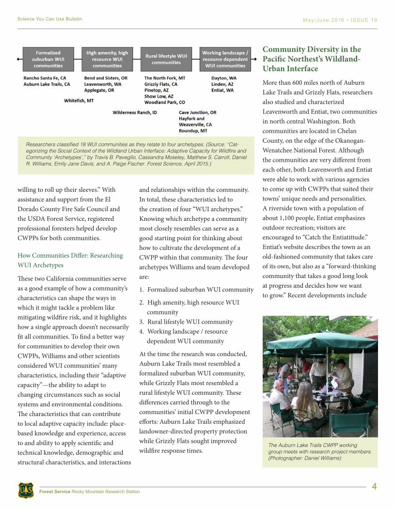
and relationships within the community. In total, these characteristics led to the creation of four “WUI archetypes.” Knowing which archetype a community most closely resembles can serve as a good starting point for thinking about how to cultivate the development of a CWPP within that community. The four archetypes Williams and team developed are:
1. Formalized suburban WUI community
2. High amenity, high resource WUI community
3. Rural lifestyle WUI community4. Working landscape / resource
dependent WUI community
At the time the research was conducted, Auburn Lake Trails most resembled a formalized suburban WUI community, while Grizzly Flats most resembled a rural lifestyle WUI community. These differences carried through to the communities’ initial CWPP development efforts: Auburn Lake Trails emphasized landowner-directed property protection while Grizzly Flats sought improved wildfire response times.
Community Diversity in the Pacific Northest’s Wildland-Urban InterfaceMore than 600 miles north of Auburn Lake Trails and Grizzly Flats, researchers also studied and characterized Leavenworth and Entiat, two communities in north central Washington. Both communities are located in Chelan County, on the edge of the Okanogan-Wenatchee National Forest. Although the communities are very different from each other, both Leavenworth and Entiat were able to work with various agencies to come up with CWPPs that suited their towns’ unique needs and personalities.A riverside town with a population of about 1,100 people, Entiat emphasizes outdoor recreation; visitors are encouraged to “Catch the Entiatittude.” Entiat’s website describes the town as an old-fashioned community that takes care of its own, but also as a “forward-thinking community that takes a good long look at progress and decides how we want to grow.” Recent developments include
Researchers classified 18 WUI communities as they relate to four archetypes. (Source: “Cat-egorizing the Social Context of the Wildland Urban Interface: Adaptive Capacity for Wildfire and Community ‘Archetypes’,” by Travis B. Paveglio, Cassandra Moseley, Matthew S. Carroll, Daniel R. Williams, Emily Jane Davis, and A. Paige Fischer. Forest Science, April 2015.)
The Auburn Lake Trails CWPP working group meets with research project members. (Photographer: Daniel Williams)
5
Science You Can Use Bulletin May/June 2016 • ISSUE 19
Forest Service Rocky Mountain Research Station
wireless internet access, major school upgrades, and a new fire station. Williams and his team indicated that, at the time of the study, Entiat most closely resembled a working landscape / resource-dependent WUI community.
Leavenworth, on the other hand, has a population of about 2,000 and a downtown area that was rebuilt as a Bavarian-style tourist destination in the 1960s. Williams and his team indicated that, at the time it was researched, Leavenworth most closely resembled a high-amenity, high-resource WUI community. But according to Annie Schmidt, director of Chelan County’s Chumstick Wildfire Stewardship Coalition, a community may have characteristics of more than one archetype, as Williams’ team recognized with Whitefish, Montana and Wilderness Ranch, Idaho.
In Schmidt’s view, Leavenworth’s outskirts more closely reflect Leavenworth’s timber business origins and have more in common with Entiat, the working landscape / resource-dependent community. To come up with a CWPP, Leavenworth had to find common ground between the people in the downtown area (high amenity) who maybe weren’t as concerned about wildfires and the people from farther out (working landscapes) for whom fire was a more immediate concern. Schmidt continued explaining that Leavenworth relies on tourism and sees about 2 million visitors per year, and that this proved to be the bridge that connected the interests of both sub-communities within Leavenworth. “So when the Chiwaukum Creek fire shut down Highway 2 and tourism revenues
were down—that kind of situation raises awareness and cooperation,” notes Schmidt.
University of Washington professor Matthew Carroll agrees. “Fire is like a Rorschach test,” says Carroll, who researched the communities of Leavenworth and Entiat for WUI archetype studies. “Perfectly reasonable people can look at fire and see totally different things. And they both may be right—or at least partially right. For example, after the [1991] Spokane fire, European-Americans in the area became very afraid of prescribed burns. But the Nez Perce tribe had the opposite
response: They looked at how they had used controlled fires in the past and they decided to increase prescribed burning on their land.”
In terms of Leavenworth and Entiat at the time of the study, Carroll says, “Leavenworth was a more cosmopolitan place with a diverse set of values—from a view of the integral role of fire in forest management to a view that fire is the
“Fire is like a Rorschach test,” Carroll says. “Perfectly reasonable people can look at it and see totally different things. And they both may be right—or at least partially right. It’s a complicated issue.”
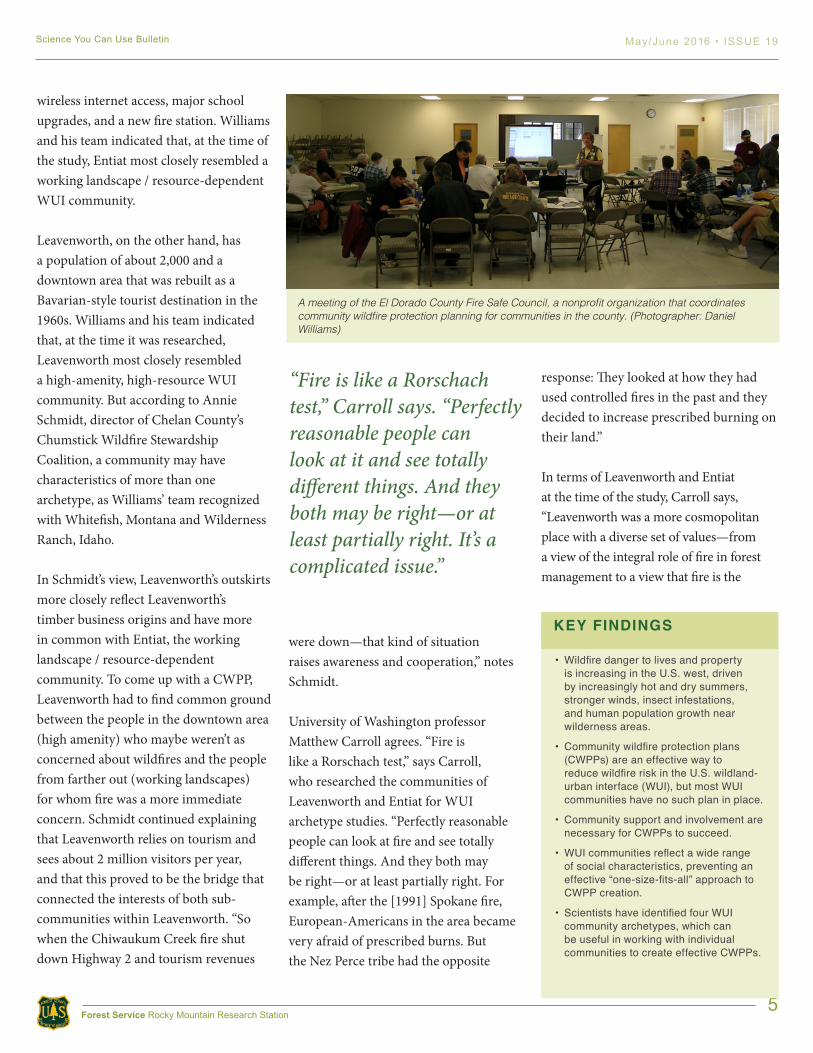
A meeting of the El Dorado County Fire Safe Council, a nonprofit organization that coordinates community wildfire protection planning for communities in the county. (Photographer: Daniel Williams)
KEY FINDINGS
• Wildfire danger to lives and property is increasing in the U.S. west, driven by increasingly hot and dry summers, stronger winds, insect infestations, and human population growth near wilderness areas.
• Community wildfire protection plans (CWPPs) are an effective way to reduce wildfire risk in the U.S. wildland-urban interface (WUI), but most WUI communities have no such plan in place.
• Community support and involvement are necessary for CWPPs to succeed.
• WUI communities reflect a wide range of social characteristics, preventing an effective “one-size-fits-all” approach to CWPP creation.
• Scientists have identified four WUI community archetypes, which can be useful in working with individual communities to create effective CWPPs.
6
Science You Can Use Bulletin May/June 2016 • ISSUE 19
Forest Service Rocky Mountain Research Station
enemy. Entiat has stronger roots in timber dependence and traditional resource management, so their view of fire was more uniformly related to fire exclusion.” Yet the two communities had similar priorities when it came to developing their CWPPs. According to Michelle Ellis, a local district fire management officer, “In both communities, as with the wider geographic area, the emphasis was on two main issues: having a resilient landscape and the reduction of hazardous fuels.”
The Bottom Line: Living With WildfireAt the end of the day, this research is all about understanding how WUI communities can live with wildfires, including fire’s natural role in their landscapes. And it’s working, according to Ed Grout, president of Auburn Lake Trails’ Fire Safety and Improvement Council. “Once we had the CWPP in place, we were able to apply for and receive federal, state, and county grants of $500,000 to put in place a 150-foot-wide, six-mile-long fuel break around the community,” Grout says. “And because we have a strong property
owners’ association, we were able to require residents to meet state standards for defensible space around their houses.”
CWPP benefits also extend to community education, according to Bill Brandt, who was on Auburn Lake Trails’ Fire Safety and Improvement Council from its inception about 10 years ago. According to Brandt, “When someone moves into the area, we have a group of people who meet with them and explain that this isn’t some bucolic garden community with no worries. It’s a wildfire waiting to happen here, and it’s an ongoing concern.” In addition to being vigilant for naturally-caused wildfires, homeowners must be aware, modify their own behaviors, and take actions to reduce the chance that a wildfire will be sparked within their community due to carelessness. Occasional careless behaviors still happen, continues Brandt: “Someone will put a pile of trash next to the house and then one of their kids will throw a match on it or someone else will throw a cigarette into it. That stuff still happens, but we’re better prepared for it now.”
Looking forward, Williams and his colleagues are developing a diagnostic tool that will help community leaders identify how their communities fit into the four WUI archetypes framework—and ultimately assist with local-level fire preparation. According to Williams, “The archetype system is a conceptual tool that we hope will help professionals identify their community’s capacities and lack thereof, whether those are financial, leadership, knowledge, or some other factor.” In the end, having this architype tool should help communities create Community Wildfire Protection Plans in a way that is more efficient and effective given their local circumstances.
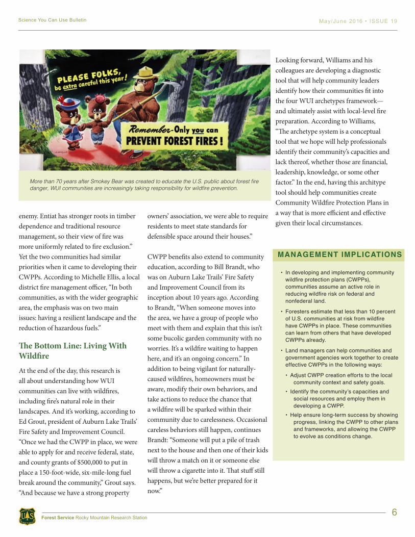
More than 70 years after Smokey Bear was created to educate the U.S. public about forest fire danger, WUI communities are increasingly taking responsibility for wildfire prevention.
MANAGEMENT IMPLICATIONS
• In developing and implementing community wildfire protection plans (CWPPs), communities assume an active role in reducing wildfire risk on federal and nonfederal land.
• Foresters estimate that less than 10 percent of U.S. communities at risk from wildfire have CWPPs in place. These communities can learn from others that have developed CWPPs already.
• Land managers can help communities and government agencies work together to create effective CWPPs in the following ways:
• Adjust CWPP creation efforts to the local community context and safety goals.
• Identify the community’s capacities and social resources and employ them in developing a CWPP.
• Help ensure long-term success by showing progress, linking the CWPP to other plans and frameworks, and allowing the CWPP to evolve as conditions change.
7
Science You Can Use Bulletin May/June 2016 • ISSUE 19
Forest Service Rocky Mountain Research Station
WHAT COMES NEXT? USING A COMMUNITY’S CHARACTERISTICS TO DEVELOP A CWPP
A CWPP allows communities to assume a leadership role in reducing local wildfire risk. Following are a few best management practices that have been identified as helpful in developing CWPPs.
Know your community
• Understand your community’s social and demographic characteristics as well as previous collaborative efforts. If previous dis-agreements hindered collaboration, address them early to prevent them from surfacing again.
• Identify your community’s resources, such as people, social networks, community organizations, technology, and funding. Re-member that any activity that brings the community together can be helpful in the CWPP development process.
• Identify community leaders and mobilizers, including those who were involved with prior community collaboration and those who can help build bridges between various groups.
Set goals: Think big but be prepared to start small
• Look for ways to build consensus and community engagement. Some communities have achieved this through educational programs while others have pursued initial CWPP goals with wide relevance, such as ecosystem restoration and protecting lives and property.
• Select a CWPP scale that is reasonable and appropriate. For example, your community may choose to develop a smaller-scale plan if the goal is to reduce hazards on local properties. If the goal is to reduce regional wildfire risk, a county-level CWPP may be the right choice.
Keep the momentum going
• Set benchmarks and recognize your progress.
• Stay organized by utilizing public and private resources, including private consultants, the Firewise Communities Program (www.firewise.org), and regional and state forestry and fire departments.
• Be flexible if your community’s wildfire-related goals change.
• Leverage your success. If the CWPP process has developed your community’s ability to work together, use that framework to address other issues, whether fire-related or not.
FURTHER READING
Best management practices for creating a community wildfire protection plan, 2011. http://www.nrs.fs.fed.us/pubs/39838
Community guide to preparing and implementing a community wildfire protection plan (supplement), August 2008.
http://www.forestsandrangelands.gov/communities/documents/CWPP_Report_Aug2008.pdf
Preparing a community wildfire protection plan: A handbook for wildland-urban interface communities, March 2004.
http://www.communitiescommittee.org/pdfs/cwpphandbook.pdf
8
Science You Can Use Bulletin May/June 2016 • ISSUE 19
Forest Service Rocky Mountain Research Station
FURTHER READING
Paveglio, T., Carroll, M., Moseley, C., Williams, D. R., Fischer, A. P., & Davis, E. J. (2015). Categorizing the social context of the wildland urban interface: Adaptive capacity for wildfire and community “archetypes.” Forest Science, 60, 298-310.
Williams, D. R., Jakes, P. J., Burns, S., Cheng, A. S., Nelson, K. C., Sturtevant, V., Brummel, R. F., Staychock, E., & Grayzeck-Souter, S. (2012). Community Wildfire Protection Planning: The importance of framing, scale, and building sustainable capacity. Journal of Forestry, 110, 415-420.
Jakes, P. J., Esposito, C., Burns, S., Cheng, A., Nelson, K., Sturtevant, V., & Williams, D. R. (2011). Best management practices for creating a community wildfire protection plan (NRS-GTR-89). St. Paul, MN: USDA Forest Service, Northern Research Station. 28p.
Jakes, P. J., Nelson, K. C., Enzler, S. A., Burns, S., Cheng, A., Sturtevant, V., Williams, D. R., Bujak, A., Brummel, R. F., Grayzeck-Souter, S., & Staychock, E. (2011). Community wildfire protection planning: Is the Healthy Forest Restoration Act’s vagueness genius? International Journal of Wildland Fire, 20, 350-363.
Paveglio, T., Jakes, P., Carroll, M., & Williams, D. (2009). Understanding social complexity within the wildland urban interface: A new species of human habitation? Environmental Management, 43, 1085-95.
Purpose of the Science You Can Use Bulletin
To provide scientific information to people who make and influence decisions about managing land. The US Forest Service RMRS Science You Can Use Bulletin is published regularly by:
Rocky Mountain Research Station (RMRS)US Forest Service240 W Prospect RdFort Collins, CO 80521 Forest Service researchers work at the forefront of science to improve the health and use of our Nation’s forests and grasslands. More information about Forest Service research in the Rocky Mountain Region can be found here: http://www.fs.fed.us/rmrs
To receive this bulletin via email, scan the QR code below or use this link: http://tinyurl.com/RMRSsciencebulletinMegan Matonis, Bulletin editor, [email protected]
Jan Engert, Assistant Station Director,Science Application & Integration;[email protected]
WRITER’S PROFILEBrian Cooke is a contract science writer for the Rocky Mountain Research Station in Fort Collins, Colorado. He received a bachelor’s degree in journalism-science writing with a minor in geology from Lehigh University. Brian’s work has included articles for the National Park Service, website writing for various environmental services companies, and editorial assignments on behalf of the Bureau of Land Management. Brian’s science and environmental writing is frequently colored by his National Park Service interpretive training and experience as a volunteer docent for Alcatraz Island and San Francisco Maritime National Historical Park.
9
Science You Can Use Bulletin May/June 2016 • ISSUE 19
Forest Service Rocky Mountain Research Station
In accordance with Federal civil rights law and U.S. Department of Agriculture (USDA) civil rights regulations and policies, the USDA, its Agencies, offices, and employees, and institutions participating in or administering USDA programs are prohibited from discriminating based on race, color, national origin, religion, sex, gender identity (including gender expression), sexual orientation, disability, age, marital status, family/parental status, income derived from a public assistance program, political beliefs, or reprisal or retaliation for prior civil rights activity, in any program or activity conducted or funded by USDA (not all bases apply to all programs). Remedies and complaint filing deadlines vary by program or incident.
Persons with disabilities who require alternative means of communication for program information (e.g., Braille, large print, audiotape, American Sign Language, etc.) should contact the responsible Agency or USDA’s TARGET Center at (202) 720-2600 (voice and TTY) or contact USDA through the Federal Relay Service at (800) 877-8339. Additionally, program information may be made available in languages other than English.
To file a program discrimination complaint, complete the USDA Program Discrimination Complaint Form, AD-3027, found online at http://www.ascr.usda.gov/complaint_filing_cust.html and at any USDA office or write a letter addressed to USDA and provide in the letter all of the information requested in the form. To request a copy of the complaint form, call (866) 632-9992. Submit your completed form or letter to USDA by: (1) mail: U.S. Department of Agriculture, Office of the Assistant Secretary for Civil Rights, 1400 Independence Avenue, SW, Washington, D.C. 20250-9410; (2) fax: (202) 690-7442; or (3) email: [email protected].
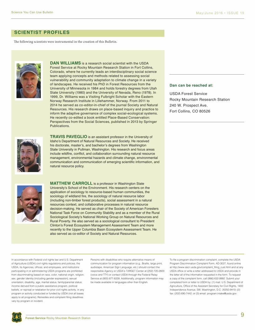
DAN WILLIAMS is a research social scientist with the USDA Forest Service at Rocky Mountain Research Station in Fort Collins, Colorado, where he currently leads an interdisciplinary social science team applying concepts and methods related to assessing social vulnerability and community adaptation to climate change in a variety of landscapes. He received his PhD in Forest Resources from the University of Minnesota in 1984 and holds forestry degrees from Utah State University (1980) and the University of Nevada, Reno (1978). In 1999, Dr. Williams was a Visiting Fulbright Scholar with the Eastern Norway Research Institute in Lillehammer, Norway. From 2011 to 2014 he served as co-editor-in-chief of the journal Society and Natural Resources. His research draws on place-based inquiry and practice to inform the adaptive governance of complex social-ecological systems. He recently co-edited a book entitled Place-Based Conservation: Perspectives from the Social Sciences, published in 2013 by Springer Publications.
TRAVIS PAVEGLIO is an assistant professor in the University of Idaho’s Department of Natural Resources and Society. He received his doctorate, master’s, and bachelor’s degrees from Washington State University in Pullman, Washington. His research and focus areas include wildfire, conflict, and collaboration surrounding natural resource management, environmental hazards and climate change, environmental communication and communication of emerging scientific information, and natural resource policy.
MATTHEW CARROLL is a professor in Washington State University’s School of the Environment. His research centers on the application of sociology to resource-based human communities, the sociology of wildland fire, the sociology of natural resource labor (including non-timber forest products), social assessment in a natural resources context, and collaborative processes in natural resource decision-making. He served as chair of the Society of American Foresters National Task Force on Community Stability and as a member of the Rural Sociological Society’s National Working Group on Natural Resources and Rural Poverty. He also served as a sociological consultant to President Clinton’s Forest Ecosystem Management Assessment Team and more recently to the Upper Columbia Basin Ecosystem Assessment Team. He also served as co-editor of Society and Natural Resources.
SCIENTIST PROFILES
Dan can be reached at:
USDA Forest ServiceRocky Mountain Research Station240 W. Prospect Ave.Fort Collins, CO 80526
The following scientists were instrumental in the creation of this Bulletin.