Embed Size (px)
Citation preview
1
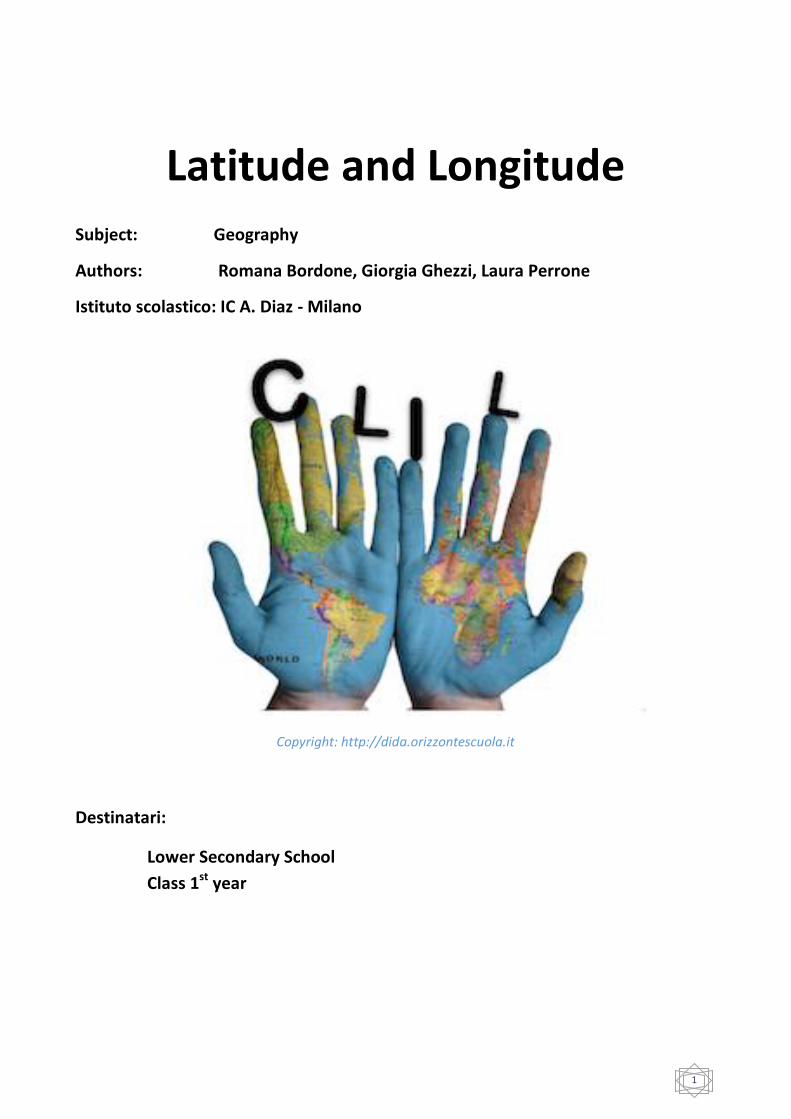
Latitude and Longitude
Subject: Geography
Authors: Romana Bordone, Giorgia Ghezzi, Laura Perrone
Istituto scolastico: IC A. Diaz - Milano
Copyright: http://dida.orizzontescuola.it
Destinatari:
Lower Secondary School
Class 1st year
2
CLIL module planning –LATITUDE and LONGITUD - Authors R. Bordone, G. Ghezzi, L. Perrone
Unit Title Latitude and Longitude CLIL language English
Subject involved Geography
Content area The geographic grid
Number of lessons 4 lessons + 1 lesson for assessment (55 minutes / lesson)
Class First year Middle School
Teaching aims - learners will know what latitude and longitude are - learners will be able to identify the latitude and the longitude
of a city on a map - learners will be able to identify a city when the latitude and
the longitude are provided
Learning outcomes - students are able to listen to authentic videos and to read texts concerning the geographic grid
- students are able to orientate themselves with maps on the basis of the cardinal points and the geographic coordinates
- learners will be aware that any place on the earth can be located
Pre-requisites - parts of a map (key, compass rose, scale, title, symbols) - types of maps - cardinal points - continents, European countries
Contents - parallels, meridians - latitude and longitude
Cognition (thinking skills)
- lower-order thinking skills: Identifying places on maps; defining latitude and longitude; classifying parallels and meridians (Tropic of Cancer / Capricorn, Equator, …)
- higher-order thinking skills: Explaining the concept of latitude, longitude and geographic grid with the aid of geographic tools (realia: globe, wooden sticks and coloured tape); Comparing the location of different places on maps (places on the same parallel and different meridians, …)
teaching strategies: the use of realia (geographic tools) allows the students to develop thinking skills
Communication - language of learning: vocabulary: numbers (0°-180°), degrees, continents, countries, capitals structures: verb “to be” (affirmative-interrogative forms),
3
wh-questions (what/where)
- language for learning: vocabulary: Equator, Meridian of Greenwich Tropic of Cancer, Tropic of Capricorn, hemispheres of the Earth, degrees, North Pole, South Pole functions: locating and identifying places
Materials and resources Computer, interactive whiteboard, worksheets, atlas, realia (wooden sticks, globe, coloured tape)
4
PROCEDURE: LEARNING UNIT STEPS
LESSON 1
WA
RM
UP
OF
THE
UN
IT
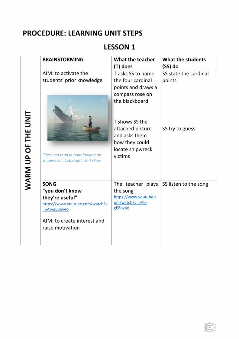
BRAINSTORMING AIM: to activate the students’ prior knowledge
“Rescued man in boat looking on shipwreck”; Copyright : mikekiev
What the teacher (T) does
What the students (SS) do
T asks SS to name the four cardinal points and draws a compass rose on the blackboard T shows SS the attached picture and asks them how they could locate shipwreck victims
SS state the cardinal points SS try to guess
SONG “you don’t know they’re useful” https://www.youtube.com/watch?v=5Ab-gE8ov4o
AIM: to create interest and raise motivation
The teacher plays the song https://www.youtube.com/watch?v=5Ab-gE8ov4o
SS listen to the song
5
FIN
D O
UT
TASK
- A
CTI
VIT
Y 1
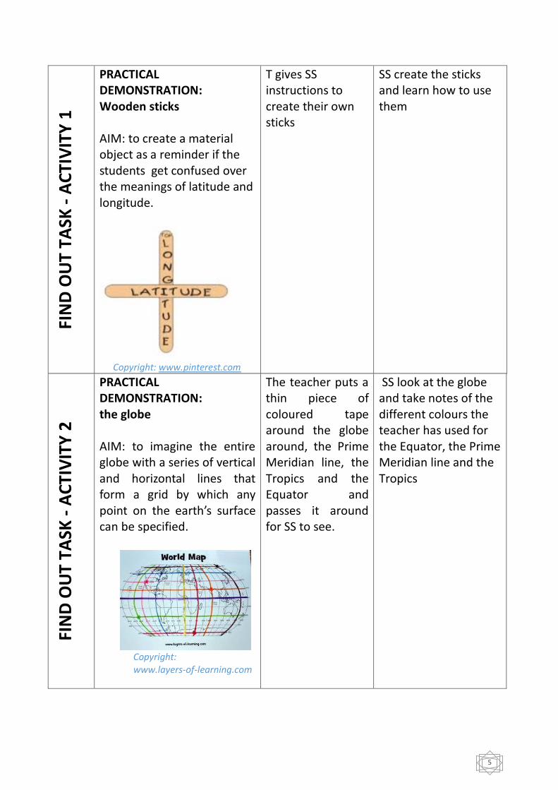
PRACTICAL DEMONSTRATION: Wooden sticks AIM: to create a material object as a reminder if the students get confused over the meanings of latitude and longitude.
Copyright: www.pinterest.com
T gives SS instructions to create their own sticks
SS create the sticks and learn how to use them
FIN
D O
UT
TASK
- A
CTI
VIT
Y 2
PRACTICAL DEMONSTRATION: the globe AIM: to imagine the entire globe with a series of vertical and horizontal lines that form a grid by which any point on the earth’s surface can be specified.
Copyright: www.layers-of-learning.com
The teacher puts a thin piece of coloured tape around the globe around, the Prime Meridian line, the Tropics and the Equator and passes it around for SS to see.
SS look at the globe and take notes of the different colours the teacher has used for the Equator, the Prime Meridian line and the Tropics
6
LESSON 2 SO
RT
OU
T TA
SK -
AC
TIV
ITY
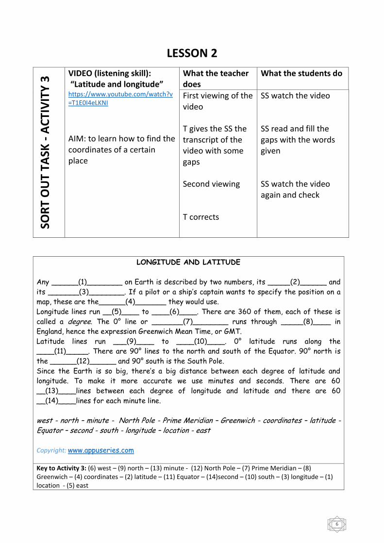
3 VIDEO (listening skill):
“Latitude and longitude” https://www.youtube.com/watch?v=T1E0I4eLKNI
AIM: to learn how to find the coordinates of a certain place
What the teacher does
What the students do
First viewing of the video T gives the SS the transcript of the video with some gaps Second viewing T corrects
SS watch the video SS read and fill the gaps with the words given SS watch the video again and check
LONGITUDE AND LATITUDE
Any ______(1)________ on Earth is described by two numbers, its _____(2)______ and
its _______(3)________. If a pilot or a ship’s captain wants to specify the position on a
map, these are the______(4)_______ they would use.
Longitude lines run __(5)____ to ____(6)____. There are 360 of them, each of these is
called a degree. The 0° line or _______(7)________ runs through _____(8)____ in
England, hence the expression Greenwich Mean Time, or GMT.
Latitude lines run ___(9)____ to ____(10)____. 0° latitude runs along the
____(11)_____. There are 90° lines to the north and south of the Equator. 90° north is
the ______(12)______ and 90° south is the South Pole. Since the Earth is so big, there’s a big distance between each degree of latitude and
longitude. To make it more accurate we use minutes and seconds. There are 60
__(13)____lines between each degree of longitude and latitude and there are 60
__(14)____lines for each minute line.
west - north – minute - North Pole - Prime Meridian – Greenwich - coordinates – latitude - Equator – second - south - longitude – location - east Copyright: www.appuseries.com
Key to Activity 3: (6) west – (9) north – (13) minute - (12) North Pole – (7) Prime Meridian – (8) Greenwich – (4) coordinates – (2) latitude – (11) Equator – (14)second – (10) south – (3) longitude – (1) location - (5) east
7
SO
RT
OU
T TA
SK -
AC
TIV
ITY
4
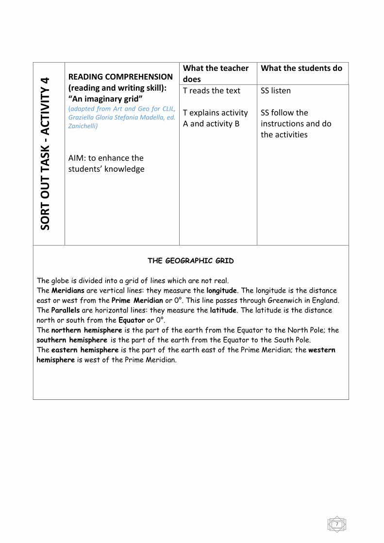
READING COMPREHENSION (reading and writing skill): “An imaginary grid” (adapted from Art and Geo for CLIL, Graziella Gloria Stefania Madella, ed. Zanichelli)
AIM: to enhance the students’ knowledge
What the teacher does
What the students do
T reads the text T explains activity A and activity B
SS listen SS follow the instructions and do the activities
THE GEOGRAPHIC GRID
The globe is divided into a grid of lines which are not real.
The Meridians are vertical lines: they measure the longitude. The longitude is the distance
east or west from the Prime Meridian or 0°. This line passes through Greenwich in England.
The Parallels are horizontal lines: they measure the latitude. The latitude is the distance
north or south from the Equator or 0°.
The northern hemisphere is the part of the earth from the Equator to the North Pole; the
southern hemisphere is the part of the earth from the Equator to the South Pole.
The eastern hemisphere is the part of the earth east of the Prime Meridian; the western
hemisphere is west of the Prime Meridian.
8
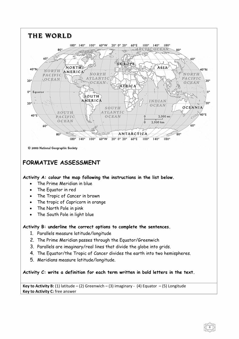
FORMATIVE ASSESSMENT
Activity A: colour the map following the instructions in the list below.
The Prime Meridian in blue
The Equator in red
The Tropic of Cancer in brown
The tropic of Capricorn in orange
The North Pole in pink
The South Pole in light blue
Activity B: underline the correct options to complete the sentences.
1. Parallels measure latitude/longitude
2. The Prime Meridian passes through the Equator/Greenwich
3. Parallels are imaginary/real lines that divide the globe into grids.
4. The Equator/the Tropic of Cancer divides the earth into two hemispheres.
5. Meridians measure latitude/longitude.
Activity C: write a definition for each term written in bold letters in the text.
Key to Activity B: (1) latitude – (2) Greenwich – (3) imaginary - (4) Equator – (5) Longitude Key to Activity C: free answer
9
LESSON 3 O
UTP
UT
TASK
(G
AM
IFIC
ATI
ON
) –
AC
TIV
ITY
5.A
ORAL INTERACTION (Speaking skill) Teacher-whole class AIM: to use SS’ knowledge to identify a place on a map when coordinates are provided
What the teacher does
What the students do
T gives the SS the coordinates of some European capital cities and she asks SS to guess the name of the city and the continent where the city is located, after finding it on their maps. T asks SS: «what capital city is located 51°N and 0°W?» T asks SS: «where is it?»
SS answer: «It’s London» SS answer: « It’s in the UK. It’s in Europe»
OU
TPU
T TA
SK
(GA
MIF
ICA
TIO
N)
-
AC
TIV
ITY
5.B
ORAL INTERACTION (speaking skill) In pairs AIM: to use SS’ knowledge to find the coordinates of a place
What the student A (St A) does
What the student B (St B) does
St A points at the world map (which is projected on the interactive whiteboard) and asks St B «what are the coordinates of this place?»
St B answers «55° N and 37°E»
10
LESSON 4 O
UTP
UT
TASK
(u
sin
g In
tern
et a
nd
ICT)
–
AC
TIV
ITY
6
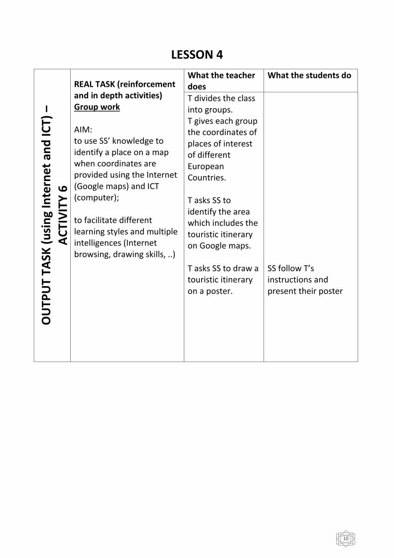
REAL TASK (reinforcement and in depth activities) Group work AIM: to use SS’ knowledge to identify a place on a map when coordinates are provided using the Internet (Google maps) and ICT (computer); to facilitate different learning styles and multiple intelligences (Internet browsing, drawing skills, ..)
What the teacher does
What the students do
T divides the class into groups. T gives each group the coordinates of places of interest of different European Countries. T asks SS to identify the area which includes the touristic itinerary on Google maps. T asks SS to draw a touristic itinerary on a poster.
SS follow T’s instructions and present their poster
11
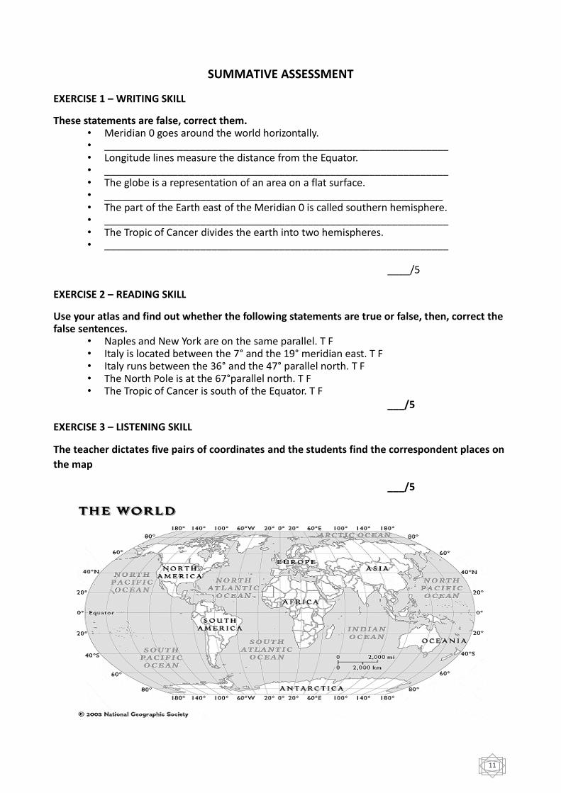
SUMMATIVE ASSESSMENT
EXERCISE 1 – WRITING SKILL
These statements are false, correct them. • Meridian 0 goes around the world horizontally. • _____________________________________________________________ • Longitude lines measure the distance from the Equator. • _____________________________________________________________ • The globe is a representation of an area on a flat surface. • ____________________________________________________________ • The part of the Earth east of the Meridian 0 is called southern hemisphere. • _____________________________________________________________ • The Tropic of Cancer divides the earth into two hemispheres. • _____________________________________________________________
____/5
EXERCISE 2 – READING SKILL
Use your atlas and find out whether the following statements are true or false, then, correct the false sentences.
• Naples and New York are on the same parallel. T F • Italy is located between the 7° and the 19° meridian east. T F • Italy runs between the 36° and the 47° parallel north. T F • The North Pole is at the 67°parallel north. T F • The Tropic of Cancer is south of the Equator. T F
___/5
EXERCISE 3 – LISTENING SKILL
The teacher dictates five pairs of coordinates and the students find the correspondent places on
the map
___/5
12
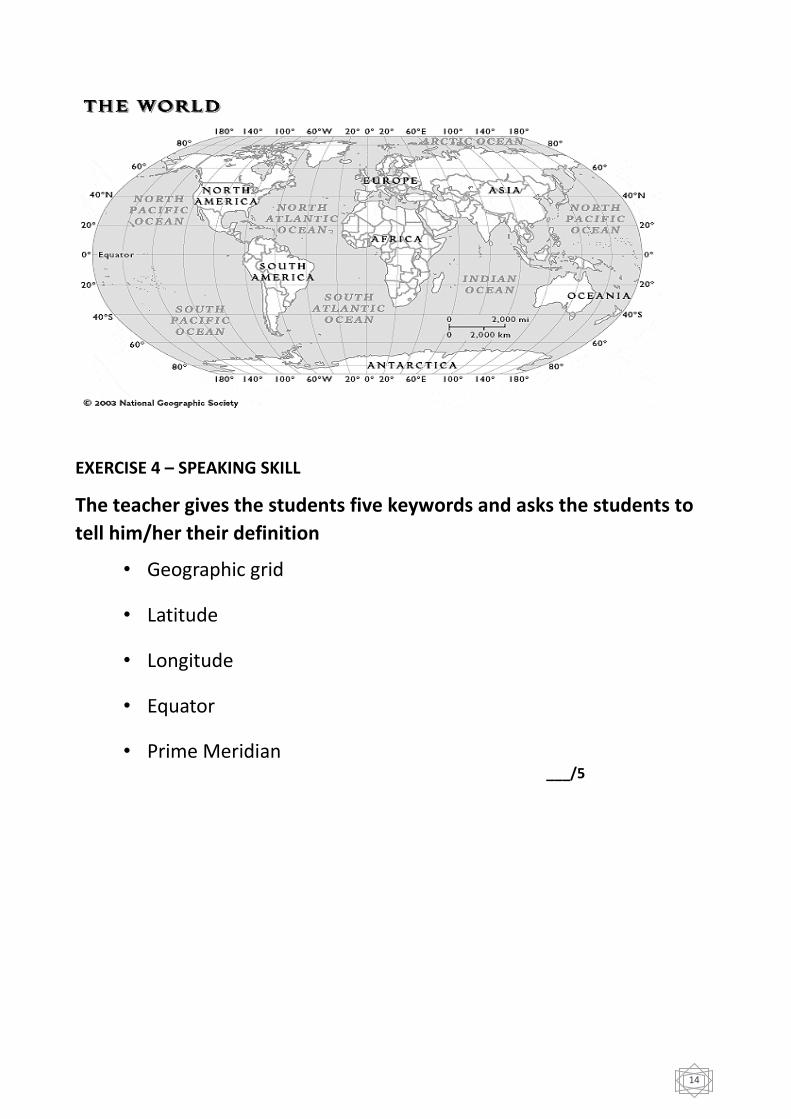
EXERCISE 4 – SPEAKING SKILL
The teacher gives the students five keywords and asks the students to tell him/her their
definition
• Geographic grid • Latitude • Longitude • Equator • Prime Meridian
___/5
13
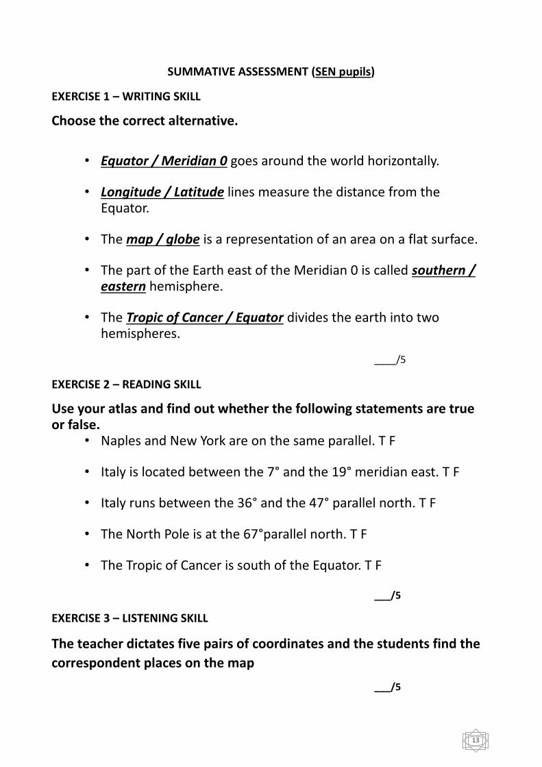
SUMMATIVE ASSESSMENT (SEN pupils)
EXERCISE 1 – WRITING SKILL
Choose the correct alternative.
• Equator / Meridian 0 goes around the world horizontally.
• Longitude / Latitude lines measure the distance from the
Equator.
• The map / globe is a representation of an area on a flat surface.
• The part of the Earth east of the Meridian 0 is called southern / eastern hemisphere.
• The Tropic of Cancer / Equator divides the earth into two hemispheres.
____/5
EXERCISE 2 – READING SKILL
Use your atlas and find out whether the following statements are true or false.
• Naples and New York are on the same parallel. T F
• Italy is located between the 7° and the 19° meridian east. T F
• Italy runs between the 36° and the 47° parallel north. T F
• The North Pole is at the 67°parallel north. T F
• The Tropic of Cancer is south of the Equator. T F
___/5
EXERCISE 3 – LISTENING SKILL
The teacher dictates five pairs of coordinates and the students find the
correspondent places on the map
___/5
14
EXERCISE 4 – SPEAKING SKILL
The teacher gives the students five keywords and asks the students to
tell him/her their definition
• Geographic grid
• Latitude
• Longitude
• Equator
• Prime Meridian ___/5

15
ASSESSMENT CRITERIA
SCORES Descriptions
0/5, 1/5 Completely unsatisfactory
Student shows no knowledge of the subject
2/5 Unsatisfactory
Student is lacking necessary background knowledge
3/5 Satisfactory
Student has essential knowledge of the subject
4/5 Good
Students shows a complete knowledge of the subject
5/5 Excellent
Students shows a complete and thorough knowledge of the subject