Embed Size (px)
Citation preview
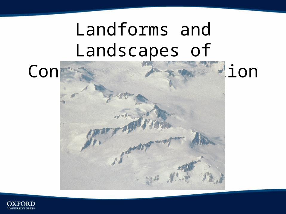
Landforms and Landscapes of Continental Glaciation
Objectives
• Delineate and describe contemporary continental ice sheets and the ice sheets of past glacial periods
• Summarize the history of continental glaciation in North America, and how our understanding of that history has changed over time
• Identify typical landforms and landscapes produced by continental glaciers and discuss the glacial processes that formed them
• Describe the development of the Great Lakes• Briefly discuss the pluvial lakes that formed during
glacial periods in the western United State
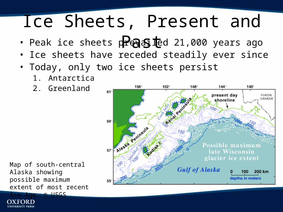
Ice Sheets, Present and Past• Peak ice sheets prevailed 21,000 years ago• Ice sheets have receded steadily ever since• Today, only two ice sheets persist
1. Antarctica2. Greenland
Map of south-central Alaska showing possible maximum extent of most recent Ice Age. © USGS
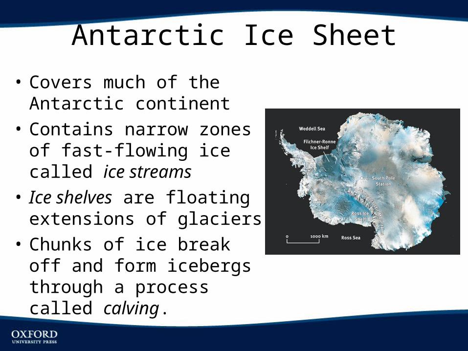
Antarctic Ice Sheet
• Covers much of the Antarctic continent
• Contains narrow zones of fast-flowing ice called ice streams
• Ice shelves are floating extensions of glaciers
• Chunks of ice break off and form icebergs through a process called calving.
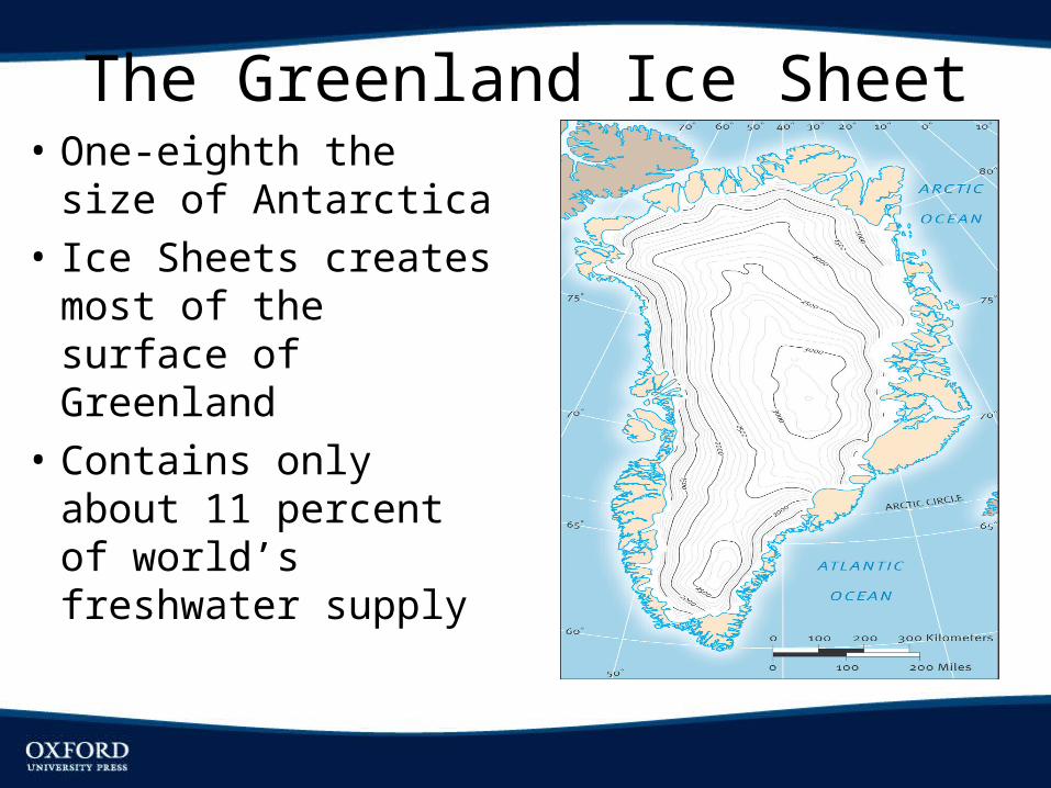
The Greenland Ice Sheet• One-eighth the size of
Antarctica• Ice Sheets creates
most of the surface of Greenland
• Contains only about 11 percent of world’s freshwater supply
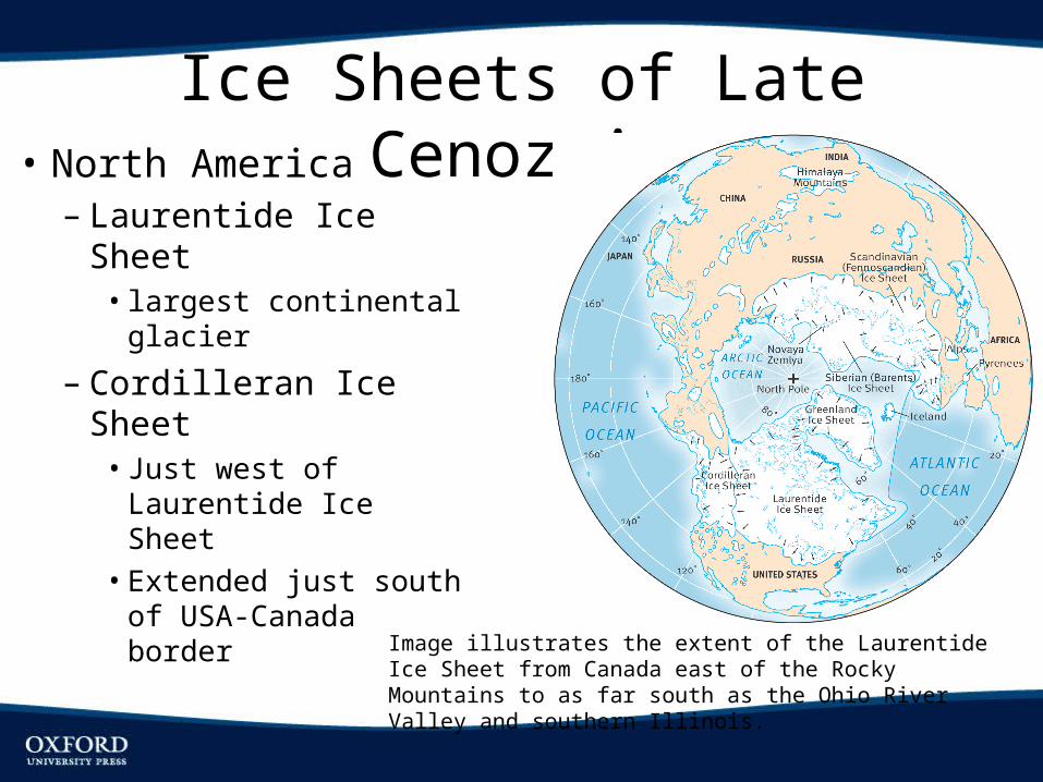
Ice Sheets of Late Cenozoic• North America– Laurentide Ice Sheet• largest continental
glacier
– Cordilleran Ice Sheet• Just west of Laurentide
Ice Sheet• Extended just south of
USA-Canada border
Image illustrates the extent of the Laurentide Ice Sheet from Canada east of the Rocky Mountains to as far south as the Ohio River Valley and southern Illinois.
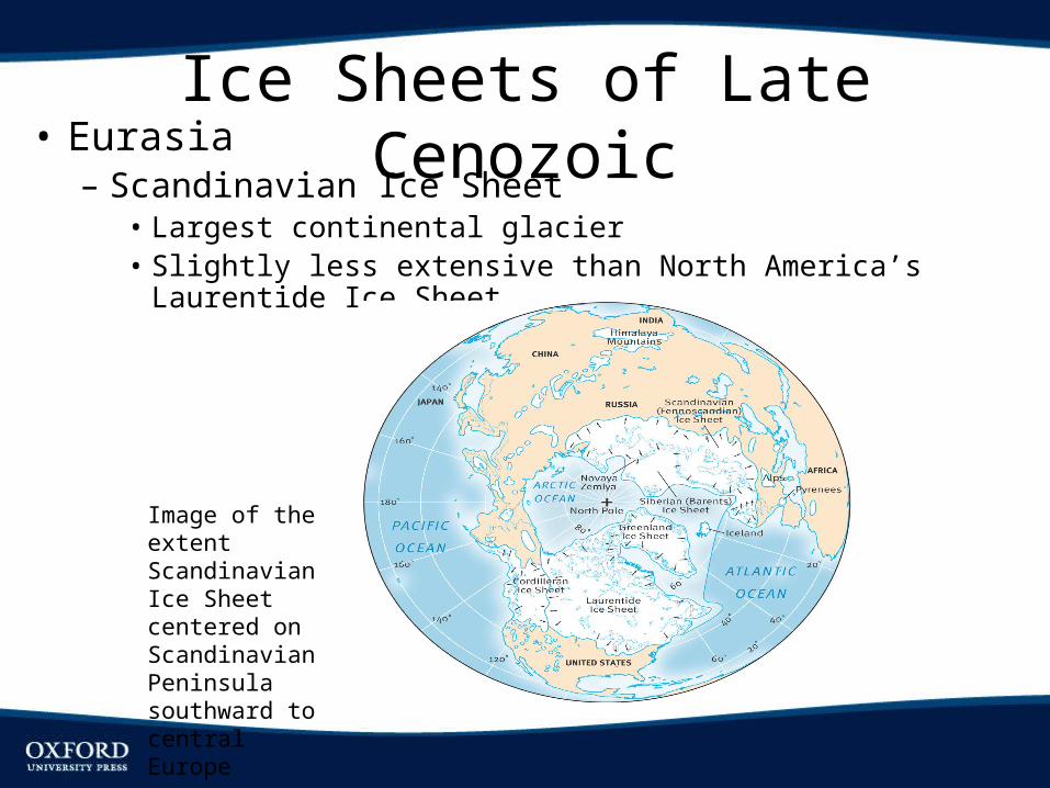
Ice Sheets of Late Cenozoic• Eurasia– Scandinavian Ice Sheet
• Largest continental glacier• Slightly less extensive than North America’s Laurentide Ice Sheet
Image of the extent Scandinavian Ice Sheet centered on Scandinavian Peninsula southward to central Europe
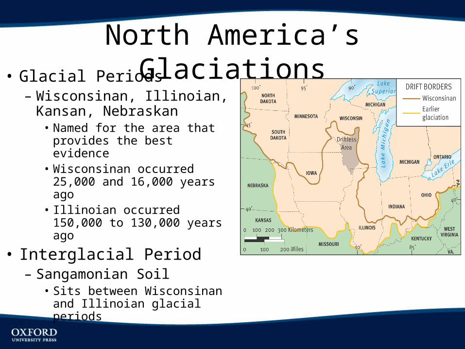
North America’s Glaciations• Glacial Periods– Wisconsinan, Illinoian,
Kansan, Nebraskan• Named for the area that
provides the best evidence• Wisconsinan occurred
25,000 and 16,000 years ago• Illinoian occurred 150,000 to
130,000 years ago
• Interglacial Period– Sangamonian Soil
• Sits between Wisconsinan and Illinoian glacial periods
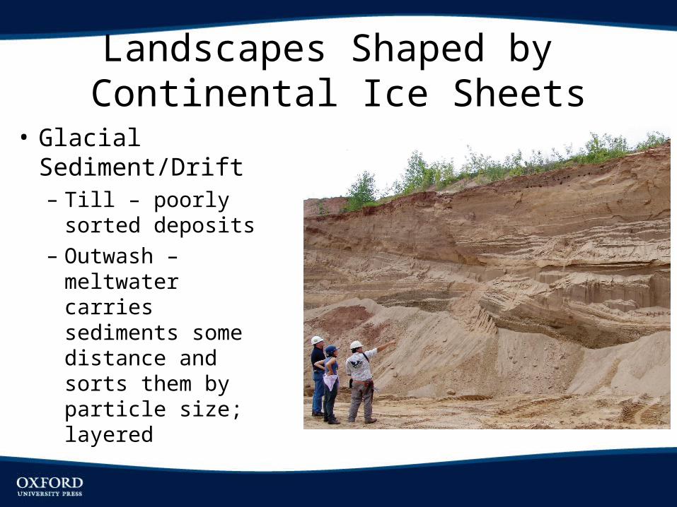
Landscapes Shaped by Continental Ice Sheets
• Glacial Sediment/Drift– Till – poorly sorted
deposits– Outwash –
meltwater carries sediments some distance and sorts them by particle size; layered
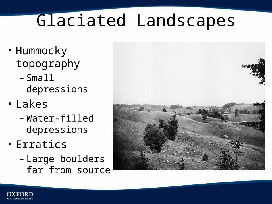
Glaciated Landscapes
• Hummocky topography– Small depressions
• Lakes– Water-filled
depressions
• Erratics– Large boulders far
from source
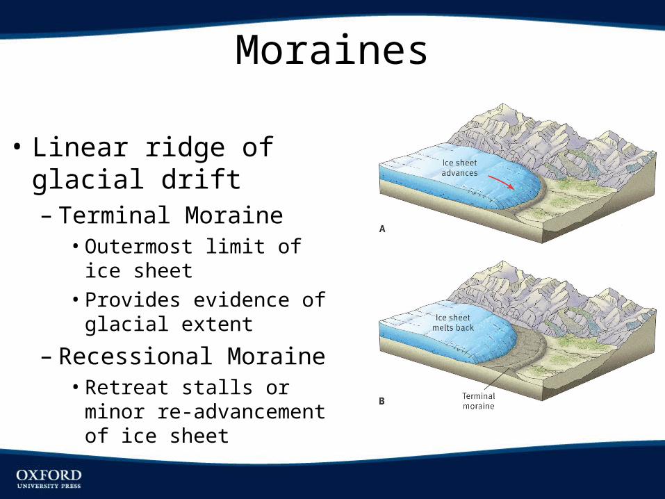
Moraines
• Linear ridge of glacial drift– Terminal Moraine• Outermost limit of ice sheet• Provides evidence of glacial
extent
– Recessional Moraine• Retreat stalls or minor re-
advancement of ice sheet
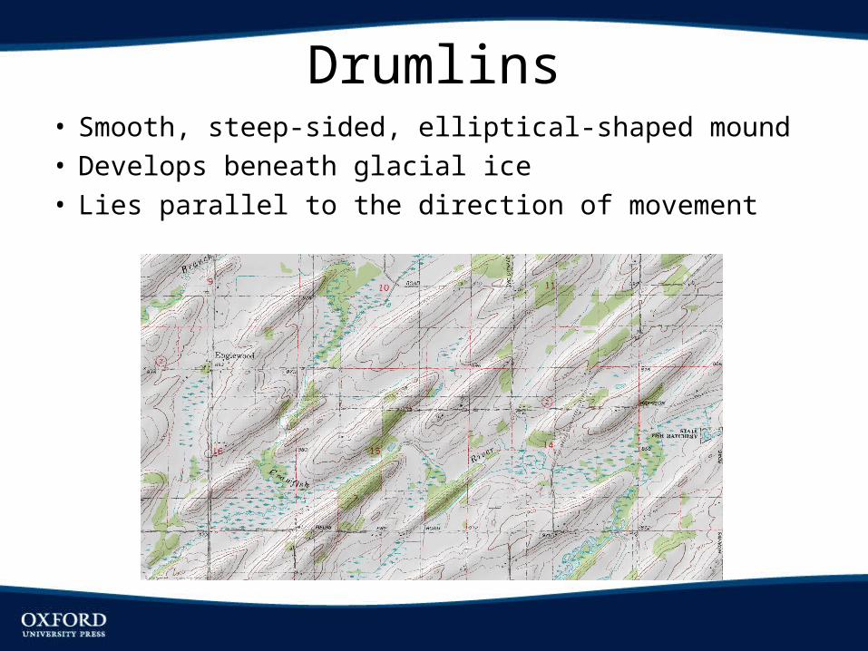
Drumlins• Smooth, steep-sided, elliptical-shaped mound• Develops beneath glacial ice• Lies parallel to the direction of movement
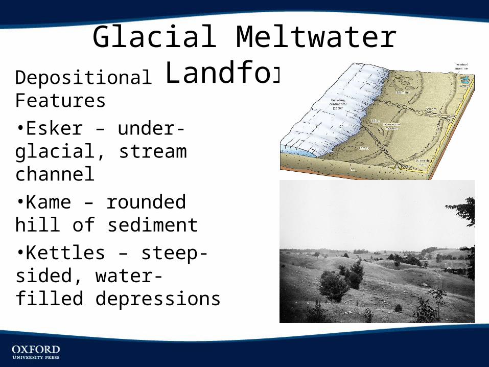
Glacial Meltwater LandformsDepositional Features•Esker – under-glacial, stream channel•Kame – rounded hill of sediment•Kettles – steep-sided, water-filled depressions
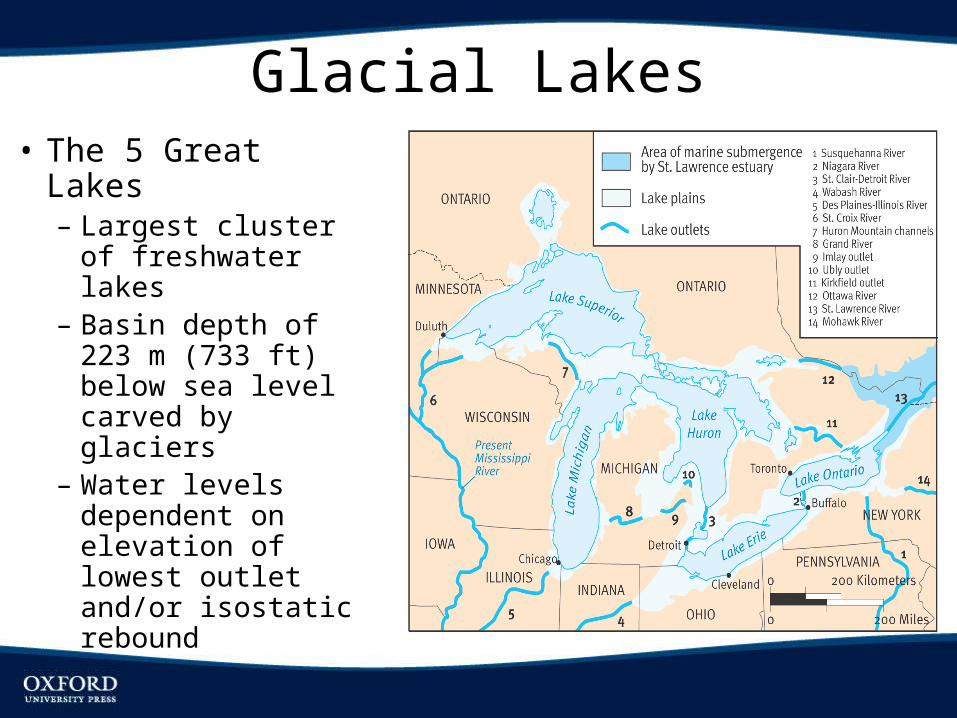
Glacial Lakes• The 5 Great Lakes– Largest cluster of
freshwater lakes– Basin depth of 223
m (733 ft) below sea level carved by glaciers
– Water levels dependent on elevation of lowest outlet and/or isostatic rebound
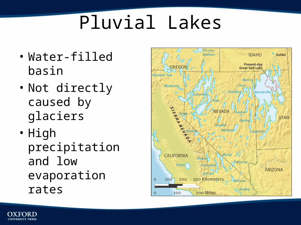
Pluvial Lakes
• Water-filled basin• Not directly caused
by glaciers• High precipitation
and low evaporation rates