Embed Size (px)
Citation preview
KABALE | SETTLEMENT PROFILES 1
[2010]
NATIONAL SLUM DWELLERS FEDERATION
OF UGANDA
AUGUST 2010
KABALE CITY

KABALE | SETTLEMENT PROFILES 2
FORE WORD
ACTogether Uganda, Uganda Slum Dwellers Federation in partnership with Kabale municipal council
and Ministry of Lands Housing and Urban Development with support from SDI and Cities Alliance,
found it necessary that they collect this information so that the challenges of the urban poor living in these
slum settlements can be brought to the fore-front in planning and development of Kabale Municipality.
The purpose of putting together these profiles is to provide an inner understanding and most
uncomfortable truth about the status of the urban slum settlements in Kabale. The report comprises of a
list of slum settlements in Kabale municipality and carries the most standardized detail of the informal
settlements as provided by slum dwellers them selves.
It’s paramount to note that the variables were not derived from professionals, academicians or technical
people but rather the slum dwellers themselves who most understand the slum conditions simply because it’s
where they live and spend their time.
It was also found very necessary to collect the past and present histories of each slum because with
experience gained from working in slums, the history of each area has a significant role to play in its
upgrading and development.
Kabale municipal council has put in place necessary legal and regulatory mechanisms to safe guard the
rights of people living in slum settlements and ensure that harmony, cohesion and inclusive development is
given a priority. The profile recognizes the presence, potentials and partnerships of people living in slums.
Kabale Municipal council authorities is fully committed to put inclusive urban development and use the slum
profile Inventory as a planning tool for the better development of Kabale into a city .
Dr. Pius Ruhemurana
Mayor Kabale Municipal Council

KABALE | SETTLEMENT PROFILES 3
ACKNOWLEDGEMENT
AN INCOPORATE LIST OF THECONTRIBUTORS
Special appreciations go to Uganda Slum Dwellers Federation members who participated in the profiling
exercise. These include: Gabiri Mariam (Jinja) , Katana Gorret –(Kampala), Nanono Aisha (Kampala),
Batamuliza Sheila, Samia Edith (Jinja), Eluju Steven (Kampala),Nkasibwe Gilbert, Kalela Richard,
Bitekateko Ali, Mbaganizi, Tugume Christopher, Kassuja Sam, Mujuni Pamela, Kombozi Brose and
Isaac .
THEY WERE SUPPORTED BY THE ACTOGETHER UGANDA TEAM
COMPRISING:
Catherine Nimusiima , Lutwama Meddie, Kakaire Waiswa ,Freddie Mugisa, Nshemereirwe Fiona
,Nyamweru Helen, Sarah Ibanda Julius Nandeba.
AND KABALE MUNICIPALITY:
Mr. Peter Masiko (Deputy Town Clerk), Mr. Karuhize (Municipal Agent) and staff of Kabale Municipal
Council for cooperation and support rendered during the exercise.

KABALE | SETTLEMENT PROFILES 4
EXCECUTIVE SUMMARY
Profiling of Kabale municipality was done as part of a Cities’ Alliance supported project for transforming
settlements of the urban poor in partnership with Uganda Slum Dwellers Federation, ACTogether-
Uganda and the Municipality of Kabale. The exercise was mainly geared towards identifying the informal
settlements within the city and finding out details about these areas on issues of land, housing, population,
basic and social services, economic activities, governance, community priorities and the historical
background of the settlement.
The profiling exercise revealed that Kabale has got a total of 12 informal settlements with a population of
over 8505 people living in the Municipality. The settlements occupy about 751 acres of land and the
majority of the settlers are tenants paying rent ranging between 5000 to 50000 shillings per month. Over
80% of the people within the informal settlements in Kabale are low income earners who earn an average
daily income of 2000 - 5000 shillings.
The sole purpose of carrying out a city profile in Kabale was to unveil valuable information about those
areas that are often over looked by authorities and yet harbour the people that influence the development
of a city. The information gathered during this exercise will therefore go a long way in influencing the
development of the city. Important to note is the fact that the information gathered was not derived from
professionals such as lawyers, planners, architects, engineers and the like but from community leaders and
elders identified by the community themselves as being more knowledgeable about their areas. The exercise
is also meant to encourage community participation in developmental activities.
KABALE | SETTLEMENT PROFILES 5
OBJECTIVES
In the process of developing towns to create inclusive cities, bridging the gap between the urban poor and
the developed communities is an important aspect of the process. The profiling exercise therefore intends;
1. To enable the slum dwellers and the Municipality to gather baseline information such as, Housing,
population, infrastructure, basic service provision, livelihoods and governance that can be used for
planning and guidance in the delivery of social services in all the informal settlements within Kabale
municipal council
2. To strengthen the working relationship between the urban poor communities and Kabale municipality
as they share information that can be used for the upgrading of informal settlements
3. To enhance the capacities of the slum dwellers involved in the research to collect and appreciate the
use of self generated information in addressing the development needs of the their settlements
KABALE | SETTLEMENT PROFILES 6
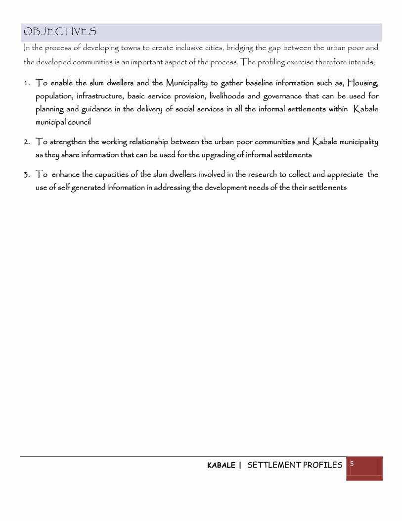
KABALE PROFILE
Division Settlements Land Area
(acres) Population Households No.
of
structures
Central Kigongi – A 65 3200 700 300
Rwakaraba –A 60 1535 307 52
Konyo 80 140 28 28
Kigongi – B 65 450 290 290
Rutenga cell 90 600 150 120
Kanyakiriro 90 500 100 60
Nyakahita 70 250 60 60
Kitojo 45 350 186 136
Rwakaraba – B 70 450 302 76
Northern Kakabano 27 380 120 80
Kabahangara 30 300 79 70
Southern Kirigime 50 350 80 50
Total 742 8505 2402 1322
Table 1: Summary of the profile of the settlements in Kabale city

KABALE | SETTLEMENT PROFILES 7
TABLE OF CONTENTS
FORE WORD .................................................................................................................................................................................... 2
ACKNOWLEDGEMENT ......................................................................................................................................................... 3
EXCECUTIVE SUMMARY ..................................................................................................................................................... 4
OBJECTIVES ............................................................................................................................................................................ 5
TABLE OF CONTENTS ......................................................................................................................................................... 7
METHODOLOGY .................................................................................................................................................................... 8
LOCATION AND BACKGROUND ............................................................................................................................... 9
SETTLEMENT PROFILES .................................................................................................................................................. 10
KIGONGI SETTLEMENT ................................................................................................................................................ 10
KONYO SETTLEMENT ................................................................................................................................................... 13
NYABIKONI SETTLEMENT .......................................................................................................................................... 16
KIJUGUTA SETTLEMENT (FOCUS ON RWAKARABA B) ..................................................................... 19
UPPER BUGONGI SETTLEMENT (KAKABANO) .......................................................................................... 23
KARUBANDA SETTLEMENT..................................................................................................................................... 26
KIRIGIME SETTLEMENT (Kihaha) ................................................................................................................................ 29
KEKUBO SETTLEMENT ............................................................................................................................................... 32

KABALE | SETTLEMENT PROFILES 8
METHODOLOGY
The profiling exercise involves active participation of community leaders, the municipality and the local
people. This includes having a series of meetings with the Municipality/ Division officials to obtain
secondary data about the informal settlements and the entire municipality.
The profiling team then meets with the LCs and councillors to identify the local teams to work with the slum
dwellers federation during the exercise.
Training of the local teams is done to ensure that
the information gathered during the profiling
exercise is accurate and can be used as a basis
for planning.
Field surveys are carried out by the profiling team
supported by ACTogether staff. During the
field surveys, interviews and focused group
discussions are carried out.
The collected data is analyzed and returned to
the community for verification. Verification is
done by the relevant authorities in the
municipality and other information that can be
gathered physically is done on ground by the
profiling team in charge of verification.
City profiling reports are produced by
ACTogether-Uganda and these are to be presented to the municipality government officials for
endorsement. The endorsed slum profiles reports are regarded as a basis for the collaboration between
organised slum dweller communities and the municipality in development.
Figure 1: First meeting with the councillors, LCs and municipal council at Kabale
municipal council

KABALE | SETTLEMENT PROFILES 9
LOCATION AND BACKGROUND
Kabale Municipality is located in the South of Western Uganda and is also the prime urban centre in the
District considering the fact that Karukara, Muhanga and Katuna have been elevated to Urban Council
status. Kabale is predominantly occupied by Bakiga, Banyankole, Banyarwanda and the other tribes
living in this area include: Baganda, Acholi, Luo and Bafumbira.
Kabale municipality is made up of three (3) divisions that is
Northern, Southern and Central Divisions. There are twelve (12)
wards with each Division having four (4) wards and then subdivided
into seventy four (74) villages. Kabale municipality has a number of
informal settlements that cut across all division. These include:
Katoojo, Rwakalaba B and Kakabano in Northern division,
Kabahangara and Kirigime in Southern division whereas Central
division has the biggest number of informal settlements in Konyo,
Kigongi A, Kigongi B, Rwakaraba A, Rutenga and Nyakahita.
Figure 2: Map of Uganda showing the location of Kabale
District

KABALE | SETTLEMENT PROFILES 10
SETTLEMENT PROFILES
KIGONGI SETTLEMENT
This settlement consists of Kigongi A, Kigongi B and Nyakahita and it is located in the Central Division.
This study put particular focus on Kigongi A since it was the main informal settlement in Kigongi
Brief History
The settlement started in 1920 and it was first inhabited by Bitwahiki who came from Rwanda and Rubugo
from near Lake Bunyonyi. They came to this place because of hunting. This place was a slippery and thus
the name Kigongi was derived from the nature of the area.
Land and Tenure System
Kigongi settlement land size is about 200 acres and it is owned by individuals though residents must seek
municipal approval before carrying out any developments.
Population
The total population of this area is estimated to be 3900 people of whom there are about 1050
households. The total number of structures is estimated to be 650.
Housing Information
The total number of structures is estimated to be 650 with the average room size ranging from 3*3, 9*10
and 8*10 ft. The average housing capacity is 5. Most of these houses are owned by landlords who charge
about 5,000-100,000 UGX every month as rent.
Basic Services (Utilities)
Kigongi settlement gets its water from
one protected spring and piped-water
points that are owned privately of which
most families have easy access to. There
is a fee of UGX 100 per jerry can on
the piped water points.
Spring water is free for all the people.
There were boreholes in this are but

KABALE | SETTLEMENT PROFILES 11
they are all out of use due to poor maintenance.
There is no sewer infrastructure in the area and the residents use pit latrines for the disposal of human
waste. Basically, there are about 280 pit latrines in this settlement owned by the landlords. There is no
price for usage since they rent the houses
They also have 2 built-up drainage channels to drive off other kinds of dirt. However, they flood during the
rainy season.
There are garbage collection points in the
settlement that are maintained by the
municipality. Residents also dump waste in their
gardens to make manure.
The area has electricity infrastructure in place
though it is mostly used for lighting alone and the
residents mostly use charcoal, firewood as
alternative sources of energy for cooking.
The community is accessed through Mbarara-
Kabale road which is an external road. Inside the
settlement there is Kigongi road which is a
murrum road and other smaller internal network
of roads that are not named. Some of these
roads can be so muddy and impassable in the rainy
season.
Social Services
The area has no schools however children in this settlement go to school in the neighboring cells. These
schools; include Rushaki Primary School (5KM), Kabale P/s (4km), and Junction P/s (2km) and Kabale
parents’ P/s (0.5km) and all these schools are government aided.The area has one health centre 2 medical
facilities called YARD that is government aided, 2 drug shops and 5 clinics privately owned. The cost
charged in the private clinics depends on the illness the patient is suffering from with the prevalent medical
Figure 3: Garbage disposal in the area

KABALE | SETTLEMENT PROFILES 12
needs being Malaria, flu, cough and HIV/AIDS. There is no cost charged in the Government health
centre though it lacks some of the facilities and even drugs at times.
Economic Activities
Residents in this settlement are mostly self-employed. Most of residents carry out subsistence farming on
the mountain slopes out of the municipality. A few of the locals are public servants. Other people do small
jobs such as grazing other people’s cattle out of the municipality, motorcycle riders (bodaboda) and
traders-business owners.
Governance and Community Participation in Development
Kigongi is governed by the Local Council and funds available for community development are local
revenue, Local Government Management and Service DeliveryProgramme and Community Driven
Development which are used for maintenance of the roads, the springs and bush clearing though there is
little evidence that is seen on the ground. There are also a few development interventions in the form of
CBO’s (self help groups) such as the Kigongi Cooperative Farmers, Business Association and Kigongi
Mwezikye Group, Nyakahita food project and Nyakahita Tunguka which is a saving and credit
organization. There are also some NGO’s such as Compassion and African Child which supports
children with school fees.

KABALE | SETTLEMENT PROFILES 13
KONYO SETTLEMENT
This settlement is located in Central Division of Kabale Municipality.
Brief History
The settlement started around 1956 with the construction of Kigezi College, Butobere. The first
inhabitants were builders at the school. Konyo means salt and the land in this place is swampy and
salty, hence the name.
Land and Tenure System
Konyo settlement land size is about 80 acres. Land in this settlement is owned by individuals though
residents must seek municipal approval before carrying out any developments because the land is
owned under lease agreement.
Population
The total population of this area is estimated to be 140 people in whom there are about 28
households. The total number of structures is estimated to be 28.
Housing Information
The total number of structures is estimated to be 28 with the average room size ranging from 8*6,
9*10 .The average housing capacity is 4. Most of these houses are owned by landlords who charge
about 5,000-15,000 UGX every month as rent.
Basic Services (Utilities)
Konyo settlement gets its water from a protected spring which is free of charge; the residents do not
pay for usage.
There is no sewer infrastructure in the area and very a few of the residents have pit latrines. Some
times the community members use the bush for the Toilets. It is therefore not clear how they dispose
of the human waste.

KABALE | SETTLEMENT PROFILES 14
There are no drainage channels or dykes to drive away other kind of waste or water hence a health
hazard.
The area also lacks garbage collection
point. Residents damp garbage at any
given place.
The area has electricity infrastructure in
place. People also use charcoal, gas and
fuel as alternative sources of energy.
It has both internal and external roads;
Konyo and Nyabushabi roads being the
internal ones and Butobere road as the
external road.
Social Services
This community has no educational facility however children from this settlement walk a distance of
about 3km to Butobere Primary and secondary school and others go to Junction p/s which is
about 4km away.
Butobere settlement has neither health centre nor any other health facility. For any health needs,
they have to visit the neighbouring cells which are about 5km. The prevalent medical needs for the
people are interventions against Malaria and cough/flu.
Economic Activities
The people of Konyo are basically subsistence farmers though others have small business from
which they earn their livelihood. A small percentage also make local brew while others are brick layers
and lumber jacks. They take home an average of UGX 2,500 everyday which is so little to sustain
themselves and their families. Women dig in farms and only a few are housewives.
Figure 4: Garbage is dumped anywhere because of lack of a designated point

KABALE | SETTLEMENT PROFILES 15
Governance and Community Participation in Development
The residents have a local council, system as well as a council of elders who decide on issues that
affect them. The residents are also organized to handle security concerns with the help of the Local
Council and the elders. Residents are aware of the Local Government Management and Service
Delivery Programme but claim that they do not benefit from it directly and in fact have nothing to
show the presence of such a program. There is CBO in the name of Konyo Timber Society who
assist members on funeral arrangements when such a tragedy hits them. There is also an NGO-
Joint Clinical Research Centre which provides health services to the people such as free
counseling and drugs, some residents said they had benefited from NAADS program which is a
government program aimed at improving living standards.
Community Priorities
The people in this settlement identified the following as their priorities, construction of public
toilets, health centres, extension of security lights and construction of garbage collection points as
well as the opening up of new roads.

KABALE | SETTLEMENT PROFILES 16
NYABIKONI SETTLEMENT
This settlement consists of Rwakaraba A, Kanyakiriro and Rutenga Villages and it is located in
the Central Division.
Brief History
This settlement existed before 1930s however by then people were sparsely populated, it’s only
after 1960 that the population increased in this area. Nyabikoni derived its name from the fact that
this place used to be soggy with clay and slippery especially whenever it rained, so residents had to
use walking sticks locally known as “Enkoni” so as to support themselves while walking; thus the
name Nyabikoni.
Land and Tenure System
Nyabikoni settlement has a total area of approximately 240 acres. Land in this settlement is owned
by individuals though residents must seek municipal approval before carrying out any developments.
Population
The total population of this area is estimated to be about 2635 people in whom there are about
households. There are about 232 structures in this settlement.
Housing Information
The area has about 232 structures with the average size ranging from 8*6 and 8*10 and the houses
are made from readily available materials like wattle, bricks and iron sheets. Some houses have
cemented floors,. Most of these houses are owned by landlords who charge about UGX 10,000-
100,000 every month as rent to their tenants.

KABALE | SETTLEMENT PROFILES 17
Basic Services (Utilities)
Nyabikoni settlement gets its water from
a protected spring and taps and a river
though it water is very dirt and not good
for human consumption. The taps are
both privately and publicly owned and
the residents pay a fee of UGX 100 per
jerry can for the water. The water points
are owned by both the landlords who own
the houses in the settlement and the
Government which has one tap.
The water in the spring is free of charge.
People in this settlement have pit latrines for
the disposal of human waste, there is no sewer infrastructure. The total number of pit latrines is
about 100 in this settlement owned by the landlords. There is no price for usage since they rent the
houses.
They have drainage channels, and ditches/dykes maintained by the landlords, the locals and the
municipal council.
Other kind of waste is collected in skips and rubbish pits and it is disposed of by the municipal
council.
The area has electricity infrastructure though most home are not yet connected due the high cost
attached to it. People also use charcoal, paraffin and firewood as alternative sources of energy.
The settlement is accessed though Kisoro road, Kekubo road, Nyabikoni road and there are many
other internal roads around 7 though they are not yet named.
Social Services
The area has only 1 nursery school, 2 primary schools and 1 secondary school.
Figure 5: A spring well in the settlement
KABALE | SETTLEMENT PROFILES 18
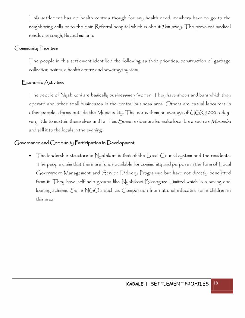
This settlement has no health centres though for any health need, members have to go to the
neighboring cells or to the main Referral hospital which is about 3km away. The prevalent medical
needs are cough, flu and malaria.
Community Priorities
The people in this settlement identified the following as their priorities, construction of garbage
collection points, a health centre and sewerage system.
Economic Activities
The people of Nyabikoni are basically businessmen/women. They have shops and bars which they
operate and other small businesses in the central business area. Others are casual labourers in
other people’s farms outside the Municipality. This earns them an average of UGX 5000 a day-
very little to sustain themselves and families. Some residents also make local brew such as Muramba
and sell it to the locals in the evening.
Governance and Community Participation in Development
The leadership structure in Nyabikoni is that of the Local Council system and the residents.
The people claim that there are funds available for community and purpose in the form of Local
Government Management and Service Delivery Programme but have not directly benefitted
from it. They have self help groups like Nyabikoni Bikaoguze Limited which is a saving and
loaning scheme. Some NGO’s such as Compassion International educates some children in
this area.
KABALE | SETTLEMENT PROFILES 19
KIJUGUTA SETTLEMENT (FOCUS ON RWAKARABA B)
This settlement consists of Katojo and Rwakaraba -B and it is located in the Northern Division.
Brief History
The settlement started in 1900. Katojo means a swamp with wattle occupied by the Bafumbira and
Bakiga who came from Kisoro looking for land. They were pushed to cultivate and rear animals.
They were pushed by missionaries from Rugarama hill down to Ruhita (free land) it is near the
Kigezi diocese
Rwakaraba is a Kinyarwanda name; Bufumbira and Bakiga were the first settlers from Kisoro.
They came to look for a free land in order to cultivate and rear animals, they first settled on
Rugarama hill where the Kigezi Diocese is located.
Land and Tenure System
Nyakahita land size is approximately 113 acres and it is owned by individuals though residents must
seek municipal approval before carrying out any developments.
Population
The total population of this area is estimated to be 800 people and there are about 488
households. The total number of structures is about 212.
Housing Information
The area has about 212 structures; the average size being 8*10 and 6*4 .The houses are made of
wattle, bricks cement and iron sheets. Most of these houses are owned by landlords who charge
about 5,000-40,000 UGX every month as rent.
KABALE | SETTLEMENT PROFILES 20
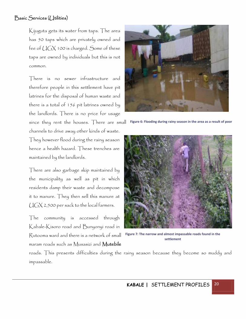
Basic Services (Utilities)
Kijuguta gets its water from taps. The area
has 50 taps which are privately owned and
fee of UGX 100 is charged. Some of these
taps are owned by individuals but this is not
common.
There is no sewer infrastructure and
therefore people in this settlement have pit
latrines for the disposal of human waste and
there is a total of 156 pit latrines owned by
the landlords. There is no price for usage
since they rent the houses. There are small
channels to drive away other kinds of waste.
They however flood during the rainy season
hence a health hazard. These trenches are
maintained by the landlords.
There are also garbage skip maintained by
the municipality as well as pit in which
residents damp their waste and decompose
it to manure. They then sell this manure at
UGX 2,500 per sack to the local farmers.
The community is accessed through
Kabale-Kisoro road and Bunyonyi road in
Rutooma ward and there is a network of small
maram roads such as Musasizi and Mutebile
roads. This presents difficulties during the rainy season because they become so muddy and
impassable.
Figure 6: Flooding during rainy season in the area as a result of poor
drainage
Figure 7: The narrow and almost impassable roads found in the
settlement

KABALE | SETTLEMENT PROFILES 21
The area has electricity infrastructure though people also use charcoal, gas and fuel as alternative
sources of energy.

KABALE | SETTLEMENT PROFILES 22
Social Services
The area has only one nursery school, one primary school and one secondary school, but there is no other
education facility available. Children in this community go to the neighbouring cell to access education.
This settlement has no health centre. Health services are accessed from the neighbouring cells such as
Rugarama Hospital which is about 4km away. The prevalent medical need is Malaria.
Community Priorities
Residents of this area identified the following as their priorities, water points, public toilets, drainage
systems and health centres and opening up of roads.
Economic Activities
The residents of Kijuguta settlement are animal keepers and subsistence farmers though they do it outside
the municipality on the mountain slopes. Others have businesses such as shops selling household
consumables, bodaboda riders and casual labourers where they earn about UGX 2,000-5,000 daily
depending on the job.
Governance and Community Participation
Kijugata area has a local council system and it also has pinion leaders who decide on some issues. They
have no registered CBO and there is no NGO in place. Residents indicated that there is little
participation in development processes most especially because there are no meetings held to facilitate
wider participation.
KABALE | SETTLEMENT PROFILES 23
UPPER BUGONGI SETTLEMENT (KAKABANO)
This settlement consists of Kakabano village and it is located in the Northern Division.
Brief History
It started in 1900 and the first settler was Rukinde from Kisoro. The land was fertile so he settled
in the area with his cattle. Kakabano comes from the word “okubana” in Kifumbira which means
being together.
The place is now occupied by a large number of the Bukiga who mostly come from Bunyonyi area
to Kakabano which is a trading area of upper Bunyonyi.
Land and Tenure System
Kakabano land size is about 4 acres and it is owned by individuals though residents must seek
municipal approval before carrying out any developments.
Population
The total population of this area is estimated to be about 720 people in whom there are about 120
households. There are about 80 structures in this settlement.
Housing Information
The area has about 80 structures with about 160 rooms; the average size being 10*10 ft and the
houses are made of wattle, bricks cement and iron sheets. Most of these houses are owned by
landlords who charge about UGX 10,000-30,000 UGX every month as rent.
Basic Services (Utilities)
Upper Bugongi (kakabano) gets its water from the 3 taps that are privately owned. We used to have
gravity water but it all stopped working due to poor maintenance, even the 2 springs that used in our
settlement got spoiled due too poor maintenance. The cost of water in this settlement is about
UGX100UgX per20 litre jerry can.

KABALE | SETTLEMENT PROFILES 24
There is no sewer infrastructure in the area. They do have about 20 pit latrines but they do not last longer
because the water table in this area is very close thus making them sink soon after construction.
There is no drainage description in this place
and thus a lot of flooding in the settlement. The
area has electricity infrastructure although
people use charcoal, gas and firewood as other
sources of energy.
The settlement is accessed through Bugongi
road. There are other internal such as
Bigombe, Ngorogoza,
Rutogire,Nyakirima,Katabazi, Rucecerwa and
Nkunda.
Social Services
The area has 2 primary schools that is
Makanga, Lower Bugongi and Kigezi High School
primary school that are located in a distance of about 2.5km. However the area has no Government Aided
secondary schools.
It also has no health centre. People in this area go to Rugarama hospital which is about 4 km to access
medical care. The prevalent medical needs are malaria, flu and cough.
Economic Activities
Residents in this area conduct small business and make local brew for sale. They earn an average of UGX
1000-2000 which is so little to sustain their families.
Figure 8: Flooding in the settlement after the rain
KABALE | SETTLEMENT PROFILES 25
Governance and Community Participation
Local representation in the area is through the local council. The residents are aware of the Local
Government Management and Service DeliveryProgramme but they say they do not benefit from it in any
way. The area has no registered CBO and there is no NGO in the area. People are not involved in
development processes such as in areas of sanitation and they were positive that with this program they will
be able to do something about the development in their area.
Community Priorities
The people in this settlement identified the following as their priorities, construction of schools, public
toilets, and construction of drainage and sewerage systems, police post and provision of more water points.
KABALE | SETTLEMENT PROFILES 26
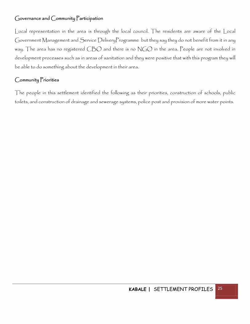
KARUBANDA SETTLEMENT
This settlement consists of Karubanda village and it is located in the Southern Division.
Brief History
The settlement was named according to the creation. There were trees called Emihangara and later the
settlers called it Kabahangara. These settlers were from Rwanda due to conflict and these were the
Bazigaba
Land and Tenure system
Karubanda land size is 30 acres and it is owned by individuals though residents must seek municipal
approval before carrying out any developments the land.
Population
The total population of this area is estimated to be about 300 people in whom there are about 79
households. There are about 70 structures in this settlement.
Housing Information
The area has about 70 structures, the average size of rooms being 5*12 feet are made from readily
available materials such as and the houses are made of wattle, bricks cement and iron sheets. Most of these
houses are owned by landlords who charge
about UGX 5,000-30,000 every month as
rent.
Basic Services (Utilities)
In Karubanda settlement, people access water
from river Kiruruma although its water is very
dirty, stand piped water point that are for
NHSC and gravity water.
Sewer infrastructure is not in place and

KABALE | SETTLEMENT PROFILES 27
residents use pit latrines owned by the landlords for their human waste. There are about 70 pit latrines;
however there is no price for usage since they rent the houses.
They have drainage channels which are maintained by the municipality. These drainage system floods in
times of heavy rains posing a health hazard to the residents of Kabahangara.
Residents also have compost pits in which they dispose off garbage and when it becomes manure they use it
in their farms.
The area has electricity infrastructure but must people use charcoal and firewood as other sources of
energy.
The settlement is accessed through Kabale-Katuna road road to Kiruba-Rubaga road. There are other
identified internal roads such as Ntemba,
Rugarisa and Karivalio as the external
road.
Social Services
The area has one private nursery school,
one primary school called Kitumba PS.
There are no secondary schools in this
area and children in this area move a
distance of 1-3km to access secondary
schools.
In this area we have Rushoroza health centre which is owned by an NGO working under Kabale diocese;
located in about 0.5km away from this area. The prevalent medical needs as identified by the residents are
Malaria and HIV/AIDS.
Community Priorities
The people in this settlement identified the following as their priorities, construction of public toilets,
creation of health centres, putting up of schools/educational facilities and construction of good drainage
systems.

KABALE | SETTLEMENT PROFILES 28
Economic Activities
The residents of this area do different activities for their livelihood. Some are brick layers; others work at
the quarries and sell sand while others make the local brew locally known as Omuramba. Most of them earn
an average of UGX 2000-5000 per day. Others still practice subsistence farming and cattle rearing.
Governance and Community Participation in Development
Local representation in this area is by the Local Council system. The residents claim that there are funds
from the Local Government Development Fund but little is done to develop their area. There is a
registered CBO in the name of Bikaoguze Kabaharannga. Residents also have other self help groups
which are not registered but which assist them in times of need.
KABALE | SETTLEMENT PROFILES 29
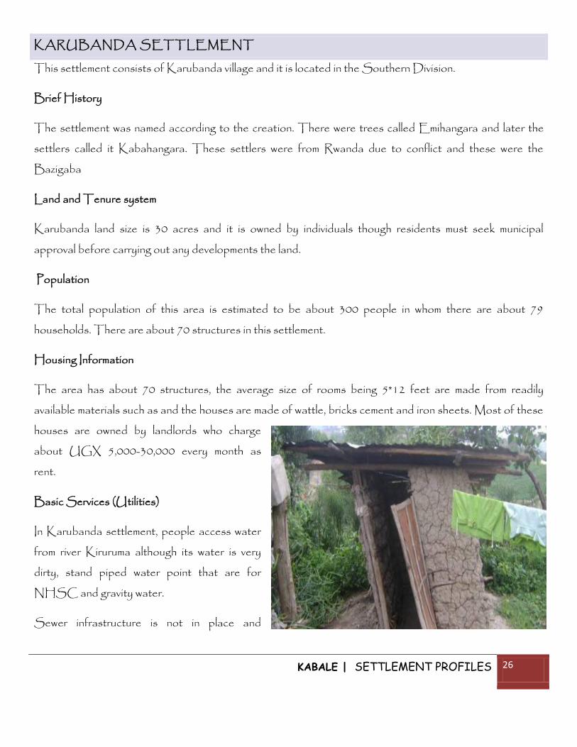
KIRIGIME SETTLEMENT (KIHAHA)
This settlement is found in the Southern division of Kabale Municipality.
Brief History
Kihaha settlement started in 1967 and the first settler was called Runaku from Rwanda. The place gets
very hot and the sun dries the grass thus the place was called Kirigime. The people who migrated to this
area came as refugees due to internal conflicts in Rwanda.
Land and Tenure System
Kihaha land size is 50 acres and it is owned by individuals though residents must seek municipal approval
before carrying out any developments the land.
Population
The total population of this area is estimated to be about 350 people in whom there are about 80
households. There are about 50 structures in this settlement.
Housing Information
The area has about 50 structures, the average size of rooms being 6*12 feet are made from readily
available materials such as and the houses
are made of wattle, bricks cement and iron
sheets. Most of these houses are owned
by landlords who charge about UGX
5,000-30,000 every month as rent.
Basic Services (Utilities)
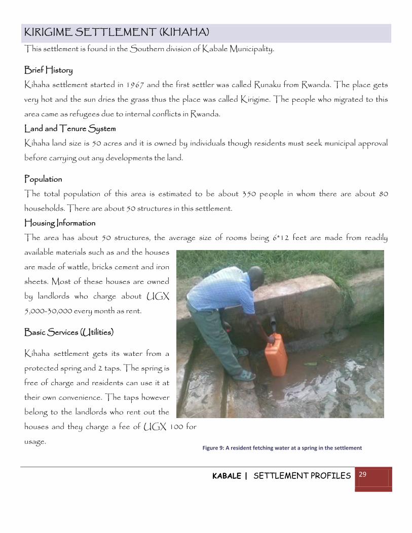
Kihaha settlement gets its water from a
protected spring and 2 taps. The spring is
free of charge and residents can use it at
their own convenience. The taps however
belong to the landlords who rent out the
houses and they charge a fee of UGX 100 for
usage. Figure 9: A resident fetching water at a spring in the settlement

KABALE | SETTLEMENT PROFILES 30
There is no sewer infrastructure and residents use pit latrines for disposal of human waste; of which they
are 50 of them. These are owned by the landlords.
There are no drainage channels in place and therefore the area has a tendency to flood posing health
hazards to the people of Kirigime.
Residents also have compost pits in which they dispose garbage and when it becomes manure they use it in
their farms.
The area has electricity infrastructure though people also use charcoal, gas and fuel as other sources of
energy.
The settlement is well serviced with both internal and external roads. They identified Bisamungu and
Rwakiseta as the internal roads and Mutango as the external road.
Social Services
The area has 1 education facility, Bishop Asilli primary school.
It also has one health centre called Kamukira H/C 4 which is located in a distance of about 1km. The
prevalent medical needs as identified by the residents are Malaria and HIV/AIDS.
Community Priorities
The people in this settlement identified the following as their priorities, construction of public toilets,
creation of health centres, putting up of schools/educational facilities and construction of good drainage
systems.

KABALE | SETTLEMENT PROFILES 31
Economic Activities
People in this settlement are brick layers and others work at the quarry. They sell sand and stones. Others
practice subsistence farming while others keep animals. The income is not much and people involve
themselves in many livelihood activities to make ends meet.
Governance and Community Participation in Development
Kirigime settlement is governed by the local council system. There are funds available for community and
purpose in the form of Local Government Management and Service Delivery Programme but there is
nothing much on ground to act as evidence for this. Self help groups exist in the area which involve rearing
animals such as poultry and goats and sell products while earning from the proceeds. They also practice
bee-keeping and sell it commercially to other cities such as in Kampala. People participation in development
activities especially in water and sanitation is still very poor most especially because they are not mobilized
in meetings.
KABALE | SETTLEMENT PROFILES 32
KEKUBO SETTLEMENT
History:
People used to come to this place to drink local brew and would take long thus people called it Kekubo
“literally meaning rubbing shoulders”. This place is also in a corner which is locally called Akakubo.
Land:
The settlement covers about 5 acres of land. The land is owned by the people but it’s managed by the
municipality.
Population:
The area has an approximate a population of about 300 people who some times increase during the day.
Housing information:
In kukube on average each household has about 5-8 members. These houses are roofed with iron sheets.
The structure size is 18-21ft. Since most houses are rentals the tenants are obliged to pay rent ranging
between ranging between UGX 25000 and 50,000 per month.
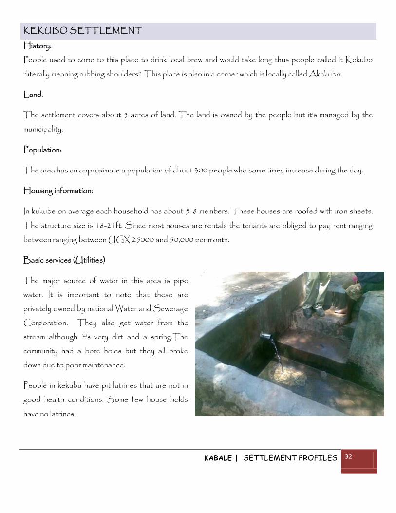
Basic services (Utilities)
The major source of water in this area is pipe
water. It is important to note that these are
privately owned by national Water and Sewerage
Corporation. They also get water from the
stream although it’s very dirt and a spring.The
community had a bore holes but they all broke
down due to poor maintenance.
People in kekubu have pit latrines that are not in
good health conditions. Some few house holds
have no latrines.

KABALE | SETTLEMENT PROFILES 33
The area is connected to the national grid of electricity but few people only use it for lighting because its
very expensive.
The area has no drainage channels and does not experience floods.
Kekubu area has a garbage skip that are managed by the municipality and others throw rubbish in their
gardens.
Social services
Education
Kekubu has only nursery schools, but there is no primary school so children go the neighbouring villages
about 1/2 kilometre in Kirigime. There is also no secondary school but he children go to Nyabikono,
Kabale S. S, and Cleveland S. S which are about ¾ kilometres.
Roads
The cell is accessed through Kekubo road,
but there are others about 5 internal murrum
roads that are not named.
Medical
There is no health centre but people access
medical services from Kamukira health centre
2 which is about 11/2 kilometres.
Income
Residents of this area commonly do small businesses like brick laying, working on construction sites, boda
bodas, hawkers, and bicycle repairs. On average a daily income is about 1000-2000ush.
Community priorities
The community suggested that improvements such as street lights, security, and surveying of the area
should be put in place.

KABALE | SETTLEMENT PROFILES 34
Conclusion
Having put all this information together it’s important to note that this slum profile report focuses mostly on
the informal settlements with in the municipality.