Embed Size (px)
Citation preview

J. Havskov
Seismology in developing countries, does it make sense ?
Introduction• University of Bergen has been involved in many seismological network projects, training workshops etc, mostly in developing countries
• We have had an international MSc and PhD program in seismology for 20 years training seismologists from many developing countries
• We have helped to develop low cost hardware and software
Why seismology• High risk countries: They have a real problem with high seismicity, volcanic eruptions and obviously need to know about the risks involved and to be able to advice the public
• Low risk countries:
• Enhanced knowledge of seismology and other fields in science is always a benefit
• Encourage international cooperation
• Local knowledge of seismology will help understand problems related to oil exploration, effects of dams, landslides etc
Why seismology II
• Seismology is just one type of science but it relates to something many people have experienced and there is therefore a need for local ‘experts’ to explain to the public
• For volcanic monitoring, it is a simple way of forecasting eruptions
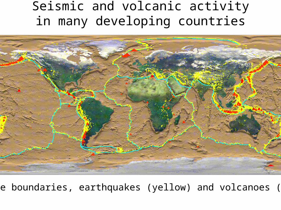
Plate boundaries, earthquakes (yellow) and volcanoes (red)
Seismic and volcanic activity in many developing countries
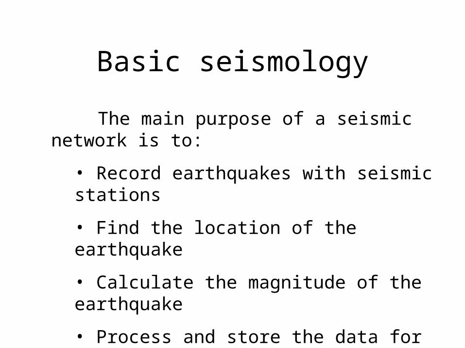
Basic seismology
The main purpose of a seismic network is to:
• Record earthquakes with seismic stations
• Find the location of the earthquake
• Calculate the magnitude of the earthquake
• Process and store the data for further scientific analysis

Seismic sensor
Mass
Damping
Spring
Measure of mass displacement
Principle behind the inertial seismometer
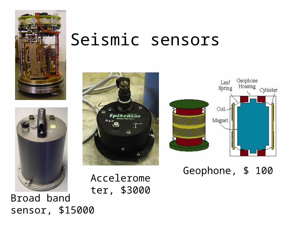
Seismic sensors
Broad band sensor, $15000
Geophone, $ 100Accelerometer, $3000
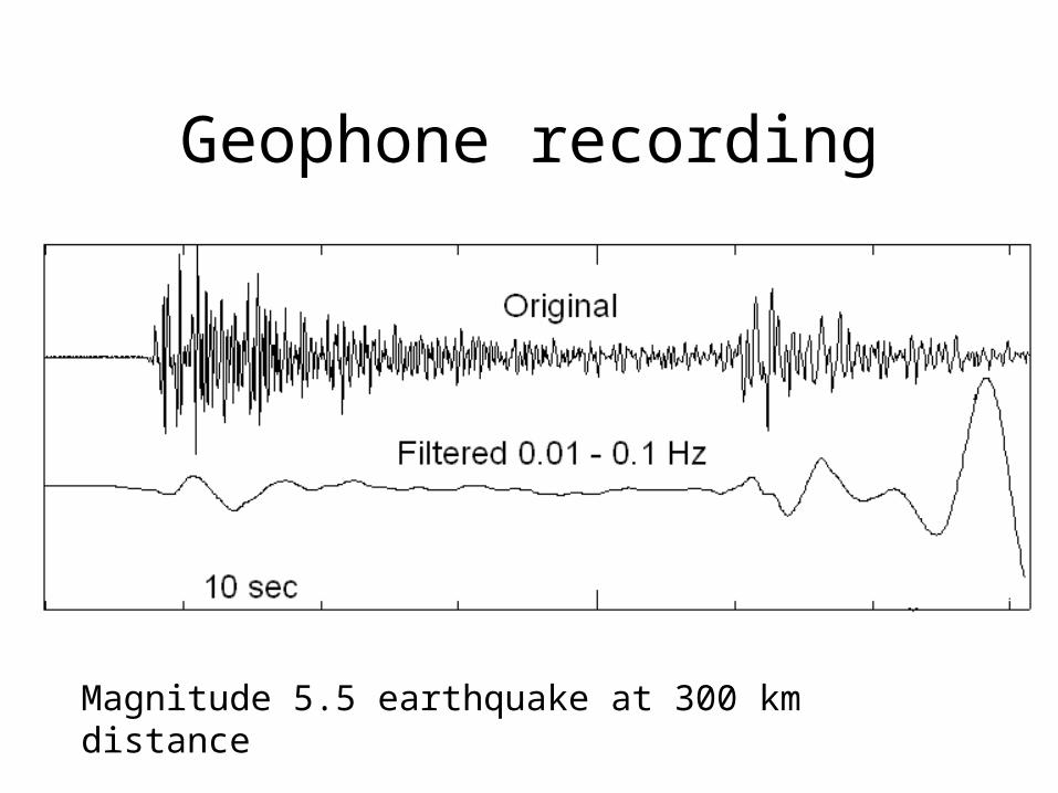
Geophone recording
Magnitude 5.5 earthquake at 300 km distance
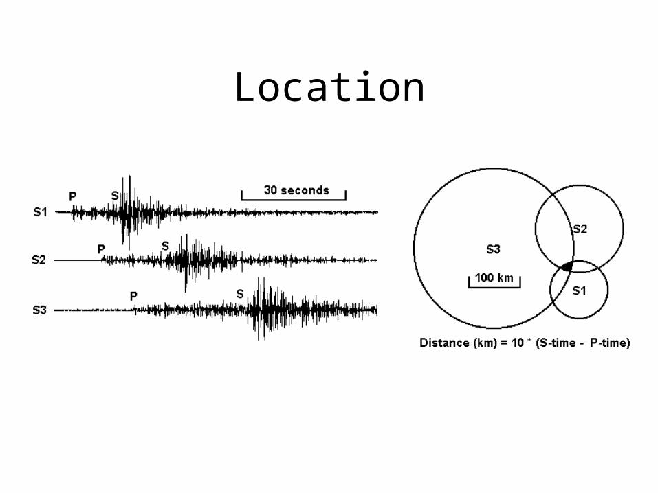
Location
Magnitude
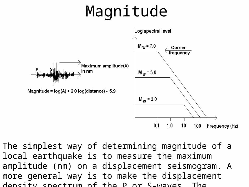
The simplest way of determining magnitude of a local earthquake is to measure the maximum amplitude (nm) on a displacement seismogram. A more general way is to make the displacement density spectrum of the P or S-waves. The magnitude can be determined from the spectral level.
Requirement to run a network
• Basic technical skills to physically operate network
• Seismological knowledge to process the data and inform the public
• Money
• People interested in running the network
Software
• Important to use a free, well tested software that can do all the routine operations required by the network of which the most important is: Local and global locations, calculate common magnitudes, correct for instrument response and store the data in a systematic way.
• The software should be able to be used on common computer platforms and use common formats.
• Training should be available

Equipment
• Before buying equipment, make sure main purpose of network is clear and that the funding for installation, operation and training is in place
• For a new network, the main purpose will be location and magnitude and there is no need for sophisticated instrumentation, simple and reliable is the main aim
• There will often be a push to install a broad band network, however accelerometers might do as well i order to get unclipped data, at a substantial lower price
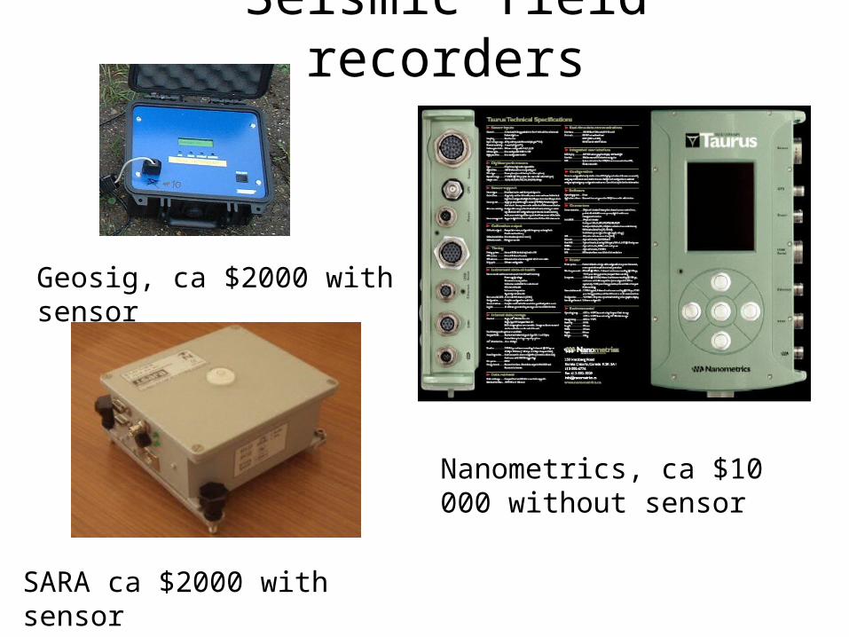
Seismic field recorders
Geosig, ca $2000 with sensor
SARA ca $2000 with sensor
Nanometrics, ca $10 000 without sensor
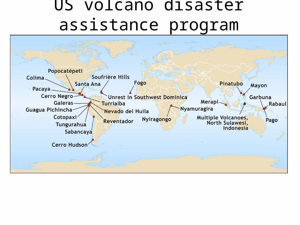
US volcano disaster assistance program
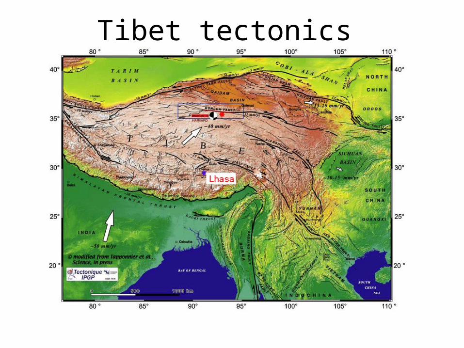
Tibet tectonics
Tibet project purpose
• Build and maintain a seismic network around Lhasa• Locate earthquakes and determine magnitude.• Advise the public about earthquakes occurring in the area.• Advise public authorities on all aspects of the local seismic risk and give general advice on earthquake related problems.• Calculate seismic hazard• Teach basic seismology and geophysics.• Build up a local database for research

Tibet station
Seismicity near Lhasa 2008. The number of recordings for this period is more than 2128, while 1837 of them fall in the above region. The stations are marked with blue.
A typical installation. The sensor to the left (small gray box), and the digitizer to the right.
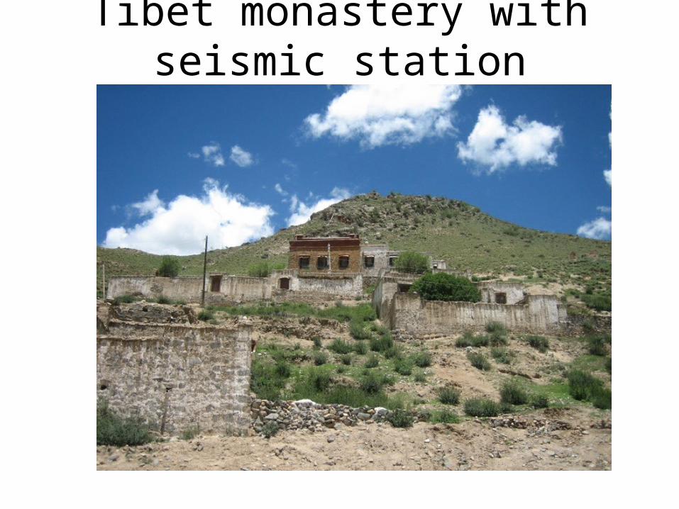
Tibet monastery with seismic station
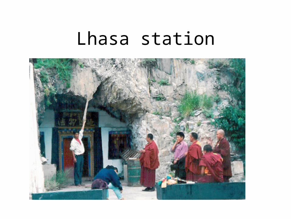
Lhasa station
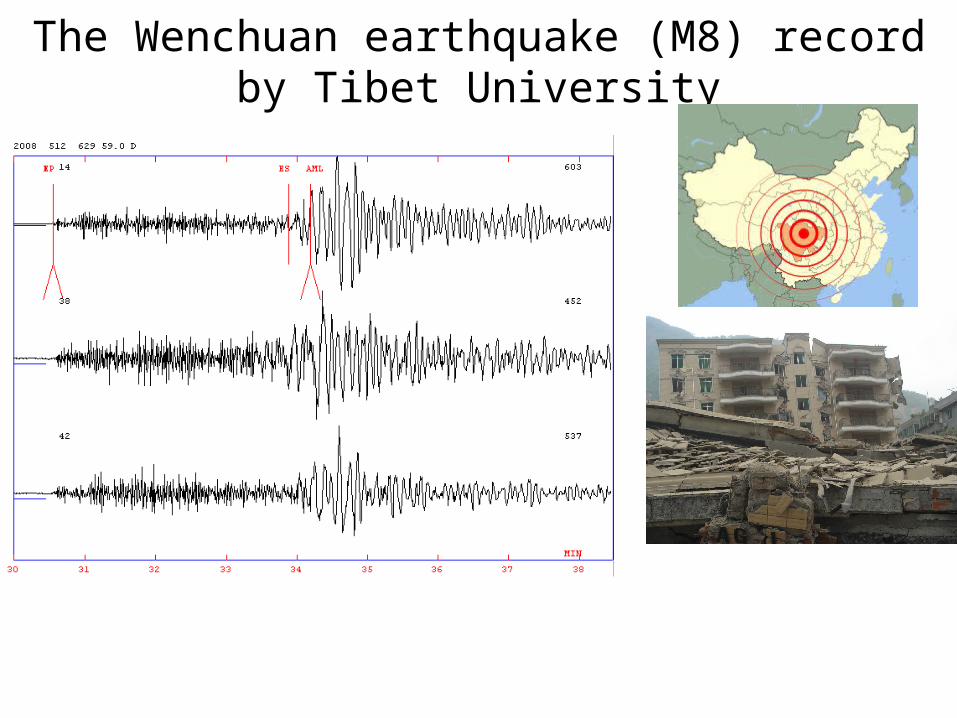
The Wenchuan earthquake (M8) record by Tibet University
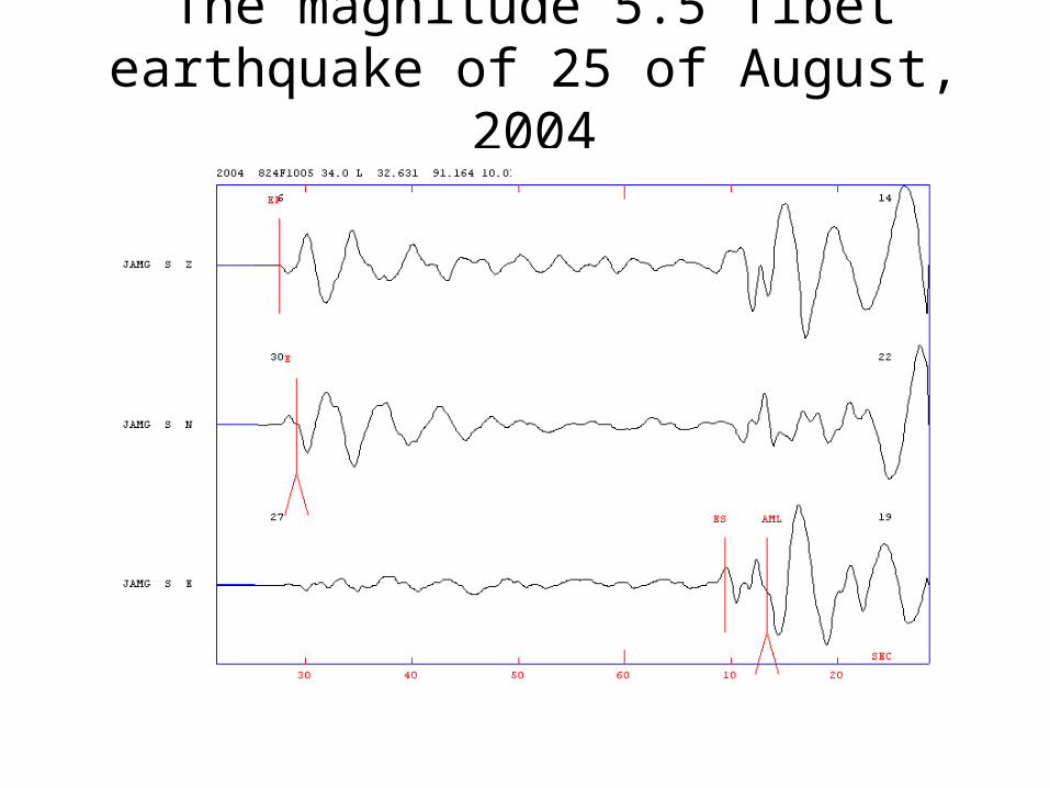
The magnitude 5.5 Tibet earthquake of 25 of August, 2004
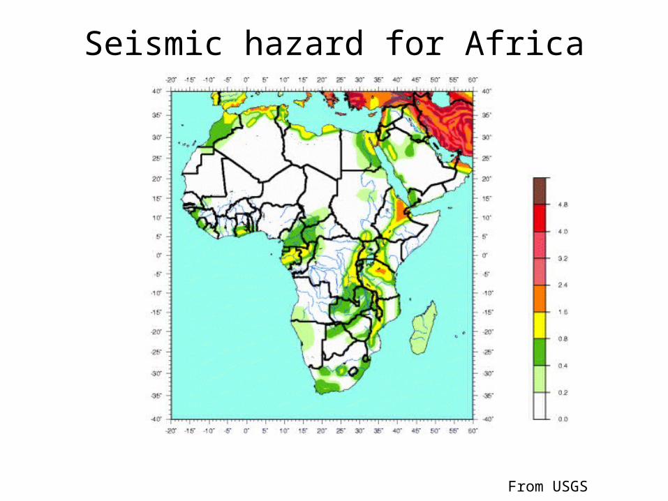
Seismic hazard for Africa
From USGS
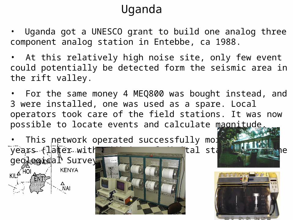
Uganda
• Uganda got a UNESCO grant to build one analog three component analog station in Entebbe, ca 1988.
• At this relatively high noise site, only few event could potentially be detected form the seismic area in the rift valley.
• For the same money 4 MEQ800 was bought instead, and 3 were installed, one was used as a spare. Local operators took care of the field stations. It was now possible to locate events and calculate magnitude.
• This network operated successfully more than 10 years (later with addition of digital stations) by the geological Survey of Uganda.
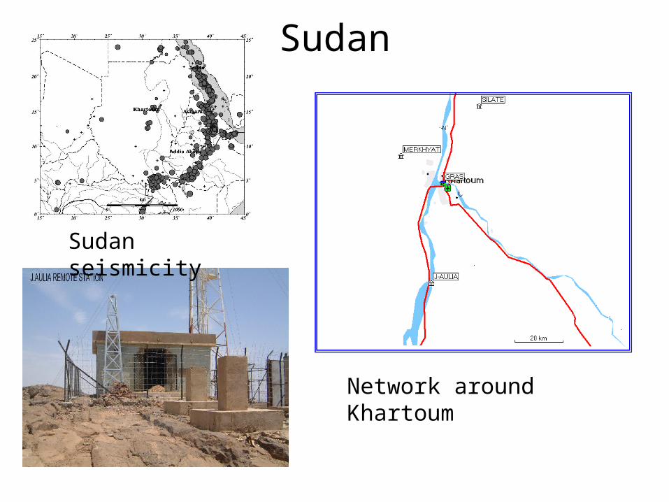
Sudan
Network around Khartoum
Sudan seismicity
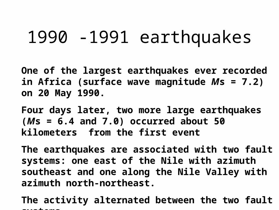
1990 -1991 earthquakes
One of the largest earthquakes ever recorded in Africa (surface wave magnitude Ms = 7.2) on 20 May 1990.
Four days later, two more large earthquakes (Ms = 6.4 and 7.0) occurred about 50 kilometers from the first event
The earthquakes are associated with two fault systems: one east of the Nile with azimuth southeast and one along the Nile Valley with azimuth north-northeast.
The activity alternated between the two fault systems
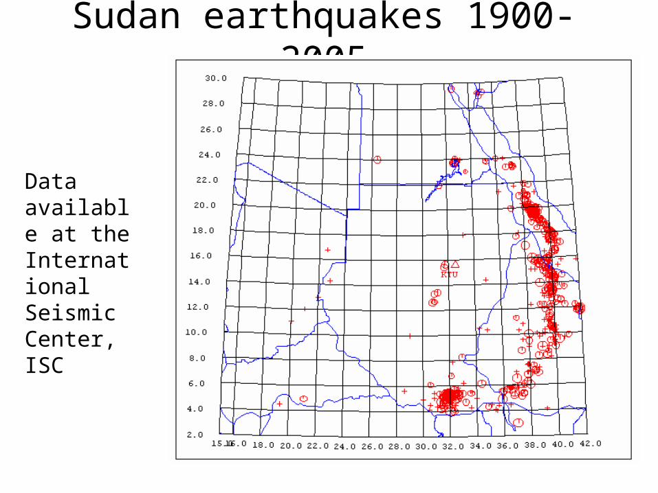
Sudan earthquakes 1900-2005
Data available at the International Seismic Center, ISC

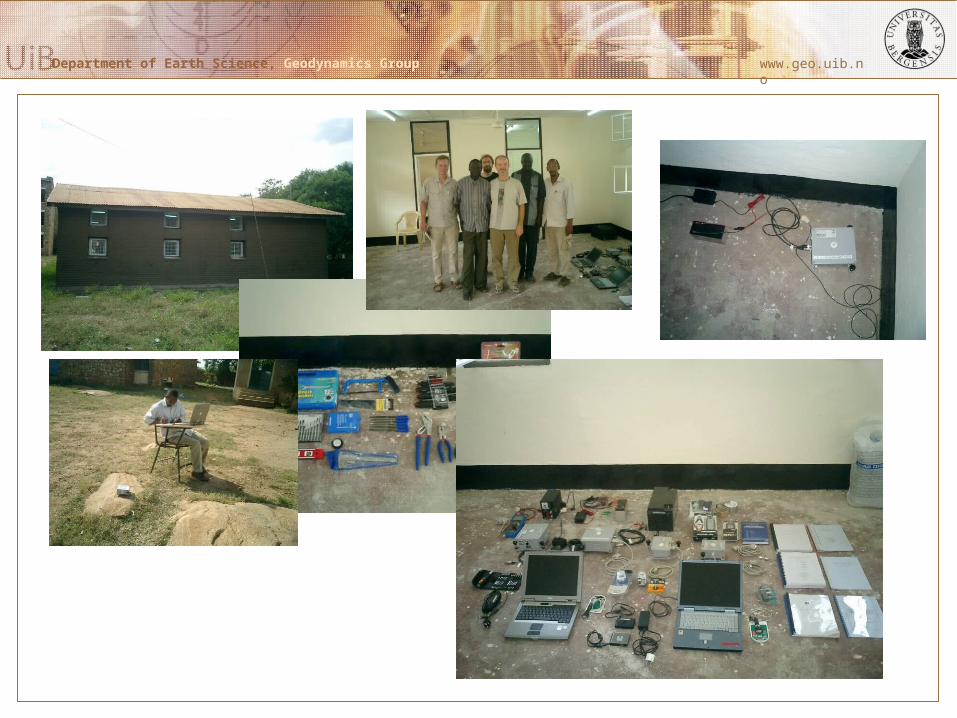
Department of Earth Science, Geodynamics Group
Department of Earth Science, Geodynamics Group www.geo.uib.no
Juba Campus

Juba Geo-science labPurpose: Enhance knowledge in geo-scienceThe Juba geo-science lab will consists of 4 elementsGeologyMeteorologySeismologyPhysicsThe lab will have the following functions:Collect data on a daily basis for meteorology, seismology and physics (UV radiation)Do teaching in basic geo-science covering all 4 fieldsRegular public relation activity
Regular visits of schoolsGeneral information of recent earthquakes in the regionMeteorological information
Department of Earth Science, Geodynamics Group
Department of Earth Science, Geodynamics Group www.geo.uib.no
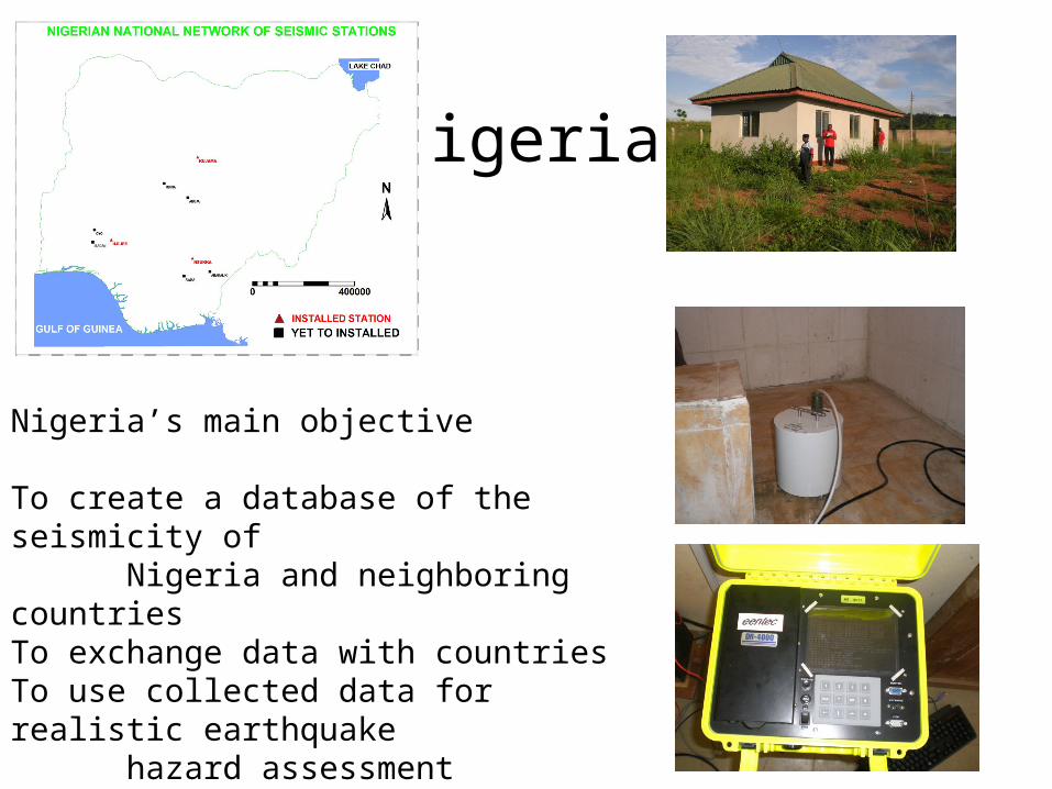
Nigeria
Nigeria’s main objective
To create a database of the seismicity of Nigeria and neighboring countriesTo exchange data with countries To use collected data for realistic earthquake hazard assessmentTo acquire continuous seismic dataHowever: No software or training was given from company delivering hardware.
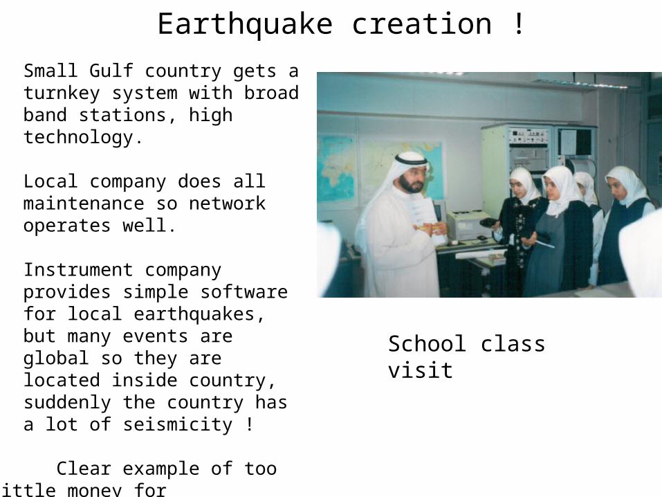
Earthquake creation !
Small Gulf country gets a turnkey system with broad band stations, high technology.
Local company does all maintenance so network operates well.
Instrument company provides simple software for local earthquakes, but many events are global so they are located inside country, suddenly the country has a lot of seismicity !
Clear example of too little money for training, compared to instruments.
School class visit
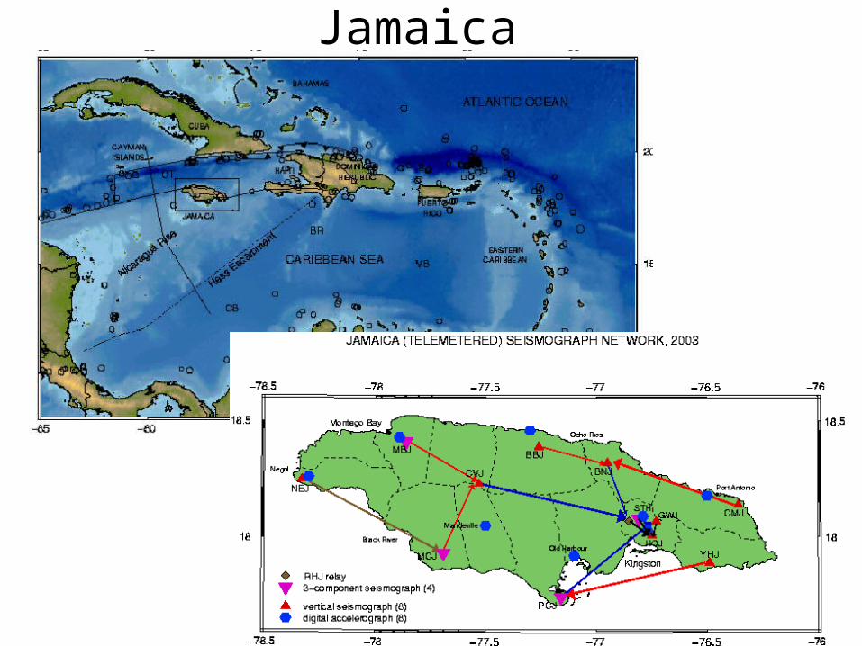
Jamaica
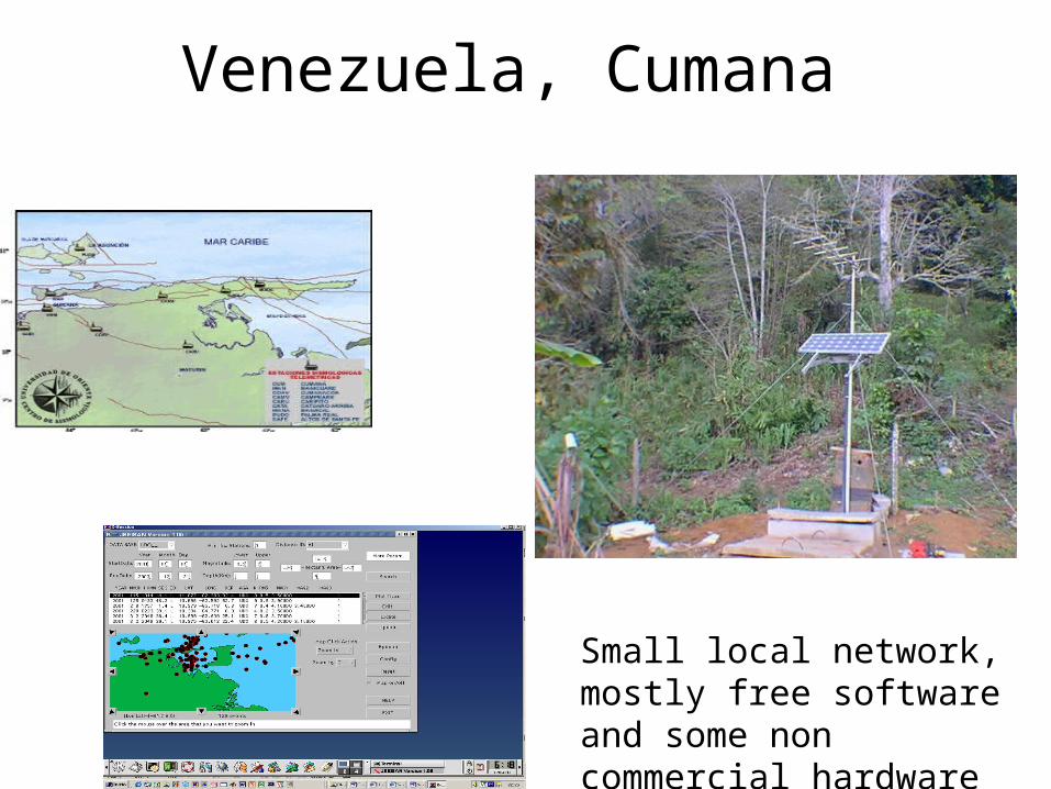
Venezuela, Cumana
Small local network, mostly free software and some non commercial hardware

How it can go wrong• Large company delivers network
• System installed with licensed software
• License runs out, not money for renewal
• Not enough local training to take over operation with free software
Lesson: Too much money for too sophisticated equipment and no contract to make sure the data actually comes out the other end finally processed. The customer should have started with the processing-people end and then seen what was needed in terms of equipment. And instrument company might have painted their equipment and automatic processing it bet too rosy.
Seismological imperialism• International organization installs one or several seismic station in a country with little seismological expertise, either as a permanent station or a temporary network
• Data is transmitted directly to donor country and local access to the data either, nonexistent, offline or unreasonably complicated
• If software is provided for local use, it is often quite useless and made to ‘have done the duty’. The result is that local use of the data is very limited.
Lessons learned:
If outside organizations offer to set up a local stations with real time transmission to their organization, make sure the operation includes:
• Complete local access to data• A simple way to find and extract out local data• Clear guidelines and training in how to use the data and be able in a simple way of integrating it with possible local data.
Regional cooperation
• Some countries too small or have too few stations to make reliable locations
• Regional cooperation will then help to:– Provide more data– Provide help in operation and processing– Increase the awareness of the value of sharing which
often is a problem in developing countries
• In some regions, it can be politically difficult to share data and experience.
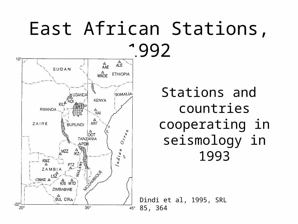
East African Stations, 1992
Stations and countries cooperating in
seismology in 1993
Dindi et al, 1995, SRL 85, 364
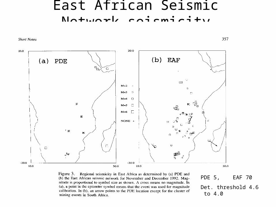
East African Seismic Network seismicity
PDE 5, EAF 70
Det. threshold 4.6 to 4.0
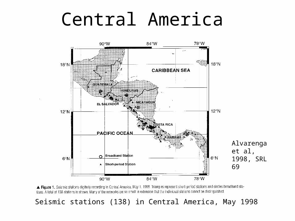
Central America
Seismic stations (138) in Central America, May 1998
Alvarenga et al, 1998, SRL 69

Central American seismicity, mb > 4.5, 1992-1997
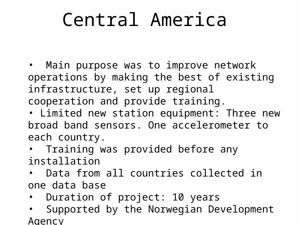
Central America
• Main purpose was to improve network operations by making the best of existing infrastructure, set up regional cooperation and provide training.• Limited new station equipment: Three new broad band sensors. One accelerometer to each country.• Training was provided before any installation• Data from all countries collected in one data base• Duration of project: 10 years• Supported by the Norwegian Development Agency
Conclusion• Seismology benefits:
• Gives good training in data collection and processing, we do not run out of earthquakes !• Enhances regional and global cooperation• Can provide useful information to the public• A local seismological data base will make research possible
• However, make sure:• There are local people interested • Resources is spent mainly on education and training• Avoid overkill in equipment purchases, upgrade existing equipment if possible