Embed Size (px)
Citation preview
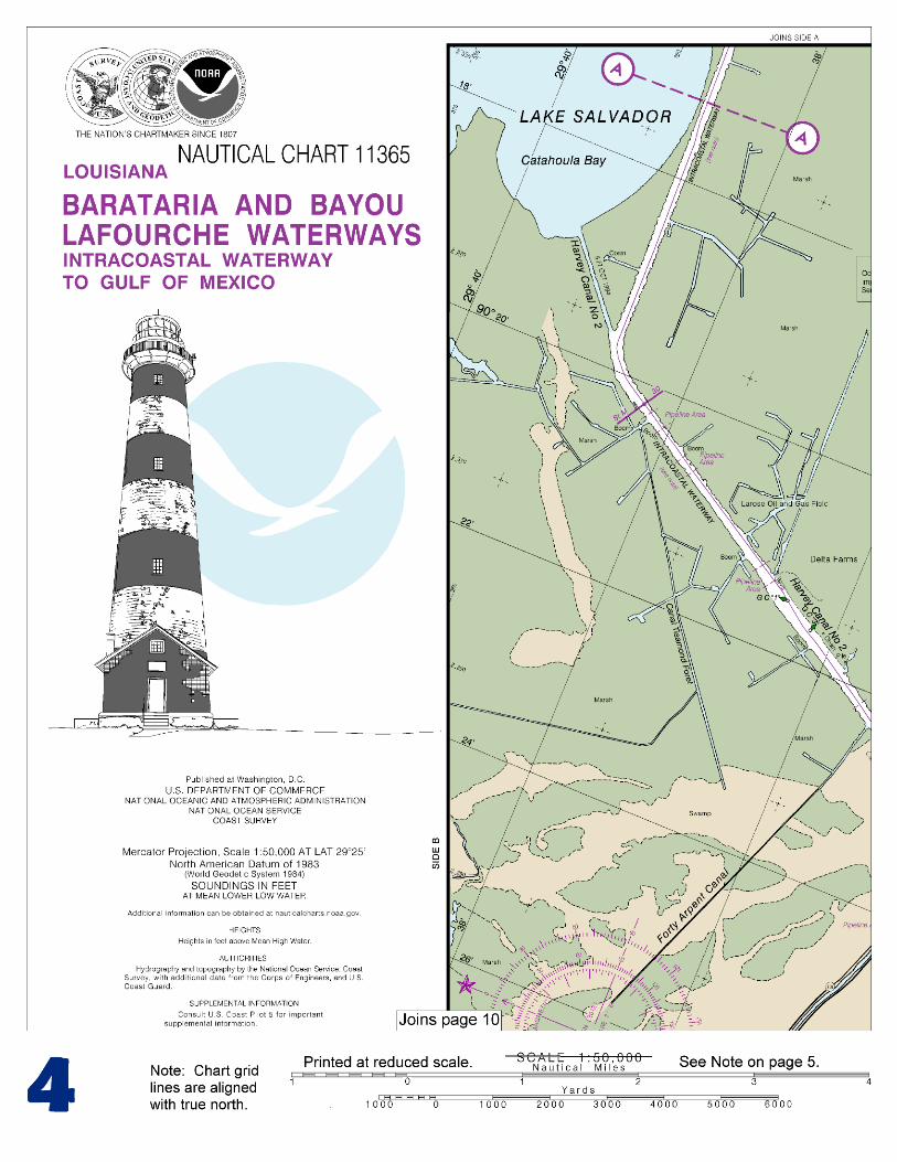
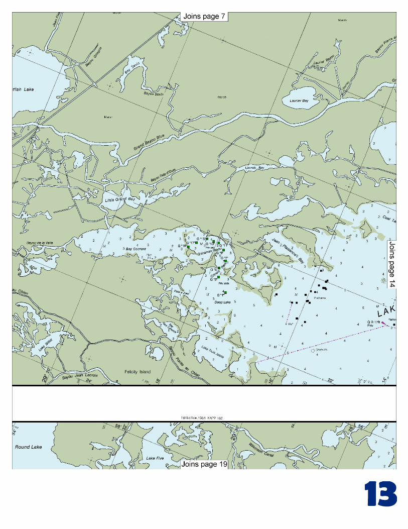
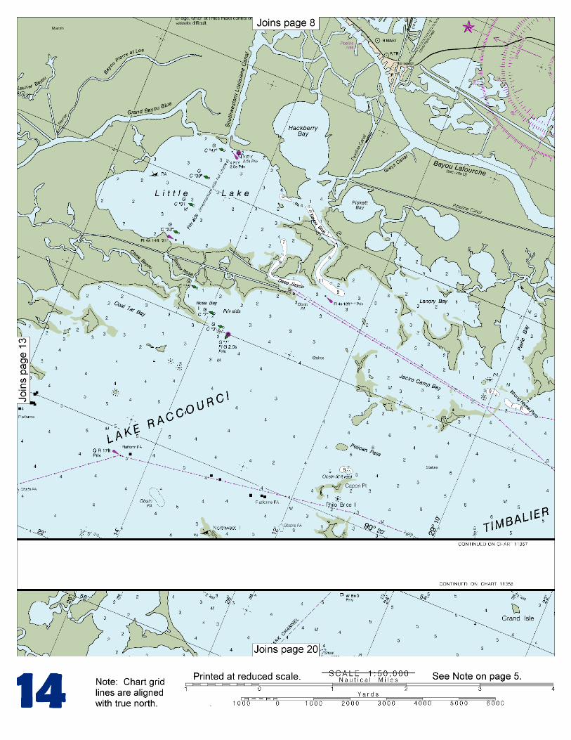
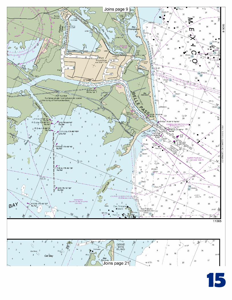
BookletChart™ Intracoastal Waterway – Barataria and Bayou Lafourche Waterways NOAA Chart 11365
A reduced-scale NOAA nautical chart for small boaters When possible, use the full-size NOAA chart for navigation.
Included Area
2
Published by the National Oceanic and Atmospheric Administration
National Ocean Service Office of Coast Survey
www.NauticalCharts.NOAA.gov 888-990-NOAA
What are Nautical Charts?
Nautical charts are a fundamental tool of marine navigation. They show water depths, obstructions, buoys, other aids to navigation, and much more. The information is shown in a way that promotes safe and efficient navigation. Chart carriage is mandatory on the commercial ships that carry America’s commerce. They are also used on every Navy and Coast Guard ship, fishing and passenger vessels, and are widely carried by recreational boaters.
What is a BookletChart?
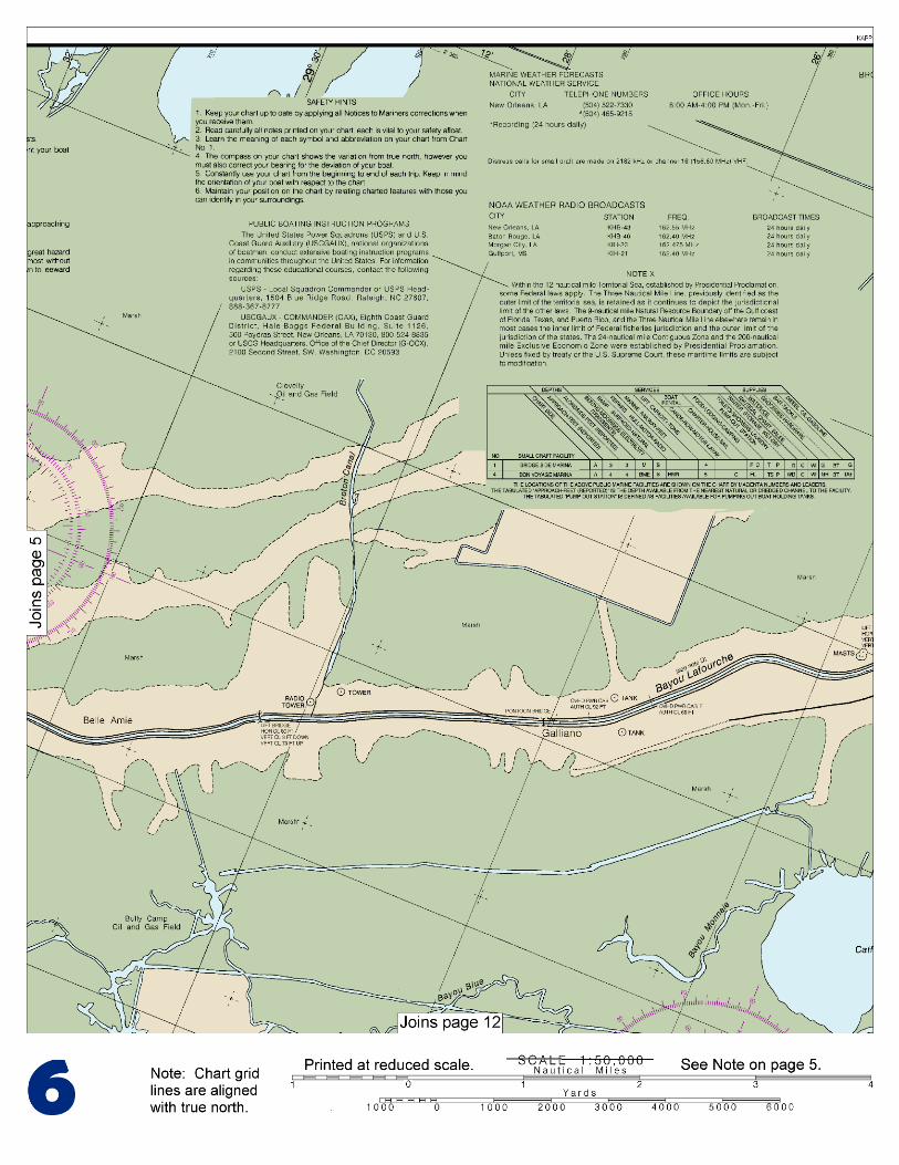
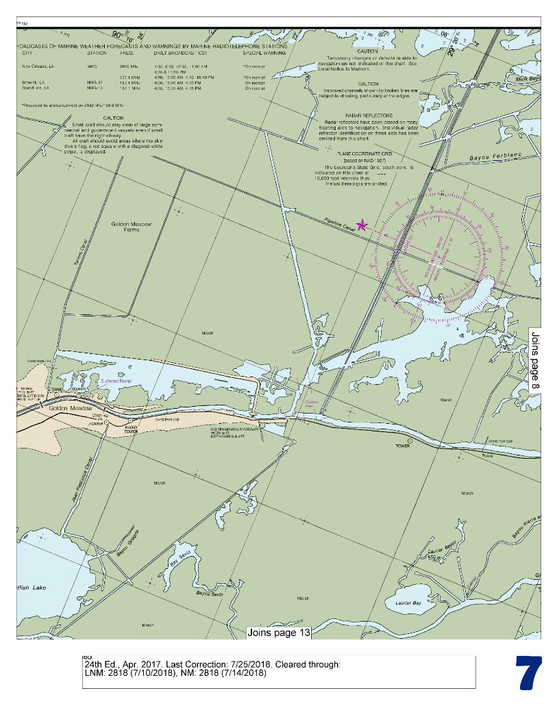
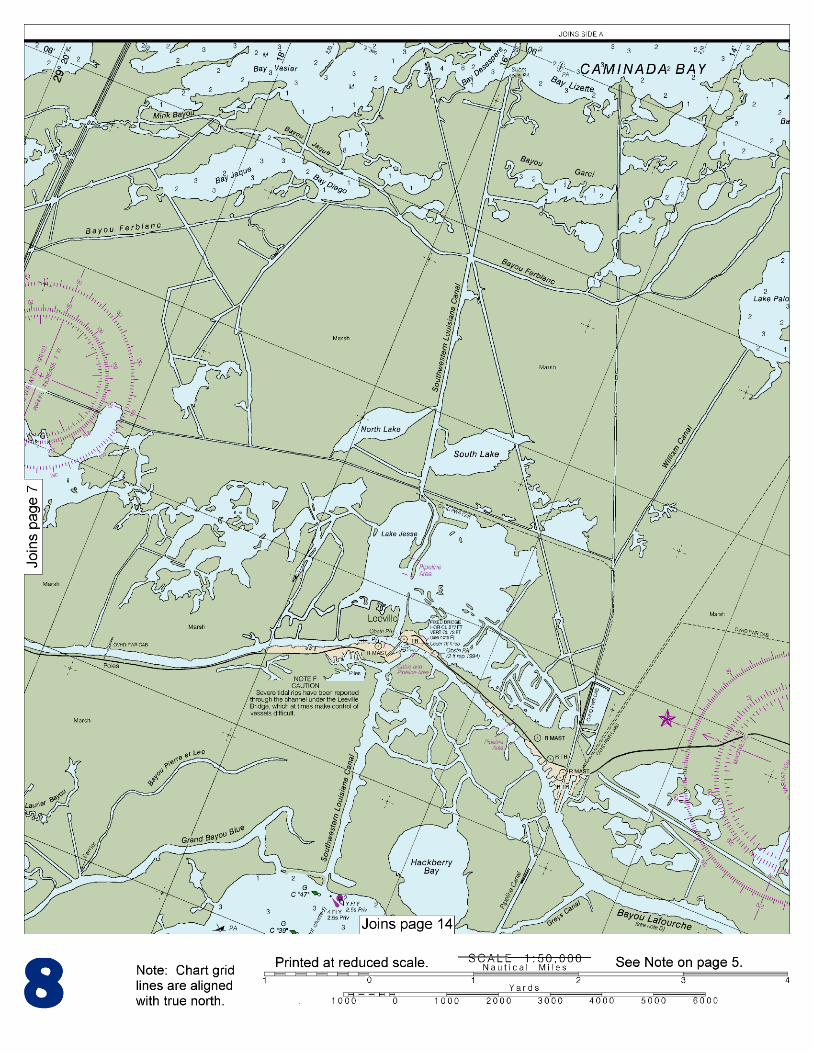
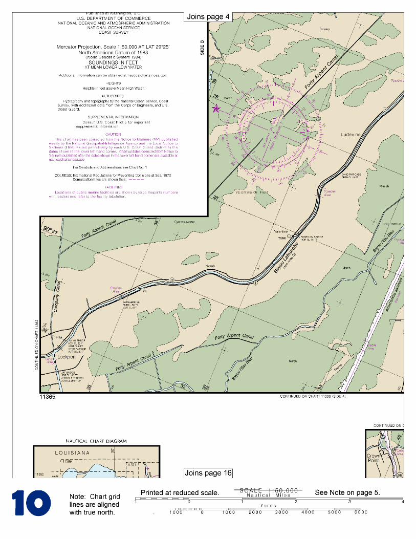
This BookletChart is made to help recreational boaters locate themselves on the water. It has been reduced in scale for convenience, but otherwise contains all the information of the full-scale nautical chart. The bar scales have also been reduced, and are accurate when used to measure distances in this BookletChart. See the Note at the bottom of page 5 for the reduction in scale applied to this chart.
Whenever possible, use the official, full scale NOAA nautical chart for navigation. Nautical chart sales agents are listed on the Internet at http://www.NauticalCharts.NOAA.gov.
This BookletChart does NOT fulfill chart carriage requirements for regulated commercial vessels under Titles 33 and 44 of the Code of Federal Regulations.
Notice to Mariners Correction Status
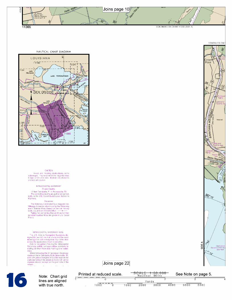
This BookletChart has been updated for chart corrections published in the U.S. Coast Guard Local Notice to Mariners, the National Geospatial Intelligence Agency Weekly Notice to Mariners, and, where applicable, the Canadian Coast Guard Notice to Mariners. Additional chart corrections have been made by NOAA in advance of their publication in a Notice to Mariners. The last Notices to Mariners applied to this chart are listed in the Note at the bottom of page 7. Coast Pilot excerpts are not being corrected.
For latest Coast Pilot excerpt visit the Office of Coast Survey website at http://www.nauticalcharts.noaa.gov/nsd/searchbychart.php?chart=11365
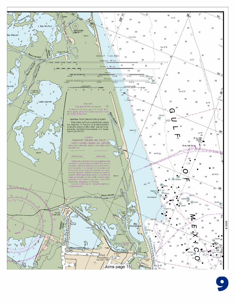
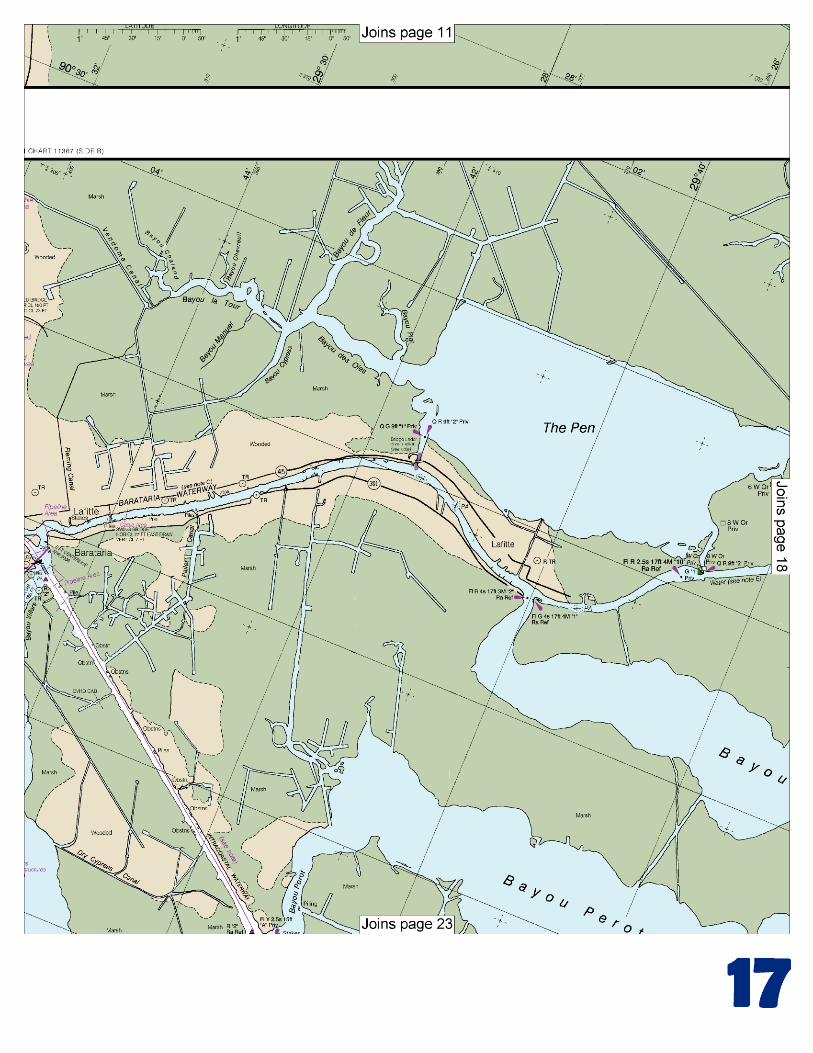
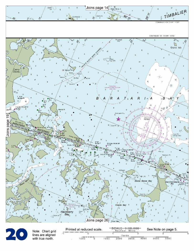
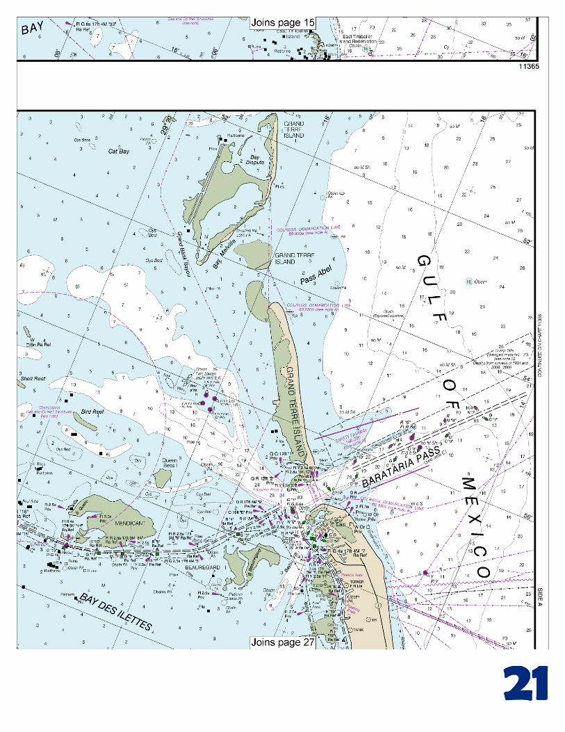
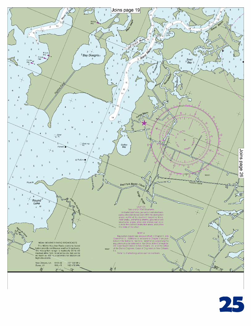
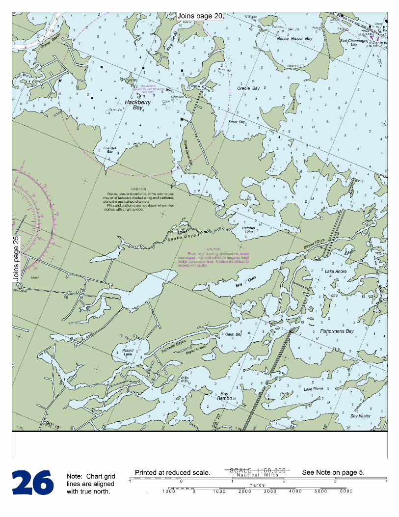
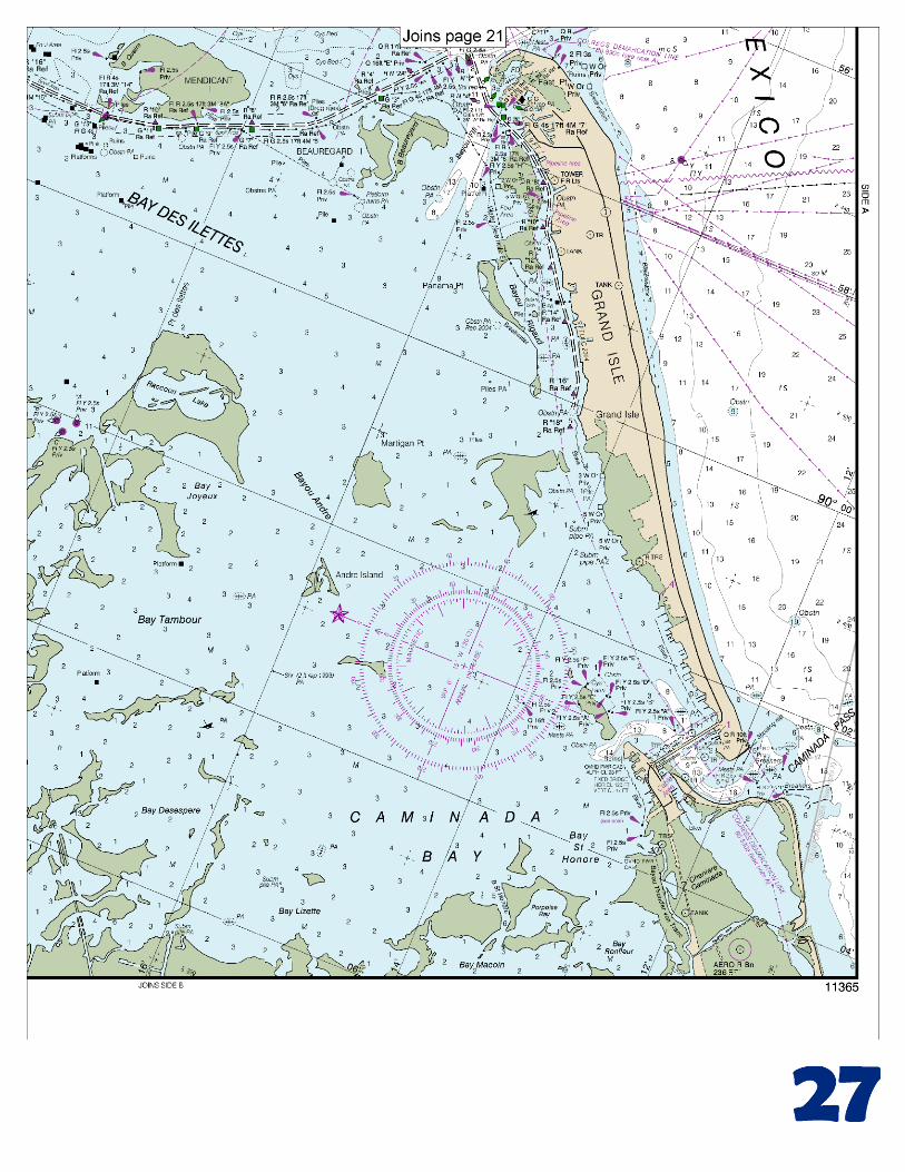
[Coast Pilot 5, Chapter 9 excerpts] Mississippi River empties into the N central part of the Gulf of Mexico through a number of mouths or passes which, taken together, form the delta of the river. The river and its tributaries form the largest network of navigable waters in the world. The two principal passes, South Pass and Southwest Pass, are about 1,600 nautical miles from New York, 500 nautical miles from Key West, Barataria Bay is a large marsh-fringed, shallow lake, separated
from the Gulf by two low, narrow sand islands known as Grand Terre
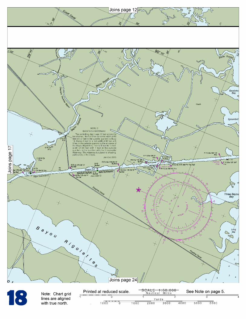
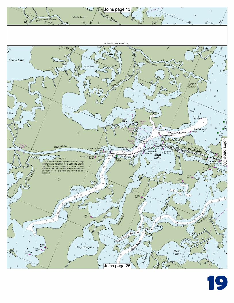
Islands. The bay has general depths of 4 to 6 feet and is frequented chiefly by oilmen, fishermen, and oystermen, who use launches of 3 to 4 feet in draft. Except for fishing camps, the only settlement on the bay is Grand Isle. Barataria Waterway, extends in a N direction from the Gulf for about 34 miles through Barataria Bay to an intersection with the Intracoastal Waterway at the towns of Barataria and Lafitte. A dredged channel leads across the bar at Barataria Pass into Barataria Bay, thence in landcuts through Beauregard, Mendicant and other islands on the W side of Barataria Bay, thence through Mud Lake, Bayou St. Denis, and Bayou Cutler, thence through a landcut known as Dupre Cut, and thence through Bayou Barataria to the Intracoastal Waterway. In March-April 2002, the controlling depth was 11 feet across the bar, thence 4 feet to Light 19, thence 5 feet to Light 43, thence 8 feet to the entrance of Bayou Rigolettes, thence 6 feet to the junction with the Intracoastal Waterway. Barataria Pass is the main entrance to Barataria Bay. A jetty, marked off its outer end by a private light, extends SE from the E tip of Grand Isle on the W side of the pass. Hard sandbars with from 2 to 5 feet over them extend for about 1 mile offshore on each side of the channel. The bar off the entrance channel shows in extremely heavy winds. Inside the bar, depths up to 12 feet extend N as far as Queen Bess Island. Former routes N through Grand Bayou, Little Lake, Turtle Bay, Harvey Cutoff and Bayou Rigolettes are little used as shoaling has occurred. Passage to the E is possible from the junction of Dupre Cut with Bayou Cutler across Round Lake and Lake Laurier into Lake Judge Perez. Local knowledge is advised. Vessels should approach Barataria Waterway and Bay through Barataria Pass Safety Fairway. (See 166.100 through 166.200, chapter 2.) Vessels should approach Bayou Lafourche and Pass Fourchon through the Belle Pass Safety Fairway. Mooring to the bulkheads in the vicinity of the intersection of Bayou Lafourche and the Intracoastal Waterway is prohibited. Pontoon bridges.–The pontoon bridges that cross Bayou Lafourche at Galliano, 5.5 miles above Galliano, and at Valentine are operated by cables that are suspended just above the water when the bridges are being opened or closed. The cables are dropped to the bottom when the bridges are in the fully opened or closed position. The pontoon bridge at Larose just E of the junction with the Intracoastal Waterway is operated by cables that are suspended just above or below the water when the bridge is being opened or closed. The cables are dropped to the bottom when the bridge is in the fully open position, but remain suspended while the bridge is fully closed. Extreme caution is advised in the area of these bridges. Do not attempt to pass through the bridges until they are fully opened and the cables are dropped to the bottom. Dangers.–There are numerous oil well structures in and about Timbalier and Terrebonne Bays. Privately marked channels lead from Cat Island Pass to Bayou Terrebonne and Bayou Lafourche. Drilling operations are in progress near Caillou Island, Brush Island, and East Timbalier Island. Mariners should use the waters in this area only with local knowledge. Vessels should enter Terrebonne Bay through Cat Island Pass Safety Fairway.
U.S. Coast Guard Rescue Coordination Center 24 hour Regional Contact for Emergencies
RCC New Orleans Commander
8th CG District (504) 589-6225 New Orleans, LA
G
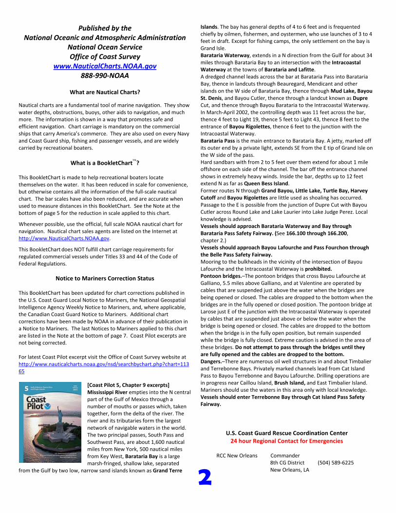
NOAA’s navigation managers serve as ambassadors to the maritime community. They help identify navigational challenges facing professional and recreational mariners, and provide NOAA resources and information for safe navigation. For additional information, please visit nauticalcharts.noaa.gov/service/navmanagers
To make suggestions or ask questions online, go to nauticalcharts.noaa.gov/inquiry. To report a chart discrepancy, please use ocsdata.ncd.noaa.gov/idrs/discrepancy.aspx.
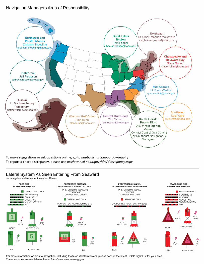
Lateral System As Seen Entering From Seaward on navigable waters except Western Rivers
PORT SIDE
ODD NUMBERED AIDS
GREEN LIGHT ONLY
FLASHING (2)
PREFERRED CHANNEL
NO NUMBERS – MAY BE LETTERED
PREFERRED CHANNEL TO
STARBOARD
TOPMOST BAND GREEN
PREFERRED CHANNEL
NO NUMBERS – MAY BE LETTERED
PREFERRED CHANNEL
TO PORT
TOPMOST BAND RED
STARBOARD SIDE
EVEN NUMBERED AIDS
RED LIGHT ONLY
FLASHING (2)
FLASHING FLASHING
OCCULTING GREEN LIGHT ONLY RED LIGHT ONLY OCCULTING QUICK FLASHING QUICK FLASHING
ISO COMPOSITE GROUP FLASHING (2+1) COMPOSITE GROUP FLASHING (2+1) ISO
"1"
Fl G 6s
G "9"
Fl G 4s
GR "A"
Fl (2+1) G 6s
RG "B"
Fl (2+1) R 6s
"2"
Fl R 6s
8
R "8"
Fl R 4s
LIGHT
G
C "1"
LIGHTED BUOY
G
"5"
GR
"U"
GR
C "S"
RG
N "C"
RG
"G"
LIGHT
6
R
N "6"
LIGHTED BUOY
R
"2
"
CAN DAYBEACON
CAN NUN NUN
DAYBEACON
For more information on aids to navigation, including those on Western Rivers, please consult the latest USCG Light List for your area.
These volumes are available online at http://www.navcen.uscg.gov
Navigation Managers Area of Responsibility
Northeast
Lt. Meghan McGovern
Northwest and
Pacific Islands
Crescent Moegling
Great Lakes Region
Tom Loeper
Chesapeake and
Delaware Bay
Steve Soherr
California
Jeff Ferguson
[email protected] Mid-Atlantic
Lt. Ryan Wartick
Alaska
Lt. Timothy M. Smith
Western Gulf Coast
Alan Bunn
Central Gulf Coast
Tim Osborn
[email protected] South Florida
Puerto Rico
U.S. Virgin Islands
Michael Henderson
Southeast
Kyle Ward
2
2 C U 5
1

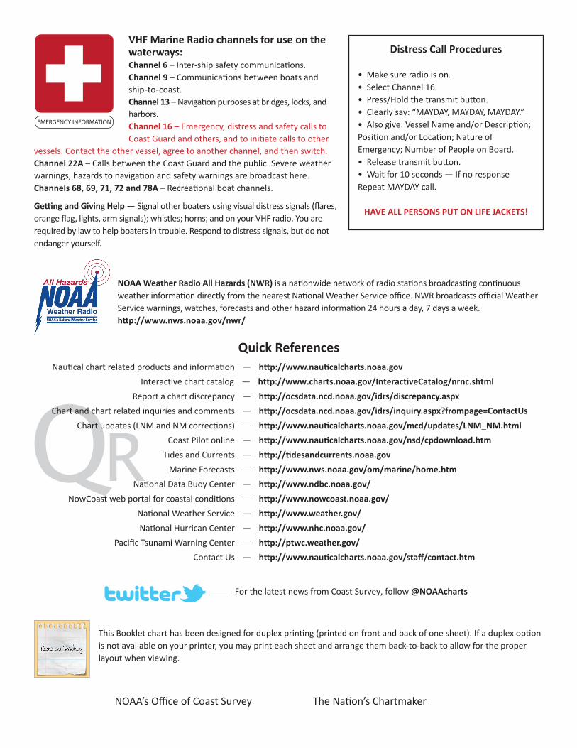
VHF Marine Radio channels for use on the waterways:Channel 6 – Inter-ship safety communications.Channel 9 – Communications between boats and ship-to-coast.Channel 13 – Navigation purposes at bridges, locks, and harbors.Channel 16 – Emergency, distress and safety calls to Coast Guard and others, and to initiate calls to other
vessels. Contact the other vessel, agree to another channel, and then switch.Channel 22A – Calls between the Coast Guard and the public. Severe weather warnings, hazards to navigation and safety warnings are broadcast here.Channels 68, 69, 71, 72 and 78A – Recreational boat channels.
Getting and Giving Help — Signal other boaters using visual distress signals (flares, orange flag, lights, arm signals); whistles; horns; and on your VHF radio. You are required by law to help boaters in trouble. Respond to distress signals, but do not endanger yourself.
EMERGENCY INFORMATION
Distress Call Procedures
• Make sure radio is on.• Select Channel 16.• Press/Hold the transmit button.• Clearly say: “MAYDAY, MAYDAY, MAYDAY.”• Also give: Vessel Name and/or Description;Position and/or Location; Nature of Emergency; Number of People on Board.• Release transmit button.• Wait for 10 seconds — If no responseRepeat MAYDAY call.
HAVE ALL PERSONS PUT ON LIFE JACKETS!
This Booklet chart has been designed for duplex printing (printed on front and back of one sheet). If a duplex option is not available on your printer, you may print each sheet and arrange them back-to-back to allow for the proper layout when viewing.
QR
Quick ReferencesNautical chart related products and information - http://www.nauticalcharts.noaa.gov
Interactive chart catalog - http://www.charts.noaa.gov/InteractiveCatalog/nrnc.shtmlReport a chart discrepancy - http://ocsdata.ncd.noaa.gov/idrs/discrepancy.aspx
Chart and chart related inquiries and comments - http://ocsdata.ncd.noaa.gov/idrs/inquiry.aspx?frompage=ContactUs
Chart updates (LNM and NM corrections) - http://www.nauticalcharts.noaa.gov/mcd/updates/LNM_NM.html
Coast Pilot online - http://www.nauticalcharts.noaa.gov/nsd/cpdownload.htm
Tides and Currents - http://tidesandcurrents.noaa.gov
Marine Forecasts - http://www.nws.noaa.gov/om/marine/home.htm
National Data Buoy Center - http://www.ndbc.noaa.gov/
NowCoast web portal for coastal conditions - http://www.nowcoast.noaa.gov/
National Weather Service - http://www.weather.gov/
National Hurrican Center - http://www.nhc.noaa.gov/
Pacific Tsunami Warning Center - http://ptwc.weather.gov/
Contact Us - http://www.nauticalcharts.noaa.gov/staff/contact.htm
NOAA’s Office of Coast Survey The Nation’s Chartmaker
For the latest news from Coast Survey, follow @NOAAcharts
NOAA Weather Radio All Hazards (NWR) is a nationwide network of radio stations broadcasting continuous weather information directly from the nearest National Weather Service office. NWR broadcasts official Weather Service warnings, watches, forecasts and other hazard information 24 hours a day, 7 days a week. http://www.nws.noaa.gov/nwr/