Embed Size (px)
Citation preview
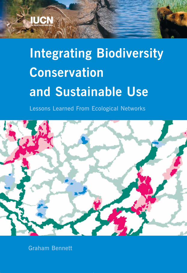
Integrating Biodiversity Conservation and Sustainable UseLessons Learned From Ecological Networks
Graham Bennett
eco_networks_2004 13-01-2004 23:15 Pagina 1

eco_networks_2004 13-01-2004 23:15 Pagina 2
Integrating Biodiversity Conservation and Sustainable UseLessons Learned From Ecological Networks
eco_networks_2004 13-01-2004 23:15 Pagina 3
The designation of geographical entities in this book, and the presentation of thematerial, do not imply the expression of any opinion whatsoever on the part ofIUCN concerning the legal status of any country, territory, or area, or of itsauthorities, or concerning the delimitation of its frontiers or boundaries.
The views expressed in this publication do not necessarily reflect those of IUCN.
This publication has been made possible by funding from the Ministry ofForeign Affairs and the Ministry of Agriculture, Nature and Food Quality,Netherlands.
Published by
IUCN, Gland, Switzerland, and Cambridge, UK,
in collaboration with Syzygy, Netherlands
Copyright
© 2004 International Union for Conservation of
Nature and Natural Resources and Graham Bennett
Reproduction of this publication for educational or
other non-commercial purposes is authorized
without prior written permission from the copyright
holders provided the source is fully acknowledged
Reproduction of this publication for resale or other
commercial purposes is prohibited without prior
written permission of the copyright holders
Citation
Graham Bennett. (2004). Integrating Biodiversity
Conservation and Sustainable Use: Lessons
Learned From Ecological Networks. IUCN, Gland,
Switzerland, and Cambridge, UK. vi + 55 pp.
ISBN
2-8317-0765-X
Layout by
Marc Hegemans, Haarlem, Netherlands
Printed by
Albani drukkers BV, The Hague, Netherlands
Illustrations
The Baltic Ecological Networks: Arne Ader (photo-
graphs), IUCN Office for Central Europe (maps).
The Vilcabamba-Amboró Conservation Corridor:
Conservation International; Tri-DOM: Paul Scholte
(photographs), UNDP-GEF (map); The Far East
Ecoregion: WWF Russia; Mesoamerican Biological
Corridor: the Mesoamerican Biological Corridor
Coordination Office (maps), Rob Glastra (page 28
top, page 45 left), Juan Pablo Moreira (page 49
left); Y2Y: Yellowstone to Yukon Conservation
Initiative, American Wildlands (map page 35);
The Terai Arc Landscape: Esther Blom (page 36
top), Wim Blom (page 36 bottom), Bernadette
Botman (page 37), WWF Nepal (map), Resources
Himalaya (page 38); The Green Wood: Ministry of
Agriculture, Nature and Food Quality, Netherlands
(map page 40), M. Klijn (page 41 left and right,
page 42), H. Smeding (page 41 centre), Province
of North Brabant (maps pages 41 and 42).
Available from
IUCN Publications Services Unit
219c Huntingdon Road
Cambridge CB3 ODL
United Kingdom
Tel.: +44 1223 277894
Fax: +44 1223 277175
E-mail: [email protected]
www.iucn.org/bookstore
A catalogue of IUCN publications is also available
eco_networks_2004 13-01-2004 23:15 Pagina 4
IUCN – The World Conservation Union 2004
Integrating Biodiversity Conservation and Sustainable UseLessons Learned From Ecological Networks
Graham Bennett
eco_networks_2004 13-01-2004 23:15 Pagina 5

eco_networks_2004 13-01-2004 23:15 Pagina 6
Contents
1 Foreword
4 Introduction: Defining Objectives, Applying Principles
11 The Baltic Ecological Networks: Estonia, Latvia and Lithuania
16 Peru and Bolivia: the Vilcabamba-Amboró Conservation Corridor
20 The Congo Basin: Tri-DOM
24 Russia: the Far East Ecoregion
28 Central America: The Mesoamerican Biological Corridor
32 North America: Y2Y
36 Nepal: the Terai Arc Landscape
40 The Netherlands: the Green Wood
44 Experience With Ecological Networks: Initial Lessons Learned
53 Further Reading
54 Acknowledgements
v
eco_networks_2004 13-01-2004 23:15 Pagina 7

eco_networks_2004 13-01-2004 23:15 Pagina 8
Foreword
Protected areas have long been one of the main strategies for safeguarding theworld’s biodiversity. But pressures on the environment caused by economicdevelopment and other human activities make it difficult to protect natural areasthat are large enough to accommodate entire ecosystems. On the other handecosystems need to be treated with care, because they provide goods and servicesthat are vitally important for human well-being.
This has been acknowledged by IUCN’s World Commission on Protected Areas(WCPA) by integrating both sustainable use and conservation in IUCN’sProtected Area classification system. This system identifies six categories ofProtected Areas ranging from Category i, ‘Strict Nature Reserve’ that focus onprotection, to Category vi, ‘Managed Resource Protected Area’ that allow forsustainable use of natural resources.
However, we have to look beyond boundaries. IUCN’s Vth World Parks Congressin Durban, South Africa (September 2003) concluded that parks should not existas unique islands, but need to be planned and managed as an integral part ofthe broader landscape. Ecological networks provide an operational model forconserving biodiversity that is based on ecological principles and allow a degreeof human use of the landscape. This combination makes the concept of ecologicalnetworks a useful instrument for the implementation of the Convention ofBiological Diversity and contributes to the intention of the World Summit onSustainable Development held in Johannesburg in 2002.
This publication illustrates the development of several ecological networksaround the world. It demonstrates the benefits of these networks, not only forconservation purposes, but also for sustainable development. Although theconcept is relatively new and needs more time to fully crystallise, these examplesindicate that investments in ecological networks yield benefits, not only becauseof the biodiversity they conserve but also because of the essential ecologicalservices they provide to local communities, thereby contributing to povertyalleviation.
But how should these ecological networks be managed? The Ecosystem Approach,endorsed by the Parties to the Convention on Biological Diversity at its fifthmeeting in Nairobi, Kenya (May 2000), is designed to balance conservation,sustainable use and equitable benefit sharing of genetic resources. It looks beyondthe boundaries of Protected Areas and promotes inter-sectoral cooperation,while placing humans at the centre of conservation efforts. As such it is the idealtool for designing and implementing effective ecological networks. IUCN’sCommission on Ecosystem Management (CEM) has therefore dedicated its workto the promotion of the application of the Ecosystem Approach.
1
eco_networks_2004 13-01-2004 23:15 Pagina 1
Because of the ever-increasing pressure on nature, habitat fragmentation willbecome more and more of a threat to sustainable development and biodiversityconservation. Ecological networks are an answer to successfully safeguard ournatural treasures and contribute to human well-being.
Achim Steiner Hillary M. MasundireDirector General of IUCN – Chair, IUCN CommissionThe World Conservation Union on Ecosystem Management
2
eco_networks_2004 13-01-2004 23:15 Pagina 2
eco_networks_2004 13-01-2004 23:15 Pagina 3
IntroductionDefining Objectives, Applying Principles
This publication is a response to the widely expressed interest within the conservation and
development communities for an evaluation of practical experience in applying models that
aim to conserve ecosystem processes in human-exploited landscapes as a means of
conserving biodiversity and securing the sustainable use of natural resources. The interest
stems from the fact that this approach is being increasingly applied around the world in an
ever-more diverse array of circumstances and often at an ambitious scale.
An Evolving International Consensus
The importance of strengthening ecological coherence and resilience as necessaryconditions for both biodiversity conservation and sustainable development hasattracted growing attention in recent years in a wide range of conservation anddevelopment fora. The World Summit on Sustainable Development, that washeld in Johannesburg in September 2002, adopted the goal of securing by 2010 asignificant reduction in the current rate of biodiversity loss. In setting out howthis can be achieved within the context of sustainable development, theJohannesburg Plan of Implementation called for the promotion of ‘national andregional ecological networks and corridors’.
The most important biodiversity conservation instrument, the Convention onBiological Diversity, also recognizes the value of ecological coherence as a meansof achieving the Convention’s three objectives – the conservation of biologicaldiversity, the sustainable use of its components and the fair and equitable sharingof the benefits arising out of the utilization of genetic resources. Although theConvention itself does not specify the exact means by which these objectives areto be achieved, its implementing mechanism is working to promote thestrengthening of ecological coherence. For example, in 2002 the Conference ofthe Parties to the Convention recommended that, in order to conserve forestbiological diversity, ‘ecological corridors’ should be developed on a national andregional basis.
With regard to broader implementation approaches, in 2000 the Conference ofthe Parties identified the Ecosystem Approach as the primary framework for theimplementation of the Convention and recommended the application of itsprinciples. The Ecosystem Approach can be regarded as a strategy for themanagement of land, water and living resources that promotes conservation andsustainable use in an equitable way. At the heart of the approach is the awarenessthat, without the effective management of ecosystems, there can be no economicdevelopment that generates sustainable human and social welfare; equally,
4
eco_networks_2004 13-01-2004 23:15 Pagina 4
without the full engagement of diverse sectors in the economy and society in themanagement of ecosystems, there can be no effective biodiversity conservation.In that sense, the Ecosystem Approach is a framework for holistic decision-making and action.
From Consensus to Action
The evolution of an international consensus on the most appropriate objectivesand principles for securing biodiversity conservation and sustainable develop-ment marks a major step forward. However, applying the principles andachieving the objectives will only be feasible if a way can be found to translatethese broad frameworks into appropriate actions on the ground. To what extentis practical experience offering useful lessons in how this can best be done?
Various operational models are providing useful lessons in implementing thisbroad approach. Six can be identified as most closely matching the Convention’sobjectives and the principles of the Ecosystem Approach and which are beingwidely applied in practice, namely Biosphere Reserves, ecological networks,reserve networks, bioregional planning, biological or conservation corridors andEcoregion-Based Conservation.
• Biosphere Reserves were launched by UNESCO’s 1974 Man and BiosphereProgramme which recognized the need to reconcile the conservation of areasthat are host to valuable biodiversity with local land-use needs through thedelineation of core areas, buffer areas and transition zones.
• Ecological networks were developed in several European countries in the 1970s and 1980s where a strong land-use planning tradition had created theinstitutional environment for allocating functions at the landscape scale andwhere, particularly in Western Europe, habitats were becoming severelyfragmented by the high intensity of economic development.
• Reserve networks were developed in North America in the 1980s, primarilywith the aim of conserving biodiversity at the regional scale, particularly inwilderness areas. They are, however, being increasingly applied to human-impacted landscapes.
• Bioregional planning has been developed primarily in the US and focuses onthe process of planning and managing the protection of ecosystem servicesand biodiversity at the bioregional scale – that is, a geographic area that, onthe basis of its ecology and community and government structure, forms anappropriate management unit.
• Biological (or conservation) corridors reflect a comparable approach that sincethe 1980s has been applied in developing regions.
• Ecoregion-Based Conservation is an approach developed by WWF in the late1990s that is being applied to the task of conserving ‘ecoregions’ – that is,relatively large units of land or water that harbour a characteristic set ofspecies, communities, dynamics and environmental conditions, of whichWWF has identified 238 in its ‘Global 200’ programme.
5
eco_networks_2004 13-01-2004 23:15 Pagina 5
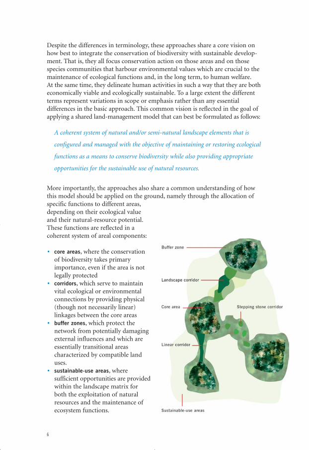
Despite the differences in terminology, these approaches share a core vision onhow best to integrate the conservation of biodiversity with sustainable develop-ment. That is, they all focus conservation action on those areas and on thosespecies communities that harbour environmental values which are crucial to themaintenance of ecological functions and, in the long term, to human welfare.At the same time, they delineate human activities in such a way that they are botheconomically viable and ecologically sustainable. To a large extent the differentterms represent variations in scope or emphasis rather than any essentialdifferences in the basic approach. This common vision is reflected in the goal ofapplying a shared land-management model that can best be formulated as follows:
A coherent system of natural and/or semi-natural landscape elements that is
configured and managed with the objective of maintaining or restoring ecological
functions as a means to conserve biodiversity while also providing appropriate
opportunities for the sustainable use of natural resources.
More importantly, the approaches also share a common understanding of howthis model should be applied on the ground, namely through the allocation ofspecific functions to different areas,depending on their ecological valueand their natural-resource potential.These functions are reflected in acoherent system of areal components:
• core areas, where the conservationof biodiversity takes primaryimportance, even if the area is notlegally protected
• corridors, which serve to maintainvital ecological or environmentalconnections by providing physical(though not necessarily linear)linkages between the core areas
• buffer zones, which protect thenetwork from potentially damagingexternal influences and which areessentially transitional areascharacterized by compatible landuses.
• sustainable-use areas, wheresufficient opportunities are providedwithin the landscape matrix forboth the exploitation of naturalresources and the maintenance ofecosystem functions.
6
eco_networks_2004 13-01-2004 23:15 Pagina 6
This functional approach therefore maintains eco-system processes by conserving a representative arrayof habitats, allowing species populations access to asufficient area of habitat (for foraging, the dispersalof juveniles or the recolonization of other habitatpatches), allowing seasonal migration, permittinggenetic exchange between different local populations,allowing local populations to move away from adegrading habitat (caused, for example, by globalwarming) and securing the integrity of vitalenvironmental processes (such as periodic flooding).In addition to this conservation dimension, theapproaches identify appropriate opportunitieswithin the landscape matrix for the exploitation of
natural resources – agriculture, forestry, fishing, human settlement, recreation etal. If these activities are planned and managed in a sensitive way and at anappropriate scale, they offer the prospect of securing the sustainable use ofnatural resources.
Although where feasible this review will refer to specific examples by using theirown preferred terminology, it will be necessary for practical purposes to use ageneric term when referring to and discussing the common approach. In thesecircumstances, the term ‘ecological network’ will be used, which reflects theterminology used by IUCN, the Conference of the Parties to the Convention onBiological Diversity and the World Summit on Sustainable Development.
Ecological Networks and Protected Areas
A key issue that these developments raise are the implications of the Convention,the Ecosystem Approach and ecological networks for the central pillar of bio-diversity conservation – the protected area. This is a matter that concerns notsimply how conservation and development strategies should best be applied interritorial terms. It has far broader implications, such as for law, institutionalstructures, the allocation of funds, planning mechanisms, poverty alleviation,policy integration and the role of indigenous peoples. However, there are goodreasons for arguing that the two approaches should be seen less as competitorsthan as allies that, in the longer term, will benefit from a substantial degree ofsynergy.
Two points are worth emphasizing here. First, it is clear that protected-areamanagement itself has undergone a revolution over the past decades. Today thereis a broad and growing awareness that the protection of individual biologicalelements – such as sites and threatened species – is in many cases not succeedingin arresting the decline in biodiversity. The traditional view that regardsprotected areas as islands of nature fenced off from a threatening world isalready regarded as far too limited by a substantial proportion of the protected-
7
eco_networks_2004 13-01-2004 23:15 Pagina 7
areas community. Second, in order to strengthentheir role in conserving biodiversity, reserves areincreasingly being designated and managed as systemsof protected areas. That is to say, the thrust ofprotected-area policy in many countries or regions ismoving towards the goal of ensuring the conservationof a representative array of characteristic habitatsand species populations. The result of these twodevelopments is that, within the protected-areascommunity, a broad awareness has arisen of theneed to embrace the ecological, social, economic andcultural context within which protected areasfunction as a means of improving their effectiveness.
Reviewing Experience
Faced with the fast-changing context of biodiversity conservation and thepressing need for securing sustainable development, the question arises of whatrole the ecological network can play. With over 150 landscape-scale or regionalnetworks under development around the world, it would seem a straightforwardquestion to answer. However, despite the fast-growing number of ecological-network programmes, no comprehensive evaluation of the model’s effectivenesshas yet been published.
There are, in fact, very good reasons why such an evaluation has yet to appear.Most obviously, until a few years ago relatively few ecological networks had beendeveloped, so in practice there was little to evaluate that could be of relevance toa broad audience. A second very apparent difficulty is that most ecologicalnetworks are being developed at a scale that invariably requires an implementingprogramme which extends over many years, if not decades. Such initiatives notonly cover huge areas, they involve large numbers of stakeholders, making processmanagement a major challenge. Demonstrable and testable results on the groundare therefore, anno 2004, few and far between.
But although it may still be too early for a comprehensive evaluation, the largenumber of ecological networks now under development offer the possibility ofassessing a variety of examples and highlighting lessons from practice that caninform interested parties and may be of value in guiding further work. That isthe purpose of this review.
Within this limited remit, it was clearly not feasible to carry out comparativeanalyses of different methodologies or to rigorously test the measured or claimedresults of the initiatives. Rather, a group of ecological networks were selected thattogether represent as wide a range of operational circumstances as possible.These therefore serve as illustrations of the rich experience that is being gainedin the large number of ecological-network programmes around the world.
8
eco_networks_2004 13-01-2004 23:15 Pagina 8
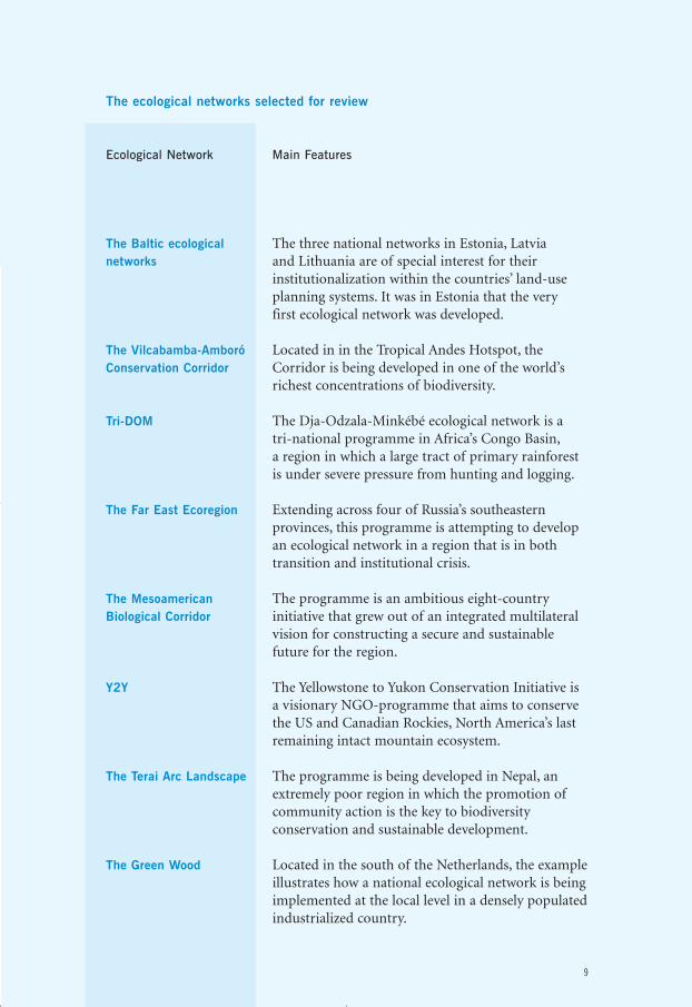
The ecological networks selected for review
Ecological Network Main Features
The Baltic ecological networks
The Vilcabamba-Amboró Conservation Corridor
Tri-DOM
The Far East Ecoregion
The Mesoamerican Biological Corridor
Y2Y
The Terai Arc Landscape
The Green Wood
9
The three national networks in Estonia, Latvia and Lithuania are of special interest for theirinstitutionalization within the countries’ land-useplanning systems. It was in Estonia that the very first ecological network was developed.
Located in in the Tropical Andes Hotspot, theCorridor is being developed in one of the world’srichest concentrations of biodiversity.
The Dja-Odzala-Minkébé ecological network is a tri-national programme in Africa’s Congo Basin,a region in which a large tract of primary rainforestis under severe pressure from hunting and logging.
Extending across four of Russia’s southeasternprovinces, this programme is attempting to developan ecological network in a region that is in bothtransition and institutional crisis.
The programme is an ambitious eight-countryinitiative that grew out of an integrated multilateralvision for constructing a secure and sustainablefuture for the region.
The Yellowstone to Yukon Conservation Initiative isa visionary NGO-programme that aims to conservethe US and Canadian Rockies, North America’s lastremaining intact mountain ecosystem.
The programme is being developed in Nepal, anextremely poor region in which the promotion ofcommunity action is the key to biodiversityconservation and sustainable development.
Located in the south of the Netherlands, the exampleillustrates how a national ecological network is beingimplemented at the local level in a densely populatedindustrialized country.
eco_networks_2004 13-01-2004 23:15 Pagina 9
This sample of ecological networks has importantimplications for the lessons that can be drawn frompractical experience. Most of the ecological networksthat are in a relatively advanced stage ofdevelopment and implementation are to be found inindustrial countries and are shaped by the need torespond to a high level of ecological fragmentation.By contrast, all of the known initiatives indeveloping countries, including those included inthis review, are still in an early phase of development. Moreover, they arebeing applied to large, relatively intact ecosystemsthat are coming under increasing pressure from
expanding populations, underdevelopment and large-scale natural resourceexploitation. This choice places certain limitations on the conclusions that can bedrawn, but a review that focused only on the most advanced networks wouldinevitably be very restricted in the range of circumstances in which ecologicalnetworks are being developed and the challenges that are being faced.
The initial lessons that can be learned from these programmes are discussed inthe final chapter. These observations concern not only the extent to whichexperience is justifying expectations with regard to conserving biodiversity on theground, but also the progress that is being achieved in securing the sustainableuse of natural resources, the process of reforming and strengthening institutions,the way in which the challenge of developing appropriate management processesis being met, the manner in which tensions between the need for urgentprotection and poverty-alleviation actions and investing in longer-term objectivesare being resolved, and the extent to which communities are becoming activelyinvolved and committed to the programmes.
10
eco_networks_2004 13-01-2004 23:15 Pagina 10
The Baltic Ecological Networks
Estonia, Latvia and LithuaniaPioneering the Network Model Through Land-Use Planning
Ecological networks have a long history in the Baltic region. Indeed, it was through Estonia’s
‘Network of Ecologically Compensating Areas’ that the ecological network concept was first
developed over 30 years ago. Lithuania developed a comparable approach in the early 1980s
with its ‘Nature Frame’ and Latvia followed in the 1990s with its ‘Complex Territorial Scheme
of Nature Protection’. Today, that work is the basis of a wide range of implementing actions,
not only at the local level but also at the continental scale through the Pan-European
Ecological Network.
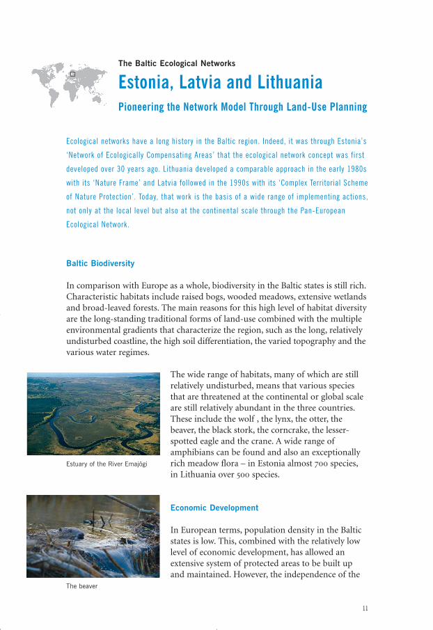
Baltic Biodiversity
In comparison with Europe as a whole, biodiversity in the Baltic states is still rich.Characteristic habitats include raised bogs, wooded meadows, extensive wetlandsand broad-leaved forests. The main reasons for this high level of habitat diversityare the long-standing traditional forms of land-use combined with the multipleenvironmental gradients that characterize the region, such as the long, relativelyundisturbed coastline, the high soil differentiation, the varied topography and thevarious water regimes.
The wide range of habitats, many of which are stillrelatively undisturbed, means that various speciesthat are threatened at the continental or global scaleare still relatively abundant in the three countries.These include the wolf , the lynx, the otter, thebeaver, the black stork, the corncrake, the lesser-spotted eagle and the crane. A wide range ofamphibians can be found and also an exceptionallyrich meadow flora – in Estonia almost 700 species,in Lithuania over 500 species.
Economic Development
In European terms, population density in the Balticstates is low. This, combined with the relatively lowlevel of economic development, has allowed anextensive system of protected areas to be built upand maintained. However, the independence of the
11
Estuary of the River Emajõgi
The beaver
eco_networks_2004 13-01-2004 23:15 Pagina 11
three Baltic states in 1991 and the initiation of political and institutional reformsmarked the start of a long period of severe economic difficulties. One of theresults of this transitionary phase is that agriculture has come under severeeconomic pressure, and this in turn is threatening many valuable semi-naturalhabitats which were managed through traditional agricultural practices. Foresthabitats are also coming under increasing threat: almost half the forests are nowprivately owned, but illegal logging and the regulatory regimes to promotesustainable forms of forestry management are still lacking in effectiveness.
The Estonian Green Network
The disintegration of strong planning institutions and the long period ofpolitical reconstruction created enormous problems for the development andimplementation of the national ecological networks. It was not until newlegislation was adopted in the three states in the years following independencethat serious work could be resumed. The Estonian ‘Green Network’, as it is nowknown, illustrates how these three ecological networks have survived thetransition and are now being refined and realized on the ground.
Given the long tradition of land-use planning and its strong institutions, theGreen Network has been developed from its inception as a spatial-planning toolfor the purpose of balancing and integrating land uses. The implementationstrategy was interrupted by the events of the early 1990s, and it required a reformof Estonian political institions and legislation to be able to establish a newimplementing framework. Since then, the network has been incorporated intonew spatial planning and environmental legislation, mainly the 1995 SustainableDevelopment Act, the 1994 Protection of Natural Features Act and the 1995Planning and Building Act. In addition, the network has been the subject ofpolicy papers such as the National Environmental Strategy (which includes anindicative map of the Green Network), the Environmental Action Plan andEstonia – Vision 2010. The National Agri-Environmental Programme furtherprovides for the development of ecological networks at the local level as a way ofsupporting extensive farming practices. Since 1995, the development of the Pan-European Ecological Network has further stimulated the process.
12
eco_networks_2004 13-01-2004 23:15 Pagina 12
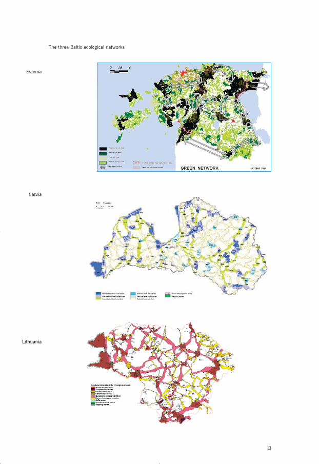
13
The three Baltic ecological networks
Estonia
Latvia
Lithuania
eco_networks_2004 13-01-2004 23:15 Pagina 13
The Estonian ecological network, as it is currently delineated, covers about 50 percent of the country’s territory and is structured to achieve the followingobjectives:• to shape the spatial structure of natural areas in order to meet ecological,
environmental, economic and social goals• to establish a fully functioning network of protected areas that are an integral
part of a complete system with natural areas• to protect valuable natural habitats and to preserve the migration routes of
wild animals and valuable landscapes• to mitigate human impacts on biodiversity and promote sustainable
development• to promote biodiversity-friendly management, lifestyles and recreation by
ensuring access to natural areas• to promote biodiversity conservation outside protected areas• to use spatial planning as a means to minimize conflicts between different
sectors• to guide human settlement and land use• to maintain the natural environment’s self-regulatory capacity• to promote international cooperation.
The network’s national-scale core areas have been identified and delineatedmainly on the basis of the size of the natural areas and their conservation value.Of these core areas, 12 are of international importance, each covering at least 100square kilometres. Other core areas are at least 15 square kilometres in extent.
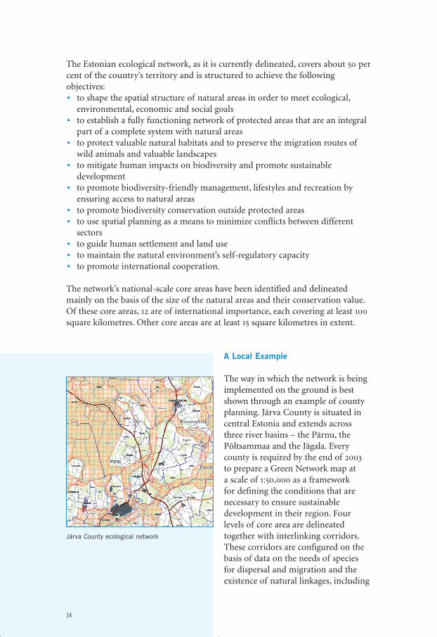
A Local Example
The way in which the network is beingimplemented on the ground is bestshown through an example of countyplanning. Järva County is situated incentral Estonia and extends acrossthree river basins – the Pärnu, thePõltsammaa and the Jägala. Everycounty is required by the end of 2003to prepare a Green Network map at a scale of 1:50,000 as a framework for defining the conditions that arenecessary to ensure sustainabledevelopment in their region. Fourlevels of core area are delineatedtogether with interlinking corridors.These corridors are configured on thebasis of data on the needs of speciesfor dispersal and migration and theexistence of natural linkages, including
14
Järva County ecological network
eco_networks_2004 13-01-2004 23:15 Pagina 14
‘stepping stones’ in the landscape. Public hearings on the configuration of thenetwork are held to ensure that local views are incorporated into the plan, andaccount is also taken of the 1995 Protection of Marine and Freshwater Coasts,Shores and Banks Act that provides for corridors and buffer zones in relation tosurface water.
By being part of the spatial planning process, the county network sets out theconditions that will apply to the regulation of land use in the development-planning process. This is particularly concerned with reducing conflicts betweendifferent land-use demands within the network, with the appropriate intensity ofland uses and with how serious conflicts of interest – such as between a road anda wildlife corridor – should be resolved in a structural way. The specific measuresadopted in the final plan for Järva County were approved by the nationalgovernment in 2003, with the result that the plan now has the force of law.
Further information
• K. Sepp & A. Kaasik. 2002. Development of National Ecological Networks in theBaltic Countries in the Framework of the Pan-European Ecological Network.IUCN Regional Office for Central Europe, Warsaw
• M. Külvik. 2002. Ecological Networks in Estonia – Concepts and Applications.Tartu University Press, Tartu
• www.iucn-ce.org.pl
15
eco_networks_2004 13-01-2004 23:15 Pagina 15
Peru and Bolivia
The Vilcabamba-Amboró Conservation CorridorConserving the Heart of the Tropical Andes
The Tropical Andes Hotspot has been called the ‘global epicentre of biodiversity ’.
Encompassing an area of over a mill ion square kilometres, the region runs from Venezuela
through Colombia, Ecuador, Peru and Bolivia to northern Argentina. Bordered in the west by
the 1000-metre altitude contour and in the east by the Amazonian lowlands, the region is a
treasure trove of biological diversity.
The Vilcabamba-Amboro Forest Ecosystem
At the core of the hotspot, covering about a quarter of its area, is the Vilcabamba-Amboró Forest Ecosystem. This system extends from the Vilcabamba mountainrange in south-central Peru southeast to Amboró National Park in centralBolivia. The vegetation of the region follows a gradient from lowland to thesnow line – from tropical moist forests through cloud-forest formations to alpinegrassland and scrubland. Other vegetation types, such as the unique dry Polylepisforests, are found at higher elevations. Species diversity is exceptional: in the17,000-square-kilometre Manu National Park, over a thousand species of birdshave been identified and in the Tambopata reserve about 1200 species ofbutterflies. The characteristic animal species include the vicuña, the spectacledbear, the mountain tapir, the jaguar, the black spider monkey, the giant riverotter, the pink river dolphin, the condor, the harpy eagle and the black caiman –all now rare or endangered.
16
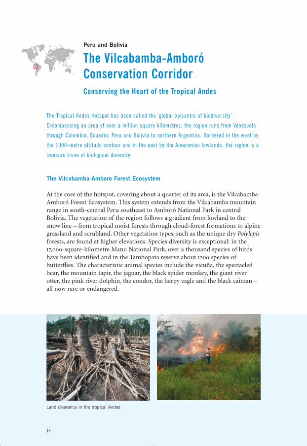
Land clearance in the tropical Andes
eco_networks_2004 13-01-2004 23:15 Pagina 16
Human Pressures
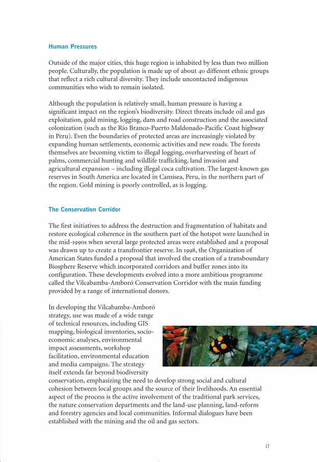
Outside of the major cities, this huge region is inhabited by less than two millionpeople. Culturally, the population is made up of about 40 different ethnic groupsthat reflect a rich cultural diversity. They include uncontacted indigenouscommunities who wish to remain isolated.
Although the population is relatively small, human pressure is having asignificant impact on the region’s biodiversity. Direct threats include oil and gasexploitation, gold mining, logging, dam and road construction and the associatedcolonization (such as the Río Branco-Puerto Maldonado-Pacific Coast highwayin Peru). Even the boundaries of protected areas are increasingly violated byexpanding human settlements, economic activities and new roads. The foreststhemselves are becoming victim to illegal logging, overharvesting of heart ofpalms, commercial hunting and wildlife trafficking, land invasion andagricultural expansion – including illegal coca cultivation. The largest-known gasreserves in South America are located in Camisea, Peru, in the northern part ofthe region. Gold mining is poorly controlled, as is logging.
The Conservation Corridor
The first initiatives to address the destruction and fragmentation of habitats andrestore ecological coherence in the southern part of the hotspot were launched inthe mid-1990s when several large protected areas were established and a proposalwas drawn up to create a transfrontier reserve. In 1998, the Organization ofAmerican States funded a proposal that involved the creation of a transboundaryBiosphere Reserve which incorporated corridors and buffer zones into itsconfiguration. These developments evolved into a more ambitious programmecalled the Vilcabamba-Amboró Conservation Corridor with the main fundingprovided by a range of international donors.
In developing the Vilcabamba-Amboróstrategy, use was made of a wide rangeof technical resources, including GISmapping, biological inventories, socio-economic analyses, environmental impact assessments, workshopfacilitation, environmental educationand media campaigns. The strategyitself extends far beyond biodiversityconservation, emphasizing the need to develop strong social and culturalcohesion between local groups and the source of their livelihoods. An essentialaspect of the process is the active involvement of the traditional park services,the nature conservation departments and the land-use planning, land-reformand forestry agencies and local communities. Informal dialogues have beenestablished with the mining and the oil and gas sectors.
17
eco_networks_2004 13-01-2004 23:15 Pagina 17
18
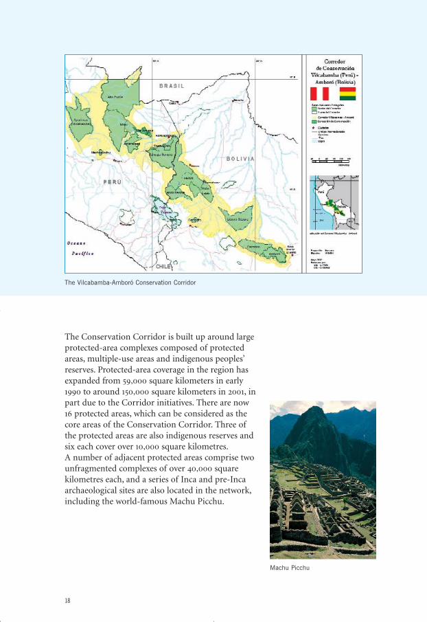
The Conservation Corridor is built up around largeprotected-area complexes composed of protectedareas, multiple-use areas and indigenous peoples’reserves. Protected-area coverage in the region hasexpanded from 59,000 square kilometers in early1990 to around 150,000 square kilometers in 2001, inpart due to the Corridor initiatives. There are now 16 protected areas, which can be considered as thecore areas of the Conservation Corridor. Three ofthe protected areas are also indigenous reserves and six each cover over 10,000 square kilometres.A number of adjacent protected areas comprise twounfragmented complexes of over 40,000 squarekilometres each, and a series of Inca and pre-Incaarchaeological sites are also located in the network,including the world-famous Machu Picchu.
The Vilcabamba-Amboró Conservation Corridor
Machu Picchu
eco_networks_2004 13-01-2004 23:15 Pagina 18
Implementing Actions
The next phase in the development of the Vilcabamba-Amboró ConservationCorridor is the preparation of detailed action plans. However, this will firstrequire further dissemination of the approach and securing greater involvementand commitment by the government departments responsible for economicdevelopment, by local administrations and communities, and also by the privatesector. The first steps in this direction are already being taken through theprogramme’s internal website and joint baseline monitoring.
A good example of actions that are now being taken in the field is the trans-national agreement that was signed in April 2002 by the directors of threeprotected areas to jointly coordinate and implement management efforts. Theagreement includes joint patrols along the boundaries of the three areas,development of a master plan for two national parks, a training course onmonitoring for park rangers and exchange of information on biodiversitythreats. It also includes joint actions to directly benefit communities, such as anevaluation of ecotourism in two areas and socio-economic research on the catchof paiche, a commercially valuable fish species.
The key to successful implementation in the two countries will be the fullparticipation of the protected areas and municipalities in a land-use planningprocess that integrates biodiversity conservation with sustainable development.Bolivia has provided some valuable experience in this respect with theparticipation of municipalities in protected-area management and support formunicipal development plans that the protected areas are providing.
Further Information
• Critical Ecosystems Partnership Fund. 2000. Ecosystem Profile: Vilcabamba-Amboró Forest Ecosystem of the Tropical Andes Biodiversity Hotspot. Peru andBolivia. Critical Ecosystem Partnership Fund, Washington DC
• N. Myers et al. 2000. ‘BiodiversityHotspots for ConservationPriorities’. Nature, 403, 853–858
• www.cepf.net; www.conservation.org• www.biodiversityhotspots.org• www.gefweb.org• www.worldbank.org• www.panda.org
19
eco_networks_2004 13-01-2004 23:15 Pagina 19
The Congo Basin
Tri-DOMSustainable Rainforest Management inthe Cameroon-Gabon-Congo Interzone
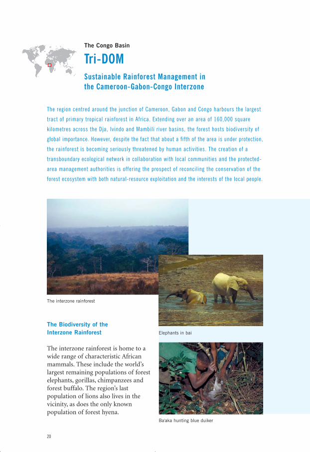
The region centred around the junction of Cameroon, Gabon and Congo harbours the largest
tract of primary tropical rainforest in Africa. Extending over an area of 160,000 square
kilometres across the Dja, Ivindo and Mambili river basins, the forest hosts biodiversity of
global importance. However, despite the fact that about a fifth of the area is under protection,
the rainforest is becoming seriously threatened by human activities. The creation of a
transboundary ecological network in collaboration with local communities and the protected-
area management authorities is offering the prospect of reconciling the conservation of the
forest ecosystem with both natural-resource exploitation and the interests of the local people.
The interzone rainforest
The Biodiversity of the Interzone Rainforest
The interzone rainforest is home to awide range of characteristic Africanmammals. These include the world’slargest remaining populations of forestelephants, gorillas, chimpanzees andforest buffalo. The region’s lastpopulation of lions also lives in thevicinity, as does the only knownpopulation of forest hyena.
20
Ba'aka hunting blue duiker
Elephants in bai
eco_networks_2004 13-01-2004 23:15 Pagina 20
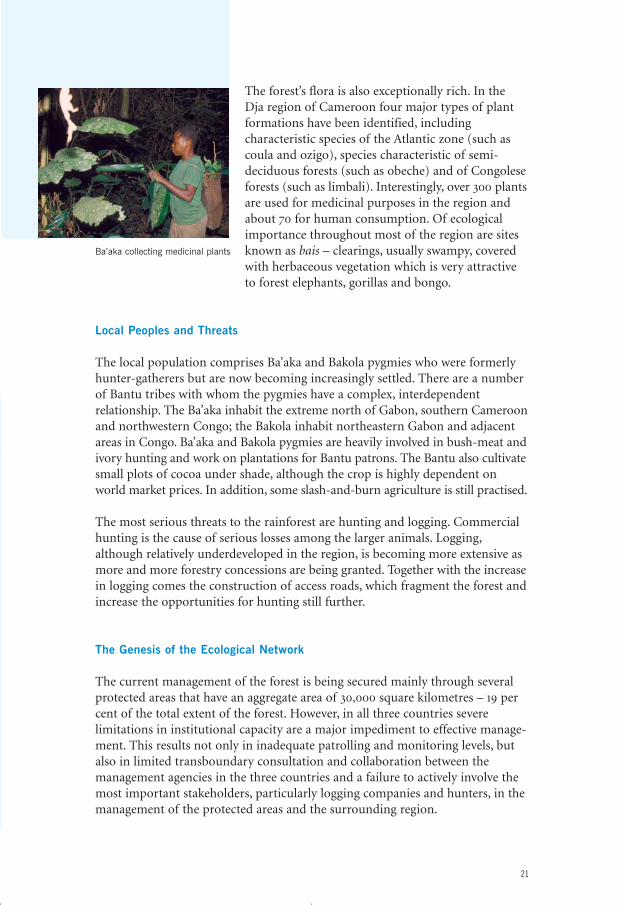
The forest’s flora is also exceptionally rich. In the Dja region of Cameroon four major types of plantformations have been identified, includingcharacteristic species of the Atlantic zone (such ascoula and ozigo), species characteristic of semi-deciduous forests (such as obeche) and of Congoleseforests (such as limbali). Interestingly, over 300 plantsare used for medicinal purposes in the region andabout 70 for human consumption. Of ecologicalimportance throughout most of the region are sitesknown as bais – clearings, usually swampy, coveredwith herbaceous vegetation which is very attractiveto forest elephants, gorillas and bongo.
Local Peoples and Threats
The local population comprises Ba’aka and Bakola pygmies who were formerlyhunter-gatherers but are now becoming increasingly settled. There are a numberof Bantu tribes with whom the pygmies have a complex, interdependentrelationship. The Ba’aka inhabit the extreme north of Gabon, southern Cameroonand northwestern Congo; the Bakola inhabit northeastern Gabon and adjacentareas in Congo. Ba’aka and Bakola pygmies are heavily involved in bush-meat andivory hunting and work on plantations for Bantu patrons. The Bantu also cultivatesmall plots of cocoa under shade, although the crop is highly dependent onworld market prices. In addition, some slash-and-burn agriculture is still practised.
The most serious threats to the rainforest are hunting and logging. Commercialhunting is the cause of serious losses among the larger animals. Logging,although relatively underdeveloped in the region, is becoming more extensive asmore and more forestry concessions are being granted. Together with the increasein logging comes the construction of access roads, which fragment the forest andincrease the opportunities for hunting still further.
The Genesis of the Ecological Network
The current management of the forest is being secured mainly through severalprotected areas that have an aggregate area of 30,000 square kilometres – 19 percent of the total extent of the forest. However, in all three countries severelimitations in institutional capacity are a major impediment to effective manage-ment. This results not only in inadequate patrolling and monitoring levels, butalso in limited transboundary consultation and collaboration between themanagement agencies in the three countries and a failure to actively involve themost important stakeholders, particularly logging companies and hunters, in themanagement of the protected areas and the surrounding region.
21
Ba’aka collecting medicinal plants
eco_networks_2004 13-01-2004 23:15 Pagina 21
The urgent need to secure biodiversity conservation and sustainable developmentin this increasingly vulnerable forest persuaded various conservation NGOs inthe mid-1990s to launch an initiative to establish an ecological network across theregion that could provide the framework for effective, long-term management.The initiative was first discussed at the political level between the Water andForestry Departments of the three countries at the meeting of EcosystèmesForestiers d’Afrique Centrale (ECOFAC) in Libreville in April 1997 and severalfollow-up meetings. These discussions resulted in March 1999 in the adoption by the three governments of the Yaoundé Declaration in which they formallycommitted themselves to:• apply the principles of biodiversity
conservation and sustainablemanagement to the forest eco-systems in Central Africa
• accelerate the process of creatingtransboundary protected areasbetween the three countries
• reinforce sustainable managementin the existing protected areas
• control large-scale poaching andany other unsustainable use offorest resources
• involve all stakeholders in theseefforts.
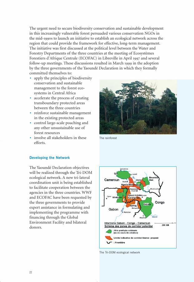
Developing the Network
The Yaoundé Declaration objectiveswill be realized through the Tri-DOMecological network. A new tri-lateralcoordination unit is being establishedto facilitate cooperation between theagencies in the three countries. WWFand ECOFAC have been requested bythe three governments to provideexpert assistance in formulating andimplementing the programme withfinancing through the GlobalEnvironment Facility and bilateraldonors.
22
The rainforest
The Tri-DOM ecological network
eco_networks_2004 13-01-2004 23:15 Pagina 22
The network is to be established over a period of 10 years. Plans provide for theestablishment of a physical network of 40,000 square kilometres in extenttogether with a complementary management strategy that will apply to a total of130,000 square kilometres. The immediate priority for action will be the areasthat lie between the existing protected areas of Ngoïla-Mintom (Cameroon),Ivindo-Karangoua-Djoua (Congo) and the Djoua (Gabon), since these zoneshave a rich fauna, a sparse human population and a relatively low potential forlogging – circumstances that offer a good opportunity for establishing linkagesbetween the existing protected areas. The creation of buffer zones and thestrengthening of the land-use planning system will take on a prominent role onthe network development strategy. Parallel to these priority actions, the initiativewill develop programmes to increase institutional capacity, improve trans-boundary coordination, encourage community participation and link the workto international developments (such as carbon sequestration programmes).
Further Information
• Kamdem Toham, A., et al. 2001. Biological Priorities for Conservation in theGuinean-Congolian Forest and Freshwater Region. March 30–April 2, 2000.Libreville, Gabon. WWF-US/CARPO, Washington, DC
• Kamdem Toham, A., et al. 2003. ‘Forest Conservation in the Congo Basin’.Science, 299:346
• www.worldwildlife.org/ecoregions/
23
eco_networks_2004 13-01-2004 23:15 Pagina 23
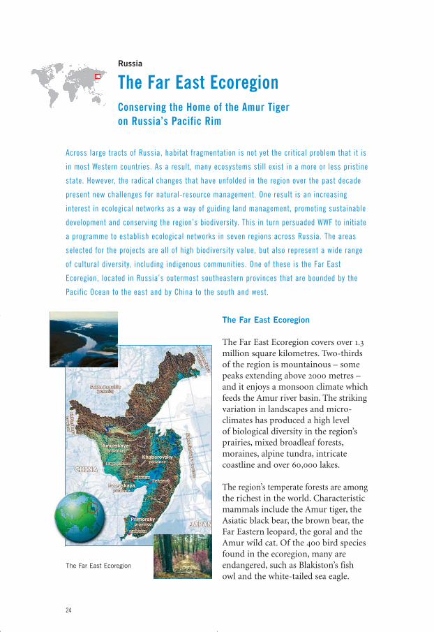
Russia
The Far East EcoregionConserving the Home of the Amur Tiger on Russia’s Pacific Rim
Across large tracts of Russia, habitat fragmentation is not yet the critical problem that it is
in most Western countries. As a result, many ecosystems still exist in a more or less pristine
state. However, the radical changes that have unfolded in the region over the past decade
present new challenges for natural-resource management. One result is an increasing
interest in ecological networks as a way of guiding land management, promoting sustainable
development and conserving the region’s biodiversity. This in turn persuaded WWF to initiate
a programme to establish ecological networks in seven regions across Russia. The areas
selected for the projects are all of high biodiversity value, but also represent a wide range
of cultural diversity, including indigenous communities. One of these is the Far East
Ecoregion, located in Russia’s outermost southeastern provinces that are bounded by the
Pacific Ocean to the east and by China to the south and west.
The Far East Ecoregion
The Far East Ecoregion covers over 1.3million square kilometres. Two-thirdsof the region is mountainous – somepeaks extending above 2000 metres –and it enjoys a monsoon climate whichfeeds the Amur river basin. The strikingvariation in landscapes and micro-climates has produced a high level of biological diversity in the region’sprairies, mixed broadleaf forests,moraines, alpine tundra, intricatecoastline and over 60,000 lakes.
The region’s temperate forests are amongthe richest in the world. Characteristicmammals include the Amur tiger, theAsiatic black bear, the brown bear, theFar Eastern leopard, the goral and theAmur wild cat. Of the 400 bird speciesfound in the ecoregion, many areendangered, such as Blakiston’s fishowl and the white-tailed sea eagle.
24
The Far East Ecoregion
eco_networks_2004 13-01-2004 23:15 Pagina 24
Population and Economic Development
Nearly five million people live in the Far East Eco-region. This is some five per cent less than ten yearsago due to emigration to more prosperous parts ofthe country. Indigenous people make up about twoper cent of the total population, most living incommunities along the middle and upper reaches ofthe rivers and the northern mountain boreal areaswhere they depend mainly on hunting or mining.
Historically, the most important natural resourceshave been furs, agricultural land, precious metals,timber, fish and non-ferrous metals. Althoughfishing in the Amur river basin – mainly for salmonand sturgeon – was an important source of income,overfishing and pollution cut yields dramatically inthe course of the twentieth century. More recently,the region has become an important transit route,with the Trans-Siberian and Amur-Baikal railwayslinking western Eurasia with the Pacific coast. Severallarge ports are located along the Amur river.
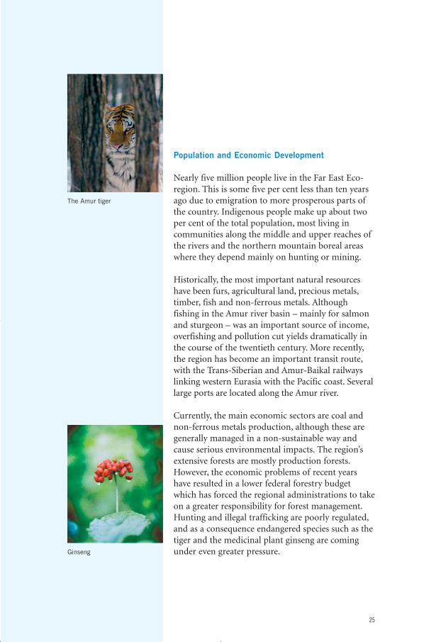
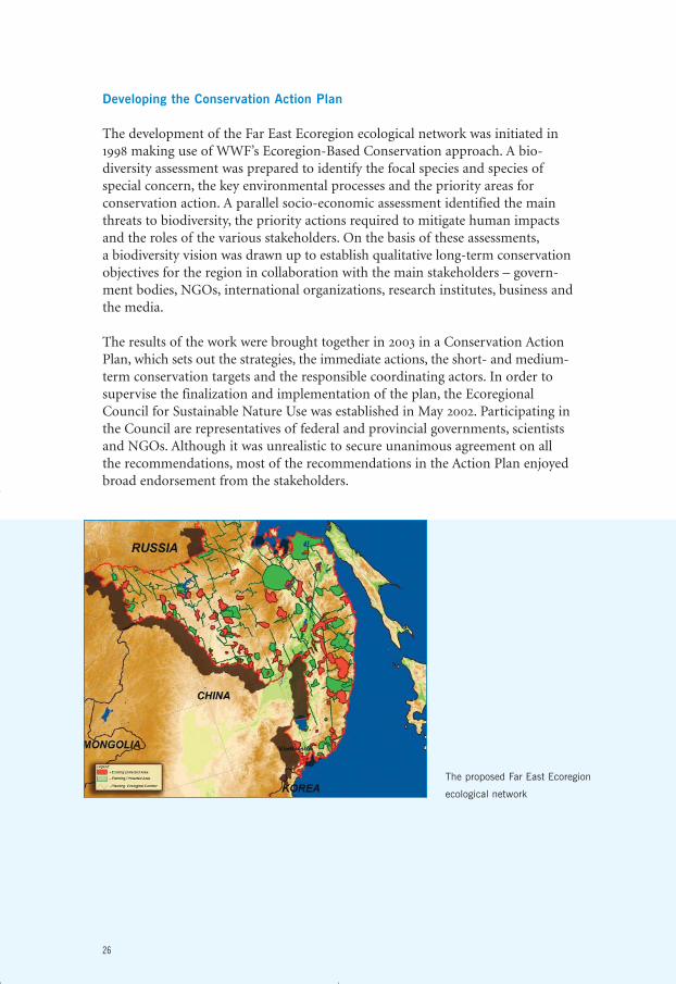
Currently, the main economic sectors are coal andnon-ferrous metals production, although these aregenerally managed in a non-sustainable way andcause serious environmental impacts. The region’sextensive forests are mostly production forests.However, the economic problems of recent yearshave resulted in a lower federal forestry budgetwhich has forced the regional administrations to takeon a greater responsibility for forest management.Hunting and illegal trafficking are poorly regulated,and as a consequence endangered species such as thetiger and the medicinal plant ginseng are comingunder even greater pressure.
25
The Amur tiger
Ginseng
eco_networks_2004 13-01-2004 23:15 Pagina 25
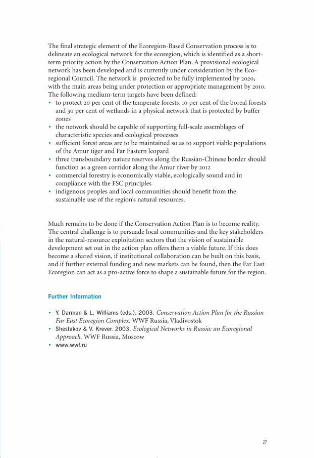
Developing the Conservation Action Plan
The development of the Far East Ecoregion ecological network was initiated in1998 making use of WWF’s Ecoregion-Based Conservation approach. A bio-diversity assessment was prepared to identify the focal species and species ofspecial concern, the key environmental processes and the priority areas forconservation action. A parallel socio-economic assessment identified the mainthreats to biodiversity, the priority actions required to mitigate human impactsand the roles of the various stakeholders. On the basis of these assessments,a biodiversity vision was drawn up to establish qualitative long-term conservationobjectives for the region in collaboration with the main stakeholders – govern-ment bodies, NGOs, international organizations, research institutes, business andthe media.
The results of the work were brought together in 2003 in a Conservation ActionPlan, which sets out the strategies, the immediate actions, the short- and medium-term conservation targets and the responsible coordinating actors. In order tosupervise the finalization and implementation of the plan, the EcoregionalCouncil for Sustainable Nature Use was established in May 2002. Participating inthe Council are representatives of federal and provincial governments, scientistsand NGOs. Although it was unrealistic to secure unanimous agreement on allthe recommendations, most of the recommendations in the Action Plan enjoyedbroad endorsement from the stakeholders.
26
The proposed Far East Ecoregion
ecological network
eco_networks_2004 13-01-2004 23:15 Pagina 26
The final strategic element of the Ecoregion-Based Conservation process is todelineate an ecological network for the ecoregion, which is identified as a short-term priority action by the Conservation Action Plan. A provisional ecologicalnetwork has been developed and is currently under consideration by the Eco-regional Council. The network is projected to be fully implemented by 2020,with the main areas being under protection or appropriate management by 2010.The following medium-term targets have been defined:• to protect 20 per cent of the temperate forests, 10 per cent of the boreal forests
and 30 per cent of wetlands in a physical network that is protected by bufferzones
• the network should be capable of supporting full-scale assemblages ofcharacteristic species and ecological processes
• sufficient forest areas are to be maintained so as to support viable populationsof the Amur tiger and Far Eastern leopard
• three transboundary nature reserves along the Russian-Chinese border shouldfunction as a green corridor along the Amur river by 2012
• commercial forestry is economically viable, ecologically sound and incompliance with the FSC principles
• indigenous peoples and local communities should benefit from thesustainable use of the region’s natural resources.
Much remains to be done if the Conservation Action Plan is to become reality.The central challenge is to persuade local communities and the key stakeholdersin the natural-resource exploitation sectors that the vision of sustainabledevelopment set out in the action plan offers them a viable future. If this doesbecome a shared vision, if institutional collaboration can be built on this basis,and if further external funding and new markets can be found, then the Far EastEcoregion can act as a pro-active force to shape a sustainable future for the region.
Further Information
• Y. Darman & L. Williams (eds.). 2003. Conservation Action Plan for the RussianFar East Ecoregion Complex. WWF Russia, Vladivostok
• Shestakov & V. Krever. 2003. Ecological Networks in Russia: an EcoregionalApproach. WWF Russia, Moscow
• www.wwf.ru
27
eco_networks_2004 13-01-2004 23:15 Pagina 27
Central America
The Mesoamerican Biological Corridor A Vision for Sustainable Development Across the Interamerican Land Bridge
Central America represents one of the world’s richest concentrations of species and eco-
system diversity on a relatively small landmass. Over a period of many decades, however,
this biological wealth has come under growing pressure through increasing population.
The effects of these social pressures have been further exacerbated by the spread of
inappropriate economic activities: extensive logging, the conversion of forests to coffee
plantations and cattle ranching for beef exports, and the establishment of fast-growing
timber, banana and oil-palm plantations. But with the ending of several armed conflicts
in the region in the late 1980s, the opportunity arose to develop an integrated, regional
approach to dealing with the region’s social and environmental problems. The response was
a visionary proposal for building a sustainable future – the Mesoamerican Biological Corridor.
Mesoamerican Biodiversity
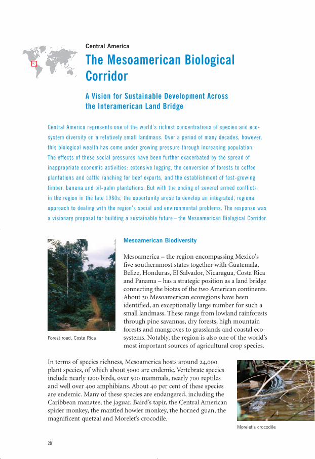
Mesoamerica – the region encompassing Mexico'sfive southernmost states together with Guatemala,Belize, Honduras, El Salvador, Nicaragua, Costa Ricaand Panama – has a strategic position as a land bridgeconnecting the biotas of the two American continents.About 30 Mesoamerican ecoregions have beenidentified, an exceptionally large number for such asmall landmass. These range from lowland rainforeststhrough pine savannas, dry forests, high mountainforests and mangroves to grasslands and coastal eco-systems. Notably, the region is also one of the world’smost important sources of agricultural crop species.
In terms of species richness, Mesoamerica hosts around 24,000plant species, of which about 5000 are endemic. Vertebrate speciesinclude nearly 1200 birds, over 500 mammals, nearly 700 reptilesand well over 400 amphibians. About 40 per cent of these speciesare endemic. Many of these species are endangered, including theCaribbean manatee, the jaguar, Baird’s tapir, the Central Americanspider monkey, the mantled howler monkey, the horned guan, themagnificent quetzal and Morelet’s crocodile.
28
Morelet’s crocodile
Forest road, Costa Rica
eco_networks_2004 13-01-2004 23:15 Pagina 28
Culture, Population and a Vision for Sustainable Development
Historically, Mesoamerica has a long and rich cultural heritage, being home tothe Olmec, Maya and Aztec empires. With a total population of 45 million people,population density is relatively high. About a quarter of the population are ofindigenous origin and almost half the total population – and 71 per cent of therural population – live below the poverty line, lacking access to basic health care,clean water and education. At the same time, the region’s population growth isquite high at more than two per cent a year.
In 1994, the combination of the need for sustainable development and anunusually rich and threatened biodiversity persuaded the Wildlife ConservationSociety and the Caribbean Conservation Corporation to launch the regionalconservation project Paseo Pantera – Path of the Jaguar – that proposed linkingexisting protected areas along the Caribbean coast with wildlife corridors.This proposal was one of the topics discussed at an ecological summit of theCentral American countries that took place the same year. Out of this summitcame the ALIDES plan, which had as its objectives the promotion of peace,the strengthening of democracy and the protection of the Central Americanenvironment. These developments encouraged the Mexican government to jointhe initiative in 1995, and in 1997 what had now become known as the Meso-american Biological Corridor was formally endorsed by all eight heads of state as a framework for protecting biodiversity and maintaining ecosystem services,while at the same time improving the lives of Central Americans.
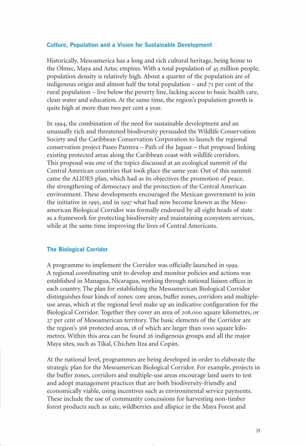
The Biological Corridor
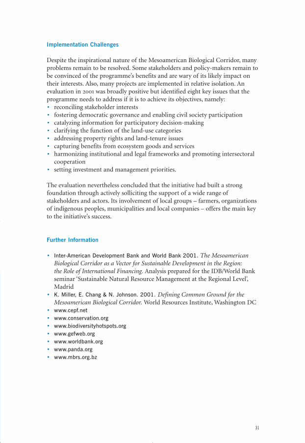
A programme to implement the Corridor was officially launched in 1999.A regional coordinating unit to develop and monitor policies and actions wasestablished in Managua, Nicaragua, working through national liaison offices ineach country. The plan for establishing the Mesoamerican Biological Corridordistinguishes four kinds of zones: core areas, buffer zones, corridors and multiple-use areas, which at the regional level make up an indicative configuration for theBiological Corridor. Together they cover an area of 208,000 square kilometres, or27 per cent of Mesoamerican territory. The basic elements of the Corridor arethe region’s 368 protected areas, 18 of which are larger than 1000 square kilo-metres. Within this area can be found 26 indigenous groups and all the majorMaya sites, such as Tikal, Chichén Itza and Copán.
At the national level, programmes are being developed in order to elaborate thestrategic plan for the Mesoamerican Biological Corridor. For example, projects inthe buffer zones, corridors and multiple-use areas encourage land users to testand adopt management practices that are both biodiversity-friendly andeconomically viable, using incentives such as environmental service payments.These include the use of community concessions for harvesting non-timberforest products such as xate, wildberries and allspice in the Maya Forest and
29
eco_networks_2004 13-01-2004 23:15 Pagina 29
layered-cropping farming and combi-nations of timber trees and shadecoffee in Guatemala, Costa Rica and El Salvador. Local projects include the1500-strong Small Farmers’ Associationof Talamanca in Costa Rica, which isnow producing 20 per cent of theworld’s organic cocoa. At the sametime, smallholders are being organizedinto producer associations that arecapable of competing on the worldmarket. Costa Rica is supportingmanagement measures by private landowners whose land is located incorridors which have been delineatedin the national ecological network.
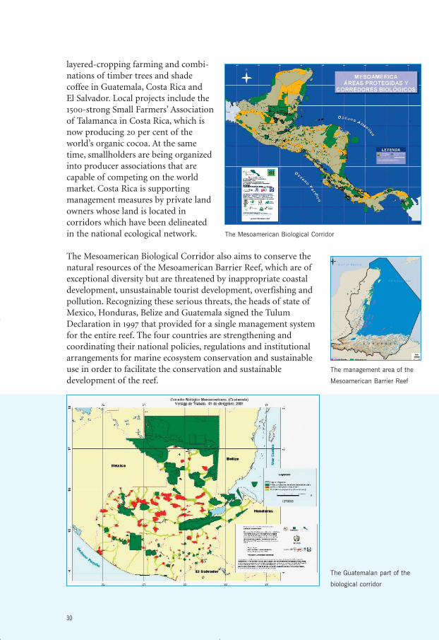
The Mesoamerican Biological Corridor also aims to conserve thenatural resources of the Mesoamerican Barrier Reef, which are ofexceptional diversity but are threatened by inappropriate coastaldevelopment, unsustainable tourist development, overfishing andpollution. Recognizing these serious threats, the heads of state ofMexico, Honduras, Belize and Guatemala signed the TulumDeclaration in 1997 that provided for a single management systemfor the entire reef. The four countries are strengthening andcoordinating their national policies, regulations and institutionalarrangements for marine ecosystem conservation and sustainableuse in order to facilitate the conservation and sustainabledevelopment of the reef.
30
The Guatemalan part of the
biological corridor
The management area of the
Mesoamerican Barrier Reef
The Mesoamerican Biological Corridor
eco_networks_2004 13-01-2004 23:15 Pagina 30
Implementation Challenges
Despite the inspirational nature of the Mesoamerican Biological Corridor, manyproblems remain to be resolved. Some stakeholders and policy-makers remain tobe convinced of the programme’s benefits and are wary of its likely impact ontheir interests. Also, many projects are implemented in relative isolation. Anevaluation in 2001 was broadly positive but identified eight key issues that theprogramme needs to address if it is to achieve its objectives, namely:• reconciling stakeholder interests• fostering democratic governance and enabling civil society participation• catalyzing information for participatory decision-making• clarifying the function of the land-use categories• addressing property rights and land-tenure issues• capturing benefits from ecosystem goods and services• harmonizing institutional and legal frameworks and promoting intersectoral
cooperation• setting investment and management priorities.
The evaluation nevertheless concluded that the initiative had built a strongfoundation through actively solliciting the support of a wide range ofstakeholders and actors. Its involvement of local groups – farmers, organizationsof indigenous peoples, municipalities and local companies – offers the main keyto the initiative’s success.
Further Information
• Inter-American Development Bank and World Bank 2001. The MesoamericanBiological Corridor as a Vector for Sustainable Development in the Region: the Role of International Financing. Analysis prepared for the IDB/World Bankseminar ‘Sustainable Natural Resource Management at the Regional Level’,Madrid
• K. Miller, E. Chang & N. Johnson. 2001. Defining Common Ground for theMesoamerican Biological Corridor. World Resources Institute, Washington DC
• www.cepf.net• www.conservation.org• www.biodiversityhotspots.org• www.gefweb.org• www.worldbank.org• www.panda.org• www.mbrs.org.bz
31
eco_networks_2004 13-01-2004 23:15 Pagina 31
North America
Y2YMaintaining the Integrity of North America’sLast Intact Mountain Ecoregion
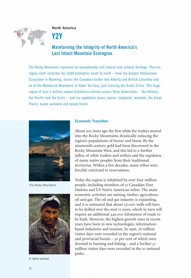
The Rocky Mountains represent an exceptionally rich natural and cultural heritage. The eco-
region itself stretches for 3200 kilometres south to north – from the Greater Yellowstone
Ecosystem in Wyoming, across the Canadian border into Alberta and British Columbia and
on to the Mackenzie Mountains in Yukon Territory, just crossing the Arctic Circle. This huge
region of over a mill ion square kilometres extends across three watersheds – the Atlantic,
the Pacific and the Arctic – and six vegetation zones: alpine, subalpine, montane, the Great
Plains, aspen parkland and boreal forest.
Economic Transition
About 300 years ago the first white fur traders movedinto the Rocky Mountains, drastically reducing theregion’s populations of beaver and bison. By thenineteenth century gold had been discovered in theRocky Mountain West, and this led to a furtherinflux of white traders and settlers and the expulsionof many native peoples from their traditionalterritories. Within a few decades, many tribes wereforcibly restricted to reservations.
Today the region is inhabited by over four millionpeople, including members of 31 Canadian FirstNations and US Native American tribes. The maineconomic activities are mining, timber, agriculture,oil and gas. The oil and gas industry is expanding,and it is estimated that about 137,000 wells will haveto be drilled over the next 15 years, which in turn willrequire an additional 440,000 kilometres of roads tobe built. However, the highest growth rates in recentyears have been in new technologies, information-based industries and tourism. In 1996, 78 millionvisitor days were recorded in the region’s nationaland provincial forests – 30 per cent of which weredevoted to hunting and fishing – and a further 37million visitor days were recorded in the 10 nationalparks.
32
The Rocky Mountains
A native woman
eco_networks_2004 13-01-2004 23:15 Pagina 32
An important feature of the region’s economy is the predominance of non-labour income in the form of returns from investment and pension payments.Together, these two sources not only account for almost three-quarters of allpersonal income, they are also the fastest growing sources of income. Bycontrast, less than five per cent of personal income is generated through mining,oil and gas, forestry and agriculture. The significance of this economic structurefor the future management of the region is that inhabitants are increasingly in aposition to live and work in the more scenic parts of the Rockies.
Biodiversity Under Threat
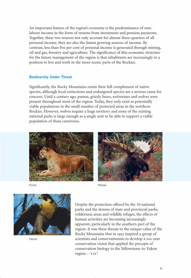
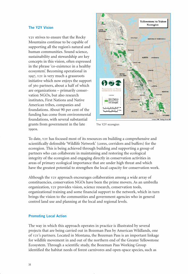
Significantly, the Rocky Mountains retain their full complement of nativespecies, although local extinctions and endangered species are a serious cause forconcern. Until a century ago, pumas, grizzly bears, wolverines and wolves werepresent throughout most of the region. Today, they only exist as potentiallyviable populations in the small number of protected areas in the northernRockies. However, wolves require a huge territory and none of the existingnational parks is large enough as a single unit to be able to support a viablepopulation of these carnivores.
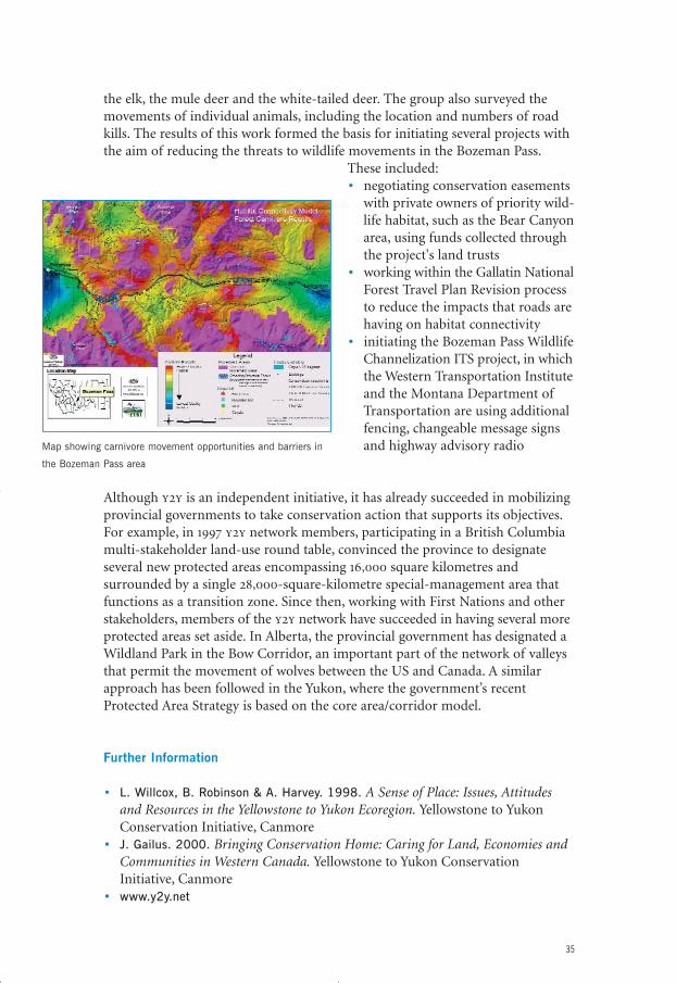
Despite the protection offered by the 10 nationalparks and the dozens of state and provincial parks,wilderness areas and wildlife refuges, the effects ofhuman activities are becoming increasinglyapparent, particularly in the southern part of theregion. It was these threats to the unique value of theRocky Mountains that in 1993 inspired a group ofscientists and conservationists to develop a 100-yearconservation vision that applied the precepts ofconservation biology to the Yellowstone-to-Yukonregion – ‘y2y’.
33
Puma Moose
Falcon
eco_networks_2004 13-01-2004 23:15 Pagina 33
The Y2Y Vision
y2y strives to ensure that the RockyMountains continue to be capable ofsupporting all the region’s natural andhuman communities. Sound science,sustainability and stewardship are keyconcepts in this vision, often expressedin the phrase ‘co-existence in a healthyecosystem’. Becoming operational in1997, y2y is very much a grassrootsinitiative which now enjoys the supportof 360 partners, about a half of whichare organizations – primarily conser-vation NGOs, but also researchinstitutes, First Nations and NativeAmerican tribes, companies andfoundations. About 90 per cent of thefunding has come from environmentalfoundations, with several substantialgrants from government in the late1990s.
To date, y2y has focused most of its resources on building a comprehensive andscientifically defensible ‘Wildlife Network’ (cores, corridors and buffers) for theecoregion. This is being achieved through building and supporting a group ofpartners who can collaborate in maintaining and restoring the ecologicalintegrity of the ecoregion and engaging directly in conservation activities inareas of primary ecological importance that are under high threat and whichhave the greatest potential to strengthen the local capacity for conservation work.
Although the y2y approach encourages collaboration among a wide array ofconstituencies, conservation NGOs have been the prime movers. As an umbrellaorganization, y2y provides vision, science research, conservation tools,organizational training and some financial support to the network, which in turnbrings the vision to the communities and government agencies who in generalcontrol land use and planning at the local and regional levels.
Promoting Local Action
The way in which this approach operates in practice is illustrated by severalprojects that are being carried out in Bozeman Pass by American Wildlands, oneof y2y’s partners. Located in Montana, the Bozeman Pass is an important linkagefor wildlife movement in and out of the northern end of the Greater YellowstoneEcosystem. Through a scientific study, the Bozeman Pass Working Groupidentified the habitat needs of forest carnivores and open-space species, such as
34
The Y2Y ecoregion
eco_networks_2004 13-01-2004 23:15 Pagina 34
the elk, the mule deer and the white-tailed deer. The group also surveyed themovements of individual animals, including the location and numbers of roadkills. The results of this work formed the basis for initiating several projects withthe aim of reducing the threats to wildlife movements in the Bozeman Pass.
These included:• negotiating conservation easements
with private owners of priority wild-life habitat, such as the Bear Canyonarea, using funds collected throughthe project's land trusts
• working within the Gallatin NationalForest Travel Plan Revision processto reduce the impacts that roads arehaving on habitat connectivity
• initiating the Bozeman Pass WildlifeChannelization ITS project, in whichthe Western Transportation Instituteand the Montana Department ofTransportation are using additionalfencing, changeable message signsand highway advisory radio
Although y2y is an independent initiative, it has already succeeded in mobilizingprovincial governments to take conservation action that supports its objectives.For example, in 1997 y2y network members, participating in a British Columbiamulti-stakeholder land-use round table, convinced the province to designateseveral new protected areas encompassing 16,000 square kilometres andsurrounded by a single 28,000-square-kilometre special-management area thatfunctions as a transition zone. Since then, working with First Nations and otherstakeholders, members of the y2y network have succeeded in having several moreprotected areas set aside. In Alberta, the provincial government has designated aWildland Park in the Bow Corridor, an important part of the network of valleysthat permit the movement of wolves between the US and Canada. A similarapproach has been followed in the Yukon, where the government’s recentProtected Area Strategy is based on the core area/corridor model.
Further Information
• L. Willcox, B. Robinson & A. Harvey. 1998. A Sense of Place: Issues, Attitudesand Resources in the Yellowstone to Yukon Ecoregion. Yellowstone to YukonConservation Initiative, Canmore
• J. Gailus. 2000. Bringing Conservation Home: Caring for Land, Economies andCommunities in Western Canada. Yellowstone to Yukon ConservationInitiative, Canmore
• www.y2y.net
35
Map showing carnivore movement opportunities and barriers in
the Bozeman Pass area
eco_networks_2004 13-01-2004 23:15 Pagina 35
Nepal
The Terai Arc LandscapeDeveloping an Ecological Network in a Poor,Densely Populated Region
Nepal is one of the least developed countries in the world. With less than 20 per cent of the
working population employed in industry or trade and services, per capita income is only
about $200 per annum. At the same time, Nepal’s population of over 25 mill ion is growing
steadily. In such a region, the challenges involved in securing biodiversity conservation and
sustainable development are enormous.
A Unique Natural Heritage
Despite the high human pressure,Nepal is still rich in unique landscapesand biological diversity. Seven of theworld’s 10 highest mountains are to befound in the country, including MountEverest, as well as five majorgeomorphological zones that run east-west: the tropical lowland Terai, thesub-tropical Siwaliks along the lowestridges of the Himalayas, the MiddleMountains, the High Mountains andthe High Himal.
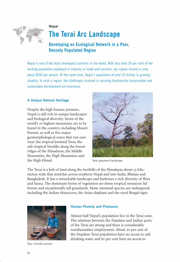
The Terai is a belt of land along the foothills of the Himalayas about 35 kilo-metres wide that stretches across southern Nepal and into India, Bhutan andBangladesh. It has a remarkable landscape and harbours a rich diversity of floraand fauna. The dominant forms of vegetation are dense tropical monsoon Salforests and exceptionally tall grasslands. Many mammal species are endangered,including the Indian rhinoceros, the Asian elephant and the royal Bengal tiger.
Human Poverty and Pressures
Almost half Nepal’s population live in the Terai zone.The relations between the Nepalese and Indian partsof the Terai are strong and there is considerabletransboundary employment. About 20 per cent ofthe Nepalese Terai population have no access to safedrinking water and 80 per cent have no access to
36
Terai grassland landscape
Taru minority woman
eco_networks_2004 13-01-2004 23:15 Pagina 36
health care. Nearly half the children are underweightand average life expectancy is relatively low at about60 years for both men and women.
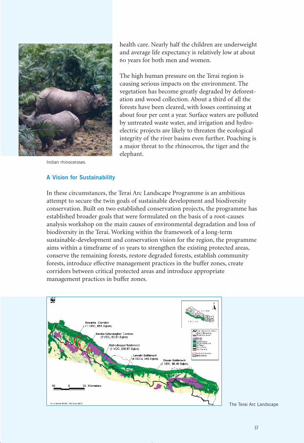
The high human pressure on the Terai region iscausing serious impacts on the environment. Thevegetation has become greatly degraded by deforest-ation and wood collection. About a third of all theforests have been cleared, with losses continuing atabout four per cent a year. Surface waters are pollutedby untreated waste water, and irrigation and hydro-electric projects are likely to threaten the ecologicalintegrity of the river basins even further. Poaching isa major threat to the rhinoceros, the tiger and theelephant.
A Vision for Sustainability
In these circumstances, the Terai Arc Landscape Programme is an ambitiousattempt to secure the twin goals of sustainable development and biodiversityconservation. Built on two established conservation projects, the programme hasestablished broader goals that were formulated on the basis of a root-causesanalysis workshop on the main causes of environmental degradation and loss ofbiodiversity in the Terai. Working within the framework of a long-termsustainable-development and conservation vision for the region, the programmeaims within a timeframe of 10 years to strengthen the existing protected areas,conserve the remaining forests, restore degraded forests, establish communityforests, introduce effective management practices in the buffer zones, createcorridors between critical protected areas and introduce appropriatemanagement practices in buffer zones.
37
The Terai Arc Landscape
Indian rhinoceroses
eco_networks_2004 13-01-2004 23:15 Pagina 37
In the Nepalese part of the Terai, four protected areas exist. However, it is clear that, with their restricted extent and the high human pressures, these are inadequate to secure the ecological integrity of the region. The Terai ArcLandscape has therefore focused on five priority areas in Nepal: two corridors –Basanta and Bardia-Katarniaghat – and three sites where serious barriers toecological continuity exist – Mahadevpuri, Lamahi and Dovan. Additionalcorridors between seven protected areas in the adjacent Indian Terai are alsoplanned, as are linkages with protected areas across the border with India, suchas between the Royal Bardiya National Park in Nepal and the KatarniyaghatWildlife Reserve in India. These projects are being supported by educationcourses for local livestock herders and awareness-raising programmes that arebeing developed by newly established Ecoclubs. To meet the increasing demandfor tree seedlings, 13 multi-purpose tree nurseries have been established. Illicithunting is being discouraged by 17 units that are stationed in the protected areas,while three new anti-poaching units are discouraging poaching in the corridors –the first community-based anti-poaching initiatives in Nepal.
38
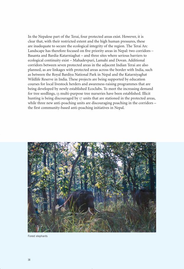
Forest elephants
eco_networks_2004 13-01-2004 23:15 Pagina 38
Implementation
Implementation the programme is being promoted through projects focusing onsustainable community development, awareness-raising and capacity-building.Support on the ground is facilitated through the establishment of a field office in the Royal Bardiya National Park that plans, implements and monitors all thefield activities in the four protected areas. Starting in August 2002, the ForestryOffice of Palpa District handed over five community forests to local communitiesin Dovan. Four community-forest coordination centres were formed to promotethe participation of local people in the conservation activities and to assist colla-boration with the community forest-user groups. These actions have contributedto the mobilization and institutional embedment of the local communities.
Community forests now enjoy a formal status under Nepalese law. In addition,the buffer-zone concept has been incorporated into the National Parks andWildlife Conservation Act and the Buffer-Zone Development Council wasestablished. The Council is entitled to receive 50 per cent of national parkrevenues for financing buffer-zone development projects, and as a result all fourprotected areas are now buttressed by buffer zones.
In the first year of the programme, a total of 536 hectares of degraded land wererestored and a management plan and a tourism plan were drawn up for theRoyal Bardiya National Park, both of which have since been endorsed by theNepalese government. Cooperation with local communities enabled the DistrictForest Office to relocate over 10,000 families who had encroached onto forestareas in the Basanta corridor (although such programmes inevitably cause localtensions and require careful management if they are to secure the cooperation ofboth the peoples who are to be relocated and the population in the area to whichthey are moved).
Further Information
• J. MacKinnon (ed.). 1997. Protected Areas Systems Review of the Indo-MalayanRealm. Asian Bureau for Conservation Ltd, Hongkong/Canterbury
• World Wildlife Fund. 2000. The Global 200 Ecoregions. A User’s Guide. WWF,Washington DC
• www.wwfnepal.org• www.resourceshimalaya.org
39
eco_networks_2004 13-01-2004 23:15 Pagina 39
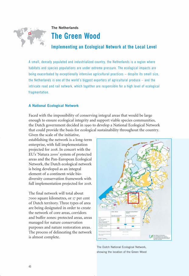
The Netherlands
The Green WoodImplementing an Ecological Network at the Local Level
A small, densely populated and industrialized country, the Netherlands is a region where
habitats and species populations are under extreme pressure. The ecological impacts are
being exacerbated by exceptionally intensive agricultural practices – despite its small size,
the Netherlands is one of the world’s biggest exporters of agricultural produce – and the
intricate road and rail network, which together are responsible for a high level of ecological
fragmentation.
A National Ecological Network
Faced with the impossibility of conserving integral areas that would be largeenough to ensure ecological integrity and support viable species communities,the Dutch government decided in 1990 to develop a National Ecological Networkthat could provide the basis for ecological sustainability throughout the country.Given the scale of the initiative,establishing the network is a long-termenterprise, with full implementationprojected for 2018. In concert with theEU’s ‘Natura 2000’ system of protectedareas and the Pan-European EcologicalNetwork, the Dutch ecological networkis being developed as an integralelement of a continent-wide bio-diversity conservation framework withfull implementation projected for 2018.
The final network will total about7000 square kilometres, or 17 per centof Dutch territory. Three types of areaare being designated in order to createthe network of core areas, corridorsand buffer zones: protected areas, areasmanaged for nature conservationpurposes and nature restoration areas.The process of delineating the networkis almost complete.
40
The Dutch National Ecological Network,
showing the location of the Green Wood
eco_networks_2004 13-01-2004 23:15 Pagina 40
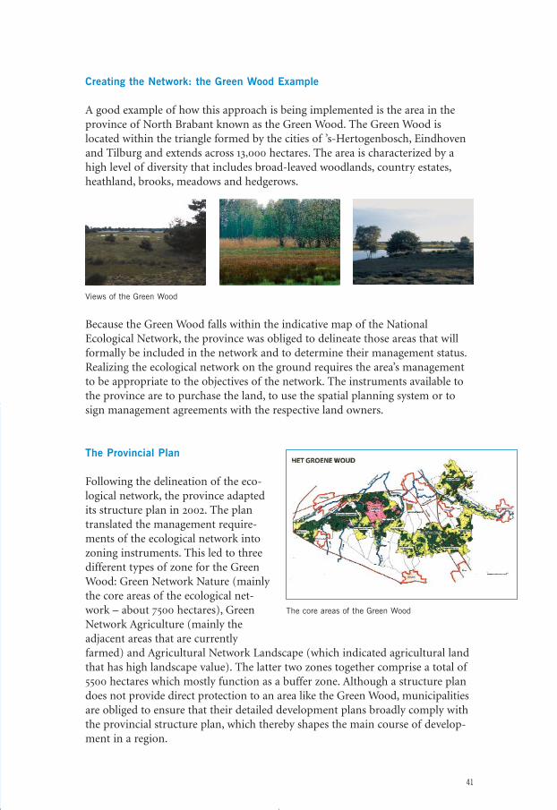
Creating the Network: the Green Wood Example
A good example of how this approach is being implemented is the area in theprovince of North Brabant known as the Green Wood. The Green Wood islocated within the triangle formed by the cities of ’s-Hertogenbosch, Eindhovenand Tilburg and extends across 13,000 hectares. The area is characterized by ahigh level of diversity that includes broad-leaved woodlands, country estates,heathland, brooks, meadows and hedgerows.
Views of the Green Wood
Because the Green Wood falls within the indicative map of the NationalEcological Network, the province was obliged to delineate those areas that willformally be included in the network and to determine their management status.Realizing the ecological network on the ground requires the area’s managementto be appropriate to the objectives of the network. The instruments available tothe province are to purchase the land, to use the spatial planning system or tosign management agreements with the respective land owners.
The Provincial Plan
Following the delineation of the eco-logical network, the province adaptedits structure plan in 2002. The plantranslated the management require-ments of the ecological network intozoning instruments. This led to threedifferent types of zone for the GreenWood: Green Network Nature (mainlythe core areas of the ecological net-work – about 7500 hectares), GreenNetwork Agriculture (mainly theadjacent areas that are currentlyfarmed) and Agricultural Network Landscape (which indicated agricultural landthat has high landscape value). The latter two zones together comprise a total of5500 hectares which mostly function as a buffer zone. Although a structure plandoes not provide direct protection to an area like the Green Wood, municipalitiesare obliged to ensure that their detailed development plans broadly comply withthe provincial structure plan, which thereby shapes the main course of develop-ment in a region.
41
The core areas of the Green Wood
eco_networks_2004 13-01-2004 23:15 Pagina 41
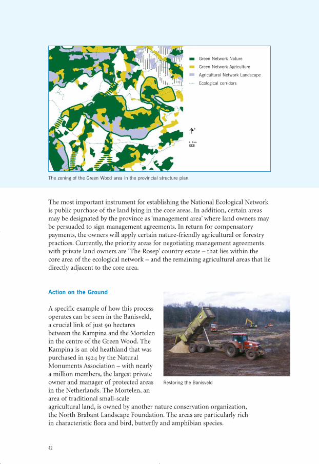
The most important instrument for establishing the National Ecological Networkis public purchase of the land lying in the core areas. In addition, certain areasmay be designated by the province as ‘management area’ where land owners maybe persuaded to sign management agreements. In return for compensatorypayments, the owners will apply certain nature-friendly agricultural or forestrypractices. Currently, the priority areas for negotiating management agreementswith private land owners are ‘The Rosep’ country estate – that lies within thecore area of the ecological network – and the remaining agricultural areas that liedirectly adjacent to the core area.
Action on the Ground
A specific example of how this processoperates can be seen in the Banisveld,a crucial link of just 90 hectaresbetween the Kampina and the Mortelenin the centre of the Green Wood. TheKampina is an old heathland that waspurchased in 1924 by the NaturalMonuments Association – with nearlya million members, the largest privateowner and manager of protected areasin the Netherlands. The Mortelen, anarea of traditional small-scaleagricultural land, is owned by another nature conservation organization,the North Brabant Landscape Foundation. The areas are particularly rich in characteristic flora and bird, butterfly and amphibian species.
42
Restoring the Banisveld
The zoning of the Green Wood area in the provincial structure plan
Green Network Nature
Green Network Agriculture
Agricultural Network Landscape
Ecological corridors
eco_networks_2004 13-01-2004 23:16 Pagina 42
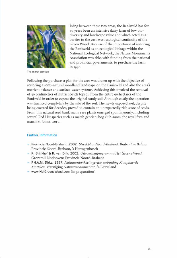
Lying between these two areas, the Banisveld has for40 years been an intensive dairy farm of low bio-diversity and landscape value and which acted as abarrier to the east-west ecological continuity of theGreen Wood. Because of the importance of restoringthe Banisveld as an ecological linkage within theNational Ecological Network, the Nature MonumentsAssociation was able, with funding from the nationaland provincial governments, to purchase the farm in 1996.
Following the purchase, a plan for the area was drawn up with the objective ofrestoring a semi-natural woodland landscape on the Banisveld and also the area’snutrient balance and surface-water systems. Achieving this involved the removalof 40 centimetres of nutrient-rich topsoil from the entire 90 hectares of theBanisveld in order to expose the original sandy soil. Although costly, the operationwas financed completely by the sale of the soil. The newly exposed soil, despitebeing covered for decades, proved to contain an unexpectedly rich store of seeds.From this natural seed bank many rare plants emerged spontaneously, includingseveral Red List species such as marsh gentian, bog club-moss, the royal fern andmarsh St John’s wort.
Further Information
• Provincie Noord-Brabant. 2002. Streekplan Noord-Brabant: Brabant in Balans.Provincie Noord-Brabant, ’s Hertogenbosch
• R. Brinkhof & R. van Dijk. 2002. Uitvoeringsprogramma Het Groene Woud.Grontmij Eindhoven/ Provincie Noord-Brabant
• P.H.A.M. Dirks. 1997. Natuurontwikkelingsvisie verbinding Kampina–deMortelen. Vereniging Natuurmonumenten, ’s-Graveland
• www.HetGroeneWoud.com (in preparation)
43
The marsh gentian
eco_networks_2004 13-01-2004 23:16 Pagina 43
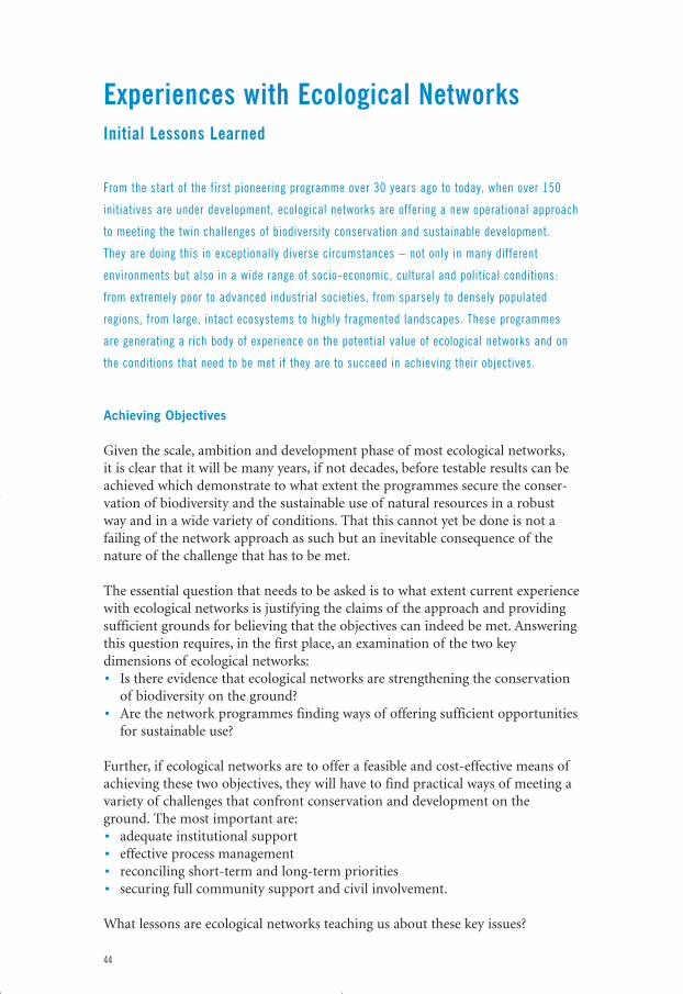
Experiences with Ecological NetworksInitial Lessons Learned
From the start of the first pioneering programme over 30 years ago to today, when over 150
initiatives are under development, ecological networks are offering a new operational approach
to meeting the twin challenges of biodiversity conservation and sustainable development.
They are doing this in exceptionally diverse circumstances – not only in many different
environments but also in a wide range of socio-economic, cultural and political conditions:
from extremely poor to advanced industrial societies, from sparsely to densely populated
regions, from large, intact ecosystems to highly fragmented landscapes. These programmes
are generating a rich body of experience on the potential value of ecological networks and on
the conditions that need to be met if they are to succeed in achieving their objectives.
Achieving Objectives
Given the scale, ambition and development phase of most ecological networks,it is clear that it will be many years, if not decades, before testable results can beachieved which demonstrate to what extent the programmes secure the conser-vation of biodiversity and the sustainable use of natural resources in a robustway and in a wide variety of conditions. That this cannot yet be done is not afailing of the network approach as such but an inevitable consequence of thenature of the challenge that has to be met.
The essential question that needs to be asked is to what extent current experiencewith ecological networks is justifying the claims of the approach and providingsufficient grounds for believing that the objectives can indeed be met. Answeringthis question requires, in the first place, an examination of the two keydimensions of ecological networks:• Is there evidence that ecological networks are strengthening the conservation
of biodiversity on the ground?• Are the network programmes finding ways of offering sufficient opportunities
for sustainable use?
Further, if ecological networks are to offer a feasible and cost-effective means ofachieving these two objectives, they will have to find practical ways of meeting avariety of challenges that confront conservation and development on theground. The most important are:• adequate institutional support• effective process management• reconciling short-term and long-term priorities• securing full community support and civil involvement.
What lessons are ecological networks teaching us about these key issues?
44
eco_networks_2004 13-01-2004 23:16 Pagina 44
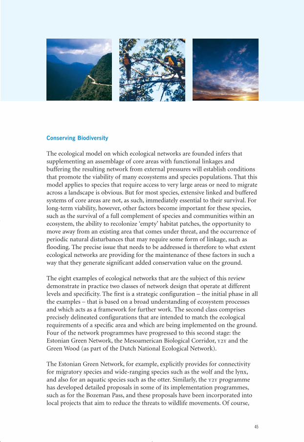
Conserving Biodiversity
The ecological model on which ecological networks are founded infers thatsupplementing an assemblage of core areas with functional linkages andbuffering the resulting network from external pressures will establish conditionsthat promote the viability of many ecosystems and species populations. That thismodel applies to species that require access to very large areas or need to migrateacross a landscape is obvious. But for most species, extensive linked and bufferedsystems of core areas are not, as such, immediately essential to their survival. Forlong-term viability, however, other factors become important for these species,such as the survival of a full complement of species and communities within anecosystem, the ability to recolonize ‘empty’ habitat patches, the opportunity tomove away from an existing area that comes under threat, and the occurrence ofperiodic natural disturbances that may require some form of linkage, such asflooding. The precise issue that needs to be addressed is therefore to what extentecological networks are providing for the maintenance of these factors in such away that they generate significant added conservation value on the ground.
The eight examples of ecological networks that are the subject of this reviewdemonstrate in practice two classes of network design that operate at differentlevels and specificity. The first is a strategic configuration – the initial phase in allthe examples – that is based on a broad understanding of ecosystem processesand which acts as a framework for further work. The second class comprisesprecisely delineated configurations that are intended to match the ecologicalrequirements of a specific area and which are being implemented on the ground.Four of the network programmes have progressed to this second stage: theEstonian Green Network, the Mesoamerican Biological Corridor, y2y and theGreen Wood (as part of the Dutch National Ecological Network).
The Estonian Green Network, for example, explicitly provides for connectivityfor migratory species and wide-ranging species such as the wolf and the lynx,and also for an aquatic species such as the otter. Similarly, the y2y programmehas developed detailed proposals in some of its implementation programmes,such as for the Bozeman Pass, and these proposals have been incorporated intolocal projects that aim to reduce the threats to wildlife movements. Of course,
45
eco_networks_2004 13-01-2004 23:16 Pagina 45
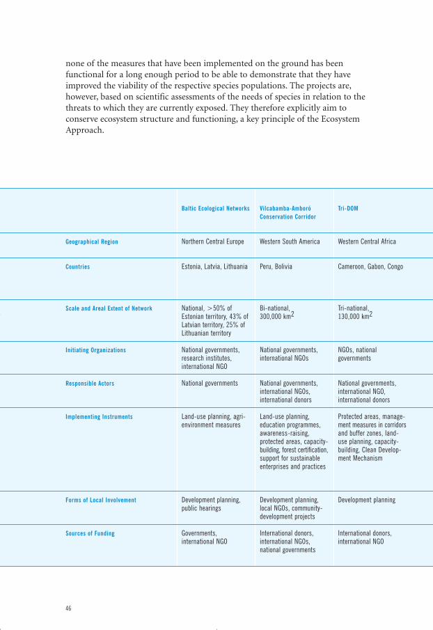
none of the measures that have been implemented on the ground has beenfunctional for a long enough period to be able to demonstrate that they haveimproved the viability of the respective species populations. The projects are,however, based on scientific assessments of the needs of species in relation to thethreats to which they are currently exposed. They therefore explicitly aim toconserve ecosystem structure and functioning, a key principle of the EcosystemApproach.
46
Geographical Region
Countries
Scale and Areal Extent of Network
Initiating Organizations
Responsible Actors
Implementing Instruments
Forms of Local Involvement
Sources of Funding
Baltic Ecological Networks
Northern Central Europe
Estonia, Latvia, Lithuania
National, >50% ofEstonian territory, 43% ofLatvian territory, 25% ofLithuanian territory
National governments,research institutes,international NGO
National governments
Land-use planning, agri-environment measures
Development planning,public hearings
Governments,international NGO
Vilcabamba-AmboróConservation Corridor
Western South America
Peru, Bolivia
Bi-national, 300,000 km2
National governments,international NGOs
National governments,international NGOs,international donors
Land-use planning,education programmes,awareness-raising,protected areas, capacity-building, forest certification,support for sustainableenterprises and practices
Development planning,local NGOs, community-development projects
International donors,international NGOs,national governments
Tri-DOM
Western Central Africa
Cameroon, Gabon, Congo
Tri-national, 130,000 km2
NGOs, nationalgovernments
National governments,international NGO,international donors
Protected areas, manage-ment measures in corridorsand buffer zones, land-use planning, capacity-building, Clean Develop-ment Mechanism
Development planning
International donors,international NGO
eco_networks_2004 13-01-2004 23:16 Pagina 46
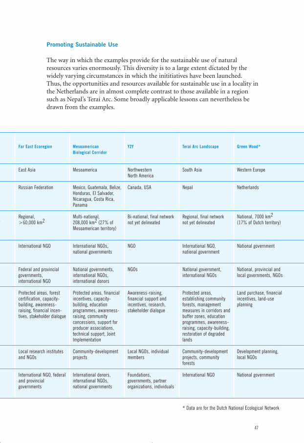
Promoting Sustainable Use
The way in which the examples provide for the sustainable use of naturalresources varies enormously. This diversity is to a large extent dictated by thewidely varying circumstances in which the inititiatives have been launched.Thus, the opportunities and resources available for sustainable use in a locality inthe Netherlands are in almost complete contrast to those available in a regionsuch as Nepal’s Terai Arc. Some broadly applicable lessons can nevertheless bedrawn from the examples.
47
Far East Ecoregion
East Asia
Russian Federation
Regional, >60,000 km2
International NGO
Federal and provincialgovernments,international NGO
Protected areas, forestcertification, capacity-building, awareness-raising, financial incen-tives, stakeholder dialogue
Local research institutesand NGOs
International NGO, federaland provincialgovernments
Mesoamerican Biological Corridor
Mesoamerica
Mexico, Guatemala, Belize,Honduras, El Salvador,Nicaragua, Costa Rica,Panama
Multi-national, 208,000 km2 (27% ofMesoamerican territory)
International NGOs,national governments
National governments,international NGOs,international donors
Protected areas, financialincentives, capacity-building, educationprogrammes, awareness-raising, communityconcessions, support forproducer associations,technical support, JointImplementation
Community-developmentprojects
International donors,international NGOs,national governments
Y2Y
Northwestern North America
Canada, USA
Bi-national, final networknot yet delineated
NGO
NGOs
Awareness-raising,financial support andincentives, research,stakeholder dialogue
Local NGOs, individualmembers
Foundations,governments, partnerorganizations, individuals
Terai Arc Landscape
South Asia
Nepal
Regional, final networknot yet delineated
International NGO,national government
National government,international NGOs
Protected areas,establishing communityforests, managementmeasures in corridors andbuffer zones, educationprogrammes, awareness-raising, capacity-building,restoration of degradedlands
Community-developmentprojects, communityforests
International NGO
Green Wood*
Western Europe
Netherlands
National, 7000 km2(17% of Dutch territory)
National government
National, provincial andlocal governments, NGOs
Land purchase, financialincentives, land-useplanning
Development planning,local NGOs
National government
* Data are for the Dutch National Ecological Network
eco_networks_2004 13-01-2004 23:16 Pagina 47
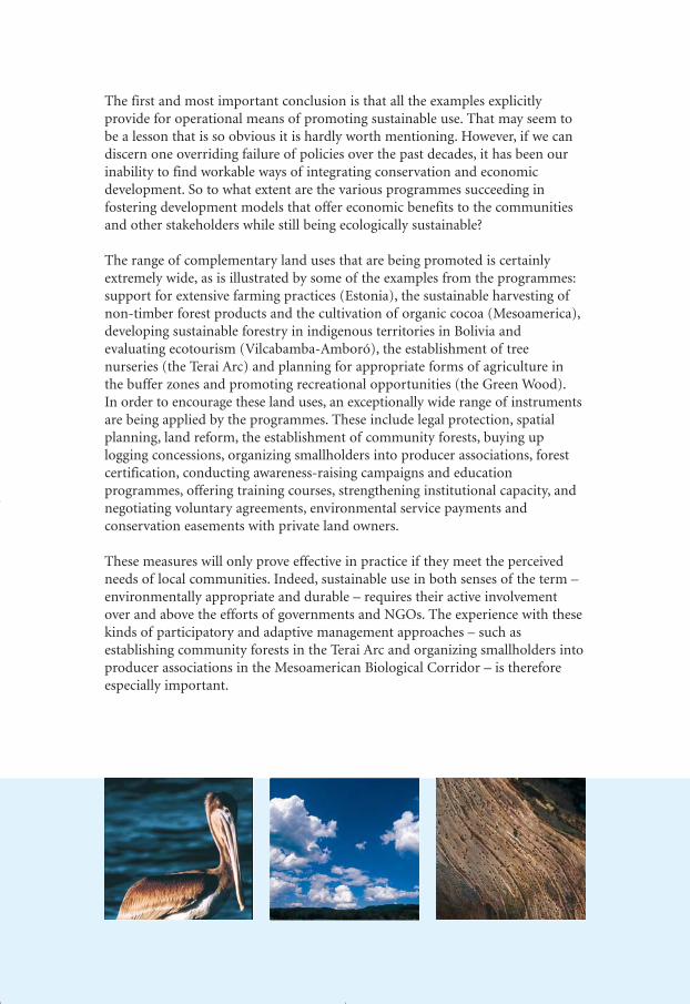
The first and most important conclusion is that all the examples explicitlyprovide for operational means of promoting sustainable use. That may seem tobe a lesson that is so obvious it is hardly worth mentioning. However, if we candiscern one overriding failure of policies over the past decades, it has been ourinability to find workable ways of integrating conservation and economicdevelopment. So to what extent are the various programmes succeeding infostering development models that offer economic benefits to the communitiesand other stakeholders while still being ecologically sustainable?
The range of complementary land uses that are being promoted is certainlyextremely wide, as is illustrated by some of the examples from the programmes:support for extensive farming practices (Estonia), the sustainable harvesting ofnon-timber forest products and the cultivation of organic cocoa (Mesoamerica),developing sustainable forestry in indigenous territories in Bolivia andevaluating ecotourism (Vilcabamba-Amboró), the establishment of treenurseries (the Terai Arc) and planning for appropriate forms of agriculture inthe buffer zones and promoting recreational opportunities (the Green Wood).In order to encourage these land uses, an exceptionally wide range of instrumentsare being applied by the programmes. These include legal protection, spatialplanning, land reform, the establishment of community forests, buying uplogging concessions, organizing smallholders into producer associations, forestcertification, conducting awareness-raising campaigns and educationprogrammes, offering training courses, strengthening institutional capacity, andnegotiating voluntary agreements, environmental service payments andconservation easements with private land owners.
These measures will only prove effective in practice if they meet the perceivedneeds of local communities. Indeed, sustainable use in both senses of the term –environmentally appropriate and durable – requires their active involvementover and above the efforts of governments and NGOs. The experience with thesekinds of participatory and adaptive management approaches – such asestablishing community forests in the Terai Arc and organizing smallholders intoproducer associations in the Mesoamerican Biological Corridor – is thereforeespecially important.
48
eco_networks_2004 13-01-2004 23:16 Pagina 48
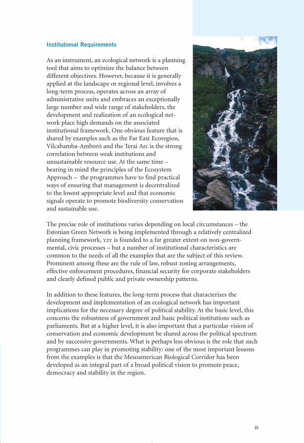
Institutional Requirements
As an instrument, an ecological network is a planningtool that aims to optimize the balance betweendifferent objectives. However, because it is generallyapplied at the landscape or regional level, involves along-term process, operates across an array ofadministrative units and embraces an exceptionallylarge number and wide range of stakeholders, thedevelopment and realization of an ecological net-work place high demands on the associatedinstitutional framework. One obvious feature that isshared by examples such as the Far East Ecoregion,Vilcabamba-Amboró and the Terai Arc is the strongcorrelation between weak institutions andunsustainable resource use. At the same time –bearing in mind the principles of the EcosystemApproach – the programmes have to find practicalways of ensuring that management is decentralizedto the lowest appropriate level and that economicsignals operate to promote biodiversity conservationand sustainable use.
The precise role of institutions varies depending on local circumstances – theEstonian Green Network is being implemented through a relatively centralizedplanning framework, y2y is founded to a far greater extent on non-govern-mental, civic processes – but a number of institutional characteristics arecommon to the needs of all the examples that are the subject of this review.Prominent among these are the rule of law, robust zoning arrangements,effective enforcement procedures, financial security for corporate stakeholdersand clearly defined public and private ownership patterns.
In addition to these features, the long-term process that characterizes thedevelopment and implementation of an ecological network has importantimplications for the necessary degree of political stability. At the basic level, thisconcerns the robustness of government and basic political institutions such asparliaments. But at a higher level, it is also important that a particular vision ofconservation and economic development be shared across the political spectrumand by successive governments. What is perhaps less obvious is the role that suchprogrammes can play in promoting stability: one of the most important lessonsfrom the examples is that the Mesoamerican Biological Corridor has beendeveloped as an integral part of a broad political vision to promote peace,democracy and stability in the region.
49
eco_networks_2004 13-01-2004 23:16 Pagina 49
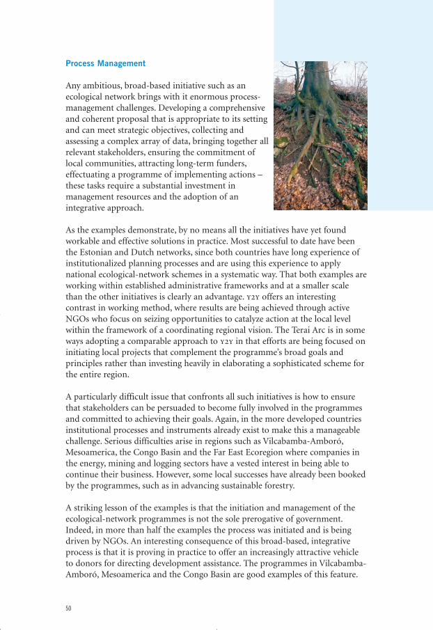
Process Management
Any ambitious, broad-based initiative such as anecological network brings with it enormous process-management challenges. Developing a comprehensiveand coherent proposal that is appropriate to its settingand can meet strategic objectives, collecting andassessing a complex array of data, bringing together allrelevant stakeholders, ensuring the commitment oflocal communities, attracting long-term funders,effectuating a programme of implementing actions –these tasks require a substantial investment inmanagement resources and the adoption of anintegrative approach.
As the examples demonstrate, by no means all the initiatives have yet foundworkable and effective solutions in practice. Most successful to date have beenthe Estonian and Dutch networks, since both countries have long experience ofinstitutionalized planning processes and are using this experience to applynational ecological-network schemes in a systematic way. That both examples areworking within established administrative frameworks and at a smaller scalethan the other initiatives is clearly an advantage. y2y offers an interestingcontrast in working method, where results are being achieved through activeNGOs who focus on seizing opportunities to catalyze action at the local levelwithin the framework of a coordinating regional vision. The Terai Arc is in someways adopting a comparable approach to y2y in that efforts are being focused oninitiating local projects that complement the programme’s broad goals andprinciples rather than investing heavily in elaborating a sophisticated scheme forthe entire region.
A particularly difficult issue that confronts all such initiatives is how to ensurethat stakeholders can be persuaded to become fully involved in the programmesand committed to achieving their goals. Again, in the more developed countriesinstitutional processes and instruments already exist to make this a manageablechallenge. Serious difficulties arise in regions such as Vilcabamba-Amboró,Mesoamerica, the Congo Basin and the Far East Ecoregion where companies inthe energy, mining and logging sectors have a vested interest in being able tocontinue their business. However, some local successes have already been bookedby the programmes, such as in advancing sustainable forestry.
A striking lesson of the examples is that the initiation and management of theecological-network programmes is not the sole prerogative of government.Indeed, in more than half the examples the process was initiated and is beingdriven by NGOs. An interesting consequence of this broad-based, integrativeprocess is that it is proving in practice to offer an increasingly attractive vehicleto donors for directing development assistance. The programmes in Vilcabamba-Amboró, Mesoamerica and the Congo Basin are good examples of this feature.
50
eco_networks_2004 13-01-2004 23:16 Pagina 50
Reconciling Urgent Needs With Long-Term Objectives
Conservation and development strategies have always been confronted with thechallenge of finding ways to meet both short-term needs and long-termobjectives. Dealing with pressing issues that demand immediate action, such ashunger, poverty and highly threatened habitats or species populations, has to bebalanced against the necessity to invest in longer-term objectives in order tosecure structural change. In that sense, this is not an issue that is exclusive to thedebate on ecological networks. However, concerns have been expressed thatecological networks encourage too large a share of the available investment to bedirected at the realization of long-term sustainable-use objectives at the cost ofurgent protection and poverty-alleviation measures.
The experience of the examples shows evidence that more complex processes areat work. To be sure, all the ecological-network programmes require significantinvestment in analytical resources, process management and capacity-building.From the perspective of the programmes, it can be argued that this investmentensures that the actions to be taken are appropriately prioritized, programmedand supported so that they have maximum effect, both in relation to urgentpriorities and to long-term objectives. The programmes would also argue thatecological networks need to build on and expand existing protected areas and toenhance their conservation value by strengthening the ecological coherence ofthe reserves.
But what the examples also suggest is that many initiatives are attracting a higherlevel of funding from a broader range of sources and over a longer period thanwould have been the case if the programmes had been limited to isolatedconservation or development projects. The question of to what extent thisadditional funding represents an increase in the total funds that are being madeavailable for biodiversity conservation and sustainable development rather than areallocation of existing funding cannot be answered by this limited review.However, there are strong indications that this is the case in some of theexamples, such as in Mesoamerica, Vilcabamba-Amboró, y2y and the GreenWood. Moreover, in underdeveloped regions or countries in transition, theexamples indicate that an ecological network can work pro-actively to shape thedevelopment agenda towards an integrated approach to securing conservationand development, as in Mesoamerica and, potentially, the Far East Ecoregion.
Securing Community Support and Civil Involvement
No programme of the breadth and ambition of an ecological network canachieve results without the active support of local communities and keystakeholders. The special problem for many of the programmes discussed in thisreview is that they are being undertaken at a scale that hinders close cooperationwith local communities and also that they might be perceived by localcommunities as irrelevant to meeting their needs. Only by demonstrating that an
51
eco_networks_2004 13-01-2004 23:16 Pagina 51
integrated approach to biodiversity conservation and economic development atthe regional scale offers benefits at the local level can these challenges be met.
It certainly cannot be claimed on the basis of the examples that broad localsupport has been gained for the initiatives and that it will be possible to transferownership of the programmes to local stakeholders in the near future. There isclearly a tension between the necessity to develop a coherent programme at theregional scale and the need to ensure that the main measures are driven by localneeds and perceived as providing a solution to local problems. The appropriatebalance has clearly not been found in all the programmes.
In fact, with the exception of instances where a clearly identifiable corridor ormultiple-use buffer zone has been established, it can be concluded that anappreciation for what the model entails is generally limited to those stakeholderswho are most actively involved in the programmes. Where local support hasbeen secured, it is almost invariably through concrete projects that offer directand tangible benefits – the establishment of community forests (the Terai Arc),providing recreation opportunities (the Green Wood), support for sustainableforms of agriculture (Mesoamerica) and the promotion of ecotourism(Vilcabamba-Amboró).
Adding Value to Conservation and Development
The examples that are the subject of this review represent but a small proportionof the total experience that ecological-network programmes around the worldare generating. They are nevertheless demonstrating that progress is being made,albeit mainly with regard to the process architecture that is appropriate forsecuring action on the ground – programme design, stakeholder involvement,land-management models, capacity-building – rather than in testableconservation and development results. As already noted, however, the shortage ofconcrete results is to a large extent an inevitable consequence of the fact thatmost ecological-network programmes are still in an early phase of development.
But there are indications that the programmes are on course to meeting at least asignificant proportion of their objectives: many are based on convincingscientific research, they are attracting substantial levels of funding fromexperienced donors, the older programmes still enjoy broad political support,conservation measures such as management plans and corridors are beingrealized, and the implementation of a wide range of sustainable-use projects iswell advanced. Considerable work remains to be done. But the growing practicalexperience with developing and implementing ecological networks suggests thata synthesis is indeed emerging in which strategic objectives (the Convention onBiological Diversity), management principles (the Ecosystem Approach) andoperational model (ecological networks) are coalescing to offer an effective andworkable approach for integrating conservation and development.
52
eco_networks_2004 13-01-2004 23:16 Pagina 52
Further Reading
International agreements and decisions that are of special relevance to bio-diversity conservation, sustainable development and ecological networks includethe following: Convention on Biological Diversity. 2000. Decisions Adopted by theConference of the Parties to the Convention on Biological Diversity at Its FifthMeeting. Nairobi, 15–26 May 2000; Convention on Biological Diversity. 2002.Decisions Adopted by the Parties to the Convention on Biological Diversity at Its Sixth Meeting. The Hague, 7–19 April 2002; World Summit on SustainableDevelopment. 2002. Plan of Implementation. Johannesburg, 4 September 2002.See also: Ministry of Agriculture, Nature and Food Quality, Netherlands, Ministry ofForeign Affairs, Netherlands, & Ministry of Science, Technology and the Environment,Malaysia. 2003. Strategic Round Table on the Role of Ecological Networks inBiodiversity Policies. Report of a meeting held on 5–6 June 2003. Ministry ofAgriculture, Nature and Food Quality & Ministry of Foreign Affairs, The Hague.
General information on the ecological network model and 38 examples of itsapplication can be found in G. Bennett & P. Wit. 2001. The Development andApplication of Ecological Networks: a Review of Proposals, Plans and Programmes.AIDEnvironment, Amsterdam.
An authoritative analysis of developments over the past 40 years with respect tobiodiversity conservation, protected areas and ecological networks was publishedby A. Phillips. 2003. ‘Turning Ideas on Their Head – the New Paradigm forProtected Areas’. The George Wright Forum, 20 (2), 8–32.
A good overview of the Ecosystem Approach and its role in implementing theConvention on Biological Diversity is available in R.D. Smith & E. Maltby. 2003.Using the Ecosystem Approach to Implement the Convention on BiologicalDiversity: Key Issues and Case Studies. IUCN, Gland. See also: Convention onBiological Diversity. 2003. Lessons Learned from Case Studies. Expert Meeting onthe Ecosystem Approach, Montreal, 7–11 July 2003.
53
eco_networks_2004 13-01-2004 23:16 Pagina 53
Acknowledgements
This publication is the product of contributions and support from a wide rangeof sources. In the first place, the author is especially grateful to IUCN – TheWorld Conservation Union for supporting the review as part of the work by itsCommission on Ecosystem Management.
Overall supervision of the preparation of the review was the responsibility ofHillary Masundire (Chair of IUCN’s Commission on Ecosystem Management),Alfred Oteng-Yeboah (Chair of the Convention on Biological Diversity’s SubsidiaryBody on Scientific, Technical and Technological Advice), Zenon Tederko (Directorof IUCN’s Regional Office for Central Europe), Willem Ferwerda (Director of theNetherlands Committee of IUCN), Simon Rietbergen (Acting Coordinator ofIUCN’s Ecosystem Management Programme), Chris Enthoven (Ministry ofForeign Affairs, Netherlands) and Peter Bos (Ministry of Agriculture, Nature andFood Quality, Netherlands). The author is grateful for their support, guidanceand willingness to comment unreasonably promptly on considerably more draftsof the review than they had anticipated.
The following experts provided detailed information on some of the programmesand also commented on drafts of the review: Wim Bergmans, NetherlandsCommittee of IUCN (the Terai Arc); Rob Glastra, AIDEnvironment (the Meso-american Biological Corridor and the Vilcabamba-Amboró ConservationCorridor); Paul Scholte (Tri-DOM); Filiep Manger (the Green Wood).
In reviewing the examples, many experts associated with the various programmeswere kind enough to provide information and to comment on several drafts.The author would particularly like to thank: Kalev Sepp (Estonian Institute of Environmental Protection); Henry Campero (WWF-Bolivia), Carlos Ponce(Conservation International-Peru), Eduardo Forno and Feddy Miranda(Conservation International-Bolivia); the WWF-Gabon team, in particularPauwel de Wachter and André Kamdem Toham; Yuri Darman (WWF Russia, FarEastern Branch), Alexander Shestakov and Vladimir Krever (both of WWF Russia);Sandra Ramirez (Mesoamerican Biological Corridor Coordination Office,Managua) and Florangel Villegas (IUCN’s Regional Office for Mesoamerica);Bart Robinson and Rob Ament (both of the Yellowstone to Yukon ConservationInitiative); Chandra P. Gurung (WWF Nepal Programme Office); Robin van Dijk(Province of North Brabant), Frans Kapteijns and Kees Laarhoven (both of theNatural Monuments Association).
54
eco_networks_2004 13-01-2004 23:16 Pagina 54
For further comments and suggestions the author is grateful to Piet Wit (Syzygy and Deputy Chair, IUCN’s Commission on Ecosystem Management),Laurent Ntahuga (IUCN’s East Africa Regional Office and Member of theCommission on Ecosystem Management), Angela Andrade (Regional Vice Chair,IUCN’s Commission on Ecosystem Management), Ted Trzyna (CaliforniaInstitute of Public Affairs/InterEnvironment), Sagendra Tiwari (IUCN Nepal),Carleen Weebers (Ministry of Agriculture, Nature and Food Quality,Netherlands), Sander van Opstal (National Reference Centre for Agriculture,Nature and Food Quality, Netherlands) and Marieke Wit (IUCN’s EcosystemManagement Programme).
Finally, the review would not have been possible without the financial support of the Ministries of Foreign Affairs and of Agriculture, Nature and Food Quality, Netherlands.
55
eco_networks_2004 13-01-2004 23:16 Pagina 55

eco_networks_2004 13-01-2004 23:16 Pagina 56

eco_networks_2004 13-01-2004 23:16 Pagina 57
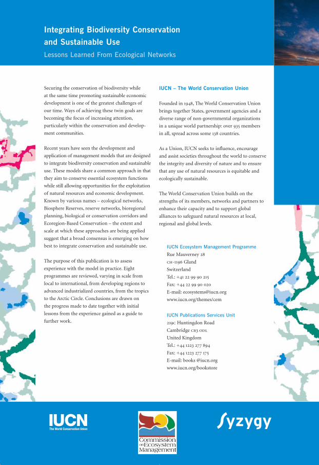
Securing the conservation of biodiversity while
at the same time promoting sustainable economic
development is one of the greatest challenges of
our time. Ways of achieving these twin goals are
becoming the focus of increasing attention,
particularly within the conservation and develop-
ment communities.
Recent years have seen the development and
application of management models that are designed
to integrate biodiversity conservation and sustainable
use. These models share a common approach in that
they aim to conserve essential ecosystem functions
while still allowing opportunities for the exploitation
of natural resources and economic development.
Known by various names – ecological networks,
Biosphere Reserves, reserve networks, bioregional
planning, biological or conservation corridors and
Ecoregion-Based Conservation – the extent and
scale at which these approaches are being applied
suggest that a broad consensus is emerging on how
best to integrate conservation and sustainable use.
The purpose of this publication is to assess
experience with the model in practice. Eight
programmes are reviewed, varying in scale from
local to international, from developing regions to
advanced industrialized countries, from the tropics
to the Arctic Circle. Conclusions are drawn on
the progress made to date together with initial
lessons from the experience gained as a guide to
further work.
Integrating Biodiversity Conservation and Sustainable UseLessons Learned From Ecological Networks
IUCN – The World Conservation Union
Founded in 1948, The World Conservation Union
brings together States, government agencies and a
diverse range of non-governmental organizations
in a unique world partnership: over 935 members
in all, spread across some 138 countries.
As a Union, IUCN seeks to influence, encourage
and assist societies throughout the world to conserve
the integrity and diversity of nature and to ensure
that any use of natural resources is equitable and
ecologically sustainable.
The World Conservation Union builds on the
strengths of its members, networks and partners to
enhance their capacity and to support global
alliances to safeguard natural resources at local,
regional and global levels.
IUCN Ecosystem Management Programme
Rue Mauverney 28
ch-1196 Gland
Switzerland
Tel.: +41 22 99 90 215
Fax: +44 22 99 90 020
E-mail: [email protected]
www.iucn.org/themes/cem
IUCN Publications Services Unit
219c Huntingdon Road
Cambridge cb3 odl
United Kingdom
Tel.: +44 1223 277 894
Fax: +44 1223 277 175
E-mail: books @iucn.org
www.iucn.org/bookstore
eco_networks_2004 13-01-2004 23:16 Pagina 58