Embed Size (px)
Citation preview

Illinois Statewide Intelligent Transportation
Systems (ITS) Architecture and
ITS Strategic Plan
March, 2005
Concept of Operations

Illinois Statewide Intelligent Transportation Systems (ITS) Architecture and ITS Strategic Plan
CONCEPT OF OPERATIONS
March 2005
prepared by
for

DOCUMENT REVISION HISTORY
Concept of Operations Illinois Statewide ITS Architecture and ITS Strategic Plan i
Concept of
Operations
Issue No.
Concept of
Operations
Issue Date
Comment
1.0 March, 2005 Initial release

TABLE OF CONTENTS
Concept of Operations Illinois Statewide ITS Architecture and ITS Strategic Plan ii
1. EXECUTIVE SUMMARY .............................................................................................. 1
2. INTRODUCTION AND BACKGROUND .................................................................... 4
2.1 DEFINITION OF ITS .......................................................................................................... 4 2.2 NATIONAL STATE OF THE PRACTICE, FEDERAL REGULATIONS AND GUIDANCE............... 4 2.3 ITS STANDARDS .............................................................................................................. 5 2.4 COSTS AND BENEFITS OF ITS........................................................................................... 6 2.5 RELATIONSHIP TO REGIONAL TRANSPORTATION PLANNING PROCESS, INCLUDING
SIMILARITIES AND DIFFERENCES ................................................................................................. 7
3. REVIEW OF STATE AND LOCAL RELATED DOCUMENTS AND EFFORTS.. 8
3.1 RELATIONSHIP OF ITS TO STATEWIDE AND REGIONAL TRANSPORTATION ACTIVITIES.. 10 3.2 RELATIONSHIP TO REGIONAL TRANSPORTATION PLANNING PROCESS, INCLUDING
SIMILARITIES AND DIFFERENCES ............................................................................................... 10 3.3 PUBLIC AND STAKEHOLDER INVOLVEMENT................................................................... 12 3.4 RELATIONSHIP TO REGIONAL ARCHITECTURE DEVELOPMENT ...................................... 13 3.5 RELATIONSHIP TO MPO VISION AND AIR QUALITY CONFORMITY ................................ 15 3.6 MOTIVATIONS FOR INTER-JURISDICTIONAL COLLABORATION ....................................... 16
4. STATEWIDE VISION FOR ITS .................................................................................. 17
4.1 SERVICES FROM IDOT ................................................................................................... 18 4.2 PROGRAM PLANNING ..................................................................................................... 23 4.3 FUNDING ........................................................................................................................ 24
5. TRAVELER INFORMATION ..................................................................................... 25
5.1 DESCRIPTION AND EXAMPLES - TRAVELER INFORMATION ............................................ 25 5.2 RELATIONSHIP TO STATEWIDE VISION - TRAVELER INFORMATION................................ 25 5.3 IDENTIFICATION OF ISSUES - TRAVELER INFORMATION ................................................. 25 5.4 BENEFITS OF TRAVELER INFORMATION ......................................................................... 26 5.5 ITS ARCHITECTURE FOR TRAVELER INFORMATION ....................................................... 27 5.6 FINDINGS AND RECOMMENDATIONS FOR TRAVELER INFORMATION .............................. 28
6. FREEWAY MANAGEMENT....................................................................................... 29
6.1 DESCRIPTION AND EXAMPLES - FREEWAY MANAGEMENT............................................. 29 6.2 RELATIONSHIP TO STATEWIDE VISION - FREEWAY MANAGEMENT................................ 31 6.3 IDENTIFICATION OF ISSUES - FREEWAY MANAGEMENT ................................................. 32 6.4 BENEFITS OF FREEWAY MANAGEMENT ......................................................................... 32 6.5 ITS ARCHITECTURE FOR FREEWAY MANAGEMENT ....................................................... 33 6.6 FINDINGS AND RECOMMENDATIONS FOR FREEWAY MANAGEMENT .............................. 37
7. INCIDENT MANAGEMENT ....................................................................................... 38
7.1 DESCRIPTION AND EXAMPLES - INCIDENT MANAGEMENT ............................................. 38 7.2 RELATIONSHIP TO STATEWIDE VISION........................................................................... 41 7.3 IDENTIFICATION OF ISSUES ............................................................................................ 41 7.4 BENEFITS OF INCIDENT MANAGEMENT .......................................................................... 43 7.5 ITS ARCHITECTURE FOR INCIDENT MANAGEMENT........................................................ 44

TABLE OF CONTENTS
Concept of Operations Illinois Statewide ITS Architecture and ITS Strategic Plan iii
7.6 FINDINGS AND RECOMMENDATIONS FOR INCIDENT MANAGEMENT............................... 46
8. ARTERIAL MANAGEMENT ...................................................................................... 47
8.1 DESCRIPTION AND EXAMPLES - ARTERIAL MANAGEMENT ............................................ 47 8.2 RELATIONSHIP TO STATEWIDE VISION - ARTERIAL MANAGEMENT ............................... 47 8.3 IDENTIFICATION OF ISSUES - ARTERIAL MANAGEMENT ................................................. 48 8.4 BENEFITS OF ARTERIAL MANAGEMENT ......................................................................... 48 8.5 ITS ARCHITECTURE FOR ARTERIAL MANAGEMENT....................................................... 49 8.6 FINDINGS AND RECOMMENDATIONS FOR ARTERIAL MANAGEMENT.............................. 50
9. ELECTRONIC FARE/TOLL PAYMENT .................................................................. 51
9.1 DESCRIPTION AND EXAMPLES-ELECTRONIC FARE/TOLL PAYMENT ............................... 51 9.2 RELATIONSHIP TO STATEWIDE VISION-ELECTRONIC FARE/TOLL PAYMENT.................. 52 9.3 IDENTIFICATION OF ISSUES - ELECTRONIC FARE/TOLL PAYMENT .................................. 53 9.4 BENEFITS OF ELECTRONIC FARE/TOLL PAYMENT.......................................................... 53 9.5 ITS ARCHITECTURE FOR ELECTRONIC FARE/TOLL PAYMENT ....................................... 54 9.6 FINDINGS AND RECOMMENDATIONS FOR ELECTRONIC FARE/TOLL PAYMENT............... 55
10. TRANSIT MANAGEMENT ......................................................................................... 56
10.1 DESCRIPTIONS AND EXAMPLES – TRANSIT MANAGEMENT ............................................ 56 10.2 RELATIONSHIP TO STATEWIDE VISION - TRANSIT .......................................................... 60 10.3 IDENTIFICATION OF ISSUES – TRANSIT MANAGEMENT................................................... 61 10.4 BENEFITS OF TRANSIT MANAGEMENT ........................................................................... 64 10.5 ITS ARCHITECTURE FOR TRANSIT MANAGEMENT ......................................................... 65 10.6 FINDINGS AND RECOMMENDATIONS FOR TRANSIT MANAGEMENT ................................ 66
11. SECURITY AND DISASTER RESPONSE MANAGEMENT.................................. 67
11.1 DESCRIPTION AND EXAMPLES - SECURITY AND DISASTER RESPONSE MANAGEMENT ... 67 11.2 RELATIONSHIP TO STATEWIDE VISION – SECURITY AND DISASTER RESPONSE
MANAGEMENT ........................................................................................................................... 69 11.3 IDENTIFICATION OF ISSUES – SECURITY AND DISASTER RESPONSE MANAGEMENT ....... 69 11.4 BENEFITS OF SECURITY AND DISASTER RESPONSE MANAGEMENT ................................ 70 11.5 ITS ARCHITECTURE FOR SECURITY AND DISASTER RESPONSE MANAGEMENT.............. 71 11.6 FINDINGS AND RECOMMENDATIONS FOR SECURITY AND DISASTER RESPONSE
MANAGEMENT ........................................................................................................................... 74
12. REGIONAL COMMUNICATIONS COORDINATION ........................................... 74
12.1 DESCRIPTION AND EXAMPLES - COMMUNICATIONS COORDINATION ............................. 75 12.2 RELATIONSHIP TO STATEWIDE VISION- COMMUNICATIONS COORDINATION ................. 76 12.3 IDENTIFICATION OF ISSUES- COMMUNICATIONS COORDINATION................................... 76 12.4 BENEFITS OF COMMUNICATIONS COORDINATION .......................................................... 77 12.5 ITS ARCHITECTURE FOR COMMUNICATIONS COORDINATION........................................ 78 12.6 FINDINGS AND RECOMMENDATIONS FOR COMMUNICATIONS COORDINATION............... 80
13. HIGHWAY/RAILROAD GRADE CROSSINGS ....................................................... 80
13.1 DESCRIPTIONS AND EXAMPLES – HIGHWAY/RAILROAD GRADE CROSSINGS ................. 80

TABLE OF CONTENTS
Concept of Operations Illinois Statewide ITS Architecture and ITS Strategic Plan iv
13.2 RELATIONSHIP TO STATEWIDE VISION - HIGHWAY/RAILROAD GRADE CROSSINGS....... 82 13.3 IDENTIFICATION OF ISSUES – HIGHWAY/RAILROAD GRADE CROSSINGS........................ 82 13.4 BENEFITS OF HIGHWAY/RAILROAD GRADE CROSSINGS ................................................ 84 13.5 ARCHITECTURE FOR HIGHWAY/RAILROAD GRADE CROSSINGS ..................................... 84 13.6 FINDINGS AND RECOMMENDATIONS FOR HIGHWAY/RAILROAD GRADE CROSSINGS ..... 85
14. COMMERCIAL VEHICLE OPERATIONS .............................................................. 86
14.1 DESCRIPTION AND EXAMPLES-COMMERCIAL VEHICLE OPERATIONS ............................. 86 14.2 RELATIONSHIP TO STATEWIDE VISION-COMMERCIAL VEHICLE OPERATIONS ............... 88 14.3 IDENTIFICATION OF ISSUES-COMMERCIAL VEHICLE OPERATIONS ................................. 88 14.4 BENEFITS OF COMMERCIAL VEHICLE OPERATIONS........................................................ 88 14.5 ITS ARCHITECTURE FOR COMMERCIAL VEHICLE OPERATIONS ..................................... 89 14.6 FINDINGS AND RECOMMENDATIONS FOR COMMERCIAL VEHICLE OPERATIONS ............ 92
15. ITS AS A DATA RESOURCE ...................................................................................... 93
15.1 DESCRIPTION AND EXAMPLES - ITS AS A DATA RESOURCE .......................................... 93 15.2 RELATIONSHIP TO STATEWIDE VISION - ITS AS A DATA RESOURCE ............................. 93 15.3 IDENTIFICATION OF ISSUES - ITS AS A DATA RESOURCE ............................................... 93 15.4 BENEFITS OF ITS AS A DATA RESOURCE ....................................................................... 94 15.5 ITS ARCHITECTURE FOR ITS AS A DATA RESOURCE..................................................... 94 15.6 FINDINGS AND RECOMMENDATIONS FOR ITS AS A DATA RESOURCE............................ 95

TABLE OF ACRONYMS
Concept of Operations Illinois Statewide ITS Architecture and ITS Strategic Plan v
AASHTO American Association of State Highway and Transportation Officials AHS Automated Highway System APCO Association of Public Safety Communications Officials ATIS Advanced Traveler Information System ATMS Advanced Traffic Management Systems AVI Automatic Vehicle Identification AVL Automatic Vehicle Location CAA Clean Air Act CAD Computer-Aided Dispatch CATS Chicago-Area Transportation Study CCTV Closed-Circuit Television CDPD Cellular Data / Packet Data CMAQ Congestion Mitigation and Air Quality (Improvement Program) CMS Central Management Services CUMTD Champaign-Urbana Mass Transit District CVISN Commercial Vehicle Information Systems and Networks CVO Commercial Vehicle Operations DMS Dynamic Message Signs DMV Department of Motor Vehicles EAS Emergency Alert System EOSS Electronic One-Stop Shopping ESDA Emergency Services and Disaster Agency ETC Electronic Toll Collection FCC Federal Communications Commission FHWA Federal Highway Administration FMCSA Federal Motor Carrier Safety Administration FTA Federal Transit Administration GCM Corridor Gary-Chicago-Milwaukee Corridor GPS Global Positioning System HAR Highway Advisory Radio HOV High Occupancy Vehicle (lane) HRI Highway Railroad Intersection ICC Illinois Commerce Commission ICJIA Illinois Criminal Justice Information Authority IDOT Illinois Department of Transportation IEMA Illinois Emergency Management Agency IEPA Illinois Environmental Protection Agency IFERN Interagency Fire Emergency Radio Network IFTA International Fuel Tax Agreement INDOT Indiana Department of Transportation IPS Itinerary Planning System IREACH Illinois Radio Emergency Assistance Channel IRP International Registration Plan

TABLE OF ACRONYMS
Concept of Operations Illinois Statewide ITS Architecture and ITS Strategic Plan vi
ISP Information Service Provider ISP Illinois State Police ISPERN Illinois State Police Emergency Radio Network ISTHA Illinois State Toll Highway Authority ITE Institute of Transportation Engineers ITS Intelligent Transportation Systems ITSPO Intelligent Transportation System Program Office ITTF Illinois Terrorism Task Force IWIN Illinois Wireless Information Network LEADS Law Enforcement Agency Data Service LRTP Long Range Transportation Plan MABAS Mutual Aid Box Alarm System MDT Mobile Data Terminal MoDOT Missouri Department of Transportation MOE Measures of Effectiveness MPO Metropolitan Planning Organization MYP Multi Year Plan NCIC National Crime Information Center NEMA National Electronics Manufacturers’ Association NLETS National Law Enforcement Telecommunications System NTCIP National Transportation Communications for ITS Protocol PSAP Public Safety Access Point REVLAC Reversible Lane Control RPC Regional Planning Commission RTA Regional Transportation Authority RTIP Regional Transit ITS Plan SEDP Strategic Early Deployment Plan SEOC State Emergency Operations Center STIP Statewide Transportation Improvement Plan TEA-21 “Transportation Equity Act for the 21st Century” – authorizing legislation
for federal transportation programs (1998 – 2004) TIMS Traffic and Incident Management System TIP Transportation Improvement Plan TMC Traffic Management Center TRB Transportation Research Board TSC Traffic Systems Center UIC University of Illinois-Chicago USDOT United States Department of Transportation WIM Weigh-in-Motion WisDOT Wisconsin Department of Transportation
Concept of Operations Illinois Statewide ITS Architecture and ITS Strategic Plan 1
1. EXECUTIVE SUMMARY
This document is the Concept of Operations for the Illinois Department of Transportation’s (IDOT) Intelligent Transportation Systems (ITS) program. It is a living document, and shall evolve as the work related to developing a Statewide ITS Strategic Plan and Architecture progresses. The purpose of the Concept of Operations is to identify the current and planned services and functions of IDOT and other participating agencies in Intelligent Transportation Systems. The topics, issues, and questions identified and discussed herein can be used to help guide discussion at stakeholder workshops and refine the plans of IDOT staff regarding ITS across the state. ITS uses advanced technologies to support transportation systems and services. The Concept of Operations supports the development of a Statewide ITS Architecture and associated regional ITS architectures across the state. The IDOT ITS Program Office located in Schaumburg, Illinois has historically held statewide responsibilities that can be divided into three basic categories, as illustrated in Figure 1.
Policy Program Planning Deployment
Resource Sharing ITS Architecture Development & Maintenance
Standards Deployment
Procurement Peer to Peer Coordination for Planning
Technical Support to Districts
> Systems Engineering
> Acceptance Testing
Peer to Peer Coordination for Funding
Accounting/Funds Tracking Support to ITS Market Packages
> Communications
> TMC Coordination
> Technical Infrastructure
Budgeting MOE Tracking and Reporting Application of R&D
Research & Development
Manage/Administer earmarks
Figure 1: IDOT ITS Program Office Responsibilities and Activities.
Activities in each category are guided by the Statewide ITS Architecture and the Concept of Operations for providing transportation services. Figure 2 illustrates, at the highest level, an IDOT-centric statewide concept of operations for ITS. Figure 3 adds some representative details, including a broader range of stakeholders that are expected to exchange information through a typical Illinois District Hub.

Concept of Operations Illinois Statewide ITS Architecture and ITS Strategic Plan 2
Figure 2: Illinois Statewide ITS Architecture (part 1).

Concept of Operations Illinois Statewide ITS Architecture and ITS Strategic Plan 3
Figure 3: Illinois Statewide ITS Architecture (Part 2) In the figure, each circle represents an entity, along with its services, functions, and requirements. A solid line between circles represents explicit protocols and procedures that the two entities use in performing operations. A dashed line represents information exchange or other communications that can support operations, but which do not perform a primary or direct operational function or service. The statewide concept of operations leverages off of the existing ITS infrastructure throughout the state. The Central Gateway Hub operates along the Gary-Chicago-Milwaukee (GCM) Corridor and shares information between Wisconsin, Indiana, and Northeastern Illinois. The Chicago Gateway Hub coordinates information and activities among the regions within Northeastern Illinois, and coordinates with the Illinois Statewide Hub for both 511 (for traveler information) and CVO/CVISN (for commercial vehicle operations). The state and each region provide transportation services by implementing functions grouped into Market Packages from the National ITS Architecture. The remainder of this document describes the details of functions and services supported by IDOT’s ITS program.

Concept of Operations
Illinois Statewide ITS Architecture and ITS Strategic Plan 4
2. INTRODUCTION AND BACKGROUND
2.1 Definition of ITS
Intelligent Transportation Systems (ITS) is a term that applies to any transportation-related project that uses computers, communications, and other advanced technologies to support transportation services. Examples include: sensors that collect real-time traffic, roadway, and weather information; telephone systems (such as 511) that disseminate traveler information; and weigh-in-motion (WIM) systems that measure truck weight without stopping the commercial vehicle. The Federal Highway Administration (FHWA) is promoting integration in planning and project definition by encouraging the use of the National ITS Architecture, which provides both a framework and a vocabulary for planning, defining, and integrating ITS projects. For funding purposes, FHWA defines ITS as “any project that … funds the acquisition of technologies…that provide…one or more ITS User Services as defined in the National ITS Architecture.” 2.2 National State of the Practice, Federal Regulations and Guidance
The Transportation Equity Act for the 21st Century (TEA-21) requires all ITS projects funded through the Highway Trust Fund to be in conformance with the National ITS Architecture and applicable standards. On January 8, 2001, FHWA issued a Rule and the Federal Transit Administration (FTA) issued a parallel Policy intended to foster integration of ITS systems. The Rule and Policy require that ITS projects conform to the National ITS Architecture and standards, in order to receive federal funding. This Rule and Policy applies to all ITS projects funded from the Highway Trust Fund, and requires all ITS projects to be based on systems engineering analysis on a scale commensurate with the project’s scope. At a minimum, all ITS projects must accommodate interface requirements and information exchanges identified in Regional ITS Architectures. Regional ITS Architecture, from the FHWA perspective, is defined as a regional framework for ensuring institutional agreement and technical integration for implementing ITS projects or groups of projects. A regional ITS Architecture is needed whenever ITS technologies being implemented in the area, an ITS project is planned for the area, or when there any system integration opportunities in the area. Additional information on Policy guidance can be found on the U.S. Department of Transportation (USDOT) website at www.its.dot.gov/aconform/policy.htm.

Concept of Operations
Illinois Statewide ITS Architecture and ITS Strategic Plan 5
2.3 ITS Standards
As transportation technology advances, users and consumers of that technology recognize the need for standards related to communications, interoperability, and interchangeability. By developing and adopting these standards, transportation managers can obtain long-term benefits, such as lower technology costs and easier system maintenance. In the short term, however, the adoption of these new and emerging standards forces users and consumers to spend additional time and effort specifying, procuring, and testing equipment to ensure that it adheres to those standards. The challenge that stakeholders face is absorbing the initial cost for standards deployment, in order to obtain the larger benefit of lower cost and improved interoperability. ITS standards are industry-consensus standards that define how system components operate within the framework of the National ITS Architecture. The standards promote interoperability by specifying how systems and components interconnect. To expedite deployment of nationally interoperable ITS systems and services, the USDOT supports specific ITS standards initiatives, especially in areas that have significant public benefit. By adopting appropriate ITS standards, Departments of Transportation can deploy systems that are vendor-neutral, obtaining interoperable systems at a lower cost. In early 1993, FHWA brought together transportation industry representatives to discuss obstacles to installing equipment for new Intelligent Transportation Systems. The representatives concluded that the number one priority should be the development of an industry-standard communications protocol. The National Electrical Manufacturers’ Association (NEMA) Transportation Section had already started a part of a new industry standard, and they offered to expedite and expand the scope of their activities. The result of their efforts was the National Transportation Communications for ITS Protocol (NTCIP). The key aspects of the new protocol are the interchangeability of similar roadside devices, and the interoperability of different types of devices on the same communications channel. The development of the NTCIP standards documents branched off in two directions: object definitions and communications profiles. “Object definitions” were developed for particular types of roadside devices and control products, such as traffic signal controllers or dynamic message signs (DMS). (An “object” is an abstract computer term which represents a range of values or functions that can be accessed or remotely controlled. The object is “defined,” as in a dictionary, so that everyone uses the same spelling of its name.) “Communications profiles” were created for standardized groupings of layered profiles, which are, in turn, based on international communications standards. FHWA sponsored a Steering Committee to help guide the development of NTCIP. Volunteer contributions to the standards-making effort came from public sector agencies, consulting firms, non-member manufacturers, and the NEMA Transportation Section’s member companies.

Concept of Operations
Illinois Statewide ITS Architecture and ITS Strategic Plan 6
In 1996, FHWA suggested a partnership of standards-developing organizations to expand both user and industry involvement. The American Association of State Highway and Transportation Officials (AASHTO) and the Institute of Transportation Engineers (ITE) signed an agreement with NEMA to establish the Joint Committee on NTCIP, and to work together on completing the protocol. Many members of the former Steering Committee were appointed to the Joint Committee. NTCIP is a true national development that has created a very high level of expectations in the transportation industry. The protocol is developed jointly by public agencies, private companies, and the Federal government to provide device-level interoperability and device-level interchangeability in order to implement (deploy) ITS user services. The National ITS Architecture and policy for early deployment depends on the uniform standards to develop and deliver Advanced Traffic Management Systems (ATMS), Advanced Traveler Information Systems (ATIS), and Commercial Vehicle Operations (CVO) functions. The implications of fitting NTCIP into DMS and other ATMS devices are enormous - in that NTCIP actually makes ITS deployment possible using a mixture of devices and cutting communication costs to the bare minimum because multiple devices share the same channel. 2.4 Costs and Benefits of ITS
Intelligent Transportation Systems have an added cost when compared to more traditional construction and maintenance projects in terms of operations but these costs over time are far outweighed by the benefits the implemented technologies provide. In many cases, the fact that a systems engineering approach is brought to bear on project planning and deployment is at first seen as a burdensome cost but in truth, opportunities for integration and interoperability are more readily identified and understood when this more systematic approach is used. The benefits of ITS methodologies and system engineering practices to date include:
• Reduced design costs and development time
• Orderly and efficient expansion
• Lower system costs of the project’s life-cycle
• Improved communications between stakeholders
• Improved communications between systems
• Lower project risk
• Interoperability
• Interchangeability of equipment and devices

Concept of Operations
Illinois Statewide ITS Architecture and ITS Strategic Plan 7
2.5 Relationship to Regional Transportation Planning Process, Including Similarities and Differences
Figure 4 and Figure 5 highlight how an ITS Architecture fits into the regional Transportation Planning Process. Bold boxes highlight where ITS elements add to the traditional process.
Figure 4: ITS Architecture in the Transportation Planning Process
Figure 4 illustrates how the use of an ITS Architecture enhances the transportation planning process. Systems engineering principles and ITS planning activities use the intended projects results to focus project development. As a part of the “Strategic Planning” step, stakeholders define the goals and objectives of the transportation network and associated agencies. In developing the “Long Range Transportation Plan” (LRTP), stakeholders define functions and services that they themselves must provide in order to meet the goals and objectives. Transportation planners then derive the requirements that must be met in order to provide the identified functions and services (the “Transportation Improvement Program”). These requirements become the basis for individual projects. Using an ITS Architecture as a part of the transportation planning process leads to a more complete definition of project requirements. This, in turn, helps streamline project implementation by reducing the risk of wasting resources or duplicating activities.

Concept of Operations
Illinois Statewide ITS Architecture and ITS Strategic Plan 8
Figure 5: ITS Architecture in the Project Planning Process Figure 5 illustrates how ITS planning activities merge into existing project planning. A Project Architecture is developed, based on the regional or statewide ITS architecture. The project architecture provides a concise project description and identifies dependencies and relationships to other projects and activities. Based on these relationships, the project scope is refined to avoid duplication of effort, and to show the precedence of projects (i.e. Project B depends upon Project A, and thus Project B should be scheduled to occur after Project A is complete). Once projects are implemented, the Regional Architecture is updated to assure that new projects will account for completed projects in their planning and development. 3. REVIEW OF STATE AND LOCAL RELATED DOCUMENTS AND EFFORTS
In many ways, Illinois is the transportation center of America. Chicago has been the hub of the nation’s rail system for nearly 150 years. Over 50 railroads currently traverse the state, providing links between all corners of the country. O'Hare International Airport and the major commuter hub at Midway Airport make Chicago one of the busiest air destinations in the world. More than 118 public-use airports, 273 heliports, and over 1,000 aviation facilities further emphasize the state’s standing in aviation. Illinois also

Concept of Operations
Illinois Statewide ITS Architecture and ITS Strategic Plan 9
has over 1,100 miles of navigable waterways which link the Mississippi River (and the Gulf of Mexico) to the Great Lakes and beyond to the Atlantic Ocean. To augment these other forms of freight shipping, over 5,700 commercial trucking companies are based in Illinois. These trucking companies, as well as the over eight million registered drivers in Illinois, provide a significant demand on the state’s 136,402 miles of roadways. This road system includes over 2,100 miles of interstate highways, the third highest total of any state in the nation, and an additional 35,000 miles of state roadways.1 Further complicating the picture of Illinois’ transportation infrastructures is the fact that vast portions of the state are not densely populated. In point of fact, approximately 73 percent of the state’s roadways are classified as rural.2 With this enormous transportation infrastructure comes a multitude of challenges, all of which revolve around the safety, mobility, and economic viability of the transportation system. Illinois has been a pioneer in the use of ITS to address these challenges. ITS began in Illinois in the Chicago area as early as 1963 when IDOT’s Traffic Systems Center (TSC) established one of the first real-time expressway surveillance and management systems in the world. The detectors, ramp meters, variable message signs, and highway advisory radio (HAR) systems have been operated continuously ever since. Some of these technologies have since been deployed outside of the Chicago area, in the Illinois portion of the St. Louis metropolitan area, Peoria and-East Peoria, Quad Cities, and Rockford. ITS components have also been deployed in rural areas of the state for road weather information systems and rural transportation management. The benefits provided by such systems have set an example for other ITS initiatives throughout the state, both in urban and rural settings. As a result, the State of Illinois and many of its municipalities have applied technology and management strategies to improve the safety, capacity, and efficiency of the transportation system. Section 4.2 provides a summary of major ITS planning initiatives in Illinois at a statewide, regional, and local level. These projects focus on a wide range of transportation fields, including transit management, traveler information, electronic toll collection, traffic management, highway-rail intersections, commercial vehicle operations, incident/emergency response, and maintenance/construction management. Documentation of these efforts consists of the following:
• Statewide and Regional Transportation Improvement Plans
• Multi-Year Highway Improvement Plans
• Regional Long Range Transportation Plans
• Regional Strategic Early Deployment Plans
• Regional Transit ITS Plans
• Regional ITS Business Plans
• Statewide and Regional ITS Architectures
• Operations Manuals
1 Illinois Department of Commerce and Economic Opportunity 2 National Association of Development Organizations

Concept of Operations
Illinois Statewide ITS Architecture and ITS Strategic Plan 10
• ITS Project Plans
• ITS Components of Individual Projects
• Regional Incident Response and Alternate Routing Plans 3.1 Relationship of ITS to Statewide and Regional Transportation
Activities
Illinois consists of 102 counties, which include 1,288 municipalities and 1,433 towns or townships, for a total of 2,721 sub-county divisions, the largest total of any state in the nation. In addition, the 1997 U.S. Census of Governments identified 83 independent, special-purpose governments in Illinois that have transportation responsibilities, including 26 for highways, 31 for airports, eight for water transport, and eighteen for transit, with an additional 33 other public transit providers serving rural areas and 61 organizations that provide specialized transit services to elderly and disabled populations in those same areas. 3 Similarities among these agencies, whether in the challenges they face, their day-to-day activities, or their plans for future operations provide key opportunities for potential integration and sharing of funds. During stakeholder workshops held throughout the state, communication was a focal point for current and planned operations among all stakeholders. In particular, interagency communications and the ability to provide information to other transportation agencies and the traveling public were the top issues raised. Similarly, emergency management services emphasized the importance of improving emergency response and coordination. Traffic management and roadway maintenance agency survey responses followed the same pattern, but also highlighted the need for improved weather information. Planning organizations and information service providers expanded upon the need for increased traveler information, particularly road construction and weather conditions. Many transportation agencies in Illinois use ITS in some manner, and many more have incorporated ITS solutions into their plans for the future. When searching for ways to solve the problems on the transportation system, Illinois is a leader in the testing and implementation of technology solutions. Section 4.2 provides further information about current and planned ITS efforts around the state. 3.2 Relationship to Regional Transportation Planning Process, Including
Similarities and Differences
In cooperation with key local agencies and the traveling public, IDOT is a key player in transportation planning in both urban and rural areas of Illinois. Metropolitan Planning Organizations (MPOs) in urban areas, and Regional Planning Commissions (RPCs) in rural settings, help to coordinate with local organizations during the planning process. These local agencies include elected officials, representatives from transit agencies, emergency services and law enforcement personnel, and environmental groups. Through coordination with these local agencies and MPOs, the nine IDOT districts identify and
3 NADO

Concept of Operations
Illinois Statewide ITS Architecture and ITS Strategic Plan 11
prioritize candidate projects throughout the state. These potential projects then move to the IDOT Central Office in Springfield, where they are considered for inclusion in the State’s Multi-Year Highway Improvement Plan. To this point, ITS planning in Illinois has been carried out on a regional, agency, or project basis - rather than statewide. In June of 1999, the Chicago Area Transportation Study (CATS) and IDOT completed the Northeastern Illinois Strategic Early Deployment Plan (SEDP), which has since guided the planning and deployment of ITS in the Chicago area. In August of 2001, the Regional Transportation Authority (RTA) of northeastern Illinois completed its Regional Transit ITS Plan (RTIP). This plan is intended to provide “a blueprint for the application and integration of technology to improve transit services and provide operators and customers with information that supports seamless, multi-modal travel for users of the transportation system.”4 In addition, ITS architectures have been created for northeastern Illinois and the GCM Corridor. Recently, ITS planning has expanded throughout the state, but focused mainly on urban areas. Regional or Project ITS Architectures have been completed (or are under development) in Dubuque, Rockford, Peoria, the Quad Cities, and St. Louis. These architectures have been developed in close coordination with the local MPOs, and in many cases this coordination has led to the inclusion of ITS in the metropolitan transportation improvement plans (TIPs). The following TIPs include references to ITS:
• FY 2004 – 2006 Transportation Improvement Program for the Dubuque, Iowa/Illinois Urbanized Area (East Central Intergovernmental Association)
• FY 2004 Transportation Improvement Plan (Rockford Area Transportation Study)
• QC 2005 Long Range Transportation Plan for the Quad Cities (Bi-State Regional Commission)
• Peoria/Pekin (IL) Urbanized Area Transportation Study Transportation Improvement Program, Fiscal Years 2004-2006 (Tri-County Regional Planning Commission)
• Fiscal Years 2004-2006 Transportation Improvement Program (Springfield Area Transportation Study)
• Transportation Improvement Plan, Fiscal Years 2004 through 2008, for the St. Louis Metropolitan Area (East-West Gateway Council of Governments)
In addition, other transportation agencies have incorporated ITS into their own internal planning procedures. The Illinois State Toll Highway Authority (ISTHA) employs many forms of ITS technologies to improve toll road system operations, including electronic toll payment, dynamic message signs, CCTV cameras, vehicle detection, and computer-aided dispatch (CAD). ISTHA’s Traffic and Incident Management System (TIMS) brings together these technologies for improved incident response and increased traveler information. Planning for these initiatives starts by identifying potential areas of improvement on the toll system. This is done either by ISTHA as part of its regular
4 Regional Transportation Authority

Concept of Operations
Illinois Statewide ITS Architecture and ITS Strategic Plan 12
operations, or within the scope of an individual project, such as the TIMS Project. ISTHA then investigates potential solutions for the identified problems, including emerging ITS tools, and how they might be applied to address the identified needs. Through this process, potential projects are created and prioritized until funding becomes available, when the projects are designed and implemented. The various transit agencies throughout Illinois employ a similar approach to ITS planning: system needs and potential ITS solutions are identified; projects are created and prioritized; and, once funding becomes available, they are designed and implemented. Formal transit planning, including the application of ITS technologies, is documented in a regional transit plan and/or the local transportation improvement plan prepared by the local MPO/RPC. Commercial vehicle operations planning in Illinois is a concerted effort between IDOT, the Illinois Commerce Commission (ICC), the Federal Motor Carrier Safety Administration (FMCSA), FHWA, the Midwest Truckers Association, and various private commercial vehicle operators. These groups are in the process of developing a Commercial Vehicle Information Systems and Networks (CVISN) Plan for Illinois. This work is part of an overall effort to attain “CVISN Level One.” A state is recognized to be at CVISN Level One if its CVISN system design conforms to the CVISN Architecture (part of the National ITS Architecture) and it demonstrates the ability to add new technologies and capabilities over time. The key capability areas include safety information exchange, credentials administration, and electronic screening. IDOT’s Intelligent Transportation System Project Office (ITSPO) does an annual solicitation of ITS project priorities to better match anticipated funding with priority needs as identified at the district and local level. The regional, agency, or project-level approach to ITS planning employed in Illinois has both benefits and shortcomings. The process allows individual agencies to provide a direct response to both its needs and the various stakeholder needs it collects, and it emphasizes the links between MPOs/RPCs and potential funding sources. However, “stove-piping” between different agencies in the planning process often overlooks integration opportunities, both at the funding level and during implementation. As a logical next step, this document, and the forthcoming Illinois (Statewide) ITS Strategic Plan, will expand ITS planning beyond the regional, agency, or project level by bringing ITS into the statewide planning process. The ITS Strategic Plan will act as a bridge between the disparate Regional ITS Architectures and planning efforts and the more comprehensive MYP and Statewide Transportation Improvement Plan (STIP). This will be a significant step in mainstreaming ITS in Illinois, bringing intelligent transportation systems further into the public eye. This step will also increase the opportunity for integration and the options for ITS funding on a statewide basis. 3.3 Public and Stakeholder Involvement
IDOT employs an extensive public outreach effort during the transportation planning process. This is done through mailings, an informational telephone number, the media, and public forums. In addition, planning documents are made available to interested

Concept of Operations
Illinois Statewide ITS Architecture and ITS Strategic Plan 13
parties for review and comment through press releases, mailings and emails, and the IDOT website. Many different agencies and organizations have a stake in ITS in Illinois. These include:
• Regional transit agencies,
• MPOs & RPCs,
• Roadway maintainers,
• Traveler information providers,
• Commercial vehicle operators,
• Emergency and incident management services,
• Railroads,
• Traffic management centers,
• Elected officials,
• Special event providers,
• Environmental groups,
• Toll authorities,
• Private partners,
• Major traffic generators, and
• The traveling public. Throughout the evolution of ITS in Illinois, and particularly during the development of the Statewide ITS Architecture and Strategic Plan, these stakeholders have played a key role. Stakeholders have participated in the project through surveys, stakeholder workshops, telephone and in-person interviews, and committee membership. These efforts, and their results, are described further in the ITS Strategic Plan. 3.4 Relationship to Regional Architecture Development
At present, three ITS architectures have been completed within Illinois: the GCM Corridor ITS Architecture, the Northeastern Illinois Regional ITS Architecture, and the I-74 Reconstruction Project ITS Architecture (Peoria). In addition to the Illinois Statewide ITS Architecture, several Regional ITS Architectures are under development across the state, as shown in Table 1.

Concept of Operations
Illinois Statewide ITS Architecture and ITS Strategic Plan 14
Architecture Status
Statewide Under Development Bloomington-Normal Under Development
Champaign-Urbana/Danville Under Development
Decatur Under Development
GCM Corridor (corridor architecture)
Ready for Use
I-74 Reconstruction Project (project-level architecture)
Ready for Use
Kankakee Under Development
NE Illinois (Chicago MPO) Ready for Use
North Central Illinois (Rockford & DeKalb MPO)
Under Development
Peoria Under Development
Quad Cities Under Development
Springfield Under Development
St. Louis Metro East Under Development
Table 1: Status of ITS Architectures in Illinois5
The completed ITS architectures in Illinois have proven to be useful tools in the planning and prioritization of ITS initiatives. The Northeastern Illinois Regional ITS Architecture, in combination with agency-level planning activities and the Northeastern Illinois SEDP, provides the direction for ITS project implementations throughout the Chicago region. The North Central Illinois ITS Architecture contains a listing of critical ITS “project concepts” that are intended to be included in the regional transportation plan. The I-74 Reconstruction Project ITS Architecture includes ITS implementations as part of the reconstruction project, but also considers initiatives for the greater Peoria area beyond the scope of the project. The Illinois Statewide ITS Architecture will summarize planned ITS projects around the state, and recommend statewide ITS initiatives, at a general statewide level. Then, as the regional architectures in Illinois are completed, these candidate projects can be considered at a more detailed regional level. Bordering States have also developed (or are developing) ITS architectures that include references to transportation elements in Illinois. These architectures are summarized in Table 2. In Northeastern Illinois, coordination between statewide ITS architecture efforts has occurred at the corridor level through the GCM Corridor Architecture. For other bordering areas, coordination occurs at the regional level, e.g., the Bi-State St. Louis ITS Regional Architecture, the Bi-State Regional ITS Architecture (Quad Cities), or the North Central Illinois ITS Architecture (Rockford).
5 Federal Highway Administration (FHWA), with additions

Concept of Operations
Illinois Statewide ITS Architecture and ITS Strategic Plan 15
Architecture Status
Davenport, IA Under Development Indiana Statewide Under Development
Iowa Statewide Under Development
Kentucky Statewide Ready for Use
Missouri Statewide Ready for Use
Quad Cities Under Development
SW Wisconsin (Beloit MPO) Ready for Use
St. Louis Under Development
Terre Haute, IN Under Development
Wisconsin Statewide Ready for Use
Table 2: Status of Related ITS Architectures in Bordering States6
3.5 Relationship to MPO Vision and Air Quality Conformity
Reviewing the goals described in long range plans across Illinois yields some common themes: transportation system efficiency, economic viability, traveler safety, and a clean environment. These themes correlate closely with the goals of ITS, as identified in TEA-21:
• Enhance surface transportation efficiency and facilitate intermodalism;
• Achieve national transportation safety goals;
• Protect and enhance the natural environment;
• Accommodate the needs of all users of surface transportation systems, including operators of commercial vehicles, passenger vehicles, and motorcycles, and including individuals with disabilities; and
• Improve the Nation's ability to respond to emergencies and natural disasters and enhance national security.7
As evidenced by the different projects that are in various stages of completion (Section 4.2), ITS project planners in Illinois have taken these goals into consideration. By creating ITS projects that focus on these core goals, planners can increase both potential benefits and likelihood of funding. One of the key planning factors included in TEA-21 states that new transportation projects should “protect and enhance the environment, promote energy conservation, and improve quality of life.”8 MPOs across the state have addressed this goal in their long range transportation plans, particularly those in areas of high pollution. Part or all of eleven counties in Illinois are designated as non-attainment areas by the Illinois Environmental Protection Agency (IEPA). In response, the East-West Gateway Council of Governments in the St. Louis area has prepared Air Quality Conformity Determination and Documentation to demonstrate that transportation projects included in its “Legacy 2025” long-range transportation plan are in accordance with the Clean Air Act (CAA) 6 FHWA, with additions 7 Transportation Equity Act for the 21st Century (TEA-21), Sect. 5203 8 TEA-21

Concept of Operations
Illinois Statewide ITS Architecture and ITS Strategic Plan 16
and other federal regulations. The Chicago Area Transportation Study (CATS) is very active in the use of ITS projects to directly address environmental issues. The working paper entitled “A Synopsis of CMAQ Demonstration Projects” details numerous ITS efforts throughout the Chicago region funded through the Congestion Mitigation and Air Quality (CMAQ) Improvement Program, and their results. Even though areas of high pollution are confined to the Chicago and St. Louis Metro East regions, all MPOs in Illinois have taken the environmental effects of the transportation system into account. In the Quad Cities, an Air Quality Task Force was created to heighten awareness of the environment, and to suggest steps that travelers can take to improve air quality. Other MPOs cite the importance of public transportation in combating the adverse environmental effects of vehicle emissions. 3.6 Motivations for Inter-jurisdictional Collaboration
Opportunities for inter-jurisdictional coordination in the procurement, deployment, and use of these technologies exist throughout Illinois. MetroLINK in the Quad Cities, the Champaign-Urbana Mass Transit District (CUMTD), and CityBus of Lafayette (Indiana) have entered into a consortium to implement and test computer-aided dispatch (CAD) and automatic vehicle location (AVL) technologies to improve the efficiency of their transit vehicles. By pooling their resources, these transit agencies have experienced benefits beyond the scope of the study, including:
• Resource sharing during grant application, research and design, system testing, operation, and maintenance;
• Ability to discuss “lessons learned” to reduce the effect of problems and, in some cases, avoid the problems altogether;
• Cost savings through higher volume of equipment purchased; and
• Wider support base among elected officials. Resource sharing, in particular, has allowed the consortium participants to provide more system functionality to their riders than would have been possible if each agency worked independently. All consortium members (and their customers) will benefit from CUMTD’s Internet website design and hosting capabilities, which are being used to create an itinerary planning website that any rider within the consortium area can use. The emergency management field offers another example of the benefits of inter-jurisdictional collaboration. The Illinois Wireless Information Network (IWIN) is a communications system owned and maintained by the State of Illinois in partnership with private telecommunications companies. The system uses common protocols, data encryption, and transmission methods to allow public safety officials to exchange data directly between their vehicles and a statewide law enforcement database. Through integration and interoperation examples such as these, transportation agencies across Illinois can augment their current capabilities and provide timely and useful assistance to their peers.

Concept of Operations
Illinois Statewide ITS Architecture and ITS Strategic Plan 17
4. STATEWIDE VISION FOR ITS
The USDOT has stated that "projects have the greatest chance for success when they promote a shared vision." A long-term view of services and needs to be addressed (and how ITS can improve the surface transportation network) underpins any vision for ITS deployments across the state of Illinois. At its simplest, an integrated network of surface transportation information is based on monitoring, information management, system control and optimization – in short, the creation of an integrated statewide network of transportation information shared between agencies and the traveling public. The information to be gathered and managed includes real-time information on the physical state of the infrastructure; how it is being built, used, maintained, and secured, relevant weather conditions, driver expectations and other information for system operators and users. At the highest level, the statewide vision for ITS in Illinois can be stated simply as …
Informed Choices for Improved Operations
Inherent in this vision is the use of technology to provide safe, secure, and seamless
services to the traveling public within a flexible, adaptable, standards-based framework for the integration and coordination of transportation for both systems and operations. The transportation system should be managed and operated to provide seamless, end-to-end intermodal passenger travel - regardless of traveler age, disability, or location. The system should be equally supportive of efficient, seamless, end-to-end intermodal freight transport. Public policy and private sector decision makers must support the Statewide ITS Vision, so that future transportation will be secure, customer-oriented, performance-driven, responsive in times of crisis, and institutionally innovative - enabled by information that is derived from a fully integrated network of computing, communications, and sensor technologies. The statewide ITS Vision is based on success in all of the following areas:
Cost-Effectiveness Equitable Service Efficient System Information to User Low User Cost Minimum Travel Time
No Surprise Delays Personal Security Positive Image Reliable Transportation Seamless Agency Coordination User Friendly Zero Accidents
A byproduct of the Statewide ITS Vision should be the continued introduction of ITS technologies into the institutional and funding framework of surface transportation in the State of Illinois. IDOT has spent over four decades pioneering efforts to achieve goals such as:

Concept of Operations
Illinois Statewide ITS Architecture and ITS Strategic Plan 18
• Deploying an electronic information infrastructure that works in concert with the physical infrastructure to maximize system efficiency and utility, and to encourage modal integration and modal choice.
• Deploying a secure system that can both detect and respond to regional crises maximizing the efficient use of resources.
• Minimizing the occurrence of incidents, and lowering response time.
• Dissemination of information to system operators and users to help contain congestion and increase the system’s effective capacity, while reducing the need for new construction.
• Reduce energy consumption and negative environmental impact through technology and information exchange.
The goals and objectives of the transportation system cannot be fully articulated without considering who will use, maintain, and expand the system. The needs of these stakeholders must guide any alterations to the transportation network. They include:
• The Motoring Public
• Public Safety Responders
• Transit Riders
• Rural Residents
• Travelers / Tourists
• Implementing Agencies
• Funding Agencies
• Commercial Vehicle Operators
• Maintenance and Operations Agencies
• Elected Officials
• Intermodal Planners / Users
• All Transportation Modes
4.1 Services from IDOT
In November of 2004, IDOT underwent a reorganization that streamlined district boundaries and identified regions. A region usually consists of a pair of districts. Because the Chicago Metropolitan area has such a large population, District 1 is a region by itself (Region 1). The specific description of regions as shown in Figure 6 is as follows:
• Region 1 encompasses District 1. This region includes Chicago and the collar counties.
• Region 2 encompasses Districts 2 and 3. This region includes Rockford, the Quad Cities, the La Salle-Peru-Ottawa areas, and the Kankakee metropolitan area.
• Region 3 encompasses Districts 4 and 5. This region includes Galesburg , Peoria , Bloomington , Champaign-Urbana, and Danville.
• Region 4 encompasses Districts 6 and 7. This includes Quincy, Jacksonville, Springfield, Decatur, Mattoon-Charleston area and Effingham. Also included is the I-70 corridor from Vandalia to the Indiana state line.
• Region 5 encompasses Districts 8 and 9. This includes the Metro East St Louis region, Mt Vernon, Marion and Carbondale. Region Five includes the entire I-64 corridor.

Concept of Operations Illinois Statewide ITS Architecture and ITS Strategic Plan 19
Figure 6: Relationship between IDOT Regions and IDOT Districts
Transportation services are provided at a district level. Regions coordinate transportation services that cross District boundaries. The Central Office provides assistance in technical areas, auditing processes at a district and regional level, and providing oversight. Operations begin at the district level.

Concept of Operations Illinois Statewide ITS Architecture and ITS Strategic Plan 20
4.1.1 CURRENT SERVICES
IDOT is currently active in the planning, programming and deployment of ITS initiatives throughout Illinois. This includes both IDOT initiatives and those at the local level, in addition to coordination with bordering states. These activities are based in the IDOT ITS Program Office, which is part of the Office of Planning and Programming. The ITS Program Office is located in Schaumburg, Illinois and performs activities that can be divided into three categories as illustrated below:
Policy Program Planning Deployment
Resource Sharing ITS Architecture Development & Maintenance
Standards Deployment
Procurement Peer to Peer Coordination for Planning
Technical Support to Districts
> Systems Engineering
> Acceptance Testing
Peer to Peer Coordination for Funding
Accounting/Funds Tracking Support to ITS Market Packages
> Communications
> TMC Coordination
> Technical Infrastructure
Budgeting MOE Tracking and Reporting Application of R&D
Research & Development
Manage/Administer earmarks
Table 3: IDOT ITS Program Office responsibilities and activities.
Each IDOT district has an ITS Coordinator, who is tasked with overseeing ITS activities. The district ITS coordinators work with the ITS Program Office, other district ITS coordinators, MPOs and RPCs, and local agencies to identify user needs and evaluate applications of technology that can address those needs. 4.1.2 PLANNED SERVICES
Figure 7 depicts, at a very high level, the ultimate framework envisioned for the Statewide ITS System Architecture. It is IDOT-centric and builds upon the current GCM ITS Priority Corridor Gateway Multi-modal Traveler Information System. The figure depicts the Illinois District Hubs as well as their relationship to the Illinois Statewide Hub and GCM Gateway Hub. Figure 7 is a context diagram illustrating the statewide ITS concept of operations at the highest level of information exchange potentially for the state of Illinois. This “Level 0” diagram is intended to focus on the concept that each region and district will gather information locally about the surface transportation network and share information between and among the various state and local agencies as warranted and as necessary. The state of Illinois consists of multiple regions and districts, and each one has a specific collection of services, functions, and requirements. The districts and the state work together to provide transportation services to the public.

Concept of Operations Illinois Statewide ITS Architecture and ITS Strategic Plan 21
In these context diagrams, each circle represents an entity, along with its services, functions, and requirements. A solid line between circles represents explicit protocols and procedures that the two entities use in performing operations in general. A dashed line represents information exchange or other communications that can support operations, but which do not perform a primary or direct operational function or service. At a statewide level, the Illinois Statewide Hub performs operations for traveler information (via 511), Commercial Vehicle Operations (for movement of goods), and coordination of statewide operations with District Hubs, the Illinois Tollway Authority, and neighboring State Departments of Transportation. The Illinois Statewide Hub shares statewide transportation information with the Illinois State Police, transit operations, and public safety answering points (PSAPs)/emergency dispatch centers. These entities also share appropriate safety, transit, and law enforcement information to the Illinois Statewide Hub. For most activities, police, safety officials, and transit organizations operate at a regional level. Information exchange at a statewide level occurs, but the primary interaction is at a regional or district level.
Figure 7: Statewide ITS Architecture Level 0 Diagram

Concept of Operations Illinois Statewide ITS Architecture and ITS Strategic Plan 22
Figure 8 is another context diagram, this time at the next layer of detail. This diagram is intended to focus within a district. The purpose of this next level of context is to show how entities relate to each other for regional and/or district operations. While each district and region is unique, Figure 8 can be applied as a template, explicitly showing the functions and services that could potentially be addressed at the regional and/or district level. As such, an individual district may have all, some, or none of the entities shown.
Figure 8: Statewide ITS Architecture Level 1 Diagram
As in Figure 7, each circle represents an entity’s services, functions, and requirements. This context diagram expands outward from the Illinois District Hub entity which is the same entity found in the Level 0 diagram. In the Level 1 diagram, a solid line between circles represents explicit protocols and procedures that the two entities use in performing operations. A dashed line between a district entity and a statewide entity represents information exchange, or other communications that can support operations but which do not necessarily perform a primary or direct operational function or service. A dashed line between two district entities shows that those two entities have other primary means for information exchange outside of IDOT operations. For example, Figure 8 has a dashed line between “Local Law Enforcement” and “Illinois State Police” - this dashed line shows that the law enforcement entities have their own means to share information; IDOT is not their primary means of information exchange.

Concept of Operations Illinois Statewide ITS Architecture and ITS Strategic Plan 23
Each district communicates and shares information with the Illinois Statewide Hub, which shares that information with all regions that need that data. Figure 8 details Level 1. While still a high-level concept, in addition to IDOT it includes a broader range of stakeholders (e.g., MPOs/RPCs, transit agencies, State Police) that are expected to exchange information through a typical Illinois District Hub.
4.2 Program Planning
4.2.1 STATEWIDE EFFORTS
ITS initiatives are in place throughout the state. Table 4 provides an overview of some statewide ITS projects involving emergency/incident management, traffic management, and commercial vehicle systems. Note the acronyms under the Project Type column in Table 4 stand for commercial vehicle check (CVC), commercial vehicle administration (CVA), emergency management (EM), and information service provider (ISP). These terms are from the National ITS Architecture.
Project Title Lead Agencies Project Type Timeframe
Pre-Pass/Weigh-in-Motion Weigh Stations
IDOT CVC 2003
Electronic One-Stop Shopping (EOSS) ICC,IDOT,IL Sec.
of State, IL Dept. of Rev.
CVA 2004
Commercial Vehicle Information System and Network (CVISN)
ICC,IDOT,ISP,IL Sec. of State, IL Dept. of Rev.,
FCMSA
CVA 2004
Illinois Wireless Information Network (IWIN)
ISP EM 2000
Interstate Rest Area Security System IDOT/ISP EM 2003
511 Traveler Information IDOT ISP 5-yr
STARCOM (Statewide Voice Communications System)
ISP EM 5-yr
State Emergency Operations Center (SEOC)
IEMA EM 5-yr
IREACH System Expansion IEMA EM 5-yr
Table 4: Statewide ITS Project List.
4.2.2 REGIONAL EFFORTS
Regional intelligent transportation systems are in use throughout the state of Illinois, mainly in urban settings. Planning documents, like the Northeastern Illinois SEDP, and ITS architecture development efforts have spurred the implementation of ITS in Chicago, Rockford, and Peoria. In other parts of the state, local agencies have taken the initiative to seek out ITS solutions to their specific challenges . Projects at a regional level are led by IDOT, ISTHA, municipalities, law enforcement, as well as transit and other local transportation agencies.

Concept of Operations Illinois Statewide ITS Architecture and ITS Strategic Plan 24
4.3 Funding
4.3.1 FUNDING FOR CAPITAL PROJECTS
Funding for capital projects comes from a wide variety of sources, including:
• Project Funds – ITS Incorporated into Larger Highway or Transit Project
• Federal ITS Funds – Deployment Program, Integration Component, Research Program
• State ITS Funds – Illinois ITS Program
• Local Funds
• Agency Management and Operations Budgets
• Public-Private Partnerships
• Special Initiatives (federal and state) Overall funding for ITS initiatives in Illinois has risen in recent years. See Figure 9 for a breakdown of federal, state and other funding sources and levels.
Figure 9: Recent ITS Funding Levels in Illinois9 4.3.2 FUNDING FOR OPERATIONS AND MAINTENANCE
Unlike deployment projects that use capital funds, ongoing operations and maintenance of ITS are normally funded by each agency’s operating budget. It is important that decision-makers fully understand the level of resources (staffing and funding) that will be required to operate and maintain ITS deployments prior to proceeding with those deployments. The “tails” (operating and maintenance obligations) that follow implementation can be more significant than with typical roadway and bridge construction projects, yet they are critical to it’s a project’s success. The USDOT recognizes that ITS deployments are different in this regard and has, in recent years,
9 State and Other funding levels not yet available for Year 2004

Concept of Operations Illinois Statewide ITS Architecture and ITS Strategic Plan 25
emphasized operations and management of ITS, granting greater flexibility in the use of federal funds to cover these costs. Funding for operations can come from many different sources. Operations usually begin at a local level, expand to a regional level, and then ultimately to a statewide level. As operations expand across multiple districts, districts can achieve cost savings by pooling their funding to support specific inter-district functions. Operational responsibilities change as they evolve up to regional and statewide scopes. Statewide operations tend to concentrate on coordination of resources and information (e.g., disaster response, traveler information, etc.) District operations tend to concentrate on controlling infrastructure (e.g., signal timing, snow plow operations, traffic monitoring, etc.). 5. TRAVELER INFORMATION
5.1 Description and Examples - Traveler Information
Traveler information consists of both information and the methods used to disseminate it. The information includes traffic conditions (such as incident information and travel times), and tourist information. At a statewide level, 511 represents one method for disseminating traveler information. 511 is the telephone number reserved by the Federal Communications Commission (FCC) for dissemination of traffic and traveler information via telephone. Other methods include highway advisory radio (HAR), dynamic message signs (DMS), and partnerships with media outlets and information service providers (ISPs) for radio, television, and the Internet. 5.2 Relationship to Statewide Vision - Traveler Information
A key component of the Illinois Statewide Vision for ITS centers on mobility, and one key to improved mobility is accurate traveler information. Having accurate information allows motorists to make decisions that give them the perception of having more control over their life. Knowing the extent and duration of congestion not only gives them better options, it removes a significant stress point - the unknown. Thus, their perception of the congestion can become less negative.
Conversely, when information is not available, the anxiety associated with the unknown reason for (and length of) the delay can cause motorists to perceive the delay as longer than it really is, perhaps leading to more erratic driving behavior, and creating a much more negative opinion of both the traffic congestion and, ultimately, how well the highway agency is using taxpayer resources.
5.3 Identification of Issues - Traveler Information
Traveler information, especially under a statewide approach for 511, presents a number of issues and choices.

Concept of Operations Illinois Statewide ITS Architecture and ITS Strategic Plan 26
One issue concerns the disparity of data across the state. Region 1 has significant detectorization and uses data to determine travel times from point to point. Other regions have fewer detectors and cannot yet provide travel times. All regions collect and use incident information - this could be used to provide a consistent base level of information, and could be augmented by travel time information, where available. A second issue is identifying appropriate public sector versus private sector functions. Traveler information is already a $500 million per year business nationally, and there are both public and private sector entities participating in the collection, fusion, and dissemination of information. Going forward, IDOT risks competing against the private sector in providing traveler information services to the traveling public, or duplicating services that already exist. As 511 evolves, IDOT should continue to monitor the traveler information marketplace and evaluate its own role in disseminating traveler information. 511 is a public sector function. In the future, traveler information may evolve into a public-private partnership. 5.4 Benefits of Traveler Information
Traveler information systems continue to be evaluated at both a Federal and Regional level. Initial results reported appear very promising, and the benefits are very real. The benefits of a Traveler Information System include
• Informed public optimizing travel times and modes
• Improved quality of travel from reduced stress
• Increased transit usage
• Reduced emissions Traveler information systems help inform the public about current traffic conditions and expected travel times. Traveler information services allow users to make more informed decisions about trip departures, routes, and modes of travel. Surveys in Seattle, Washington and Boston, Massachusetts indicate that 50% of travelers change their route based on traveler information and up to 45% will change their time of travel. A recent study by MitreTek, using data from the Partners in Motion ATIS project in the Washington D.C. region, showed that if travelers change their travel times based on traveler information, they can improve their on-time arrivals and reduce the stress encountered en route. According to the Intelligent Transportation System Benefits 1999 Update, also developed by MitreTek, 5%-10% of travelers will change travel mode based on traveler information. The most readily available alternative mode is transit. Using the MOBILE5a model and the results of the survey in Boston, this adjustment of travel behavior would net an estimated reduction of 25% of volatile organic compounds, 1.5% reduction in nitrous oxides, and a 33% reduction in carbon monoxide on a daily basis. In a metropolitan area

Concept of Operations Illinois Statewide ITS Architecture and ITS Strategic Plan 27
with 2.9 million registered drivers, approximately 28,800 daily trips can be expected to be affected by traveler information. 5.5 ITS Architecture for Traveler Information
511 and traveler information is a statewide function, augmented by local capabilities. The Illinois Statewide Hub is the primary source that supports 511 and statewide traveler information. The Illinois Statewide Hub receives regional information from each Region’s Gateway Hub and the Central Gateway Hub that communicates with other states. Various market packages exist currently in the national ITS Architecture that address traveler information in its many forms. A key component of any of these market packages is the need for real-time, accurate data about the surface transportation network. At the most fundamental level, the Broadcast Traveler Information market package collects traffic conditions, advisories, general public transportation, toll and parking information, incident information, roadway maintenance and construction information, air quality and weather information, and broadly disseminates this information through existing infrastructures and low cost user equipment (e.g., FM subcarrier, cellular data broadcast). The information gathered may be provided directly to travelers or provided to merchants and other traveler service providers so that they can better inform their customers of travel conditions. Note that this is not the same set of functionality that is in the Traffic Information Dissemination market package which provides localized HAR and DMS information capabilities; Broadcast Traveler Information provides a wide area digital broadcast service. This package contains the core collection and processing capabilities in other ATIS packages and provides many of the traveler information functions in basic forms If providing tailored information in response to a traveler request is the service to be provided, then the Interactive Traveler Information market package is available within the National ITS Architecture for review and tailoring.. In this instance, both real-time interactive request/response systems and information systems that "push" a tailored stream of information to the traveler based on a submitted profile are supported. The traveler can obtain current information regarding traffic conditions, roadway maintenance and construction, transit services, ride share/ride match, parking management, detours and pricing information. A range of two-way wide-area wireless and fixed-point to fixed-point communications systems may be used to support the required data communications between the traveler and Information Service Provider (ISP). A variety of interactive devices may be used by the traveler to access information prior to a trip or en route including phone via a 511-like portal, kiosk, Personal Digital Assistant, personal computer, and a variety of in-vehicle devices. This market package also allows value-added resellers to collect transportation information that can be aggregated and be available to their personal devices or remote traveler systems to better inform their customers of transportation conditions. Successful deployment of this market package relies on availability of real-time transportation data
Concept of Operations Illinois Statewide ITS Architecture and ITS Strategic Plan 28
from roadway instrumentation, transit, probe vehicles or other means. A traveler may also input personal preferences and identification information via a “traveler card” that can convey information to the system about the traveler as well as receive updates from the system so the card can be updated over time. Dynamic Route Guidance is a market package that offers advanced route planning and guidance that is responsive to current conditions. The package combines the autonomous route guidance user equipment with a digital receiver capable of receiving real-time traffic, transit, and road condition information, which is considered by the user equipment in provision of route guidance. The most advanced traveler information market package is the ISP Based Trip Planning
and Route Guidance. At it’s essence is the ability to offer the user pre-trip route planning and turn-by-turn route guidance services. Routes may be based on static information or reflect real time network conditions. Unlike the Dynamic Route Guidance or Autonomous
Route Guidance market packages where the user equipment determines the route, the route determination functions are performed in the ISP Subsystem element of the architecture in this market package. This approach simplifies the user equipment requirements and can provide the infrastructure better information on which to predict future traffic. The package includes two way data communications and optionally also equips the vehicle with the databases, location determination capability, and display technology to support turn by turn route guidance. The In-Vehicle Signing market package supports distribution of traffic and travel advisory information to drivers through in-vehicle devices. It includes short range communications between roadside equipment and the vehicle and wireline connections to the Traffic Management Subsystem for coordination and control. The Dynamic Ridesharing market package is one to consider in larger metropolitan or the more heavily traveled corridors of Illinois. In this market package, dynamic ridesharing/ride matching services are provided to travelers. This service could allow near real time ridesharing reservations to be made through the same basic user equipment used for Interactive Traveler Information. This ridesharing/ride matching capability also includes arranging connections to transit or other multimodal services. 5.6 Findings and Recommendations for Traveler Information
In order to successfully integrate traveler information into its daily activities , IDOT should consider multiple simultaneous integration strategies, including:
• Traveler information systems are an inter-jurisdictional issue. IDOT should continue providing coordination activities.
• Advocate a regional collaborative approach to determine recommendations on aspects of ATIS and 511
• Continuing support in the establishment of 511 throughout the state with a broad variety of content in collaboration with individual agencies and statewide plans for
Concept of Operations Illinois Statewide ITS Architecture and ITS Strategic Plan 29
511 (Give an emphasis to communication with traveler to get information on the traffic network as well as inform the traveler)
• Monitor developments in telematics for possible future functionalities
• Recommend continuing public sector and private sector investment in improved accuracy and timeliness of data dissemination to the public.
6. FREEWAY MANAGEMENT
6.1 Description and Examples - Freeway Management
An excellent introduction to Freeway Management can be found in the Introduction of FHWA’s newly revised Freeway Management and Operations Handbook:
“Increased turbulence and increased vehicle demand leads to more conflicts and collisions, reducing safety. Today, the demand for freeway facilities is overwhelming, and problems have grown to an intolerable proportion in some metropolitan areas. A FHWA paper discussing TEA-21 Reauthorization states: "It is has become widely acknowledged that providing effective highway-based transportation consists of three component parts:
• Building the necessary infrastructure • Preserving that infrastructure (e.g., maintenance & reconstruction), and • Preserving its operating capacity by managing operations on a day-to-
day basis.
Highway transportation can thus be likened to a three-legged stool that cannot effectively serve customer needs if any of these three parts (legs) is missing or is underemphasized (too short) relative to the others.” The focus of this document is the "operations leg".
Freeway traffic management and operations is the implementation of policies, strategies and technologies to improve freeway performance. The over-riding objectives of freeway management programs are to minimize congestion (and its side effects), improve safety, enhance overall mobility, and provide support to other agencies during emergencies. The TRB Freeway Operations Committee's Millennium Paper states: "Freeway operations, in its broadest context, entails a program to combat congestion and its damaging effects: user delay, inconvenience and frustration, reduced safety, and deteriorated air quality.” Moreover, this "context" includes a vast array of freeway uses – the daily commute, commercial vehicle operations, personal and recreational trips, emergency service response, and evacuations during emergencies.”
Illinois pioneered ITS for freeway management even before the term “ITS” was coined; here are just some examples of current freeway management systems:

Concept of Operations Illinois Statewide ITS Architecture and ITS Strategic Plan 30
• The IDOT Traffic Systems Center (TSC) in Oak Park provides volumes, speeds, and occupancy information, as well as ramp meter operations information, via a connection to the Chicago Gateway Hub to the Gateway Central Hub. The TSC also shares a connection with the ComCenter located in Schaumburg that can allow monitoring of CCTV camera feeds and control of DMS messages.
• IDOT’s Operations and Communications Center (ComCenter) in Schaumburg performs centralized incident and communications coordination 24/7/365. District One’s 1,200-unit mobile radio system utilizes multiple base stations and a mix of frequencies to cover 4,400 sq. miles of northeastern Illinois. The ComCenter monitors, dispatches, and assists the Emergency Traffic Patrol, IDOT Maintenance, and other field forces by coordinating information with the Illinois State Police, over 350 local police and fire departments, other agencies, contractors, the news media, and the general public. Direct dedicated telephone hotlines are used for immediate communications with key agencies. Maintenance and response activities managed by the ComCenter include 52 pump stations that prevent expressways from flooding , traffic surveillance, weigh stations, and other systems such as DMS, HAR, pavement sensors, weather radar, storm warning and response systems, and programmable paging. The ComCenter also operates the Kennedy Expressway Reversible Lane Control (REVLAC) system and the Roosevelt Road ramp control system on the Eisenhower Expressway. The ComCenter receives real-time expressway information from the TSC and provides monitoring and operational support for ramp metering and DMS. The ComCenter works closely and shares information with the Illinois State Police, TSC, and GCM Gateway through the Chicago Gateway Hub. Traffic conditions are provided to the ComCenter through protected pages on the Gateway.
• Illinois Emergency Traffic Patrol (ETP) operates on 160 miles of expressway, with a
central facility located off the Dan Ryan Expressway in Chicago, and centralized dispatching from the ComCenter in Schaumburg. The mission of the ETP, which operates 24/5/365, is to restore traffic flow through rapid response to incidents. The ETP shares information with the Illinois State Police, TSC, and GCM Gateway, in addition to the ComCenter through the Chicago Gateway Hub. Traffic conditions are provided to the ETP through protected pages on the Gateway.
• Illinois State Toll Highway Authority (ISHTA) operates a Traffic Management Center that controls flows and monitors DMS and CCTV cameras, provides data to calculate travel times, and provides construction, maintenance, and incident information to other affected agencies, such as IDOT and Chicago Department of Transportation.
• Multi-State Agreements for Coordinated DMS Message Posting— IDOT prepared an operations manual to assist IDOT, ISTHA and Indiana DOT (INDOT) in the usage of DMS for incidents on Interstates 80, 94 and 294. This manual identifies procedures and techniques for coordinating DMS message postings using primarily low-tech methods. Additional agreements are being developed to allow GCM traffic managers to more effectively respond to cross-border impacts of traffic incidents, thereby

Concept of Operations Illinois Statewide ITS Architecture and ITS Strategic Plan 31
reducing congestion and delay, secondary accidents, and driver frustration associated with such incidents.
• Agreements for Multi-State Incident Response Teams in State Border Regions—Agreements and coordination procedures are in development to support new and existing multi-agency incident response teams at the Wisconsin-Illinois and Illinois-Indiana state border regions. The teams will be composed of individuals from agencies that deliver incident management services in the field (such as fire, police, DOT, and EMS), and traffic operations center staff.
• ITS elements were added to the Peoria Communications Center as part of IDOT’s I-74 Reconstruction Project to help manage traffic flow both during and after the project. Video Detection, surveillance cameras, portable traffic management stations, and both embedded and non-embedded detector stations gather real-time traffic information that is transmitted to a central location for assessment and response coordination. After the reconstruction project is completed, the dual communication network (microwave and fiber optic) will continue to be used to collect and share information with police and public works departments throughout Peoria and East Peoria.
• The Gateway Guide, the regional Intelligent Transportation System for the Bi-State St. Louis Metropolitan area, is being developed through a partnership between:
• IDOT District 8,
• Missouri Department of Transportation (MoDOT) District 6,
• East-West Gateway Council of Governments (MPO), and
• METRO (formerly Bi-State Development Agency).
• MoDOT’s Transportation Management Center (TMC) in suburban St. Louis collects and disseminates regional traffic information on the west side of the Mississippi River via vehicle detectors and pan-tilt-zoom cameras installed by MoDOT. IDOT District 8’s communication office (currently being transformed into the District 8 TMC) is collecting and disseminating the traffic information from the ITS field elements installed in Illinois. Once a communication link between MoDOT’s fiber optic cable backbone and IDOT’s communications infrastructure is established, the information collected by the Illinois equipment and the Missouri equipment will be shared between the MoDOT TMC and the District 8 IDOT TMC. Information is distributed to motorists on roadways via DMS and HAR. Traffic information is also distributed from the MoDOT TMC to the public via the GatewayGuide.com web site, and will soon be available to the public through a 511 traveler information hot-line and a cable-access channel.
6.2 Relationship to Statewide Vision - Freeway Management
A key component of the vision for ITS in the State of Illinois centers on mobility. When it comes to freeway management, drivers of any vehicle want to know what to expect –

Concept of Operations Illinois Statewide ITS Architecture and ITS Strategic Plan 32
this knowledge is a key attribute of "mobility". Having accurate information about roadway performance significantly improves the perception of a trip because information allows motorists to make decisions that give them the perception of having more control over their life. Knowing the extent and duration of congestion not only gives the motorist better options, it removes a significant stress point, the unknown. Thus the perception of the congestion improves significantly. Conversely, when information is not available, the motorist can only guess the cause and the duration of the delay. Without this information, the delay seems longer than it is, increasing the motorist’s anxiety and/or anger. This may in turn lead to more erratic driving behavior, and may create a much more negative opinion of both the traffic congestion and, ultimately, how well the highway agency is using taxpayer resources. 6.3 Identification of Issues - Freeway Management
In general, the greatest challenges with freeway management are institutional and human in nature; there are no immense technical challenges to overcome. Core issues that need to be addressed include: 1. An ever increasing need for automation, standardization, and interoperability across
the existing transportation network, and the need to strike the appropriate balance between construction, maintenance, and operation of infrastructure elements.
2. Shift from responsive planning to predictive and/or preventive action plans 3. Integration of various information sources across the state to enable and encourage
data sharing, in order to promote safer and more cost-effective operations 4. Up-front inclusion of operations and maintenance costs for ITS elements into freeway
management projects - particularly upgrades to the major roadway network where obvious alternate routes are not evident.
5. Determination of the criteria for centralized versus decentralized freeway management operations - particularly in light of the interstate and cross county aspects of freight movement.
6. Qualified staff to maintain and operate the ITS components, who also have the necessary background required to understand the transportation and traffic environments.
6.4 Benefits of Freeway Management
Benefits from day-to-day freeway operations focus squarely on mitigating congestion and ensuring safety. Congestion – particularly unexpected congestion – and safety have very strong impacts on travelers' attitudes. Freeway management systems are designed to improve traffic flow, safety, accessibility, and reliability/predictability. ITS technologies, such as surveillance and detection, center-to-center communications, data processing archiving, and information dissemination enable transportation engineers to rapidly identify potential causes of congestion, unsafe conditions requiring maintenance and/or law enforcement, and environmental hazards. Appropriate strategies can then be implemented to mitigate their duration and impacts on travel. The benefits of

Concept of Operations Illinois Statewide ITS Architecture and ITS Strategic Plan 33
freeway management systems are demonstrated in a diverse set of measures: improved response time of an ambulance, more rapid dissemination of "Amber Alerts" via DMS along rural interstates and metropolitan freeways, and the state of Illinois website showing real-time traffic conditions and providing links to roadway condition information. 6.5 ITS Architecture for Freeway Management
The National ITS Architecture primarily addresses freeway management under Advanced Transportation Management Systems (ATMS), with the focal point being the Traffic Management Center Subsystem. This subsystem controls traffic flow, and monitors the road network, the surrounding environmental conditions, and the status of ITS equipment in the field. Architecturally, this subsystem embodies the typical TMC that manages a broad range of transportation facilities, including freeway systems, rural and suburban highway systems, and urban and suburban traffic control systems. Other areas addressed in the core functionality of this subsystem include:
• Incident detection, verification and dissemination
• Management of traffic and transportation resources to support allied agencies in responding to, and recovering from, incidents ranging from minor traffic incidents through major disasters including special traffic management strategies to support evacuation and re-entry
• Coordination with maintenance and construction operations to maintain the road network and coordinate and/or adapt to maintenance activities, closures, and detours
• HOV lane management and coordination, road pricing, and other demand management policies that can alleviate congestion and influence mode selection.
• Reversible lane facilities and barrier and safeguard systems management that control access to transportation infrastructure.
• Interagency coordination of traffic information and control strategies between neighboring jurisdictions.
• Rail operations coordination to support safer and more efficient highway traffic management at highway-rail intersections.
• Control over those devices utilized for automated highway system (AHS) traffic and vehicle control in the more futuristic architectural scenarios.
The National ITS Architecture outlines 21 “advanced transportation management” market packages and 10 maintenance and “construction management” market packages, many of which address freeway management-oriented services. As a starting point in developing Illinois’ statewide architecture, the following key market packages have a strong freeway management focus: Network Surveillance is the foundational market package that enables traffic managers to monitor traffic and road conditions, identify and verify incidents, detect faults in indicator operations, and collect census data for traffic strategy development and long range planning. Functionality includes traffic detectors, other surveillance equipment, the
Concept of Operations Illinois Statewide ITS Architecture and ITS Strategic Plan 34
supporting field equipment, and fixed-point to fixed-point communications to transmit the collected data back to the Traffic Management Subsystem. The derived data can be used locally, such as when traffic detectors are connected directly to a signal control system, or remotely (e.g., when a CCTV system sends data back). An alternative to Network Surveillance, or an adjunct, the Probe Surveillance market package provides an alternative approach for surveillance of the roadway network. Two general implementation paths are supported by this market package: the first approach leverages wide area communications equipment that may already be in the vehicle to support personal safety and advanced traveler information services, and the second approach utilizes vehicle equipment that supports toll collection, in-vehicle signing, and other short-range communications applications identified within the architecture. The market package enables traffic managers to monitor road conditions, identify incidents, analyze and reduce the collected data, and make it available to users and private information providers. Given the large volume of data collected by probes, data reduction techniques are required, such as the ability to identify and filter out-of-bounds or extreme data reports. The Freeway Control market package encompasses the communications and roadside equipment to support ramp control, lane controls, and interchange control for freeways. Coordination and integration of ramp meters are included as part of this market package, as well as the capability to utilize surveillance information for detection of incidents. Typically, the processing would be performed at a TMC; however, developments might allow for point detection with roadway equipment. For example, CCTV might include the capability to detect an incident based upon image changes. Additionally, this market package allows general advisory and traffic control information to be provided to the driver while en route. HOV Lane Management is a specialized market package that has ready applicability to the state of Illinois. This market package covers the functionality to manage HOV lanes (by coordinating freeway ramp meters and connector signals with HOV lane usage signals), with preferential treatment given to HOV lanes using special bypasses, reserved lanes, and exclusive rights-of-way that may vary by time of day.
Traffic Information Dissemination is a simple market package that addresses the need to provide drivers with information using DMS or HAR. The Regional Traffic Control market package supports the need to share traffic information and control among TMCs to support a regional control strategy. This market package advances the Surface Street Control (arterial management) and Freeway Control (freeway management) Market Packages by adding the communications links and integrated control strategies that enable integrated inter-jurisdictional traffic control. The nature of optimization and extent of information and control sharing is determined through working arrangements between jurisdictions.

Concept of Operations Illinois Statewide ITS Architecture and ITS Strategic Plan 35
Traffic Incident Management System is a broad market package that manages both unexpected incidents and planned events, so that the impact to the transportation network and traveler safety can be minimized. The market package includes incident detection capabilities through roadside surveillance devices (e.g., CCTV) and through regional coordination with other traffic management, maintenance and construction management and emergency management centers, as well as rail operators and event promoters. Information from these diverse sources is collected and correlated to detect and verify incidents and implement an appropriate response. This market package supports traffic operations personnel in developing an appropriate response in coordination with emergency management, maintenance and construction management, and other incident response personnel to confirmed incidents. The roadside equipment used to detect and verify incidents also allows the operator to monitor incident status as the response unfolds. The coordination with emergency management might be through a CAD system, or through other communication with emergency field personnel. The coordination can also extend to tow trucks and other allied response agencies and field service personnel.
The Traffic Forecast and Demand Management market package includes advanced algorithms, processing, and mass storage capabilities that support historical evaluation, real-time assessment, and forecast of the roadway network performance. This includes the prediction of travel demand patterns to support better link travel time forecasts. Unlike the previous market packages, the Virtual TMC and Smart Probe Data market package was designed to meet the special requirements of rural road systems. Instead of a central TMC, the traffic management is distributed over a very wide area, where each locality has the capability of accessing available information for assessment of road conditions. The package uses vehicles as smart probes that are capable of measuring road conditions and providing this information to the roadway for relay to the Traffic Management Subsystem (and potentially direct relay to following vehicles - i.e., the automated road signing equipment is capable of autonomous operation). In-vehicle signing is used to inform drivers of detected road conditions.
Reversible Lane Management is a market package similar to HOV Lane Management. This market package provides for the management of reversible lane facilities and includes functionality to detect wrong-way vehicles and other special surveillance capabilities that mitigate safety hazards associated with reversible lanes. This market package also includes the equipment used to electronically reconfigure intersections and manage right-of-way to address dynamic demand changes and special events.
Speed Monitoring is one on the newest market packages that supports the concept of monitoring vehicle speeds through a roadway system. If the speed is determined to be excessive, roadside equipment can suggest a safe driving speed. Environmental conditions may be monitored and factored into the safe speed advisories that are provided to the motorist. This service can also support notifications to an enforcement agency to enforce the speed limit on a roadway system.

Concept of Operations Illinois Statewide ITS Architecture and ITS Strategic Plan 36
The Drawbridge Management market package centers on the functionality necessary to manage drawbridges at rivers and canals and other multimodal crossings (other than railroad grade crossings, which are specifically covered by other market packages). The equipment managed by this market package includes control devices (e.g., gates, warning lights, DMS) at the drawbridge, as well as the information systems that are used to keep travelers apprised of current and forecasted drawbridge status.
Roadway Closure Management is a general market package whose primary goal is to close roadways to vehicular traffic when driving conditions are unsafe, maintenance must be performed or under other scenarios where access to the roadway must be prohibited. The market package includes automatic or remotely controlled gates or barriers that control access to roadway segments, including ramps and traffic lanes. Remote control systems allow the gates to be controlled from a central location, improving system efficiency and reducing personnel exposure to unsafe conditions during severe weather and other situations where roads must be closed. Surveillance systems allow operating personnel to visually verify the safe activation of the closure system and driver information systems (e.g., DMS) provide closure information to motorists in the vicinity of the closure. Note that this market package covers general road closure applications; specific closure systems that are used at railroad grade crossings, drawbridges, reversible lanes, etc. are covered by other ATMS market packages.
Road Weather Data Collection: This market package collects current road and weather conditions using environmental sensors deployed on and about the roadway or sensor systems located on maintenance vehicles and on-board sensors provided by auto manufacturers. Note that the collected environmental data is used by the Weather Information Processing and Distribution Market Package to process the information and make decisions on operations. The Weather Information Processing and Distribution market package encompasses all aspects of what it takes to distribute the environmental data collected from the Road Weather Data Collection market package. This market package uses the environmental data to detect environmental hazards, such as icy road conditions, high winds, dense fog, etc. so system operators and decision support systems can make decisions on corrective actions to take. The continuing updates can be used to more effectively deploy road maintenance resources, issue general traveler advisories, issue location-specific warnings to drivers (via the Traffic Information Dissemination market package), and aid operators in scheduling work activity. Roadway Automated Treatment is a market package of great interest in the more rural parts of Illinois. This market package automatically treats a roadway section, based on environmental or atmospheric conditions (e.g., fog dispersion, anti-icing chemicals, etc.) and warns drivers when the treatment system is applied (e.g., DMS). The Winter Maintenance market package supports winter road maintenance, including snow plow operations, roadway treatments (e.g., salt spraying and other anti-icing material applications), and other snow and ice control activities.

Concept of Operations Illinois Statewide ITS Architecture and ITS Strategic Plan 37
The Roadway Maintenance and Construction market package is a broad set of functionality aimed at scheduled and unscheduled maintenance and construction activities along the roadway and/or right-of-way. Maintenance services would include landscape maintenance, hazard removal (roadway debris, dead animals), routine maintenance activities (roadway cleaning, grass cutting), and repair and maintenance of both ITS and non-ITS equipment on the roadway (e.g., signs, traffic controllers, traffic detectors, DMS, traffic signals, CCTV, etc.). Environmental conditions information is also received from various weather sources to aid in scheduling maintenance and construction activities. The market package for Work Zone Management directs activity in work zones, controlling traffic through portable DMS and informing other groups of activity (e.g., ISP, traffic management, other maintenance and construction centers) for better coordination management. Information on work zone speeds and anticipated delays are provided to the motorist prior to the work zones. The Maintenance and Construction Activity Coordination market package supports the dissemination of maintenance and construction activity information to centers that can utilize it as part of their operations, such as a traffic operations center that manages freeway operations. 6.6 Findings and Recommendations for Freeway Management
In order to improve freeway management, IDOT should consider multiple simultaneous integration strategies, including:
• Expand freeway management activities beyond building and reconstructing conventional infrastructure. Transportation agencies and authorities, and their staffs, need tools to be more proactive in addressing potential problems, rather than merely reactive to existing conditions. This includes managing the elements of the network itself (e.g., asset management, maintenance, and IT support), not just the traffic flow.
• Support continued coordination between regional operating agencies responsible for freeway operations. Transportation is becoming increasingly customer-driven, with a need to view the network on a regional scale. Travelers do not care which jurisdiction is responsible for the road on which they are currently traveling - they only want a safe, reliable, and predictable trip - one that is safe from physical and mental harm, provides consistent service, and has a predictable set of travel times within a reasonable band of variability.
• Support expansion of Safety Service Patrols (e.g., Minutemen along metropolitan Chicago freeways dispatched out of the IDOT Communications Center) to roadways not yet covered, and increase coverage on current routes.

Concept of Operations Illinois Statewide ITS Architecture and ITS Strategic Plan 38
• Continue to increase the use and coordination of ITS technologies (detectorization, video surveillance, DMS, HAR, ramp metering, roadway weather information systems, etc.) to provide information on current roadway conditions to and among the various agencies, as well as to the public
• Continue to provide information on all aspects of the major roadway network (work zones, alternate routes, weather and roadway conditions, etc). Efficient transportation access and good transportation is very important to the movement of goods and services, and thus has a direct impact on sound economic growth and productivity. Commercial freight carriers notice the growing lack of travel reliability even more. These companies experience increasing costs from lost driver productivity and missed deliveries, because their trucks are stuck in unexpected traffic. These delays may be due to urban congestion, such as in Chicago or St. Louis metropolitan areas; multi-mile backups due to freeway reconstruction projects; or weather conditions in the more rural areas where alternate routes aren’t readily apparent.
7. INCIDENT MANAGEMENT
7.1 Description and Examples - Incident Management
Incident Management is a big issue for any state, because of the tremendous impact that major incidents have on the free flow of people and goods across its transportation networks. Without the right information delivered to the right people at the right times, an incident can literally result in the unnecessary additional loss of life and property greater than that which caused by the incident itself. It can also lead to a great deal of unnecessary delay, fuel consumption, and air pollution - particularly during the long restoration periods following major incidents or during the recurring rush hour congestion that occurs at many locations in Illinois' major metropolitan areas.
In order to get a better understanding of Incident Management, it is helpful to apply the familiar law of supply and demand. Traffic engineers measure a roadway's supply in terms of capacity (for example, the maximum number of vehicles that can travel down a single lane in an hour) and the demand is measured in terms of how many motorists need to travel down that lane during that hour. Sometimes an incident reduces the transportation network's capacity by taking out portions of roadway infrastructure. At other times the incident is actually a circumstance that creates excessive demands, like rush hour traffic. In other words, an incident can cause the supply to become smaller or the demand to become larger, or both. Incidents have been defined in many ways, but the most current definitions explain that an incident reduces roadway capacity by making lanes or entire sections of the roadway network unavailable to motorists. An incident can be as small as debris on the roadway, and as large as entire communities being closed to traffic. All incidents have the

Concept of Operations Illinois Statewide ITS Architecture and ITS Strategic Plan 39
potential to cause crashes, congestion, wasted fuel consumption and increases in air pollution. Unfortunately, incidents also have the tendency to self-propagate - they often cause additional incidents as traffic backups occur. In many cases, these secondary incidents are more serious than the initial incident. For the purpose of this document, an incident will be described as: any circumstance that negatively reduces traffic flow for a significant amount of time. The term "traffic flow" is used because the impact is the same, whether the capacity is reduced or the demand is excessive. The term "significant" is a relative one that depends upon the local importance of that portion of the network. For heavily traveled areas such as the urban Interstates, this could be as little as 10 or 20 minutes. For a rural highway this could be several hours if traffic demand is low. Significance can be ranked by the negative impacts created by the incident such as the man-hours of delay the incident causes or the statistical potential for a new crash to occur. The following examples describe some typical circumstances that fit the description of incidents as defined above.
• Traffic Crashes: Traffic crashes are what most people think of when the term "incident" is used. One very significant characteristic of a traffic crash type of incident is that they are usually very unpredictable and have sudden local consequences. They are also the cause of secondary incidents, because they create backups that catch motorists off guard. Another significant aspect of traffic crashes is that the subsequent congestion can make access for emergency crews difficult, prolonging the problem and increasing the potential for loss of life. The ITS Architecture addresses these issues by defining effective information paths that enable DOT and emergency response personnel to be rapidly aware that an incident has occurred, what critical circumstances exist on site (e.g., spills, fire, overturned vehicles), and how the response personnel can effectively approach the scene. The ITS Architecture also helps define how information is collected over time so that problem areas can be identified and countermeasures can be put into place to prevent or mitigate the impacts.
• Weather Events: While the weather is not often thought of as an incident, it meets the criteria mentioned above – severe or inclement weather can reduce the transportation system capacity. Typically, the roadway networks are more vulnerable to weather-related incidents than the rail or transit systems. Weather events can occur very suddenly, but the ITS Architecture can dramatically improve the circumstances by defining the information paths that enable earlier warnings to unsuspecting motorists. The ITS Architecture also defines how pavement condition information can be acquired and delivered to the appropriate maintenance personnel on a timely basis, so they can aggressively respond before the pavement surfaces become unusually dangerous.
• Bridge or Roadway Failures: The physical highway infrastructure itself can even cause some incidents. Pavement failures, bridge damage and rail crossings that become impassible meet the criteria for an incident. They effectively reduce the

Concept of Operations Illinois Statewide ITS Architecture and ITS Strategic Plan 40
capacity of the network, and they can occur with little or no warning. The ITS Architecture can provide remedies to this type of incident by defining how agencies become aware of the problem, how traffic is behaving in response to the loss of capacity, and how traffic control devices are adapted to reconfigure the network in order to achieve the maximum efficiency possible.
• Construction Activity (“Planned Incidents”): Construction activity is a "planned" incident. Advance notification can help reduce the negative impact by encouraging motorists to divert to an alternate route if their trips enable them to do so. Those that cannot divert can be informed of conditions that they must face in their immediate future . Informed motorists usually make better choices than surprised motorists. The ITS Architecture defines how all of this information is created, processed, and delivered.
• Rush Hour Traffic: While not exactly a "planned" incident like construction, rush hour traffic is usually rather predictable, enabling some countermeasures to be mobilized before the congestion occurs. Rush hour traffic is a "demand" side of incident management, in the sense that available capacity is exceeded over a significant amount of time, and this causes the same result - backups. Like crashes, rush hour traffic also has the same potential for secondary incidents, due to stopped traffic. ITS Architectures are very useful for this type of incident, because they describe how traffic flow data can be obtained and converted into useful information (such as travel times and alternate route advisories) that the motorists can immediately use to better their chances of making their trips in the most reliable and predictable time. ITS Architectures can also help Planners improve their designs and justify funding requests, because they define how the performance data can be acquired and stored.
• Special Events: Special events are another form of "planned" incident – again having the advantage of predictability. Like Rush Hour Traffic, they affect the demand side of the equation, rather than the supply side. ITS Architectures can be useful for identifying how to reconfigure the network to best adapt to this increased demand. ITS Architectures also identify the specific agencies that must be kept informed - both during the planning stages for the event and during the event itself.
To reduce the negative impacts of the examples just described, information is needed by motorists, by operations personnel, and by others - who then react and influence either the supply or demand for capacity. For example, motorists can reroute themselves, thereby making the maximum use of the remaining available capacity across the network and reducing the demand on the links with problems. Accurate and timely information also helps the emergency response personnel to know the best access routes, so they can more effectively accomplish their important, time-sensitive work and minimize the duration of the incident. For Planners, past and present information about the surface transportation network helps by providing very detailed information about the roadway's capacity and the changes in demand that can be expected to occur.

Concept of Operations Illinois Statewide ITS Architecture and ITS Strategic Plan 41
7.2 Relationship to Statewide Vision
A key critical component in achieving the Statewide Vision for ITS in Illinois of Informed Choices for Improved Operations is to provide a flexible, adaptable, standards-based framework for the integration and coordination of transportation technologies. One of the most important applications for the Statewide ITS Architecture is its use when coordinating ITS features or systems between agencies. Major incidents typically affect traffic flow over a very broad area that reaches far beyond the local region. To be effective, the neighboring regions need to operate as one, or at least keep each other well informed of the changing conditions and issues. The Statewide ITS Architecture fulfills this need for coordination by establishing which entities need to interact, and by defining the information flows that must occur for a successful outcome. The Statewide ITS Architecture also identifies the standards that must be used when the system components are assembled, so that they are compatible. To date, this has often been a serious problem, as agencies built their systems with little regard as to how they might interact with their neighbors in the future.
7.3 Identification of Issues
The single most important issue in terms of Incident Management is addressing the various agency interdependencies. The agencies have been around for a long time, and their processes are well established, but often parochially focused on their own specific needs. By using systems engineering to view the interactions between the technologies, the agencies and the public, the Statewide ITS Architecture effort helps identify how these components interact and influence each other. Because we are attempting to overlay the IDOT ITS Architecture on top of existing systems and not recreate Illinois’ well thought out emergency response policies and procedures, it is clear that a number of issues will need to be addressed that are solely interface related. Some of the more critical ones include:
• Technological Incompatibilities between Legacy Systems: Since most (if not all) incident response agencies have been in place for many years, their processes, procedures, and particularly their technologies are often at different stages of evolution. In today's world, the interoperability of electronic devices purchased in different years often varies considerably. For example, the life expectancy of a radio system is around 10 years. An agency that acquired their analog radio system in the mid 1990s would likely have a difficult time interfacing with another agency's digital radio system that was just recently purchased. This means that the front line personnel at an incident would have a difficult time communicating with each other without some sort of special (or human) relay system. One goal in the Statewide ITS Architecture for Illinois is to minimize this problem in the future by identify and/or establish basic standards that would require common protocols.
• Internal Policies or Procedures that Impede Cooperation Outside an Agency: Sometimes problems are institutional. An agency might have an internal rule that precludes them from sharing certain information. This can be resolved in several
Concept of Operations Illinois Statewide ITS Architecture and ITS Strategic Plan 42
ways. One is to simply revisit the need for the policy and change it if the need no longer exists. Another is to "sanitize" the data by stripping it of sensitive information or summarizing the data before it is handed off. An example might be to remove personal information from transponder or cellular phone data and leave the location, time and directional information intact. This information can be used to calculate travel time messages for upstream motorists on roadway links. This information can then be shared with the media, adjacent agencies commercial vehicle dispatchers, etc. to encourage motorists to divert when incidents cause backups.
• Confidentiality Issues Relating to Data and Data Ownership: Private entities are now getting into the business of creating timely traffic information. Some examples are the media, an organization known as HELP, Inc. that provides transponders for trucks to use in order to by-pass weigh stations, cellular companies, and a few others. Having invested significant resources in the creation of that data, these organizations naturally want to retain ownership of their information. Under these circumstances, sharing can sometimes be a problem. The solutions to this problem can be found by developing business cases that promote win/win solutions. For example, if an OnStar™equipped vehicle's airbag is deployed, the appropriate emergency responders are notified immediately, and the motorist is called for additional details within seconds. This private sector service promotes rapid incident awareness, quicker response times, and more accurate information for the responders to use. Although the OnStar™ system has the potential to gather a great deal of personal information about the motorist, only the essential data that deals with the immediate situation is shared.
• Differences in Technological Sophistication between Agencies: Besides the differences in technology mentioned earlier, some agencies simply do not take advantage of available technologies. This can be due to limitations in personnel skill levels, outdated procedures, and any number of other reasons. For example, if neighboring agencies decide to email each other when significant incidents occur, one agency might monitor their emails minute by minute, while another other only checks once or twice a day. A third may not even have email service. The resolution of this type of issue can often be resolved by revisiting the processes and procedures that an agency uses, and by providing more training to get personnel more comfortable with the technologies.
• Differences in Resources: Becoming interoperable or integrating services often requires some investment in money, time, and human resources, and these resources can vary widely from agency to agency. The ITS Architecture helps each agency to define the level of resources that are needed now, and are likely to be needed in the future, so that better management decisions can be made.
• Redundant Services: It is quite common for different agencies to be collecting the same information or providing similar services. Traffic volume information is a good example. Real cost-saving opportunities can be found by using the ITS Architecture to look at the system from a regional perspective and identify common information

Concept of Operations Illinois Statewide ITS Architecture and ITS Strategic Plan 43
needs. Sometimes this can lead to "bartering" one type of information for another, or pooling funds to create the information in the first place. Both approaches can reduce operating costs or improve the accuracy and timeliness of the data.
7.4 Benefits of Incident Management
Incident Management is one of the most useful services that transportation agencies can perform because of the many benefits it affords. Study after study has clearly demonstrated that the return on the investment is extremely high. The list below briefly describes a few of these benefits.
• Faster Notification of Incidents: A comprehensive Incident Management program takes advantage of the ITS features to provide fast notification when anomalies in traffic flow occur. When the agencies become aware of these sudden changes from the normal flow of traffic, they immediately suspect that an incident has occurred, and their resources are made ready for mobilization.
• Reduction in the Overall Number of Incidents: Incidents often breed secondary incidents that can be more severe than the original. By aggressively responding to incidents and quickly clearing the obstructions to traffic flow, the likelihood of secondary incidents is greatly reduced. This has been proven in a number of studies, and is one of the primary benefits of Incident Management.
• Improved Overall System Reliability: Implementing a comprehensive Incident Management Program, and thereby minimizing the number of hours each year that a roadway is restricted, can lead to the public perception of the system as more dependable.
• Optimized Performance: Reducing the number of secondary crashes and altering traffic management devices (like traffic signals and DMS) can dramatically improve system performance during an incident by adapting the available network to the changes in demand.
• Reduced Loss of Life and Property: Fewer incidents and more rapid response efforts translate into a reduction in the loss of life and property.
• Lowered Cost of Response: Critical information delivered to emergency responders in a timely manner can improve their choices as they initiate response actions. For example, a vehicle fire, an overturned truck spilling its cargo, and a pedestrian crash all require very different response strategies and equipment. If an emergency response agency gets critical information about the details of the incident at the time when they are first notified, they can deploy the appropriate equipment for the problem at hand. "Using the right tools for the job," coupled with fewer secondary incidents, translates into significantly lower operating costs for emergency response agencies.

Concept of Operations Illinois Statewide ITS Architecture and ITS Strategic Plan 44
7.5 ITS Architecture for Incident Management
It has already been mentioned above that a Statewide ITS Architecture is highly relevant to Incident Management. Several key reasons are listed below:
• Defines System Component Functions: It is quite common for cooperating agencies to discover unmet needs and new ways of using information simply by studying their region’s ITS Architecture. In doing so, agency personnel can take an objective look at what they routinely do and become more creative about what they should be doing. They can also prepare for future needs, when their systems become outdated and need to be replaced. For example, there are many ways to use radio systems for more than just sending voice messages back and forth. Mobile data terminals are becoming much more popular for transmitting non-urgent information, automatic alarms, digital images and even video signals. An ITS Architecture can help an agency identify these functions during the planning stages to identify needs and priorities, as well as phasing procurement schedules.
• Defines How Information Needs to Flow: Most agencies are quite surprised when they see the complex set of paths that they actually follow as they interact with others (both internal and external). An ITS Architecture maps these out, and not only defines the path, but also provides some insight about the type of information that needs to be communicated. This can often lead to more efficient procedures. For example, using email or fax machines can enable one person to contact many others simultaneously - much faster than a phone callout process.
• Defines Standards for Equipment Components: The need for standards has been discussed many times in this report. For Incident Management, common interfaces and protocols are very important, because they enable different agencies to operate as one. For example, when an incident command post needs to be set up quickly, temporary communication groups and other services can be built around a suite of technologies provided by cooperating agencies - if their equipment is compatible. Without standards, this would not be possible. The ITS Architecture helps agencies understand what standards need to be used as they purchase their equipment.
Given the importance of Incident Management and its affects on the surface transportation network, a large number of market packages exist in the National ITS Architecture that could be used in creating the statewide and regional ITS architectures in Illinois.
The Traffic Incident Management System market package manages both unexpected incidents and planned events so that the impact to the transportation network and traveler safety is minimized. The market package includes incident detection capabilities through roadside surveillance devices (e.g. CCTV) and through regional coordination with other traffic management, maintenance and construction management and emergency management centers as well as rail operations and event promoters. Information from these diverse sources is collected and correlated by this market package to detect and

Concept of Operations Illinois Statewide ITS Architecture and ITS Strategic Plan 45
verify incidents and implement an appropriate response. This market package supports traffic operations personnel in developing an appropriate response in coordination with emergency management, maintenance and construction management, and other incident response personnel to confirmed incidents. Note that the response may include traffic control strategy modifications or resource coordination between center subsystems. Incident response also includes presentation of information to affected travelers using the Traffic Information Dissemination market package and dissemination of incident information to travelers through the Broadcast Traveler Information or Interactive Traveler Information market packages. These are described previously under the Travel Information section. The roadside equipment used to detect and verify incidents also allows the operator to monitor incident status as the response unfolds. The coordination with emergency management might be through a CAD system or through other communication with emergency field personnel. The coordination can also extend to tow trucks and other allied response agencies and field service personnel.
Emergency Call-Taking and Dispatch provides the functionality for basic public safety call-taking and dispatch services. It includes emergency vehicle equipment, equipment used to receive and route emergency calls, and wireless communications that enable safe and rapid deployment of appropriate resources to an emergency. Coordination between Emergency Management Subsystems supports emergency notification between agencies. Wide area wireless communications between the Emergency Management Subsystem and an Emergency Vehicle supports dispatch and provision of information to responding personnel. Emergency Routing is a potentially huge time saver of a market package when the ability to use automated vehicle location and dynamic routing of emergency vehicles is postulated or present. Traffic information, road conditions, and suggested routing information can be provided to enhance emergency vehicle routing. Special priority or other specific emergency traffic control strategies can be coordinated to improve the safety and time-efficiency of responding vehicle travel on the selected route(s). The Emergency Management Subsystem provides the routing for the emergency fleet based on real-time conditions and has the option of requesting a route from the Traffic Management subsystem. The Emergency Vehicle may also be equipped with dedicated short range communications for local signal preemption. The service provides for information exchange between care facilities and both the Emergency Management Subsystem and emergency vehicles. Of note is that market package is an area of active private sector interest and public sector procurement since this market package leverages the same vehicle location, wide area digital communications, dispatch support, and in-vehicle interactive interface technologies that are instrumental to the related commercial and transit fleet support market packages. New standards are not required to support basic implementations. Progressive implementations which address more extensive inter-agency coordination in routing may be added as new standards become available and are adopted for the implementing region. The Mayday Support market package allows the user (driver or non-driver) to initiate a request for emergency assistance and enables the Emergency Management Subsystem to

Concept of Operations Illinois Statewide ITS Architecture and ITS Strategic Plan 46
locate the user, gather information about the incident, and determine the appropriate response. The request for assistance may be manually initiated or automated and linked to vehicle sensors. This market package also includes general surveillance capabilities that enable the Emergency Management Subsystem to remotely monitor public areas (e.g., rest stops, parking lots) to improve security in these areas. The Emergency Management Subsystem may be operated by the public sector or by a private sector telematics service provider. In those areas of Illinois that are more rural in nature as opposed to metropolitan, this market package is applicable to a significant number of rural user needs with some augmentation for the rural environment. In general, the market package addresses the needs of the broad rural development track by the following: Allows agencies to automatically know the location of a vehicle calling in an incident, as travelers/users don’t always know where they are. This type of service will further be enhanced as efforts in the E911 community continue. Another potential driver for inclusion of this market package is that it provides the ability to automatically transmit Mayday information from traveler personal devices and/or vehicles. For vehicle crashes, can include vehicle location and extent of crash damage. Finally, this market package also provides for the instance in which a user of the system (driver or non-driver) initiates a request for emergency assistance and the infrastructure is in place to enables the closest emergency management center to locate the user and determine the appropriate response.
Roadway Service Patrols: Supporting the concept of roadway service patrol vehicles that monitor roads that aid motorists, offering rapid response to minor incidents (flat tire, accidents, out of gas) to minimize disruption to the traffic stream is the thrust behind the Roadway Service Patrol market package. If problems are detected, the roadway service patrol vehicles will provide assistance to the motorist (e.g., push a vehicle to the shoulder or median). The market package monitors service patrol vehicle locations and supports vehicle dispatch to identified incident locations. Incident information collected by the service patrol is shared with traffic, maintenance and construction, and traveler information systems.
7.6 Findings and Recommendations for Incident Management
From an Incident Management perspective, there are a number of Architecture-related reasons to perhaps pay special attention to the interfaces and interconnections within the State of Illinois:
• Radio Communications Interoperability: Illinois, like most other states, is finding that different agencies’ radio systems are not compatible. This is particularly important during incidents, when multiple agencies across jurisdictions need to work closely with each other. It is highly recommended that existing common standards be expanded and new interoperability agreements be put in place.
• The IEMA > ESDA relationships: Illinois has in place an effective organizational structure that can be very useful, and should be regularly updated. Typically, the

Concept of Operations Illinois Statewide ITS Architecture and ITS Strategic Plan 47
local Emergency Services and Disaster Agency (ESDA) organizations act as front line agents, handling a majority of the minor incidents at the county level. When significant incidents warrant extraordinary resources, they then approach the Illinois Emergency Management Agency (IEMA), who has the ability and authority to mobilize regional and statewide resources. Consistent training - such as tabletop exercises - should be expanded to continue Illinois’ high level of preparedness.
• Incident Command for transportation professionals: The fire agencies have developed the Incident Command System - an incident response protocol that enables a variety of disparate players to arrive on scene and execute their roles within a chain of command that can be quickly established. Transportation agencies should continue to participate, and should provide training to their personnel, so that they can take advantage of the increased efficiency that this tool provides.
• Performance Measures: Performance measures are useful for insuring consistent results. Incident Management performance measures include response times, clearance times, incident-related delays, and others. This data can be used for planning and operational improvement purposes. This data should be archived in a readily accessible data warehouse and used to support operational improvements.
8. ARTERIAL MANAGEMENT
8.1 Description and Examples - Arterial Management
Arterial management systems manage traffic along arterial roadways, employing traffic detectors, traffic signals, and various means of communicating information to travelers. These systems ultimately make use of traffic surveillance information to smooth the flow of traffic along travel corridors and it is this traffic signal progression that prevents unnecessary delays for motorists. Dissemination of information about travel conditions via technologies such as DMS or HAR is yet another means to inform the users of the surface roadway of current conditions. In order to manage arterial roadways, data collection and management systems are needed, so that signal timing plans can be developed. These timing plans typically coordinate signals at intersections within a traffic management subsystem. In a more advanced implementation, this same system can integrate traffic flow information to predict future traffic conditions, and assist in route planning. 8.2 Relationship to Statewide Vision - Arterial Management
Large-scale signal coordination efforts can not only provide traveler benefits, but can also substantially increase levels of inter-agency communication, which are key

Concept of Operations Illinois Statewide ITS Architecture and ITS Strategic Plan 48
underpinnings of Illinois’ statewide vision. Just as the Manual for Uniform Traffic Control Devices defines the signs, signals, and pavement markings that guide drivers along the nation’s roadways, the statewide vision for arterial management should strive to provide a smooth and consistent progression along surface streets. Furthermore, the same types of integration and interoperability benefits should be realized from Dixon to Effingham, Peoria to Rockville, and East St. Louis to Chicago. 8.3 Identification of Issues - Arterial Management
Northeastern Illinois is one of the five largest urban areas in the U.S., and it faces significant transportation challenges, including: worsening congestion, transportation delays, increased impacts from incidents, declining transit use, travelers with limited information, air quality concerns, and limited funding and resources. To varying degrees, other MPO/RPC agencies face these same issues. In the more rural counties of Illinois, limited funding and resources, transportation delays due to construction or weather, and limited availability of traveler information also exist.
The underlying issue for arterial management is integration and communication. Integration is one of the factors in successful ITS deployment. An integrated system is often more effective than one in which all components function separately. A communications infrastructure allowing multiple agencies to share real-time traffic operations information (and update signal plans accordingly) allows regional integration goals to be achieved. Specific areas in which challenges have been identified for arterial management include:
• Signal preemption / signal priority
• Continued and expanded signal coordination and detectorization
• Frequency of optimization and appropriate maintenance funding
• Boundary effects on signal coordination, preemption, and transit priority effectiveness
• Impacts of proprietary systems versus open standards
• Signal problem reporting system and public outreach
• Enforcement – red light running
• Management and Operations a. Corridor signal coordination b. Alternative Devices c. Independent Timing Philosophies d. Transit / Traffic Interaction e. Safety / spot problems f. Boundary issues g. Pedestrian issues
8.4 Benefits of Arterial Management
Traffic signal control systems address a number of objectives, primarily improving traffic flow and safety. Transit signal priority systems can ease the travel of buses or light-rail

Concept of Operations Illinois Statewide ITS Architecture and ITS Strategic Plan 49
vehicles traveling arterial corridors and improve on-time performance. Signal preemption for emergency vehicles enhances the safety of emergency responders, reducing the likelihood of crashes, while improving response times. Adaptive signal control systems coordinate control of traffic signals across metropolitan areas, adjusting the lengths of signal phases based on prevailing traffic conditions. Advanced signal systems include coordinated signal operations across neighboring jurisdictions, as well as centralized control of traffic signals which may include some necessary technologies for the later development of adaptive signal control. It is of note that the most important factor in achieving coordination within or across jurisdictional boundaries is not the technical or equipment challenges. Rather, it is the prevalence of cooperation and communications among the agencies or departments involved. The benefits that can be achieved from signal coordination at any level (but particularly cross-jurisdictional), are not only seen in alleviating traffic congestion, and improving air quality and safety, but also in cost efficiencies for the purchase and installation of traffic control equipment. Other less publicized areas include pedestrian detectors, specialized signal heads, and bicycle-actuated signals that can improve the safety of all road users at signalized intersections. Arterial management systems with unique operating schemes can also smooth traffic flow during special events. A variety of techniques are available to manage available travel lanes on arterial roadways, and ITS applications can support many of these strategies. Examples include dynamic posting of high-occupancy vehicle (HOV) restrictions and the use of reversible flow lanes - opening more lanes in the peak direction of travel during rush hours. Parking management systems, most commonly deployed in urban centers or at modal transfer points such as airports, monitor the availability of parking and disseminate the information to drivers, reducing traveler frustration and congestion associated with searching for parking. Any agency or organization operating ITS can (and should) share information with road users through technologies within the arterial network, such as DMS or HAR, and with other agencies to help smooth traffic progression. Arterial management systems may also include automated enforcement programs that increase compliance with speed limits, traffic signals, or other traffic control devices. An Institute of Transportation Engineers (ITE) synthesis study on automated enforcement lists two U.S. cities with automated speed limit enforcement programs, with documented crash reductions of 40% in Paradise Valley, Arizona, and 51% in National City, California. 8.5 ITS Architecture for Arterial Management
Architecturally speaking, the same high level physical architecture entities as discussed in Section 6 (Freeway Management) come into play for arterial management. The market packages discussed previously are largely the same for arterial management functions - with a few notable exceptions.

Concept of Operations Illinois Statewide ITS Architecture and ITS Strategic Plan 50
As noted previously, the foundational market package for managing the surface roadway network is Network Surveillance and its alternative, Probe Surveillance. However, this is the first differentiation point between freeway and arterial management. Instead of the Freeway Control market package, the Surface Street Control market package is geared toward providing the central control and monitoring equipment, communication links, and the signal control equipment that support local surface street control and/or arterial traffic management. A range of traffic signal control systems ranging from fixed-schedule control systems to fully responsive systems that dynamically adjust control plans and strategies based on current traffic conditions and priority requests are supported in this market package. Additionally, general advisory and traffic control information can be provided to the driver while en route. Note: this market package is intra-jurisdictional; it does not rely on real-time communications between separate control systems to achieve area-wide traffic signal coordination. Systems that achieve coordination across jurisdictions by using a common time base or other strategies that do not require real-time coordination would be represented by this package. Those areas needing inter-jurisdictional coordination would use the Regional Traffic Control market package described in Section 6. As an aside, the transit-related Multi-modal Coordination and emergency responder-related Emergency
Routing market packages are also involved with arterial management strategies when it comes to preemption signal priority. The Traffic Incident Management System, Traffic Forecast and Demand Management, Emissions Monitoring and Management, and Roadway Closure Management are also ATMS market packages that could be applied to Arterial Management. Construction-related market packages such as Road Weather Data Collection, Weather Information
Processing and Distribution, Roadway Automated Treatment, Winter Maintenance, Roadway Maintenance and Construction, Maintenance and Construction Activity
Coordination and Work Zone Management described in Section 6 can also be applied to arterial management. Another important construction-related market package is Work Zone Safety Monitoring, which is more technologically advanced. Here, rather than simply “managing” the work zone, ITS systems improve work crew safety and reduce collisions between the motoring public and maintenance and construction vehicles by detecting vehicle intrusions in work zones. In turn, these systems warn crew workers and drivers of potential safety hazards. 8.6 Findings and Recommendations for Arterial Management
• IDOT should promote more cooperative purchases of arterial ITS systems. It should work to develop guidelines – not specifications – for the most desired functions, to guide agencies and municipalities in formulating their own ITS plans, which will promote integration and inter-jurisdictional coordination once these arterial roadway systems are in place.
• Encourage continued and expanded detectorization.

Concept of Operations Illinois Statewide ITS Architecture and ITS Strategic Plan 51
• IDOT should encourage agencies in the same region to interconnect their systems, creating corridors and working through any institutional issues through shared cooperative committees. Planning for different types of incidents can speed up on-scene management and reduce traffic disruptions. Planning and coordination are needed not only among the agencies within a jurisdiction, but also among various jurisdictions--in order to define authority and determine resources. Planning also requires carefully evaluating current policies and procedures.
• IDOT should encourage management and operations considerations in the planning process through the distribution of best practices information about how others are mining their ITS data to support operations analysis, incident/disaster response planning and construction/maintenance activities support.
• Encourage appropriate frequency of optimization and appropriate maintenance funding
• Encourage hiring of sufficient technical staff, and provide on-going training via staff who have implemented arterial management ITS projects, and can therefore serve as resources to other agencies undertaking similar ITS implementations.
• Encourage the use of Safety Service Patrols on selected arterial routes, as well as the timely removal of vehicles and debris from the roadway.
• Institute a signal problem reporting system with public outreach. Educate the traveling public about incident reporting through a number of avenues, including vehicle registration inserts, insurance premium notices, driver education courses, and training for workers whose jobs put them on the road - such as bus and taxi drivers.
• Encourage additional efforts to utilize national standards through development of a statewide, vendor-neutral signal specification.
• IDOT and other state agencies should expand coordination between arterial and freeway management centers and systems - particularly in the areas of incident management, emergency response, and construction and maintenance activities.
• IDOT should monitor progress in testing standards, and guide agencies in deciding which standards to adopt.
9. ELECTRONIC FARE/TOLL PAYMENT
9.1 Description and examples-Electronic Fare/Toll Payment
Electronic payment systems employ various communication and electronic technologies to facilitate commerce between travelers and transportation agencies. Agencies such as the Illinois State Toll Highway Association (ISTHA) have discovered how electronic media can replace money by collecting payment at toll plazas using automated systems to increase the operational efficiency and convenience of toll collection. In the GCM Corridor, there are 395 toll collection lanes and 56 toll collection plazas with electronic toll collection systems in place; the second phase of the I-PASS Expansion Project is slated to provide 69 new “I-PASS Only” Lanes at 40 locations system-wide by the end of
Concept of Operations Illinois Statewide ITS Architecture and ITS Strategic Plan 52
2004. Similarly in the realm of Transit Services, there are some 2,472 fixed route buses that accept electronic fare payment in the GCM corridor.
I-PASS, which came into being in November of 1993 on the North-South Tollway (I-355), is an automatic vehicle identification (AVI) and video surveillance system for ISTHA. Ten years later, 41% of all tollway transactions are made via I-PASS, with more than 1 million active transponders logging more than 908,500 toll transactions per day. These transponders are used by both passenger cars and commercial vehicles.
The I-PASS transponder, available through the internet, toll plazas, and from selected retail stores (Jewel-Osco), contains a computer chip that stores a prepaid value of toll fares. Each time a driver passes through a designated I-PASS lane, radio signals communicate to the transponder and deduct the proper toll amount from the driver’s balance. The transponder has an LCD visual display and an audio beeper, and can store up to 100 transactions. When passing an AVI toll plaza, the dashboard-mounted transponder shows motorists LCD readouts, such as their account balance and the amount debited. In the case of insufficient funds, the transponder beeps prior to the toll plaza, so that the driver can pay cash or replenish the account. 9.2 Relationship to Statewide Vision-Electronic Fare/Toll Payment
In order to support such important goals as increased performance and customer satisfaction through improved mobility, electronic payment methodologies are an important tool for the transportation agency’s use.
Mobility: As evidenced by the fact that 41% of toll transactions are done via electronic payment, travelers on Illinois roadways are enjoying not having to stop to pay tolls. As discussed in Section 10 (Transit) of this document, the ability to have electronic fare cards for various transit options allows for greater use and increased ridership for the transit operator. Customer Satisfaction: Payment devices – whether they be transit fare cards, parking payment cards, or tollway transponders – are secure and portable. They are conveniently available at kiosks, on-line and at retail outlets and toll plazas. The fact that 75% of transponder accounts are replenished via credit cards, and that 41% of all tolls are paid electronically illustrates a high level of customer trust and acceptance of these electronic toll payment systems. Productivity: In transit services, the use of smart card fare payment systems, especially proximity detection systems, improve and speed boarding compared to traditional methods - lowering station dwell times and improving operational efficiencies. Similarly, the use of electronic toll payment systems – I-PASS for example – for truck-only lanes allows the commercial vehicle to continue to move at a 5-mph rate, instead of stopping at the toll plaza itself, which would cause additional wear and tear on the vehicle, as well as added emissions and fuel consumption.

Concept of Operations Illinois Statewide ITS Architecture and ITS Strategic Plan 53
An underlying tenet for the success of the Statewide ITS vision is Integration. From both a technical and institutional perspective, electronic fare payment solutions are a complex undertaking, involving linkages across systems, modes, and functions. The State of Illinois has pioneered electronic payment in conjunction with the ISTHA. As increases in interoperability significantly ease integration of electronic payments across financial institutions, the consensus-driven standards development process for transportation will require more time to arrive at the same place nationally that the banking industry has reached today; that is true interoperability across different electronic fare payment solution that cross regional and state lines without the traveler needing different equipment for mode or state.. 9.3 Identification of issues - Electronic Fare/Toll Payment
Electronic payment for transportation services has three issues. The first surrounds the technology that addresses the different modes of service – public transit vs. parking vs. tollways. Existing proprietary revenue collection systems are limited in their ability to support an “open” architecture; therefore, a technology standard is needed to ensure compatibility and support reuse of the technology in the different modes. The issue goes beyond state borders; Illinois I-PASS users who go out of state, as well as E-Z Pass users visiting Illinois, are unable at this time to use their transponders interchangeably. The second issue surrounds roadway usage and traffic flows. It is important to determine the proper mix of electronic toll collection (ETC) and manual lanes to allow for optimal road use and traffic flow. Related to this is the institutional debate on discounting of tolls. Some believe it is a good policy to discount tolls or fare for electronic payment users (thereby encouraging ETC use) while others believe that charging them for the convenience of ETC is a way to offset increasing capital costs. The third issue is funding. The shortfall in available road maintenance funds may mean more widespread use of tolling over the next 20 years. Where possible, IDOT should follow the ISTHA template and have barrier-less mainlines for I-PASS users, with an off-line toll plaza for cash patrons. If it’s necessary to toll existing facilities, cash toll collection will not be an option, and some other technology (e.g. registration and video detection) may be necessary. Despite the political sensitivity of the issue, technology plans must recognize that this approach may be a future requirement. 9.4 Benefits of Electronic Fare/Toll Payment
ETC is one of the most successful ITS applications, with numerous benefits related to delay reduction, improved throughput, and reduced fuel consumption and vehicle emissions at toll plazas. Electronic payment systems can reduce revenue collection and maintenance costs, increase security, and provide more detailed customer information.
Transit fare payment systems can provide increased convenience to customers and generate significant cost savings to transportation agencies by increasing the efficiency of money-handling processes and improving administrative controls.

Concept of Operations Illinois Statewide ITS Architecture and ITS Strategic Plan 54
Multi-use payment systems can make transit payment more convenient. Payment for bus, rail, and other public or private sector goods and services can be made simply by passing a smart-card-sized device over an automated transaction point located at terminal gates, or at check-out counters and phone booths of participating merchants located near transit stations. Ultimately, multi-use systems may also incorporate the ability to pay highway tolls with the same card. 9.5 ITS Architecture for Electronic Fare/Toll Payment
Unlike other areas such as Transit or Commercial Vehicle Operations in the National ITS Architecture, the area of electronic fare/toll payment is centered in the Toll Administration Subsystem functionality (even though it touches Transit and Parking, in addition to Toll Center operations). The Toll Administration Subsystem provides general payment administration capabilities and supports the electronic transfer of authenticated funds from the customer to the transportation system operator. This subsystem supports traveler enrollment and collection of both pre-payment and post-payment transportation fees in coordination with the existing, and evolving financial infrastructure supporting electronic payment transactions. It supports communications with the Toll Collection Subsystem to support fee collection operations. The subsystem also sets and administers the pricing structures, and includes the capability to implement road pricing policies in coordination with the Traffic Management Subsystem. The primary security consideration is related to the financial information collected from the field and exchanged between other agencies using common electronic payment media that needs to have a relatively high degree of confidentiality in order to safeguard it. The electronic financial transactions (in which this subsystem is an intermediary between the customer and the financial infrastructure) are generally cryptographically protected and authenticated to preserve privacy and ensure authenticity and auditability. It is important to note that Toll Administration subsystems in the national ITS Architecture share important interfaces with Terminators – those entities whose internal functionality is not governed nor described by the surface transportation network – that are different. These Terminators are
1. Toll Administrator (human interface) 2. Other Toll Administrator (toll coordination) 3. DMV (registration and license requests) 4. Enforcement Agency (payment violation) 5. Financial Institution (payment request and transaction status)
The intrinsic features of electronic fare/toll payment methods are encompassed within three Market Packages and described as follows:
Transit Passenger and Fare Management – This market package manages passenger loading and fare payments on-board transit vehicles using electronic means. It allows transit users to use a traveler card or other electronic payment device. Sensors mounted on the vehicle permit the operator and central operations to determine vehicle loads, and

Concept of Operations Illinois Statewide ITS Architecture and ITS Strategic Plan 55
readers located either in the infrastructure or on-board the transit vehicle allow electronic fare payment. Data is processed, stored, and displayed on the transit vehicle and communicated as needed to the Transit Management Subsystem.
Electronic Toll Collection is covered in a market package that describes functionality allowing toll operators to collect tolls electronically and detect and process violations. The fees that are collected may be adjusted to implement demand management strategies. Dedicated short range communication (DSRC) between the roadway equipment and the vehicle is required, as well as fixed-point to fixed-point interfaces between the toll collection equipment and transportation authorities and the financial infrastructure that supports fee collection. Vehicle tags of toll violators are read and electronically posted to vehicle owners. Standards, inter-agency coordination, and financial clearinghouse capabilities enable regional, and ultimately national, interoperability for these services. The Parking Facility Management market package covers enhanced monitoring and management of parking facilities, and specifically supports electronic collection of parking fees. A key feather of this market package is the collection of parking fees using the same in-vehicle equipment utilized for electronic toll collection or contact or proximity traveler cards used for electronic payment. 9.6 Findings and Recommendations for Electronic Fare/Toll Payment
Electronic payment systems provide an opportunity to partner with other agencies and integrate with other ITS technologies. One of the next steps in its evolution is for Illinois’ various agencies to continue looking for other uses of e-payment – frequent trip discounts, senior discounts, etc. Similarly, institutional arrangements whereby common e-payment solutions are used across modes (increasing customer service and ridership) should be explored.
• Expanded outreach to identify and address the diverse Illinois audiences who may become enrolled in the transit fare card or tollway transponder programs is needed. It is also important to speak to an individual’s needs and should include those patrons who are not currently regular commuters. Marketing campaigns targeted to the commuting population only may, in fact, miss a significant portion of potential electronic payment customers.
Illinois is a central delivery point for country’s shipping industry, both by rail or by road. Disparities between the various electronic payment systems need to addressed and a statewide interoperable standard implemented across modes.

Concept of Operations Illinois Statewide ITS Architecture and ITS Strategic Plan 56
10. TRANSIT MANAGEMENT
10.1 Descriptions and Examples – Transit Management
The Transit Management component of ITS is focused around transit users and operations. Depending on the specific technologies deployed, users can receive transit traveler information, pay for transit and other services electronically, and request services or service information electronically. They can also ride more safely with advanced on-board concepts, such as collision warning systems and detection of pedestrians or other obstructions around the vehicle. Transit operations can employ computer aided dispatching systems with automatic vehicle location to better manage vehicles and respond to operational or mechanical challenges. It can also improve running times and schedule adherence through the use of transit signal priority. Paratransit operations can use location data to increase scheduling efficiency, and save valuable driver time by minimizing paperwork and voice radio connection delays. Operations planning can access historical data to improve routes and schedules, while maintenance can enhance its core software packages with vehicle health histories and tracking. Illinois transit agencies deserve praise for adopting many ITS technologies as they operate in a variety of settings: rural areas, where demand responsive services connect communities within the region; small-medium Illinois cities, with fixed route and/or demand responsive services, in some cases spanning state borders, and large urban areas, with services including commuter rail, rapid transit, light rail, express bus, bus, paratransit services and community or township dial-a-ride services. Where appropriate, many of these agencies collaborate with neighboring agencies for scheduling and technology planning purposes. Just as the settings for transit services in Illinois vary, so do the types of transit ITS applications planned or currently in operation in the state. Here are some examples: Collaborative medium-sized city AVL system: Three transit agencies in two states –MetroLINK (Moline-Rock Island), Champaign-Urbana Mass Transit District, and CityBus (Lafayette, IN) have teamed up to specify and procure transit ITS packages for their fixed route and paratransit services. Services they are installing include automatic vehicle location (AVL), automated next stop announcements and displays, trip planning software for travelers, and automatic passenger counting. The vehicle location system will allow dispatchers to pinpoint where buses are and make more efficient adjustments when operational problems occur. Automated announcements give all passengers, including those with sensory disabilities, access to next stop and other important information while on the vehicle. Trip planning software will allow transit users and customer service personnel to create custom transit itineraries for their desired trips. Automatic passenger counting will reduce on-board counter expenses, and more importantly, provide a wealth of information about transit usage and ridership patterns. Similar systems are planned by other agencies in the state.

Concept of Operations Illinois Statewide ITS Architecture and ITS Strategic Plan 57
RTA Itinerary Planning System (IPS): In the late 1990s, the Regional Transportation Authority in northeast Illinois implemented the IPS, a regionwide trip planning system. This system draws schedule and fare information from the three operating service boards of the RTA, fuses it, and makes it available to both call center operators, and the traveling public. Perhaps its greatest value to the traveling public is its ability to plan trips across all three carriers, eliminating the need to manually determine connections by consulting multiple schedules from different sources. Most recently, the IPS has been used as a key component of a kiosk application, Chicagoland TRIPS, that will allow visitors and others to find attractions and to receive a customized transit itinerary with a single touch. Chicagoland TRIPS has been developed by the Metropolitan Planning Council, with funding from the RTA. RTA Transit Signal Priority Integration Project: This ambitious RTA project seeks to foster regionwide adoption of transit signal priority, through a process of planning, analysis, and prioritization of corridors that will yield the highest payoff. The expected benefit is increased mobility for transit users, due to: • Reduced congestion • Improved reliability of service • Reduced running times for buses through reduced intersection delays The project started with development of an enhanced regional signal inventory. This inventory identified over 7,500 traffic signals, of which about 30% were already equipped with emergency vehicle priority systems. Next was a location study, which first looked at locations most desirable for implementing signals, then performed micro-simulation to determine the impacts of transit signal priority. The location study identified 60 potential corridors containing around 2,000 signals. Finally, a technology component looked at field implementations of various signal priority technologies. The results of this study will be used to guide future implementation efforts.
Ride DuPage: The DuPage County Department of Human Services, working with Pace Suburban Bus, is in the process of rolling out a major effort for coordination among more than 40 distinct paratransit, dial-a-ride, and taxi subsidy programs. This effort is called “Ride DuPage”. Customers can call a single number to get access to all participating services. The initial implementation of this service is being supported by ITS Paratransit Management software, through which participating services are scheduled and dispatched. Soon to come will be AVL and mobile data terminals (MDTs) that will give the Ride DuPage contractor – Pace – the ability to better respond to same day issues, such as cancellations and no-shows. This service will ultimately reduce driver paperwork, increasing productive time. UIC homegrown shuttle bus tracking: Students at the University of Illinois-Chicago (UIC) have developed a simple vehicle tracking system for campus shuttle buses. The system is built with off-the-shelf components, and displays the current status of shuttle

Concept of Operations Illinois Statewide ITS Architecture and ITS Strategic Plan 58
buses on a map on the Internet. Such an approach may be very cost effective when information needs to be available to transit users, but AVL is not needed for operations management Figure 10, Figure 11, and Figure 12 show Level 2 diagrams, illustrating transit examples for large urban areas, medium size cities, and a rural area.
Figure 10: Level 2 Diagram for Large Urban Area Transit

Concept of Operations Illinois Statewide ITS Architecture and ITS Strategic Plan 59
Figure 11: Level 2 Diagram for Medium Size City Transit
Figure 12: Level 2 Diagram for Rural Transit

Concept of Operations Illinois Statewide ITS Architecture and ITS Strategic Plan 60
10.2 Relationship to Statewide Vision - Transit
The statewide vision for ITS focuses on the improvement of the transportation system in these three areas:
• Performance
• Safety
• User mobility The goal of these improvements is to save:
• Lives
• Time
• Money Transit is an important part of the state’s transportation system – for some, it is the only affordable system available. Transit ITS contributes, and will continue to contribute, to every element of the vision outlined above: Performance: Scheduling, AVL, and CAD systems all work to make transit performance better. Scheduling systems aim to most efficiently service the routes and frequencies planned for fixed route and paratransit operations, by getting the greatest number of runs (fixed route) and rides (paratransit) out of the existing vehicle fleet and driver roster. AVL systems for fixed route service permit dispatchers to quickly identify and respond to service problems, leading to quicker recovery times. AVL for paratransit operations allows dispatchers to pick the best vehicles to respond to will calls and other same-day trip requests as well as handle cancellations and no-shows. Transit signal priority systems improve running times and on-time performance. Smart card fare payment systems - especially proximity detection systems - speed boarding compared to traditional methods, lowering station dwell times. Safety: On-board vehicle security cameras are a proven deterrent to criminal acts, and can help positively identify perpetrators, in the event there is an incident on-board. These cameras have also been shown to substantially reduce agencies’ claims due to crashes, fender-benders, abrupt stops, etc, by providing a photographic record of what really happened to/on the vehicle. Silent or audible alarms, often accompanied by an open microphone and channel from the bus to the dispatch center, allow the driver to instantaneously report a developing emergency on the bus, and allow the dispatcher to contact 911 for response to the precise bus location. Safety warning for lateral, front or rear obstacles, as well as intersections, will help drivers avoid crashes or pedestrian accidents. Passenger Mobility: Transit ITS applications primarily improve customer mobility through transit traveler information. Before their trips, travelers can request fare and schedule information, request a fixed route transit itinerary, or check the current on-time status of their intended bus or train. At their stop or station, they can check parking

Concept of Operations Illinois Statewide ITS Architecture and ITS Strategic Plan 61
availability before entering a particular lot. And during their trip, then can access the status of connecting trips through a PDA or on-board terminal. Lives: The safety features outlined above will help save lives in transit operations. In addition, all transit ITS features discussed so far are mobilized in case of disaster or hostile action, as transit agencies provide evacuation assistance in collaboration with emergency management agencies, counties, and municipalities. Time: The performance tools outlined above all have the goal of improving on-time operations by fixed route systems, and of meeting promised pickup or drop-off times for paratransit trips. In addition, use of real time traffic data by transit agencies, when available, can help transit agencies avoid congestion, construction, incidents, or emergency closures that often delay trips. Money: ITS functions that help transit travelers save time most often save them money, as well. When travelers choose a transit option on the basis of traveler information, they typically save money on their trips when compared to the cost of driving and parking an automobile. Finally, automated fare payment systems can save transit users money through purchase discounts, eliminating overpayment due to not having exact change, and through free or reduced-cost transfers. 10.3 Identification of Issues – Transit Management
As planning and implementation of transit ITS proceeds around Illinois, a number of issues have arisen, or can be expected to arise. This section discusses some of these issues, along with their importance to the state’s travelers and transit agencies. 1. How far does Illinois desire to go toward adoption of a statewide vision for transit
ITS? While ITS adoption continues to take place around the state, and IDOT is contributing funds, no vision for ITS adoption or coordination among agencies is apparent. Coordination among agencies under the aegis of a transit ITS vision could bring economies in planning and engineering of transit ITS solutions, as well as procurement. This could be carried further if desired, with IDOT identifying desired minimum ITS functional capabilities for different sized agencies. As noted above, some state agencies have taken the initiative and done this on their own – MetroLINK (Quad Cities) and CUMTD (Champaign-Urbana). In addition, Dubuque KeyLine Transit, which serves East Dubuque, Illinois, collaborated with the Ottumwa (IA) Transit Authority in the initial stages of a transit AVL/CAD procurement. However, other opportunities could be missed for these synergies. 2. Barriers to transit signal priority adoption: The Chicago Area Regional Transportation Authority has undertaken a major initiative to plan the implementation of transit signal priority capabilities around the region. The careful planning process involved inventory development, prioritization of corridors for signal priority, and macro and micro simulation of selected corridors.

Concept of Operations Illinois Statewide ITS Architecture and ITS Strategic Plan 62
One barrier to full implementation of transit signal priority in the Chicago region, as well as around the state, is the large number of separate signal owners that must coordinate. While it is necessary and appropriate to work with municipal and county signal owners, as well as agencies already using emergency vehicle priority systems, this can lead to very long installation timeframes. More importantly, there may be conflicts with emergency response agencies and traffic engineers about the impact of installing transit signal priority. Once again, it is necessary and appropriate for these discussions to take place in order to assure that the systems work together smoothly and that unintended impacts of transit signal priority are minimized. However, there is currently no mechanism by which the needs of transit agencies and riders can be advocated in this process and assured an equitable outcome. Finally, there is a technology issue. The variety of priority systems already installed for emergency vehicles means that regional transit agencies either need to install multiple signal priority technologies in their vehicles, or forgo installation in what may be critical corridors. 3: Agencies need competent technical staff for planning, implementation, operations,
and maintenance of ITS technologies: Many transit agencies have technical specialists on staff or on call for information technology, fareboxes and radio systems. However, the adoption of new ITS technologies may put a strain on those staff resources. While some of the functions can be contracted out as part of the ITS procurement, post-warranty maintenance will most likely need to be done in-house. This may require additional staff. Another area where many agencies are strapped is in information technology or management information systems staff. Available staff is often substantially committed strictly for the maintenance and upgrade of existing systems. As agencies undertake systems integration between ITS subsystems and existing agency enterprise systems, experienced staff will be needed - both to assure successful integration of real-time and batch systems, and to minimize the unintended consequences of modifying legacy systems. As a backdrop to this, many transit agencies face challenges in hiring IT staff qualified to deal with state-of-the-art mobile technologies, Web-based systems, and complex integration issues. While the economic slowdown beginning in 2000 has allowed some transit agencies to bolster their staff resources in these areas, it will be a challenge to retain these people as economic expansion offers them more and better job choices. Transit agencies need both funding levels and salary structures that will allow them to attract and retain sufficient staff with leading edge skills, in order to effectively exploit the cost, service, and revenue advantages available with ITS systems. 4: Bus transit AVL systems in major metropolitan areas may not be able to support
transit traveler information requirements for accuracy and timeliness: This issue is a consequence of the limited number of private radio channels available to transit operators. Bus systems in northeastern Illinois have enough radio spectrum to fully
Concept of Operations Illinois Statewide ITS Architecture and ITS Strategic Plan 63
support dispatch requirements, but not to support such applications as countdown signs at bus stops or web-based real-time bus status information. Solutions need to be found to provide the data timeliness and accuracy necessary to support real-time traveler information. 5: NTCIP Standards for Transit Objects are not yet proven in a revenue installation: Illinois transit agencies wanting to observe industry standards in their procurements face a dilemma - while many NTCIP standards for transit have been approved, most have not been field tested in revenue service. Also, major software packages are not yet fully compliant. This leaves agencies desiring to follow the approved standards with a choice: they can specify compliance with approved standards (which will likely increase the cost and risk of their implementations, as software vendors develop standards compliant versions), or, they can ask vendors for upward compatibility with standards (which usually amounts to an industry-standard connector for future use, but software that is not compliant). Another consequence of the transit software market not yet being fully NTCIP compliant is that many major software players’ packages still offer only proprietary interfaces for some key interconnections. This essentially restricts market choices available to transit agencies for products that must interface with these software packages. However, there is good news, as well. First, some testing has been undertaken in Portland, Oregon, at Tri-met which has shown some success to date. Also, some newer transit software vendors have developed their products using NTCIP transit objects. Nonetheless, Illinois agencies still face barriers if they desire standards compliance for their new ITS systems. 6: There is still a steep learning curve to climb for agencies trying to make use of their
ITS-generated data: Many Illinois agencies have implemented (or are implementing) transit CAD/AVL systems. As they do so, they are beginning to receive large volumes of data, which may include door opening and closing times, vehicle stop and start times, boardings and alightings, lift operations, fare transactions, operator logoff and login, route number changes, video stills, clips or full motion, etc.. For larger systems, it doesn’t take long before huge volumes of data accumulate. Transit agencies need to learn from the experiences of early adopters of transit ITS systems. They are also naturally positioned as early users of Archived Data User Services, which can efficiently store these data and allow their retrieval for use in future analyses. 7: Regional integration of electronic payment services: As transit agencies in Illinois adopt electronic payment media such as magnetic stripe cards, contact, and contactless smart cards, they face challenges of establishing and maintaining these systems administratively and technically. When multiple agencies share a common payment system, they must also establish a clearinghouse to receive payment system transactions

Concept of Operations Illinois Statewide ITS Architecture and ITS Strategic Plan 64
and disburse revenue accordingly. A few major systems around the U.S. have already adopted these technologies, so Illinois agencies can learn from their experiences. However, agencies in Illinois and elsewhere face a longer-range challenge with respect to electronic fare payment systems: the convergence of different payment media. A transportation user in the Chicago region could be carrying a transit smart card, a magnetic (mag) stripe parking payment card, and an I-PASS transponder for electronic toll payments, along with traditional and or smart credit cards. Transit agencies need to decide whether to continue to invest in their own separate systems, which can be very costly, or to look for collaborative solutions with other agencies. 10.4 Benefits of Transit Management
Elements of ITS Transit Management are being widely adopted in Illinois and across the U.S. because of the benefits they provide. Here are some of the key benefits: Better operations and service: Transit CAD/AVL systems give dispatchers the tools to spot developing service problems sooner, reducing fixed route bus bunching and improving the spacing of buses and trains along the route. These translate into better on-time performance. For paratransit, these tools allow more efficient scheduling, as well as more effective response to same day service requirements. Transit signal priority systems also improve route reliability and running times, and have been demonstrated to improve fleet utilization, reducing the number of buses required to service a given route schedule. Vehicle health monitoring systems allow maintenance departments to identify mechanical problems and address them before they can impact revenue runs, thus improving reliability. All these improvements will help make transit a more attractive option, which can be expected to lead over time to more riders. Improved revenue generation: Transit electronic fare payment systems benefit transit agencies by reducing the cost of handling cash collected on board the bus and at the train station. Revenue shrinkage is also reduced. Proximity smart card readers speed passenger boardings. Another revenue generation opportunity is available through marrying a college or university ID, or a corporate ID, with the transit card, making it easier for card owners to use transit. Finally, transit traveler information delivery brings with it the opportunity for revenue generation, by allowing advertising on delivery media at high volume locations or on board high-occupancy vehicles. Improved information for transit users: Transit CAD/AVL systems, as well as other third party systems, can provide real time status information for transit services. Transit trip planning systems, such as the Regional Transportation Authority’s Itinerary Planning System (IPS), plan and present transit alternatives for riders, making transit easier to use. Improved safety and security: ITS technologies for transit help protect passengers, drivers, motorists, and pedestrians. They include on-board video cameras for security, silent alarm for the driver to summon help, and collision avoidance systems.

Concept of Operations Illinois Statewide ITS Architecture and ITS Strategic Plan 65
10.5 ITS Architecture for Transit Management
The National ITS Architecture includes a rich set of transit functionality as part of the Transit Management Subsystem. Core Transit Management features are addressed by eight Market Packages - groupings of features that relate to commonly understood transit system functions: The Transit Vehicle Tracking Market Package represents AVL systems that track the location of transit vehicles, using GPS or fixed “beacons” to identify location. These systems forward location information to the Transit Management Center, where they are used to update the dispatch system, and to provide real-time location information to transit users. Transit Fixed-Route Operations encompasses the functions of driver assignment, vehicle routing, and scheduling. It can also calculate transit schedule adherence in real-time. It supports dispatcher displays of system operations. Further, it forwards transit schedule and on-time status to Information Service Providers for use in their multimodal traveler planning and information systems. The Demand Response Transit Operations market package addresses paratransit reservations, scheduling and dispatching functions, including the function of recommending/picking the best vehicle to take a new trip based on input from vehicle AVL systems. It provides displays for vehicle management to the paratransit dispatcher. It also allows for direct trip requests from travelers, as well as trip requests through a regional trip broker or multimodal trip planner. Transit Passenger and Fare Management is a market package that encompasses two common transit ITS components: electronic fare payment and automatic passenger counters. The market package includes the collection and management of fares and fare transactions, as well as data on passenger boardings and alightings. It covers the interactions of travelers with remote payment systems, and transit cards with fareboxes and turnstiles. Like a number of other market packages, it also addresses information coordination with other transit providers.
The Transit Security market package covers the physical security of bus riders and drivers, transit public areas such as stations and parking lots, transit facilities, and transit infrastructure. On board features include video and audio monitoring, threat sensors, motion detectors, and passenger alarms. Public facilities can be monitored and allow emergency reporting by travelers. Infrastructure can be monitored for structural health, threat sensors and structural integrity. It also supports remote vehicle shutdown in case of emergency, such as can be accomplished by OnStar™, and direct links to emergency management agencies. The Transit Maintenance market package covers remote monitoring of transit vehicle health parameters, forwarding this information to maintenance management systems, and automatic scheduling of maintenance actions on transit vehicles.

Concept of Operations Illinois Statewide ITS Architecture and ITS Strategic Plan 66
The Multi-modal Coordination market package covers coordination among transit agencies, and between transit agencies and traffic management centers. Transit inter-agency coordination incorporates schedule coordination and real-time connection protection, with the goal of seamless travel between different agency services. Coordination with traffic management centers includes transit agencies receiving real-time traffic information to support optimal routing, and roadside and center-based transit signal priority. Transit Traveler Information is a market package that covers the provision of static and real-time transit information to travelers before, during, and at the end of their trip. It includes on-board information, such as audio and video announcements, as well as information delivered to signs at stations, kiosks, via the Internet, and through personal information devices. It also incorporates transit itinerary planning systems available to potential transit travelers. In addition to these eight transit-oriented market packages, Transit Management takes advantage of other ITS subsystems and market packages, involving such functions as archived data, safety warnings, and traffic information. 10.6 Findings and Recommendations for Transit Management
In order to better integrate transit management into its daily activities, IDOT should consider multiple simultaneous integration strategies for transit:
• IDOT should help “spread the word” to transit agencies around the state about the benefits of ITS technologies, particularly transit signal priority and AVL/CAD systems for fixed route and paratransit systems.
• IDOT should help facilitate more cooperative purchasing of transit ITS systems and work to develop guidelines – not specifications – for the most desired functions, to guide agencies in formulating their ITS plans.
• Agencies in the same region should explore interconnecting their systems and collaborating for service improvement
• IDOT should monitor the progress in testing transit ITS standards, and guide agencies in deciding which standards to adopt.
• Assure that transit CAD/AVL system procurements are preceded by communications studies to assure that bandwidth is available to support full quality traveler information.
• Encourage state agencies to consider payment system options that anticipate future convergence with toll and parking payment systems, as well as commercial payment media.
• Facilitate the distribution of best practices information about how other agencies are mining their ITS data to support operations analysis and service planning.
• Identify a set of agency technical staff who have implemented transit ITS and can serve as resources to other agencies undertaking ITS implementation.

Concept of Operations Illinois Statewide ITS Architecture and ITS Strategic Plan 67
11. SECURITY AND DISASTER RESPONSE MANAGEMENT
11.1 Description and Examples - Security and Disaster Response Management
The following section describes the role that the ITS Architecture plays in the Illinois Security and Disaster Response Management initiatives. There are a number of similarities between this section and Section 7 (Incident Management). While both deal with events that impede traffic flow, the difference between the two is primarily one of scale. Security and Disaster Response Management initiatives deal with large-scale circumstances that have the potential for wholesale loss of life and property. Major weather disasters, terrorism, and industrial accidents are some categories of these situations - they would all have a great negative impact on the flow of goods and services. The Statewide ITS Architecture can be very useful toward the planning and implementation of countermeasures that mitigate the damage. As stated in Section 7, without the right information delivered to the right people at the right time, the aftermath of an incident can result in additional loss of life and property greater than that which was caused by the incident itself. It can also lead to a great deal of unnecessary delay, fuel consumption, and air pollution - particularly during the long restoration periods following the catastrophe.
IDOT’s Emergency Operations Manual is an example of the type of preparedness planning that would allow an agency to efficiently and quickly respond to a disaster. IDOT is a statewide agency with transportation resources that are well-positioned to respond to major incidents across the state. The Emergency Operations Manual provides roles and responsibilities for personnel in each district and for the Central Office, including a “District Emergency Coordinator” for each district, during a major disaster. The manual also stresses close coordination between IDOT and the “Disaster Control Group” at the Illinois Emergency Management Agency.
The ITS Architecture can be of great help to those who produce preparedness plans. Such planning is a difficult task, because the nature, location and magnitude of the disaster are not known in advance. This leaves the planners with no choice but to examine the most likely scenarios and conduct tabletop exercises of mock disasters. Illinois' anticipated major earthquake from the New Madrid Fault is one example that shows how the location and magnitude could make a huge difference in the level of damage that might occur. The Statewide ITS Architecture will also be useful during the aftermath of such an event, as the transportation networks are restored. During those times, the managing agencies would want to insure that the ITS infrastructure is incorporated into the design plans and the ITS Architecture would aid in that process.
11.1.1 DESCRIPTION
In Section 7, an incident was described as "any circumstance that negatively reduces traffic flow for a significant amount of time." This definition also applies to Security and Disaster Response Management. The difference is in the order of magnitude. During a

Concept of Operations Illinois Statewide ITS Architecture and ITS Strategic Plan 68
major disaster, huge portions of the transportation network would be made unavailable to the public, due to damage or the exclusive use of the system by military and disaster relief crews. During these times, the public would have a very large appetite for information about their travel options, and the ITS systems would help satisfy that need. The events of September 11, 2001 demonstrated this very well, because traffic was affected for hundreds of miles and the ITS systems provided motorists with very useful information as the situation unfolded. This was true not only in the New York area, but also across the country, as all commercial aviation was grounded and airports were closed. Mitigating the impact of major incidents requires a substantial planning effort to create the necessary strategies and to put the appropriate technologies in place. The Statewide ITS Architecture provides the framework to design these flexible and integrated systems.
11.1.2 EXAMPLES
The following examples describe some typical circumstances that create a need for security and disaster response management efforts. Major Weather Disasters: Extreme weather conditions like tornadoes, major flooding, or blizzards can bring the transportation network in Illinois to a standstill. Weather events can occur very suddenly, but the ITS Architecture can dramatically improve outcomes, by defining the information paths that enable earlier warnings to be given to motorists. It is important to note that a large portion of our population is mobile at any given moment. This creates a unique set of challenges for transportation and emergency management agencies, which must get critical information to motorists over large areas in a timely manner. Not everyone is listening to the news on their radio all the time, so we must depend on other information delivery systems. The ITS Architecture helps define what and how this information needs to flow.
Terrorism: Probably the most extreme example of a major incident is a terrorist act. Without question, these incidents are severely aggravated by their unpredictable nature and their deliberate focus on heavily populated areas during peak times. An ITS Architecture is a valuable tool for developing preparedness plans, because it helps identify who needs to be notified, what data sources are available, how critical information is processed, and how the traveling public is kept informed as they negotiate their way around the problem area during the recovery period. ITS Architectures are extremely valuable tools for use during evacuation planning exercises, because they identify all of the agencies that must participate. They also identify the changes that must be made to the arterial traffic signal systems and the traveler information systems. Large-scale Evacuation: Immediately after the World Trade Center was attacked on 9/11, traffic in the vicinity was brought to a standstill. To escape, a large portion of New York’s population literally walked out of the City. Many different security-related scenarios in highly populated areas of Illinois and elsewhere would have this same outcome. The IDOT Emergency Operations Plan provides general evacuation plans for major metropolitan areas in the state. In addition, the Chicago Area Transportation Study is currently working on a more detailed evacuation plan for Chicago. Well maintained

Concept of Operations Illinois Statewide ITS Architecture and ITS Strategic Plan 69
Statewide and Regional ITS Architectures provide the framework for the transportation portion of these evacuation plans. Public Unrest: Anytime a large gathering of people turns ugly, such as in a riot, a violent demonstration, or a strike, the transportation network is adversely affected. Once again, the ITS Architecture is useful in helping to establish robust transportation systems that are dynamic enough to adapt to the changes in traffic capacity and demand. This is true while the event is unfolding, and is especially important during the aftermath. Large-scale Infrastructure Failures: The power grid failure in 2003 in the northeastern U.S. was a classic example of a large-scale infrastructure failure. The interdependencies between the various critical infrastructures are very intricate and create some surprisingly complex vulnerabilities. For example, a widespread power failure can affect traffic signals, fuel station pumps, drawbridges, electric gates, sump pumps that keep lowland roadways from flooding, highway lighting, rest areas, and ATM machines, to name a few. Add to this the change in traffic demand caused by a large number of people attempting to get home when their places of business suddenly close, and we have created capacity problems on both the demand and supply sides. Maintaining security and some level of mobility under such circumstances can be very challenging. The ITS Architecture can help identify the most critical of these interdependencies, leading to the creation of more robust systems. 11.2 Relationship to Statewide Vision – Security and Disaster Response
Management
As previously stated in Section 7.3, a key component of the Statewide vision for Illinois is provide a flexible, adaptable, standards-based framework for the integration and coordination of transportation technologies in Illinois. This vision of integrated systems becomes even more important when considering Security and Disaster Response Management systems, because it can lead to considerably lower carnage rates when major catastrophes occur. One of the main objectives of the Illinois Terrorism Task Force (ITTF) is to have rescue teams in place. This includes enforcement and medical personnel who can be deployed to any of the 19 homeland security regions within two hours. These teams will be assembled from agencies all over the state, and it is essential that their equipment be compatible. Almost every emergency situation of this magnitude will have a mobile command post established for the duration of the incident, and the ITS Architectures can be very useful for planning and setting these up. 11.3 Identification of Issues – Security and Disaster Response
Management
The initiation of the Statewide ITS Architecture can be thought of as an effort to address the various agency interdependencies. The agencies have been around for a long time, and their processes are well established, but they often are narrowly focused on each agency's specific needs. Systems engineering looks at the interactions between the technology, the agencies, and the public, and helps identify how these components interact and influence each other. Because this project attempts to overlay the Statewide

Concept of Operations Illinois Statewide ITS Architecture and ITS Strategic Plan 70
ITS Architecture on top of existing systems, it is almost certain that a number of issues will need to be addressed. All of the issues identified in Section 7.4 can be applied to Security and Disaster Response Management. In addition, there are some other issues that also apply:
• Large Number of Players: The types of scenarios described in the ‘Examples’ section (11.1) above will nearly always have a regional impact resulting in a very large number of players. Under these circumstances, communication becomes the driving force that determines how fast resources can be mobilized and the public can be informed. The Statewide and Regional ITS Architectures provide an excellent framework for handling this problem.
• Non-Routine Partnerships: It has often been stated that there is nothing like a crisis to bring people together and instill cooperation. The types of events being discussed in this section certainly fit that scenario, but working out the details in advance can result in dramatically more effective response efforts. It is particularly important that working agreements be established long before they are needed. Issues like liability, insurance coverage, how to share equipment and materials, etc. can be resolved with clear thinking and documented agreements. This can be accomplished without the immediate pressure of a crisis imposed on the decision makers. It is also quite likely that private sector resources might need to be mobilized on very short notice due to their logistical advantages of location and available skill sets. Essentially, private sector resources would replace or supplement the public sector's. The specific details of pre-established, open-ended contracting mechanisms can be driven to a great extent by the information derived from the ITS Architectures. At the very least, the contact information for these private sector resources could be kept up to date and the processes for emergency contracting mechanisms could be studied and revised as needed.
11.4 Benefits of Security and Disaster Response Management
Security and Disaster Response Management are essential functions of government. The benefits of these programs are derived in the form of reduced losses when catastrophic events occur, much like insurance. Again, the benefits outlined in Section 7 (Incident Management) apply. The list below briefly describes a few additional benefits.
• Faster Mobilization of Supporting Resources: When responding to the types of disasters described in Section 11.1, rapid mobilization is a key to successful response. Large numbers of personnel from different backgrounds, with varying transportation needs, must be deployed on a moment’s notice. To be effective, the logistics for these activities must be worked out in advance. The ITS Architectures (both Statewide and Regional) provide a solid foundation on which to build the necessary deployment or readiness plans.
• Reduced Loss of Life and Property: In addition to the important work of dealing with the catastrophic incident itself, the recovery and restoration period following an

Concept of Operations Illinois Statewide ITS Architecture and ITS Strategic Plan 71
event is equally critical. The ITS Architectures can be used as a blueprint to guide the planners, designers and specification writers as they attempt to bring conditions back to normal.
11.5 ITS Architecture for Security and Disaster Response Management
In general, Emergency Management initiatives are larger, have more people involved, and expend greater amounts of public and private resources as compared to local Incident Management initiatives. This implies that it is extremely important that the pre-arranged processes, procedures, and resources are well established and kept up to date. Ideally, many of these services would be routinely exercised as part of the Incident Management program in day-to-day operations, and in standard training programs designed to prepare organizations to work together. In addition to the market packages in Section 7.5, "ITS Architecture for Incident Management," the National ITS Architecture also has market packages that directly apply to Security and Disaster Response Management. The differences between Incident Management and Security and Disaster Response Management lie only in the urgency and magnitude of the circumstances. The market package that includes the monitoring of transportation infrastructure for potential threats using sensors and surveillance equipment and barrier and safeguard systems to preclude an incident, control access during and after an incident or mitigate impact of an incident is the Transportation Infrastructure Protection market package. Threats can result from acts of nature (e.g., hurricanes, earthquakes), terrorist attacks or other incidents causing damage to the infrastructure (e.g., stray barge hitting a bridge support). Infrastructure may be monitored with acoustic, environmental threat (such as nuclear, biological, chemical, and explosives), infrastructure condition and integrity, motion and object sensors and video and audio surveillance equipment. Data from such sensors and surveillance equipment may be processed in the field or sent to a center for processing. The data enables operators at the center to detect and verify threats. When a threat is detected, agencies are notified. Detected threats or advisories received from other agencies result in an increased level of system preparedness. In response to threats, barrier and safeguard systems may be activated by Traffic Management Subsystems to deter an incident, control access to an area or mitigate the impact of an incident. Barrier systems include gates, barriers and other automated and remotely controlled systems that manage entry to transportation infrastructure. Safeguard systems include blast shields, exhaust systems and other automated and remotely controlled systems that mitigate impact of an incident.
The Wide-Area Alert market package uses ITS driver and traveler information systems to alert the public in emergency situations such as child abductions, severe weather events, civil emergencies, and other situations that pose a threat to life and property. The alert includes information and instructions for transportation system operators and the traveling public, improving public safety and enlisting the public’s help in some scenarios. The ITS technologies will supplement and support other emergency and homeland security alert systems such as the Emergency Alert System (EAS). When an

Concept of Operations Illinois Statewide ITS Architecture and ITS Strategic Plan 72
emergency situation is reported and verified and the terms and conditions for system activation are satisfied, a designated agency broadcasts emergency information to traffic agencies, transit agencies, information service providers, toll operators, and others that operate ITS systems. The ITS systems, in turn, provide the alert information to transportation system operators and the traveling public using ITS technologies such as dynamic message signs, highway advisory radios, in-vehicle displays, transit displays, 511 traveler information systems, and traveler information web sites.
This Early Warning System market package monitors and detects potential, looming, and actual disasters including natural disasters (hurricanes, earthquakes, floods, winter storms, tsunamis, etc.) and technological and man-made disasters (hazardous materials incidents, nuclear power plant accidents, and acts of terrorism including nuclear, chemical, biological, and radiological weapons attacks). The market package monitors alerting and advisory systems, ITS sensors and surveillance systems, field reports, and emergency call-taking systems to identify emergencies and notifies all responding agencies of detected emergencies The Disaster Response and Recovery market package enhances the ability of the surface transportation system to respond to and recover from disasters. It addresses the most severe incidents that require an extraordinary response from outside the local community. All types of disasters are addressed including natural disasters (hurricanes, earthquakes, floods, winter storms, tsunamis, etc.) and technological and man-made disasters (hazardous materials incidents, nuclear power plant accidents, and national security emergencies such as nuclear, chemical, biological, and radiological weapons attacks). The market package supports coordination of emergency response plans, including general plans developed before a disaster as well as specific tactical plans with short time horizon that are developed as part of a disaster response. The market package provides enhanced access to the scene for response personnel and resources, provides better information about the transportation system in the vicinity of the disaster, and maintains situation awareness regarding the disaster itself. In addition, this market package tracks and coordinates the transportation resources - the transportation professionals, equipment, and materials - that constitute a portion of the disaster response. In Illinois, this is a key market package that should be considered. The market package identifies the key points of integration between transportation systems and the public safety, emergency management, and other allied organizations that form the overall disaster response. In this market package, the Emergency Management subsystem represents the federal, regional, state, and local Emergency Operations Centers and the Incident Commands that are established to respond to the disaster. The interface between the Emergency Management Subsystem and the other center subsystems provides situation awareness and resource coordination among transportation and other allied response agencies. In its role, traffic management implements special traffic control strategies and detours and restrictions to effectively manage traffic in and around the disaster. Maintenance and construction provides damage assessment of road network facilities and manages service restoration. Transit

Concept of Operations Illinois Statewide ITS Architecture and ITS Strategic Plan 73
management provides a similar assessment of status for transit facilities and modifies transit operations to meet the special demands of the disaster. As immediate public safety concerns are addressed and disaster response transitions into recovery, this market package supports transition back to normal transportation system operation, recovering resources, managing on-going transportation facility repair, supporting data collection and revised plan coordination, and other recovery activities. To support evacuation of the general public from a disaster area and manage subsequent reentry to the disaster area, the National ITS Architecture has a market package entitled Evacuation and Reentry Management.. The market package addresses evacuations for all types of disasters, including disasters like hurricanes that are anticipated and occur slowly, allowing a well-planned orderly evacuation, as well as disasters like terrorist acts that occur rapidly, without warning, and allow little or no time for preparation or public warning. This market package supports coordination of evacuation plans among the federal, state, and local transportation, emergency, and law enforcement agencies that may be involved in a large-scale evacuation. All affected jurisdictions (e.g., states and counties) at the evacuation origin, evacuation destination, and along the evacuation route are informed of the plan. Information is shared with traffic management agencies to implement special traffic control strategies and to control evacuation traffic, including traffic on local streets and arterials as well as the major evacuation routes. Reversible lanes, shoulder use, closures, special signal control strategies, and other special strategies may be implemented to maximize capacity along the evacuation routes. Transit resources play an important role in an evacuation, removing many people from an evacuated area while making efficient use of limited capacity. Additional shared transit resources may be added and managed in evacuation scenarios. Resource requirements are forecast based on the evacuation plans, and the necessary resources are located, shared between agencies if necessary, and deployed at the right locations at the appropriate times. Disaster Traveler Information is the market package that uses ITS to provide disaster-related traveler information to the general public, including evacuation and reentry information and other information concerning the operation of the transportation system during a disaster. Of note is that this is a building block market package as it augments the ATIS market packages that provide traveler information on a day-to-day basis for the surface transportation system. For this market package, the focus is on the special requirements for traveler information dissemination in disaster situations. Information from multiple sources including traffic, transit, public safety, emergency management, shelter provider, and travel service provider organizations will be collected and processed so that real-time disaster and evacuation information using ITS traveler information systems can be utilized as broadly as possible. A disaster will stress the surface transportation system since it may damage transportation facilities at the same time that it places unique demands on these facilities to support public evacuation and provide access for emergency responders. Similarly, a disaster may interrupt or degrade the operation of many traveler information systems at the same time

Concept of Operations Illinois Statewide ITS Architecture and ITS Strategic Plan 74
that safety-critical information must be provided to the traveling public. This market package keeps the public informed in these scenarios, using all available means to provide information about the disaster area including damage to the transportation system, detours and closures in effect, special traffic restrictions and allowances, special transit schedules, and real-time information on traffic conditions and transit system performance in and around the disaster. This market package also provides emergency information to assist the public with evacuations when necessary. Information on mandatory and voluntary evacuation zones, evacuation times, and instructions are provided. Available evacuation routes and destinations and current and anticipated travel conditions along those routes are provided so evacuees are prepared and know their destination and preferred evacuation route. Information on available transit services and traveler services (shelters, medical services, hotels, restaurants, gas stations, etc.) is also provided. In addition to general evacuation information, this market package provides specific evacuation trip planning information that is tailored for the evacuee based on origin, selected destination, and evacuee-specified evacuation requirements and route parameters. 11.6 Findings and Recommendations for Security and Disaster Response
Management
Recommendations for Security and Disaster Response Management mirror the recommendations for Incident Management, with the differences being in the order of magnitude. Since the organizations that would need to work together for an Emergency Management type of event are even less likely to work together on a routine basis, it is especially important that the master blueprint for transportation issues be documented and maintained, so that it can be put into service as quickly as possible with the least amount of confusion. Specific recommendations include
• Improve Radio Communications Interoperability
• Take Advantage of IEMA > ESDA relationships – especially for training and the use of the statewide software currently being put in place for centralized control of emergency management across the various state and local agencies.
• Account for the Differences in an Urban vs. Rural focus
• Continue to Utilize Incident Command for Transportation Professionals
• Utilize Performance Measures to Quantify Progress 12. REGIONAL COMMUNICATIONS COORDINATION
The ability for a transportation agency to communicate with its resources, as well as with other transportation organizations, is critical to the agency’s success . This is especially true for transportation agencies that operate vehicles, such as transit, maintenance, and emergency and incident management services. Most of these agencies have some sort of communication link, in most cases telephone or fax, both to contact drivers and to

Concept of Operations Illinois Statewide ITS Architecture and ITS Strategic Plan 75
coordinate with other agencies. Not surprisingly, these agencies have also led the way in creating integrated and interoperable statewide and regional communications systems. 12.1 Description and Examples - Communications Coordination
Aside from standard telephone and fax communications, many different agencies in Illinois have developed integrated statewide and regional communications systems in an attempt to enhance their operations and to improve inter-jurisdictional coordination. The following sections describe some notable efforts.
• Traffic Management / Maintenance Example: Station One was established by IDOT to serve as a universal communications network between all nine IDOT districts. Station One is based at the IDOT Central Office in Springfield, and is operated 24/7. Station One serves two primary purposes: emergency dispatch when the local district office is closed, and maintenance of traveler information, specifically road conditions, across the state. As such, it also acts as a central repository for such information, as collected by IDOT personnel and equipment across the state.
• Emergency Management Examples: - In 1982, the Illinois Chapter of the Association of Public Safety Communications
Officials (APCO) created IREACH, the Illinois Radio Emergency Assistance Channel. This channel (155.055 MHz) was designed to serve as a means of interjurisdictional communications between public safety access points (PSAP) during emergencies. While some PSAPs do use IREACH, the system been used primarily for mobile-to-mobile communications between emergency responders.10
- STARCOM21 is recent initiative intended to link different emergency management services across the state. Built, owned and operated by Motorola, STARCOM21 is a 700/800 MHz, trunked, digital, voice public safety network. The STARCOM21 coverage area includes major metropolitan areas, with the rest of the state linked to the system using 800 MHz in-band vehicular repeaters. STARCOM21 is expected to be fully deployed by September 28, 2004.11
- IWIN (Illinois Wireless Information Network) has developed into the primary
means of communication between different law enforcement agencies. IWIN is a statewide communications system (CDPD through Verizon Wireless) set up by the Illinois State Police (ISP), Central Management Services (CMS), and the Illinois Criminal Justice Information Authority (ICJIA). It is linked to statewide/national databases like Law Enforcement Agency Data Service (LEADS), National Crime Information Center (NCIC), National Law Enforcement Telecommunications System (NLETS) and the Illinois Secretary of State databases. It can also be linked to an agency's CAD system or record management system.
10 IREACH Governing Board 11 Motorola

Concept of Operations Illinois Statewide ITS Architecture and ITS Strategic Plan 76
- The Illinois State Police also have their own statewide communications channel, ISPERN (Illinois State Police Emergency Radio Network). As a means of secondary coordination, law enforcement officials around the state monitor the ISPERN frequency (155.475 MHz) to stay informed of ISP activities.
- Fire departments, particularly those in the northern part of the state, also utilize
dedicated communications channels to coordinate their operations. Started in the late 1960’s, the Mutual Aid Box Alarm System (MABAS) allows hundreds of fire and emergency services personnel to coordinate their response to incidents. Recently adopted for fire and EMS Mutual Aid across Illinois, MABAS includes over 25,000 firefighters and emergency response units, including more than 750 fire stations and 600 ambulances. Using a common radio frequency, Interagency Fire Emergency Radio Network (IFERN), MABAS agencies are activated for response through pre-designed "run" cards that each participating agency designs and tailors to meet their local risk need.12
• Transit Example: Transit agencies across Illinois use a number of different systems to communicate between dispatch centers and transit vehicles. Some utilize trunked 800 MHz systems, others have VHF radio, while others rely on cellular communications. In at least one instance, transit agencies are also performing feasibility studies for inter-jurisdictional transit communications systems.
12.2 Relationship to Statewide Vision- Communications Coordination
The emergence of integrated, interoperable communications between transportation agencies is perhaps the most effective tool for addressing the elements of the Statewide Vision. Such communications systems promote the flexible, adaptable, standards-based approach to applying technology in transportation. Furthermore, these systems provide direct benefit to the traveling public, by providing more efficient transit options, improving emergency and incident response, and expanding the overall efficiency of the transportation system, as discussed in Section 12.4. 12.3 Identification of Issues- Communications Coordination
There are several issues that transportation agencies face when dealing with communications - primarily cost, coverage, reliability, and interoperability. These issues apply both within an agency (e.g., communication between a dispatch center and vehicles) and to inter-agency communications. When first undertaking the task of implementing a communications system, an agency must determine its needs, as well as its available funding. These two constraints often do not correlate. Furthermore, new technologies may provide functionality that would enhance an agency’s operations, but their costs may be prohibitive.
12 MABAS.org

Concept of Operations Illinois Statewide ITS Architecture and ITS Strategic Plan 77
Soon after deployment of a mobile communications system, users will quickly determine the boundaries of coverage. “Dead spots” where system reception is unavailable can cause response delays and reduce the efficiency and effectiveness of the agency. Unfortunately, these dead spots are usually not addressed until there is a demonstrated cost benefit to the communications carrier. During emergency situations such as those described in Section 11.1, or even traffic crashes that cause delays along a section of interstate freeway, communications systems become crucial to effective response and recovery. However, it is during these events that the largest stresses are placed on a communications system. Whether the volume of mobile phone calls overloads a given cell, or strong winds damage a telephone line, transportation agencies continually face threats to their communication systems’ reliability. Another issue of concern is the interoperability between two or more agencies’ communications systems. Often, independent organizations carry out feasibility studies to determine the best communication approach for their own situation. The resulting customized systems may meet their own requirements, but do not support interagency coordination. In addition, the effort to create these agency-specific communications systems often duplicates efforts by other agencies that have developed statewide or regional communications systems, like IWIN or STARCOM21. However, there are tradeoffs that an agency must face when joining an integrated system: they must apply, purchase the associated hardware/software, receive training on the systems, and give up a certain measure of control – all potential obstacles. Furthermore, as the examples in Section 12.1 demonstrate, there are several statewide or regional communications systems, causing each transportation agency to choose which system it will join. The lack of a single system creates potential barriers to agency coordination. 12.4 Benefits of Communications Coordination
The ability of a transportation agency to communicate with its resources and its peers is perhaps the most important factor in determining the effectiveness of its services. Section 12.3 describes the some of the obstacles associated with communications systems that an agency must overcome; once these issues are addressed, the agency will experience innumerable benefits, some of which are described below. Traffic Management – Through various communications media, transportation data like traffic counts, weather conditions, and real-time video can be collected from devices in the field to help system operators more quickly detect an incident and determine the appropriate response.
Incident Management – Communications systems allow emergency dispatch facilities to contact and guide response vehicles in the field to an incident in the most direct and efficient manner, saving lives and reducing congestion.

Concept of Operations Illinois Statewide ITS Architecture and ITS Strategic Plan 78
Security and Disaster Response Management – Interagency communication during a major disaster allows response agencies to pool resources and coordinate activities, helping to lessen the adverse effects of the event and reducing the recovery period.
Traveler Information – Information collected and processed by traffic management agencies can be distributed to the traveling public using a number of communications media, reducing congestion and its impact on the environment.
Transit Management – Communications between transit vehicles and dispatch centers allow transit managers to locate the vehicles, determine if they are off schedule, and provide direction to transit operators to get them back on schedule, improving on-time arrivals and increasing ridership.
Commercial Vehicle Operations – Short-range communications between pre-cleared commercial vehicles and ITS field elements can allow truckers to legally bypass inspection facilities, reducing travel times and helping commercial vehicle drivers to meet their delivery times. 12.5 ITS Architecture for Communications Coordination
The National ITS Architecture can be described as three different layers: the transportation, institutional, and communications layers. The concept of statewide or regional communications coordination is directly related to the each of these layers. Defined using the Physical Architecture of the National ITS Architecture, the transportation layer describes the various components of an intelligent transportation system (subsystems) and the individual elements that interact with the system (terminators). Subsystems include transportation centers, vehicles, field devices, and traveler information sources. System terminators represent the users, systems, and general environment that interact with intelligent transportation systems. The following terminators, as described in the National ITS Architecture, directly represent ITS communications systems:
• Alerting and Advisory Systems - federal, state, and local systems that provide alerts and warnings about threats to the transportation system, including adverse weather, crashes, or other emergencies;
• Emergency Telecommunications Systems – wireline or wireless communications systems that connect emergency services with travelers in need;
• Government Reporting Systems – systems associated with the collection of transportation data, such as crash reports, highway performance, etc.;
• Media – various public information outlets, including radio, telephone, and the Internet; and
• Telecommunications System for Traveler Information – systems that collect and provide customized traveler information, such as 511.

Concept of Operations Illinois Statewide ITS Architecture and ITS Strategic Plan 79
The institutional layer represents the policies, funding, and interagency agreements that support the technical layers of an ITS architecture. Often the most critical factor to the success of communications coordination, the institutional layer describes ways in which multiple agencies can pool their efforts to address common challenges. Many of the initiatives described in Section 12.1 are examples of this approach. The communications layer is the backbone of any intelligent transportation system. It describes the equipment and capabilities necessary to exchange data between system components. While an ITS architecture does not identify specific technologies (fiber optic cable, 800 MHz, CDPD, etc.), it does provide technology types. Figure 13 is the National ITS Architecture “Sausage” Diagram, a graphical representation of the Physical Architecture. The sausage-shaped forms between each of the subsystem groups show the different communications types, as well as the manner in which they are commonly used to transmit data between the different subsystems. For example, for an emergency management center to communicate with an emergency vehicle, the center would use “fixed-point to fixed-point communications” (from the dispatch center to a wireless tower near the center) and “wide area wireless (mobile) communications” (from the wireless tower to the radio in the emergency vehicle). In this way, the communications layer supports the coordination of communications systems within and between different transportation agencies.13
Figure 13: National ITS Architecture “Sausage” Diagram
13 National ITS Architecture
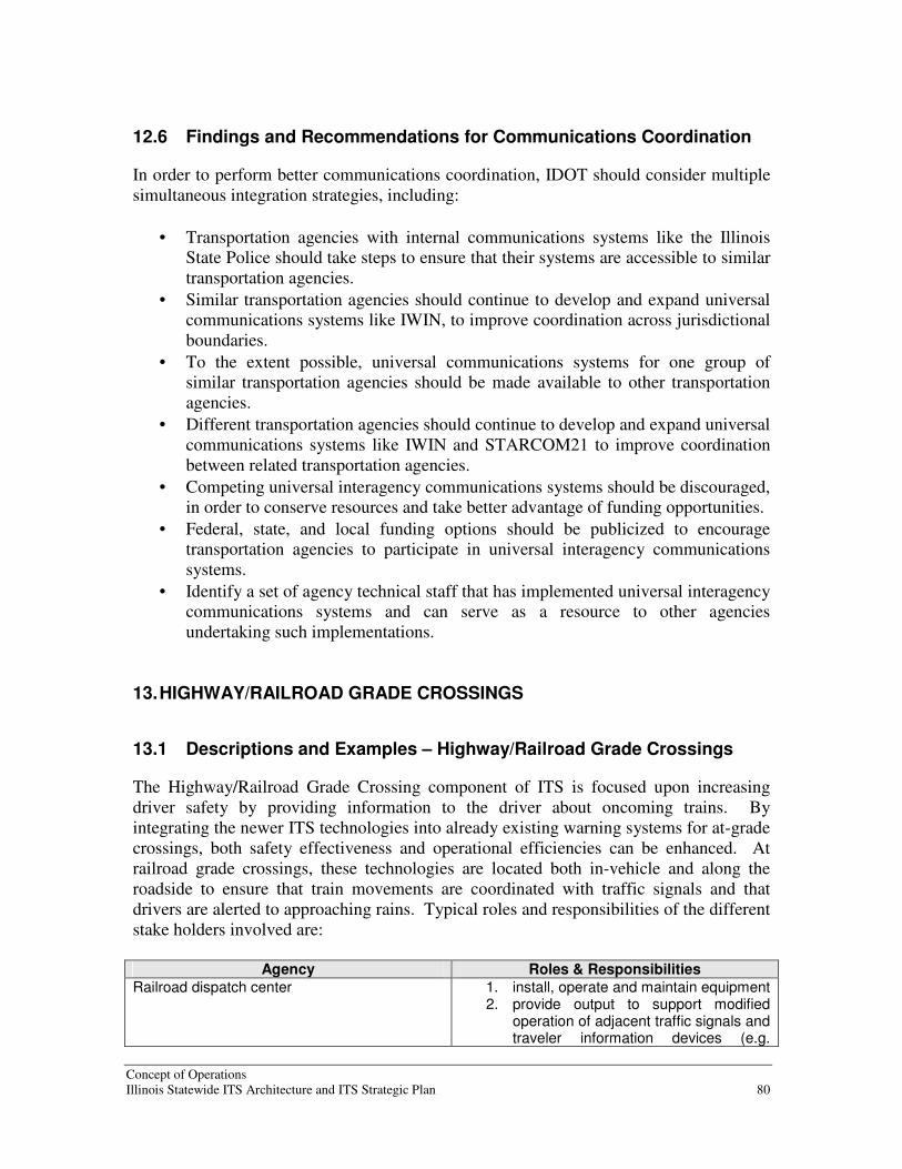
Concept of Operations Illinois Statewide ITS Architecture and ITS Strategic Plan 80
12.6 Findings and Recommendations for Communications Coordination
In order to perform better communications coordination, IDOT should consider multiple simultaneous integration strategies, including:
• Transportation agencies with internal communications systems like the Illinois State Police should take steps to ensure that their systems are accessible to similar transportation agencies.
• Similar transportation agencies should continue to develop and expand universal communications systems like IWIN, to improve coordination across jurisdictional boundaries.
• To the extent possible, universal communications systems for one group of similar transportation agencies should be made available to other transportation agencies.
• Different transportation agencies should continue to develop and expand universal communications systems like IWIN and STARCOM21 to improve coordination between related transportation agencies.
• Competing universal interagency communications systems should be discouraged, in order to conserve resources and take better advantage of funding opportunities.
• Federal, state, and local funding options should be publicized to encourage transportation agencies to participate in universal interagency communications systems.
• Identify a set of agency technical staff that has implemented universal interagency communications systems and can serve as a resource to other agencies undertaking such implementations.
13. HIGHWAY/RAILROAD GRADE CROSSINGS
13.1 Descriptions and Examples – Highway/Railroad Grade Crossings
The Highway/Railroad Grade Crossing component of ITS is focused upon increasing driver safety by providing information to the driver about oncoming trains. By integrating the newer ITS technologies into already existing warning systems for at-grade crossings, both safety effectiveness and operational efficiencies can be enhanced. At railroad grade crossings, these technologies are located both in-vehicle and along the roadside to ensure that train movements are coordinated with traffic signals and that drivers are alerted to approaching rains. Typical roles and responsibilities of the different stake holders involved are:
Agency Roles & Responsibilities
Railroad dispatch center 1. install, operate and maintain equipment 2. provide output to support modified
operation of adjacent traffic signals and traveler information devices (e.g.
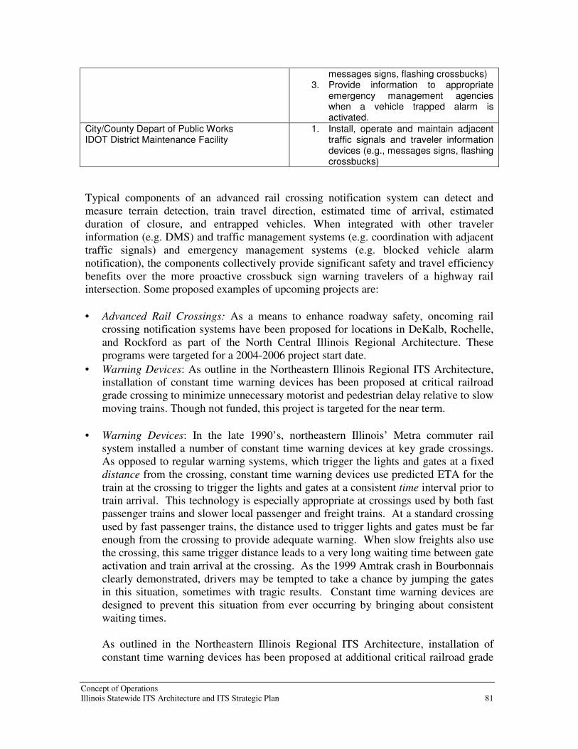
Concept of Operations Illinois Statewide ITS Architecture and ITS Strategic Plan 81
messages signs, flashing crossbucks) 3. Provide information to appropriate
emergency management agencies when a vehicle trapped alarm is activated.
City/County Depart of Public Works IDOT District Maintenance Facility
1. Install, operate and maintain adjacent traffic signals and traveler information devices (e.g., messages signs, flashing crossbucks)
Typical components of an advanced rail crossing notification system can detect and measure terrain detection, train travel direction, estimated time of arrival, estimated duration of closure, and entrapped vehicles. When integrated with other traveler information (e.g. DMS) and traffic management systems (e.g. coordination with adjacent traffic signals) and emergency management systems (e.g. blocked vehicle alarm notification), the components collectively provide significant safety and travel efficiency benefits over the more proactive crossbuck sign warning travelers of a highway rail intersection. Some proposed examples of upcoming projects are:
• Advanced Rail Crossings: As a means to enhance roadway safety, oncoming rail crossing notification systems have been proposed for locations in DeKalb, Rochelle, and Rockford as part of the North Central Illinois Regional Architecture. These programs were targeted for a 2004-2006 project start date.
• Warning Devices: As outline in the Northeastern Illinois Regional ITS Architecture, installation of constant time warning devices has been proposed at critical railroad grade crossing to minimize unnecessary motorist and pedestrian delay relative to slow moving trains. Though not funded, this project is targeted for the near term.
• Warning Devices: In the late 1990’s, northeastern Illinois’ Metra commuter rail system installed a number of constant time warning devices at key grade crossings. As opposed to regular warning systems, which trigger the lights and gates at a fixed distance from the crossing, constant time warning devices use predicted ETA for the train at the crossing to trigger the lights and gates at a consistent time interval prior to train arrival. This technology is especially appropriate at crossings used by both fast passenger trains and slower local passenger and freight trains. At a standard crossing used by fast passenger trains, the distance used to trigger lights and gates must be far enough from the crossing to provide adequate warning. When slow freights also use the crossing, this same trigger distance leads to a very long waiting time between gate activation and train arrival at the crossing. As the 1999 Amtrak crash in Bourbonnais clearly demonstrated, drivers may be tempted to take a chance by jumping the gates in this situation, sometimes with tragic results. Constant time warning devices are designed to prevent this situation from ever occurring by bringing about consistent waiting times. As outlined in the Northeastern Illinois Regional ITS Architecture, installation of constant time warning devices has been proposed at additional critical railroad grade

Concept of Operations Illinois Statewide ITS Architecture and ITS Strategic Plan 82
crossings to minimize motorist and pedestrian delay and to improve safety. Though not funded, this project is targeted for the near term.
• Traveler Information on Crossing Delays: In the GCM Corridor, a project to implement railroad grade crossing delay that provides traveler information is one of the near term projects (2004-2006) that has been proposed as part of the GCM Corridor ITS Architecture. Another longer-term ITS project relating to high speed rail traveler information systems was proposed for a 2006 implementation along the GCM Corridor.
13.2 Relationship to Statewide Vision - Highway/Railroad Grade
Crossings
The statewide vision for ITS focuses on the improvement of the transportation system in these three areas:
• Performance
• Safety
• User mobility With over 6,000 at-grade crossings in Northeastern Illinois – many with significant volumes of both rail and vehicular traffic – it is no wonder that significant operational and safety issues arise daily due to the extent of rail crossing traffic delay experienced along the major rail corridors. Motorists suffer almost 11,000 hours of delay on a typical weekday in northeastern Illinois alone. Also, as Illinois is a critical link in the North American freight rail network, a safe and secure highway rail intersection system that supports both highway and rail performance will continue to be an important part of the state’s transportation system. 13.3 Identification of Issues – Highway/Railroad Grade Crossings
As planning and implementation of advanced highway rail intersection technologies continues in Illinois, a number of issues have arisen, or can be expected to arise. This section discusses some of these issues, along with their importance to the state’s travelers and various operational stakeholders. 1: How far does Illinois desire to go toward a statewide vision for Highway Railroad
Interchange (HRI) technology enhancements? While ITS adoption continues to take place around the state, and IDOT is contributing funds, no vision for ITS adoption or coordination among agencies is apparent. Coordination among IDOT, the rail operators and owners, and the various agencies under the banner of safer highway/railroad grade crossings, could bring economies in planning and the engineering of ITS solutions, as well as procurement. This could be carried further if desired, with IDOT identifying desired minimum ITS functional capabilities for different areas of state, as the metropolitan issues with at grade crossing are fundamentally different than those in the more rural areas.

Concept of Operations Illinois Statewide ITS Architecture and ITS Strategic Plan 83
2: Maximizing goods movement on rail is contradictory to enhanced mobility for the
surface network: As mentioned earlier in this section, there are over 6,000 at-grade crossings in the northeastern portion of Illinois experiencing significant volumes of both rail and vehicular traffic. In the larger cities, significant operational and safety issues arise daily due to the extent of rail crossing traffic delay experienced along the major rail corridors. There are over 28 major intermodal yards in the central, southwest, and south areas of Chicago and suburban Cook County alone. Looking more broadly, north central Illinois experiences a significant amount of rail traffic, including container and trailer traffic from the West Coast, coal from Wyoming, metals and metal products, grains and processed foods, lumber and paper products from Canada and the northern US, and automobiles. Similar flows are experienced crossing Illinois through the St. Louis area. One barrier to full implementation of any at-grade highway rail intersection crossing system is the coordination of the separate rail operators and railroad owners that it may be necessary to work with. While it is crucial to work with these railroad operators and owners, as well as the agencies and entities using grade crossing systems already in place, this can lead to very long timeframes for installing enhanced capabilities. More importantly, there may be conflicts with railway operators and traffic engineers about the impact of coordinated activities. Once again, it is necessary and appropriate for these discussions to take place in order to assure that the systems work together smoothly and that unintended impacts are minimized. However, there is no mechanism by which the needs of traveling public can be advocated in this process and assured an equitable outcome. 3: Agencies need competent technical staff for planning, implementation, operations and
maintenance of ITS technologies: Many transportation management agencies have technical specialists on staff or on call for information technology, field devices and radio systems. However, the adoption of new ITS technologies may put a strain on those staff resources. While some of the functions can be contracted out as part of the ITS procurement, post-warranty maintenance will most likely need to be done in-house. This may require additional staff. Another area where many agencies are strapped is in information technology or management information systems staff. Available staff is often substantially committed strictly for the maintenance of existing systems and applying upgrades. As agencies undertake systems integration between ITS subsystems and existing agency enterprise systems, experienced staff will be needed both to assure successful integration of real time and batch systems, but also to minimize the unintended consequences of modifying and/or interfacing to proprietary systems owned and operated by the railroad operators. As a backdrop to this, many transit agencies face challenges in hiring IT staff qualified to deal with state-of-the-art mobile technologies, Web-based systems, and complex integration issues. While the economic slowdown beginning in 2000 has allowed some transit agencies to bolster their staff resources in these areas, it will be a challenge to retain these people as economic expansion offers them more and better job choices.

Concept of Operations Illinois Statewide ITS Architecture and ITS Strategic Plan 84
Agencies need both funding levels and salary structures that will allow them to attract and retain sufficient staff with leading edge skills, in order to effectively exploit the cost, service, and revenue advantages available with ITS systems. 13.4 Benefits of Highway/Railroad Grade Crossings
Elements of ITS Transit Management are being widely adopted in Illinois and across the U.S. because of the benefits they provide. Here are some of the key benefits from Highway Rail Intersection Management: Increase Transportation System Efficiency and Capacity: By augmenting passive warning systems and active warning devices with standard traffic control devices and interconnected with adjacent intersections, more efficient management of highway traffic at highway-rail intersections is achievable. Note that all of these capabilities can be implemented with today’s technology, and without need for major new standardization efforts or institutional change. Enhance Mobility: Strategic coordination between rail operations and traffic management centers enhances the quality of traveler information and offers the highest promise of both goods movement and efficient traveler mobility. Reduce Energy Consumption and Environmental Costs: Technology solutions such as the installation of constant time warning devices at critical railroad grade crossing service to minimize unnecessary motorist and pedestrian delay relative to slow moving trains, thus reduce fuel consumption and the resultant air pollutants from idling traffic.
Improved safety and security: Systems that manage highway rail intersections by warning vehicle operators of train proximity and providing traffic control through barriers to prevent vehicle from entering rail/roadway to prevent accidents from occurring. System provides additional safety features to mitigate the risk associated with higher rail speeds. Data from the intersection is shared with the local traffic management agency and/or ITS field elements. 13.5 Architecture for Highway/Railroad Grade Crossings
The National ITS Architecture includes both a standard and an advanced set of functionality as part of the Traffic Management and Field Subsystems, as well as operational coordination planning under the heading Highway Rail Intersections. Core HRI features are encapsulated in three Market Packages, groupings of features that relate to commonly understood transit system functions: The Standard Railroad Grade Crossing market package manages highway traffic at highway/railroad grade crossing where operational requirements do not dictate more advanced features (e.g., where rail operational speeds are less than 80 miles per hour). Both passive (e.g., the crossbuck sign) and active warning systems (e.g., flashing lights and gates) are supported. These traditional HRI warning systems may also be augmented with other standard traffic management devices. The warning systems are activated on

Concept of Operations Illinois Statewide ITS Architecture and ITS Strategic Plan 85
notification by interfaced wayside equipment of an approaching train. The equipment at the HRI may also be interconnected with adjacent signalized intersections so that local control can be adapted to highway-rail intersection activities. Health monitoring of the HRI equipment and interfaces is performed; detected abnormalities are reported to both highway and railroad officials through wayside interfaces and interfaces to the traffic management subsystem. The Advanced Railroad Grade Crossing market package encompasses the functions at highway railroad grade crossings where operational requirements demand advanced features (e.g., where rail operational speeds are greater than 80 miles per hour). This market package includes all capabilities from the Standard Railroad Grade Crossing Market Package, and augments these with additional safety features to mitigate the risks associated with higher rail speeds. The active warning systems supported by this market package include positive barrier systems that preclude entrance into the intersection when the barriers are activated. HRI equipment is activated on notification by wayside interface equipment which detects or communicates with the approaching train. In this market package, the wayside equipment provides additional information about the arriving train so that the train's direction of travel, estimated time of arrival, and estimated duration of closure may be derived. This enhanced information may be conveyed to the driver prior to, or in context with, warning system activation. This market package also includes additional detection capabilities that enable it to detect an entrapped or otherwise immobilized vehicle within the HRI and provide an immediate notification to highway and railroad officials. The Railroad Operations Coordination market package provides an additional level of strategic coordination between freight rail operations and traffic management centers. Rail operations provides train schedules, maintenance schedules, and any other forecast events that will result in highway-rail intersection (HRI) closures. This information is used to develop forecast HRI closure times and durations that may be used in advanced traffic control strategies or to enhance the quality of traveler information. 13.6 Findings and Recommendations for Highway/Railroad Grade
Crossings
In order to address safety issues at highway/railroad grade crossings, IDOT should consider multiple simultaneous integration strategies, including:
• IDOT should help facilitate more cooperative purchasing of HRI ITS systems. It should work to develop guidelines – not specifications – for the most desired functions, to guide agencies trying to formulate their ITS plans.
• Agencies throughout the state should explore interconnecting their systems and collaborating for service improvement.
• IDOT should monitor any new standards development in the HRI area, and guide agencies in deciding which new standards to adopt.
• Address the most problematic HRIs (measured by total hours of vehicle delay) with grade separation where physically feasible. For HRIs where this is not possible due to

Concept of Operations Illinois Statewide ITS Architecture and ITS Strategic Plan 86
physical constraints, IDOT should look at application of advanced railroad grade crossing functionality, including TMC interconnects, to allow traffic diversion when long crossing blockages are expected.
14. COMMERCIAL VEHICLE OPERATIONS
14.1 Description and examples-Commercial Vehicle Operations
The Commercial Vehicle Operations, or CVO, Management component of ITS is focused upon goods movement (primarily) and their operations (both private and public). Depending on the specific technologies deployed, electronic credentialing systems can receive driver and vehicle information that allows the motor carrier to pay for credentials, registration, and fuel taxes electronically, and request services or service information electronically. Safety information exchange electronically records, stores and downloads vehicle inspection data, and issues citations as appropriate, and exchanges this safety data among agencies with a state and among other states. Drivers can also ride more safely with advanced on-board concepts, such as collision warning systems and detection of pedestrians or other obstructions around the vehicle. Fleet and Freight operators can employ CAD systems with AVL to better manage vehicles and respond to operational or mechanical challenges that may arise. Non-fixed route deliverers can use location data to make scheduling more efficient, and save valuable driver time by minimizing paperwork and voice radio connection delays. Operations planning can access historical data to improve routes and schedules, while maintenance can enhance its core software packages with vehicle health histories and tracking. Currently, IDOT deploys PrePass, an electronic clearance system for commercial carriers at all 20 weigh stations along the Illinois interstate highway network. As of March 2001, nearly 20% of all trucks that passed Illinois interstate weigh scales possessed PrePass transponders. Of these vehicles, almost 66% were given a green light to bypass. In addition, Virtual Weigh-in-Motion (WIM) is being field tested in conjunction with law enforcement authorities in Illinois. In Illinois, the agencies actively involved in performing administration functions to support credentials, tax, and safety regulations, and in issuing special oversize/overweight and HAZMAT permits are:
1. Illinois Commerce Commission operates the electronic permitting systems called Signal State Registration System (SSRS)
2. Illinois Department of Revenue issues International Fuel Tax Agreement (IFTA) electronic permits and collects fuel taxes
3. IDOT Bureau of Operations processes and issues special permits for Oversize/Overweight vehicles.
4. Illinois Secretary of State issues International Registration Plan (IRP) permits and provides the electronic data from the IRP to the SAFER system, allowing a vehicle’s safety records to be examined along with their registration fees.

Concept of Operations Illinois Statewide ITS Architecture and ITS Strategic Plan 87
Other states which border Illinois must be considered when discussing commercial vehicles, because goods movement is an intrastate commerce activity. Some examples of what bordering states are doing in terms of ITS and CVO are:
1. Indiana Department of Revenue communicates with motor carriers conducting business in Indiana through an electronic permitting system (e.g. a “One-Stop Shop” for operators.)
2. Wisconsin DOT Motor Carrier Services communicates with the IRP and the IFTA to process credentials applications and collect fuel, weight/distance, and other taxes and fees associated with commercial vehicle operations. It also receives application for, and issues special Oversize/Overweight and HAZMAT permits.
Figure 14 presents a level 2 diagram detailing commercial vehicle operations for Illinois.
Figure 14: Level 2 Diagram for Commercial Vehicle Operations

Concept of Operations Illinois Statewide ITS Architecture and ITS Strategic Plan 88
14.2 Relationship to Statewide Vision-Commercial Vehicle Operations
Among the areas that the statewide vision for ITS focuses on in terms of improving the transportation system are Performance and Safety. In the realm of CVO, everything comes down to money, as goods movement via Commercial Vehicles is not only an important part of the state’s transportation system – it is the vital lifeblood of the nation’s economy. While there are challenges to the surface transportation network from these larger vehicles, CVO most certainly has a positive and pivotal role to play in the vision element annotated above: Improve System Efficiency and Performance: Scheduling, AVL and CAD systems all work to make freight movers and vehicle fleets perform better. Scheduling systems aim to most efficiently service the routes and frequencies planned by getting the greatest number of runs (fixed route) out of the existing vehicle fleet and driver roster. AVL systems permit dispatchers to quickly identify and respond to service problems , leading to quicker recovery times. AVL for goods movement that is not on a fixed route, but rather scheduled per load, allows dispatchers to optimize the delivery schedules and can respond to cancellations, no-shows, and other later-in-the-same-day trips. New technologies that allow for the trucks to maximize driving by minimizing stops through electronic credentialing, pre-pay permit systems, and WIM improve running times and on-time performance, while lowering operational costs to the Commercial Vehicle Operator. Enhance Safety: On-board vehicle security cameras are a proven deterrent to criminal acts, and can help positively identify perpetrators in the event there is an incident on-board. These cameras have also been shown to substantially reduce agencies’ claims due to crashes, fender-benders, abrupt stops, etc, by providing a photographic record of what really happened to/on the vehicle. Safety warning for lateral, front or rear obstacles, as well as intersections, will help drivers avoid crashes or pedestrian accidents. 14.3 Identification of issues-Commercial Vehicle Operations
Commercial Vehicle Operators and regulating agencies face a number of issues in performing services and planning new projects:
1. In spite of a general dislike of trucks by the general public, trucking is a vital commercial activity.
2. Agencies deserve credit for their efforts to improve truck safety and for improved operations
3. There are unfunded opportunities in CVO that could offer significant benefits 14.4 Benefits of Commercial Vehicle Operations
ITS offers significant benefits to state motor carrier agencies, the motor carrier industry, and the traveling public. New and emerging technologies, information systems, and communications networks provide the framework for states, the Federal Government, and

Concept of Operations Illinois Statewide ITS Architecture and ITS Strategic Plan 89
private stakeholders to electronically collect and exchange motor carrier safety and interstate registration and tax payment information. Use of these technologies supports initiatives by the state of Illinois and cognizant Federal agencies, in partnership with the motor carrier industry, to improve highway safety, simplify government administrative credentialing operations, enhance productivity, and reduce delays for safe and legal carriers. By using the three main ITS technology areas designed for CVO applications (e.g. safety information exchange, electronic screening, and electronic credentialing), the Federal Motor Carrier Safety Administration has established a set of goals to reduce commercial vehicle fatalities by 50 percent by 2010, with a baseline of 5,374 fatalities in 1998, and to reduce the number of persons injured in commercial vehicle crashes by 20 percent by 2008. As a baseline, the 1998 calendar year was chosen, which had 127,000 injuries. As a result, the benefit of programs such as PrePass implemented statewide provides enforcement personnel with access to up-to-date safety and credential information for motor carriers, as well as for individual vehicles. This access yields improved highway safety by allowing state and federal enforcement officials to concentrate their resources on high-risk carriers and vehicles. 14.5 ITS Architecture for Commercial Vehicle Operations
The National ITS Architecture includes a diverse set of functionality as part of the Commercial Vehicle Management and Fleet and Freight Management Subsystems. Thirteen Market Packages - groupings of features that relate to commonly understood commercial vehicle operations functions - encompass the fundamental management features: The Fleet Administration Market Package represents the capability to manage a fleet of commercial vehicles. The Fleet and Freight Management subsystem provides the route for a commercial vehicle by utilizing either an in-house routing software package or an Information Service Provider. Routes are constrained by hazardous materials and other restrictions (such as height or weight). The Commercial Vehicle Administration determines any such restricted areas. A route is electronically sent to the Commercial Vehicle with any appropriate dispatch instructions. The location of the Commercial Vehicle is monitored by the Fleet and Freight Management subsystem and routing changes can be made depending on current road network conditions. Once a route is assigned, changes must be coordinated between the Fleet and Freight Management subsystem and the Commercial Vehicle. Commercial Vehicle Drivers would be alerted to any changes in route from the planned route and given an opportunity to justify a rerouting. Any unauthorized or unexpected route changes by the Commercial Vehicle will register a route deviation alert with the Fleet and Freight Management subsystem. The Fleet and Freight Management subsystem can also notify local public safety agencies of the route deviation when appropriate (e.g., if there is a safety sensitive HAZMAT being carried), by sending an alarm to the Emergency Management subsystem. Freight Administration is a market package that encompasses the movement of cargo and monitors the cargo condition. Interconnections are provided to intermodal freight

Concept of Operations Illinois Statewide ITS Architecture and ITS Strategic Plan 90
shippers and intermodal freight depots for tracking of cargo from source to destination. In addition to the usual cargo monitoring required to insure that cargo gets from origin to destination, the Fleet and Freight Management subsystem monitors shipments to make sure that no tampering or breach of security occurs to the cargo on commercial vehicles. Any such tampering is reported to the Fleet and Freight Management subsystem. In addition to exceptions (e.g., alerts) that are reported, on-going indications of the state of various freight equipment are reported to the Fleet and Freight Management subsystem. The commercial vehicle driver is also alerted of any tampering or breach of cargo security. Freight managers may decide to take further action on the alerts and/or provide responses that explain that the alerts are false alarms. If no explanation is received, the Fleet and Freight Management subsystem may notify the Emergency Management subsystem. The Electronic Clearance market package provides for automated clearance at roadside check facilities. The roadside check facility communicates with the Commercial Vehicle Administration subsystem to retrieve infrastructure snapshots of critical carrier, vehicle, and driver data are used to sort passing vehicles. This allows a good driver/vehicle/carrier to pass roadside facilities at highway speeds using transponders and dedicated short range communications to the roadside. Results of roadside clearance activities are passed on to the Commercial Vehicle Administration. The roadside check facility may be equipped with Automated Vehicle Identification (AVI), weighing sensors, transponder read/write devices and computer workstations. CV Administrative Processes is a market package that provides for electronic application, processing, fee collection, issuance, and distribution of CVO credential and tax filing. Through this process, carriers, drivers, and vehicles may be enrolled in the electronic clearance program provided by a separate market package, which allows commercial vehicles to be screened at mainline speeds at roadside check facilities. Through this enrollment process, current profile databases are maintained in the Commercial Vehicle Administration subsystem and snapshots of this database are made available to the roadside check facilities at the roadside to support the electronic clearance process. Commercial Vehicle Administration subsystems can share credential information with other Commercial Vehicle Administration subsystems, so that it is possible for any Commercial Vehicle Administration subsystem to have access to all credentials, credential fees, credentials status and safety status information. In addition, it is possible for one Commercial Vehicle Administration subsystem to collect HAZMAT route restrictions information from other Commercial Vehicle Administration subsystems and then act as a clearinghouse for this information for Information Service Providers, Map Update Providers, and Fleet and Freight Management subsystems.
The On-Board CVO and Freight Safety & Security market package covers on-board commercial vehicle safety monitoring and reporting. It is an enhancement of the Roadside CVO Safety Market Package and includes roadside support for reading on-board safety data via tags. Safety warnings are provided to the driver as a priority with secondary requirements to notify the Commercial Vehicle Check roadside elements. This

Concept of Operations Illinois Statewide ITS Architecture and ITS Strategic Plan 91
market package allows for the Fleet and Freight Management subsystem to have access to the on-board safety data. In addition to safety data, this market package provides a means for monitoring the security of the Commercial Vehicle along with the cargo, containers, trailers, and other equipment that are being hauled. Commercial Vehicle on-board tamper and breach sensors provide an indication of any security irregularities and the sensor data is provided to the Fleet and Freight Management subsystem along with particular notification of any breach alerts. Commercial Vehicle Drivers may be aware of the sensor readings and can provide an explanation back to the Fleet and Freight Management subsystem via the Commercial Vehicle. It also supports remote vehicle shutdown in case of emergency, such as can be accomplished by telematics providers, and direct links to emergency management agencies. Roadside CVO Safety is a market package that covers automated monitoring of vehicle health parameters, forwarding this information to roadside check facilities systems. The capabilities for performing the safety inspection are shared between this market package and the On-Board CVO and Freight Safety & Security Market Package which enables a variety of implementation options. The basic option, directly supported by this market package, facilitates safety inspection of vehicles that have been pulled in, perhaps as a result of the automated screening process provided by the Electronic Clearance Market Package. More advanced implementations, supported by the On-board CVO and Freight Safety & Security market package, utilize additional on-board vehicle safety monitoring and reporting capabilities in the commercial vehicle to augment the roadside safety check. The Weigh-In-Motion market package covers high speed weigh-in-motion with or without AVI capabilities. This market package provides the roadside equipment that could be used as a stand-alone system or to augment the Electronic Clearance market package. International Boarder Electronic Clearance is a market package that covers the provision of automated clearance at international border crossings. This package augments the electronic clearance package by allowing interface with customs-related functions. The CVO Fleet Maintenance market package encompasses maintenance of CVO fleet vehicles with on-board monitoring equipment and AVL capabilities within the Fleet and Freight Management Subsystem. Records of vehicle mileage, repairs, and safety violations are maintained to assure safe vehicles on the highway. HAZMAT Management is a market package that integrates incident management capabilities with commercial vehicle tracking to assure effective treatment of HAZMAT material and incidents. The Fleet and Freight Management Subsystem perform HAZMAT tracking. The Emergency Management subsystem is notified by the Commercial Vehicle if an incident occurs and coordinates the response. The response is tailored based on information that is provided as part of the original incident notification or derived from supplemental information provided by the Fleet and Freight Management

Concept of Operations Illinois Statewide ITS Architecture and ITS Strategic Plan 92
Subsystem. The latter information can be provided prior to the beginning of the trip or gathered following the incident depending on the selected policy and implementation. Roadside HAZMAT Security Detection and Mitigation is the market package that provides the capability to detect and classify security sensitive HAZMAT on commercial vehicles using roadside sensing and imaging technology. Credentials information can be accessed to verify if the commercial driver, vehicle and carrier are permitted to transport the identified HAZMAT. If the credentials analysis and sensed HAZMAT information do not agree, the vehicle can be signaled to pull in, and if required, an alarm can be sent to Emergency Management to request they monitor, traffic stop or disable the vehicle. Driver Security Authentication provides the ability for Fleet and Freight Management to detect when an unauthorized commercial vehicle driver attempts to drive their vehicle, based on stored driver identity information. If an unauthorized driver has been detected, Fleet and Freight Management can activate commands to safely disable the vehicle. Alarms sent to emergency management subsystems inform them of a potential commercial vehicle hijacking or theft and a potential hazardous situation. In addition, Emergency Management can request Fleet and Freight Management to disable a specific vehicle in their fleet. Freight Assignment Tracking market package provides for the planning and tracking of three aspects of commercial vehicle shipments. For each shipment, the commercial vehicle, the freight equipment, and the commercial vehicle driver are monitored for consistency with the planned assignment. The Fleet and Freight Management subsystem determine any unauthorized changes and then the appropriate people and subsystems are notified. Data collected by the On-board CV and Freight Safety & Security and the On-board Driver Authentication equipment packages used in other market packages are also used to monitor the three aspects of assignment for this market package. In addition to this market package, Fleet and Freight Managers may also monitor routes and itineraries and this capability is included in Fleet Administration. In addition to these thirteen CVO-oriented market packages, Commercial Vehicle Operation and Fleet and Freight Management takes advantage of other ITS subsystems and market packages, involving such functions as archived data, safety warnings, and traffic information. 14.6 Findings and Recommendations for Commercial Vehicle Operations
In order to improve support to commercial vehicle operations, IDOT should take advantage of the considerable amount of work that has been accomplished and is on-going in CVO. The Department should perform the following activities to enhance commercial vehicle operations:
• Continue to support and implement CVISN
• Build on the CVO work developed along the GCM Corridor

Concept of Operations Illinois Statewide ITS Architecture and ITS Strategic Plan 93
15. ITS AS A DATA RESOURCE
15.1 Description and Examples - ITS As a Data Resource
Intelligent Transportation Systems create data that has significant value at a regional and statewide level. This data can include traffic counts, vehicle classifications, speed, travel time, road conditions, weather information, and even system status information. This data can be used for a number of purposes. At a regional level, the data supports daily operations, maintenance, and construction activities. At a statewide level, the data can be used to improve mobility, effectively manage and monitor transportation services, and improve communication to the public regarding how well the Department is performing. Integrating and using data as a resource leads to new Department capabilities. Real-time traffic information would allow better inter-jurisdictional operations - travel between IDOT regions could be seamless from the public’s perspective. Traveler information across the state would be consistent, accurate, and timely. This traffic information can be used to support data-related activities, such as the traffic count program, signal optimization, and truck classification. 15.2 Relationship to Statewide Vision - ITS As a Data Resource
Under the statewide concept of operations, each district has a hub that communicates with the Illinois Statewide Hub. Information communicated to other regions includes real-time data for traffic conditions and archived data storing historical traffic information. Districts share data within their region. Initially they share data via the Illinois Statewide Hub. In the future, adjacent districts and regions could exchange information directly with each other. When exchanging data directly with an adjacent region, the data that gets exchanged is only of interest to those two regions. If the data is of interest to more than those two regions, the data should be shared via the Illinois hub. 15.3 Identification of issues - ITS As a Data Resource
In order to implement ITS as a Data Resource, there are a number of policy issues and technical questions that should be addressed. At a policy level, IDOT managers need to address the following questions:
• What is IDOT going to do with the data, i.e., what functions and services shall be supported?
• What data does IDOT want to collect, store, and distribute?
• How long should IDOT keep the data?

Concept of Operations Illinois Statewide ITS Architecture and ITS Strategic Plan 94
• Is the data subject to Freedom of Information Act requests, and how should IDOT handle such requests for real-time data, versus historic or archived data?
• Will IDOT make real-time and archived data available to Independent Service Provides and other third parties?
With guidance on these policy related questions, technical staff can address the following questions:
• Should IDOT implement a distributed data system, a centralized data system, or a hybrid system?
• What data standards should IDOT use?
• How should IDOT store the data and make it available to authorized users? The keys to using data are: to identify the functions and services that the data must support; and to deploy, operate, and maintain the technical infrastructure required to collect, fuse, and disseminate the data, while maintaining flexibility to meet evolving requirements for the data. 15.4 Benefits of ITS As a Data Resource
Using ITS as a data resource provides significant benefits to IDOT, including:
• Better Measures of Effectiveness (MOE) for improved operations
• Improved support to programs that require data, e.g. traffic count program
• Improved support to perform multi-district operations
• Improved ability to quantify performance
• Lower cost to developing data resources by leveraging ITS components as data sources
As the transportation program continues to grow, data and information become the means by which IDOT can effectively manage the system and communicate results to the traveling public and other stakeholders. 15.5 ITS Architecture for ITS As a Data Resource
Within the Statewide ITS Architecture, data collection remains a District function. Data fusion can be done regionally and then shared or centralized and then distributed. The Statewide ITS architecture would reflect a data resource at both a regional and statewide level. The statewide architecture can reflect the decisions of each region by initially assuming the responsibilities for data fusion and dissemination with the regions responsible for data collection. For mature regions, the data fusion function can be performed locally, and then the statewide hub can provide data distribution services. The market packages available in the National ITS Architecture fit this statewide vision for Illinois. Initially, the ITS Data Mart market package would be the vision of data collection at the local or district level. In this market package, a focused archive that

Concept of Operations Illinois Statewide ITS Architecture and ITS Strategic Plan 95
houses data collected and owned by a single agency, district, private sector provider, research institution, or other organization is envisioned. This focused archive typically includes data covering a single transportation mode and one jurisdiction that is collected from an operational data store and archived for future use. It provides the basic data quality, data privacy, and meta data management common to all ITS archives and provides general query and report access to archive data users The ITS Data Warehouse market package includes all the data collection and management capabilities provided by the ITS Data Mart market package, and adds the functionality and interface definitions that allow collection of data from multiple agencies and data sources spanning across modal and jurisdictional boundaries. This type of functionality matches well within the district and at the MPO level as a means of collecting the various information for use by multiple agencies within the region and/or district. The Data Warehouse performs the additional transformations and provides the additional meta data management features that are necessary so that all this data can be managed in a single repository with consistent formats. The potential for large volumes of varied data suggests additional on-line analysis and data mining features that are also included in this market package in addition to the basic query and reporting user access features offered by the ITS Data Mart. Eventually at the statewide level, a Virtual Data Warehouse is the type of market package that is envisioned. This market package provides the same broad access to multimodal, multidimensional data from varied data sources as in the ITS Data
Warehouse, but provides this access using enhanced interoperability between physically distributed ITS archives that are each locally managed. 15.6 Findings and Recommendations for ITS As a Data Resource
ITS as a data resource is a new function that provides significant capabilities to IDOT at both a planning and operations level. In order to take advantage of this resource, IDOT should divide data resource functions into data collection, data storage, data fusion, and information dissemination. The Illinois Hub shall support data storage, data fusion, and information dissemination. Data collection is a regional activity. As regions mature, they can assume the data fusion function and the data storage function in addition, to the data collection function. The Illinois hub keeps responsibility for data dissemination for 511 and other statewide functions.