Embed Size (px)
Citation preview

fHistorical Aspects of Place Names in YogyakartaNames in Yogyakarta
The 4th United Nations Group of Experts on G hi l N (UNGEGN) T i iGeographical Names (UNGEGN) Training
Course on Toponymy Yogyakarta 17—21 September 2012
Multamia RMT Lauder & Allan F. LauderDepartment of Linguistics Universitas Indonesia

Are geographical names trivial?Are geographical names trivial?
• The study of geographical names may seem toThe study of geographical names may seem to the average person a trivial activity compared to studying medicine, agriculture or economicsy g , g
• Geographical names are largely taken for granted. The assumption is that they simply serve to referThe assumption is that they simply serve to refer to geographical features and that everything is obvious. They might also assume that looking y g ginto them would be a waste of time
• But nothing could be further from the truthg

The value of geographical namesThe value of geographical names
• In fact, geographical names can often tell aIn fact, geographical names can often tell a story. They can give us clues to a cultural landscape from the past; they can also provide evidence of the sequence of human migration and settlement in an area, even when time h d ll h i l idhas erased all physical evidence
• Geographical names also have value as they l i h ffi i i fplay a part in the efficient operation of
modern urban societies.

Useful place namesUseful place names
• When linked to a coordinated system of house ynumbers and postal codes, a city’s street names become elements of a geolocational system that makes life easier in many ways for many peoplelife easier in many ways for many people.
• Government authorities can provide public services or collect taxes. Commercial companies can target p gpotential customers. Ordinary people can find their way to a place they have never been before. Names are an essential and useful part of our daily lifean essential and useful part of our daily life.
• We can therefore argue that they are not trivial and that we should ensure they serve us well.

Toponymyc ResearchToponymyc Research
• The field of toponymy has experienced aThe field of toponymy has experienced a major transformation over the course of the last 20 years A variety of new thematiclast 20 years. A variety of new thematic concerns have been explored, and there is now a far greater recognition that toponymicnow a far greater recognition that toponymic research should be firmly grounded in an explicit engagement with critical theories ofexplicit engagement with critical theories of space, place, and landscape (Rose‐Redwood, 2010: 458)2010: 458)
Place‐naming and Political PowerPlace naming and Political Power
• The semiotic association between placeThe semiotic association between place naming and political power can be traced back throughout the course of history
• It is relatively common to name places after their founder or some person of influence; e.g. Bandara Soekarno‐Hatta
• We also see examples of naming places (streets, airports, etc.) after national heroes or historical figures; e.g. Jl. Jend. Sudirman

Place‐naming TodayPlace naming Today
• The image‐generating power of toponyms hasThe image generating power of toponyms has long played a role in the political economy of place promotionplace promotion
• Place‐naming rights are increasingly bought and sold like commodities used to project theand sold like commodities, used to project the power of corporations and privatize public space and memory (Boyd 2000; Yurchakspace and memory (Boyd, 2000; Yurchak, 2000).

FieldworkFieldwork
• Yogyakarta has been selected as the venue for the 4th gyUnited Nations Group of Experts on Geographical Names Training CourseTh hi t d hi t f l i ft• The history and prehistory of a place is often implicated in geographical names
• We will use the opportunity of this unique location as aWe will use the opportunity of this unique location as a case study in learning about a place’s history, its ancient kingdoms, and prehistoric settlements, to see the connection between history geographythe connection between history, geography, archeology, culture and place names
• Let’s take a look back in time in YogyakartaLet s take a look back in time in Yogyakarta

The Last Javanese MonarchyThe Last Javanese Monarchy
• Kraton Ngayogyakerto Hadiningrat is a JavaneseKraton Ngayogyakerto Hadiningrat is a Javanese monarchy located today in the Special Region of Yogyakarta, Indonesiagy ,
• It traces its origins back to the sixteenth century.
• In 1558 the King of Pajang gave land in the area• In 1558, the King of Pajang gave land in the area of Mentaok to Ki Ageng Pemanahan and land in the area of Pati to Ki Panjawi because they hadthe area of Pati to Ki Panjawi because they had helped to kill his enemy Arya Penangsang

MentaokMentaok
• Mentaok was forested and unpopulated. KiMentaok was forested and unpopulated. Ki Ageng Pemanahan encouraged people to move there from Pajang and Grobogan. According to historical records, during the journey to Mentaok, the migrants – the
f h M ki d dancestors of the Mataram kingdom – stopped on the way to rest at the village of Taji in the Prambanan area They were welcomed therePrambanan area. They were welcomed there by Ki Gede Karanglo with great hospitality (de Graaf 1941:63—64)Graaf, 1941:63 64)

MataramMataram
• The forested area of Metaok was cleared to make e o ested a ea o etao as c ea ed to a eway for human settlement which developed into the Mataram kingdom
• All of the Mataram kings can trace their ancestry back to Ki Ageng Sela (who came from Seselaill i th G b i )village in the Grobogan region).
• Ki Ageng Sela had a son named Ki Ageng Ngenis(who resided in Lawiyan Village) and a grandson(who resided in Lawiyan Village) and a grandson named Ki Ageng Pemanahan (after the village Manahan))

Capital Cities of MataramCapital Cities of Mataram
• Since 1588 the capital city of the MataramSince 1588, the capital city of the Mataram kingdom has moved a number of times (Daldjoeni 1984):(Daldjoeni, 1984):– Kota Gede
Kartasura– Kartasura
– Plered
Yog akarta– Yogyakarta

Mataram Sultanate during Sultan ' ( )Agung's Reign (1613‐1645)
The maximum extent of Mataram Sultanate expansions during the reign of Sultan Agung Hanyokrokusumo (1613‐1645). The map shows in the darker color the Sultanate territory at the beginning of his reign and in the medium color the extent of expansion by the end.© 2011 Gunkarta Gunawan Kartapranata Wikipedia based on Chalid Latief dan lrwin Lay© 2011 Gunkarta Gunawan Kartapranata, Wikipedia, based on Chalid Latief dan lrwin Lay. 1997 Atlas Sejarah Indonesia dan Dunia. Jakarta: Pembina Peraga

Mataram's overseas empire
Cribb, Robert. 2000. Historical Atlas of Indonesia. Richmond, Surrey: Curzon. p. 89

Kraton Ngayogyakarta HadiningratKraton Ngayogyakarta Hadiningrat
• Mataram itself refers to the areas around present‐day Yogyakarta.
• Based on The Giyanti Treaty with the Dutch Colonial Government, the Mataram Sultanate was split into two on February 13, 1755 becoming the Yogyakarta Sultanate and the Surakarta Sultanate
• The Sultanate of Yogyakarta was also called Mataram Islam – Founded on February 13, 1755– Integrated with Indonesia on September 5, 1945– The Special Region of Yogyakarta was created after the war of p g gy
independence ended and was legalized on August 3, 1950– The Sultan is the Head of the Special Region of Yogyakarta. He
has responsibility as the Head of the Territory and takes the title f Gof Governor
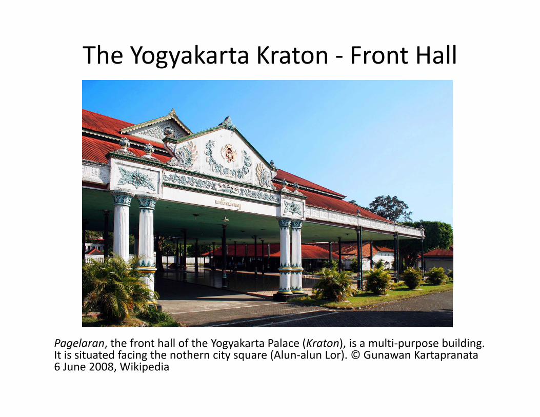
The Yogyakarta Kraton ‐ Front Hall
P l th f t h ll f th Y k t P l (K t ) i lti b ildiPagelaran, the front hall of the Yogyakarta Palace (Kraton), is a multi‐purpose building. It is situated facing the nothern city square (Alun‐alun Lor). © Gunawan Kartapranata 6 June 2008, Wikipedia

Princes and princesses of the k l ( )Yogyakarta Sultanate (1870)
This photo, taken around 1870, shows young princes and princesses of theyoung princes and princesses of the Yogyakarta royal family. They are, from left to right: Gusti Raden Mas Soedjadi, Gusti Raden Mas Poentoadji, Gusti Raden Mas Poetra, Gusti Raden Mas Soegiri, , g ,Bendara Raden Mas Soegirman. These children, when they became adults, were accorded royal titles as follows, again from left to right: Bendara PangeranHarjo Soerjodiningrat Kanjeng GustiHarjo Soerjodiningrat, Kanjeng GustiPangeran Hadipati Djoeminah, SampejanDalem Kanjeng Gusti Anom PangeranAdipati Hamengkunegara, GustiPangeran Harjo Mangkukusumo, Ngarsag j g , gSampejan Dalem Dalem Ingkang SinuwunKanjeng Sultan HB VIII.Source: Tropenmuseum; Photographer: Kassian Cephas (1845–1912). Wikipedia

Traces of MataramTraces of Mataram
• Traces of the expansion of the Mataram kingdom outside its main area of power can be found in the place names of the Special Region of Jakarta:– Matraman District, East Jakarta (Ruchiat, 2012: 113—115), ( , )
• was the location of the Mataram troops final defense in the campaign against Batavia
– Pegangsaan Sub‐district, Central Jakarta (Ruchiat, 2012: 123)
• was formerly a handicraft center for fine metal workers in bronze (gangsa). Many of the artisans came from Mataram in Java
J k Di t i t S th J k t (Z ddi 2012 257– Jagakarsa District, South Jakarta (Zaenuddin, 2012: 257—258)
• originated from a general called Raden Bagus JagakarsaSurobinangun during the Mataram war of 1625. After his defeatSurobinangun during the Mataram war of 1625. After his defeat against Batavia, he decided not to return to Mataram, fearing that he might be beheaded

Mataram SoldierMataram Soldier
Pasukan Mataram (Haks, Leo danGuus Maris. 1995.Lexicon of Foreign Artists who Visualized Indonesia (1600‐1950).
h l ) f dSingapura: Archipelago Press), found in Ruchiat, Rachmat. 2011. Asal‐UsulNama Tempat di Jakarta. Jakarta: Masup p 114Masup. p. 114.

According to historyAccording to history
• The historical records for the Mataram Kingdom gtell us that a number of names have been found:– The Special Region of Yogyakarta: Mentaok, Pati, Pajang Grobogan Prambanan Taji Sesela LawiyanPajang, Grobogan, Prambanan, Taji, Sesela, Lawiyan, Manahan, Kota Gede, Karta, Plered, Surakarta, and YogyakartaThe Special Region of Jakarta: Matraman Pegangsaan– The Special Region of Jakarta: Matraman, Pegangsaan, and Jagakarsa
• Tracing these names from history is not difficult, especially if we also include information from prehistoric settlements
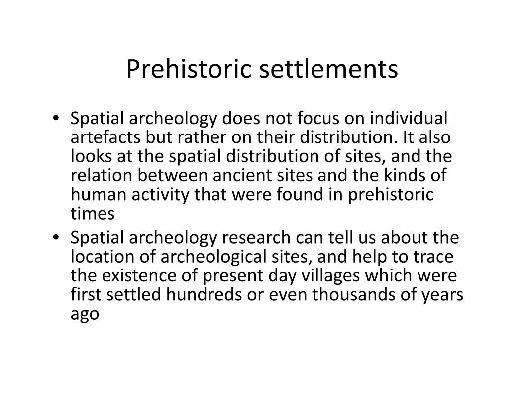
Prehistoric settlementsPrehistoric settlements
• Spatial archeology does not focus on individual p gyartefacts but rather on their distribution. It also looks at the spatial distribution of sites, and the relation between ancient sites and the kinds ofrelation between ancient sites and the kinds of human activity that were found in prehistoric times
• Spatial archeology research can tell us about the location of archeological sites, and help to trace the existence of present day villages which werethe existence of present day villages which were first settled hundreds or even thousands of years ago

Spatial Archeology ResearchSpatial Archeology Research
• Mundardjito performed spatial archeological u da dj to pe o ed spat a a c eo og caresearch on the location of sites from the Hindu‐Buda period in Sleman and Bantul, Yogyakarta
• He found that there was evidence that the old temples had been built using the ancient Indian t t M Sil t d Sil P ktexts Manasara‐Silapasastra and Silpa Prakasa
• See the Appendix (in the paper) on the location of temples (candi) in Yogyakarta from the spatialof temples (candi) in Yogyakarta from the spatial archeology research by Mundardjito (2002: 54‐‐60))
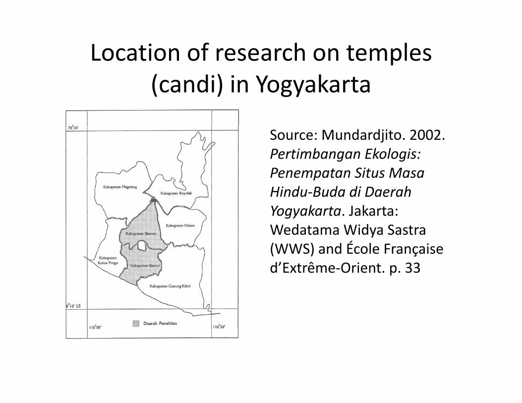
Location of research on temples ( d ) k(candi) in Yogyakarta
Source: Mundardjito. 2002. Pertimbangan Ekologis: Penempatan Situs MasaPenempatan Situs Masa Hindu‐Buda di Daerah Yogyakarta. Jakarta: W d t Wid S tWedatama Widya Sastra (WWS) and École Françaised’Extrême‐Orient. p. 33

Local namesLocal names
• UNGEGN advises that local names are usedU G G ad ses t at oca a es a e used• The benefit of this is that it will help to preserve the history of the local community, their y yupheavals, settlements and migrations
• All geographical names, whether of natural features, man‐made features or administrative areas, can be identified through spatial archeological researcharcheological research.
• This will have a positive impact in preserving and respecting the culture of the local communityrespecting the culture of the local community

ConclusionConclusion
• The function and role of history in the naming of y gtopographic features is very important if we want to understand the local cultureTh hi t f th t h l t k h th• The history of the past helps us to know whether geographical names are relatively new or if they have existed for hundreds of yearsy
• Tracking the name of historical topographic features requires the involvement of a team of people with different expertise Linguists who are specialists indifferent expertise. Linguists, who are specialists in geographical linguistics, should work with archeologists, who are specialists in spatial archeology