Embed Size (px)
Citation preview
Journal of Earth Science, Vol. 21, Special Issue, p. 257–259, June 2010 ISSN 1674-487X Printed in China
Grain Size Variation of Quaternary Sediments Related to Paleoclimate Change in Tarim Basin,
Northwest China
Song Shuhong (宋淑红)
School of the Earth Sciences and Resources, China University of Geosciences, Beijing 100083, China;
Institute of Hydrogeology and Environmental Geology, Chinese Academy of Geological Sciences,
Shijiazhuang 050061, China
Bi Zhiwei* (毕志伟)
Institute of Hydrogeology and Environmental Geology, Chinese Academy of Geological Sciences,
Shijiazhuang 050061, China
Yang Jing (杨靖)
School of the Earth Sciences and Resources, China University of Geosciences, Beijing 100083, China
Yang Zhenjing (杨振京)
Institute of Hydrogeology and Environmental Geology, Chinese Academy of Geological Sciences,
Shijiazhuang 050061, China
INTRODUCTION
Quaternary sediments contain the records related
to the changes in paleoclimate and paleoenvironment.
Grain size of the sediments is taken as the good indi-
cator of the sedimentary environmental conditions re-
lated to the climate change (Xiao et al., 1995;
McLaren and Bowles, 1985; Glasiter and Nelson,
1975). We report here the data of KT2 core samples to
show the change of Quaternary paleoclimate in Tarim
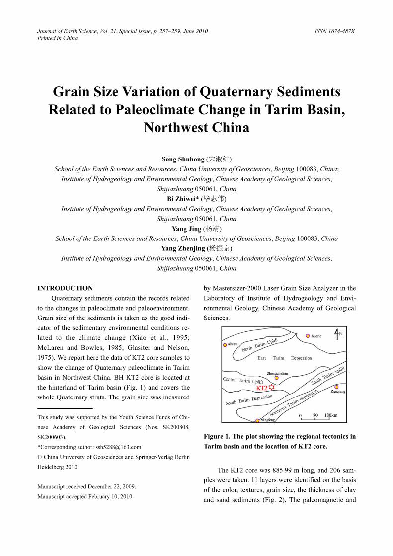
basin in Northwest China. BH KT2 core is located at
the hinterland of Tarim basin (Fig. 1) and covers the
whole Quaternary strata. The grain size was measured
This study was supported by the Youth Science Funds of Chi-
nese Academy of Geological Sciences (Nos. SK200808,
SK200603).
*Corresponding author: [email protected]
© China University of Geosciences and Springer-Verlag Berlin
Heidelberg 2010
Manuscript received December 22, 2009.
Manuscript accepted February 10, 2010.
by Mastersizer-2000 Laser Grain Size Analyzer in the
Laboratory of Institute of Hydrogeology and Envi-
ronmental Geology, Chinese Academy of Geological
Sciences.
Figure 1. The plot showing the regional tectonics in
Tarim basin and the location of KT2 core.
The KT2 core was 885.99 m long, and 206 sam-
ples were taken. 11 layers were identified on the basis
of the color, textures, grain size, the thickness of clay
and sand sediments (Fig. 2). The paleomagnetic and
Song Shuhong, Bi Zhiwei, Yang Jing and Yang Zhenjing
258
OSL dating indicated that the M/G boundary is lo-
cated at 634.30 m, and the B/M boundary at 130.25 m.
The boundary (130 kaBP) between the Late and the
Middle Pleistocene is at 30.79 m (Xu et al., 2003), and
the boundary (10 kaBP) between Late Pleistocene and
Holocene at the top of the borehole.
RESULTS AND DISCUSSION
The sedimentary environment is relatively stable
due to the slight changes in the grain size, generally
with the diameter between 2.5φ–6.2φ (Lerman and
Lakes, 1978). Three intervals can be identified based
on variations of the grain size, including the mean
values, the frequency and the probability cumulation
of the grain size (Fig. 2), along with the lithology,
sporopollen records and some other information (Cao,
2003).
Figure 2. Lithology and grain size distribution of KT2 core.
The depth interval from 650 m downward, cor-
responding to samples Nos. 144 to 206, is Late Plio-
cene. The sediments mainly consist of silty fine sand,
followed by fine sand and silt, with unimodal grain
size frequency curves. The samples below 855 m at
depth are mainly featured by coarse sand, generally
with the diameter of the grains between 2.5φ–3.4φ,
indicating a sedimentary environment of fluvial facies
with strong hydrodynamic condition. The samples
above 855 m at depth are mainly composed of fine
sand with much clay, positive skew distribution, gen-
erally with the diameter between 4.1φ–6.2φ. This in-
Grain Size Variation of Quaternary Sediments Related to Paleoclimate Change in Tarim Basin, Northwest China
259
fers a sedimentary environment of depression facies
with weak hydrodynamic condition.
The interval at 650–130 m deep, corresponding
to samples Nos. 19 to 143, is Early Pleistocene.
Coarse sand and fine sand appear to occur alternately.
The frequency curve of the grain size is unimodal but
the proportion of bimodal and multi-peak increases
greatly, reflecting a basic sedimentary environment of
fluvial facies associated with the alternative presence
of alluvion and diluvial sediments. Above the depth of
180 m, aeolian deposits occurred, and the grain di-
ameters are between 2.2φ–3.8φ. The unimodal distri-
bution and well-sorted grains demonstrate the occur-
rence of the desert.
The interval above 130 m at depth, corresponding
to samples Nos. 1 to 18, is Middle–Late Pleistocene.
The sediments mainly consist of silty fine sand and
fine sand, showing mostly the unimodal distribution
with the diameter of the grains between 2.8φ–3.9φ.
This indicates a change in sedimentary environment
from fluviatile facies slowly to eolian facies. The de-
sert was formed and expanded at a large scale.
CONCLUSIONS
The fluvial-lacustrine sediments dominated in
Early Pleistocene in Tarim basin, followed by the oc-
currence of the aeolian deposits. The lacustrine sedi-
ments were found in the early period of the Middle
Pleistocene while the aeolian sediments became
stronger, and dominated in the late period of the Mid-
dle Pleistocene. Since the Late Pleistocene, the desert
was formed and expanded widely throughout the
Holocene.
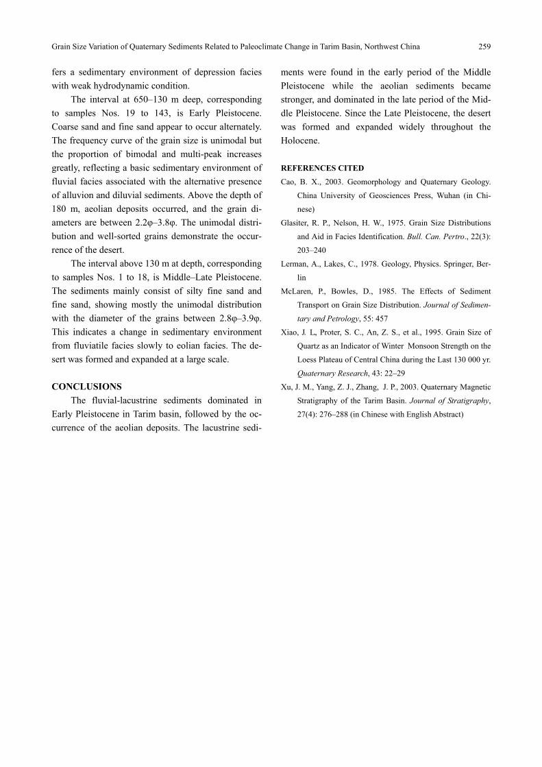
REFERENCES CITED
Cao, B. X., 2003. Geomorphology and Quaternary Geology.
China University of Geosciences Press, Wuhan (in Chi-
nese)
Glasiter, R. P., Nelson, H. W., 1975. Grain Size Distributions
and Aid in Facies Identification. Bull. Can. Pertro., 22(3):
203–240
Lerman, A., Lakes, C., 1978. Geology, Physics. Springer, Ber-
lin
McLaren, P., Bowles, D., 1985. The Effects of Sediment
Transport on Grain Size Distribution. Journal of Sedimen-
tary and Petrology, 55: 457
Xiao, J. L., Proter, S. C., An, Z. S., et al., 1995. Grain Size of
Quartz as an Indicator of Winter .Monsoon Strength on the
Loess Plateau of Central China during the Last 130 000 yr.
Quaternary Research, 43: 22–29
Xu, J. M., Yang, Z. J., Zhang, .J. P., 2003. Quaternary Magnetic
Stratigraphy of the Tarim Basin. Journal of Stratigraphy,
27(4): 276–288 (in Chinese with English Abstract)