Embed Size (px)
Citation preview
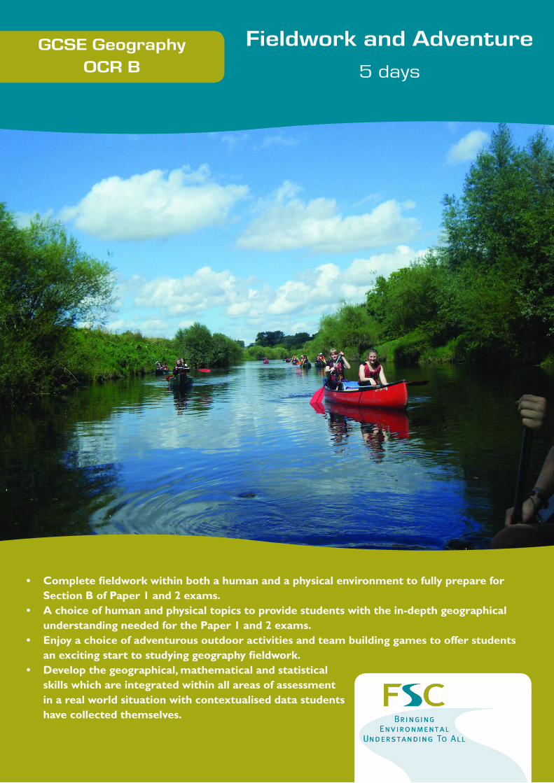
GCSE GeographyOCR B
Fieldwork and Adventure
5 days
• CompletefieldworkwithinbothahumanandaphysicalenvironmenttofullyprepareforSectionBofPaper1and2exams.
• Achoiceofhumanandphysicaltopicstoprovidestudentswiththein-depthgeographicalunderstandingneededforthePaper1and2exams.
• Enjoyachoiceofadventurousoutdooractivitiesandteambuildinggamestoofferstudentsanexcitingstarttostudyinggeographyfieldwork.
• Developthegeographical,mathematicalandstatisticalskillswhichareintegratedwithinallareasofassessmentinarealworldsituationwithcontextualiseddatastudentshavecollectedthemselves.
Please visit http://www.field-studies-council.org/outdoorclassroom/
For alternative courses
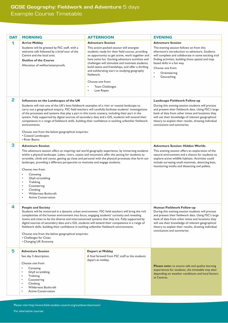
GCSE Geography: Fieldwork and Adventure 5 daysExample Course Timetable
DAY MORNING AFTERNOON EVENING
1 ArriveMidday
Students will be greeted by FSC staff, with a welcome talk followed by a brief tour of the Centre and the local area.
OutlineoftheCourse
Allocation of wellies/waterproofs.
AdventureSession
This action-packed session will energize students ready for their field course, providing an opportunity to get active, work together and have some fun. Exciting adventure activities and challenges will stimulate and motivate students, build teams and friendships, and offer a thrilling and exhilarating start to studying geography fieldwork.
Choose one from:
• Team Challenges • Low Ropes
AdventureSession
The evening session follows on from this afternoon’s introduction to adventure. Students will complete and collaborate in some exciting trail finding activities, building those spatial and map based skills in a fun way.
Choose one from:
• Orienteering • Geocaching
2 InfluencesontheLandscapesoftheUK
Students will visit one of the UK’s best fieldwork examples of a river or coastal landscape to carry out a geographical enquiry. FSC field teachers will carefully facilitate students’ investigations of the processes and systems that play a part in this iconic scenery, including their part in the system. Fully supported by digital sources of secondary data and a GIS, students will extend their competence in a range of fieldwork skills, building their confidence in tackling unfamiliar fieldwork environments.
Choose one from the below geographical enquiries:•CoastalLandscapes•RiverBasins
LandscapeFieldworkFollow-up
During this evening session students will process and present their fieldwork data. Using FSC’s large bank of data from other times and locations they will use their knowledge of relevant geographical theory to explain their results, drawing individual conclusions and summaries.
3 AdventureSession
This adventure session offers an inspiring real world geography experience, by immersing students within a physical landscape. Lakes, rivers, coasts and mountains offer the setting for students to scramble, climb and canoe, getting up close and personal with the physical processes that form our landscape, providing a different perspective to motivate and engage students.
Choose two from:
• Canoeing• Ghyll scrambling• Trekking• Coasteering• Climbing• WildernessBushcraft• Active Conservation
AdventureSession:HiddenWorlds
This evening session offers an exploration of the natural environment and a chance for students to explore active wildlife habitats. Activities could include surveying small mammals, detecting bats, monitoring moths and dissecting owl pellets.
4 PeopleandSocietyStudents will be immersed in a dynamic urban environment. FSC field teachers will bring the rich complexities of the human environment into focus, engaging students’ curiosity and revealing towns and cities to be the diverse and interconnected systems that they are. Fully supported by digital sources of secondary data and a GIS, students will extend their competence in a range of fieldwork skills, building their confidence in tackling unfamiliar fieldwork environments.
Choose one from the below geographical enquiries:•ChallengesforCities•ChangingUKEconomy
HumanFieldworkFollow-upDuring this evening session students will process and present their fieldwork data. Using FSC’s large bank of data from other times and locations they will use their knowledge of relevant geographical theory to explain their results, drawing individual conclusions and summaries.
5 AdventureSession
See day 3 description.
Choose one from:
• Canoeing• Ghyll scrambling• Trekking• Coasteering• Climbing• WildernessBushcraft• Active Conservation
DepartatMidday
A final farewell from FSC staff as the students depart at midday.
Pleasenote: to ensure safe and quality learning experiences for students, the timetable may alter depending on weather conditions and local factors at Centres.
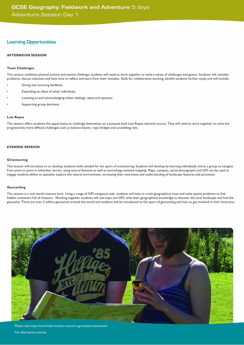
GCSE Geography: Fieldwork and Adventure 5 daysAdventure Session Day 1
Please visit http://www.field-studies-council.org/outdoorclassroom/
For alternative courses
Learning Opportunities
AFTERNOONSESSION
TeamChallenges
This session combines physical activity and mental challenge, students will need to work together to solve a series of challenges and games. Students will consider problems, discuss solutions and have time to reflect and learn from their mistakes. Skills for collaborative working, benefit students further study and will include:
• Givingandreceivingfeedback.
• Expandingonideasofotherindividuals.
• Listeningtoandacknowledgingothersfeelings,ideasandopinions.
• Supportinggroupdecisions.
LowRopes
This session offers students the opportunity to challenge themselves on a purpose built Low Ropes obstacle course. They will need to work together to solve the progressively more difficult challenges such as balance beams, rope bridges and scrambling nets.
EVENINGSESSION
Orienteering
This session will introduce to or develop students skills needed for the sport of orienteering. Students will develop by learning individually and as a group to navigate from point to point in unfamiliar terrain, using natural features as well as technology assisted mapping. Maps, compass, aerial photographs and GPS can be used to engage students ability to spatiality explore the natural environment, increasing their awareness and understanding of landscape features and processes.
Geocaching
This session is a real world treasure hunt. Using a range of GPS navigation aids, students will have to crack geographical clues and solve spatial problems to find hidden containers full of treasure. Working together students will use maps and GPS, with their geographical knowledge to discover the local landscape and find the geocache. There are over 2 million geocaches around the world and students will be introduced to the sport of geocaching and how to get involved in their local area.
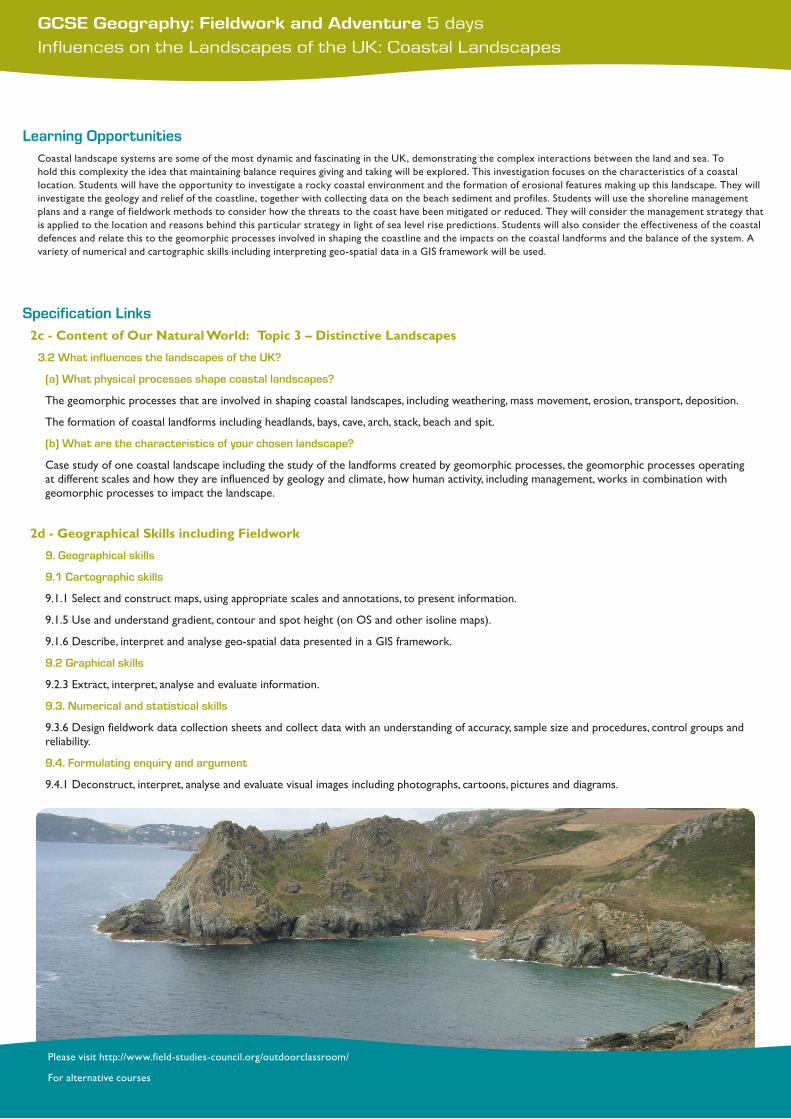
GCSE Geography: Fieldwork and Adventure 5 daysInfluences on the Landscapes of the UK: Coastal Landscapes
Please visit http://www.field-studies-council.org/outdoorclassroom/
For alternative courses
Learning OpportunitiesCoastal landscape systems are some of the most dynamic and fascinating in the UK, demonstrating the complex interactions between the land and sea. To hold this complexity the idea that maintaining balance requires giving and taking will be explored. This investigation focuses on the characteristics of a coastal location. Students will have the opportunity to investigate a rocky coastal environment and the formation of erosional features making up this landscape. They will investigate the geology and relief of the coastline, together with collecting data on the beach sediment and profiles. Students will use the shoreline management plans and a range of fieldwork methods to consider how the threats to the coast have been mitigated or reduced. They will consider the management strategy that is applied to the location and reasons behind this particular strategy in light of sea level rise predictions. Students will also consider the effectiveness of the coastal defences and relate this to the geomorphic processes involved in shaping the coastline and the impacts on the coastal landforms and the balance of the system. A variety of numerical and cartographic skills including interpreting geo-spatial data in a GIS framework will be used.
Specification Links2c-ContentofOurNaturalWorld:Topic3–DistinctiveLandscapes
3.2 What influences the landscapes of the UK?
(a) What physical processes shape coastal landscapes?
The geomorphic processes that are involved in shaping coastal landscapes, including weathering, mass movement, erosion, transport, deposition.
The formation of coastal landforms including headlands, bays, cave, arch, stack, beach and spit.
(b) What are the characteristics of your chosen landscape?
Case study of one coastal landscape including the study of the landforms created by geomorphic processes, the geomorphic processes operating at different scales and how they are influenced by geology and climate, how human activity, including management, works in combination with geomorphic processes to impact the landscape.
2d-GeographicalSkillsincludingFieldwork
9. Geographical skills
9.1 Cartographic skills
9.1.1 Select and construct maps, using appropriate scales and annotations, to present information.
9.1.5 Use and understand gradient, contour and spot height (on OS and other isoline maps).
9.1.6 Describe, interpret and analyse geo-spatial data presented in a GIS framework.
9.2 Graphical skills
9.2.3 Extract, interpret, analyse and evaluate information.
9.3. Numerical and statistical skills
9.3.6 Design fieldwork data collection sheets and collect data with an understanding of accuracy, sample size and procedures, control groups and reliability.
9.4. Formulating enquiry and argument
9.4.1 Deconstruct, interpret, analyse and evaluate visual images including photographs, cartoons, pictures and diagrams.
GCSE Geography: Fieldwork and Adventure 5 daysInfluences on the Landscapes of the UK: River Basins
Please visit http://www.field-studies-council.org/outdoorclassroom/
For alternative courses
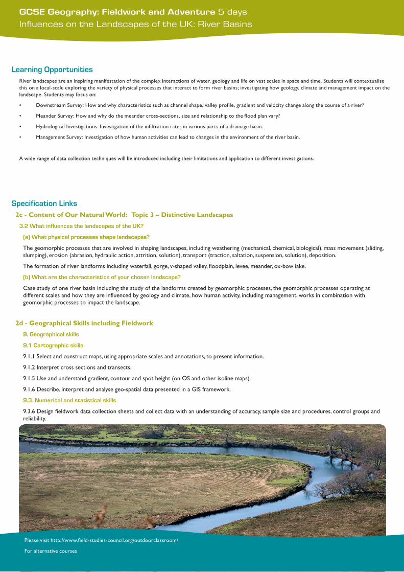
Learning OpportunitiesRiver landscapes are an inspiring manifestation of the complex interactions of water, geology and life on vast scales in space and time. Students will contextualise this on a local-scale exploring the variety of physical processes that interact to form river basins; investigating how geology, climate and management impact on the landscape. Students may focus on:
• DownstreamSurvey:Howandwhycharacteristicssuchaschannelshape,valleyprofile,gradientandvelocitychangealongthecourseofariver?
• MeanderSurvey:Howandwhydothemeandercross-sections,sizeandrelationshiptothefloodplanvary?
• HydrologicalInvestigations:Investigationoftheinfiltrationratesinvariouspartsofadrainagebasin.
• ManagementSurvey:Investigationofhowhumanactivitiescanleadtochangesintheenvironmentoftheriverbasin.
A wide range of data collection techniques will be introduced including their limitations and application to different investigations.
Specification Links2c-ContentofOurNaturalWorld:Topic3–DistinctiveLandscapes
3.2 What influences the landscapes of the UK?
(a) What physical processes shape landscapes?
The geomorphic processes that are involved in shaping landscapes, including weathering (mechanical, chemical, biological), mass movement (sliding, slumping), erosion (abrasion, hydraulic action, attrition, solution), transport (traction, saltation, suspension, solution), deposition.
The formation of river landforms including waterfall, gorge, v-shaped valley, floodplain, levee, meander, ox-bow lake.
(b) What are the characteristics of your chosen landscape?
Case study of one river basin including the study of the landforms created by geomorphic processes, the geomorphic processes operating at different scales and how they are influenced by geology and climate, how human activity, including management, works in combination with geomorphic processes to impact the landscape.
2d-GeographicalSkillsincludingFieldwork
9. Geographical skills
9.1 Cartographic skills
9.1.1 Select and construct maps, using appropriate scales and annotations, to present information.
9.1.2 Interpret cross sections and transects.
9.1.5 Use and understand gradient, contour and spot height (on OS and other isoline maps).
9.1.6 Describe, interpret and analyse geo-spatial data presented in a GIS framework.
9.3. Numerical and statistical skills
9.3.6 Design fieldwork data collection sheets and collect data with an understanding of accuracy, sample size and procedures, control groups and reliability.
GCSE Geography: Fieldwork and Adventure 5 daysLandscape Fieldwork Follow-up
Please visit http://www.field-studies-council.org/outdoorclassroom/
For alternative courses
Learning OpportunitiesFocussing on the final four stages of the geographical fieldwork process, students will:
• Process and present their fieldwork data.
• Analyse and explain data collected with reference to their background knowledge.
• Consider possible conclusions based on the evidence collected.
• Reflect critically on fieldwork data, methods used and conclusions drawn.
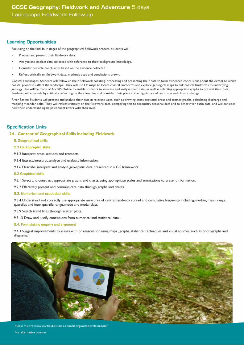
Coastal Landscapes: Students will follow up their fieldwork collating, processing and presenting their data to form evidenced conclusions about the extent to which coastal processes affect the landscape. They will use OS maps to locate coastal landforms and explore geological maps to link coastal landforms to underlying geology. Use will be made of ArcGIS Online to enable students to visualise and analyse their data, as well as selecting appropriate graphs to present their data. Students will conclude by critically reflecting on their learning and consider their place in the big picture of landscape and climatic change.
RiverBasins:Studentswillpresentandanalysetheirdatainrelevantways,suchasdrawingcross-sectionalareasandscattergraphs,calculatingdischargeandmapping meander belts. They will reflect critically on the fieldwork data, comparing this to secondary seasonal data and to other river basin data, and will consider how their understanding helps connect rivers with their lives.
Specification Links2d-ContentofGeographicalSkillsincludingFieldwork
9. Geographical skills
9.1 Cartographic skills
9.1.2 Interpret cross sections and transects.
9.1.4 Extract, interpret, analyse and evaluate information.
9.1.6 Describe, interpret and analyse geo-spatial data presented in a GIS framework.
9.2 Graphical skills
9.2.1 Select and construct appropriate graphs and charts, using appropriate scales and annotations to present information.
9.2.2 Effectively present and communicate data through graphs and charts.
9.3. Numerical and statistical skills
9.3.4 Understand and correctly use appropriate measures of central tendency, spread and cumulative frequency including, median, mean, range, quartiles and inter-quartile range, mode and modal class.
9.3.9 Sketch trend lines through scatter plots.
9.3.13 Draw and justify conclusions from numerical and statistical data.
9.4. Formulating enquiry and argument
9.4.3 Suggest improvements to, issues with or reasons for using maps , graphs, statistical techniques and visual sources, such as photographs and diagrams.
GCSE Geography: Fieldwork and Adventure 5 daysAdventure Session (Day 3 and 5)
Please visit http://www.field-studies-council.org/outdoorclassroom/
For alternative courses
Learning Opportunities
Canoeing
Students will experience the exciting, adventurous and maybe the competitive sport of canoeing. Using open canoes, which seat 2 or 3 people or individual kayaks, students will complete a short journey and a series of games and activities on a local river or lake. A range of skills will be introduced in basic boat handling and strokes, balance and navigation.
GhyllScrambling
This exhilarating session will find students immersed in a dramatic river gorge, working their way upstream, scrambling over river features, traversing rock faces and climbing up waterfalls. Students will experience the processes that form river features in an active, personal and direct way, by helping each other down natural rock chutes, plunging into pools and floating through gorges.
Trekking
During this session students will be immersed in a natural hilly landscape, navigating and exploring their way through stunning and beautiful countryside. A range of skills will be introduced including navigation, route choices and safe movement over a range of terrain. This is a great opportunity for students to discover how the geology, history and weather combine to form the scenery around them.
Coasteering
This session will introduce students to exploring and scrambling around the intertidal zone, climbing over rocky coastal obstacles and boulders. They will experience a range of wet and wild challenges, jumping and plunging into rock pools, clambering along rocky shelves and exploring this unique landscape. There will be active first-hand opportunities to discover the processes that form this coastal environment and make such exciting and dynamic scenery.
Climbing
Students will experience the combination of physical and mental challenge on beginner friendly crags and outcrops. They will build skills in balance, judgement and dexterity, as they tackle increasingly stimulating problems and routes. FSC tutors will work together with students to select climbs to suit students’ abilities and ambitions, building basic skills in bouldering, simple ropework and belaying.
WildernessBushcraft
This session is about the skills needed to thrive in a natural environment. Students could focus on fire-making, tracking, shelter building or making useful items from natural materials. They could learn to:
• Lightafirewithoutmatches,usingflintandsteelstrikersorthemoretraditionalmethodsofabowdrill.
• Heightentheirsensesanddeveloptheirtrackingskills.
• Designandbuildanaturalshelter.
• Whittleorweaveusefulobjectsfromnaturalmaterials.
ActiveConservation
ThissessionwillintroducestudentstothenativefloraandfaunaoftheBritishIslesandthechallengesthatitfaces.Hands-onactivitiessuchas,bird-boxbuilding,coppicing, insect habitat enhancement provide a focus for a series of explorations into the skills needed to look after the countryside. Students will have the opportunity to survey local species either from a pond or woodland and discover the ways in which professional environmental scientists monitor and record wildlife.
EVENINGSESSION
HiddenWorlds
This evening session will introduce students to some of the exciting spatial and temporal natural history monitoring that professional environment scientists use to enhance our knowledge of the real world. Using digital technologies such as GIS students will complete an active investigation of selected native species and start to understand how spatial data is used in to inform decision making.
GCSE Geography: Fieldwork and Adventure 5 daysPeople and Society: Challenges for Cities
Please visit http://www.field-studies-council.org/outdoorclassroom/
For alternative courses
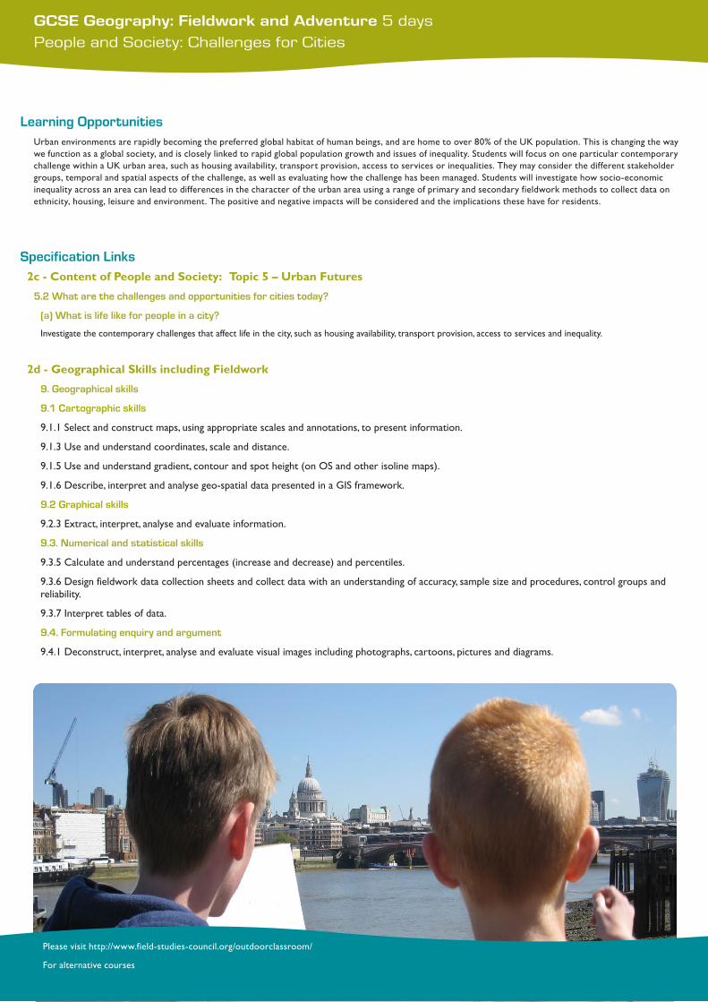
Learning OpportunitiesUrban environments are rapidly becoming the preferred global habitat of human beings, and are home to over 80% of the UK population. This is changing the way we function as a global society, and is closely linked to rapid global population growth and issues of inequality. Students will focus on one particular contemporary challenge within a UK urban area, such as housing availability, transport provision, access to services or inequalities. They may consider the different stakeholder groups, temporal and spatial aspects of the challenge, as well as evaluating how the challenge has been managed. Students will investigate how socio-economic inequality across an area can lead to differences in the character of the urban area using a range of primary and secondary fieldwork methods to collect data on ethnicity, housing, leisure and environment. The positive and negative impacts will be considered and the implications these have for residents.
Specification Links2c-ContentofPeopleandSociety:Topic5–UrbanFutures
5.2 What are the challenges and opportunities for cities today?
(a) What is life like for people in a city?
Investigate the contemporary challenges that affect life in the city, such as housing availability, transport provision, access to services and inequality.
2d-GeographicalSkillsincludingFieldwork
9. Geographical skills
9.1 Cartographic skills
9.1.1 Select and construct maps, using appropriate scales and annotations, to present information.
9.1.3 Use and understand coordinates, scale and distance.
9.1.5 Use and understand gradient, contour and spot height (on OS and other isoline maps).
9.1.6 Describe, interpret and analyse geo-spatial data presented in a GIS framework.
9.2 Graphical skills
9.2.3 Extract, interpret, analyse and evaluate information.
9.3. Numerical and statistical skills
9.3.5 Calculate and understand percentages (increase and decrease) and percentiles.
9.3.6 Design fieldwork data collection sheets and collect data with an understanding of accuracy, sample size and procedures, control groups and reliability.
9.3.7 Interpret tables of data.
9.4. Formulating enquiry and argument
9.4.1 Deconstruct, interpret, analyse and evaluate visual images including photographs, cartoons, pictures and diagrams.
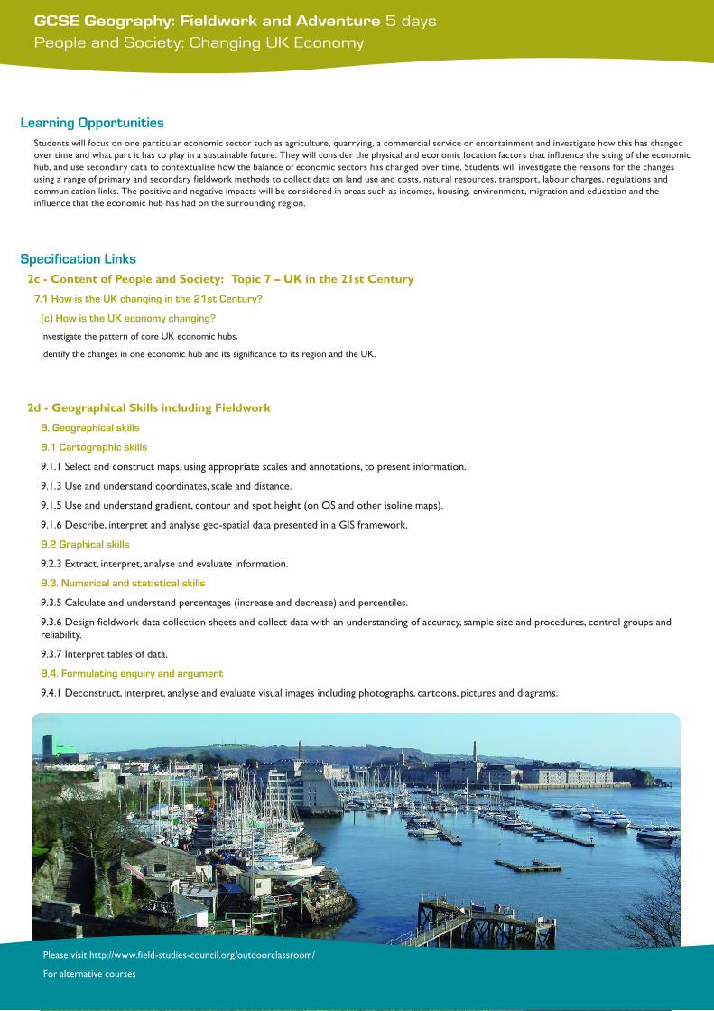
GCSE Geography: Fieldwork and Adventure 5 daysPeople and Society: Changing UK Economy
Please visit http://www.field-studies-council.org/outdoorclassroom/
For alternative courses
Learning OpportunitiesStudents will focus on one particular economic sector such as agriculture, quarrying, a commercial service or entertainment and investigate how this has changed over time and what part it has to play in a sustainable future. They will consider the physical and economic location factors that influence the siting of the economic hub, and use secondary data to contextualise how the balance of economic sectors has changed over time. Students will investigate the reasons for the changes using a range of primary and secondary fieldwork methods to collect data on land use and costs, natural resources, transport, labour charges, regulations and communication links. The positive and negative impacts will be considered in areas such as incomes, housing, environment, migration and education and the influence that the economic hub has had on the surrounding region.
Specification Links2c-ContentofPeopleandSociety:Topic7–UKinthe21stCentury
7.1 How is the UK changing in the 21st Century?
(c) How is the UK economy changing?
Investigate the pattern of core UK economic hubs.
Identify the changes in one economic hub and its significance to its region and the UK.
2d-GeographicalSkillsincludingFieldwork
9. Geographical skills
9.1 Cartographic skills
9.1.1 Select and construct maps, using appropriate scales and annotations, to present information.
9.1.3 Use and understand coordinates, scale and distance.
9.1.5 Use and understand gradient, contour and spot height (on OS and other isoline maps).
9.1.6 Describe, interpret and analyse geo-spatial data presented in a GIS framework.
9.2 Graphical skills
9.2.3 Extract, interpret, analyse and evaluate information.
9.3. Numerical and statistical skills
9.3.5 Calculate and understand percentages (increase and decrease) and percentiles.
9.3.6 Design fieldwork data collection sheets and collect data with an understanding of accuracy, sample size and procedures, control groups and reliability.
9.3.7 Interpret tables of data.
9.4. Formulating enquiry and argument
9.4.1 Deconstruct, interpret, analyse and evaluate visual images including photographs, cartoons, pictures and diagrams.
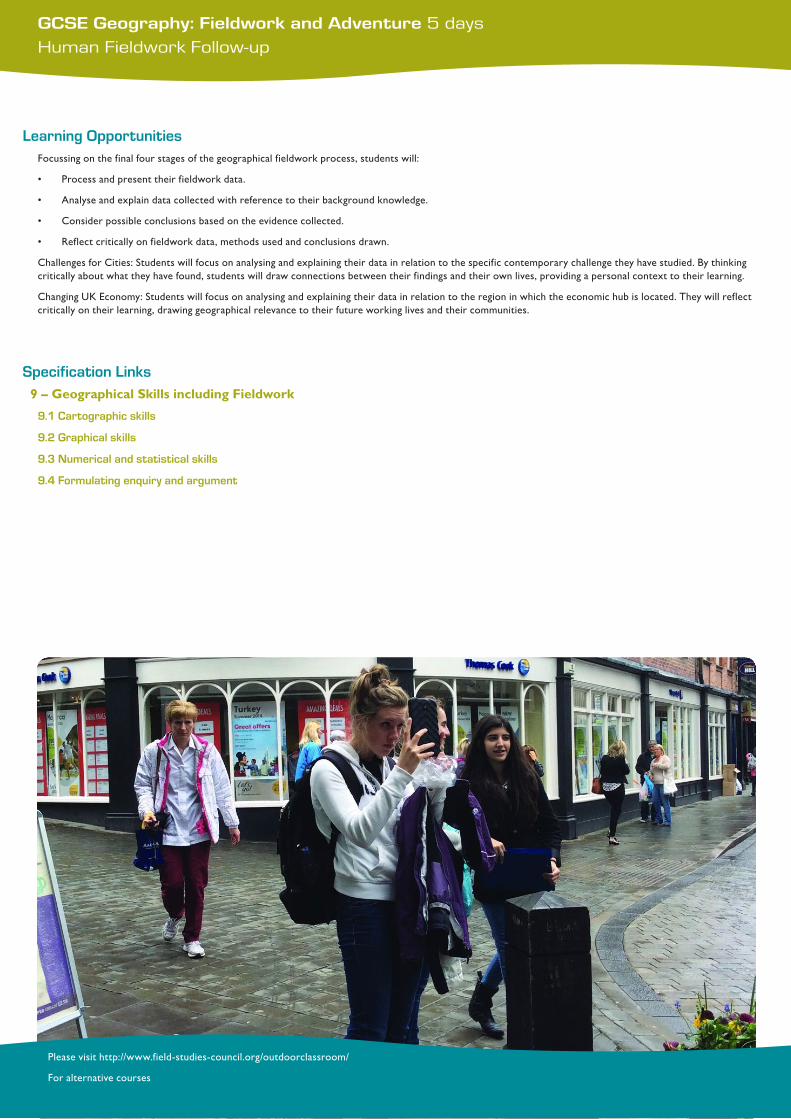
GCSE Geography: Fieldwork and Adventure 5 daysHuman Fieldwork Follow-up
Please visit http://www.field-studies-council.org/outdoorclassroom/
For alternative courses
Learning OpportunitiesFocussing on the final four stages of the geographical fieldwork process, students will:
• Process and present their fieldwork data.
• Analyse and explain data collected with reference to their background knowledge.
• Consider possible conclusions based on the evidence collected.
• Reflect critically on fieldwork data, methods used and conclusions drawn.
ChallengesforCities:Studentswillfocusonanalysingandexplainingtheirdatainrelationtothespecificcontemporarychallengetheyhavestudied.Bythinkingcritically about what they have found, students will draw connections between their findings and their own lives, providing a personal context to their learning.
Changing UK Economy: Students will focus on analysing and explaining their data in relation to the region in which the economic hub is located. They will reflect critically on their learning, drawing geographical relevance to their future working lives and their communities.
Specification Links9–GeographicalSkillsincludingFieldwork
9.1 Cartographic skills
9.2 Graphical skills
9.3 Numerical and statistical skills
9.4 Formulating enquiry and argument
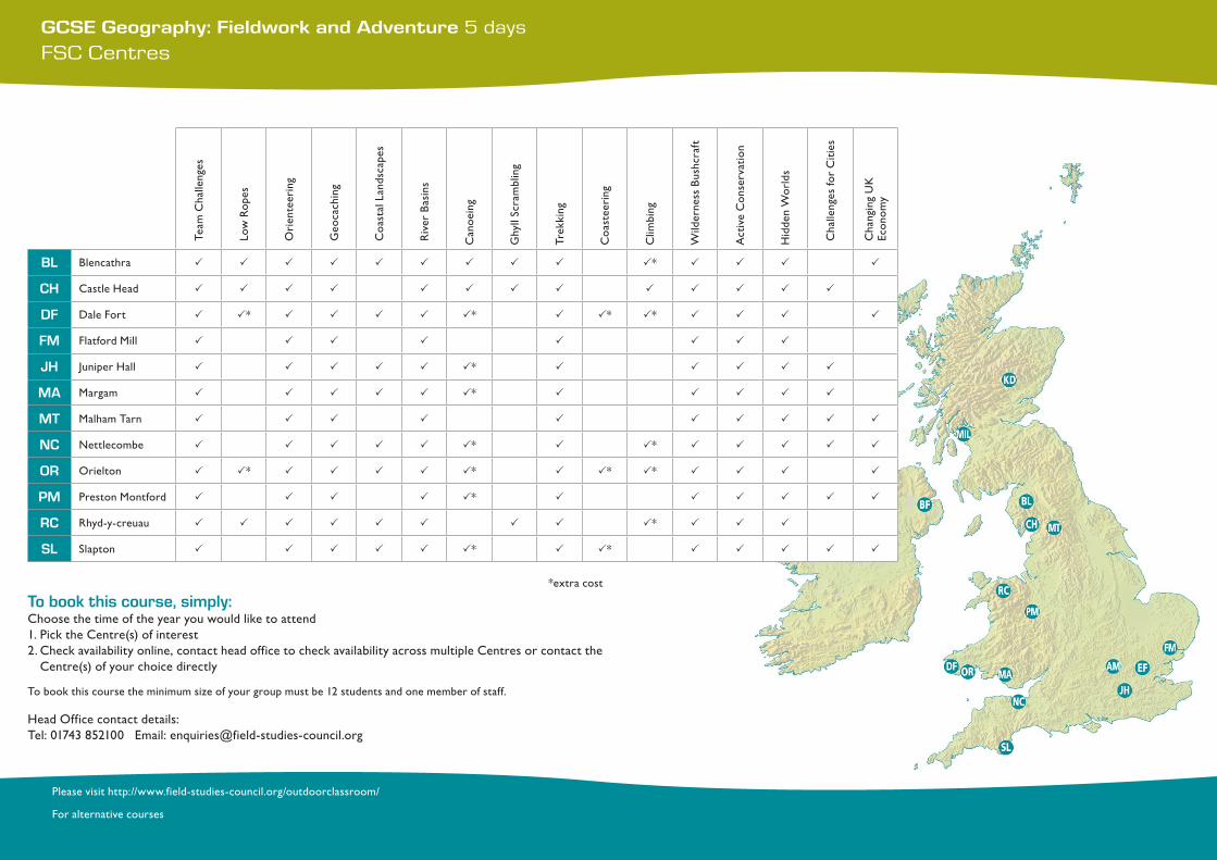
Team
Cha
lleng
es
Low
Rop
es
Ori
ente
erin
g
Geo
cach
ing
Coa
stal
Lan
dsca
pes
RiverBasins
Can
oein
g
Ghy
ll Sc
ram
blin
g
Trek
king
Coa
stee
ring
Clim
bing
WildernessBushcraft
Act
ive
Con
serv
atio
n
HiddenWorlds
Cha
lleng
es fo
r C
ities
Cha
ngin
g U
K
Econ
omy
BL Blencathra P P P P P P P P P P* P P P P
CH CastleHead P P P P P P P P P P P P P
DF Dale Fort P P* P P P P P* P P* P* P P P P
FM Flatford Mill P P P P P P P P
JH JuniperHall P P P P P P* P P P P P
MA Margam P P P P P P* P P P P P
MT Malham Tarn P P P P P P P P P P
NC Nettlecombe P P P P P P* P P* P P P P P
OR Orielton P P* P P P P P* P P* P* P P P P
PM Preston Montford P P P P P* P P P P P P
RC Rhyd-y-creuau P P P P P P P P P* P P P
SL Slapton P P P P P P* P P* P P P P P
GCSE Geography: Fieldwork and Adventure 5 daysFSC Centres
Please visit http://www.field-studies-council.org/outdoorclassroom/
For alternative courses
*extra cost
To book this course, simply: Choose the time of the year you would like to attend1. Pick the Centre(s) of interest2. Check availability online, contact head office to check availability across multiple Centres or contact the
Centre(s) of your choice directly To book this course the minimum size of your group must be 12 students and one member of staff.
HeadOfficecontactdetails:Tel: 01743 852100 Email: [email protected]