Embed Size (px)
DESCRIPTION
Camping guide to Shoalhaven
Citation preview
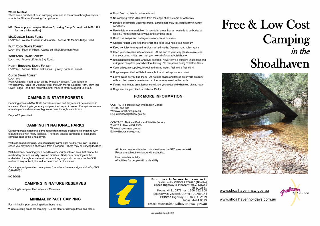
Free & Low Cost
Camping in the
Shoalhaven
Where to Stay:
There are a number of bush camping locations in the area although a popular spot is the Shallow Crossing Camp Ground. NB: (Fees apply to camp at Shallow Crossing Camp Ground call 4478 1183
for more information)
MACDONALD STATE FOREST LOCATION: West of Fishermans Paradise. Access off Martins Ridge Road.
FLAT ROCK STATE FOREST
LOCATION: South of Milton. Access off Milton/Brooman Road.
TOMERONG STATE FOREST
LOCATION: Access off Jervis Bay Road.
NORTH BROOMAN STATE FOREST
LOCATION: Access off the Old Princes Highway, north of Termeil.
CLYDE STATE FOREST
LOCATION: From Ulladulla, head south on the Princes Highway. Turn right into Wheelbarrow Road (at Dolphin Point) through Meroo National Park. Turn into Clyde Ridge Road and follow this until the turn off for Mogood Lookout.
CAMPING IN STATE FORESTS
Camping areas in NSW State Forests are free and they cannot be reserved in advance. Camping is generally not permitted in picnic areas. Exceptions are rest areas in places where major highways pass through state forests. Dogs ARE permitted.
CAMPING IN NATIONAL PARKS
Camping areas in national parks range from remote bushland clearings to fully featured sites with many facilities. There are several car based or back pack camping sites in the Shoalhaven. With car-based camping, you can usually camp right next to your car. In some cases you may have a short walk from a car park. There may be varying facilities. With backpack camping you’ll need to carry your tent to an area that cannot be reached by car and usually have no facilities. Back-pack camping can be undertaken throughout national parks as long as you do not camp within 500 metres of any lookout, fire trail, access road or picnic area. Camping is not permitted on any beach or where there are signs indicating “NO
CAMPING”. NO DOGS
CAMPING IN NATURE RESERVES
Camping is not permitted in Nature Reserves.
MINIMAL IMPACT CAMPING
For minimal impact camping follow these rules:
Use existing areas for camping. Do not clear or damage trees and plants
Don't feed or disturb native animals
No camping within 20 metres from the edge of any stream or waterway
Beware of camping under tall trees. Large limbs may fall, particularly in windy
conditions
Use toilets where available. In non-toilet areas human waste is to be buried at
least 50 metres from waterways and camping areas
Don't use soaps and detergents near creeks or rivers
Consider other visitors to the forest and keep your noise to a minimum
Keep vehicles to mapped and/or marked roads. General road rules apply
Keep your campsite safe and clean. At the end of your stay please make sure
that your camp is tidy. and that you take all of your rubbish home
Use established fireplace wherever possible. Never leave a campfire unattended and
extinguish campfires properly before leaving. No camp fires during Total Fire Bans
Carry adequate supplies, including drinking water, fuel and a first aid kit
Dogs are permitted in State forests, but must be kept under control
Leave gates as you find them. Do not use roads and tracks on private property
without the owner’s permission or other areas closed to the public If going to a remote area, let someone know your route and when you plan to return
Dogs are not permitted in National Parks
FOR MORE INFORMATION:
CONTACT: Forests NSW Information Centre T: 1300 655 687 W: www.forest.nsw.gov.au E: [email protected]
CONTACT: National Parks and Wildlife Service T: 4423 2170 or 4454 9500 W: www.npws.nsw.gov.au E: [email protected]
Last updated: August 2009
www.shoalhaven.nsw.gov.au www.shoalhavenholidays.com.au
For more in formation contact : SHOALHAVEN VISITORS CENTRE (NOWRA)
Princes Highway & Pleasant Way, NOWRA NSW 2541
PHONE: 4421 0778 or 1300 662 808
SHOALHAVEN VISITORS CENTRE (ULLADULLA) Princes Highway ULLADULLA 2539
PHONE: 4444 8819
Email: [email protected]
All phone numbers listed on this sheet have the STD area code 02 Prices are subject to change without notice.
Ûwet weather activity éFacilities for people with a disability
KANGAROO VALLEY
BENDEELA - (SYDNEY CATCHMENT AUTHORITY)
LOCATION: 8km west of Kangaroo Valley. Bendeela Camping Area is located on the Kangaroo River Arm of Lake Yarrunga near the Bendeela Pumping and Power Station. Picnic and camping sites are available on a ‘first in first served’ basis and cannot be reserved. Non-powered boating, fishing & swimming is permitted. FACILITIES:
Toilet facilities
Treated drinking water
RESTRICTIONS:
No campfires or charcoal barbeques
No gas barbeques during a Total Fire Ban
No pets
No horse riding, abseiling, shooting or archery
No collection of firewood
No power boats or unregistered vehicles
TALLOWA DAM CAMPING AREA—(SYDNEY CATCHMENT AUTHORITY) LOCATION: 22km west of Kangaroo Valley. The dam is surrounded by Morton National Park. Access via Tallowa Dam Road. Camping, non-powered boating, fishing & swimming are permitted. FACILITIES:
Electric barbecues
Toilets
Untreated water; boil before using
RESTRICTIONS: as for Bendeela
WEST NOWRA
SHOALHAVEN STATE FOREST
LOCATION: West of Nowra. Access off Yalwal Road
BURRIER BUNDUNDAH RESERVE / GRASSY GULLY CAMPING AREA LOCATION:
22km west of Nowra. Access via Yalwal Road then Burrier Road. Located beside Grassy Gully Creek. FACILITIES: No facilities or drinking water available.
YALWAL DANJERA DAM LOCATION: 27km west of Nowra. Access via Yalwal Road and then Burrier Road. Camping is only permitted in designated areas. Bring own drinking water and firewood.
YERRIYONG
YERRIYONG STATE FOREST LOCATION: West of Nowra off Blackbutt Range Road
ENDRICK
ENDRICK RIVER CAMPING AREA LOCATION: Access via Braidwood Road at Endrick River Crossing. Bring firewood. Pets allowed.
SASSAFRAS
SASSAFRAS CAMPING AREA (MORTON NATIONAL PARK) LOCATION: 15km east of Nerriga. Access via Endrick Fire Trail off Turpentine Road. Camp site is 800 metres from the end of the road. Gas/fuel stove preferred. No dogs allowed.
NATIONAL PARKS
MORTON NATIONAL PARK LOCATION: Access to the southern section is reached by Pointers Gap Rd from the Princes Highway, north of Milton, or Yadboro Rd for Pigeon House Mountain. A number of trails suitable for walkers provide access to remote areas of the park. FACILITIES:
Toilet
Picnic Shelter
Drinking water
WOG WOG CAMPING AREA LOCATION: 15km south of Nerriga village. Access via Charleys Forest Road via Nerriga Road and vehicle based camping is allowed. FACILITIES:
Pit toilets
Fire places, except on a Total Fire Ban day. Bring own firewood
Water from creek, needs to be boiled.
BLUE GUM FLAT CAMPING AREA LOCATION: 34km west of Milton. Access from Yadboro Rd, then Blue Gum Flat Road. Camping (non-vehicle based) beside the Clyde River. Sites are walk-in, minimum 30 metres.
FACILITIES:
Pit toilet
BUDAWANG NATIONAL PARK LOCATION: 50km west of Ulladulla. There is no vehicle access but walking access is possible from the Western Distributor Road off Yadboro Road (both unsealed) or Kings Highway.
LONG GULLY CAMPING AREA LOCATION:
36km west of Milton. Access via Yadboro Road and Long Gully Road. Camping area is beside the Yadboro River. One overnight stay only. Toilet facilities provided. FACILITIES:
Toilets
Picnic table
MURRAMARANG NATIONAL PARK
LOCATION: A coastal park 10km north of Batemans Bay. Numerous signposted access roads off the Princes Highway. Walk-in camping permitted more than 100 metres from any road, walking track, parking area or the coastline and 500 metres from picnic areas. NB: ($7-$14 fee applies for all camping areas in Murramarang National Park)
FORESTS NSW
YADBORO STATE FOREST LOCATION: South West of Milton. Access via Brooman-Milton Road from Milton, then Clyde & Yadboro Roads. Adjoins Morton & Budawang National Parks.
YADBORO FLAT CAMPING LOCATION:
34km south-west of Milton. Access via Brooman-Milton Road from Milton, then Clyde and Yadboro Roads. Large grassy area beside the Clyde River. FACILITIES:
Toilet facilities
BBQ’s
Pets allowed
CURROWAN STATE FOREST
LOCATION: 15km north west of Batemans Bay near Nelligen. Access via Lyons Road from the Kings Highway.
CURROWAN CREEK CAMPING AREA LOCATION: 14km north west of Nelligen near Currowan Creek Bridge. Access via Lyons Road form the Kings Highway.
SHALLOW CROSSING STATE FOREST LOCATION:
30 minutes drive from Batemans Bay on the upper reaches of the Clyde River, where a low concrete causeway separates the salt water from the fresh. The area is surrounded by the Boyne, South Brooman and Shallow Crossing State Forests and is a haven for fisherman, bushwalkers, four wheel drivers and those who just like to sit around in the quiet listening to the birds and the wind through the trees. Shallow Crossing can be accessed from the Princes Highway at East Lynne or from the Kings Highway, Nelligen. Either way involves travel along well formed dirt roads suitable for all vehicles. Extreme care should be taken if driving on these roads after rain as they can become very slippery when wet. Both access roads and surrounding forest roads are shown on the South Coast State Forest map.
SOUTHERN SHOALHAVEN
NORTHERN SHOALHAVEN
CENTRAL SHOALHAVEN