Embed Size (px)
Citation preview
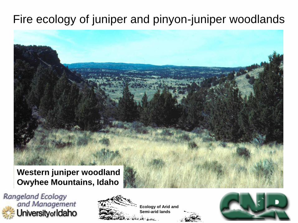
Western juniper woodland
Owyhee Mountains, Idaho
Fire ecology of juniper and pinyon-juniper woodlands
Ecology of Arid and
Semi-arid lands
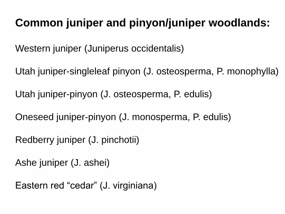
Common juniper and pinyon/juniper woodlands:
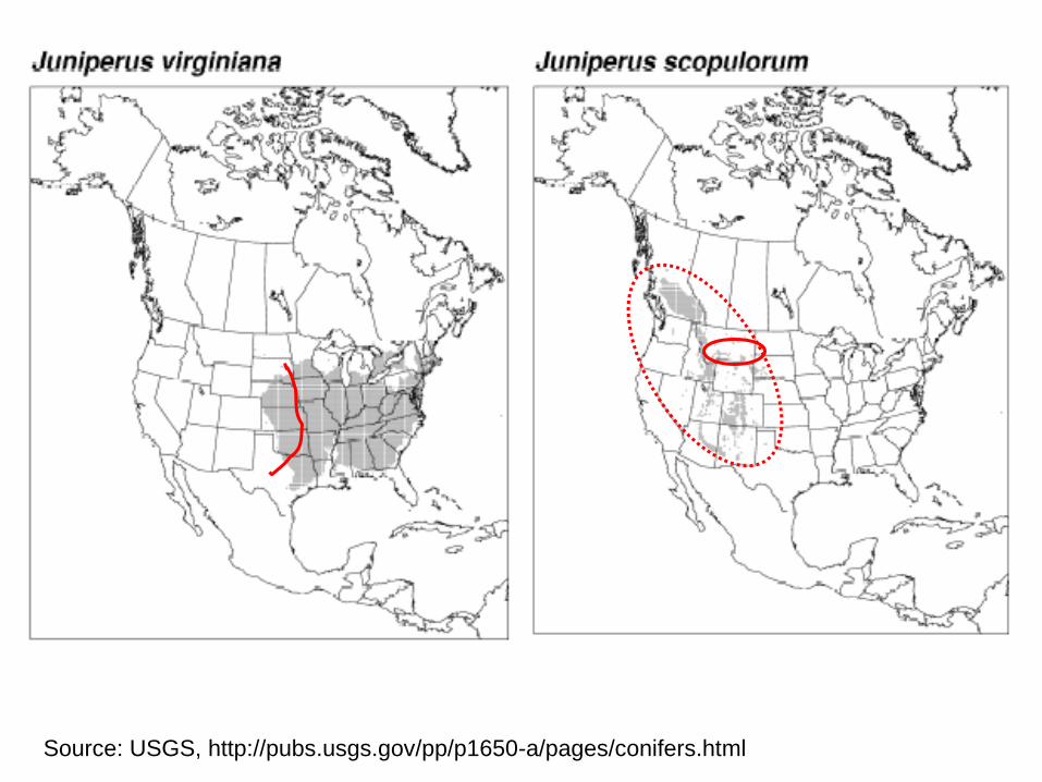
Western juniper (Juniperus occidentalis)
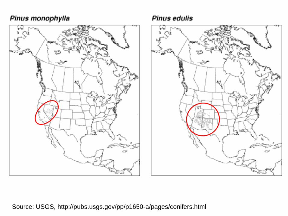
Utah juniper-singleleaf pinyon (J. osteosperma, P. monophylla)
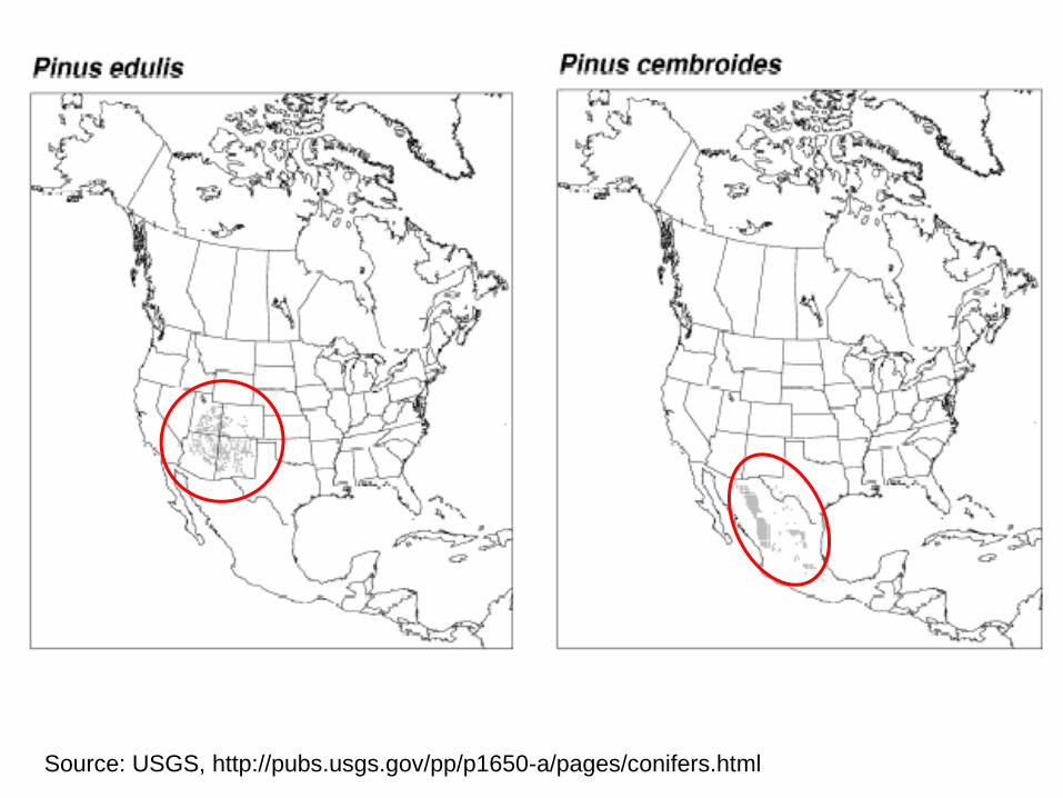
Utah juniper-pinyon (J. osteosperma, P. edulis)
Oneseed juniper-pinyon (J. monosperma, P. edulis)
Redberry juniper (J. pinchotii)
Ashe juniper (J. ashei)
Eastern red “cedar” (J. virginiana)
Source: USGS, http://pubs.usgs.gov/pp/p1650-a/pages/conifers.html
Source: USGS, http://pubs.usgs.gov/pp/p1650-a/pages/conifers.html
Source: USGS, http://pubs.usgs.gov/pp/p1650-a/pages/conifers.html
Source: USGS, http://pubs.usgs.gov/pp/p1650-a/pages/conifers.html
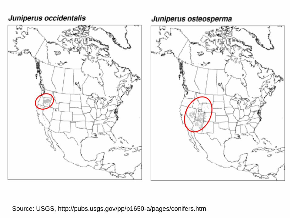
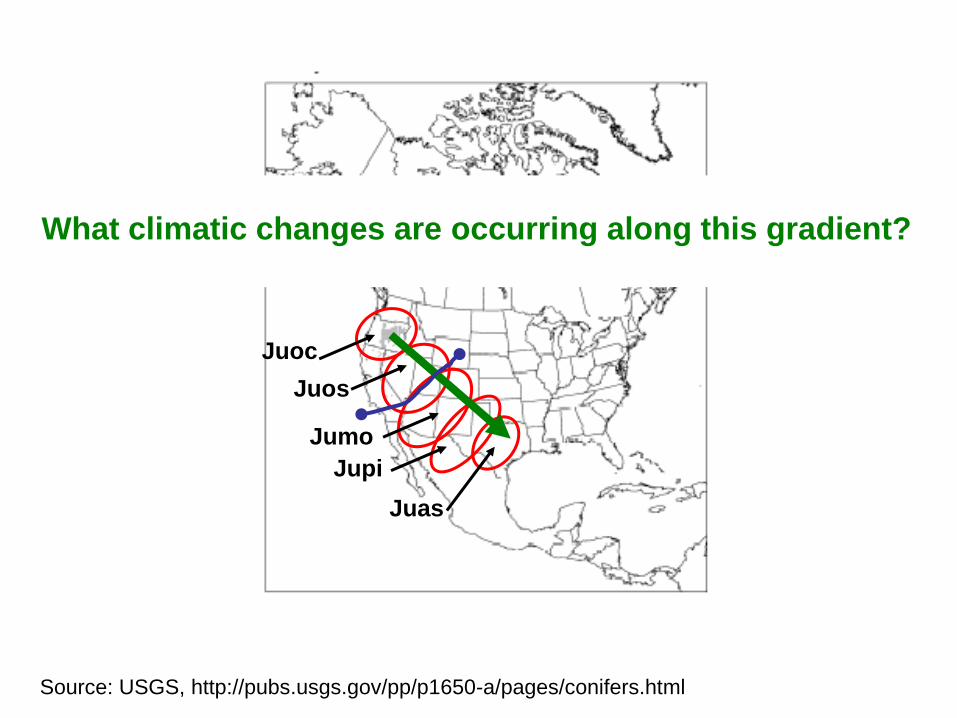
Juoc
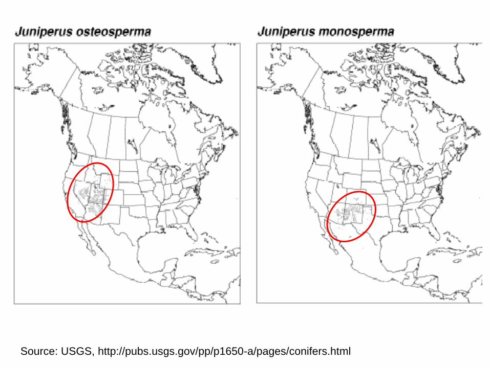
Juos
Jumo
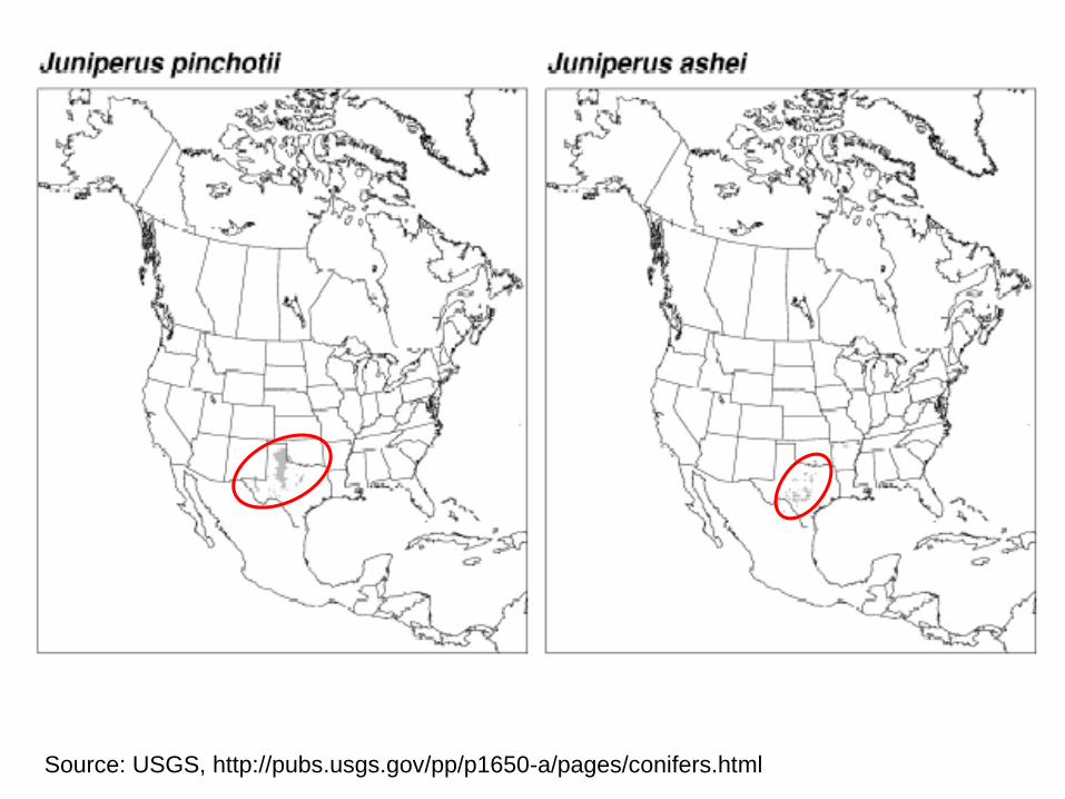
Jupi
Juas
What climatic changes are occurring along this gradient?
Source: USGS, http://pubs.usgs.gov/pp/p1650-a/pages/conifers.html
Source: USGS, http://pubs.usgs.gov/pp/p1650-a/pages/conifers.html
Source: USGS, http://pubs.usgs.gov/pp/p1650-a/pages/conifers.html
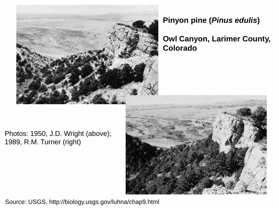
Pinyon pine (Pinus edulis)
Owl Canyon, Larimer County,
Colorado
Source: USGS, http://biology.usgs.gov/luhna/chap9.html
Photos: 1950, J.D. Wright (above);
1989, R.M. Turner (right)
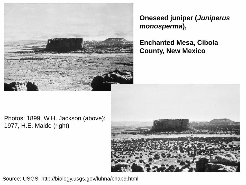
Oneseed juniper (Juniperus
monosperma),
Enchanted Mesa, Cibola
County, New Mexico
Photos: 1899, W.H. Jackson (above);
1977, H.E. Malde (right)
Source: USGS, http://biology.usgs.gov/luhna/chap9.html
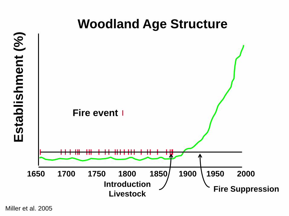
Fire SuppressionIntroduction
Livestock
Es
tab
lish
men
t (%
)Woodland Age Structure
1650 1700 1750 1800 1850 1900 1950 2000
Fire event
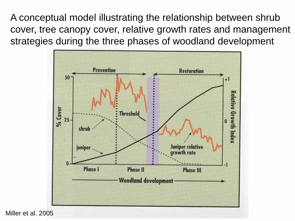
Miller et al. 2005
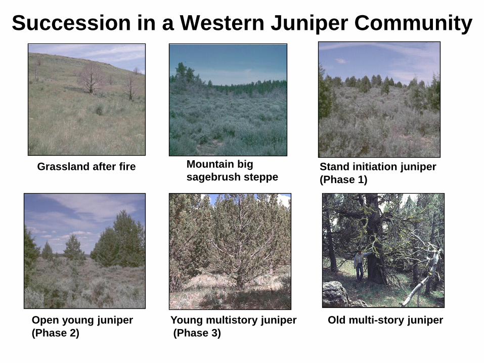
Succession in a Western Juniper Community
Grassland after fire Mountain big
sagebrush steppeStand initiation juniper
(Phase 1)
Open young juniper
(Phase 2)
Young multistory juniper
(Phase 3)
Old multi-story juniper
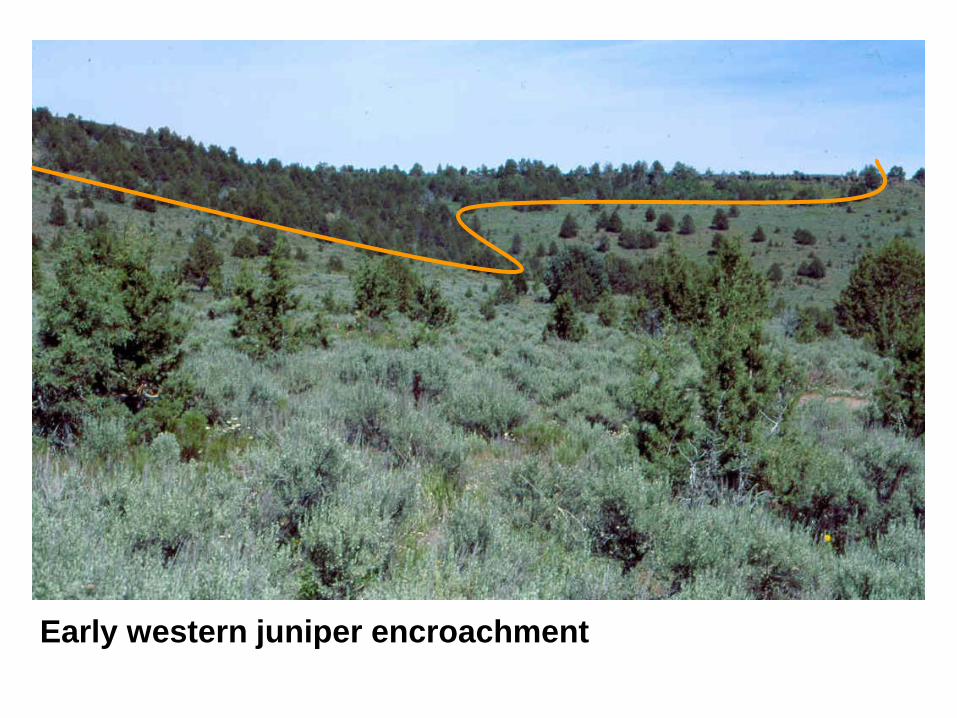
Early western juniper encroachment
Miller et al. 2005
A conceptual model illustrating the relationship between shrub
cover, tree canopy cover, relative growth rates and management
strategies during the three phases of woodland development
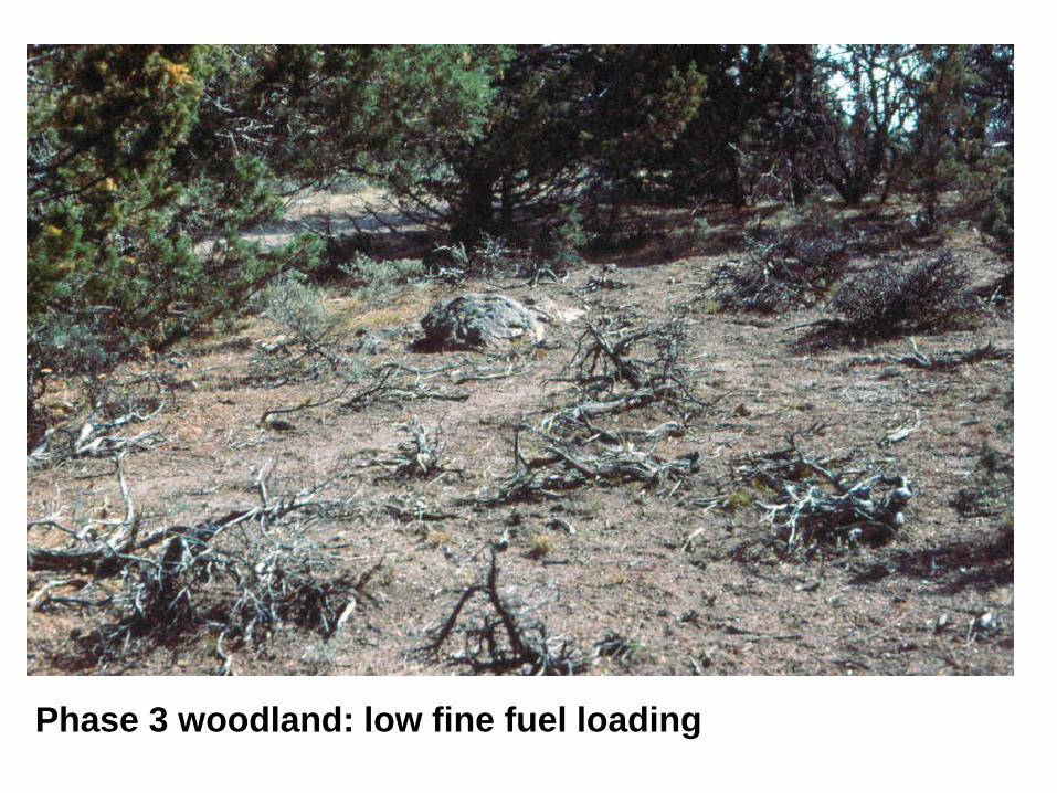
Phase 3 woodland: low fine fuel loading
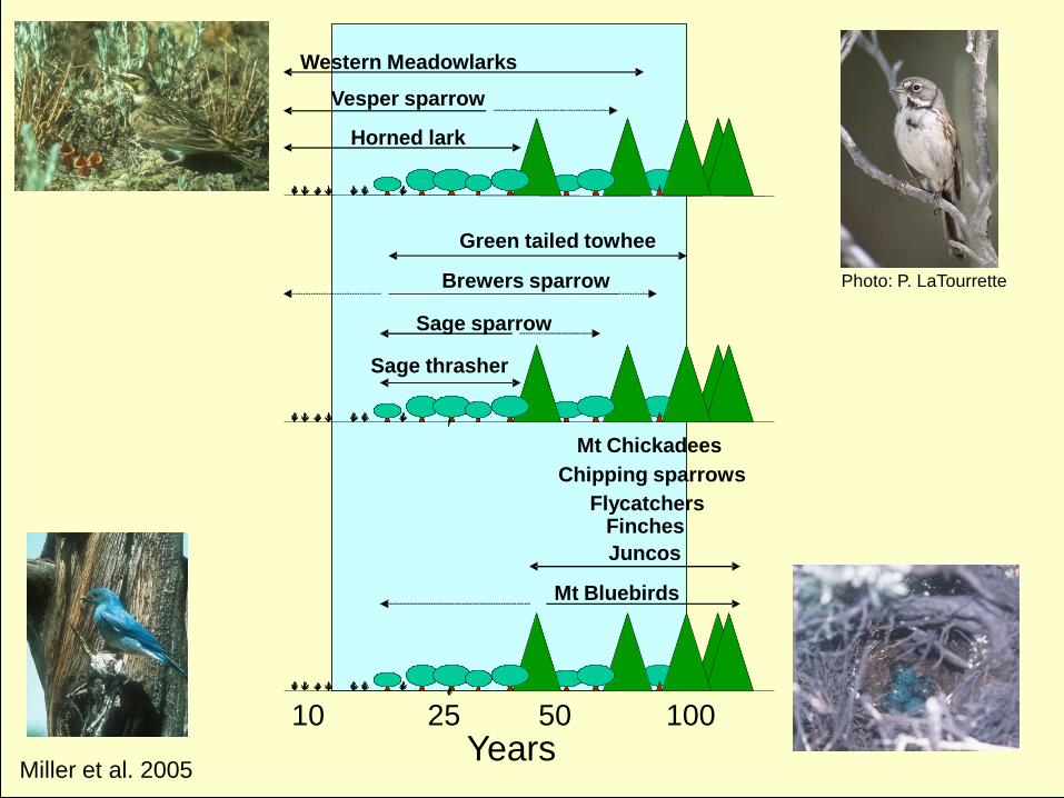
Mt Bluebirds
Mt Chickadees
Chipping sparrows
Flycatchers
Juncos
Sage thrasher
Sage sparrow
Brewers sparrow
Green tailed towhee
Vesper sparrow
Horned lark
Western Meadowlarks
Finches
10 25 50 100
Years
Photo: P. LaTourrette
Miller et al. 2005
Miller et al. 2005
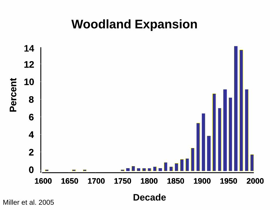
Woodland ExpansionP
erc
en
t
0
2
4
6
8
10
12
14
1600 1650 1700 1750 1800 1850 1900 1950 2000
Decade
Perc
en
t
0
2
4
6
8
10
12
1600 1650 1700 1750 1800 1850 1900 1950 20001600 1650 1700 1750 1800 1850 1900 1950 2000
Miller and Tausch 2001, Miller et al. 2005
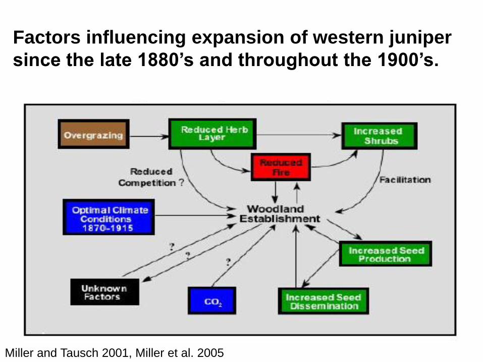
Factors influencing expansion of western juniper
since the late 1880’s and throughout the 1900’s.
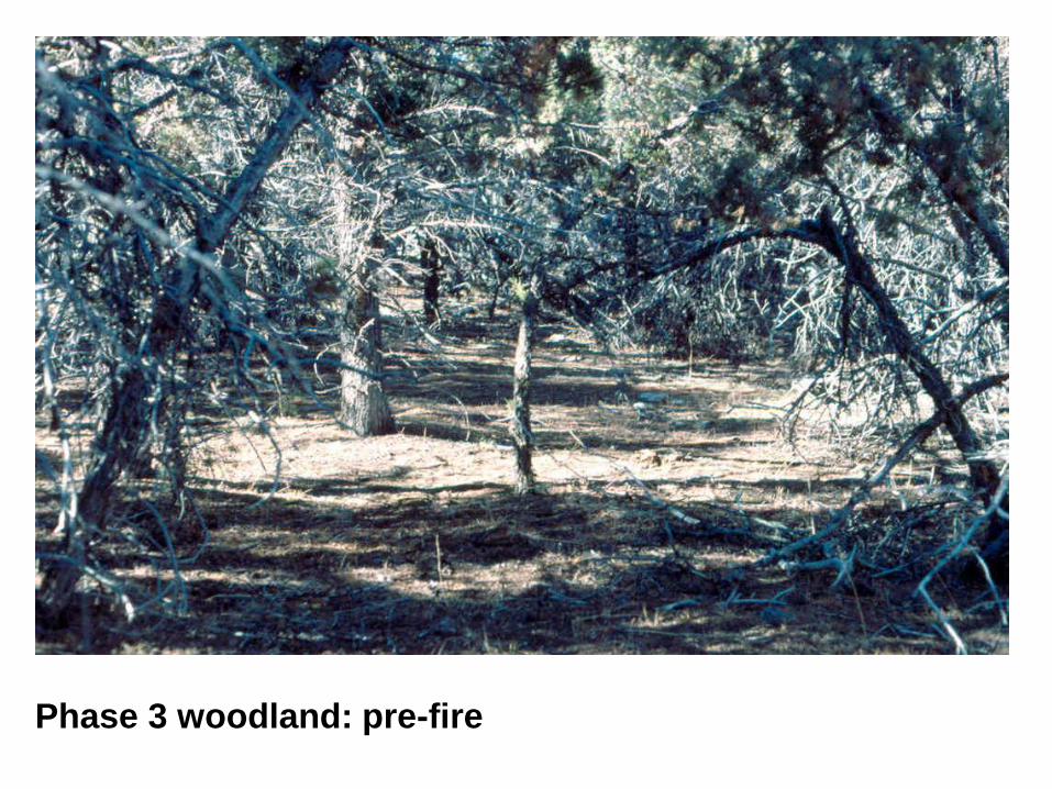
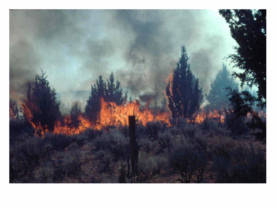
Phase 3 woodland: pre-fire
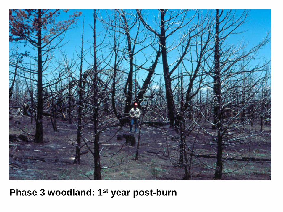
Phase 3 woodland: 1st year post-burn
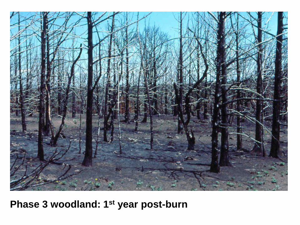
Phase 3 woodland: 1st year post-burn
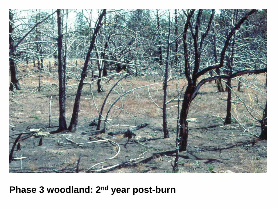
Phase 3 woodland: 2nd year post-burn
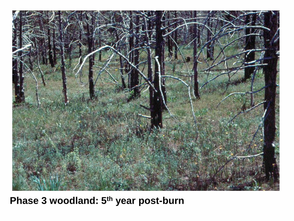
Phase 3 woodland: 5th year post-burn
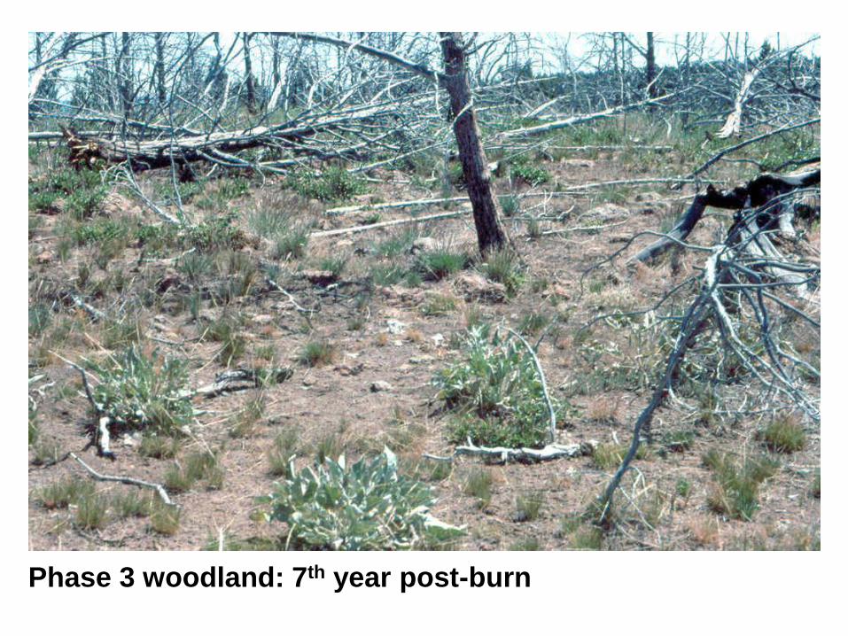
Phase 3 woodland: 7th year post-burn
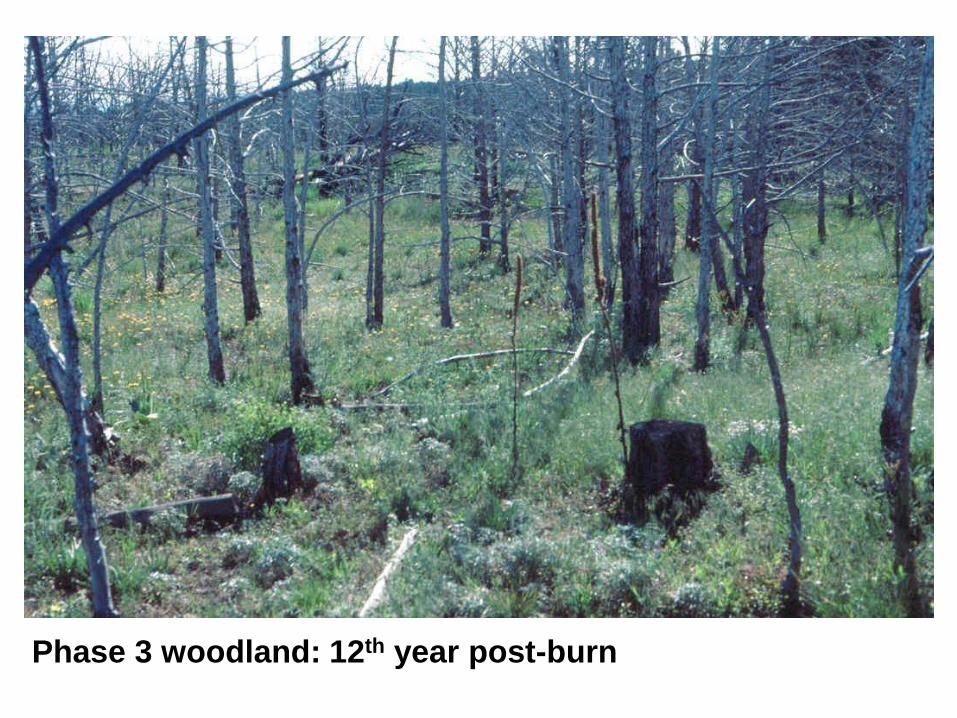
Phase 3 woodland: 12th year post-burn
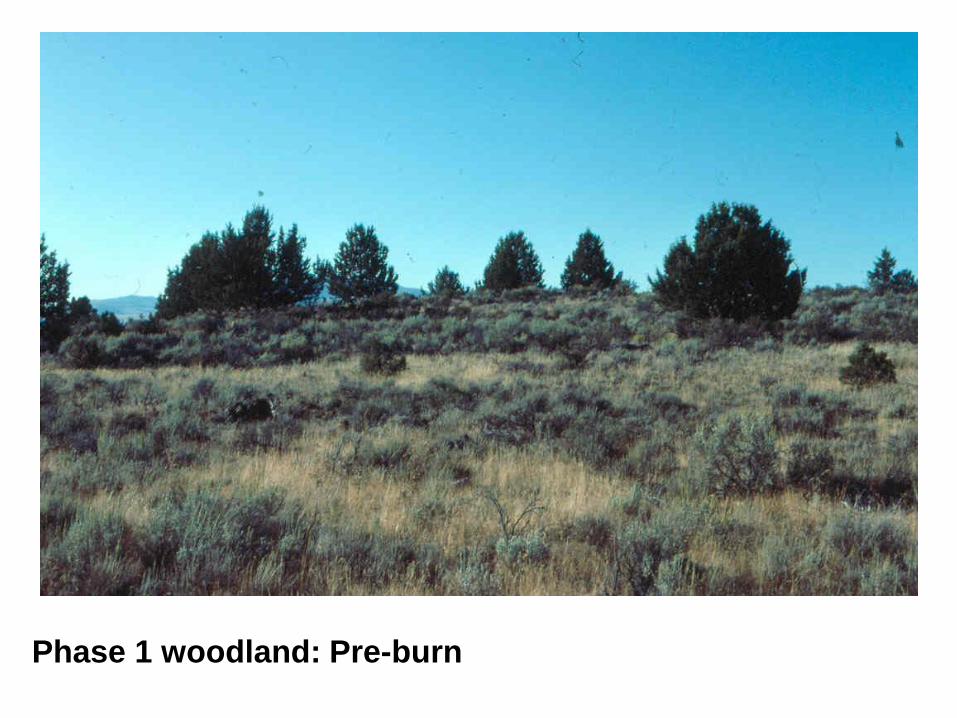
Phase 1 woodland: Pre-burn
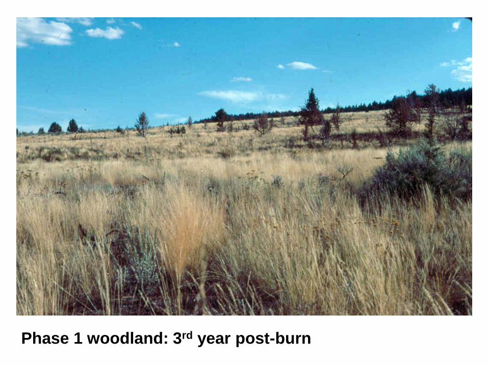
Phase 1 woodland: 3rd year post-burn
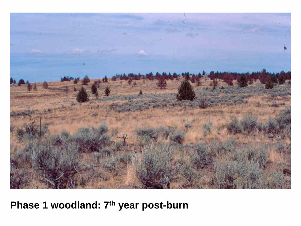
Phase 1 woodland: 7th year post-burn

Current Creek
Smith Creek
Red Canyon Creek
Hurry Back Creek
Juniper Mountain, Owyhee Uplands, Idaho
Landsat 5 imagery, July 1992
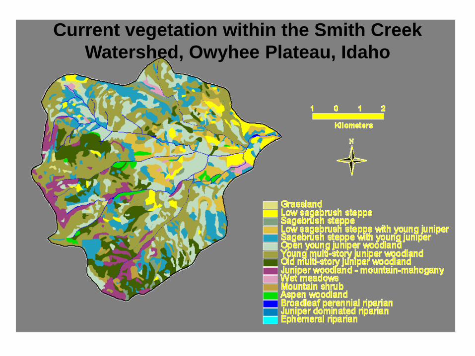
Current vegetation within the Smith Creek
Watershed, Owyhee Plateau, Idaho
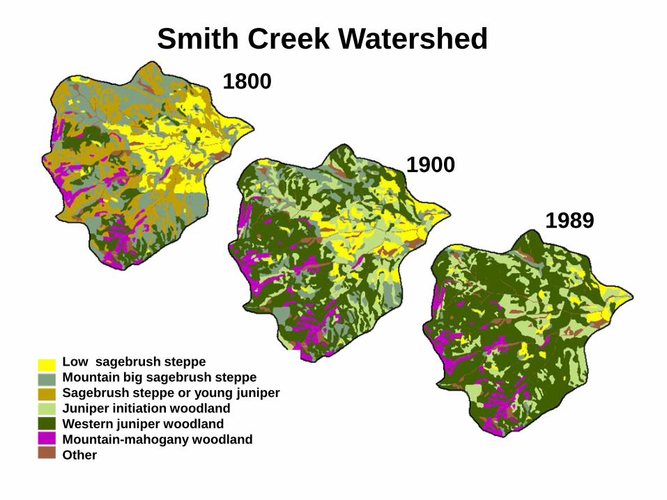
Low sagebrush steppe
Mountain big sagebrush steppe
Sagebrush steppe or young juniper
Juniper initiation woodland
Western juniper woodland
Mountain-mahogany woodland
Other
Smith Creek Watershed
1800
1900
1989
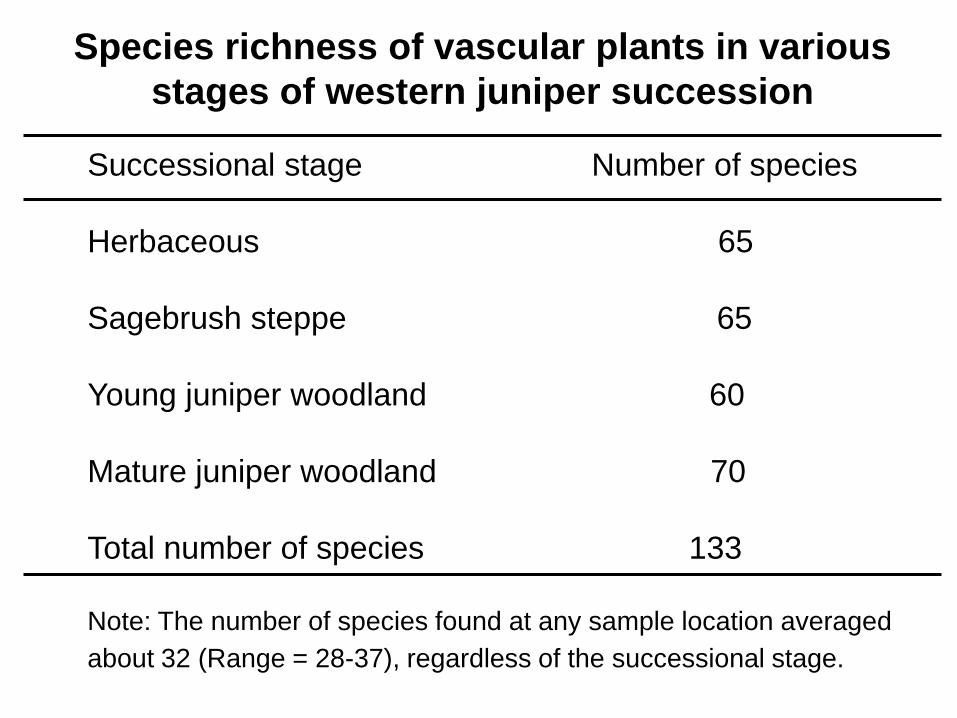
Species richness of vascular plants in various
stages of western juniper succession
Successional stage Number of species
Herbaceous 65
Sagebrush steppe 65
Young juniper woodland 60
Mature juniper woodland 70
Total number of species 133
Note: The number of species found at any sample location averaged
about 32 (Range = 28-37), regardless of the successional stage.
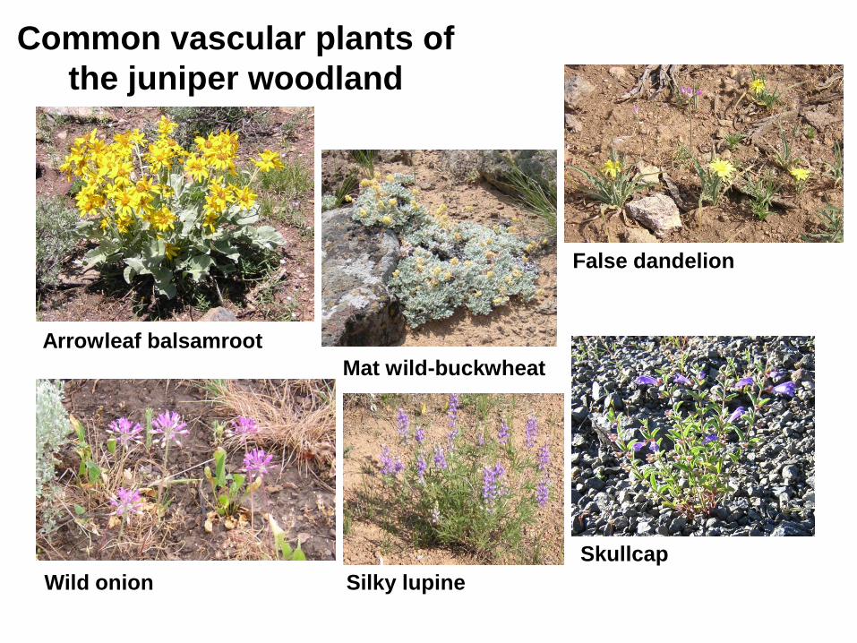
Common vascular plants of
the juniper woodland
Arrowleaf balsamroot
Wild onion
False dandelion
Mat wild-buckwheat
Skullcap
Silky lupine
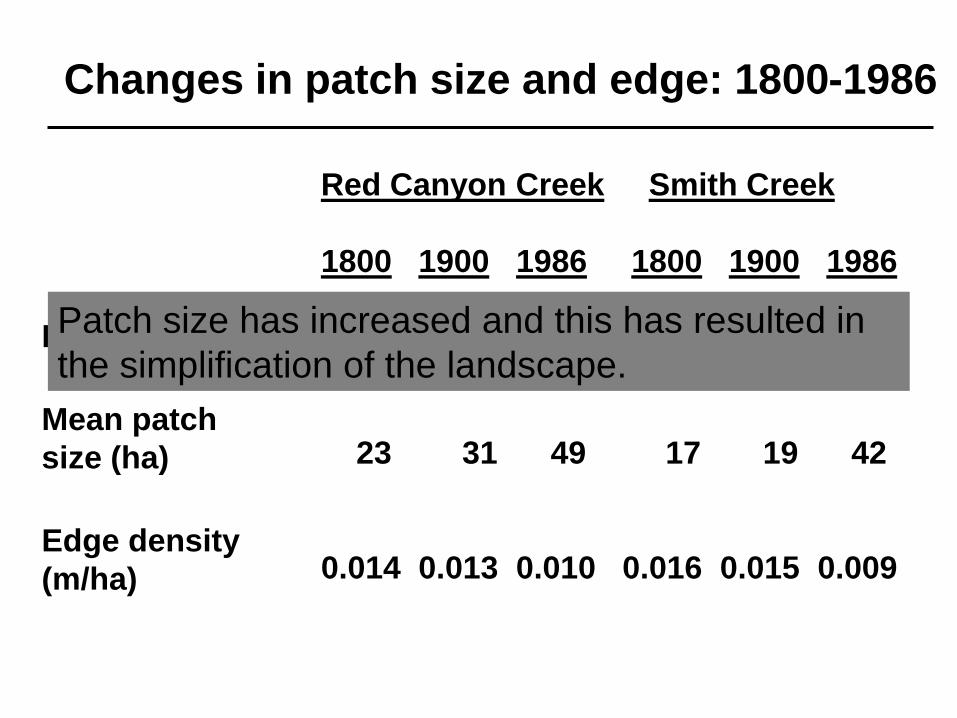
Red Canyon Creek Smith Creek
1800 1900 1986 1800 1900 1986
280 210 132 410 363 163
23 31 49 17 19 42
0.014 0.013 0.010 0.016 0.015 0.009
Patch number
Mean patch
size (ha)
Edge density
(m/ha)
Changes in patch size and edge: 1800-1986
Patch size has increased and this has resulted in
the simplification of the landscape.
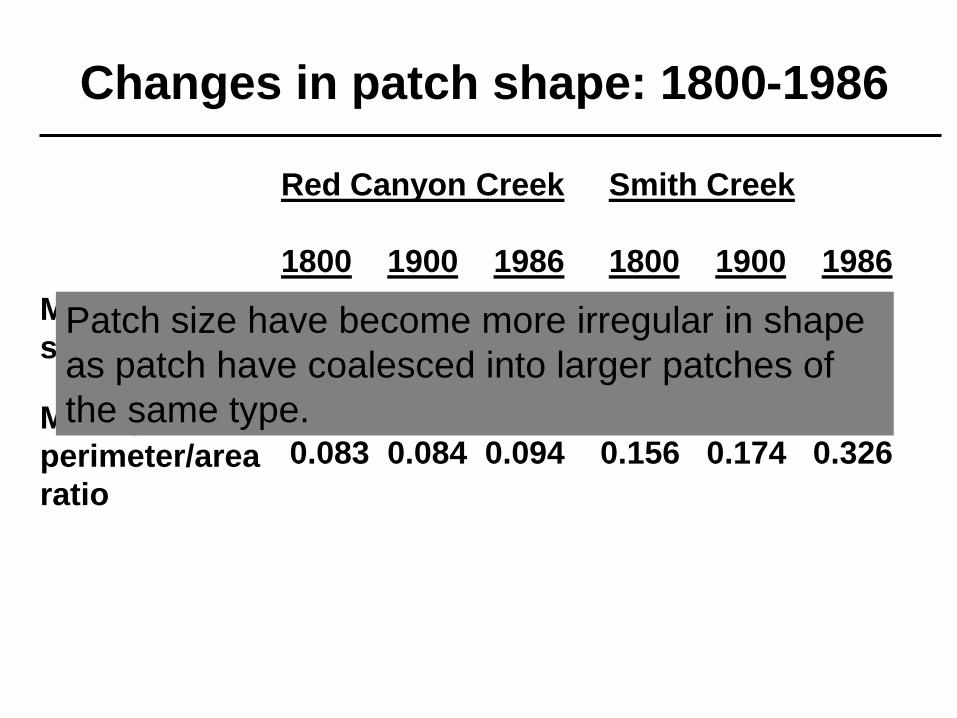
Red Canyon Creek Smith Creek
1800 1900 1986 1800 1900 1986
1.96 2.09 2.22 1.94 1.99 2.23
0.083 0.084 0.094 0.156 0.174 0.326
Mean patch
shape index
Mean patch
perimeter/area
ratio
Changes in patch shape: 1800-1986
Patch size have become more irregular in shape
as patch have coalesced into larger patches of
the same type.
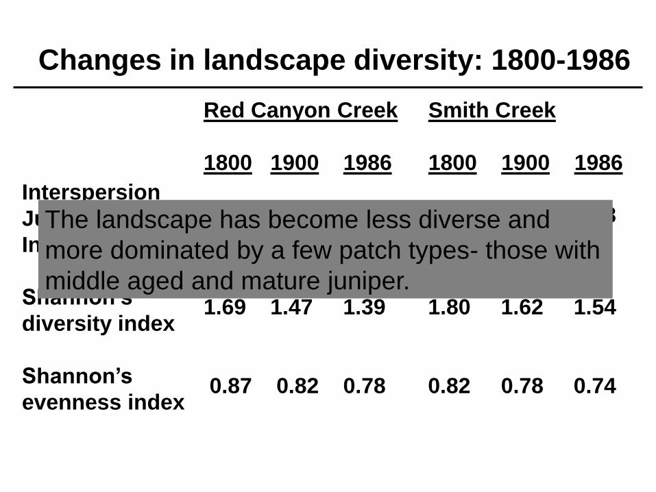
Red Canyon Creek Smith Creek
1800 1900 1986 1800 1900 1986
77.4 68.2 60.7 72.4 65.6 58.8
1.69 1.47 1.39 1.80 1.62 1.54
0.87 0.82 0.78 0.82 0.78 0.74
Interspersion
Juxtaposition
Index
Shannon’s
diversity index
Shannon’s
evenness index
Changes in landscape diversity: 1800-1986
The landscape has become less diverse and
more dominated by a few patch types- those with
middle aged and mature juniper.
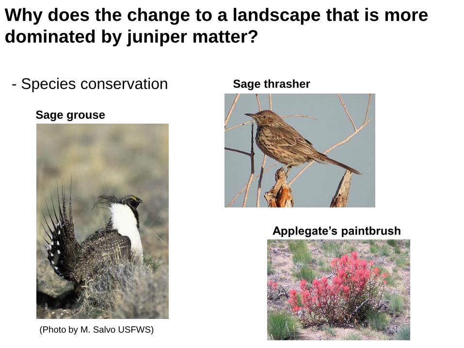
Why does the change to a landscape that is more
dominated by juniper matter?
- Species conservation
(Photo by M. Salvo USFWS)
Sage thrasher
Sage grouse
Applegate’s paintbrush
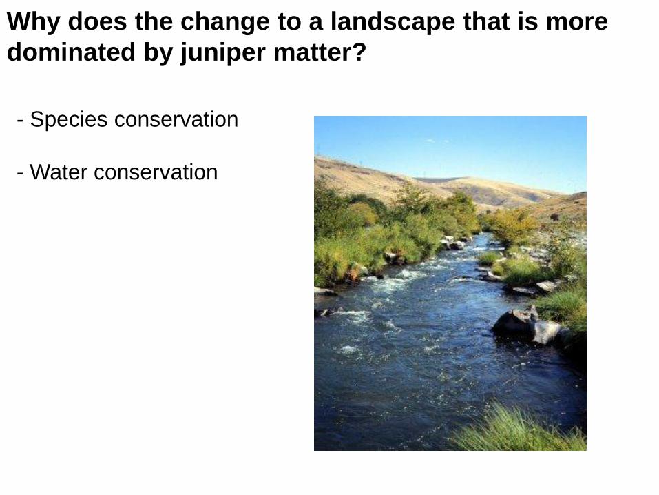
Why does the change to a landscape that is more
dominated by juniper matter?
- Species conservation
- Water conservation
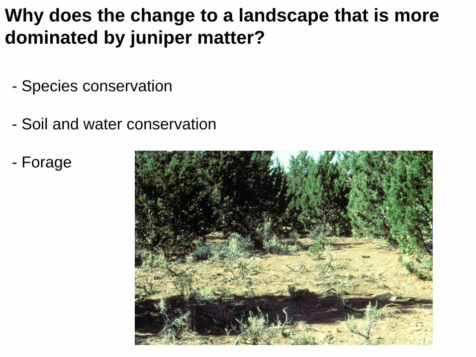
Why does the change to a landscape that is more
dominated by juniper matter?
- Species conservation
- Soil and water conservation
- Forage
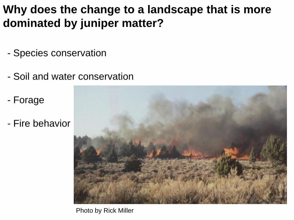
Why does the change to a landscape that is more
dominated by juniper matter?
- Species conservation
- Soil and water conservation
- Forage
- Fire behavior
Photo by Rick Miller
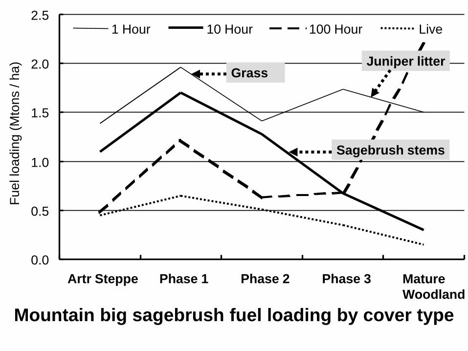
Mountain big sagebrush fuel loading by cover type
0.0
0.5
1.0
1.5
2.0
2.5
Artr Steppe Phase 1 Phase 2 Phase 3 Mature
Woodland
Fu
el lo
ad
ing
(M
ton
s / h
a)
1 Hour 10 Hour 100 Hour Live
GrassJuniper litter
Sagebrush stems
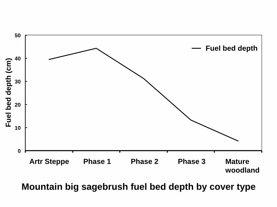
Mountain big sagebrush fuel bed depth by cover type
0
10
20
30
40
50
Artr Steppe Phase 1 Phase 2 Phase 3 Mature
woodland
Fu
el b
ed
de
pth
(c
m)
Fuel bed depth
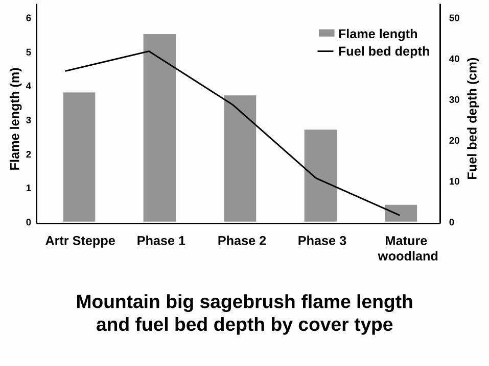
Mountain big sagebrush flame length
and fuel bed depth by cover type
0
1
2
3
4
5
6
Artr Steppe Phase 1 Phase 2 Phase 3 Mature
woodland
Fla
me len
gth
(m
)
0
10
20
30
40
50
Fu
el b
ed
de
pth
(c
m)
Flame length
Fuel bed depth
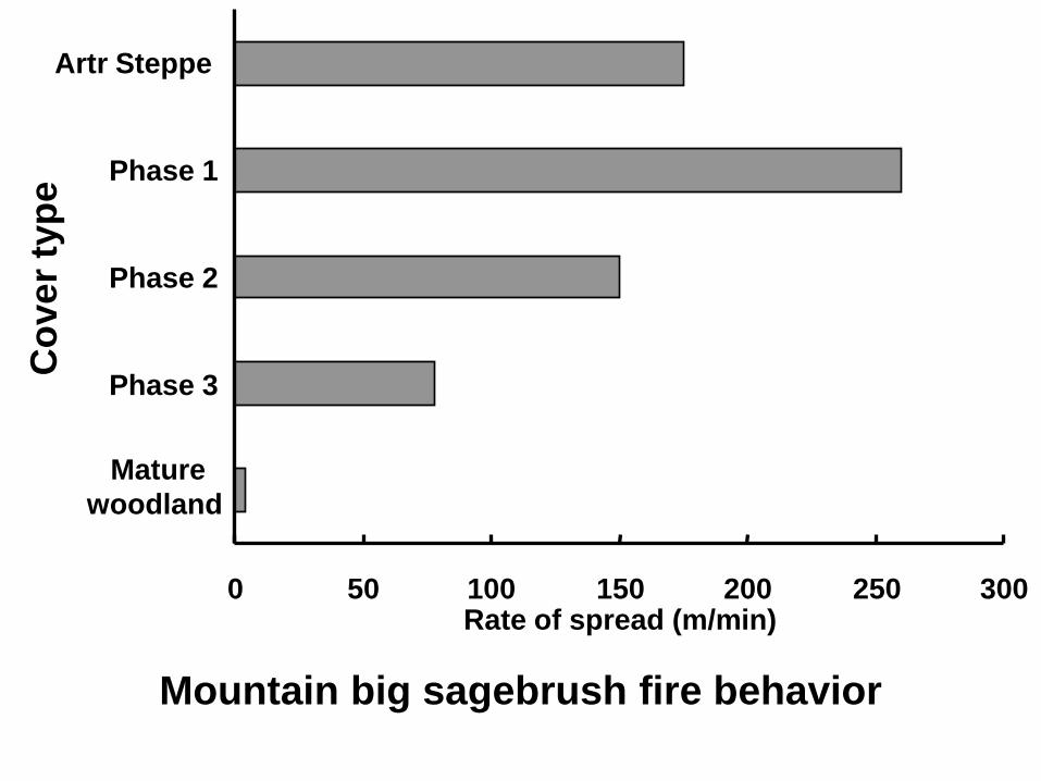
Mountain big sagebrush fire behavior
0 50 100 150 200 250 300
Mature
woodland
Phase 3
Phase 2
Phase 1
Artr SteppeC
ov
er
typ
e
Rate of spread (m/min)
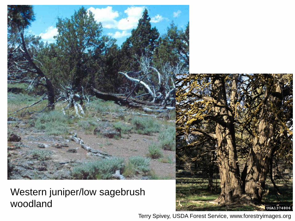
Western juniper/low sagebrush
woodlandTerry Spivey, USDA Forest Service, www.forestryimages.org
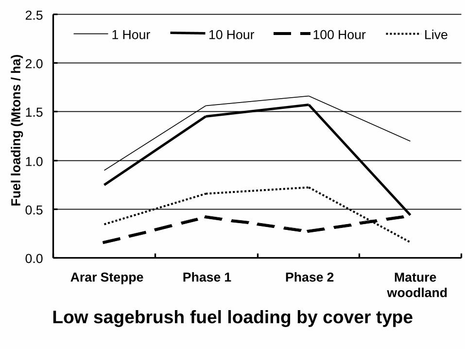
Low sagebrush fuel loading by cover type
0.0
0.5
1.0
1.5
2.0
2.5
Arar Steppe Phase 1 Phase 2 Mature
woodland
Fu
el lo
ad
ing
(M
ton
s / h
a)
1 Hour 10 Hour 100 Hour Live
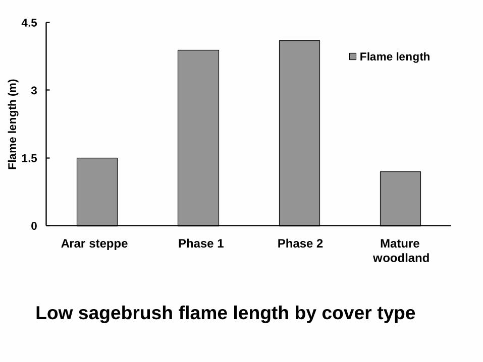
Low sagebrush flame length by cover type
0
1.5
3
4.5
Arar Steppe W1 Arar W2 Arar W5 Arar
Fla
me
le
ng
th (
m)
Flame length
Arar steppe Phase 1 Phase 2 Mature
woodland
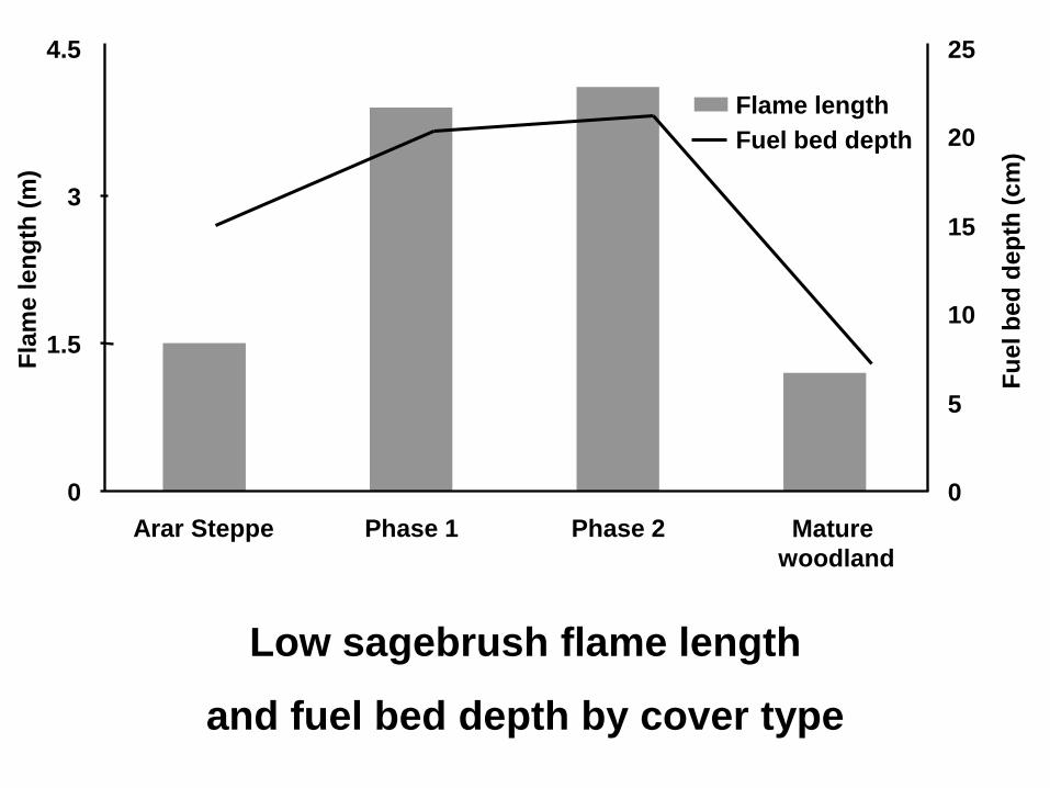
Low sagebrush flame length
and fuel bed depth by cover type
0
1.5
3
4.5
Arar Steppe Phase 1 Phase 2 Mature
woodland
Fla
me
le
ng
th (
m)
0
5
10
15
20
25
Fu
el b
ed
de
pth
(c
m)
Flame length
Fuel bed depth
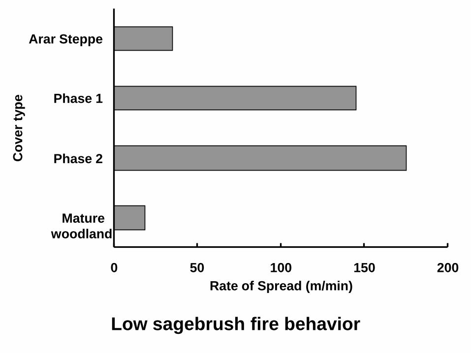
Low sagebrush fire behavior
0 50 100 150 200
Mature
woodland
Phase 2
Phase 1
Arar Steppe
Co
ve
r ty
pe
Rate of Spread (m/min)
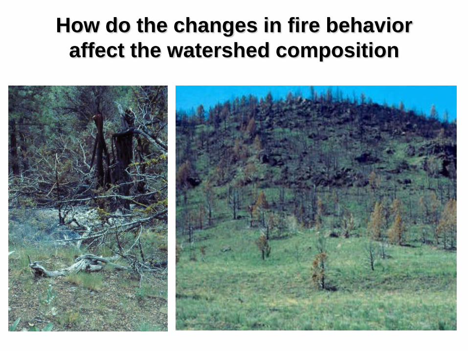
How do the changes in fire behavior
affect the watershed composition

Modeling Landscape
ChangeLooking into the future -
Ecological Modeling
Red Canyon Creek
Watershed
?
2025
Input data layers
created using GIS
Modeling in external
computer programs
VDDT and TELSA or
LANDSUM
Output linked to GIS
layer for final display
Landscape
analysis through
FRAGSTATS or
other stat package
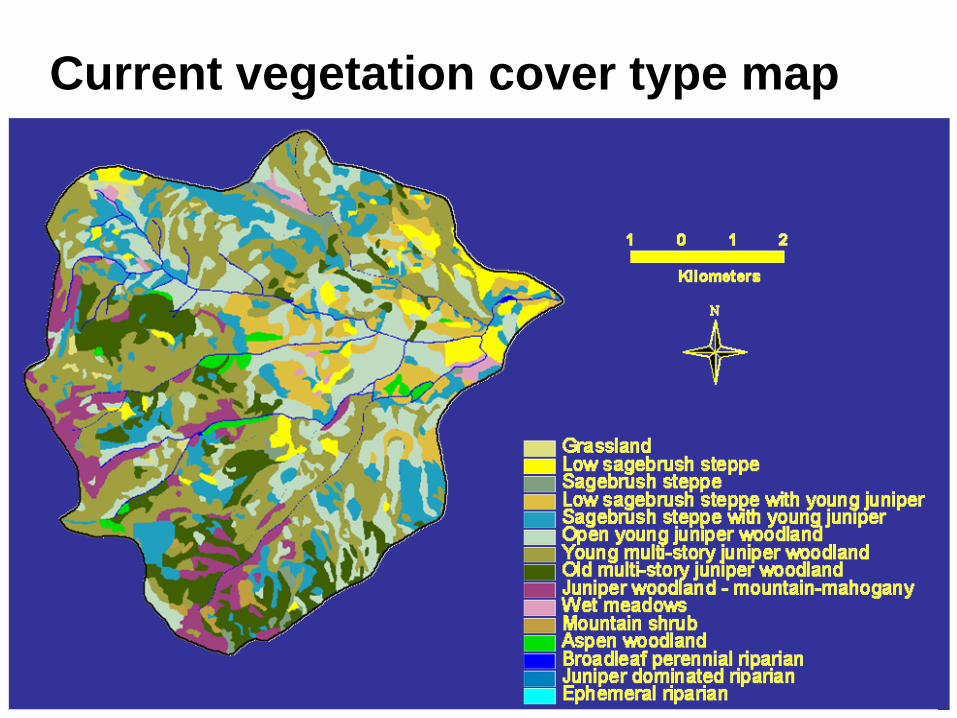
Current vegetation cover type map
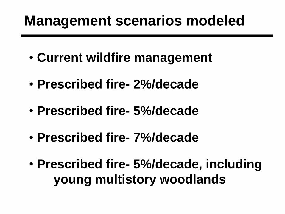
Management scenarios modeled
• Current wildfire management
• Prescribed fire- 2%/decade
• Prescribed fire- 5%/decade
• Prescribed fire- 7%/decade
• Prescribed fire- 5%/decade, including
young multistory woodlands
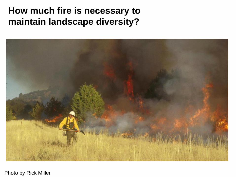
Photo by Rick Miller
How much fire is necessary to
maintain landscape diversity?
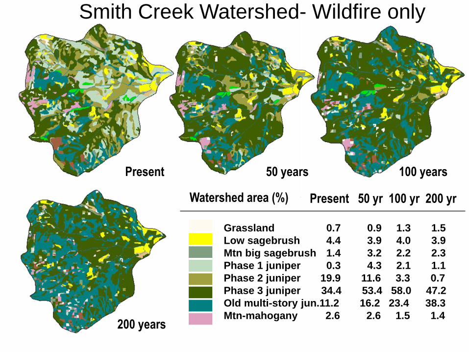
Watershed area (%) Present 50 yr 100 yr 200 yr
Present 50 years 100 years
200 years
Grassland 0.7 0.9 1.3 1.5
Low sagebrush 4.4 3.9 4.0 3.9
Mtn big sagebrush 1.4 3.2 2.2 2.3
Phase 1 juniper 0.3 4.3 2.1 1.1
Phase 2 juniper 19.9 11.6 3.3 0.7
Phase 3 juniper 34.4 53.4 58.0 47.2
Old multi-story jun.11.2 16.2 23.4 38.3
Mtn-mahogany 2.6 2.6 1.5 1.4
Smith Creek Watershed- Wildfire only
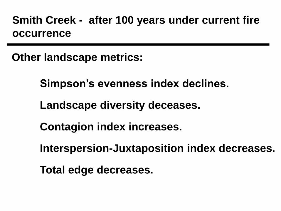
Smith Creek - after 100 years under current fire
occurrence
Other landscape metrics:
Simpson’s evenness index declines.
Landscape diversity deceases.
Contagion index increases.
Interspersion-Juxtaposition index decreases.
Total edge decreases.
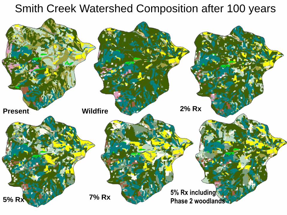
Smith Creek Watershed Composition after 100 years
Present Wildfire 2% Rx
5% Rx 7% Rx5% Rx including
Phase 2 woodlands
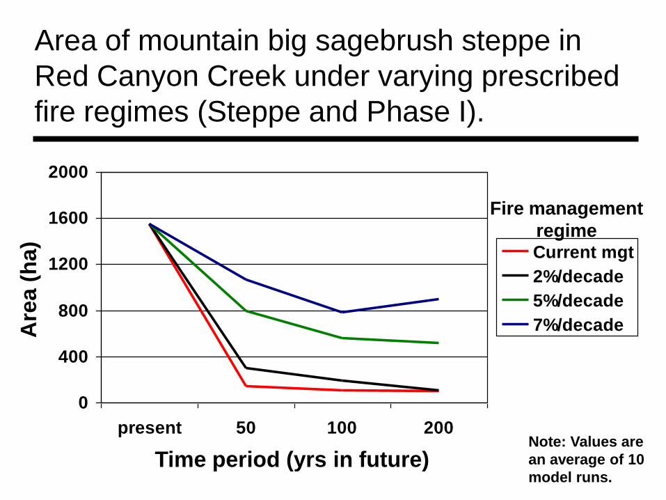
Area of mountain big sagebrush steppe in
Red Canyon Creek under varying prescribed
fire regimes (Steppe and Phase I).
0
400
800
1200
1600
2000
present 50 100 200
Current mgt
2%/decade
5%/decade
7%/decade
Time period (yrs in future)
Are
a (
ha)
Fire management
regime
Note: Values are
an average of 10
model runs.
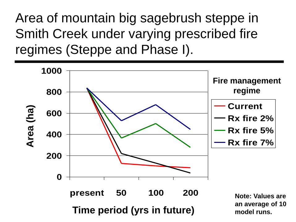
Area of mountain big sagebrush steppe in
Smith Creek under varying prescribed fire
regimes (Steppe and Phase I).
Time period (yrs in future)
Are
a (
ha
)
Fire management
regime
Note: Values are
an average of 10
model runs.
0
200
400
600
800
1000
present 50 100 200
Current
Rx fire 2%
Rx fire 5%
Rx fire 7%
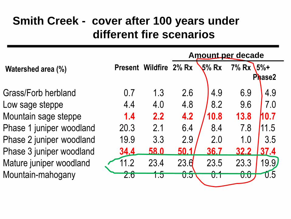
Grass/Forb herbland 0.7 1.3 2.6 4.9 6.9 4.9
Low sage steppe 4.4 4.0 4.8 8.2 9.6 7.0
Mountain sage steppe 1.4 2.2 4.2 10.8 13.8 10.7
Phase 1 juniper woodland 20.3 2.1 6.4 8.4 7.8 11.5
Phase 2 juniper woodland 19.9 3.3 2.9 2.0 1.0 3.5
Phase 3 juniper woodland 34.4 58.0 50.1 36.7 32.2 37.4
Mature juniper woodland 11.2 23.4 23.6 23.5 23.3 19.9
Mountain-mahogany 2.6 1.5 0.5 0.1 0.0 0.5
Present Wildfire 2% Rx 5% Rx 7% Rx 5%+
Phase2
Smith Creek - cover after 100 years under
different fire scenarios
Watershed area (%)
Amount per decade
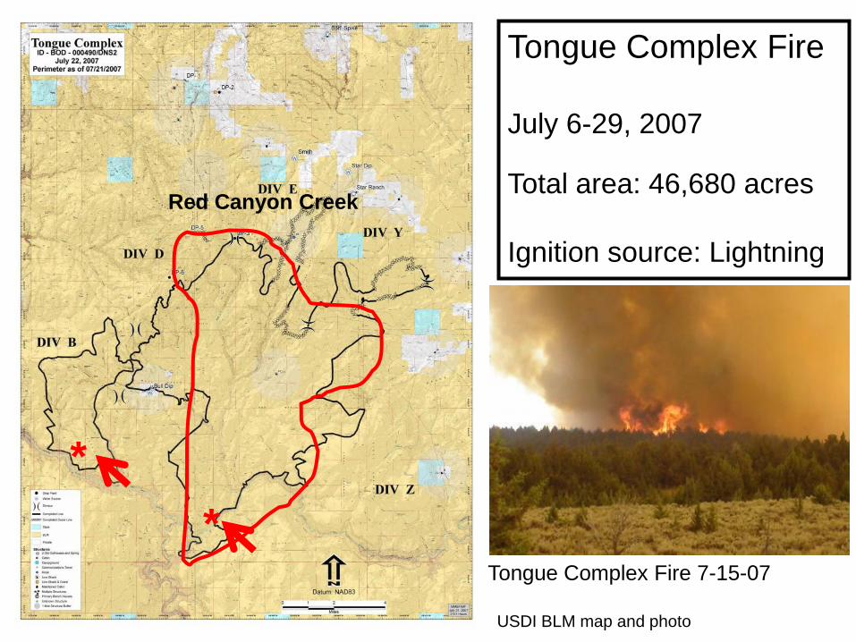
Tongue Complex Fire
July 6-29, 2007
Total area: 46,680 acres
Ignition source: Lightning
*
*
USDI BLM map and photo
Tongue Complex Fire 7-15-07
Red Canyon Creek
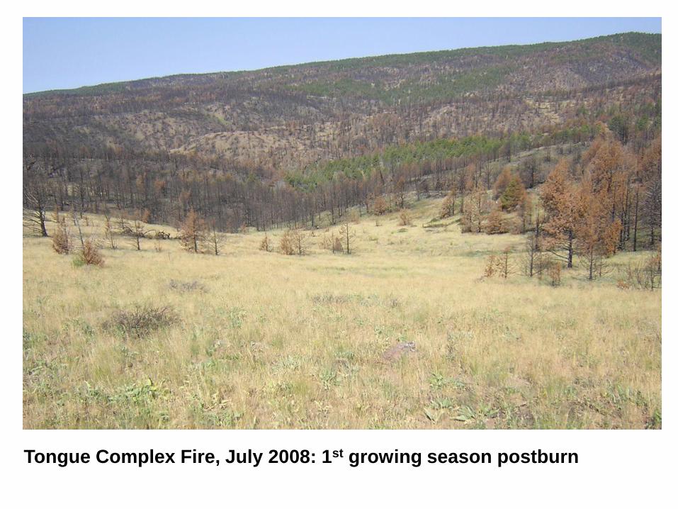
Tongue Complex Fire, July 2008: 1st growing season postburn
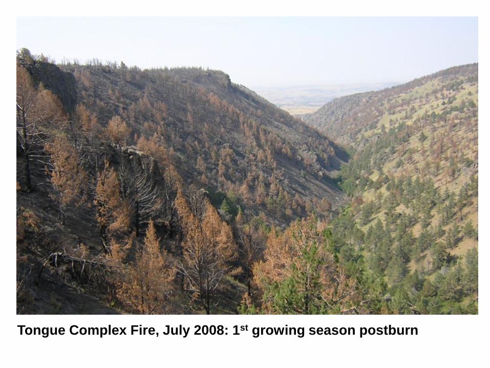
Tongue Complex Fire, July 2008: 1st growing season postburn
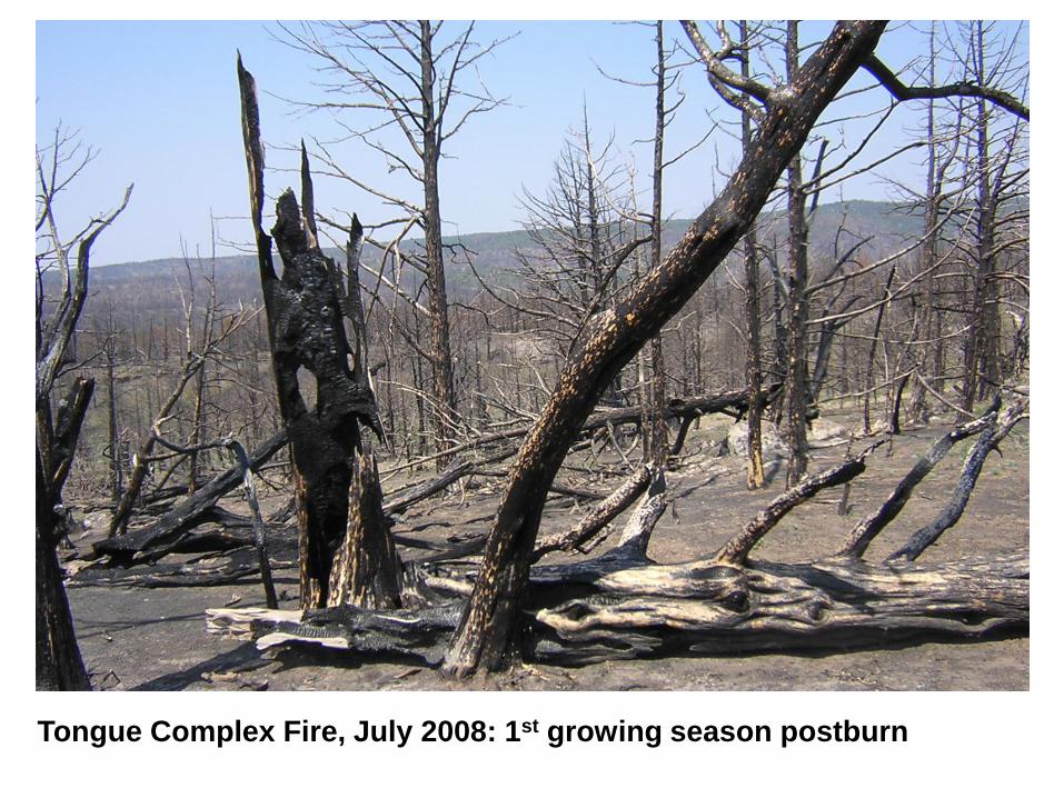
Tongue Complex Fire, July 2008: 1st growing season postburn
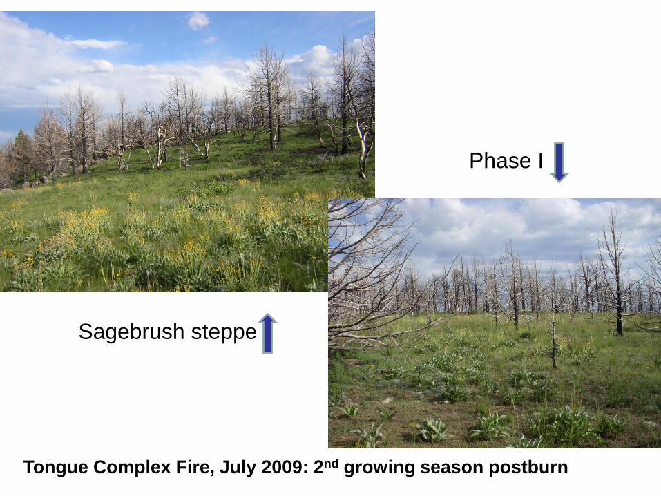
Sagebrush steppe
Phase I
Tongue Complex Fire, July 2009: 2nd growing season postburn
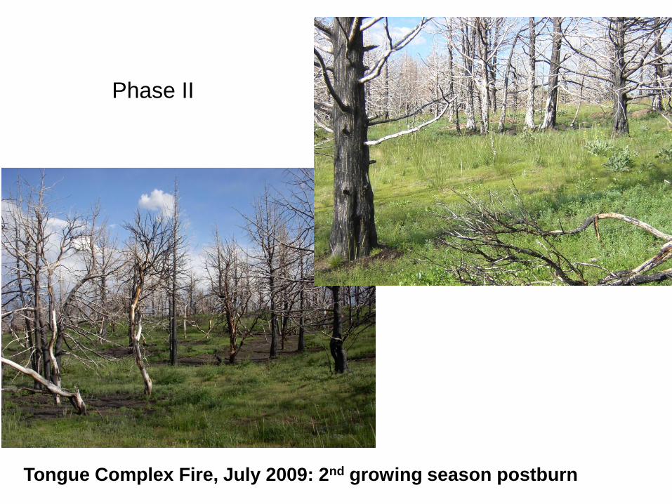
Phase II
Tongue Complex Fire, July 2009: 2nd growing season postburn
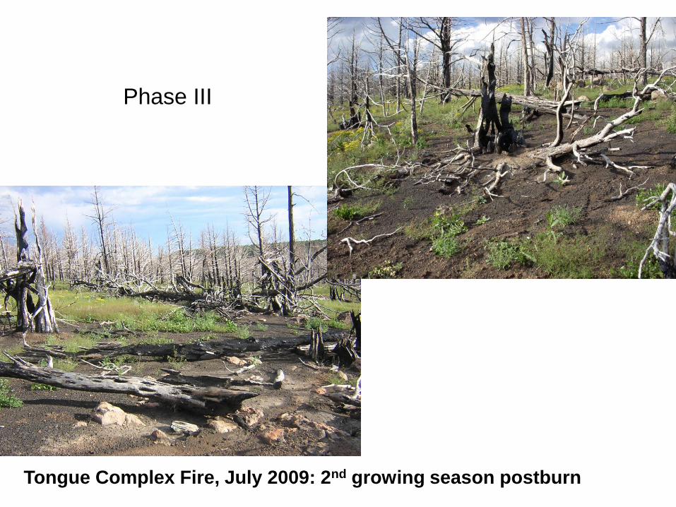
Phase III
Tongue Complex Fire, July 2009: 2nd growing season postburn