Embed Size (px)
Citation preview

Finding The Physical Dividing Line
Denise Aguilar, OKAGE Teacher Consultant, Lawton OK
Between Europe and Asia
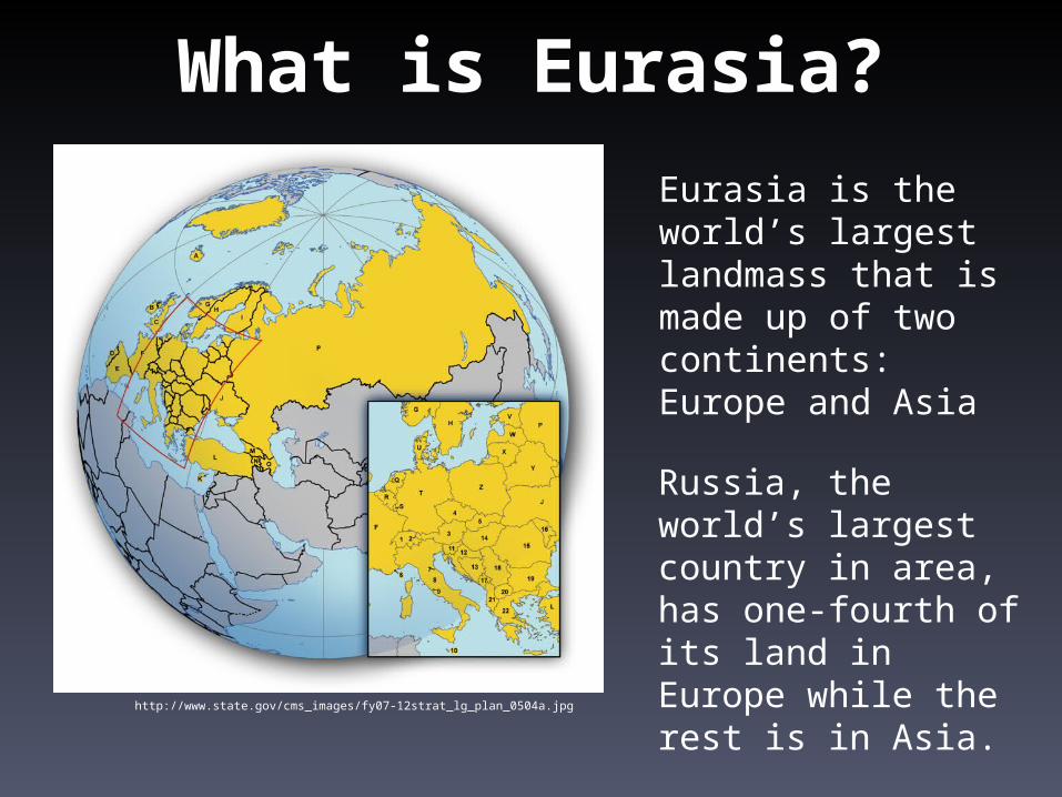
What is Eurasia?
Eurasia is the world’s largest landmass that is made up of two continents: Europe and Asia
Russia, the world’s largest country in area, has one-fourth of its land in Europe while the rest is in Asia.
http://www.state.gov/cms_images/fy07-12strat_lg_plan_0504a.jpg
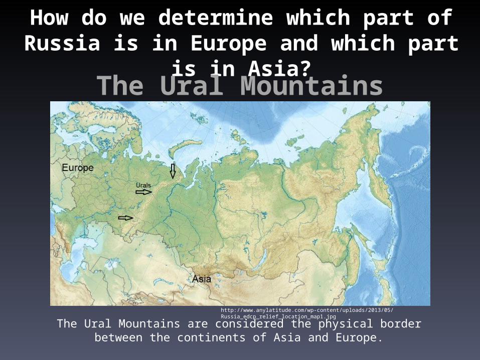
How do we determine which part of Russia is in Europe and which part is in Asia?
The Ural Mountains
The Ural Mountains are considered the physical border between the continents of Asia and Europe.
http://www.anylatitude.com/wp-content/uploads/2013/05/Russia_edcp_relief_location_map1.jpg
http://movelands.com/data_images/images/ural-mountains/ural-mountains-03.jpg
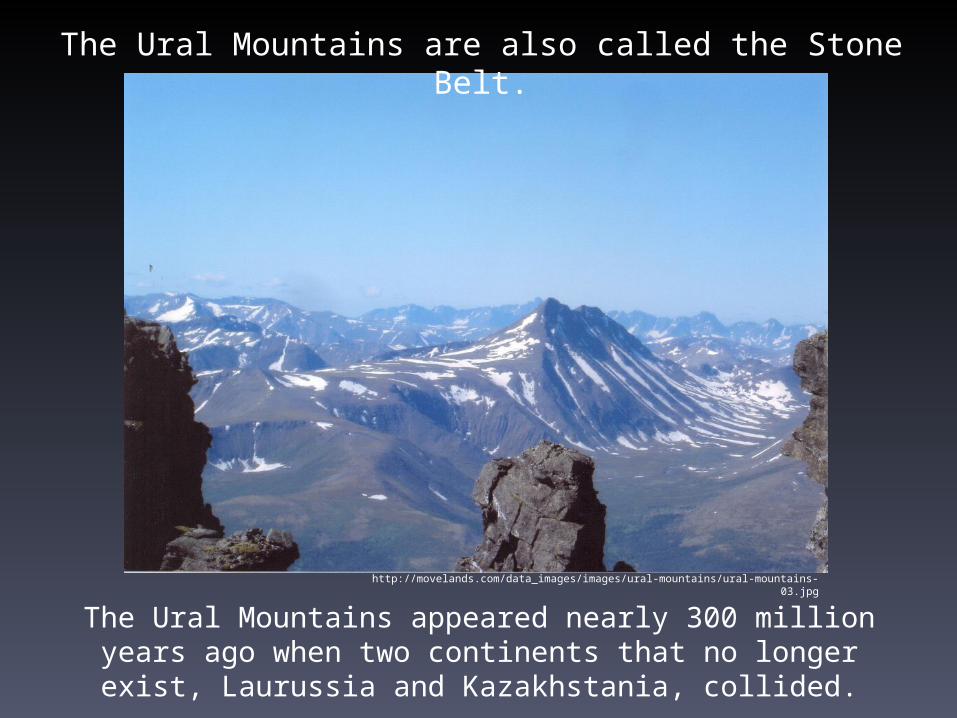
The Ural Mountains are also called the Stone Belt.
The Ural Mountains appeared nearly 300 million years ago when two continents that no longer exist, Laurussia and
Kazakhstania, collided.

West of the Urals lie the European
prairies of Russia, while on the East
Siberia spans thousands of
miles.
The Urals run north to south in Russia
from the Arctic Ocean to the
Caspian Lowland in Northern
Kazakhstan.
http://metaldetectingworld.com/05_photo_gallery/singles/russia_map_siberia.gif

http://www.worldatlas.com/webimage/countrys/europe/eurlarge.htm
The Ural Mountains - WEST
To the WEST of the Urals is the European part of Russia, also called the North European Plain.
Russia’s largest cities, Moscow and St. Petersburg, are located here.
More people live in this region than in any other part of Russia.

http://www.worldatlas.com/webimage/countrys/europe/eurlarge.htm
The Ural Mountains - EAST
To the EAST of the Urals is the Asian part of Russia. This area is known as Siberia.
Siberia makes up about 75% of Russian territory.
Only 20% of Russia’s population lives in this region due to its harsh climate.
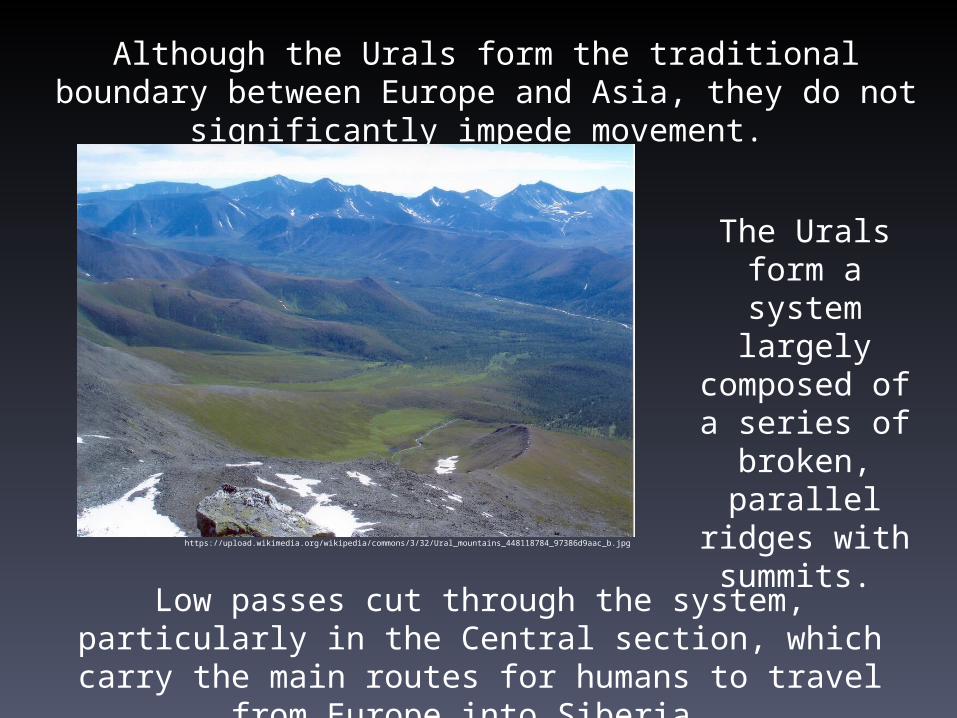
Although the Urals form the traditional boundary between Europe and Asia, they do not significantly impede movement.
The Urals form a system largely
composed of a series of
broken, parallel ridges with summits.
https://upload.wikimedia.org/wikipedia/commons/3/32/Ural_mountains_448118784_97386d9aac_b.jpg
Low passes cut through the system, particularly in the Central section, which carry the main routes for humans to travel from
Europe into Siberia.

The Urals impact the climate by acting as a natural barrier to winds from the Atlantic Ocean.
After blowing east from the ocean for thousands of miles across the European central plains, those winds are stopped by the Urals.
As a result, the region east of the Urals – Siberia – is colder and drier on average because of the rain shadow.http://media.web.britannica.com/eb-media/41/89941-004-0962A14F.gif
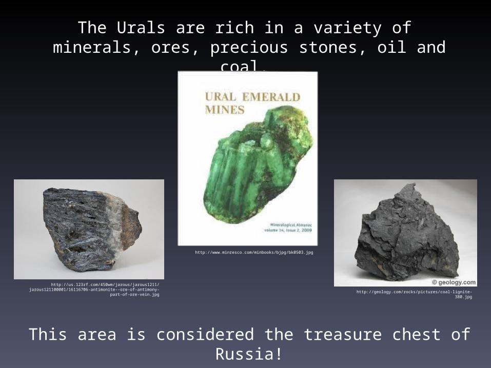
The Urals are rich in a variety of minerals, ores, precious stones, oil and coal.
This area is considered the treasure chest of Russia!
http://www.minresco.com/minbooks/bjpg/bk0503.jpg
http://geology.com/rocks/pictures/coal-lignite-380.jpg
http://us.123rf.com/450wm/jarous/jarous1211/jarous121100001/16116706-antimonite--ore-of-antimony-part-of-
ore-vein.jpg
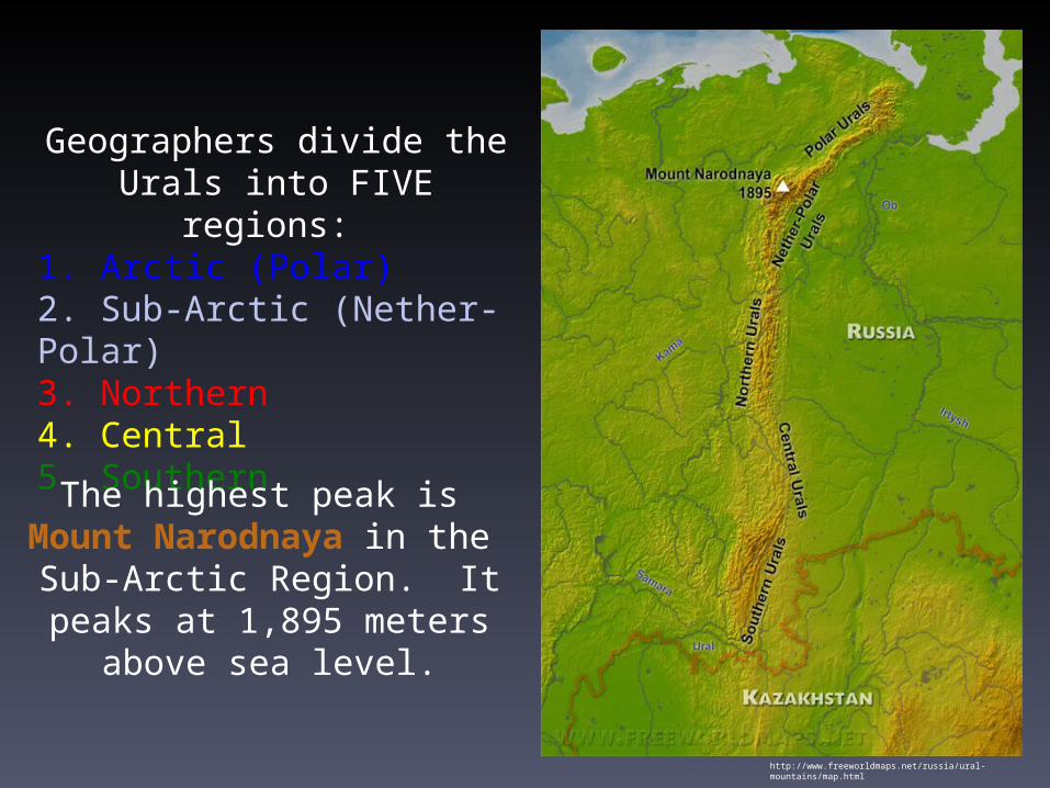
Geographers divide the Urals into FIVE regions:
1. Arctic (Polar)2. Sub-Arctic (Nether-Polar) 3. Northern 4. Central5. Southern
The highest peak is Mount Narodnaya in the
Sub-Arctic Region. It peaks at 1,895 meters above sea level.
http://www.freeworldmaps.net/russia/ural-mountains/map.html