Embed Size (px)
Citation preview

FINAL ENVIRONMENTAL ASSESSMENT
Morrow Point Trash Rack Cleaning Project
Prepared by
Bureau of Reclamation Western Colorado Area Office
Grand Junction, Colorado
for
Power Office Upper Colorado Regional Office
Salt Lake City, Utah
July 31, 2002
ii
iii
TABLE OF CONTENTS CHAPTER I - Introduction..............................................................................................................1 Proposed Action...................................................................................................................1
Need For and Purpose of Action..........................................................................................1 Background Information......................................................................................................2 Public Scoping .....................................................................................................................4
CHAPTER II - ALTERNATIVES ..................................................................................................5
Alternatives ..........................................................................................................................5 Reservoir Draw Down and Trash Rack Cleaning................................................................5 Aspinall Operations .............................................................................................................6 Other Alternative Considered but Eliminated from Detailed Analysis ...............................6
CHAPTER III - AFFECTED ENVIRONMENT/ENVIRONMENTAL CONSEQUENCES ........7 General.................................................................................................................................7 Aspinall Unit and Morrow Point Reservoir .........................................................................7 Recreation Resources...........................................................................................................8 Land Use and Vegetation...................................................................................................10 Geology and Landslides.....................................................................................................10 Fish and Wildlife Resources ..............................................................................................12 Threatened and Endangered Species .................................................................................15 Water Quality.....................................................................................................................15 Water Rights ......................................................................................................................16 Historical and Cultural Resource Properties......................................................................16 Indian Trust Assets ............................................................................................................17 Environmental Justice........................................................................................................17 Socioeconomic...................................................................................................................17 Cumulative Impacts ...........................................................................................................19 Summary and Environmental Commitments.....................................................................20
CHAPTER IV - CONSULTATION AND COORDINATION.....................................................22
General...............................................................................................................................22 Consultation with Other Agencies .....................................................................................23 Distribution List .................................................................................................................24
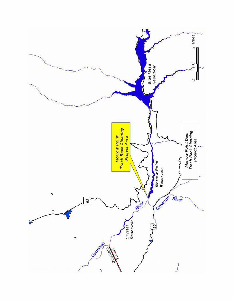
REFERENCES CITED..................................................................................................................25 FIGURES Frontispiece Map-Morrow Point Dam Trash Rack Cleaning Project Area
Figure 1-Morrow Point Power Intake Trash Racks .............................................................1 Figure 2-Reservoirs of the Aspinall Unit.............................................................................8
Figure 3-Morrow Point Landslide Areas ...........................................................................11

iv
TABLES – Table 1-Reservoir Elevation Frequency .....................................................................13 APPENDIX A - Distribution Mailing List APPENDIX B - Water Quality Data APPENDIX C - Modeled Reservoir Draw Down and Refill Tables APPENDIX D – Comment Letters
CHAPTER 1 – INTRODUCTION
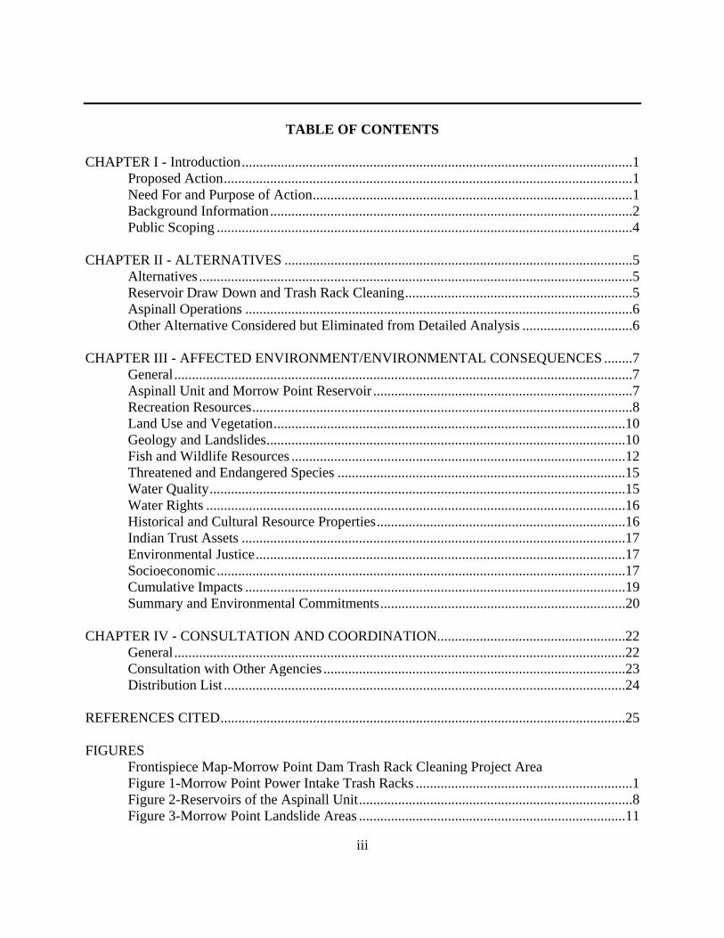
Proposed Action The Bureau of Reclamation (Reclamation) proposed to accomplish required facilities maintenance by lowering the water surface elevation of Morrow Point Reservoir, on the Gunnison River in western Colorado, and cleaning the power plant intake trash racks. The controlled draw down would begin in August with a target date of September 4, 2002 to reach a water surface elevation of 7,129ft. This would result in a Morrow Point Reservoir refill start date between September 9, 2002 and September 19, 2002. Need for and Purpose of Action
This Final Environmental Assessment (EA) evaluates effects on the human environment for the proposed lowering of the water surface elevation at Morrow Point Reservoir and cleaning of the power plant intake trash racks (Figure 1) located in Montrose County, Colorado. The Bureau of Reclamation (Reclamation) prepared this EA in cooperation with other federal and state agencies to comply with the National Environmental Policy Act (NEPA), Endangered Species Act, and related U.S. Department of Interior policies and regulations. If, based on this analysis, Reclamation concludes the proposed action would have no significant impact on the human
Figure 1 – Morrow Point Power Intake Trash Racks

2
environment; preparation of an Environmental Impact Statement would not be required before the action could be implemented. Morrow Point Dam was completed in 1968 as part of the Aspinall Unit of the Colorado River Storage Project (CRSP). Blue Mesa, Morrow Point and Crystal Reservoirs on the Gunnison River are operated as a system to comprise the Aspinall Unit. Other features of the CRSP include Flaming Gorge Dam on the Green River, Navajo Dam on the San Juan River, and Glen Canyon Dam on the Colorado River. The Aspinall Unit is located in Gunnison and Montrose Counties, Colorado, along a 40-mile reach of the Gunnison River as shown on the Frontispiece Map. The Aspinall Unit is operated by Reclamation, while the land and waters associated with the reservoirs are managed by the National Park Service as the Curecanti National Recreation Area. Reclamation operates these reservoirs and power plants to meet the following authorized purposes:
< Regulate the flow of the Colorado River < Store water for beneficial consumptive uses < Allow the Upper Basin states to use the apportionment made to and among them
throughout the Colorado River Basin Compact < Provide for the reclamation of arid and semiarid land < Provide for flood control < Provide for fish and wildlife enhancement and public recreation < Generate hydropower Need: Action is needed to lower the water surface elevation of Morrow Point Reservoir to an elevation of about 7,129 feet to remove trash and debris (i.e. trees, logs and branches) from the power plant intake trash racks. Purpose: The purpose of the proposed action is to conduct dam and power plant maintenance activities to ensure continued operation of the Aspinall Unit to meet the above authorized purposes. Background Information
Morrow Point Dam - Morrow Point Dam was completed in 1968 as part of the Aspinall Unit of the Colorado River Storage Project. The dam is a double-curvature, thin wall structure. The dam is 720 feet long at the crest with a maximum height of 468 feet above the lowest point of the foundation. Curecanti National Recreation Area – The Curecanti National Recreation Area includes the areas surrounding Blue Mesa, Morrow Point and Crystal Reservoirs, and provides recreation for over 1 million visitors annually. Administered by the National Park Service, activities include boating, fishing, sightseeing, and hiking. Black Canyon of the Gunnison National Park - The Black Canyon of the Gunnison National Park (formerly National Monument until 1999) was established by Presidential Proclamation No.

3
2033 (47 Stat 2558) to preserve the spectacular gorge and other objects of scenic, scientific, and educational interests. The Park includes 14 miles of the Gunnison River downstream from the Aspinall Unit. Gunnison Gorge National Conservation Area - The Bureau of Land Management manages the area below the Black Canyon of the Gunnison National Park including an additional 23 miles of the Gunnison River. Gold Medal Trout Fisheries - The Colorado Division of Wildlife (CDOW) has classified the Gunnison River from the upper end of the Black Canyon of the Gunnison National Park to the confluence of the North Fork River as a Gold Medal Trout Fishery. Crystal Trash Rack Cleaning Project - In 1999, Reclamation lowered the water surface at Crystal Reservoir and cleaned its trash racks. Morrow Point Dam continued to peak releases during the trash rack cleaning project, which resulted in exposed sediments being picked up by Morrow Point releases and deposited downstream of Crystal Dam in the Gunnison River. Flushing flows were needed to remove sediments in downstream rainbow and brown trout spawning areas. Public Scoping Reclamation identified issues and concerns with participation from individuals, agencies, and organizations that may be affected by the project. The Morrow Point Trash Rack Cleaning Project was first presented to the general public at the January 2001 Aspinall operations meeting. On January 25, 2001, a public scoping letter was mailed to interested parties and was published in the Grand Junction Daily Sentinel. Additional discussion was conducted at the January and April 2002 Aspinall operations meeting. Each issue and concern described below is discussed in Chapter 3. More information on public scoping activities is included in Chapter 4. Water Resources The proposed action has the potential to temporarily affect water quality downstream of Morrow Point Dam. Concerns focus around total suspended solids (TSS), total dissolved solids (TDS), turbidity, and dissolved oxygen (DO) levels below Crystal Reservoir. The Gunnison Tunnel, operated by the Uncompahgre Valley Water Users Association (UVWUA) below Crystal Reservoir, diverts water for irrigation and municipal use in the Montrose and Delta areas. The proposed action has the potential to temporarily affect water storage and supply if releases from Crystal Reservoir are affected.
4
Trout Fisheries The proposed action has the potential to temporarily affect the Gunnison River Gold Metal Trout Fishery from Crystal Dam downstream to the Gunnison’s confluence with the North Fork of the Gunnison. Concerns focus primarily around water quality issues as they affect trout spawning and recruitment. Fall brown trout and spring rainbow trout spawning success could be greatly reduced if suspended sediments travel downstream into trout spawning areas and smother nests (redds). Reducing flows after spawning also has the potential to affect spawning success. Fisheries resources in Morrow Point Reservoir could also be affected by the reduction in water surface elevations and changes in water quality (i.e., DO, temperature). Recreation Resources The Gunnison River is a valuable recreation resource. Rafting, float fishing, walk-wade fishing, hiking, and sightseeing are all common uses on portions of the Gunnison River in Curecanti National Recreation Area, the Black Canyon of the Gunnison National Park, and the Gunnison Gorge National Conservation Area. If the river below Crystal Reservoir becomes cloudy because of increased sediments, fishing, rafting, and the overall aesthetics of the Gunnison River are negatively affected. In addition, the National Park Service operates a tour boat on Morrow Point Reservoir and the proposed action has the potential to interfere with the tour boat operations. Land and Facility Resources Three landslide areas have been identified along the shoreline of Morrow Point Reservoir. Changes in reservoir water surface elevations could result in landslide movement followed by increased sediment being discharged into Morrow Point Reservoir and threats to public safety as a result of landslides. Socioeconomic Resources Reclamation generates electricity from the Aspinall Unit, which is marketed by the Western Area Power Administration. Reduced flows or reduced peaking during the reservoir draw down have the potential to affect power generation and consequently CRSP repayment schedules. Recreational guide services have also developed in conjunction with the recreational opportunities in the Gunnison River. Guided river rafting and fishing activities may also be affected by the proposed action if increased sediments create turbid waters.
5
CHAPTER 2 - PROPOSED ACTION AND ALTERNATIVES
Alternatives Alternatives evaluated in this environmental assessment include a No Action and Proposed Action Alternative. No Action Alternative: Morrow Point Reservoir water surface elevation would not be lowered and trash and debris would not be removed from the Morrow Point Power Plant inlet trash racks. Trash and debris would continue to be collected on the trash rack, thus creating additional flow restrictions and reduced power generation over time. Proposed Action: The proposed action would lower the water surface elevation of Morrow Point Reservoir approximately 31 feet to about 7,129 feet using controlled releases from Blue Mesa and Morrow Point Dams and Power Plants. (Note: original plan called for lowering the reservoir to 7,100 ft.).
Reservoir Draw Down and Trash Rack Cleaning Procedure
1. A slow draw down (1 to 3 ft./day) of Morrow Point Reservoir would begin in August 2002, beginning at an approximate elevation of 7,152 ft. (full reservoir is 7,160 ft.) See Appendix C for modeled reservoir draw down and refill scenarios. Daily reservoir fluctuation would not be greater that the 1 to 3 ft./day.
a. Surveyors would take a set of readings on the landslide points prior to the start of this draw down to determine if there is any movement occurring.
2. Draw down would continue until elevation 7,129 ft. is reached (on or about September 4, 2002).
a. At a minimum, landslides would be surveyed at least once during the reservoir draw down between elevations 7,141 and 7,129 ft., and again at 7,129 ft. Landslide movements would be evaluated by Reclamation to determine if changes in draw down rates are needed or if the draw down should continue.
3. At elevation 7,129 ft., the trash rack cleaning would begin. The elevation would be held
at or about 7,129 ft. while a dive team cleans the trash racks. A team of four divers would be working from a crane mounted on a barge. Trash would be removed and transported off-site for disposal. The trash rack cleaning would require between 4 days and two weeks to complete depending on the amount of trash and difficulty in removal.
4. Once the trash rack cleaning is completed, the reservoir would be refilled. The rate of
refill would be determined and adjusted as needed to protect downstream water quality. Turbidity monitoring points in Morrow Point Reservoir, Crystal Reservoir and the
6
Gunnison River would be established and the reservoir draw down might be temporarily stopped if turbidity readings exceed desired conditions.
Aspinall Operations
Releases from the Aspinall Unit and flows below the Gunnison Tunnel would be unaffected by the project. Releases from Blue Mesa Dam during the draw down would be reduced to facilitate the draw down and gradually increased during the refill. Blue Mesa and Morrow Point Dam releases would be adjusted by Reclamation as needed to control Morrow Point Reservoir’s elevation at or near 7,129 ft. and protect downstream water quality. During the draw down, Blue Mesa releases could be made as peaking releases or uniform releases. Reclamation proposes to use peak releases, with a commitment to make adjustments as needed to protect downstream water quality. Gunnison Tunnel diversions will also not be affected. Other Alternatives Eliminated for Detailed Analysis Other alternatives considered but eliminated from detailed analysis included:
1. Using divers to clean the trash rack without a reservoir draw down. This alternative was not considered feasible because of the reduced diver’s bottom time (time actually cleaning the trash racks). Under the proposed plan, divers would be working in 30 feet of water, compared to 60 feet of water without the reservoir draw down.
2. Draw down of Morrow Point Reservoir to elevation 7,100 ft. and using divers or crane to clean the trash rack. This alternative was originally proposed but has been eliminated because of landslide issues and the cost of monitoring landslide movement. Potential impacts to downstream resources would also increase with additional exposed sediments as a result of the additional reservoir draw down. 3. Timing of Reservoir Draw Down. Alternate times of year for implementing the trash rack cleaning project were considered but found not feasible. A reservoir drawn down in the spring was considered not feasible because it could trigger landslide movements with saturated soils. A winter reservoir draw down was also considered not feasible because of potential trash rack icing problems and inclement weather.

7
CHAPTER 3 – AFFECTED ENVIRONMENT AND ENVIRONMENTAL CONSEQUENCES
General This chapter discusses resources that may be affected by the proposed actions of drawing down Morrow Point Reservoir to a water surface elevation of around 7,129 ft. and cleaning the power plant trash racks. During the preparation of this Final EA, information on issues and concerns was received from affected water users, resource agencies, private interests, recreational interest groups and citizens and other parties (see Chapter 4, Consultation and Coordination, for further details). For each resource, the potentially affected area, and/or interests are identified, existing conditions are described, and impacts expected under the No Action and Proposed Action Alternative are discussed. This chapter concludes with a summary comparison of the alternatives and a list of mitigation measures. The project area is located in Montrose County, Colorado along the Gunnison River within Reclamation withdrawn lands of the Aspinall Unit (Federal lands withdrawn for project purposes). Montrose County has a population of about 31,500 (U.S. Census, 2001). Montrose is the largest city in the area with a population of about 12,000. The county is primarily rural in nature with an agricultural base. The Uncompahgre Project, constructed in the early 1900’s, provides irrigation water for about 86,000 acres by diverting water from the Gunnison River primarily through the Gunnison Tunnel, and the Uncompaghre River. Tourism and recreation are also a significant source of economic activity for the area with the Gunnison River, Black Canyon of the Gunnison National Park, Curecanti National Recreation Area, and the San Juan Range of the Rocky Mountains nearby. Aspinall Unit and Morrow Point Reservoir The Aspinall Unit of the Colorado River Storage Project consists of three reservoirs (Blue Mesa, Morrow Point, and Crystal) along a 40-mile stretch of the Gunnison River (see Figure 2). Morrow Point Dam was completed in 1968. In the fall of 2001, about 11,000 cubic yards of gravel and other material was removed from the river channel below Morrow Point Dam (USBR, 2001). Blue Mesa and Morrow Point Dams are operated to provide peaking power, while Crystal Dam is operated to re-regulate water releases in the Gunnison River. Under the proposed action, releases from Blue Mesa would be adjusted to create a controlled draw down of the Morrow Point Reservoir. When full (at elevation 7,160 ft.), Morrow Point Reservoir comprises 117,190

8
surface acres. Lowering the reservoir water surface elevation to 7,129 ft. would reduce the reservoir surface by about 20 percent.
Figure 2-Reservoirs of the Aspinall Unit
Recreation Resources The Gunnison River provides various recreational opportunities including fishing, rafting, hiking, and sightseeing. Recreation on the Gunnison River below Morrow Point Dam is managed by the National Park Service (NPS), the Bureau of Land Management (BLM), and the Colorado Division of Wildlife. The NPS manages recreation within the Curecanti National Recreation Area, which includes recreation sites at Blue Mesa, Morrow Point and Crystal Reservoirs. The Curecanti National Recreation Area was developed in conjunction with the construction of the Aspinall Unit. Because of limited public access created by high canyon walls, Morrow Point and Crystal Reservoirs receive very little recreational use. Access is primarily limited to the upper ends of
9
Morrow Point and Crystal Reservoirs, and the East Portal area of the Gunnison River below Crystal Reservoir. Recreational use at the upper end of Crystal Reservoir is primarily limited to the spring through fall. NPS also operates a tour boat at Morrow Point Reservoir by concession. The tour boat is launched and picks up passengers at the upper end of Morrow Point Reservoir and provides a 1-2 hour tour. The boat operates typically from Memorial Day to Labor Day and requires a reservoir water surface elevation of 7,152 ft. for the boat tour to put in and take out. Because of recent events including the September 11th terrorist attacks, the Morrow Point Boat Tour has been suspended in 2002. If the trash rack cleaning is completed in 2002, the boat tour will not be affected. However, if the cleaning is scheduled in another year and the boat tour is resumed, a water surface lower than 7,152 ft. before September 1st would shorten the boat tour season. The Black Canyon of the Gunnison National Park (Park) is located downstream of the East Portal of the Gunnison Tunnel and is managed by the National Park Service. The Park was established to preserve the spectacular gorge and other scenic, scientific, and educational interests. The Park includes 14 miles of the Gunnison River. An additional 23 miles of the Gunnison River downstream of the National Park are managed by the BLM. The river flows through the BLM’s 57,700-acre Gunnison Gorge National Conservation Area (NCA) and Wilderness. BLM manages the NCA and Wilderness to permanently protect and conserve its outstanding scenic, geologic, wildlife and wilderness resources and to provide a diverse range of recreational opportunities including wilderness whitewater boating and camping, float-fishing, walk-wade fishing, hiking, and sightseeing. The Colorado Division of Wildlife manages recreational fishing on the Gunnison River. Recreational fishing is discussed in greater detail in the Wildlife Section of this Chapter. The No Action Alternative would not affect current use of recreational resources. In future years without the trash rack cleaning, flows may become more reduced by additional trash build-up, thus potentially affecting downstream recreation. The Proposed Action could negatively affect recreational uses if the Gunnison River becomes cloudy (turbid). If the waters are turbid, fishing success may be reduced and the river may become difficult to navigate by boat, thus reducing the quality of the recreational experience. For example, during the Crystal trash rack cleaning and draw down, private and commercial recreation use was almost non-existent. In addition, access to Morrow Point Reservoir would likely be closed to the public from September 3rd to October 1st for public safety and resource protection. Water quality is discussed in greater detail in the Water Resources section of this chapter.

10
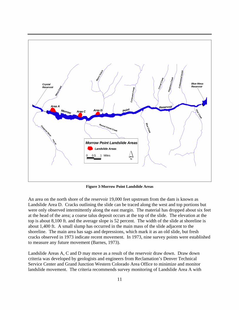
Land Use and Vegetation The project area is located on lands of the United States withdrawn by Reclamation for the construction and operation of the Aspinall Unit. The lands are co-managed by Reclamation and the NPS. Vegetation resources within the project area are limited because of the nature of the rock canyon walls. Chokecherry (Prunus virginiana), box-elder (Acer negundo), narrow-leaf cottonwood (Populus angustifolia), and poison ivy (Rhus radicans) are common in the canyon along the river banks (NPS 2001). The no action and proposed action are expected to have no effect on land use or vegetation resources. Geology and Landslides The Gunnison River, cutting through Precambrian metamorphic and igneous rock created the canyon. This resulted in steep sheer canyon walls. Upstream of Morrow Point Dam is a series of major landslide areas, which are a potential safety hazard (Figure 4). These landslides are all very old and existed many centuries prior to creation of the reservoir. The saturation of the toe of these slides has, however, generated renewed movement in three areas. The landslide of primary concern is the Area A, which is situated approximately 2,500 feet upstream of the dam on the north side of the reservoir. The slides have all involved bedrock material as well as overburden. The cause of the movements is unknown but is suspected, at least in some instances, to be related to the weaker mica schist rock and shattering of the rock by faulting (Barnes, 1973). Landslide Area A is outlined by a fresh crack almost entirely around the slide perimeter. Vertical displacement across the crack varies from about 5 to 15 feet. Numerous cracks are also found within the slide, mostly in the lower one-third near the toe. Movement has reportedly been observed in this area since the reservoir creation in 1968 but numerous “sags” and other features demonstrate that the slide is very ancient. The present disturbed area has a width of about 1,250 feet at the base and extends uphill to elevation 7,850 ft. From the top of the slide to the shoreline, the average slope is about 40 percent. In 1973, surveyors established 14 points in this area to monitor movement (Barnes, 1973). Landslide Area C is found 12,500 feet upstream from the dam on the north side of the reservoir. The disturbed area is clearly marked by a continuous crack around its border. Along its west margin, the slide material has dropped 15 to 20 feet away from a rock cliff. The outlining crack is open as wide as 24 inches in several places. The top elevation of the slide is about 7,840 feet and the average slope is 48 percent. At the shoreline, the slide width is about 1,100 feet. The rock involved seems to have been mica schist but some gneiss was also noted. The step-like profile and numerous sags define the area as an ancient landslide, but the fresh cracks observed 1973 indicated recent movement. In 1973, eleven survey points were established to monitor the slide area.
11
Area A
Area C Area DMorrow Point Reservoirvoir
Hwy 50
Crystal Reservoir
Blue Mesa Reservoir
Cimarron River
Mes
a Cre
ek
Round Corral Creek
Mye
rs G
ulch
Cur
ecan
ti Cr
eek
Blue Creek
Corr
al C
reek
Pine Creek
Hay
pres
s C
reek
Cot
tonw
ood
Gul
ch
Morrow Point Landslide AreasLandslide Areas
N0 0.5 1 Miles
Figure 3-Morrow Point Landslide Areas
An area on the north shore of the reservoir 19,000 feet upstream from the dam is known as Landslide Area D. Cracks outlining the slide can be traced along the west and top portions but were only observed intermittently along the east margin. The material has dropped about six feet at the head of the area; a coarse talus deposit occurs at the top of the slide. The elevation at the top is about 8,100 ft. and the average slope is 52 percent. The width of the slide at shoreline is about 1,400 ft. A small slump has occurred in the main mass of the slide adjacent to the shoreline. The main area has sags and depressions, which mark it as an old slide, but fresh cracks observed in 1973 indicate recent movement. In 1973, nine survey points were established to measure any future movement (Barnes, 1973). Landslide Areas A, C and D may move as a result of the reservoir draw down. Draw down criteria was developed by geologists and engineers from Reclamation’s Denver Technical Service Center and Grand Junction Western Colorado Area Office to minimize and monitor landslide movement. The criteria recommends survey monitoring of Landslide Area A with

12
visual observations of Landslide Areas C and D during the reservoir draw down operation. Survey monument movements greater than 2 inches would stop the reservoir draw down. Additional data would be collected and evaluated to determine if the draw down could continue. A review of reservoir operations from 1973 to present, shows that the end of day reservoir elevations has not been lower than 7,140 ft since 1996. Table 1 shows the daily frequency of reservoir elevation from 1973 to present between 7,102 ft. and 7,144 ft. Small landslide movements are anticipated during the reservoir draw down and would have minimal affect on downstream water quality if releases from Morrow Point Reservoir were adjusted to allow sediment settling in Morrow Point and Crystal Reservoirs. A sudden release of a large landside mass could increase sediments in Morrow Point Reservoir and possibly downstream of Crystal Reservoir resulting in impacts to recreation and trout spawning sites. Such an occurrence could also create a wave that could overtop Morrow Point Dam and pose a safety threat to persons on the reservoir and immediately below the dam. However, chances of large, rapid movements are considered to be very remote. Fish and Wildlife Resources The Gunnison River and its canyon walls support wildlife including beaver (Castor Canadensis), mule deer (Odocoileus hemionus), ringtail cat (Bassariscus astutus), great horned owl (Bubo virginianus), western fence lizard (Sceloporus occidentalis), yellow warbler (Dendroica petechia), rainbow trout (Oncorhynchus mykiss) and brown trout (Salmo trutta) (NPS 2001). The Colorado Division of Wildlife (CDOW) manages the fishery resource of the Gunnison River below Crystal Reservoir. This stretch of river has an excellent rainbow and brown trout fishery. These populations are self-sustaining; however, whirling disease has greatly reduced recruitment for rainbow trout. The CDOW conducts an annual fall (September) survey on the Gunnison River below the Black Canyon of the Gunnison National Park. CDOW stocks Morrow Point Reservoir with Kokanee (Oncorhynchus nerkus) and Colorado River cutthroat trout (Oncorhyncus clarki pleuriticus). Entrainment from Blue Mesa Reservoir also provides a significant number of fish in Morrow Point Reservoir (Hebein, 2001). Fish species lists for both Crystal and Morrow Point Reservoirs are identical even though the sources of species vary. These include Kokanee, Colorado River cutthroat trout, rainbow trout, brown trout, brook trout (Salvelinus fontinalis), possibly Snake River cutthroat trout (Oncorhyncus clarki sp.), Mackinaw or lake trout (Salvelinus namacush), longnose sucker (Catostomus catostumus), white sucker (Catostomus commersoni), bluehead sucker (Catostomus discobolus), longnose dace (Rhinichthys cataractae), and mottled sculpin (Cottus bairdi). Hybridized remnants of flannelmouth sucker (Catostomus latipinnis) may also be present (McAda 2000, Hebein 2001).

13
According to Nehring (1998), critical time periods for brown trout spawning, incubation and hatching are October 15th through May 15th. Rainbow and brown trout spawning habitat is located downstream of Crystal Reservoir.
Reservoir Elevation Frequency (in days) Year(s)
7,102 2 1973 7,104 1 1973 7,105 1 1973 7,108 1 1973 7,110 1 1973 7,113 1 1973 7,116 1 1973 7,117 1 1973 7,121 1 1973 7,123 1 1973 7,126 1 1973 7,131 1 1973 7,133 1 1973 7,136 1 1973 7,137 1 1973 7,138 1 1973 7,139 1 1973 7,141 3 1973, 1996 7,142 2 1996 7,143 4 1995, 1996 7,144 45 1973, 1975,
1995-2001 Table 1- Reservoir Elevation Frequency (7,102-7,144 ft.) Brown and rainbow trout may be affected by the proposed action if significant sediments are transported and deposited in key spawning areas downstream of Crystal Reservoir during critical time periods. This could result in eggs laid in redds (nests) being covered with fine silts and deprive the eggs of oxygen. Large amounts of transported sediments could greatly reduce rainbow and brown trout recruitment.
14
In addition, brown and rainbow trout are affected if flows in the Gunnison River are below 300 cfs. Crystal Reservoir will continue to operate as the regulating reservoir with releases being made based on projected hydrology. Therefore, flows in the Gunnison River below Crystal would be unaffected by the proposed action. During the Cimarron Dredging Project (USBR, 2001), it was observed that periods of zero releases from Morrow Point Dam assisted in settling suspended sediments out of the water column and protecting water quality below Crystal Reservoir. CDOW fishery surveys on the Gunnison River are done in September. These surveys are very important in the management of rainbow and brown trout populations. If turbidity increases, these surveys cannot be completed. Releases from Blue Mesa would be reduced to facilitate the draw down of Morrow Point Reservoir. Reservoir releases from Blue Mesa combined with other Morrow Point Reservoir tributary inflows would need to be less than releases from Morrow Point Dam to facilitate the draw down. Exposed sediments from the reservoir draw down would likely be picked up during releases from Blue Mesa Reservoir into Morrow Point Reservoir. The commitment to adjust releases from Blue Mesa as needed, would reduce this potential. The rate of refill for Morrow Point Reservoir would also be adjusted as needed to protect downstream water quality and trout spawning sites. Additional information is presented in the water quality section of this chapter. Landslide movements are also a potential source for suspended sediments that could degrade water quality. Major landslide movements would significantly affect water quality and likely deposit sediment in critical trout spawning habitats. A slow, controlled draw down of Morrow Point Reservoir and monitoring of Landslides A, C and D is predicted to minimize landslide movements. Suspended sediments from minor landslide movements (less than 2 inches) are predicted to settle into Crystal Reservoir, and have little or no affect on trout spawning. Additional information on landslides was presented in the geology and landslide section of this chapter. If existing water quality is maintained and landslide movement is minimized, fisheries resources are predicted to be unaffected by the proposed action. Flushing flow releases are should not be necessary mitigation measures for the Trash Rack Cleaning Project, and would only be considered if other mitigation measures were unsuccessful in preventing increased sediment deposits in the Gunnison River below Crystal Reservoir. Additional consultation with the Service and CDOW would be needed to implement this type of mitigation measure. Other local wildlife may avoid the project area during activities, however effects are projected to be short-term and the project would not alter existing wildlife habitat.

15
Threatened and Endangered Species Informal consultation with the U.S. Fish and Wildlife Service (Service, 2001) identified no threatened or endangered species that could be directly affected by the proposed action. Reclamation has a contract with the Service to deliver water over the Redlands Division Dam to benefit endangered fish. Contract No. 95-07-40R1760 (300 cfs) has a shortage clause during dry years and Reclamation is currently working on a proposed operations scheme that is less than 300 cfs during the July-October months. Additionally, if flushing flows were needed to remove large volumes of deposited sediments from the Gunnison River, flushing flows could affect the U.S. Fish and Wildlife Service’s razorback sucker stocking program. The proposed action would not affect Reclamation’s contract to deliver contract flows over the Redlands Diversion Dam and large volumes of deposited sediments in the Gunnison River are not predicted. Additional consultation with the U.S. Fish and Wildlife Service and CDOW would be needed to implement flushing flows as a mitigation measure. Water Quality Water quality is good in the Gunnison River above its confluence with the North Fork of the Gunnison River. The Aspinall Unit acts as a sink for suspended solids and provides constant cold-water releases. The clarity (total suspended solids and total dissolved solids) and temperature of the Gunnison River creates an excellent trout fishery and provides recreational opportunities for fishing, rafting, and other forms of recreation. The Gunnison River and the three reservoirs are classified by the Colorado Water Quality Control Commission as Aquatic Life Cold 1, Recreation 1, Water Supply and Agriculture, and designated as Anti-degradation Reviewable waters (previously a High Water Quality 2 designation). The Aquatic Life Cold 1 classification denotes waters, which support a wide variety of cold water biota. Recreation 1 waters are suitable for primary human contact including swimming, kayaking, rafting, and water-skiing. The Water Supply and Agriculture classifications denote that the waters are suitable for such purposes. The anti-degradation reviewable designation recognizes water, which are not outstanding state or national resources but exhibit high water quality. These waters yield to the anti-degradation review process, a process that allows degradation of water quality if economic or social benefits override water quality benefits (Long et al, 1995). Significant changes in water quality could negatively affect downstream trout fisheries and recreation. A cloudy (turbid) Gunnison River would reduce angling success, make river running more difficult (cannot see rocks and other obstructions), and generally detract from the scenic views in the Black Canyon of the Gunnison National Park and the Gunnison Gorge.

16
Associated with the proposed action, Reclamation began monitoring water quality parameters on a monthly basis in April 2001. Seven sample sites were established within the Aspinall Unit (See Figure 5). Water quality parameters measured will continue and include:
- ambient air temperature - water temperature - total dissolved solids - total suspended solids - dissolved oxygen
Water quality data collected from April 2001 to present is included in the appendices. During the trash rack cleaning project, turbidity measurements in Morrow Point Reservoir, Crystal Reservoir, and in the Gunnison River below Crystal Dam will be taken on a daily basis. Water quality would be monitored during the controlled draw down, trash rack cleaning, and refill of Morrow Point Reservoir. Adjustments in releases from Blue Mesa and Morrow Point Dams would be made as needed to protect downstream water quality. Trash rack cleaning and reservoir draw down would be temporarily stopped if turbidity readings below Crystal exceed desired conditions. Once the reservoirs begin to clear, the trash rack cleaning or reservoir draw down would continue. Water Rights Water rights in the Upper Gunnison Basin include both direct and indirect flow and storage rights. One of the project authorizations for the Aspinall Unit was to store Upper Basin States water. The Aspinall Unit would continue under normal operations, providing water to meet downstream obligations (water rights, delivery contracts, etc.) The proposed action is projected to have no effect on water rights or Aspinall water deliveries. Historical and Cultural Resource Properties The proposed project is located near the Curecanti Archeological District (District). The District consists of a complex of over 200 recorded archeological sites and encompasses 6,750 acres. The District was listed on the National Register of Historic Places on August 15, 1984. Prehistoric sites dating back to 8,000 B.C. represent a significant change in the understanding of how these early people used Colorado’s high mountain valleys. A large collection of artifacts from the area is in storage at the Midwest Archeological Center in Lincoln, Nebraska. In addition, 39 sites generally associated with the Ute Tribe and classified as temporary camps have been identified in the Black Canyon of the Gunnison National Park (NPS 1997). Historic resources within the Curecanti National Recreation Area illustrate three great human achievements—building narrow gauge railroads, dam building/engineering, and homesteading/saw milling (NPS 1997). The proposed project is in the Cimarron area and is a focal point for illustrating the role of the narrow gauge railroad in the development of western
17
Colorado. A display at Cimarron depicts the rise and fall of the narrow gauge railroad as a mountain transportation system. The lowering of Morrow Point Reservoir to a water surface elevation of 7,129 ft. may expose portions of the old Cimarron Narrow Gauge railroad bed that have been underwater since the filling of Morrow Point Reservoir. Morrow Point Reservoir may be closed to the public between September 4th and October 1st for public safety; therefore, the railroad bed would be protected when exposed. No other known historic or archeological sites occur within the reservoir high water line. Indian Trust Assets Indian trust assets are legal interests in property held by the United State for Indian Tribes or individuals. Reclamation and other Federal agencies share the responsibility to protect these assets. There have been no trust assets identified in the project area, and therefore no impact on these assets is predicted. Environmental Justice Executive Order 12898 on Environmental Justice provides that Federal agencies analyze programs to assure that they do not disproportionately adversely affect minority or low income populations or Indian Tribes. There are no potentially affected minority or low income populations in the project area and no adverse effects related to environmental justice are predicted. Socioeconomic Socioeconomic resources related to the proposed action can be broken into two general categories: 1) Hydropower Production from the Aspinall Unit and 2) Commerical Guiding Services for fishing and float guides. Hydropower Production The Aspinall Unit is operated to meet base demand and daily peak power demands and reserve criteria, and the Western Area Power Administration (WAPA) markets the power. Peaking power means that higher releases are made at those times during the day when energy demands are highest. Part of Blue Mesa and Morrow Point Dam releases are made to meet peak power demands. This results, at times, in more frequent flow changes Blue Mesa and Morrow Point, and between Morrow Point Reservoir and Crystal Reservoir. Crystal Reservoir is operated differently than the other two reservoirs. Crystal Reservoir provides storage space for smoothing peaking power releases from Morrow Point Reservoir to meet the relatively uniform river flows required to provide the existing Uncompaghre Project
18
diversions through the downstream Gunnison Tunnel in the summer months. Within a 24 hour period, releases for power production from Blue Mesa Dam can fluctuate between 0 and 3,400 cfs, Morrow Point Dam between 0 and 5,000 cfs, while Crystal’s releases typically fluctuate in the 50 cfs range. When the Aspinall Unit is at maximum power production, daily fluctuations in releases from Crystal Dam may increase to the 200 cfs range. The Morrow Point Power Plant is able to generate electricity with a water surface elevation range of 7,160 ft. to 7,100 ft. As Morrow Point Reservoir’s water surface elevation drops, generation efficiency would be lost and fewer megawatts of power would be generated per acre-feet released. To replace generation lost at both Blue Mesa and Morrow Point power plants, during the periods of Morrow Point Reservoir draw down, WAPA would purchase surplus power from other power generators. Replacement power, especially during times of peak power demand, represent an additional cost to WAPA and it’s customers. Some of the cost could be recovered when Morrow Point Reservoir is refilled, as power generation at Blue Mesa would be increased. The extent that costs could be recovered depends on the month, the days of the week, and the times of day that increases in generation at Blue Mesa occur. Off-peak/non-high-load periods of generation and by-passed water would also be considered a loss of power generation. WAPA conducted an economic analysis based on the draw down rate scenarios in Appendix C (0.5, 1.0 and 1.5 ft./day) and estimates the generation difference as a result of the draw down would be between 5,962 MWh to 7,714 MWh. Costs associated with each elevation change range from $122,200 to $156,300. If a power emergency occurred during the Trash Rack Cleaning Project, other facilities of the CRSP (i.e. Flaming Gorge, Glen Canyon) would provide first response to the emergency. If needed, Morrow Point releases would be made to address the power emergency as long as releases kept the reservoir within the draw down criteria (1 to 3 feet/day). To facilitate the draw down of Morrow Point Reservoir and protect water quality downstream of Crystal Reservoir during the trash rack cleaning project, releases made from Blue Mesa and Morrow Point Reservoirs will be adjusted. Losses in power generation and the cost of purchasing supplemental power during the trash rack cleaning are considered necessary general operation and maintenance costs of the Aspinall Unit. Test flow releases from Glen Canyon Reservoir as part of the Glen Canyon Adaptive Management Program during September 2002 to March 2003 would affect the Glen Canyon Unit’s ability to compensate for significant power reduction from the Aspinall Unit. If peaking releases from the Aspinall Unit resulted in water quality concerns below Crystal Reservoir, it may be necessary to postpone the trash rack cleaning project until the Glen Canyon test is completed. Additional consultation with the Western Area Power Administration would be needed.

19
Commercial Guiding Services Commercial guiding services have developed on the Gunnison River as a result of the high quality of fishing, rafting, and sightseeing available to the general public. The majority of commercial float and walk-wade fishing use occurs within the BLM’s Gunnison Gorge NCA and Wilderness. These activities are popular throughout the summer (May – early October) with the highest annual use of the river by both commercial and private float and walk-wade fishers occurring during June (stonefly hatch period). Float fishing by commercial guides is also extremely popular in July, August and September. Any action that would reduce fishing success, river navigability, or the aesthetic nature of the river will have a negative effect on commercial guiding services. The majority (79.4%) of visitation at the Curecanti National Recreation Area, the Black Canyon of the Gunnison National Park and the Gunnison Gorge NCA and Wilderness occur between May and September. Effects to commercial guiding services are projected to be greatest during this time period as well. The greatest potential for increased turbidity during the trash rack cleaning could occur during the reservoir refill. This is because sediments deposited in the reservoir, normally covered and protected by the reservoir, would be exposed. Water moving over the top of these exposed sediments during the reservoir refill would pick up and move the sediments. This type of sediment movement was observed during the 2001 Crystal Trash Rack Cleaning. The controlled draw down would begin in August with a target date of September 4th to reach a water surface elevation of 7,129 ft. This would result in a Morrow Point Reservoir refill start date between September 9th and September 19th. Releases during the reservoir refill would be adjusted as needed to protect downstream water quality. Water quality monitoring during the trash rack cleaning project would be implemented as described in the water quality section of this chapter. Cumulative Impacts Cumulative impacts are impacts on the environment, which result from the incremental impact of the action, when added to other past, present, and reasonably foreseeable future actions. Cumulative impacts can result from individually minor but collectively significant actions taking place over a period of time. Past and present activities that have affected river-related resources in the area include irrigation, urban development and recreational activities associated with construction and operation of the Aspinall Unit and the Uncompahgre Project, and activities associated with the Recovery Implementation Program for Endangered Fish Species in the Upper Colorado River Basin. Implementation of all or any of these projects has affected and continues to affect the human environment including but not limited to water quality, water rights, socioeconomic and wildlife

20
resources. Incremental cumulative impacts associated with the implementation of the Morrow Point Trash Rack Cleaning Project are anticipated to be short-term and too small to measure. Summary and Environmental Commitments In summary, the primary effect of the proposed action would be to remove trash and debris from the Morrow Point Power Plant intake trash racks. The project is designed and would be implemented to avoid or reduce impacts or harm to recreation, fish and wildlife resources, and water quality. There would be no effect on water rights, water uses, or water supplies. The following environmental and social/economic commitments are included in the project plan. ♦The reservoir draw down would begin in August 2002 with a target date of September 4, 2002 to reach a reservoir water surface elevation of 7,129 ft.
♦The reservoir draw down would occur at a rate not to exceed 1 to 3 ft./day. Landslide movements during the trash rack cleaning project would be monitored using survey equipment and visual observations. At a minimum, landslides would be surveyed at least once during the reservoir draw down between elevations 7,141 and 7,129 ft., and again at 7,129 ft. Landslide movements would be evaluated by Reclamation to determine if changes in draw down rates are needed or if the draw down should continue.
♦Water quality monitoring at Morrow Point and Crystal Reservoirs, and downstream of Crystal Dam would be conducted during the trash rack cleaning project (including reservoir draw down and refill). Reclamation would coordinate water quality monitoring activities with the Colorado Division of Wildlife and Trout Unlimited. Rates of draw down and refill would be in response to the results of water quality measurements and landslide monitoring. ♦Releases from Blue Mesa Dam during the reservoir draw down and refill would be adjusted by Reclamation to control Morrow Point Reservoir’s elevation and to reduce the amount of exposed sediment picked up and transported downstream. Adjustments in releases from Blue Mesa and Morrow Point Dams would also be made as needed to protect water quality downstream of Crystal Reservoir. ♦Morrow Point Reservoir may be closed to the public from September 4th to October 1st as a safety precaution and to protect resources. ♦Trash and debris removed from the Morrow Point Power Plant inlet trash racks would be disposed of off-site at a location approved by the National Park Service or at an existing permitted landfill, depending on the material removed. ♦Replacement power would be purchased as needed to offset power generation losses during the trash rack cleaning project.

21
♦If a power emergency occurred during the Trash Rack Cleaning Project, other facilities of the CRSP (i.e. Flaming Gorge, Glen Canyon) would provide first response to the emergency. If needed, Morrow Point releases would be made to address the power emergency as long as releases kept the reservoir within the draw down criteria (1 to 3 feet/day). ♦Flows in the Gunnison River below Crystal Reservoir will remain within the general operations of the Aspinall Unit and would not be modified by the proposed trash rack cleaning project action. Releases from Crystal would be based using existing operational criteria for the Aspinall Unit.

22
CHAPTER IV – CONSULTATION AND COORDINATION
General The Morrow Point Trash Rack Cleaning Project was first presented to the general public at the January 2001 Aspinall Operations meeting. The Aspinall Operations meetings are hosted three times a year by Reclamation and attended by local, state, and federal agencies, water users, environmental organizations, recreationist, and other interested parties. On January 25, 2001, a public scoping letter was mailed to interested parties and was published in the Grand Junction Daily Sentinel. Comments were requested by March 2, 2001. A draft environmental assessment was distributed for public comment on June 7, 2002. Comments were requested by July 15, 2002. Reclamation received 7 comments on the draft environmental assessment. Below is a summary of comments received and responses. Copies of the comments are attached in the Appendices. Colorado River Energy Distributors Association: 1). ....suggests that the EA should contain economic analysis of the lost generation/replacement power impacts to CRSP customers. The EA should attempt to quantify those impacts on draw-down rates and timing, as well as wholesale market outlook. This approach would be consistent with the analysis contained in the Cimarron Dredging EA. 2). ...disagrees that the cost could be recovered when Morrow Point is refilled. Responses: Additional economic analysis was added. The sentence “….all or most of the cost…” was changed to “some”. Grand Valley Anglers: 1) We urge you to closely monitor the river below Crystal Reservoir to insure that your planned project doesn't release any additional sediments into the river. Your planning last year in the removal of the gravel bar below Morrow Point didn't result in sediment entering the river. We urge you to carefully monitor the river again this year to prevent impact. Response: Monitoring similar to what was used during the dredging project would be implemented as part of the Trash Rack Cleaning Project. U.S. Fish and Wildlife Service: 1) The Service does not object to the time frames and draw down rate in the proposed alternative and concurs that the project would not impact the endangered fishes. Colorado Rover Water Conservation District: 1)...we believe that a statement on Water Rights, similar to that which appears....EA on the Cimarron Dredging Project, is appropriate, and
23
should be added to ensure that the proposes action explicitly has no impact on water rights or upon Aspinall Unit water delivers. Response: This statement will be added to the final EA. Western Area Power Administration (WAPA): 1)...the EA should better identify the criteria that will be used to determine at what point sediment levels or changes in water quality are excessive. Western would like to work with Reclamation to determine at what point sediment suspension becomes a significant problem. 2) During the scheduled trask rack cleaning project…, Reclamation will be (with approval from the Secretary) conducting test releases at Glen Canyon Dam. During the this test, if sediment becomes a concern in the Gunnison River and Reclamation halts releases at Blue Mesa and/or Morrow Point, or reduces releases significantly, this will cause and immediate and significant impact to the operation of the CRSP power system. Response: Reclamation welcomes WAPA's participation in investigating impacts as a result of increased sediments. Reclamation will be documenting water quality changes during the project and will be consulting with CDOW and TU. WAPA is invited to participate in these consultations. A conference call on July 30, 2002 between the WAPA and Reclamation discussed WAPA’s concerns with project impacts on the operation of the CRSP power system during the Glen Canyon test flows. WAPA would be consulted before release adjustments are made. Also discussed was the issue that if peaking releases result in significant sediment loads in the Gunnison River below Crystal, it may be necessary to temporary stop the reservoir draw down, or postpone the draw down until after the Glen Canyon test flows to avoid a significant impact to the CRSP power system. Bureau of Land Management: ...change Gunnison Gorge Special Recreation Area to Gunnison Gorge National Conservation Area, and ...26 miles to 23 miles. Response: Corrections made in Final EA. Colorado Division of Wildlife (via telephone conversation with Sherman Hebein on 7/22/02): …concerned that Reclamation keep a close watch on the water quality, Colorado has a lot of drought related fish problems this year, and water quality problems in the Gunnison would be very unwelcome. Consultation with other Agencies Reclamation staff continues to informally coordinate and consult with the U.S. Fish and Wildlife Service, Colorado Division of Wildlife, National Park Service, Bureau of Land Management and Western Area Power Administration. A complete list of Agencies is included in the Distribution

24
List. Distribution List Appendix A contains the mailing list for this Final EA. The list includes all individuals, agencies, and organizations to which Reclamation sent the scoping document in January 2001. In addition, others who have specifically requested a copy of the final EA are included on the list.

25
References: Barnes, Joe G. 1973. Memorandum dated July 11, 1973 in reference to Field Reconnaissance of Landslides around Morrow Point Reservoir to Project Manager, Grand Junction, CO. Hebein, S. 2001. Personal communication with Sherman Hebein (Email), Colorado Division of Wildlife on June 11, 2001. Long, B.A. L.S. Cudlip, and R.A. Smith 1995. Water Quality Data Analysis and Interpretation, Curecanti National Recreation Area. National Park Service, Water Resources Division, Technical Report NPS/NRWRD/NRTR-95/98. McAda, C.W. 2000. Flow Recommendations to Benefit Endangered Fishes in the Colorado and Gunnison Rivers, Recovery Program Project Number 54, Draft Final Report, U.S. Fish and Wildlife Service, Grand Junction, Colorado. National Park Service 1997. General Management Plan, Black Canyon of the Gunnison National Monument and Curecanti National Recreation Area. NPS D-63 & NPS D-63a. National Park Service 2001. Website URL. Http://www.nps.blca/webvc/lifezone.htm. Nehring, R.B. 1988. Stream fisheries investigations. Colorado Division of Wildlife Job Final Report. Federal Aid Project F-51-R. 49pp. U.S. Bureau of Reclamation 1981. Project Data. United States Department of the Interior, Water and Power Resources Service, Denver, Colorado. 1463. pp. U.S. Bureau of Reclamation 2001. Final Environmental Assessment, Morrow Point Cimarron Dredging Project, Western Colorado Area Office, U.S. Bureau of Reclamation, Grand Junction, Colorado. 33 pp. U.S. Bureau of Reclamation 2002. Personal communication with Paul Davidson, Bureau of Reclamation, Salt Lake Regional Office on February 26, 2001. U.S. Census 2001. Website URL. Http://www.census.gov/population/estimates/county/crh.htm. U.S. Fish and Wildlife Service 2001. Memorandum from Assistant Field Supervisor, Grand Junction Ecological Services Field Office, U.S. Fish and Wildlife Service, to Technical Services Manager, Western Colorado Area Office, U.S. Bureau of Reclamation dated May 4, 2001.


1
ATTACHMENT A Cimarron Dredging Project Distribution Mailing List
Mr. Larry Abbott Mr. Jeffery Ackerman Colorado Department of Transportation Western Area Power Administration Grand Junction, CO Montrose, CO Mr. Ray Alvarado Mr. Brian Avery Colorado Water Conservation Board National Weather Service Denver, CO Grand Junction, CO Mr. Rooster Barnhart Mr. Allan Belt Delta, CO Bureau of Land Management Montrose, CO Mr. Bob Boulger Mr. Daniel Brauch U.S. Geological Survey Colorado Division of Wildlife Grand Junction, CO Gunnison, CO Mr. Dave Buchanan Mr. Gary Burton Daily Sentinel Western Area Power Administration Grand Junction, CO Lakewood, CO Mr. Marc Catlin Mr. Myron Chase Uncompahgre Valley Water Users Association U.S. National Park Service Montrose, CO Montrose, CO Mr. Ralph Clark III Ms. Shane Collins Gunnison, CO Western Area Power Administration
Salt Lake City, UT Ms. Kathy Crane Ms. Kathleen Curry Western Area Power Administration Upper Gunnison River Water Conservancy Montrose, CO District, Gunnison, CO Mr. Pat Daniel Mr. Bill Day Gunnison Country Times Hotchkiss, CO Gunnison, CO Ms. Wilma Ervin Peter Fahmy City of Delta Regional Solicitor=s Office Delta, CO U.S. Department of the Interior
Lakewood, CO
2
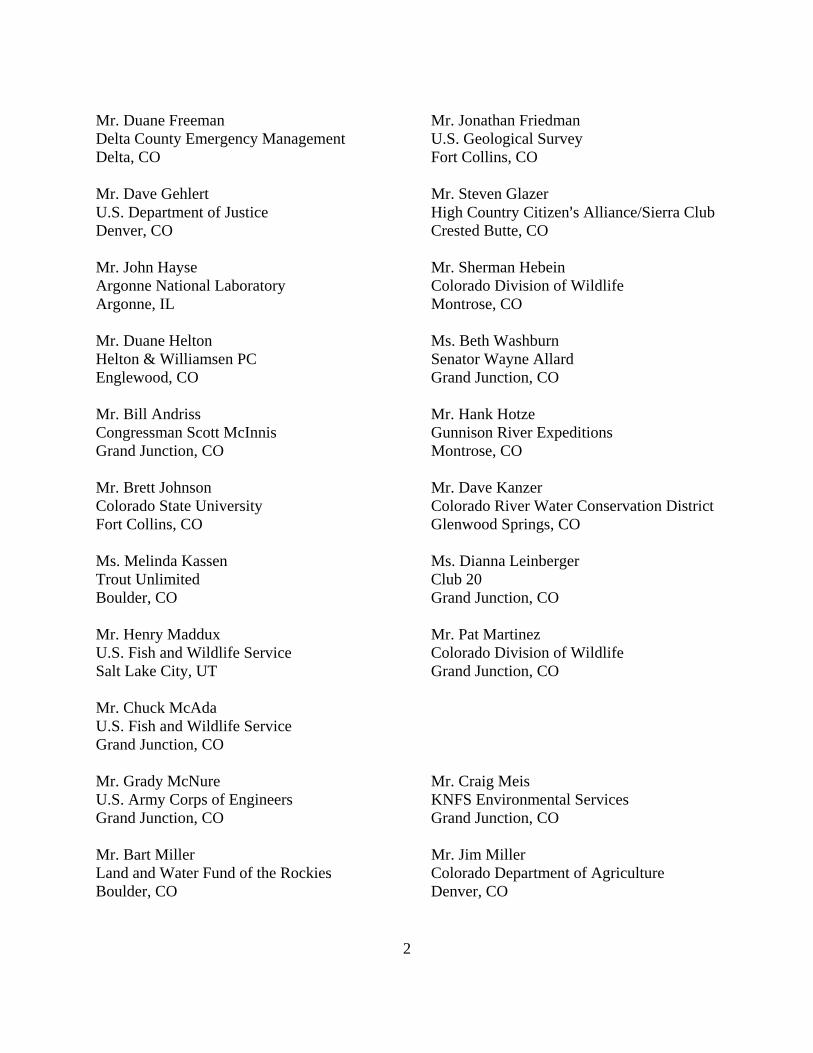
Mr. Duane Freeman Mr. Jonathan Friedman Delta County Emergency Management U.S. Geological Survey Delta, CO Fort Collins, CO Mr. Dave Gehlert Mr. Steven Glazer U.S. Department of Justice High Country Citizen=s Alliance/Sierra Club Denver, CO Crested Butte, CO Mr. John Hayse Mr. Sherman Hebein Argonne National Laboratory Colorado Division of Wildlife Argonne, IL Montrose, CO Mr. Duane Helton Ms. Beth Washburn Helton & Williamsen PC Senator Wayne Allard Englewood, CO Grand Junction, CO Mr. Bill Andriss Mr. Hank Hotze Congressman Scott McInnis Gunnison River Expeditions Grand Junction, CO Montrose, CO Mr. Brett Johnson Mr. Dave Kanzer Colorado State University Colorado River Water Conservation District Fort Collins, CO Glenwood Springs, CO Ms. Melinda Kassen Ms. Dianna Leinberger Trout Unlimited Club 20 Boulder, CO Grand Junction, CO Mr. Henry Maddux Mr. Pat Martinez U.S. Fish and Wildlife Service Colorado Division of Wildlife Salt Lake City, UT Grand Junction, CO Mr. Chuck McAda U.S. Fish and Wildlife Service Grand Junction, CO Mr. Grady McNure Mr. Craig Meis U.S. Army Corps of Engineers KNFS Environmental Services Grand Junction, CO Grand Junction, CO Mr. Bart Miller Mr. Jim Miller Land and Water Fund of the Rockies Colorado Department of Agriculture Boulder, CO Denver, CO
3
Mr. Gordon Mueller Mr. Dennis Murphy Bureau of Reclamation Bureau of Land Management Denver, CO Montrose, CO Mr. Rober Muth Mr. Mike Myers U.S. Fish and Wildlife Service U.S. National Weather Service Denver, CO Grand Junction, CO Mr. Pat Oglesby Mr. Matt Owens Trout Unlimited Matt Owen=s Fly Company Grand Junction, CO Cedaredge, CO Mr. Chuck Pettee Mr. Frank Pfeifer National Park Service U.S. Fish and Wildlife Service Fort Collins, CO Vernal, UT Mr. Al Pfister Ms. Andrea Ray U.S. Fish and Wildlife Service U.S. National Oceanic & Atmospheric Grand Junction, CO Administration, Boulder, CO Mr. Ramon Reed Ms. George Rossman Gunnison Basin Power Senator Ben Nighthorse Campbell Gunnison, CO Grand Junction, CO Mr. Richard Sales Mr. Wayne Schieldt City of Delta Colorado Division of Water Resources Delta, CO Montrose, CO Mr. Mark Schumacher Mr. Randy Seaholm Upper Gunnison River Water Conservancy Colorado Water Conservation Board District, Gunnison, CO Denver, CO Mr. John Shields Mr. George Smith Wyoming State Engineers Office U.S. Fish and Wildlife Service Cheyenne, WY Denver, CO Mr. Roy Smith Mr. Ken Stahlnecker Bureau of Land Management U.S. National Park Service Lakewood, CO Gunnison, CO Dr. Jack Stanford Mr. Dennis Steckel Flathead Biological Station Upper Gunnison River Water Conservancy Polson, MT District, Gunnison, CO

4
Mr. Sheridan Steele Mr. Richard Stodt U.S. National Park Service Bureau of Reclamation Gunnison, CO Denver, CO Mr. Gregg Strong Mr. Everett Sunderland Redlands Water and Power Company Upper Colorado River Commission Grand Junction, CO Salt Lake City, UT Mr. Matt Sura Mr. Ray Tenney Western Colorado Congress Colorado River Water Conservation District Grand Junction, CO Glenwood Springs, CO Mr. Greg Trainor Mr. John Trammel City of Grand Junction Trout Unlimited Grand Junction, CO Grand Junction, CO Mr. Jim Ventrello Mr. Paul Von Guerard Delta County Commissioners U.S. Geological Survey Delta, CO Grand Junction, CO Mr. Klaus Weickmann Mr. Mark Wondzell U.S. National Oceanic & Atmospheric Admin. U.S. National Park Service Boulder, CO Fort Collins, CO Ms. Marlene Zanetell Editor Gunnison, CO Delta County Independent
Delta, CO Members Ballantyne Loper and Wetlaufer Mr. William E. Davies Western Colorado Congress EcoPlan Associates, Inc. Montrose, CO Mesa, AZ Ms. Leslie James Mr. Terry Ireland Colorado River Energy Distributors Association U.S. Fish and Wildlife Service Tempe, AZ Grand Junction, CO Ms. Marian Atkins Mr. Mike Berry Bureau of Land Management Tri-County Water Conservancy District Grand Junction, CO Montrose, CO Mr. Tom Craddock Mr. Michael Dale Telluride Outside National Park Service Telluride, CO Gunnison, CO
5
Mr. Bill Day Mr. Robert Dougherty Hotchkiss, CO Clifton Tribune Clifton, CO Mr. Richard Dudginski Mr. Scott Ensley Austin, CO Relief Ditch Company Delta, CO Mr. Todd Herrick Mr. Mike Humbert Black Canyon Anglers Western Slope Libertarian Party Austin, CO Montrose, CO Mr. Joe Keys Mr. Marty Shelp Clifton, CO Glad Park, CO Mr. Randy Sunderland Ms. Elizabeth Washburn Delta County Independent Office of Senator Wayne Allard Delta, CO Grand Junction, CO


1
ATTACHMENT B Water Quality Data


1
Sample
Water Quality Data From the Morrow Point Footbridge
Date pH Conduct TDS TSS Ca Mg Hardness DO 4/10/01 7.04 207 137 2.2 27 5 88 10.5
5/20/01 7.62 175 115 6.2 27 3 79 10.5
6/21/01 7.67 148 98 2 18 3 57 9.8
7/17/01 7.47 151 101 0.2 13 4 47 7.4
8/14/01 7.81 163 108 3.4 20 4 66 7.4
9/19/01 7.38 169 112 3 20 4 66 7.3
10/2/01 7.28 177 117 0.6 27 4 84 8.3
10/3/01 7.53 175 116 2.6 26 4 81 17.2
10/5/01 7.61 179 118 5.2 23 4 73 6.9
10/6/01 7.48 178 117 9 21 4 68 7.6
10/8/01 7.66 181 119 7.4 21 4 68 11.8
10/10/01 7.54 184 121 10.6 20 4 66 7.6
10/12/01 7.39 184 121 7.6 14 4 51 9.5
10/19/01 7.72 180 119 5.2 18 4 61 8.4
10/15/01 7.67 181 119 6.4 18 4 61 9
10/21/01 7.73 179 118 3 18 4 61 10.5
11/15/01 8.02 184 121 2.4 24 3 72 8.0
12/18/01 7.87 214 141 1 25 5 82 9.5
1/15/02 7.72 183 121 2.6 21 4 68 12.2
2/14/02 7.73 194 128 1.2 21 5 72 11.8
3/16/02 7.77 194 128 4.4 31 4 93 11.4
4/17/02 7.36 192 127 4.8 24 5 81 8.4

2
Sample
Water Quality Data From The Cimarron River
Date pH Conduct TDS TSS Ca Mg Hardness DO
4/10/01 7.56 624 418 16.6 44 23 203 9.8
5/20/01 7.69 230 152 63.3 24 5 81 8.6
6/21/01 8.38 360 241 16 29 12 121 8.4
7/17/01 8.07 512 358 4.8 33 7 111 12.2
8/14/01 8.06 636 444 234 43 29 226 9.2
9/19/01 8.42 606 400 17.7 43 27 218 7.6
10/2/01 8.01 626 413 6.8 59 28 262 7.7
10/3/01 8.48 616 407 13 61 28 267 19.6
10/5/01 7.92 186 123 2.8 23 4 73 7.4
10/6/01 8.2 554 365 12 50 22 215 9.8
10/8/01 8.39 564 372 11.4 45 26 219 10.6
10/10/01 8.39 631 416 16 41 23 198 10.8
10/12/01 7.55 190 125 5.4 20 5 71 9.8
10/19/01 7.73 195 129 3.8 18 4 61 11
10/15/01 7.78 194 128 5.4 18 4 61 8.1
10/21/01 7.78 193 127 2.8 19 4 63 9.8
11/15/01 8.38 512 338 6.4 39 20 179 8.5
12/18/01 7.95 440 290 7 32 17 150 10.2
1/15/02 7.68 391 258 12.6 28 13 123 10.4
2/14/02 7.58 301 199 17.9 18 8 78 11.4
3/16/02 7.82 656 433 18.2 46 33 250 10.6
4/17/02 7.4 347 229 198 23 12 106 9.2

3
Sample
Water Quality Data From Crystal Tail Bay
Date pH Conduct TDS TSS Ca Mg Hardness DO
4/10/01 7.18 228 150 5.2 28 6 94 7.4
5/20/01 7.46 190 125 6.3 30 4 91 11.5
6/21/01 7.47 182 120 6.6 21 4 71 9.6
7/17/01 7.34 197 132 1.2 18 4 61 9.2
8/14/01 7.66 191 126 10.6 25 5 83 7.7
9/19/01 7.58 183 121 3 21 4 70 7.6
10/2/01 7.67 184 121 1.6 25 5 82 7.7
10/3/01 7.78 186 123 3.6 26 4 81 17.8
10/5/01 7.79 188 124 2.6 21 4 68 8.2
10/6/01 7.67 193 127 6.8 21 4 68 8.1
10/8/01 7.69 191 126 4.8 24 5 81 7.9
10/10/01 7.69 188 124 6.2 20 4 66 7.8
10/12/01 7.52 193 127 7.8 21 6 77 8.5
10/19/01 7.74 199 131 6.4 18 4 61 10.5
10/15/01 7.72 202 133 6.2 17 4 58 7.8
10/21/01 7.83 195 129 4.2 19 4 63 8.4
11/15/01 7.96 198 131 5.0 24 4 76 8.7
12/18/01 8.01 205 135 2.8 23 5 77 10.5
1/15/02 7.58 203 134 3.2 22 5 76 10.6
2/14/02 7.66 201 133 4.2 21 5 72 12.4
3/16/02 7.86 201 133 3.6 29 5 92 11.8
4/17/02 7.52 206 136 11.8 25 5 83 9.7

4

APPENDIX C
MODELED RESERVOIR DRAW DOWN AND REFILL SCENARIOS


1

2

3

4

APPENDIX D – COMMENT LETTERS