Embed Size (px)
Citation preview
EVEREST: A TREKKER’S GUIDE
EVEREST: A TREKKER'S GUIDE
BASE CAMP, KALA PATTHAR AND OTHER TREKKING ROUTES IN NEPAL AND TIBET
by Radek Kucharski
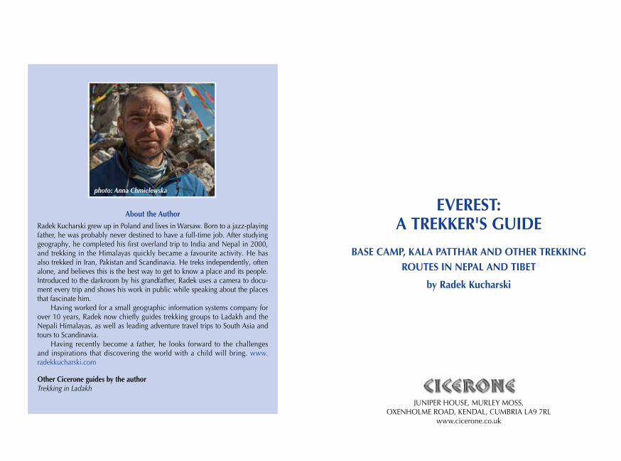
About the AuthorRadek Kucharski grew up in Poland and lives in Warsaw. Born to a jazz-playing father, he was probably never destined to have a full-time job. After studying geography, he completed his first overland trip to India and Nepal in 2000, and trekking in the Himalayas quickly became a favourite activity. He has also trekked in Iran, Pakistan and Scandinavia. He treks independently, often alone, and believes this is the best way to get to know a place and its people. Introduced to the darkroom by his grandfather, Radek uses a camera to docu-ment every trip and shows his work in public while speaking about the places that fascinate him.
Having worked for a small geographic information systems company for over 10 years, Radek now chiefly guides trekking groups to Ladakh and the Nepali Himalayas, as well as leading adventure travel trips to South Asia and tours to Scandinavia.
Having recently become a father, he looks forward to the challenges and inspirations that discovering the world with a child will bring. www. radekkucharski.com
Other Cicerone guides by the authorTrekking in Ladakh
JUNIPER HOUSE, MURLEY MOSS, OXENHOLME ROAD, KENDAL, CUMBRIA LA9 7RL
www.cicerone.co.uk
photo: Anna Chmielewska
WarningAll mountain activities contain an element of danger, with a risk of personal injury or death. Treks described in this guidebook are no exception. Under nor-mal conditions, wandering the trails towards Everest will be neither more nor less hazardous than walking among big mountains anywhere in the world, but trekking involves physically demanding exercise in a challenging landscape, where caution is advised and a degree of stamina is often required, and it should be undertaken only by those with a full and proper understanding of the risks involved, and with the training and experience to evaluate them. Trekkers should be properly equipped for the routes undertaken. The effects of altitude and the potential for altitude sickness (AMS) or worse, and how to deal with it, should be understood before you go trekking.
While every care and effort has been taken in the preparation of this guide, the user should be aware that conditions can be highly variable and change rapidly. Rockfall, landslide and crumbling paths can alter the character of the route, and the presence of snow and the possibility of avalanche must be care-fully considered, for these can materially affect the seriousness of a trek.
Therefore, except for any liability which cannot be excluded by law, nei-ther Cicerone Press nor the author accepts liability for damage of any nature (including damage to property, personal injury or death) arising directly or indi-rectly from information given in this guide.
Readers are warned that trekkers are sometimes badly injured by passing yaks; a few unfortunates die of hypothermia or acute mountain sickness; others simply lose their balance and fall from the trail due to a momentary loss of con-centration. Since there is no organised mountain rescue service in Nepal, such as exists in some mountain regions of Europe, if an accident occurs self-help may be the only option. Note too, that where it is possible to summon a rescue helicopter, the cost of doing so is very high and guarantee of payment essential. Make sure your insurance includes such costs, and carry a credit card with suf-ficient funds to back its use for the initial call-out.
Everyone trekking in the Everest region should assume responsibility for their own safety and look to the needs of those with them. This includes espe-cially porters and members of a trek crew, as well as fellow trekkers.
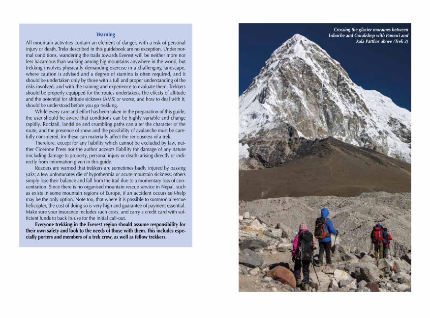
Crossing the glacier moraines between Lobuche and Gorakshep with Pumori and
Kala Patthar above (Trek 3)
© Radek Kucharski 2018Fifth edition 2018ISBN: 978 1 85284 836 1Fourth edition 2012Third edition 2005Second edition 2000First edition 1995
Printed by KHL Printing, SingaporeA catalogue record for this book is available from the British Library.All photographs are by the author unless otherwise stated.
Route mapping by Lovell Johns www.lovelljohns.comContains OpenStreetMap.org data © OpenStreetMap contributors, CC-BY-SA. NASA relief data courtesy of ESRI
DedicationTo the nameless porters who supply lodges along the trail in Khumbu, making the trek easier or even feasible. To those travellers who are ready to compromise some of their comforts and desires to protect the vulnerable environment and the local cultures. To
visitors who come to learn and enrich themselves rather than change others.
CONTENTS
Map key . . . . . . . . . . . . . . . . . . . . . . . . . . . . . . . . . . . . . . . . . . . . . . . . . . . . . . . . . . 9Regional map . . . . . . . . . . . . . . . . . . . . . . . . . . . . . . . . . . . . . . . . . . . . . . . . . . 10–11Location of treks . . . . . . . . . . . . . . . . . . . . . . . . . . . . . . . . . . . . . . . . . . . . . . . . 12–13Everest from Tibet (China) . . . . . . . . . . . . . . . . . . . . . . . . . . . . . . . . . . . . . . . . . . . . 14Preface . . . . . . . . . . . . . . . . . . . . . . . . . . . . . . . . . . . . . . . . . . . . . . . . . . . . . . . . . . 19
INTRODUCTION . . . . . . . . . . . . . . . . . . . . . . . . . . . . . . . . . . . . . . . . . . . . . . . . . 21Visa arrangements . . . . . . . . . . . . . . . . . . . . . . . . . . . . . . . . . . . . . . . . . . . . . . . . . 23Getting there and travelling around . . . . . . . . . . . . . . . . . . . . . . . . . . . . . . . . . . . . 25Kathmandu Valley . . . . . . . . . . . . . . . . . . . . . . . . . . . . . . . . . . . . . . . . . . . . . . . . . 26The Everest Region (Solukhumbu) . . . . . . . . . . . . . . . . . . . . . . . . . . . . . . . . . . . . . . 31Trekking routes in Nepal . . . . . . . . . . . . . . . . . . . . . . . . . . . . . . . . . . . . . . . . . . . . . 37Accommodation and food . . . . . . . . . . . . . . . . . . . . . . . . . . . . . . . . . . . . . . . . . . . 41Drinking water . . . . . . . . . . . . . . . . . . . . . . . . . . . . . . . . . . . . . . . . . . . . . . . . . . . . 43Trekking styles . . . . . . . . . . . . . . . . . . . . . . . . . . . . . . . . . . . . . . . . . . . . . . . . . . . . 45Seasons and weather . . . . . . . . . . . . . . . . . . . . . . . . . . . . . . . . . . . . . . . . . . . . . . . 50Weather forecast . . . . . . . . . . . . . . . . . . . . . . . . . . . . . . . . . . . . . . . . . . . . . . . . . . 52Fitness, health and emergencies . . . . . . . . . . . . . . . . . . . . . . . . . . . . . . . . . . . . . . . 53Respect others on the trail . . . . . . . . . . . . . . . . . . . . . . . . . . . . . . . . . . . . . . . . . . . 58Hazards en route . . . . . . . . . . . . . . . . . . . . . . . . . . . . . . . . . . . . . . . . . . . . . . . . . . 59Equipment . . . . . . . . . . . . . . . . . . . . . . . . . . . . . . . . . . . . . . . . . . . . . . . . . . . . . . . 60Trekking formalities . . . . . . . . . . . . . . . . . . . . . . . . . . . . . . . . . . . . . . . . . . . . . . . . 62Communication . . . . . . . . . . . . . . . . . . . . . . . . . . . . . . . . . . . . . . . . . . . . . . . . . . . 65Budget . . . . . . . . . . . . . . . . . . . . . . . . . . . . . . . . . . . . . . . . . . . . . . . . . . . . . . . . . . 65Minimum impact trekking . . . . . . . . . . . . . . . . . . . . . . . . . . . . . . . . . . . . . . . . . . . 66Cultural interaction . . . . . . . . . . . . . . . . . . . . . . . . . . . . . . . . . . . . . . . . . . . . . . . . . 68Using this guide . . . . . . . . . . . . . . . . . . . . . . . . . . . . . . . . . . . . . . . . . . . . . . . . . . . 72
TREKKING ROUTES IN NEPALTrek 1: Jiri or Salleri/Phaplu to Chheplung and Lukla . . . . . . . . . . . . . . . . . . . . . . 75Prologue Kathmandu to Jiri . . . . . . . . . . . . . . . . . . . . . . . . . . . . . . . . . . . . . . 81Section 1 Jiri to Shivalaya . . . . . . . . . . . . . . . . . . . . . . . . . . . . . . . . . . . . . . . . 83Section 2 Shivalaya to Junbesi . . . . . . . . . . . . . . . . . . . . . . . . . . . . . . . . . . . . 87Section 3 Junbesi to Ringmu . . . . . . . . . . . . . . . . . . . . . . . . . . . . . . . . . . . . . 99Alternative start Salleri or Phaplu to Ringmu . . . . . . . . . . . . . . . . . . . . . . . . . . . . 103Section 4 Ringmu to Surke . . . . . . . . . . . . . . . . . . . . . . . . . . . . . . . . . . . . . . 106Section 5A Surke to Chheplung (for Namche Bazaar) . . . . . . . . . . . . . . . . . . . 115Section 5B Surke to Lukla . . . . . . . . . . . . . . . . . . . . . . . . . . . . . . . . . . . . . . . . 118
Updates to this guideWhile every effort is made by our authors to ensure the accuracy of guidebooks as they go to print, changes can occur during the lifetime of an edition. Any updates that we know of for this guide will be on the Cicerone website (www.cicerone.co.uk/836/updates), so please check before planning your trip. We also advise that you check information about such things as transport, accom-modation and shops locally. Even rights of way can be altered over time.
The route maps in this guide are derived from publicly available data, data-bases and crowd-sourced data. As such they have not been through the detailed checking procedures that would generally be applied to a published map from an official mapping agency, although naturally we have reviewed them closely in the light of local knowledge as part of the preparation of this guide.
We are always grateful for information about any discrepancies between a guidebook and the facts on the ground, sent by email to [email protected] or by post to Cicerone, Juniper House, Murley Moss, Oxenholme Road, Kendal, LA9 7RL.
Register your book: To sign up to receive free updates, special offers and files where available, register your book at www.cicerone.co.uk.
Front cover: Everest, Nuptse, Lhotse, Ngozumpa Glacier and Gokyo viewed from the way to Renjo Pass
9
Map key
Trek 2: Lukla to Namche Bazaar . . . . . . . . . . . . . . . . . . . . . . . . . . . . . . . . . . . . . 121Prologue Flight from Kathmandu to Lukla . . . . . . . . . . . . . . . . . . . . . . . . . . 124Section 1 Lukla to Phakding . . . . . . . . . . . . . . . . . . . . . . . . . . . . . . . . . . . . . 128Section 2 Phakding to Namche Bazaar . . . . . . . . . . . . . . . . . . . . . . . . . . . . 134Trek 3: Namche Bazaar to Everest Base Camp (EBC) and Kala Patthar . . . . . . . . . 148Section 1A Namche to Sanasa via Tenzing Norgay Chorten and Khyangjuma . 153Section 1B Namche to Sanasa via Khumjung . . . . . . . . . . . . . . . . . . . . . . . . . 157Section 2A Sanasa to Pangboche via Tengboche and Deboche . . . . . . . . . . . . 159Section 2B Sanasa to Pangboche via Mong La and Phortse . . . . . . . . . . . . . . . 164Section 3 Pangboche to Dingboche (or Pheriche) . . . . . . . . . . . . . . . . . . . . . 175Section 4 Dingboche (or Pheriche) to Lobuche . . . . . . . . . . . . . . . . . . . . . . 191Section 5 Lobuche to Gorakshep . . . . . . . . . . . . . . . . . . . . . . . . . . . . . . . . . 197Section 6A Ascent of Kala Patthar (5645m/18,520ft) . . . . . . . . . . . . . . . . . . . . 202Section 6B Hike to Everest Base Camp (5275m/17,306ft) . . . . . . . . . . . . . . . . 204Trek 4: Namche Bazaar to Gokyo. . . . . . . . . . . . . . . . . . . . . . . . . . . . . . . . . . . . . 207Section 1A Namche to Sanasa via Tenzing Norgay Chorten and Khyangjuma . 211Section 1B Namche to Sanasa via Khumjung . . . . . . . . . . . . . . . . . . . . . . . . . 211Section 2 Sanasa to Phortse Thanga . . . . . . . . . . . . . . . . . . . . . . . . . . . . . . . 212Section 3 Phortse Thanga to Machhermo . . . . . . . . . . . . . . . . . . . . . . . . . . . 214Section 4 Machhermo to Gokyo . . . . . . . . . . . . . . . . . . . . . . . . . . . . . . . . . . 219Trek 5: Three Passes Trek . . . . . . . . . . . . . . . . . . . . . . . . . . . . . . . . . . . . . . . . . . . 227Section 1 Namche to Sanasa . . . . . . . . . . . . . . . . . . . . . . . . . . . . . . . . . . . . 233Section 2 Sanasa to Pangboche . . . . . . . . . . . . . . . . . . . . . . . . . . . . . . . . . . 233Section 3 Pangboche to Dingboche . . . . . . . . . . . . . . . . . . . . . . . . . . . . . . . 234Section 4 Dingboche to Chukhung . . . . . . . . . . . . . . . . . . . . . . . . . . . . . . . 235Section 5 Chukhung to Lobuche via Kongma La . . . . . . . . . . . . . . . . . . . . . 237Section 6 Lobuche to Dzongla . . . . . . . . . . . . . . . . . . . . . . . . . . . . . . . . . . . 246Section 7 Dzongla to Gokyo via Cho La. . . . . . . . . . . . . . . . . . . . . . . . . . . . 249Section 8 Gokyo to Namche Bazaar via Renjo La and Thame . . . . . . . . . . . 256
EVEREST FROM TIBET . . . . . . . . . . . . . . . . . . . . . . . . . . . . . . . . . . . . . . . . . . . . . 269Trek 6 Tingri to Rongbuk Everest Base Camp . . . . . . . . . . . . . . . . . . . . . . 271Trek 7 Kharta to the Kangshung Face . . . . . . . . . . . . . . . . . . . . . . . . . . . . 280
Appendix A Summary of treks . . . . . . . . . . . . . . . . . . . . . . . . . . . . . . . . . . . . . 296Appendix B Selected trekking peaks in the Everest Region . . . . . . . . . . . . . . . . 300Appendix C Index of place names . . . . . . . . . . . . . . . . . . . . . . . . . . . . . . . . . . 302Appendix D Useful websites . . . . . . . . . . . . . . . . . . . . . . . . . . . . . . . . . . . . . . 308Appendix E Selected lodges in the Everest Region . . . . . . . . . . . . . . . . . . . . . . 311Appendix F Glossary . . . . . . . . . . . . . . . . . . . . . . . . . . . . . . . . . . . . . . . . . . . . 314
8400–8800
8000–8400
7600–8000
7200–7600
6800–7200
6400–6800
6000–6400
5600–6000
5200–5600
4800–5200
4400–4800
4000–4400
3600–4000
3200–3600
2800–3200
2400–2800
2000–2400
1600–2000
1200–1600
800–1200
400–800
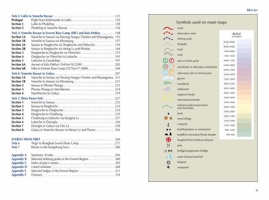
Symbols used on route mapsroute
alternative route
linking route
footpath
track
road
start or finish point
start/finish or alternative start/finish
alternative start or finish point
glacier
woodland
settlement
regional border
international border
national park/conservation area boundary
peak
town/village
campsite
building/statue or monument
buddhist monastery/hindu temple
hospital/clinic/medical aid-post
pass
bridge/suspension bridge water feature/waterfall
helipad
viewpoint
Reliefin metres
10
everest: a trekker’s Guide
11
RaviRavi
PamirPamir
Yarkant
Yarkant
SutlejSutlej
Yam
una
Yam
una
Chambal
ChambalBanasBanas
Betwa
Betwa
Son
Son
Gandak
Gandak
Ghaghara
Ghaghara
Gha
ghar
aG
hagh
ara
Yamuna
Yamuna
Yamuna
YamunaG
anges
Ganges
GangesGanges
ParbatiParbati
JhelumJhelum
JhelumJhelum
Beas
Beas
Beas
Beas
IndusIndus
IndusIndus
SutlejSutlej
Chenab
Chenab
Chenab
Chenab
YurungkaxYurungkax
ShiquanShiquan
LahoreLahore
DELHIDELHI
JaipurJaipur
KanpurKanpur
ISLAMABADISLAMABAD
AmritsarAmritsar
JammuJammu
AgraAgra
SrinagarSrinagar
LucknowLucknow
PokharaPokhara
SkarduSkardu
Kangju KangriKangju Kangri
NunNun
Ak TagAk Tag
Liushi ShanLiushi Shan
Nanda DeviNanda Devi
DhaulagiriDhaulagiri
NganglongKangri
NganglongKangri
K2K2
KailashKailash
BaturaMustagh I
BaturaMustagh I
NangaParbatNangaParbat
7135m7135m
7816m7816m
8167m8167m
8611m8611m
6714m6714m
8126m8126m
AFGHANISTANAFGHANISTAN
INDIAINDIA
NEPALNEPAL
PAKISTANPAKISTAN
Yarlung Tsangpo
Yarlung Tsangpo
Tibet AutonomousRegion (China)
Tibet AutonomousRegion (China)Ravi
Pamir
Yarkant
Sutlej
Yam
una
ChambalBanas
Betwa
Son
Gandak
Ghaghara
Gha
ghar
a
Yamuna
YamunaG
anges
Ganges
Parbati
Jhelum
Jhelum
Yarlung Tsangpo
Beas
Beas
Indus
Indus
Sutlej
Chenab
Chenab
Yurungkax
Shiquan
Lahore
DELHI
Jaipur
Kanpur
ISLAMABAD
Amritsar
Jammu
Agra
Srinagar
Lucknow
Pokhara
Skardu
Kangju Kangri
Nun
Ak Tag
Liushi Shan
Nanda Devi
Dhaulagiri
NganglongKangri
K2
Kailash
BaturaMustagh I
NangaParbat
7135m
7816m
8167m
8611m
6714m
8126m
AFGHANISTAN
Tibet AutonomousRegion (China)
INDIA
NEPAL
PAKISTAN00
00
100 miles100 miles
200km200kmBogcangBogcang
QarqanQarqan
NuNu (Salween)(Salween)
Son
Son
Kosi
Ko
si
Gandak
Gandak
Ghaghara
Ghaghara
GangesGanges
ZaZa
Mam
asM
amas
TistaTista
Za?gya
BrahmaputraBrahmaputra
PatnaPatna
KATHMANDUKATHMANDU
LHASALHASA
THIMPHUTHIMPHU
GuwahatiGuwahati
PokharaPokhara
DarjeelingDarjeeling
Ak TagAk Tag
Mt.Everest
Mt.Everest
NyainqentanglhaFeng
NyainqentanglhaFeng
Muztag FengMuztag Feng
Lunpo GangriLunpo Gangri
KanchenjungaKanchenjunga
Gangkar PunsumGangkar Punsum
8848m8848m
7550m7550m
BANGLADESHBANGLADESH
BHUTANBHUTAN
8586m8586m
Yarlung TsangpoYarlung Tsangpo
Yarlung Tsangpo
Yarlung Tsangpo
Shigatse(Xigazê)Shigatse(Xigazê)
Tibet AutonomousRegion (China)
Tibet AutonomousRegion (China)
0
0
100 miles
200kmBogcang
Qarqan
Nu (Salween)
Son
Kosi
Gandak
Ghaghara
Ganges
Za
Yarlung Tsangpo
Yarlung Tsangpo
Mam
as
Tista
Brahmaputra
Patna
KATHMANDU
LHASA
THIMPHU
Shigatse(Xigazê)
Guwahati
Pokhara
Darjeeling
Ak Tag
Mt.Everest
NyainqentanglhaFeng
Muztag Feng
Lunpo Gangri
Kanchenjunga
Gangkar Punsum
8848m
7550m
BANGLADESH
BHUTAN
Tibet AutonomousRegion (China)
8586m
Afghanistan
Bangladesh
BhutanTibet (China)
India
NepalPakis
tan
12
everest: a trekker’s Guide
13
Location of treks
Lobuch
e
Lobuch
eIm
ja K
hol
aIm
ja K
hol
a
Bhote Koshi
Bhote Koshi
Dudh Koshi
Dudh Koshi
Cho
lats
eTs
oC
hola
tse
Tso
Dud
h Po
khar
iD
udh
Pokh
ari
Don
ag T
sho
Don
ag T
sho
Imja
Tsh
oIm
ja T
sho
Lhotse Glacier
Lhotse Glacier
Am
a D
abla
mG
laci
erA
ma
Dab
lam
Gla
cier
Lhot
se N
upG
laci
erLh
otse
Nup
Gla
cier
Nup
tse
Gla
cier
Nup
tse
Gla
cier
Rong
buk
Gla
cier
Rong
buk
Gla
cier
Cha
ngri
Nup
Gla
cier
Cha
ngri
Nup
Gla
cier
Cha
ngri
Shar
Gla
cier
Cha
ngri
Shar
Gla
cier
Lobu
jeG
laci
erLo
buje
Gla
cier
Am
bula
pcha
Gla
cier
Am
bula
pcha
Gla
cier
Imja
Gla
cier
Imja
Gla
cier
Duw
oG
laci
erD
uwo
Gla
cier
Sum
naG
laci
erSu
mna
Gla
cier
Balu
ngG
laci
erBa
lung
Gla
cier
Cho
loG
laci
erC
holo
Gla
cier
Chu
khun
gG
laci
erC
hukh
ung
Gla
cier
Kan
gshu
ngG
laci
erK
angs
hung
Gla
cier
Wes
t Ron
gbuk
Gla
cier
Wes
t Ron
gbuk
Gla
cier
Nan
gpa
Gla
cier
Nan
gpa
Gla
cier
Khum
buG
laci
erKh
umbu
Gla
cier
Ngo
zum
paG
laci
erN
gozu
mpa
Gla
cier
Jiuda
Gla
cier
Jiuda
Gla
cier
Cha
ngts
eG
laci
erC
hang
tse
Gla
cier
Gok
yoG
okyo
Mac
hher
mo
Mac
hher
mo
Lobu
che
Lobu
che
Gor
akSh
epG
orak
Shep
Thar
eTh
are
Nha
Nha
Shom
are
Shom
are
Tsur
oTs
uro
Chu
khun
gC
hukh
ung
Pher
iche
Pher
iche
Din
gboc
heD
ingb
oche
Cho
Oyu
Cho
Oyu
Gya
chun
gKa
ngG
yach
ung
Kang
Lhot
seLh
otse
Gok
yo R
iG
okyo
Ri
Mac
hher
mo
Peak
Mac
hher
mo
Peak
Kyaj
ori
Kyaj
ori
Isla
ndPe
akIs
land
Peak
Kala
Pat
thar
Kala
Pat
thar
Chu
khun
g Ri
Chu
khun
g Ri
Cho
lats
eC
hola
tse
Tabo
che
Tabo
che
Cha
ngts
eC
hang
tse
Khum
buts
eKh
umbu
tse
Ling
tren
Ling
tren
Pum
ori
Pum
ori
Mou
ntEv
eres
tM
ount
Ever
est
Chu
mbu
Chu
mbu
Lobu
che
Lobu
che
Hun
gchi
Hun
gchi
Ngo
zum
paKa
ng I
Ngo
zum
paKa
ng I
Ngo
zum
paKa
ng II
Ngo
zum
paKa
ng II
Ngo
zum
paTs
eN
gozu
mpa
Tse
Nan
gkar
tsha
ngN
angk
arts
hang
Poka
lde
Poka
lde
Nup
tse
IN
upts
e I
Nan
gpai
Gos
umN
angp
aiG
osum
8201
m82
01m
7952
m79
52m
8516
m85
16m
5360
m53
60m
6017
m60
17m
6151
m61
51m
6189
m61
89m
5648
m56
48m
5546
m55
46m
6440
m64
40m 64
95m
6495
m
7543
m75
43m
6636
m66
36m
7161
m71
61m
7590
m75
90m
7161
m71
61m
8848
m88
48m
6859
m68
59m
6145
m61
45m
7036
m70
36m
7861
m78
61m
7916
m79
16m
7743
m77
43m
5553
m55
53m
5073
m50
73m
5806
m58
06m
7350
m73
50m
Loca
tion
of tr
eks
Loca
tion
of tr
eks
Lobuch
eIm
ja K
hol
a
Bhote Koshi
Dudh Koshi
Cho
lats
eTs
o
Dud
h Po
khar
i
Don
ag T
sho
Imja
Tsh
o
Lhotse Glacier
Am
a D
abla
mG
laci
er
Lhot
se N
upG
laci
er
Nup
tse
Gla
cier
Rong
buk
Gla
cier
Cha
ngri
Nup
Gla
cier
Cha
ngri
Shar
Gla
cier
Lobu
jeG
laci
er
Am
bula
pcha
Gla
cier
Imja
Gla
cier
Duw
oG
laci
er
Sum
naG
laci
er
Balu
ngG
laci
er
Cho
loG
laci
er
Chu
khun
gG
laci
er
Kan
gshu
ngG
laci
er
Wes
t Ron
gbuk
Gla
cier
Nan
gpa
Gla
cier
Khum
buG
laci
er
Ngo
zum
paG
laci
er
Jiuda
Gla
cier
Cha
ngts
eG
laci
er
Gok
yo
Mac
hher
mo
Lobu
che
Gor
akSh
ep
Thar
e
Nha
Shom
are
Tsur
o
Chu
khun
g
Pher
iche
Din
gboc
he
Cho
Oyu
Gya
chun
gKa
ng
Lhot
seG
okyo
Ri
Mac
hher
mo
Peak
Kyaj
ori
Isla
ndPe
ak
Kala
Pat
thar
Chu
khun
g Ri
Cho
lats
e
Tabo
che
Cha
ngts
eKh
umbu
tse
Ling
tren
Pum
ori
Mou
ntEv
eres
t
Chu
mbu
Lobu
che
Hun
gchi
Ngo
zum
paKa
ng I
Ngo
zum
paKa
ng II
Ngo
zum
paTs
e
Nan
gkar
tsha
ng
Poka
lde
Nup
tse
I
Nan
gpai
Gos
um
8201
m79
52m
8516
m53
60m
6017
m
6151
m
6189
m
5648
m
5546
m64
40m 64
95m
7543
m66
36m
7161
m
7590
m
7161
m
8848
m
6859
m
6145
m
7036
m
7861
m
7916
m77
43m
5553
m
5073
m
5806
m
7350
m
Trek
1Tr
ek 2
Trek
3Tr
ek 4
Trek
5
Loca
tion
of tr
eks
Dudh Koshi
Dudh Koshi
Dudh KoshiDudh Koshi
Hunku DrangkaHunku Drangka
Han
di
Han
di
Hinku DrangkaHinku Drangka
Tham
e Kh
ola
Tham
e Kh
ola
Deku Kho
la
Deku Kho
la
Lum
ding
Tsho
Lum
ding
Tsho
Cha
mla
ngC
hoC
ham
lang
Cho
Am
bula
pcha
Gla
cier
Am
bula
pcha
Gla
cier
Duw
oG
laci
erD
uwo
Gla
cier
Hun
ku N
upG
laci
erH
unku
Nup
Gla
cier
Chu
khun
gG
laci
erC
hukh
ung
Gla
cier
Hun
kuG
laci
erH
unku
Gla
cier
Hin
ku N
upG
laci
erH
inku
Nup
Gla
cier
Kyas
har
Gla
cier
Kyas
har
Gla
cier
Nau
lekh
Gla
cier
Nau
lekh
Gla
cier
Mer
aG
laci
erM
era
Gla
cier
Sanu
Gla
cier
Sanu
Gla
cier
Lum
ding
Gla
cier
Lum
ding
Gla
cier
Nar
eG
laci
erN
are
Gla
cier Nar
eG
laci
erN
are
Gla
cier
Nar
eG
laci
erN
are
Gla
cier
Hin
ku S
har
Gla
cier
Hin
ku S
har
Gla
cier
Nam
che
Baza
arN
amch
e Ba
zaar
Teng
boch
eTe
ngbo
che
Lukl
aLu
kla
Thad
okos
iTh
adok
osi
Phak
ding
Phak
ding
Zam
phut
iZa
mph
uti
Benk
arBe
nkar
Chu
moa
Chu
moa
Mon
joM
onjo
Thao
gTh
aog
Khu
nde
Khu
nde
Khu
mju
ngK
hum
jung
Pang
boch
ePa
ngbo
che
Phor
tse
Phor
tse
Deb
uche
Deb
uche
Che
plun
gC
hepl
ung
Chh
utha
wa
Chh
utha
wa
Syan
gboc
heSy
angb
oche
Tham
eTh
ame
Tara
ngar
Tara
ngar
Sam
shin
gSa
msh
ing
Tham
oTh
amo
Sam
deSa
mde
Thul
ang
Thul
ang
Kyan
gjum
aKy
angj
uma
Tash
inga
Tash
inga
Shom
are
Shom
are
Ors
hoO
rsho
Sana
saSa
nasa
Phun
kiTh
anga
Phun
kiTh
anga
Mill
ingo
Mill
ingo
Toc
Toc
Toc
Toc
Kha
rte
Kha
rte
Puiy
aPu
iya
Surk
eSu
rke
Cha
urik
hark
aC
haur
ikha
rka
Kong
de R
iKo
ngde
Ri
Tham
serk
uTh
amse
rku
Kusu
mKa
nggu
ruKu
sum
Kang
guru
Am
a D
abla
mA
ma
Dab
lam
Mer
a Pe
akM
era
Peak
Nau
lekh
Nau
lekh
Gon
glha
Gon
glha
Kyas
har
Kyas
har
6187
m61
87m
6623
m66
23m
6367
m63
67m
6856
m68
56m
7075
m70
75m
6476
m64
76m
6363
m63
63m
3735
m37
35m
5085
m50
85m
6465
m64
65m
6735
m67
35m
5813
m58
13m
6769
m67
69m
Tenz
ing-
Hill
ary
Air
port
Tenz
ing-
Hill
ary
Air
port
Dudh Koshi
Dudh Koshi
Hunku Drangka
Han
di
Hinku Drangka
Tham
e Kh
ola
Deku Kho
la
Lum
ding
Tsho
Cha
mla
ngC
ho
Am
bula
pcha
Gla
cier
Duw
oG
laci
er
Hun
ku N
upG
laci
er
Chu
khun
gG
laci
erH
unku
Gla
cier
Hin
ku N
upG
laci
erKy
asha
rG
laci
er
Nau
lekh
Gla
cier
Mer
aG
laci
er
Sanu
Gla
cier
Lum
ding
Gla
cier
Nar
eG
laci
er Nar
eG
laci
er
Nar
eG
laci
er
Hin
ku S
har
Gla
cier
Nam
che
Baza
ar
Teng
boch
e
Lukl
a
Thad
okos
i
Phak
ding
Zam
phut
i
Benk
arC
hum
oa
Mon
jo
Thao
g
Khu
nde
Khu
mju
ng
Pang
boch
e
Phor
tse
Deb
uche
Che
plun
g
Chh
utha
wa
Syan
gboc
he
Tham
e
Tara
ngar
Sam
shin
gTh
amo
Sam
de
Thul
ang
Kyan
gjum
aTa
shin
ga
Shom
are
Ors
ho
Sana
sa
Phun
kiTh
anga
Mill
ingo
Toc
Toc
Kha
rte
Paiy
a
Surk
e
Cha
urik
hark
a
Kong
de R
i
Tham
serk
u
Kusu
mKa
nggu
ru
Am
a D
abla
m
Mer
a Pe
ak
Nau
lekh
Gon
glha
Kyas
har
6187
m
6623
m
6367
m
6856
m
7075
m
6476
m
6363
m
3735
m
5085
m
6465
m
6735
m
5813
m
6769
m
Tenz
ing-
Hill
ary
Air
port
N 2.5
50
km
14
everest: a trekker’s Guide
15Ever
est r
oute
s fro
m T
ibet
(Chi
na)
Tong
La
Nan
gpa
La
Men
lung
La
Phum
a La
Ting
ri
Kharta
Nya
lam
Koda
riZh
angm
u
Barabise
Bhak
tapu
r
KATH
MANDU
Patan
Cho
Oyu
Shis
hapa
ngm
a
Pum
ori
Mt E
vere
st
Lhot
se
Mak
alu
SAG
AR
MA
TH
AN
AT
ION
AL
PAR
K
LAN
GTA
NG
NA
TIO
NA
LPA
RK
NE
PA
L
Rong
buk
Ever
est
Nor
th B
ase
Cam
p
to L
hasa
Trek
7
Trek
6
N 1530
0km
TIB
ET
(C
HIN
A)
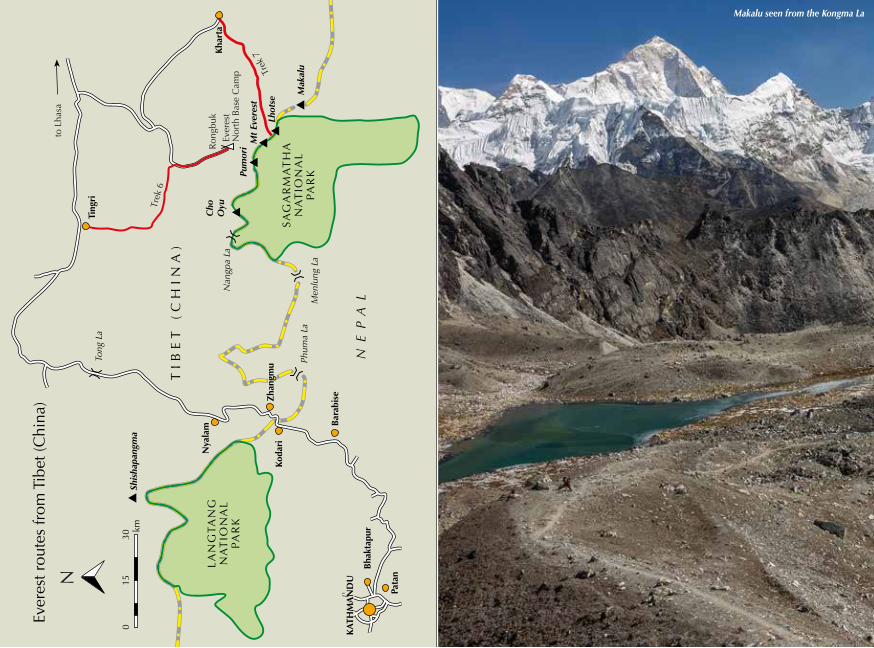
Makalu seen from the Kongma La
50
everest: a trekker’s Guide seasons and weather
51
SEASONS AND WEATHER
Although trekking may be possible at any time of the year in Solukhumbu, there are generally considered to be two main seasons: the pre-monsoon period (spring), and the more popular post-monsoon months before winter sets in. However, these periods receive a great many tourists and the number of visi-tors has been rapidly growing in recent
year, saw over 9500 visitors – compared with 5500 in 2016, almost 6300 in 2015 when the earthquake struck and 6900 in 2014. In the spring season, however, a large number of those who attempt to climb Everest should be added, as the quoted figures exclude members of expeditions. Spring is the season for commercial expeditions on Everest when a town of tents appears at the Base Camp, while in autumn the same place is usually empty. The summer monsoon season in 2017 saw 340 tourists in July and 530 in August. In winter 2016/17 there were almost 2500 trekkers in December, about 1300 in January and the same number in February.Spring (pre-monsoon): March–May The spring trekking season runs from late March to May. Early March above Namche can be colder than December, but from mid March onwards tempera-tures in the lower hills rise considerably, and by May the first few days of a trek
years. Therefore, you might want to con-sider other seasons to avoid the crowds.
According to data displayed at the entry gate to the Sagarmatha National Park in Monjo, in 2017 the number of tourists entering in September (the busi-est month of the year) reached almost 12,500 – the highest monthly number since records began in 1998. April, the busiest pre-monsoon month, the same
from Jiri will be uncomfortably humid – especially for independent travellers carrying large rucksacks. Clouds often build up during the afternoon, while heat haze throughout the day can spoil distant views in the foothills and mid-dle hills, although at higher elevations the atmosphere is generally clear and temperatures moderate. This is the sea-son for the keen botanist, as numerous wildflower varieties add a riot of colour throughout the region. Rhododendrons will be blooming at lower elevations as early as late February, but coming into flower during March and April at higher levels.Summer (monsoon): June–September From June to September Nepal is affected by the monsoon. During this time paths can be treacherous with mud, rivers and streams become raging tor-rents, torrential rain and mist deny views for much of the day, while trees, shrubs and undergrowth are infested with
as you observe yours or your friends’. Let them rest on arrival at the new lodge at the end of the day – it is their free time. Although many porters and guides will want to serve you during meals, you may try to limit that by collecting your own meal from the kitchen and returning utensils and plates when you have finished.
Never overload your porters, and make sure that the bag they carry for you is reasonably comfortable. Although you will see porters carrying uncomfortable loads weighing at least 80kg, this is unacceptable. Porters are not super-human; they are simply trying to make a living in a tough environment.
A few organisations try to implement porters’ work standards by publish-ing guidelines and suggestions. Porters’ Progress UK (www.portersprogressuk.org) suggests the weight limit of a load carried by a porter in Nepal should be 30kg and this should be further adjusted according to altitude and other conditions. In the author’s opinion, on a Khumbu trek where a large part of each route runs above 4000m, the load should be smaller. Remember that in addition to your bag, your porter needs to carry his own belongings. Consider also that in an emergency or if you become weak, the porter will also be expected to carry your daypack. It is therefore suggested that the bag you give a porter should weigh no more than about 15kg, and it should be a comfortable rucksack or duffle bag with shoulder straps for convenient carrying. If you came to Nepal with a suit-case, leave it in Kathmandu. If you hire a porter for two trekkers – although some organisations dictate ‘one trekker, one porter’ – pack everything in one rucksack to ensure the load is comfortable.
Porters should have life insurance (see above). If your porter becomes unwell on the trek, provide him with medicine and do not leave him on his own. If he needs to stay at altitude, make sure he is safe and has someone to care for him. If a sick porter needs to descend, it is imperative that someone assists him. Before the trek, make sure your porter has adequate clothing and boots, and consider tipping him when the trek is over (see above). If you have clothes you do not want to take back home, you might ask your porter if he would find them useful. If the answer is no, donate them to the Everest Clothing Bank (see above).
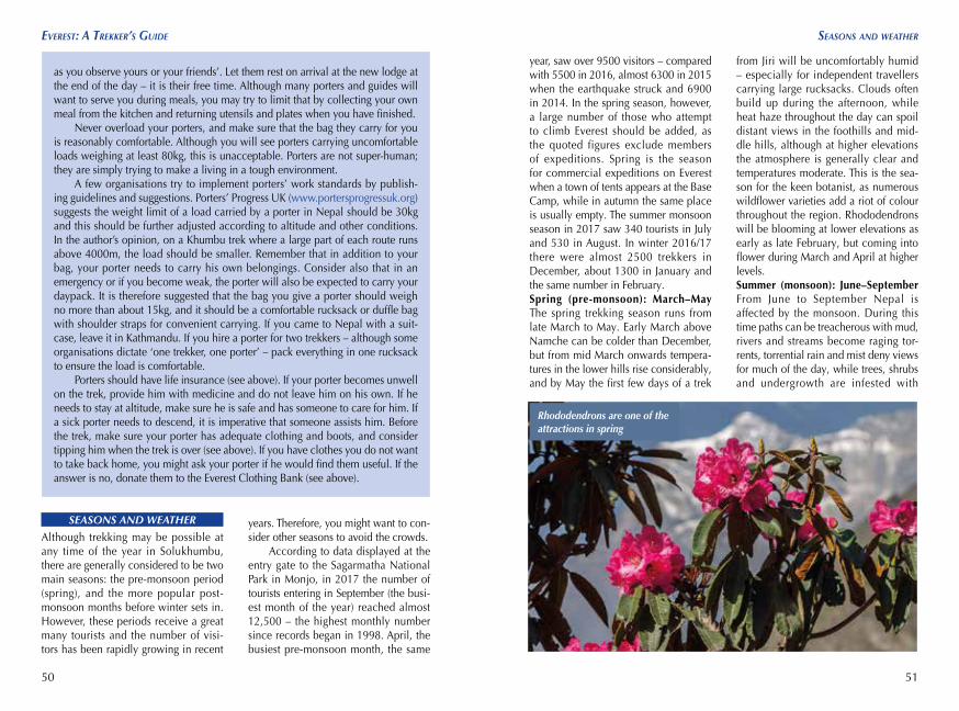
Rhododendrons are one of the attractions in spring
52
everest: a trekker’s Guide
53
fitness, heaLth and eMerGencies
leeches except in the highest valleys. However, the countryside is then green and lush, wildflowers are impressive, and when clouds shred and momentar-ily part the mountains reveal an undeni-able drama. There are very few trekkers along the trails, and village life resumes its age-old pattern. Anyone tempted to trek during the monsoon, though, should be aware that paths may be re-routed, some bridges could be washed away and lengthy diversions become necessary. That being said, when condi-tions allow, flights to Lukla still operate, so determined trekkers with sufficient time to wait for a window of opportunity could avoid the worst effects of the mon-soon and begin there.Autumn (post-monsoon): October–late November The post-monsoon period tra-ditionally began at the end of September and continued until the arrival of win-ter in December, but weather patterns are changing and in recent years the rains have continued well into October. Should this pattern continue, trekkers may face unpredictable weather at least until mid October, with more stable conditions in November and December. Autumn remains the most popular trek-king period, when trails and lodges are at their busiest, and with the monsoon having cleansed the atmosphere, the weather is mostly settled. Above 3000m an occasional dump of snow is not unu-sual, however, and when prolonged can have an effect on plans to cross high passes. Mostly, though, days are blessed with clear, often cloud-free skies with a magical light ideal for photography. Daytime temperatures are very pleas-ant. Above Namche nights can be chilly in October, while at Gokyo, Tengboche
FITNESS, HEALTH AND EMERGENCIES
FitnessYou do not need to be extremely fit to go trekking in the Everest Region. The range of possible styles of trek, the length and flexibility of stages and the diversity of routes make trekking available to people of different ages and levels of physical strength.
Trekking is a matter of walking – you don’t need any particular skills to do it. However, trekking inevitably means spending days in the mountains, chang-ing your routine, abandoning home comforts, and stepping beyond your comfort zone. It means long hours of constant walking, possibly with a heavy rucksack, usually steeply up or down at altitude, often with unpleasant weather as a close companion. You need to be able to cope with a full day’s activity in
and beyond heavy frosts should be expected. By mid November night-time temperatures will have dropped to well below freezing, although views by day have a lustre unrivalled at any other time of the year.Winter: December–February December is statistically the driest month, and as long as you’ve got good down clothing and sleeping bag, trekking right up to Christmas can be magnificent. In mid winter (January) the intense cold experi-enced above Namche Bazaar can make nights especially uncomfortable, and in some years heavy snowfall in the higher regions can make travel difficult or even impossible. Late winter (February–March) is sometimes disrupted by snowstorms. Not only can these cause severe trail problems, but on occasion flights are unable to land at Lukla for several days at a time. Although some lodges close for the season, expect to find accommo-dation along the main routes as owners arrange to keep at least one lodge open in each settlement. This particularly refers to Lobuche and Gokyo where you can expect to find a place all year round.
WEATHER FORECAST
For a local weather forecast, check www.mountain-forecast.com (which has forecasts for various altitudes on moun-tains including Kala Patthar, Gokyo Ri and Everest, as well as all the other giants in the region), www.accuweather.com (Lukla, Namche Bazaar), www.yr.no (for the majority of the region’s main settlements), www.meteoblue.com (main settlements and peaks and any given coordinates), and www.mfd.gov.np.
mountainous terrain, so what you need to practise before the trek is walking. Regular running or any other physical activity will of course help, but walk-ing is most important. Familiarity with mountain walking is especially useful, given the ascents and descents involved, but if you do not live near mountains simply go on frequent long walks in your neighbourhood.
The Everest Region is a moder-ately demanding trekking destination in Himalayan terms. Easier areas should be chosen by first-time visitors to this mountain range and – even more impor-tantly – first-time trekkers at altitude. The Annapurna Himal or Langtang, among others, are generally considered easier and safer than the Khumbu in terms of altitude and acclimatisation, although the comprehensive tourist infrastructure in the Khumbu vastly aids its exploration. Altitude is the biggest challenge here.
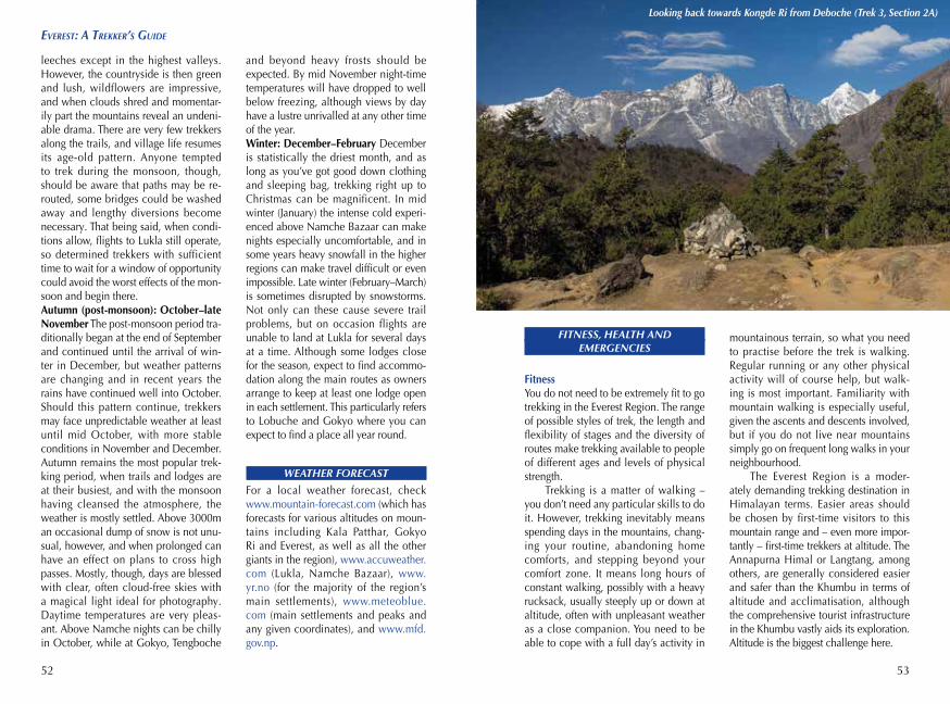
Looking back towards Kongde Ri from Deboche (Trek 3, Section 2A)
54
everest: a trekker’s Guide
55
fitness, heaLth and eMerGencies
Vaccinations and medical preparationsA number of vaccinations are recom-mended before a trip to Nepal. These are best started a few months, and at least four weeks, in advance of your visit. Consult your doctor and treat the following as a basic suggestion only. Although no vaccination is mandatory, the following are usually advised: diph-theria, tetanus, hepatitis A, hepatitis B, typhoid, and meningococcal meningi-tis. Of these, hepatitis A and typhoid vaccines are particularly important as you may get infected through con-taminated water or food. In addition, if you haven’t already been immunised against tuberculosis (TB), consider get-ting the vaccine. Those who trek from Jiri during the monsoon, or plan to visit Chitwan, should consider vaccinations for Japanese encephalitis as well as malaria prophylaxis. All visitors should take measures to avoid mosquito bites, as they can transmit Japanese encepha-litis and malaria as well as dengue fever. Be aware, too, that there is a seri-ous risk of rabies via dog bites. Rabies vaccinations are often recommended to those travelling to Nepal, and should also be considered. (Contact with stray dogs should be avoided; beware of monkeys too.) For more informa-tion about vaccines, check the follow-ing sources: www.who.int/ith, https://travelhealthpro.org.uk, www.fitfor travel.nhs.uk, www.nhs.uk/conditions/travel-vaccinations, www.cdc.gov, and www.traveldoctor.info.
It is also advisable to visit a dentist well before your trip, to make sure your teeth are in good condition.
It is important to take some medi-cines with you on your trek. Make sure
• ‘Travel at High Altitude’ – a free book published by Medex, recom-mended by UIAA, BMC and BMG, available at www.medex.org.uk;
• ‘Emergency Field Management of Acute Mountain Sickness, High Altitude Pulmonary Oedema, and High Altitude Cerebral Oedema’ – document available at www.theuiaa.org (select ‘Safety’ > ‘Mountain Medicine’ > ‘High alti-tude medical advice’);
• articles regarding acclimatisation and altitude illness in ‘Resources’ at www.ismm.org;
• High Altitude Medicine Guide: www.high-altitude-medicine.com;
• www.altitude.orgThe higher the altitude, the lower
the air pressure. Hence there is less oxy-gen – as well as other particles – in a single breath. At an altitude of 3400m (Namche Bazaar) the standard baro-metric pressure is 680hPa (it is about
to include drugs used to treat altitude sickness – Diamox (acetazolamide) is an absolute minimum, but carrying Dexamethasone is strongly recom-mended (see below). You should take painkillers with you as well as medi-cines to deal with stomach problems. Carrying a wide-range antibiotic is also recommended. All medication should obviously be accompanied by notes on their usage – ask your doctor to help you complete your first aid kit. All the necessary medication can be purchased in pharmacies in Kathmandu without prescription.
Altitude sicknessAltitude sickness can be a reality for those trekking in the Everest Region and the risk should not be ignored or under-estimated. If not treated properly, severe forms of the illness can rapidly become fatal.
However, as long as you follow a few simple rules, you should not be affected. Consider the following infor-mation as a base for further reading – it has not been written by a doctor and must not be treated as authorised medi-cal advice.
Make sure you understand the pro-cess of proper acclimatisation and that you are able to recognise the various symptoms of altitude sickness. Never ignore any symptoms. If you feel unwell at altitude, assume it is altitude-related unless an alternative explanation is obvi-ous. Observe your condition and that of those travelling with you. Remember that anyone can become ill, no mat-ter their number of visits, their age, or fitness.
Consult the following sources:
1013hPa at sea level) – meaning there is only 67% of the oxygen available at sea level. It is 53% at 5275m (EBC). Our bodies adjust to these conditions in a process called acclimatisation. Most of us can adapt to an altitude of about 5000–5500m, but the process takes time. If the rate of acclimatisation is not adequate, a form of altitude sickness occurs. This might be acute mountain sickness (AMS), high-altitude cerebral oedema (HACE) or high-altitude pulmo-nary oedema (HAPE). When travelling to any altitude above 2500m, acclimatisa-tion must be considered!
AMS is not life-threatening but it can quickly develop into HACE or HAPE if symptoms are ignored. With AMS you may experience symptoms includ-ing headache, nausea, loss of appetite, dizziness, sleep disorder and vomiting. Use a painkiller such as ibuprofen or paracetamol, consider acetazolamide (Diamox), hydrate properly and do not
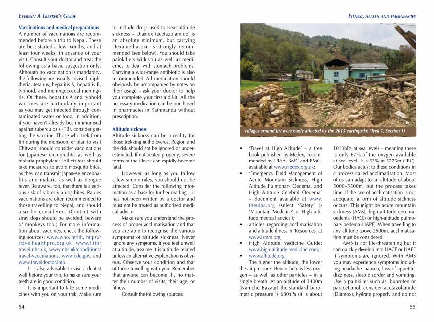
Villages around Jiri were badly affected by the 2015 earthquake (Trek 1, Section 1)