Embed Size (px)
Citation preview
Goyder Regional Council
Eudunda IWMP
GOYDER: INTEGRATED WATER MANAGEMENT PLAN (IWMP) FOR EUDUNDA
January 2012


Regional Council of Goyder AWE
11105 Integrated Water Management Plan for Eudunda i
Document History and Status
Issue Rev. Issued to Qty Date Reviewed Approved
1 V5 T. Wood 1 30/9/11 GF GF
Final V6 T.Wood 1 25/01/12 GF GF
Printed: January 25, 2012
Last Saved: September 30, 2011
File Name: 11105 R001 IWMP Eudunda v6 120125.docx
Project Manager: Ben Taylor
Client: Regional Council of Goyder
Project: Integrated Water Management Plan for Eudunda
Name of Document: Integrated Water Management Plan for Eudunda
Document Version: v6
Job Number: 11105

AWE Regional Council of Goyder
ii 11105 Integrated Water Management Plan for Eudunda

Regional Council of Goyder AWE
11105 Integrated Water Management Plan for Eudunda iii
Table of Contents
1 Introduction ................................................................................................................................................. 1
1.1 Total Water Cycle Management ....................................................................................................... 2
1.2 Purpose of the Plan ........................................................................................................................... 2
1.3 IWMP Objectives .............................................................................................................................. 4
2 The Township of Eudunda ........................................................................................................................... 6
2.1 Climate .............................................................................................................................................. 6
2.2 Future Township Growth Scenario ................................................................................................... 6
2.2.1 Residential Land Supply and Demand .............................................................................................. 7
2.2.2 Potential Areas for Future Residential Development ...................................................................... 7
2.2.3 Potential Lot Yield for Identified growth areas and Infill Greenfield areas ...................................... 7
2.2.4 Potential Development Constraints ................................................................................................. 7
3 Strategic IWMP Objectives .......................................................................................................................... 9
3.1 Objectives and Measures .................................................................................................................. 9
4 Current and Potential Water Resources Use and Recommendations ...................................................... 12
4.1 Water Balance ................................................................................................................................ 12
4.1.1 Anticipated Future Water Demand ................................................................................................ 13
4.2 Potable Water ................................................................................................................................. 14
4.2.1 Roof Runoff .................................................................................................................................... 14
4.3 Groundwater .................................................................................................................................. 15
4.3.1 Geology and Hydrogeology ............................................................................................................ 15
4.4 Water Dependent Ecosystems ........................................................................................................ 16
4.5 Stormwater ..................................................................................................................................... 19
4.5.1 Surface Drainage and Watercourses .............................................................................................. 19
4.5.2 Existing Stormwater Infrastructure ................................................................................................ 19
4.5.3 Stormwater Management Options ................................................................................................ 20
4.5.4 Stormwater Harvesting Opportunities ........................................................................................... 20
4.5.5 Stormwater Quality ........................................................................................................................ 21
4.5.6 Wastewater .................................................................................................................................... 23
4.6 Climate Change Impacts ................................................................................................................. 25
5 Implementation Plan ................................................................................................................................. 26
5.1 Overview ......................................................................................................................................... 26
5.2 Immediate Recommended Actions ................................................................................................ 27
5.2.1 Eudunda ......................................................................................................................................... 27
5.2.2 Regional .......................................................................................................................................... 28
5.3 Intermediate Actions ...................................................................................................................... 36
5.3.1 Eudunda ......................................................................................................................................... 36
5.3.2 Regional .......................................................................................................................................... 36
5.4 Strategic and Long Term Actions .................................................................................................... 38

AWE Regional Council of Goyder
iv 11105 Integrated Water Management Plan for Eudunda
5.4.1 Eudunda ......................................................................................................................................... 38
5.4.2 Regional .......................................................................................................................................... 38
5.5 Monitoring and Review .................................................................................................................. 40
6 Funding Opportunities .............................................................................................................................. 42
6.1 Strengthening Basin Communities – Water Saving Initiatives ........................................................ 42
6.2 South Australian Murray Darling Basin NRM Board ....................................................................... 42
6.3 Stormwater Harvesting and Reuse Projects ‐ Third Competitive Grants Round ............................ 42
6.4 Regional Development Australia .................................................................................................... 42
7 References ................................................................................................................................................. 44
List of Tables
Table 2‐1 Average Rainfall Statistics for Eudunda Calculated Over All Years of Data ............................................ 6
Table 2‐2 Eudunda Lot Yields, Potential Additional Population and Water Demand. ............................................ 7
Table 3‐1 Integrated Water Resource Management Objectives, Strategies and Measures ................................ 10
Table 4‐1 Current Water Use in Eudunda ............................................................................................................. 13
Table 4‐2 Potential Future Water Resource Demand in Eudunda........................................................................ 14
Table 4‐3 Eudunda DES Borehole Details ............................................................................................................. 17
Table 4‐4 Monthly Climate Change Scenario Data ............................................................................................... 25
Table 5‐1 Description of Priority Rankings ........................................................................................................... 26
Table 5‐2 Immediate IWMP Recommended Actions for the next 1‐5 Years: Eudunda ........................................ 33
Table 5‐3 Immediate IWMP Recommended Actions for the next 1‐5 Years: Regional ........................................ 34
Table 5‐4 Intermediate IWMP Recommended Actions for the next 5‐10 Years: Eudunda .................................. 37
Table 5‐5 Intermediate IWMP Recommended Actions for the next 5‐10 Years: Regional .................................. 37
Table 5‐6 Strategic and Long Term IWMP Recommended Actions for the next 10‐30 Years: Eudunda .............. 39
Table 5‐7 Strategic and Long Term IWMP Recommended Actions for the next 10‐30 Years: Regional .............. 39
List of Figures
Figure 1‐1 Total Water Cycle .................................................................................................................................. 2
Figure 1‐2 Township of Eudunda ............................................................................................................................ 5
Figure 4‐1 Current Potable Water Use in Eudunda .............................................................................................. 14
Figure 4‐2 DES Borehole Location Plan ................................................................................................................. 18
Figure 4‐3 Existing catchment, Wastewater and stormwater Infrastructure and Flooding Issues in Eudunda ... 22
Appendices
Appendix A : Federal, State and Regional Legislative Framework
Appendix B : Council’s Strategic Planning Framework: Development Planning and Climate Change
Appendix C : Recommended Actions Map

Regional Council of Goyder AWE
11105 Integrated Water Management Plan for Eudunda v
Executive Summary
Introduction
Council engaged Australian Water Environments (AWE) to develop an Integrated Water Management Plan
(IWMP) for Eudunda. The Regional Council of Goyder and the community are committed to becoming more
sustainable with its water use and to ensure that existing flooding and wastewater management issues are
administered appropriately to enable future growth.
Objectives
The IWMP aims to provide for Eudunda:
Sustainable management of all water resources within, impacted or drawn upon by the
township including planned growth areas;
Preservation, or enhancement where possible, of the ecological function of watercourses
that receive runoff from Eudunda;
Water management strategies to support a productive, sustainable, liveable, socially
inclusive town that is well placed to meet future challenges and growth;
Sufficient water supplies to maintain public open space for amenity and recreational
values, while protecting the health and wellbeing of the community in a warming climate;
Water use that is “fit for purpose”, i.e. Water treated to an appropriate standard in keeping
with its intended use;
Clearly articulated connections and directions to the different sections of the council’s
business, e.g. planning and engineering, operations, and strategy;
A resilient township capable of responding to an uncertain climate future;
Water infrastructure with a minimised carbon footprint across its life‐cycle; and
Clear direction as to how water will be managed within growth areas and the existing
township area.
Eudunda Township
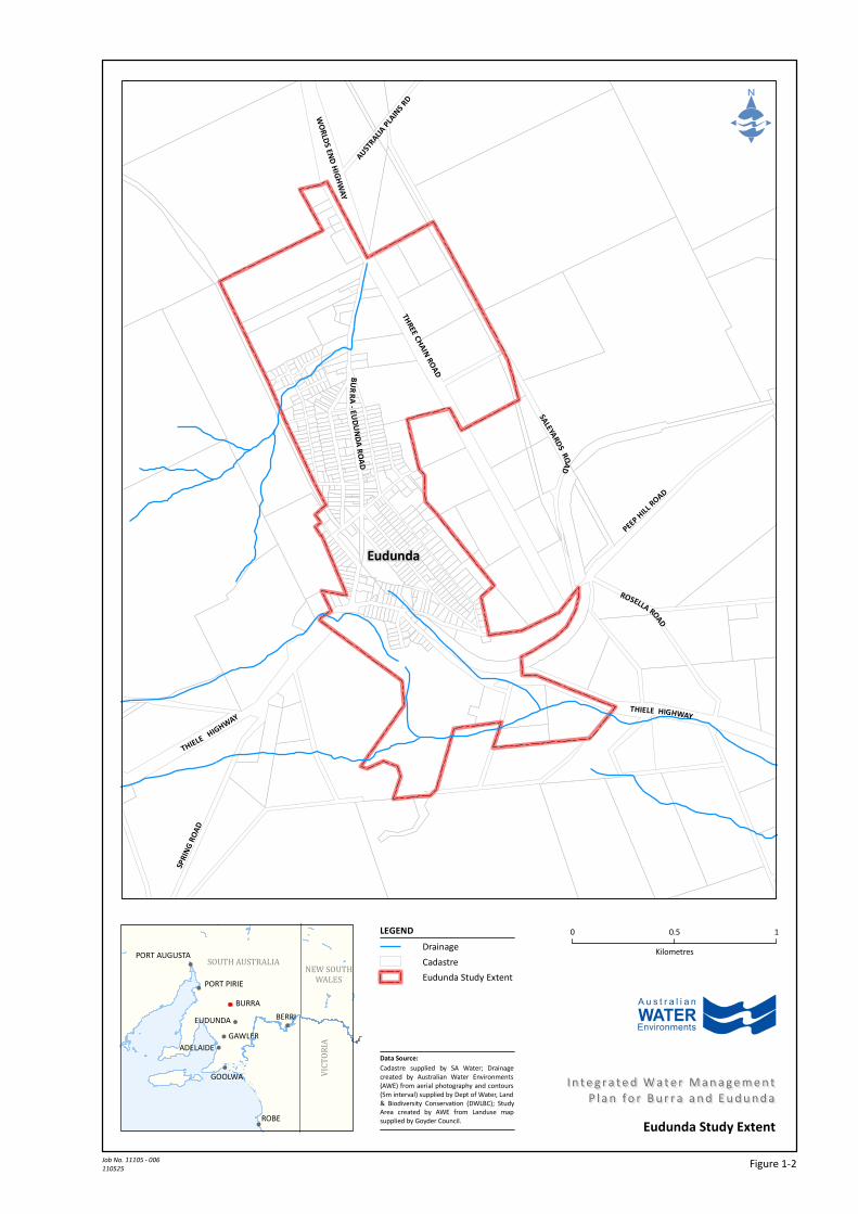
The IWMP applies to the township boundaries of Eudunda designated in Figure 1‐2.
The township of Eudunda is located on the eastern fringe of the Mount Lofty Ranges, 95 km north – northeast
of the Adelaide CBD and 24 km northeast of Kapunda.
The long term average annual rainfall for Eudunda is 447 mm.
Eudunda recorded a population of 641 in the 2006 Census which is an increase of 38 from 2001. Eudunda is
not anticipated to experience major growth requiring augmentation of the existing township zone extent.
The Regional Council of Goyder has identified a number of water resource management issues in the
township, including stormwater and wastewater management.
Key Findings
The main water management issues faced by Council and the people of Eudunda relate to existing known high
risk flood sites and wastewater management.

AWE Regional Council of Goyder
vi 11105 Integrated Water Management Plan for Eudunda
A previous Stormwater Management Report for Eudunda defined the key catchment contributing to local
flooding and provided recommendations for remediation. Many of these recommendations have been acted
upon.
A stormwater harvesting scheme has recently been constructed but will require further investigation to
identify how this may be operated in the future to maximise benefits in reducing River Murray water for non‐
potable demands in Eudunda, whilst ensuring that legislation requirements are adhered to.
Climate change will effect both irrigation demand and water resource availability but the impacts are not large
and are less than the national variability in runoff from one year to the next.
Recommendations
The report provides a series of recommended actions in relation to potable water, groundwater, surface
water, water dependent ecosystems, stormwater and wastewater. These recommended actions have been
grouped into those that are specific to Eudunda and those that would be more effectively implemented on a
Council wide basis. The Eudunda specific recommendations are highlighted below.
Potable Water
Council consider increasing the storage volumes of rainwater tanks required to be provided as part of
new legislation and / or Development Plan provisions, especially with regard to commercial, industrial
and larger scale residential developments.
Council investigate opportunities to encourage installation of rainwater tanks through additional
rebates and education of the benefits.
Council review where rainwater tanks can be installed on Council properties and / or opportunities for
tanks to be plumbed into Council buildings, where this is not already done.
Surface Water
Reduce the reliance and impact on the surface water resources of the region by implementing
harvesting and reuse schemes that comply with the relevant legislation.
Water Dependent Ecosystems
Undertake an on‐ground survey of sites that might potentially be impacted by IWMP related works to
ensure WDE’s are not compromised.
Stormwater
Implement the recommendations from the Stormwater Management Report to mitigate the potential
magnitude of future flood events through Eudunda.
Rectification of existing detention basin upstream of Drain E (west of railway embankment).
Identify appropriate Water Sensitive Urban Design (WSUD), detention and capacity improvements.
Complete the sealing and kerbing of all roads and provide formalised drainage easements/reserves
over existing water courses through private land.
Wastewater
All future development within the township to be connected to the existing CWMS scheme.
Meter and monitor wastewater inflows and outflows to determine accurate long term water balance
to base future decisions regarding system augmentation requirements.

Regional Council of Goyder AWE
11105 Integrated Water Management Plan for Eudunda vii
Ensure sufficient irrigation demand and wastewater storage to minimise potential risk of discharge to
receiving waters.
Implementation
The Implementation Plan in Section 5 clearly sets out the activities that Council can undertake to achieve the
objectives of the IWMP. It breaks the activities down into immediate, intermediate and strategic/long term
actions.
Monitoring and Review
A monitoring and evaluation approach for the IWMP is recommended which establishes an approach for
continuous improvement in the planning, implementation and regular review of the Plan. This is detailed in
Section 6.

AWE Regional Council of Goyder
viii 11105 Integrated Water Management Plan for Eudunda
Regional Council of Goyder AWE
11105 Integrated Water Management Plan for Eudunda 1
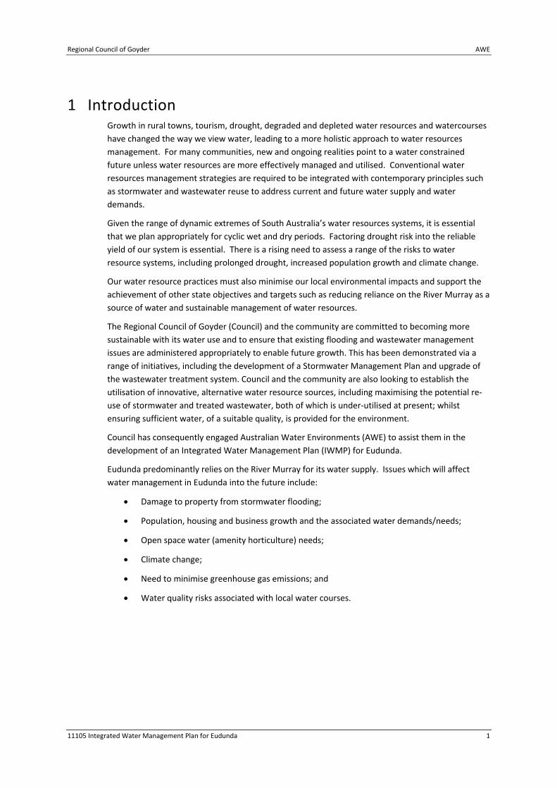
1 Introduction Growth in rural towns, tourism, drought, degraded and depleted water resources and watercourses
have changed the way we view water, leading to a more holistic approach to water resources
management. For many communities, new and ongoing realities point to a water constrained
future unless water resources are more effectively managed and utilised. Conventional water
resources management strategies are required to be integrated with contemporary principles such
as stormwater and wastewater reuse to address current and future water supply and water
demands.
Given the range of dynamic extremes of South Australia’s water resources systems, it is essential
that we plan appropriately for cyclic wet and dry periods. Factoring drought risk into the reliable
yield of our system is essential. There is a rising need to assess a range of the risks to water
resource systems, including prolonged drought, increased population growth and climate change.
Our water resource practices must also minimise our local environmental impacts and support the
achievement of other state objectives and targets such as reducing reliance on the River Murray as a
source of water and sustainable management of water resources.
The Regional Council of Goyder (Council) and the community are committed to becoming more
sustainable with its water use and to ensure that existing flooding and wastewater management
issues are administered appropriately to enable future growth. This has been demonstrated via a
range of initiatives, including the development of a Stormwater Management Plan and upgrade of
the wastewater treatment system. Council and the community are also looking to establish the
utilisation of innovative, alternative water resource sources, including maximising the potential re‐
use of stormwater and treated wastewater, both of which is under‐utilised at present; whilst
ensuring sufficient water, of a suitable quality, is provided for the environment.
Council has consequently engaged Australian Water Environments (AWE) to assist them in the
development of an Integrated Water Management Plan (IWMP) for Eudunda.
Eudunda predominantly relies on the River Murray for its water supply. Issues which will affect
water management in Eudunda into the future include:
Damage to property from stormwater flooding;
Population, housing and business growth and the associated water demands/needs;
Open space water (amenity horticulture) needs;
Climate change;
Need to minimise greenhouse gas emissions; and
Water quality risks associated with local water courses.
AWE Regional Council of Goyder
2 11105 Integrated Water Management Plan for Eudunda
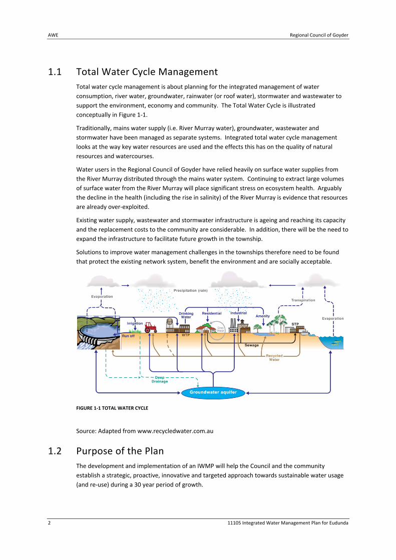
1.1 Total Water Cycle Management
Total water cycle management is about planning for the integrated management of water
consumption, river water, groundwater, rainwater (or roof water), stormwater and wastewater to
support the environment, economy and community. The Total Water Cycle is illustrated
conceptually in Figure 1‐1.
Traditionally, mains water supply (i.e. River Murray water), groundwater, wastewater and
stormwater have been managed as separate systems. Integrated total water cycle management
looks at the way key water resources are used and the effects this has on the quality of natural
resources and watercourses.
Water users in the Regional Council of Goyder have relied heavily on surface water supplies from
the River Murray distributed through the mains water system. Continuing to extract large volumes
of surface water from the River Murray will place significant stress on ecosystem health. Arguably
the decline in the health (including the rise in salinity) of the River Murray is evidence that resources
are already over‐exploited.
Existing water supply, wastewater and stormwater infrastructure is ageing and reaching its capacity
and the replacement costs to the community are considerable. In addition, there will be the need to
expand the infrastructure to facilitate future growth in the township.
Solutions to improve water management challenges in the townships therefore need to be found
that protect the existing network system, benefit the environment and are socially acceptable.
FIGURE 1‐1 TOTAL WATER CYCLE
Source: Adapted from www.recycledwater.com.au
1.2 Purpose of the Plan
The development and implementation of an IWMP will help the Council and the community
establish a strategic, proactive, innovative and targeted approach towards sustainable water usage
(and re‐use) during a 30 year period of growth.

Regional Council of Goyder AWE
11105 Integrated Water Management Plan for Eudunda 3
The benefits of such an approach will help minimise the draw on River Murray and provide the
Eudunda community with opportunities to improve their recreational facilities as well as delivering a
wide range of other environmental, social and economic benefits.
The Plan is intended to provide Council management, staff and Elected Members guidance for
investing in water management actions that:
Conserve water;
Protect water quality;
Protect ecosystem health; and
Support the sustainable growth of Eudunda.
The Plan will also serve to inform the community, other Councils and State Government about the
water management programs and goals that the Council have for the five townships. It is intended
that this Plan will be integrated with other water management tools and initiatives in the Council
area including:
The Regional Council of Goyder Development Plan;
The River Murray Water Allocation Plan;
Community Wastewater Management Systems;
Water for Good Plan; and
The South Australian Murray Darling Basin Natural Resources Management Plan.
The development, and most importantly, the implementation of the Integrated Water Management
Plan for Eudunda will enable it to prosper whilst ensuring that:
Council has an understanding of the scale and sustainability of its surface and groundwater
resources;
The general public and landowners can support and implement relevant strategies;
Developers are better informed and educated on environmental considerations;
Council can develop long term Capital Works Programs and Asset and Infrastructure
Management Plans, matched by a Long Term Financial Plan;
Council can effectively deal with emerging global warming and climate change adaptation
scenarios;
IWMP outcomes can be marketed to stimulate further growth;
Council, agencies and the community are well placed to target grant opportunities for
various projects;
Development Plans are brought up‐to‐date with current environmental considerations and
are consistent with Structure Plans, the Planning Strategy, NRM Strategies and other
relevant research;
The taking of water for current and future uses is within sustainable limits;
Where practicable, re‐use of stormwater and wastewater can be economically achieved;

AWE Regional Council of Goyder
4 11105 Integrated Water Management Plan for Eudunda
Development is balanced with environmental and social considerations;
Consideration is given to water quantity, water quality, surface and groundwater and other
resource linkages; and
The plan provides linkages with relevant Local, State and Federal Government plans and
strategies.
1.3 IWMP Objectives
This IWMP aims to provide for Eudunda, the following:
Sustainable management of all water resources within, impacted or drawn upon by the
township including planned growth areas;
Preservation, or enhancement where possible, of the ecological function of watercourses
that receive runoff from Eudunda;
Water management strategies to support productive, sustainable, liveable, socially
inclusive town that is well placed to meet future challenges and growth;
Sufficient water supplies to maintain public open space for amenity and recreational
values, while protecting the health and wellbeing of the community in a warming climate;
Water use that is “fit for purpose”, i.e. Water treated to an appropriate standard in keeping
with its intended use;
Clearly articulated connections and directions to the different sections of the council’s
business, e.g. Planning and engineering, operations, and strategy;
A resilient township capable of responding to an uncertain climate future;
Water infrastructure with a minimised carbon footprint across its life‐cycle; and
Clear direction as to how water will be managed within growth areas and the existing
township area.
The IWMP applies to the township boundary to Eudunda designated in Figure 1‐2.
"
WORLDS EN
D HIGHWAY
Eudunda
ROSELLA ROAD
PEEP HILL ROAD
THIELE HIGHWAY
SALEYA
RDS ROA
D
THREE CH
AIN RO
ADBURRA ‐ EU
DUNDA ROAD
THIEL
E HIG
HWAY
SPRING ROAD
AUSTRALIA PLAINS RD
Figure 1‐2Job No. 11105 ‐ 006110525
0 0.5 1
Kilometres
A u s t r a l i a n
WATEREnvironments
Eudunda Study Extent
I n teg ra ted Water ManagementIn teg ra ted Water Management
P lan fo r Bur r a and EudundaP lan fo r Bur r a and Eudunda
LEGEND
Data Source:
Drainage
Cadastre
Eudunda Study Extent
Cadastre supplied by SA Water; Drainagecreated by Australian Water Environments(AWE) from aerial photography and contours(5m interval) supplied by Dept of Water, Land& Biodiversity Conservation (DWLBC); StudyArea created by AWE from Landuse mapsupplied by Goyder Council.
!(
!(
!(!(
!(
!(
!(
!(
!(
SOUTH AUSTRALIA
VICTOR
IA
NEW SOUTHWALES
ROBE
BURRA
BERRI
GAWLER
GOOLWA
EUDUNDA
ADELAIDE
PORT PIRIE
PORT AUGUSTA
AWE Regional Council of Goyder
6 11105 Integrated Water Management Plan for Eudunda
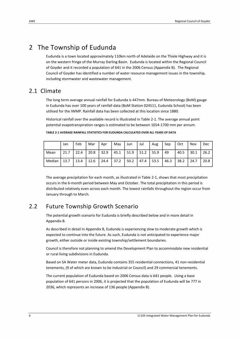
2 The Township of Eudunda Eudunda is a town located approximately 110km north of Adelaide on the Thiele Highway and it is
on the western fringe of the Murray Darling Basin. Eudunda is located within the Regional Council
of Goyder and it recorded a population of 641 in the 2006 Census (Appendix B). The Regional
Council of Goyder has identified a number of water resource management issues in the township,
including stormwater and wastewater management.
2.1 Climate
The long term average annual rainfall for Eudunda is 447mm. Bureau of Meteorology (BoM) gauge
in Eudunda has over 100 years of rainfall data (BoM Station 024511, Eudunda School) has been
utilised for the IWMP. Rainfall data has been collected at this location since 1880.
Historical rainfall over the available record is illustrated in Table 2‐1. The average annual point
potential evapotranspiration ranges is estimated to be between 1654‐1700 mm per annum.
TABLE 2‐1 AVERAGE RAINFALL STATISTICS FOR EUDUNDA CALCULATED OVER ALL YEARS OF DATA
Jan Feb Mar Apr May Jun Jul Aug Sep Oct Nov Dec
Mean 21.7 22.4 20.8 32.9 45.1 51.9 51.2 55.9 49 40.5 30.1 26.2
Median 13.7 13.4 12.6 24.4 37.2 50.2 47.4 53.5 46.3 38.2 24.7 20.8
The average precipitation for each month, as illustrated in Table 2‐1, shows that most precipitation
occurs in the 6‐month period between May and October. The total precipitation in this period is
distributed relatively even across each month. The lowest rainfalls throughout the region occur from
January through to March.
2.2 Future Township Growth Scenario
The potential growth scenario for Eudunda is briefly described below and in more detail in
Appendix B.
As described in detail in Appendix B, Eudunda is experiencing slow to moderate growth which is
expected to continue into the future. As such, Eudunda is not anticipated to experience major
growth, either outside or inside existing township/settlement boundaries.
Council is therefore not planning to amend the Development Plan to accommodate new residential
or rural living subdivisions in Eudunda.
Based on SA Water meter data, Eudunda contains 355 residential connections, 41 non‐residential
tenements, (9 of which are known to be industrial or Council) and 29 commercial tenements.
The current population of Eudunda based on 2006 Census data is 641 people. Using a base
population of 641 persons in 2006, it is projected that the population of Eudunda will be 777 in
2036, which represents an increase of 136 people (Appendix B).

Regional Council of Goyder AWE
11105 Integrated Water Management Plan for Eudunda 7
2.2.1 Residential Land Supply and Demand Based on 2006 ABS records there are currently 318 residential dwellings in Eudunda.
The current Development Plan (consolidated 17 February 2011) states that in the Residential Zone,
the minimum allotment size for a detached dwelling is 1000m2.
Based on the current township Structure Plan, a site inspection on 13 May 2011, and perusal of
aerial photographs, Eudunda has sufficient land to support an additional 17 residential infill
allotments within the existing town and an additional 404 allotments through subdivision of
Greenfield sites located to the east and north of the township.
2.2.2 Potential Areas for Future Residential Development The area available for residential development, comprises infill within the existing Residential Zone
and further subdivision of the vacant Greenfield land to the east and west of the Burra‐Eudunda
Road.
2.2.3 Potential Lot Yield for Identified growth areas and Infill Greenfield
areas The potential lot yields for each of the identified growth areas based on the proposed minimum lot
sizes are outlined below.
The estimated population growth by 2036 as outlined in the interim planning report for Eudunda is
136 indicating that lot take up rates within Eudunda within existing residential and Rural Living
zones would be 60% and 18% by that date.
TABLE 2‐2 EUDUNDA LOT YIELDS, POTENTIAL ADDITIONAL POPULATION AND WATER DEMAND.
Township area Area (Ha)
Estimated Max Lot Yield
Potential Additional Maximum Population
Eudunda South and South East 1.5 12 22
Eudunda North East ‐vacant land east of Hannan Street
14 107 193
Eudunda North West‐vacant land and council land north of Michael Street and abutting Burra‐Eudunda Road
38 295 532
Total Eudunda 54.4 423 767
2.2.4 Potential Development Constraints The current Development Plan (Consolidated 17 February 2011) provides for allotments within the
Residential Zone of a minimum of 1000 m2 for detached dwellings, 600 m2 for semi‐detached, 500
m2 for group dwellings and 400 m2 for row dwellings.
There is currently no Rural Living Zone associated with the township of Eudunda. There is some
demand for Rural Living allotments, as Council receives enquiries each year.
The Development Act 1993 also provides for the listing of State and Local heritage places within the
Development Plan, and there is one State Heritage Place within Eudunda at 8 South Terrace,
Eudunda.
AWE Regional Council of Goyder
8 11105 Integrated Water Management Plan for Eudunda
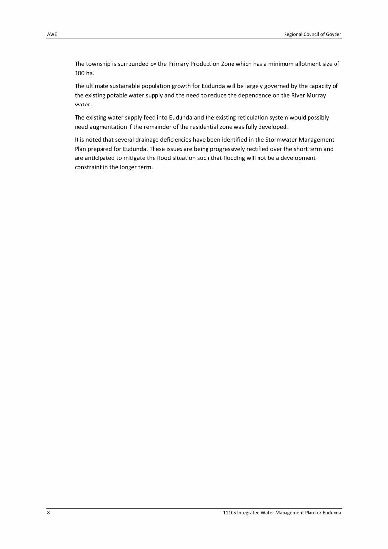
The township is surrounded by the Primary Production Zone which has a minimum allotment size of
100 ha.
The ultimate sustainable population growth for Eudunda will be largely governed by the capacity of
the existing potable water supply and the need to reduce the dependence on the River Murray
water.
The existing water supply feed into Eudunda and the existing reticulation system would possibly
need augmentation if the remainder of the residential zone was fully developed.
It is noted that several drainage deficiencies have been identified in the Stormwater Management
Plan prepared for Eudunda. These issues are being progressively rectified over the short term and
are anticipated to mitigate the flood situation such that flooding will not be a development
constraint in the longer term.
Regional Council of Goyder AWE
11105 Integrated Water Management Plan for Eudunda 9
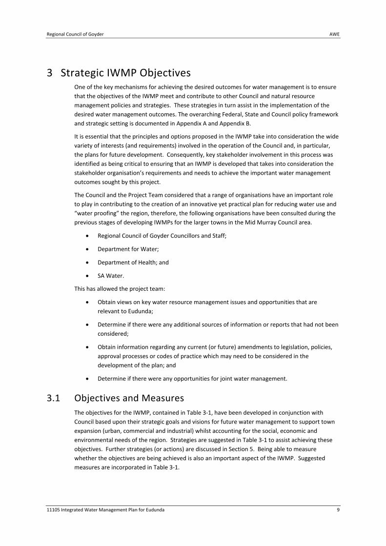
3 Strategic IWMP Objectives One of the key mechanisms for achieving the desired outcomes for water management is to ensure
that the objectives of the IWMP meet and contribute to other Council and natural resource
management policies and strategies. These strategies in turn assist in the implementation of the
desired water management outcomes. The overarching Federal, State and Council policy framework
and strategic setting is documented in Appendix A and Appendix B.
It is essential that the principles and options proposed in the IWMP take into consideration the wide
variety of interests (and requirements) involved in the operation of the Council and, in particular,
the plans for future development. Consequently, key stakeholder involvement in this process was
identified as being critical to ensuring that an IWMP is developed that takes into consideration the
stakeholder organisation’s requirements and needs to achieve the important water management
outcomes sought by this project.
The Council and the Project Team considered that a range of organisations have an important role
to play in contributing to the creation of an innovative yet practical plan for reducing water use and
“water proofing” the region, therefore, the following organisations have been consulted during the
previous stages of developing IWMPs for the larger towns in the Mid Murray Council area.
Regional Council of Goyder Councillors and Staff;
Department for Water;
Department of Health; and
SA Water.
This has allowed the project team:
Obtain views on key water resource management issues and opportunities that are
relevant to Eudunda;
Determine if there were any additional sources of information or reports that had not been
considered;
Obtain information regarding any current (or future) amendments to legislation, policies,
approval processes or codes of practice which may need to be considered in the
development of the plan; and
Determine if there were any opportunities for joint water management.
3.1 Objectives and Measures
The objectives for the IWMP, contained in Table 3‐1, have been developed in conjunction with
Council based upon their strategic goals and visions for future water management to support town
expansion (urban, commercial and industrial) whilst accounting for the social, economic and
environmental needs of the region. Strategies are suggested in Table 3‐1 to assist achieving these
objectives. Further strategies (or actions) are discussed in Section 5. Being able to measure
whether the objectives are being achieved is also an important aspect of the IWMP. Suggested
measures are incorporated in Table 3‐1.

AWE Regional Council of Goyder
10 11105 Integrated Water Management Plan for Eudunda
TABLE 3‐1 INTEGRATED WATER RESOURCE MANAGEMENT OBJECTIVES, STRATEGIES AND MEASURES
Objectives Strategies Measures
1. Sustainable Total
Water Cycle Management
(1a) Integrate the management of
stormwater, wastewater,
groundwater and water
consumption.
(1b) Integrate land, biodiversity and
water management.
(1c) Promote the principles of Water
Sensitive Urban Design through land
use planning and building design.
(i) IWMP adopted by Council.
(ii) IWMP amended on a
continual basis as more
information is obtained.
(iii) All new development
incorporates WSUD principles
and measures.
2. Protect water quality
and public health
(2a) Protect the environmental
values of watercourses to enhance
environmental and urban amenity
and biodiversity.
(2b) Prevention of pollution of the
stormwater system and
watercourses.
(i) Number of water quality
concerns reported.
(ii) Compliance with all
relevant licences.
3. Conserve more water
(3a) Residents, business, industry
and Council to conserve River
Murray water.
(3b) Sustainable water management
through more efficient use of water.
(i) Target set for Council
reduction of River Murray
water use.1
(ii) Target set for community
reduction of River Murray
water.
(iii) Monitor and report water
consumption
4. Promote fit for
purpose supplies
(4a) Provide the best opportunities
for rainwater, stormwater and
treated wastewater to be re‐used
through better methods of water
management.
(4b) Seek opportunities to increase
the uptake of alternate water
supplies.
(i) Number of projects
undertaken which utilise
alternate water supplies.
1 Suggested target of 30%, however, this should be determined based on current water use and what is
determined to be achievable.

Regional Council of Goyder AWE
11105 Integrated Water Management Plan for Eudunda 11
Objectives Strategies Measures
5. Provide protection
from flooding
(5a) Reduce the incidence of local
flooding.
(5b) Retain more urban runoff.
(5c) Reduce rate and volume of
runoff.
(i) Number of properties
flooded.
(ii) Number of incidents of
nuisance reported due to
flooding.
(iii) Volume of water able to
be detained in stormwater
basins.
(iv) Increase in uptake of
WSUD measures.
6. Continual
improvement
(6a) Capture baseline information for
water consumption, stormwater,
wastewater and groundwater.
(6b) Establish a monitoring and
review process to keep the water
management program relevant,
consultative and effective.
(i) Data capture and
monitoring processes
established.
(ii) Baseline water quality of
stormwater and groundwater
determined.
(iii) Measure volumes of
water used for irrigation.
7. Form partnerships
(7a) Establish a framework for Local
Government to work collaboratively
on priority water resource
management actions to benefit the
region.
(7b) Work with business, community
and government agencies for
effective water management.
(i) Partnerships developed
with adjacent councils.
(ii) Partnership with Regional
Development Board
continued.
(iii) Partnership with the NRM
Board.
8. Educate to encourage
participation
(8a) Involve and educate residents,
businesses and staff in integrated
water management.
(i) A community aware of
Council’s environmental
initiatives.
(ii) Number of information
sessions on water
management undertaken.
(iii) Number of demonstration
sites established.
9. Develop / promote a
‘water industry’ and the
business of water
conservation and reuse
(9a) Adoption of WSUD targets.
(9b) Continue partnership with
Regional Development Board.
(i) Review businesses and
expanding industry in water
management.
(ii) Industry use of treated
wastewater.
AWE Regional Council of Goyder
12 11105 Integrated Water Management Plan for Eudunda
4 Current and Potential Water Resources Use and
Recommendations This section describes the current and possible future water resources available in the region,
including the potential impacts of a mid‐range climate change scenario.
4.1 Water Balance
A water balance was undertaken for Eudunda that involved the assessment of all potential water
sources and uses. The components of the water balance are described in the sections below. A brief
overview of the water balance approach and key assumptions follows.
The current water use in Eudunda is summarised in Table 4‐1.
The water balance modelling has considered both the use of wastewater and stormwater options.
A town water balance was developed to analyse existing and future reuse potential. Potential
demands and extraction rates were estimated based on a daily inflow. There is no existing irrigation
use data available. Demands were estimated based on SA Water IPOS guidelines values. Waste
water inflows were based on a per capita basis with allowances for groundwater ingress during low
flow periods.
An existing stormwater harvesting scheme has recently been constructed at the intersection of
Burra Eudunda Road and Industry Road with a rising main transferring water along Three Chains
Road to the wastewater lagoons. Stormwater yields were estimated using historical rainfall data
within a MUSIC model to estimate flows. Transfer rates and volumes from the existing sump to the
lagoons is limited by the pump capacity (7.5 L/s) and the small storage area. The maximum daily
stormwater yield is 650 kL/day based on the pumping rate. It was assumed that between 20 ‐ 35%
of flows would bypass the sump due to the small storage volume.
Existing irrigation demands of the oval and golf course were estimated to be 9.8 ML/a and 0.3 ML/a
respectively. Future demands could include expansion of golf course irrigation (18.3 ML/a), Eudunda
Bowling club (2.2 ML/a), within the Eudunda School (1.3 ML/a), Centenary Gardens (2.8 ML/a) and
the Eudunda Cemetery (2.1 ML/a). The potential total demand is approximately 37 ML/a.
From the rainfall record utilised (20 years from 1990‐2011) and with the current wastewater and
stormwater harvesting system configuration, it was estimated that an annual irrigation area of 16 ha
could be irrigated with 100% supply reliability. Modelling indicated that the storage lagoon would
rarely fall below 30 ML. The irrigation supply reliability decreases to 90% if the irrigation demand is
increased to 48 ML/a. This is greatly in excess of the identified potential future demands of 37 ML/a
which indicates there may be potential for additional third party users.
During drought years, an adaptive management strategy could be implemented, with lower
irrigation of some areas, or priority irrigation based on water level triggers and season. For example
during years with below average rainfall, under‐irrigation could occur.
Stormwater yields were estimated based on available information and within the context of the
development of the IWMP. The volume of water runoff depends on the intensity and the duration
of the rain event, losses due to wetting of the surfaces and the history of the rainfall prior to the
event. Historical rainfall data was used to derive a daily runoff series for the water balance;
Regional Council of Goyder AWE
11105 Integrated Water Management Plan for Eudunda 13
evaporation, demand and seepage were evaluated. Irrigation demand values were calculated based
on the surface type, average evapotranspiration, average rainfall and use. Runoff from both
pervious and impervious surfaces were assessed, to take into account the hydrological response of
the different surface types. These high level assessments will need to be supplemented by detailed
hydrological calculation and system assessments as part of the detailed design process. Further
information on the proposed storage and irrigation locations can be found below.
Multiple options were considered for the water balance analysis considering both the demand and
yield on a short term and long term basis. Storages including basins and below ground storage tanks
were evaluated. The impact of an impermeable liner was considered in the operation of basins. The
dimensions that were used were based on estimations of storage areas from site inspections and
aerial photography.
The impact of climate change on the potential yields and demands has been investigated. The
average climate change projections to 2030 has been used with the change in rainfall and
evaporation based on a rolling 3 month basis. The climate change effect sees an annual reduction in
rainfall and increase in evaporation and average temperature.
Climate change affects both irrigation demand and stormwater yields resulting in an average
increase in demand and a decrease in supply.
Further discussion on the climate change data can be found in Section 4.6 but the impacts for
Eudunda are likely to be minor (in terms of water harvesting).
TABLE 4‐1 CURRENT WATER USE IN EUDUNDA
Current Potable Water Use (ML/a)
Current Reuse of Stormwater (ML/a)
Current Reuse of Wastewater (ML/a)
Current use Groundwater (ML/a)
117 <5 26.7 unknown
4.1.1 Anticipated Future Water Demand Increases in the price of mains water, decreasing water allocations and developments incorporating
WSUD measures will have an influence on the future water demand in the region. The future water
demand reflects the projected growth of the township (see Section 2 and Appendix B).
Irrigation demand satisfied by non potable water sources (e.g. treated stormwater/wastewater) are
required to be treated to guideline values. The development and release of the Australian
Guidelines for Water Recycling – Managing Health and Environmental Risks (2006, 2008a, 2008b)
(which provides a national unified framework for safe and environmentally sustainable reuse of
waste waters across Australia), along with the South Australian Environment Protection (Water
Quality) Policy, 2003 and South Australian Reclaimed Water Guidelines (1999) describes methods by
which reclaimed water can be used in a sustainable manner without imposing undue risks to public
health or the environment; and details the performance criteria/treatment levels to which the
treated wastewater must meet.
Table 4‐2 details the potential future water resource demand in Eudunda. The slight increase in
demand is reflective of the anticipated modest growth in the township and the impacts of climate
change. Whilst most of the non‐potable water demand could be met with stormwater and
wastewater reuse.
AWE Regional Council of Goyder
14 11105 Integrated Water Management Plan for Eudunda
TABLE 4‐2 POTENTIAL FUTURE WATER RESOURCE DEMAND IN EUDUNDA
Potable Water Demand (ML/a)
Non Potable Water Demand (ML/a)
Potable to Non Potable (ML/a)
Wastewater Supply Volume (ML/a)
Stormwater Supply Volume (ML/a)
133 37 8 32 18
The following sections detail the water resource components of the water balance.
4.2 Potable Water
Treated potable water is supplied to the township via an SA Water reticulation main supplied from
the Swan Reach‐Yorke Peninsula pipeline.
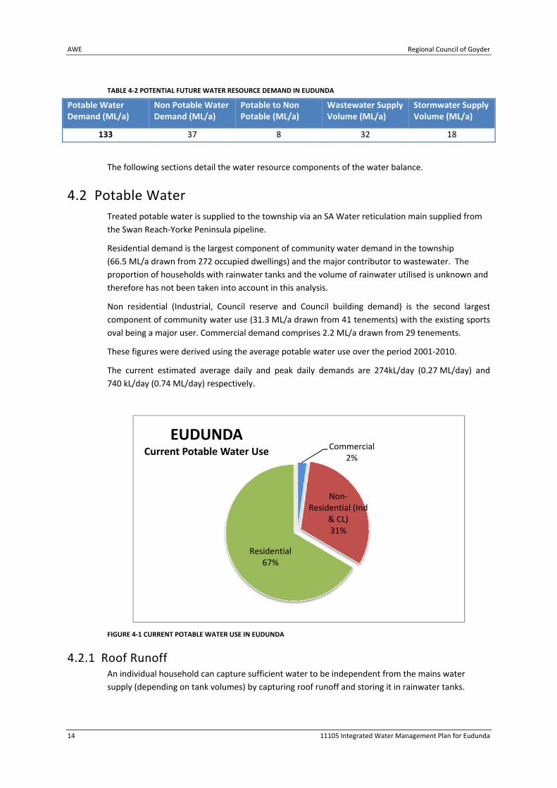
Residential demand is the largest component of community water demand in the township
(66.5 ML/a drawn from 272 occupied dwellings) and the major contributor to wastewater. The
proportion of households with rainwater tanks and the volume of rainwater utilised is unknown and
therefore has not been taken into account in this analysis.
Non residential (Industrial, Council reserve and Council building demand) is the second largest
component of community water use (31.3 ML/a drawn from 41 tenements) with the existing sports
oval being a major user. Commercial demand comprises 2.2 ML/a drawn from 29 tenements.
These figures were derived using the average potable water use over the period 2001‐2010.
The current estimated average daily and peak daily demands are 274kL/day (0.27 ML/day) and
740 kL/day (0.74 ML/day) respectively.
FIGURE 4‐1 CURRENT POTABLE WATER USE IN EUDUNDA
4.2.1 Roof Runoff An individual household can capture sufficient water to be independent from the mains water
supply (depending on tank volumes) by capturing roof runoff and storing it in rainwater tanks.
Commercial2%
Non‐Residential (Ind
& CL)31%
Residential67%
EUDUNDACurrent Potable Water Use

Regional Council of Goyder AWE
11105 Integrated Water Management Plan for Eudunda 15
The amount of rainwater (or roof runoff) a property can capture, store and use annually is
dependent on factors including:
The annual rainfall;
The roof area connected to the tank;
How much rainwater is used and when it is used; and
The capacity of the tank.
Commercial and industrial buildings can also harvest considerable volumes from roofs even with a
low annual rainfall.
Rainwater can reduce the demand for mains water if there is frequent drawdown. This process
involves using the rainwater as the primary source of water with mains water providing a backup
supply. Rainwater tanks used in this way can have an impact on minor flows (less than 1 in 5 ARI) in
the downstream drainage system. They will also reduce the total volume of stormwater discharged
from allotments and as a result are likely to have some effect in reducing the impact of stormwater
on the downstream receiving environment.
Continuing to encourage the installation of rainwater tanks is considered to be appropriate in
Eudunda. The current legislated requirement is for a 10,000L tank to be installed for new housing
developments and re‐developments. There is the potential for Council to increase this minimum
requirement which would increase the potential savings of River Murray water and of the
watercourses in and around Eudunda. The suitability of a rainwater tank greater than 10,000L would
be site/development dependent.
There is also the potential for council to further encourage the installation and use of rainwater
tanks by offering additional rebates to the rebates already available from SA Water.
4.3 Groundwater
4.3.1 Geology and Hydrogeology The township of Eudunda is located within the Adelaide Geosyncline which comprises a thick
sequence of variably folded and faulted sedimentary layers. Locally, siltstone of the Tapley Hill
Formation and tillite, sandstone and siltstone of the Appila Tillite are present. These sediments are
overlain by thin skeletal soils.
Recommended Actions
Council consider increasing the storage volumes of rainwater tanks required to be provided as
part of new legislation and / or Development Plan provisions, especially with regard to
commercial, industrial and larger scale residential developments.
Council investigate opportunities to encourage installation of rainwater tanks through
additional rebates and education of the benefits.
Council review where rainwater tanks can be installed on Council properties and / or
opportunities for tanks to be plumbed into Council buildings, where this is not already done.

AWE Regional Council of Goyder
16 11105 Integrated Water Management Plan for Eudunda
The hydrogeology of the district is characterized by the presence of fractured rock aquifers,
generally of low yield (due to low fracture density) and of marginal quality, and are also difficult to
predict in terms of the extent of fracturing and distribution of water quality.
Bore hole details are presented in Table 4‐3. A bore hole location plan is provided in Figure 4‐2. In
summary:
12 boreholes were identified and are of unknown purpose apart from 6729‐1079 which is
recorded as a drainage bore. It is presumed that the other bores may have been drilled for
stock supply purposes;
Salinities range from 594 mg/L to 6,199 mg/L. The low value is interpreted to be anomalous
as it is derived from the drainage bore 6729‐1079. Ignoring this bore the lower salinity
recorded limit is 2,141 mg/L;
The two recorded bore yields are low at 0.25 L/s and 0.3 L/s, and
Depth to water ranges from 2.03 m below ground level to 22.86 m below ground level and
these are highly dependent on topography at the actual bore locations.
The above data indicates that groundwater use as a resource would be limited due to low bore
yields and marginal to poor quality. The potential for Managed Aquifer Recharge would also be low
for the same reasons.
4.4 Water Dependent Ecosystems
The following description of the ecological environment within the township of Eudunda study area
is drawn from desktop research. Based on the available information, there are no water dependent
ecosystems (WDE) within the study area (i.e. the township boundary) or immediately upstream or
downstream of the study area.
Eudunda is built to the immediate east of the eastern Mount Lofty Ranges escarpment. Along the
escarpment there is a series of easterly sloping alluvial fans draining surface water run‐off from the
escarpment. This forms many minor intermittent creeks and low relief drainage lines which
ultimately fan out to become ill‐defined and intermittently connected shallow depressions on the
plain to the east of Eudunda. There are several minor drainage lines which pass through Eudunda
township.
An inspection of existing vegetation mapping (state‐wide floristic data, Department of Environment
and Natural Resources, viewed 4th July 2011) does not reveal any mapped intact native vegetation
associated with these creeklines. There are no fauna or flora survey sites recorded in the Biological
Databases of South Australia for the Eudunda township. All of the fauna and flora survey sites
recorded in immediate surrounds of Eudunda list species characteristic of terrestrial ecosystems,
rather than water dependent ecosystems. It should be noted that existing desktop mapping does
not necessarily record small areas of native vegetation and it is possible that there are occurrences
of native species associated with these creeklines.
A literature search has not found any existing detailed study on the connectivity or significance of
flow contribution to downstream aquatic ecosystems for any of the creeks which pass through the
township of Eudunda. No existing study on the value of local aquatic habitat provided by these
creeklines has been found.

Table 4-3: DES bore hole information
Eudunda
Unit No
Max drill
depth
Max drill
date
Late
open
depth
Late open
date Cased to
Case min
diam Purpose
Late
status
Late status
date SWL SWL date TDS TDS date pH pH date Yield yield date
MGA
easting
MGA
northing
6729-1075 2141 6/11/1914 322683.89 6216222.3
6729-1076 323134.91 6217037.26
6729-1077 16.76 20/09/1961 16.76 20/09/1961 UKN 20/09/1961 323350.87 6216934.27
6729-1078 5.33 21/09/1961 5.33 21/09/1961 UKN 21/09/1961 323399.92 6216880.27
6729-1079 31.09 1/10/1965 31.09 1/10/1965 23.82 152 DRN OPR 22.86 1/10/1965 594 1/10/1965 0.25 1/10/1965 323459.85 6216689.35
6729-1080 3484 5/11/1914 323793.93 6215922.35
6729-1237 18.55 23/03/1984 18.55 23/03/1984 152 13.73 23/03/1984 322475.93 6215439.32
6729-1243 3.35 27/03/1984 3.35 27/03/1984 2.03 27/03/1984 3764 27/03/1984 321358.87 6219071.33
6729-1337 44.84 13/03/1984 44.84 13/03/1984 34.82 13/03/1984 320830.92 6216900.29
6729-1338 12.2 13/03/1984 12.2 13/03/1984 ABD 320532.93 6217680.32
6729-1339 2.38 13/03/1984 2.38 13/03/1984 ABD 320783.91 6217943.28
6729-1361 136 23/05/1985 136 23/05/1985 24 150 6199 22/05/1985 7.5 22/05/1985 0.3 23/05/1985 325006.93 6216173.25
Notes
MGA Zone 54
DES search and download on 15/8/2011 - 3km radius search from bore 6729-1079
Figure 1 presents all bores in this table
No drillers or lithological logs were available for any of these bores

"
"/
12.2 mbglAbandoned
3,764 mg/L3.35 mbgl
2.03 mbgl
2.38 mbglAbandoned
44.84 mbgl
34.8 mbglna
na
nana 16.76 mbgl
nana
31.09 mbgl
22.86 mbgl594 mg/L
136 mbgl
na6,199 mg/L
na
na3,484 mg/L
18.55 mbgl
13.73 mbglna
5.33 mbgl
nana
na
na2,141 mg/L
Eudunda
6729-1361
6729-1339
6729-1338
6729-1337
6729-1243
6729-1237
6729-1080
6729-1078
6729-1075
6729-1079
6729-10776729-1076
321000
321000
322000
322000
323000
323000
324000
324000
325000
3250006213
000
6213
000
6214
000
6214
000
6215
000
6215
000
6216
000
6216
000
6217
000
6217
000
6218
000
6218
000
6219
000
6219
000
6220
000
6220
000
Figure 4-2Job No. 11105 D011110816
0 0.5 1
Kilometres
A u s t r a l i a n
WATEREnvironments
Eudunda Groundwater Borehole Location Plan
I n t e g r a t e d W a t e r M a n a g e m e n tI n t e g r a t e d W a t e r M a n a g e m e n tP l a n f o r B u r r a a n d E u d u n d aP l a n f o r B u r r a a n d E u d u n d a
LEGEND
Data Source:Cadastre supplied by SA Water; Drainage createdby Australian Water Environments (AWE) fromaerial photography and contours (5m interval)supplied by Dept of Water, Land & BiodiversityConservation (DWLBC); Study Area created byAWE from Landuse map supplied by GoyderCouncil.
!(
!(
!(!(
!(
!(
!(
!(
!(
SOUTH AUSTRALIA
VICTORIA
NEW SOUWALE
ROBE
BURRABERRI
GAWLER
GOOLWA
EUDUNDA
ADELAIDE
PORT PIRIE
PORT AUGUSTA
Eudunda DES bore hole
DrainageEudunda Study ExtentCadastre
Salinity (TDS)2.03 mbgl
3.35 mbgl3,764 mg/L
Maximum drill depth
Standing water level
"/ Drainage bore

Regional Council of Goyder AWE
11105 Integrated Water Management Plan for Eudunda 19
An on‐ground inspection may therefore be required to support the approvals process for any
proposed management actions with the potential to impact water quality or flow volume.
4.5 Stormwater
Stormwater is a significant issue in Eudunda, with regular and damaging flooding events occurring
within the township. A number of natural features contribute to this issue, including the topography
and limited formal drainage network. Recent stormwater management investigations have
identified the flooding issues within the township and recommended mitigation strategies. The
following outlines the existing stormwater catchments, infrastructure, potential harvesting
opportunities and recommended actions which still need to be implemented.
4.5.1 Surface Drainage and Watercourses Eudunda has two (2) dominant major catchments. The delineation between the catchments is
approximately at South Terrace, with discharges towards to the north and south east.
4.5.2 Existing Stormwater Infrastructure There is limited underground drainage within the township, with most of the flows conveyed along
roadways or open channels. A stormwater harvesting scheme captures runoff from the northern
Eudunda catchment, which then discharges, via a rising main, to the effluent storage ponds south of
the township.
The majority of the southern Eudunda stormwater is conveyed along kerbs or open channels. A
short piped section starts through a vacant lot on Weigall Street and discharges within the Viterra
grain silo facility. An open channel is located adjacent to the Kapunda‐Morgan Main Road. A second
channel has been constructed to the south of South Terrace. This flows south of the township to a
basin adjacent to the golf course.
The northern catchment includes a large rural catchment to the west, where a detention basin has
been recently constructed. This detention basin has suffered a major failure during a recent high
flow event. Remediation of this basin is a high priority due to the risk of a catastrophic dam break in
a future flood event and on public safety grounds. From this basin, flow is directed through a culvert
beneath the old railway line. This flows through an open channel within a drainage easement to
Bruce Street (via Drain E) where stormwater is conveyed in a concrete lined channel running parallel
to the roadway. Underground drainage is located along Hannan Street which discharges to the open
channel along Bruce Street.
There is currently one stormwater harvesting system in Eudunda, however the extent of reuse is
currently unclear. The current scheme is located at junction of Eudunda Road/ Three Chains Road/
Industry road
Recommended Actions
Undertake an on‐ground inspection to support the approvals process for any proposed
management action with the potential to impact on water quality or flow volume.
AWE Regional Council of Goyder
20 11105 Integrated Water Management Plan for Eudunda
The last storms choked up the intake gratings and it failed to collect significant volumes of water
and Council now have to reconstruct with riprap and plants around the intake to prevent silting.
That work will commence shortly and should minimise the occurrence of future failures.
The WWTP lagoon has sensor to prevent stormwater intake when levels are such that dam
overtopping is imminent. An additional lagoon may be required in future to increase the stormwater
harvesting potential, but more irrigation areas will be required to justify the capital cost.
4.5.3 Stormwater Management Options Eudunda has previously had a stormwater management study undertaken in 2005. Several of the
recommendations from the study have been implemented.
The culverts under South Terrace from the eastern catchment are under capacity as is the contour
drain just south of South Terrace. Works are required to provide additional capacity for the culverts
and channel. Detention within the old railway dam adjacent to the golf course would reduce peak
flows through the southern areas of the township. There is potential to provide some reuse from
this basin on an opportunistic basis, however the basins is primary function is to act as detention
basin to mitigate flow.
There are several overland flow paths through privately owned property. Providing formal drainage
easements through these areas will aid in the management of stormwater runoff.
There is insufficient capacity to convey all flows in a major storm event along the Gunn Street/Bruce
Street. Providing an underground drainage network would increase the conveyance capacity during
a major event. Providing an underground system would also reduce nuisance flooding which occurs
during minor events. Alternatively, the roads through this area have a steep camber and regrading
the road would provide additional conveyance capacity. However this option is not as cost effective
and underground flows for minor events is not achieved.
The detention basin constructed upstream of the railway line experienced a piping failure during the
February/March 2011 extreme rainfall events. Repair of this will need to be undertaken.
4.5.4 Stormwater Harvesting Opportunities The existing harvesting scheme collects stormwater from the northern catchment and discharges to
the storage lagoons. No data of discharge to the lagoons has so far been collected. Estimates based
on catchment runoff and pumping rates suggest that between 40‐50 ML/a could be harvested.
However, this will be limited by several factors including the availability of storage at the
wastewater lagoons.
The stormwater harvesting basin has limited storage volume, it is expected that a significant volume
of stormwater currently bypasses the basin. Storage must be available within the wastewater ponds
to prevent overtopping at this location.
There is a potential stormwater harvesting opportunity within golf course at south end of Ayr Street
which captures stormwater from diversion channel south of junction of South Terrace/ Bruce Street.
This dam is not actively used at present but the larger former railway dam may in the future be used
to mitigate the stormwater flow from the northwest. It is understood that investigations are
underway into the sizing of the culvert and channel design servicing these dams and beyond.
Stormwater harvesting could be investigated in the future if there is an increase in demand which
could be met by this supply.
Regional Council of Goyder AWE
11105 Integrated Water Management Plan for Eudunda 21
4.5.5 Stormwater Quality Within any catchment, particular activities and types of development are likely to generate higher
than average pollutant loads. The following provides a broad identification of key land uses and
activities that are likely to constitute higher than average pollutant sources to stormwater:
Construction sites;
Car parks;
Major transport centres;
Industrial sites; and
Horticultural sites.
An integrated approach is required to manage pollutants from these land uses and activities. There
is currently no local data/information available with regard to the stormwater quality and the
potential risk that it poses to the watercourses, groundwater resource, Water Dependent
Ecosystems (WDE) and other users (e.g. potable water supplies) in the region. A risk analysis of
indicates that turbidity, nutrients (e.g. nitrate) and heavy metal hazards are key water quality issues
relating to the discharge of township stormwater to the receiving environments in the region. Based
on the water quality objectives for ecosystem health (contained within the Environment Protection
(Water Quality) Policy 2003), the concentration of pollutants entering the receiving environments
could exceed the water quality objectives (principally associated with storm events). Consequently,
installation of stormwater treatments measures (via WSUD, swales, detention basins etc) is
recommended.
Due to the relative lack of data, it is recommended that a supplementary program of analysis of
stormwater quality in existing detention basins be developed and subsequently undertaken at
various times throughout the year to obtain further baseline information.
Opportunities identified to manage and improve stormwater quality within the Regional Council of
Goyder include:
Installation of Gross Pollutant Traps (GPTs);
Construction of wetlands/bioretention systems;
Education campaigns; and
Provision of guidance materials to developers (such as EPA handbook for building sites).
Recommended Actions
Sealing all roads and providing sealed or kerbed verges and formalised drainage
easements/reserves over existing water courses through private land;
Rectification of detention basin upstream of Drain E (west of railway embankment).
Design upgrade of the contour channel and culverts at South Terrace to mitigate flood risk.
Ensure all stormwater harvesting opportunities would comply with the relevant legislation.

1
1
1
1
1
1
11
1
1
1
1
1
1
1
1
1
1
1
1
1
1
1
1
1
1
1
1
"M
"M"M"M
"M
kj
kjkj
kj
ExistingTownOval Existing
SchoolOval
ExistingSchoolOval
Cemetary
1
1
5
6
3
2
4
5
5
5
400
380
390
430
420
450
410
370
460
470
360
440
480
480460
430
430
440
430
440
390
390
410
410
380
440
430
370
400
390
420
410
410 400
440
420
370
420
420
400
390
460
322500
322500
323000
323000
323500
323500
324000
324000
324500
324500
325000
325000
6216
000
6216
000
6216
500
6216
500
6217
000
6217
000
6217
500
6217
500
6218
000
6218
000
!(
!(!(
!(
!(
!(
!(
!(
SOUTH AUSTRALIA
VICTORIA
NEW SOUTHWALESBURRA
BERRI
GAWLER
GOOLWA
EUDUNDA
ADELAIDE
PORT PIRIE
PORT AUGUSTA
Figure 4-3Job No. 11105 - 013110817
Existing Catchment, Wastewater andStormwater Infrastructure Flooding Issues in Eudunda
I n t e g r a t e d W a t e r M a n a g e m e n t P l a nI n t e g r a t e d W a t e r M a n a g e m e n t P l a nf o r B u r r a a n d E u d u n d af o r B u r r a a n d E u d u n d a
Eudunda
A u s t r a l i a n
WATEREnvironments
Data Source:
0 200 400 600 800
Metres (scale 1:12,000 Sheet A3)
LEGEND
Aerial Photography (2005) obtained from Google Earth; Contours and Cadastre (2003) supplied by SA Water;Tanks and Pumping Stations, Pipes, Culverts, Wastewater Treatment Plant, Stormwater Capture Basin,Stormwater Detention Basin, Gully Erosion Damage and Drainage created by Australian Water Environments(AWE) from field survey and aerial photography.
Tanks and Pumping Stations"M Stormwater Pump Station
"M WW Pump Station
kjPotable WaterTank - SA Water
kj Reclaimed Water Tank
kj WWTP TankContour: 10m interval
IntermediateMajorCadastreWastwater Treatment PlantStormwater Capture BasinStormwater Detention BasinGully Erosion Damage
PipesConcrete ChannelReclaimed WW Rising MainStormwater Rising MainUnderground PipeWater Mains - SA WaterSewer Raising MainCulvert
1 DrainageIssues
Flooding
Bund
Detention and Harvesting
Irrigation
Infrastructure notes: (see RED numbers)1. Existing area of flood issues.2. Redesign of existing contour bund.3. Rectification of detention basin.4. Potential stormwater detention and harvesting at golfcourse dam.5. Potential additional irrigation areas.6. Monitoring use and Water Quality.
Regional Council of Goyder AWE
11105 Integrated Water Management Plan for Eudunda 23
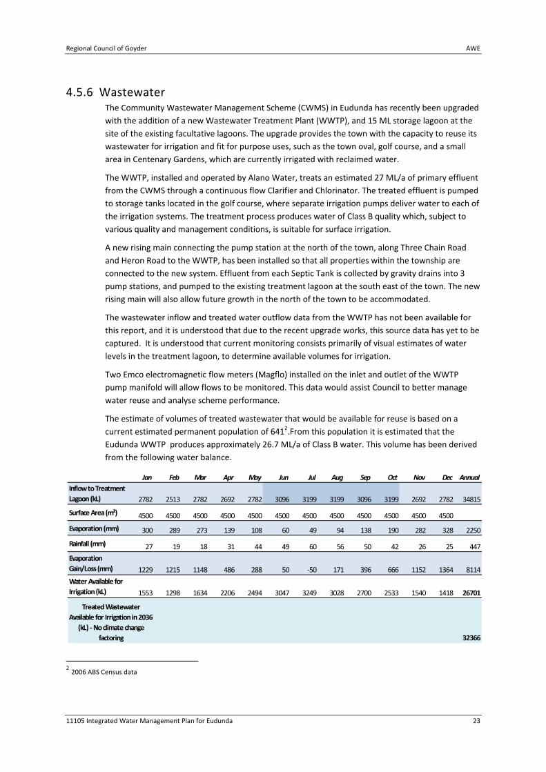
4.5.6 Wastewater The Community Wastewater Management Scheme (CWMS) in Eudunda has recently been upgraded
with the addition of a new Wastewater Treatment Plant (WWTP), and 15 ML storage lagoon at the
site of the existing facultative lagoons. The upgrade provides the town with the capacity to reuse its
wastewater for irrigation and fit for purpose uses, such as the town oval, golf course, and a small
area in Centenary Gardens, which are currently irrigated with reclaimed water.
The WWTP, installed and operated by Alano Water, treats an estimated 27 ML/a of primary effluent
from the CWMS through a continuous flow Clarifier and Chlorinator. The treated effluent is pumped
to storage tanks located in the golf course, where separate irrigation pumps deliver water to each of
the irrigation systems. The treatment process produces water of Class B quality which, subject to
various quality and management conditions, is suitable for surface irrigation.
A new rising main connecting the pump station at the north of the town, along Three Chain Road
and Heron Road to the WWTP, has been installed so that all properties within the township are
connected to the new system. Effluent from each Septic Tank is collected by gravity drains into 3
pump stations, and pumped to the existing treatment lagoon at the south east of the town. The new
rising main will also allow future growth in the north of the town to be accommodated.
The wastewater inflow and treated water outflow data from the WWTP has not been available for
this report, and it is understood that due to the recent upgrade works, this source data has yet to be
captured. It is understood that current monitoring consists primarily of visual estimates of water
levels in the treatment lagoon, to determine available volumes for irrigation.
Two Emco electromagnetic flow meters (Magflo) installed on the inlet and outlet of the WWTP
pump manifold will allow flows to be monitored. This data would assist Council to better manage
water reuse and analyse scheme performance.
The estimate of volumes of treated wastewater that would be available for reuse is based on a
current estimated permanent population of 6412.From this population it is estimated that the
Eudunda WWTP produces approximately 26.7 ML/a of Class B water. This volume has been derived
from the following water balance.
2 2006 ABS Census data
Jan Feb Mar Apr May Jun Jul Aug Sep Oct Nov Dec Annual
2782 2513 2782 2692 2782 3096 3199 3199 3096 3199 2692 2782 34815
4500 4500 4500 4500 4500 4500 4500 4500 4500 4500 4500 4500
300 289 273 139 108 60 49 94 138 190 282 328 2250
27 19 18 31 44 49 60 56 50 42 26 25 447
1229 1215 1148 486 288 50 ‐50 171 396 666 1152 1364 8114
1553 1298 1634 2206 2494 3047 3249 3028 2700 2533 1540 1418 26701
32366
Rainfall (mm)
Inflow to Treatment
Lagoon (kL)
Surface Area (m²)
Evaporation (mm)
Evaporation
Gain/Loss (mm)
Water Available for
Irrigation (kL)
Treated Wastewater
Available for Irrigation in 2036
(kL) ‐ No climate change
factoring

AWE Regional Council of Goyder
24 11105 Integrated Water Management Plan for Eudunda
Wastewater inflows are based on an average daily wastewater demand of 140L per person
(Department of Health: Onsite Wastewater Systems Code), with an additional nominal allowance of
15% (shown in darker shading) to account for winter flows (June‐October).
The water balance also includes an allowance for a projected population growth of around 21% by
2036, to 777 people. This will result in the production of 32.4kL/d of reclaimed wastewater, which is
an additional 4.7ML/a.
It is understood that the treated wastewater is fully utilised for irrigation of the oval and golf course
the irrigation season. During the winter months, when irrigation is not necessary, wastewater can
be stored in the lagoon. This would amount to approximately 12 ML over the four months (May to
August).
Stormwater is harvested in the north of the town, and pumped to the storage lagoon. The addition
of stormwater to the wastewater lagoon dilutes the effluent, and has the added advantage of
reducing the overall salt level in the dam, which is a significant advantage to water quality. The
volume of stormwater that can be harvested has been estimated to be between 550 ‐ 850kL/a (HDS
‐ Eudunda Stormwater Harvesting Sept 2007). A water balance model of inflows to the storage
lagoon has been developed which assessed both the existing capacity of the storage system, and
future capacity for additional harvesting. The analysis indicates that, with the current addition of
stormwater, the lagoon storage would be likely to have infrequent overflows. It is understood that
this surplus water is currently irrigated on demand, even outside of the irrigation season.
There may be opportunities to extend the irrigation system to additional locations, such as the
school, cemetery, and other town gardens and reserves, and expand irrigation within the golf
course. With more detailed information on the available volumes through metering, together with
appropriate winter storage facilities it is highly likely that irrigation can be expanded.
Recommended Actions
Undertake monitoring of the wastewater and irrigation scheme to determine current and
future performance requirements, and provide data on water use for future planning and water
security;
Investigate additional reuse opportunities for treated wastewater (third party users), including
increase public open space irrigation, and/or commercial opportunities such as market gardens.

Regional Council of Goyder AWE
11105 Integrated Water Management Plan for Eudunda 25
4.6 Climate Change Impacts
Climate change impacts on the water balance were estimated by increasing the demand from
irrigated areas with higher evapotranspiration and lower rainfall. The supply is also decreased with
low rainfall resulting in lower runoff and increased evaporation from open storages.
The climate change scenarios adopted as part of this IWMP was a “mid level’ drying scenario. The
details of this scenario are described in Appendix B.
For the purpose of assessing the impact of climate change on the water balance of Eudunda, climate
was altered on a month by month basis within the model. A three month, rolling average climate
change value for each month was used in the analysis.
TABLE 4‐4 MONTHLY CLIMATE CHANGE SCENARIO DATA
Jan Feb Mar Apr May Jun Jul Aug Sep Oct Nov Dec
Temperature change from
current (degrees C)
0.86 0.82 0.79 0.76 0.72 0.68 0.68 0.68 0.74 0.82 0.9 0.91
Jan Feb Mar Apr May Jun Jul Aug Sep Oct Nov Dec
Rainfall change from current
(%) ‐0.8 2.1 0.93 ‐0.5 1.3 0.4 2.8 0.0 ‐3.0 ‐7.8 ‐9.5 ‐4.4
Jan Feb Mar Apr May Jun Jul Aug Sep Oct Nov Dec
Evaporation change from current (mm)
2.3 3.5 3.5 3.3 2.6 1.9 1.8 1.9 1.9 1.4 0.7 1.4
Typically the climate change scenario results in a small change in the runoff from a catchment,
typically in the order of 2‐4%. There are modest increases in irrigation demand typically around 1%,
There are also small decreases in the volume supplied and reliably, around 2%.
This represents a small consistent reduction in reduction in yield. Generally the variation between
years is greater than a general reduction in rainfall.
If future increases in temperature/evaporation and reductions in rainfall continue, then more
extreme scenarios will have a larger effect on the operation and viability of reuse options.

AWE Regional Council of Goyder
26 11105 Integrated Water Management Plan for Eudunda
5 Implementation Plan
5.1 Overview
The Implementation Plan clearly sets out the activities that Council can undertake to achieve the
objectives of the IWMP.
Recommended Actions/Strategic Directions have been included for both the Council sector and the
Community sector (residential, industrial and commercial activities). The Plan therefore
recommends that Council commit resources to improving its own organisational environmental
performance, as well as implementing projects in the community sector.
The implementation plan incorporates a priority system where a priority ranking is assigned to each
identified action. The rankings are defined and described in Table 5‐1.
TABLE 5‐1 DESCRIPTION OF PRIORITY RANKINGS
Priority Ranking Explanation
H High
To be undertaken as soon as practicable. Actions:
Are funded or require funding as a matter of urgency
Will result in multiple objectives being achieved (social,
environmental and economic)
M Medium
To be undertaken once the high priority actions are completed or if
external funds or resources are available. Actions:
Should be funded during the implementation of the plan
Will result in positive environmental outcomes and may have
other benefits
BP Business
Process
To be undertaken as part of normal business processes or through a minor
change to process. Actions:
Can be carried out as part of existing budgets and workload
Will result in a change to existing services, processes or activities
and will have no or marginal impact on workload
The Implementation Plan provides detail on each of the actions. Possible partnerships have been
assigned to each action along with a suggested timeframe and where appropriate (and possible), an
estimated budget for implementation.
The implementation plan has grouped the Recommended Actions/Strategic Directions into the
following:
1‐5 year horizon, or Immediate Actions;
5‐10 year horizon, or Intermediate Actions; and
10‐30 year horizon or Long Term/Strategic Actions.

Regional Council of Goyder AWE
11105 Integrated Water Management Plan for Eudunda 27
They have also been grouped into Eudunda specific actions and recommended actions which are
relevant to both Eudunda and the whole Council region. The regional recommendations have been
identified from a range of investigations associated with Eudunda as well as Burra and other
regional towns in neighbouring Council areas. It would be inefficient to implement these
recommendations for Eudunda alone but collectively with other towns they would be worthwhile.
The Recommended Actions are mapped in Appendix C.
5.2 Immediate Recommended Actions
Based upon the review of the current and future demands of Eudunda (and the community) and the
opportunities with regards to the range of possible water sources to meet those demands, a range
of recommended actions have been proposed in Table 5‐2 and 5‐3 for the next one to five years,
which are described below.
5.2.1 Eudunda
5.2.1.1 Recommended Action E1: Metering and Monitoring
Undertake monitoring of the wastewater, stormwater and irrigation scheme to validate
assumptions regarding water availability and usage. Determine current and future performance
requirements, and provide data on water use for future planning and water security;
5.2.1.2 Recommended Action E2: Mandate Wastewater Connection
All future development in Eudunda to be connected to the CWMS scheme.
5.2.1.3 Recommended Action E3: Implement Selected Actions from Stormwater
Management Plan
The Stormwater Management Plan previously produced for Eudunda provided direction for the
implementation of priority actions to assist in the reduction of flooding in the township of Eudunda.
Many of these actions have been undertaken and it is recommended that the remaining key
recommendations are acted upon in the short term.
5.2.1.4 Recommended Action E4: Sealing and Kerbing of Roads
Complete the sealing and kerbing of all roads and provide formalised drainage easements/reserves
over existing water courses through private land.
5.2.1.5 Recommended Action E5: Detention Basin Rectification
Rectification of detention basin upstream of Drain E. Currently, the dam poses a high risk of
catastrophic failure if a major storm event were to occur in the near future.
5.2.1.6 Recommended Action E6: Potential Third Party Users
Investigate additional reuse opportunities for treated wastewater (third party users), including
increase public open space irrigation, and/or commercial opportunities such as market gardens as
even with proposed expansion of the irrigation scheme there appears to be additional supply
capacity for further users.
AWE Regional Council of Goyder
28 11105 Integrated Water Management Plan for Eudunda
5.2.2 Regional The following recommended actions are relevant for the Regional Council of Goyder to proceed
within entire Council area, including Eudunda.
5.2.2.1 Recommended Action R1: Discussion with Stormwater Management Authority
Application may be made to the Stormwater Management Authority (SMA) for funding towards the
production of Stormwater Management Plans and stormwater infrastructure works (including
associated technical investigations and land acquisition). Projects must demonstrate a significant
flood mitigation component as well as addressing, wherever practicable, value adding opportunities
such as stormwater reuse and water quality enhancements to be eligible for funding from the
Stormwater Management Fund.
Discussions should be held with the appropriate officer of the SMA regarding the application
process. The aims of the discussion would be gain an understanding of the priorities and willingness
of the SMA to fund the Stormwater Management Plan and to clarify the practical components of the
application process.
Clarification of the application process will inform the scope of works for the Stormwater
Management Plan in particular the format and content of the application.
5.2.2.2 Recommended Action R2: Complete a Corporate Water Consumption Inventory /
Audit
In order to identify actions to reduce the water consumption of the region, particularly with respect
to Eudunda, it is important to understand how much water is used, where, by whom and how.
It is therefore recommended that an audit of the water usage at various Council properties be
conducted in the first instance. An audit can range from a broad overview to a detailed study. The
following steps provide an example of how an understanding can be obtained of the water usage:
Obtain information from SA Water regarding water consumption (annual water usage data
has been obtained from SA Water however quarterly data should be obtained if possible).
Sudden or gradual increases in water use may indicate leakage.
Identify equipment and practices that waste water.
Identify the water intensive areas of the buildings to target specific areas of high
consumption.
Investigate seasonal trends in water usage.
Through the audit process a range of opportunities will be identified. These water conservation and
water reuse opportunities should then be prioritised and actions put in place which will help achieve
water conservation objectives and targets for the Council.
5.2.2.3 Recommended Action R3: Council Website Review and Update
A range of communication methods can be utilised to promote environmental sustainability,
including integrated water management. The Council’s website is an ideal forum to promote the
work that Council is undertaking with regards to sustainable water management and also to provide
information sources to residents and industries. The website can be utilised for educational
purposes as discussed below.
Regional Council of Goyder AWE
11105 Integrated Water Management Plan for Eudunda 29
It is therefore recommended that a review of the Council website be undertaken and information
included, where relevant, regarding Integrated Water Resources Management.
5.2.2.4 Recommended Action R4: Environmental Awareness Education
Raising awareness is one of the most cost effective and sustainable methods to save water.
Education and incentive schemes can be used to encourage the uptake of water conservation
practices and technologies.
There are a range of methods to engage people through education and communication – from
informal learning and engaging activities (often hands‐on) to professional development and
continuing education, formal education, presentations, performances, information, artwork and
media. Available funds will influence the methods that are used.
To be successful, programs must be tailored as different people have different understandings of
water and their environment. They will also have different ways and different amounts of time and
resources that they can contribute to learning about water conservation.
There are already a number of community water conservation programs run by government
agencies such as SA Water, the EPA, WaterWise, WaterCare and the NRM Boards.
It is therefore recommended that environmental education awareness be commenced over the next
12 months with Council staff and elected members which will assist in achieving the other actions
(and associated objectives and targets) proposed.
5.2.2.5 Recommended Action R5: Environmental Officer
The Integrated Water Management Plan will set the framework and actions for sustainable water
management for the long term. The IWMP should be seen as a living document that will require
updating and re‐evaluating as information is gained and targets are being achieved.
It is recommended that to ensure the Plan (and its associated actions) achieve the desired
outcomes, a review be undertaken to determine if a dedicated position is warranted to undertake a
range of tasks, including implementation of the IWMP and / or if it may be feasible for a position to
be created which is shared between a number of adjacent Council areas.
5.2.2.6 Recommended Action R6: Establish a Maintenance Program for Stormwater
Infrastructure
A maintenance program should be established for the existing stormwater management system in
the Eudunda. This management plan should consider both the formal underground system
components and the known informal flow paths which have posed a problem in the past.
The content of the maintenance plan should be informed by the problems experienced in the
system in the past and the measures the Council has found effective in other similar locations.
The maintenance plan should be mindful of the higher risk periods for large flow events based on
historic experience (i.e. historic destructive rainfall events have occurred in summer months and, as
such, cleaning of blockages of debris etc from the stormwater system at the end of winter may be
useful in addition to works prior to the wet period in winter).
The maintenance plan should also consider the need for emergency maintenance and inspections in
response to large rainfall events or heavy rainfall / storm warnings. This type of maintenance may
include the removal of debris and sediment from key locations within the stormwater management

AWE Regional Council of Goyder
30 11105 Integrated Water Management Plan for Eudunda
system when blockages are increasing the residence time of floodwaters within the township.
Action of this type may reduce the damage and hazard caused by pooled floodwaters after large
events.
5.2.2.7 Recommended Action R7: Review of Plant Species on Council Properties
Application of Water Sensitive Urban Design (WSUD) principles to landscape design aims to perform
the following functions:
Maximising the survival of plants during periods of low rainfall;
Conserving an effective vegetation cover for WSUD measures that incorporate vegetation
such as drainage needs and filter strips; and
Enhancing biodiversity and habitat values by giving preference to locally indigenous plant
species.
It is therefore recommended that a review of plant species on Council properties be undertaken to
determine if landscaping practices can be improved including replanting with locally indigenous
plant species to achieve the above outcomes where possible.
5.2.2.8 Recommended Action R8: Irrigation Practice Review
Many environmental hazards can be concentrated in the soil, being stripped out of the water as it
moves through the soil matrix. Salinisation of soils is one of the most difficult environmental
consequences of irrigation to ameliorate. Thus, soil analysis is essential to verify that the soil
continues to remain fit for its intended use, and that it is appropriate for sustainable land use. Soil
sampling results help to ensure that detrimental changes in the soil environment are identified at an
early stage, thus minimising or preventing effects on vegetation, surface and groundwater. This is
particularly important at the oval due to the level of salinity in the groundwater that is being used to
irrigate the oval.
Through more efficient irrigation practices there is the opportunity to reduce water consumption in
Eudunda as well as ensure the ability to irrigate in the long term (i.e. by maintaining the health of
the soil structure and turf).
It is recommended that the key principles in the Irrigated Public Open Space Code of Practice (2008)
be followed to ensure that irrigation in Eudunda is undertaken sustainably including:
Undertake an audit of irrigation systems to ensure the system is functioning correctly;
Implement a horticultural management and maintenance program to maintain soil
structures and ensure turf has adequate nutrients;
Determine the baseline irrigation requirement using long term average climatic data to set
a monthly irrigation schedule; and
Monitor irrigation consumption against irrigation requirements and report on irrigation
efficiency and turf quality.
5.2.2.9 Recommended Action R9: Water Dependent/Native Ecosystem Assessments
Undertake on‐ground survey of potential sites to be impacted via IWMP recommendations to
document any native vegetation present its condition and its habitat value.

Regional Council of Goyder AWE
11105 Integrated Water Management Plan for Eudunda 31
5.2.2.10 Recommended Action R10: Development of a Stormwater Management Plan for
Regional Council of Goyder Towns
It is recommended that a standalone Stormwater Management Plan be developed to ensure the
management of stormwater in the future is integrated. The plan will also provide valuable guidance
on onsite stormwater management requirements to be integrated into the development application
process.
A stormwater management plan is of particular importance in areas where residential development
is expected to increase. As such, the plan should be completed after the current planning review is
complete.
Funding is available for completing a Stormwater Management Plan from the Stormwater
Management Authority (SMA). If appropriate, application should be made to the SMA for funds to
development the Stormwater Management Plan.
The outcomes of the Stormwater Management Plan will provide information for further applications
for funding to complete works.
The development of a Stormwater Management Plan should be informed by discussions with the
SMA. The Stormwater Management Plan would be also informed by the survey of the town. The
scope of the development of the Stormwater Management Plan should include:
The content as required by the Stormwater Management Planning Guidelines (Stormwater
Management Authority, 2007). It is envisaged that some of these aspects have been
addressed in this Plan;
Modelling of the catchments feeding the town, the existing stormwater network and
drainage lines and any proposed upgrades or additional infrastructure. The modelling will
inform detailed design, negotiations with DTEI regarding funding contributions and works,
the level of risk and magnitude of the hazard posed under the existing conditions and
proposed designs for problem areas;
Detailed design including drawings for any additional infrastructure, including road
alignment changes, detention basins, treatment devices and expansion of the existing
stormwater network;
Detailed costing of the proposed works. The presentation of the costing information should
be consistent with the requirements of the SMA for further funding applications;
Consultation with landholders regarding the construction, maintenance and access to
stormwater management devices on private land;
Recommendations on the prioritisation of infrastructure works and further planning
related tasks;
Recommendations for policies for new development areas including on site stormwater
management, identification of areas or land parcels that are well placed to be used for
future stormwater management; and
Consideration of the magnitude and location of increases in development.
5.2.2.11 Recommended Action R11: Investigate Rainwater Tank Storage Increase

AWE Regional Council of Goyder
32 11105 Integrated Water Management Plan for Eudunda
Council consider increasing the storage volumes of rainwater tanks required to be provided as part
of new legislation and / or Development Plan provisions, especially with regard to commercial,
industrial and larger scale residential developments
5.2.2.12 Recommended Action R12: Investigate Additional Rainwater Tank Rebates
Council investigate opportunities to encourage installation of rainwater tanks through additional
rebates and education of the benefits.
5.2.2.13 Recommended Action R13: Investigate Installation and Plumbing of Rainwater
Tanks into Council Properties
Council review where rainwater tanks can be installed on Council properties and / or opportunities
for tanks to be plumbed into Council buildings, where this is not already done.

Regional Council of Goyder AWE
11105 Integrated Water Management Plan for Eudunda 33
TABLE 5‐2 IMMEDIATE IWMP RECOMMENDED ACTIONS FOR THE NEXT 1‐5 YEARS: EUDUNDA
Action
Number
Action Description Priority Contributes to
Objective:
Potential Partnerships Estimated Costing Timeframe &
Process
E1 Metering and Monitoring H 1, 2, 3, 4, 6, 7, 8, 9 SA MDB NRM Board, EPA,
DoH $5,000 2012
E2 Mandate Wastewater
Systems M 1, 2, 3, 4, 6, 7, 8, 9
SA MDB NRM Board, EPA,
DoH N/A 2012
E3
Implement Stormwater
Management Plan
Recommendations
H 1, 2, 3, 4, 5, 6, 9 SMA, LGA, SA MDB NRM
Board See Table 5‐3 2012
E4 Sealing and Kerbing of
Roads M 1, 2, 3, 4, 5, 9
SMA, LGA, SA MDB NRM
Board $100,000 2012 ‐ 2015
E5 Detention Basin
Rectification H 1, 2, 5, 6 LGA, SA MDB NRM Board $80,000 2012
E6 Investigate Potential Third
Party Users M 1, 2, 3, 4, 6, 7, 9
LGA, SA MDB NRM Board,
EPA, DoH N/A 2012 ‐ 2015
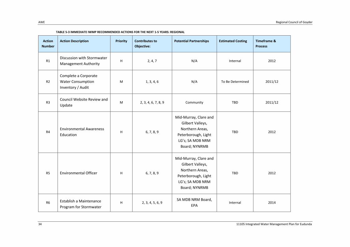
AWE Regional Council of Goyder
34 11105 Integrated Water Management Plan for Eudunda
TABLE 5‐3 IMMEDIATE IWMP RECOMMENDED ACTIONS FOR THE NEXT 1‐5 YEARS: REGIONAL
Action
Number
Action Description Priority Contributes to
Objective:
Potential Partnerships Estimated Costing Timeframe &
Process
R1 Discussion with Stormwater
Management Authority H 2, 4, 7 N/A Internal 2012
R2
Complete a Corporate
Water Consumption
Inventory / Audit
M 1, 3, 4, 6 N/A To Be Determined 2011/12
R3 Council Website Review and
Update M 2, 3, 4, 6, 7, 8, 9 Community TBD 2011/12
R4 Environmental Awareness
Education H 6, 7, 8, 9
Mid‐Murray, Clare and
Gilbert Valleys,
Northern Areas,
Peterborough, Light
LG’s; SA MDB NRM
Board; NYNRMB
TBD 2012
R5 Environmental Officer H 6, 7, 8, 9
Mid‐Murray, Clare and
Gilbert Valleys,
Northern Areas,
Peterborough, Light
LG’s; SA MDB NRM
Board; NYNRMB
TBD 2012
R6 Establish a Maintenance
Program for Stormwater H 2, 3, 4, 5, 6, 9
SA MDB NRM Board,
EPA Internal 2014

Regional Council of Goyder AWE
11105 Integrated Water Management Plan for Eudunda 35
Action
Number
Action Description Priority Contributes to
Objective:
Potential Partnerships Estimated Costing Timeframe &
Process
Infrastructure
R7 Review of Plant Species on
Council Properties H 3, 6, 8
DENR, SA MDB NRM
Board $20,000 2014
R8 Irrigation Practice Review H 1, 2, 3, 4, 6, 7, 8, 9 SA MDB NRM Board $10,000 2011/12
R9 Water Dependent/Native
Ecosystem Assessments H 2, 6
DENR, SA MDB NRM
Board $30,000 2013
R10
Development of a
Stormwater Management
Plan for Regional Council of
Goyder Towns
H 1, 2, 3, 4, 5, 6, 9 SMA, LGA, SA MDB NRM
Board $150,000 2011/12
R11 Investigate Rainwater Tank
Storage Increase M 1, 2, 3, 4, 5, 6 SA MDB NRM Board Internal 2012
R12 Investigate Additional
Rainwater Tank Rebates BP 1, 2, 3, 4, 5, 6 SA MDB NRM Board Internal 2013/14
R13
Investigate Installation and
Plumbing of Rainwater
Tanks into Council
Properties
M 1, 2, 3, 4, 5, 6 SA MDB NRM Board, DoH,
EPA Internal 2012

AWE Regional Council of Goyder
36 11105 Integrated Water Management Plan for Eudunda
5.3 Intermediate Actions
Based upon the review of the current and future demands of Eudunda (and the community) and the
opportunities with regards to the range of possible water sources to meet those demands, a range
of actions have been proposed in Table 5‐4 to 5‐5 for the next five to ten years. A number of these
actions are described below.
5.3.1 Eudunda
5.3.1.1 Recommended Action E7: Review Potential for Stormwater Harvesting
In addition to the current stormwater harvesting scheme, if there is sufficient demand that exceeds
the existing water availability then there may be potential to increase the stormwater harvesting
scheme to harvest runoff from within the golf course. This will be dependent upon wastewater,
stormwater and irrigation monitoring outcomes.
5.3.2 Regional
5.3.2.1 Recommended Action R14: Incorporate Integrated Water Management Objectives
in Council Strategic Plan
The Regional Council of Goyder Strategic Management Plan provides the overarching planning
framework, vision, goals and future directions to guide Council’s priorities, project and investment.
The purpose of the Strategic Management Plan is to provide for the management of the Council
area.
The Strategic Management Plan contains a number of references to environmental sustainability
and water management, however, it is recommended that when the Strategic Management Plan is
reviewed, that the objectives of the IWMP are taken into account and that water management
principles are incorporated in the plan.

11105 Integrated Water Management Plan for Burra 37
TABLE 5‐4 INTERMEDIATE IWMP RECOMMENDED ACTIONS FOR THE NEXT 5‐10 YEARS: EUDUNDA
Action
Number
Action Description Priority Contributes to
Objective:
Potential Partnerships Estimated Costing Timeframe &
Process
E7 Review Potential
Stormwater Harvesting M 1, 2, 3, 4, 5, 7, 9
LGA, SMA, SA MDB NRM
Board $15,000 2020
TABLE 5‐5 INTERMEDIATE IWMP RECOMMENDED ACTIONS FOR THE NEXT 5‐10 YEARS: REGIONAL
Action
Number
Action Description Priority Contributes to
Objective:
Potential Partnerships Estimated Costing Timeframe &
Process
R14
Incorporate Integrated
Water Management
Objectives in Council
Strategic Plan
H 1, 2, 3, 4, 5, 6, 7, 8, 9 Internal 2015

AWE Regional Council of Goyder
38 11105 Integrated Water Management Plan for Eudunda
5.4 Strategic and Long Term Actions
Based upon the review of the current and future demands of Eudunda (and the community) and the
opportunities with regards to the range of possible water sources to meet those demands, a range
of actions have been proposed in Table 5‐6 for the next ten to thirty years.
5.4.1 Eudunda
5.4.1.1 Recommended Action E8: Review Monitoring Data and Update IWMP
Undertake a detailed review of metered data obtained from the wastewater and stormwater
system and irrigation demand. This would be to verify the water resource availability assumptions of
the IWMP. It would be recommended to update the IWMP at that time based on this new
information.
5.4.2 Regional
5.4.2.1 Recommended Action R15: Ensure that reliance on the River Murray is reduced
through undertaking actions in this plan and reviewing and updating plan
5.4.2.2 Recommended Action R16: Support and encourage community based groups
regarding environment protection and conservation
5.4.2.3 Recommended Action R17: Develop appropriate locations across the Council area
as water management demonstration sites
5.4.2.4 Recommended Action R18: Regularly review development principles for
environmental sustainability and provide clear information for developers on
environmental design criteria
5.4.2.5 Recommended Action R19: Ensure the exchange of environmental ideas and
information across Local Government
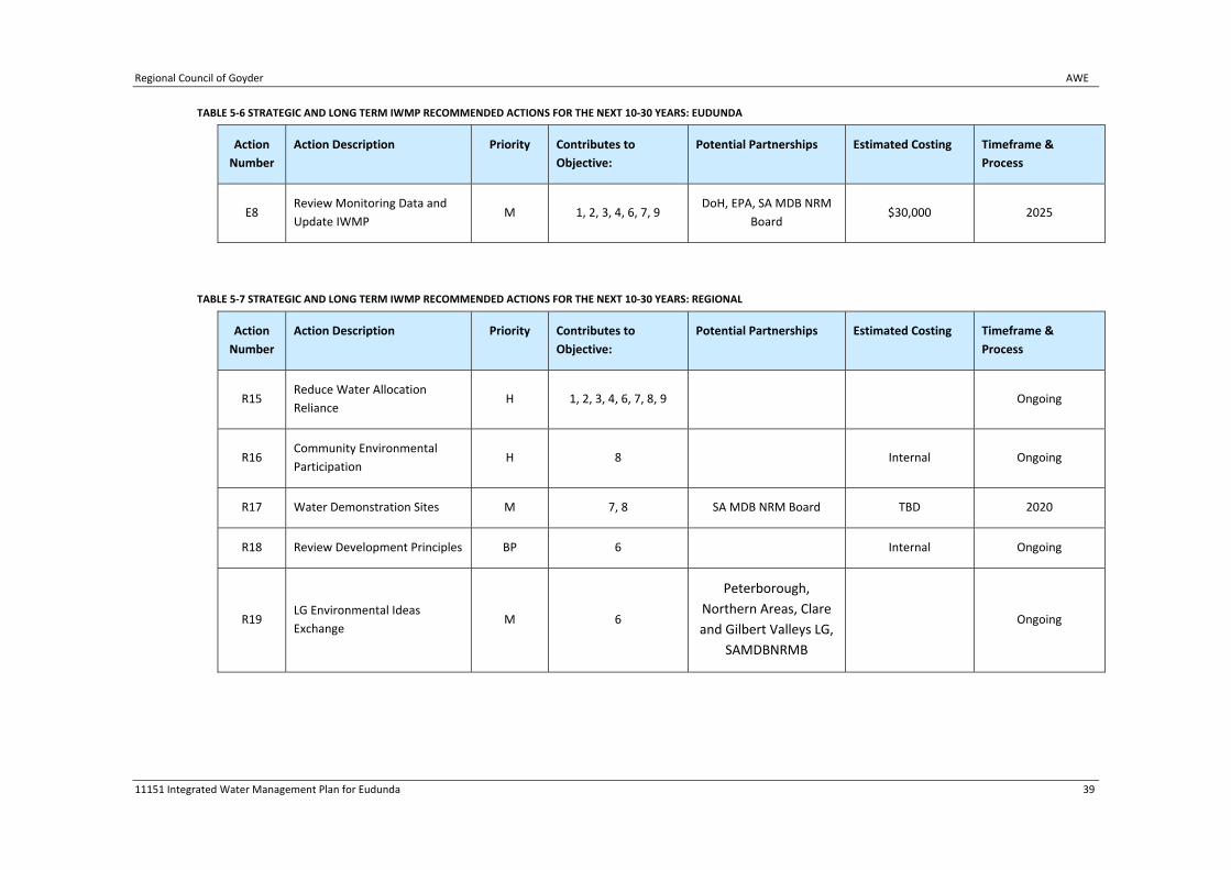
Regional Council of Goyder AWE
11151 Integrated Water Management Plan for Eudunda 39
TABLE 5‐6 STRATEGIC AND LONG TERM IWMP RECOMMENDED ACTIONS FOR THE NEXT 10‐30 YEARS: EUDUNDA
Action
Number
Action Description Priority Contributes to
Objective:
Potential Partnerships Estimated Costing Timeframe &
Process
E8 Review Monitoring Data and
Update IWMP M 1, 2, 3, 4, 6, 7, 9
DoH, EPA, SA MDB NRM
Board $30,000 2025
TABLE 5‐7 STRATEGIC AND LONG TERM IWMP RECOMMENDED ACTIONS FOR THE NEXT 10‐30 YEARS: REGIONAL
Action
Number
Action Description Priority Contributes to
Objective:
Potential Partnerships Estimated Costing Timeframe &
Process
R15 Reduce Water Allocation
Reliance H 1, 2, 3, 4, 6, 7, 8, 9 Ongoing
R16 Community Environmental
Participation H 8 Internal Ongoing
R17 Water Demonstration Sites M 7, 8 SA MDB NRM Board TBD 2020
R18 Review Development Principles BP 6 Internal Ongoing
R19 LG Environmental Ideas
Exchange M 6
Peterborough,
Northern Areas, Clare
and Gilbert Valleys LG,
SAMDBNRMB
Ongoing

AWE Regional Council of Goyder
40 11105 Integrated Water Management Plan for Eudunda
5.5 Monitoring and Review
All actions contained in the Implementation Plan contribute to State, Regional and Local strategies
and outcomes, as identified in Appendix A.
Monitoring and evaluation of the IWMP establishes an approach for continuous improvement in the
planning, implementation and regular review of the Plan. Monitoring and evaluation processes will
ensure that the Plan is adapted or modified in light of experience and new knowledge so that it
continues to meet the needs of the Council, the community, governments and other stakeholders
into the future.
Monitoring, evaluation and reporting activities are specifically designed to help:
Decide if the Plan and its priorities, targets and actions need to be changed, and where
attention should be focused;
Support the use of an adaptive management approach planning to ensure continuous
improvement based on new knowledge and experiences;
Determine who will be accountable for achieving, monitoring, evaluating and reporting
outcomes; and
Establish regular reporting systems for accountability to any investors including State and
Australian governments.
Water management planning is a dynamic process and will not end with the completion of the plan.
There is a clear need to establish mechanisms to:
Develop appropriate monitoring programs;
Set further targets;
Monitor progress and changes in Eudunda;
Monitor key environmental, social and economic indicators;
Identify new and emerging issues;
Monitor implementation of the plan outcomes; and
Monitor the effectiveness of the strategies proposed in the plan.
Different components of monitoring, evaluation and reporting activities include:
Plan monitoring – assessment of progress of project investments and other related activity
outputs against significant milestones and management action targets;
Outcomes monitoring – overall assessment of progress towards effecting change in the
region’s resource condition targets;
Adaptive management evaluation – comprehensive evaluation and review of progress and
effectiveness of the Plan and its implementation towards improving management
processes and decision making that provides feedback for modifying and improving Plan
targets, investments and actions; and
Regional Council of Goyder AWE
11105 Integrated Water Management Plan for Eudunda 41
Accountability evaluation – assessment of the overall achievements of the plan towards set
goals (that is, in terms of progress towards improving natural resource condition and
improving regional capacity in the longer term) for the investment received.
Each of these core components has a different focus, time frame and reporting requirement.
Importantly, they provide the basis for structuring a range of monitoring and evaluation activities
and identifying responsibilities for the strategy to operate. Because of the differences between the
core components, however, each requires different management structures and processes and
reporting requirements.
Therefore, in order to facilitate effective implementation of the Plan, an efficient coordination
system to guide, monitor and assist implementation activities is required. In addition, the
implementation process should, wherever possible, make use of existing administrative structures
and frameworks and avoid duplication of process.
This plan adopts the adaptive management cycle of Plan – Do – Monitor – Evaluate. Therefore it is
recommended that continual review of the Plan is undertaken and that a comprehensive review of
this plan should be undertaken in 2013.

AWE Regional Council of Goyder
42 11105 Integrated Water Management Plan for Eudunda
6 Funding Opportunities A wide range of grants and other funding opportunities are available from government agencies,
corporate bodies and non‐government organisations. There are a number of funding opportunities
to assist the Council undertake the actions recommended above including:
Strengthening Basin Communities – Water Saving Initiatives;
South Australian Murray Darling Basin NRM Board; and
Stormwater Management Authority.
Each of these is discussed below.
It should also be noted that to assist Councils and the community to identify the range of grant
options available from Commonwealth, State, Local Government and private organisations, the
Local Government Research and Development Scheme funded a project with the SA Office of
Regional Affairs to establish an online search facility which is updated by all three spheres of
government and other organisations online.
6.1 Strengthening Basin Communities – Water Saving Initiatives
Future Federal Government funding under the Strengthening Basin Communities – Water Saving
Initiatives Component will be available (on a competitive basis) to Murray‐Darling Basin Councils in
accordance with an IWMP for the relevant township.
6.2 South Australian Murray Darling Basin NRM Board
There are a number of opportunities for obtaining funding support for NRM activities by the NRM
Board including Community Grants. Information can be obtained from the NRM Board.
6.3 Stormwater Harvesting and Reuse Projects ‐ Third
Competitive Grants Round
The Australian Government is calling for applications for funding to support eligible stormwater
harvesting and reuse projects under the National Urban Water and Desalination Plan: stormwater
harvesting and reuse grants round. Projects are sought that capture, treat and use stormwater to
ease the pressure on drinking water supplies and deliver improved water quality to our urban
waterways.
6.4 Regional Development Australia
The Australian Government Department for Regional Australia, Regional Development and Local
Government provides a range of regional funding programs, including:
Regional Development Australia Fund ‐ a national program to support Australia’s regions
and enhance the economic development and liveability of their communities. It is
understood that Round 2 of the RDAF program will be open to applicants in November
2011.

Regional Council of Goyder AWE
11105 Integrated Water Management Plan for Eudunda 43
Community Infrastructure Grants Program – funding construction and upgrade of local
sport, recreation and community infrastructure identified by communities as priority
investments for their region
Additional information is available at: http://www.regional.gov.au/regional/programs/index.aspx.

AWE Regional Council of Goyder
44 11105 Integrated Water Management Plan for Eudunda
7 References Environment Protection Authority (2003) South Australian Environment Protection (Water Quality)
Policy
Government of South Australia (October 2009) Onsite Wastewater Systems Code
HDS (September 2007) Eudunda Stormwater Harvesting
Moise, D. and Milne, T. (eds) (2010). A Biological Survey of Permanent Water Sites within the South
Australian Murray Darling Basin Rangelands. Nature Conservation Society of South Australia,
Adelaide.
Natural Resources Management Ministerial Council, Environment Protection and Heritage Council,
Australian Health Minister’s Conference (2006, 2008a, 2008b) Australian Guidelines for Water
Recycling – Managing Health and Environmental Risks
Officers of the South Australian Health Commission, the South Australian Water Corporation,
Department of Primary Industries South Australia, Environment Protection Authority, Local
Government Association and United Water (1999) South Australian Reclaimed Water Guidelines
(1999)
Regional Council of Goyder (2004) Regional Council of Goyder Strategic Directions Report
Sustainable Focus (January 2011) Draft Climate Change and Natural Resources Management Plan
Tonkin Consulting (2005) Water Supply Investigation
Spatial Data‐sets
DENR (2008) Native Vegetation (Floristic) – NVIS Statewide. Mapping data.
Appendix A : Federal, State and Regional
Legislative Framework

Overview
South Australia’s legislative framework provides a number of tools to address water management
ranging from state‐wide legislation to regional and local policy.
One of the key mechanisms for achieving the desired outcomes of integrated water management is
to ensure that the objectives of the Plan meet and contribute to other State and National Natural
Resources Management policies and strategies. These strategies therefore assist in the
implementation of the desired water management outcomes in the township of Eudunda.
A brief summary of each document is provided to highlight interrelationships between the
administrative systems/agencies and legislative/policy documents.
A literature review was undertaken which provided a broad understanding of the associated Federal
and State legislation and policy context as well as State, regional and local plans and strategies.
Several of the key documents reviewed include:
South Australian Government, Water for Good.
Strategic growth plans for the region from State, Council and Regional Development
Australia.
SA Murray‐Darling Natural Resources Management Plan and Water Allocation Plan.
The National Water Quality Management Strategy and accompanying guidelines.
Australian Government, Water or the Future Program.
In addition to the above sources of relevant legislation and policy, background information was also
sought on the existing infrastructure, relevant water management plans and spatial constraints that
would be relevant in developing a viable water management strategy for the Regional Council of
Goyder with a particular focus on stormwater and wastewater.
Legislative and Policy Framework
The following table (Table 1) summarises the legislative and administrative framework related to the
Eudunda IWMP:
TABLE 1 LEGISLATIVE, POLICY AND ADMINISTRATIVE FRAMEWORK
National legislation, strategies, policies and plans and Authorities
South Australian legislation and regulations
South Australian
Strategies, Plans
South Australian Policies, Guidelines and Codes
South Australian relevant Authorities, organisations
Regional Council of Goyder Plans and Policies
Water Act 2007 Development Act 1993
South Australia’s Strategic Plan, 2007
SA Stormwater Pollution Prevention Codes of Practice
Regional Council of Goyder
Goyder Council Development Plan
Water Regulations 2008
Environment Protection Act, 1993
Water for Good
Building Code of Australia
Environment Protection Authority
Regional Council of Goyder Strategic Management Plan
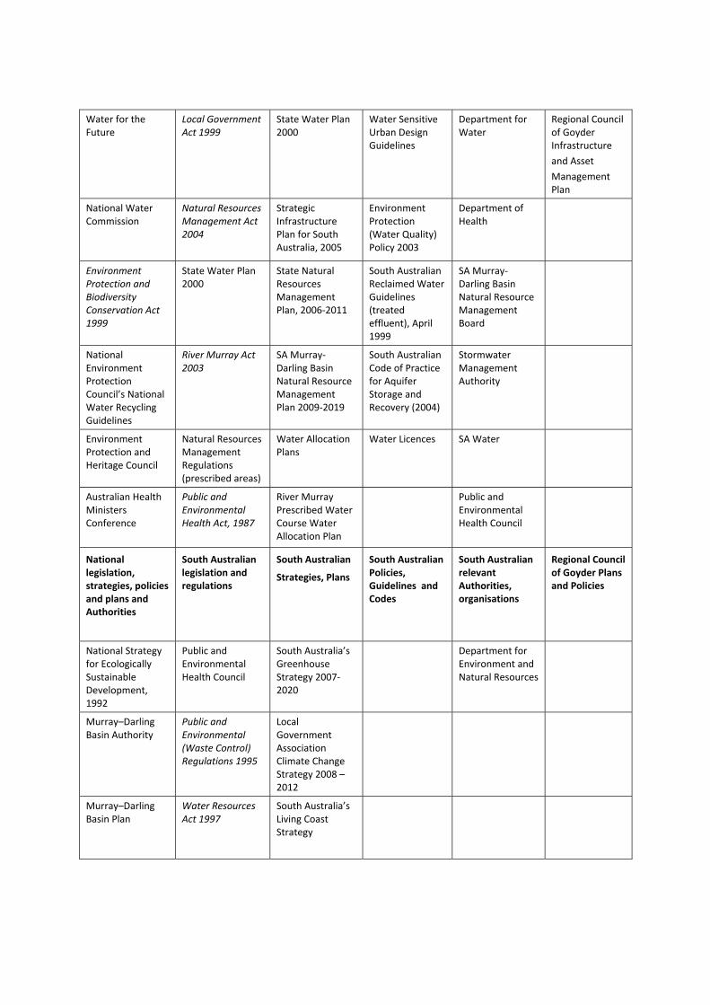
Water for the Future
Local Government Act 1999
State Water Plan 2000
Water Sensitive Urban Design Guidelines
Department for Water
Regional Council of Goyder Infrastructure
and Asset
Management Plan
National Water Commission
Natural Resources Management Act 2004
Strategic Infrastructure Plan for South Australia, 2005
Environment Protection (Water Quality) Policy 2003
Department of Health
Environment Protection and Biodiversity Conservation Act 1999
State Water Plan 2000
State Natural Resources Management Plan, 2006‐2011
South Australian Reclaimed Water Guidelines (treated effluent), April 1999
SA Murray‐Darling Basin Natural Resource Management Board
National Environment Protection Council’s National Water Recycling Guidelines
River Murray Act 2003
SA Murray‐Darling Basin Natural Resource Management Plan 2009‐2019
South Australian Code of Practice for Aquifer Storage and Recovery (2004)
Stormwater Management Authority
Environment Protection and Heritage Council
Natural Resources Management Regulations (prescribed areas)
Water Allocation Plans
Water Licences
SA Water
Australian Health Ministers Conference
Public and Environmental Health Act, 1987
River Murray Prescribed Water Course Water Allocation Plan
Public and Environmental Health Council
National legislation, strategies, policies and plans and Authorities
South Australian legislation and regulations
South Australian
Strategies, Plans
South Australian Policies, Guidelines and Codes
South Australian relevant Authorities, organisations
Regional Council of Goyder Plans and Policies
National Strategy for Ecologically Sustainable Development, 1992
Public and Environmental Health Council
South Australia’s Greenhouse Strategy 2007‐2020
Department for Environment and Natural Resources
Murray–Darling Basin Authority
Public and Environmental (Waste Control) Regulations 1995
Local Government Association Climate Change Strategy 2008 – 2012
Murray–Darling Basin Plan
Water Resources Act 1997
South Australia’s Living Coast Strategy

Murray‐Darling Association
Local Government (Stormwater Management) Amendment Act 2007
Local Government Association Mutual Liability Scheme
National Water Quality Management Strategy
Waterworks Act, 1932
Climate Change Risk Management and Adaptation Program
Natural Resource Management Ministerial Council
Sewerage Act, 1929
National Groundwater Action Plan, 2007
Climate Change and Greenhouse Emissions Reduction Act, 2007
Water CampaignTM Milestone Framework
Bureau of Meteorology
Regional Development Australia

Appendix B : Council’s Strategic Planning
Framework: Development Planning and Climate
Change

Council’s Strategic Planning Framework: Development Planning and
Climate Change
Regional Council of Goyder Plans and Policies
The Regional Council of Goyder has a number of strategic documents which guide the development
of integrated water management plans in the region, including:
Regional Council of Goyder Development Plan;
Regional Council of Goyder Strategic Directions Report;
Regional Council of Goyder Infrastructure and Asset Management Plan;
Regional Council of Goyder Long Term Financial Plan
Water Supply Investigation (2005) Tonkin Consulting
Draft Climate Change and Natural Resources Management Plan (January 2011) Sustainable
Focus.
These are briefly discussed below.
Regional Council of Goyder Development Plan
A Development Plan is required for each Council area in accordance with the Development Act 1993.
Development Plans provide the detailed zones, maps and policies against which development
applications are assessed. Council’s Development Plan provides the major control over development
in the Regional Council of Goyder, including Burra and Eudunda.
Current Development Plan Policy
Development Plans are regularly amended to reflect updated local council or State Government
policy (particularly the State Government Planning Strategy); to introduce changes to zoning; and/or
to implement a new vision for the future development of a particular zone or area.
The Goyder Council Development Plan was consolidated on 17 February 2011, in accordance to the
Development Act 1993.
The Development Plan was converted to the Better Development Plan format, via the Better
Development Plan DPA in 2007.
Council has advised that they have no current Development Plan Amendments in the system, apart
from the Integrated Water Management Regional Development Plan Amendment.
The Development Act 1993 also provides for the listing of State and Local heritage places within the
Development Plan. Of significance, the Town of Burra is included as a State Heritage Place, and
there are 75 State Heritage listed properties in Burra, and 1 State Heritage Listed property in
Eudunda.
The Goyder Council Development Plan includes relevant policies relating to water management in
the General Section and within specific zones. Relevant policies are listed below; the zoning map for
each township is included in Appendix A.

Relevant Policies
The following subsections from the General Section of the Development Plan include Objectives and
Principles of Development Control relating to water management:
Animal Keeping
Objectives: 1
Principles of Development Control: 1, 2, 3, 4, 6‐12, 16
Forestry
Principles of Development Control: 3
Industrial
Principles of Development Control: 10, 11
Infrastructure
Objectives: 1, 2, 3, 4, 5
Principles of Development Control: 1 (b, c and e), 4, 5, 6,7
Hazards
Objectives: 1, 2
Principles of Development Control: 4, 5, 13, 16, 17
Landscaping
Principles of Development Control: 1, 3
Land Division
Objectives: 1, 3
Principles of Development Control: 1 (a, b, c), 2 (e), 5 (g), 7 (b), 9, 10, 11, 12, 13(e)
Mineral Extraction
Principles of Development Control: 4, 6
Natural Resources
Objectives: 1, 2, 3, 4, 5, (a‐e), 6
Principles of Development Control: 1, 2, 3, 5, 6, 7, 8 (9&10?), 11 (a‐i), 12, 13, 14 (a‐c), 15 (a‐
e), 16 (a‐g), 18, 19, 20, 21, 22, 23, 24, 25, 26 (a & b), 29.
Open Space and Recreation
Principles of Development Control: 2 (c) (e), 3, 8, 13
Residential
Principles of Development Control: 14 (d)
Sloping Land
Objectives: 1

Principles of Development Control: 2, 5, 6
Waste
Objectives: 2
Principles of Development Control 1, 2, 3, 4, 5, 6 (c and e), 7, 8, 9, 10, 11, 12, 13, 14, 15, 16,
17, 18, 19.
Other Relevant Policies:
The Residential Zone policies provide for allotments of a minimum of 1000m2 for detached
dwellings, 600 m2 for semi‐detached, 500 m2 for group dwellings and 400 m2 for row
dwellings. The Rural Living Zone provides for allotments within the Rural Living Zone of a
minimum of 1 Ha.
Both Burra and Eudunda townships are surrounded by the Primary Production Zone, which
provides for a minimum of 100Ha allotments.
“Waste reception, storage, treatment or disposal” is listed as non‐complying in the
following zones:
o Bulk Handling Zone
o District Town Centre Zone
o Historic Mining Zone
o Open Space Zone
o Recreation Zone
o Residential Zone
o Town Centre Zone
o Primary Production Zone (only in defined Policy Areas: Township Fringe Policy
Area 1 and Enterprise Policy Area 2)
This is relevant to any future management of wastewater within the township.
Other Development Plan considerations:
The Development Plan does not include Floodplain Mapping, and Council has required some
applicants to obtain independent flood investigations to inform the assessment of their
application for developments in proximity to Burra Creek.
Council receives enquiries regarding rural living land division; however land division creating
allotments of less than 100 Ha are non‐complying in the Primary Production Zone which
surrounds both townships.
Proposed changes to the Goyder Council Development Plan
A Development Plan may be amended by a Development Plan Amendment (DPA). A DPA is
currently in progress across the Local Government Areas within the SA Murray Darling Basin Natural
Resources Management Board area with a focus on Integrated Water Management. A Statement of
Intent was prepared in December 2010 and is pending Ministerial authorisation. The DPA is
proposing the preparation of integrated water resources management policies across the eleven

consortium Councils to ensure that future growth of these regional areas and their surrounds are
sustainable in terms of both water quality and quantity, under predicted future climatic conditions.
Due to the early stage of this DPA, the exact nature of any proposed changes are not yet available,
however the project is anticipated to include the development of an Integrated Water Management
Development Plan policy module, to provide model policy that will ensure future town growth is
undertaken in accordance with a relevant IWMP.
Regional Council of Goyder Strategic Directions Report
Councils under Section 30 of the Development Act 1993 must prepare a Strategic Directions Report
(Section 30 Review) every 5 years, or within 12 months of any alteration to the State Planning
Strategy.
The Regional Council of Goyder prepared a Strategic Directions Report on 3 February 2004. This
report produced 50 recommendations under the headings of:‐
Economic Activity;
Infrastructure;
Environment and Resources;
People, Towns and Housing;
Regional Settlements;
Development Plan Format; and
Water Resources.
The next Strategic Directions Report is scheduled for 2012.
Regional Council of Goyder Infrastructure and Asset Management Plan
Under Section 122 of the Local Government Act 1999, Councils must develop and adopt
Infrastructure and Asset Management Plans covering a period of at least 10 years.
Councils in South Australia are the custodians of infrastructure and assets on behalf of their
communities. They have an obligation to ensure that current assets are managed efficiently and
effectively and that decisions regarding the acquisition of new assets, the sale of current assets and
the maintenance of current assets are undertaken in an open and transparent fashion.
Council has adopted a series of Plans as required by the Act, incorporating the following key
elements:‐
Road Infrastructure
Building Infrastructure
o Core Activities
o Core Community
o Council Heritage and Self‐funded Buildings
o Non Council Recreation

o Non Core Council Activities
Plant and Equipment
Regional Council of Goyder Long Term Financial Management Plan
All councils are required to adopt Long Term Financial Management Plans covering a period of at
least 10 years.
The Regional Council of Goyder adopted their 10 year Long Term Financial Management Plan,
incorporating their Infrastructure and Asset Management Plan, in June 2010.
Water Supply Investigation, 2005
The Central Local Government Region of South Australia (CLGRSA), which consists of 15 member
councils including the Regional Council of Goyder, engaged Tonkin Consulting to undertake a review
of water supply systems within the region.
The purpose of this review was to provide recommendations on future water supply issues for the
region, and to inform the development of a 5, 10 and 20 year capital works program.
As a result of this project it was agreed that in order to facilitate economic development across the
region, a more consistent funding methodology was needed to support water supply projects.
A number of alternative models were presented in this report, with Council, the Regional
Development Board and the Natural Resources Management Board Staff agreeing on a preferred
model.
Draft Climate Change and Natural Resources Management Plan (January 2011), Sustainable
Focus
A Climate Change and Natural Resources Management Plan was prepared for the Regional Council
of Goyder, with a view of including it in Council’s Strategic Management Plan. The report provides
information about climate change, describes some of the issues that will be faced by people and the
natural environment in the Goyder region. The Plan seeks to achieve the following outcomes:‐
Council has improved capacity to manage NRM and climate change issues;
Communities are knowledgeable and actively engaged in NRM and climate change
mitigation and adaptation;
Council minimises its use of energy and water;
Council activities protect and enhance natural resources;
Water resources across the region are managed sustainably; and
Environmental assets of the region are protected.

Future Township Growth
The extent of land subject to future growth is limited within the study area, however potential
growth scenarios for Eudunda are described below.
Eudunda
Eudunda is not anticipated to experience significant growth, either outside or inside existing
township/settlement boundaries.
The growth scenario was determined by considering the following inputs:
The Project Brief;
Review of available population projections for the region; and
Review of existing Development Plan.
Population
Current Population
The township of Eudunda comprises one Census Collection District: 4040202. In the 2006 Census
there were 641 persons usually resident in Eudunda, 16.1% of which were children aged between 0‐
14 years and 46.8% were persons aged 55 years and over. The median age of persons in Eudunda
was 52 years, compared with 37 years for persons in Australia.
Projected Population Growth
Using a base population of 641 persons in 2006, it is projected that the population of Eudunda will
be 777 in 2036, which represents an increase of 136 people.
This projection has been developed by applying the percentage increase in population for the Yorke
and Lower North Statistical Division to the 2006 population of Eudunda at 5‐yearly intervals.
(Source: Population Projections for South Australia and Statistical Division, 2006‐36 (Medium Series),
December 2010 release (Department of Planning and Local Government, Government of South
Australia 2010).
Dwellings
There were 272 occupied private dwellings in 2006, of a total of 318 total private dwellings. 94.9%
of these were separate houses, 3.3% were flats, units or apartments, and 1.8% were other
dwellings. There were no semi‐detached dwellings.
This represented an increase in 10 occupied dwellings, and an increase of 10 total dwellings
(including unoccupied) since the 2001 Census. (Reference: 2006 Census QuickStats: Burra (State
Suburb), Australian Bureau of Statistics, and 2001 Census QuickStats: Burra (Urban Centre/Locality),
Australian Bureau of Statistics).
Council has indicated that there were 14 new dwellings approved in Eudunda since 2006.
Growth Areas
The following is an overview of residential and rural living land supply and demand and potential
areas for residential and rural living development.
Residential Land Supply and Demand
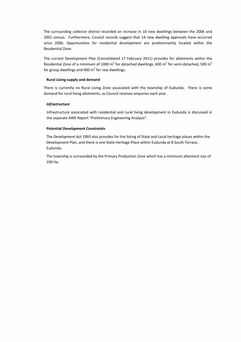
The surrounding collector district recorded an increase in 10 new dwellings between the 2006 and
2001 census. Furthermore, Council records suggest that 14 new dwelling approvals have occurred
since 2006. Opportunities for residential development are predominantly located within the
Residential Zone.
The current Development Plan (Consolidated 17 February 2011) provides for allotments within the
Residential Zone of a minimum of 1000 m2 for detached dwellings, 600 m2 for semi‐detached, 500 m2
for group dwellings and 400 m2 for row dwellings.
Rural Living supply and demand
There is currently no Rural Living Zone associated with the township of Eudunda. There is some
demand for rural living allotments, as Council receives enquiries each year.
Infrastructure
Infrastructure associated with residential and rural living development in Eudunda is discussed in
the separate AWE Report “Preliminary Engineering Analysis”.
Potential Development Constraints
The Development Act 1993 also provides for the listing of State and Local heritage places within the
Development Plan, and there is one State Heritage Place within Eudunda at 8 South Terrace,
Eudunda.
The township is surrounded by the Primary Production Zone which has a minimum allotment size of
100 Ha.

Climate Change Scenarios
This section outlines the agreed approach to incorporating climate change scenarios for the
development of the IWMP. Background information is provided from the following two sources:
“Water Availability in the Murray – A Report to the Australian Government from the CSIRO
Murray‐Darling Basin Sustainable Yields Project” (July, 2008), and
“Planning Component Consultancy SBC033A.1/2 Climate Change impact assessment,
adaptation and emerging opportunities for the SA Murray Darling region”
Outcomes from the “Planning Component Consultancy SBC033A.1/2 Climate Change impact
assessment, adaptation and emerging opportunities for the SA Murray Darling region” project are
summarised here and provide the basis for incorporation of climate change scenarios into this
project.
Overview of “Water Availability in the Murray”
CSIRO has developed climate change predictions within “Water Availability in the Murray – A Report
to the Australian Government from the CSIRO Murray‐Darling Basin Sustainable Yields Project” (July,
2008). An overview of the approach to that report and key findings are provided here. A copy of
the summary report of the “Water Availability in the Murray” document is included in Appendix B.
“The assessments of current and potential future water availability have been undertaken by
considering four scenarios of historical, recent and future climate and current and future
development. All scenarios are defined by daily time series of climate variables based on different
scaling of the 1895 – 2006 climate.
The first scenario is for historical climate and current development and is used as a baseline against
which other scenarios are compared.
The second scenario is for recent climate and current development and is intended as a basis for
assessing future water availability should the climate in the future prove to be to be similar to that
of the last ten years.
The third scenario is for future climate and current development and evaluates three global
warming scenarios using 15 global climate models to provide a spectrum of possible climates for
2030. From this spectrum three variants are reported: a median or best estimate, a wet variant and
a dry variant.
The fourth scenario is for future climate and future development and considers the effects of both
a 2030 climate and the expansions in farm dams and commercial plantation forestry expected under
current policy, and the changes in groundwater extractions anticipated under existing groundwater
plans.
All scenarios assume current water sharing arrangements and do not attempt to include possible
management responses to changes in climate, water availability or development.” (CSIRO, July 2008,
p2).
Murray Region
The Murray Region used for the “Water Availability in the Murray” study represents 19.5% of the
total area of the Murray Darling Basin. It is based around the Murray River and the Lower Darling
River below Menindee and extends to the Southern Ocean.

The population of the region is 309,000, which is mainly in the centres of Albury‐Wodonga, Echuca,
Swan Hill, Mildura, Renmark, Murray Bridge and Goolwa.
The Murray Region receives inflows from the following regions:
Barwon‐Darling
Murrumbidgee
Ovens
Goulburn‐Broken
Campaspe
Loddon‐Avoca
It should be noted that the results of this study are primarily for the region as defined above.
However, in places the findings relate to hydrologic assessments aggregated through the entire
connected river system of the MDB because this region is strongly affected by inflows from
upstream regions.
Dryland pasture for livestock grazing (60.5 percent) is the dominant land use in the Murray region.
Native vegetation is around 22 percent, dryland crops comprise 6.9 percent, while irrigated crops
comprise 2.6 percent of land use.
“The region uses over 36 percent of the surface water diverted for irrigation and urban use in the
MDB and around 14 percent of groundwater used in the MDB.” (CSIRO, July 2008, p.3)
Key Findings
The following is a summary of key findings taken from the CSIRO report; please refer to Appendix B
for additional detail of the findings for each of the four scenarios.
Historical Climate and Current Development
“Average surface water availability for the MDB aggregated to Wentworth under the historical
climate is 14,493 GL/year. For the Murray region, average surface water availability is 11,162
GL/year.
Under current development, surface water use across the MDB aggregated to Wentworth
(including downstream use) is extremely high with 56 percent of the average available water used.
Average surface water use within the Murray region aggregated to Wentworth is 4045 GL/year or a
high 36 percent of the average surface water available in the region. Current groundwater use
within the region is about 233 GL/year or 5 percent of total water use in the region.” (CSIRO, July
2008, p.4).
Recent Climate and Current Development
“If the recent (1997 to 2006) climate were to persist, average surface water availability for the
Murray region would fall by 30 percent, average diversions in the Murray region would fall by 13
percent and end‐of‐system flows would fall by 50 percent. The relative level of surface water use
across the MDB would be 66 percent.” (CSIRO, July 2008, p.4).
Future Climate and Current Development
“The best estimate (median) of climate change by 2030 is less severe than the recent past. Under
this climate, average surface water availability for the Murray region would fall by 14 percent,
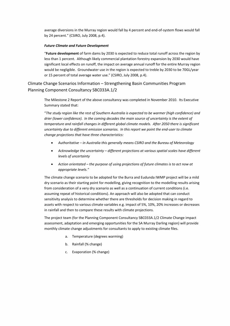
average diversions in the Murray region would fall by 4 percent and end‐of‐system flows would fall
by 24 percent.” (CSIRO, July 2008, p.4).
Future Climate and Future Development
“Future development of farm dams by 2030 is expected to reduce total runoff across the region by
less than 1 percent. Although likely commercial plantation forestry expansion by 2030 would have
significant local effects on runoff, the impact on average annual runoff for the entire Murray region
would be negligible. Groundwater use in the region is expected to treble by 2030 to be 70GL/year
or 15 percent of total average water use.” (CSIRO, July 2008, p.4).
Climate Change Scenarios Information – Strengthening Basin Communities Program
Planning Component Consultancy SBC033A.1/2
The Milestone 2 Report of the above consultancy was completed in November 2010. Its Executive
Summary stated that:
“The study region like the rest of Southern Australia is expected to be warmer (high confidence) and
drier (lower confidence). In the coming decades the main source of uncertainty is the extent of
temperature and rainfall changes in different global climate models. After 2050 there is significant
uncertainty due to different emission scenarios. In this report we point the end‐user to climate
change projections that have three characteristics:
Authoritative – in Australia this generally means CSIRO and the Bureau of Meteorology
Acknowledge the uncertainty – different projections at various spatial scales have different
levels of uncertainty
Action orientated – the purpose of using projections of future climates is to act now at
appropriate levels.”
The climate change scenario to be adopted for the Burra and Eudunda IWMP project will be a mild
dry scenario as their starting point for modelling, giving recognition to the modelling results arising
from consideration of a very dry scenario as well as a continuation of current conditions (i.e.
assuming repeat of historical conditions). An approach will also be adopted that can conduct
sensitivity analysis to determine whether there are thresholds for decision making in regard to
assets with respect to various climate variables e.g. impact of 5%, 10%, 20% increases or decreases
in rainfall and then to compare these results with climate projections.
The project team (for the Planning Component Consultancy SBC033A.1/2 Climate Change impact
assessment, adaptation and emerging opportunities for the SA Murray Darling region) will provide
monthly climate change adjustments for consultants to apply to existing climate files.
a. Temperature (degrees warming)
b. Rainfall (% change)
c. Evaporation (% change)


Appendix C : Recommended Actions Map

1
1
1
1
1
1
11
1
1
1
1
1
1
1
1
1
1
1
1
1
1
1
1
1
1
1
1
"M
"M"M"M
"M
kj
kjkj
kj
ExistingTownOval Existing
SchoolOval
ExistingSchoolOval
Cemetary
Rectify ExistingDetention Basin
Redesign Culvertand Contour Drain
Potential StormwaterHarvesting
Potential Irrigation Increased Monitoring ofWWTP Inflows and Outflows
Monitor StormwaterExtractions
Potential Irrigation
Potential Irrigation
400
380
390
430
420
450
410
370
460
470
360
440
480
480460
430
430
440
430
440
390
390
410
410
380
440
430
370
400390
420 410
410 400
440
420
370
420
420
400
390
460
322500
322500
323000
323000
323500
323500
324000
324000
324500
324500
325000
325000
6216
000
6216
000
6216
500
6216
500
6217
000
6217
000
6217
500
6217
500
6218
000
6218
000
!(
!(!(
!(
!(
!(
!(
!(
SOUTH AUSTRALIA
VICTORIA
NEW SOUTHWALESBURRA
BERRI
GAWLER
GOOLWA
EUDUNDA
ADELAIDE
PORT PIRIE
PORT AUGUSTA
Job No. 11105 - 022110817
Potential Water Management Options for Eudunda
I n t e g r a t e d W a t e r M a n a g e m e n t P l a nI n t e g r a t e d W a t e r M a n a g e m e n t P l a nf o r E u d u n d af o r E u d u n d a
A u s t r a l i a n
WATEREnvironments
Data Source:
0 200 400 600 800
Metres (scale 1:12,000 Sheet A3)
LEGEND
Aerial Photography (2005) obtained from Google Earth; Contours and Cadastre (2003) supplied by SA Water;Tanks and Pumping Stations, Pipes, Culverts, Wastewater Treatment Plant, Stormwater Capture Basin,Stormwater Detention Basin, Gully Erosion Damage and Drainage created by Australian Water Environments(AWE) from field survey and aerial photography.
Tanks and Pumping Stations"M Stormwater Pump Station"M WW Pump Station
kjPotable WaterTank - SA Water
kj Reclaimed Water Tank
kj WWTP TankContour: 10m interval
IntermediateMajorCadastreWastwater Treatment Plant
Stormwater Capture BasinStormwater Detention BasinGully Erosion Damage
PipesConcrete ChannelReclaimed WW Rising MainStormwater Rising MainUnderground PipeWater Mains - SA WaterSewer Raising MainCulvert
1 Drainage