Embed Size (px)
Citation preview
EARTHQUAKE CATALOG, STATISTICS, SEISMICITY SMOOTHING & PSHA
WAHYU TRIYOSO
GLOBAL GEOPHYSICS DIVISION GEOPHYSICS ENGINEERING DEPARTMENT BANDUNG INSTITUTE OF TECHNOLOGY
Some basic knowledge behind PSHA Revision Map of 2017
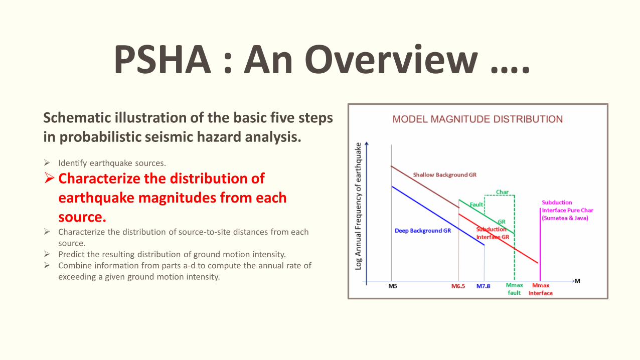
PSHA : An Overview …. Schematic illustration of the basic five steps in probabilistic seismic hazard analysis. Identify earthquake sources.
Characterize the distribution of earthquake magnitudes from each source.
Characterize the distribution of source-to-site distances from each source.
Predict the resulting distribution of ground motion intensity. Combine information from parts a-d to compute the annual rate of
exceeding a given ground motion intensity.
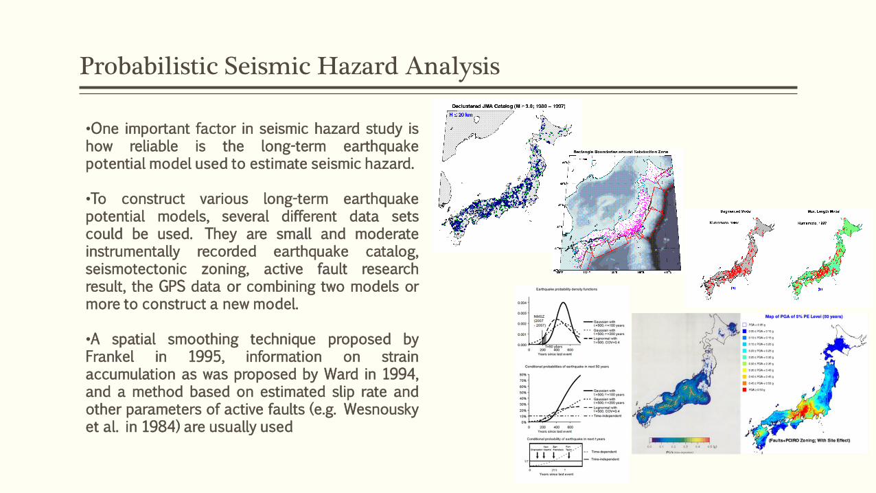
Probabilistic Seismic Hazard Analysis
•One important factor in seismic hazard study is how reliable is the long-term earthquake potential model used to estimate seismic hazard. •To construct various long-term earthquake potential models, several different data sets could be used. They are small and moderate instrumentally recorded earthquake catalog, seismotectonic zoning, active fault research result, the GPS data or combining two models or more to construct a new model. •A spatial smoothing technique proposed by Frankel in 1995, information on strain accumulation as was proposed by Ward in 1994, and a method based on estimated slip rate and other parameters of active faults (e.g. Wesnousky et al. in 1984) are usually used
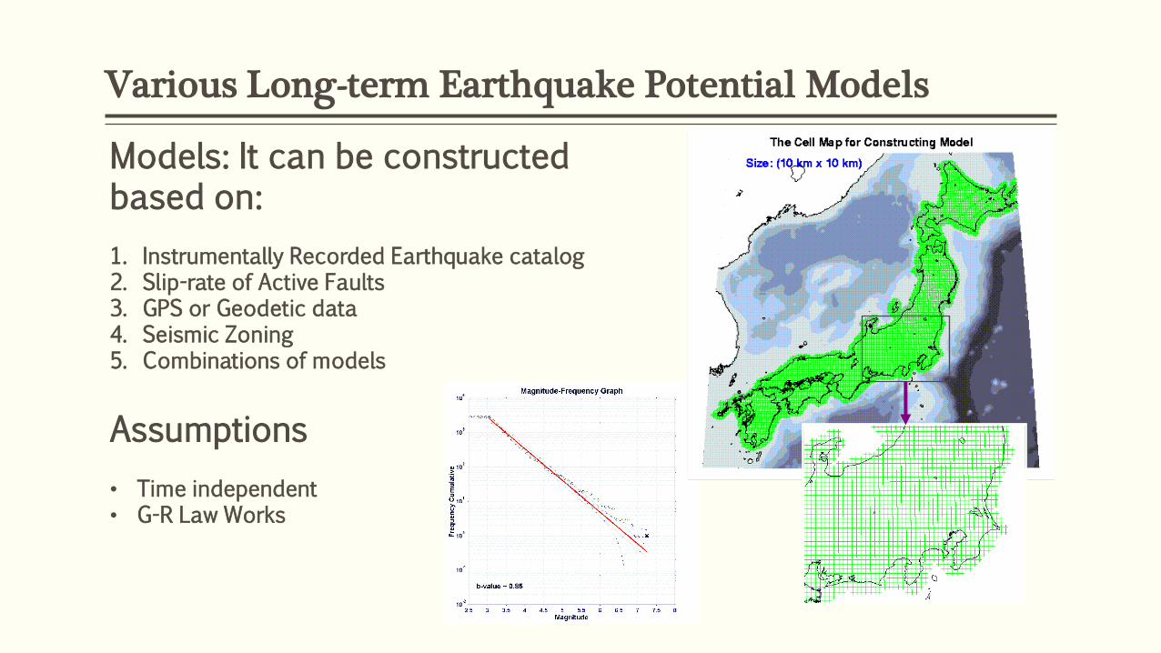
Various Long-term Earthquake Potential Models
Models: It can be constructed based on: 1. Instrumentally Recorded Earthquake catalog 2. Slip-rate of Active Faults 3. GPS or Geodetic data 4. Seismic Zoning 5. Combinations of models
Assumptions • Time independent • G-R Law Works
EARTHQUAKE CATALOG, STATISTIC & SEISMICITY Understanding catalog for psha map revision of 2017
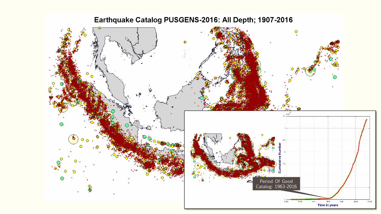
Period Of Good Catalog: 1963-2016
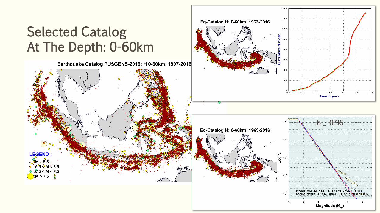
Selected Catalog At The Depth: 0-60km
b ~ 0.96
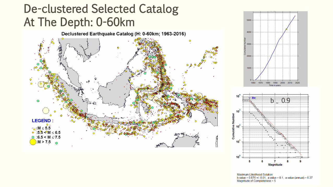
De-clustered Selected Catalog At The Depth: 0-60km
b ~ 0.9
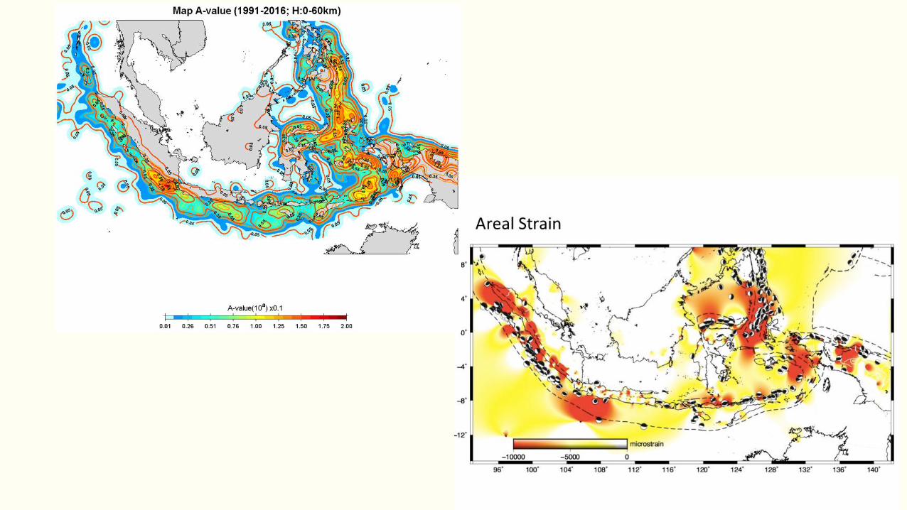
TESTING STABILITY SEISMICITY PATTERN UNDER
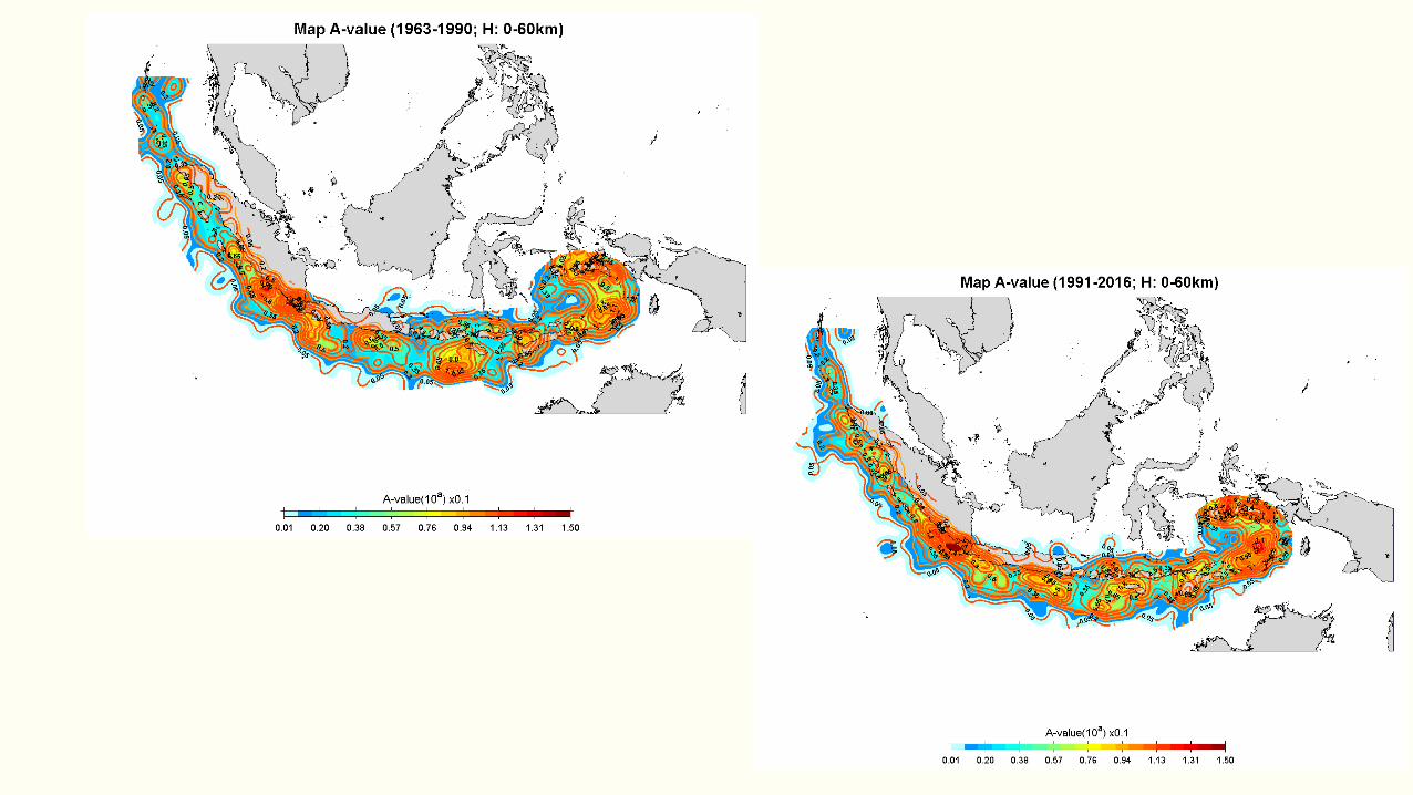
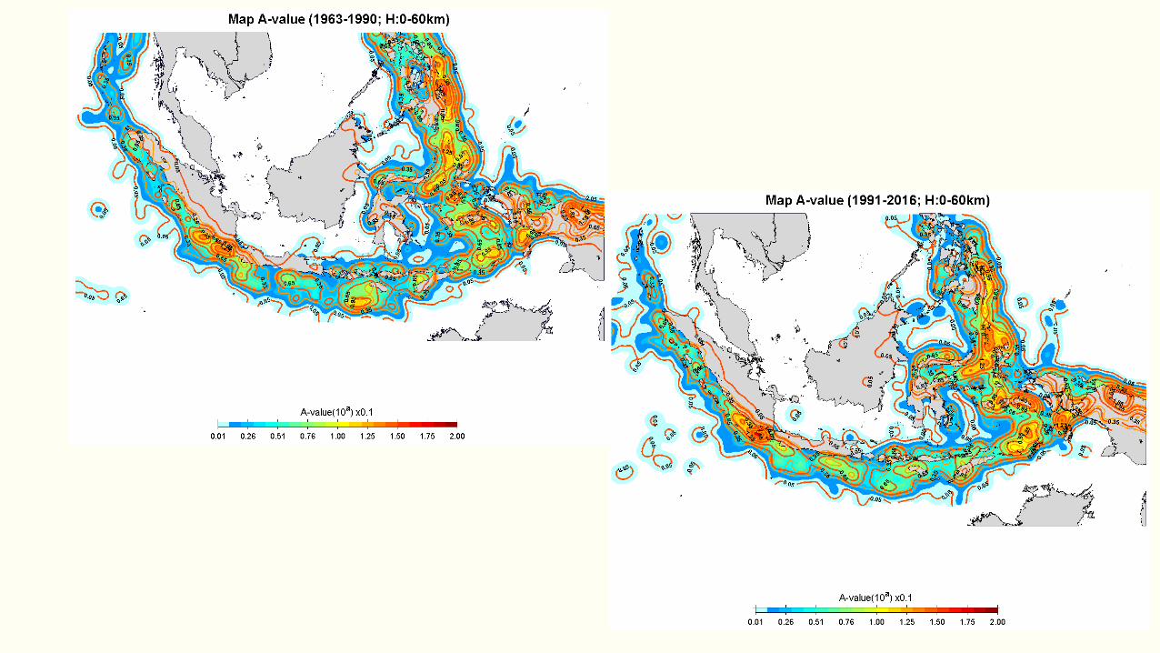
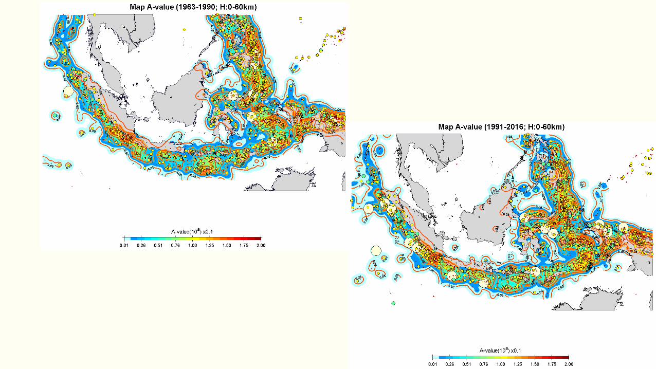
ASSUMPTION OF POISONIAN DISTRIBUTION: STUDY CASE FOR SUNDA ARC We divide catalog of 1963-2016 of The De-clustered Earthquake Catalog to 1963-1990 & 1991-2016 by following Frankel’s Hypothesis
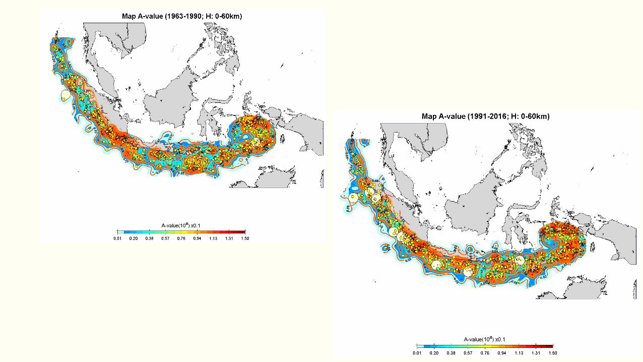
TESTING STABILITY SEISMICITY PATTERN UNDER
ASSUMPTION OF POISONIAN DISTRIBUTION: INDONESIA REGION We divide catalog of 1963-2016 of The De-clustered Earthquake Catalog to 1963-1990 & 1991-2016 by following Frankel’s Hypothesis
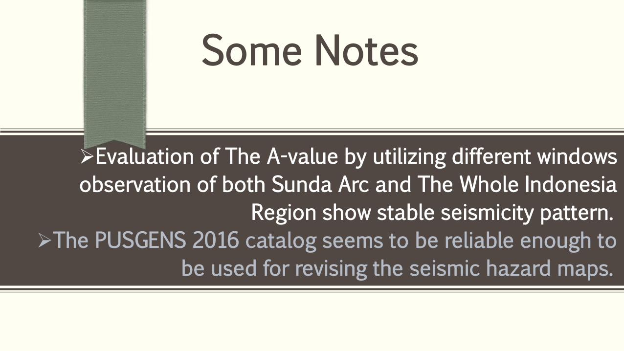
Some Notes
Evaluation of The A-value by utilizing different windows
observation of both Sunda Arc and The Whole Indonesia
Region show stable seismicity pattern.
The PUSGENS 2016 catalog seems to be reliable enough to
be used for revising the seismic hazard maps.
UNDERSTANDING SEISMO-GEODETIC BEHAVIOR OF BASIC TECTONIC ELEMENTS IN JAVA ISLAND
FOR PSHA MAP REVISION OF 2017
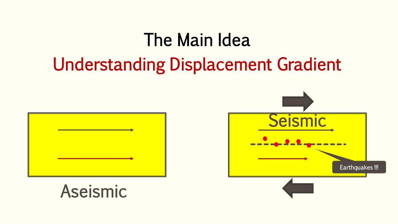
The Main Idea
Understanding Displacement Gradient
Earthquakes !!!
Aseismic
Seismic
Tectonic Implication
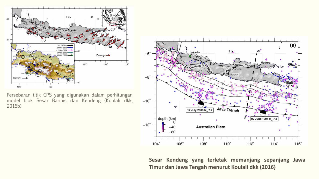
Persebaran titik GPS yang digunakan dalam perhitungan model blok Sesar Baribis dan Kendeng (Koulali dkk, 2016b)
Sesar Kendeng yang terletak memanjang sepanjang Jawa Timur dan Jawa Tengah menurut Koulali dkk (2016)
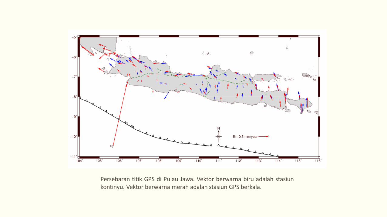
Persebaran titik GPS di Pulau Jawa. Vektor berwarna biru adalah stasiun kontinyu. Vektor berwarna merah adalah stasiun GPS berkala.
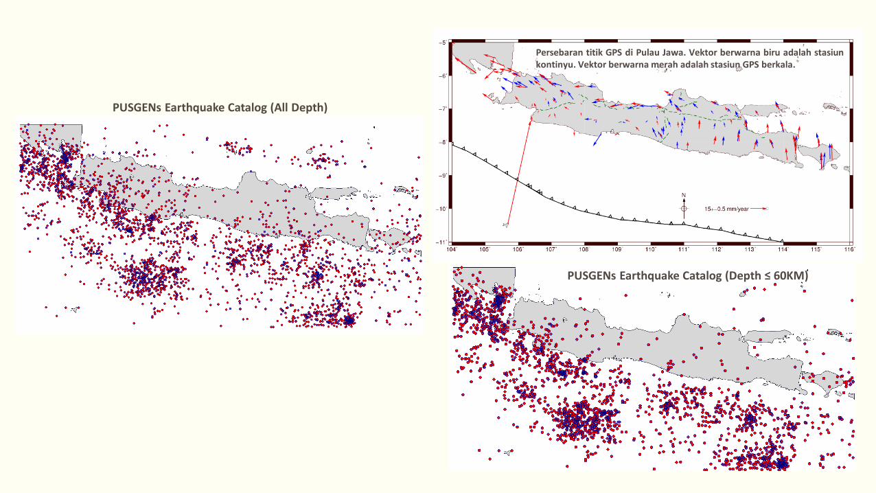
Persebaran titik GPS di Pulau Jawa. Vektor berwarna biru adalah stasiun kontinyu. Vektor berwarna merah adalah stasiun GPS berkala.
PUSGENs Earthquake Catalog (Depth ≤ 60KM)
PUSGENs Earthquake Catalog (All Depth)
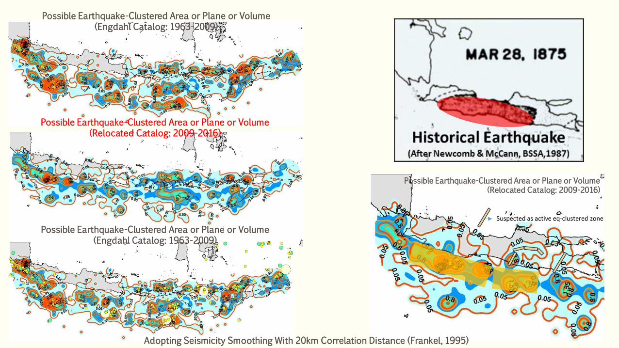
Possible Earthquake-Clustered Area or Plane or Volume (Engdahl Catalog: 1963-2009)
Possible Earthquake-Clustered Area or Plane or Volume (Engdahl Catalog: 1963-2009)
Possible Earthquake-Clustered Area or Plane or Volume (Relocated Catalog: 2009-2016)
Possible Earthquake-Clustered Area or Plane or Volume (Relocated Catalog: 2009-2016)
Adopting Seismicity Smoothing With 20km Correlation Distance (Frankel, 1995)
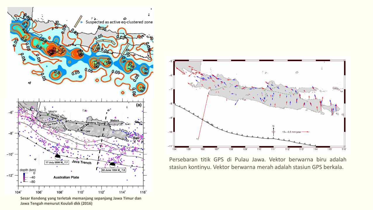
Sesar Kendeng yang terletak memanjang sepanjang Jawa Timur dan Jawa Tengah menurut Koulali dkk (2016)
Persebaran titik GPS di Pulau Jawa. Vektor berwarna biru adalah stasiun kontinyu. Vektor berwarna merah adalah stasiun GPS berkala.
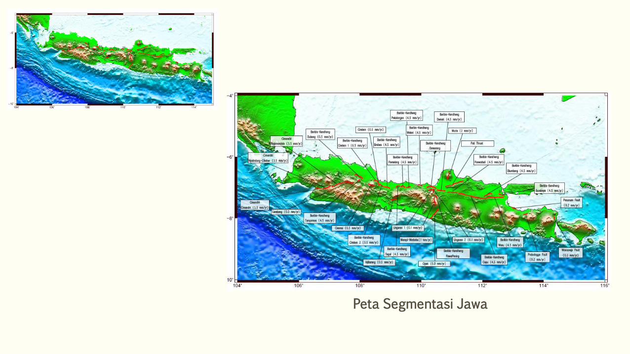
Peta Segmentasi Jawa
Our Basic & Main Data for PSHA Input are Updated
Thus ….
We really Need to Update Our PSHA Map
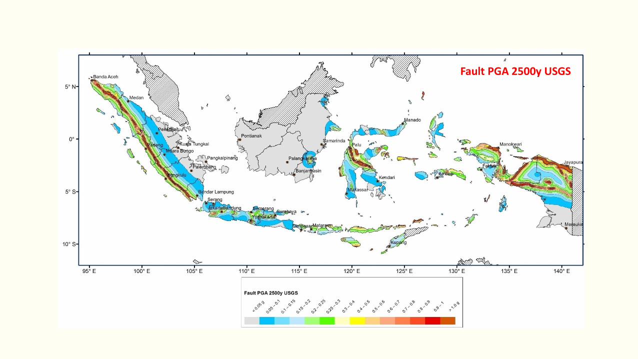
Fault PGA 2500y USGS
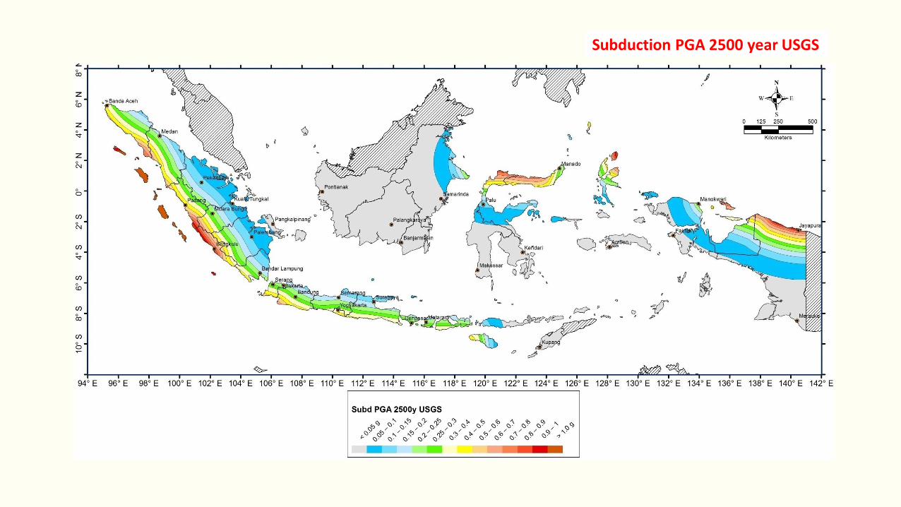
Subduction PGA 2500 year USGS
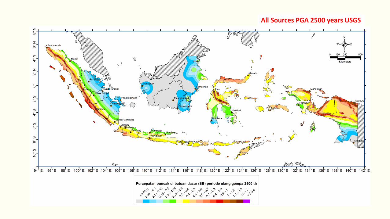
All Sources PGA 2500 years USGS
Hazard Map 2010
New Hazard Map 2016
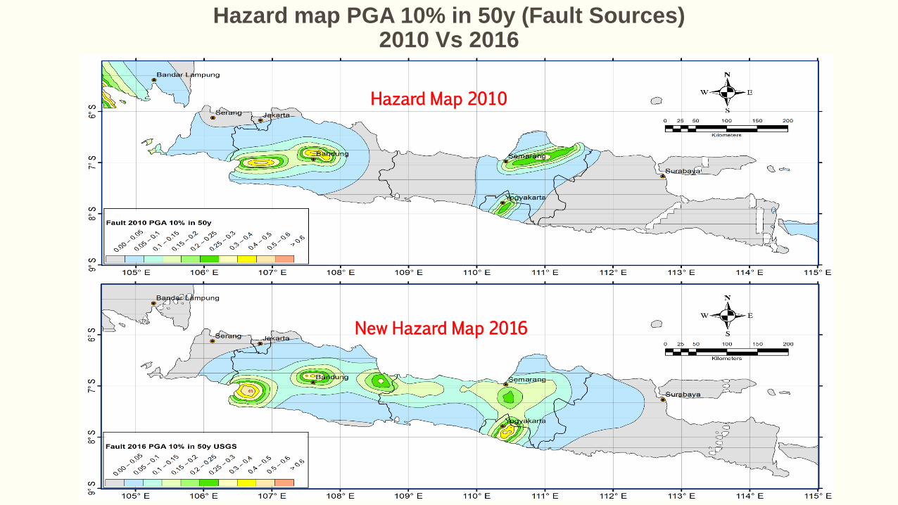
Hazard map PGA 10% in 50y (Fault Sources) 2010 Vs 2016
Hazard Map 2010
New Hazard Map 2016
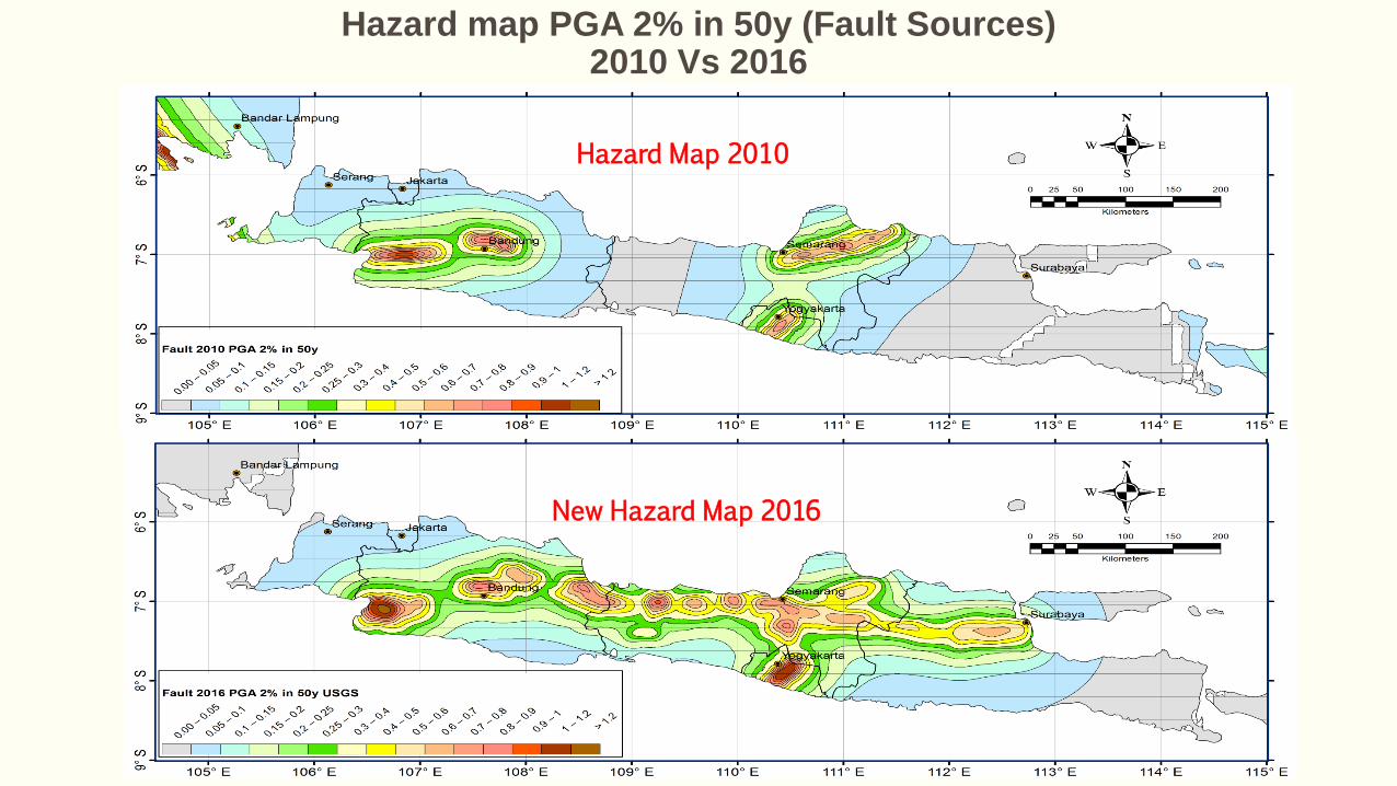
Hazard map PGA 2% in 50y (Fault Sources) 2010 Vs 2016

Hazard Map 2016 New Mmax
New Hazard Map 2016
Hazard map PGA 2% in 50y (Fault Sources) 2010 Vs 2016
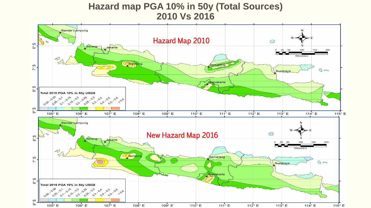
Hazard map PGA 10% in 50y (Total Sources) 2010 Vs 2016
Hazard Map 2010
New Hazard Map 2016
Hazard Map 2010
New Hazard Map 2016
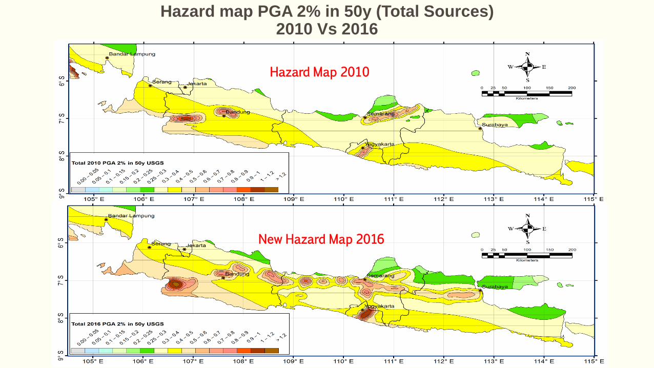
Hazard map PGA 2% in 50y (Total Sources) 2010 Vs 2016
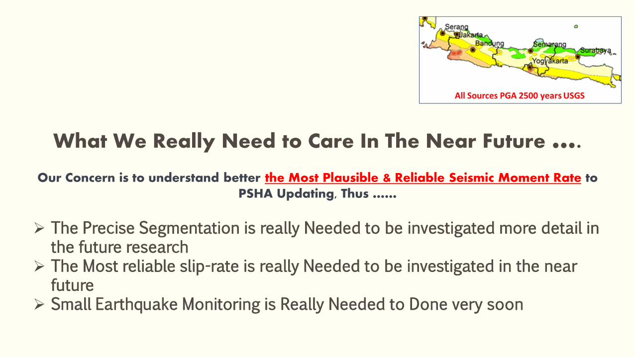
What We Really Need to Care In The Near Future …. Our Concern is to understand better the Most Plausible & Reliable Seismic Moment Rate to
PSHA Updating, Thus ……
The Precise Segmentation is really Needed to be investigated more detail in the future research
The Most reliable slip-rate is really Needed to be investigated in the near future
Small Earthquake Monitoring is Really Needed to Done very soon


“IT WASN’T RAINING, WHEN NOAH BUILT THE ARK”
- Howard Ruff

MAKA, TAK PERLU MENUNGGU BENCANA KEMBALI TIBA UNTUK MEWUJUDKAN
KESIAPSIAGAAN BENCANA, SEPERTI YANG TENGAH KITA USAHAKAN BERSAMA

THANK YOU ……