Embed Size (px)
Citation preview
State of Oregon Natural Hazards Mitigation Plan February 2012
Emergency Management Plan 3‐DS‐1
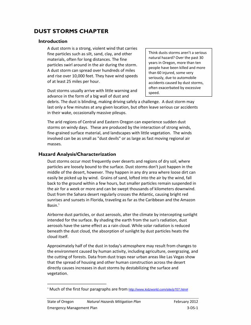
DUST STORMS CHAPTER
Introduction A dust storm is a strong, violent wind that carries fine particles such as silt, sand, clay, and other materials, often for long distances. The fine particles swirl around in the air during the storm. A dust storm can spread over hundreds of miles and rise over 10,000 feet. They have wind speeds of at least 25 miles per hour.
Dust storms usually arrive with little warning and advance in the form of a big wall of dust and debris. The dust is blinding, making driving safely a challenge. A dust storm may last only a few minutes at any given location, but often leave serious car accidents in their wake, occasionally massive pileups.
The arid regions of Central and Eastern Oregon can experience sudden dust storms on windy days. These are produced by the interaction of strong winds, fine‐grained surface material, and landscapes with little vegetation. The winds involved can be as small as "dust devils" or as large as fast moving regional air masses.
Hazard Analysis/Characterization Dust storms occur most frequently over deserts and regions of dry soil, where particles are loosely bound to the surface. Dust storms don't just happen in the middle of the desert, however. They happen in any dry area where loose dirt can easily be picked up by wind. Grains of sand, lofted into the air by the wind, fall back to the ground within a few hours, but smaller particles remain suspended in the air for a week or more and can be swept thousands of kilometers downwind. Dust from the Sahara desert regularly crosses the Atlantic, causing bright red sunrises and sunsets in Florida, traveling as far as the Caribbean and the Amazon Basin.1
Airborne dust particles, or dust aerosols, alter the climate by intercepting sunlight intended for the surface. By shading the earth from the sun's radiation, dust aerosols have the same effect as a rain cloud. While solar radiation is reduced beneath the dust cloud, the absorption of sunlight by dust particles heats the cloud itself.
Approximately half of the dust in today's atmosphere may result from changes to the environment caused by human activity, including agriculture, overgrazing, and the cutting of forests. Data from dust traps near urban areas like Las Vegas show that the spread of housing and other human construction across the desert directly causes increases in dust storms by destabilizing the surface and vegetation.
1 Much of the first four paragraphs are from http://www.kidzworld.com/site/p707.htm#
Think dusts storms aren’t a serious natural hazard? Over the past 30 years in Oregon, more than ten people have been killed and more than 60 injured, some very seriously, due to automobile accidents caused by dust storms, often exacerbated by excessive speed.
February 2012 Natural Hazards Mitigation Plan State of Oregon
3‐DS‐2 Emergency Management Plan
Intensive tillage of soils in agricultural uses is also a significant condition releasing soil to make it easily transportable by high winds. Depending on the crop and region involved, tillage may be occurring in the spring and/or in the autumn. Research in north‐central Oregon and south‐central Washington2 indicates that region's dust problem isn't simply a matter of soil being redistributed from one
2 In the State Natural Hazards Risk Assessment, this portion of Oregon is called the Mid‐Columbia Region.
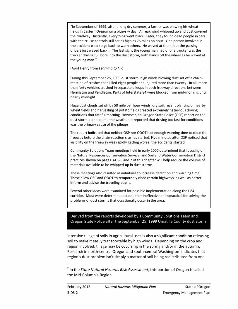
“In September of 1999, after a long dry summer, a farmer was plowing his wheat fields in Eastern Oregon on a blue‐sky day. A freak wind whipped up and dust covered the roadway. Instantly, everything went black. Later, they found dead people in cars with the cruise controls still set as high as 75 miles an hour. One person involved in the accident tried to go back to warn others. He waved at them, but the passing drivers just waved back... The last sight the young man had of one trucker was the trucker driving full bore into the dust storm, both hands off the wheel as he waved at the young man.”
(April Henry from Learning to Fly)
During this September 25, 1999 dust storm, high winds blowing dust set off a chain‐reaction of crashes that killed eight people and injured more than twenty. In all, more than forty vehicles crashed in separate pileups in both freeway directions between Hermiston and Pendleton. Parts of Interstate 84 were blocked from mid‐morning until nearly midnight.
Huge dust clouds set off by 50 mile per hour winds, dry soil, recent planting of nearby wheat fields and harvesting of potato fields created extremely hazardous driving conditions that fateful morning. However, an Oregon State Police (OSP) report on the dust storm didn’t blame the weather. It reported that driving too fast for conditions was the primary cause of the pileups.
The report indicated that neither OSP nor ODOT had enough warning time to close the freeway before the chain reaction crashes started. Five minutes after OSP noticed that visibility on the freeway was rapidly getting worse, the accidents started.
Community Solutions Team meetings held in early 2000 determined that focusing on the Natural Resources Conservation Service, and Soil and Water Conservation District practices shown on pages 3‐DS‐6 and 7 of this chapter will help reduce the volume of materials available to be whipped‐up in dust storms.
These meetings also resulted in initiatives to increase detection and warning time. These allow OSP and ODOT to temporarily close certain highways, as well as better inform and advise the traveling public.
Several other ideas were examined for possible implementation along the I‐84 corridor. Most were determined to be either ineffective or impractical for solving the problems of dust storms that occasionally occur in the area.
Derived from the reports developed by a Community Solutions Team and Oregon State Police after the September 25, 1999 Umatilla County dust storm
State of Oregon Natural Hazards Mitigation Plan February 2012
Emergency Management Plan 3‐DS‐3
field to another by the wind. Fine particulate becomes suspended in the air and may travel thousands of miles. Scientists indicate that the region is truly losing soil.
Among the significant dust storms that have occurred in the Mid‐Columbia Region in the past are the following:
May 2, 1843 Mid‐Columbia Region
Information from the diary of Rev. Gustavus Hines, who was traveling by canoe with a Dr. Davis in the Columbia Gorge
April 21‐23, 1931
Mid‐Columbia Region
Dust from this event was carried by an east wind into the Willamette Valley, both down the Gorge and over the Cascade passes (also see the box on page 3‐DS‐5 and Appendix DS‐1: news reports from the 1931 event make historical reference to “the great sandstorm of 1906 that lasted two weeks”)
May 23, 1975 Near Echo, Oregon
(Mid‐Columbia Region)
Winds up to 45 mph blew dust from nearby plowed fields, resulting in a seven‐car accident on a Friday afternoon in the eastbound lanes of Interstate 80 (now I‐84), four injured
March 24, 1976 Near Stanfield, Oregon
(Mid‐Columbia Region)
Eighteen vehicles piled‐up in two separate accidents on Interstate 80, now I‐84; these accidents killed one and injured 20 people; they were caused by a dust storm (referred to in the press as a sand storm) that produced “near zero” visibility; one of the pile‐ups was a fiery accident involving a loaded fuel tanker truck, two other trucks, and two cars; this dust storm also caused road closures both south and north of Hermiston, and caused other accidents on Highway 207 about nine miles south of I‐80 (84)
Pendleton area farmer and member of the Oregon Wheat Growers League, talking about the September 25, 1999 event
“We called the weather service about 9:30 saying that visibility was getting bad… I could see the dust coming in a big cloud from the southwest. There’s too much tillage to the west and southwest of us. You get a wind event like we had and that soil is loose, powdery and lifting, and I don’t think you can stop it… Farming by its very nature, particularly in this country on these soils, at some time is going to involve tillage, and when it does… you’re going to have exposure to winds… have wind and exposed soil, you’re going to have dust.”
February 2012 Natural Hazards Mitigation Plan State of Oregon
3‐DS‐4 Emergency Management Plan
July 9, 1979 Near Stanfield
This dust storm caused two deaths and six injuries in a freeway pile‐up on I‐80 (84) very close to the location of the previous event; winds near 60 mph; some of the injured were hit as pedestrians while trying to assist those already injured or pinned in automobiles
Oct. 3, 1990 Near Kennewick, WA
Two chain‐reaction accidents on I‐82 involving 26 vehicles killed one and injured at least a dozen; due to blowing dust and the aftermath of the collisions, the highway was closed more than nine hours
Sept. 25, 1999 Near Echo See box on page 3‐DS‐2
March 16, 2005 Near Boardman
Weather stations at nineteen locations measured peak wind gusts from 45 to 64 mph. Visibility restrictions down to near zero due to blowing dust occurred in the Tri‐Cities Area, along I‐84 between Boardman and Pendleton, and along highways on the Hanford Nuclear Reservation. Extremely low visibilities led to road closures and multiple vehicle pileups. Vehicles pulled off the road to avoid collisions. Visibilities of a half mile or less due to flowing dust were reported in the following counties: Benton, Columbia, Deschutes, Morrow, Umatilla, Walla Walla, and Yakima.
The following occurred in Klamath County in south‐central Oregon:
April 16, 2001 Near Klamath Falls
Highway 97 about five miles north of Klamath Falls was closed for approximately six hours following three separate crashes; eleven cars were involved, sending nine people to the hospital; the accidents were due to severely limited visibility caused by high winds blowing dust from a recently plowed field across the highway
August of 2004, a dust storm struck in Arizona, proving that fatal accidents due to dust storms are not a situation limited to Oregon:
“(Farmers) say this is a problem the Columbia Basin, composed of mostly sandy soils, has experienced every spring before the rapid farm development that has followed circle irrigation… Luther Fitch, county extension agent in Hermiston… facetiously said Wednesday’s winds ‘probably sent a foot of topsoil back to Montana… undoubtedly there will be considerable need to replant spring wheat and potatoes. Fertilizer will have moved on and needs to be reapplied.’ ” East Oregonian, Steve Clark, Friday, March 26, 1976, p.1
State of Oregon Natural Hazards Mitigation Plan February 2012
Emergency Management Plan 3‐DS‐5
Aug. 11, 2004 West of Phoenix
A series of chain‐reaction accidents 45 and 75 miles west of Phoenix led to four deaths and 42 injuries “during a blinding dust storm”; nearly two‐dozen vehicles, including a passenger bus and 12 tractor‐trailers, were involved in crashes on both sides of Interstate 10.
Central and Southeast Oregon farmers, ranchers, homeowners, resort properties, and wildlife sometimes find themselves vying for limited water. This competition for scarce water can affect the locations and amounts of dust lifted into the atmosphere, and blown on the wind.
Air quality is adversely affected by windblown dust. Oregon’s Department of Environmental Quality (DEQ) has developed a rule concerning air pollution caused by particulates from volcanic ashfall or windblown dust. Excerpts from that rule are shown in Appendix DS‐2 to this chapter.
Although many people are aware of the negative effects of dust storms such as vehicle crashes on highways, erosion of topsoil, dust in electronic equipment and aircraft engines, and poor air quality, a less obvious but important effect of dust storms and volcanic ashfall is not widely known: dust and ash deposited on the ground surface in new locations is eventually carried down into the soil by rain, providing important nutrients for plants in those locations.
“…dust from freshly plowed fields hung heavy over much of Oregon last night as a windstorm of gale proportions continued unabated. One death and several injuries were attributed to the storm… Political storms abated for the moment, Salem lay yesterday under a pall of Eastern Oregon dust, which the oldest old‐timers said was unique in the city’s history. A swirling northeast wind drove tons of Eastern Oregon dust before it, down the Columbia Gorge and into Western Oregon. Diverting down the Willamette River at Portland, the dust clouds reached the valley early Wednesday morning and shrouded the entire country… Lights went on in schools, homes, and business houses as though the day was mid‐winter… Old‐timers in Salem scratched their heads yesterday and tried to recall a parallel in storm history for the dust invasion… but no precedent for the gale of dirt could be recalled. ‘I recall a terrific storm in January 1880,’ said A.N. Moores. ‘However, it was a wind storm alone and there was no dirt accompanying it’… (Mill City) was surprised Tuesday evening when a heavy bank of clouds filled with dust began to work its way over the mountains and shut off the view of the surrounding hills by its denseness.” Oregon Statesman, Thursday, April 23, 1931, pp.1‐2
See Appendix DS‐1 for additional historic accounts of this event.
February 2012 Natural Hazards Mitigation Plan State of Oregon
3‐DS‐6 Emergency Management Plan
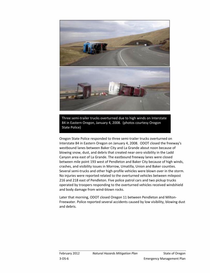
Oregon State Police responded to three semi‐trailer trucks overturned on Interstate 84 in Eastern Oregon on January 4, 2008. ODOT closed the freeway's westbound lanes between Baker City and La Grande about noon because of blowing snow, dust, and debris that created near‐zero visibility in the Ladd Canyon area east of La Grande. The eastbound freeway lanes were closed between mile point 193 west of Pendleton and Baker City because of high winds, crashes, and visibility issues in Morrow, Umatilla, Union and Baker counties. Several semi‐trucks and other high‐profile vehicles were blown over in the storm. No injuries were reported related to the overturned vehicles between milepost 216 and 218 east of Pendleton. Five police patrol cars and two pickup trucks operated by troopers responding to the overturned vehicles received windshield and body damage from wind‐blown rocks.
Later that morning, ODOT closed Oregon 11 between Pendleton and Milton‐Freewater. Police reported several accidents caused by low visibility, blowing dust and debris.
Three semi‐trailer trucks overturned due to high winds on Interstate 84 in Eastern Oregon, January 4, 2008. (photos courtesy Oregon State Police)
State of Oregon Natural Hazards Mitigation Plan February 2012
Emergency Management Plan 3‐DS‐7
Existing Strategies and Programs The Natural Resources Conservation Service (NRCS) and local soil and water conservation districts (SWCD) have long sought to reduce wind erosion of cropland. Farming practices commonly used in dryland cropping areas, such as reduced tillage and residue management, reflect this interest. However, occasionally after long periods with little or no precipitation any activities that disturb soil or reduce vegetation can lead to conditions conducive to dust storms.
Nationally, NRCS has developed quality criteria for wind erosion control practices and use a wind erosion equation model for predicting potential wind erosion under various farming systems.
Since 1985, to maintain eligibility for USDA Farm Program benefits, landowners have been required to meet minimum standards for control of erosion, both from water and wind. Participating farmers have developed and are responsible for implementing conservation plans for all farmland designated as highly erodible. Plans address practices such as residue management, tillage methods, and irrigation management.
At this time, wind erosion control is a requirement under the Federal Farm Bill for certain commodities such as wheat and corn, but depending on the rotation, may not be a requirement for other commodities such as potatoes or vegetables. USDA‐NRCS is generally responsible for these programs.
Wind erosion is ranked high among concerns for funding under the Environmental Quality Incentive Program, the current USDA cost‐share program available to landowners.
Competition for scarce water can affect the location and frequency of dust storms.
During June 2004, a group of residents of Summer Lake, known as Friends of Summer Lake, asked the state to divert to the lake a third of the water that currently feeds a wildlife sanctuary and irrigates pastures, contending that these uses make the lake dry‐up sooner and more often. Another factor in the lake drying‐up, however, is increased development in and around the basin, which has reduced the underground aquifer, decreasing the flow of springs.
Rainfall in the area, mostly during winter, averages 12 inches per year, but evaporation in the high desert ‐ where summer temperatures can climb to 105 degrees ‐ averages 40 to 50 inches per year.
Darrell Seven, who owns Summer Lake Inn with his wife, Jean Sage, said wind whipping over the dry lakebed causes alkali dust storms. "It's hard to breathe, it's irritating and it makes you sick," said Seven, who has been in the valley for 30 years. "I lose customers all the time who say they just can't handle it."
Alan Withers, president of the Summer Lake Irrigation District said, however, "This lake isn't very pretty, and we get a lot of dust down here. It's nature's way.”
Based on an Associated Press article
February 2012 Natural Hazards Mitigation Plan State of Oregon
3‐DS‐8 Emergency Management Plan
CONSERVATION RESERVE PROGRAM (CRP) CRP retires eligible cropland from agricultural production and plants the land to permanent grass cover that reduces erosion and benefits wildlife populations. CRP does a very good job of providing cover that reduces windblown dust and has been effective in reducing soil erosion in the areas most prone to wind erosion. However, silt soils easily stay suspended for long periods of time and thus can move great distances affecting visibility on roads away from the protected fields. The strategy to encourage a strip of CRP along the freeway has been determined to probably be ineffective at reducing dust storm intensity. Also, the fire hazard could be worst than the dust hazard. In Umatilla County, NRCS has designated an area near I‐84 as a wind erosion priority area to influence enrollment into the Conservation Reserve Program.
DUST STORM DRIVING SAFETY TIPS
Dust storms usually last only a few minutes at any given location, but the actions a motorist takes during the storm may be the most important of his or her life, and those of passengers. OSP and ODOT officials have issued the following tips for driving when visibility is limited.
If dense dust is observed blowing across or approaching a roadway, pull your vehicle off the pavement as far as possible; stop, turn off lights, set the emergency brake, take your foot off of the brake pedal to be sure tail lights are not illuminated. Don’t enter the dust storm area if you can avoid it. If you can't pull off the roadway, de‐activate cruise control if in use, proceed at a speed suitable for visibility, turn on lights and sound horn occasionally. Use the painted centerline to help guide you. Look for a safe place to pull off the roadway. Never stop on the traveled portion of the roadway.
LIGHTS OUT!
In the past, motorists driving in dust storms have pulled off the roadway, leaving lights on. Vehicles approaching from the rear and using the advanced car's lights as a guide have inadvertently left the roadway and in some instances collided with the parked vehicle. Make sure all of your lights are off when you park off the roadway.
HEED WARNINGS
A dust storm (or sand storm) warning means visibility of less than ¼ mile due to blowing dust or sand, and wind speeds of 25 miles per hour or more. A blowing dust advisory is issued for visibility between ¼ and ¾ of a mile. Dust and other environmental factors such as smoke, snow, heavy rain or fog can create dangerous driving situations.
This advice is consolidated from numerous sources in an attempt to clarify and simplify the best actions to take when encountering reduced visibility. During threatening weather, drivers should listen to commercial radio or television, adjust travel plans accordingly, and drive with extra caution.
********************************
One source for the above is:
http://www.nws.noaa.gov/om/brochures/duststrm.htm
State of Oregon Natural Hazards Mitigation Plan February 2012
Emergency Management Plan 3‐DS‐9
NO-TILL CROPPING SWCDs have been actively promoting, through education and incentives, direct seeding methods. Direct seeding or no‐till cropping systems utilize technology that places seed and fertilizer into undisturbed soil and residue from the previous crop. This results in minimal soil disturbance and reduced potential for wind and water erosion.
Cooperative State Research, Education, and Extension Service (CSREES) funded research on the Columbia Plateau has demonstrated that no‐till cropping can significantly reduce predicted dust emissions during severe winds:
http://www.csrees.usda.gov/nea/nre/sri/air_sri_dust.html
The research shows that no‐till cropping can reduce predicted dust emissions by 94% during severe wind events, compared to conventional wheat‐fallow. Research continues on measuring dust emissions from fields on the Columbia Plateau, a 50,000 square‐mile region in Washington, Oregon, and Idaho containing one of the driest, yet most productive, rain‐fed wheat regions in the world.
No‐till only works for some crops under certain conditions, however, and even in situations where it does work, some farmers find that they need to till the soil periodically to reduce diseases and redistribute soil moisture.
Hazard Mitigation Successes Local, state, and federal agencies have achieved a number of successes in reducing losses due to dust storms, especially since the tragic events of September 1999. A few of the key successes follow.
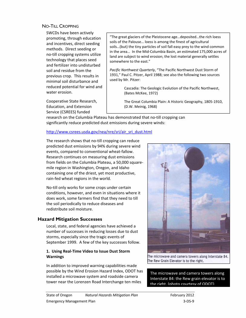
1. Using Real‐Time Video to Issue Dust Storm Warnings
In addition to improved warning capabilities made possible by the Wind Erosion Hazard Index, ODOT has installed a microwave system and roadside camera tower near the Lorenzen Road Interchange ten miles
“The great glaciers of the Pleistocene age…deposited…the rich loess soils of the Palouse… loess is among the finest of agricultural soils…(but) the tiny particles of soil fall easy prey to the wind common in the area… In the Mid‐Columbia Basin, an estimated 175,000 acres of land are subject to wind erosion; the lost material generally settles somewhere to the east.”
Pacific Northwest Quarterly, “The Pacific Northwest Dust Storm of 1931,” Paul C. Pitzer, April 1988; see also the following two sources used by Mr. Pitzer:
Cascadia: The Geologic Evolution of the Pacific Northwest, (Bates McKee, 1972)
The Great Columbia Plain: A Historic Geography, 1805‐1910, (D.W. Meinig, 1968)
The microwave and camera towers along Interstate 84: the Rew grain elevator is to the right. (photo courtesy of ODOT)
February 2012 Natural Hazards Mitigation Plan State of Oregon
3‐DS‐10 Emergency Management Plan
west of Pendleton. The microwave and camera structures flank the south side of the freeway, opposite the Rew Grain Elevator, a familiar sight for many traveling the dry flatlands between Pendleton and Boardman. Although the two structures will not likely replace the grain elevator as a key navigational landmark, the camera images and weather information will serve motorists.
Two cameras are currently mounted on a metal tower next to the microwave tower. One provides a snapshot of the freeway and is posted on the TripCheck Web site:
http://www.tripcheck.com/Pages/RCMap.asp?mainNav=RoadConditions&curRegion=3
The other camera provides a real‐time image, viewed by ODOT District 12 office personnel only.
A weather station and visibility meter have also been added to the camera tower. These tools monitor blowing dust conditions during high winds. The real‐time camera can be panned and tilted to check eastbound and westbound traffic as well as scan the nearby fields. With blowing dust a major concern, the camera provides an easy way to check the status of the freeway and quickly dispatch service providers to where they are needed. In addition to ODOT personnel, Oregon State Police are contacted if any dust storm activity is seen.
The cameras and weather monitoring equipment are part of an ongoing effort to provide immediate information about highway sections that are prone to blowing dust hazards. They are also items identified by the Community Solutions Team (CST) that was established in response to the multi‐vehicle crashes that occurred in September 1999 near the towers.
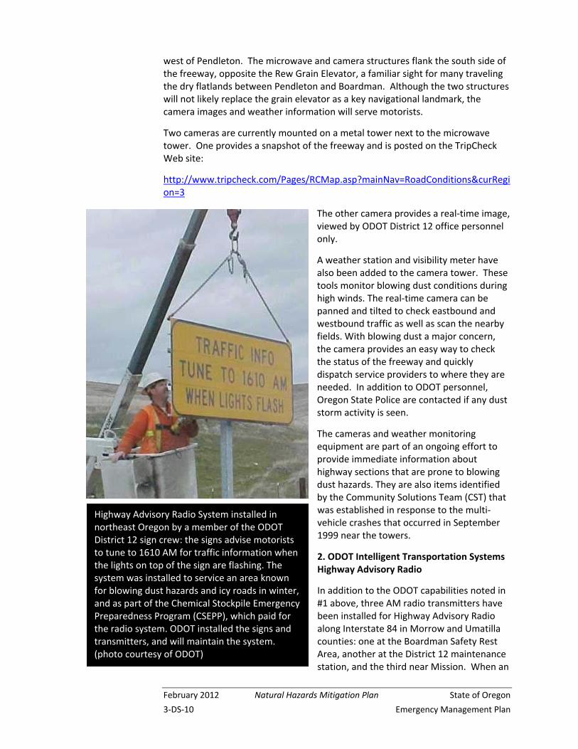
2. ODOT Intelligent Transportation Systems Highway Advisory Radio
In addition to the ODOT capabilities noted in #1 above, three AM radio transmitters have been installed for Highway Advisory Radio along Interstate 84 in Morrow and Umatilla counties: one at the Boardman Safety Rest Area, another at the District 12 maintenance station, and the third near Mission. When an
Highway Advisory Radio System installed in northeast Oregon by a member of the ODOT District 12 sign crew: the signs advise motorists to tune to 1610 AM for traffic information when the lights on top of the sign are flashing. The system was installed to service an area known for blowing dust hazards and icy roads in winter, and as part of the Chemical Stockpile Emergency Preparedness Program (CSEPP), which paid for the radio system. ODOT installed the signs and transmitters, and will maintain the system. (photo courtesy of ODOT)
State of Oregon Natural Hazards Mitigation Plan February 2012
Emergency Management Plan 3‐DS‐11
emergency occurs, the ODOT District 12 office selects the appropriate pre‐recorded message on the system and transmits it via radio. At the same time, ODOT activates yellow flashing beacons. Motorists seeing the signs and flashing lights should tune to 1610 AM3 and comply with any messages. In the case of a dust storm, motorists are advised to slow down and exit the freeway as soon as possible. ODOT worked with OEM’s CSEPP4 office in Pendleton and local emergency management personnel on this project.
Also installed in the system is the ability to re‐broadcast National Weather Service (NWS) weather information. NOAA Weather Radio5 is re‐broadcast on a continuous basis unless there is an emergency. An emergency broadcast then overrides the NOAA Weather Radio service.
3. Gates to Close Access to Interstate 84 During Hazardous Conditions
ODOT has installed two gates for I‐84 closures as recommended by the Community Solutions Team that met in early 2000. The gates were also funded by CSEPP. The gates are not across the freeway itself, but rather at on‐ramps. There is one at the eastbound I‐84 on‐ramp at exit 165 (Port of Morrow, just east of Boardman). The other is on the westbound on‐ramp at exit 202 (Barnhart Road, just west of Pendleton). State and local law enforcement officers and ODOT highway workers can close the gates, restricting access to I‐84 due to hazardous dust conditions or other situations that make highway travel dangerous.
3 The AM frequency is different for the station near Mission.
4 CSEPP is the Chemical Stockpile Emergency Preparedness Program. The chemical stockpile in question is in the same vicinity as an area in Morrow and Umatilla counties occasionally subject to dust storms.
5 NOAA Weather Radio (NWR) is a nationwide network of radio stations broadcasting continuous weather information direct from a nearby National Weather Service office. NWR broadcasts National Weather Service warnings, watches, forecasts, and other hazard information 24 hours per day: http://www.nws.noaa.gov/nwr/
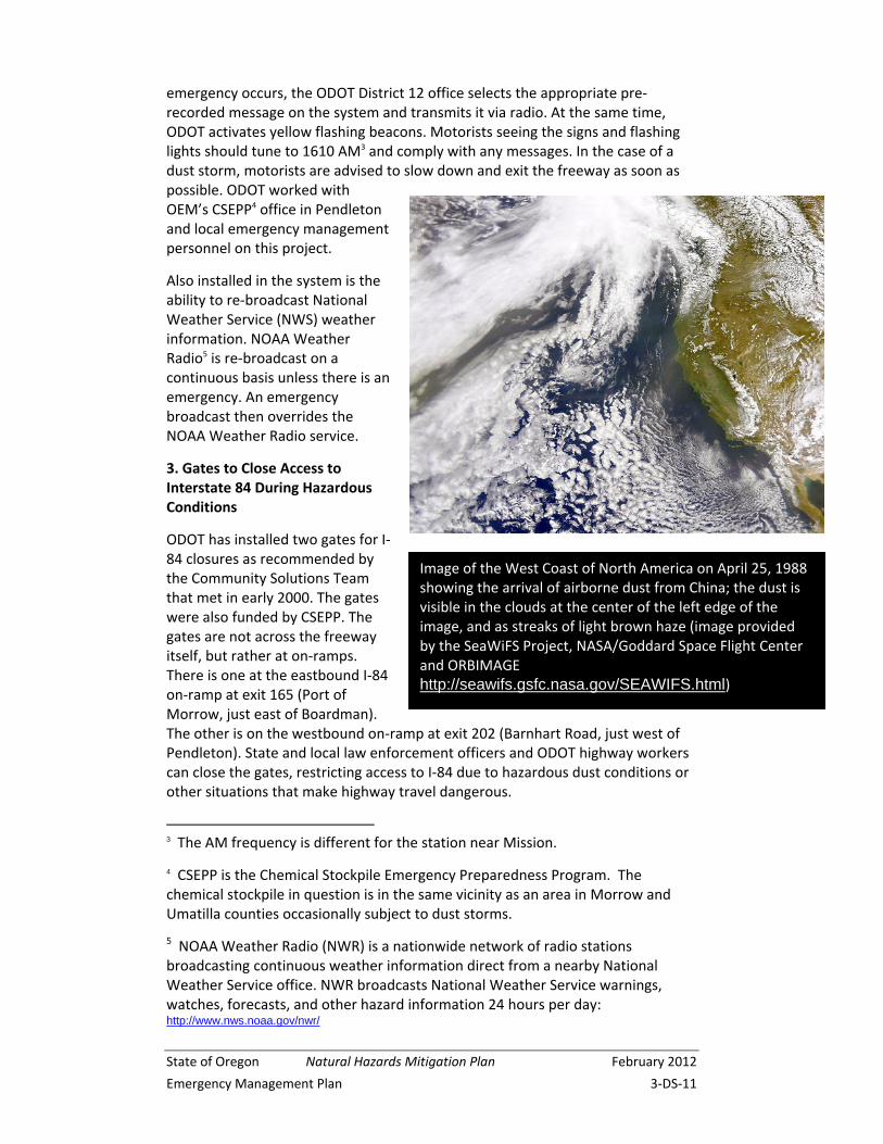
Image of the West Coast of North America on April 25, 1988 showing the arrival of airborne dust from China; the dust is visible in the clouds at the center of the left edge of the image, and as streaks of light brown haze (image provided by the SeaWiFS Project, NASA/Goddard Space Flight Center and ORBIMAGE http://seawifs.gsfc.nasa.gov/SEAWIFS.html)
February 2012 Natural Hazards Mitigation Plan State of Oregon
3‐DS‐12 Emergency Management Plan
4. Additional Emergency Vehicle Crossover Access in Dust Prone Areas
In response to recommendations made by the Community Solutions Team during the spring of 2000, ODOT developed additional emergency vehicle crossover access on the interstate (better access for emergency response by fire, ambulance, and police officials and equipment to accident scenes), especially in areas where blowing dust has historically been a problem.
5. Using the “Wind Erosion Hazard Index” to Predict Dust Storms
Representatives from the USDA Agricultural Research Service, located in Pullman, WA and near Pendleton, have collaborated with the staff from the NOAA National Weather Service in Pendleton to develop a wind erosion hazard index to improve the anticipation of soil and weather conditions that could lead to dust storms. This work takes into account the unique properties of the fine silt loam soils prevalent in the area.6
6 "The Stanfield… storms were probably derived from soils that are sandy loams or loamy sands… silt loam or coarser." Donald Horneck, Ph.D., Extension Agronomist ‐ Hermiston
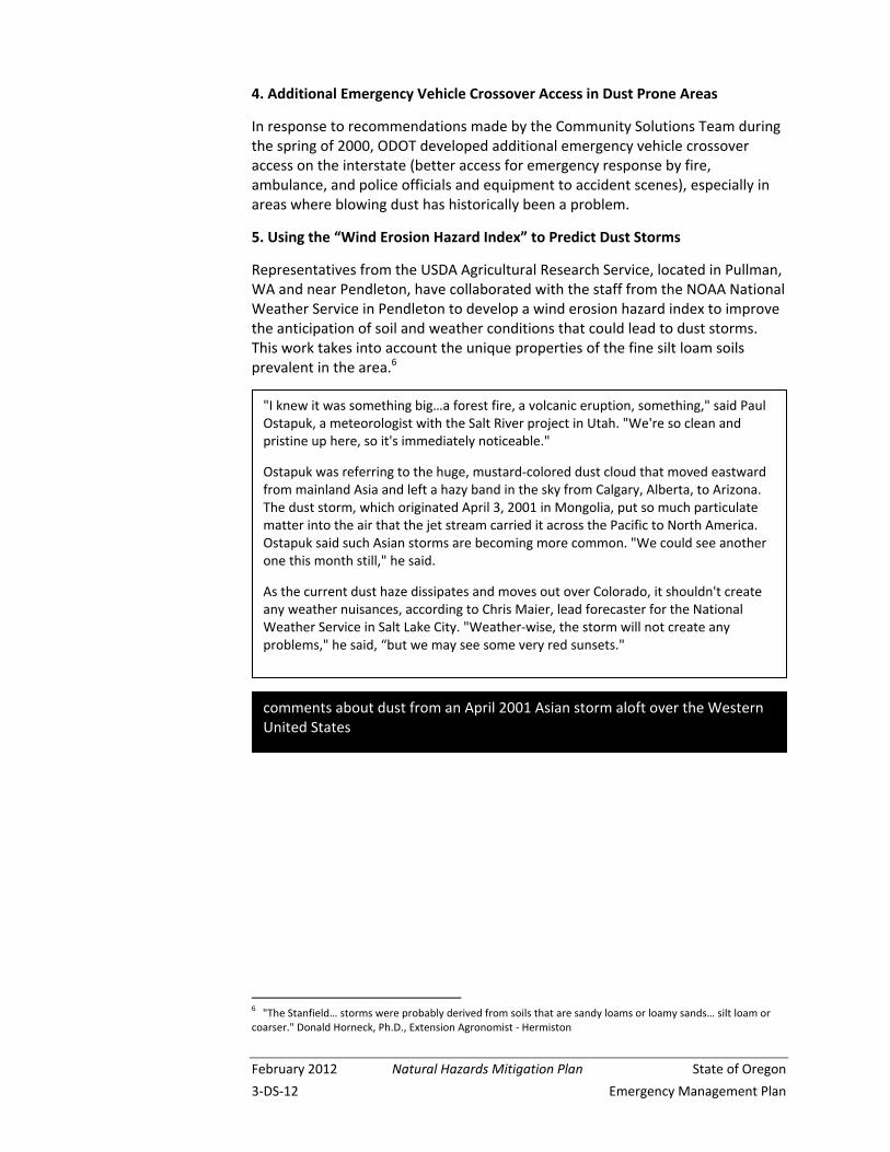
comments about dust from an April 2001 Asian storm aloft over the Western United States
"I knew it was something big…a forest fire, a volcanic eruption, something," said Paul Ostapuk, a meteorologist with the Salt River project in Utah. "We're so clean and pristine up here, so it's immediately noticeable."
Ostapuk was referring to the huge, mustard‐colored dust cloud that moved eastward from mainland Asia and left a hazy band in the sky from Calgary, Alberta, to Arizona. The dust storm, which originated April 3, 2001 in Mongolia, put so much particulate matter into the air that the jet stream carried it across the Pacific to North America. Ostapuk said such Asian storms are becoming more common. "We could see another one this month still," he said.
As the current dust haze dissipates and moves out over Colorado, it shouldn't create any weather nuisances, according to Chris Maier, lead forecaster for the National Weather Service in Salt Lake City. "Weather‐wise, the storm will not create any problems," he said, “but we may see some very red sunsets."
State of Oregon Natural Hazards Mitigation Plan February 2012
Emergency Management Plan 3‐DS‐13
Appendix DS-1: The Pacific Northwest Dust Storm of 1931 7
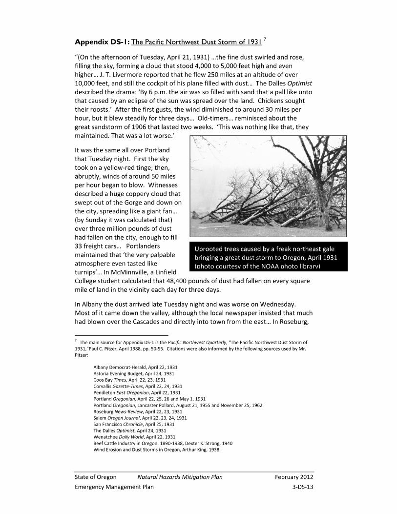
“(On the afternoon of Tuesday, April 21, 1931) …the fine dust swirled and rose, filling the sky, forming a cloud that stood 4,000 to 5,000 feet high and even higher… J. T. Livermore reported that he flew 250 miles at an altitude of over 10,000 feet, and still the cockpit of his plane filled with dust… The Dalles Optimist described the drama: ‘By 6 p.m. the air was so filled with sand that a pall like unto that caused by an eclipse of the sun was spread over the land. Chickens sought their roosts.’ After the first gusts, the wind diminished to around 30 miles per hour, but it blew steadily for three days… Old‐timers… reminisced about the great sandstorm of 1906 that lasted two weeks. ‘This was nothing like that, they maintained. That was a lot worse.’
It was the same all over Portland that Tuesday night. First the sky took on a yellow‐red tinge; then, abruptly, winds of around 50 miles per hour began to blow. Witnesses described a huge coppery cloud that swept out of the Gorge and down on the city, spreading like a giant fan… (by Sunday it was calculated that) over three million pounds of dust had fallen on the city, enough to fill 33 freight cars… Portlanders maintained that ‘the very palpable atmosphere even tasted like turnips’… In McMinnville, a Linfield College student calculated that 48,400 pounds of dust had fallen on every square mile of land in the vicinity each day for three days.
In Albany the dust arrived late Tuesday night and was worse on Wednesday. Most of it came down the valley, although the local newspaper insisted that much had blown over the Cascades and directly into town from the east… In Roseburg,
7 The main source for Appendix DS‐1 is the Pacific Northwest Quarterly, “The Pacific Northwest Dust Storm of 1931,”Paul C. Pitzer, April 1988, pp. 50‐55. Citations were also informed by the following sources used by Mr. Pitzer:
Albany Democrat‐Herald, April 22, 1931 Astoria Evening Budget, April 24, 1931
Coos Bay Times, April 22, 23, 1931 Corvallis Gazette‐Times, April 22, 24, 1931 Pendleton East Oregonian, April 22, 1931 Portland Oregonian, April 22, 25, 26 and May 1, 1931 Portland Oregonian, Lancaster Pollard, August 21, 1955 and November 25, 1962 Roseburg News‐Review, April 22, 23, 1931 Salem Oregon Journal, April 22, 23, 24, 1931 San Francisco Chronicle, April 25, 1931 The Dalles Optimist, April 24, 1931 Wenatchee Daily World, April 22, 1931 Beef Cattle Industry in Oregon: 1890‐1938, Dexter K. Strong, 1940 Wind Erosion and Dust Storms in Oregon, Arthur King, 1938
Uprooted trees caused by a freak northeast gale bringing a great dust storm to Oregon, April 1931 (photo courtesy of the NOAA photo library)
February 2012 Natural Hazards Mitigation Plan State of Oregon
3‐DS‐14 Emergency Management Plan
the wind gusted to only about 25 miles per hour, but the dust, which hit about 1 a.m. Wednesday was every bit as annoying as it was in more northerly places… (In its southerly travel) the dust seems to have stopped at Roseburg… but it clearly went west, following the Columbia River and … Coos Bay reported that the sand and dust that covered everything had blown in over the Coast Range.
Captain Henry Speller of the freighter Maui… about 500 miles off the coast… could only conclude that some nearby volcano had erupted… the steamship Sacramento sailed into Gray’s Harbor… looking as if it had crossed the Sahara… At its height, the dust cloud that brought grit to Astoria stretched for nearly 1,000 miles, from more than 300 miles east of Portland to well over 500 miles out above the Pacific Ocean… Not since Krakatoa had erupted nearly 50 years before… had so much dust hung in western Oregon skies.”
State of Oregon Natural Hazards Mitigation Plan February 2012
Emergency Management Plan 3‐DS‐15
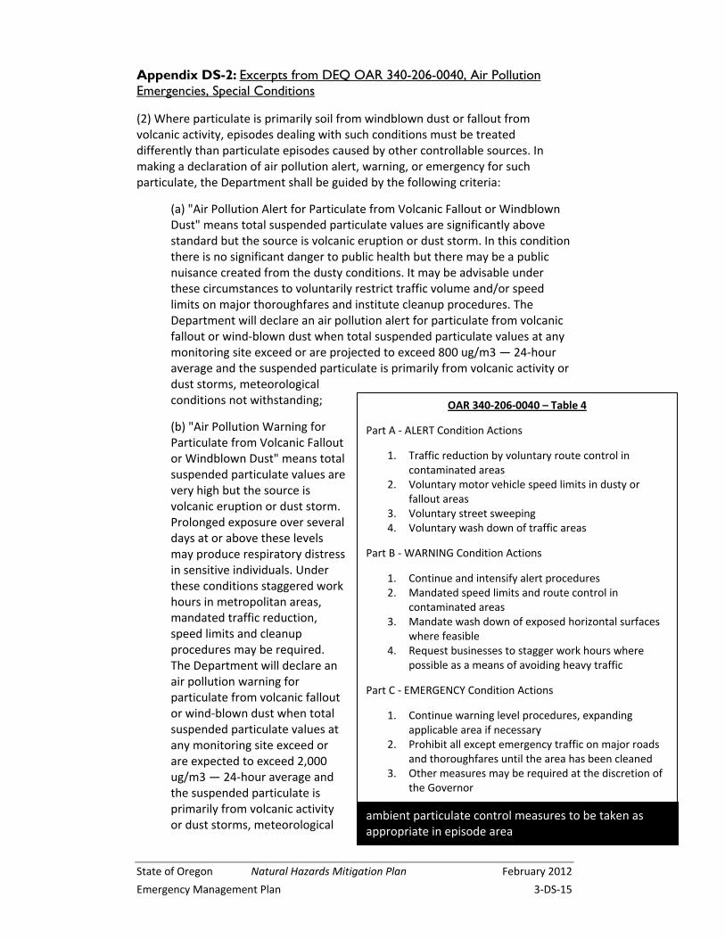
Appendix DS-2: Excerpts from DEQ OAR 340-206-0040, Air Pollution Emergencies, Special Conditions
(2) Where particulate is primarily soil from windblown dust or fallout from volcanic activity, episodes dealing with such conditions must be treated differently than particulate episodes caused by other controllable sources. In making a declaration of air pollution alert, warning, or emergency for such particulate, the Department shall be guided by the following criteria:
(a) "Air Pollution Alert for Particulate from Volcanic Fallout or Windblown Dust" means total suspended particulate values are significantly above standard but the source is volcanic eruption or dust storm. In this condition there is no significant danger to public health but there may be a public nuisance created from the dusty conditions. It may be advisable under these circumstances to voluntarily restrict traffic volume and/or speed limits on major thoroughfares and institute cleanup procedures. The Department will declare an air pollution alert for particulate from volcanic fallout or wind‐blown dust when total suspended particulate values at any monitoring site exceed or are projected to exceed 800 ug/m3 — 24‐hour average and the suspended particulate is primarily from volcanic activity or dust storms, meteorological conditions not withstanding;
(b) "Air Pollution Warning for Particulate from Volcanic Fallout or Windblown Dust" means total suspended particulate values are very high but the source is volcanic eruption or dust storm. Prolonged exposure over several days at or above these levels may produce respiratory distress in sensitive individuals. Under these conditions staggered work hours in metropolitan areas, mandated traffic reduction, speed limits and cleanup procedures may be required. The Department will declare an air pollution warning for particulate from volcanic fallout or wind‐blown dust when total suspended particulate values at any monitoring site exceed or are expected to exceed 2,000 ug/m3 — 24‐hour average and the suspended particulate is primarily from volcanic activity or dust storms, meteorological
OAR 340‐206‐0040 – Table 4
Part A ‐ ALERT Condition Actions
1. Traffic reduction by voluntary route control in contaminated areas
2. Voluntary motor vehicle speed limits in dusty or fallout areas
3. Voluntary street sweeping 4. Voluntary wash down of traffic areas
Part B ‐ WARNING Condition Actions
1. Continue and intensify alert procedures 2. Mandated speed limits and route control in
contaminated areas 3. Mandate wash down of exposed horizontal surfaces
where feasible 4. Request businesses to stagger work hours where
possible as a means of avoiding heavy traffic
Part C ‐ EMERGENCY Condition Actions
1. Continue warning level procedures, expanding applicable area if necessary
2. Prohibit all except emergency traffic on major roads and thoroughfares until the area has been cleaned
3. Other measures may be required at the discretion of the Governor
ambient particulate control measures to be taken as appropriate in episode area
February 2012 Natural Hazards Mitigation Plan State of Oregon
3‐DS‐16 Emergency Management Plan
conditions not withstanding;
(c) "Air Pollution Emergency for Particulate from Volcanic Fallout or Windblown Dust" means total suspended particulate values are extremely high but the source is volcanic eruption or dust storm. Prolonged exposure over several days at or above these levels may produce respiratory distress in a significant number of people. Under these conditions cleaning procedures must be accomplished before normal traffic can be permitted. An air pollution emergency for particulate from volcanic fallout or wind‐blown dust will be declared by the Director, who shall keep the Governor advised of the situation, when total suspended particulate values at any monitoring site exceed or are expected to exceed 5,000 ug/m3 — 24‐hour average and the suspended particulate is primarily from volcanic activity or dust storms, meteorological conditions notwithstanding.
(3) Termination: Any air pollution condition for particulate established by these criteria may be reduced to a lower condition when the criteria for establishing the higher condition are no longer observed.
(4) Action: Municipal and county governments or other governmental agency having jurisdiction in areas affected by an air pollution Alert, Warning or Emergency for particulate from volcanic fallout or windblown dust shall place into effect the actions pertaining to such episodes which are described in Table 4.