Embed Size (px)
Citation preview
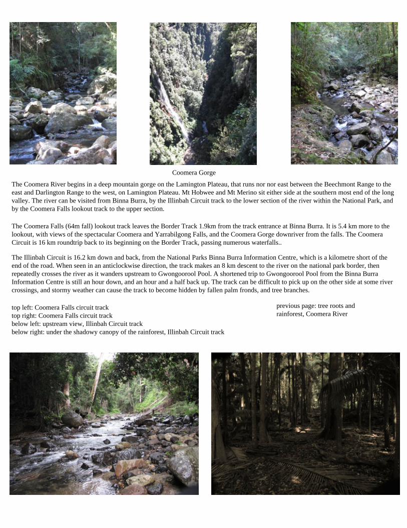
Coomera Gorge
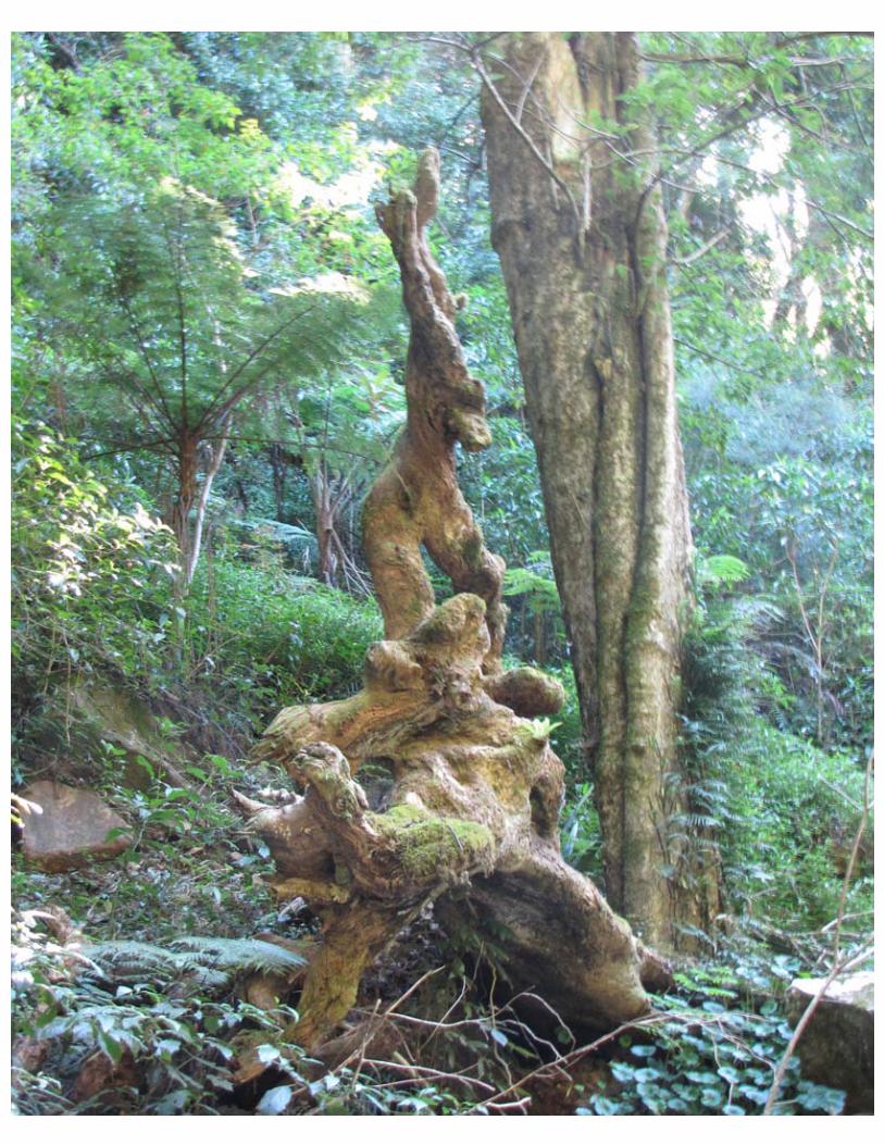
previous page: tree roots and rainforest, Coomera River
The Coomera River begins in a deep mountain gorge on the Lamington Plateau, that runs nor nor east between the Beechmont Range to the east and Darlington Range to the west, on Lamington Plateau. Mt Hobwee and Mt Merino sit either side at the southern most end of the long valley. The river can be visited from Binna Burra, by the Illinbah Circuit track to the lower section of the river within the National Park, and by the Coomera Falls lookout track to the upper section.
The Coomera Falls (64m fall) lookout track leaves the Border Track 1.9km from the track entrance at Binna Burra. It is 5.4 km more to the lookout, with views of the spectacular Coomera and Yarrabilgong Falls, and the Coomera Gorge downriver from the falls. The Coomera Circuit is 16 km roundtrip back to its beginning on the Border Track, passing numerous waterfalls.. The Illinbah Circuit is 16.2 km down and back, from the National Parks Binna Burra Information Centre, which is a kilometre short of the end of the road. When seen in an anticlockwise direction, the track makes an 8 km descent to the river on the national park border, then repeatedly crosses the river as it wanders upstream to Gwongoorool Pool. A shortened trip to Gwongoorool Pool from the Binna Burra Information Centre is still an hour down, and an hour and a half back up. The track can be difficult to pick up on the other side at some river crossings, and stormy weather can cause the track to become hidden by fallen palm fronds, and tree branches.
top left: Coomera Falls circuit track top right: Coomera Falls circuit track below left: upstream view, Illinbah Circuit track below right: under the shadowy canopy of the rainforest, Illinbah Circuit track
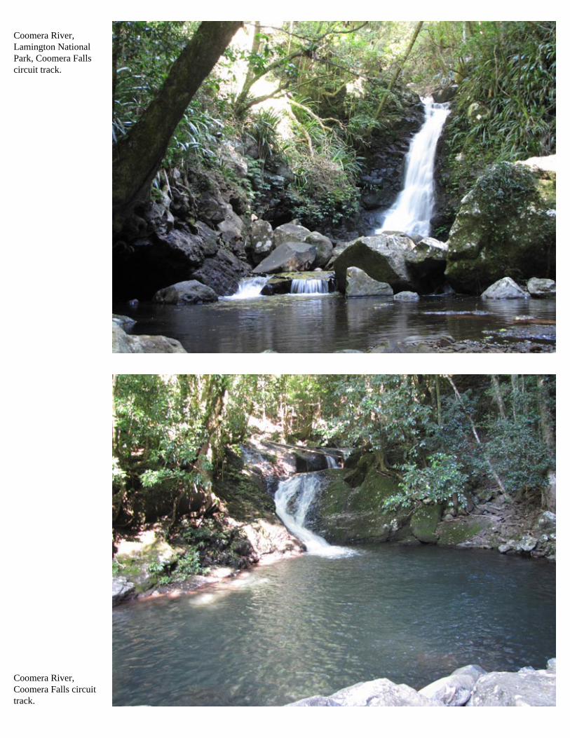
Coomera River, Lamington National Park, Coomera Falls circuit track.
Coomera River, Coomera Falls circuit track.
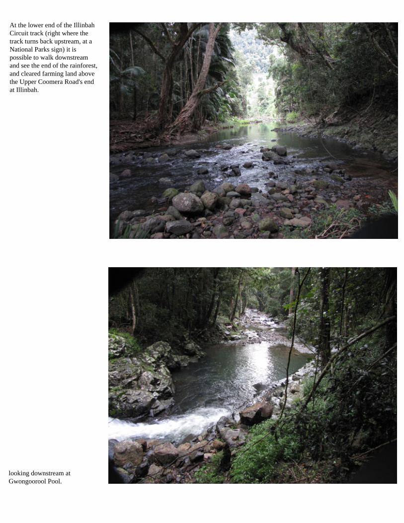
looking downstream at Gwongoorool Pool.
At the lower end of the Illinbah Circuit track (right where the track turns back upstream, at a National Parks sign) it is possible to walk downstream and see the end of the rainforest, and cleared farming land above the Upper Coomera Road's end at Illinbah.
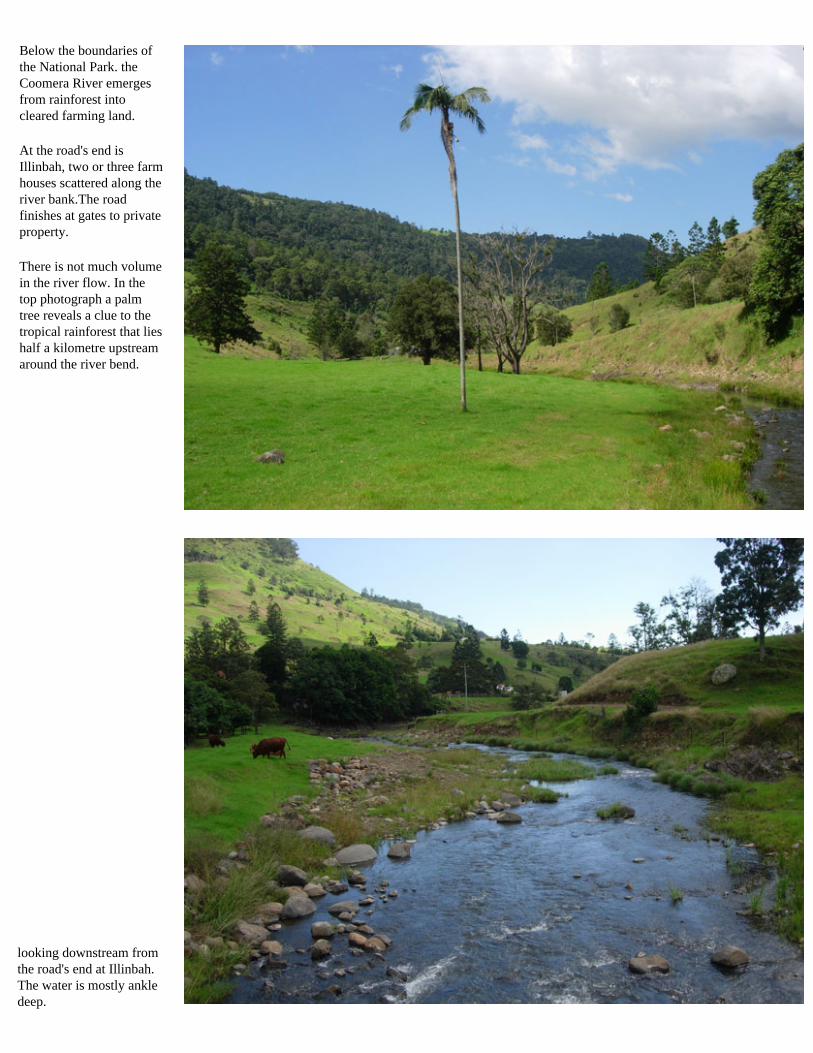
looking downstream from the road's end at Illinbah. The water is mostly ankle deep.
Below the boundaries of the National Park. the Coomera River emerges from rainforest into cleared farming land.
At the road's end is Illinbah, two or three farm houses scattered along the river bank.The road finishes at gates to private property.
There is not much volume in the river flow. In the top photograph a palm tree reveals a clue to the tropical rainforest that lies half a kilometre upstream around the river bend.
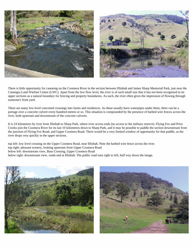
There is little opportunity for canoeing on the Coomera River in the section between Illinbah and James Sharp Memorial Park, just near the Canungra Land Warfare Centre (LWC). Apart from the low flow level, the river is of such small size that it has not been recognised in its upper sections as a natural boundary for fencing and property boundaries. As such, the river often gives the impression of flowing through someone's front yard.
There are many low level concreted crossings into farms and residences. As these usually have waterpipes under them, there can be a portage over a concrete culvert every hundred metres or so. This situation is compounded by the presence of barbed wire fences across the river, both upstream and downstream of the concrete culverts.
It is 24 kilometres by river from Illinbah to Sharp Park, where river access ends (no access to the military reserve). Flying Fox and Price Creeks join the Coomera River for its last 10 kilometres down to Sharp Park, and it may be possible to paddle the section downstream from the junction of Flying Fox Road, and Upper Coomera Road. There would be a very limited window of opportunity for that paddle, as the river drops very quickly in the upper sections.
top left: low level crossing on the Upper Coomera Road, near Illinbah. Note the barbed wire fence across the river. top right: pleasant scenery, looking upstream from Upper Coomera Road below left: downstream view, Bass Crossing, Upper Coomera Road below right: downstream view, roads end at Illinbah. The public road runs right to left, half way down the image.
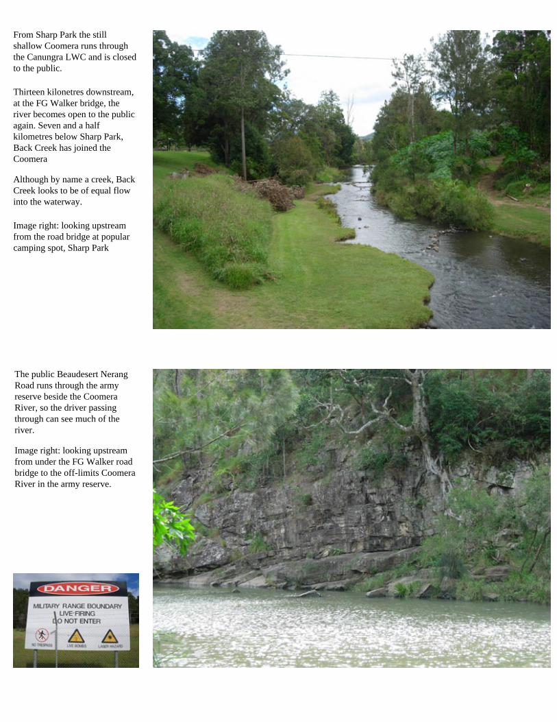
The public Beaudesert Nerang Road runs through the army reserve beside the Coomera River, so the driver passing through can see much of the river. Image right: looking upstream from under the FG Walker road bridge to the off-limits Coomera River in the army reserve.
From Sharp Park the still shallow Coomera runs through the Canungra LWC and is closed to the public.
Thirteen kilonetres downstream, at the FG Walker bridge, the river becomes open to the public again. Seven and a half kilometres below Sharp Park, Back Creek has joined the Coomera Although by name a creek, Back Creek looks to be of equal flow into the waterway.
Image right: looking upstream from the road bridge at popular camping spot, Sharp Park
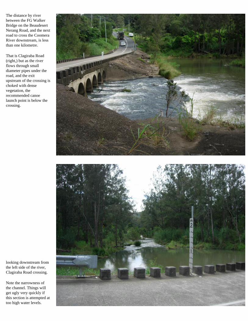
The distance by river between the FG Walker Bridge on the Beaudesert Nerang Road, and the next road to cross the Coomera River downstream, is less than one kilometre.
That is Clagiraba Road (right,) but as the river flows through small diameter pipes under the road, and the exit upstream of the crossing is choked with dense vegetation, the recommended canoe launch point is below the crossing.
looking downstream from the left side of the river, Clagiraba Road crossing.
Note the narrowness of the channel. Things will get ugly very quickly if this section is attempted at too high water levels.
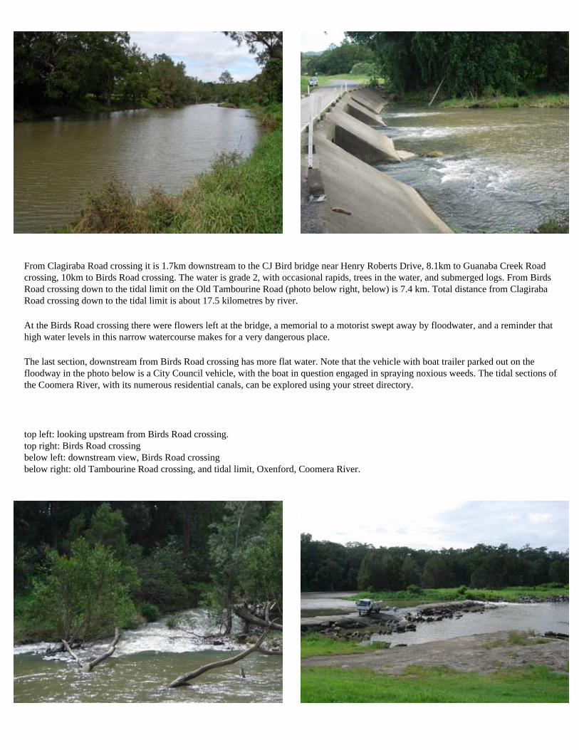
From Clagiraba Road crossing it is 1.7km downstream to the CJ Bird bridge near Henry Roberts Drive, 8.1km to Guanaba Creek Road crossing, 10km to Birds Road crossing. The water is grade 2, with occasional rapids, trees in the water, and submerged logs. From Birds Road crossing down to the tidal limit on the Old Tambourine Road (photo below right, below) is 7.4 km. Total distance from Clagiraba Road crossing down to the tidal limit is about 17.5 kilometres by river.
At the Birds Road crossing there were flowers left at the bridge, a memorial to a motorist swept away by floodwater, and a reminder that high water levels in this narrow watercourse makes for a very dangerous place.
The last section, downstream from Birds Road crossing has more flat water. Note that the vehicle with boat trailer parked out on the floodway in the photo below is a City Council vehicle, with the boat in question engaged in spraying noxious weeds. The tidal sections of the Coomera River, with its numerous residential canals, can be explored using your street directory.
top left: looking upstream from Birds Road crossing. top right: Birds Road crossing below left: downstream view, Birds Road crossing below right: old Tambourine Road crossing, and tidal limit, Oxenford, Coomera River.