Embed Size (px)
Citation preview
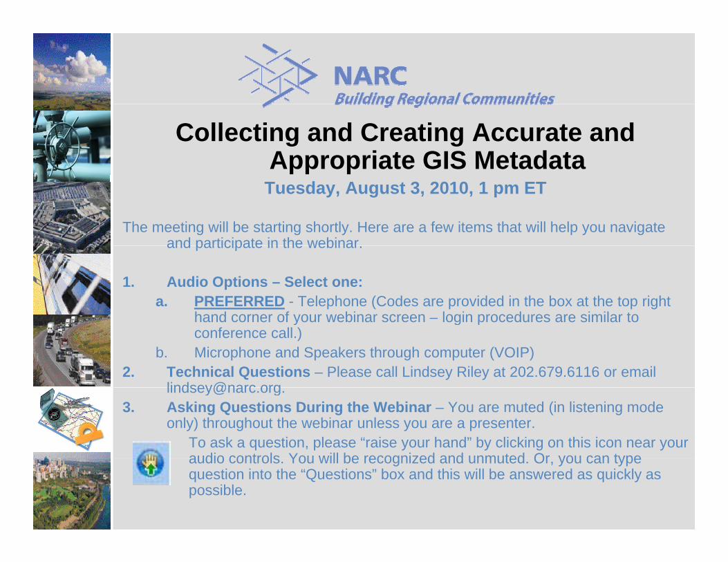
Collecting and Creating Accurate and Appropriate GIS Metadata
Tuesday, August 3, 2010, 1 pm ET
The meeting will be starting shortly. Here are a few items that will help you navigate and participate in the webinarand participate in the webinar.
1. Audio Options – Select one:a. PREFERRED - Telephone (Codes are provided in the box at the top right
hand corner of your webinar screen login procedures are similar tohand corner of your webinar screen – login procedures are similar to conference call.)
b. Microphone and Speakers through computer (VOIP)2. Technical Questions – Please call Lindsey Riley at 202.679.6116 or email
lindsey@narc [email protected]. Asking Questions During the Webinar – You are muted (in listening mode
only) throughout the webinar unless you are a presenter. To ask a question, please “raise your hand” by clicking on this icon near your audio controls You will be recognized and unmuted Or you can typeaudio controls. You will be recognized and unmuted. Or, you can type question into the “Questions” box and this will be answered as quickly as possible.
Metadata for OGC-based GeospatialMetadata for OGC based Geospatial Services
Part 2: ServicesGeoff Mortson
PART 1: METADATA (REVIEW)PART 1: METADATA (REVIEW)
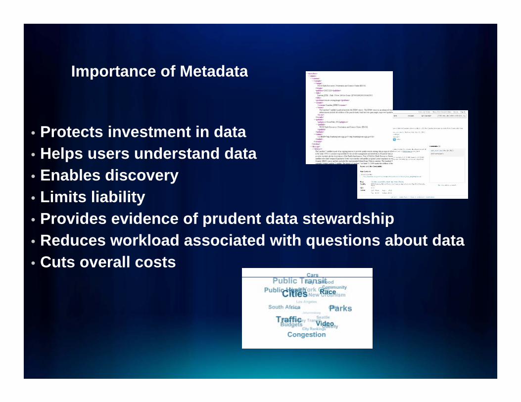
Importance of MetadataImportance of Metadata
• Protects investment in data• Helps users understand data • Enables discovery• Enables discovery • Limits liability• Provides evidence of prudent data stewardshipp p• Reduces workload associated with questions about data• Cuts overall costs
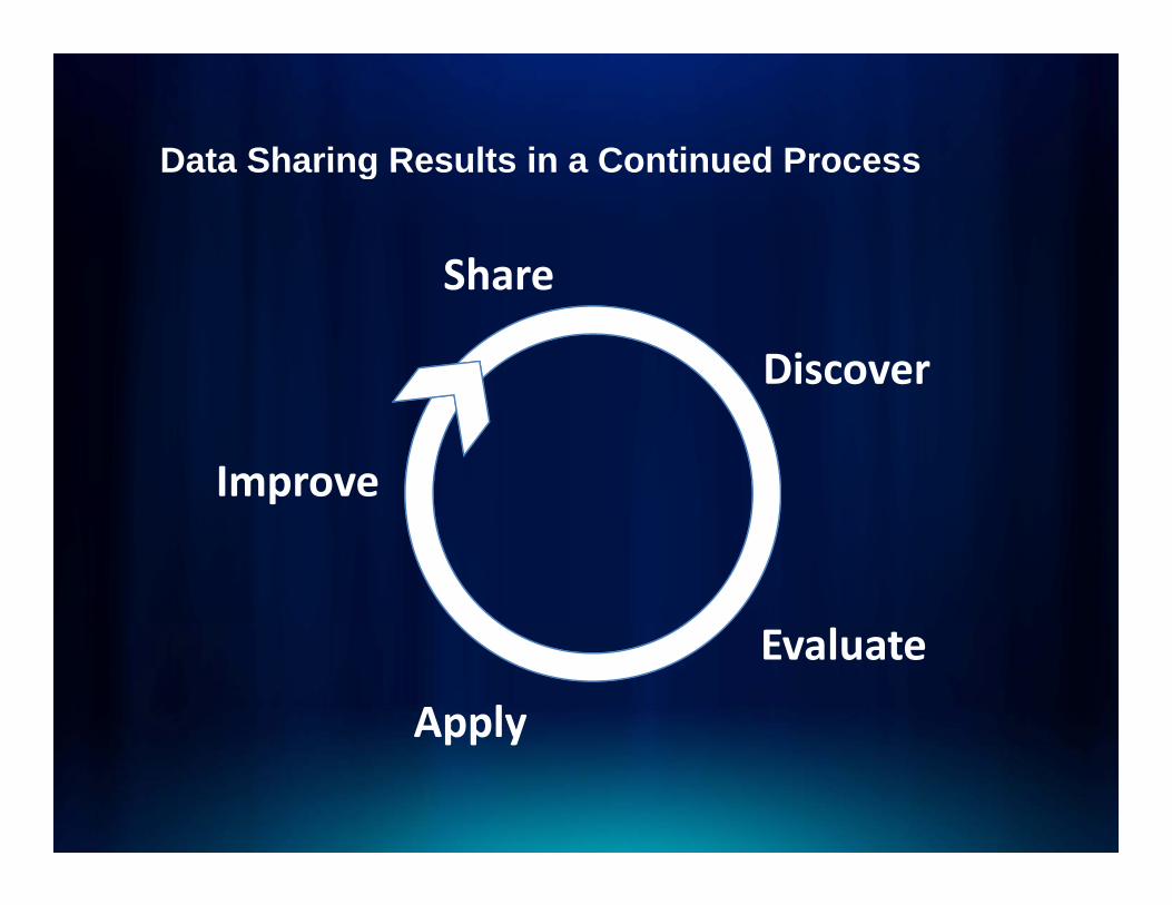
Data Sharing Results in a Continued ProcessData Sharing Results in a Continued Process
ShareShare
Discover
Improve
Evaluate
Applypp y
Metadata StandardsMetadata Standards
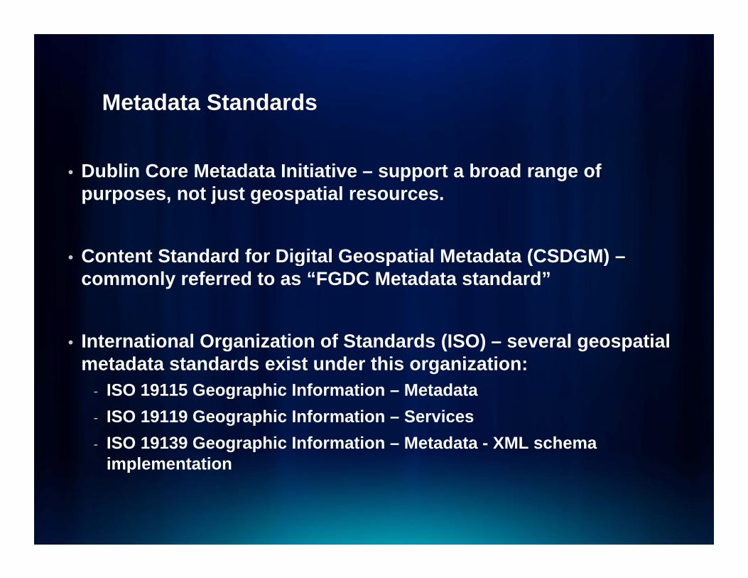
• Dublin Core Metadata Initiative – support a broad range of pp gpurposes, not just geospatial resources.
Content Standard for Digital Geospatial Metadata (CSDGM)• Content Standard for Digital Geospatial Metadata (CSDGM) –commonly referred to as “FGDC Metadata standard”
• International Organization of Standards (ISO) – several geospatial metadata standards exist under this organization:
- ISO 19115 Geographic Information – Metadatag p- ISO 19119 Geographic Information – Services- ISO 19139 Geographic Information – Metadata - XML schema
implementationp
Metadata ProfilesMetadata Profiles
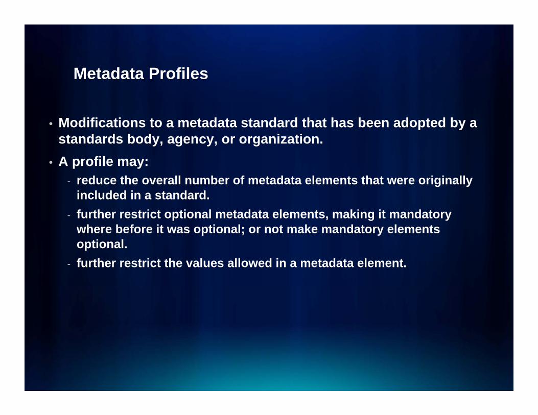
• Modifications to a metadata standard that has been adopted by a p ystandards body, agency, or organization.
• A profile may:- reduce the overall number of metadata elements that were originally- reduce the overall number of metadata elements that were originally
included in a standard. - further restrict optional metadata elements, making it mandatory
where before it was optional; or not make mandatory elements p ; yoptional.
- further restrict the values allowed in a metadata element.
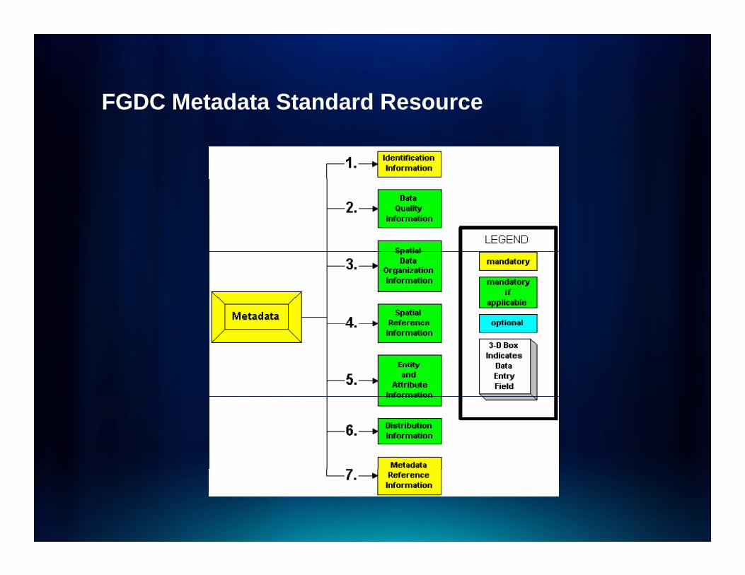
FGDC Metadata Standard ResourceFGDC Metadata Standard Resource
Improve Metadata CaptureImprove Metadata Capture
• Develop organizational processes and d
p g pprocedures
• Understand metadata standards fit• Map metadata fields to workflows• Utilize metadata creation and validation tools• Utilize metadata creation and validation tools
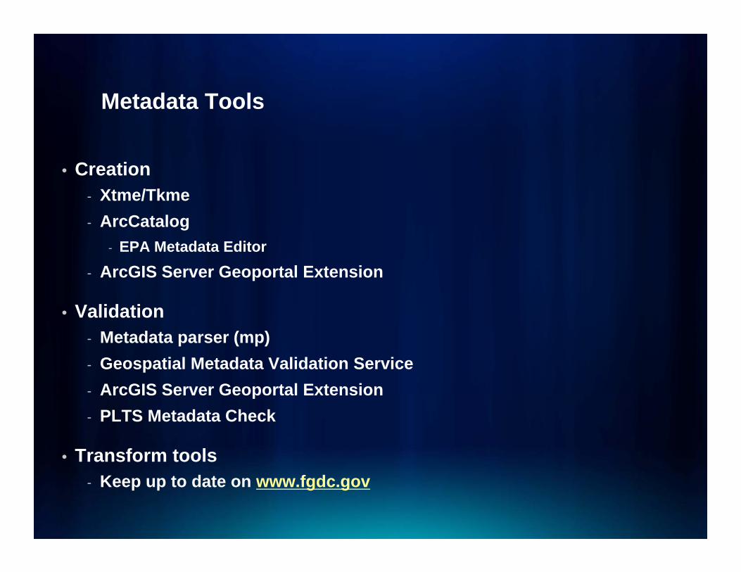
Metadata ToolsMetadata Tools
• Creation- Xtme/Tkme- ArcCatalog
- EPA Metadata EditorEPA Metadata Editor- ArcGIS Server Geoportal Extension
• Validation- Metadata parser (mp)- Geospatial Metadata Validation Service- ArcGIS Server Geoportal ExtensionArcGIS Server Geoportal Extension- PLTS Metadata Check
• Transform tools- Keep up to date on www.fgdc.gov
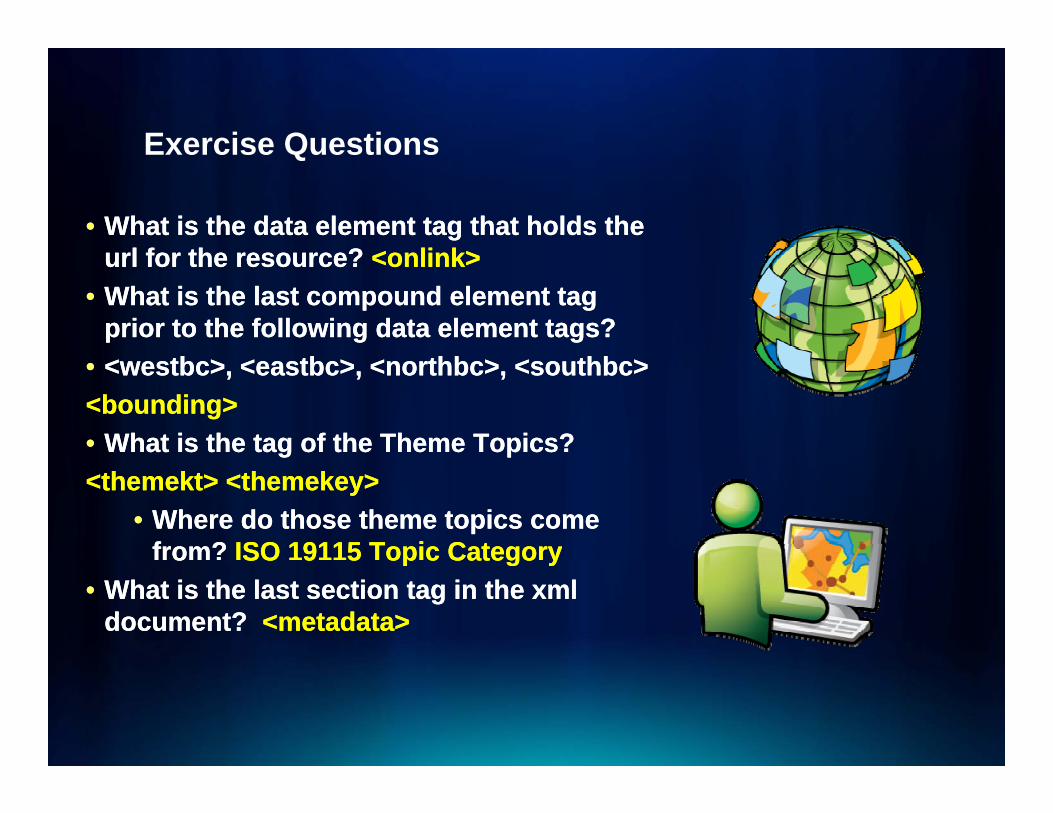
Exercise QuestionsExercise Questions
•• What is the data element tag that holds the What is the data element tag that holds the rlrl for the reso rce?for the reso rce? <<onlinkonlink>>urlurl for the resource? for the resource? <<onlinkonlink>>
•• What is the last compound element tag What is the last compound element tag prior to the following data element tags?prior to the following data element tags?
•• <<westbcwestbc>, <>, <eastbceastbc>, <>, <northbcnorthbc>, <>, <southbcsouthbc>><bounding><bounding>•• What is the tag of the Theme Topics?What is the tag of the Theme Topics?<<themektthemekt> <> <themekeythemekey>>
•• Where do those theme topics come Where do those theme topics come from? from? ISO 19115 Topic CategoryISO 19115 Topic Categoryoo SO 9 5 op c Catego ySO 9 5 op c Catego y
•• What is the last section tag in the xml What is the last section tag in the xml document? document? <metadata><metadata>
PART 2: SERVICESPART 2: SERVICES
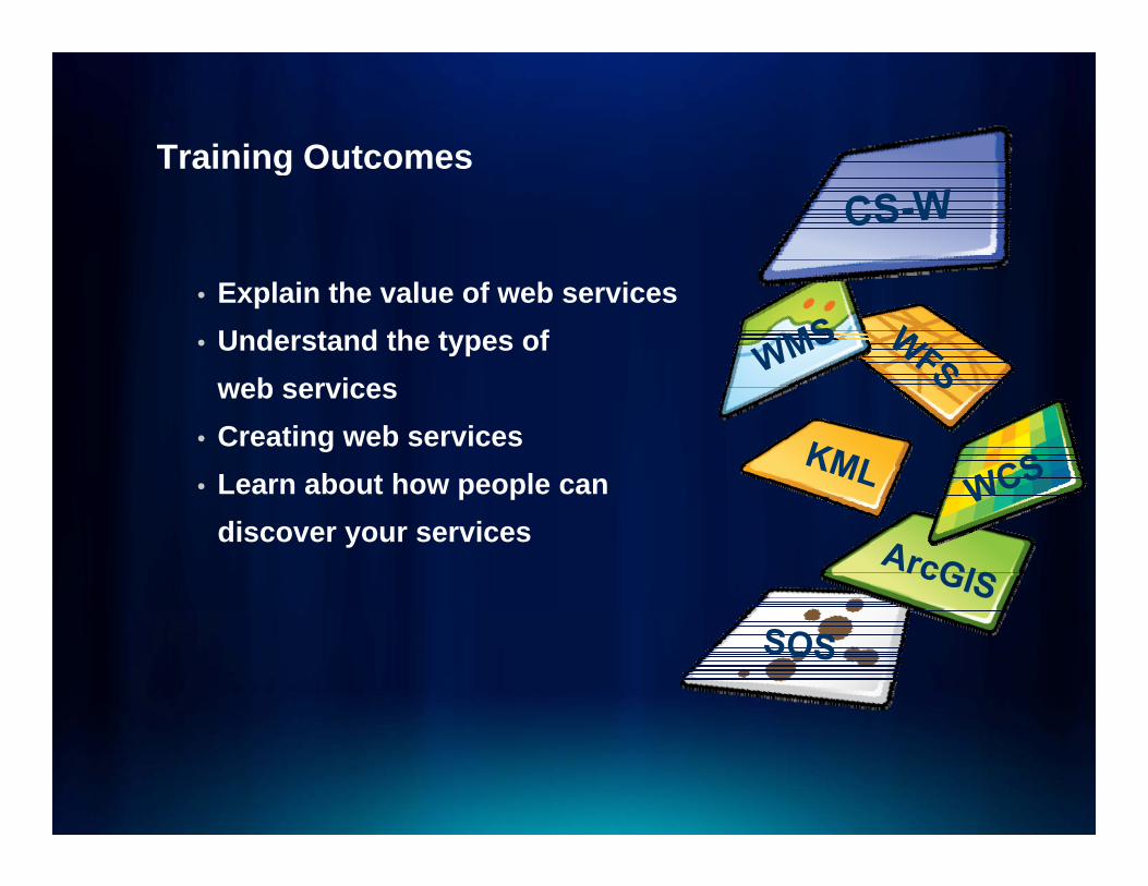
Training OutcomesTraining Outcomes
• Explain the value of web services• Understand the types of
web servicesweb services• Creating web services• Learn about how people can p p
discover your services

GoalsGoals
• Learn• Leverage• Leave and Lead• Leave and Lead

VALUE OF WEB SERVICESVALUE OF WEB SERVICES
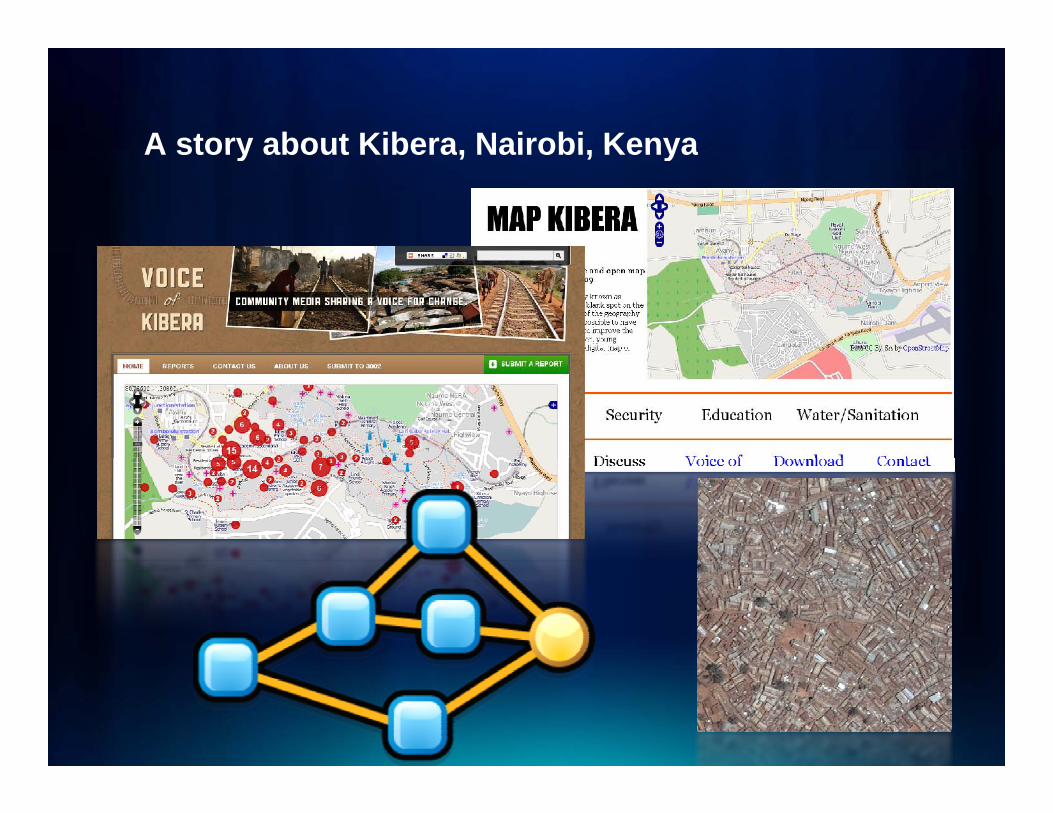
A story about Kibera, Nairobi, KenyaA story about Kibera, Nairobi, Kenya
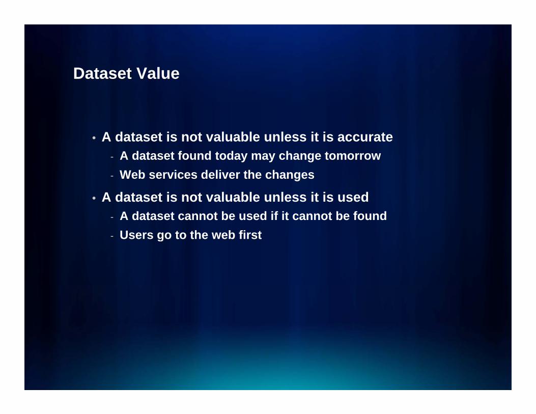
Dataset ValueDataset Value
• A dataset is not valuable unless it is accurate - A dataset found today may change tomorrow- Web services deliver the changesg
• A dataset is not valuable unless it is used- A dataset cannot be used if it cannot be found
Users go to the web first- Users go to the web first
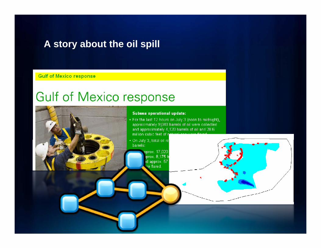
A story about the oil spillA story about the oil spill

Inter-organizational Mash UpsInter organizational Mash Ups

Uncle Sam says, “Share!”Uncle Sam says, Share!
• Open Government Directive- http://www.whitehouse.gov/open/documents/open-
government-directive- Make high value datasets public online
• Data.gov- Valuable to youValuable to you- Searches Geospatial OneStop as well- Open so users can mash up with quality data
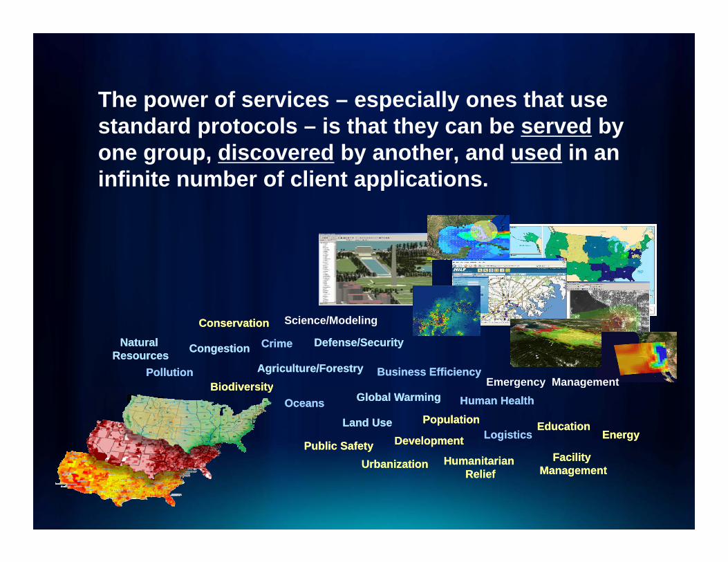
The power of services – especially ones that useThe power of services especially ones that use standard protocols – is that they can be served by one group, discovered by another, and used in an infinite n mber of client applicationsinfinite number of client applications.
S i /M d li
CrimeCrime Defense/SecurityDefense/Security
Agriculture/ForestryAgriculture/ForestryPollutionPollution
CongestionCongestion
Business EfficiencyBusiness EfficiencyBiodiversityBiodiversity
ConservationConservation Science/Modeling
Emergency Management
Natural Natural ResourcesResources
Human HealthHuman Health
EducationEducationLogisticsLogistics
EnergyEnergy
Public SafetyPublic Safety
Global WarmingGlobal Warming
Land UseLand Use
OceansOceans
DevelopmentDevelopment
BiodiversityBiodiversity
PopulationPopulation
H it iH it i
g y g
FacilityFacility
Energy Energy
UrbanizationUrbanization HumanitarianHumanitarianReliefRelief
Facility Facility ManagementManagement

TYPES OF SERVICESTYPES OF SERVICES
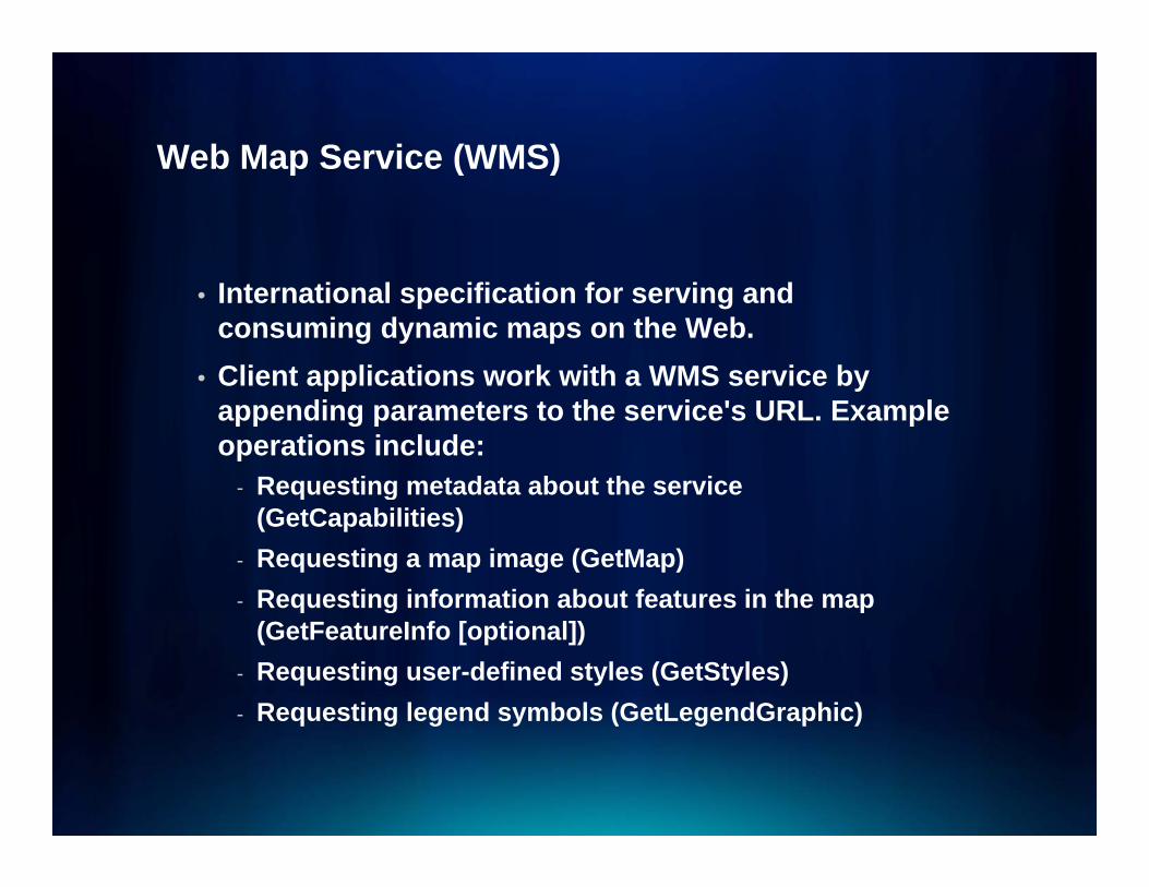
Web Map Service (WMS)Web Map Service (WMS)
• International specification for serving and consuming dynamic maps on the Web.
• Client applications work with a WMS service by pp yappending parameters to the service's URL. Example operations include:
- Requesting metadata about the service q g(GetCapabilities)
- Requesting a map image (GetMap)- Requesting information about features in the map q g p
(GetFeatureInfo [optional])- Requesting user-defined styles (GetStyles)- Requesting legend symbols (GetLegendGraphic)q g g y ( g p )
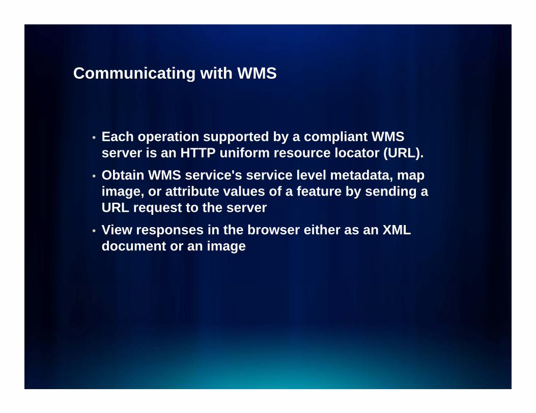
Communicating with WMSCommunicating with WMS
• Each operation supported by a compliant WMS server is an HTTP uniform resource locator (URL).
• Obtain WMS service's service level metadata, map , pimage, or attribute values of a feature by sending a URL request to the server
• View responses in the browser either as an XMLView responses in the browser either as an XML document or an image
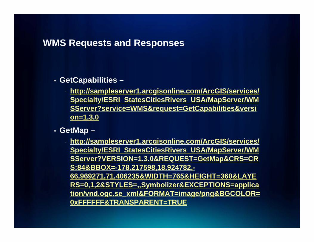
WMS Requests and ResponsesWMS Requests and Responses
• GetCapabilities –- http://sampleserver1.arcgisonline.com/ArcGIS/services/
Specialty/ESRI_StatesCitiesRivers_USA/MapServer/WMSS ? i WMS& t G tC biliti & iSServer?service=WMS&request=GetCapabilities&version=1.3.0
• GetMap –- http://sampleserver1.arcgisonline.com/ArcGIS/services/
Specialty/ESRI_StatesCitiesRivers_USA/MapServer/WMSServer?VERSION=1.3.0&REQUEST=GetMap&CRS=CRS:84&BBOX= 178 217598 18 924782S:84&BBOX=-178.217598,18.924782,-66.969271,71.406235&WIDTH=765&HEIGHT=360&LAYERS=0,1,2&STYLES=,,Symbolizer&EXCEPTIONS=application/vnd.ogc.se_xml&FORMAT=image/png&BGCOLOR=g g g0xFFFFFF&TRANSPARENT=TRUE
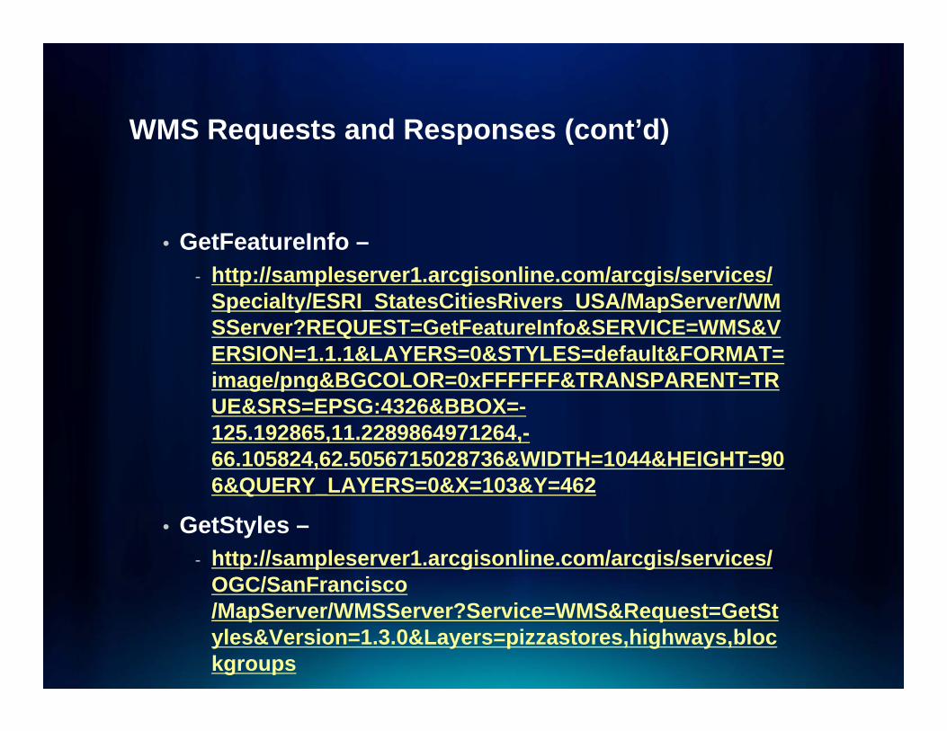
WMS Requests and Responses (cont’d)WMS Requests and Responses (cont d)
• GetFeatureInfo –- http://sampleserver1.arcgisonline.com/arcgis/services/
Specialty/ESRI_StatesCitiesRivers_USA/MapServer/WMSS ?REQUEST G tF t I f &SERVICE WMS&VSServer?REQUEST=GetFeatureInfo&SERVICE=WMS&VERSION=1.1.1&LAYERS=0&STYLES=default&FORMAT=image/png&BGCOLOR=0xFFFFFF&TRANSPARENT=TRUE&SRS=EPSG:4326&BBOX=-UE&SRS EPSG:4326&BBOX125.192865,11.2289864971264,-66.105824,62.5056715028736&WIDTH=1044&HEIGHT=906&QUERY_LAYERS=0&X=103&Y=462
• GetStyles –- http://sampleserver1.arcgisonline.com/arcgis/services/
OGC/SanFrancisco /MapServer/WMSServer?Service=WMS&Request=GetStyles&Version=1.3.0&Layers=pizzastores,highways,blockgroups
WMS Requests and Responses (cont’d)WMS Requests and Responses (cont d)
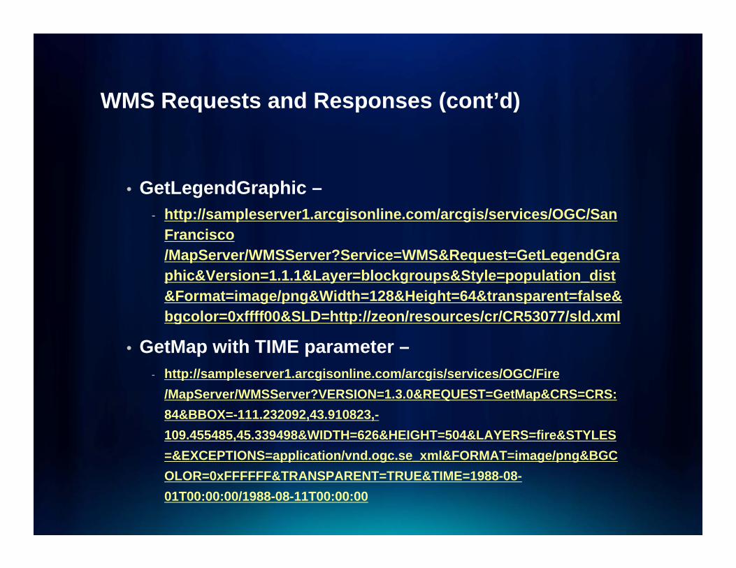
• GetLegendGraphic –- http://sampleserver1.arcgisonline.com/arcgis/services/OGC/San
Francisco /MapServer/WMSServer?Service=WMS&Request=GetLegendGraphic&Version=1.1.1&Layer=blockgroups&Style=population_dist&Format=image/png&Width=128&Height=64&transparent=false&bgcolor=0xffff00&SLD=http://zeon/resources/cr/CR53077/sld.xmlbgcolor 0xffff00&SLD http://zeon/resources/cr/CR53077/sld.xml
• GetMap with TIME parameter –- http://sampleserver1.arcgisonline.com/arcgis/services/OGC/Fire
/MapSer er/WMSSer er?VERSION 1 3 0&REQUEST GetMap&CRS CRS/MapServer/WMSServer?VERSION=1.3.0&REQUEST=GetMap&CRS=CRS:84&BBOX=-111.232092,43.910823,-109.455485,45.339498&WIDTH=626&HEIGHT=504&LAYERS=fire&STYLES=&EXCEPTIONS=application/vnd.ogc.se_xml&FORMAT=image/png&BGCOLOR=0xFFFFFF&TRANSPARENT=TRUE&TIME=1988-08-01T00:00:00/1988-08-11T00:00:00
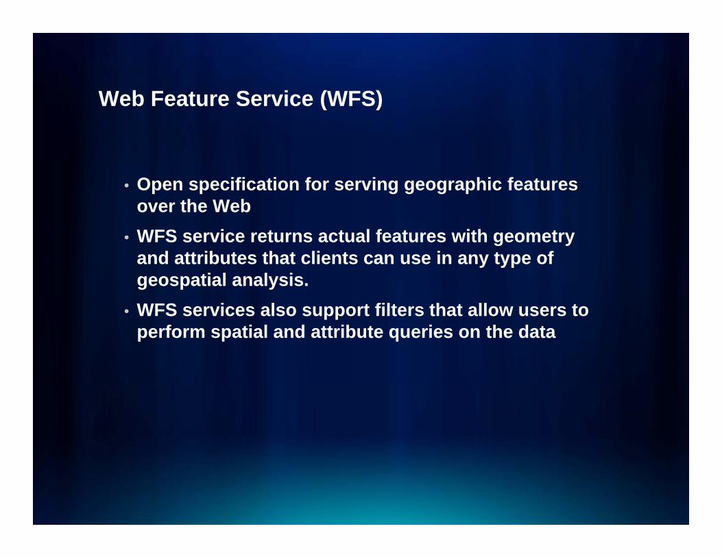
Web Feature Service (WFS)Web Feature Service (WFS)
• Open specification for serving geographic features over the Web
• WFS service returns actual features with geometry g yand attributes that clients can use in any type of geospatial analysis.
• WFS services also support filters that allow users toWFS services also support filters that allow users to perform spatial and attribute queries on the data
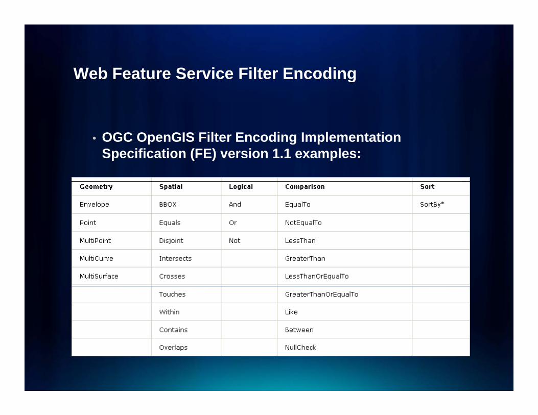
Web Feature Service Filter EncodingWeb Feature Service Filter Encoding
• OGC OpenGIS Filter Encoding Implementation Specification (FE) version 1.1 examples:
WFS ResponseWFS Response
• A web feature service may respond to a GetFeaturerequest in one of two ways:
- It can either generate a complete response document or;
- Simply return a count of the number of features that a GetFeature request would return.

FeatureID of WFSFeatureID of WFS
• FeatureID parameter can be used in GetFeaturerequests to request specific features in a WFS service
- For example: There is a FeatureType called Cities in a WFS service. If you do a GetFeature request for the Cities, the response will include the gml:id for each featurefeature.
- URL example: http://exampleserver/arcgis/services/wfs_services/ArcSDE_wfs/GeoDataServer/WFSServer?request=getfeature&typename=cities
FeatureID of WFS (cont’d)FeatureID of WFS (cont d)
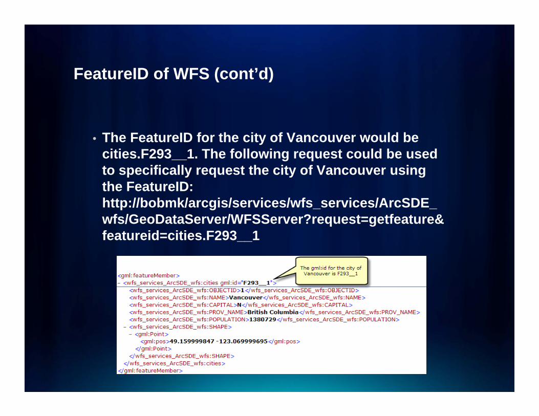
• The FeatureID for the city of Vancouver would be cities.F293__1. The following request could be used to specifically request the city of Vancouver using th F t IDthe FeatureID: http://bobmk/arcgis/services/wfs_services/ArcSDE_wfs/GeoDataServer/WFSServer?request=getfeature&featureid=cities F293 1featureid=cities.F293__1

Web Coverage Service (WCS)Web Coverage Service (WCS)
• Web Coverage Service (WCS) provides an open specification for sharing raster datasets on the Web
• WCS returns data in a format that can be used as input for analysis and modeling
• Raster datasets made available through WCS services are referred to as coveragesservices are referred to as coverages
WCS ActionsWCS Actions
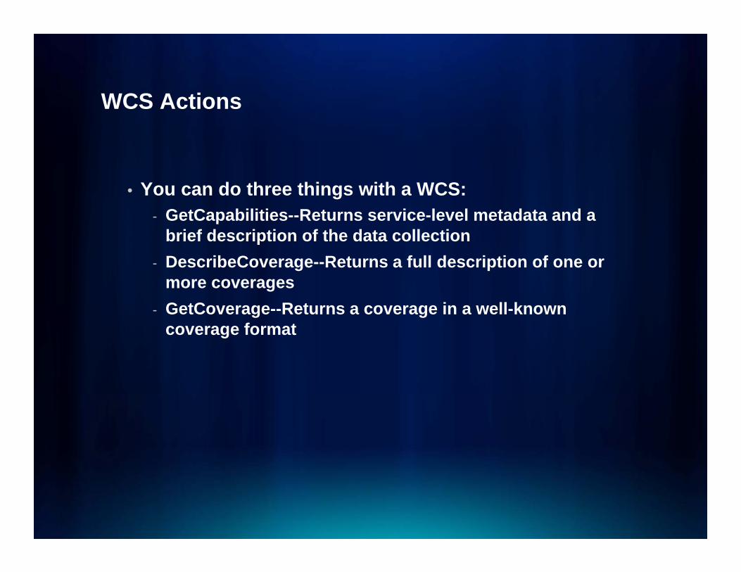
• You can do three things with a WCS:- GetCapabilities--Returns service-level metadata and a
brief description of the data collection- DescribeCoverage--Returns a full description of one or
more coverages- GetCoverage--Returns a coverage in a well-known
coverage format
WCS GetCapabilites ExampleWCS GetCapabilites Example
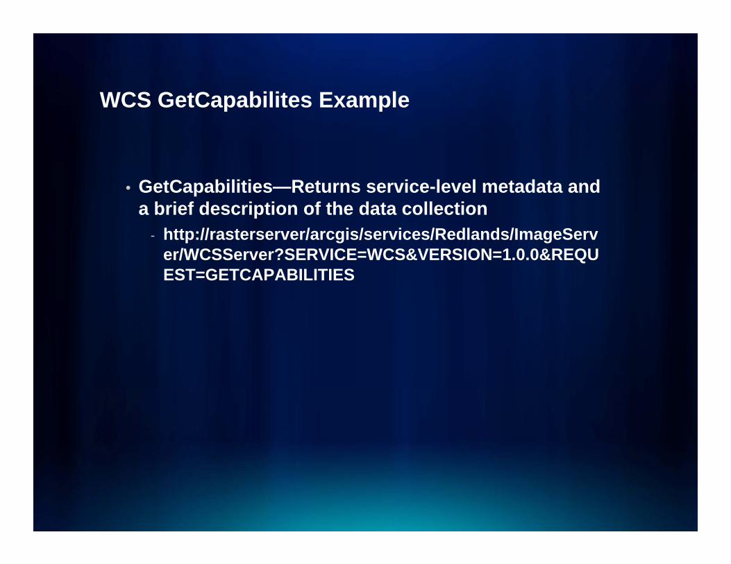
• GetCapabilities—Returns service-level metadata and a brief description of the data collection
- http://rasterserver/arcgis/services/Redlands/ImageServer/WCSServer?SERVICE=WCS&VERSION=1.0.0&REQUEST=GETCAPABILITIES
WCS DescribeCoverage ExampleWCS DescribeCoverage Example
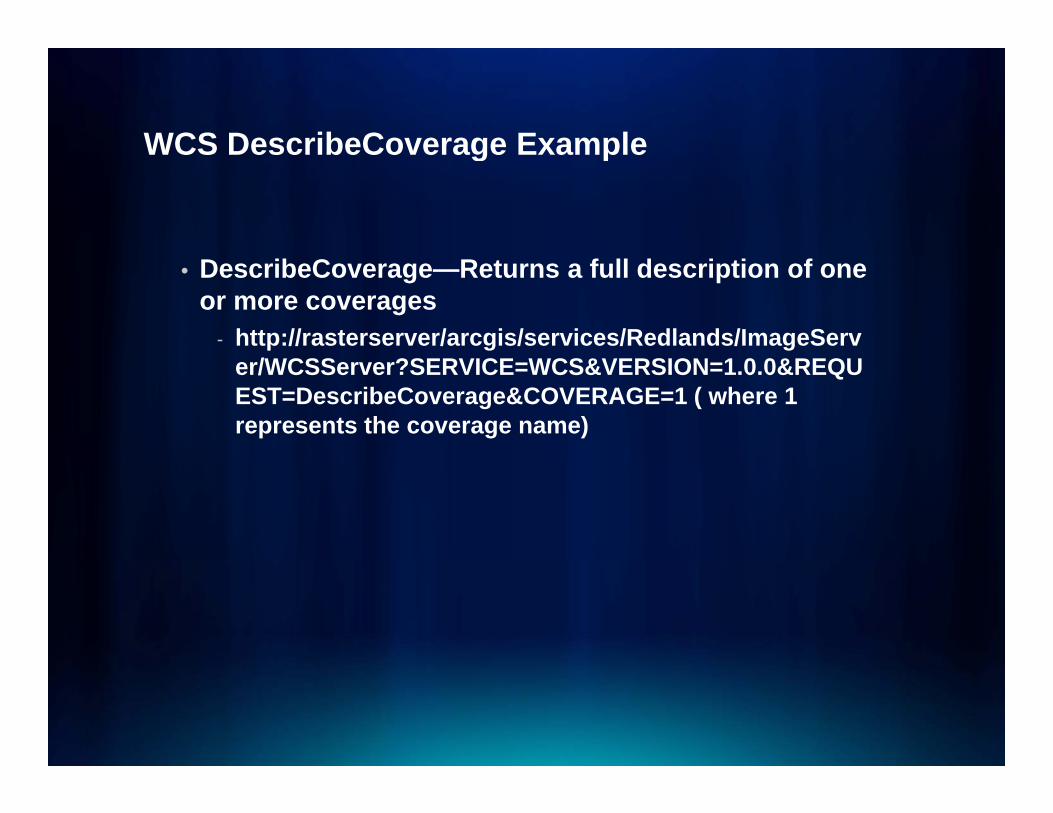
• DescribeCoverage—Returns a full description of one or more coverages
- http://rasterserver/arcgis/services/Redlands/ImageServer/WCSServer?SERVICE=WCS&VERSION=1.0.0&REQUEST=DescribeCoverage&COVERAGE=1 ( where 1 represents the coverage name)
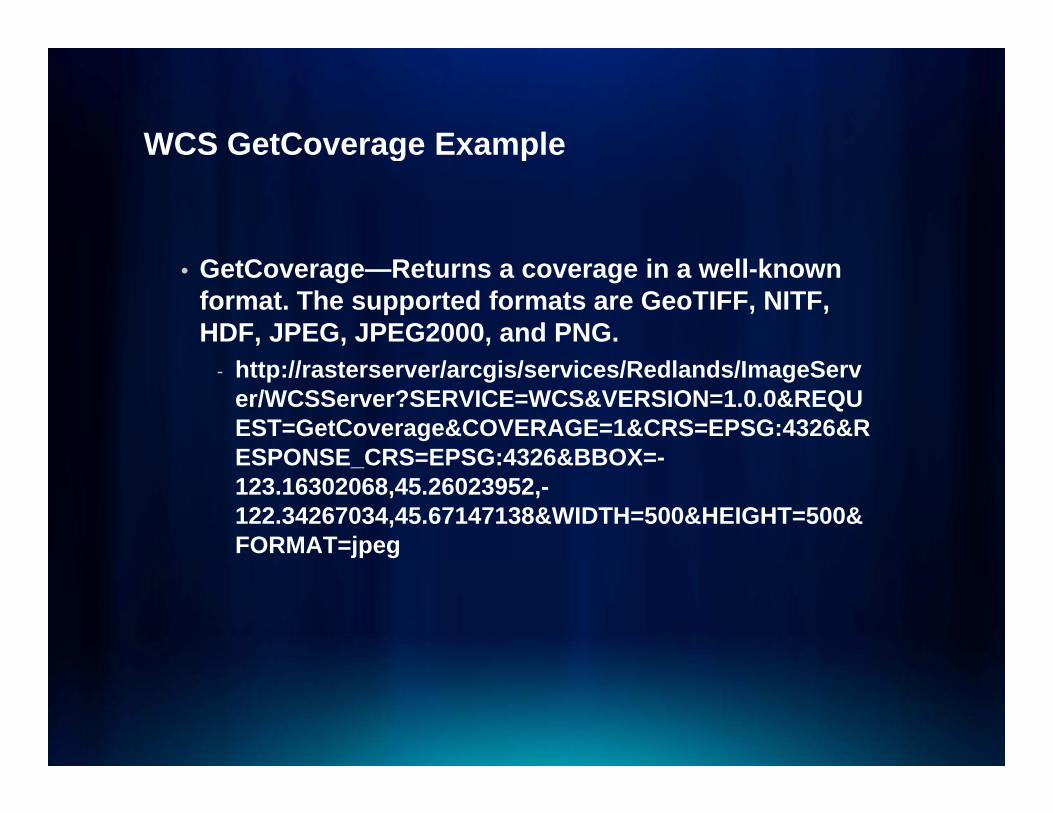
WCS GetCoverage ExampleWCS GetCoverage Example
• GetCoverage—Returns a coverage in a well-known format. The supported formats are GeoTIFF, NITF, HDF, JPEG, JPEG2000, and PNG.
- http://rasterserver/arcgis/services/Redlands/ImageServer/WCSServer?SERVICE=WCS&VERSION=1.0.0&REQUEST=GetCoverage&COVERAGE=1&CRS=EPSG:4326&RESPONSE CRS=EPSG:4326&BBOX=-ESPONSE_CRS=EPSG:4326&BBOX=-123.16302068,45.26023952,-122.34267034,45.67147138&WIDTH=500&HEIGHT=500&FORMAT=jpeg

Keyhole Markup Language (KML)Keyhole Markup Language (KML)
• Keyhole Markup Language (KML) is an XML-based file format used to represent geographic features in applications such as Google Earth and ArcGISE lExplorer.
• KML allows you to draw points, lines, and polygons on maps and globes and share them with others.
• Can also designate text, pictures, movies, or links to other GIS services that appear when the user clicks the feature
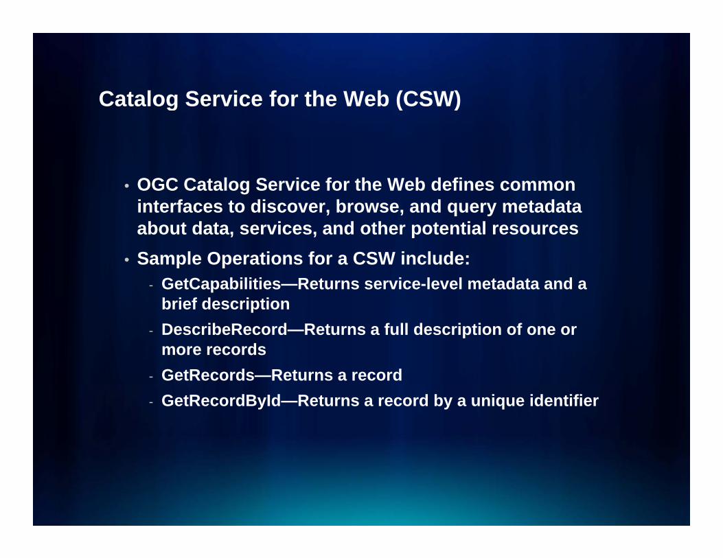
Catalog Service for the Web (CSW)Catalog Service for the Web (CSW)
• OGC Catalog Service for the Web defines common interfaces to discover, browse, and query metadata about data, services, and other potential resources
• Sample Operations for a CSW include:- GetCapabilities—Returns service-level metadata and a
brief description- DescribeRecord—Returns a full description of one or
more records- GetRecords—Returns a record- GetRecordById—Returns a record by a unique identifier

CSW Core QueryablesCSW Core Queryables
CSW GetCapabilities exampleCSW GetCapabilities example
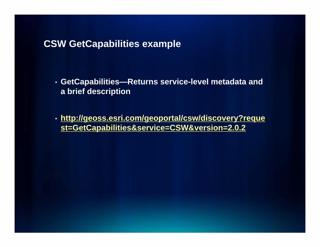
• GetCapabilities—Returns service-level metadata and a brief description
• http://geoss.esri.com/geoportal/csw/discovery?request=GetCapabilities&service=CSW&version=2.0.2
CSW GetRecords exampleCSW GetRecords example
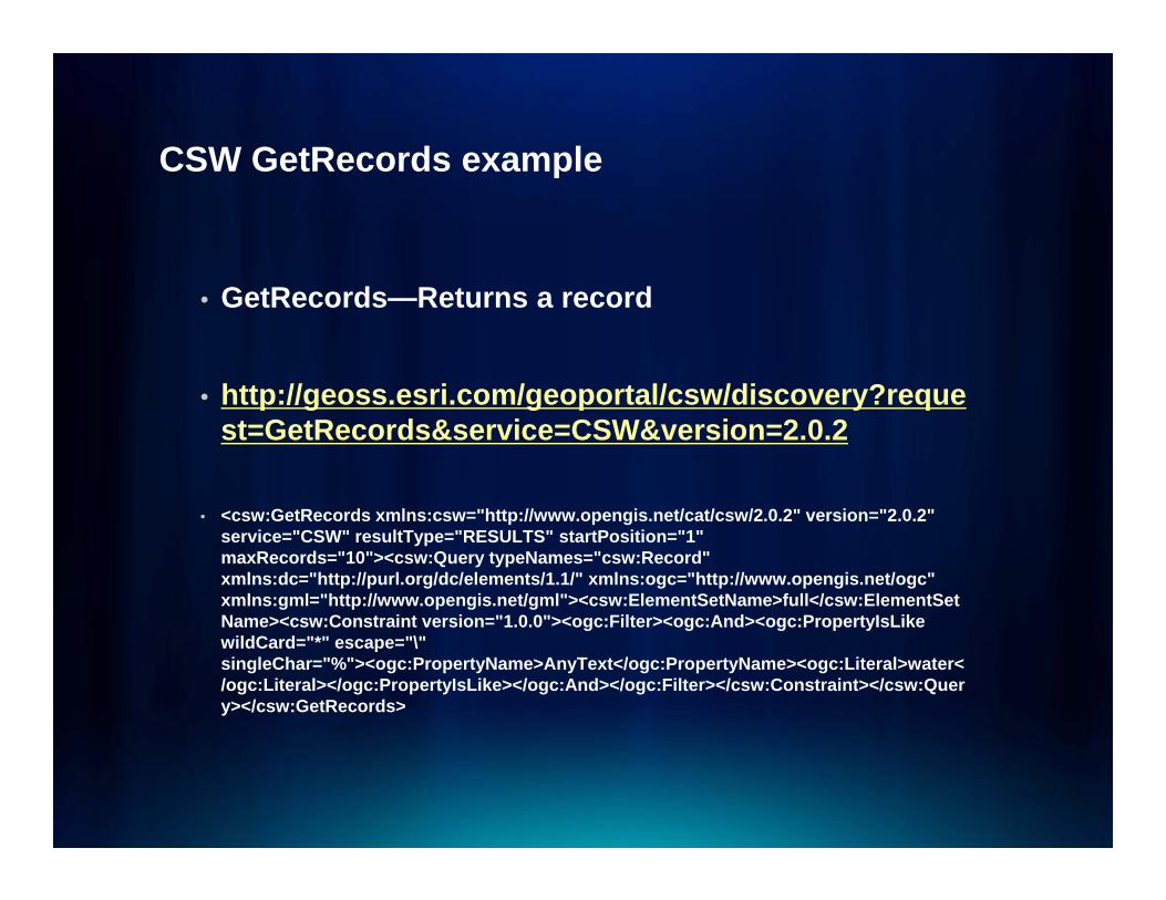
• GetRecords—Returns a record
• http://geoss esri com/geoportal/csw/discovery?reque• http://geoss.esri.com/geoportal/csw/discovery?request=GetRecords&service=CSW&version=2.0.2
• <csw:GetRecords xmlns:csw="http://www.opengis.net/cat/csw/2.0.2" version="2.0.2" service="CSW" resultType="RESULTS" startPosition="1" maxRecords="10"><csw:Query typeNames="csw:Record" xmlns:dc="http://purl.org/dc/elements/1.1/" xmlns:ogc="http://www.opengis.net/ogc" xmlns:gml="http://www.opengis.net/gml"><csw:ElementSetName>full</csw:ElementSetName><csw:Constraint version="1 0 0"><ogc:Filter><ogc:And><ogc:PropertyIsLikeName><csw:Constraint version= 1.0.0 ><ogc:Filter><ogc:And><ogc:PropertyIsLikewildCard="*" escape="\" singleChar="%"><ogc:PropertyName>AnyText</ogc:PropertyName><ogc:Literal>water</ogc:Literal></ogc:PropertyIsLike></ogc:And></ogc:Filter></csw:Constraint></csw:Query></csw:GetRecords>
CSW GetRecordById exampleCSW GetRecordById example
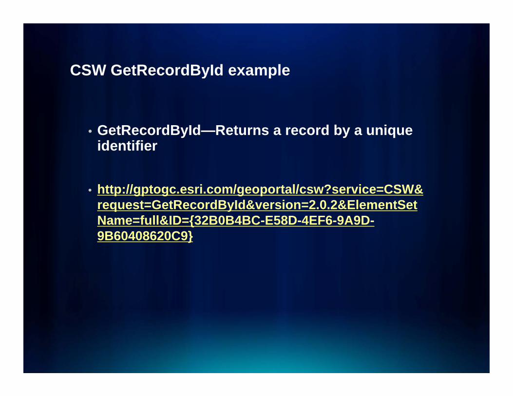
• GetRecordById—Returns a record by a unique identifier
• http://gptogc.esri.com/geoportal/csw?service=CSW&request=GetRecordById&version=2.0.2&ElementSetName=full&ID={32B0B4BC-E58D-4EF6-9A9D-Name full&ID {32B0B4BC E58D 4EF6 9A9D9B60408620C9}
Example: Data.govExample: Data.gov
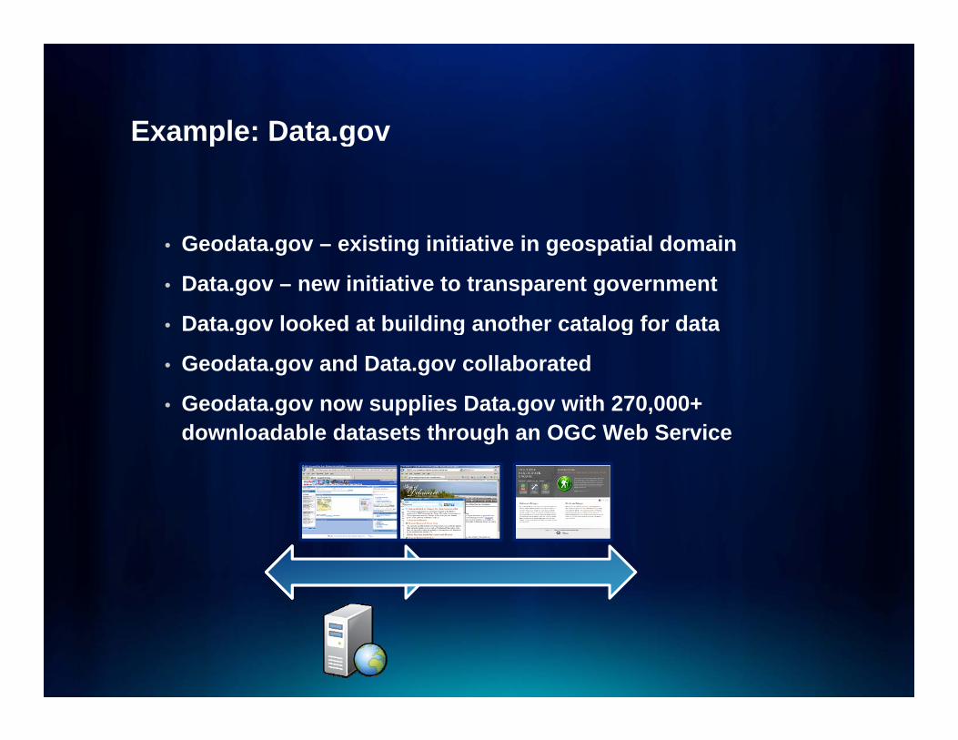
• Geodata.gov – existing initiative in geospatial domain
• Data.gov – new initiative to transparent government
• Data gov looked at building another catalog for data• Data.gov looked at building another catalog for data
• Geodata.gov and Data.gov collaborated
• Geodata.gov now supplies Data.gov with 270,000+ downloadable datasets through an OGC Web Service
Sensor Observation Service (SOS)Sensor Observation Service (SOS)
• The standard defines a web service interface for the discovery and retrieval of real time or archived data produced by all kinds of sensors like mobile or t ti ll i it tstationary as well as in-situ or remote sensors- GetCapabilities: Returns a service description
containing information about the service interface and the available sensor datathe available sensor data.
- DescribeSensor: Returns a description of one specific sensor, sensor system or data producing procedure containing information like position of sensor,containing information like position of sensor, calibration, input- and outputs, etc.
- GetObservation: Provides pull-based access to sensor observations and measurement-data via a spatio-ptemporal query that can be filtered by phenomena and value constraints.
SOS ExampleSOS Example
• http://sdf.ndbc.noaa.gov/sos/server.php
• http://gptogc esri com/geoportal/catalog/search/reso• http://gptogc.esri.com/geoportal/catalog/search/resource/livedata-preview.page?uuid={D706E3DE-24FF-459E-A0B3-6B51D7968FB1}&url=http%3A%2F%2Fsdf.ndbc.noaa6B51D7968FB1}&url http%3A%2F%2Fsdf.ndbc.noaa.gov%2Fsos%2Fserver.php&info=http%3A%2F%2Fgptogc.esri.com%2Fgeoportal%2Frest%2Fdocument%3Ff%3Dhtml%26id%3D%257BD706E3DE-24FF-459E-A0B3-6B51D7968FB1%257D

YOUR DATA + WEB SERVICESYOUR DATA WEB SERVICES
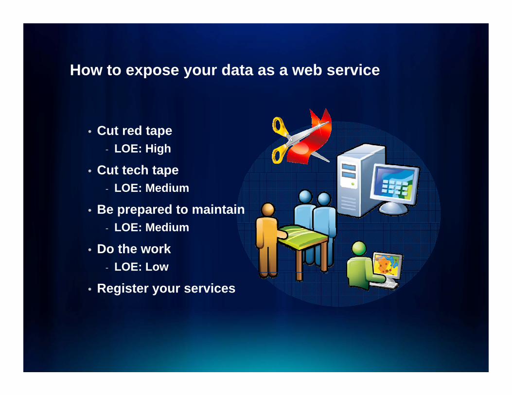
How to expose your data as a web serviceHow to expose your data as a web service
• Cut red tape - LOE: High
• Cut tech tapeCut tech tape- LOE: Medium
• Be prepared to maintain- LOE: Medium
• Do the work- LOE: Low
• Register your services
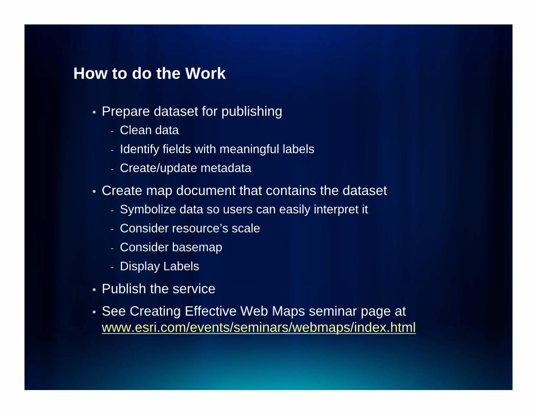
How to do the WorkHow to do the Work
• Prepare dataset for publishingClean data- Clean data
- Identify fields with meaningful labels- Create/update metadata
• Create map document that contains the dataset- Symbolize data so users can easily interpret it- Consider resource’s scale- Consider basemap- Display Labels
P bli h th i• Publish the service• See Creating Effective Web Maps seminar page at
www.esri.com/events/seminars/webmaps/index.html
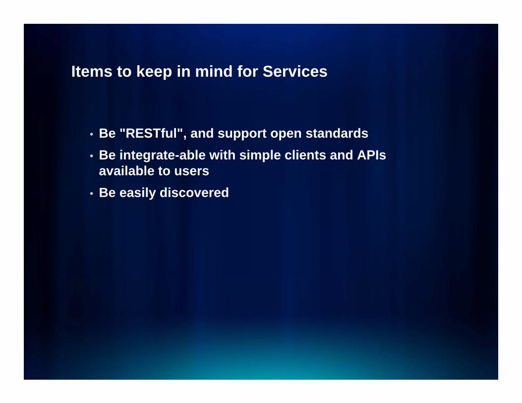
Items to keep in mind for ServicesItems to keep in mind for Services
• Be "RESTful", and support open standards• Be integrate-able with simple clients and APIs
available to users• Be easily discovered

USERS + YOUR WEBUSERS YOUR WEB SERVICES
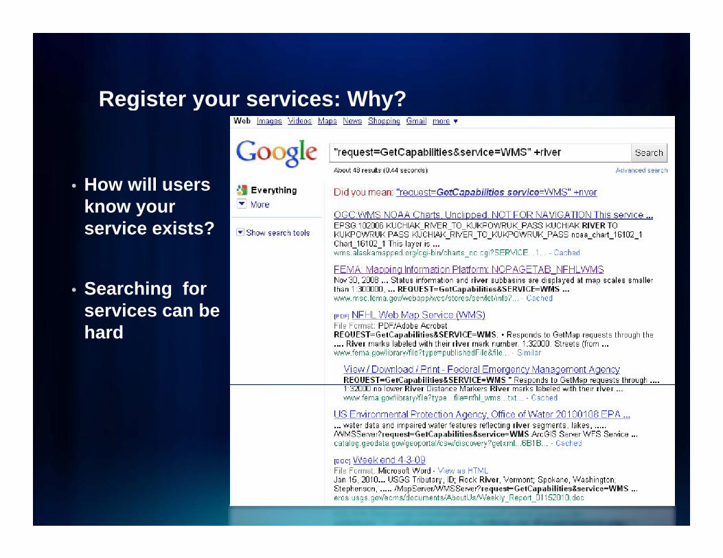
Register your services: Why?Register your services: Why?
• How will users know your service exists?
• Searching for services can beservices can be hard
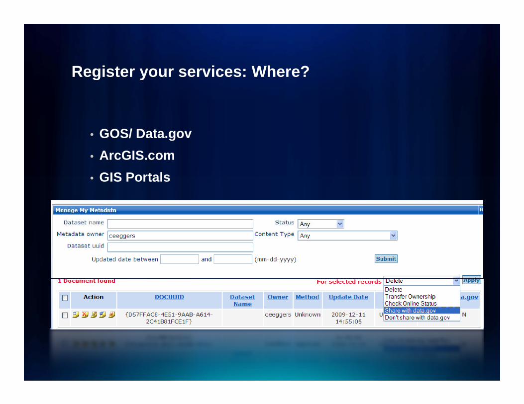
Register your services: Where?Register your services: Where?
• GOS/ Data.gov• ArcGIS.com• GIS Portals• GIS Portals

GIS Portal ExamplesGIS Portal Examples
• Data.gov and Geospatial One-stop• NOAA NCDC Geoportal• Washington State Geospatial Clearinghouse• Washington State Geospatial Clearinghouse• IDENA• ESRI Geoportal extension Beta sitep• Italy Geoportal
Service QualityService Quality
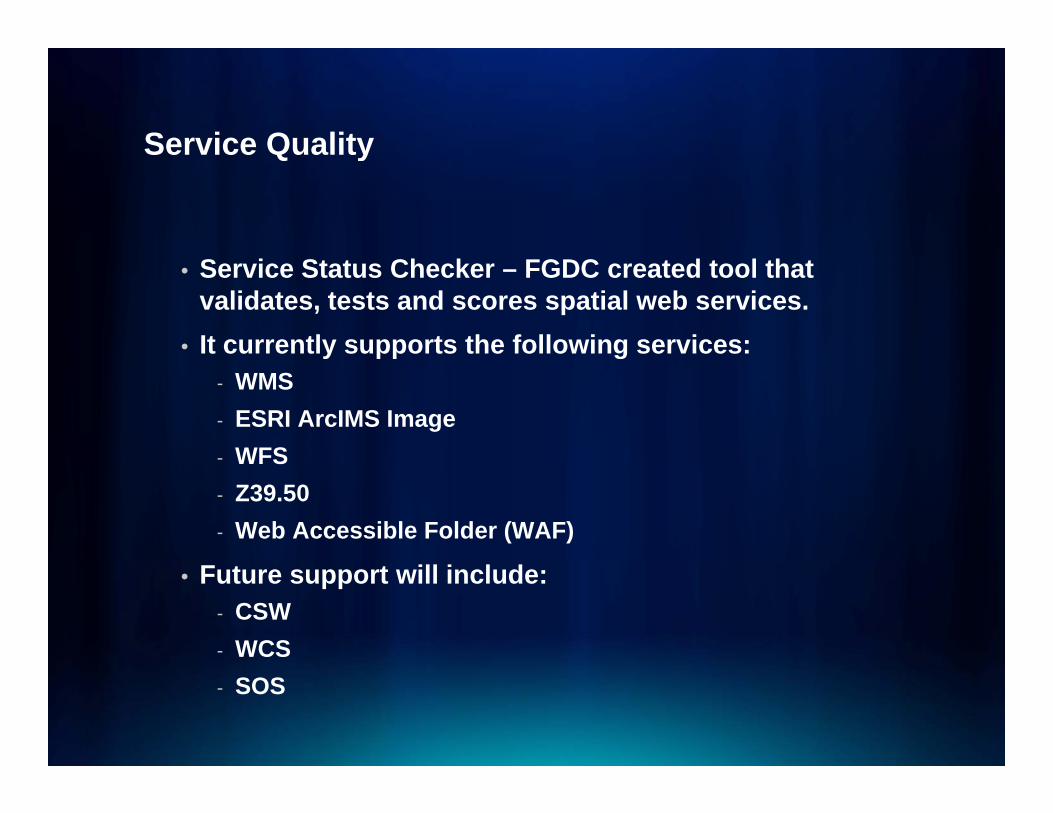
• Service Status Checker – FGDC created tool that validates, tests and scores spatial web services.
• It currently supports the following services:y pp g- WMS- ESRI ArcIMS Image
WFS- WFS- Z39.50- Web Accessible Folder (WAF)
• Future support will include:- CSW- WCS- SOS
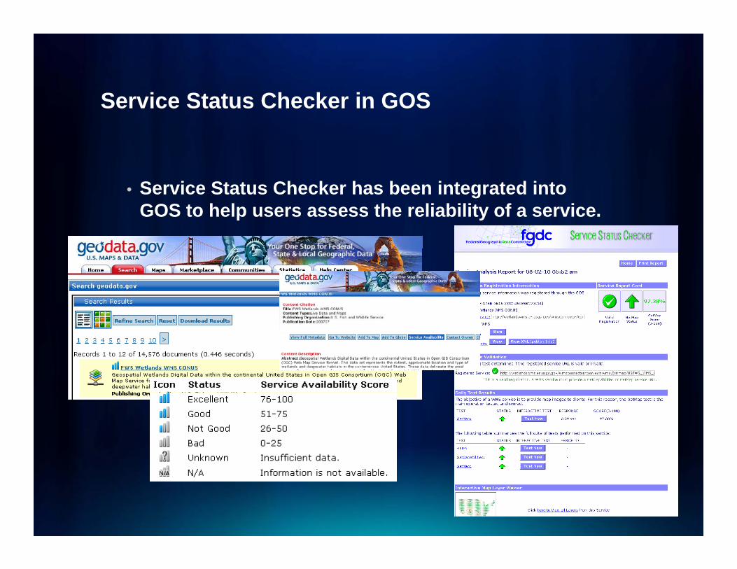
Service Status Checker in GOSService Status Checker in GOS
• Service Status Checker has been integrated into GOS to help users assess the reliability of a service.
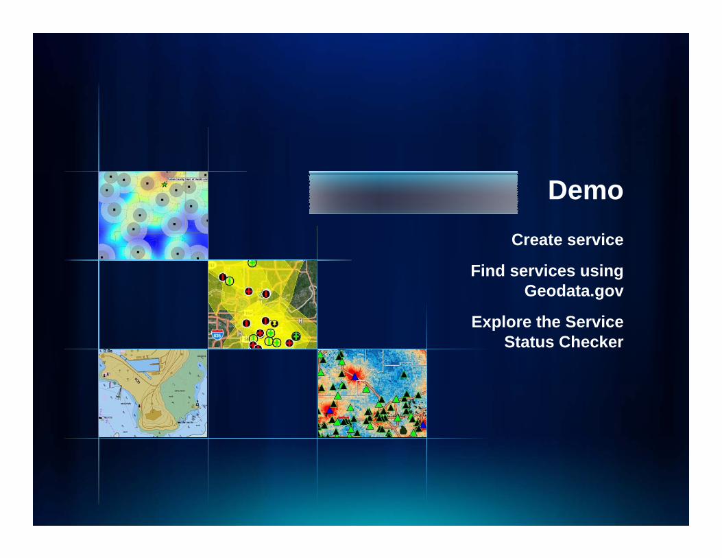
Demo Create serviceCreate service
Find services using Geodata.gov
Explore the Service Status Checker

EXERCISE: PART 2EXERCISE: PART 2
Service ExerciseService Exercise
•• Search for live services in geodata.gov. Search for live services in geodata.gov. http //gos2 geodata go / ps/portal/goshttp //gos2 geodata go / ps/portal/goshttp://gos2.geodata.gov/wps/portal/goshttp://gos2.geodata.gov/wps/portal/gos
•• Search for ‘Search for ‘USGS Water Watch’•• Question 1 and 2 will pertain to this Question 1 and 2 will pertain to this
serviceservice•• Search for ‘Search for ‘PDC Meteorology Service’
•• Questions 3Questions 3--6 will pertain to this 6 will pertain to this recordrecord
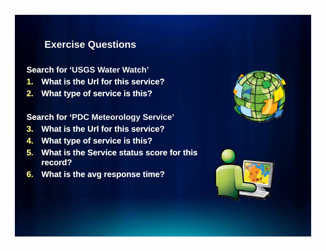
Exercise QuestionsExercise Questions
Search for ‘Search for ‘USGS Water Watch’1.1. What is the What is the UrlUrl for this service?for this service?2.2. What type of service is this?What type of service is this?
Search for ‘Search for ‘PDC Meteorology Service’3.3. What is the What is the UrlUrl for this service?for this service?44 What type of service is this?What type of service is this?4.4. What type of service is this?What type of service is this?5.5. What is the Service status score for this What is the Service status score for this
record?record?66 What is theWhat is the avgavg response time?response time?6.6. What is the What is the avgavg response time?response time?

QUESTIONS?QUESTIONS?
AcknowledgementThe project described in this publication was supported by Cooperative Agreement Number G10AC00236 from the United States Geological Survey Its contents are solely the responsibility of the authors and does not necessarily represent theStates Geological Survey. Its contents are solely the responsibility of the authors and does not necessarily represent the
official views of the USGS.