Embed Size (px)
Citation preview
Climate Change and Rural Communities in the Greater Mekong SubregionA Framework for Assessing Vulnerability and Adaptation Options
CEP Knowledge Series # 1

Climate Change and Rural Communities in the Greater Mekong SubregionA Framework for Assessing Vulnerability and Adaptation Options
May 2014
© 2014 Asian Development Bank
All rights reserved. Published in 2014. Printed in Thailand.
ISBN 978-92-9254-534-5 (Print), 978-92-9254-535-2 (PDF) Publication Stock No. RPT146512-2 Cataloging-In-Publication Data
Asian Development Bank.Climate change and rural communities in the Greater Mekong Subregion: A framework for assessing vulnerability and adaptation options.Mandaluyong City, Philippines: Asian Development Bank, 2014.
1. Climate Change Adaptation 2. Communities I. Environment Operations Center
The views expressed in this publication are those of the authors and do not necessarily reflect the views and policies of the Asian Development Bank (ADB) or its Board of Governors or the governments they represent.
ADB does not guarantee the accuracy of the data included in this publication and accepts no responsibility for any consequence of their use.
By making any designation of or reference to a particular territory or geographic area, or by using the term “country” in this document, ADB does not intend to make any judgments as to the legal or other status of any territory or area.
ADB encourages printing or copying information exclusively for personal and noncommercial use with proper acknowledgment of ADB. Users are restricted from reselling, redistributing, or creating derivative works for commercial purposes without the express, written consent of ADB.
Note: In this publication, “$” refers to US dollars.
Asian Development Bank6 ADB Avenue, Mandaluyong City 1550 Metro Manila, PhilippinesTel +63 2 632 4444Fax +63 2 636 2444www.adb.org
For orders, please contact: Public Information CenterFax +63 2 636 [email protected]
Printed on Recycled Paper
GMS Environment Operations Center23rd Floor, The Offices at Central World999/9 Rama 1 Road, Pathumwan Bangkok 10330Tel: (+66) 2 207 4444Fax: (+66) 2 207 4400E-mail: [email protected]: www.gms-eoc.org
iii
Contents
Acknowledgments v
Abbreviations vii
Executive Summary ix
Introduction 1
Agriculture, Rural Communities, and Climate Change in the GMS 3
Study Sites 5
Lao PDR: Xe Pian-Dong Hua Sao Biodiversity Corridor 5
Thailand: Tenasserim Biodiversity Corridor 7
Viet Nam: Ngoc Linh-Xe Sap Biodiversity Corridor 9
Framework for Assessing Climate Change Vulnerability and Adaptation in Rural Communities 11
Key Concepts 11
Assessment Approach 13
Assessment Steps 14
Synthesis of Study Results 16
Recommendations 25
Next Steps 27
Appendix 1: A Regional Climate Change Scenario for Southeast Asia 28
Appendix 2: Other Key Climate Change Terminology 34
Appendix 3: Summary of Characteristics of Five Climate Change Impact, Adaptation, and Vulnerability Assessment Approaches 35
iv
v
Acknowledgments
This publication was authored by Ornsaran Pomme Manuamorn, Climate Change Coordinator at the GMS Environment Operations Center (EOC). It was prepared under the technical guidance of Sumit Pokhrel, Deputy Technical Program Head, EOC.
Dr. Michael Green, Technical Program Head and Duncan McLeod, Outreach Specialist (both EOC) provided extensive technical review and inputs to the draft. Valuable comments were also provided by Naeeda Crishna Morgado, EOC, Suppakorn Chinvanno, SEA START, and Jiao Xi. Site maps were created by Nguyen Hanh Quyen, EOC.
The publication was based on technical reports produced for the regional study ‘Climate Change Vulnerability and Adaptation in Agriculture Areas in the Biodiversity Conservation Corridors Initiative Pilot Sites.’ EOC would like thank the study team members Robert Everitt, Suppakorn Chinvanno, Jiao Xi, Pham Ha Phuong, and Vichien Kerdsuk. The study was conducted and publication developed under the overall supervision of Sanath Ranawana, Senior Natural Resources Management Specialist, Asian Development Bank (ADB).
EOC appreciates the technical expertise of the Southeast Asia START Regional Center, which provided the climate change projection data for the study.
EOC acknowledges the environment ministries of Lao PDR, Thailand, and Viet Nam for their active support of the regional study. In particular, the provincial officers involved in the study from Champasak and Attapeu Provinces in Lao PDR, Kanchanaburi and Ratchaburi Provinces in Thailand, and Quang Nam Province in Viet Nam. Also to the community members who participated in the study.
Finally, EOC would like to thank the governments of Finland and Sweden, the Nordic Development Fund, and ADB for their continued cofinancing of the GMS Core Environment Program.
vi
vii
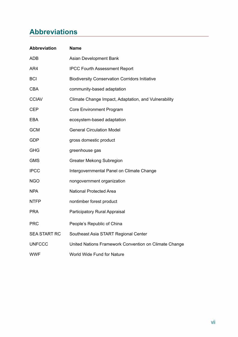
Abbreviations
Abbreviation Name
ADB Asian Development Bank
AR4 IPCC Fourth Assessment Report
BCI Biodiversity Conservation Corridors Initiative
CBA community-based adaptation
CCIAV Climate Change Impact, Adaptation, and Vulnerability
CEP Core Environment Program
EBA ecosystem-based adaptation
GCM General Circulation Model
GDP gross domestic product
GHG greenhouse gas
GMS Greater Mekong Subregion
IPCC Intergovernmental Panel on Climate Change
NGO nongovernment organization
NPA National Protected Area
NTFP nontimber forest product
PRA Participatory Rural Appraisal
PRC People’s Republic of China
SEA START RC Southeast Asia START Regional Center
UNFCCC United Nations Framework Convention on Climate Change
WWF World Wide Fund for Nature

viii
ix
Executive Summary
Rural communities in the Greater Mekong Subregion (GMS) are particularly vulnerable to climate change due to their dependence on rainfed agriculture. To improve adaptation planning for agrarian communities, there is a need to better understand their climate vulnerability through an appropriate assessment methodology. Assessment outcomes can then be used to support the mainstreaming of climate change adaptation initiatives in community development planning to increase community resilience both now and under a future climate.
Building on existing assessment methodologies, the GMS Core Environment Program (CEP) developed a participatory framework to assess climate vulnerability and identify adaptation options in rural GMS communities. This work aimed to demonstrate how a step-wise framework can help translate available scientific information into adaptation options and inform the integration of climate change considerations into community-level planning.
CEP tested the assessment framework in selected communities in Lao People’s Democratic Republic (Lao PDR), Thailand and Viet Nam in 2011–2012.
The following is a summary of key messages:
(i) Planning for climate change requires a move away from a “predict-then-act” approach and towards a “no-regret” approach. The latter calls for an understanding of drivers of vulnerability and investments in resilience that would be justifiable under a wide range of climate scenarios or even in the absence of climate change. The “no-regret” approach does not depend on detailed climate projections.
(i) The vulnerability of communities to climate change must be considered in a broader socioeconomic context. As climate change may unfold over decades, socioeconomic changes may have a larger impact on communities in a much shorter timeframe, thus potentially changing the vulnerability context completely. It is crucial that climate change vulnerability assessments analyze socioeconomic dynamics.
(ii) To inform community development planning, a climate vulnerability assessment framework should be as practical as possible. The framework should be accessible to diverse users and applicable to local contexts. This requires a balance between the use of scientific information (such as climate projections, crop model outputs, etc.) to frame the context, and a simple step-by-step approach that enables nontechnical practitioners to apply the framework in a community setting. A framework that does not incorporate scientific information is less robust, while one that is too technical may be less cost-effective and replicable, especially for community level application.
x
(iii) Participatory approaches are essential for climate vulnerability assessment at the community level. Participatory tools help fill information gaps and validate a community’s climate and nonclimate concerns. Community participation in the assessment process ensures a joint visualization of future scenarios and selection of context-appropriate adaptation options. It will also ensure greater ownership in the implementation of adaptation strategies.
(iv) Ecosystem-based and community-based approaches are needed to formulate a climate change adaptation strategy for natural resource dependent communities. Vulnerability assessments should consider the potential impact of climate and nonclimate risks, not only on the agricultural sector itself but also on the broader ecosystems that support agricultural production and other aspects of community livelihoods. The role that ecosystems and related services play in the livelihoods of rural communities needs to be analyzed.
(v) The adaptation strategy should be mainstreamed into local development plans. Mainstreaming ensures that development plans will not increase vulnerability and will be able to achieve their goals and targets under the current and future climate. Entry points for mainstreaming should be identified as part of developing adaptation strategies.
This study identified common elements among adaptation strategies for the upland rural communities in the three study sites. They are the need for livelihood diversification, improved land and risk management practices, financing resources for alternative livelihoods, and transfer of knowledge to farmers in transition from the reliance on upland rice. In addition, the alignment of forestry and biodiversity conservation policies has great potential to enhance adaptive capacity and promote ecosystem-based adaptation among these communities.
In conclusion, the study identified areas for future research on climate vulnerability in the context of natural resource dependent rural communities. Key areas include improvements in the assessment approach and methodology, expansion of geographical coverage, and a more thorough examination of the policy and planning contexts of the communities.
1
Introduction
Climate change has put people, the economy and natural resources of the Greater Mekong Subregion (GMS) at risk.1 Increased weather variability and extreme weather events are expected to reduce agricultural yields, lessen the availability of fresh water, and further degrade biodiversity and ecosystem services. Major GMS investments in energy and transport, particularly in the Mekong delta and along coastal areas are exposed to sea level rise.
Climate change impacts fall disproportionately on the poor. Rural people—comprising nearly 67% of the GMS population—are particularly vulnerable due to their dependence on rainfed agriculture and other climate-sensitive natural resources such as nontimber forest products (NTFPs). Improved planning and appropriate investments in climate change adaptation are needed to safeguard the livelihoods of rural communities and the economic development of the GMS.
The GMS Core Environment Program (CEP) of the Asian Development Bank (ADB) promotes an integrated approach to conservation and development in the GMS. CEP pilot projects in seven GMS transboundary biodiversity landscapes have helped improve habitat connectivity and ecosystem functions while developing sustainable livelihoods for local communities. Within these landscapes, a major aim of CEP is to build adaptive capacity to climate change and mainstream adaptation in local planning processes.
In 2010, CEP conducted an initial assessment of biodiversity, food security, water resources and livelihoods in the GMS.2 The assessment identified a need to better understand the threats of climate change to rural communities through an appropriate methodology. To inform adaptation planning at the community level, the methodology must be simple, practical, and participatory.
As a follow-on regional study, CEP developed and applied a participatory framework to assess climate vulnerability and identify potential adaptation options in rural, agriculture-dependent communities in the GMS. The framework builds on existing assessment methodologies to formulate an approach suitable for community-level application. Rather than a scientific assessment of climate change on a particular sector, the framework used available data and information on future climate scenarios to formulate a future context under which the changing determinants of a community’s vulnerability could be analyzed. The application of the framework is intended to support mainstreaming of climate change adaptation in community development plans, which will increase community resilience both now and under a future climate. The assessment framework was tested in selected communities in Lao PDR, Thailand and Viet Nam in 2011–2012.
1 The GMS countries are Cambodia, Lao PDR, Myanmar, Thailand, Viet Nam, and the People’s Republic of China (Yunnan and Guangxi Provinces).
2 ADB and Murdoch University. 2010. Risks and Adaptation to Climate Change in BCI Pilot Sites in PRC, Thailand and Viet Nam. Final Consultants Report. Perth, Australia and Manila, Phillippines (TA 6289).
2
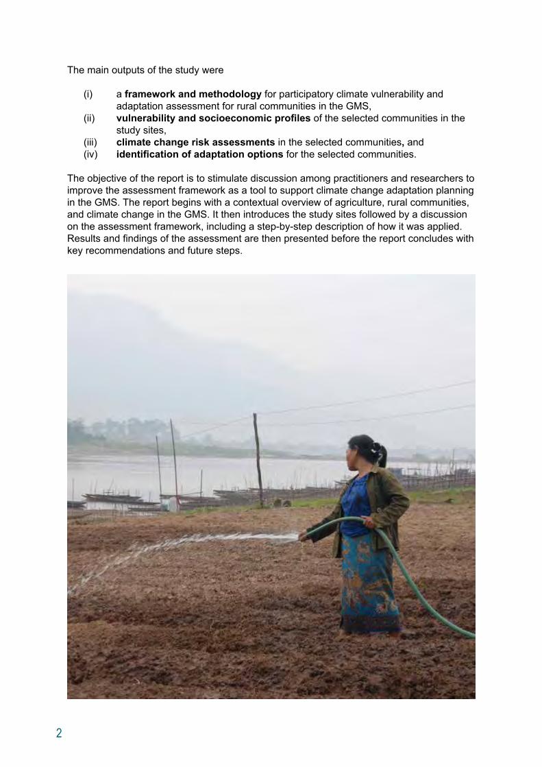
The main outputs of the study were
(i) a framework and methodology for participatory climate vulnerability and adaptation assessment for rural communities in the GMS,
(ii) vulnerability and socioeconomic profiles of the selected communities in the study sites,
(iii) climate change risk assessments in the selected communities, and(iv) identification of adaptation options for the selected communities.
The objective of the report is to stimulate discussion among practitioners and researchers to improve the assessment framework as a tool to support climate change adaptation planning in the GMS. The report begins with a contextual overview of agriculture, rural communities, and climate change in the GMS. It then introduces the study sites followed by a discussion on the assessment framework, including a step-by-step description of how it was applied. Results and findings of the assessment are then presented before the report concludes with key recommendations and future steps.
3
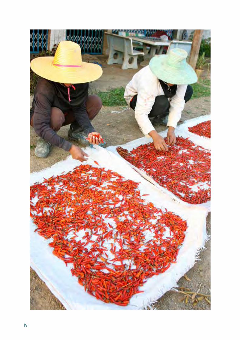
Agriculture, Rural Communities, and Climate Change in the GMS
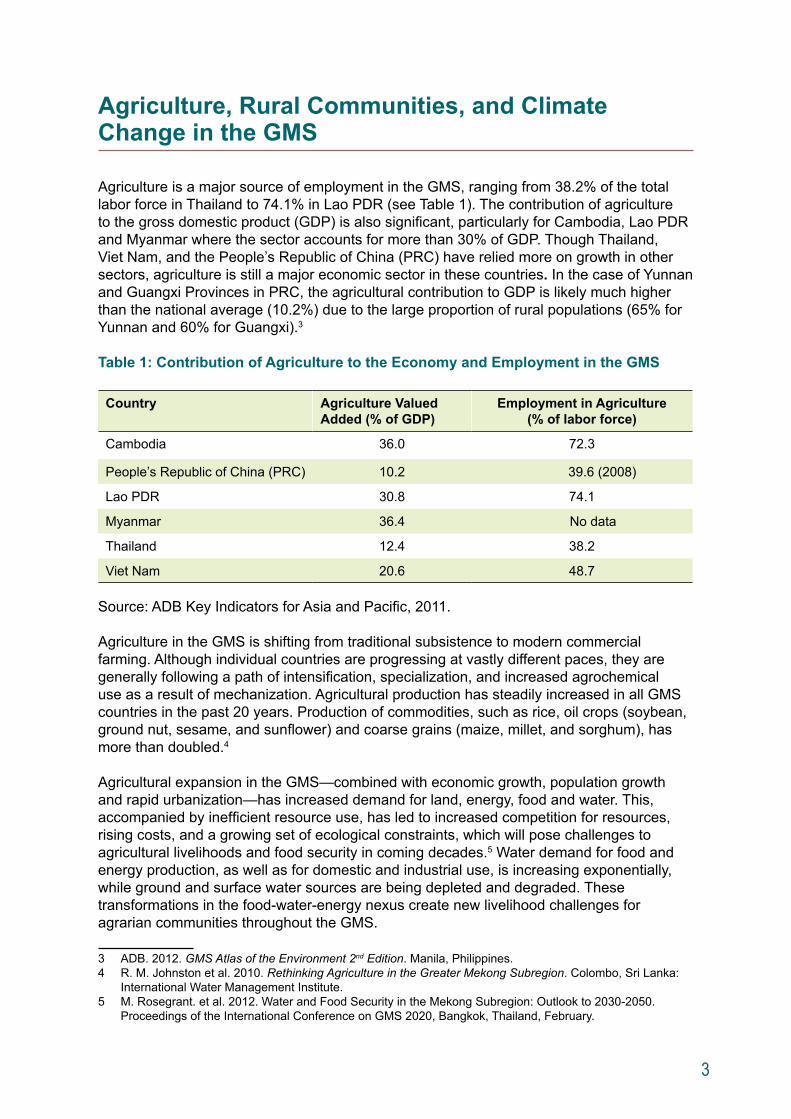
Agriculture is a major source of employment in the GMS, ranging from 38.2% of the total labor force in Thailand to 74.1% in Lao PDR (see Table 1). The contribution of agriculture to the gross domestic product (GDP) is also significant, particularly for Cambodia, Lao PDR and Myanmar where the sector accounts for more than 30% of GDP. Though Thailand, Viet Nam, and the People’s Republic of China (PRC) have relied more on growth in other sectors, agriculture is still a major economic sector in these countries. In the case of Yunnan and Guangxi Provinces in PRC, the agricultural contribution to GDP is likely much higher than the national average (10.2%) due to the large proportion of rural populations (65% for Yunnan and 60% for Guangxi).3
Table 1: Contribution of Agriculture to the Economy and Employment in the GMS
Country Agriculture Valued Added (% of GDP)
Employment in Agriculture (% of labor force)
Cambodia 36.0 72.3
People’s Republic of China (PRC) 10.2 39.6 (2008)
Lao PDR 30.8 74.1
Myanmar 36.4 No data
Thailand 12.4 38.2
Viet Nam 20.6 48.7
Source: ADB Key Indicators for Asia and Pacific, 2011.
Agriculture in the GMS is shifting from traditional subsistence to modern commercial farming. Although individual countries are progressing at vastly different paces, they are generally following a path of intensification, specialization, and increased agrochemical use as a result of mechanization. Agricultural production has steadily increased in all GMS countries in the past 20 years. Production of commodities, such as rice, oil crops (soybean, ground nut, sesame, and sunflower) and coarse grains (maize, millet, and sorghum), has more than doubled.4
Agricultural expansion in the GMS—combined with economic growth, population growth and rapid urbanization—has increased demand for land, energy, food and water. This, accompanied by inefficient resource use, has led to increased competition for resources, rising costs, and a growing set of ecological constraints, which will pose challenges to agricultural livelihoods and food security in coming decades.5 Water demand for food and energy production, as well as for domestic and industrial use, is increasing exponentially, while ground and surface water sources are being depleted and degraded. These transformations in the food-water-energy nexus create new livelihood challenges for agrarian communities throughout the GMS.
3 ADB. 2012. GMS Atlas of the Environment 2nd Edition. Manila, Philippines.4 R. M. Johnston et al. 2010. Rethinking Agriculture in the Greater Mekong Subregion. Colombo, Sri Lanka:
International Water Management Institute.5 M. Rosegrant. et al. 2012. Water and Food Security in the Mekong Subregion: Outlook to 2030-2050.
Proceedings of the International Conference on GMS 2020, Bangkok, Thailand, February.
4
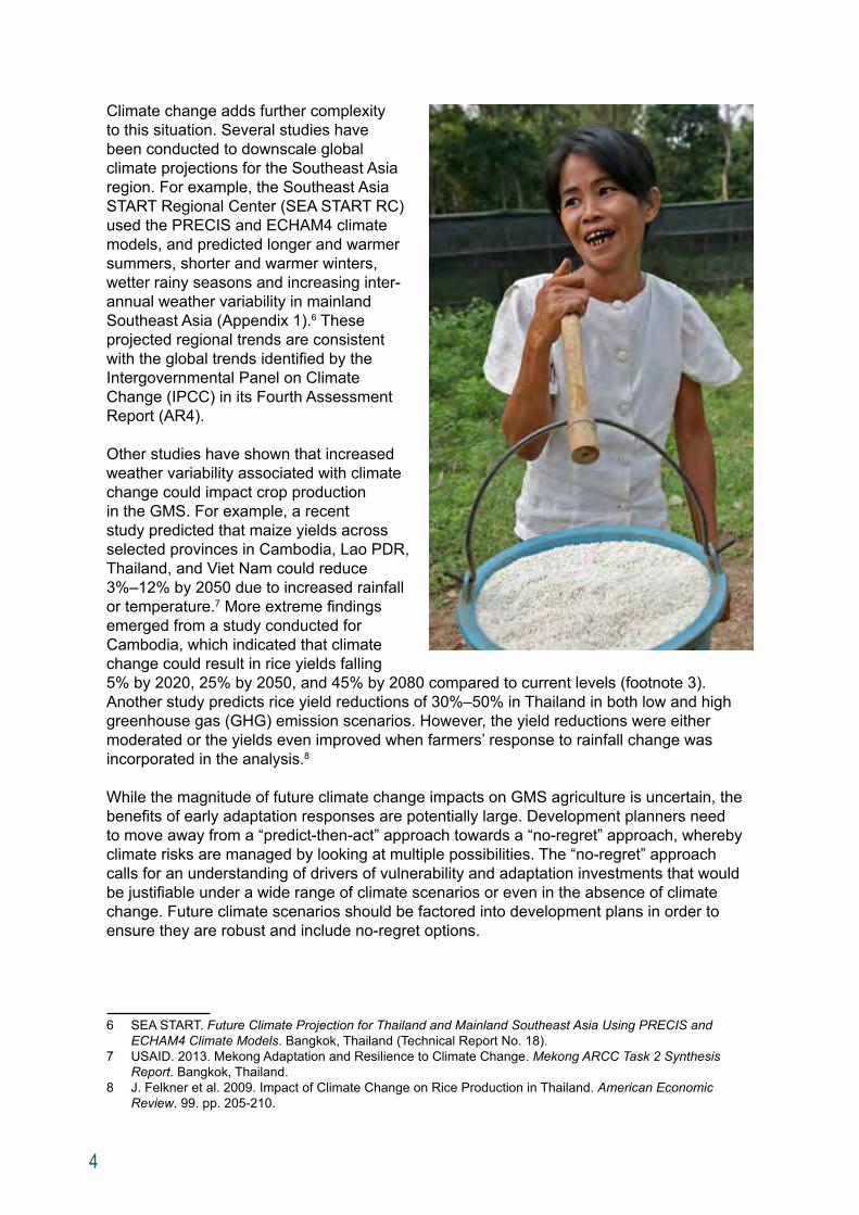
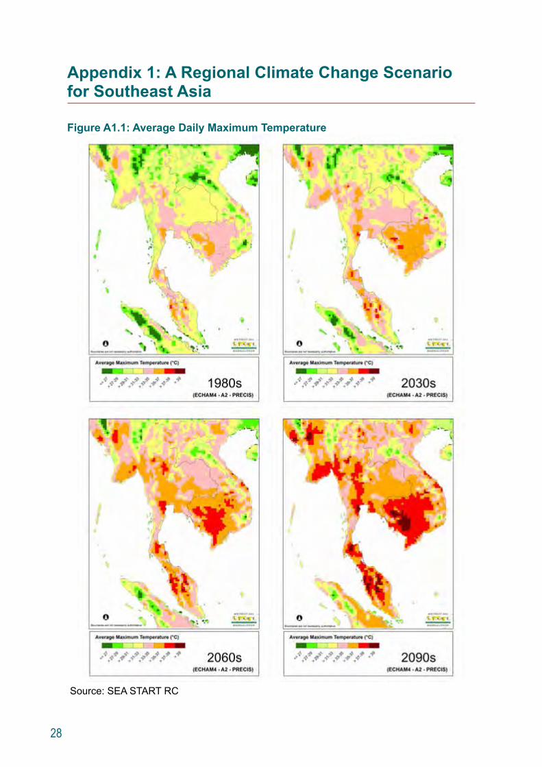
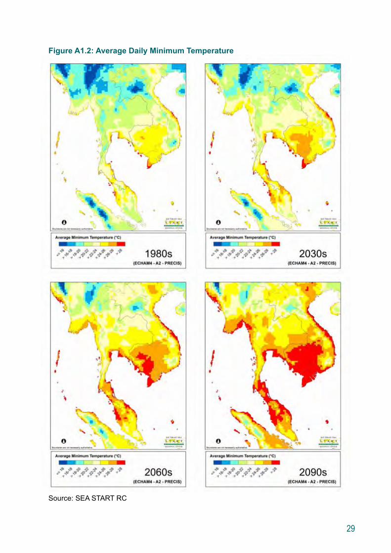
Climate change adds further complexity to this situation. Several studies have been conducted to downscale global climate projections for the Southeast Asia region. For example, the Southeast Asia START Regional Center (SEA START RC) used the PRECIS and ECHAM4 climate models, and predicted longer and warmer summers, shorter and warmer winters, wetter rainy seasons and increasing inter-annual weather variability in mainland Southeast Asia (Appendix 1).6 These projected regional trends are consistent with the global trends identified by the Intergovernmental Panel on Climate Change (IPCC) in its Fourth Assessment Report (AR4).
Other studies have shown that increased weather variability associated with climate change could impact crop production in the GMS. For example, a recent study predicted that maize yields across selected provinces in Cambodia, Lao PDR, Thailand, and Viet Nam could reduce 3%–12% by 2050 due to increased rainfall or temperature.7 More extreme findings emerged from a study conducted for Cambodia, which indicated that climate change could result in rice yields falling 5% by 2020, 25% by 2050, and 45% by 2080 compared to current levels (footnote 3).
Another study predicts rice yield reductions of 30%–50% in Thailand in both low and high greenhouse gas (GHG) emission scenarios. However, the yield reductions were either moderated or the yields even improved when farmers’ response to rainfall change was incorporated in the analysis.8
While the magnitude of future climate change impacts on GMS agriculture is uncertain, the benefits of early adaptation responses are potentially large. Development planners need to move away from a “predict-then-act” approach towards a “no-regret” approach, whereby climate risks are managed by looking at multiple possibilities. The “no-regret” approach calls for an understanding of drivers of vulnerability and adaptation investments that would be justifiable under a wide range of climate scenarios or even in the absence of climate change. Future climate scenarios should be factored into development plans in order to ensure they are robust and include no-regret options.
6 SEA START. Future Climate Projection for Thailand and Mainland Southeast Asia Using PRECIS and ECHAM4 Climate Models. Bangkok, Thailand (Technical Report No. 18).
7 USAID. 2013. Mekong Adaptation and Resilience to Climate Change. Mekong ARCC Task 2 Synthesis Report. Bangkok, Thailand.
8 J. Felkner et al. 2009. Impact of Climate Change on Rice Production in Thailand. American Economic Review. 99. pp. 205-210.
5
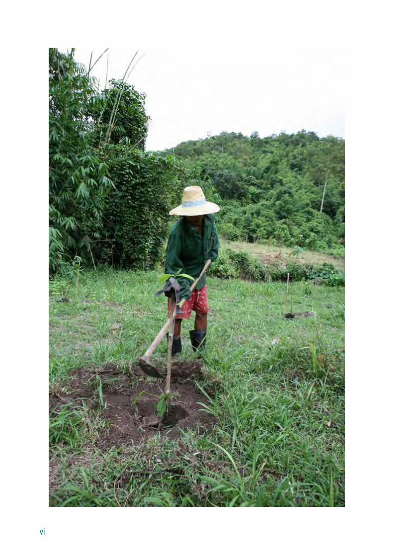
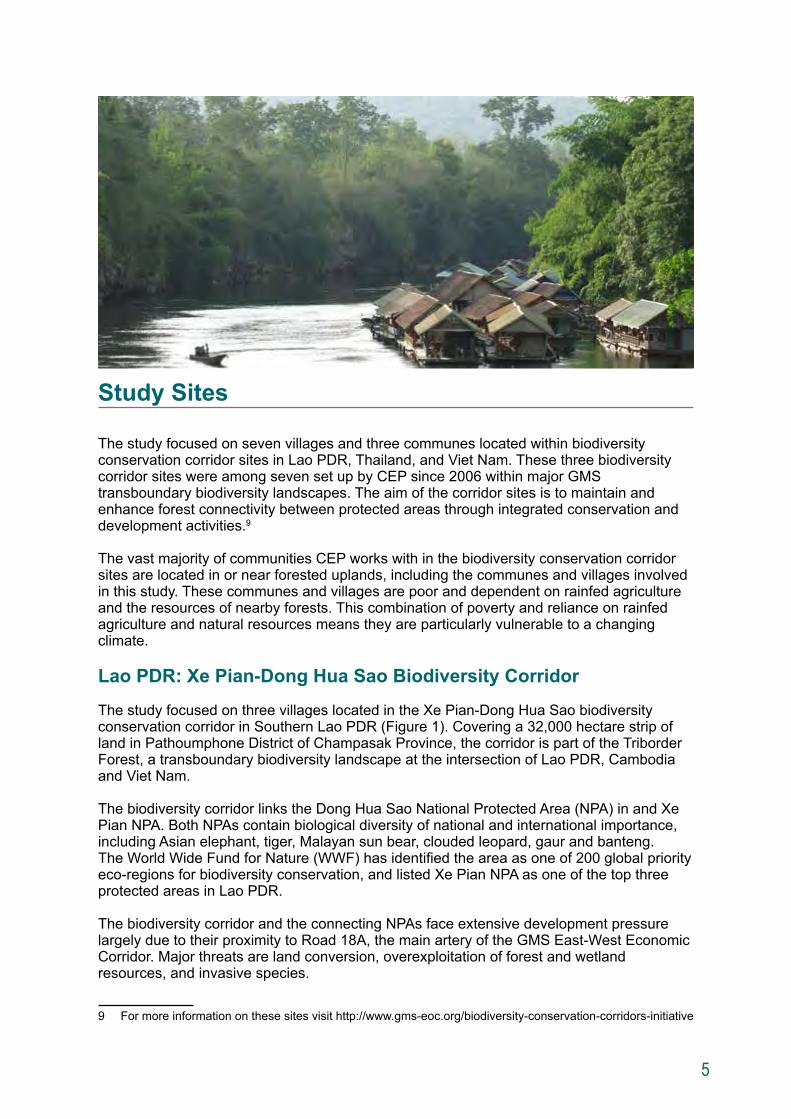
Study Sites
The study focused on seven villages and three communes located within biodiversity conservation corridor sites in Lao PDR, Thailand, and Viet Nam. These three biodiversity corridor sites were among seven set up by CEP since 2006 within major GMS transboundary biodiversity landscapes. The aim of the corridor sites is to maintain and enhance forest connectivity between protected areas through integrated conservation and development activities.9
The vast majority of communities CEP works with in the biodiversity conservation corridor sites are located in or near forested uplands, including the communes and villages involved in this study. These communes and villages are poor and dependent on rainfed agriculture and the resources of nearby forests. This combination of poverty and reliance on rainfed agriculture and natural resources means they are particularly vulnerable to a changing climate.
Lao PDR: Xe Pian-Dong Hua Sao Biodiversity Corridor
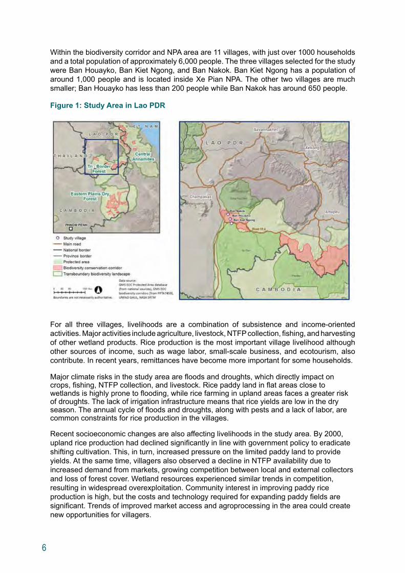
The study focused on three villages located in the Xe Pian-Dong Hua Sao biodiversity conservation corridor in Southern Lao PDR (Figure 1). Covering a 32,000 hectare strip of land in Pathoumphone District of Champasak Province, the corridor is part of the Triborder Forest, a transboundary biodiversity landscape at the intersection of Lao PDR, Cambodia and Viet Nam.
The biodiversity corridor links the Dong Hua Sao National Protected Area (NPA) in and Xe Pian NPA. Both NPAs contain biological diversity of national and international importance, including Asian elephant, tiger, Malayan sun bear, clouded leopard, gaur and banteng. The World Wide Fund for Nature (WWF) has identified the area as one of 200 global priority eco-regions for biodiversity conservation, and listed Xe Pian NPA as one of the top three protected areas in Lao PDR.
The biodiversity corridor and the connecting NPAs face extensive development pressure largely due to their proximity to Road 18A, the main artery of the GMS East-West Economic Corridor. Major threats are land conversion, overexploitation of forest and wetland resources, and invasive species.
9 For more information on these sites visit http://www.gms-eoc.org/biodiversity-conservation-corridors-initiative
6
Within the biodiversity corridor and NPA area are 11 villages, with just over 1000 households and a total population of approximately 6,000 people. The three villages selected for the study were Ban Houayko, Ban Kiet Ngong, and Ban Nakok. Ban Kiet Ngong has a population of around 1,000 people and is located inside Xe Pian NPA. The other two villages are much smaller; Ban Houayko has less than 200 people while Ban Nakok has around 650 people.
Figure 1: Study Area in Lao PDR
For all three villages, livelihoods are a combination of subsistence and income-oriented activities. Major activities include agriculture, livestock, NTFP collection, fishing, and harvesting of other wetland products. Rice production is the most important village livelihood although other sources of income, such as wage labor, small-scale business, and ecotourism, also contribute. In recent years, remittances have become more important for some households.
Major climate risks in the study area are floods and droughts, which directly impact on crops, fishing, NTFP collection, and livestock. Rice paddy land in flat areas close to wetlands is highly prone to flooding, while rice farming in upland areas faces a greater risk of droughts. The lack of irrigation infrastructure means that rice yields are low in the dry season. The annual cycle of floods and droughts, along with pests and a lack of labor, are common constraints for rice production in the villages.
Recent socioeconomic changes are also affecting livelihoods in the study area. By 2000, upland rice production had declined significantly in line with government policy to eradicate shifting cultivation. This, in turn, increased pressure on the limited paddy land to provide yields. At the same time, villagers also observed a decline in NTFP availability due to increased demand from markets, growing competition between local and external collectors and loss of forest cover. Wetland resources experienced similar trends in competition, resulting in widespread overexploitation. Community interest in improving paddy rice production is high, but the costs and technology required for expanding paddy fields are significant. Trends of improved market access and agroprocessing in the area could create new opportunities for villagers.
7
Thailand: Tenasserim Biodiversity Corridor
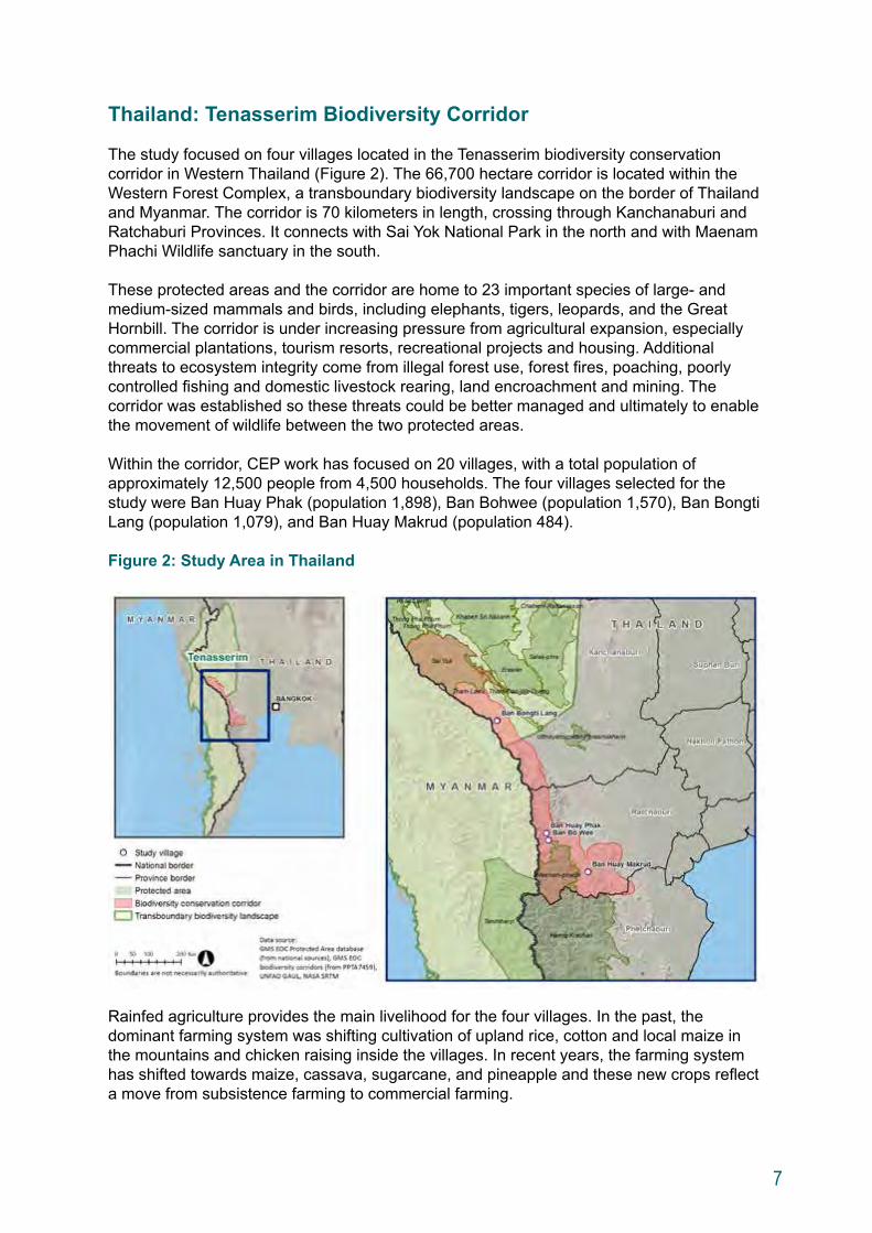
The study focused on four villages located in the Tenasserim biodiversity conservation corridor in Western Thailand (Figure 2). The 66,700 hectare corridor is located within the Western Forest Complex, a transboundary biodiversity landscape on the border of Thailand and Myanmar. The corridor is 70 kilometers in length, crossing through Kanchanaburi and Ratchaburi Provinces. It connects with Sai Yok National Park in the north and with Maenam Phachi Wildlife sanctuary in the south.
These protected areas and the corridor are home to 23 important species of large- and medium-sized mammals and birds, including elephants, tigers, leopards, and the Great Hornbill. The corridor is under increasing pressure from agricultural expansion, especially commercial plantations, tourism resorts, recreational projects and housing. Additional threats to ecosystem integrity come from illegal forest use, forest fires, poaching, poorly controlled fishing and domestic livestock rearing, land encroachment and mining. The corridor was established so these threats could be better managed and ultimately to enable the movement of wildlife between the two protected areas.
Within the corridor, CEP work has focused on 20 villages, with a total population of approximately 12,500 people from 4,500 households. The four villages selected for the study were Ban Huay Phak (population 1,898), Ban Bohwee (population 1,570), Ban Bongti Lang (population 1,079), and Ban Huay Makrud (population 484).
Figure 2: Study Area in Thailand
Rainfed agriculture provides the main livelihood for the four villages. In the past, the dominant farming system was shifting cultivation of upland rice, cotton and local maize in the mountains and chicken raising inside the villages. In recent years, the farming system has shifted towards maize, cassava, sugarcane, and pineapple and these new crops reflect a move from subsistence farming to commercial farming.
8
While most of the working population is engaged in agricultural activities, many also work as laborers on larger farms or in other sectors, particularly construction. Most households do not own land; about 46% of the households have land use permits with no right to sell. In addition to agriculture, villagers are also highly dependent on the forest as an additional source of livelihood. More than 80% of the households harvest NTFPs for both consumption and sale, including wild animals, bamboo shoots, honeybees, and mushrooms.
The key climate concern for the study villages is the exposure to dry spells during the crop season. Dry spells affect most of the major crops including upland rice, maize, cassava, and sugarcane. However, pineapple, which is an important crop for Ban Huay Makrud, and to a lesser extent Ban Huay Phak and Ban Bohwee, is also exposed to high temperature during the dry season, resulting in fruit burn and low yield. Vegetables planted in Ban Huay Makrud and nearby villages are in an area exposed to flash floods.
Recent socioeconomic changes are also affecting livelihoods in the study area. These include (i) the upgrading and expansion of irrigation infrastructure; (ii) use of new crop varieties (such as drought tolerant rice) and practices (such as the use of fertilizer instead of shifting cultivation); (iii) rearrangement of forest and crop production zones; and (iv) increased employment opportunities in the tourism sector.
9
Viet Nam: Ngoc Linh-Xe Sap Biodiversity Corridor
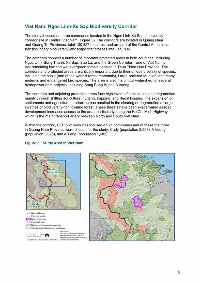
The study focused on three communes located in the Ngoc Linh-Xe Sap biodiversity corridor site in Central Viet Nam (Figure 3). The corridors are located in Quang Nam and Quang Tri Provinces, total 130,827 hectares, and are part of the Central Annamites transboundary biodiversity landscape that crosses into Lao PDR.
The corridors connect a number of important protected areas in both countries, including Ngoc Linh, Song Thanh, Xe Sap, Sao La, and the Green Corridor—one of Viet Nam’s last remaining lowland wet evergreen forests, located in Thua Thien Hue Province. The corridors and protected areas are critically important due to their unique diversity of species, including the saola (one of the world’s rarest mammals), Large-antlered Muntjac, and many endemic and endangered bird species. The area is also the critical watershed for several hydropower dam projects, including Song Bung IV and A Vuong.
The corridors and adjoining protected areas face high levels of habitat loss and degradation, mainly through shifting agriculture, hunting, trapping, and illegal logging. The expansion of settlements and agricultural production has resulted in the clearing or degradation of large swathes of biodiversity-rich lowland forest. These threats have been exacerbated as road development increases access to the area, particularly along the Ho Chi Minh Highway, which is the main transport artery between North and South Viet Nam.
Within the corridor, CEP pilot work has focused on 21 communes and of these the three in Quang Nam Province were chosen for the study: Cady (population 2,958), A Vuong (population 2,025), and A Tieng (population 1,682).
Figure 3: Study Area in Viet Nam
10
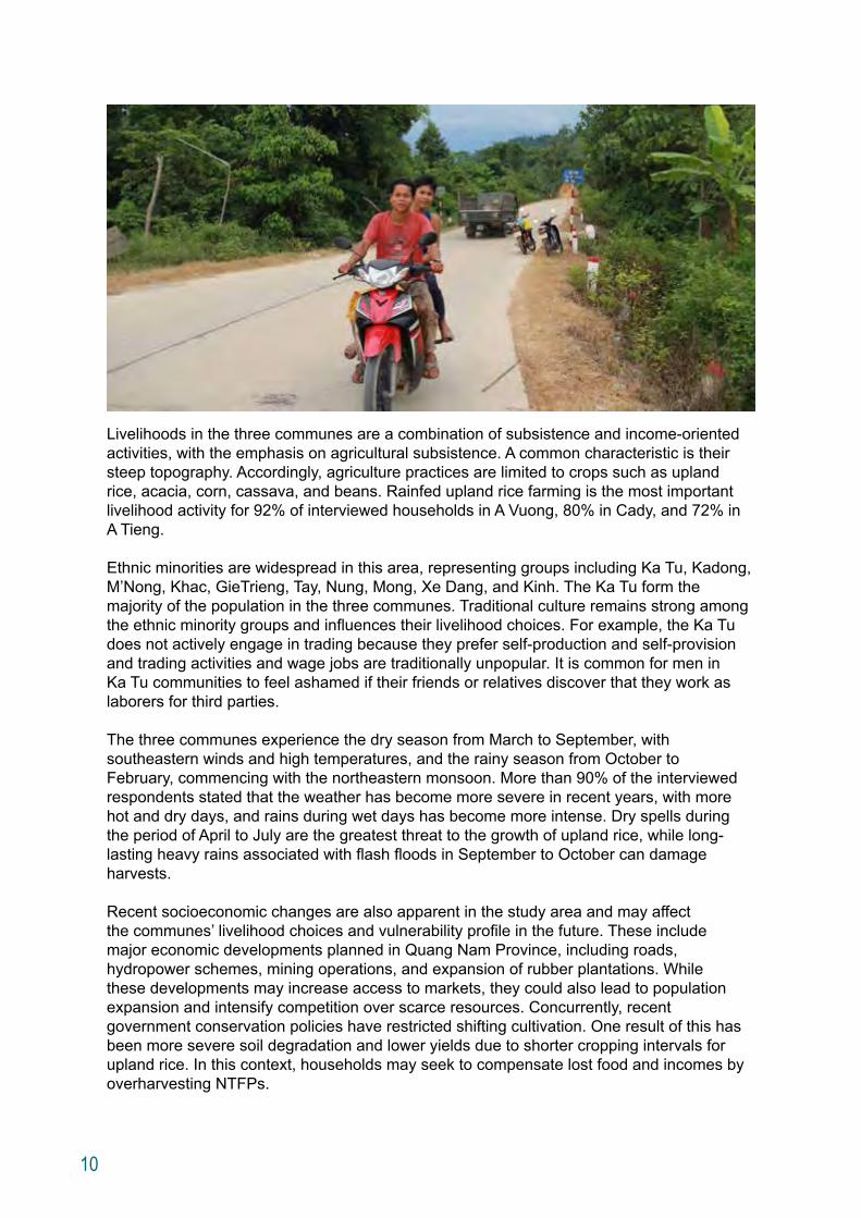
Livelihoods in the three communes are a combination of subsistence and income-oriented activities, with the emphasis on agricultural subsistence. A common characteristic is their steep topography. Accordingly, agriculture practices are limited to crops such as upland rice, acacia, corn, cassava, and beans. Rainfed upland rice farming is the most important livelihood activity for 92% of interviewed households in A Vuong, 80% in Cady, and 72% in A Tieng.
Ethnic minorities are widespread in this area, representing groups including Ka Tu, Kadong, M’Nong, Khac, GieTrieng, Tay, Nung, Mong, Xe Dang, and Kinh. The Ka Tu form the majority of the population in the three communes. Traditional culture remains strong among the ethnic minority groups and influences their livelihood choices. For example, the Ka Tu does not actively engage in trading because they prefer self-production and self-provision and trading activities and wage jobs are traditionally unpopular. It is common for men in Ka Tu communities to feel ashamed if their friends or relatives discover that they work as laborers for third parties.
The three communes experience the dry season from March to September, with southeastern winds and high temperatures, and the rainy season from October to February, commencing with the northeastern monsoon. More than 90% of the interviewed respondents stated that the weather has become more severe in recent years, with more hot and dry days, and rains during wet days has become more intense. Dry spells during the period of April to July are the greatest threat to the growth of upland rice, while long-lasting heavy rains associated with flash floods in September to October can damage harvests. Recent socioeconomic changes are also apparent in the study area and may affect the communes’ livelihood choices and vulnerability profile in the future. These include major economic developments planned in Quang Nam Province, including roads, hydropower schemes, mining operations, and expansion of rubber plantations. While these developments may increase access to markets, they could also lead to population expansion and intensify competition over scarce resources. Concurrently, recent government conservation policies have restricted shifting cultivation. One result of this has been more severe soil degradation and lower yields due to shorter cropping intervals for upland rice. In this context, households may seek to compensate lost food and incomes by overharvesting NTFPs.
11
Framework for Assessing Climate Change Vulnerability and Adaptation in Rural Communities
Key Concepts
The two key concepts employed in this study are “vulnerability” and “adaptation.” According to the IPCC, vulnerability to climate change refers to “the degree to which a system is susceptible to, or unable to cope with, adverse effects of climate change, including climate variability and extremes.”10 Vulnerability can also be considered as the underlying exposure to damaging shocks, perturbation or stress, rather than the probability or projected incidence of those shocks themselves.11 In simple terms, vulnerability can be understood as the likelihood of being harmed. For example, a coastal community is more vulnerable to sea level rise and cyclones than a community located further from the coast. Similarly, an agriculture-dependent community is more vulnerable to droughts and floods than a community with more access to non-farm income opportunities.
Vulnerability of an individual, a community or a system to climate change is determined by three components:
Exposure = Biophysical impacts of climate change, which can vary in magnitude, frequency, and duration
Sensitivity = Degree to which a system is affected, either adversely or beneficially, by climate variability or change
Adaptive Capacity = Ability or potential of a system to respond successfully to climate variability and change
10 IPCC. 2007. Climate Change 2007: Impacts, Adaptation and Vulnerability. Contribution of Working Group II to the Fourth Assessment Report of the Intergovernmental Panel on Climate Change, New York, USA.
11 B. Lim and E. Spanger-Siegfried (eds). 2004. Adaptation Policy Frameworks for Climate Change: Developing Strategies, Policies and Measures. Cambridge, UK: United Nations Development Programme.
12
The IPCC defines adaptation as “initiatives and measures to reduce the vulnerability of natural and human systems against actual or expected climate change effects.”12 In essence, climate change adaptation is about reducing vulnerability to future climate risks. Vulnerability can be reduced by reducing exposure to future impacts and risks, reducing sensitivity to future impacts and risks, and (iii) increasing adaptive capacity to deal with future impacts and risks. Adaptation measures may be infrastructure-based (such as building a sea wall) and ecosystem-based (such as mangrove rehabilitation to mitigate storm surges). These measures can be complemented by actions focusing on information sharing, capacity building and policy improvement (such as changes in land zoning laws), sometimes referred to as “soft” adaptation (See Appendix 2 for other key climate change terminology).
As climate change adaptation in this study is focused on people, vulnerability needs to be considered in socioeconomic terms. “Socioeconomic vulnerability” is an aggregate measure of human welfare that integrates environmental, social, economic and political exposure to a range of harmful perturbations, including climate change. In other words, an individual, a community, or a system can be vulnerable to climate change due to socioeconomic factors, including geographical location, demographic profile, economic conditions, and livelihood strategies.
Based on these concepts of vulnerability and adaptation, the study aimed to assess how rural communities may be vulnerable to climate threats, both now and under future conditions. Non-climate changes—such as infrastructure developments, changes in land use planning, fluctuating commodity prices, changing demographics—could affect both the exposure and adaptive capacity of the communities and the agroecosystems that support them. Since the climate changes relatively slowly over decades, socioeconomic changes may have a larger impact in a much shorter timeframe, potentially changing the vulnerability context completely. This is likely to be the case in the fast-changing GMS; therefore, it is crucial to address socioeconomic dynamics as an integral part of a climate change vulnerability assessment.
12 IPCC. 2007. Summary for Policymakers. In: Climate Change 2007: The Physical Science Basis. Contribution of Working Group I to the Fourth Assessment Report of the Intergovernmental Panel on Climate Change, New York, USA.
13
Assessment Approach
In its Fourth Assessment Report (AR4), the IPCC identified five approaches to climate change impact, adaptation and vulnerability (CCIAV) assessments: (i) impact assessment; (ii) vulnerability assessment; (iii) adaptation assessment; (iv) integrated assessment; and (v) risk management-based assessment (See Appendix 3).13 This study built on these approaches, formulating an integrated assessment framework suitable for community-level application. Specifically, the integrated framework combined the risk management and vulnerability approaches. The combination was both necessary and practical for understanding threats to rural communities, which result both from climate variability and change and from non-climate risks.
The integrated approach is a simplified way to understand the current risk and vulnerability of the communities, and use climate projections as information to determine risk and vulnerability. The study determined the current context by considering socioeconomic conditions and key climate threats that have already affected the communities. Subsequently, the future context of the study sites was developed as a basis for assessing future vulnerability. The future context was based on the expectation of consequences of ongoing and foreseeable development plans and socioeconomic changes, as well as a changing future climate.
Based on the understanding of vulnerability in a plausible future context, adaptation was then formulated as a strategy which could be mainstreamed into local development plans. An emphasis on mainstreaming ensures that development plans will not increase vulnerability, while achieving the development goals and targets under the current and future climate, based on currently available knowledge.14
The study team applied the integrated approach through a participatory process. Vulnerability of the communities and livelihood groups was assessed using participatory rural appraisal (PRA) tools including hazard mapping, livelihood calendar development, household surveys, and group discussions. The PRA-based approach helped identify the communities’ current coping strategies and their applicability to future climate change scenarios. Qualitative information collected from the study communities was complemented by climate projection data in order to understand each community’s current and future risk profile and develop risk management strategies. Drawing on this information, community representatives and government officials worked together in a workshop setting to identify potential adaptation interventions for each of the study sites.
13 Carter, T.R. et al. 2007. New Assessment Methods and the Characterisation of Future Conditions: Contribution of Working Group II to the Fourth Assessment Report of the Intergovernmental Panel on Climate Change. In M. L. Parry et al., eds., Climate Change 2007: Impacts, Adaptation and Vulnerability. Cambridge, UK: Cambridge University Press.
14 Chinvanno, S. and Vichien Kerdsuk 2013. “Mainstreaming Climate Change into Community Development Strategies and Plans: A Case Study in Thailand,” Adaptation Knowledge Platform, Partner Report Series No. 5, Stockholm Environment Institute, Bangkok.
14
Assessment Steps
The study team applied the integrated approach through the following steps:
Step 1: Assessing the current socioeconomic context
The study team examined the current context of the communities, focusing on the agricultural system and different livelihood groups. To determine the context, the study team collected data on the communities’ basic socioeconomic conditions, agricultural production, and livelihood strategies. Methods of data collection included the review of secondary data sources (such as online community databases), household surveys, and interviews with key informants (such as commune/village leaders and members, government officials, and patriarchs) to fill data gaps.
Step 2: Assessing current risk and vulnerability
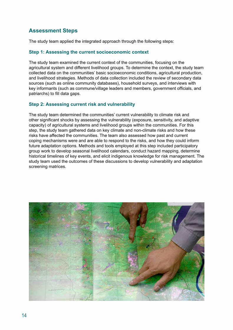
The study team determined the communities’ current vulnerability to climate risk and other significant shocks by assessing the vulnerability (exposure, sensitivity, and adaptive capacity) of agricultural systems and livelihood groups within the communities. For this step, the study team gathered data on key climate and non-climate risks and how these risks have affected the communities. The team also assessed how past and current coping mechanisms were and are able to respond to the risks, and how they could inform future adaptation options. Methods and tools employed at this step included participatory group work to develop seasonal livelihood calendars, conduct hazard mapping, determine historical timelines of key events, and elicit indigenous knowledge for risk management. The study team used the outcomes of these discussions to develop vulnerability and adaptation screening matrices.
15
Step 3: Formulating a plausible future
The study team formulated a plausible future context for the communities by assessing the potential consequences of foreseeable changes in socioeconomic conditions, based on an analysis of development plans and changes in key climate risks. The team chose a future climate scenario from downscaled climate projections, developed by SEA START RC, to form the basis of the climate risk assessment. The chosen scenario represented a future with “big change” in the climate pattern as it would better stimulate visualization and discussion. Under the big-change scenario, the team developed temperature and rainfall-based climate indicators to assess the potential impacts of climate change on agriculture and different livelihood groups in the studied communities.
Step 4: Assessing future risk and vulnerability
The study team assessed changes in the vulnerability profile of the agricultural system and livelihood groups, which may be altered by socioeconomic changes and by climate change. While Step 3 looked at how the future context might change, here the focus was on understanding how the communities’ vulnerability profile might change in the new climate and socioeconomic context. Specifically, the team assessed community vulnerability to increased risks associated with more severe and frequent floods and droughts. The assessment was conducted for four farming systems in Lao PDR, for three farming systems in Viet Nam, and for a range of different crops (under the same farming system) in Thailand.
The study team also sought to understand how socioeconomic changes may affect the vulnerability profile of the communities under a future climate pattern. The team considered socioeconomic changes such as new infrastructure developments, changes in conservation policy and land use plans, government agricultural policy, and new economic opportunities in the location. Finally, they analyzed how the communities may cope with future threats, leading to an understanding of the vulnerability of the communities in the future context. Methods and tools used included crop modeling (for selected crops in Thailand), qualitative assessments through interviews, and household surveys. Socioeconomic changes considered were based on what participants in the consultation workshops considered “foreseeable.”
Step 5: Formulating an adaptation strategy
The study team identified an adaptation strategy that could help communities minimize future vulnerability. For this step, the study team held multistakeholder workshops with community representatives and government officials from the study areas. Workshop participants reviewed results of the vulnerability assessments, verified key findings, and discussed future livelihood options as part of a local risk management strategy.
Step 6: Identifying options to operationalize the adaptation strategy
The study team led an examination of options to operationalize the adaptation strategy. They evaluated these options for benefit, feasibility, and suitability, and identified the enabling and critical success factors. To do this, participants in the workshop were divided into two subgroups: the Policy and Planning Subgroup and the Community Subgroup. The Policy and Planning Subgroup focused on adaptation options that need government intervention (e.g., subsidies, incentives to change land and water management practices). The Community Subgroup considered adaptation options that can be implemented by households and communities (e.g., new crop varieties, improvement to land and water management systems, rice bank, community fish ponds, village development funds). The Policy and Planning Subgroup developed a “policy matrix” for government consideration, while the Community Subgroup looked at adaptation options for each livelihood group.
16
Synthesis of Study Results
Due to the small sample size of villages and communes, it is not possible to generalize the findings of the study to the entire GMS. In addition, there are some key differences between the three study sites.
At the Lao PDR site, government policy and regional development have changed the context of communities’ vulnerability to future climate threats. Although stricter government conservation policy restricts traditional shifting cultivation as well as access to NTFPs for the communities, one of the GMS economic corridors—a network of priority roads which increase physical and economic connectivity between the GMS countries—runs through the site and opens up new opportunities for income diversification.
At the Thailand site, the increasing influence of commercial farming could make local communities more vulnerable to climate change due to the adoption of plantation
monocropping. Unclear regulations on land title and conservation boundaries may also limit villagers’ future access to NTFPs, which currently supplement their farm income.
At the Viet Nam site, the communities face multiple pressures from large scale developments, such as hydropower dams, mining schemes and rubber plantations. These developments alter the communities’ access to natural resources and could make the villagers, mostly ethnic minorities, more vulnerable to current and future climate hazards. Adaptation measures implemented in these ethnic communities face several constraints including cultural ones.
Despite these differences, some cross-cutting observations from the three study sites are likely relevant for climate change adaptation planning for rural communities in other areas of the GMS.
First, threats from climatic characteristics that may negatively impact agricultural production could become greater. Based on the climate change scenario used in this study, rural communities in the study areas are likely to experience an increase in extreme weather events, including higher temperatures, floods and droughts. Higher average annual temperatures are projected in all the study sites, which may negatively affect plant growth and lead to reduced crop yields. The climate change scenario also forecasts higher flood
17
risk during the rainy session, particularly with respect to flash floods. The flood risk is likely to be greater in the study sites in Lao PDR and Viet Nam than at the study site in Thailand. The pattern of drought risk is more uncertain and varies across the sites. To adjust to these potential impacts of climate change, innovations in agricultural technologies and management practices will be necessary.
Second, socioeconomic dynamics and government policy can significantly change a community’s risk profile and adaptive capacity. These forces can put a community more at risk to climate change or increase its adaptive capacity by expanding access to new livelihood options. For example, the study found that ecosystems and services, especially NTFPs, currently play an important role in supporting livelihoods in all the study areas. In addition to providing food security and living materials, NTFPs supplement income when a primary cash crop fails. However, government policy, such as conservation policy and large economic concessions for hydropower and mining, affects land use and access to resources, including to NTFPs.
In addition, new employment opportunities, such as ecotourism, commerce, and paid labor, arise as a result of socioeconomic developments. Understanding a changing community risk and vulnerability profile as a result of these developments as well as climate change is essential to identifying adaptation strategies that reduce vulnerability and takes advantage of new opportunities.
Third, while adaptation is site specific, there are commonalities among the adaptation strategies identified for the study communities. For example, upland farming is prevalent in each study site and is very vulnerable to climate change. Common elements of an adaptation strategy for upland farming include crop diversification (reducing reliance on upland rice); adoption of drought resistant varieties of upland crops; improved land management practices to control soil erosion and reduce flash flood risk; financing resources for alternative livelihoods, and transfer of knowledge to farmers.
Fourth, communities and households need government assistance, planning, and policy reform to create enabling conditions for effective climate change adaptation. Governments must incorporate climate change considerations into the planning process for land use, agriculture development, and water resource management. Targeted policies on livelihood, poverty reduction, and food security have the potential to complement climate change
adaptation planning, and should be designed with adaptation considerations in mind. In the three study sites, the alignment of forestry and biodiversity conservation policies has great potential to enhance adaptive capacity and promote ecosystem-based adaptation among communities.
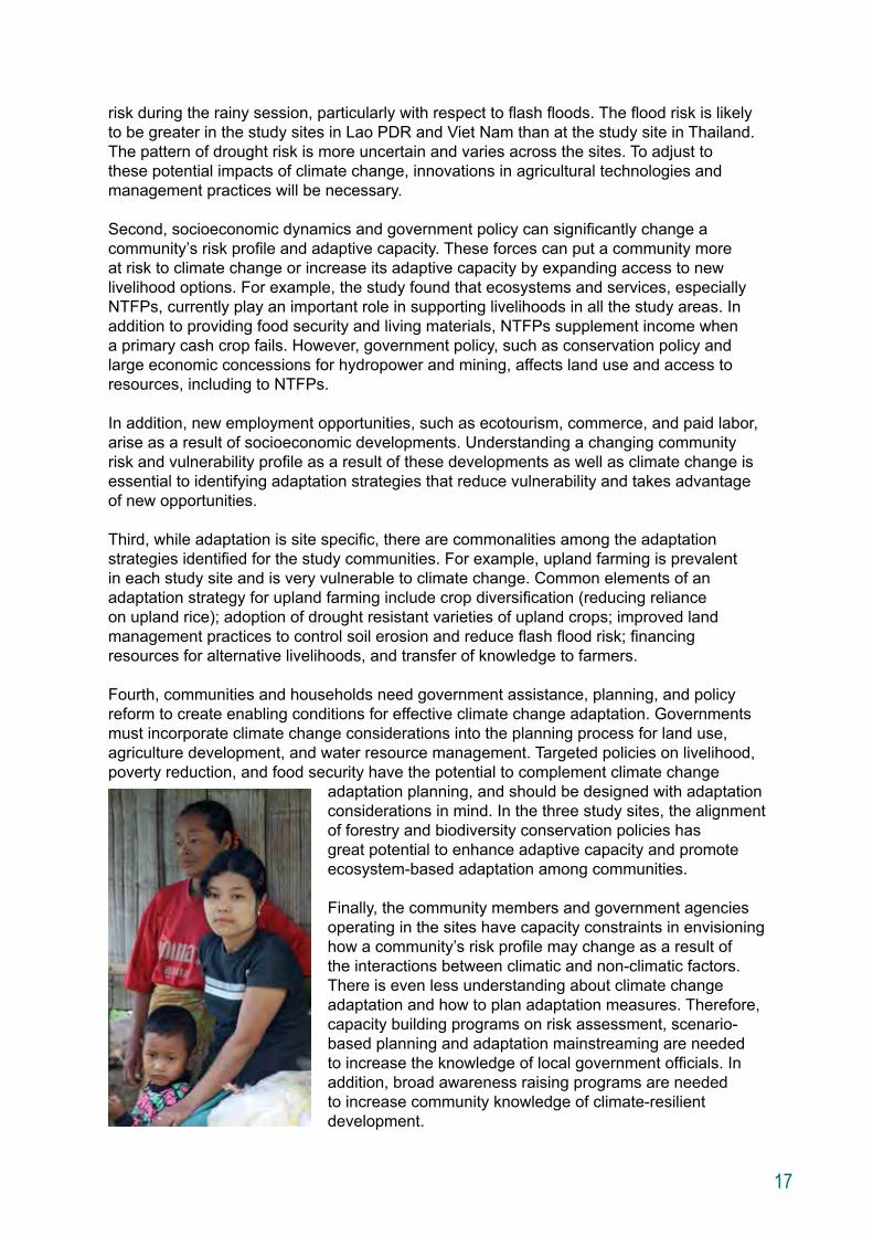
Finally, the community members and government agencies operating in the sites have capacity constraints in envisioning how a community’s risk profile may change as a result of the interactions between climatic and non-climatic factors. There is even less understanding about climate change adaptation and how to plan adaptation measures. Therefore, capacity building programs on risk assessment, scenario-based planning and adaptation mainstreaming are needed to increase the knowledge of local government officials. In addition, broad awareness raising programs are needed to increase community knowledge of climate-resilient development.
18
Lao PDR: Upland Agricultural Communities in Xe Pian-Dong Hua Sao
Assessing the current context
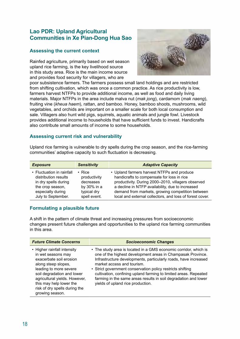
Rainfed agriculture, primarily based on wet season upland rice farming, is the key livelihood source in this study area. Rice is the main income source and provides food security for villagers, who are poor subsistence farmers. The farmers possess small land holdings and are restricted from shifting cultivation, which was once a common practice. As rice productivity is low, farmers harvest NTFPs to provide additional income, as well as food and daily living materials. Major NTFPs in the area include malva nut (mak jong), cardamom (mak naeng), fruiting vine (kheua haem), rattan, and bamboo. Honey, bamboo shoots, mushrooms, wild vegetables, and orchids are important on a smaller scale for both local consumption and sale. Villagers also hunt wild pigs, squirrels, aquatic animals and jungle fowl. Livestock provides additional income to households that have sufficient funds to invest. Handicrafts also contribute small amounts of income to some households.
Assessing current risk and vulnerability
Upland rice farming is vulnerable to dry spells during the crop season, and the rice-farming communities’ adaptive capacity to such fluctuation is decreasing.
Exposure Sensitivity Adaptive Capacity
• Fluctuation in rainfall distribution results in dry spells during the crop season, especially during July to September.
• Rice productivity decreases by 30% in a typical dry spell event.
• Upland farmers harvest NTFPs and produce handicrafts to compensate for loss in rice productivity. During 2000 –2010, villagers observed a decline in NTFP availability, due to increased demand from markets, growing competition between local and external collectors, and loss of forest cover.
Formulating a plausible future
A shift in the pattern of climate threat and increasing pressures from socioeconomic changes present future challenges and opportunities to the upland rice farming communities in this area.
Future Climate Concerns Socioeconomic Changes
• Higher rainfall intensity in wet seasons may exacerbate soil erosion along steep slopes, leading to more severe soil degradation and lower agricultural yields. However, this may help lower the risk of dry spells during the growing season.
• The study area is located in a GMS economic corridor, which is one of the highest development areas in Champasak Province. Infrastructure developments, particularly roads, have increased market access and tourism.
• Strict government conservation policy restricts shifting cultivation, confining upland farming to limited areas. Repeated farming in the same areas results in soil degradation and lower yields of upland rice production.
19
Assessing future risk and vulnerability
Dry spells during the growing season, which are the communities’ primary short term climate concern, could shift towards a longer-term trend of higher precipitation during the rainy season under a future climate. Given the steep topography and the repeated rice cultivation on a fixed, small area, a new risk of more precipitation may worsen soil erosion and soil quality, resulting in lower crop productivity.
Changes in socioeconomic conditions as a result of development could change the communities’ adaptive capacity. With better roads, communities may face increasing competition from outsiders for NTFPs, which are currently a major coping strategy. However, the context of the agricultural sector in the study area may also change. With better access to markets, the upland rainfed rice farmers may rely less on rice production and NTFPs for income and food security. Alternative agricultural practices aiming at production for markets could become a livelihood option.
Formulating an adaptation strategy
Based on the assumption that rice production will further expand in the lower plain of Champasak Province, upland rice farmers in the study area may diversify away from rice as an adaptation strategy. Other annual crops, such as sugar cane or cassava, or perennial crops, such as the Yang Bong tree (perseakurzii), rattan or coffee could be considered. Compared to upland rainfed rice, the annual and perennial crops are more climate-tolerant and can help hold soil together better. Production of these crops is more market oriented than subsistence based. Moreover, some crops may generate income all year round, which could increase the capacity of villagers to cope with climate and non-climate risks.
Adaptation Measures Current and Future Benefits
• Switch from rice to other annual crops, such as sugar cane or maize, or perennial crops and trees such as the Yang Bong tree, rattan or coffee (some zones only).
• Less sensitivity to rainfall fluctuations and droughts than rice.
• Reduced soil erosion.• Provide higher income than rice.• Stable market demand.• Some crops generate multiple incomes annually.
Identifying options to operationalize the adaptation strategy
To realize the adaptation strategy, enabling factors and critical success factors must be in place.
Enabling Factors Critical Success Factors
• Alternate revenue or financial support in the form of special loans or other mechanisms of funding, to support livelihood transition until new trees are ready for harvesting.
• Mixing perennial crops with other crops to provide quick returns.
• New agricultural knowledge.
• Evolving mindset of villagers from producing rice for consumption to producing economic crops.
• Availability of labor.• Agriculture advisory services to farmers,
which require institutional support, e.g. the presence of an agricultural extension support unit in the community.
20
Thailand: Commercially-oriented Agricultural Communities in Tenasserim
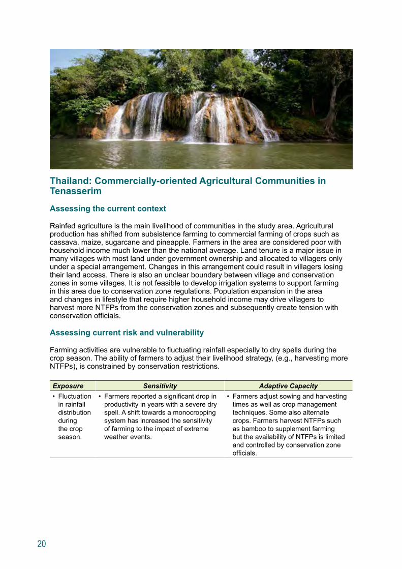
Assessing the current context
Rainfed agriculture is the main livelihood of communities in the study area. Agricultural production has shifted from subsistence farming to commercial farming of crops such as cassava, maize, sugarcane and pineapple. Farmers in the area are considered poor with household income much lower than the national average. Land tenure is a major issue in many villages with most land under government ownership and allocated to villagers only under a special arrangement. Changes in this arrangement could result in villagers losing their land access. There is also an unclear boundary between village and conservation zones in some villages. It is not feasible to develop irrigation systems to support farming in this area due to conservation zone regulations. Population expansion in the area and changes in lifestyle that require higher household income may drive villagers to harvest more NTFPs from the conservation zones and subsequently create tension with conservation officials.
Assessing current risk and vulnerability
Farming activities are vulnerable to fluctuating rainfall especially to dry spells during the crop season. The ability of farmers to adjust their livelihood strategy, (e.g., harvesting more NTFPs), is constrained by conservation restrictions.
Exposure Sensitivity Adaptive Capacity• Fluctuation
in rainfall distribution during the crop season.
• Farmers reported a significant drop in productivity in years with a severe dry spell. A shift towards a monocropping system has increased the sensitivity of farming to the impact of extreme weather events.
• Farmers adjust sowing and harvesting times as well as crop management techniques. Some also alternate crops. Farmers harvest NTFPs such as bamboo to supplement farming but the availability of NTFPs is limited and controlled by conservation zone officials.
21
Formulating a plausible future
A shift in the pattern of climate threats combined with market driven socioeconomic changes present future challenges and opportunities for farmers in this area.
Future Climate Concerns Socioeconomic Changes• More severe dry
spells, which may have a direct impact on crop productivity and exacerbate pests, especially for cassava.
• Increasing commercial monocropping makes livelihoods more market dependent and increased production may lead to intrusions into conservation zones.
• High rubber prices have driven many farmers to switch from annual crops to rubber (a perennial crop). However, there has been no study of the suitability of rubber for the area’s climate in the long run. Shifting toward perennial crops also reduces the flexibility of farmers to respond to market fluctuations.
• A lack of clarity regarding land titles and the boundaries between villages and conservation zones may cause villagers to violate regulations and lose their farmland.
• The expansion of tourism in the area may offer more off-farm income potential for villagers.
Assessing future risk and vulnerability
Farmers could be more vulnerable to future climate change due to the likelihood of more severe dry spells, resulting in lower productivity and crop failure. In addition, the shift towards intensive monocropping, as well as towards perennial crops, could also increase the sensitivity of agricultural production in this area to both climate and market risks.
Formulating an adaptation strategy
Farmers could implement intercropping practices and use drought tolerant cultivars to help reduce vulnerability to climate impacts. Such a risk management strategy could help the farmers adapt to climate variability now and in the future.
Adaptation Measures Current and Future Benefits• Practice intercropping. • Adopt drought tolerant cultivars.• Enhance crop management techniques,
especially ecosystem-friendly pest control.
• Reduced exposure, as a result of risk diversification, to both climate variability and climate change.
• Reduced sensitivity to dry spells.• Improved crop productivity.
Identifying options to operationalize the adaptation strategy
To realize the adaptation strategy, enabling factors and critical success factors must be in place.
Enabling Factors Critical Success Factors• Alternate revenue or financial support,
in the form of special loans or other mechanisms of funding, to support livelihood transition until new crops could be harvested.
• Government support for seed production.
• Efficient pest control information dissemination.
• Agriculture advisory services to farmers, which require institutional support, e.g. the presence of an agricultural extension support unit in the community.
• Precise zoning and land use planning to ensure no intrusion into conservation zones.
• Effective seed distribution channels.• Local reproducing facility for parasitic warp for
biological pest control.
22
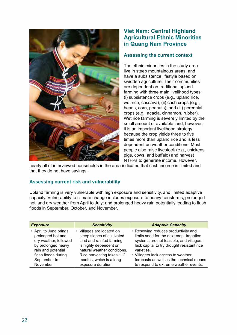
Viet Nam: Central Highland Agricultural Ethnic Minorities in Quang Nam Province
Assessing the current context
The ethnic minorities in the study area live in steep mountainous areas, and have a subsistence lifestyle based on swidden agriculture. Their communities are dependent on traditional upland farming with three main livelihood types: (i) subsistence crops (e.g., upland rice, wet rice, cassava); (ii) cash crops (e.g., beans, corn, peanuts); and (iii) perennial crops (e.g., acacia, cinnamon, rubber). Wet rice farming is severely limited by the small amount of available land; however, it is an important livelihood strategy because the crop yields three to five times more than upland rice and is less dependent on weather conditions. Most people also raise livestock (e.g., chickens, pigs, cows, and buffalo) and harvest NTFPs to generate income. However,
nearly all of interviewed households in the area indicated that cash income is limited and that they do not have savings.
Assessing current risk and vulnerability
Upland farming is very vulnerable with high exposure and sensitivity, and limited adaptive capacity. Vulnerability to climate change includes exposure to heavy rainstorms; prolonged hot and dry weather from April to July; and prolonged heavy rain potentially leading to flash floods in September, October, and November.
Exposure Sensitivity Adaptive Capacity• April to June brings
prolonged hot and dry weather, followed by prolonged heavy rain and potential flash floods during September to November.
• Villages are located on steep slopes of cultivated land and rainfed farming is highly dependent on natural weather conditions. Rice harvesting takes 1–2 months, which is a long exposure duration.
• Resowing reduces productivity and limits seed for the next crop. Irrigation systems are not feasible, and villagers lack capital to try drought resistant rice varieties.
• Villagers lack access to weather forecasts as well as the technical means to respond to extreme weather events.
23
Formulating a plausible future
A shift in the pattern of climate threat and increasing pressures from socioeconomic changes present future challenges and opportunities to the ethnic communities in this area.
Future Climate Concerns Socioeconomic Changes• Hotter and drier weather
from March to July exac-erbates risks to upland crops.
• Higher risk of flooding during the rainy season threatens rice harvests.
• Current land use practices, with shorter resting time of cultivated land, result in soil degradation and reduce the area suitable for cultivation.
• Due to lack of market information and technical knowledge, local communities tend to follow government instructions on which crops to plant. Often, the crop choices do not generate income as expect-ed when market conditions are not favorable.
• Cultural conceptions of ethnic minorities influence what is an accept-able choice of livelihood, which in turn limit livelihood diversification options.
• A number of major economic developments are underway in Quang Nam Province including hydropower schemes, mining operations, and expansion of rubber plantations.
Assessing future risk and vulnerability
The communities are vulnerable to the impacts of climate change, with crop yields expected to decline. Land degradation through soil erosion and inadequate crop rotation may lead to a reduction in the land available for agriculture. In addition to climate change, socioeconomic changes are also likely to have a strong impact on the communities. Government policies, including prohibitions on shifting cultivation, restrictions on hunting and access to other forest resources are reducing traditional livelihood practices such as the harvesting of NTFPs. Government policy encouraging hydropower and mining also reduces the land and forests available to the communities.
Both as a result of climate change and socioeconomic pressures, ethnic communities are being forced to change their way of life. They are constrained by their geographic location, climate conditions, and strong cultural traditions that limit the communities to few adaptation options. However, increasing economic development in the area may provide new economic opportunities for the communities, e.g., the marketing and selling of cash crops and NTFPs, community-based agroforestry, and cultural- and eco-tourism.
24
Formulating an adaptation strategy
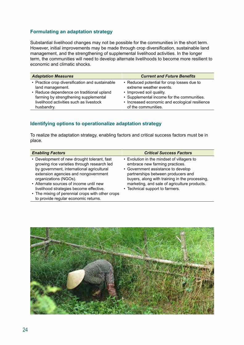
Substantial livelihood changes may not be possible for the communities in the short term. However, initial improvements may be made through crop diversification, sustainable land management, and the strengthening of supplemental livelihood activities. In the longer term, the communities will need to develop alternate livelihoods to become more resilient to economic and climatic shocks.
Adaptation Measures Current and Future Benefits • Practice crop diversification and sustainable
land management.• Reduce dependence on traditional upland
farming by strengthening supplemental livelihood activities such as livestock husbandry.
• Reduced potential for crop losses due to extreme weather events.
• Improved soil quality.• Supplemental income for the communities.• Increased economic and ecological resilience
of the communities.
Identifying options to operationalize adaptation strategy
To realize the adaptation strategy, enabling factors and critical success factors must be in place.
Enabling Factors Critical Success Factors• Development of new drought tolerant, fast
growing rice varieties through research led by government, international agricultural extension agencies and nongovernment organizations (NGOs).
• Alternate sources of income until new livelihood strategies become effective.
• The mixing of perennial crops with other crops to provide regular economic returns.
• Evolution in the mindset of villagers to embrace new farming practices.
• Government assistance to develop partnerships between producers and buyers, along with training in the processing, marketing, and sale of agriculture products.
• Technical support to farmers.
25
Recommendations
This study contributes to building understanding of the risks that GMS rural communities face with changing climatic conditions and of appropriate adaptation options. Lessons from this study can inform future research. The following eight recommendations suggest ways in which the study approach and methodology can be improved and scaled up.
Recommendation 1: Strengthen socioeconomic analyses
As socioeconomic changes significantly influence local livelihoods along with climate change, development scenarios used for climate vulnerability assessments must be informed by comprehensive socioeconomic analyses. These analyses need to project socioeconomic changes that will affect human communities and natural ecosystems over near, medium, and long terms. While this study formulated a socioeconomic profile for each community, future studies could use multiple socioeconomic scenarios to better address uncertainty with long term time scales. Effective socioeconomic analyses require improved baseline data as well as the combination of quantitative and qualitative research techniques.
Recommendation 2: Apply multiple climate scenarios
The study was informed by just one climate scenario that represented a “big change” in the climate pattern. Future studies would be strengthened by applying multiple climate scenarios to inform the discussion on alternative futures and to test the robustness of adaptation strategies. In addition, improvements are needed to enable regional climate projections to be more confidently applied to local scales. If relevant, microclimates at study sites should be analyzed to inform the assessment.
Recommendation 3: Integrate community-based adaptation (CBA) and ecosystem-based adaptation (EBA) approaches
The study only considered agroecosystems within the immediate study sites and did not analyze potential climate impacts on broader forest ecosystems that also support community livelihoods. As a result, adaptation measures to protect biodiversity and ecological services that support local livelihoods were not directly considered. Future assessments need to better understand the role of forest ecosystems in supporting agriculture livelihoods to promote more effective resilience strategies. This could be achieved by integrating CBA and EBA in the assessment.
26
Recommendation 4: Improve participatory approaches
The identification of adaptation options through stakeholder consultation workshops proved to be challenging during this study. Community members appeared to have great difficulty in visualizing “what things might be like” in the medium and long terms. As a consequence, many of the adaptation options proposed during the consultation workshops focused on short term measures to current climate risks. Future studies could improve the participatory approach to identify adaptation options. Communities would benefit from new techniques and approaches to help them better visualize future scenarios and understand the longer term implications of adaptation options. In addition, new techniques could improve understanding of how communities might respond to climate change and lead to adaptation planning that reconciles potential conflicts of interest between community needs and environmental conservation goals in the wider landscapes.
Recommendation 5: Integrate site specific crop model simulations where possible
Future studies will need to better examine the potential impact of climate change on agriculture productivity. This study included a component on crop modeling to project changes in agricultural productivity in response to climate scenarios. However, the need for site specific data to parameterize the crop models made it impractical to undertake crop modeling at all sites. If possible, future assessments should secure adequate resources to collect more site specific data necessary for crop model simulations.
Recommendation 6: Integrate an economic analysis
The study did not analyze and compare costs and benefits of different adaptation options. Before investments are made, adaptation options should be subjected to an economic analysis to understand costs and benefits of adaptation as well as the cost-effectiveness of different options.
Recommendation 7: Analyze the broader policy and planning environment
The study mostly considered the likely socioeconomic changes resulting from local level policies, plans and projects. However, large scale changes in the broader policy and planning environment also influence risks and adaptation options for communities. Understanding this context will help identify constraints and opportunities for community adaptation more effectively. Future studies should examine the policy and planning environment nationally and provincially, as well as locally.
Recommendation 8: Upscale to regional studies
As only a small sample of communities was included in the study, its specific findings cannot be generalized to the broader GMS. To move to a regional level, future studies will need to include more landscapes and many more communities. Such studies will need to target a representative set of communities carefully stratified based on biological, geographical, and climatic factors; current and future climate risks; development pressures; and livelihood, population and demographic features.
27
Next Steps
Building on this study, CEP will strengthen the capacity of GMS practitioners and institutions to conduct climate vulnerability and adaptation assessments at the community level. Through a consultation process and partnership with GMS institutions, CEP will enhance the overall assessment framework and facilitate a wider application of the framework to inform adaptation planning in the subregion.
28
Appendix 1: A Regional Climate Change Scenario for Southeast Asia
Figure A1.1: Average Daily Maximum Temperature
Source: SEA START RC
29
Figure A1.2: Average Daily Minimum Temperature
Source: SEA START RC
30
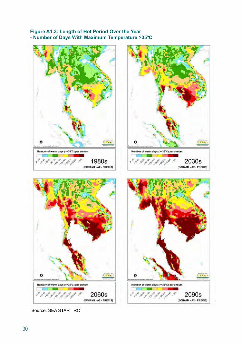
Figure A1.3: Length of Hot Period Over the Year - Number of Days With Maximum Temperature >35ºC
Source: SEA START RC
31
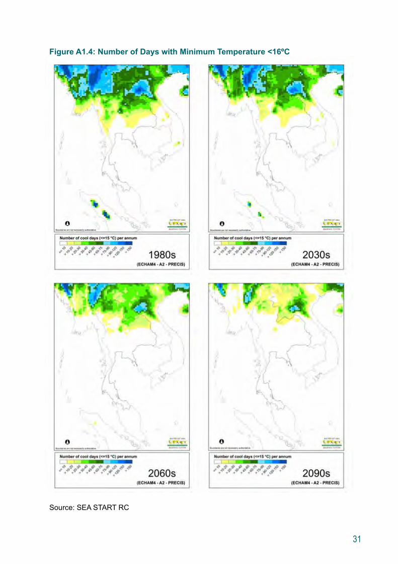
Figure A1.4: Number of Days with Minimum Temperature <16ºC
Source: SEA START RC
32
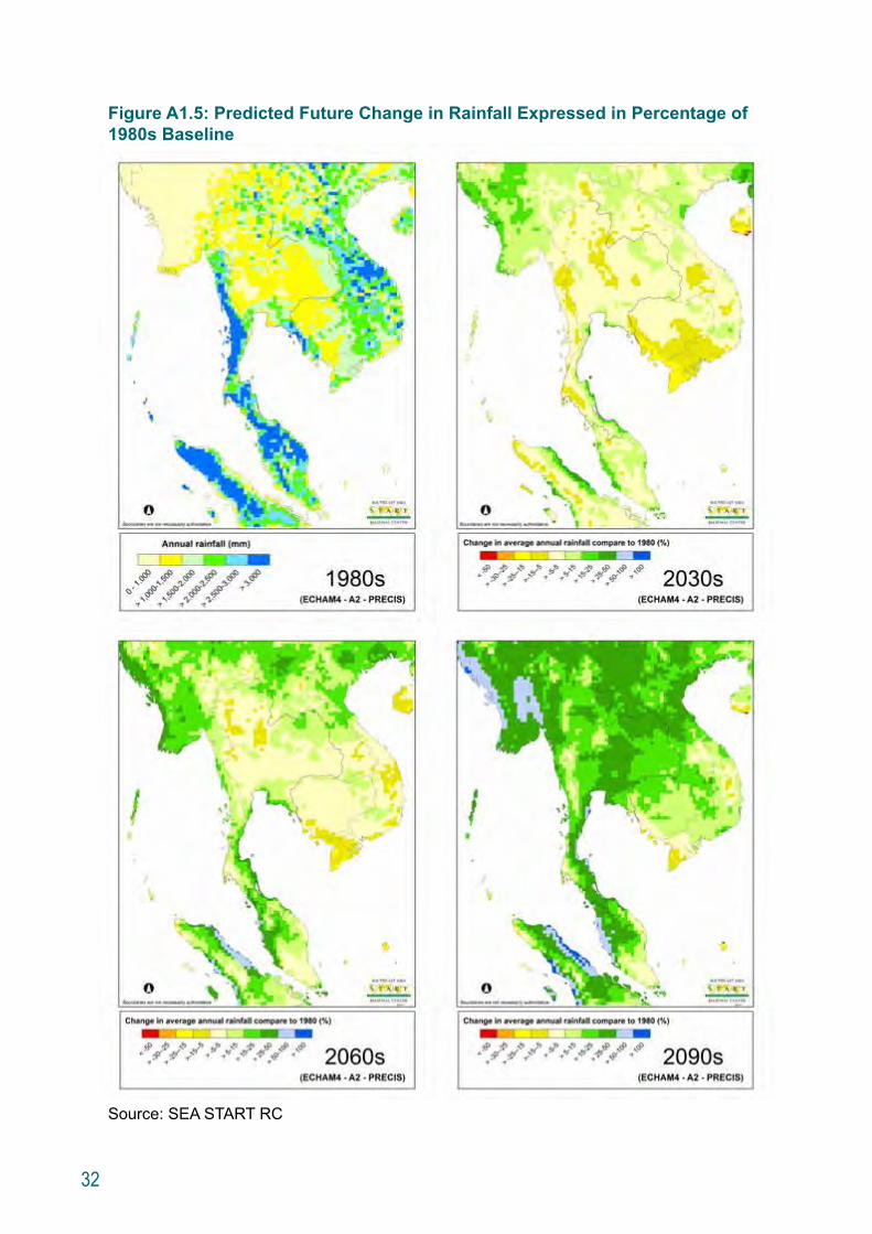
Figure A1.5: Predicted Future Change in Rainfall Expressed in Percentage of 1980s Baseline
Source: SEA START RC
33
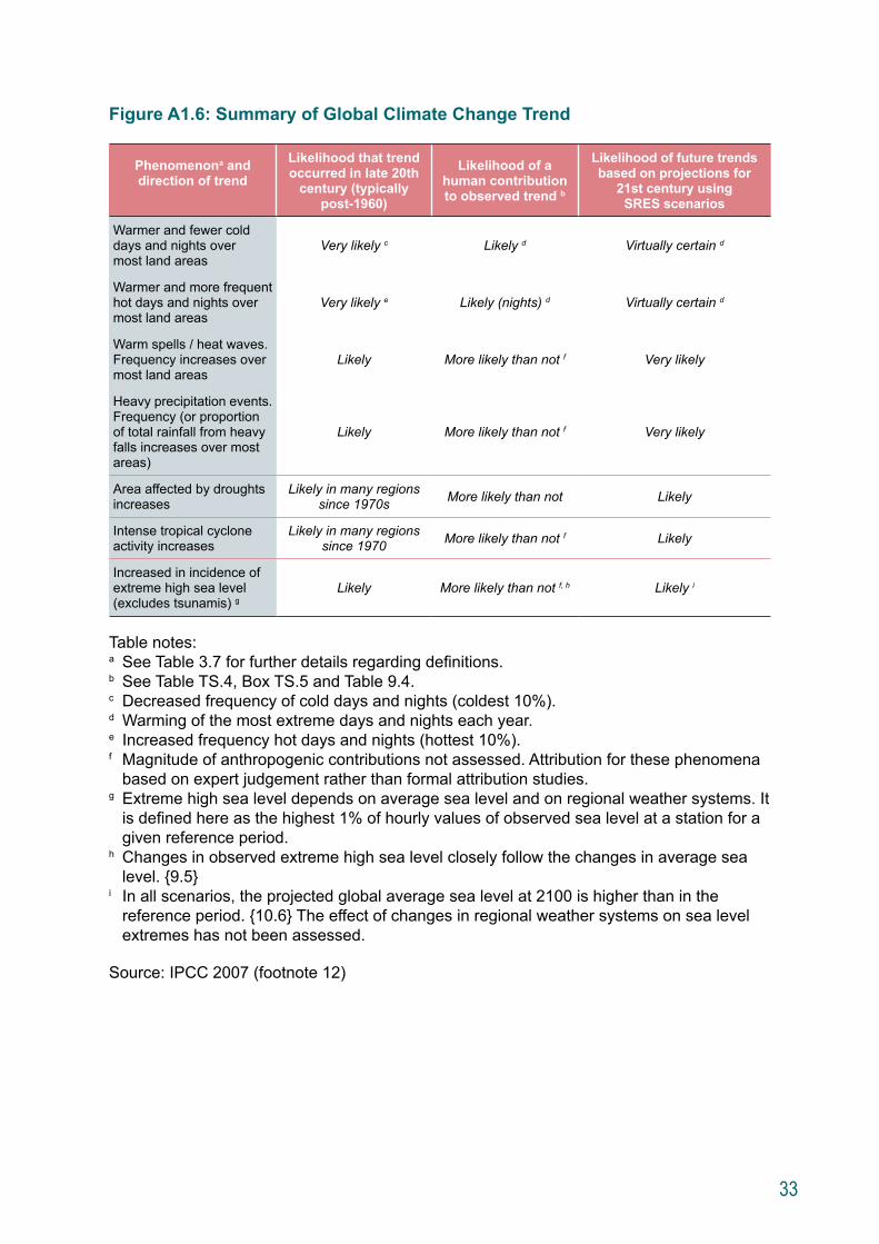
Figure A1.6: Summary of Global Climate Change Trend
Phenomenona and direction of trend
Likelihood that trend occurred in late 20th
century (typically post-1960)
Likelihood of a human contribution to observed trend b
Likelihood of future trends based on projections for
21st century using SRES scenarios
Warmer and fewer cold days and nights over most land areas
Very likely c Likely d Virtually certain d
Warmer and more frequent hot days and nights over most land areas
Very likely e Likely (nights) d Virtually certain d
Warm spells / heat waves. Frequency increases over most land areas
Likely More likely than not f Very likely
Heavy precipitation events. Frequency (or proportion of total rainfall from heavy falls increases over most areas)
Likely More likely than not f Very likely
Area affected by droughts increases
Likely in many regions since 1970s More likely than not Likely
Intense tropical cyclone activity increases
Likely in many regions since 1970 More likely than not f Likely
Increased in incidence of extreme high sea level (excludes tsunamis) g
Likely More likely than not f, h Likely i
Table notes:a See Table 3.7 for further details regarding definitions.b See Table TS.4, Box TS.5 and Table 9.4.c Decreased frequency of cold days and nights (coldest 10%).d Warming of the most extreme days and nights each year.e Increased frequency hot days and nights (hottest 10%).f Magnitude of anthropogenic contributions not assessed. Attribution for these phenomena
based on expert judgement rather than formal attribution studies.g Extreme high sea level depends on average sea level and on regional weather systems. It
is defined here as the highest 1% of hourly values of observed sea level at a station for a given reference period.
h Changes in observed extreme high sea level closely follow the changes in average sea level. {9.5}
i In all scenarios, the projected global average sea level at 2100 is higher than in the reference period. {10.6} The effect of changes in regional weather systems on sea level extremes has not been assessed.
Source: IPCC 2007 (footnote 12)
34
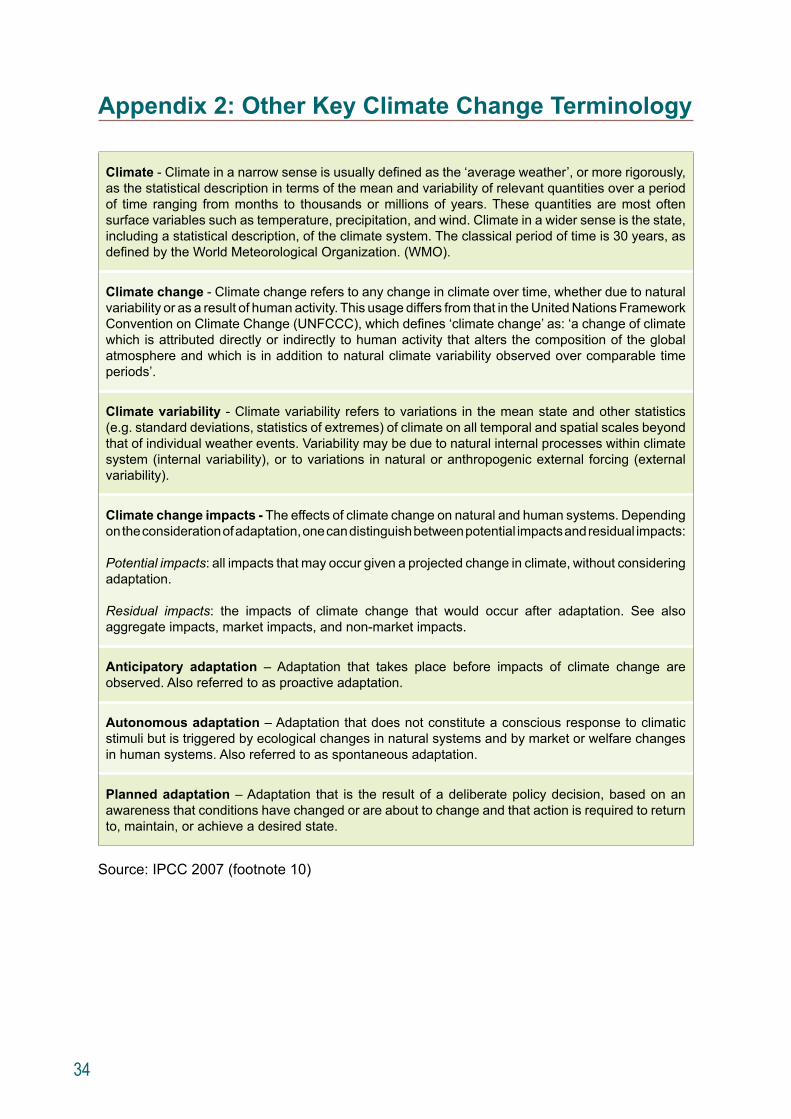
Appendix 2: Other Key Climate Change Terminology
Climate - Climate in a narrow sense is usually defined as the ‘average weather’, or more rigorously, as the statistical description in terms of the mean and variability of relevant quantities over a period of time ranging from months to thousands or millions of years. These quantities are most often surface variables such as temperature, precipitation, and wind. Climate in a wider sense is the state, including a statistical description, of the climate system. The classical period of time is 30 years, as defined by the World Meteorological Organization. (WMO).
Climate change - Climate change refers to any change in climate over time, whether due to natural variability or as a result of human activity. This usage differs from that in the United Nations Framework Convention on Climate Change (UNFCCC), which defines ‘climate change’ as: ‘a change of climate which is attributed directly or indirectly to human activity that alters the composition of the global atmosphere and which is in addition to natural climate variability observed over comparable time periods’.
Climate variability - Climate variability refers to variations in the mean state and other statistics (e.g. standard deviations, statistics of extremes) of climate on all temporal and spatial scales beyond that of individual weather events. Variability may be due to natural internal processes within climate system (internal variability), or to variations in natural or anthropogenic external forcing (external variability).
Climate change impacts - The effects of climate change on natural and human systems. Depending on the consideration of adaptation, one can distinguish between potential impacts and residual impacts:
Potential impacts: all impacts that may occur given a projected change in climate, without considering adaptation. Residual impacts: the impacts of climate change that would occur after adaptation. See also aggregate impacts, market impacts, and non-market impacts.
Anticipatory adaptation – Adaptation that takes place before impacts of climate change are observed. Also referred to as proactive adaptation.
Autonomous adaptation – Adaptation that does not constitute a conscious response to climatic stimuli but is triggered by ecological changes in natural systems and by market or welfare changes in human systems. Also referred to as spontaneous adaptation.
Planned adaptation – Adaptation that is the result of a deliberate policy decision, based on an awareness that conditions have changed or are about to change and that action is required to return to, maintain, or achieve a desired state.
Source: IPCC 2007 (footnote 10)
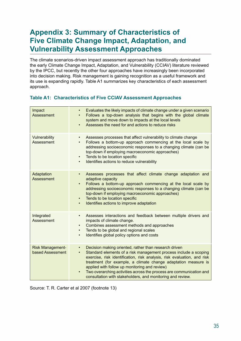
35
Appendix 3: Summary of Characteristics of Five Climate Change Impact, Adaptation, and Vulnerability Assessment ApproachesThe climate scenarios-driven impact assessment approach has traditionally dominated the early Climate Change Impact, Adaptation, and Vulnerability (CCIAV) literature reviewed by the IPCC, but recently the other four approaches have increasingly been incorporated into decision making. Risk management is gaining recognition as a useful framework and its use is expanding rapidly. Table A1 summarizes key characteristics of each assessment approach.
Table A1: Characteristics of Five CCIAV Assessment Approaches
Impact Assessment
• Evaluates the likely impacts of climate change under a given scenario • Follows a top-down analysis that begins with the global climate
system and move down to impacts at the local levels• Assesses the need for and actions to reduce risks
Vulnerability Assessment
• Assesses processes that affect vulnerability to climate change• Follows a bottom-up approach commencing at the local scale by
addressing socioeconomic responses to a changing climate (can be top-down if employing macroeconomic approaches)
• Tends to be location specific• Identifies actions to reduce vulnerability
Adaptation Assessment
• Assesses processes that affect climate change adaptation and adaptive capacity
• Follows a bottom-up approach commencing at the local scale by addressing socioeconomic responses to a changing climate (can be top-down if employing macroeconomic approaches)
• Tends to be location specific• Identifies actions to improve adaptation
Integrated Assessment
• Assesses interactions and feedback between multiple drivers and impacts of climate change.
• Combines assessment methods and approaches• Tends to be global and regional scales• Identifies global policy options and costs
Risk Management-based Assessment
• Decision making oriented, rather than research driven• Standard elements of a risk management process include a scoping
exercise, risk identification, risk analysis, risk evaluation, and risk treatment (for example, a climate change adaptation measure is applied with follow up monitoring and review)
• Two overarching activities across the process are communication and consultation with stakeholders, and monitoring and review.
Source: T. R. Carter et al 2007 (footnote 13)


Photo Credits Cover: Justin Mott, ADBPages iv, vi, 4, 8, 14, 16, 17, 20, 22, 25, 27, back cover: Steve Griffiths, ADBPage viii: Nireka Starkloff, EOCPages 2, 5, 24: Duncan McLeod, EOCPage 10: Bopha Seng, EOCPages 11, 18: Ornsaran Manuamorn, EOCPage 12: Steven Schipani, ADB

About the Climate Change and Rural Communities in the Greater Mekong SubregionA Framework for Assessing Vulnerability and Adaptation Options
This report presents the methodology and lessons learned from a climate change adaptation study conducted under the Greater Mekong Subregion (GMS) Core Environment Program. The study yielded a framework and methodology for assessing climate vulnerability and adaptation options for rural communities in the GMS. It was conducted in biodiversity conservation corridors in the Lao People’s Democratic Republic, Thailand, and Viet Nam during 2011–2012. The report introduces the framework, describes how it was applied, presents major results, and makes recommendations for future improvement.
About the Asian Development Bank ADB’s vision is an Asia and Pacific region free of poverty. Its mission is to help its developing member countries reduce poverty and improve the quality of life of their people. Despite the region’s many successes, it remains home to approximately two-thirds of the world’s poor: 1.6 billion people who live on less than $2 a day, with 733 million struggling on less than $1.25 a day. ADB is committed to reducing poverty through inclusive economic growth, environmentally sustainable growth, and regional integration.
Based in Manila, ADB is owned by 67 members, including 48 from the region. Its main instruments for helping its developing member countries are policy dialogue, loans, equity investments, guarantees, grants, and technical assistance.
About the Core Environment Program (CEP)The Core Environment Program (CEP) supports the Greater Mekong Subregion (GMS) in delivering environmentally friendly economic growth. Anchored on the Asian Development Bank’s (ADB) GMS Economic Cooperation Program, CEP promotes regional cooperation to improve development planning, safeguards, biodiversity conservation, and resilience to climate change–all of which are underpinned by building capacity. CEP is overseen by the environment ministries of the six GMS countries and implemented by the ADB-administered Environment Operations Center. Cofinancing is provided by the Governments of Finland and Sweden, and the Nordic Development Fund
GMS Environment Operations CenterAsian Development Bank, 23rd Floor, The Offices at Central World999/9 Rama 1 Road, Pathumwan Bangkok 10330Tel: (+66) 2 207 4444 Fax: (+66) 2 207 4400Email: [email protected] Website: www.gms-eoc.org


![[Mekong ARCC] Climate Change Impact and Adaptation Study for Natural and Agricultural Systems](https://img.dokumen.tips/doc/110x75/557d297ad8b42a80608b4b33/mekong-arcc-climate-change-impact-and-adaptation-study-for-natural-and-agricultural-systems.jpg)


![Mekong ARCC Interim Results Workshop: Challenges of Climate Change Adaptation and Mitigation in Agriculture [Keynote]](https://img.dokumen.tips/doc/110x75/54cfe4044a7959964d8b45a5/mekong-arcc-interim-results-workshop-challenges-of-climate-change-adaptation-and-mitigation-in-agriculture-keynote.jpg)