Embed Size (px)
Citation preview

Environmental Assessment CLARKSVILLE WWTP EXPANSION AND EFFLUENT LINE REPLACEMENT PROJECT
Clarksville, Clark County, Indiana September 2012 Prepared by: Redwing Ecological Services, Inc. Louisville, Kentucky Prepared for: FEMA Region V 536 South Clark Street, Sixth Floor Chicago, Illinois 60605

i
TABLE OF CONTENTS TABLE OF CONTENTS ....................................................................................................................... i 1.0 BACKGROUND ........................................................................................................................... 2
1.1 Project Authority ....................................................................................................................... 2 1.2 Project Location ....................................................................................................................... 3 1.3 Purpose and Need ................................................................................................................... 3
2.0 ALTERNATIVES ANALYSIS ....................................................................................................... 4 2.1 Alternative 1 – No Action Alternative ....................................................................................... 4 2.2 Alternative 2 – Proposed Action Alternative (Mill Creek Line) ................................................. 5 2.3 Alternatives Considered and Eliminated .................................................................................. 8
3.0 AFFECTED ENVIRONMENT AND CONSEQUENCES .............................................................. 8 3.1 Physical Environment .............................................................................................................. 8
3.1.1 Geology, Seismicity and Soils ........................................................................................... 8 3.1.2 Water Resources and Water Quality .............................................................................. 10 3.1.3 Floodplain Management (Executive Order 11988) ......................................................... 11 3.1.4 Air Quality ....................................................................................................................... 13
3.2 Biological Environment .......................................................................................................... 14 3.2.1 Terrestrial and Aquatic Environment .............................................................................. 14 3.2.2 Wetlands (Executive Order 11990) ................................................................................ 15 3.2.3 Threatened and Endangered Species ............................................................................ 16
3.3 Hazardous Materials .............................................................................................................. 19 3.4 Socioeconomic ....................................................................................................................... 21
3.4.1 Zoning and Land Use ...................................................................................................... 21 3.4.2 Visual Resources ............................................................................................................. 22 3.4.3 Noise ............................................................................................................................... 22 3.4.4 Public Services and Utilities ............................................................................................. 23 3.4.5 Traffic and Circulation ...................................................................................................... 24 3.4.6 Environmental Justice (Executive Order 12898) .............................................................. 24 3.4.7 Safety and Security .......................................................................................................... 25
3.5 Historic and Cultural Resources ............................................................................................ 25 3.5.1 Historic Structures ........................................................................................................... 26 3.5.2 Archaeological Resources ............................................................................................... 27
3.6 Comparison of Alternatives .................................................................................................... 29 4.0 CUMULATIVE IMPACTS ........................................................................................................... 35 5.0 PUBLIC PARTICIPATION ......................................................................................................... 35 6.0 MITIGATION MEASURES AND PERMITS ............................................................................... 36 7.0 CONSULTATIONS AND REFERENCES .................................................................................. 39 8.0 LIST OF PREPARERS .............................................................................................................. 39 Appendix A – Project Maps Appendix B – Acronyms Appendix C – Agency Consultations Appendix D – Hazardous Materials Assessment Report Appendix E – Public Notice

1.0 BACKGROUND This Environmental Assessment (EA) presents an assessment of the environmental consequences of the proposed Clarksville Waste Water Treatment Plant (WWTP) Expansion and Effluent Line Replacement Project in Clark County, Indiana. This assessment is based on correspondence with state and federal resource agencies, in-house research, and field assessments of the study areas. The EA has been prepared following the Guidelines for the Preparation of an Environmental Assessment (May 2012-draft) developed by the U. S. Department of Homeland Security’s Federal Emergency Management Agency (FEMA) – Region V. The background of the project is presented in more detail below in terms of project authority, location, purpose, and need.
1.1 Project Authority The Town of Clarksville (Town) operates the WWTP that services approximately 6,000 homes and 700 businesses in Clarksville, Indiana. The WWTP was constructed in 1987 and receives approximately 3.32 million gallons of waste per day (MGD) with a peak hourly rate of 12.13 MGD. The original effluent line extended south from the southeast corner of the WWTP, across Mill Creek, and discharged to the Cannelton Pool of the Ohio River at approximately Mile Point 606. In late April and early May of 2011, Clarksville experienced significant flooding that resulted in the effluent line being submerged under 35 to 40 feet of water for almost two months. Governor Mitchell E. Daniels, Jr. requested a major disaster declaration due to severe storms, tornadoes, straight-line winds, and flooding, which was confirmed by President Obama in June 2011 (FEMA 1997-DR). As the flood waters receded, a local landowner informed the Town that water was discharging from the effluent line into Mill Creek. The Town began excavation of the line to identify the location of the rupture but was forced to cease work due to inclement weather. Upon restarting excavation efforts, the Town discovered that a slope failure had occurred in the adjacent hillside causing the effluent line to shift from its original alignment, which resulted in the separation of numerous joints. The slope failure also resulted in a series of cracks and separations in the effluent line pipe north of the rupture location. The Town has initially been awarded $823,041 through FEMA’s Public Assistance (PA) Program for repair of the damaged line; however, in 2012, the Town requested an improved project to relocate the effluent pipe from the Ohio River to Mill Creek This was the second time a break in the Town’s effluent line occurred as a result of a significant flood event. This break was much larger than the previous due to a hillside collapse following the flood, which destroyed the effluent line and the overlying hill. Due to these circumstances, the Town assessed the line to determine if additional breaks had occurred and possible ways to prevent future breakages. Currently, the effluent line discharges from the line rupture to Mill Creek through a channel eroded by the flows from the effluent line. Due to the limited capacity of the existing WWTP, the Town struggles to treat the combined volume of wastewater and stormwater during wet weather events. The collection system has experienced a total of 43 overflows since 2009, including 36 overflows that are directly attributed to wet weather

events. At the time of the effluent line breakage, the Town was assessing the need to expand the current WWTP to assist in addressing overflows attributed to wet weather flows. The expansion of the WWTP will be performed concurrently and under a separate contract with the installation of the effluent line. Due to the increased capacity of the WWTP, the effluent line will be upgraded from an 18-inch line to a 36-inch line. In accordance with the National Environmental Policy Act (NEPA) of 1969, the Council on Environmental Quality (CEQ) regulation implementing NEPA (40 Code of Federal Regulations [CFR] Parts 1500 through 1508), and FEMA regulations for NEPA compliance (44 CFR Part 10), FEMA must fully understand and consider the environmental consequences of actions proposed for federal funding. The purpose of this Environmental Assessment (EA) is to meet FEMA’s responsibility under NEPA and to determine whether to prepare a Finding of No Significant Impact (FONSI) or a Notice of Intent (NOI) to prepare an Environmental Impact Statement (EIS) for the proposed project.
1.2 Project Location The Clarksville WWTP services a population of approximately 21,482 (2010 population) residents in Clarksville, Clark County, Indiana (Appendix A). The Project consists of two distinct study areas. The approximately 7.5-acre WWTP expansion area is located immediately southeast of the existing WWTP and is a former Town park (Midway Park). The WWTP expansion area is bound by the existing WWTP and Browns Station Way to the northwest and northeast, respectively; the floodwall to the southwest; and undeveloped land to the southeast. This study area is located at Latitude 38.29603° North and Longitude -85.77355° West. The proposed effluent line study area extends from the existing treatment plant, located at 1 Leuthart Drive, to Mill Creek located approximately 1,200 feet south of the plant in southern Clark County, Indiana (Appendix A). The majority of the approximately 9.4-acre corridor where the new effluent line is proposed is located on property owned by the Jeffersonville Flood Control District with a portion of the southern project area located in the Falls of the Ohio River State Park, which is administered by State of Indiana, through the Department of Natural Resources, Division of State Parks and Reservoirs (IDNR). This project study area is bound by a floodwall to the east, undeveloped land to the south, commercial development and undeveloped land to the west, and the existing WWTP to the north. The study area is located within Clark’s Grant at Latitude: 38.29499° North and Longitude -85.77600° West.
1.3 Purpose and Need The purpose of FEMA’s PA Program is to provide financial assistance to State, Tribal and local governments, and certain private nonprofit organizations so that communities can quickly respond to and recover from major disasters or emergencies declared by the President. In the spring of 2011, receding floodwaters severely damaged the current effluent line and caused a hillside collapse, which destroyed the line. An engineering assessment of the line and the
surrounding soil materials, determined that the soils in which the line was installed were unstable, and future flooding would likely result in additional movement of the surrounding hillsides causing additional line breaks. Furthermore, the assessment identified additional breaks within the existing line and areas susceptible to future breaks. The engineer’s recommendation was to abandon the old line and install a new line back to the Ohio River or relocate the Town’s outfall to the nearby Mill Creek. However, due to the instability of the soil materials along the likely alignment of the new line to the Ohio River and the potential risk of future line breaks due to unstable soils, it was decided to relocate the Town’s WWTP outfall to Mill Creek. Based on an extensive geotechnical study, the proposed alignment to Mill Creek avoids unstable soils. IDEM has agreed to the proposed new outfall location but will require more stringent discharge permit limits due to the outfall location on a smaller receiving water. In order to meet the more stringent outfall limits, the Town will be required to expand/upgrade its existing WWTP facilities. The expansion/upgrade of Town’s WWTP will serve two primary goals. It will allow the Town to meet the more stringent outfall permit limits required to discharge to Mill Creek, and it will enable the Town to adequately treat wet weather flows, which will limit/prevent overflows within the sanitary collection system. The need for the project is to provide a WWTP capable of addressing the treatment needs of the Town that meets all regulatory effluent requirements while minimizing risks from future flood events.
2.0 ALTERNATIVES ANALYSIS The NEPA of 1969 requires that federal agencies consider the potential environmental consequences of proposed project including an analysis of alternatives that meet the purpose and need of the project. Federal agencies are not required to consider every potential alternative, but they must consider a full range of reasonable alternatives including those that are “practical or feasible from the technical and economic standpoint and using common sense”. The No-action Alternative, Proposed Action Alternative, and alternatives considered and eliminated are discussed in more detail below.
2.1 Alternative 1 – No Action Alternative Under the No-action Alternative, the Town would continue to discharge effluent through the current line. The No-build alternative would result in no changes to the present system, which requires periodic, major maintenance at the location of the line breaks. The Town is currently discharging its effluent through an effluent line break point to Mill Creek. The Town has been authorized by IDEM to have a temporary discharge at the Mill Creek break site from May 2011 to June 2013. This discharge is in violation of the NPDES permit, and the authorization included the following restrictions:
• The site must be stabilized to prevent further erosion and breaks. This was completed by April 2012.

• The Town must complete design and construction of a new outfall to Mill Creek no later than June 2013.
• The Town must upgrade its Wastewater Treatment Plant to meet new permit limits by
November 2014. If no additional funding were made available, the Town would repair the break site to allow discharge to the Ohio River. This repair would only temporarily address the issue, and a significant flood event or rainfall would likely result in an additional break in the effluent line. Without federal (FEMA) assistance, a long-term solution would be funded through an increase in Wastewater rates paid by citizens and businesses. Evaluation through the EA process has determined that this No-build Alternative will not satisfy the project needs as described under Section 1.3. Furthermore, the Indiana Department of Environmental Management (IDEM) will only authorize effluent discharges to Mill Creek if the town meets stricter permit limits, which would require the expansion of the WWTP.
2.2 Alternative 2 – Proposed Action Alternative (Mill Creek Line) The existing WWTP is serviced by an 18-inch line that is currently ruptured and discharging to Mill Creek. The existing 18-inch line will remain in service during construction of the new 36-inch effluent line and associated energy dissipation feature. Once construction of the new effluent line and dissipation feature is complete, the existing 18-inch line will be abandoned in place. The broken sections of pipe will be removed, the area disturbed during removal of the broken sections will be regraded, and the line will be plugged at the northern terminus. The proposed project involves installation of approximately 1,200 feet of 36-inch effluent line at a depth ranging from 10 to 20 feet within a 30-foot permanent easement with the exception of an approximately 60-foot pipe crossing at one (southern) of the two ephemeral streams. The northern terminus of the project is located at the existing effluent pump station in the southeast corner of the existing facility. The proposed effluent line will be installed through the floodwall and will generally follow the base of the floodwall to Mill Creek. The project will require a 3.25-acre contractor staging area located in the former park (Midway Park) located east of the existing WWTP. Currently, the proposed project corridor is dominated by forested habitat containing both upland and wetland portions with a smaller area of emergent wetland. The study area includes one perennial stream (Mill Creek), two intermittent streams, two ephemeral streams, and one emergent and two wooded wetlands (Appendix A). Effluent from the 36-inch effluent line will discharge to a native rock forebay before flowing into an approximately 0.5-acre energy dissipation basin. Flows from the energy dissipation basin will be directed into a 150-foot step-pool channel, which will discharge to Mill Creek. A boulder toe is proposed along the right bank of Mill Creek for approximately 25 feet upstream and 20 feet downstream of the confluence with the effluent step-pool channel to ensure bank stability. The project will require excavations up to 15 feet below the ground surface resulting in a temporary construction easement width of 90 feet and a final easement width of 30 feet. Installation of the

pipe is anticipated to be completed using typical excavation techniques including trench boxes or benching/shoring. During the effluent line installation activities, a temporary stream crossing will be established across Ephemeral 2 within the temporary construction limits, as shown in Appendix A. Upon completion of the effluent line installation activities, the temporary stream crossing will be removed, and Ephemeral 2 will be restored to pre-construction contours and stabilized with native seed, clean straw mulch, and erosion control matting. The disturbed areas along the stream will then be planted with one to three-gallon containerized native trees and shrubs. Approximately 60 feet of streambank along Mill Creek will be regraded to establish the step-pool channel as shown in Appendix A. As part of the construction of the step-pool channel, two boulder toe sections will be constructed along the right bank of Mill Creek, immediately upstream and downstream of the confluence of the step-pool channel and Mill Creek (Appendix A). Upon completion of the step-pool channel, the disturbed streambanks and step-pool channel banks will be seeded with a native seed mix, covered with clean straw mulch, and protected with erosion control matting. One to three-gallon native trees and shrubs will then be planted in riparian areas along these features. Construction Drawings are included as Appendix A. The Town proposes to expand the capacity of the existing WWTP to provide treatment for high flows due to stormwater inflow/infiltration (I/I) during wet weather events; however, additional renovation of the existing plant is necessary to meet the more stringent regulatory limits for discharge to Mill Creek. The proposed WWTP expansion is depicted on the figures provided in Appendix A and will consist of the following:
• New sanitary sewer influent line • New influent mechanically cleaned bar screen and accessories • New influent pumping station • New grit removal facilities • New biological treatment with Orbal oxidation ditch • New secondary clarifiers • New ultraviolet disinfection • New effluent pumps and renovated effluent pump station
The proposed WWTP expansion will be constucted in the former park (Midway Park) located east of the existing WWTP. This area will be used as a contractor staging area during construction of the effluent line project. The area is owned by the Town; therefore, property acquistions or easements are not anticipated. The project will primarily involve excavation activities (up to 30-feet deep) for the installation of tankage and treatment structures, concrete work in constructing the tanks and structures, pipe work connecting the treatment structures, and backfill around the tanks and pipework. Construction is expected to take approximately 18 months, beginning in the spring of 2013. The WWTP improvements will provide the ability for the Clarksville WWTP to process additional wet weather (I/I) flows. The peak hourly design capacity will increase 45% (from 11.4 MGD to 16.5

MGD) and the maximum allowable hydraulic flow will increase 75% (from 12.5 MGD to 22 MGD). The WWTP improvements will meet the more stringent effluent limitations of discharging to Mill Creek rather than the Ohio River. The total cost of the proposed effluent line project is $1,361,000, of which $823,041 (60%) is being funded by FEMA. The expansion of the WWTP is being funded through other sources.

2.3 Alternatives Considered and Eliminated During review of project alternatives, the Town assessed reconstruction of the existing effluent line to its previous discharge point at the Ohio River (repair to pre-disaster condition). This alternative was eliminated due to:
• the altered hydrology of the area results in the inability to predict suitable soil conditions for an alignment precluding construction of a stable line even utilizing new pipe and construction technologies
• reconstruction of the existing line would result in greater impacts to the Falls of the Ohio State Park
• the overall cost to install a new line to the Ohio River discharge point was in excess of three times the cost to construct a line to the proposed Mill Creek location
The Town also assessed if renovation of the existing treatment facility would allow the effluent to meet regulatory limits for discharge to Mill Creek. Renovation of the existing facility could potentially result in effluent quality sufficient to meet the regulatory standards; however, renovation alone of the existing facility would not increase the treatment capacity sufficiently to address wet weather events. As discussed in Section 1.1, a total of 43 overflow events have occurred since 2009 including 36 attributed to wet weather events. Treatment of wet weather flows is critical to adherence to regulatory standards. Based on the inability to sufficiently treat wet weather flows, renovation of the existing facility to current technologies without capacity increase was not a viable alternative.
3.0 AFFECTED ENVIRONMENT AND CONSEQUENCES The general environmental settings of the study areas are presented below in terms of the physical and biological environments, hazardous materials, socioeconomics, and historic and archaeological resources. Each of these components is discussed in more detail below.
3.1 Physical Environment The components of the physical environment – Geology, Seismicity, Soils, Water, Floodplains and Air - are discussed in more detail in the following sections.
3.1.1 Geology, Seismicity and Soils In late April and early May of 2011, Clarksville experienced significant flooding that resulted in the effluent line being submerged under 35 to 40 feet of water for almost two months. As the flood waters receded, an adjacent hill slope failed causing the effluent line to shift from its original alignment, which resulted in the separation of numerous joints. The slope failure also resulted in a series of cracks and separations in the effluent line pipe north of the rupture location. An

engineering assessment of the existing line and the surrounding soil materials, particularly in the lower reach of the existing effluent line alignment, determined that the soils in which the line was installed were unstable, and future flooding would likely result in additional movement of the surrounding hillsides causing additional line breaks. A figure depicting the past slope failures and line breaks in relationship to the proposed project study areas is provided in Appendix A. The proposed project is located in the Loamy, High Lime Till Plain (Level IV Ecoregion) of Indiana (Griffith et al 2008), which contains soils that developed from loamy, limy, glacial deposits of the Wisconsinian age. The USDA Soil Survey Geographic Database for Clark County, Indiana maps the study area as being underlain predominately by an Urban Land-Aquents soil complex with a loamy substratum and Udorents with a small area of former sand and gravel pits in the northern portion of the effluent line replacement study area (Appendix A). These soil complexes are not listed as hydric. The study areas vary in elevation from 458 feet within the proposed WWTP expansion site to 412 feet at the proposed effluent discharge point at Mill Creek. The existing WWTP is located upgradient of the earthen floodwall with a crest elevation of 462 feet at the proposed effluent line crossing. The study areas are not located in an elevated seismic hazard area (USGS 2012). A geotechnical assessment of the study areas did not encounter bedrock in the borings, which were extended to depths greater than the proposed excavation. The Farmland Protection Policy Act (FPPA) (P.L. 97-98, Sec. 1539-1549; 7 U.S.C. 4201, et seq.), which states that federal agencies must “minimize the extent to which federal programs contribute to the unnecessary conversion of farmland to nonagricultural uses,” was considered in this EA. The Web Soil Survey does not identify prime farmland within the study area (USDA 2012). Alternative 1 – No Action: Under the No Action Alternative, no impacts to geology or soils would occur as a result of construction related activities; however, the effluent line would continue to be located within unstable slopes. As determined by an engineering assessment, future breaks in the existing line would likely occur if the existing line remains in its present location. Alternative 2 – Proposed Action: The Proposed Action Alternative will require excavation of up to approximately 30 feet below ground surface. Bedrock was not encountered within the study area during the geotechnical exploration; therefore, the proposed project will not impact geologic resources. The project will require excavation to construct facilities within the WWTP expansion site, to install the effluent line, and to construct the energy dissipation basin and step-pool channel. Construction activities will require a total of 7.2 acres of soil disruption within the 17.1-acre total project area. Excess soils generated from the expansion of the plant will be utilized to construct a screening berm between the proposed treatment plant and Browns Station Way. Soils excavated from the effluent line will be replaced in the trench. Soils excavated from the energy dissipation basin and step-pool channel, as well as excess soils from the effluent line excavation, will be utilized to construct the berm for the energy dissipation basin. Soil disruption will be minimized to the extent possible. Soil erosion prevention and sediment control will be addressed through the development

and implementation of a Construction Plan and Storm Water Pollution Prevention Plan (SWPPP), which will be submitted to IDEM for review and approval. The proposed project will result in minor impacts to soils; however, these impacts will be localized to the project areas through the use of best management practices. The soil disturbances will occur in areas noted on the Soil Survey Geographic database (SSURGO) as sand and gravel pits and udorthents-cut and filled (Appendix A). Based on the minimization of soil disruption, the use of best management practices to reduce soil migration, and the disturbed character of the soils within and surrounding the project, significant impacts to soils will not occur as a result of the proposed project.
3.1.2 Water Resources and Water Quality Redwing wetland scientists conducted field visits on December 13 and 14, 2011 and on February 3 and March 29, 2012, to delineate jurisdictional waters of the U.S., including wetlands, within the study areas. Jurisdictional waters within the effluent line replacement study area include approximately 284 feet (0.014 acre) of ephemeral stream; 359 feet (0.021 acre) of degraded, urbanized intermittent stream; 520 feet (0.24 acre) of perennial stream (Mill Creek); and 1.31 acres of emergent and forested wetland. No jurisdictional waters were identified within the WWTP expansion study area. The location of each identified waters/wetlands is depicted on Figure 4 of Appendix A, and the delineation is summarized in the table below.
Feature Stream Length (ft)
Area (Acres) Status
Mill Creek 520 0.24 Jurisdictional Perennial Stream Total 520 0.24
Intermittent 1 307 0.02 Jurisdictional Intermittent 2 52 0.001 Jurisdictional
Intermittent Stream Total 359 0.021 Ephemeral 1 175 0.01 Jurisdictional Ephemeral 2 109 0.004 Jurisdictional
Ephemeral Stream Total 284 0.014 Wetland 1 ---- 0.01 Jurisdictional Wetland 2 ---- 0.71 Jurisdictional Wetland 3 ---- 0.59 Jurisdictional
Wetland Total ---- 1.31 Total Jurisdictional Waters 1,163 1.585
Mill Creek is a perennial stream that flows through an urban watershed dominated by commercial, residential and industrial development and has a drainage area of approximately six square miles (3,840 acres). A search for available water quality data for Mill Creek did not identify any available or published data; however, given the urban character of the Mill Creek watershed, it is expected that water quality is expected to be impaired by typical urban stormwater inputs such as phosphorus, nitrogen, fecal coliform bacteria, suspended solids, petroleum hydrocarbons, metals, insecticides, and herbicides. A review of Indiana’s web-based 303(d) program, identifies Mill Creek as a Category 3, which is defined as insufficient data and information is available to determine if any designated uses are attained.

Alternative 1 – No Action: As discussed under Section 2.1, the effluent does not meet the regulatory limits for discharge to Mill Creek. Under the No Action Alternative, the WWTP effluent would continue to discharge to Mill Creek, and the effluent would not meet the regulatory requirements from IDEM resulting in a violation of the NPDES permit. There would also be the risk of future line breaks due to the unstable soils in the lower portion of the existing effluent line alignment, and further ruptures would result in effluent discharges at additional locations along Mill Creek. Thus, the No Action Alternative would result in continued degradation of water quality within Mill Creek and potential impacts to other ecological resources due to anticipated future breaks. Alternative 2 – Proposed Action: Installation of the proposed effluent line will result in temporary impacts to one ephemeral stream (Ephemeral 2). An aerial pipe crossing of Ephemeral 2 will be established (Appendix A). The aerial section of pipe will be approximately 60 feet long with the bottom of the pipe being approximately three feet above the thalweg of Ephemeral 2. Temporary indirect impacts to the adjacent wetlands and streams could result from erosion and sedimentation from the disturbed soil surfaces within the project corridor. However, these indirect impacts will be controlled and minimized through the implementation of the SWPPP, which will be submitted to the IDEM for review and approval. The SWPPP will propose the use of appropriate Best Management Practices (BMPs) to prevent erosion and control sediment. The BMPs proposed for the project include silt fence, rock check dams, stabilized construction entrances, a temporary stream crossing, and a pump around system. The Town is coordinating with the U.S. Army Corps of Engineers (USACE) and the IDEM regarding acquisition of the appropriate permits under Sections 404 and 401 of the Clean Water Act. Construction of the project will require a general National Pollutant Discharge Elimination System (NPDES) permit for construction related activities, which is administered by IDEM under the Rule 5 Permit. The Town has also submitted an individual NPDES application to revise the current effluent discharge permit. The NPDES anti-degradation requirements will require appropriate best management practices to minimize the impacts to water quality and prevent degradation of the water quality in Mill Creek. Although implementation of the BMPs, along with the NPDES, Section 404 permit and Section 401 certification will minimize impacts, some short term minor impacts to water temperature, turbidity and sedimentation may still occur. However, the long term outcome is expected to have a overall beneficial effect to water quality due to the more stringent standards for the discharge.
3.1.3 Floodplain Management (Executive Order 11988) Executive Order (EO) 11988 requires federal agencies to avoid to the extent possible the long and short-term adverse impacts associated with occupancy and modification of floodplains and to avoid direct and indirect support of floodplain development wherever there is a practicable alternative. FEMA’s regulations for complying with EO 11988 are promulgated in 44 CFR Part 9. FEMA applies the Eight-Step Decision-Making Process to ensure that it funds projects consistent with EO 11988. The NEPA compliance process involves essentially the same basic decision-making

process to meet its objectives as the Eight-Step Decision-Making Process. Therefore, the Eight-Step Decision-Making Process has been applied through implementation of the NEPA process. The Eight-Step Decision Making Process documentation can be found in Appendix C. The proposed WWTP expansion site is located upgradient of the floodwall and is not located within the 100-year floodplain. The central and southern portions of the effluent line project are located within the 100-year floodplain of Mill Creek and the Ohio River as indicated in the Digital Flood Insurance Rate Map (FIRM), dated May 28, 2004 for Clark County, Indiana. The southern approximately 550 feet of the effluent line replacement corridor are located within the FEMA floodway (Appendix A). Alternative 1 – No Action: Under the No Action Alternative, no impacts to the 100-year floodplain would occur, but the existing effluent line will be damaged considerably more in future flood events. Alternative 2 – Proposed Action: The project will result in the installation of approximately 1,200 feet of 36-inch effluent line, which will discharge to an approximately 0.5-acre energy dissipation basin. Flows from the energy dissipation basin will be directed into a 150-foot step-pool channel, which will discharge to Mill Creek. A boulder toe is proposed along the right bank of Mill Creek for approximately 25 feet upstream and 20 feet downstream of the confluence with the effluent step-pool channel to ensure bank stability and protect against future flooding events. Based upon the findings of the geotechnical engineering assessment within the study areas, the proposed effluent line, energy dissipation basin, and step-pool effluent channel will be located in stable soil materials that will prevent damage during future flooding events. To ensure stability of the new effluent line and associated energy dissipation feature, the soil materials used to backfill the effluent line trench and to construct the energy dissipation berm will be compacted to a minimum of 95% Standard Proctor Density. The proper compaction will be confirmed through geotechnical testing during construction. The boulder materials to be utilized to construct the boulder step and boulder toe structures have been sized to maintain stability during flood events. Therefore, the proposed effluent line and associated energy dissipation feature have been properly designed to remain stable during future flood events. The installation of the effluent line will not result in the loss of floodplain capacity due to the installation of the infrastructure below the ground surface. Construction of the energy dissipation basin will require construction of a berm to impound water; however, the material needed to construct the berm will be acquired from grading within the basin and the outfall channel below the basin. It is anticipated that approximately 415 cubic yards of material will be required to construct the berm for the energy dissipation basin; however, approximately 460 cubic yards of soil will be excavated/removed from the floodplain and floodway to establish the boulder-step effluent channel connection to Mill Creek. The proposed fill in the floodplain and floodway is more than offset by the cut from the floodplain and floodway; and therefore, will not result in a loss of floodplain or floodway volume. Excess cut materials will be removed from the floodplain and floodway and placed on the WWTP expansion site, which is located upgradient of the floodwall. Some localized flow direction will be impacted by the regrading around the energy dissipation basin and boulder-step effluent channel, but is not expected to negatively impact any floodplain values.
The project, including the expansion of the WWTP, will not encourage continued development of the floodplain, as the Town of Clarksville’s mapped SFHA is largely set-aside for recreational purposes (i.e. the Ohio River Greenway, Falls of the Ohio State Park, Colgate Park, etc). Based on the functionally dependent need to discharge WWTP effluent to a sizeable perennial steam, practicable alternatives to avoid the project within a 100-year floodplain are not available. Following construction, disturbed areas will be revegetated with native herbaceous and woody species to restore floodplain biological and physical values. To minimize/eliminate indirect impacts, the Town will prepare and implement a SWPPP, which includes an erosion prevention and sediment control (EPSC) plan, prior to commencement of construction activities. A Permit Application for Construction in a floodway was submitted to IDNR on July 20, 2012. IDNR provided an Acknowledgement of Receipt of the Application on July 24, 2012 and authorized the issuance of public notices to all adjacent properties, which was completed on July 25, 2012. The 30-day public notice period ended on August 29, 2012. No questions or comments were received. The proposed project has been presented to the local floodplain coordinator with the Town of Clarksville to determine local floodplain permit requirements. A draft Application for Floodplain Development Permit for local floodplain approval has been prepared and will be submitted to the Town for review and approval. The Town can not issue the local floodplain permit until they receive a copy of the floodway construction permit from IDNR.
3.1.4 Air Quality The Clean Air Act requires the U.S. Environmental Protection Agency (EPA) to set National Ambient Air Quality Standards (NAAQS) for pollutants considered harmful to public health and the environment; the Clean Air Act established two types of national air quality standards; primary standards set limits to protect public health, including the health of “sensitive” populations such as asthmatics, children, and the elderly; secondary standards set limits to protect public welfare, including protection against decreased visibility, damage to animals, crops, vegetation and buildings; current criteria pollutants are: Carbon Monoxide (CO), Nitrogen Dioxide (NO2), Ozone (O3), Lead (Pb), Particulate Matter (PM10), and Sulfur Dioxide (SO2). Areas that consistently exceed the national air quality standards are designated as non-attainment areas. The non-attainment status may be issued for individual or multiple criteria pollutants. The proposed project is located in Clark County, Indiana, which is listed as a non-attainment area for fine particle pollution (PM2.5) by the EPA. Alternative 1 – No Action: Under the No Action Alternative, no adverse impacts to air quality would occur. Alternative 2 – Proposed Action: The project does not involve the construction of a facility that produces waste gases or particulate matter that are regulated under the Clean Air Act; therefore, the proposed project will not result in an increase in air emissions that will jeopardize the Clean Air

Act attainment status of the area. To reduce the temporary impacts to air quality associated with construction activities, the applicant will be required to water down construction areas when necessary to prevent dust generation. State and local regulations ban open burning which contributes to the PM2.5 pollution; therefore, impacts to air quality are not anticipated due to the burning of material generated during construction. Emissions from fuel-burning internal combustion engines (e.g. heavy equipment and earth moving machinery) can temporarily increase the levels of some pollutants, including CO, Volatile Organic Compounds (VOCs), NO2, O3, and Particulate Matter. These increases will be temporary, and the Proposed Action Alternative will not result in an adverse impact to air quality. The project will be coordinated with IDEM; however, an air emissions permit will not be required due to the small emission quantities.
3.2 Biological Environment The biological environment for the project setting for Terrestrial and Aquatic Environment, Wetlands, and Threatened and Endangered Species is discussed in more detail below.
3.2.1 Terrestrial and Aquatic Environment The proposed project is located in southwestern portion of the Town (Appendix A) adjacent to the existing Clarksville WWTP. The project consists of two distinct study areas, the WWTP expansion study area and the effluent line replacement study area. The WWTP expansion study area is approximately 7.5 acres in size and is located adjacent to the existing WWTP. The WWTP expansion study area consists of a former town park with picnic and athletic facilities including an athletic field and walking track (Appendix A). Habitat found here is typical of a park setting and includes maintained lawn with scattered trees ranging in age from young to mature. No jurisdictional waters are located within the proposed WWTP expansion study area. The effluent line replacement study area is a linear project that begins at the existing WWTP and extends south approximately 1,550 feet, within a varying-width corridor that terminates at Mill Creek. The effluent line replacement study area is dominated by young to mature wooded habitat with smaller areas of herbaceous and scrub/shrub habitat (Appendix A). The WTTP expansion study area is dominated by maintained lawn with scattered trees and shrubs. The open fields are dominated by turf grasses such as fescue (Festuca arundinacea) and Kentucky bluegrass (Poa pratensis), while other common species include field garlic (Allium vineale), chickweed (Cerastium viscosum), crabgrass (Digeteria sp.), white clover (Trifolium repense), woodland strawberry (Fragaria vesca), and purple dead nettle (Lamium purpureum). Common species of trees and shrubs scattered throughout out the project area include sugar maple (Acer saccharum), pin oak (Quercus palustris), American holly (Ilex opaca), white pine (Pinus strobus), Siberian elm (Ulmus pumila), and spruce (Picea sp.). These species are listed as upland (UPL), facultative upland (FACU), facultative (FAC), and facultative wetland (FACW) on the National List of Plant Species that Occur in Wetlands (Reed, 1988).

The effluent line replacement corridor is dominated by forested habitat containing both upland and wetland portions with a smaller area of emergent wetland. The forested upland areas are dominated by trees and shrubs and include box-elder (Acer negundo), bush honeysuckle (Lonicera maackii), hackberry (Celtis occidentalis), American elm (Ulmus americanus), black cherry (Prunus serotina), sycamore (Platanus occidentalis), sweet gum (Liquidambar styraciflua), black locust (Robina pseudoacacia), elderberry (Sambucus canadensis), winter creeper (Euonymus fortunei), garlic mustard (Alliaria petiolata), and grape vine (Vitis riparia). These species are listed as UPL, FACU, FAC, and FACW on the National List of Plant Species that Occur in Wetlands (Reed, 1988). Common species in the emergent wetland areas include curly dock (Rumex crispus), softstem bulrush (Schoenoplectus tabernaemontani), arrow arum (Peltandra virginica), reed canary grass (Phalaris arundinacea), horsetail (Equisetum sp.), eastern cottonwood (Populus deltoides), arrowhead (Sagettaria latifolia), Japanese chaff flower (Achyranthes japonica), green bulrush (Scirpus atrovirens), and swamp smartweed (Polygonum cf. hydropiperoides). These species are listed as FAC, FACW, and obligate (OBL) in Reed, 1988. Common species in the forested wetland areas included box elder, green ash (Fraxinus pennsyvanica), silver maple (Acer saccharinum), sycamore, black willow (Salix nigra), winter creeper, woodland sedge (Carex blanda.), grape vine, and poison ivy (Toxicodendron radicans). These species are listed as FAC, FACW, and OBL in Reed, 1988. There has not been a site specific wildlife survey completed for the study areas; however, common urban mammals, birds, and reptiles have been observed at the site. Alternative 1 – No Action: Under the No Action Alternative, no additional impacts to the terrestrial and aquatic environment will occur. However, the WWTP would continue to discharge to Mill Creek, and the effluent would not meet the more stringent effluent limits mandated by IDEM. Alternative 2 – Proposed Action: The Proposed Action Alternative will require clearing of the majority of the scattered trees and shrubs within the WWTP expansion area and a total of approximately 3.7 acres of wooded habitat within the effluent line replacement study area to install the new effluent pipe and construct the flow dissipation feature. The impacted wooded habitat represents potential habitat for two federally-listed bat species. A further discussion of these impacts is provided in Section 3.2.3. The project will involve temporary impacts to 60 feet of Ephemeral 2 and permanent impacts to 60 feet of streambank along Mill Creek. A detailed discussion of these impacts and the proposed minimization and mitigation measures are provided in section 3.1.2.
3.2.2 Wetlands (Executive Order 11990) Executive Order (EO) 11990, Protection of Wetlands, requires federal agencies to avoid to the extent possible the long and short-term adverse impacts associated with the destruction or

modification of wetlands. The NEPA compliance process requires federal agencies to consider direct and indirect impacts to wetlands, which may result from federally funded actions. As with EO 11988, FEMA applies the Eight-Step Decision-Making Process to ensure that it funds projects consistent with EO 11990. The NEPA compliance process involves essentially the same basic decision-making process to meet its objectives as the Eight-Step Decision-Making Process. Therefore, the Eight-Step Decision-Making Process has been applied through implementation of the NEPA process and is provided as Appendix C. As previously discussed in Section 3.1.2, there are no jurisdictional wetlands or streams located within the WWTP expansion study area. Jurisdictional waters within the effluent line replacement study area include approximately 284 feet (0.014 acre) of ephemeral stream, 359 feet (0.021 acre) of degraded, urbanized intermittent stream, 520 feet (0.24 acre) of perennial stream (Mill Creek), and 1.31 acres of emergent and forested wetland (Appendix A). Alternative 1 – No Action: Under the No Action Alternative, no impacts to the wetlands will occur. Alternative 2 – Proposed Action: The proposed project avoids impacts to jurisdictional wetlands; therefore, the Proposed Action Alternative will not adversely affect wetland resources. The project will involve temporary impacts to 60 feet of Ephemeral 2 and permanent impacts to 60 feet of streambank along Mill Creek; however, indirect impacts to wetlands will be prevented through the use of appropriate erosion prevention and sediment control (EPSC) measures during construction. These impacts will also be addressed through the U.S. Army Corps of Engineers Clean Water Act permitting process. See section 3.1.2 for a detailed discussion of these impacts and the proposed minimization and mitigation measures.
3.2.3 Threatened and Endangered Species In accordance with Section 7 of the Endangered Species Act (ESA) of 1973, the project areas were evaluated for the potential occurrences of federally-listed threatened and endangered species. The ESA requires any federal agency that funds, authorizes or carries out an action to ensure that their action is not likely to jeopardize the continued existence of any endangered or threatened species (including plant species) or result in the destruction or adverse modification of designated critical habitats Redwing assessed the potential for the proposed project to impact federally-listed threatened/endangered species through a combination of in-house review and field surveys. Based upon the survey there appears to be potential summer foraging and roosting habitat for the federally endangered Indiana bat and potential summer foraging habitat for the federally endangered gray bat. The following table summarizes the status of all federally threatened/endangered species included in the USFWS database for Clark County, Indiana.
Species Common Name Status Habitat Present? Species Likely
Impacted?

Mammals
Myotis sodalis Indiana Bat E Potential Summer Roosting/Foraging No
Myotis grisescens Gray Bat E Potential Summer Foraging No
Mussels Plethobasus cyphyus Sheepnose E No No
E = Federally Endangered Species The results of the field survey are discussed below for pertinent species.
Indiana Bat: This federally-endangered species requires distinct habitat types during the summer and winter months. Summer foraging habitat includes wooded areas and edge habitat along fields often in close proximity to streams. Summer roosting habitat includes live or dead trees with exfoliating bark, cracks, crevices, or cavities located either on upland slopes, bottomlands, or along streams. Winter hibernacula habitat consists of limestone caves with pools, rock shelters and abandoned mine portals.
Gray Bat: The preferred summer and winter roosting habitat for this federally-endangered species includes limestone caves. Summer foraging habitat includes forested areas along banks of streams and lakes near cave entrances. No caves, rock shelters, or mine portals are present within the project area. The open and wooded habitat along Mill Creek represents potential summer foraging habitat.
Sheepnose: The federally-endangered sheepnose mussel is found in large rivers and streams such as the Ohio River in Clark County, Indiana.
Based on the limited amount of tree clearing proposed, the observance of appropriate tree clearing dates, the proposed EPSC measures, and the lack of habitat for federally-listed mussels within the project corridor, it appears that the proposed project is not likely to have an adverse impact on federally-listed species. A Request for Informal Consultation was submitted to the USFWS on June 22, 2012. In an electronic mail between the USFWS and Redwing, the USFWS stated there “would be no Endangered Species Act issues provided that there are no major alterations to the stream's aquatic insect production capability or to its riparian corridor.” Additionally, in an electronic mail communication with the U.S. Army Corps of Engineers on August 17, 2012, USFWS stated “if tree removal is avoided from April 1 through September 30 to prevent possible disturbance of an occupied Indiana bat roost tree, the project is not likely to adversely affect these listed species.” A copy of the electronic mail correspondence among Redwing, the USACE, and USFWS is provided in Appendix C. As required by the Section 401 approval process with IDEM, a Request for State Protected Species Coordination was submitted to the Indiana Department of Natural Resources (IDNR) – Division of Nature Preserves on May 18, 2012 requesting documentation of known occurrences of state endangered, threatened or rare species on a permanent or seasonal basis within one-half mile of the proposed project site. A response letter from IDNR was received on May 23, 2012 identifying that the state endangered bird black-crowned night heron (Nycticorax nycticorax) was documented in 1985 in the area bounded by Silver Creek, State Road 62 and the Ohio River. In an electronic mail to IDNR, Redwing has requested further information regarding the black-crowned

night heron to determine the potential affect of the project on this species. A copy of correspondence with the IDNR regarding state-protected species is attached as Appendix C. Alternative 1 – No Action: Under the No Action Alternative, no impacts to the federally threatened/endangered species will occur. Alternative 2 – Proposed Action: Habitat for federally-protected species in the Clarksville WWTP Expansion and Effluent Line Replacement Project area is limited to potential summer roosting/foraging habitat for the Indiana bat and summer foraging habitat for the gray bat. The Proposed Action Alternative will require clearing of the majority of the scattered trees and shrubs within the WWTP expansion area and a total of approximately 3.7 acres of wooded habitat within the effluent line replacement study area to install the new effluent pipe and construct the flow dissipation feature. Tree clearing activities are proposed to take place between October 1, 2012 and March 31, 2013. Due to the absence of caves, rock shelters or mine portals within the study area, neither Indiana bat winter habitat nor gray bat summer and winter roosting habitat are not present. Potential summer roosting/foraging habitat for the Indiana bat, including scattered snags and live trees ≥ 3 inch diameter at breast height (dbh) with exfoliating bark or cavities, is present in the wooded areas within the effluent line replacement study area and the scattered trees within the WWTP expansion area. Tree clearing activities will be necessary in order to install the effluent line and to expand the WWTP. Tree clearing activities for the project are currently proposed to occur between October 1, 2012 and March 31, 2013 without a formal survey due to the absence of the species. Therefore, this project is not likely to have an adverse impact on this species. Tree clearing along the streams will be limited to the minimum extent necessary to construct the replacement effluent line. All work will be performed during daylight hours as to not disturb the gray bat during active foraging. Although a portion of the streambank along Mill Creek will be regraded, an EPSC plan approved by the IDEM will be followed throughout construction which will ensure sediment is not transferred to Mill Creek and adversely affect downstream aquatic insect populations, which are important to gray bats during foraging. Additionally, no potential gray bat habitat will be impacted by the WWTP expansion portion of the project. Therefore, this project is not likely to have an adverse impact on this species. Since sheepnose habitat is limited to the Ohio River, this project is not likely to impact this endangered mussel species. In addition, an approved EPSC plan will be implemented during construction to ensure sediment is not transferred off site. Thus, the project will not have an adverse effect on this species or its critical habitat. Based on the limited amount of tree clearing proposed, the observance of appropriate tree clearing dates, the proposed EPSC measures, and the lack of habitat for federally-listed mussels within the study areas, FEMA makes a determination that the project is not likely to adversely affect federally-listed species and/or habitat (Appendix C).

3.3 Hazardous Materials The presence of hazardous waste materials within the project study area was assessed through: a reconnaissance of the study area; a review of environmental database information, historical aerial photographs, and historical topographic quadrangle map; a review of previous Phase I and Phase II Environmental Site Assessment reports; and an on-line review of records from the IDEM. A reconnaissance of the project study areas was performed on July 17, 2012 by Linebach Funkhouser, Inc. (LFI). The site reconnaissance of the former park property identified the presence of two structures, a sheltered pavilion and a two-car garage. The buildings appear to have a limited potential for asbestos containing materials (ACMs) and lead-based paint. An above-ground storage tank (AST) labeled to contain waste oil was noted adjacent to the garage structure. The reconnaissance of the effluent line replacement study area identified: solid waste materials (scrap metal, waste tires, automotive parts [oil filters, gas tanks, etc.], rusted 55-gallon drums, bottles and cans, and asphalt and concrete construction debris) on the Lucas Brothers, Inc. property, which is located on the west side of the study area; small amounts of solid waste debris on the Falls of the Ohio State Park property; and surface water discharge with an orange precipitate from Intermittent 1 on the Falls of the Ohio State Park property. A review of files maintained by the EPA and IDEM, review of previous Phase I/Phase II Environmental Assessment Reports, and review of historic aerial photographs identified the following properties.
• Lucas Brothers, Inc. – A small part of the Lucas Brothers, Inc. property is located in the west-central portion of the effluent line replacement study area. Records document that on-site Underground Storage Tank (UST) systems were reported to be permanently out of service or under investigation. The facility was also listed under the state brownfields program. The Phase I report (dated April 26, 2010) noted the following environmental concerns: the historic use of the Lucas Brothers property as an unlicensed landfill, with abundant unregulated waste materials dumped into water filled gravel pits. Volatile organic compounds detected in groundwater samples from a nearby water plant (Atkins Well Field Site) were attributed to the former dumping operations at the site. Solid waste debris was visible at the ground surface including tires, scrap metal, equipment, construction debris, automotive equipment and trash. It has been noted that an additional dump (Galligan Dump), located northwest of the Lucas Brothers, Inc. property, may have resulted in the potential for the migration of contamination onto the Lucas Brothers, Inc. property. This dump reportedly received a violation of non-compliance in 2011. The Phase II report (dated November 19, 2010) included results of soil and groundwater sampling. Groundwater was reportedly encountered at approximately 23 feet below ground surface, with an interpreted flow direction to the southwest toward Mill Creek and the Ohio River, downgradient of the proposed project areas. Soil samples collected near the study area indicated levels of arsenic, lead and total petroleum hydrocarbons above state residential closure levels. Groundwater samples collected near the study area indicated levels of lead in groundwater above state residential closure levels. IDEM correspondence to Lucas Brothers, Inc. in 1986 and 1987 noted continued dumping observed during state inspections. A 1987 IDEM report recommended further investigation

and sampling, noting the presence of unknown wastes, flammable liquids and the potential for groundwater and surface water contamination. A 1990 letter from IDEM to the EPA noted a 1989 site inspection that identified lead contamination in soil and low concentrations of contaminants in groundwater. IDEM requested no additional investigation based on a ‘slim likely-hood’ of a threat to human health and the environment. In 1990 the Region V-EPA indicated that no additional investigation would be required.
• Clarksville WWTP – A chlorine spill (10 pounds) was noted to have occurred at the Clarksville WWTP in April 1992. The facility was identified as a small quantity generator of hazardous wastes in 2002, and later revised as a no longer regulated facility in 2012. A sewage discharge permit was noted to be active from 2003 through 2008. Lastly, a 2,000-gallon UST was noted to have been installed in 1988.
• Galligan Dump – No information was obtained through the regulatory database search.
This facility was noted to be upgradient and a potential contaminant source for the Lucas Brothers, Inc. property, as discussed above.
• Atkins Well Field Site – This site reportedly operated as a municipal water supply. A
landfill was noted at the Lucas Brothers property by well field personnel in 1967. Dumping operations reportedly consisted of solid materials burned, and then pushed with liquid wastes into a gravel pit. Monitoring wells were installed at the well field, and possible water degradation from dumping operations was reported in 1968. Illegal dumping reportedly continued through the 1970s and use of the well field was apparently terminated. A 1988 IDEM inspection recommended ‘No Further Action’ for the well field as dumping operations occurred off-site and not at the former well field.
Alternative 1 – No Action: Under the No Action Alternative, no ground would be disturbed and no hazardous materials would be encountered or disturbed. Any existing hazardous materials would remain in their present condition. Thus, the No Action Alternative will not result in the generation or disruption of hazardous materials. Alternative 2 – Proposed Action: The proposed project would require excavations up to 15 feet within the effluent line replacement construction easement to install the effluent line. The construction easement is located away from the areas of obvious solid waste. The excavation is not expected to expose hazardous materials or produce hazardous wastes. If suspected hazardous materials are found during construction (e.g. through the discovery of buried solid waste, discolored soils, etc.), appropriate measures will be taken to identify, remove, and dispose of the waste and any associated contaminated soils. Hazardous materials discovered, generated, or used during construction would be handled and disposed of in accordance with applicable local, state, and federal regulations. Based on review of public records, a potential was previously noted for groundwater from the Lucas Brothers, Inc. dump (west of the study areas) to impact the former public water wells (further southwest of the study areas). Previous environmental studies in the area indicated a local depth to groundwater of approximately 23 feet below ground surface with an interpreted flow direction to the southwest towards Mill Creek and the Ohio River, downgradient of the proposed project areas. The excavation associated with this project is not anticipated to extend to this depth, indicating that the potential to encounter impacted groundwater during excavation activities is unlikely.

If the project includes the demolition of existing structures on the former park property, an assessment for potential asbestos-containing materials and lead-based paint should be conducted in accordance with the requirements for National Emission Standards for Hazardous Air Pollutants (NESHAP).
3.4 Socioeconomic The following resources under socioeconomics; zoning/land use, visual, noise, public services and utilities, traffic and transportation, environmental justice, safety and security, are discussed in more detail in the following sections.
3.4.1 Zoning and Land Use As discussed above, the proposed project is located in the southwestern portion of the Town (Appendix A) adjacent to the existing Clarksville WWTP and consists of two distinct study areas. The WWTP expansion study area is approximately 7.5 acres in size and is located adjacent to the existing WWTP. The WWTP expansion study area consists of a former town park with picnic and athletic facilities including an athletic field and walking track (Appendix A). The effluent line replacement study area is a linear project that begins at the existing WWTP and extends south approximately 1,550 feet, within a varying-width corridor that terminates at Mill Creek. The effluent line replacement study area is dominated by young to mature wooded habitat with smaller areas of herbaceous and scrub/shrub habitat (Appendix A). The southern approximately 550 feet of the effluent line replacement corridor study area are located within the floodway (Appendix A). The WWTP expansion area is currently zoned as I-1 (manufacturing and warehousing with minimal nuisances). The Town is in the process of submitting a request for a Planned Unit Development for the expansion area. The effluent line replacement area is presently zoned as West Riverfront Overlay. The proposed new effluent line and associated dissipation feature will meet the existing zoning definition, and will not need a zoning change. The proposed land uses are consistent with the existing adjacent land uses. The existing WWTP is located north and west of the proposed project activities. A vacant lot (former drive-in theater) is located just east of the property. A former sand and gravel quarry is located west of the project area, and IDNR park property is located to the south of the project area. An aerial photograph of the project site and adjacent properties is provided in Appendix A. Alternative 1 – No Action: Under the No Action Alternative, there would be no changes to current zoning or land uses. Alternative 2 – Proposed Action: The Proposed Action Alternative will require the vacant former park property, which is owned by the Town, to be converted from its current open/slightly wooded land cover to an expanded waste water treatment facility. The zoning for this former park property will have to be changed. The Town is in the process of submitting a request for a Planned Unit

Development for the project. The zoning for the effluent line replacement study area will not have to be changed.
3.4.2 Visual Resources Visual resources associated with the project include the former park property (Midway Park) and the state park (Falls of the Ohio State Park). The project includes two distinct areas, the WWTP expansion study area and the effluent line replacement study area. The 7.5-acre WWTP expansion study area consists of the former Midway Park with picnic and athletic facilities including an athletic field and walking track (Appendix A). The effluent line replacement study area is partially located within the Falls of the Ohio State Park, which is located south of the floodwall and the Silver Creek Sand and Gravel Co. rail line (Appendix A). Areas in the vicinity of the project, especially along Browns Station Way, have been extensively developed for residential, commercial, or industrial uses. The former Midway Park and the Falls of the Ohio State Park represent relatively undeveloped conditions compared to the surrounding areas. Groups interacting with the visual resources are currently limited to commuters traveling on Browns Station Way, residents located immediately north of Browns Station Way, and employees of businesses located north of Browns Station Way. The portion of the Falls of the Ohio State Park impacted by the proposed project is not accessible by existing trails and is not heavily used. Due to the location of the floodwall and the railroad tracks, viewer groups located on, and along, Browns Station Way are separated from the Falls of the Ohio State Park. Alternative 1 – No Action: Under the No Action Alternative, there would be no impact to the visual character of the proposed site. Alternative 2 – Proposed Action: The Proposed Action Alternative will convert the vacant former Midway Park to a treatment facility resulting in the loss of open/slightly wooded land cover. The Town will provide a landscape berm adjacent to Browns Station Way and at the intersection of Browns Station Way and Leuthart Drive. The landscape berm will provide a vegetated buffer that will join the existing vegetated buffer north of the existing WWTP, which will provide continuous vegetated buffer along this portion of Browns Station Way. Once the vegetation matures, views from Browns Station Way and the adjacent areas to the north will consist of natural vegetation. Temporary visual impacts through the loss of undeveloped land in a highly urban area will occur during construction of the expanded WWTP. Installation of a landscaped buffer between the expanded WWTP and viewer groups along Browns Station Way will provide continuity with the wooded buffer adjacent to the existing WWTP.
3.4.3 Noise Noise is considered unwanted sound and is typically measured in decibels (dB). Noise federally regulated by the Noise Control Act of 1972 and is administered by the EPA. The EPA’s guideline
for outdoor sound level states that sound in excess of 55 dB are “normally not acceptable” for noise-sensitive land uses such as residences, schools, and hospitals. The project areas are surrounded by urbanized land to the north, east, and west. The existing WWTP is located north and west of the proposed project activities. A vacant lot (former drive-in theater) is located just east of the property. A former sand and gravel quarry is located west of the project area, and IDNR park property is located to the south of the project area. An aerial photograph of the project site and adjacent properties is provided in Appendix A. There are residences located to the north and northeast of the existing WWTP and proposed WWTP expansion area; however, the residences are located greater than 400 feet from the proposed project. Alternative 1 – No Action: Under the No Action Alternative, there would be no change to current noise levels. Alternative 2 – Proposed Action: The Proposed Action Alternative will involve temporary short-term increases in noise levels during construction. To minimize the noise impact, construction will be restricted to normal business hours to the maximum extent possible. The construction equipment on the site will meet all federal, state, and local noise requirements. The WWTP expansion will involve installation of similar, but enhanced, equipment and processes; therefore, an increase in the noise level is not anticipated from operation of the expanded WWTP. The new equipment and processes will meet all federal, state, and local noise requirements. The only noise change for the effluent line replacement corridor will be the sound of flowing water through the dissipation basin and effluent step-pool channel, which will meet all federal, state and local noise requirements. There are no long-term effects to noise levels anticipated with this proposed action.
3.4.4 Public Services and Utilities Presently the Town provides police and fire protection to the project area. There are also numerous public utilities located within and adjacent to the project area. A sanitary sewer runs along the northern portion of the proposed WWTP expansion site that transports sewage to the existing WWTP. A water line runs through the southern portion of the WWTP expansion area and provides water to the existing WWTP. Phone and gas service for the existing WWTP are located along Leuthart Drive. There is also sanitary, water, and electric service that run to the existing shelter house within the proposed WWTP expansion area. Alternative 1 – No Action: Under the No Action Alternative, there would be no changes to existing public services and utilities. Alternative 2 – Proposed Action: The Proposed Action Alternative will involve modifications of the public utilities running to the proposed WWTP expansion area. The utility services would be

modified to provide the necessary utilities to the appropriate locations within the expanded WWTP. There will be no utilities required for the effluent dissipation feature. The project will benefit the Town’s community by providing the capacity needed to handle the Town’s sanitary waste and wet weather flows and will meet more stringent effluent limits which is an overall benefit to the aquatic environment. There are no long-term effects to public services and utilities anticipated for this proposed action.
3.4.5 Traffic and Circulation Presently, only one public street (Leuthart Drive) provides access to the existing WWTP and the project area. The existing WWTP is located at the terminus of Leuthart Drive. There is a public pedestrian trail system along the floodwall. Alternative 1 – No Action: Under the No Action Alternative, there would be no changes to current traffic conditions or circulation. Alternative 2 – Proposed Action: The Proposed Action Alternative will involve an increase in construction related traffic during installation of the project particularly along Browns Station Way (Indiana State Route 62) at its intersection with Leuthart Road as construction equipment and materials are transported to the project site. The pedestrian trail will be temporarily closed during the construction of new effluent line and associated dissipation feature and during construction of the WWTP expansion project. Once construction is complete, Leuthart Road will be shortened by approximately 200 feet to allow for a new gated entrance to the expanded WWTP. Leuthart Drive will continue to be utilized for public access to the pedestrian trail system along the flood wall. There will likely be temporary increases in construction-related traffic during construction of the WWTP expansion and the effluent line replacement activities. There is the potential for traffic disruption along Browns Station Way as construction equipment and vehicles are turning onto Leuthart Road. To help minimize traffic disruptions, construction equipment and vehicles will be stored on-site during construction activities to the extent possible. Once the construction activities are complete, there will be no change in traffic at the proposed project site.
3.4.6 Environmental Justice (Executive Order 12898) On February 11, 1994, President Clinton signed Executive Order (EO) 12898, entitled, “Federal Actions to Address Environmental Justice in Minority Populations and Low-Income Populations”. The EO directs federal agencies, “to make achieving environmental justice part of its mission by identifying and addressing, as appropriate, disproportionately high and adverse human health or environmental effects of its programs, policies, and activities on minority populations and low-income populations in the United States…” The proposed project is located in the Town of Clarksville. Based on available U.S. Census Bureau data for 2010 (USCB 2012), Clarksville has a population of 21,724 individuals, of which

85.1% is white, 5.6% is black, 0.3% is American Indian or Alaska Native, 0.7% is Asian, 2.5% reported two or more races, and 9.5% is Hispanic or Latino. The median household income is $39,427 with 17.1% of the population living below the poverty level. The Town exhibits similar minority populations as the State of Indiana. The Town has a lower median household income than the State with a corresponding higher number of people living below the poverty level. Demographics in the vicinity of the proposed project are representative of that for the Town. No concentration of minority or low income populations were identified near the proposed project area. Alternative 1 – No Action: Under the No Action Alternative, there would be no disproportionately high and adverse impacts on minority or low income populations. Alternative 2 – Proposed Action: The Proposed Action Alternative will not result in disproportionately high and adverse impacts on minority or low income populations. The proposed project will be an overall benefit to the community.
3.4.7 Safety and Security To minimize risks to safety and human health, all construction activities would be performed using qualified personnel trained in the proper use of the appropriate equipment including all appropriate safety precautions. Additionally, all activities would be conducted in a safe manner in accordance with the standards specified in Occupational Safety and Health Act (OSHA) regulations. An existing six-foot chainlink fence is located around the proposed WWTP expansion area, which will remain following construction activities. Alternative 1 – No Action: Under the No Action Alternative, there would be no changes or impacts to safety and security. Alternative 2 – Proposed Action: Under the Proposed Action Alternative, all construction activities will be conducted by qualified personnel trained in the proper use of the equipment including all appropriate safety precautions. In addition, all construction activities will be completed in accordance with OSHA regulations. The existing fence around the WWTP expansion area will deter individuals from entering the construction site. Once the WWTP expansion is complete, the entire WWTP will be located within a fenced and gated area to control access to the plant. During installation of the new effluent line and construction of the dissipation feature, the contractor will establish perimeter controls to deter individuals from entering the construction area. Once construction of the effluent line and dissipation feature is complete, the areas will be revegetated and will be allowed to return to a natural state. This will discourage individuals from approaching the dissipation feature.
3.5 Historic and Cultural Resources

Consideration of effects on historic and cultural resources is mandated under Section 106 of the National Historic Preservation Act (NHPA). The following subsections address the proposed project activities and their potential to affect historic or cultural resources.
3.5.1 Historic Structures In addition to review under NEPA, consideration of effects to historic properties is mandated under Section 106 of the NHPA, as amended, and implemented by 36 CFR Part 800. Requirements include identification of significant historic properties that may be affected by the Proposed Action. Historic properties are defined as buildings, structures, objects, sites or districts included or eligible for listing in the National Register of Historic Places (NRHP) (36 CFR 60.4). As defined in 36 CFR Part 800.16(d), the Area of Potential Effect (APE), “is the geographic area or areas within which an undertaking may directly or indirectly cause changes in the character or use of historic properties, if such properties exist.” In addition to identifying historic properties that may exist in the proposed project’s APE, FEMA must also determine, in consultation with the appropriate State Historic Preservation Officer (SHPO)/Tribal Historic Preservation Officer (THPO), what effect, if any, the action will have on historic properties. Moreover, if the project would have an adverse effect on these properties, FEMA must consult with SHPO/THPO on ways to avoid, minimize, or mitigate the adverse effect. The nearest property listed on the National Register of Historic Places is the Division Street School (NPS Reference #02000193) at 1803 Conservative Street in neighboring New Albany. This resource is located approximately 2.5 miles west of the project site in Floyd County. The Clark County Interim Report shows a number of residences along Lakeview Drive (2, 10, 12, 14, 16 and 18) as contributing structures, but these, like the Division Street School, are outside of the APE. Two Phase IA Archaeological and Cultural Historic Surveys were conducted by Cultural Resource Analysts (CRA) in early 2012. The first of these, dated March 28, included a review of standing structures both on the project site and in the APE to the northeast. A total of 33 architectural resources were reviewed, and determined that most of the buildings were constructed in the late 1940s with the most prominent type being the American Small House. Resources 1 through 32 are located in the subdivision northeast of the project site. Resource 33 is located within the project site. Based on the information provided in these reports and in concurrence with their findings, FEMA has determined that these structures are not eligible for listing in the National Register of Historic Places. Alternative 1 – No Action: Under the No Action Alternative, there would be no impacts to historic structures. Alternative 2 – Proposed Action: According to findings and results of the archaeological and historic survey conducted by CRA, there are no historic properties or structures within or adjacent to the project area that are either listed or eligible for listing on the NRHP; therefore, the Proposed Action Alternative will not have impacts to historic structures. Based on the information provided

by the two survey reports and the conditions applied to the project, FEMA determined that this undertaking will result in no adverse effects on historic properties. In a letter dated August 8, 2012, IDNR Division of Historic Preservation and Archaeology (SHPO) concurred with FEMA’s finding that there are no historic buildings, structures, districts, or objects within the area of potential effects that will be adversely affected by the project.
3.5.2 Archaeological Resources In addition to the requirements under the NHPA, the project must also satisfy the requirements of the Archaeological and Historic Preservation Act. This Act provides for the survey, recovery, and preservation of significant scientific, prehistoric, archaeological or paleontological data when such data may be destroyed or irreparably lost due to a federal, federally licensed, or federally funded project. The March 28, 2012 CRA survey identified two archaeological sites within the perimeter of the proposed plant expansion, labeled 12CI969 and 12CI968. No further work was recommended for 12CI968. Based on the information provided by the survey report and in concurrence with its findings, FEMA has determined that Site 12CI968 is not eligible for listing on the National Register. Based on the limited detail provided by this type of survey, the eligibility of 12CI969 for listing in the National Register could not be determined. However, the report notes that “Site 12CI969 exhibits the potential to contribute significant information to the prehistory and history of the region” (p 85). Criterion D refers to resources that “have yielded or may be likely to yield, information important in history or prehistory.” Until such time as additional work is done to verify the extent of information available from this site and its importance, FEMA will proceed as though Site 12CI969 is eligible for listing on the National Register. In the May 24, 2012 survey, a single archaeological site in the vicinity of the existing effluent line was identified. The survey’s findings regarding Site 12CI972 were identical to those for Site 12CI969. Therefore, until such time as additional work is done to verify the extent of information available from this site and its importance, FEMA will proceed as though Site 12CI972 is eligible for listing on the National Register. Alternative 1 – No Action: Under the No Action Alternative, there would be no impacts to archaeological resources. Alternative 2 – Proposed Action: Two archaeological sites with potential for listing on the National Register, 12CI969 and 12CI972, lie within the APE, and therefore may be affected by this undertaking. Avoidance is recommended in order to preserve both sites until such time additional work can be done to confirm their eligibility for listing in the National Register. Plans for this undertaking show that Site 12CI972 lies outside the boundary of any ground disturbing activities or staging required for installation of the new effluent line.
The recommendations provided for Site 12CI969 in the survey report suggest avoidance can be achieved by establishing a “15.2 m (50.0 ft) buffer around the core site area. This avoidance buffer will preserve the central, high-density portion of the site where the potential for subsurface features is the greatest” (p 85). Plans for the WWTP expansion show this buffer zone in place, with construction clearly avoiding the buffer zone. Along with the avoidance measures cited above, the following project conditions shall be met:
• The project activities are to avoid archaeological sites 12Cl972 and 12Cl969. Before construction begins, install temporary fencing around the 10-foot buffer of Site 12CI972 and the 50-foot buffer around the core of Site 12CI969. No construction activity shall take place within these fenced areas. This fencing may be removed only after all construction activities are complete.
• An archaeologist qualified in the State of Indiana shall monitor all ground disturbing
activities within 10 feet of the fenced zones. If no ground disturbing activities will occur within 10 feet of the fenced zones, oversight by an archaeologist will not be required. The archaeologist will have been provided copies of the two Phase IA Study reports completed for this project.
• If no archaeological artifacts are discovered upon completion of ground disturbing activities
within 10 feet of the fenced zones, the monitoring archaeologist shall prepare a brief statement to that effect, accompanied by a sketch map of the project site indicating the work completed. Copies of this report will be provided electronically or by mail to FEMA, IDHS, and the SHPO.
• If human remains or intact archaeological deposits are discovered during construction
activities, the sub-applicant will immediately cease work in that area and all reasonable measures to avoid or minimize harm to the finds will be taken. The sub-applicant will ensure that archaeological discoveries are secured in place, that access to the sensitive area is restricted, and that all reasonable measures are taken to avoid further disturbance of the discoveries. The sub-applicant’s contractor will provide immediate notice of such discoveries to the applicant, and the applicant will notify FEMA and SHPO within 24 hours of the discovery; FEMA shall contact any Tribal groups who have expressed an interest in the project site; and FEMA, SHPO, IDHS, any interested Tribal groups, and the sub-applicant shall consult. Work in the vicinity of the discovery may not resume until FEMA has completed consultation with SHPO, Tribes, and other consulting parties as necessary.
• A formal deed instruction or covenant shall be instituted to protect Site 12CI969 from future
long-term indirect and/or cumulative impacts. In light of the information provided by the two survey reports and the conditions applied to the undertaking as described above, FEMA finds that this undertaking will result in no adverse effects on historic properties. In a letter dated August 8, 2012, IDNR Division of Historic Preservation and

Archaeology (SHPO) concurred with FEMA’s finding that there are no archaeological resources within the area of potential effects that will be adversely affected by the project. Letters requesting evaluation of the presence or absence of known archaeological and Indian Religious sites within the proposed project areas were submitted to all of the federally recognized tribal groups in Indiana, in accordance with NEPA, NHPA and AIRFA (if applicable). CRA conducted a survey of the project area between February 6 and 13, 2012 and on April 18, 2012 to assess the project area for the presence of historic and cultural resources and their potential eligibility for the NHRP. Upon conclusion of the survey, CRA prepared Phase 1A Archaeological and Cultural Resource Survey Reports documenting their findings and recommendations. Copies of the reports were provided to FEMA on June 5, 2012. FEMA summarized the survey results in July 10, 2012 letters to the Tribal Historic Preservation Offices (THPO) for the Miami Tribe of Oklahoma, Peoria Tribe of Indians of Oklahoma, Absentee Shawnee Tribe of Oklahoma, Eastern Shawnee Tribe of Oklahoma, the Shawnee Tribe, and the Pokagon Band of Potawatomi Indians. No responses have been received.
3.6 Comparison of Alternatives A summary of potential impacts associated with the No Action and Proposed Action Alternatives is provided in the following table. The table also describes the measures used to mitigate potential impacts to resources.
Affected Environment
Impacts by Alternative Mitigation
No Action Proposed Action
Geology, Seismicity, and Soils
No Impacts
There will be no impacts to underlying geological resources. There will be short-term soil disturbances.
A Rule 5 Permit approved Construction Plan and Stormwater Pollution Prevention Plan will be implemented and maintained throughout the construction activities.

Water Resources and Water Quality
There would likely be continued degradation of water quality as additional breaks occur.
There will be no permanent impacts to jurisdictional intermittent streams or wetlands within the project areas. Temporary impacts will occur along Ephemeral 2 for the installation of an aerial section of pipe. Permanent impacts to approximately 60 feet of bank along Mill Creek will result as part of establishing the connection of the effluent step-pool channel to Mill Creek and the establishment of the boulder toe structure.
A Rule 5 Permit approved Construction Plan and Stormwater Pollution Prevention Plan will be implemented and maintained throughout the construction activities. Disturbed ground surfaces along effluent line replacement corridor will be stabilized through seed and clean straw mulch and/or an erosion control blanket.
Floodplain Management
Temporary impacts associated with future repairs after a flood event.
There will be temporary impacts within the floodplain during construction of the effluent line replacement corridor and dissipation feature.
The proposed project has been designed so that the cut in the floodplain exceeds the fill and therefore there is not a loss of available floodplain capacity. Following construction of the new effluent line and associated dissipation feature, the disturbed ground surfaces will be revegetated with native herbaceous species. A state Floodway Construction Permit and a Local Floodplain Permit will be obtained for the project.
Air Quality No Impacts
The proposed project will not result in a long-term increase in air emissions that jeopardize the Clean Air Act attainment status. There is the potential for temporary impacts to air quality associated with the construction activities such as dust and construction equipment and vehicle emissions.
To minimize the potential temporary impacts to air quality, disturbed ground surfaces will be watered, as needed, to prevent dust generation. Fuel-burning equipment running times will also be minimized to the extent possible.
Terrestrial and Aquatic Environment
No Impacts
The project will require temporary impacts to 60 feet of ephemeral stream, and 60 feet of streambank along Mill Creek will be permanently impacted for construction of the effluent step-pool channel and boulder toe structure. Tree clearing will occur within the WWTP expansion area and the temporary construction easement for installation of the effluent line and establishment of the dissipation feature.
A Rule 5 Permit approved Construction Plan and Stormwater Pollution Prevention Plan will be implemented and maintained throughout the construction activities. Disturbed ground surfaces within the riparian planting areas will be stabilized through native seed and clean straw mulch and/or an erosion control blanket followed by the planting of containerized native trees and shrubs. The remaining disturbed ground surfaces will be planted with a turf grass seed mix and covered with clean straw.

Wetlands No Impacts
There will be no impacts to jurisdictional intermittent streams or wetlands. Temporary impacts will occur along Ephemeral 2 for the installation of an aerial section of pipe. Permanent impacts to approximately 60 feet of bank along Mill Creek will result as part of establishing the connection of the effluent step-pool channel and the establishment of the boulder toe structure.
A Rule 5 Permit approved Construction Plan and Stormwater Pollution Prevention Plan will be implemented and maintained throughout the construction activities. Disturbed ground surfaces within the riparian planting areas will be stabilized through native seed and clean straw mulch and/or an erosion control blanket followed by the planting of containerized native trees and shrubs. The remaining disturbed ground surfaces will be planted with a turf grass seed mix and covered with clean straw. The Town is presently in coordinating the issuance of the necessary Section 404 and 401 approvals from the USACE and IDEM, respectively.
Threatened and Endangered Species
No Impacts
Long-term impacts to threatened/ endangered species are not anticipated. Short-term impacts will involve the clearing of wooded habitat within the project areas and the disturbance of the streambank along Mill Creek.
To minimize short-term impacts to federally-listed threatened and endangered species, seasonal tree clearing will occur between October 1st and March 31st. Work will only be conducted during normal business hours to the maximum extent possible. A Rule 5 Permit approved Construction Plan and Stormwater Pollution Prevention Plan will be implemented and maintained throughout the construction activities. The Town is in consultation with the USFWS and IDNR to obtain concurrence with the proposed minimization efforts.
Hazardous Materials No Impacts No impacts are anticipated.
The existing buildings within the WWTP expansion area will be assessed for the presence of lead and ACM prior to demolition. Any hazardous materials discovered, generated, or used during construction activities will be handled and disposed of in accordance with applicable federal, state, and local regulations.
Zoning and Land Use No Impacts
There should be no long-term impacts to zoning and land use within and adjacent to the project area. Short-term impacts to traffic may occur along Browns Station Way as additional construction equipment and vehicles enter Leuthart Drive.
To minimize the short-term impact of the proposed project, construction equipment and vehicles will remain onsite to the maximum extent possible. There will be a zoning change to the WWTP expansion area. The Town is in the process of submitting a request for a Planned Unit Development.

Visual Resources No Impacts
Long-term impacts to visual resources are not anticipated as a result of this project. Short-term impacts to visual resources consist of the loss of undeveloped land in an urban area.
A landscape buffer will be constructed and vegetated along Browns Station Way and at the intersection of Leuthart Drive and Browns Station Way. The buffer will screen the view of the WWTP facility and will provide a continuous corridor of native woody vegetation along Browns Station Way adjacent to the existing and expanded WWTP.
Noise No Impacts
Long-term impacts associated with the project are not anticipated. Short-term impacts will involve increase in noise levels associated with construction equipment.
To mitigate for the short-term increases to noise associated with construction equipment, construction activities will only occur during normal business hours to the maximum extent possible.
Public Services and Utilities No Impacts No Impacts
There will be modifications to the public utilities in the project area to provide the needed services to the appropriate location of the expanded WWTP. However, there are no anticipated long-term effects to adjacent properties. The project will benefit the community by providing the capacity needed to adequately treat the Town’s sanitary waste and wet weather flows. The upgraded WWTP facility will enable compliance with the more stringent effluent limits which is an overall benefit to the aquatic environment
Traffic and Circulation No Impacts
There are no long-term impacts associated with the project. Short-term impacts include additional traffic along Browns Station Way (Indiana State Road 62) and Leuthart Drive associated with construction equipment and vehicles. A portion of the pedestrian trail along the floodwall will be closed during the construction of the effluent line, the dissipation feature, and the WWTP expansion.
Construction activities will only occur during normal business hours to the maximum extent possible. While the section of pedestrian trail along the floodwall is closed, there will still be public parking along Leuthart Drive to allow the public to access the open portion of the pedestrian trails. The pedestrian trail system will remain open during the construction of the WWTP expansion.
Environmental Justice No Impacts No Impacts The expansion of the WWTP will be a
benefit to the community.

Safety and Security No Impacts
Long-term impacts associated with the project are not anticipated. Short-term impacts will be temporary during construction activities particularly along the effluent line replacement corridor.
To minimize the short-term impacts to safety and security, the contractor will ensure that only trained and qualified employees are used during construction. The contractor will follow all federal, state, and local environmental and safety regulations. The existing 6-foot chainlink fence located around the WWTP expansion area will be maintained during and following construction. The contractor will establish perimeter controls along the effluent replacement construction corridor to deter individuals from entering the construction area. Once construction activities are completed along the effluent line replacement corridor, the disturbed areas will revegetated.
Historic Structures No Impacts No Impacts
Based upon the findings of the archaeological and historic survey, there are no historic properties or structures within or adjacent to the project area. A letter dated August 8, 2012 has been received from SHPO providing concurrence with FEMA’s findings that no historic structures within the area of potential affect will be adversely affected by the project.
Archaeological Resources No Impacts No Impacts
Based upon the findings of the archaeological and historic survey, three previously unrecorded archaeological sites exist within the project area. These areas will be fenced off during construction and will not be disturbed; therefore, there are no impacts associated with the project. A letter dated August 8, 2012 has been received from SHPO providing concurrence with FEMA’s findings that no archaeological resources within the area of potential affect will be adversely affected by the project. Along with the avoidance measures cited above, the following project conditions shall be met: • Before construction begins, install
temporary fencing around the 10-foot buffer of Site 12CI972 and the 50-foot buffer around the core of Site 12CI969. No construction activity shall take place within these fenced areas.

Archaeological Resources (continued)
No Impacts No Impacts
An SOI-qualified archaeologist shall: • monitor all ground disturbing activities
within 10 feet of the fenced zones. • If no archaeological artifacts are
discovered upon completion of ground disturbing activities within 10 feet of the fenced zones, the monitoring archaeologist shall prepare a brief report to that effect. Copies of this report will be provided electronically or by mail to FEMA, IDHS and the SHPO.
• If human remains or intact
archaeological deposits are discovered during construction activities, the sub-applicant will immediately cease work in that area and all reasonable measures to avoid or minimize harm to the finds will be taken. The sub-applicant will ensure that archaeological discoveries are secured in place, that access to the sensitive area is restricted, and that all reasonable measures are taken to avoid further disturbance of the discoveries. The sub-applicant’s contractor will provide immediate notice of such discoveries to the applicant, and the applicant will notify FEMA and SHPO within 24 hours of the discovery. FEMA shall contact any Tribal groups who have expressed an interest in the project site; and FEMA, SHPO, IDHS, any interested Tribal groups, and the sub-applicant shall consult. Work in the vicinity of the discovery may not resume until FEMA has completed consultation with SHPO, Tribes, and other consulting parties as necessary.
• A formal deed instruction or covenant
shall be instituted to protect Site 12CI969 from future indirect and/or cumulative impacts.
Numerous Tribal Councils have been provided a summary of the Phase 1A Archaeological and Historic Survey Reports for review and comment. No responses were received.

4.0 CUMULATIVE IMPACTS Cumulative effects are defined under NEPA as impacts on the environment which result from the incremental impact of the action when added to other past, present and reasonably foreseeable future actions regardless of what entity undertakes the action (40 CFR 1508.7). The primary purpose of the project is to replace the existing, structurally-compromised effluent line and expand the existing WWTP to provide adequate treatment during wet weather events to meet regulatory standards. Presently, the Town is only aware of one on-going or planned project in the vicinity of the proposed WWTP expansion and effluent line replacement project. It involves the establishment of a regional stormwater detention basin in the existing wood lot located immediately north of the existing WWTP. The vicinity of the projects is highly developed with the exception of the areas located south of the projects, which are located within the boundary of the Falls of the Ohio State Park. Therefore, future projects are not likely to impact resources in the vicinity of the project due to the developed nature of surrounding areas and the control of the areas to the south by the State of Indiana. Although these projects have some temporary impacts to the environment in the vicinity of the project areas, the long-term benefits to successful completion of these projects for the community and the environment, particularly for aquatic environments, far exceed the temporary impacts. Cumulative impacts are not anticipated as a result of this project.
5.0 PUBLIC PARTICIPATION
The lead federal agency for the Clarksville WWTP Expansion and Effluent Line Replacement Project will be FEMA, which will be responsible for ensuring compliance with the requirements of the NEPA. The lead agency is responsible for determining the level of environmental documentation required for the project and assisting in an efficient review of the project. The proposed project was discussed at a series of four public meetings held in May and June of 2011. Prior to each meeting, notification was published on the Town’s website and in the local newspaper of record, The Evening News. The project was discussed at numerous Town Council meetings, which are held the first and third Monday of every month, at several work sessions, and at meetings with the Historic Preservation Commission. These meetings are open to the public, and the times are published on the Town’s website. The following table presents a summary of the meetings when the project was discussed.

Meeting Date Meeting Type Discussion August 15, 2011 Town Council Ordinance and Agreed order approval
September 6, 2011 Town Council Bond Ordinance approval September 6, 2011 Work Session Discussion of projects
October 3, 2011 Work Session FEMA effluent agreement discussion October 17, 2011 Town Council Approval of contract October 17, 2011 Work Session Discussion of projects and compliance plan November 7, 2011 Town Council Approval of effluent short-term stabilization
November 21, 2011 Town Council Approval of contract and closing of adjacent park for investigations December 5, 2011 Town Council Compliance plan approval February 2, 2012 Work Session Review of project and approval of proposed plant layout
April 3, 2012 Special Meeting Review of project and discussion of financing
May 14, 2012 Historic
Preservation Presentation of effluent line historical report and consensus of
requirements June 4, 2012 Work Session Approval of effluent line design
July 9, 2012 Historic
Preservation Discussion on certificate of appropriateness and approval
The Town will notify the public of the availability of the EA through publication of a Public Notice in the local newspaper of record. FEMA will conduct a 30-day public comment period commencing on the initial date of publication of the public notices. The adjacent property owners to the project area have already been notified of the proposed project activities as part of the 30-day public notice process associated with acquiring the necessary floodway construction permit from IDNR and the construction permit from IDEM. The proposed project activities will also be advertised in the newspaper of record as part of the Rule 5 Permit process with IDEM. No comments or concerns have been identified from the public.
6.0 MITIGATION MEASURES AND PERMITS The Town of Clarksville will follow all local, state, and federal rules and regulations pertaining to the proposed project. The Town, along with FEMA, will obtain all necessary permits and consultations prior to construction of the proposed project. The following table summarizes the permits required for construction of the Clarksville WWTP Expansion and Effluent Line Replacement Project.
Agency Permit
Federal USACE Clean Water Act – Nationwide Permit 12 USFWS Endangered Species Act – Section 7 Consultation
State
IDEM Water Quality Certification Rule 5 Stormwater Permit
Construction Permit
IDNR Floodway Construction Permit Section 106 Cultural/Historic Consultation
Local
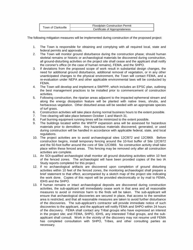
Town of Clarksville Floodplain Construction Permit Certificate of Appropriateness
The following mitigation measures will be implemented during construction of the proposed project:
1. The Town is responsible for obtaining and complying with all required local, state and federal permits and approvals.
2. The Town will monitor ground disturbance during the construction phase; should human skeletal remains or historic or archaeological materials be discovered during construction, all ground-disturbing activities on the project site shall cease and the applicant shall notify the coroner’s office (in the case of human remains), FEMA, and the SHPO.
3. If deviations from the proposed scope of work result in substantial design changes, the need for additional ground disturbance, additional removal of vegetation, or in any other unanticipated changes to the physical environment, the Town will contact FEMA, and a re-evaluation under NEPA and other applicable environmental laws will be conducted by FEMA.
4. The Town will develop and implement a SWPPP, which includes an EPSC plan, outlining the best management practices to be installed prior to commencement of construction activities.
5. Following construction, the riparian areas adjacent to the impacted ephemeral stream and along the energy dissipation feature will be planted with native trees, shrubs, and herbaceous vegetation. Other disturbed areas will be seeded with an appropriate species of turf grass.
6. Construction activities will take place during normal business hours to the extent possible. 7. Tree clearing will take place between October 1 and March 31. 8. Fuel burning equipment running times will be minimized to the extent possible. 9. The buildings located within the WWTP expansion area will be assessed for hazardous
materials prior to demolition. Any hazardous materials discovered, generated, or used during construction will be handled in accordance with applicable federal, state, and local regulations.
10. The project activities are to avoid archaeological sites 12Cl972 and 12Cl969. Before construction begins, install temporary fencing around the 10-foot buffer of Site 12CI972 and the 50-foot buffer around the core of Site 12CI969. No construction activity shall take place within these fenced areas. This fencing may be removed only after all construction activities are complete.
11. An SOI-qualified archaeologist shall monitor all ground disturbing activities within 10 feet of the fenced zones. The archaeologist will have been provided copies of the two IA Study reports completed for this project.
12. If no archaeological artifacts are discovered upon completion of ground disturbing activities within 10 feet of the fenced zones, the monitoring archaeologist shall prepare a brief statement to that effect, accompanied by a sketch map of the project site indicating the work done. Copies of this report will be provided electronically or by mail to FEMA, IDHS and the SHPO.
13. If human remains or intact archaeological deposits are discovered during construction activities, the sub-applicant will immediately cease work in that area and all reasonable measures to avoid or minimize harm to the finds will be taken. The sub-applicant will ensure that archaeological discoveries are secured in place, that access to the sensitive area is restricted, and that all reasonable measures are taken to avoid further disturbance of the discoveries. The sub-applicant’s contractor will provide immediate notice of such discoveries to the applicant, and the applicant will notify FEMA and SHPO within 24 hours of the discovery. FEMA shall contact any Tribal groups who have expressed an interest in the project site; and FEMA, SHPO, IDHS, any interested Tribal groups, and the sub-applicant shall consult. Work in the vicinity of the discovery may not resume until FEMA has completed consultation with SHPO, Tribes, and other consulting parties as necessary.

14. A formal deed instruction or covenant shall be instituted to protect Site 12CI969 from future long-term indirect and/or cumulative impacts.

7.0 CONSULTATIONS AND REFERENCES Glenn E. Griffith, James M. Omernik (Lead Author);Mark McGinley (Topic Editor) "Ecoregions of
the United States-Level IV (EPA)". In: Encyclopedia of Earth. Eds. Cutler J. Cleveland (Washington, D.C.: Environmental Information Coalition, National Council for Science and the Environment). [First published in the Encyclopedia of Earth October 17, 2008; Last revised Date October 17, 2008; Retrieved July 10, 2012 <http://www.eoearth.org/article/Ecoregions_of_the_United_States-Level_IV_(EPA)>
U.S. Census Bureau (USCB). “State and County Quick Facts.”
http://quickfacts.censu.gov/qfd/index.htm. Accessed August 1, 2012. U.S. Department of Agriculture – Natural Resources Conservation Service (NRCS). “Suitabilities
and Limitations for Use: Farmland Classifications.” Web Soil Survey. http://websoilsurvey.nrcs.usda.gov/app/websoilsurvey.aspx. Accessed August 1, 2012.
U.S. Environmental Protection Agency (USEPA). “The Green Book Nonattainment Areas for
Criteria Pollutants.” http://www.epa.gov/oaqps001/greenbk/. Accessed July 10, 2012. U. S. Geological Survey – Earthquake Hazards Program (USGS). “Central/Eastern U.S. 2% in 50
Years.” Map. 2008 U.S. Geological Survey National Seismic Hazard Maps. http://earthquake.usgs.gov/hazards/products/contreinous/2008/maps/ Accessed August 1, 2012.
8.0 LIST OF PREPARERS Bradley M. Anderson, P.E., Senior Engineer, Redwing Ecological Services, Inc. Richard S. Clausen, Principal, Redwing Ecological Services, Inc. Brittany Montgomery, CFM, Project Coordinator, Town of Clarksville Indiana Brandon Bratcher, Environmental Protection Specialist, FEMA – Region V Nicholas Mueller, Acting Regional Environmental Officer, FEMA – Region V