Embed Size (px)
Citation preview
Delaware Department of Transportation
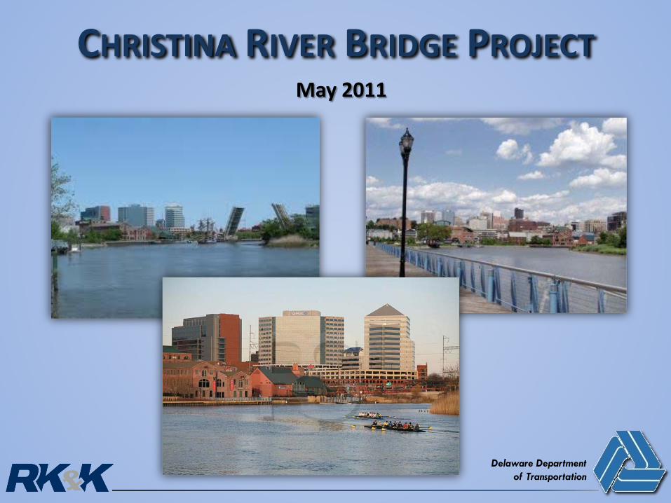
CHRISTINA RIVER BRIDGE PROJECTMay 2011

Project History
Purpose and Need
Livability Principles
Existing Conditions/Resources
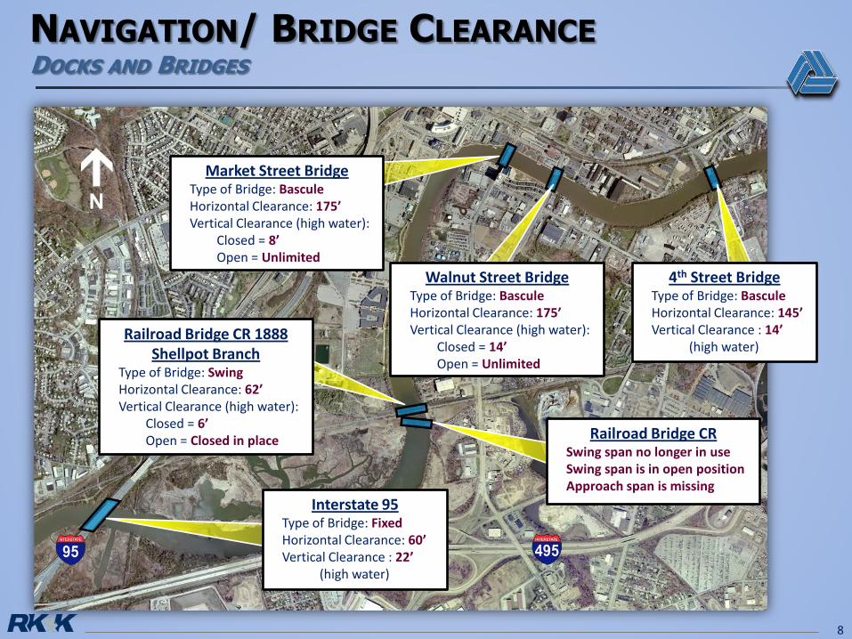
Navigation/Bridge Clearance
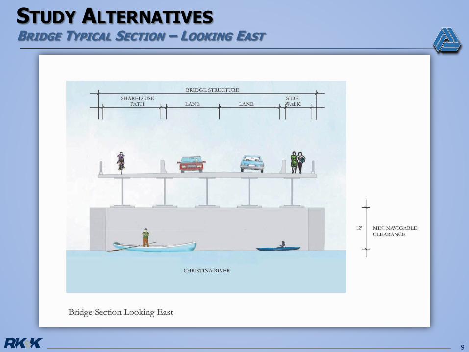
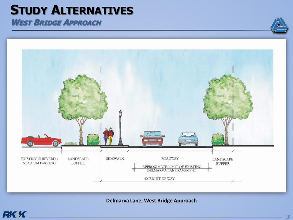
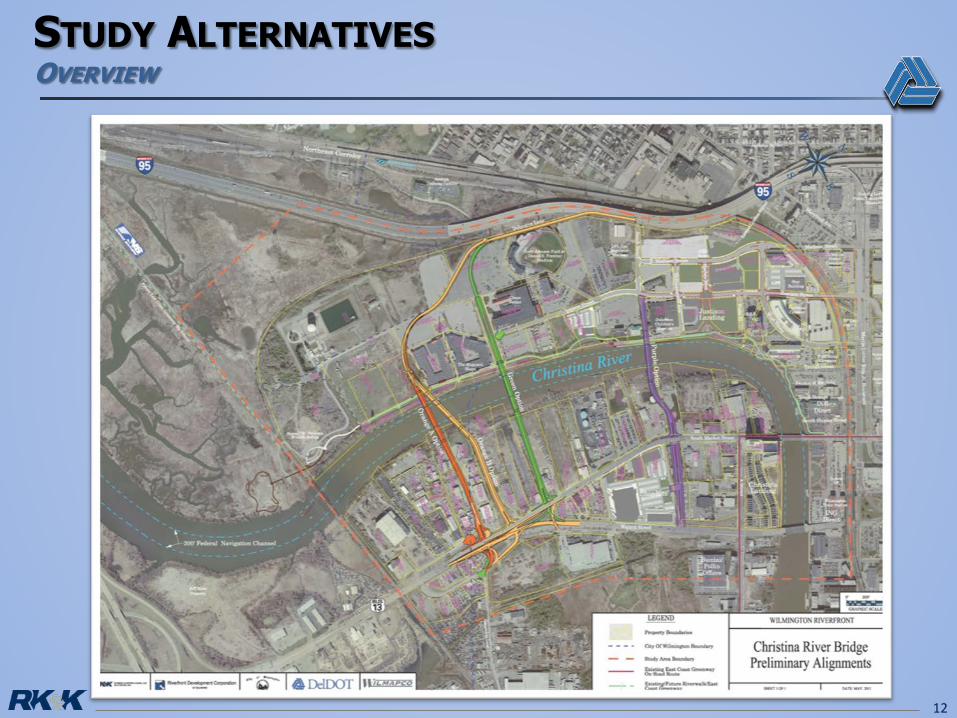
Study Alternatives
Recommended Alternative
Draft Schedule
2
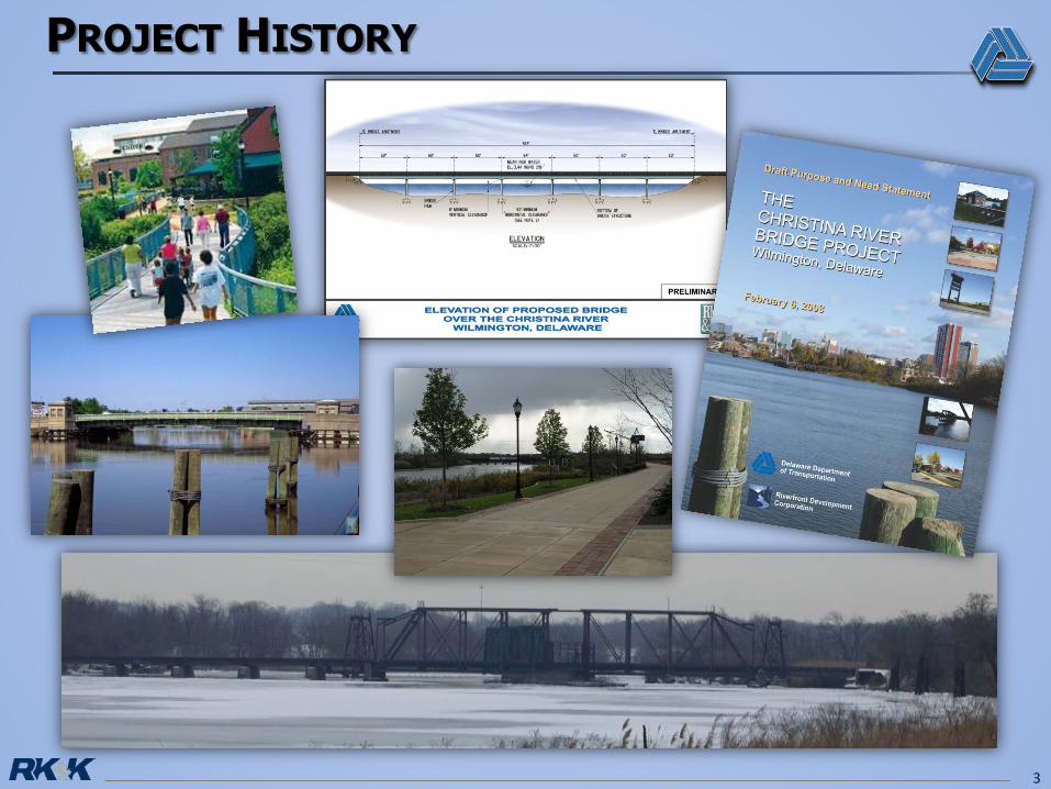
3
To ensure that infrastructure enables the WilmingtonRiverfront area to continue to effectively redevelop, whileaccommodating growing transportation demands fromincreased development.
4
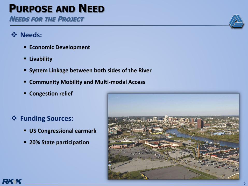
Needs: Economic Development
Livability
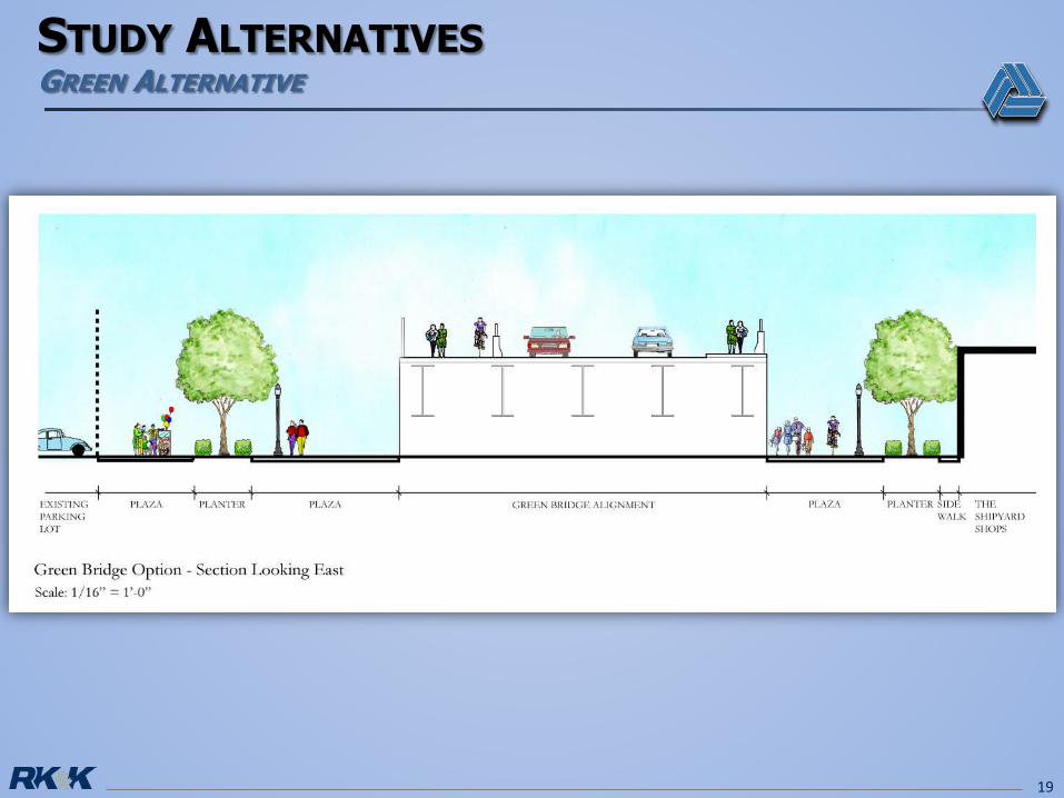
System Linkage between both sides of the River
Community Mobility and Multi-modal Access
Congestion relief
Funding Sources: US Congressional earmark
20% State participation
5
6
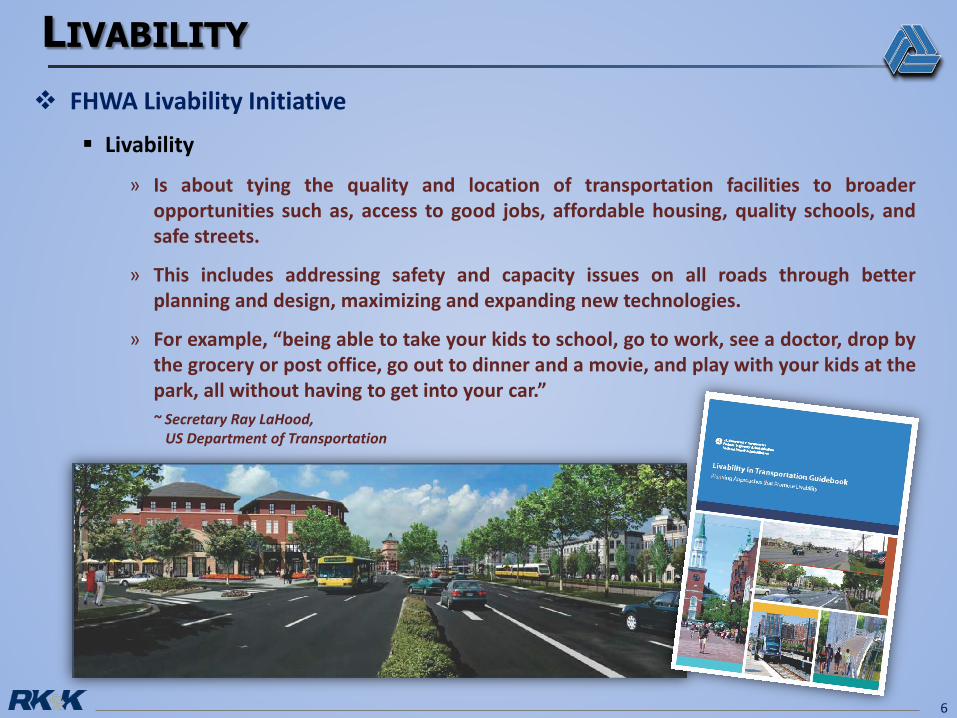
FHWA Livability Initiative
Livability
» Is about tying the quality and location of transportation facilities to broaderopportunities such as, access to good jobs, affordable housing, quality schools, andsafe streets.
» This includes addressing safety and capacity issues on all roads through betterplanning and design, maximizing and expanding new technologies.
» For example, “being able to take your kids to school, go to work, see a doctor, drop bythe grocery or post office, go out to dinner and a movie, and play with your kids at thepark, all without having to get into your car.”~ Secretary Ray LaHood,
US Department of Transportation
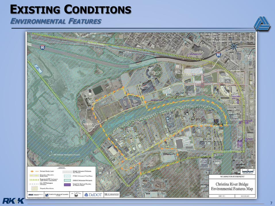
7
8
Market Street BridgeType of Bridge: BasculeHorizontal Clearance: 175’Vertical Clearance (high water):
Closed = 8’Open = Unlimited
Walnut Street BridgeType of Bridge: BasculeHorizontal Clearance: 175’Vertical Clearance (high water):
Closed = 14’Open = Unlimited
4th Street BridgeType of Bridge: BasculeHorizontal Clearance: 145’Vertical Clearance : 14’
(high water)
Railroad Bridge CRSwing span no longer in useSwing span is in open positionApproach span is missing
Railroad Bridge CR 1888Shellpot Branch
Type of Bridge: SwingHorizontal Clearance: 62’Vertical Clearance (high water):
Closed = 6’Open = Closed in place
Interstate 95Type of Bridge: FixedHorizontal Clearance: 60’Vertical Clearance : 22’
(high water)
9
10
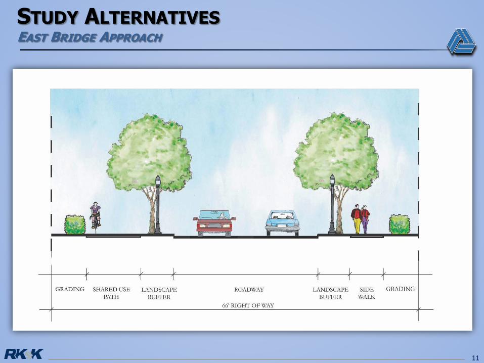
Delmarva Lane, West Bridge Approach
11
12
13
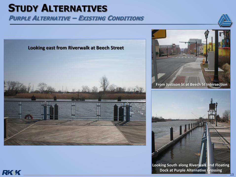
Looking east from Riverwalk at Beech Street
Looking South along Riverwalk and Floating Dock at Purple Alternative Crossing
From Justison St at Beech St Intersection
14
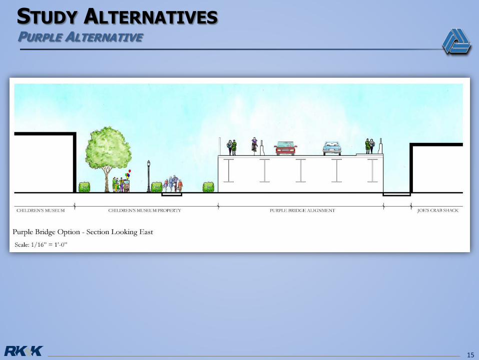
15
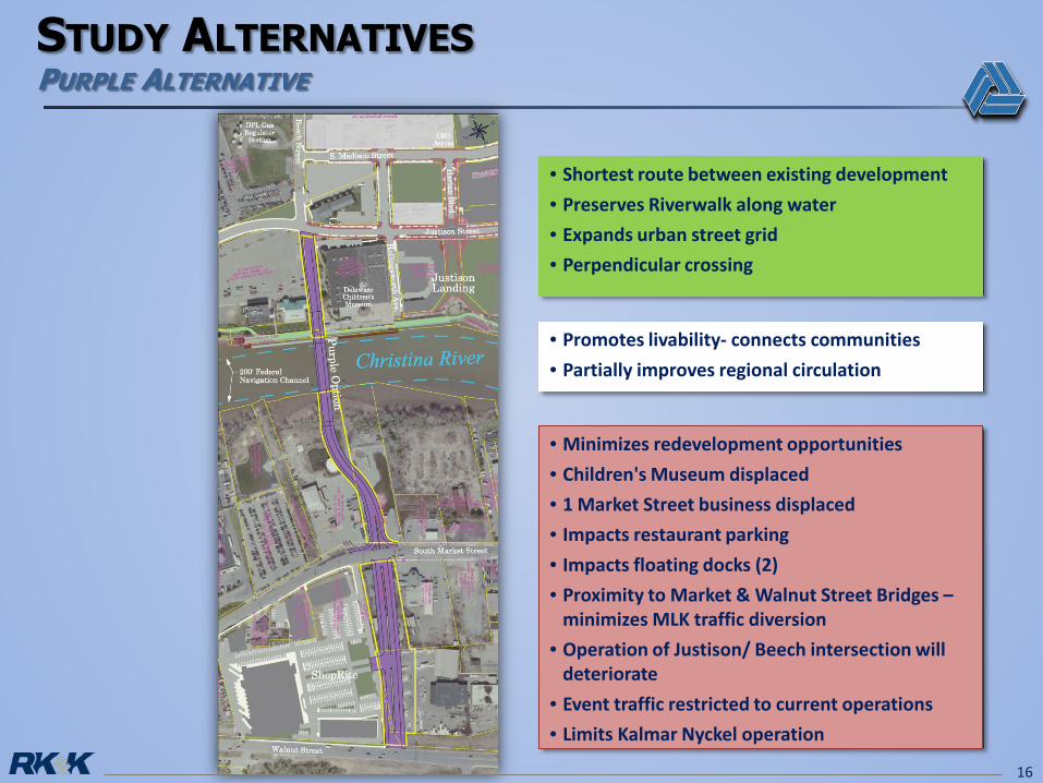
16
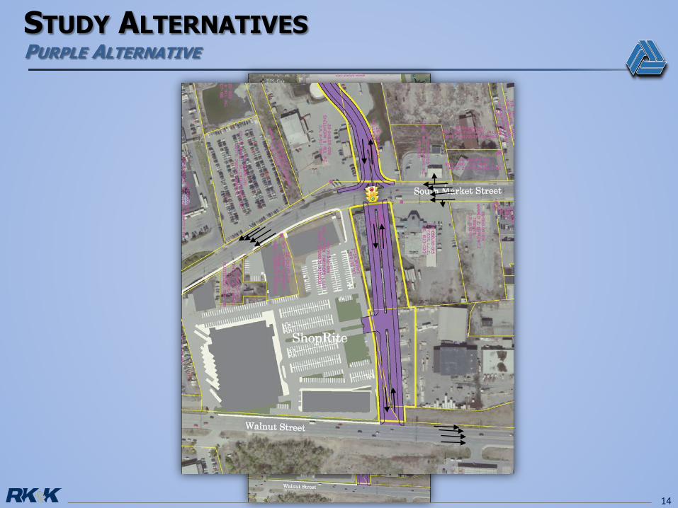
• Shortest route between existing development • Preserves Riverwalk along water• Expands urban street grid• Perpendicular crossing
• Promotes livability- connects communities• Partially improves regional circulation
• Minimizes redevelopment opportunities• Children's Museum displaced• 1 Market Street business displaced• Impacts restaurant parking• Impacts floating docks (2)• Proximity to Market & Walnut Street Bridges –
minimizes MLK traffic diversion• Operation of Justison/ Beech intersection will
deteriorate• Event traffic restricted to current operations• Limits Kalmar Nyckel operation
17
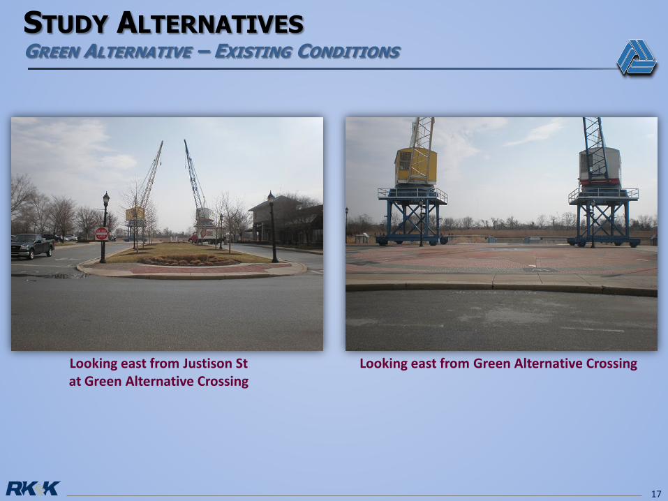
Looking east from Green Alternative CrossingLooking east from Justison St at Green Alternative Crossing
18
19
20
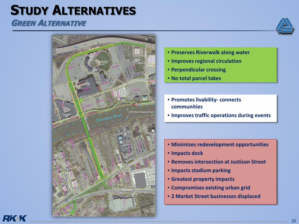
• Preserves Riverwalk along water• Improves regional circulation• Perpendicular crossing• No total parcel takes
• Promotes livability- connectscommunities
• Improves traffic operations during events
• Minimizes redevelopment opportunities• Impacts dock• Removes intersection at Justison Street• Impacts stadium parking• Greatest property impacts• Compromises existing urban grid• 2 Market Street businesses displaced
21
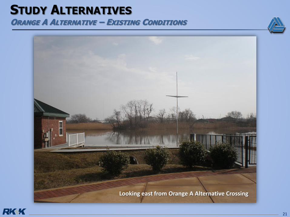
Looking east from Orange A Alternative Crossing
22
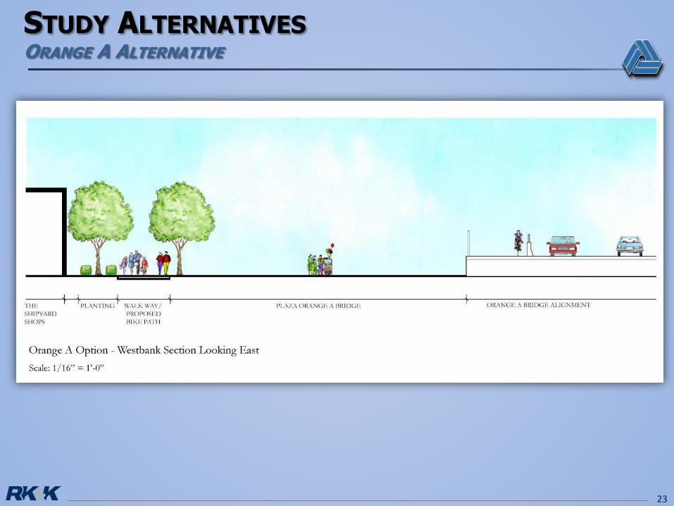
23
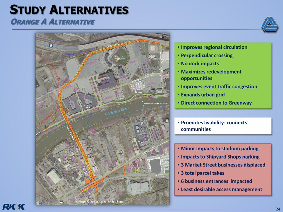
24
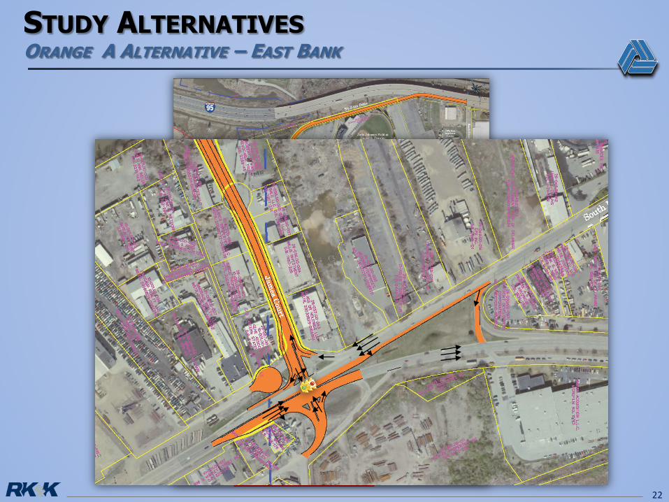
• Improves regional circulation• Perpendicular crossing• No dock impacts• Maximizes redevelopment
opportunities• Improves event traffic congestion• Expands urban grid• Direct connection to Greenway
• Promotes livability- connectscommunities
• Minor impacts to stadium parking• Impacts to Shipyard Shops parking• 3 Market Street businesses displaced• 3 total parcel takes• 6 business entrances impacted• Least desirable access management
25
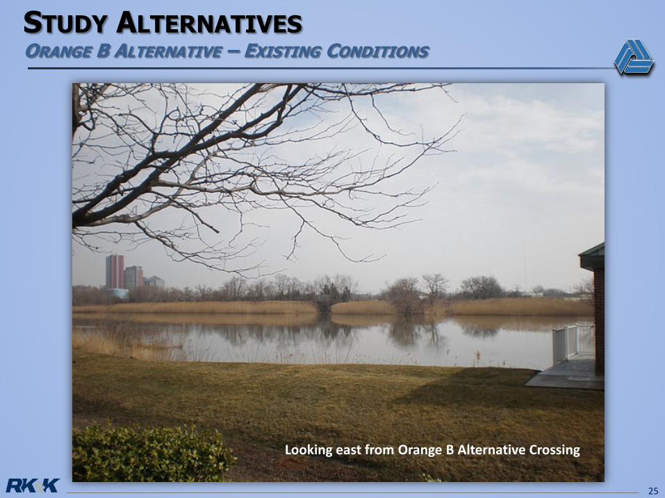
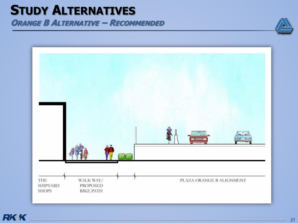
Looking east from Orange B Alternative Crossing
26
27
28
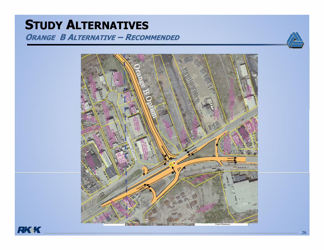
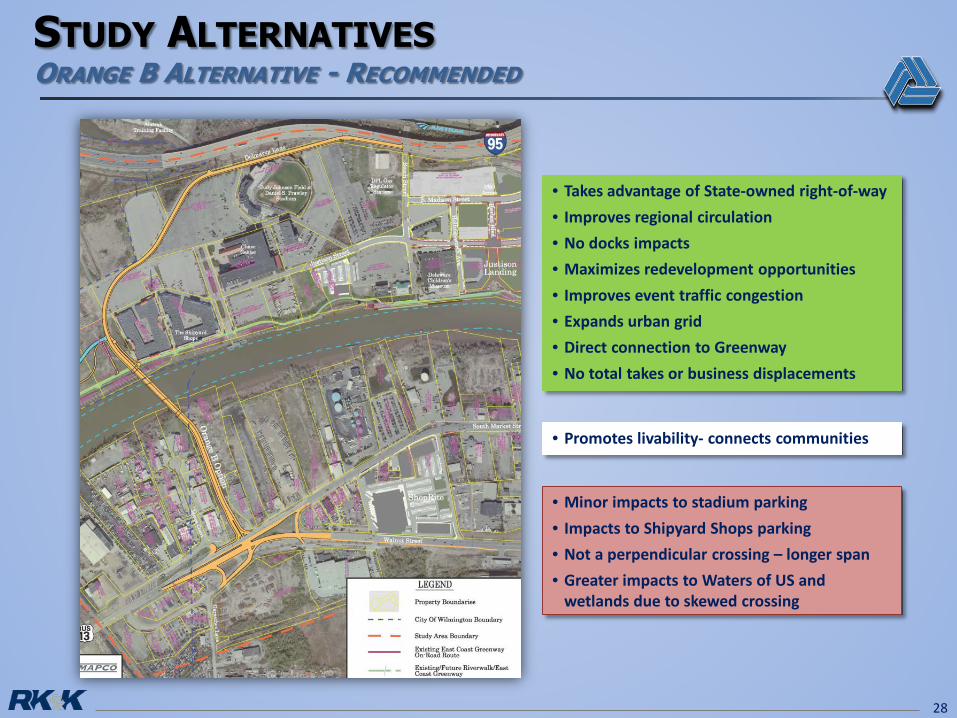
• Promotes livability- connects communities
• Takes advantage of State-owned right-of-way • Improves regional circulation• No docks impacts• Maximizes redevelopment opportunities• Improves event traffic congestion• Expands urban grid• Direct connection to Greenway• No total takes or business displacements
• Minor impacts to stadium parking• Impacts to Shipyard Shops parking• Not a perpendicular crossing – longer span• Greater impacts to Waters of US and
wetlands due to skewed crossing
29
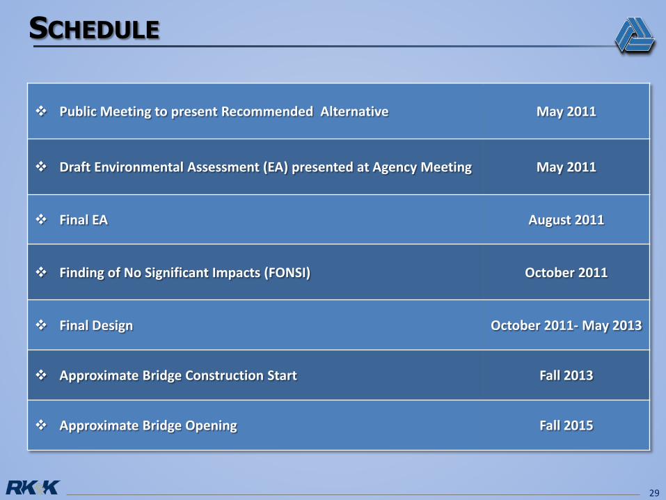
Public Meeting to present Recommended Alternative May 2011
Draft Environmental Assessment (EA) presented at Agency Meeting May 2011
Final EA August 2011
Finding of No Significant Impacts (FONSI) October 2011
Final Design October 2011- May 2013
Approximate Bridge Construction Start Fall 2013
Approximate Bridge Opening Fall 2015