Embed Size (px)
Citation preview

Territory of American Samoa Multi-Hazard Mitigation Plan230
CHAPTER V Capability Assessment

April 2015 231
The purpose of conducting the capability assessment is to identify the strengths and weaknesses of the Territory in terms of mitigating risks. The capability assessment serves as a critical component to designing an effective hazard mitigation strategy. It not only helps establish the goals and objectives for the Territory of American Samoa Multi-Hazard Mitigation Plan but it ensures that those goals and objectives are realistically achievable under given local conditions.
The capability assessment looks at government departments, agencies, offices and authorities as well as several private organizations that are directly involved in hazard mitigation. With the isolation of American Samoa, its dependency on outside resources, and its repeated history and experience with natural disasters, many systems are in place to create a resilient island community, including community and hazard mitigation planning and implementation. Through this plan and support for hazard mitigation projects since 1988, American Samoa has mitigated threats to life and property and has built government capabilities and capacities.
This chapter is organized by how the American Samoa Government categorizes its offices, agencies, authorities and departments. Each of these offices is represented on the Hazard Mitigation Council. The description of each office includes its mission and its disaster management capabilities.
The Lieutenant Governor serves as the Governor’s Authorized Representative (GAR) and heads the American Samoa Hazard Mitigation Council, which meets and has authorities according to formal by-laws. These by-laws are included in Appendix C: Planning Process Supporting Materials.
Historic Preservation Office (ASHPO)The Historic Preservation Office was “established in response to the National Historic Preservation Act of 1966, the American Samoa Historic Preservation Office (ASHPO) identifies, evaluates, registers, interprets and protects American Samoa’s historic and cultural properties, from star mounds to shipwrecked vessels. The ASHPO provides communities and preservation organizations with a variety of services, and maintains an inventory of historic properties. It also reviews nominations to the National Register of Historic Places and oversees sites on that register. Under Section 106 of the National Historic Preservation Act, the ASHPO reviews all Federal undertakings for impacts on historic properties.” 1
The mission statement for ASHPO is “it is the responsibility of the American Samoa Historic Preservation Officer to administer the Territorial Historic Preservation Program. American Samoa’s strong indigenous culture and traditional system of communal land ownership impose special conditions of cultural sensitivity upon such an endeavor. A primary concern of the ASHPO is to fulfill its responsibilities in a manner that recognizes and honors these inherent cultural conditions.”2
1 American Samoa Historic Preservation Office. (2014) Retrieved September 30, 2014 from http://ashpo.org2 Ibid.
American Samoa Government - Offices of the Governor

Territory of American Samoa Multi-Hazard Mitigation Plan232
ASHPO has multiple areas of responsibility. These include maintaining a list of historic properties, nominating these properties to the National Register of Historic Places, assisting other American Samoa Government agencies with carrying out their historic preservation responsibilities, they make sure historic properties are considered during all levels of planning and development and finally they provide public education and training
regarding historic preservation. 3
ASHPO is a member of the Territorial Hazard Mitigation Council. Mr. Steve Maga contacted David J. Herdrich, Director/Historic Preservation Officer regarding access to a list of historical WWII installations and other cultural artifacts in the Territory. ASHPO is in the process of putting this list together and it may be included in the update to this plan. Figure 1 shows one of the WWII installations in American Samoa.
Office of Disaster Assistance and Petroleum Management (ODAPM) The Office of Disaster Assistance and Petroleum Management (ODAPM) was formerly known as the Territorial Office of Fiscal Reform (TOFR). According to an executive order dated September 8, 2014, TOFR has achieved its original goals and its responsibilities have shifted to warrant renaming of the agency.
The leaders of the Planning Team, Lima Fiatoa and Steve Maga work at ODAPM. Ms. Fiatoa has led the mitigation planning process since 2008. She also solicits and manages all mitigation grant-funding activities. The ODAPM staff managed all of the Hazard Mitigation Council Meetings and stakeholder meetings. ODAPM also manages updates to and applications of the Territorial Hazard Mitigation Plan.
ODAPM manages the Pre-Disaster Mitigation Grant Program, administered by the Federal Emergency Management Agency (FEMA) as well and the post-disaster Hazard Mitigation Grant Program. ODAPM remains the focal point for these two funding programs.
TOFR existence extended, renamed a mouthful4 9/11/14 By Fili [email protected]
In an executive order, dated Monday, Sept. 8, 2014, Gov. Lolo Matalasi Moliga extended the existence of the Territorial Office of Fiscal Reform (TOFR) and renamed it the Office of Disaster Assistance and Petroleum Management (ODAPM).
Extending the existence of TOFR comes amid concerns by lawmakers, who threatened not to act on TOFR’s budget for fiscal year 2015 until there was an official written document from the administration showing the legal existence of this office.
3 American Samoa Historic Preservation Office. (2014). Retrieved September 30, 2014 from http://ashpo.org4 Sagapolutele, Fili. (2014). Samoa News; 9-10-2014. Retrieved September 30, 2014 from http://www.samoanews.com/con-
tent/en/tofr-existence-extended-renamed-mouthful
Figure 1 WWII Installation

April 2015 233
It was learned during the current budget hearings that the executive order which last extended TOFR’s existence expired in 2011.
In his letter to the Fono, which included the new executive order, the governor said with “regards to your request during the TOFR budget hearing that brought to light the necessary and overdue” amendments outlined in the new executive order regarding TOFR.
In the executive order’s preamble, Lolo said responsibilities of TOFR have evolved significantly from its original focus on fiscal reform, general fund debt management, financial reviews and audits, along with administering the tobacco settlement loan.
Most, if not all, of the initial objectives and functions of TOFR since its inception in the year 2000 have either been fulfilled or transferred to ASG Treasury Department. Further, TOFR’s current functions and responsibilities include among other things, management of the American Samoa Disaster Recovery Office (ASDRO), administration of FEMA grants, FAA airport improvement, and the remaining American Recovery and Reinvestment Act.
Therefore, Lolo says it’s necessary and appropriate to extend the existence of this office, to change its name and update its functions, responsibilities, and authority to reflect its current duties and services to ASG and the people of American Samoa.
He said TOFR is changed to ODAPM, and any and all legal rights, property, entitlements and obligations previously held by and under the name TOFR shall be retained, accepted and honored by ODAPM. Additionally all services and functions being provided by ODAPM — formerly TOFR — will continue without interruption and all ASG departments and vendors, and private entities are asked to assist in making this transition as seamless and as smooth as possible.
Functions and Responsibilities •ASGFEMApublicassistanceandhazardmitigation—AssistASGandthecommunity
in the recruitment, administration and implementation of FEMA Public Assistance and Hazard Mitigation, FAA Airport improvement funds, American Recovery and Reinvestment Act and other special programs and projects.
•ASGDisasterPropertyInsuranceProgram—administerandmanageincooperationwith the ASG Property Insurance Committee of Treasury, Procurement, ASTCA, LBJ hospital and ASCC the solicitation and maintenance of qualified, cost-effective property insurance for insuring ASG fixed assets, structures and contents funded and required by FEMA.
•OfficeofPetroleumManagement—administerandmanage,incooperationwiththeAmerican Samoa Petroleum Cooperative, the ASG fuel storage and distribution facility including the Fuel Dock, Tank Farm in Gataivai and the Tafuna Airport fuel depot to ensure American Samoa maintains an adequate and reliable supply of uniformly high quality petroleum products at reasonable and competitive prices.

Territory of American Samoa Multi-Hazard Mitigation Plan234
Budget and Personnel According to the governor, ODAPM shall maintain and retain its current fiscal year 2014 budget and FY 2015 budget, including any and all accounts and personnel as established and submitted under TOFR.
ODAPM is to also remain as part of the Governor’s Office and be managed by an executive director, who reports directly to the governor. Its current executive director is Alfonso Pete Galeai, who has been at the helm of TOFR since last year.
American Samoa Department of Disaster Recovery (ASDRO)The ASDRO executive order has expired. It was established by way of Executive Order No. 10-1997, an order to amend Executive Order No. 09-95; the American Samoa Disaster Recovery Office (ASDRO) was established as an agency of the Executive Branch of the American Samoa Government (ASG). The Office was managed under the direction of the Governor’s Authorized Representative (GAR) or otherwise directed by the Governor to carry out functions pertaining to response and recovery programs.
The Hazard Mitigation Council, the Office of Disaster Assistance and Petroleum Management (ODAPM) and the Department of Homeland Security are now responsible for administering the funds and facilitating the implementation of the mitigation projects.
American Samoa Environmental Protection Agency (ASEPA)The mission of ASEPA is to “provide regulatory services to promote clean air, safe and clean drinking water and land free of pollutants in order to protect the environment and safeguard the quality of natural resources upon which life on our islands depends.”5
“The ASEPA is one hundred percent funded by the U.S. EPA Region 9 through a EPA Consolidated Environmental Program Grant awarded on a fiscal year budget period. At present, the Consolidated Grant consists of the following categorical grant funding: Clean Water Act (CWA), Safe Drinking Water Act (SDWA), Resource Conservation and Recovery Act (RCRA), Clean Air Act (CAA), Federal Fungicide, Insecticide and Rodenticide Act (FFIRA), and the Beach Grant Act.”6
The ASEPA building (shown in Figure 2) was awarded the LEED Platinum Green Building Certification.7 The LEED rating system, developed by the U.S. Green Building Council (USGBC), is the foremost program for buildings, homes and communities that are designed, constructed, maintained and operated for improved environmental and human health performance. ASEPA’s building is the first LEED-certified building in the South Pacific and only the second LEED-certified Platinum project in a U.S. Territory.
5 American Samoa Environmental Protection Agency. (2014). Retrieved September 30, 2014 from http://www.epa.as.gov/about-asepa
6 Ibid.7 American Samoa Environmental Protection Agency. (2014) Retrieved September 30, 2014 from http://www.epa.as.gov/
leed-platinum-certified-green-building
American Samoa Government -Executive Branch, Agencies

April 2015 235
ASEPA programs related to emergency management, health, and safety are shown in the list below:
• AS-EPALaboratory• Piggeries• Waterquality• Drinkingwater• ClimateChange• LandUsePermitting• HazardousMaterials
The Water Quality Branch actively monitors surface runoff and contamination of streams and coastal beaches. The Drinking Water Branch seeks to protect the groundwater in American Samoa. The Climate Change Branch looks at sea level rise and other impacts to fresh water and the Territory’s ecosystem. ASEPA holds a seat on the Project Notification and Review System (PNRS) Board. ASEPA’s role here is to review potential building projects in terms of their impact to the environment. The Hazardous Materials Board regulates the importation, storage and disposal of hazardous materials in the Territory.
ASEPA is an active member in the mitigation planning process through the PNRS and the Hazard Mitigation Council. The Planning Team met with ASEPA representatives in April and June 2014. Additionally, ASEPA has in-house expertise and services to place additional emphasis and active participation in understanding and mitigating the ubiquitous landslide hazard throughout American Samoa due to its steep terrain. ASEPA is actively reviewing new LIDAR coverage for the entire island, available to map in detail the landslide areas that need mitigation. Some landslides are natural and some are created when the toe of stable landslides is cut to build houses and businesses.
ASEPA is working on a sustainable drinking water system. ASEPA manages an omnibus grant from EPA for water, wastewater, and energy, as well as water quality, clean drinking water grants and engineering to make drinking water more manageable.
ASEPA is a working member on the Governor’s Renewable Energy Committee. ASEPA’s goal is 100% sustainable energy for outer islands, and they are working with Stanford University and University of Hawaii geoscientists on ground water issues. Renewable energy will bring sustainability to these outer islands.
ASEPA has identified multiple areas that if improved would reduce the impact of hazards to the Territory of American Samoa. ASEPA is developing a new geological base map for the Territory since the previous map was developed in the 1940’s. Below is a list of several other areas that need improvement, they all relate to landslides.
• Faga’aluQuarryLandslideHospitalMitigationProjectisproposeddue to its threat to the valley with hospital. There is a cut slope 150 feet long and 30-40 feet high – it is an unsupported slope with a major reservoir upstream. This is an identified significant risk for the watershed.
Figure 2 ASEPA building building
Figure 3 Alefa Afalava, Department of Homeland Security and Faamao Asalele, ASEPA on the green roof of the ASEPA building

Territory of American Samoa Multi-Hazard Mitigation Plan236
• Updateexistinglandslideriskmaps,whicharebasedon1970technology.NowLIDARisavailableand in hand for landslide mapping. The ASEPA is working with University of Hilo volcanologists and groundwater experts (Dr. Don Johnson, UH Hilo). One thousand eight hundred buildings are in the high-risk landslide zones as shown on new LIDAR data.
• TheAfonorockfall/landslidehasoccurredthreetimesoverthepastyearandisamajorhazard.• Lawsuitforthe“crystalburgerdeath”,2003flooding,severalbuildingsinvolved.Ahousewasbuiltina
landslide area and the house collapsed during a landslide resulting in the death of a child.• Upuntil2008,theUSGeologicalSurveymonitoredstreams.TherearenownoraingaugesonManua
islands and on Tutuila.• ThearticlebelowdiscussestheimpactstoAmericanSamoaasrelatedtothesurfacewaterrunoffinthe
Tualauta plain that could be mitigated through the Tualauta Flood Control Hazard Mitigation Grant Project.
No relief for Tualauta; Boil Water Notice remains 8
ASPA responds to one resident’s idea for new reservoir4/23/14 By Joyetter [email protected]
“The original plan to manifold the Fagaima wells is no longer feasible, due to land issues, and the majority of the wells have now been classified by the Environmental Protection Agency as GUDI (Groundwater Under the Direct Influence) of surface water,” said Reno Vivao, ASPA’s Chief Operation Office.
Vivao was responding to concerns raised by Tualauta faipule Larry Sanitoa, who inquired on the status of ASPA & EPA’s plan to address the Boil Water notice still in affect in Tualauta county. Sanitoa pointed out that when the Fono was in session they were told that new wells will be drilled in the Tafuna and Iliili areas. He also pointed out a suggestion by Tualauta resident, Lawrence French, who has advocated for years that in the bush area between Kokoland and the main highway, ASG should purchase about six acres of land.
In an e-mail sent to Sanitoa, French explained, “you dig a hole about 30+ feet deep and make a lined reservoir. All of the water coming from the two major streams by the ASCC would be diverted to that reservoir. The water would be filtered and treated and pumped into the mains as needed.”
“The reservoir of that size would hold 24.5 Million gallons. You could make it another 10 deep and have a 30 million gallon water reservoir. You would get about 100,000 cu yd of stone to make highways with. That equates to about the amount of aggregate for 15+ miles of road.” In a response letter to both French and Sanitoa, Vivao said the reservoir proposal is a good alternative but it would be costly, and the land issues would most likely be an uphill battle.
8 Feagaimaalii-Luamanu, Joyetter. (2014). Samoa News; 4-23-2014. Retrieved September 30, 2014 from http://www.samo-anews.com/content/en/no-relief-tualauta-boil-water-notice-remains#sthash.nEw8zwR7.dpuf

April 2015 237
“Such an undertaking will require the collective efforts of the land owners, all government agencies that will be involved and the community,” said Vivao. He further pointed out that ASPA’s current plan is to drill new wells in the Tafuna and Malaeloa areas to replace seven of the nine wells in Fagaima that have been tested to be GUDI wells.
“The new wells are estimated to produce about 1,000 gpm and production is estimated to be sufficient to replace 50% of the current production of the Fagaima GUDI wells. Other well sites have been identified and will be drilled as funding sources become available.
ASPA’s goal is to remove the Boil Water Notice in the next two years, he said, adding that ASPA has in place plans to drill new wells and set targets to reduce the water losses. Also, “ASPA will be re-commissioning the Fagatogo micro filtration plant,” he said, adding that ASPA has submitted the National Environment Policy Act (NEPA) application and funding request to the United States-Environmental Protection Agency (USEPA) to drill new wells in the area and are awaiting their approval. We are planning on drilling these new wells this year and completing connection of these new wells to the system in the next couple of years.”
Samoa News notes the Water Boil Notice has been in effect for several years now, and continues to be one of the hot button issues of many Tualauta residents, including the flooding that occurs whenever it rains in certain Tualauta areas.
ASPA did lift the boil water ban on parts of Tutuila from Pago Pago to Atu’u in August 2014.9 ASPA is drilling new groundwater wells, which should enable them to remove the Boil Water Notice (BWN) in the future. “Based on the yield from these new wells and the reduction in water losses, we will be able to remove the GUDI wells, which will result in the lifting of the BWN in these areas.” 10
Department of Port Authority (DOP)The Department of Port Authority (DOP) is represented on the Hazard Mitigation Committee. Their mission states, “in partnership with the port users Port shall provide excellent service to its customers and the community and in doing so raise the standard of living of the Territory to that of a developed country in a manner that protects our environment and maintains the best of our “Faa-samoa”. 11
The DOP actively participated in the hazard mitigation planning process by attending all meetings and assisting with the distribution of the public preparedness survey.
9 Feagaimaalii-Luamanu, Joyetter. (2014). Samoa News; 8-25-2014. Retrieved September 30, 2014 from http://www.samoanews.com/content/en/aspa-lifts-boil-water-notice-parts-eastern-district
10 Ibid.11 Port Administration. (2014). American Samoa Government. Retrieved September 30, 2014 from http://americansa-
moa.gov/index.php/2012-04-25-19-44-32/2012-04-25-19-52-04/agencies/port-administration

Territory of American Samoa Multi-Hazard Mitigation Plan238
American Samoa Power Authority (ASPA)The American Samoa Power Authority is an “entity of the American Samoa Government, which since 1981 has provided quality, safe, economical and sustainable utility services to the residents of American Samoa.”12 According to the ASPA website they are a “development-oriented public utility providing electricity, water, wastewater and solid waste service to over 60,000 residents of American Samoa. We install, operate and maintain American Samoa’s public utility infrastructure and offer our customers the highest quality services at affordable rates.”13
“ASPA is both mandated by law and motivated by ideals of community service to operate as a viable and successful business entity of American Samoa Government. ASPA is directed by a five-member board of directors, and administered by a Chief Executive Officer. Members are nominated to the board by American Samoa’s Governor and confirmed by the Legislature of American Samoa Government.”14
ASPA’s Anemometer Project/Wind Study is working to determine wind resources available on Tutuila. They have twelve anemometers, wind vanes and data loggers on the island. This is one example of how ASPA is working toward sustainability in the Territory.
ASPA actively supports mitigation planning in American Samoa by participating on the Hazard Mitigation Council and collaborating with multiple organizations on projects related to undergrounding utilities. The mitigation planning team met with ASPA in April and June 2014. Since 2011 their mitigation capabilities have increased. ASPA has expanded their radio ability, they are developing a Green Operations Building for water and wastewater, their staff is more proactive at seeking funding and they are using solar energy. ASPA representatives mentioned that the canneries put a huge drain on the water system because they pull water directly from the main line. It would help to build a storage tank for them to pull water from so island residents are not impacted by poor water pressure. They mentioned four new mitigation projects:
1. Weatherproof Wastewater Lift Stations2. Water Tank Corrosion Repair3. Generators for Water Wells4. Undergrounding Power Lines
They also mentioned concern for the road up Mt. Alava because they maintain several transformers that at the top of the mountain.
12 American Samoa Power Authority. (2014). Retrieved September 30, 2014 from http://www.aspower.com13 Ibid.14 Ibid.
American Samoa Government - Executive Branch, Authorities

April 2015 239
American Samoa Telecommunication Authority (ASTCA)The U.S. Navy and the U.S. Department of Interior, originally built the local communications network in American Samoa.”15 The American Samoa Government gave the responsibility of operations to ASTCA, when it inherited this network.16 “Because of American Samoa’s remote location, limited economy, and small population base, tier one-telephone companies have not been interested in providing local telecommunication services or originating long distance services in the Territory to date. To date, ASTCA remains the only telecommunications service provider with service covering all the inhabited islands of American Samoa, including the islands of Tutuila and Aunu’u, and the islands of Manu’a.” 17
ASTCA has continued to actively participate in the mitigation planning process by working the Department of Public Works and ASPA to underground vulnerable main telephone communications lines along common roadways with electric lines. Over 50% of all communications lines are now underground, significantly lessoning damage during hurricanes and providing critical communications links for response and recovery.
When the Planning Team met with ASTCA in April 2014 they mentioned the need to re-dig some buried cables and put in conduits for fiber optic cable. However, there are multiple types of rock on the island and they are not well mapped or planned for by off-island contractors.
ASTCA buildings are built to withstand hurricane winds and earthquakes. They would like to further harden these buildings by adding shutters to windows. They maintain two generators at each facility and rotate them weekly. ASTCA actively participates in the Hazard Mitigation Council.
Department of Commerce (DOC)The mission of the Department of Commerce (DOC) is “to improve the quality of life for individuals and communities through economic development and sustainable resource management.”18 The Department of Commerce houses the American Samoa Coastal Management Program, Project Notification and Review System, National Marine Sanctuary of American Samoa and the Geographic Information System User Group. Each of these divisions plays a role in disaster mitigation. The Department of Commerce, with its planning role, grants role, GIS role, permit review role, and coastal zone management role is a key player in the mitigation planning process for American Samoa. The Department of Commerce actively participates in the Hazard Mitigation Council and contributed data and other resources to this plan.
American Samoa Coastal Management Program“The American Samoa Coastal Management Program (ASCMP) provides effective resource management for the protection, maintenance, enhancement, and restoration of natural and cultural resources for the Territory. Additionally, ASCMP is tasked with monitoring development within the framework of comprehensive land and resource use planning while simultaneously protecting the territory’s natural resources.” 19
15 American Samoa Telecommunications Authority. (2014). Retrieved September 30, 2014 from http://astca.net/about-us16 Ibid.17 Ibid.18 American Samoa Government Department of Commerce. (2014). Retrieved September 30, 2014 from http://doc.
as.gov19 American Samoa Government Department of Commerce. (2014). Retrieved September 30, 2014 from http://doc.
as.gov/resource-management/ascmp/
American Samoa Government - Executive Branch, Departments

Territory of American Samoa Multi-Hazard Mitigation Plan240
“ASCMP plays a central role in promoting development while safeguarding the Territory’s natural resources. ASCMP is engaged at an inter-agency and inter-governmental level. ASCMP also works closely with members of the private sector and community to build stewardship and awareness in the territory. ASCMP Sections include Project Notification and Review System, Wetlands, Ocean Resources Management and Geographic Information Systems/IT” 20
Tutuila Hazard Assessment Tool (T-HAT)The Tutuila Hazard Assessment Tool is part of the Department of Commerce, American Samoa Coastal Management Program. ASCMP personnel can display the T-HAT tool and procedures for applicants proposing an activity in an area. They can check vulnerability of land use after site inspections and guide development away from hazard prone areas.
Geographic Information System (GIS)The Geographic Information Systems (GIS) and IT branch of the Department of Commerce provides in-house technical support along with GIS data, maps, and expertise for the Department of Commerce and for other government agencies. They maintain Digital Orthoimagery (DOI) and Land Use and Marine web portals. Both provide essential data and mapping for government users.
The GIS Branch leads the American Samoa GIS (Geographic Information System) Users group. This group was “first convened in February of 2001 as an informal grassroots effort among both public and private entities that have an interest in GIS development in the territory. The primary tenet for the group’s formation was the establishment of a forum for disseminating GIS information for collaboration and funding and decreasing data duplication. The group recognized that in order to make GIS development sustainable in American Samoa, local institutional capacity would need to be strengthened through training and education in Geographic Information Science.” 21
“The American Samoa GIS Users Group has a memorandum of understanding among their member agencies. The member agencies are “mutually interested in cooperative activities aimed at the development of the American Samoa Spatial Data Infrastructure,” which includes provisions for a territorial GIS dataset, metadata creation, and projection/datum scheme.22
Member agencies include:• AmericanSamoaDepartmentofCommerce,• AmericanSamoaHistoricPreservationOffice,• AmericanSamoaCommunityCollege,• DepartmentofMarineandWildlifeResources,• AmericanSamoaPowerAuthority,• NationalParkofAmericanSamoa,• OregonStateUniversity–DaveyJonesLockerLab,• USDAForestService,ForestHealthProtection,• FagateleBayNationalMarineSanctuary,• AmericanSamoaDepartmentofPublicWorks,• AmericanSamoaTelecommunicationsAuthority,
20 American Samoa Government Department of Commerce. (2014). Retrieved September 30, 2014 from http://doc.as.gov/resource-management/ascmp/
21 American Samoa GIS Users Group Memorandum of Understanding22 Ibid.

April 2015 241
• AmericanSamoaEPA,andthe• DevelopmentBankofAmericanSamoa.
The Department of Commerce maintains additional plans and resources for the Territory. Including the Territorial General Plan and the Community Development Block Grant.
Territorial General Plan and the Territorial Planning CommissionThe Territorial Planning Commission “serves as an oversight body, on behalf of the Governor, to review and approve government plans in relation to the overall goals of the government. Plans cover agencies providing a comprehensive range of services and regulatory controls.”23
The Territorial Planning Commission was statutorily created for the purpose of establishing a public review body that authorizes the territorial general plan program for American Samoa. This Commission is responsible to promote the general welfare of the territory’s citizens and create an orderly, healthy, and viable economic and living environment.
The Territorial General Plan may be concerned particularly with industrial, commercial or agricultural development; with education, social services, housing, essential fire, water and electric utilities services, and with transportation, communications, recreation, conservation, and cultural services and with other relevant aspects of life in American Samoa.
The Territorial General Plan is an indicative policy agenda for the economic and social development of the Territory of American Samoa. The purpose of the plan is to promote a better quality of life for the Territory’s residents, protect the natural environment and preserve the Territory’s resources for the sustainable development of the islands.
Where master and comprehensive plans exist, e.g. the Port Master Plan of 1999, the Territorial General Plan endorses these plans and builds in policy to support their agenda and functions. In essence, the Territorial General Plan provides the overall policy agenda and serves as the umbrella under which future government development and functional or action plans will be formulated.
Goals of the Territorial General Plan• Createclearvisionofthefuture• Focusonissuesofprimaryconcern• Createcooperativecoordinatedsystemofdevelopment• Identifystrategicpath&bestuseoffunds• Createcapacitytoimplementprograms• Showhowgovernmentdirects/gaugesprogress
23 American Samoa Government Department of Commerce. (2014). Retrieved September 30, 2014 from http://doc.as.gov/planning_grants/

Territory of American Samoa Multi-Hazard Mitigation Plan242
Community Development Block GrantThe American Samoa Government (ASG) Community Development Block Grant (CDBG) is one of three Community Planning and Development (CPD) programs funded by the U.S. Department of Housing and Urban Development (HUD). While the Office of the Governor oversees all CPD programs, the Department of Commerce (DOC) administers CDBG. The CDBG was designed to merge eight categorical grant programs, authorized by the Housing and Community Act of 1974. Since its inception, CDBG funds awarded to American Samoa have produced life-changing developments for numerous families and have provided various upgrades within the island community.
The CDBG program supports American Samoa’s economic growth. Its primary principle is to develop feasible urban communities by creating employment opportunities, provide decent housing and form suitable living environments. In reaching the main purpose, projects must be eligible, cannot be a prohibited activity, and must meet a National Objective. Plans must adhere to federal and local laws and regulations.
Department of Homeland Security (DHS)The Department of Homeland Security authorities and legal references include:
• WorkwithagenciesoftheAmericanSamoaGovernmentandtheU.S.DepartmentofHomelandSecurityand other federal agencies, to prevent terrorist attacks within American Samoa, reduce the vulnerability of American Samoa to terrorism, and minimize the damage, and assist in the recovery, from terrorist attacks that do occur with American Samoa;
• ActastheSingleStateAgency(SSA)oftheAmericanSamoaGovernmentdesignatedtoprovidetheoverallcoordination and administration of efforts to be funded by the U.S. Department of Homeland Security;
• BetheleadagencyinalleffortsforthepreparationoftheTerritoryagainstnaturalorman-madedisasters,and shall coordinate with federal agencies to secure and receive federal assistance in order to prepare for, or to recover from natural or man-made disasters;
• DevelopaTerritorialHomelandSecurityOperationsPlan.Thisplanistoidentifysecurityandresponseweaknesses and prioritize specific homeland security projects and programs to address shortfalls and security lapses;
• Workwithfront-linefirstresponders,governmentagencies,privatesectorandlocalcommunitiesinAmerican Samoa to enhance security and the overall state of readiness in the territory;
• Identifyandnegotiatefederal,stateandcommunityresources(human,financial,equipment)fortheimplementation of homeland security projects and programs;
• Ensuretheappropriateexpenditureoffederalandlocalresourcesforthepurposesofhomelandsecurity,drug and human trafficking enforcement and prevention;
• Monitortheimplementationofhomelandsecurityprogramsandprojectsandreportingontheterritorialstate readiness to the Governor and the U.S. Department of Homeland Security;
• RecordandstoreallvitalrecordsandstatisticsoftheTerritoryofAmericanSamoatoassuretheirsafekeeping, accuracy and authenticity upon their proper issuance;
• Coordinate,consolidateandcollaboratetheeffortsofitscomponentagenciesintoacogentwholethatsupports the overall purposes of all-hazard preparedness, response, detection, deterrence, prevention and enforcement;
• CarryoutthosefunctionsandresponsibilitiesasstatedinSection26.0106,A.S.C.A.;• ExecutethedutiesandresponsibilitiesnecessarytofulfilltheAmericanSamoaGovernment’sobligations
and commitments to the: South Pacific Islands Criminal Intelligence Network (SPICIN), International Criminal Police Organization (INTERPOL), Federal Bureau of Investigation’s National Crime Information Center (FBI-NCIC), El Paso Intelligence Center (EPIC), National Law Enforcement Telecommunications

April 2015 243
System (NLETS), and other regional and international law enforcement programs;• Gatherintelligenceinformationregardingdrugtraffickingandelementsoforganizedcrimeandother
illegal or suspect activities in the Territory and share the same with other law enforcement agencies in the Territory;
• Coordinatetheflowofinformationbetweeninvolvedagenciesonmajorcriminalinvestigationsinvolving narcotics, white collar crime, and corruption in government operations; and
• Coordinateinformationcollectionandsharingondrugandhumantraffickingandwhitecollarcrimeswith federal, state, territorial and local law enforcement agencies which have similarly provided for the coordination of enhanced intelligence sharing, investigative efforts, training, and the increased competence and proficiency of law enforcement officers.24
Agencies under this department include:• OfficeofVitalStatistics,• TerritorialEmergencyManagementCoordinationOffice(TEMCO),• TerritorialOfficeofHomelandSecurity(TOHS),and• OfficeofTerritorialandInternationalCriminalIntelligenceandDrugEnforcement(OTICIDE).
The agencies shall keep their functions as they have been established by executive order, regulations, or existing law and shall be maintained as distinct entities within the department. For the purposes of this plan TEMCO and TOHS are covered in detail.
American Samoa DHS plays a crucial role in mitigation planning and implementation in American Samoa. Alefa Afalava, ASDHS, participated in multiple planning team meetings and the Director of ASDHS is an active participant on the Hazard Mitigation Council. The Planning Team met with ASDHS in April and June 2014. The priority of the Director is protection of the Territory. He mentioned the lack of customs and immigration regulation in Manu’a as well as the tremendous challenge of monitoring the ocean waters. He also expressed concern over the poor condition of the road up Mt. Alava. It is dangerous to travel however multiple government communication assets are on the top of the mountain. ASDHS does not maintain a list of critical facilities.
Territorial Emergency Management Coordinating Office (TEMCO) The Territorial Emergency Management Coordinating Office (TEMCO) operates under the general supervision of the Director of the American Samoa Department of Homeland Security (ASDHS). The Disaster Assistance Coordinator (TEMCO Manager) reports to the Director of ASDHS. TEMCO is created under the American Samoa Code Annotated (ASCA) Section 26.0106 as a coordinating agency. Their purpose is to coordinate assistance, resource management, and emergency response and recovery efforts.
TEMCO is responsible for the development and revision of territory wide disaster plans. It is also responsible for the development, coordination, and updating the Disaster Assistance Plan (DAP), currently known as the Territorial Emergency Operations Plan (TEOP) with the American Samoa Government agencies and private sector. The office is responsible for the primary Emergency Operations Center (EOC), which serves as the central communications and command center for reporting emergencies and coordinating Territorial response activities. The office also operates and mans the 24/7 Center; a territory emergency communication center staffed 24 hours each day. They also review the TEOP and make necessary revisions annually. 25
24 American Samoa Department of Homeland Security. (2014). Retrieved September 30, 2014 from http://asdhs.org/sample-page/
25 Ibid.

Territory of American Samoa Multi-Hazard Mitigation Plan244
TEMCO administers and implements all Emergency Management Programs: Hazard Mitigation, Preparedness and Prevention, Response, and Recovery programs. TEMCO also manages the Emergency Management Performance Grant (EMPG), National Tsunami Hazard Mitigation Programs (NTHMP), Hazardous Materials Emergency Preparedness Grant (HMEGP) Program, and Disaster Assistance programs. The Disaster Assistance programs include the Great American Samoa Shakeout, National Preparedness Month, and the National Cyber Security Month.
As stated in the Executive Order adopting the 2011 American Samoa Hazard Mitigation Plan, the Territory Hazard Mitigation Officer in collaboration with the Territorial Emergency Management Coordinating Office (TEMCO), through the approval of the American Samoa Territorial Hazard Mitigation Council, has been responsible for administering the funds and facilitating the implementation of the mitigation projects identified and supported by the Pre-Disaster Mitigation (PDM) Grant Program, (FMA), Repetitive Flood Claims (RFC), and Severe Repetitive Loss (SRL) as approved by FEMA.
The Public Assistance programs are under Office of Disaster Assistance and Petroleum Management (ODAPM). They are responsible for disbursing hazard mitigation disaster funds.
Emergency Shelter GIS Data LayerTEMCO maintains the territorial emergency shelter layer of the GIS database. This will dovetail with the PDM Shelter upgrade project to identify and record shelter parameters including roof wind ratings, accessibility, and power and water supply security and capacity. As TEMCO develops the in-house expertise required to manage the GIS database, other layers will be added to this maintenance task. The goal for TEMCO has been to become an active partner in the GIS users group and to help generate and manage critical spatial data for emergency management purposes.
Territorial Office of Homeland Security (TOHS)The Territorial Office of Homeland Security works to develop and update a Territorial Homeland Security Strategic Plan. The Plan states the goals, objectives and activities of projects and programs. The strategy is reviewed annually. This office is tasked with monitoring the progress of program and project management activities in accordance with the Territorial Homeland Security Strategy to gauge territorial-wide progress toward strategy implementation required for on-line reporting to the U.S. Department of Homeland Security (DHS) and Federal Emergency Management Agency (FEMA). 26
ASDHS is interested in competing for a Pre-disaster Mitigation project application to add hurricane shutters for ASDHS building, which is a critical facility. The project total is more than $100,000. The project facility is less than 10 years old. There are no shutter projects in American Samoa – this will be the first and represents a showcase project that needs to be seen by DOE for schools to strengthen them as shelters. ASDHS recommends that DOE should add shutters as part of construction specifications for new schools. Past costs include extensive manpower costs to board up TEMCO, ASDHS and EOC – three facilities, plus materials. The building has served in past during tsunami event as the Joint Field Office (JFO). Generators are in the parking lot.
26 American Samoa Department of Homeland Security. (2014). Retrieved September 30, 2014 from http://asdhs.org/pro-grams/grants-management/

April 2015 245
ASDHS is also interested in a project to make road repairs up Mt. Alava. The road up Mt. Alava is in disrepair making travel dangerous. Many government assets are on the top of the mountain. These include, radio towers that first responders rely upon, television facilities, and generators. Transformers on the mountaintop have not been secured. A cable system used to hoist things up the mountain is damaged and operations to the mountaintop have not been restored. Fixing the road presents a problem because the National Park Service wants to preserve the mountain as a natural resource and use the road as a hiking trail. A cable car could be built as a secondary option to the road. An engineer from Hawaii looked at the situation and recommends moving the generators to the bottom of the mountain, so they can be repaired without the long drive/hike up mountain. Road repair could be part of a Capital Improvement Program in five to ten years. A win-win is to fix the road and still have a hiking trail.
The ASDHS Director’s priority is protection, he lacks access to assist with border protection, and he wants an unmanned aircraft (UAD) to protect ocean water. Another issue is that there are no customs or immigration offices in Manu’a.
Emergency Alert SystemThe original Territory emergency alert system is a bell hanging from a tree, as shown in Figure 4. These can be seen in all of the villages and near many churches. The Territory has worked consistently to upgrade this system to more advanced warning systems, as shown in Figure 5.
The National Weather Service (NWS) has worked with TEMCO and DHS on all alert protocol and agency activation coordination. The NWS receives tsunami alerts from Pacific Tsunami Warning Center, Honolulu. There is an early alert system in place for the islands, including Manu’a, via NOAA Weather Radio (NWR).The NWS Office activates the NWR alarm for watches and warnings including tsunamis, hurricanes, flash flooding, etc. as well has a provision for Civil Emergency Messages such as Hazardous Spills. The NWS Office is operational 24/7. Alerts are also broadcast over the Emergency Alert System, which becomes activated via KKHJ radio station as the Local Primary Broadcast system. The NWR System has been funded by a DHS grant of $250,000. Four hundred NOAA radios have been purchased and distributed. The EAS system does weekly testing of the system as required by the FCC. The NWS is committed to maintaining the NWR system. The NWR program also includes observations, forecasts, and climate and outreach information such as hurricane preparedness activities. Radios are available for purchase in stores.
The alert system was successfully tested during the May 2007 Pacific Wave Tsunami Exercise. The EAS system did a second alert test with all the schools. Every school and every village mayor has an NWR. Although some of the Manu’a Islands do have a strong signal, not all villages do. The NWS has identified weak signals and is working to improve them. The signal is good on the North Shore of Tutuila in
Figure 4 Tsunami warning bell
Figure 5 Tsunami warning siren

Territory of American Samoa Multi-Hazard Mitigation Plan246
pockets. There is movement to put a tower on Mount Olotele at 1617 feet. Also, the NWS may put a repeater on Manu’a depending upon coverage from the Olotele site. This could happen in 2007 during the next several months.
This radio alert system is a low cost, practical alternative to a multimillion-dollar siren system, which would deteriorate from salt air. In addition, sirens indicate you should go to your radios and television for warnings anyway.
Department of Public Safety (DPS)The Department of Public Safety (DPS) has the responsibility to maintain law enforcement, fire and corrections on all levels in the Territory. Their mission is simply, “to serve and protect.”27 The Fire Department maintains four fire stations throughout Tutuila. They have sixty-four full-time firefighters who work on three shifts. They have 469 fire hydrants that are color-coded by pressure level. The department has three fire trucks so they only staff three of their fire stations. They respond to all disasters on island and are accompanied by DHS and Emergency Medical Services. They also actively participate in Shakeout drills and the Tsunami Ready program. They do outreach in each of the schools, which has helped to limit the number of kids playing with matches and causing fires. The majority of fires happen in the Western District due to the population density.
Hazardous materials on Tutuila present a problem to the Fire Department. Stockpiling propane tanks at “mom and pop” convenience stores presents a danger. These tanks should be stored away from buildings and in limited quantities.
They mentioned in the meeting with the Planning Team that the Federal Aviation Administration (FAA) has a fire suppression system at the airport. DPS does assist the FAA as needed but a formal Memorandum of Understanding (MOU) is not in place between the agencies.
The Planning Team met with the Fire Chief and Captain in April 2014 to discuss their capabilities. Limits of equipment and staff hinders their ability to respond quickly to all areas of Tutuila. An additional fire truck, and smaller agile fire trucks as well as a boat would help them respond faster and to more areas of the island. All roads and homes are not named or numbered which limits response time but the dispatchers are adept at guiding the fire department to the scene of an emergency. The Planning Team mentioned the possibility of developing a CERT team but American Samoans are not quick to join volunteer organizations like this.
Samoan AffairsThe Department of Local Government, Office of Samoan Affairs is dedicated to promoting peace and harmony within the Territory, and to ensure that the village council’s actions are not in conflict with the Laws of the Territory. Most importantly, we remain faithfully in preserving, promoting, and enhancing the Samoan Culture and language.28
27 American Samoa Department of Public Safety. (2014). Retrieved September 30, 2014 from http://americansamoa.gov/index.php/2012-04-25-19-44-32/2012-04-25-19-52-04/departments/public-safety
28 American Samoa Government Department of Samoan Affairs. (2014). Retrieved September 30, 2014 from http://ameri-cansamoa.gov/index.php/2012-04-25-19-44-32/2012-04-25-19-52-04/departments/samoan-affairs

April 2015 247
Samoan Affairs is a member of the Hazard Mitigation Council and involved in all aspects of hazard mitigation planning. They are often consulted regarding adherence to laws of the land and the Samoan way of life.
American Samoa National Park Service“American Samoa National Park opened in 1988 and is the only US National Park south of the equator. The National Park Service in American Samoa participated in the National Emergency Grant program and was one of the sites documented in the From Tsunami to Renewal project report and documentary video.”29
National Park of American Samoa Wildland Fire Management Plan30 The wildland fire management policies, of the National Park Service (NPS), support the NPS resource management goals. The overriding goals are to provide for firefighter and public safety and protection of natural and cultural resources, and protection of human developments from unwanted wildland fire and to perpetuate and conserve the cultural and natural resources of the NPS.
The Wildland Fire Management Plan program focuses on guiding the decision-making process where safety, social, political, and resource values are evaluated, and appropriate management response strategies are identified for wildland fires. The park has chosen a fire suppression only policy.
The Plan is organized to combine the latest scientific knowledge, including regional and local studies, with policy direction from the National Park Service, the Department of the Interior, the Federal Wildland and Prescribed Fire Management Policy and Program Review (USDI/USDA1995), and other Federal Government level wildland fire policies to accomplish resource and fire management goals and objectives. The intent of the plan is to provide direction for rare wildland fire events.
This Plan is in compliance with the requirements found in the National Environmental Policy Act (NEPA) and the National Historic Preservation Act (NHPA). These requirements ensure a prudent assessment and balance between a federal action and any potential effects of that action, leading to consensus between fire managers, agency resource specialists, and the public. Any constraints or limitations imposed on the fire management program are also included.
Pago Pago Bay Shoreside Development PlanAccording to the Department of Parks and Recreation Pago Pago Bay Shoreside Development Plan, the shoreline revetment between Niuloa Point and Faga’alu Park was completed by the end of 2003. This project is a required portion of the reconstruction of the main highway leading toward the center of Pago Pago harbor. The road has been improved and the revetment installed between Faga’alu village and Breaker’s Point. There is no other road construction contemplated for the main highway.
Faga’alu Park requires the installation of revetment along its shoreline to prevent further erosion. The possibility of funding the installation of revetment, which would cost several hundred thousand dollars, is possible.
29 National Emergency Grant American Samoa: From Tsunami to Renewal. (2014). Retrieved September 30, 2014 from http://americansamoarenewal.org/resources
30 National Park of American Samoa Wildland Fire Management Plan (2006).
Territory of American Samoa Multi-Hazard Mitigation Plan248
The June 2010 “NOAA American Samoa Tsunami-generated Marine Debris and Coral Damage Response Report” states in the executive summary, “the tsunami event pointed out areas for improvement in Federal response to future disaster events. It is important to comprehensively respond to and mitigate the impacts of disasters across inland, coastal, and in water environments.”
Department of Public Works (DPW)The primary mission of the Department of Public Works (DPW) is “to provide high quality construction engineering, design, construction management, construction, maintenance, renovation, and repair services for ASG infrastructure, equipment and facilities throughout the Territory. Within this framework, the DPW endeavors to employ environmentally sound, culturally sensitive, socially responsible and cost effective practices in all service areas, programs and projects. In carrying out this mission, the DPW maintains a high level of accountability through fiscal management and planning with emphasis on the development of American Samoa’s construction industry and improving construction capacity in the Territory. Employing the latest technology, management concepts, and training techniques, the Department offers reliable and effective civil engineering, architectural, construction, inspection and maintenance services that effectively extend the useful life of public assets and improves overall safety conditions for the general public.” 31
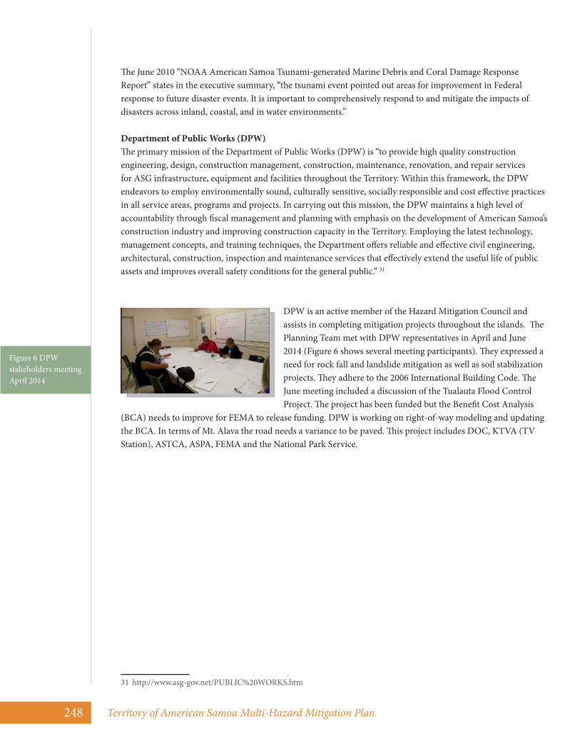
DPW is an active member of the Hazard Mitigation Council and assists in completing mitigation projects throughout the islands. The Planning Team met with DPW representatives in April and June 2014 (Figure 6 shows several meeting participants). They expressed a need for rock fall and landslide mitigation as well as soil stabilization projects. They adhere to the 2006 International Building Code. The June meeting included a discussion of the Tualauta Flood Control Project. The project has been funded but the Benefit Cost Analysis
(BCA) needs to improve for FEMA to release funding. DPW is working on right-of-way modeling and updating the BCA. In terms of Mt. Alava the road needs a variance to be paved. This project includes DOC, KTVA (TV Station), ASTCA, ASPA, FEMA and the National Park Service.
31 http://www.asg-gov.net/PUBLIC%20WORKS.htm
Figure 6 DPW stakeholders meeting April 2014

April 2015 249
National Oceanic and Atmospheric Administration (NOAA) programs provide for environmental management and mitigation programs that compliment the natural hazards mitigation programs, preserving habitats and the Samoan way of life. NOAA maintains several programs in American Samoa including the Coral Reef Information System, the Fagatele Bay National Marine Sanctuary, and the American Samoa Observatory.
The Coral Reef Information System has attributed high population growth to the extensive “coastal disruptions, fishing pressure, loss of wetlands, soil erosion and coastal sedimentation, solid and hazardous waste disposal, and pollution.32
Fagatele Bay National Marine Sanctuary (sanctuary) was established by NOAA in 1986, “to protect and preserve an example of a pristine tropical marine habitat and coral reef terrace ecosystem of exceptional biological productivity,”33 Sanctuary regulations clarify that NOAA has primary responsibility for sanctuary management, and that the American Samoa Economic and Development Planning Office (now known as the American Samoa Department of Commerce or AS DOC) will assist NOAA in the administration of the sanctuary.
“As a territorial partner and co-manager, AS DOC provides a local alliance and support services to address territorial processes and coordination. AS DOC greatly assists sanctuary staff with joint efforts in outreach, constituency building and cooperation in the territory. Through the partnership with AS DOC, sanctuary staff are also able to coordinate efforts to reach out to local communities through the American Samoa Government’s Office of Samoan Affairs, whose staff serve as liaisons between the territorial government and local residents. The local alliance with AS DOC is critical since the Office of Natural Marine Sanctuaries (ONMS) and Fagatele Bay sanctuary staff place a high value on partnerships with sanctuary communities and maintain great respect for fa’a-Samoa. Fa’a-Samoa, the traditional Samoan way of life, provides the cultural context for all sanctuary activities and functions. The foundation of Polynesia’s oldest culture, which dates back some 3,000 years, fa’a-Samoa places great importance on the dignity and achievements of the group rather than on individual achievements. Sanctuary staff must work in a culturally appropriate manner with local communities, who may serve as sanctuary stewards and whose communally-owned lands adjacent to the sanctuary are managed by local matais (chiefs).”34
“As managers of the natural resources at Fagatele Bay, there is little they can do in the face of natural disasters. The September 2009 tsunami that devastated much of the island’s shoreline is the latest example of nature’s power. However, the sanctuary’s role becomes vital in reducing human-caused impacts. Fagatele Bay is protected by regulations from destructive types of fishing including dynamite fishing and the traditional poison fishing (futu or ‘ava niukini).
32 American Samoa. (2014). NOAA CoRIS - Regional Portal - Coral Ecosystem Publications. Retrieved September 30, 2014 from http://www.coris.noaa.gov/portals/samoa.html
33 National Marine Sanctuary of American Samoa. (2014). Retrieved September 30, 2014 from http://americansamoa.noaa.gov/management/welcome.html
34 Ibid.
National Oceanic and Atmospheric Administration

Territory of American Samoa Multi-Hazard Mitigation Plan250
In addition, spearfishing and fixed nets are also prohibited, and all invertebrates-including the crown-of-thorns starfish-are protected. NOAA Office of Law Enforcement and local American Samoa Department of Marine and Wildlife Resources conservation officers share responsibility for enforcing the regulations at the sanctuary. Local landowners are also sanctuary enforcement partners -- they are our eyes and ears at the site. Sanctuary management will continue to blend marine education, research and enforcement into an effective management package that preserves the natural and cultural resources of this special place for the Samoan community, visitors and the American people.”35
The American Samoa Observatory (SMO)36 was established in 1974 on a 26.7-acre site. Since its construction, it has survived two major hurricanes, an earthquake, and a tsunami with only minor damage. A staff of three operates the facility year round. This observatory has the distinction of obtaining 30% of its daytime power from solar panels.
Blue Sky is a private telecommunications company in American Samoa. They compete with ASTCA for telephone and cable customers. Cell towers on the island provide local service and a submarine cable provides off island communication. American Samoa connected to the Internet in 2009 via an undersea cable that connects American Samoa to Hawaii. The fiber optic system allows for consistent service on the islands and an increase in capacity and speed. The submarine cable has been hardened and is supported by satellite back-up services. The LBJ Hospital relies on the cable. All of Blue Sky’s cable services are provided via aerial systems. They are interested in undergounding the cables that service banks and ATM machines.
The Blue Sky headquarters building has been hardened for earthquakes and high winds. It is located on the edge of the flood zone. They are working toward making their emergency plan National Incident Management System (NIMS) compliant.
The Planning Team met with Blue Sky representatives in April 2014. They demonstrated how proactive they are regarding mitigating risk to their facility so services are not interrupted to their customers.
The American Samoa Chamber of Commerce is an active member of the Hazard Mitigation Council. They represent multiple small businesses in the Territory. They also participate in the National Emergency Grant Program, From Tsunami to Renewal. The 2009 Tsunami eliminated one in eight jobs in American Samoa.37 The U.S. Department of Labor awarded American Samoa $25 million to support recovery including job growth.
35 National Marine Sanctuary of American Samoa. (2014). Retrieved September 30, 2014 from http://americansamoa.noaa.gov/management/welcome.html
36 American Samoa Observatory. (2014). NOAA Earth System Research Laboratory – Global Monitoring Division. Retrieved September 30, 2014 from http://www.esrl.noaa.gov/gmd/obop/smo/
37 From Tsunami to Renewal. (2012). National Emergency Grant American Samoa. Retrieved September 30, 2014 from http://americansamoarenewal.org/the_story
Blue Sky
American Samoa Chamber of Commerce

April 2015 251
The legal framework for regulating development in areas subject to natural hazards is Public Law 21-35, the American Samoa Coastal Management Act (ASCMP). This law ensures that development is restricted in areas subject to natural hazards. The American Samoa Coastal Management Program Administrative Code gives the Department of Commerce, the agency that now contains the Coastal Management Program, responsibility to restrict development in areas subject to flooding, storm surge, tsunamis, landslides, and coastal erosion in order to minimize losses from these disasters.
The American Samoa Coastal Management Act (26.0202) mandates the establishment of a system of environmental review known as the Project Notification and Review System (PNRS). The Act includes development standards, procedures for the designation, planning and management of Special Management Areas, procedures for environmental assessments, and procedures for determination of federal consistency. The land use management system provides a mechanism for regulating unsafe building practices. It also mitigates the risk of natural hazards by monitoring the location of construction and avoiding development in hazardous areas.
Rules establishing and regulating development in Special Management Areas are explicitly aimed at reducing the impact of the natural hazards described in Chapter 4. The rules define and delineate Special Management Areas as:
“…Areas which, if development were permitted, might be subject to significant hazard due to storms, landslides, floods, erosion, settlement (subsidence), or salt water intrusion…”38
The ASCMP Administrative Rules establish an explicit coastal hazards policy to restrict development in hazardous areas. The policy on coastal hazards and shoreline development mandates (1) protection of life and property, (2) denial of projects, uses, or activities in coastal hazardous areas, (3) compliance with the American Samoa Flood Plain Management Regulations. The shoreline development provisions of the regulations restrict development in a 200-foot shoreline setback. The regulations also provide legal backing for Village Mitigation Ordinances established through agreements between the American Samoa Coastal Management Program, eight villages on Tutuila, and one village in the Manu’a Islands.
A soil erosion policy in the Administrative rules explicitly targets restriction of development in areas subject to landslides. It permits projects, uses, or activities in areas with slopes of grades from 0-20%. It allows conditional use permits for development in areas with grades of 20-40% and mandates the denial of permits for projects, uses, or activities on slopes of greater than 40%.
38 Rizer, J. P., Michael P. Hamnett, and Caroline Sinavaiana. (2011). “Section 309 Assessment and Strategy for the Ameri-can Samoa Coastal Management Program.” Pacific Baisn Development Council. Retrived September 30, 2014 from http://coastalmanagement.noaa.gov/mystate/docs/as3092011.pdf
Development in Hazard Prone Areas

Territory of American Samoa Multi-Hazard Mitigation Plan252
Droughts are serious threats to the wellbeing of the people of American Samoa. Mitigation of the drought risk is addressed indirectly through general planning functions of the Department of Commerce conducted in conjunction with the Coastal Zone Management Act and the Project Notification and Review System. However, drought impacts are mitigated directly through the management of ground water resources by the American Samoa Power Authority; efforts to minimize agricultural losses by the Land Grant College extension program and the Department of Agriculture; and fire suppression efforts. Drought impacts are also mitigated through seasonal to inter-annual climate forecasts issued by the Pacific ENSO Application Center and the U.S. National Weather Service.
Project Notification and Review System 39
The American Samoa Land Use Permitting Portal “is a compilation of data relating to land use from the Department of Commerce (DOC), Environmental Protection Agency (ASEPA), and the American Samoa Power Authority (ASPA). Board members on the Project Notification and Review System (PNRS) provided all data for this portal to help with permitting. Users are encouraged to use this data to visually verify existing setbacks and hazard zones when looking into possible development locations by clicking on different data layers. This data should be used in conjuncture with the PNRS review process. This is the best available data, but it may not represent all recent changes. The development of the Land Use Permitting Portal was completed by the American Samoa Department of Commerce in partnership with the National Oceanic and Atmospheric Administration (NOAA) Pacific Services Center.”40
The Department of Commerce, under its statutory responsibility, is responsible for insuring that changes in the planning and land use management systems adopted as part of this plan are implemented. These changes should be coordinated through the Hazard Mitigation Council. The Project Review and Notification System will continue to serve as the primary means for insuring that future development does not increase the vulnerability of American Samoa to natural disasters.
PNRS is the primary land use management and regulation mechanism. It is coupled with other land use planning and permitting functions within the American Samoa Government. The PNRS is, however, the primary mechanism for mitigating the risk of natural hazards by controlling the location of new structures and avoiding development in the hazardous areas. It is also integrated with the administration of the building code and flood plain management regulations.
The PNRS Board meets twice a month and reviews major projects. The PNRS Board conducts site visits to these projects every Tuesday. Major projects usually require the review and approval of technical plans prior to full permit approval. The applicant provides these technical plans, which are reviewed by the agency given jurisdiction (e.g., DPW would review parking and drainage plans). The PNRS Board only reviews Land Use Permits classified as Major projects.
The PNRS Board is composed of representatives from agencies with land use and environmental management responsibilities in the Territory (Table 1). Each agency plays a role in the PNRS review process and votes on projects based on their agency jurisdiction. In general, major development projects must be carefully planned and reviewed for environmental compliance prior to final approval. Technical information provided to the Board by the applicant must be complete.
39 American Samoa Department of Commerce GIS Web Portal. (20140 Retrieved September 30, 2014 from http://portal.gis.doc.as/LandUse/
40 Ibid.

April 2015 253
Agency PNRS Function or Responsibility
American Samoa Coastal Management Program within
Department of Commerce (ASCMP/DOC)
Administrative Coordinating Agency for the PNRS process. The goal of the ASCMP is to preserve, protect, develop, and enhance coastal resources. Also lead agency for flood plain management.
The Department of Public Works (DPW)
Infrastructure requirements: traffic flow, parking, drainage, and building design. Reviews plans for major construction activities that involve major earthworks. Responsible for building code administration.
American Samoa Environmental Protection
Agency (ASEPA)
Impacts on land, air, and water quality. Projects involving hazardous materials, chemicals, and pesticides must be approved by ASEPA.
American Samoa Historical Territory Office (ASHPO)
Documentation and review of ancient cultural and historic sites throughout American Samoa. Projects receiving federal funds must conduct a Section 106 review of historic findings at the site.
Department of Marine and Wildlife Resources (DMWR)
Protection of plant and animal habitats, especially endangered species. DMWR also reviews projects that may impact reef and fishery resources.
American Samoa Power Authority (ASPA)
Major utility provider. Reviews projects based on water distribution and resources, such as groundwater and wastewater treatment.
Department of Health (DOH)
Public health, including new facilities, such as restaurants or food distribution centers, and pollution from sources that will impact the public.
Department of Parks and Recreation
Park and government owned land, recreation opportunities, and shoreline access.
The PNRS requires the collaboration of the agencies listed in the above table. In order for the agencies to effectively evaluate and issue permits, they must first obtain all of the appropriate information from the applicants. Should the applicant fail to include information, the entire process may be delayed for months. Therefore, the PNRS has developed a substantive packet of instructions for applicants that outline the process. PNRS has proven to be a very effective way to restrict development in hazardous areas, although, as discussed below, improvements are needed in the system.
The building code and its enforcement, the Project Notification and Review System, and the American Samoa Flood Plain Management Regulations are the primary ways in which the American Samoa Government prevents losses from future development. As described below, the three regulatory regimes function as an integrated system to mitigate damage to future development from floods, tropical cyclones including storm surge, landslides, tsunamis, earthquakes, and drought.
The 1997 Uniform Building Code is used by engineering and design professionals in the Territory and by the Department of Public Works (DPW) in administering building and safety code regulation.
An application for a land use permit from the Department of Commerce is required before a building permit application can be provided and issued by the Department of Commerce. Plans are submitted with the building permit and land use permit applications. The Architecture and Engineering Division of the DPW reviews the building permit application. As an example, under the 5% Initiative, ASDRO, with support from DPW, submitted an application for HMGP-1859-DR-AS for compliance with the 1997 Uniform Building
Table 1 Project Notifications and Review Board Membership and Responsibilities

Territory of American Samoa Multi-Hazard Mitigation Plan254
Code. Ten or more separate inspections were required, including special inspections by an engineer, during the course of construction. FEMA Region 9 requested that an engineer and the SHMO provide some additional information for this application.
DPW officials believe that the existing building safety program has done much to reduce the risk of losses to government buildings, commercial structures, community buildings, and homes. However, improvements can be made and those endorsed by the Hazard Mitigation Council are included in a later section of this chapter.
In 1991, the Governor promulgated the Territory of American Samoa Floodplain Management Regulations through Executive Order 02-1991, to meet requirements for participating in the National Flood Insurance Program (NFIP). The Executive Order adopted the 1991 Flood Insurance Rate Maps (FIRMs) and declared that no structure could be constructed, located, extended, converted, or altered without full compliance with the terms of the regulations contained in the Executive Order and other applicable regulations. It also states that violators of these regulations may be subject to sanctions, both civil and criminal, according to Title 24, Chapter 05, and Title 26, Chapters 02 and 10 of the American Samoa Code Annotated. The Executive Order appointed the Office of Economic Development and Planning, now the Department of Commerce, to administer and implement the Floodplain Management Regulations.
As indicated above, the land use permit obtained through the PNRS is the mechanism for insuring compliance with the Floodplain Management Regulations. The Executive Orders that established the Floodplain Management Regulations require that a determination should be made based on whether a structure is in a Special Flood Hazard Area during the preliminary review of the Land Use Permit/Building Permit Application. The Floodplain Administrator determines the Base Flood Elevation for a proposed location and the Survey Branch of the Department of Public Works provides the applicant with a determination of the actual elevation of the construction site. When the applicant has received the Base Flood Elevation Determination and the determination of the actual elevation of the proposed construction site, a final plan may be prepared and submitted to the Floodplain Administrator for review prior to issuance of the Land Use Permit through the PNRS.
It is also the responsibility of the Floodplain Administrator to notify the community and applicable federal agencies prior to any alteration or relocation of a watercourse, to submit evidence of such notification to FEMA, and to require that the flood carrying capacity of the altered or relocated portion of said watercourse be maintained.
Under the floodplain management regulations, variances may be issued for new construction and substantial improvements being erected on a lot of one-half acre or less in size which is contiguous to, and surrounded by, lots with existing structures constructed below the base flood level. As the lot size increases beyond one-half acre, the technical justification required for issuing the variance must increase.
Variances may be issued for the reconstruction, rehabilitation, or restoration of “historic structures” upon a determination that the proposed repair or rehabilitation will not preclude the structure’s continued designation as a historic structure, and that the variance is the minimum necessary to preserve the historic character and design of the structure. Variances may be granted for new construction, substantial improvement, and other proposed new developments necessary for the conduct of a “functionally dependent use” with certain restrictions. The structure or other development must be protected by methods that minimize flood damages during the base flood and create no additional threats to public safety. Variances are not granted within any designated floodway or floodway setback area if any increase in flood levels during the base flood discharge would result.
April 2015 255
Prior to 2014, the Hazard Mitigation Grant Program was managed by the American Samoa Disaster Recovery Office, under the Territorial Office of Fiscal Reform for all disasters since the enactment of the Hazard Mitigation Program in 1998 with the Robert T. Stafford Disaster Relief Act. This included five presidentially declared disasters. The Hazard Mitigation Grant Program has successfully completed all mitigation projects funded for Hurricane Ofa, 1990 and Hurricane Val, 1991. All HMGP projects funded under the Flood DR-1473, Hurricane Heta DR-1508 and Hurricane Olaf DR-1578 were completed or funded.
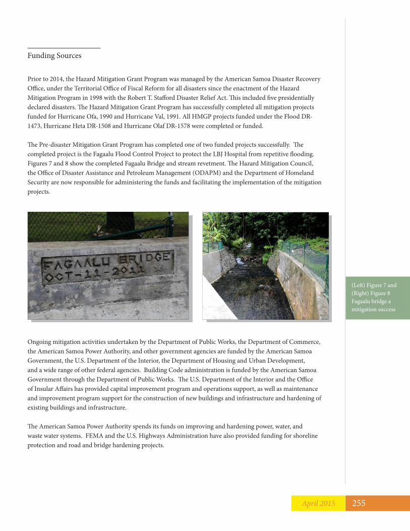
The Pre-disaster Mitigation Grant Program has completed one of two funded projects successfully. The completed project is the Fagaalu Flood Control Project to protect the LBJ Hospital from repetitive flooding. Figures 7 and 8 show the completed Fagaalu Bridge and stream revetment. The Hazard Mitigation Council, the Office of Disaster Assistance and Petroleum Management (ODAPM) and the Department of Homeland Security are now responsible for administering the funds and facilitating the implementation of the mitigation projects.
Ongoing mitigation activities undertaken by the Department of Public Works, the Department of Commerce, the American Samoa Power Authority, and other government agencies are funded by the American Samoa Government, the U.S. Department of the Interior, the Department of Housing and Urban Development, and a wide range of other federal agencies. Building Code administration is funded by the American Samoa Government through the Department of Public Works. The U.S. Department of the Interior and the Office of Insular Affairs has provided capital improvement program and operations support, as well as maintenance and improvement program support for the construction of new buildings and infrastructure and hardening of existing buildings and infrastructure.
The American Samoa Power Authority spends its funds on improving and hardening power, water, and waste water systems. FEMA and the U.S. Highways Administration have also provided funding for shoreline protection and road and bridge hardening projects.
Funding Sources
(Left) Figure 7 and (Right) Figure 8 Fagaalu bridge a mitigation success

Territory of American Samoa Multi-Hazard Mitigation Plan256
The Hazard Mitigation Council has identified funding options for the mitigation measures. American Samoa must match FEMA mitigation grant funds with a 25 percent local match. The Hazard Mitigation Council identified five sources of matching funds that qualify for FEMA grants:
1. Housing and Urban Development funds can be converted to non-federal mitigation fund match.2. Department of Interior Capital Improvement Project funds have been used in the past to match other
federal grants and FEMA grants.3. American Samoa Power Authority and American Samoa Telecommunications Authority private matching
funds.4. General funds from the American Samoa Government treasury. 5. In-kind labor on all projects.
Past Territorial Mitigation ProjectsAmerican Samoa has managed hazard mitigation projects aimed at reducing the risk of losses to existing critical facilities and infrastructure for many years. The Territorial government, American Samoa Power Authority, U.S. Department of Transportation, the U.S. Army Corps of Engineers, the U.S. Department of the Interior, and other federal agencies has funded such efforts. Following Hurricane Ofa and Val, the housing rehabilitation program and the reconstruction of government buildings and infrastructure were planned in ways to reduce the risk of future losses. The American Samoa Government has also participated in the Hazard Mitigation Grant Program since Cyclone Ofa struck American Samoa in 1990. Table 2 lists the Hazard Mitigation Grant Program projects completed following Ofa and Val. It also includes two DR-1859 Tsunami projects.
Project Name Total Costs Federal Share
DR-0855 Ofa2 Harden Tank Farm I $500,000.00 $975,000.00 3 Underground Power Lines II $1,850,000.00 $925,000.00 4 Underground Communication Lines II $1,476,064.00 $738,032.00 M01 Territory Management Cost $120,000.00 $30,000.00
Ofa subtotal $3,946,064.00 $2,668,032.00 DR-0927 Val15 Harden Fitiuta Water Line $126,000.00 $126,000.00 16 Harden Sewer Outfalls $1,071,050.00 $200,000.00 17 Harden Satala Power Plant $3,204,000.00 $1,602,000.00 18 Underground Power Lines I $4,074,114.00 $2,037,057.00 19 Harden Tafuna Housing $250,000.00 $125,000.00 20 Harden Hazmat Storage Areas $169,877.00 $169,877.00 22 Harden PEACESAT Earth Station $52,041.00 $52,041.00 23 Harden Public Safety Bldg. $395,570.00 $197,785.00 25 Harden Ta'u-Faleasao Water Line $146,958.00 $146,958.00 27 Harden DCI/KVZK Bldg. $177,709.00 $177,709.00 28 Harden Tula Elementary School $199,999.00 $199,999.00 29 Harden Procurement Warehouse $466,918.00 $233,459.00 31 Underground Communication Lines I $703,625.00 $351,812.00
Table 2 Ofa, Val, Heta and Olaf mitigation projects

April 2015 257
Project Name Total Costs Federal Share
32 Harden Tafuna Power Plant $97,482.00 $97,482.00 33 Harden LBJ Hospital Windows $182,650.00 $182,650.00 34 Harden Fagatogo Fire Station $101,128.00 $101,128.00 35 Harden Vatia Elementary School $112,600.00 $112,600.00 36 Harden High Court Bldg I $400,000.00 $200,000.00 37 Harden High Court Bldg II $198,875.00 $198,875.00 38 Harden Am Samoa Library Bldg $199,000.00 $199,000.00 41 Harden OMV Bldg $73,123.00 $73,123.00 42 Harden Tank Farm II $1,175,000.00 $555,000.00 MO1 Territory Management Cost $196,000.00 $196,000.00
Val Subtotal $13,773,719.00 $7,535,555.00 DR-1473 Flood1 ASPA-Underground Lines $1,027,000.00 $924,300.00 M01 State Management Costs $55,000.00 $49,500.00
Flood Subtotal $1,082,000.00 $973,800.00DR-1506 Heta2 ASTCA-Underground Lines Rte. 1 to LBJ $59,966.67 $53,970.00 3 ASTCA-Underground for ASPA to Airport $100,242.22 $90,218.00 4 ASPA-Underground Lines Utulei Loop $153,112.00 $137,800.80 5 TEMCO-Fagatogo Stream Flood Control $1,056,720.00 $951,048.00 7 ASPA-Underground Lines Rte. 1 to LBJ $300,000.00 $270,000.00 8 DOE Hardening Government Buildings $399,288.89 $359,360.00 9 TEMCO-Fagatogo Stream Flood Control-A&E $45,000.00 $40,500.00 MO1 State Management Costs $125,000.00 $112,500.00
Heta Subtotal $2,239,329.78 $2,015,396.80 DR-15821 ASTCA Underground Lines Ili'ili $375,064.44 $337,558.00 2 Hardening Government Buildings Phase II $288,233.33 $259,410.00 3 State Multi-Hazard Planning Grant $56,201.11 $50,581.00 M01 State Management Costs $68,600.00 $61,740.00
Olaf Subtotal $788,098.88 $709,288.99 DR-18591 HM Planning Update $356,600.00 $320,940.00 M01 State Management Costs $302,101.11 $271,891.00 #03 Futiga Underground $1,903,281.26 $1,712,953.13#04 Leone Underground $1,136,801.39 $1,023,121.25 #05 Matu’u Stream $929,600.00 $836,640.00 #07 Building Code Upgrade $297,000.00 $267,300.00
Tsunami Total $4,925,383.76 $4,432,845.38TOTAL
$25,672,595.42 $18,334,918.17

Territory of American Samoa Multi-Hazard Mitigation Plan258
Other mitigation projects completed or underway include shoreline protection structures to reduce the risk of damage to coastal roads, the most important of which is the highway linking the main urban and government center in Pago Pago with the International Airport and the Emergency Operations Center in Tafuna. This road protection program is being managed by the U.S. Army Corps of Engineers (USACE) and is funded by the U.S. Highway Administration. An example of shoreline protection is shown in Figure 9.
The USACE, Pacific Ocean Division, Honolulu, completed the field study American Samoa Shoreline Inventory Update II in March 1994. Completed by Sea Engineering, Inc. and Belt Collins Hawaii, both of Honolulu, the study is in hard copy format. It is a shoreline inventory identifying the physical characteristics of the shoreline with emphasis on erosion and protection needs. The engineers developed a rating system that identifies critical and potentially critical erosion in each coastal sector of American Samoa.
The American Samoa Department of Public Works has developed a multi-phased plan to repair and reconstruct a major portion of Route 1. Along the coastal reaches of Route 1, the project also includes mitigation of vulnerable shoreline hazards with the construction of shoreline revetments. The USACE has been involved for some of the design for coastal revetments and shoreline protection methods. To determine the design wave height for USACE projects, numerical models were developed by Sea Engineering, Inc. Three different hurricane scenarios were considered in arriving at the design wave height that was used for the project.
For all Route 1 projects, U. S. Federal Highways funded the Department of Public Works to manage the mitigation projects. The Department of Public Works contracted with the USACE as design and construction agents to complete some of the work and contracted with other companies to complete other projects. Currently, the USACE is constructing a road revetment in Faganeanea, between the hospital and the airport.
Figure 9 Jim Buika, hazard mitigation consultant, standing on beach revetment

April 2015 259
Four Disaster Declarations (2003, 2004, 2005, 2009) Flooding - DR-1473-AS 41
There was a Presidential declaration of a major disaster for the Territory of American Samoa (FEMA-1473-DR), dated June 6, 2003. The Hazard Mitigation funding amount granted to American Samoa was $890,582.00. “I have determined that the damage in certain areas of the Territory of American Samoa, resulting from heavy rainfall, flooding, landslides, and mudslides on May 19-21, 2003, is of sufficient severity and magnitude to warrant a major disaster declaration under the Robert T. Stafford Disaster Relief and Emergency Assistance Act, 42 U.S.C. §§ 5121-5206 (the Stafford Act). I, therefore, declare that such a major disaster exists in the Territory of American Samoa.”
“The mudslides damaged roads, bridges, buildings, and equipment and burdened municipal resources for response, debris removal and protective measure costs in many communities,” Lieutenant Governor Aitofele Sunia said. “Most of these communities would be hard-pressed to cover these costs without the help of federal disaster assistance.”42
Tropical Cyclone Heta - DR-1506-AS With high winds in excess of 190 mph, heavy rainfall and high surf, Tropical Cyclone HETA made landfall on January 5, 2004 in American Samoa, as well as other islands of the South Pacific. The impact of the cyclone created widespread power outages, scattered debris, and caused personal property damage, resulting in the displacement of more than 1,200 residents.43
The Federal Emergency Management Agency (FEMA) provides this final update of federal disaster recovery assistance and services as a result of Cyclone Heta.44
FEMA has issued approximately $11.5 million in temporary disaster housing grants to people whose homes have been severely damaged and to those repairing their primary residences to make them safe, sanitary and functional. The agency has provided more than $13.8 million for other serious needs directly related to Heta.The U.S. Small Business Administration (SBA) has approved approximately $5.6 million in low-interest disaster loans to homeowners, renters and business owners. The loans cover costs for the long-term repair or rebuilding of cyclone-damaged private property. Registered applicants who have already been issued an SBA loan application have until April 1 to submit their application to SBA.
Funding of approximately $1.2 million under FEMA’s Public Assistance Program has been approved for the American Samoa Government (ASG). The money is reimbursement for 75% of the costs incurred by the territorial government due to Heta. The final “federal share” is expected to reach several million dollars more, once all eligible projects that ASG has submitted for funding have been approved.
41 President Declares Major Disaster For American Samoa (2003). FEMA. Retrieved September 30, 2014 from http://www.fema.gov/news-release/2003/06/06/president-declares-major-disaster-american-samoa
42 Public Assistance For Local Governments and Villages. (2003). FEMA. Retrieved September 30, 2014 from http://www.fema.gov/news-release/2003/07/11/public-assistance-local-governments-and-villages
43 Tropical Cyclone Heta strikes. (2004). PB Inspections. Retrieved September 30, 2014 from http://www.pbinspections.com/articles/01222004_tropical_cyclone_heta_strikes.asp
44 Ibid.

Territory of American Samoa Multi-Hazard Mitigation Plan260
Tropical Cyclone Olaf - DR-1582-AS There was a Presidential declaration of a major disaster for the Territory of American Samoa (FEMA-1582-DR), dated February 18, 2005. American Samoa received $722,587.00 in funding. “I have determined that the damage in certain areas of the Territory of American Samoa, resulting from Tropical Cyclone Olaf, including high winds, high surf, and heavy rainfall, beginning on February 15, 2005, and continuing, is of sufficient severity and magnitude to warrant a major disaster declaration under the Robert T. Stafford Disaster Relief and Emergency Assistance Act, 42 U.S.C. §§ 5121-5206 (the Stafford Act). Therefore, I declare that such a major disaster exists in the Territory of American Samoa.”
Magnitude 8.0 Earthquake and Tsunami – DR-1859-ASOn September 29, 2009, American Samoa was struck by an 8.3 magnitude earthquake. The earthquake generated a tsunami with waves reaching 5.1 feet in Pago Pago, the territory’s capital, causing flooding in portions of the island. More than 30 people were killed and hundreds were injured. The combination of the earthquake, tsunami, and flooding resulted in a devastating amount of damage on the island of Tutuila. A local power plant was disabled, 241 homes were destroyed, 308 homes had major damage, another 2,750 dwellings reported some damage, one school was destroyed and four others sustained substantial damage. Most of the damage was caused by the tsunami rather than the earthquake.45 Figure 10 shows a Church completely destroyed by tsunami waves.
National Emergency GrantTo aid in the recovery from the September 29, 2009 tsunami, the U.S. Department of Labor awarded the island a $25 million National Emergency Grant (NEG).
“In the wake of a devastating tsunami that eliminated one in eight jobs in the territory overnight, American Samoa received the largest National Emergency Grant ever awarded by the US Department of Labor – nearly $25M – to support the recovery process. Within weeks, despite severely compromised infrastructure, the Department of Human Resources (DHR) - the agency charged with planning and implementing the NEG initiative - launched a public jobs program. NEG program staff recruited and employed over 2,361 people in cleanup and recovery efforts at 65 work sites between November 2009 and April 2010.
They launched the program without an existing one-stop career center or other key Department of Labor assets common to states on the US mainland and in the context of a village-level community leaders and faith-based organizations with limited prior experience managing employment and recovery efforts on the scale required in the wake of the tsunami.”46
45 American Samoa 2009 Earthquake and Tsunami After-Action Report. Washington, DC: Department of Homeland Secu-rity, Office of Inspector General, October 2010, p.2. Retrieved September 30, 2014 from http://www.oig.dhs.gov/assets/Mgmt/OIG_11-03_Oct10.pdf
46 National Emergency Grant American Samoa: From Tsunami to Renewal. Retrieved September 30, 2014 from http://ameri-cansamoarenewal.org/the_story
Figure 10 Church destroyed by Tsunami waves

April 2015 261
“In 2010, the NEG Program, following the NEG disaster grant requirements issued by the US Department of Labor, shifted it focus to longer term workforce development including training, education, and helping the over two thousand NEG temporary workers and hundreds of unemployed job-seekers affected by the tsunami transition to new jobs or education and training aimed at helping them build careers.”47
“The project’s deliverable include:• Athirty-fiveminutevideodocumentaryaboutthetsunamiandNEGprojectcalled“FromTsunamito
Renewal.”• Areportdetailingthecontext,program,lessons,andresultstodateoftheAmericanSamoaNational
Emergency Grant Program.• ProfilesofthreeNEGinitiativesthatdemonstratedcreativeresponsestodocumentedneed,engaged
new partners, and generated excitement among “the public” - people with no direct connection to the NEG program.
• Awebsiteandprojectarchivethatincludes:linksand/ordownloadabledocumentsorvideoscitedin the report; “Stories from the Community” - video interviews produced by the story gatherers in which islanders described their experiences during the tsunami; and other relevant documents and resources.”48
47 National Emergency Grant American Samoa: From Tsunami to Renewal. Retrieved September 30, 2014 from http://americansamoarenewal.org/the_story
48 Ibid.

Territory of American Samoa Multi-Hazard Mitigation Plan262
HUD announces $1.5 million for community development and affordable housing in American Samoa49
Thursday, 23 August 2012
(WASHINGTON, DC: Thursday, August 2, 2012) – U.S. Housing and Urban Development Secretary Shaun Donovan today announced that American Samoa will receive approximately $1.5 million to support community development and produce more affordable housing. HUD’s annual funding will also help find homes for individuals and families living on the streets.
This year’s block grant funding requires tough choices that we would not have made in better circumstances,” Donovan said. “As we work under the challenges of our nation’s deficit, we must also understand that these programs are absolutely essential in promoting community development, producing affordable housing, helping our homeless and even supporting long-term disaster recovery.”
The funding announced today is for:• CommunityDevelopmentBlockGrant(CDBG)funds;• HOMEInvestmentPartnerships(HOME)funding;• EmergencyShelterGrant(ESG)
Since 1974, HUD’s Community Development Block Grant (CDBG) Program has provided approximately $132 billion to state and local governments to target their own community development priorities. The rehabilitation of affordable housing and the improvement of public facilities have traditionally been the largest uses of CDBG although the program is also an important catalyst for job growth and business opportunities. Annual CDBG funds are distributed to communities according to a statutory formula based on a community’s population, poverty, and age of its housing stock, and extent of overcrowded housing.
HOME (HOME Investment Partnerships Program is the largest federal block grant to state and local governments designed exclusively to produce affordable housing for low-income families. Since 1992, more than 600 communities have completed nearly 950,000 affordable housing units, including 403,000 for new homebuyers. In addition, 224,000 tenants have received direct rental assistance.
Emergency Shelter Grants (ESG) provides homeless persons with basic shelter and essential supportive services. It can assist with the operational costs of the shelter facility, and for the administration of the grant. ESG also provides short-term homeless prevention assistance to persons at imminent risk of losing their own housing due to eviction, foreclosure, or utility shutoffs.
49 HUD Announces $1.5 Million for Community Development an Affordable Housing in American Samoa. (2012). U.S. De-partment of Housing and Urban Development. Retrieved September 30, 2014 from http://archives.hud.gov/local/hi/news/pr2012-08-02.cfm

April 2015 263
Highlights of OIA Financial Assistance Awards to American Samoa in FY 201150
Prepared for the Senior Plenary Session of the Interagency Group on Insular Areas February 28, 2012. The Office of Insular Affairs provided a substantial amount of financial assistance in fiscal year 2011 to assist American Samoa in a variety of areas ranging from infrastructure improvements to health care services.
• Atotalof$10.5millioninCIPfundingwasawardedtoAmericanSamoatoaddressavarietyofinfrastructure needs including $2.6 million to renovate and expand the Dialysis Unit at the LBJ Tropical Medical Center; $1.6 million to continue building classroom buildings at elementary schools; and $380,000 to complete the Petesa Happy Valley Village Road project.
• TheAmericanSamoaPowerAuthoritywasawarded$596,000inEmpoweringInsularCommunityfunding for energy efficiency and conservation projects including a program to provide florescent bulbs to Manu’a residents and a recycling rebate project.
• $600,000wasawardedtofundtheAmericanSamoaAirTransportMarketStudythroughtheTechnicalAssistance Program (TAP). The study will be to quantify and document the market demand for expanded air cargo and passenger transportation services at the territory’s Pago Pago International Airport.
• $400,000wasawardedtofundLyndonB.JohnsonHospitalforPractitionertraining.Thefundswillbeused to train LBJ practitioners, by 4 board-certified physicians, in order to improve healthcare services.
USDA Rural Development in American Samoa 51
• Since2009,USDARuralDevelopmenthasassistedover186homeownerswithover$1.3millioninHome Improvement and Repair Loans and Grant Programs.
• AmericanSamoa’s“Communal”landtenuresystemhaspreventedRuralDevelopmentfromutilizingits flagship Direct and Guaranteed Loan Program (502 Loan Program). Rural Development has been working with the Development Bank of American Samoa to develop a Memorandum of Understanding to provide “security” for homeownership loans.
• In2011,a$110,000CommunityFacilitiesGrantwasawardedtotheLBJHospitalforthepurchaseofmuch needed microbiology equipment.
• RuralDevelopmentiscurrentlyworkingona$1.5millionCommunityFacilitiesloanapplicationreceived from a faith-based school project.
• BusinessandIndustry(B&I)GuaranteedLoan.In2010,a$16.7millionB&IGuaranteedLoanwasapproved with the American Samoa Hawaii Cable, LLC (ASHC) and American Samoa Cable, LLC (ASC) for the purchase of fiber optic cable. In addition, Rural Development is in discussion with Tri-Marine Group,Inc. for a $30 million B&I Guaranteed Loan for a tuna cannery processing facility.
• In2010,TheAmericanSamoaTelecommunicationAuthority(ASTCA)receivedan$81milliongrant and $10 million loan under the America Recovery and Reinvestment Act. This project is being administered by the USDA Rural Development, Rural Utility Service under the Broadband Initiative Program.
• In2009AmericanSamoaPowerauthorityreceived2grantstotaling$3.14millioninHighEnergyCostGrants provided for rural communities with home energy costs that are over 275 percent of the national average.
50 Summary of Resources Granted to Insular Areas (Including American Samoa) by US Department of Interior. (2012). National Emergency Grant American Samoa. Retrieved September 30, 2014 from http://americansamoarenewal.org/library/summary-resources-granted-insular-areas-including-american-samoa-us-dept-interior
51 Summary of USDA Program and Resources in Insular Areas, Including American Samoa. (2012). National Emergency Grant American Samoa: From Tsunami to Renewal. Retrieved September 30, 2014 from http://americansamoarenewal.org/library/summary-usda-program-and-resources-insular-areas-including-american-samoa

Territory of American Samoa Multi-Hazard Mitigation Plan264
Potential FEMA Funding Sources“FEMA’s Hazard Mitigation Assistance (HMA) grant programs provide funding for eligible mitigation activities that reduce disaster losses and protect life and property from future disaster damages. Currently, FEMA administers the following HMA grant programs:
• Hazard Mitigation Grant Program (HMGP) assists in implementing long-term hazard mitigation measures following Presidential disaster declarations. Funding is available to implement projects in accordance with State, Tribal, and local priorities.
• Pre-Disaster Mitigation (PDM) provides funds on an annual basis for hazard mitigation planning and the implementation of mitigation projects prior to a disaster. The goal of the PDM program is to reduce overall risk to the population and structures, while at the same time, also reducing reliance on Federal funding from actual disaster declarations.
• Flood Mitigation Assistance (FMA) provides funds on an annual basis so that measures can be taken to reduce or eliminate risk of flood damage to buildings insured under the National Flood Insurance Program (NFIP).”52 53
Eligible Activities HMGP PDM FMA
1. Mitigation Projects √ √ √Property Acquisition and Structure Demolition √ √ √Property Acquisition and Structure Relocation √ √ √Structure Elevation √ √ √Mitigation Reconstruction √Dry Floodproofing of Historic Residential Structures √ √ √Dry Floodproofing of Non-residential Structures √ √ √Minor Localized Flood Reduction Projects √ √ √Structural Retrofitting of Existing Buildings √ √ Non-structural Retrofitting of Existing Buildings and Facilities √ √ √Safe Room Construction √ √ Wind Retrofit for One- and Two-Family Residences √ √ Infrastructure Retrofit √ √ √Soil Stabilization √ √ √Wildfire Mitigation √ √ Post-Disaster Code Enforcement √ Generators √ √ 5 Percent Initiative Projects √ Advance Assistance √ 2. Hazard Mitigation Planning √ √ √3. Management Costs √ √ √
52 Hazard Mitigation Assistance. (2014). FEMA. Retrieved September 30 2014 from http://www.fema.gov/hazard-mitigation-assistance
53 Hazard Mitigation Assistance Mitigation Activity Eligibility. (2014). FEMA. Retrieved September 30 2014 from http://www.fema.gov/hazard-mitigation-assistance-mitigation-activity-eligibility
Table 3 Hazard Mitigation Assistance Mitigation Activity Eligibility 53

April 2015 265
Through a series of disasters impacting American Samoa, including the 2009 earthquake and tsunami, this Hazard Mitigation Plan has provided the Territory with a mitigation planning and risk reduction program and process that has been cost effective in reducing losses and impacts to the Territory of American Samoa for 24 years now – since the inception and passage of the FEMA Hazard Mitigation Program. The following table summarizes the mitigation capabilities of the organizations named above.
Organization Disaster Mitigation Capabilities
American Samoa Government OfficesHistoric Preservation Office (ASHPO)
Active participant in the Hazard Mitigation Council. Developing GIS database of historical artifacts. Exploring possibility of revitalizing hydroelectric power on the islands.
Office of Disaster Assistance and Petroleum Management (ODAPM) formerly the Territorial Office of Fiscal Reform (TOFR)
Manages pre- and post-disaster mitigation funding grants. Responsible for assisting the Hazard Mitigation Council with the development of the Hazard Mitigation Plan.
American Samoa Government AgenciesAmerican Samoa Environmental Protection Agency (ASEPA)
Responsible for protecting all environmental resources and operates the only laboratory in American Samoa used for environmental testing. Leader in the PNRS. Identifies multiple projects for flood reduction and erosion control. Manages several environmental management programs.
Department of Port Authority (DOP)
Active participant in Hazard Mitigation Council. Responsible for mitigating risks to all ports including Pago Pago Harbor, Port, Marina and Airport facilities.
American Samoa Government Authorities
American Samoa Power Authority (ASPA)
Active participant in Hazard Mitigation Council. Responsible for mitigating risk to systems for electricity, water, and wastewater and solid waste management. Implementing multiple mitigation projects to underground power. Improving the Satala Power Plant with mitigation dollars. Also responsible for water supply. Interested in quickly implementing the Tualauta Flood Control project.
American Samoa Telecommunications Authority (ASTCA)
Active participant in Hazard Mitigation Council.
American Samoa Government DepartmentsDepartment of Commerce (DOC)
Active participant in Hazard Mitigation Council. Maintains a GIS database actively used for mitigation. Maintain several mitigation programs including a new mapping program. Interested in benefits of NFIP. Also an active PNRS member. Managed Coastal Management Program.
Capability Assessment Conclusion
Table 4 Mitigation Capability Summary

Territory of American Samoa Multi-Hazard Mitigation Plan266
Organization Disaster Mitigation Capabilities
Department of Homeland Security (DHS)
Active participant in Hazard Mitigation Council. Collaborates closely with TOFR on Mitigation Plan development. Implements disaster preparedness education programs. Assist with implementation of mitigation plan.
Samoan Affairs Samoan Affairs promotes Samoan culture. The Hazard Mitigation Council consults with Samoan Affairs as needed regarding actions impacting the Territory or specific villages.
American Samoa National Park Service
The National Park of American Samoa works to protect Samoan culture and natural resources. They are involved with preserving the natural habitat on Mt. Alava.
Department of Public Works (DPW)
Active participant in Hazard Mitigation Council. Enforces the building code standards and permitting process. Works on major mitigation projects. Focused on landslide mitigation and undergrounding utilities.
Other OrganizationsNational Oceana and Atmospheric Administration (NOAA)
Work on coastal zone management regulations. Collaborate closely with other agencies.
Land Use Planning Land Use Planning is a critical part of mitigation planning in American Samoa. The strengths and weaknesses of the PNRS system play directly into the resilience of the Territory.
Blue Sky As a premier telecommunications provider in American Samoa. They collaborate with several government agencies to ensure consistent communications before, during and after a disaster.
American Samoa Chamber of Commerce
Active participant in Hazard Mitigation Council.
Evaluation of the Territory’s Pre-Disaster CapabilitiesThe PNRS has proven to be an effective way to restrict development in hazardous areas. The PNRS Board is composed of representatives from agencies with land use and environmental management responsibilities in the Territory, as listed in the table above. Locating hazard free building space in the Territory is challenging considering the small amount of flat land and the incredibly steep slopes. By improving the PNRS system, American Samoa has taken steps to improve the overall land use system. With a strategic planning process established, these subcommittees have continued to revise and improve the system since 2003.
Hazard Management Capabilities Changed Since 2011American Samoa’s hazard management capability has grown since 2008 through 1) the repeated yearly engagements of the Hazard Mitigation Council, 2) disaster event management experience in 2003-2014, and 3) through the subsequent management of major mitigation projects that have improved life safety and reduced property losses throughout the Territory. Since 2008, the Territory has committed funds and expertise to completing multiple hazard mitigation projects. American Samoa now has over two decades of mitigation accomplishments and has expanded its local technical expertise via projects that have been managed technically, fiscally, and administratively in a competent and prudent manner. The Territory has added tsunami evacuation signs, tsunami sirens, evacuation and mass-care training and is now a Tsunami Ready community as awarded by FEMA.

April 2015 267
Evaluation of the Territory’s Post-Disaster CapabilitiesYearly Plan updates involved addition of new projects added to the Mitigation Plan and project priorities have been updated. The project priority listing has been updated on an annual basis, during the Hazard Mitigation Council review, dependent upon availability of funds. In 2003, under the DR-1473 Flood, the American Samoa Power Authority received funds through HMGP for hardening infrastructure. In 2004, DR-1506 Hurricane Heta, 9 projects were awarded funds through HMGP. The projects ranged from roof hardening to flood stream control projects. In 2005, DR-1582 Cyclone Olaf, three projects were funded through HMGP as well. Now with the more recent disaster, DR-1859 Tsunami, Flood & Earthquake 8 project applications have been submitted to FEMA Region IX Pacific Area Office for review and consideration through HMGP. The Territory’s Post Disaster mitigation grants are monitored and maintained by the American Samoa Disaster Recovery Office. The current State Hazard Mitigation Officer works closely with the standing y established Hazard Mitigation Council as well as the Governor’s Authorized Representative. The Hazard Mitigation Council has successfully continued through the new government administration.
Through its past repetitive disaster experience, directed fiscal management, direct engineering project development and monitoring, and additional Federal technical expertise, American Samoa has completed or is in the process of completing numerous mitigation projects successfully since 1990. These projects have been funded through the FEMA Hazard Mitigation Grant Program and the Pre-disaster Mitigation Grant Program. ASPA, ASTCA and the Department of Public Works have become agencies cognizant with the Pre-Disaster Mitigation Program and the Hazard Mitigation Grant Program processes.
The Territorial Hazard Mitigation Council has proven to be an effective review and advisory body for the Hazard Mitigation Plan. The Council has met from one to as many as seven times a year to complete an annual thorough project review and prioritization of projects for funding. Nine departments, organizations and agencies have developed mitigation project worksheets for future funding.
The 2015 Mitigation Plan update process has identified ODAPM as the key administrative office for managing mitigation project funding programs. The Department of Commerce continues to administer and effectively regulate the land use planning system known as the Permit Notification and Review System, the flood mitigation programs, and the Coastal Zone Program. The PNRS review has been enhanced through the instituted Territorial Hazard Assessment Tool risk management system, which utilizes the GIS mapping products. The Department of Commerce maintains a full-time GIS Professional for data collection and analysis.
American Samoa has made strides in several areas of environmental management that contribute to the overall health of the island environment and reduce vulnerability to hazards addressed in this Plan. The American Samoa Government has planned and implemented formal programs, which improve watershed management, reduce pollution and debris, and protect reef ecosystems. Coral reefs provide protection to the islands from storms. Without their protection, damage resulting from storm surge and waves would be far greater. Healthy watersheds can reduce impacts from flooding and erosion. There are efforts underway to improve watershed management with the explicit goal of reducing flooding.
In addition, the ASEPA is placing emphasis on the landslide mitigation problem. With new LIDAR data in hand for the islands and geotechnical resources available, landslide hazards will be further mapped and entered into the PNRS system for review and mitigation during future building.

Territory of American Samoa Multi-Hazard Mitigation Plan268
The following four sections describe ongoing mitigation actions to improve the ecosystem, including a reduction of vessel groundings from storms in coral reef ecosystems, participation in the U.S. All Islands Coral Reef Initiative54 to protect coral reefs, the watershed protection and non-point pollution plans, and the Coastal Hazard Assessment and Management Program.
Vessel Grounding During Hurricane Val, nine long-line fishing vessels in Pago Pago Harbor ran aground. Most of these vessels were abandoned. The vessels and their slow oil leaks contributed to harbor pollution and were a potential threat to navigation. They also damaged precious coral reef ecosystems and threatened ciguatera poisoning. After a decade of concentrated effort, American Samoa received assistance from the National Oceanic and Atmospheric Administration (NOAA) and the United Territories Coast Guard (USCG) to remove these vessels and their contaminants.
American Samoa supports activities to protect its coral reef health and to prevent such costly damage from vessel groundings in the future. The U.S. Flag Pacific Islands Vessel Grounding Workshops, held January and February 2002 in Honolulu and Guam for the U.S.-affiliated islands led to specific actions from the U.S. Coral Reef Task Force through NOAA, based on vessel grounding and removal experience in American Samoa.
The experience in Pago Pago Harbor initiated a sequence of events that ultimately led to a draft resolution on grounded vessels by the U.S. Coral Reef Task Force (U.S. CRTF) at their August 2000 meeting in American Samoa. In response to that resolution, NOAA initiated actions to address the issue, including the use of legal mechanisms to remove grounded and abandoned vessels from coral reef ecosystems. For this hazard mitigation strategy, it is important to note that American Samoa has experienced extensive reef damage from storms and from vessel groundings and that the actions taken by the U.S. Coral Reef Task Force will help to minimize the impacts on coral reef ecosystems.
U.S. All Islands Coral Reef InitiativeAmerican Samoa has participated in the U.S. All Islands Coral Reef Initiative since it was first initiated in 1994 to develop strategies for protecting coral reef ecosystems. Efforts in coordination with groups in Hawaii, Guam, Northern Mariana Islands, Puerto Rico, and the U.S. Virgin Islands came to be known as the “U.S. All Islands Coral Reef Initiative.” The Governor of American Samoa established the Coral Reef Advisory Group (CRAG) in 1999 to develop an American Samoa action strategy for the protection of coral reefs and coordination of coral reef protection activities involving federal and Territorial agencies and the private sector. All of the island jurisdictions participating in the U.S. Coral Reef Initiative recognized that coral reef ecosystems provide essential resources, contributing to commercial and subsistence economies, food security, recreation, and storm protection.
Hurricanes and storms have caused damage to the reefs directly by overturning coral heads and scouring reef areas with debris and indirectly by blanketing several reefs with sediments and solid waste from the land. As part of future landslide and debris management plans, it will be important to consider ways to remove marine debris from storms as recommended by FEMA debris management plans that address dealing with the lack of disposal sites and need for emergency landfill sites following a storm.
54 1999 U.S. All Islands Coral Reef Initiative Strategy. (1999). USAICRICC, The Territory of American Samoa. Retrieved September 30, 2014 from http://www.hawaii.edu/ssri/99USAICRI.pdf

April 2015 269
Watershed Protection American Samoa has several initiatives that focus on watershed management and protection that will help reduce flooding:
• The Watershed Protection Plan of 1998 makes 311 recommendations, with the American Samoa Environmental Protection Agency mandated to “facilitate coordinated resource management efforts” within each of the territory’s 41 watersheds. Top priority watersheds not meeting EPA environmental standards are Nuuuli, Tafuna, Leone, Pago Pago, and Fagaalu.
• The Non-Point Source Pollution Control Plan was developed in 1995 by the American Samoa Coastal Management Program, in association with the American Samoa Environmental Protection Agency, to meet the requirements contained in Section 6217 of the Coastal Zone Amendments Reauthorization Act of 1990. Non-Point Source [NPS] pollution refers to pollution of waters that comes from a broad area rather than a specific location. It generally results from rainwater running off the land and is amplified by hydrologic modification projects, such as stream hardening and channeling. The NPS Control Plan provides management and design guidelines to agencies and private businesses.
• TheU.S.DepartmentofAgricultureNaturalResourcesConservationService(NRCS)hasconducteda number of activities to improve watershed management and assist in the application of appropriate agricultural methods. NRCS previously conducted a landslide risk assessment for American Samoa. They provide farmers with information and identify sources of relief for drought, storms, and other hazards. NRCS is currently working on watershed issues around Pago Pago Harbor by identifying methods to reduce flooding and prevent future devastating landslides.
Village Coastal Hazard Assessment and Mitigation ProgramMost of the actual land use decisions that affect people happen in the traditional villages that still value the Samoan way of life. To help the leaders and people in villages better plan their communities in order to prevent impacts from disasters, the Department of Commerce Coastal Management Program developed the Coastal Hazard Assessment and Management Program (CHAMP) at the village level. The program was voluntary and implemented in 11 villages throughout American Samoa. Village risk assessments were conducted, and mitigation plans and regulations were developed for each village. This was done in conjunction with the Territorial regulatory system and enabled people to take action at the community level to reduce the impacts of disasters with the backing of the Territorial government.