Embed Size (px)
Citation preview
11 July 2013
Mr M Hare Civitas Planning 4 Moncktons Avenue Maidstone Kent ME14 2PZ
Our Ref: APP/W2275/V/11/2158341
Dear Sir, TOWN AND COUNTRY PLANNING ACT 1990 (SECTIONS 73 & 77) APPLICATION BY GALLAGHER AGGREGATES LTD HERMITAGE QUARRY, HERMITAGE LANE, AYLESFORD APPLICATION REF. TM/10/2158341
1. I am directed by the Secretary of State to say that consideration has been given to
the report of the Inspector, J I McPherson JP BSc CEng CEnv CWEM MICE MCIWEM MCMI, who held a public local inquiry which sat on 27-30 November, 4-6, 13-14 and 18 December 2012, into your client’s application in respect of application Ref.TM/10/2158341 dated 21 June 2010 for the Westerly Extension of Hermitage Quarry; and the variation of conditions relating to the original quarry and its previous extensions.
2. On 27 July 2011, the Secretary of State directed, in pursuance of Section 77 of the Town and Country Planning Act 1990, that your client’s application be referred to him instead of being dealt with by the Mineral Planning Authority, Kent County Council (‘KCC’). The reason for making the direction was that the proposal may conflict with national policies on important matters.
Inspector’s recommendation and summary of the decision
3. The Inspector recommended that the application for the Westerly Extension be approved with recommended conditions, and that new permissions be approved for the Original Quarry, the Southern Extension and the Eastern Extension with recommended conditions. For the reasons given below, the Secretary of State agrees with the Inspector’s recommendations. A copy of the Inspector’s report (IR)
Richard Watson Department for Communities and Local Government Planning Central Casework Division,
Tel: 0303 4441627 Email: [email protected]
1/J2, Eland House Bressenden Place London SW1E 5DU
is enclosed. All references to paragraph numbers, unless otherwise stated, are to the IR.
4. In addition to the application for the Westerly Extension of Hermitage Quarry and the variation of the conditions applying to the existing quarry workings, the Inquiry also considered two Highway Orders sought by your client for: a) the temporary diversion of Byway MR496 for a period of 9 months while a cut and cover tunnel is constructed into the Westerly Extension site; and b) the temporary diversion of Bridleway MR108 for a period of 25 years whilst the Westerly Extension is worked and restored. The decision on these Orders is the subject of two separate letters which will be issued separately by the Secretaries of State for Transport and Environment, Food and Rural Affairs.
Procedural Matters 5. The Secretary of State notes that the application is to extract some 16 million
tonnes of ragstone and hassock from within the land enclosed by the permissive path, whilst still retaining a minimum of 50m of woodland between the path and the mineral operations; and that some of the ragstone would be supplied as high quality building/dimension stone (IR4.4). He also notes that the phased working of the Westerly Extension would involve progressive stripping, extraction, filling with inert waste and topsoiling to the original ground levels, followed by restoration to native woodland and rides that would be open to the public (IR4.5); and that all materials entering and leaving the quarry itself would continue to use the existing weighbridge and access onto Hermitage Lane (IR4.7).
6. The Secretary of State notes that the application also proposes the formation of a 9 ha ‘Habitat Creation Field’ to the south-west of the site which, at the original application stage, was intended to receive the soil resources from quarrying Phases 8 – 11; that a revision has been made to the proposed phasing such that this soil would now be used in the restoration of the existing quarry instead; and that, in accordance with the revised working scheme, the Habitat Creation Field would be formed at a very early stage and used principally as the site for the translocation of reptiles from the Application Site (IR4.9).
7. The Secretary of State agrees with the Inspector that although there have been revisions to the phases of working since KCC considered the application, they simply affect the internal working of the site and would not prejudice anyone else, and should therefore be accepted as part of the application proposals (IR4.14).
8. In reaching his decision, the Secretary of State has taken into account the Environmental Statement and the Addendum submitted under the Town and Country Planning (Environmental Impact Assessment) (England and Wales) Regulations 1999. He considers that the environmental information as a whole meets the requirements of these regulations and that sufficient information has been provided for him to assess the environmental impact of the application.
Policy considerations 9. In determining the application, the Secretary of State has had regard to section
38(6) of the Planning and Compulsory Purchase Act 2004 which requires that proposals be determined in accordance with the development plan unless material considerations indicate otherwise. In this case, following the partial revocation of the Regional Strategy for the South East (RS) on 25 March 2013, the development
plan comprises the saved policies of the Kent Minerals Local Plan: Construction Aggregates (December 1993); the Tonbridge and Malling Borough Council (TMBC) Core Strategy (2007); the TMBC Managing Development and the Environment Development Plan Document (2010); and the saved policies in the TMBC Local Plan (1998). The Secretary of State gives no weight to the revoked policies in the RS. He considers that the partial revocation of the RS has had little effect on the policy considerations in this case, and that it was not necessary for him to refer back to parties on this issue before reaching his decision. He considers that the development plan policies most relevant to this case are those set out at IR5.5-5.7.
10. Material considerations which the Secretary of State has taken into account include: The National Planning Policy Framework (“the Framework”); The Planning System: General Principles; Circular 11/95: The Use of Conditions in Planning Permission; the Community Infrastructure Levy (CIL) Regulations (2010 and 2011); the Ministerial Statement “Planning for Growth” (2011); Keepers of Time Statement of Policy for England’s Ancient & Native Woodland (2005); and the letter to Planning Authorities from Steve Quartermain, the Governments Chief Planner concerning the Revocation of Regional Strategies (6 July 2010).
11. For the reasons set out in IR16.212-16.215, the Secretary of State agrees with the Inspector that the emerging Kent Minerals and Waste Local Plan and the Kent Minerals Sites Plan carry only limited weight in the determination of this application (IR16.212 and 16.215).
Main issues 12. The Secretary of State agrees with the Inspector that the main considerations are
those set out in IR16.2. Need for, and Supply of, the Minerals 13. The Secretary of State agrees with the Inspector’s reasoning and conclusions on
the need for, and supply of minerals as set out in IR16.3 and 16.6-16.39. He agrees that there is a 0.78 million tonnes per annum (mtpa) sub-regional apportionment of crushed rock for aggregates to be produced in Kent (IR16.35 and 16.179), and that with the limited remaining supplies at Hermitage Quarry as the only regular source of crushed rock in Kent, there is a strong need for the proposed extension which would also provide a source of high quality dimension stone for which there is also a very considerable need (IR16.40). He does not consider that the partial revocation of the RS changes his conclusion on this matter.
Ancient Woodland 14. The Secretary of State agrees with the Inspector that 31 ha of the 33 ha
application site is a ‘plantation on ancient woodland site’ (PAWS) (IR16.41). He also agrees with the Inspector that paragraph 118 of the Framework, whilst seeking to protect ancient woodland, does allow for circumstances where the loss can be outweighed by other considerations (IR16.42). He notes that Natural England did not consider the loss of ancient woodland to be sufficiently important to seek call-in of the application (IR8.49 and 16.42).
15. The Secretary of State agrees with the Inspector that in order to properly balance the harm against the benefits, the characteristics of the ancient woodland in
question must be assessed (IR16.43). He notes that the Framework advice does not differentiate between Ancient Semi-Natural Woodland (ASNW) and PAWS but that the Keepers of Time Statement by Defra seems to draw a distinction by saying that ASNWs are generally the most valuable ancient woodland sites (IR16.44). He notes also that the Woodland Trust’s Position Statement on the subject also draws a distinction between PAWS and ASNW in the context of habitat translocation which, in the latter case, is said to be particularly inappropriate (16.44). He agrees with the Inspector that, for the purposes of this assessment, there is no particular need to identify the cause of the relatively poor quality of this ancient woodland (IR16.47).
16. The Secretary of State agrees with the Inspector that, with the loss of a viable sweet chestnut coppicing industry in the area and limited woodland management grants, there is no reason to suppose there would be a return to a regular coppicing cycle if the proposed extension was refused (IR16.48).
17. The Secretary of State agrees with the Inspector that, regardless of the relatively poor quality PAWS and the results achievable through translocation, this would not be the restoration of the PAWS lost to the scheme (IR16.49).
Biodiversity 18. The Secretary of State agrees with the Inspector’s reasoning and conclusions on
biodiversity as set out in IR16.50-16.61. For these reasons, he agrees with the Inspector that, overall, despite designation as a Local Wildlife Site, the relatively poor biodiversity interest in the current woodland would, in the longer term, be considerably increased by the restoration to native woodland and the conservation management of other off-site woodlands; and that in due course the site could re-qualify for Local Wildlife Site designation (IR16.62).
Landscape and Visual Impact 19. For the reasons in IR16.63-16.83, the Secretary of State agrees with the Inspector
that: the surrounding woodland and the lack of public vantage points would result in very little visual impact from the proposed scheme and the effect on the landscape character would also be quite limited; there would however be a loss of recreational tranquillity during the operating life of the extension and the final restoration to native woodland would not be strictly in accordance with the present sweet chestnut dominated landscape character of the area (IR16.84).
Archaeology and Heritage Impacts 20. The Secretary of State agrees with the Inspector that although the site is mostly
covered by ancient woodland, there are no veteran trees, and he notes that it was accepted by the Kent Archaeological Officer that there were also no features of surface archaeological interest, although there is the potential for some palaeolithic interest, which can be the subject of a suitable planning condition (IR16.85).
Landfill and Waste Permitting 21. For the reasons in IR16.87 and 16.88, the Secretary of State agrees with the
Inspector that there is no reason to suppose that an adequate supply of fill material would not be forthcoming (IR16.87), or that the landfilling operations would not be properly controlled (IR16.88).
Groundwater 22. The Secretary of State agrees with the Inspector that there is no reason to
anticipate any detrimental effects on the groundwater in the area (IR16.89). Residential Amenity 23. The Secretary of State agrees with the Inspector’s reasoning and conclusions on
residential amenity as set out in IR16.90-16.112. He agrees with the Inspector that, whilst there would be little harm to the amenities of the local residents from dust or traffic, there would be some residual impacts from blasting, noise and the effects on the quiet recreational use of Oaken Wood for a significant number of years, and the development would therefore prolong the effects of the existing quarry for the local residents. He agrees that this should be considered in the planning balance (IR16.113).
Socio-Economics 24. The Secretary of State agrees with the Inspector that, in the absence of permission
for the Westerly Extension, the currently permitted reserves would be exhausted in late 2014 or early 2015, after which time the core of the workforce would no longer be required and there would be a phased downsizing of the remainder (IR16.115). He agrees with the Inspector that it is unlikely that many of these employees would be re-deployed within the associated Gallagher businesses, and that these other businesses could also be affected by the closure of the quarry. He also agrees with the Inspector that not only would the loss of these jobs be a personal blow to the employees, but that these skilled workers currently make a beneficial contribution to the diversity of the workforce in Kent (IR16.115).
25. The Secretary of State also agrees with the Inspector that, in the event that permission for the proposed extension was refused and the existing quarry closed by early 2015, crushed rock would have to be imported into Kent by other suppliers, who would not necessarily be subject to the competition currently provided by the appellant, and that this could well increase prices, to the detriment of the local economy (IR16.116).
Sustainability 26. The Secretary of State agrees with the Inspector’s reasoning and conclusions on
sustainability in IR16.117-16.122. He agrees with the Inspector that, whilst there are a number of other considerations to be weighed in the balance, there is no reason why the scheme should be considered unsustainable (IR16.122).
Compliance with the Development Plan 27. In terms of consistency with the Framework (not including the policies in the RS
which have now been revoked), the Secretary of State agrees with the Inspector that the remaining relevant pre- and post-2004 Development Plan policies are generally consistent with those of the Framework and should therefore carry considerable weight in reaching the planning decision (IR16.208).
28. The Secretary of State agrees with the Inspector’s reasoning and conclusions on the Development Plan as set out in IR16.173-16.207, not including the policies in the RS which have now been revoked. The Secretary of State agrees with the Inspector that, leaving aside the loss of ancient woodland, which he will consider further below, the proposed extension would comply with the Development Plan in all respects, except for a limited effect on the landscape character and the
recreational tranquillity of the area, as well as prolonging the current limited impacts on residential amenity (IR16.210). He also agrees that the benefits of the proposals include a sustainable steady and adequate supply of crushed rock, improved biodiversity in the longer term which, with the ongoing socio-economic benefits, would clearly outweigh the loss of the ancient woodland and the other adverse effects of the development; and therefore that the loss of ancient woodland would not be contrary to Development Plan policy in this case (IR16.211).
Other Material Considerations 29. For the reasons in IR16.216, the Secretary of State agrees with the Inspector that
prematurity would not be a sound reason to refuse the application, particularly in the light of the need for a steady and adequate supply of aggregates and the limited reserves left at Hermitage Quarry (IR16.216).
30. The Secretary of State agrees with the Inspector that, as concluded above, the relevant Development Plan policies are generally consistent with the Framework (paragraph 118 for instance similarly seeks to protect ancient woodland, unless the benefits would outweigh the loss) (IR16.218). He notes that paragraph 144 of the Framework places great weight on the benefits of mineral extraction, including those to the economy; that paragraph 19 also says that significant weight should be placed on the need to support economic growth through the planning system; and he agrees with the Inspector that in both cases, this adds considerable weight to counter the scheme’s limited non-compliance with the Development Plan (IR16.219).
31. The Secretary of State agrees with the Inspector that the reinstatement in due course of the sweet chestnut coppice on the application site with native woodland would help to achieve one of the objectives of the Kent Biodiversity Action Plan and the relevant Biodiversity Opportunity Area Statement, and that this would be a benefit of the proposals that further outweighs the limited harm to the dominant landscape characteristics of the site (IR16.221).
Planning Obligation 32. The Secretary of State agrees with the Inspector’s reasoning and conclusions on
the planning obligation in IR13.1-13.6 and 16.126-16.127. He is satisfied that it is directly related to the development and fairly and reasonably related to it in scale and kind, and is CIL-compliant. He notes that the Woodland Management Plan has the vision of providing high quality native woodland cover to replace the current non-native monoculture on the application site, as well as the establishment of new native woodland to promote connectivity with, and between, the existing woodlands at Fullingpits Wood and Broke Wood; and that it also seeks management that would maximise opportunities for wildlife and the provision of public access (IR13.5).
Planning Conditions 33. The Secretary of State has had regard to the proposed conditions set out at
Annexes C1-C4 of the Inspector’s Report. He has also taken account of the Inspector’s comments in IR14.1-15.5 and 16.128-16.172, and Circular 11/95. For the reasons in IR14.1-14.6 and 16.154 the Secretary of State agrees with the Inspector that the conditions attached to the permissions for the original quarry and the Southern and Eastern Extensions would need appropriate variation (IR14.7)
and he agrees that those conditions which no longer serve a purpose should be removed (IR16.154). He agrees with the Inspector that new permissions would be created and the descriptions of the developments should also be updated as follows (IR14.8 and 16.155-16.156):
Original Quarry
‘The development of land situated at Hermitage Quarry, Hermitage Lane, Maidstone, Kent for the extraction of ragstone and hassock, backfilling to former levels with inert waste, restoration in part to native woodland and in part to agriculture, continued use of existing quarry plant, buildings and access road and the recycling of construction aggregates.’
Southern Extension
‘The development of land situated at Hermitage Quarry, Hermitage Lane, Maidstone, Kent and being a southern extension of the existing quarry for extraction of ragstone and hassock, backfilling to former levels with inert waste, restoration in part to native woodland and in part to agriculture, continued use of existing quarry plant, buildings and access road, recycling of construction aggregates.’
Eastern Extension
‘The development of land situated at Hermitage Quarry, Hermitage Lane, Maidstone Kent and being an eastern extension of the existing quarry for extraction of ragstone and hassock, backfilling to former levels with inert waste, restoration to native woodland, continued use of existing quarry plant, buildings and access road.’
34. The Secretary of State agrees with the Inspector that there is no need to vary the permission for the Western Extension because it is compatible with the proposals for the currently proposed Westerly Extension (IR14.7 and 16.224).
35. The Secretary of State is satisfied that the conditions are reasonable and necessary, and meet the tests of Circular 11/95.
Overall Conclusions 36. The Secretary of State concludes that the proposed Westerly Extension would
comply with the Development Plan, except to a limited extent in terms of landscape and tranquillity considerations. He considers that it would also prolong the limited effects on nearby residents’ amenities. However, he considers that the very considerable need for both crushed rock aggregates and dimension stone, together with the eventual biodiversity improvements, and the ongoing socio-economic benefits, would clearly outweigh the loss of the ancient woodland and the other adverse effects of the development in this case; and therefore that the loss of ancient woodland would not be contrary to Development Plan policy.
Formal Decision 37. Accordingly, for the reasons given above, the Secretary of State agrees with the
Inspector’s recommendation. He hereby grants planning permission in respect of application Ref.TM/10/2158341 dated 21 June 2010: • for the Westerly Extension of Hermitage Quarry, subject to the conditions set out
in Annex A1 to this letter; and
• for new permissions for the Original Quarry, the Southern Extension and the Eastern Extension, subject to the updated descriptions set out in paragraph 33 above, and the conditions set out in Annexes A2-A4 to this letter.
38. An applicant for any consent, agreement or approval required by a condition of this permission for agreement of reserved matters has a statutory right of appeal to the Secretary of State if consent, agreement or approval is refused or granted conditionally or if the Local Planning Authority fail to give notice of their decision within the prescribed period.
39. This letter does not convey any approval or consent which may be required under any enactment, bye-law, order or regulation other than section 57 of the Town and Country Planning Act 1990.
Right to challenge the decision 40. A separate note is attached setting out the circumstances in which the validity of
the Secretary of State’s decision may be challenged by making an application to the High Court within six weeks from the date of this letter.
41. A copy of this letter has been sent to KCC. A notification letter has been sent to other parties who asked to be informed of the decision.
Yours faithfully Richard Watson Authorised by the Secretary of State to sign in that behalf
Annex A1 Conditions
Westerly Extension Implementation 1. The development to which this permission relates shall be commenced
not later than three years from the date of this permission. Written notification of the date of commencement shall be sent to the Mineral Planning Authority within seven days of such commencement.
Development Scheme 2. The development hereby permitted shall be carried out and completed in
all respects strictly in accordance with the plans contained in the application as referred to in the attached Schedule and as stipulated in the conditions set out below, together with those further details required to be submitted for approval.
3. The working and restoration of the site shall be carried out in accordance with the following:- a) working and restoration in the Application Site shall be undertaken
pursuant to the details hereby approved, and the phasing shall be as identified on Plans:- • 0257/10/3/rev L ‘Hermitage Quarry Phasing and Working Plan’,
and • 0257/10/2. rev. F ‘Quarry Working Plan’, and
b) within 3 months of the date of the decision, the phased restoration Plans 0257/10/211 to 0257/10/225 inclusive which were originally submitted showing the progressive restoration of the individual phases of the site, shall be updated for consistency with the plans referred to in a) above, and shall be submitted to the Mineral Planning Authority for written approval. The restoration scheme shall thereafter be implemented in accordance with the approved plans, and no variations or omissions shall take place without the prior written approval of the Mineral Planning Authority.
4. In implementing the development scheme illustrated on plans 0257/10/3/ rev L entitled ‘Hermitage Quarry phasing and working plan’ and 0257/10/2 rev F entitled ‘Quarry Working Plan’, no more than three individual phases shall be in operational use at any one time, comprising quarrying, filling and restoration. Advance woodland clearance works shall only take place in one further phase at any one time.
5. Prior to the commencement of the development hereby permitted, the boundary of the permission shall be marked out by the installation of robust ground markers around the extension site boundary and these shall remain in place for the duration of the development.
Coppicing Regime 6. Notwithstanding the details of the coppicing sequence for the perimeter
woodland area around the Westerly Extension site shown on plans ref 0257/10/1/L and 0257/10/14, a woodland management scheme for the coppicing of the westerly extension site perimeter woodland area shall be submitted for the written approval of the Mineral Planning Authority prior to the commencement of the development. The scheme shall be consistent with the principles for ensuring visual screening set out in Section 4, paragraphs 4.21 – 4.23 of the Woodland Management Plan attached to the Section 106 Agreement. The scheme shall thereafter be implemented as approved.
Drainage 7. Prior to the commencement of the development hereby permitted, details
of the provision to be made for the disposal of all water entering, arising on, or leaving the site during the permitted operations shall be submitted to the Mineral Planning Authority for written approval, and the scheme shall be carried out as approved.
Handling of Soils 8. Within 3 months of the date of this decision, a scheme shall be submitted
for the written approval of the Mineral Planning Authority setting out details of the management, handling and re-use of the topsoil and overburden stripped from the phased application site development. This scheme shall accord with the sequence of soil movements illustrated on drawing number 0257/10/12 rev B entitled Management of Overburden and Ancient Woodland Topsoil dated July 2012 and shall include the maximum acceptable moisture contents for handling the soils. The development hereby permitted shall be carried out in compliance with that scheme and no variations to, or omissions from the approved scheme shall take place without the prior written approval of the Mineral Planning Authority.
Infilling and restoration 9. No material shall be imported to the site for use in backfilling, except for
subsoil, topsoil and solid inert waste (excluding notifiable asbestos). 10. The top one metre of infill shall consist of either overburden or clean fill
and, in either case, be free from any objects larger than 100mm in any direction.
11. On completion of each phase of infilling, as detailed on drawing number 0257/10/12 Rev B entitled Management of Overburden and Ancient Woodland, topsoil and soil materials shall be re-spread to a total depth of at least 1.2 metres of final cover, consisting of a minimum 0.95 metres of subsoil or soil forming material, covered by a minimum thickness of 100mm of topsoil.
12. The pre-settlement and final restoration levels shall be those identified on drawing number 0257/10/15 entitled ‘Final restoration and pre-settlement levels’.
13. In the event that the winning and working of minerals ceases for a period of two years, the operations shall be deemed to have been abandoned and a revised scheme shall be submitted for approval in the same terms
as set out under Condition 3. The site shall thereafter be restored and landscaped in accordance with that revised scheme and within the timescales set out therein.
Access & Traffic 14. Prior to the commencement of the development hereby permitted, details
of the construction of the access into the application site from the existing Hermitage Quarry shall be submitted for written approval by the Mineral Planning Authority and shall be implemented as approved. Once fomed, this access shall be the only access into and out of the extension site with all vehicles accessing the highway via the existing plant area and weighbridge.
15. The details of the new cut and cover tunnel access shall include provision for landscaping and screening within the area disturbed by the construction works designed to minimize potential views from Byway MR496 into the existing quarry to the east and the extension area to the west.
16. All vehicles, plant and machinery operating solely within the site shall be maintained in accordance with the manufacturers’ specifications at all times, and shall be fitted with, and shall use, effective silencers. All vehicles operating solely on the site shall be fitted with, and shall use, ‘white noise’ reversing warning systems.
Plant 17. No buildings shall be erected, or fixed materials processing plant shall
operate, within the area of the Application Site. Hours of working 18. No operation other than essential maintenance shall take place on site
except between 0700 and 1800 hours Mondays to Fridays and 0700 and 1300 hours on Saturdays.
19. There shall be no operation of plant associated with the construction and removal of the soil screen bunds surrounding the site except between 0800 hours and 1600 hours on Mondays to Fridays inclusive.
Dust 20. Measures shall be taken to minimise dust emissions from quarrying
operations and they shall include the following:- (i) Soils and overburden shall not be handled during dry conditions
likely to give rise to fugitive dust emissions unless the working areas are damped down using water bowsers,
(ii) Drilling of shot holes shall be undertaken by an air flushed drilling rig fitted with a dust collection system,
(iii) Site haul roads within the quarry shall be dampened down in dry conditions using a water bowser,
(iv) Site haul roads shall be regularly maintained by grading to minimise dust generation,
(v) When loading vehicles, drop heights shall be kept to the maximum that has previously been approved in writing by the Mineral Planning Authority ,
(vi) All HGV’s travelling on internal haul roads shall be subject to a speed limit of 15mph,
(vii) Once loaded at the existing quarry plant site, all lorries shall pass through the existing vehicle wheel wash before exiting onto the public highway,
(viii) All aggregate lorries accessing the highway shall be sheeted, except for those carrying stone greater than 75mm, and
(ix) A minimum width of 50 metres of tree cover shall be maintained between the permissive path and the perimeter of the extraction area.
Blasting 21. Blasting shall not take place other than between the hours of 10.00 and
12.00 and 13.00 to 15.00 on Mondays to Fridays. No blasting shall take place on Saturdays, Sundays or Bank Holidays
22. No more than one blast shall take place in any one day. 23. Ground vibration as a result of blasting operations shall not exceed a
peak particle velocity of 6mm/sec in 95% of all blasts when measured over any period of 1 month, and no individual blast shall exceed a peak particle velocity of 10mm/sec as measured at any vibration sensitive property, and at no time shall vibration exceed 0.3mm/sec as measured at an agreed location at Maidstone Hospital; the measurement to be the maximum of three mutually perpendicular directions taken at the ground surface.
24. Prior to the commencement of blasting operations, details of the methods to be employed to minimise air overpressure with a maximum of 120 dB shall have been submitted to and approved in writing by the MPA. Blasting shall only be carried out in accordance with the approved scheme.
Noise 25. Except for those temporary operations described in Condition 26, the
free-field Equivalent Continuous Noise Level LAeq 1 hour due to operations in the site shall not exceed the relevant limit specified in Table 1 at each nominated representative dwelling for the periods specified. Measurements taken to verify compliance shall have regard to the effects of extraneous noise and shall be corrected for such effects. Table 1
Location Criterion dB LAeq,1hr free field Luckhurst Farm 48 Kiln Barn Farm 48 Hermitage Farm 55 Water Tower 55 Merrybrow 55
26. For temporary operations, which are defined as site preparation, soil and overburden stripping, bund formation and removal and final restoration, the free field noise level due to work at the nearest point to each dwelling shall not exceed 70dB LAeq 1 hour, expressed in the same manner as for Condition 25 above. Temporary operations shall not exceed a total of
eight weeks in any calendar year for work within 300m of any noise sensitive property.
27. Phase 20 of the development hereby permitted shall not commence unless the noise screen bund shown on plan ref 0257/10/21 entitled ‘Noise Screen Bunds’ as submitted under TM/10/2029 between the working area and the North Pole Road dwellings has been provided as detailed on the drawing and no variations or omissions shall take place.
Groundwater 28. Within 3 months of the date of this decision notice, a scheme shall be
submitted for the written approval of the Mineral Planning Authority setting out proposals for groundwater monitoring. The scheme shall be consistent with the principles set out in sections 4.2 and 4.3 of Appendix 20 to the ES (ref Hydrogeological Risk Assessment (Voelcker, May 2010)), and shall confirm the locations for additional groundwater observation boreholes; the frequency of monitoring during an initial one year monitoring period; the reporting and interpretation of results and, following a one year period of monitoring, proposals for a monitoring regime for the remaining duration of the development. The approved scheme shall thereafter be implemented as approved.
29. The quarry floor shall not be excavated below 43m AOD or at least 2m above the highest recorded ground water levels, whichever is the higher. The depth of the quarry floor shall be subject to annual topographic surveys, and the results of such surveys shall be made available to the Mineral Planning Authority upon request.
30. Prior to the commencement of the development hereby permitted, a scheme shall be submitted for the written approval of the Mineral Planning Authtority to prevent tipping by unauthorized persons on the site. The scheme shall be implemented as approved and any unauthorized material tipped on the site shall be removed within 24 hours of such tipping taking place.
Archaeology 31. No groundworks shall take place within the area of the Application Site
until a programme of archaeological work has been approved in writing by the Mineral Planning Authority and that programme shall thereafter be implemented as approved.
Ecology 32. No removal of trees within the site of the development hereby permitted
shall take place between 1st March and 31st July inclusive in any year. Building Stone 33. The operator of the hereby permitted Westerly Extension to Hermitage
Quarry shall make available for sale a minimum of 25,000 tonnes of building stone per annum throughout the operational life of the quarry. A stockpile of half this quantity shall be maintained on the site after the first year of operation for the duration of extraction operations. Records shall be submitted annually to the Mineral Planning Authority to confirm the sales of building stone in the preceding year and the amounts held on site.
34. The operation of the Westerly Extension development shall cease in the event that the stone cutting saw approved by KCC on 8th August 2012 (ref TM/88/295R) is not available (save for essential maintenance) at the Hermitage Quarry processing plant site for the processing of sawn six-sided stone.
Display of Permissions 35. The terms of this planning permission, and any schemes or details
approved pursuant there to, shall be displayed at the office on site, and shall be made known to any person(s) involved in the management or control of operations at the site.
Schedule of Approved Plans Plan ref Title 0257/10/9/C Oaken Wood application area, existing quarry and access 0257/10/3/L Hermitage Quarry Phasing & Working Plan 0257/10/2/F Quarry Working Plan 0257/10/6/B Access between existing quarry and Oaken Wood 0257/10/12/B Management of overburden and ancient woodland topsoil 0257/10/1/L Woodland Management * 0257/10/14 Conversion of Chestnut Coppice Around Quarry to Scrub with
Standards* 0257/09/1C Final Restoration and Habitat Management 0257/10/4D Final restoration of quarry, Habitat Creation Field & woodland
management around quarry (proposals for Habitat creation field are for illustrative purposes only)
0257/10/10/F Hermitage Quarry and Oaken Wood - Final Restoration Plan 0257/10/15 Final Restoration and Pre-Settlement Levels 0257/10/211 – 225
Phases 11- 25 restoration (subject to update required by condition 3b)
0257/11/5/A Land under proposed woodland management agreement 0257/12/4 Woodland areas in KCC Committee report * Subject to the provisions of Condition 6
Annex A2 Conditions Original Quarry Working Infill and Restoration 1. The development hereby permitted shall be carried out and completed in
all respects strictly in accordance with the plans referred to in the Schedule attached to this decision notice and as stipulated in the conditions set out below, together with those further details required to be submitted for approval; no variations or omissions shall take place without the prior approval in writing of the Mineral Planning Authority (MPA).
2. The working and restoration of the site shall be carried out in accordance with the following:-
a. working and restoration shall be undertaken pursuant to the details hereby approved, and the phasing shall be as identified on plan 0257/10/3/rev L entitled ‘Hermitage Quarry Phasing and Working Plan’ dated July 2012, and
b. within 3 months of the date of this decision, the phased restoration plans 0257/10/202 to 205 and 0257/10/226 to 0257/10/230 inclusive shall be updated for consistency with the plans referred to in a. above, and shall be submitted to the MPA for written approval: the restoration scheme shall thereafter be implemented in accordance with the approved plans, and no variations or omissions shall take place without the prior approval in writing of the MPA.
3. The site shall be worked and restored in accordance with the Quarry Working Plans numbers 0257/10/02 Rev F and 0257/10/03 Rev L and with the Restoration Drawings numbers 0257/10/202 to 0257/10/204 and 0257/10/226 to 0257/10/230 (subject to Condition 2b above), together with the final restoration plan number 0257/10/10 Rev F, and woodland management plans 0257/11/5/A and 0257/12/4.
4. The pre-settlement levels of the restored site and their merging with the adjoining ground levels, including those approved for the existing quarry permitted under reference TM/88/295 and TM/03/2785 (Western Extension), shall be in accordance with the details set out in Planning Design Solutions letter dated 20 June 2008 and drawing number 0108/08/01 approved on 6 October 2008, and no variations or omissions shall take place.
5. Topsoil and subsoil shall only be handled when their moisture contents are at least 5% and 3% below their respective plastic limits. The plastic limits shall be determined and the results notified to the Mineral Planning Authority at least one week before the soils are stripped.
6. No material shall be imported to the site for use in backfilling, except for subsoil, topsoil and solid inert waste (excluding notifiable asbestos).
7. The top one metre of infill shall consist of either overburden or clean fill and, in either case, be free from any objects larger than 100mm in any direction.
8. On completion of each phase of infilling, as detailed on drawing number 0257/10/12 Rev B entitled Management of Overburden and Ancient Woodland, topsoil and soil materials shall be re-spread to a total depth of at least 1.2 metres of final cover, consisting of a minimum 0.95 metres of subsoil or soil forming material, covered by a minimum thickness of 100mm of topsoil.
Traffic and Access 9. The highest average daily number of HGV movements both entering and
leaving the site during any one calendar month excluding non-working days shall not exceed a combined total of 300 movements per day and the number of movements on any single day shall not exceed 600 movements.
10. During the morning and evening peak periods of 0730 hours to 0930 hours and 1600 hours to 1800hours, the maximum number of HGVs entering and leaving the site shall not exceed 30 movements.
11. With effect from the date of the permission hereby granted, the operators shall submit to the Mineral Planning Authority six-monthly returns of all HGV movements to and from the site showing daily and peak hour movements.
12. Measures shall be taken to ensure that vehicles leaving the site do not deposit mud or other materials onto the public highway and such measures shall include the continued provision of wheel and chassis cleaning equipment at Hermitage Quarry.
13. The present visibility splays of 9 metres by 160 metres at the site entrance shall be maintained free of all obstruction to a height of 0.9 metres clear of the carriageway on Hermitage Lane throughout the life of the quarry, including that period of time during which final restoration works are being completed.
14. Upon cessation of all operations that are subject to this decision, the highway access shall be restored in accordance with the details approved under Condition 2.
Cessation and Aftercare 15. In the event that the winning and working of minerals ceases for a period
of two years, the operations shall be deemed to have been abandoned and a revised scheme shall be submitted for approval in the same terms as set out under Condition 2. The site shall be restored and landscaped in accordance with that revised scheme and within the timescales set out therein.
16. Notwithstanding the approval on 18th December 1990 of the details of aftercare management of the restored area, an updated aftercare management scheme shall be submitted for the written approval of the MPA prior to the commencement of restoration of infilling Phase 30. The scheme shall be implemented as approved.
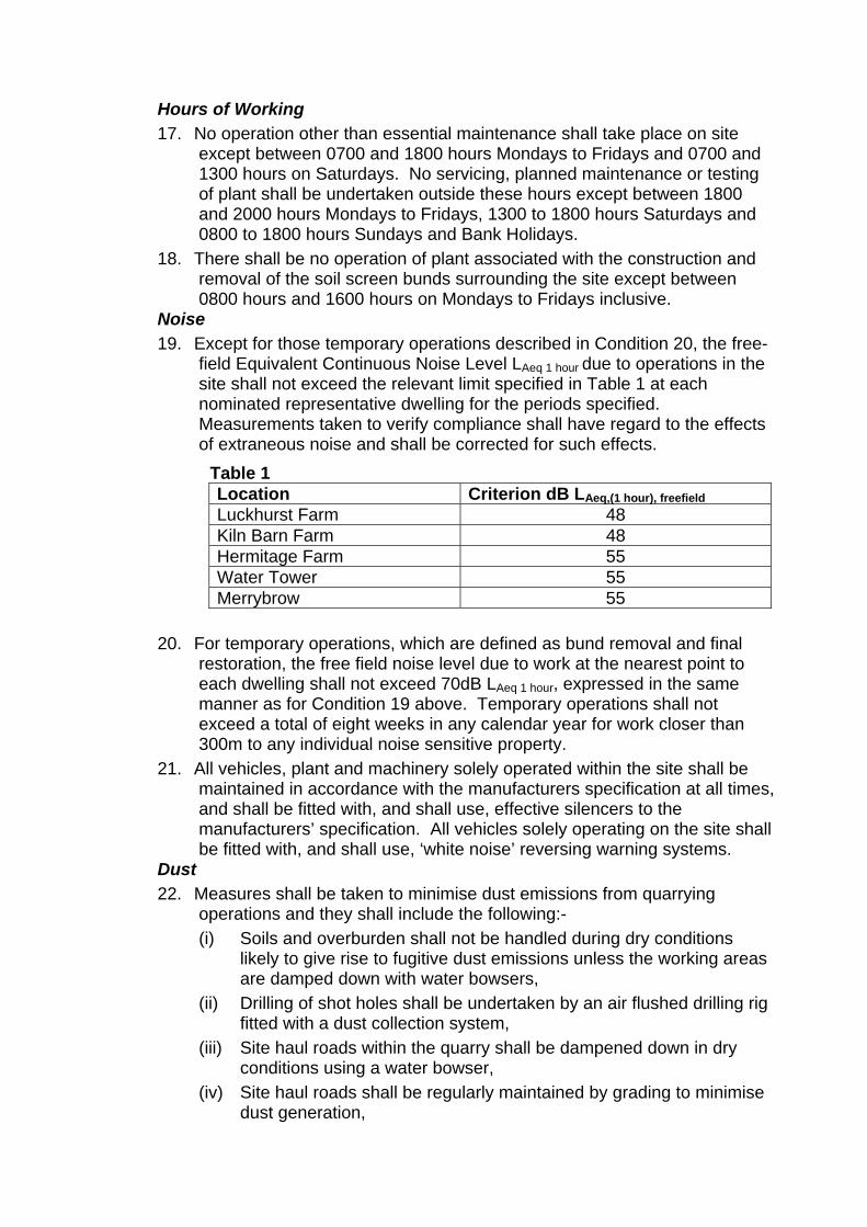
Hours of Working 17. No operation other than essential maintenance shall take place on site
except between 0700 and 1800 hours Mondays to Fridays and 0700 and 1300 hours on Saturdays. No servicing, planned maintenance or testing of plant shall be undertaken outside these hours except between 1800 and 2000 hours Mondays to Fridays, 1300 to 1800 hours Saturdays and 0800 to 1800 hours Sundays and Bank Holidays.
18. There shall be no operation of plant associated with the construction and removal of the soil screen bunds surrounding the site except between 0800 hours and 1600 hours on Mondays to Fridays inclusive.
Noise 19. Except for those temporary operations described in Condition 20, the free-
field Equivalent Continuous Noise Level LAeq 1 hour due to operations in the site shall not exceed the relevant limit specified in Table 1 at each nominated representative dwelling for the periods specified. Measurements taken to verify compliance shall have regard to the effects of extraneous noise and shall be corrected for such effects.
Table 1 Location Criterion dB LAeq,(1 hour), freefield Luckhurst Farm 48 Kiln Barn Farm 48 Hermitage Farm 55 Water Tower 55 Merrybrow 55
20. For temporary operations, which are defined as bund removal and final
restoration, the free field noise level due to work at the nearest point to each dwelling shall not exceed 70dB LAeq 1 hour, expressed in the same manner as for Condition 19 above. Temporary operations shall not exceed a total of eight weeks in any calendar year for work closer than 300m to any individual noise sensitive property.
21. All vehicles, plant and machinery solely operated within the site shall be maintained in accordance with the manufacturers specification at all times, and shall be fitted with, and shall use, effective silencers to the manufacturers’ specification. All vehicles solely operating on the site shall be fitted with, and shall use, ‘white noise’ reversing warning systems.
Dust 22. Measures shall be taken to minimise dust emissions from quarrying
operations and they shall include the following:- (i) Soils and overburden shall not be handled during dry conditions
likely to give rise to fugitive dust emissions unless the working areas are damped down with water bowsers,
(ii) Drilling of shot holes shall be undertaken by an air flushed drilling rig fitted with a dust collection system,
(iii) Site haul roads within the quarry shall be dampened down in dry conditions using a water bowser,
(iv) Site haul roads shall be regularly maintained by grading to minimise dust generation,
(v) When loading vehicles, drop heights shall be kept to the maximum that has previously been approved in writing by the Mineral Planning Authority
(vi) All HGV’s travelling on internal haul roads shall be subject to a speed limit of 15mph,
(vii) Once loaded at the existing quarry plant site, all lorries shall pass through the existing vehicle wheel wash before exiting onto the public highway,
(viii) All aggregate lorries accessing the highway shall be sheeted, except for those carrying stone greater than 75mm.
Drainage 23. Within three months of the date of this permission, details of the provision
to be made for the disposal of all water entering, arising on, or leaving the site during the permitted operations shall be submitted to the Mineral Planning Authority for written approval, and the scheme shall be carried out as approved.
Groundwater 24. Any facilities for storage of oils, fuels or chemicals on the site shall be sited
in impervious bases and surrounded by impervious bund walls. The volume of the bunded compound shall be at least equivalent to the capacity of the tank plus 10%. If there is multiple tankage, the compound shall be at least equivalent to the capacity of the largest tank, or the combined capacity of inter-connective tanks, plus 10%. All filling points, vents, gauges and site glasses shall be located within the bund. The drainage system of the bund shall be sealed with no discharge to any water course, land or underground strata. Associated pipework shall be located above ground and protected from accidental damage.
25. Prior to the commencement of the Westerly Extension, a scheme shall be submitted for the written approval of the Mineral Planning Authtority to prevent tipping by unauthorized persons on the site. The scheme shall be implemented as approved and any unauthorized material tipped on the site shall be removed within 24 hours of such tipping taking place.
Plant and Buildings 26. Notwithstanding the provisions of Part 19 of Schedule 2 of the Town and
Country Planning General Development Order 1995 as may be amended, no additional buildings, fixed plant or machinery shall be located on site without the prior approval in writing of the details of their siting, design and external appearance by the Mineral Planning Authority;
27. All plant, buildings, machinery and sanitary facilities and their foundations and bases, together with any internal access roads and vehicle parking shall be removed from the site at such time as they are no longer required for the working or restoration of the site, and the site shall be restored in accordance with the restoration scheme approved pursuant to Condition 2.
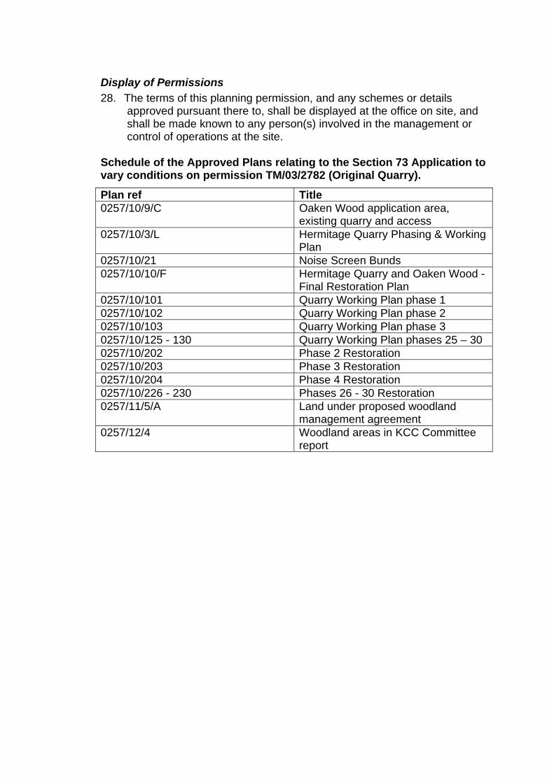
Display of Permissions 28. The terms of this planning permission, and any schemes or details
approved pursuant there to, shall be displayed at the office on site, and shall be made known to any person(s) involved in the management or control of operations at the site.
Schedule of the Approved Plans relating to the Section 73 Application to vary conditions on permission TM/03/2782 (Original Quarry).
Plan ref Title 0257/10/9/C Oaken Wood application area,
existing quarry and access 0257/10/3/L Hermitage Quarry Phasing & Working
Plan 0257/10/21 Noise Screen Bunds 0257/10/10/F Hermitage Quarry and Oaken Wood -
Final Restoration Plan 0257/10/101 Quarry Working Plan phase 1 0257/10/102 Quarry Working Plan phase 2 0257/10/103 Quarry Working Plan phase 3 0257/10/125 - 130 Quarry Working Plan phases 25 – 30 0257/10/202 Phase 2 Restoration 0257/10/203 Phase 3 Restoration 0257/10/204 Phase 4 Restoration 0257/10/226 - 230 Phases 26 - 30 Restoration 0257/11/5/A Land under proposed woodland
management agreement 0257/12/4 Woodland areas in KCC Committee
report
Annex A3 Conditions Southern Extension Working, Infill and Restoration 1. The development hereby permitted shall be carried out and completed in
all respects strictly in accordance with the plans referred to in the Schedule attached to this decision notice and as stipulated in the conditions set out below, together with those further details required to be submitted for approval; no variations or omissions shall take place without the prior approval in writing of the Mineral Planning Authority (MPA).
2. The working and restoration of the site shall be carried out in accordance with the following:- a. the details hereby approved, and the phasing as identified on Plan
0257/10/3/rev L entitled ‘Hermitage Quarry Phasing and Working Plan’ dated July 2012, and
b. within 3 months of the date of the decision notice, the phased restoration plans 0257/10/202 to 205 0257/10/226 to 0257/10/230 inclusive shall have been updated for consistency with the plan referred to in a. above, and they shall have been submitted to the MPA for written approval. The restoration scheme shall thereafter be implemented in accordance with the approved plans, and no variations or omissions shall take place.
3. The pre-settlement levels of the restored site shall be in accordance with the details set out in Planning Design Solutions letter dated 20 June 2008 and drawing number 0108/08/01 approved on 6 October 2008, and no variations or omissions shall take place.
4. No material shall be imported to the site for use in backfilling, except for subsoil, topsoil and solid inert waste (excluding notifiable asbestos).
5. Topsoil and subsoil shall only be handled when their moisture contents are at least 5% and 3% below their respective plastic limits. The plastic limits shall be determined and the results notified to the Mineral Planning Authority at least one week before the soils are stripped.
6. The top one metre of infill shall consist of either overburden or clean fill and, in either case, be free from any objects larger than 100mm in any direction.
7. On completion of each phase of infilling, topsoil and soil materials shall be re-spread to a total depth of at least 1.2 metres of final cover, consisting of a minimum of 0.95m of subsoil or soil forming material, covered by a minimum thickness of 100mm of topsoil.
8. All plant, buildings, machinery and sanitary facilities and their foundations and bases, together with any internal access roads and vehicle parking shall be removed from the site at such time as they are no longer required for the working or restoration of the site, and the site shall be restored in
accordance with the restoration scheme approved pursuant to Condition 2.
Cessation 9. In the event that the winning and working of minerals ceases for a period
of two years, the operations shall be deemed to have been abandoned and a revised scheme shall be submitted for approval in the same terms as set out under Condition 2. The site shall be restored and landscaped in accordance with that revised scheme and within the timescales set out therein.
Access 10. All vehicles shall enter and leave the site via the existing access onto
Hermitage Lane. Hours of Working 11. No operation other than essential maintenance shall take place on site
except between 0700 and 1800 hours Mondays to Fridays and 0700 and 1300 hours on Saturdays. No servicing, planned maintenance or testing of plant shall be undertaken outside these hours except between 1800 and 2000 hours Mondays to Fridays, 1300 to 1800 hours Saturdays and 0800 to 1800 hours Sundays and Bank Holidays.
12. There shall be no operation of plant associated with the removal of the soil screen bunds surrounding the site except between 0800 hours and 1600 hours on Mondays to Fridays inclusive.
Noise 13. Except for those temporary operations described in Condition 14, the free-
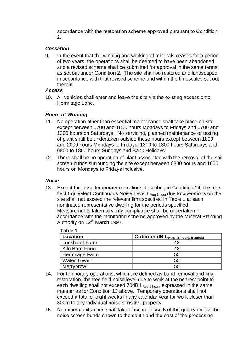
field Equivalent Continuous Noise Level LAeq 1 hour due to operations on the site shall not exceed the relevant limit specified in Table 1 at each nominated representative dwelling for the periods specified. Measurements taken to verify compliance shall be undertaken in accordance with the monitoring scheme approved by the Mineral Planning Authority on 12th March 1997.
Table 1 Location Criterion dB LAeq, (1 hour), freefield Luckhurst Farm 48 Kiln Barn Farm 48 Hermitage Farm 55 Water Tower 55 Merrybrow 55
14. For temporary operations, which are defined as bund removal and final restoration, the free field noise level due to work at the nearest point to each dwelling shall not exceed 70dB LAeq 1 hour, expressed in the same manner as for Condition 13 above. Temporary operations shall not exceed a total of eight weeks in any calendar year for work closer than 300m to any individual noise sensitive property.
15. No mineral extraction shall take place in Phase 5 of the quarry unless the noise screen bunds shown to the south and the east of the processing
area have been erected as shown on plan ref 0257/10/21 entitled ‘Noise Screen Bunds’ as submitted under TM/10/2029. They shall thereafter be retained until the processing plant is no longer in use.
16. All vehicles, plant and machinery solely operated within the site shall be maintained in accordance with the manufacturers specification at all times, and shall be fitted with, and shall use, effective silencers to the manufacturers’ specification. All vehicles operating solely on the site shall be fitted with, and shall use, ‘white noise’ reversing warning systems.
Dust 17. Measures shall be taken to minimise dust emissions from quarrying
operations and they shall include the following :- (i) Soils and overburden shall not be handled during dry conditions
likely to give rise to fugitive dust emissions unless the working areas are damped down with water bowsers,
(ii) Drilling of shot holes shall be undertaken by an air flushed drilling rig fitted with a dust collection system,
(iii) Site haul roads within the quarry shall be dampened down in dry conditions using a water bowser,
(iv) Site haul roads shall be regularly maintained by grading to minimise dust generation,
(v) When loading vehicles, drop heights shall be kept to the maximum that has previously been approved in writing by the Mineral Planning Authority
(vi) All HGV’s travelling on internal haul roads shall be subject to a speed limit of 15mph,
(vii) Once loaded at the existing quarry plant site, all lorries shall pass through the existing vehicle wheel wash before exiting onto the public highway,
(viii) All aggregate lorries accessing the highway shall be sheeted, except for those carrying stone greater than 75mm.
Blasting 18. Blasting shall not take place other than between the hours of 1000 and
1200 and 1300 to 1500 on Mondays to Fridays. No blasting shall take place on Saturdays, Sundays or Bank Holidays
19. No more than one blast shall take place in any one day. 20. Ground vibration as a result of blasting operations shall not exceed a peak
particle velocity of 6mm/sec in 95% of all blasts when measured over any period of 1 month, and no individual blast shall exceed a peak particle velocity of 10mm/sec as measured at any vibration sensitive property, and at no time shall vibration exceed 0.3mm/sec as measured at an agreed location at Maidstone Hospital; the measurement to be the maximum of three mutually perpendicular directions taken at the ground surface.
21. Prior to the commencement of blasting operations, details of the methods to be employed to minimise air overpressure to at least 120 dB shall have been approved in writing by the MPA, and the approved scheme shall be implemented.
Drainage 22. Within three months of the date of this permission, details of the provision
to be made for the disposal of all water entering, arising on, or leaving the site during the permitted operations shall be submitted to the Mineral Planning Authority for written approval, and the scheme shall be carried out as approved.
Groundwater 23. The level of the quarry floor shall not be excavated below 47m AOD at
grid reference northing 155 965 (along an east west line) and below 55m AOD at grid reference northing 155 575 (along an east west line) and the gradient of the quarry floor between these two lines shall not be steeper than 1:51 with the gradient measured between the above grid reference points.
24. Arrangements for the monitoring of groundwater levels at the site shall be implemented in accordance with the scheme approved by the Mineral Planning Authority on 12th March 1997.
25. Any facilities for storage of oils, fuels or chemicals on the site shall be sited in impervious bases and surrounded by impervious bund walls. The volume of the bunded compound shall be at least equivalent to the capacity of the tank plus 10%. If there is multiple tankage, the compound shall be at least equivalent to the capacity of the largest tank, or the combined capacity of inter-connective tanks, plus 10%. All filling points, vents, gauges and site glasses shall be located within the bund. The drainage system of the bund shall be sealed with no discharge to any water course, land or underground strata. Associated pipe-work shall be located above ground and protected from accidental damage.
26. The recycling operation shall be undertaken in accordance with the scheme approved by the Mineral Planning Authority on 12th March 1997.
27. Prior to the commencement of the Westerly Extension, a scheme shall be submitted for the written approval of the Mineral Planning Authtority to prevent tipping by unauthorized persons on the site. The scheme shall be implemented as approved and any unauthorized material tipped on the site shall be removed within 24 hours of such tipping taking place.
Plant and Buildings 28. Notwithstanding the provisions of Part 19 of Schedule 2 of the Town and
Country Planning General Development Order 1995 as may be amended, no additional buildings, fixed plant or machinery shall be located on site without the prior approval in writing of the details of their siting, design and external appearance by the Mineral Planning Authority.
Display of Permissions 29. The terms of this planning permission and any schemes or details
approved pursuant there to shall be displayed at the office on site, and shall be made known to any person(s) involved in the management or control of operations at the site.
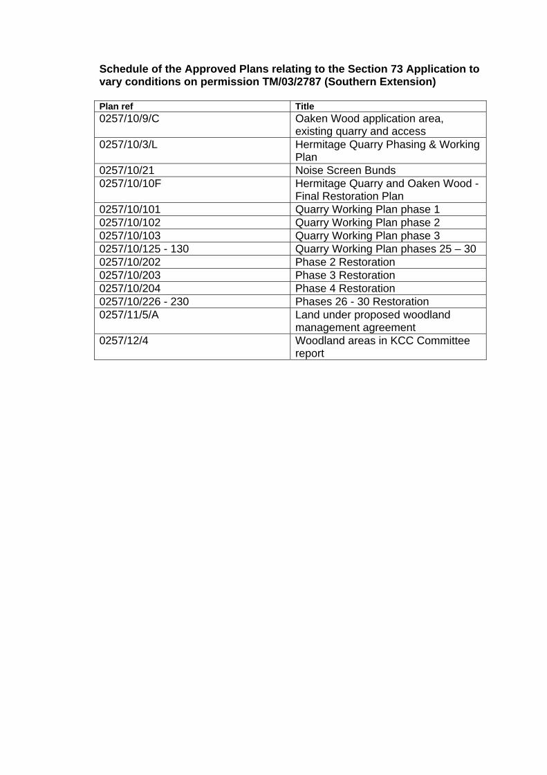
Schedule of the Approved Plans relating to the Section 73 Application to vary conditions on permission TM/03/2787 (Southern Extension) Plan ref Title 0257/10/9/C Oaken Wood application area,
existing quarry and access 0257/10/3/L Hermitage Quarry Phasing & Working
Plan 0257/10/21 Noise Screen Bunds 0257/10/10F Hermitage Quarry and Oaken Wood -
Final Restoration Plan 0257/10/101 Quarry Working Plan phase 1 0257/10/102 Quarry Working Plan phase 2 0257/10/103 Quarry Working Plan phase 3 0257/10/125 - 130 Quarry Working Plan phases 25 – 30 0257/10/202 Phase 2 Restoration 0257/10/203 Phase 3 Restoration 0257/10/204 Phase 4 Restoration 0257/10/226 - 230 Phases 26 - 30 Restoration 0257/11/5/A Land under proposed woodland
management agreement 0257/12/4 Woodland areas in KCC Committee
report
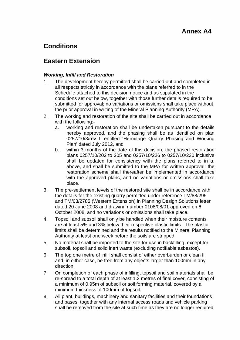
Annex A4 Conditions Eastern Extension Working, Infill and Restoration 1. The development hereby permitted shall be carried out and completed in
all respects strictly in accordance with the plans referred to in the Schedule attached to this decision notice and as stipulated in the conditions set out below, together with those further details required to be submitted for approval; no variations or omissions shall take place without the prior approval in writing of the Mineral Planning Authority (MPA).
2. The working and restoration of the site shall be carried out in accordance with the following:- a. working and restoration shall be undertaken pursuant to the details
hereby approved, and the phasing shall be as identified on plan 0257/10/3/rev L entitled ‘Hermitage Quarry Phasing and Working Plan’ dated July 2012, and
b. within 3 months of the date of this decision, the phased restoration plans 0257/10/202 to 205 and 0257/10/226 to 0257/10/230 inclusive shall be updated for consistency with the plans referred to in a. above, and shall be submitted to the MPA for written approval: the restoration scheme shall thereafter be implemented in accordance with the approved plans, and no variations or omissions shall take place.
3. The pre-settlement levels of the restored site shall be in accordance with the details for the existing quarry permitted under reference TM/88/295 and TM/03/2785 (Western Extension) in Planning Design Solutions letter dated 20 June 2008 and drawing number 0108/08/01 approved on 6 October 2008, and no variations or omissions shall take place.
4. Topsoil and subsoil shall only be handled when their moisture contents are at least 5% and 3% below their respective plastic limits. The plastic limits shall be determined and the results notified to the Mineral Planning Authority at least one week before the soils are stripped.
5. No material shall be imported to the site for use in backfilling, except for subsoil, topsoil and solid inert waste (excluding notifiable asbestos).
6. The top one metre of infill shall consist of either overburden or clean fill and, in either case, be free from any objects larger than 100mm in any direction.
7. On completion of each phase of infilling, topsoil and soil materials shall be re-spread to a total depth of at least 1.2 metres of final cover, consisting of a minimum of 0.95m of subsoil or soil forming material, covered by a minimum thickness of 100mm of topsoil.
8. All plant, buildings, machinery and sanitary facilities and their foundations and bases, together with any internal access roads and vehicle parking shall be removed from the site at such time as they are no longer required
for the working or restoration of the site, and the site shall be restored in accordance with the restoration scheme approved pursuant to Condition 2.
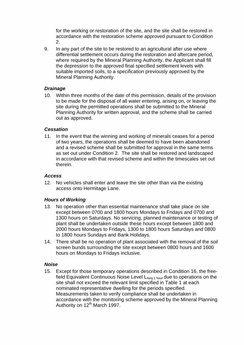
9. In any part of the site to be restored to an agricultural after use where differential settlement occurs during the restoration and aftercare period, where required by the Mineral Planning Authority, the Applicant shall fill the depression to the approved final specified settlement levels with suitable imported soils, to a specification previously approved by the Mineral Planning Authority.
Drainage 10. Within three months of the date of this permission, details of the provision
to be made for the disposal of all water entering, arising on, or leaving the site during the permitted operations shall be submitted to the Mineral Planning Authority for written approval, and the scheme shall be carried out as approved.
Cessation 11. In the event that the winning and working of minerals ceases for a period
of two years, the operations shall be deemed to have been abandoned and a revised scheme shall be submitted for approval in the same terms as set out under Condition 2. The site shall be restored and landscaped in accordance with that revised scheme and within the timescales set out therein.
Access 12. No vehicles shall enter and leave the site other than via the existing
access onto Hermitage Lane. Hours of Working 13. No operation other than essential maintenance shall take place on site
except between 0700 and 1800 hours Mondays to Fridays and 0700 and 1300 hours on Saturdays. No servicing, planned maintenance or testing of plant shall be undertaken outside these hours except between 1800 and 2000 hours Mondays to Fridays, 1300 to 1800 hours Saturdays and 0800 to 1800 hours Sundays and Bank Holidays.
14. There shall be no operation of plant associated with the removal of the soil screen bunds surrounding the site except between 0800 hours and 1600 hours on Mondays to Fridays inclusive.
Noise 15. Except for those temporary operations described in Condition 16, the free-
field Equivalent Continuous Noise Level LAeq 1 hour due to operations on the site shall not exceed the relevant limit specified in Table 1 at each nominated representative dwelling for the periods specified. Measurements taken to verify compliance shall be undertaken in accordance with the monitoring scheme approved by the Mineral Planning Authority on 12th March 1997.
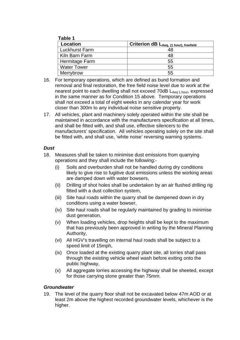
Table 1 Location Criterion dB LAeq, (1 hour), freefield Luckhurst Farm 48 Kiln Barn Farm 48 Hermitage Farm 55 Water Tower 55 Merrybrow 55
16. For temporary operations, which are defined as bund formation and removal and final restoration, the free field noise level due to work at the nearest point to each dwelling shall not exceed 70dB LAeq 1 hour, expressed in the same manner as for Condition 15 above. Temporary operations shall not exceed a total of eight weeks in any calendar year for work closer than 300m to any individual noise sensitive property.
17. All vehicles, plant and machinery solely operated within the site shall be maintained in accordance with the manufacturers specification at all times, and shall be fitted with, and shall use, effective silencers to the manufacturers’ specification. All vehicles operating solely on the site shall be fitted with, and shall use, ‘white noise’ reversing warning systems.
Dust 18. Measures shall be taken to minimise dust emissions from quarrying
operations and they shall include the following:- (i) Soils and overburden shall not be handled during dry conditions
likely to give rise to fugitive dust emissions unless the working areas are damped down with water bowsers,
(ii) Drilling of shot holes shall be undertaken by an air flushed drilling rig fitted with a dust collection system,
(iii) Site haul roads within the quarry shall be dampened down in dry conditions using a water bowser,
(iv) Site haul roads shall be regularly maintained by grading to minimise dust generation,
(v) When loading vehicles, drop heights shall be kept to the maximum that has previously been approved in writing by the Mineral Planning Authority,
(vi) All HGV’s travelling on internal haul roads shall be subject to a speed limit of 15mph,
(ix) Once loaded at the existing quarry plant site, all lorries shall pass through the existing vehicle wheel wash before exiting onto the public highway,
(x) All aggregate lorries accessing the highway shall be sheeted, except for those carrying stone greater than 75mm.
Groundwater 19. The level of the quarry floor shall not be excavated below 47m AOD or at
least 2m above the highest recorded groundwater levels, whichever is the higher.
20. Arrangements for the monitoring of groundwater levels at the site shall be implemented in accordance with the scheme approved by the Mineral Planning Authority on 12th March 1997.
21. The recycling operation shall be undertaken in accordance with the scheme approved by the Mineral Planning Authority on 12th March 1997.
22. Prior to the commencement of the Westerly Extension, a scheme shall be submitted for the written approval of the Mineral Planning Authtority to prevent tipping by unauthorized persons on the site. The scheme shall be implemented as approved and any unauthorized material tipped on the site shall be removed within 24 hours of such tipping taking place.
Plant and Buildings 23. Notwithstanding the provisions of Part 19 of Schedule 2 of the Town and
Country Planning General Development Order 1995 as may be amended, no additional buildings, fixed plant or machinery shall be located on site without the prior approval in writing of the details of their siting, design and external appearance by the Mineral Planning Authority.
Display of Permissions 24. The terms of this planning permission and any schemes or details
approved pursuant there to shall be displayed at the office on site, and shall be made known to any person(s) involved in the management or control of operations at the site.
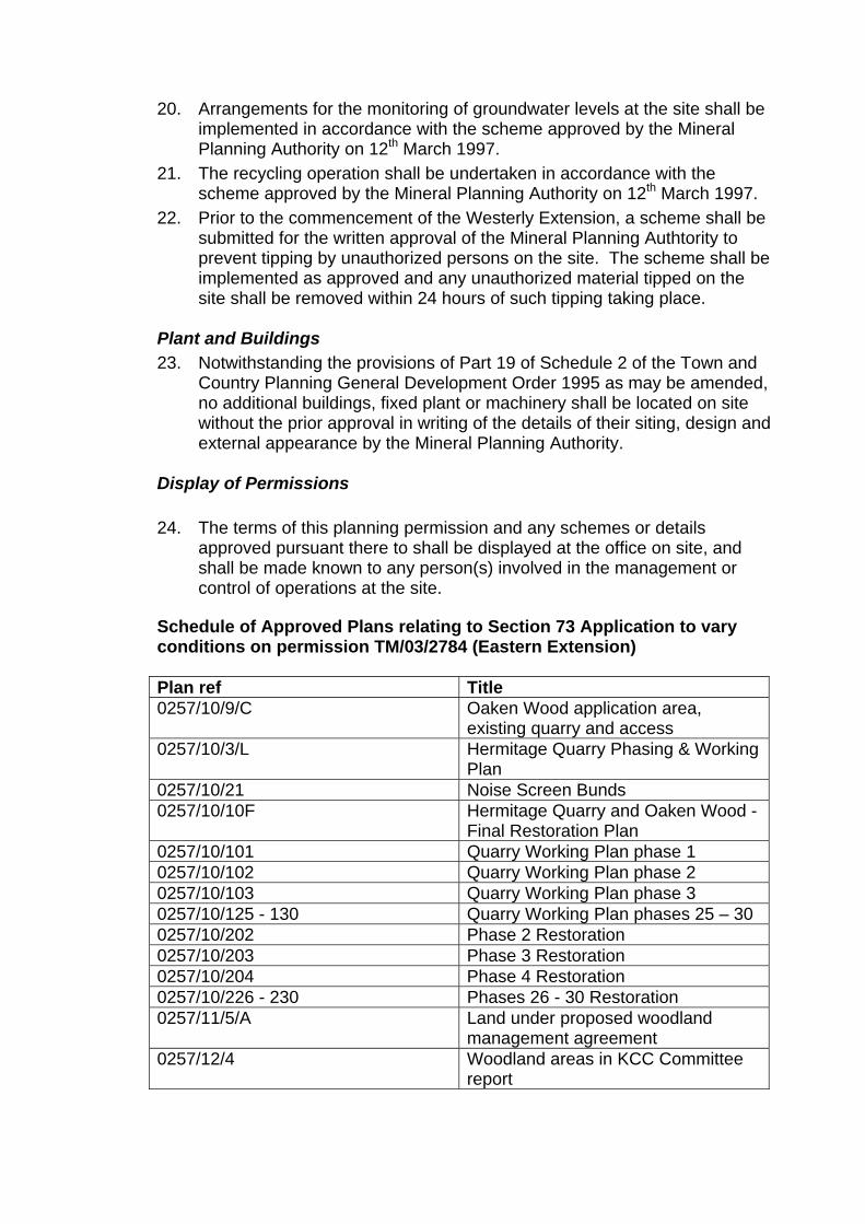
Schedule of Approved Plans relating to Section 73 Application to vary conditions on permission TM/03/2784 (Eastern Extension) Plan ref Title 0257/10/9/C Oaken Wood application area,
existing quarry and access 0257/10/3/L Hermitage Quarry Phasing & Working
Plan 0257/10/21 Noise Screen Bunds 0257/10/10F Hermitage Quarry and Oaken Wood -
Final Restoration Plan 0257/10/101 Quarry Working Plan phase 1 0257/10/102 Quarry Working Plan phase 2 0257/10/103 Quarry Working Plan phase 3 0257/10/125 - 130 Quarry Working Plan phases 25 – 30 0257/10/202 Phase 2 Restoration 0257/10/203 Phase 3 Restoration 0257/10/204 Phase 4 Restoration 0257/10/226 - 230 Phases 26 - 30 Restoration 0257/11/5/A Land under proposed woodland
management agreement 0257/12/4 Woodland areas in KCC Committee
report
Inquiry sitting days 27-30 November, 4-6, 13-14 and 18 December 2012 Hermitage Quarry, Hermitage Lane, Aylesford, Maidstone, Kent, ME16 8AE File Ref: APP/W2275/V/11/2158341
Report to the Secretary of State for Communities and Local Government by J I McPherson JP BSc CEng CEnv CWEM MICE MCIWEM MCMI an Inspector appointed by the Secretary of State for Communities and Local Government
Date: 11 March 2013
TOWN AND COUNTRY PLANNING ACT 1990
KENT COUNTY COUNCIL
APPLICATION
MADE BY
GALLAGHER AGGREGATES LTD
FOR
THE WESTERLY EXTENSION OF HERMITAGE QUARRY
AND
VARIATION OF THE PLANNING CONDITIONS RELATING TO THE EXISTING QUARRY PERMISSIONS
Report APP/W2275/V/11/2158341
www.planningportal.gov.uk/planninginspectorate Page 1
File Ref: APP/W2275/V/11/2158341 Hermitage Quarry, Hermitage Lane, Aylesford, Maidstone, Kent, ME16 8AE • The planning application was called in for decision by the Secretary of State by a direction,
made under section 77 of the Town and Country Planning Act 1990, on 27 July 2011. • The application is made by Gallagher Aggregates Ltd to Kent County Council. • The application Ref TM/10/2158341 was submitted with a letter dated 21 June 2010. • The proposed development is the westerly extension of Hermitage Quarry and the
variation of conditions (under Section 73 of the Act) relating to the original quarry and its previous extensions.
• The reason given for making the direction was that the proposals may conflict with national policies on important matters.
• On the information available at the time of making the direction, the following were the matters on which the Secretary of State particularly wished to be informed: a) The extent to which the proposed development is in accordance with the development
plan for the area including any ‘saved policies’. The weight that should be attached to the development plan, and any emerging plans, having regard to Section 38(6) of the Planning and Compulsory Purchase Act 2004 and other material considerations,
b) The extent to which the proposed development is consistent with Government Policies in Minerals Policy Statement 1: Planning and Minerals,
c) Any other issues which the Inspector considers appropriate. • The applications for the temporary diversions of Byway MR496 and Bridleway MR108 are
the subject of separate reports to the Secretaries of State at the Department for Transport and at the Department for the Environment, Food and Rural Affairs respectively.
Summary of Recommendations: • That the application for the Westerly Extension be approved, with the
recommended conditions, and • New permissions be approved for the Existing Quarry, the Southern
Extension and the Eastern Extension with the recommended conditions. NB. The two temporary highway diversions would also be required in order
to carry out the Westerly Extension.
Table of Contents Para No 1. Procedural Matters
The Application 1.1 Pre-Inquiry Meeting 1.5 Environmental Impact Assessment 1.6 Highways Orders 1.8 Inquiry Dates 1.11 Report Format 1.12
2. The Existing Quarry Location and Extent of the Quarry 2.1 Existing Operations 2.9
3. The Local Geology 3.1 4. The Proposed Westerly Extension 4.1
Consequential Effects of the Proposed Westerly Extension 4.11 Consideration of the Applications 4.14
5. Development Plan Policy South East Plan 5.1 Saved Policies of the Kent Minerals Local Plan: Construction Aggregates
5.5
Adopted Tonbridge and Malling Borough Council Core Strategy 5.6 Adopted TMBC Managing Development and the Environment DPD 5.7 Saved Policies of the Adopted TMBC Local Plan 5.8
Report APP/W2275/V/11/2158341
www.planningportal.gov.uk/planninginspectorate Page 2
6. Emerging Development Plan Policy The Kent Minerals and Waste Core Strategy (Local Plan) 6.1 The Kent Minerals Sites Plan 6.2
7. The Case for the Applicant (Gallagher Aggregates Ltd) Introduction 7.1 Need 7.3 A Steady and Adequate Supply of Ragstone 7.5 Dimension Stone Requirements 7.18 Site Selection and Alternatives 7.25 Geology 7.29 Groundwater 7.31 Ecology and Ancient Woodland 7.32 Landscape and Visual Impact 7.54 Archaeology 7.64 Impact on Local Residents 7.65 Waste Permitting 7.73 Economic Effects 7.75 The Proposed Diversion Orders 7.78 The Balance: the Framework and the Development Plan 7.82
8. The Case for the Mineral Planning Authority (Kent CC) Introduction 8.1 The Need for the Extension 8.4 Policy Requirements 8.6 The Existing and Potential Reserves 8.13 Real Need and Real Supply 8.20 Ancient Woodland
The Approach to the Issue 8.37 The Loss of Ancient Woodland in Perspective 8.47 Off-Setting Measures 8.61
Other Matters 8.65 Landscape and Visual Impact 8.66
Visual Impacts 8.70 Landscape Impact 8.74 Summary 8.79
Impact on Residential Amenity 8.81 Blasting 8.84 Dust 8.86 Noise 8.87 Traffic 8.89
Groundwater 8.91 Landfill 8.92 Geology 8.93 Heritage 8.94
The Balance 8.96 Conclusion 8.108
9. The Case for the Woodland Trust The Applicable Policy Framework 9.1 The Approach to Planning Judgement 9.6 The Benefits of Mineral Extraction 9.10 Landbank Requirements 9.14 Emerging Policy 9.30 Building Stone 9.37
Report APP/W2275/V/11/2158341
www.planningportal.gov.uk/planninginspectorate Page 3
Landscape
Methodology 9.41 Impact 9.45
Ecology 9.46 Soils 9.47 Carbon Footprint 9.51 Mitigation / Compensation 9.52 Conclusion 9.56
10. The Case for Kent Wildlife Trust Ancient Woodland 10.1 Loss of Ancient Woodland 10.4 Conclusion 10.8
11. The Cases for the Other Third Parties In Support of the Proposals
Kent Conservation Officers’ Group 11.1 Institute of Historic Building Conservation 11.9 Aylesford Parish Council 11.16 Mr Hathorn 11.20
In Opposition to the Proposals Save Oaken Wood Action Group 11.22
Woodland 11.23 Need 11.27 Noise 11.29 Conclusion 11.33
Barming Parish Council 11.35 Mrs Dyer
Need 11.39 Historic Buildings 11.46 Birds 11.47 Noise 11.49 Jobs 11.50 Conclusion 11.51
Mrs Malthouse Woodland 11.53 Residential Amenity 11.55
Mr Mew Introduction 11.56 Blasting 11.58 Noise
Quarrying Operations 11.62 Mobile and Fixed Plant 11.64
Mr Power 11.66 Building Stone 11.67 Employment 11.69 Carbon Footprint 11.71 Woodland 11.72 Residential Amenity 11.74 Conclusion 11.77
Mr Ridout Need 11.78 Quality and Quantity of Rock 11.83 Competition 11.91 Restoration 11.92 Blasting 11.93
Report APP/W2275/V/11/2158341
www.planningportal.gov.uk/planninginspectorate Page 4
Woodland 11.94 Conclusion 11.95
12. Written Representations 12.1 13. Planning Obligation 13.1 14. Variation of Existing Permissions 14.1 15. Suggested Planning Conditions 15.1 16. Conclusions
Main Considerations 16.1 Need for, and Supply of, the Minerals
Crushed Rock 16.3 Building / Dimension Stone 16.8 Geology 16.12 Sources of Supply 16.14 Landbank 16.22 Steady and Adequate Supply
Crushed Rock 16.29 Dimension Stone 16.31 Combined Supply 16.34
Summary of Conclusions on Need and Supply Crushed Rock 16.35 Dimension Stone 16.38 Combined Need and Supply 16.40
Ancient Woodland 16.41 Biodiversity 16.50 Landscape and Visual Impact
Methodology 16.63 Visual Impact
Existing Conditions 16.66 Future Conditions 16.68
Landscape Impact 16.74 Existing Conditions 16.75 Future Conditions 16.80
Archaeology and Heritage Impacts 16.85 Landfill and Waste Permitting 16.87 Groundwater 16.89 Residential Amenity
Blasting 16.90 Noise 16.98 Dust 16.104 Traffic 16.106 Recreational Uses 16.107 Prolonged Effects 16.110 Summary of Residential Amenity Impacts 16.113
Socio-Economics 16.114 Sustainability 16.117 Consequential Effects 16.123 Planning Obligation 16.126 Suggested Planning Conditions 16.128
Proposed Westerly Extension 16.129 Variation of Existing Permissions 16.154
Report APP/W2275/V/11/2158341
www.planningportal.gov.uk/planninginspectorate Page 5
Original Quarry 16.158 Southern Extension 16.165 Eastern Extension 16.169
Compliance with the Development Plan 16.173 The Development Plan 16.174 Weight to be Accorded to Policies 16.176 Need for, and Supply of, the Mineral 16.179 Ancient Woodland 16.183 Biodiversity 16.184 Landscape and Visual Impact 16.186 Archaeology and Heritage Impacts 16.190 Landfill and Waste Permitting 16.191 Groundwater 16.193 Residential Amenity 16.194 Public Rights of Way 16.203 Socio-Economics 16.204 Sustainability 16.206 Consistency with the Framework 16.208 Overall Compliance with the Development Plan 16.210
Other Material Considerations Emerging Development Plan Policies 16.212 The National Planning Policy Framework 16.217 Biodiversity Action Plans 16.221
Overall Conclusions on the Westerly Extension 16.222 Consequential Decisions 16.224
17. Recommendations 17.1 Annex A – Glossary of Abbreviations in the Report Page 114
Annex B1 – Glossaries of Specialist Terms B1 - Quarrying etc Terms from Mr Bate’s Evidence B2 – Minerals & Testing Terms from Mr Wilkinson’s Evidence B3 – Biodiversity Terms from Mr Goodwin’s Evidence B4 – Woodland Terms from Mr Mackworth-Praed’s Evidence B5 – Abbreviations used in Kent CC’s Evidence B6 – Geological Terms from Mrs Poole’s Evidence B7 – Soils Terms from Mr Allen’s Evidence B8 – Woodland Terms from Mr Barnes’ Evidence B9 – Biodiversity Terms from Dr Young’s Evidence
Page Nos 115 117 118 122 125 126 128 132 134
Annex C – Recommended Planning Conditions C1 - Westerly Extension Application
Applications to Vary Conditions C2 - Original Quarry, Section 73 C3 - Southern Extension, Section 73 C4 - Eastern Extension, Section 73
Page Nos 137
142 147 151
APPEARANCES Page 155 DOCUMENTS Page 157
Report APP/W2275/V/11/2158341
www.planningportal.gov.uk/planninginspectorate Page 6
1. Procedural Matters
The Application
1.1. In addition to the Application Plans (CD1.2), the Planning Application for the Westerly Extension of Hermitage Quarry (CD1.1) was accompanied by a Planning Statement (CD1.3) and an Environmental Statement (CD1.4-1.6).
1.2. Some of the Application Plans were amended after submission but before the Mineral Planning Authority, Kent County Council (KCC), had considered the Application (CD1.2a-1.2d).
1.3. KCC considered the Application on 10 May 2011 and resolved to grant planning permission subject to the Secretary of State not calling it in and subject also to a Section 106 Obligation and conditions (SOCG1a, Section 5).
1.4. On 27 July 2010, the Secretary of State called-in the application for his own decision under Section 77 of the 1990 Act (KCC/MC/P, para 2.5).
Pre-Inquiry Meeting
1.5. A Pre-Inquiry Meeting was held on 31 July 2012 (Notes of the Meeting at Document G1) and a preliminary accompanied site visit to both Hermitage Quarry and Blaise Farm Quarry was carried out immediately after the Meeting.
Environmental Impact Assessment
1.6. Following the Pre-Inquiry Meeting, an Addendum (CD1.7-1.9) was produced to the original Environmental Statement (ES)(CD1.4-1.6). This principally updated the ES in terms of the results of the ecological surveys carried out in 2012 (GAL/GJ/P, para 4.3.3). In addition to a general updating of the original ES, the addendum also reflects the issues raised during the processing of the application by KCC, the applications for Highway Orders, the new National Planning Policy Framework (the Framework), a reassessment of the mineral resources at Blaise Farm Quarry and further alternative sites information (GAL/GJ/P, para 4.3.4).
1.7. There were no objections to the adequacy of the Environmental Impact Assessment, and all of the environmental information has been taken into account in this report.
Highways Orders
1.8. In addition to the application for the Westerly Extension of Hermitage Quarry and the variation of the conditions applying to the existing quarry workings, the Inquiry also considered two Highway Orders sought by Gallagher Aggregates Limited.
1.9. One Order is for the temporary diversion of Byway MR496 for a period of 9 months while a cut and cover tunnel is constructed into the Westerly Extension site. There is a separate report on this Order to the Secretary of State at the Department for Transport.
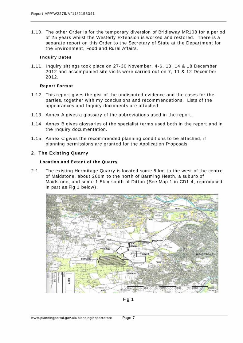
Report APP/W2275/V/11/2158341
www.planningportal.gov.uk/planninginspectorate Page 7
1.10. The other Order is for the temporary diversion of Bridleway MR108 for a period of 25 years whilst the Westerly Extension is worked and restored. There is a separate report on this Order to the Secretary of State at the Department for the Environment, Food and Rural Affairs.
Inquiry Dates
1.11. Inquiry sittings took place on 27-30 November, 4-6, 13, 14 & 18 December 2012 and accompanied site visits were carried out on 7, 11 & 12 December 2012.
Report Format
1.12. This report gives the gist of the undisputed evidence and the cases for the parties, together with my conclusions and recommendations. Lists of the appearances and Inquiry documents are attached.
1.13. Annex A gives a glossary of the abbreviations used in the report.
1.14. Annex B gives glossaries of the specialist terms used both in the report and in the Inquiry documentation.
1.15. Annex C gives the recommended planning conditions to be attached, if planning permissions are granted for the Application Proposals.
2. The Existing Quarry
Location and Extent of the Quarry
2.1. The existing Hermitage Quarry is located some 5 km to the west of the centre of Maidstone, about 260m to the north of Barming Heath, a suburb of Maidstone, and some 1.5km south of Ditton (See Map 1 in CD1.4, reproduced in part as Fig 1 below).
Fig 1
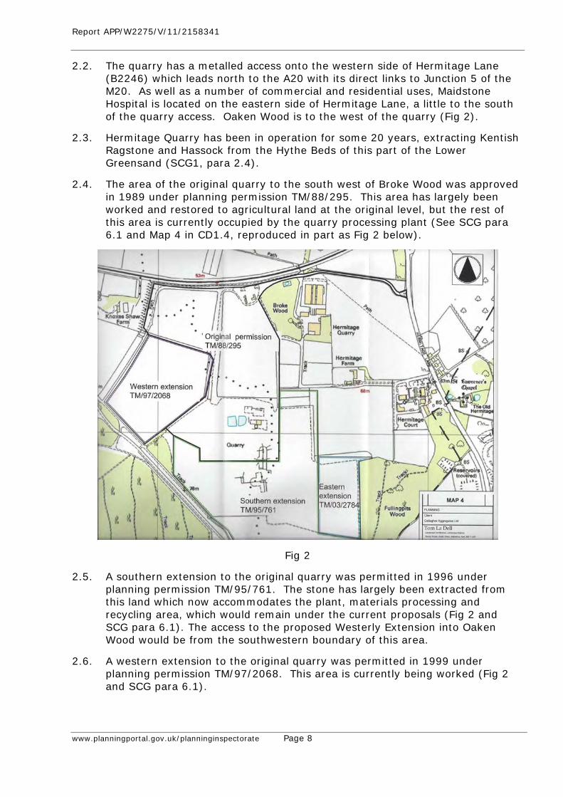
Report APP/W2275/V/11/2158341
www.planningportal.gov.uk/planninginspectorate Page 8
2.2. The quarry has a metalled access onto the western side of Hermitage Lane (B2246) which leads north to the A20 with its direct links to Junction 5 of the M20. As well as a number of commercial and residential uses, Maidstone Hospital is located on the eastern side of Hermitage Lane, a little to the south of the quarry access. Oaken Wood is to the west of the quarry (Fig 2).
2.3. Hermitage Quarry has been in operation for some 20 years, extracting Kentish Ragstone and Hassock from the Hythe Beds of this part of the Lower Greensand (SCG1, para 2.4).
2.4. The area of the original quarry to the south west of Broke Wood was approved in 1989 under planning permission TM/88/295. This area has largely been worked and restored to agricultural land at the original level, but the rest of this area is currently occupied by the quarry processing plant (See SCG para 6.1 and Map 4 in CD1.4, reproduced in part as Fig 2 below).
Fig 2
2.5. A southern extension to the original quarry was permitted in 1996 under planning permission TM/95/761. The stone has largely been extracted from this land which now accommodates the plant, materials processing and recycling area, which would remain under the current proposals (Fig 2 and SCG para 6.1). The access to the proposed Westerly Extension into Oaken Wood would be from the southwestern boundary of this area.
2.6. A western extension to the original quarry was permitted in 1999 under planning permission TM/97/2068. This area is currently being worked (Fig 2 and SCG para 6.1).
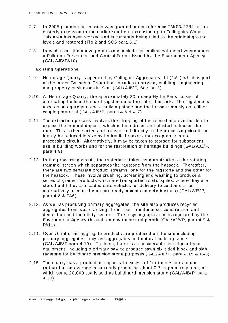
Report APP/W2275/V/11/2158341
www.planningportal.gov.uk/planninginspectorate Page 9
2.7. In 2005 planning permission was granted under reference TM/03/2784 for an easterly extension to the earlier southern extension up to Fullingpits Wood. This area has been worked and is currently being filled to the original ground levels and restored (Fig 2 and SCG para 6.1).
2.8. In each case, the above permissions include for infilling with inert waste under a Pollution Prevention and Control Permit issued by the Environment Agency (GAL/AJB/PA10).
Existing Operations
2.9. Hermitage Quarry is operated by Gallagher Aggregates Ltd (GAL) which is part of the larger Gallagher Group that includes quarrying, building, engineering and property businesses in Kent (GAL/AJB/P, Section 3).
2.10. At Hermitage Quarry, the approximately 30m deep Hythe Beds consist of alternating beds of the hard ragstone and the softer hassock. The ragstone is used as an aggregate and a building stone and the hassock mainly as a fill or capping material (GAL/AJB/P, paras 4.6 & 4.7).
2.11. The extraction process involves the stripping of the topsoil and overburden to expose the mineral deposit, which is then drilled and blasted to loosen the rock. This is then sorted and transported directly to the processing circuit, or it may be reduced in size by hydraulic breakers for acceptance in the processing circuit. Alternatively, it may be taken to storage for subsequent use in building works and for the restoration of heritage buildings (GAL/AJB/P, para 4.8).
2.12. In the processing circuit, the material is taken by dumptrucks to the rotating trammel screen which separates the ragstone from the hassock. Thereafter, there are two separate product streams, one for the ragstone and the other for the hassock. These involve crushing, screening and washing to produce a series of graded products which are transported to stockpiles, where they are stored until they are loaded onto vehicles for delivery to customers, or alternatively used in the on-site ready-mixed concrete business (GAL/AJB/P, para 4.8 & PA6).
2.13. As well as producing primary aggregates, the site also produces recycled aggregates from waste arisings from road maintenance, construction and demolition and the utility sectors. The recycling operation is regulated by the Environment Agency through an environmental permit (GAL/AJB/P, para 4.9 & PA11).
2.14. Over 70 different aggregate products are produced on the site including primary aggregates, recycled aggregates and natural building stone (GAL/AJB/P para 4.10). To do so, there is a considerable use of plant and equipment, including a primary saw to produce sawn six sided block and slab ragstone for building/dimension stone purposes (GAL/AJB/P, para 4.15 & PA3).
2.15. The quarry has a production capacity in excess of 1m tonnes per annum (mtpa) but on average is currently producing about 0.7 mtpa of ragstone, of which some 20,000 tpa is sold as building/dimension stone (GAL/AJB/P, para 4.20).
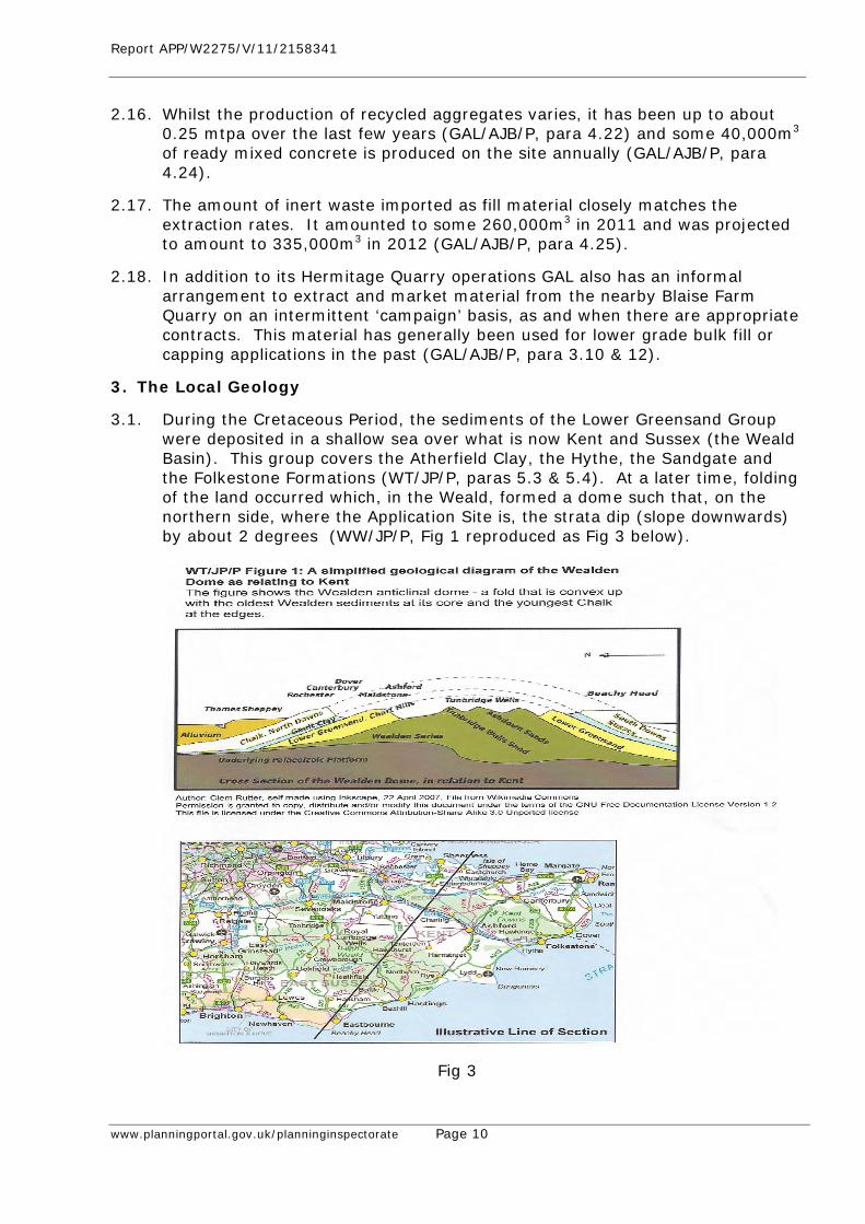
Report APP/W2275/V/11/2158341
www.planningportal.gov.uk/planninginspectorate Page 10
2.16. Whilst the production of recycled aggregates varies, it has been up to about 0.25 mtpa over the last few years (GAL/AJB/P, para 4.22) and some 40,000m3 of ready mixed concrete is produced on the site annually (GAL/AJB/P, para 4.24).
2.17. The amount of inert waste imported as fill material closely matches the extraction rates. It amounted to some 260,000m3 in 2011 and was projected to amount to 335,000m3 in 2012 (GAL/AJB/P, para 4.25).
2.18. In addition to its Hermitage Quarry operations GAL also has an informal arrangement to extract and market material from the nearby Blaise Farm Quarry on an intermittent ‘campaign’ basis, as and when there are appropriate contracts. This material has generally been used for lower grade bulk fill or capping applications in the past (GAL/AJB/P, para 3.10 & 12).
3. The Local Geology
3.1. During the Cretaceous Period, the sediments of the Lower Greensand Group were deposited in a shallow sea over what is now Kent and Sussex (the Weald Basin). This group covers the Atherfield Clay, the Hythe, the Sandgate and the Folkestone Formations (WT/JP/P, paras 5.3 & 5.4). At a later time, folding of the land occurred which, in the Weald, formed a dome such that, on the northern side, where the Application Site is, the strata dip (slope downwards) by about 2 degrees (WW/JP/P, Fig 1 reproduced as Fig 3 below).
Fig 3
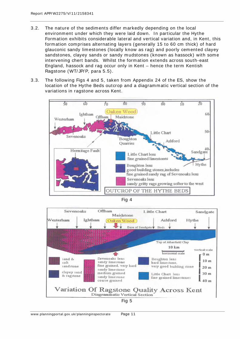
Report APP/W2275/V/11/2158341
www.planningportal.gov.uk/planninginspectorate Page 11
3.2. The nature of the sediments differ markedly depending on the local environment under which they were laid down. In particular the Hythe Formation exhibits considerable lateral and vertical variation and, in Kent, this formation comprises alternating layers (generally 15 to 60 cm thick) of hard glauconic sandy limestones (locally know as rag) and poorly cemented clayey sandstones, clayey sands or sandy mudstones (known as hassock) with some intervening chert bands. Whilst the formation extends across south-east England, hassock and rag occur only in Kent – hence the term Kentish Ragstone (WT/JP/P, para 5.5).
3.3. The following Figs 4 and 5, taken from Appendix 24 of the ES, show the location of the Hythe Beds outcrop and a diagrammatic vertical section of the variations in ragstone across Kent.
Fig 4
Fig 5
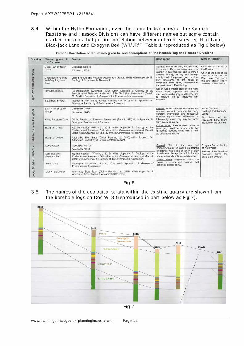
Report APP/W2275/V/11/2158341
www.planningportal.gov.uk/planninginspectorate Page 12
3.4. Within the Hythe Formation, even the same beds (lanes) of the Kentish Ragstone and Hassock Divisions can have different names but some contain marker horizons that permit correlation between different sites, eg Flint Lane, Blackjack Lane and Exogyra Bed (WT/JP/P, Table 1 reproduced as Fig 6 below)
Fig 6
3.5. The names of the geological strata within the existing quarry are shown from the borehole logs on Doc WT8 (reproduced in part below as Fig 7).
Fig 7
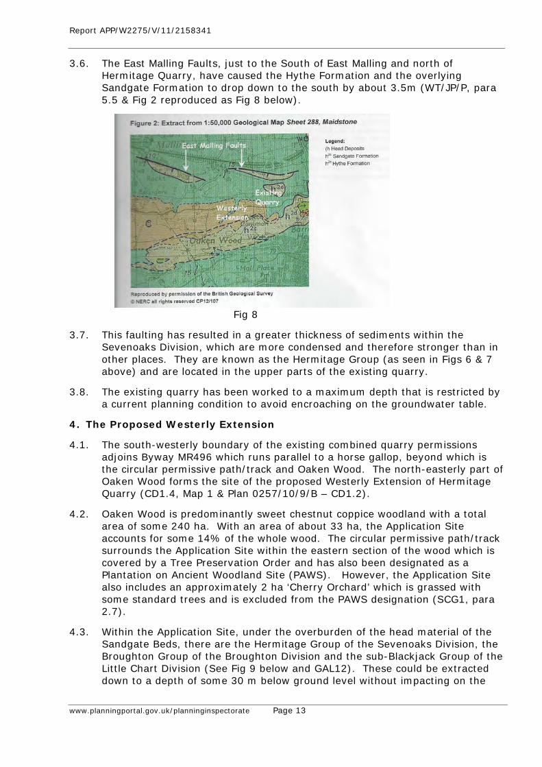
Report APP/W2275/V/11/2158341
www.planningportal.gov.uk/planninginspectorate Page 13
3.6. The East Malling Faults, just to the South of East Malling and north of Hermitage Quarry, have caused the Hythe Formation and the overlying Sandgate Formation to drop down to the south by about 3.5m (WT/JP/P, para 5.5 & Fig 2 reproduced as Fig 8 below).
Fig 8
3.7. This faulting has resulted in a greater thickness of sediments within the Sevenoaks Division, which are more condensed and therefore stronger than in other places. They are known as the Hermitage Group (as seen in Figs 6 & 7 above) and are located in the upper parts of the existing quarry.
3.8. The existing quarry has been worked to a maximum depth that is restricted by a current planning condition to avoid encroaching on the groundwater table.
4. The Proposed Westerly Extension
4.1. The south-westerly boundary of the existing combined quarry permissions adjoins Byway MR496 which runs parallel to a horse gallop, beyond which is the circular permissive path/track and Oaken Wood. The north-easterly part of Oaken Wood forms the site of the proposed Westerly Extension of Hermitage Quarry (CD1.4, Map 1 & Plan 0257/10/9/B – CD1.2).
4.2. Oaken Wood is predominantly sweet chestnut coppice woodland with a total area of some 240 ha. With an area of about 33 ha, the Application Site accounts for some 14% of the whole wood. The circular permissive path/track surrounds the Application Site within the eastern section of the wood which is covered by a Tree Preservation Order and has also been designated as a Plantation on Ancient Woodland Site (PAWS). However, the Application Site also includes an approximately 2 ha ‘Cherry Orchard’ which is grassed with some standard trees and is excluded from the PAWS designation (SCG1, para 2.7).
4.3. Within the Application Site, under the overburden of the head material of the Sandgate Beds, there are the Hermitage Group of the Sevenoaks Division, the Broughton Group of the Broughton Division and the sub-Blackjack Group of the Little Chart Division (See Fig 9 below and GAL12). These could be extracted down to a depth of some 30 m below ground level without impacting on the
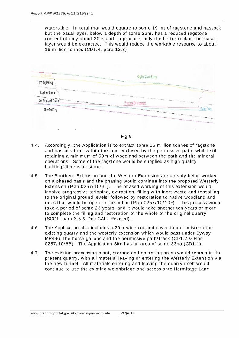
Report APP/W2275/V/11/2158341
www.planningportal.gov.uk/planninginspectorate Page 14
watertable. In total that would equate to some 19 mt of ragstone and hassock but the basal layer, below a depth of some 22m, has a reduced ragstone content of only about 30% and, in practice, only the better rock in this basal layer would be extracted. This would reduce the workable resource to about 16 million tonnes (CD1.4, para 13.3).
Fig 9
4.4. Accordingly, the Application is to extract some 16 million tonnes of ragstone and hassock from within the land enclosed by the permissive path, whilst still retaining a minimum of 50m of woodland between the path and the mineral operations. Some of the ragstone would be supplied as high quality building/dimension stone.
4.5. The Southern Extension and the Western Extension are already being worked on a phased basis and the phasing would continue into the proposed Westerly Extension (Plan 0257/10/3L). The phased working of this extension would involve progressive stripping, extraction, filling with inert waste and topsoiling to the original ground levels, followed by restoration to native woodland and rides that would be open to the public (Plan 0257/10/10F). This process would take a period of some 23 years, and it would take another ten years or more to complete the filling and restoration of the whole of the original quarry (SCG1, para 3.5 & Doc GAL2 Revised).
4.6. The Application also includes a 20m wide cut and cover tunnel between the existing quarry and the westerly extension which would pass under Byway MR496, the horse gallops and the permissive path/track (CD1.2 & Plan 0257/10/6B). The Application Site has an area of some 33ha (CD1.1).
4.7. The existing processing plant, storage and operating areas would remain in the present quarry, with all material leaving or entering the Westerly Extension via the new tunnel. All materials entering and leaving the quarry itself would continue to use the existing weighbridge and access onto Hermitage Lane.
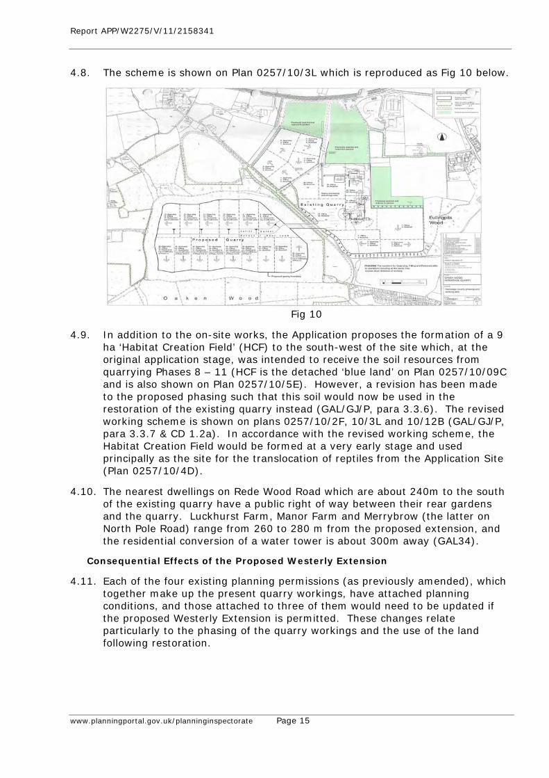
Report APP/W2275/V/11/2158341
www.planningportal.gov.uk/planninginspectorate Page 15
4.8. The scheme is shown on Plan 0257/10/3L which is reproduced as Fig 10 below.
Fig 10
4.9. In addition to the on-site works, the Application proposes the formation of a 9 ha ‘Habitat Creation Field’ (HCF) to the south-west of the site which, at the original application stage, was intended to receive the soil resources from quarrying Phases 8 – 11 (HCF is the detached ‘blue land’ on Plan 0257/10/09C and is also shown on Plan 0257/10/5E). However, a revision has been made to the proposed phasing such that this soil would now be used in the restoration of the existing quarry instead (GAL/GJ/P, para 3.3.6). The revised working scheme is shown on plans 0257/10/2F, 10/3L and 10/12B (GAL/GJ/P, para 3.3.7 & CD 1.2a). In accordance with the revised working scheme, the Habitat Creation Field would be formed at a very early stage and used principally as the site for the translocation of reptiles from the Application Site (Plan 0257/10/4D).
4.10. The nearest dwellings on Rede Wood Road which are about 240m to the south of the existing quarry have a public right of way between their rear gardens and the quarry. Luckhurst Farm, Manor Farm and Merrybrow (the latter on North Pole Road) range from 260 to 280 m from the proposed extension, and the residential conversion of a water tower is about 300m away (GAL34).
Consequential Effects of the Proposed Westerly Extension
4.11. Each of the four existing planning permissions (as previously amended), which together make up the present quarry workings, have attached planning conditions, and those attached to three of them would need to be updated if the proposed Westerly Extension is permitted. These changes relate particularly to the phasing of the quarry workings and the use of the land following restoration.
Report APP/W2275/V/11/2158341
www.planningportal.gov.uk/planninginspectorate Page 16
4.12. The Highways Order Applications were made on 1 June 2012 to divert Byway MR496 to allow for the construction of the cut and cover tunnel, and to divert Bridleway MR108, which crosses the proposed working area, until restoration has been completed (GAL/GJ/P, para 3.4.1).
4.13. Over and above the approximately 33 ha of new native woodland proposed on the site, there is a Section 106 Planning Obligation which is intended to provide some 26.6 ha of additional woodland planting in the vicinity of the site (including the Habitat Creation Field), the management of 4.3 ha of recently planted woodland and 41.8 ha of other existing woodland, as well as the management of some 1.4 ha (6.8km) of existing hedgerows. This total of some 107 ha would be the subject of a Woodland Management Plan which is attached to the Planning Obligation (GAL/GJ/P, para 3.3.9(vii)). The adequacy of this Section 106 obligation is considered in Section 13 below.
Consideration of the Applications
4.14. Although there have been revisions to the phases of working since KCC considered the Application, they simply affect the internal working of the site and would not prejudice anyone else. They should therefore be accepted as part of the Application Proposals.
4.15. The two Highways Orders are for determination by the relevant Secretaries of State.
5. Development Plan Policy South East Plan (May 2009) CD 4.1)
5.1. The Government has announced the intention to revoke the South East Plan (SEP) but, for the time being, it remains part of the Development Plan.
5.2. The vision of the SEP includes a socially and economically strong, healthy and just South East that respects the limits of the global environment.
5.3. The relevant policies in the SEP are as follows:- • Policy CC1 - States that the principal objective of the plan is to achieve
sustainable development, • Policy RE1 - Calls for the regional economy to contribute to the UK’s long
term competiveness, • Policy NRM2 - Aims to maintain and enhance water quality, • Policy NRM5 - Seeks the conservation and improvement of biodiversity, • Policy NRM7 - Calls for woodlands to be protected and enhanced, • Policy NRM10 - Required measures to address and reduce noise pollution, • Policy W13 - Says that provision should be made for landfill capacity, • Policy W14 - Seeks high quality restoration, • Policy M1 - Declares and intention to work with others to achieve
sustainable construction, • Policy M2 - Sets targets for recycled and secondary aggregates, and • Policy M3 - Sets a crushed rock apportionment of 1.2mtpa for Kent.
5.4. Modifications were being considered to Policy M3 at the time that the intention to revoke the SEP was announced (CD 4.2). These included a reduced crushed
Report APP/W2275/V/11/2158341
www.planningportal.gov.uk/planninginspectorate Page 17
rock apportionment of 0.78 mtpa for Kent, and the Department for Communities and Local Government’s Chief Planner’s letter of 6 July 2010 advised Planning Authorities in the South East to use the ‘Proposed Changes’ apportionment.
Saved Policies of the Kent Minerals Local Plan: Construction Aggregates (December 1993)(CD4.11)
5.5. The following policies are relevant:- • Policy CA7 - Calls for evidence of the extent and quality of mineral
reserves, • Policy CA8D - Mineral workings outside areas of search to be the exception, • Policy CA16 - Safeguards highway safety, • Policy CA18 - Seeks controls over noise, vibration and dust, • Policy CA19 - Controls the siting, design and appearance of fixed plant and
buildings, • Policy CA21 - Needs the effects on the uses of public rights of way to be
considered, • Policy CA22 - Requires an appropriate landscaping scheme, and • Policy CA23 - Requires a satisfactory working and restoration scheme.
Adopted Tonbridge and Malling Borough Council (TMBC) Core Strategy (2007) (CD4.9)
5.6. The following policies are relevant:- • Policy CP1 - Calls for a high quality sustainable environment, • Policy CP2 - Aims to prevent harm from increased traffic, • Policy CP5 - Seeks to prevent development in the Mid-Kent Strategic Gap, • Policy CP14 - Controls development in the countryside, • Policy CP24 - Requires high quality design, and • Policy CP25 - Requires mitigation of material harm to natural or historic
resources.
Adopted TMBC Managing Development and the Environment DPD (2010) (CD4.10)
5.7. The following policies are relevant:- • Policy NE1 - Protects Local Wildlife Sites, • Policy NE2 - Seeks to protect and enhance habitats and networks where
this would contribute to the UK and Kent Biodiversity Action Plans,
• Policy NE3 - Calls for the retention or provision of habitats and wildlife links and for mitigation measures if biodiversity or wildlife habitats would be harmed,
• Policy NE4 - Aims to maintain or enhance tree cover and hedgerows and to protect ancient woodland unless the need for, and the benefits of, the development in that location override the harm,
• Policy SQ1 - Requires the protection and enhancement of the character and local distinctiveness of the local landscape, including its tranquillity,
• Policy SQ4 - Seeks to protect air quality,
Report APP/W2275/V/11/2158341
www.planningportal.gov.uk/planninginspectorate Page 18
• Policy SQ6 - Deals with the noise from transport-related sources and for noise sensitive developments, and
• Policy SQ8 - Requires adequate highway infrastructure and no significant harm to highway safety.
Saved Policies of the Adopted TMBC Local Plan (1998) (CD4.12)
5.8. There are no saved policies in this Plan of relevance to the Application Proposals.
6. Emerging Development Plan Policy
The Kent Minerals and Waste Core Strategy (Local Plan) (CD4.4)
6.1. The Minerals and Waste Core Strategy, Strategy and Policy Directions Consultation Document was published in May 2011 (CD4.4). It is now referred to as the Minerals and Waste Local Plan and adoption is anticipated in about the beginning of 2015.
The Kent Minerals Sites Plan (CD4.6)
6.2. The Preferred Options Consultation Document for the Minerals Sites Plan was published in May 2012 (CD4.6) and adoption is currently anticipated about a year after the adoption of the Minerals and Waste Local Plan.
7. The Case for the Applicant (Gallagher Aggregates Ltd) (GAL)
Introduction
7.1. The issues in determining the application are those formulated by the Secretary of State as amplified by the Inspector at the Pre-Inquiry Meeting, as follows:- • Need, • Site selection and alternatives, • Geology, • Groundwater, • Ecology and ancient woodland matters, • Landscape and visual impact, • Archaeology and heritage matters, • Impact on local residents, • Waste Permitting, • Economic effects, • Proposed diversion orders, and • The Balance: Compliance with the Development Plan and the National
Planning Policy Framework (NPPF).
7.2. There is no objection to the adequacy of the Environmental Statement (ES), as augmented by the ES Addendum. Between them, they encompass the effects of both the extension site proposals and the Section 73 applications.
Report APP/W2275/V/11/2158341
www.planningportal.gov.uk/planninginspectorate Page 19
Need
7.3. Crushed rock and sand and gravel made up over 70% of the construction minerals produced in the last decade in the UK and the highest demand is in London and the South East. 1 In 2009 the Kent and Medway sub-region consumed some 5.7 million tonnes (mt) of these primary aggregates, 1.9 mt being crushed rock. The equivalent figures for 2005 were 5.2 mt of primary aggregates and 1.4 mt of crushed rock. In 2009 some 0.8 mt of crushed rock was produced from Hermitage and Blaise Farm Quarries and the remainder of the sub-regional demand was made up of imports. 2
7.4. The Application Proposals would meet two coincident needs; the need to ensure that Kent provides a steady and adequate supply of hard rock in the form of ragstone and the need to ensure that ragstone of the appropriate quality and dimensions is provided to meet national heritage requirements.
A Steady and Adequate Supply of Ragstone
7.5. Ragstone is the only hard rock which is realistically capable of being worked in Kent. There was some reference to the possible underground mining of limestone in the emerging Kent MWDF. That is a concept which was first floated in the Verney report in the early 1970s. It was contemplated as a potential source of rock in the 1986 Kent Structure Plan but there is still no realistic prospect of such working, as confirmed most recently in the Hicks report for Defra.3
7.6. Policy M3 of the South East Plan (SEP) (as proposed to be changed)4 gives the sub-regional apportionment for Kent as the provision of 0.78 million tonnes per annum of crushed rock. This can be afforded significant weight because of the subsequent Government advice that planning authorities in the South East should work from that apportionment.5 Unless that Government advice is changed, the prospective revocation of the SEP would make no difference. Furthermore, KCC has accepted this figure, saying ‘it is an accurate representation of past sales in the county,’6 concluding that it ‘remains relevant and credible and will continue to be used’. 7
7.7. Mr Steedman, The Woodland Trust’s (WT) planning witness, agreed that there remains a presumption that the 0.78 mtpa will continue8, that it could only be displaced with a proper evidence base9 and that this Inquiry was the wrong forum to seek to change the apportionment10.
1 GAL/BR/PA, para 2.16 2 GAL/BR/PA, para 3.2 ‐ 3.7 3 XX Steedman Day 5; GAL 19: indeed, the barriers are “firmer (now) than at any time since Verney speculated about it in the early 1970s …” 4 CD 4.2 5 CD 3.7 para 15 6 CD 4.7 para 5.0.10 7 CD 4.7 para 5.0.17 8 WT/JS/P, para 2.9 9 XX Steedman Day 5 10 XX Steedman Day 5
Report APP/W2275/V/11/2158341
www.planningportal.gov.uk/planninginspectorate Page 20
7.8. Without Hermitage Quarry more crushed rock would have to be imported by rail from the Mendips or Leicestershire or by sea from Scotland or France11. The purpose of ensuring an indigenous supply of hard rock includes the evident sustainability benefits of limiting long-distance imports. These benefits are explicitly recognised in Policy M1 of the South East Plan12 and the emerging Kent MWDF: ‘mineral supplies should be sourced indigenously where possible to reduce the need to transport minerals over long distances and minimise carbon emissions.’13 The fact that Kent already has to import significant volumes of hard rock reinforces, rather than lessens, the need to ensure that the requirement is met14, not least when having regard to GAL’s economic evidence that projects further sustained growth in Kent.15
7.9. The overarching objective in paragraph 145 of the Framework16, and also at paragraph 11 of the October 2012 Guidance on the Managed Aggregate Supply System17, is for a ‘steady and adequate supply’ of crushed rock, which in Kent is ragstone. This expression is notably absent from the WT evidence.
7.10. Hermitage Quarry currently provides that steady and adequate supply of ragstone, but the permitted reserves would be exhausted in late 2014 or early 2015 when production would cease.
7.11. Blaise Farm Quarry cannot be relied upon to provide a steady and adequate supply to meet the 0.78 mtpa requirement. It was only worked by its owners, Hanson, from 2001 – 2005 before being mothballed having regard to ‘increasing competition from recycled and other materials’18.
7.12. The Inquiry heard evidence from two geologists in respect of the resource at Blaise Farm; Mr Wilkinson for the Applicant and Mrs Poole for the Woodland Trust. Mrs Poole confirmed that the evidence ‘strongly suggests that the hassock material from Blaise Quarry is inferior to that at Hermitage, being likely to give rise to much greater quantities of waste, much smaller volumes of usable aggregate and much higher processing costs’19, and that the ragstone at Blaise Farm is ‘of poorer quality relative to Hermitage Quarry’20. The material from Blaise Farm cannot produce higher grade products, such as concrete and bituminous materials21. It is so poor that only with the investment in the type of plant at Hermitage Quarry would there be any (theoretical) prospect of even basic Type 1 sub-base materials being achieved.22 The material can therefore only compete in the capping and bulk fill market where there is ‘a significant commercial and social incentive for end users to procure secondary and recycled aggregates’ (Mrs Poole). The current
11 GAL/BR/P, para 5.5 12 CD 4.1 13 CD 4.7, para 7.2.4 14 GAL/BR/P, paras 4.5 and 5.9 15 GAL/BR/P, paras. 4.7 to 4.25 16 CD 3.1 17 CD 3.20 18 GAL/AJB/PA8 19 WT/JP/P, para 7.17 20 WT/JP/P, para 4.4; para 7.29 21 GAL 22; it fails to meet the fundamental MGS04 test, has high absorption, does not meet GAL’s fines test, and fails or is doubtful in respect of LA abrasion. It is also far weaker (GAL/AW/PA p.53) 22 XX Poole Day 6; even that fails the fundamental MGS04 test, where the results, even using the advanced processing at Hermitage, are “particularly high”.
Report APP/W2275/V/11/2158341
www.planningportal.gov.uk/planninginspectorate Page 21
price of bulk fill from Blaise Farm is about £4.75 - £5.00 per tonne, before the addition of the Aggregates Levy; comparing very unfavourably with comparable recycled material at some £3.50 - £4 per tonne23. Mrs Poole confirmed that the Levy, and the focus on higher specifications, ‘significantly reduces the demand for low grade aggregates from primary sources’24.
7.13. Mr Bate, GAL’s Quarry Operations Witness, provided detailed evidence about why resumed production from Blaise Farm, beyond the current basis of bulk fill and capping materials on a campaign basis, would not be viable. This evidence was not challenged by the Woodland Trust (WT)25. It included factors such as the cost of plant, the cost of double handling, the uncompetitive conditions for the material and its poor quality. If the Hermitage Quarry application does not succeed, he confirmed that even the intermittent use of Blaise Farm for low grade purposes would be likely to cease26.
7.14. This evidence is corroborated by the fact that, when operated by Hanson prior to mothballing, Blaise Farm only produced low grade materials27. That accords with the problems that GAL had when seeking to use material from Blaise Farm for Type 1 footpath uses; the highest that Blaise Farm can aspire to28. There have even been problems with bulk fill, as experience at Dartford indicated29.
7.15. These are exactly the circumstances where reliance on an arithmetic landbank would lead to a distorted outcome. The October 2012 Guidance on the Managed Aggregate Supply System refers to factors such as ‘the nature, type and qualities of the aggregate’ and ‘known constraints on the availability of consented reserves that might limit output over the plan period’, as well as warning about ‘a large existing landbank bound up in a very few sites’30. It also confirms that ‘an adequate or excess landbank is not a reason for withholding planning permission’, absent other objections which are not outweighed by benefits.
7.16. In any event, the two geologists agreed that the reserve at Blaise Farm is not in fact the 33m tonnes of notional ragstone and hassock which benefit from planning permission, but instead comprises 7.68 mt of ragstone and 4.7 mt of hassock, a total of 12.38 mt31. This reflected Mrs Poole’s agreement that the base of the Boughton Division should be excluded from the calculation of the reserve32 - which equates to 6.58 mt of ragstone and 13.78 mt of hassock – and that the 780,000 tonnes of ragstone and 1.4mt of hassock which lies beneath up to 10.34m depth of overburden (with low percentages of ragstone33 and 594,000 m3 of tipped overburden and hassock above it34)
23 GAL/AJB/P, para 5.7 24 WT/JP/P, para 7.3 25 GAL/AJB/P, para 5.18 26 Day 1 RX Bate 27 GAL/AJB/PR, para 3.13 28 Bate x Day 1 29 CD 1.5, Appx 23 ES, para 4.9 30 CD 3.20, para 26 and 27 31 GAL/AW/P, para 5.5.19; XX Poole Day 6 32 WT/JP/P, para 6.14; only 22% Ragstone (GAL/AW/PA p.52) 33 GAL/AW/P, para 5.5.11 34 GAL/AJB/P, para 5.5; GAL/AW/PR, para 3.2.6
Report APP/W2275/V/11/2158341
www.planningportal.gov.uk/planninginspectorate Page 22
should also be excluded35. In their closing submissions, KCC and the WT agreed that the arithmetic landbank is therefore not 40 years. At present if, as Mr Jenkins, GAL’s Planning Witness, contended the very poor hassock at Blaise Farm is excluded, the notional supply at December 2012 was just over 11 years36 and by the time of the exhaustion of the Hermitage reserves in about two years time it would be less than 10 years; thus falling below the provision of ‘at least 10 years’ of crushed rock37. This is of course a theoretical examination, which in the real world has no bearing on securing a steady and adequate supply of ragstone.
7.17. There is therefore a compelling need to secure a further long-term supply of ragstone in Kent. At paragraph 145, the Framework expressly identifies the need for periods in excess of 10 years supply to be provided for, where appropriate. It is entirely appropriate that the application proposals should provide some 16m tonnes, having particular regard to the longer term needs for the mineral. There was no suggestion by any party to the Inquiry that this quantum would be inappropriate.
Dimension Stone Requirements
7.18. Hermitage Quarry is the only current source of ragstone for heritage dimension stone purposes in the country. It is able to provide material of a high quality and has many bands (lanes) of the requisite thickness38. Its importance in this context can fairly be described as at least national, having regard to the specific heritage assets for which good quality ragstone in deep beds is essential. These assets include the Tower of London, Canterbury Cathedral, Rochester Cathedral, the Guildhall, London Greenwich Maritime Complex and the precincts of Westminster Abbey39, as well as over one thousand listed buildings. It is also significant in the character of at least 51 Conservation Areas in Kent40.
7.19. Indeed, given the World Heritage Status of the Tower of London, Canterbury Cathedral, Westminster Abbey and Greenwich Maritime41, it is no overstatement to describe the importance as being international. English Heritage commented that ‘it is vital that a source of Kentish Ragstone is maintained for the conservation of historic structures. English Heritage is extremely concerned that current permitted reserves of Kentish Ragstone will be exhausted … It is important that any source of Kentish Ragstone be of a good quality and available in sufficient bed-depths (up to 800mm) to match historic applications’42.
7.20. This extreme concern is echoed by others. The Kent Conservation Officers’ Group state that the loss of a source of Kentish Ragstone ‘would not only be a disaster for Kent … its lack would be felt very widely, well beyond Kent’43; the Society for the Protection of Ancient Buildings describe the continuing supply of
35 XX Poole Day 6 36 GAL/GJ/P, para 8.7 37 CD 3.1, para 145 38 GAL/AJB/P paras 4.4.2 to 4.4.3; GAL/AJB/P, para. 4.18 39 CD 1.4, para 2.11; GAL/AJB/PA14 40 GAL/PC/P, para. 6.4 according to EH 41 GAL/PC/P, para 4.4; X Mrs. Maltby (I.H.B.C.), Day 9 42 CD 18, Appx 8, EH letter 23 August 2012 43 KCOG letter 24 October 2012
Report APP/W2275/V/11/2158341
www.planningportal.gov.uk/planninginspectorate Page 23
good quality ragstone as ‘essential’, with Hermitage Quarry as the ‘sole significant and viable source of architectural quality Ragstone’44; the Surveyor to the Fabric of Rochester Cathedral states that ‘our heritage would be severely compromised if the ‘correct’ material ceased to be available’ 45; the Ecclesiastical Architects and Surveyors Association state that ‘the continued availability of good quality Kentish Ragstone in bed depths up to 800 mm is essential if we are to have a fighting chance to preserve historic buildings46’ and that its loss ‘would seriously put at risk this Country’s built heritage as no alternative stone exists’; the Surveyor to the Fabric of Canterbury Cathedral states that ‘it will be essential that we can be assured that there are supplies available of traditional Kentish Ragstone in bed depths between 300 mm and 800 mm’47. The Historic Royal Palaces would be ‘deeply concerned’ at the loss to the heritage sector of the supply of good quality, deep-bed Kentish Ragstone ‘which is a key component of the historic fabric of the Tower of London’48; and the Ancient Monuments Society refer to any loss of the supply as a ‘tragedy’.49 This is not an exhaustive list of the comments, as can be seen from Mr Bate’s Appendix 5.
7.21. Blaise Farm Quarry demonstrably cannot meet these requirements. In terms of quality, the problem of durability and strength already identified on a scientific basis, means that this material will always be at risk of early failure. This is amply borne out by the dismal experience of masons who used material from Blaise Farm when it was in operation. Mr Neil Andrew of Essential Stone, describes it as ‘a source of extremely poor rock … direct experience of using Blaise … was frustrating to say the least; the stone was soft, heavily fractured and the wastage factor was extremely high, well over 100%’. Mr Andrew refers to numerous failures at Wye Bridge (a ‘fiasco’) and major issues at St. Nicholas-at-Wade where the ‘wastage was phenomenal’ requiring replacement with Chilmark stone following spalling and venting. He records that ‘I, along with many others, will no longer use this source’50. Mrs Poole confirmed that having made enquiries, she could find no satisfied user of material for dimension stone purposes from Blaise51.
7.22. In addition, Blaise Farm cannot provide the necessary bed depths. It has only a single bed in excess of 450 mm and only 8 in excess of 250 mm. Quite apart from its qualitative deficiencies, it cannot therefore provide ragstone for quoins and coping stones but only smaller (100 – 150 mm) ashlar blocks52.
7.23. It is plain from the representations of the heritage bodies, and from the evidence of inappropriate replacement stonework at St Nicholas’ Church and elsewhere53 that there is no adequate substitute for ragstone. As English Heritage observe ‘no other suitable stone, whether indigenous or imported, is a viable match either aesthetically or in terms of hardness, permeability and
44 SPAB letter 14 November 2012 45 Carden and Godfrey letter 12 September 2012 46 EASA letters 12 September and 16 April 2012 47 Canterbury Cathedral Surveyor’s letter 4 April 2012 (GAL/AJB/PA Appx 5 p.32) 48 HRP letter 19 September 2012 49 AMS letter 11 September 2012 50 GAL/AJB/PA 15 51 Poole answers to Inspector, Day 6 52 GAL/AW/P, para 5.4.2; see also GAL 11 on coping stones 53 GAL 17; the unfortunate replacement of Ragstone at Knole (Sevenoaks) with Portland Stone being described as “dreadful, absolutely awful” by Mr. Sargant of KCOG (Day 9)
Report APP/W2275/V/11/2158341
www.planningportal.gov.uk/planninginspectorate Page 24
weathering characteristics’. The only adequate supply is from Hermitage Quarry where the permitted reserves will soon be exhausted and GAL is currently involved in a study to match the stone in a number of historic buildings to that found in the various lanes in Hermitage Quarry. Mr Bate’s evidence addressed just these points.54
7.24. It follows that there is a compelling need to identify a new source of supply to meet these nationally important needs; with a global dimension.
Site Selection and Alternatives
7.25. In identifying a suitable site to meet these needs, there is again a coincidence of requirements between the two elements of need. It is plain that a quarry devoted to the production of building/dimension stone alone would not be viable. This was made clear in Mr Bate’s evidence55 and not challenged at the Inquiry; it ‘would simply not occur’.
7.26. English Heritage agreed with that assessment: ‘Without the demand for aggregates, winning of the building stone would almost certainly be prohibitively expensive, to the detriment of the built heritage’56. The Kent Conservation Officers’ Group (KCOG) said ‘… it is inconceivable that it would be possible to get anyone to be interested in opening a specialist building stone quarry. The planning would be expensive to achieve and the development costs would be high …’57. The Society for the Protection of Ancient Buildings (SPAB) said ‘… commercial reality dictates that Ragstone for building work must be produced as part of an aggregate business’58. In his evidence for the Woodland Trust (WT), Mr Steedman sought to draw on a generalised reference to small stone quarries in Derbyshire and Dorset but did not explore, or even acknowledge, material differences in the economics of extraction of another stone in a different geological context.
7.27. It follows that the site selection process, applied to a potentially viable aggregates quarry, is appropriate. The methodology and conclusions of the Alternative Sites Study were agreed with KCC, who also took separate technical advice.59 On any view, the study was exhaustive. It included the examination of 118 initial sites, with 18 sites then subjected to a detailed site assessment. No viable alternative to the application proposals emerged from this process60. The process was repeated in 2012, as reported in the ES Addendum, with the same conclusion61. At the Inquiry, there were no challenges to the process or the conclusions, with the exception of the WT’s suggestion that a small-stone quarry might be viable. Indeed, there have been no representations as part of the Minerals and Waste Development Framework process, whether in response to the calls for sites or otherwise, that a ragstone quarry (of any size) should be considered, except by GAL in respect of the extension site.
54 GAL/AJB/PA, 15) 55 GAL/AJB/P, par 7.2; GAL/AJB/PR, para 5.1 56 EH letter to WT 28 September 2012; GAL/AJB/PA16 57 KCOG letter 24 October 2012 58 SPAB letter 14 November 2012 59 CD1.10 KCC Committee report, para 65 to 77: the separate technical advice is referred to at para 76 60 A brief summary is contained at GAL23; the full assessment is set out at length in the ES, as updated in the ES addendum 61 CD1.8, ES Addendum Appendix 9
Report APP/W2275/V/11/2158341
www.planningportal.gov.uk/planninginspectorate Page 25
7.28. It is reasonable to conclude on the evidence that no alternative site to the extension site exists, and that the extension site is the only viable site to meet the identified needs. Furthermore, it benefits from being proximate to an existing quarry, thereby avoiding the need for the establishment of new plant, with the obvious associated economic costs. As addressed in the following section, the geological attributes of the extension site are such as to meet the identified needs.
Geology
7.29. It was agreed with Mrs Poole, on behalf of the WT, that the reserves in the extension site comprise some 16.01 mt, of which 10.67 mt is ragstone and 5.34 mt is saleable hassock62. Mrs Poole had initially questioned whether the extension site would provide as high quality material as the existing quarry because she thought the thickness of the Sevenoaks Division was less than at the existing site and there was some potential for gulling63. Nevertheless, she subsequently agreed that the thickness was not in fact less, as confirmed by 3-D modelling64, and the limited potential gulling in the south-east of the extension site simply duplicates that already encountered in the southern part of the existing quarry65. In any event, Mrs Poole accepted that, with effective processing, such as occurs at present, ‘a comparable product range could be produced’ from the extension site to that which is currently produced at Hermitage Quarry66. Furthermore, Mr Wilkinson was able to correlate geological data from the extension site with Coombe Quarry which exhibits a full sequence of strata. This provided further confidence that a similar range of building/dimension stone would be available in the extension site.67
7.30. The range of products that is currently produced, and which can be anticipated from the extension site68, depends upon both of the quality of the material extracted and the significant investment that GAL has made in advanced processing equipment. There is clearly user satisfaction with the quality of the material from Hermitage Quarry as dimension stone, with Mr Andrew noting that there is ‘more suitable block [than Blaise] which has significantly improved over the years’69. There is also wide support from more general users70. The draft conditions would ensure the retention of the primary saw and also that a significant quantity of building stone was made available to meet these needs. There was no reason for WT to doubt this in their Closing Submissions71. The tests that have been undertaken show that Hermitage Quarry material can meet the aggregate specifications for concrete and for bituminous material, as well as for unbound and hydraulically bound aggregates72. The same can be expected from the extension site.
62 GAL/AW/P, para 4.5.8; WT/JT/P, para 6.13; XX Poole Day 6 63 WT/JP/P, para 4.3 and 7.30 64 WT/JP/P paras 5.9 and 9.20, refs to 12 to 13m whereas it is 11.9 – 19.1m: see GAL/AW/PR para 3.1.1; XX Poole Day 6 65 GAL/AW/PR para 3.1.3 and its Appendix 2 66 WT/JP/P para 7.30 67 GAL/AW/P, para 4.4.5 68 GAL/AJB/PA2 69 GAL/AJB/PA15 70 A number of responses are found in GAL/AJB/PA5 71 WT15, para 30 72 GAL22: the only exception relates to high traffic volume road surfacing where concrete surfacing is not used anyway.
Report APP/W2275/V/11/2158341
www.planningportal.gov.uk/planninginspectorate Page 26
Groundwater
7.31. Quarrying would be limited to a level 2m above the water table in accordance with the recommendations of the hydrogeological risk assessment73 and boreholes would be installed to monitor groundwater fluctuations and quality. Conditions are proposed to secure this, and there is no objection from the Environment Agency.74 There would therefore be no adverse effects on the groundwater.
Ecology and Ancient Woodland
7.32. The truism embodied in policy that minerals can only be won where they are found75 applies most acutely to ragstone. As Mrs Poole for the WT observed, ‘the Ragstone in Kent (with its limited occurrence) is a unique and important resource in south east England’76. The outcrop is narrow77.
7.33. Whilst there is only 2.7% ancient woodland coverage of England as a whole78, Kent happens to be a county with a large proportion of woodland coverage. 13% of Kent’s land area comprises woodland, and 57% of that is ancient woodland79. The 28,000 ha of ancient woodland in Kent identified in 2003 is likely to be an underestimate, for the reasons explained by Mr Mackworth-Praed in his evidence as the Woodland Witness for GAL. This view is supported by the recent net increase of 74 ha of identified ancient woodland in Maidstone80.
7.34. The extension site is part of a Local Wildlife Site. It has an area of 33 ha but the development would involve the loss of some 31 ha of plantation on ancient woodland site (PAWS) because the approximately 2 ha ‘Cherry Orchard’ is not PAWS. Apart from the Cherry Orchard, the site is covered by dense sweet chestnut coppice of which the majority has not been re-coppiced for between twenty and thirty years81. There are also some 85 mature standard trees.
7.35. In his ecology evidence for GAL, Mr Goodwin expressed considerable doubt about whether the extension site should properly be regarded as ancient woodland, having regard to the more modern approach to examining such a status82. As set out in GAL’s Statement of Case, that status is highly questionable83, but GAL’s case at the Inquiry proceeded on the basis that 31 ha of the 33 ha extension site is PAWS. All parties to the Inquiry proceeded on the basis that it should be treated as PAWS of mid-19th Century origin. The suggestion floated by the WT that the site ‘functions as ancient semi-natural woodland (ASNW)’ was withdrawn84.
73 CD 1.5 Appendix 20 74 GAL/AW/P chapter 6 75 CD3.1, NPPF, para. 142 76 WT/JP/P, para 7.2 77 GAL/AW/P paras 3.1 to 3.11 78 GAL/MMP/P para 4.2.3 79 GAL/MMP/P, para 4.2.7 80 GAL/MMP/P, paras 4.2.12 and 4.2.13 and GAL13 81 GAL/MMP/P, para 3.2.2 82 GAL/TG/P, chapter 8 and para 8.75 in particular: GAL/TG/PA Appendix 7 and para 1.31 in particular. The application of the more modern approach reinforces Mr. Goodwin’s doubts: RX Goodwin Day 3 83 CD9.1, para 7.8 84 WT/AB/P, para 8.15, xx Barnes Day 7
Report APP/W2275/V/11/2158341
www.planningportal.gov.uk/planninginspectorate Page 27
7.36. In any case, neither status would provide a bar to development. In both instances, it is necessary to exercise judgment and to examine the attributes of the site beyond merely applying the labels of ancient woodland and a Local Wildlife Site. The Framework does not distinguish between PAWS and Ancient Semi-Natural Woodland (ASNW). Both types of ancient woodland benefit from the protection in paragraph 118 of the Framework, but that cannot mean that the quality – or potential quality – of ancient woodland should be ignored. Mr Barnes for the WT accepted that Policy NE4 of the Tonbridge and Malling DPD, which forms part of the Development Plan, was adopted in conformity with PPS9, that there is no material difference in the relevant test for ancient woodland between PPS9 and the Framework (as confirmed by Natural England85) and that it can reasonably be concluded therefore that Policy NE4 is consistent with the Framework. He confirmed that it would conflict with the Development Plan not to consider the ecological and historical importance, and the significance of any loss of the particular ancient woodland in question when striking the required planning balance86.
7.37. It is also relevant to consider the attributes of the ancient woodland in question when considering the adequacy or appropriateness of the mitigation or compensation package. The WT itself acknowledged that its Position Statement, which still remains extant (although Mr Barnes indicated that there have been intermittent attempts to remove it from the public domain), draws a distinction between PAWS and ASNW in the context of habitat translocation87; with ASNW translocation being described as particularly inappropriate. That makes sense since in the case of PAWS, its value principally resides in the soil, which is deemed irreplaceable, in contrast to ASNW where the trees themselves would be irreplaceable and be more likely to possess other important features88. In Keepers of Time, Defra exercises a judgment on value by confirming that ASNW are generally the most valuable ancient woodland sites89, referring in particular to the presence of ancient or veteran trees. In any given case, a judgment must be formed as to what it is that is irreplaceable.
7.38. There are appeal decisions where it may not have been necessary to examine the significance of the loss of ancient woodland in any depth, given the absence of need90. However in the recent appeal decision following publication of the Framework, where a need was identified, the balance was struck with regard to the quality of the woodland, as well as the proposed compensatory soil translocation91. So, the fact that there is no explicit policy distinction in the Framework between ASNW and PAWS cannot lead to the conclusion that the qualitative attributes and significance of effect on the ancient woodland in question should somehow be ignored. The point is not that PAWS is to be treated as less valuable simply because it is not ASNW but that the attributes of the ancient woodland in question must be understood and judgment exercised in the light of that understanding.
85 CD 6.1, para 7.2.3 86 XX Barnes Day 7 87 GAL26 88 Although it does not follow that these factors will necessarily be absent from PAWS 89 CD3.4, p.7 90 Eg CD 7.2: but even there, “quality of habitat” was nonetheless examined (see para 27) 91 CD7.3, para 43 and 44
Report APP/W2275/V/11/2158341
www.planningportal.gov.uk/planninginspectorate Page 28
7.39. It would be equally inappropriate if, in the face of evidence to the contrary, the quality of all Local Wildlife Sites (LWS) were treated as identical, notwithstanding the absence of any explicit policy distinction between one LWS and another92.
7.40. In the present case, there are 21 (2009 survey) or 22 (2012 survey) ancient woodland indicator (AWI) vascular plants within the extension site; such things as field maple, wood anemone, wood sedge, wood spurge, bluebell, slender St John’s-wort and yellow archangel93. It was common ground with Kent Wildlife Trust (KWT) that their distribution is patchy and sporadic94, that 90-95% of the extension site is dominated by bramble95, and that Mr Goodwin’s plan, EC02, was a fair general representation of the location of significant areas of AWIs. It was also agreed that none of the AWIs on site are nationally rare. Mr Barnes, on behalf of the WT, agreed that he was giving no evidence about the ecological attributes of the extension site. Neither he nor any other witness on behalf of the WT, sought to disagree with Mr Goodwin’s ecological analysis and, consistent with this, the WT did not cross-examine him about his assessment of the inherently poor quality of the ancient woodland.
7.41. In many cases it may well be that, with appropriate management, floristic richness can be rejuvenated in woodlands96. As Mr Goodwin demonstrated however, where there has been recent coppicing allowing greater light penetration on the extension site, this has not been associated with such rejuvenation. This was in marked contrast to other local woodlands which have had a similar pattern of part coppicing and open patches, where abundant AWI floristic interest is evident.
7.42. Natural England recognised that ‘the inherent richness of much of the site, particularly for the flora, is limited, compared to some other ancient woodland, by reason of the nature of the soil’97. It confirmed that the loss of ancient woodland in the present case did not in itself ‘present risks of national importance to the natural environment’98. Natural England’s representatives did not have the benefit of visiting the extension site during the relevant period of the year99 and thus its theory that more active coppicing might improve abundance and richness has not been tested by experience on this site100.
7.43. In any event, there can be no certainty that, in the absence of the Application Proposals, any management through coppicing or otherwise would occur. Since Kemsley Mill has not taken coppice for wood pulp for some 20 years101, no party sought to question Mr Mackworth-Praed's conclusion that restoration and management of the woodland as a silvicultural enterprise is ‘unlikely to be readily practical or viable in the current coppice market situation’, as confirmed
92 Para 117 of the NPPF refers to locally designated sites but does not explicitly distinguish between such sites. 93 CD1.8 Appendix 14 94 KWT/SY/P, para 3.15 (“sporadic and localised”), XX Young Day 6 95 and effectively impenetrable 96 Pursuant to the WT’s advice that “what you see is what you get”: CD6.36, p. 25 97 CD 6.21, Appendix 3, para 6c 98 NE letter, 31 May 2011 99 GAL/TG/P para 5.23 100 See GAL/MMP/P para 4.5.4 to 4.5.8 101 Mr Mackworth‐Praed Evidence in Chief
Report APP/W2275/V/11/2158341
www.planningportal.gov.uk/planninginspectorate Page 29
by a leading expert102. The WT Document WT14, suggested the possibility of three woodland management grants, namely the Woodland Planning Grant, the Woodland Improvement Grant and the Woodfuel Woodland Improvement Grant (WPG WIG WFG). However, Document GAL 32 (Table 1) included these as well as other possible sources of income to provide the ‘best case’. Even so, Forestry Commission grants are so limited in extent and meagre in amount that they would not to alter the financial position.103
7.44. It also appeared to be common ground that the extension site is devoid of archaeological features of the type often associated with ancient woodland.104 Ancient woodland habitat indicator invertebrates are ‘extremely poorly represented’ according to Kent Wildlife Trust’s (KWT) own surveyor105. No-one has suggested there are any ancient or veteran trees and Mr Mackworth-Praed has confirmed that there are none106. There are no old, or large, coppice stools, nor any significant amounts of standing dead wood107. Indeed, having regard to the purposes of protecting ancient woodland set out in Natural England’s Standing Advice, the extension site is not ‘exceptionally rich in wildlife’ (as agreed by Dr Young on behalf of KWT in cross-examination). It does not contain a ‘wealth of features of historical and archaeological importance, little altered by modern cultivation or disturbance’. It does not contain remnants from ‘the original natural forests’ and it contributes little, or at all, to other facets108.
7.45. It is not necessary to reach a conclusion about what it is that accounts for the inherent limitations of the floristic interest of the Application Site. Nevertheless, the evidence from Messrs Goodwin, Chadwick and Mackworth-Praed, does present a persuasive explanation. The agreed fact of the comprehensive removal of tree cover in the mid-19th Century, the evidence of Mr Mackworth-Praed as to the contemporaneous methods of tree removal109, the absence of any surface archaeological features, the evidence of related local activity by the then railway entrepreneur owner110 and the fact that the pockets of floristic interest within the extension site are to be found in only a few hollows are all consistent with a significant act of disturbance to the soils which has affected the inherent value of the site. That is reinforced by the general thinness of the soils111 - in contrast to the thicker soils not only on floristically richer sites elsewhere but also in Compartment 17, outside the Extension Site, where the only reasonably sized significant area of AWIs is located112. On behalf of the WT, Mr Allen was unable to explain why cereal pollen was found to be widespread across the extension site113, including in the hollow at BH63114.
102 GAL/MMP/P, paras 4.6.1 to 4.6.4, GAL/MMP/PA Appendix 3 103 GAL 32 104 Mr Chadwick describes this as a “striking” absence of archaeological features commonly associated with ancient woodland: GAL/PC/P para 5.7.1 105 CD1.5 ES Appendix 6, P.(i) 106 GAL/MMP/P, Para 7.2.6 107 GAL/TG/P, para 8.34 108 GAL/TG/P, paras 8.63 to 8.70 109 GAL/MMP/P, para 4.4.12 110 GAL/PC/P paras 5.4.5 to 5.4.8; GAL8 111 Mr Allen’s academic review of the various Reading University reports was just that: he had not visited the site. Regrettably he had been instructed not to discuss matters so as to narrow issues, such as the detail of the recording of the thinness of soils. 112 X Goodwin Day 3; GAL/TG/P, para 8.44; GAL/PC/PR appendix 1; GAL15 113 GAL 15: 12/14 test pits, compared to 4/8 at the less disturbed Cattering Wood and 0/6 at the least disturbed Blaise Quarry 114 CD 1.8, Appendix 16, Table 2; Appendix 22, p.(i)‐the hollow is post medieval in origin, consistent with more recent disturbance
Report APP/W2275/V/11/2158341
www.planningportal.gov.uk/planninginspectorate Page 30
7.46. In contrast to the WT, Mrs Goldberg of Natural England had at least sought to examine other possible explanations for disturbance. These are unconvincing for the reasons explained by Mr Goodwin115. They include the idea of ‘rare long distance dispersal events’ which is entirely inconsistent with the patches being primarily in the hollows and, in any event, it does not sit easily with the idea of ancient woodland status at all116. No party at the Inquiry sought to advance her possible explanations, or to challenge Mr Goodwin’s rebuttal of them117.
7.47. In terms of other species, Natural England noted that ‘many species are restricted in distribution and large areas have a relatively low species-richness’118. Dr Young noted that there were ‘fewer than the optimum’119 and agreed that the extension site was ‘relatively poor’ in terms of species. According to KWT’s own surveyors in 2009, as confirmed in 2012, there is a ‘low diversity’ of breeding birds with no rare species, Red Data Book or EC Directive Schedule 1 species breeding on the site120. Lichens are ‘poor’121, the ‘paucity of dead wood reduces the number of fungal species to a minimum’, with no Red Data Book or nationally rare fungi122. Those invertebrates found were of ‘negligible ecological interest’123 and the wood is ‘poor for roosting bats’124. The habitat is ‘sub-optimal for dormice’, but would be improved if it were not dominated by sweet chestnut125, and there was a single common toad found in 2009, but no instances of any amphibians found by 2012126. No badger setts were recorded in the extension site in 2009 or 2012, with the focus of activity for badgers to the north of the study area, outside the extension site127.
7.48. In respect of the species which give the site its Local Wildlife Site (LWS) status, 3 species of reptile (common lizard, slow worm and grass snake) were found in medium or low densities in a limited number of locations; none of them being other than common species128. As Mr Goodwin pointed out, the threshold for LWS designation for reptiles does not appear to be a high one. A reasonable number of bryophytes have been recorded, but no nationally rare species, and Dr Young agreed that no bryophyte species would be lost to the area by reason of the development129. Requiring microscopic examination, and in a relative backwater of knowledge, bryophytes are notably under-recorded130. As such, it is not unreasonable to infer that the record of their existence here owes much to the thoroughness of the range and depth of survey work, rather than to their intrinsic significance.
115 GAL/TB/P para 10.2 – 10.13 116 Indeed, it is directly at odds with what is commonly known about AWIs, as confirmed by Mr Barnes in WT/AR/P para 3.2 “they tend to disperse poorly” ‐ see GAL/TG/PR para 3.11 117 As noted at GAL/TG/PR para 3.21 118 NE letter 8 October 2012 119 KWT/SY/P, para 4.2.7 120 CD1.5, Appendix 10 (i) and Appendix 11 121 CD1.5, Appendix 5 122 CD1.5, Appendix 5 123 CD1.5 Appendix 6 124 CD1.5 Appendix 8 125 CD1.5 Appendix 9 126 CD1.5 Appendix 13; CD1.7 para 8.187 127 XX Young, Day 6 128 CD1.5, Appendix 12; grass snake was not found in 2012 but the weather may have affected this 129 XX Young Day 6 130 GAL/TG/PR paras 5.3 to 5.12 and Appendix 3; XX Young
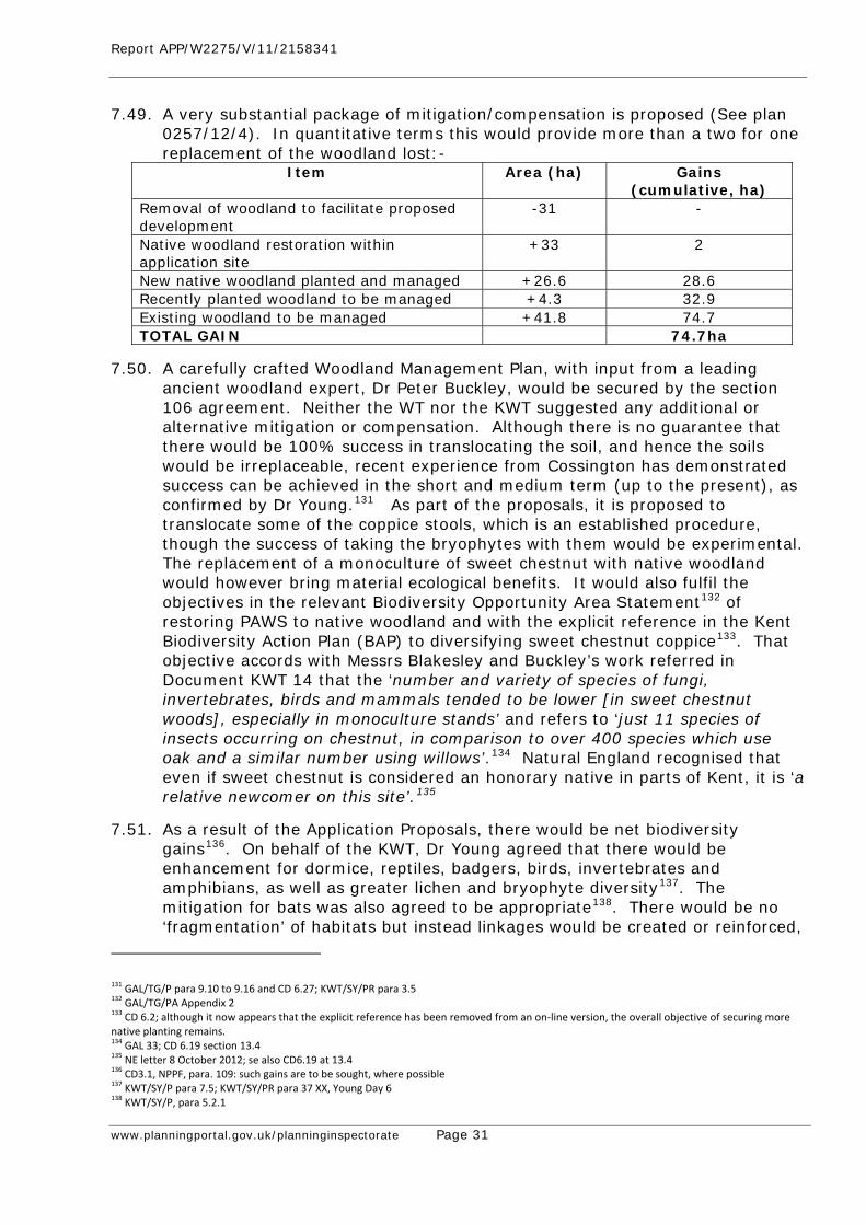
Report APP/W2275/V/11/2158341
www.planningportal.gov.uk/planninginspectorate Page 31
7.49. A very substantial package of mitigation/compensation is proposed (See plan 0257/12/4). In quantitative terms this would provide more than a two for one replacement of the woodland lost:-
Item Area (ha) Gains (cumulative, ha)
Removal of woodland to facilitate proposed development
-31 -
Native woodland restoration within application site
+33 2
New native woodland planted and managed +26.6 28.6 Recently planted woodland to be managed +4.3 32.9 Existing woodland to be managed +41.8 74.7 TOTAL GAIN 74.7ha
7.50. A carefully crafted Woodland Management Plan, with input from a leading ancient woodland expert, Dr Peter Buckley, would be secured by the section 106 agreement. Neither the WT nor the KWT suggested any additional or alternative mitigation or compensation. Although there is no guarantee that there would be 100% success in translocating the soil, and hence the soils would be irreplaceable, recent experience from Cossington has demonstrated success can be achieved in the short and medium term (up to the present), as confirmed by Dr Young.131 As part of the proposals, it is proposed to translocate some of the coppice stools, which is an established procedure, though the success of taking the bryophytes with them would be experimental. The replacement of a monoculture of sweet chestnut with native woodland would however bring material ecological benefits. It would also fulfil the objectives in the relevant Biodiversity Opportunity Area Statement132 of restoring PAWS to native woodland and with the explicit reference in the Kent Biodiversity Action Plan (BAP) to diversifying sweet chestnut coppice133. That objective accords with Messrs Blakesley and Buckley’s work referred in Document KWT 14 that the ‘number and variety of species of fungi, invertebrates, birds and mammals tended to be lower [in sweet chestnut woods], especially in monoculture stands’ and refers to ‘just 11 species of insects occurring on chestnut, in comparison to over 400 species which use oak and a similar number using willows’.134 Natural England recognised that even if sweet chestnut is considered an honorary native in parts of Kent, it is ‘a relative newcomer on this site’.135
7.51. As a result of the Application Proposals, there would be net biodiversity gains136. On behalf of the KWT, Dr Young agreed that there would be enhancement for dormice, reptiles, badgers, birds, invertebrates and amphibians, as well as greater lichen and bryophyte diversity137. The mitigation for bats was also agreed to be appropriate138. There would be no ‘fragmentation’ of habitats but instead linkages would be created or reinforced,
131 GAL/TG/P para 9.10 to 9.16 and CD 6.27; KWT/SY/PR para 3.5 132 GAL/TG/PA Appendix 2 133 CD 6.2; although it now appears that the explicit reference has been removed from an on‐line version, the overall objective of securing more native planting remains. 134 GAL 33; CD 6.19 section 13.4 135 NE letter 8 October 2012; se also CD6.19 at 13.4 136 CD3.1, NPPF, para. 109: such gains are to be sought, where possible 137 KWT/SY/P para 7.5; KWT/SY/PR para 37 XX, Young Day 6 138 KWT/SY/P, para 5.2.1
Report APP/W2275/V/11/2158341
www.planningportal.gov.uk/planninginspectorate Page 32
particularly links to the ASNW at Broke Wood and Fullingpits Wood, in accordance with the objectives of Keepers of Time139, the South East Plan140 and the Tonbridge and Malling BC DPD141. Indeed, as Dr Young acknowledged, there is every reason to suppose that the new woodland planting would qualify as part of the LWS on the basis of one of the ancient woodland criteria142. The new arrangements for reptiles at the Habitat Creation Field would also qualify.
7.52. There is no evidence of any adverse indirect effects from the quarry’s current operations, nor any basis for concluding that there would be any with the proposed extension in operation. Mr Barnes’ case studies in his Appendix 11143 are manifestly inapplicable to the application proposals.
7.53. Licences are likely to be required from Natural England in respect of dormice144. Natural England has not expressed any dissent from the conclusion in the ES Addendum, reiterated in Mr Goodwin’s evidence, that there is no basis to conclude that the derogation tests would not be met and it is therefore reasonable to expect that the necessary licences would be forthcoming.145
Landscape and Visual Impact
7.54. The extension proposals are able to take advantage of the dense screen of sweet chestnut, with a minimum distance of at least 50 m being retained between the workings and the permissive path or the public rights of way146 (including as proposed to be diverted147). With the phased working, a maximum of four phases of about 2 ha each would be without woodland cover at any one time, a total of some 8 ha in all148.
7.55. In consequence, the visual effects of the proposals would generally be limited, as Mr Etchells agreed for the WT149. Pursuant to the Woodland Management Plan, the perimeter zone would be managed to ensure that this screening remained effective150. The only area where any material visual effects, albeit highly localised, would arise is in the location of the cut and cover tunnel but this would be subject to requirements for fencing and landscaping, secured by condition, which in a short period would remove the impact (Mr Jenkins referred to 3-5 years151; Mr Etchells referred to 5-10 years, depending on growth rates152). Mr Etchells’ only other observation in this respect related to an area to the north-east which from a photograph appeared to provide less dense screening, however, Mr Etchells seems not to have appreciated the fast
139 CD 3.4, p.14 140 CD 4.1, Policy NRM5 141 CD4.10, Policy NE3 142 XX Dr Young Day 6; LWS criterion WO8 143 WT/AB/PA, Appendix 11 144 Discussed further in GAL 35 and in the ES Addendum 145 GAL/TG/P, para 6.61‐165; CD 1.7, paras 8.163 to 8.169 146 GAL/GJ/PR Appendix 147 GAL 29 148 GAL2 Revised 149 WT/JE/P para 5.1.1, 5.1.11 p.32 and XX Etchells Day 7 150 GAL36, Woodland Management Plan, chapter 4 151 CD 1.7, ES Addendum, para 7.3.4 152 XX Etchells Day 6; WT/JE/P, para. 4.3.3
Report APP/W2275/V/11/2158341
www.planningportal.gov.uk/planninginspectorate Page 33
growing properties of sweet chestnut, as evident from Mr Mackworth-Praed’s evidence153.
7.56. There is a widespread concurrence of view as to the limited nature of any visual effects, confirmed by the Kent AONB unit154 and Maidstone BC’s Landscape Officer155.
7.57. Although without mitigation there would be a major/moderate adverse landscape effect, this would reduce to moderate by reason of the phased approach to the development, with no more than about 8 ha of woodland removed at any one time and would, with additional planting, ultimately be moderate beneficial156.
7.58. Mr Etchells, for the WT, put the assessment higher, noting that the current landscape value of the extension site was high, not least because ancient woodland is of ‘national importance’, the sensitivity to the development was high, that no account should be taken of the existing quarry in any assessment and that, even with restoration and the substantial additional areas of planting, there would be moderate adverse effects in the long-term.
7.59. The WT’s case is overstated. The existing landscape is subject to no national or local landscape designation. The Kent-wide Special Landscape Areas, designated for their value, do not include the Extension Site157. The notion of ‘national importance’ is disputed by Natural England who considered that the proposals did not raise issues of national importance to the natural environment158, the plantation is of the mid-19th century with no veteran trees, and it is not of national ecological significance, such as to be designated a SSSI159. It was mistaken for Mr Etchells to assume that simply because it is PAWS, it must be of high landscape value160. Furthermore, Mr Etchells did not appear to take account, or at least adequate account, of one of the striking characteristics of coppiced sweet chestnut which is that far from being exclusively ‘quiet, shady and enclosed’161, it would have been subject to episodes of substantial change through coppicing.
7.60. The suggestion of high sensitivity does not take sufficient account of the screening effect of the perimeter zone. Both landscape character assessments undertaken by Jacobs refer to moderate sensitivity162 and the Maidstone Landscape Character Assessment expressly refers to the relevance of screening in forming the judgment – the fact that it envisages ‘minor development’ (undefined) does not remove the force of the rationale that it is of moderate sensitivity by reason of screening. The use of terms such as ‘destructive, not constructive’ and ‘literally consume’163 does not assist in the assessment.
153 GAL/MMP/PA photograph 12: 1‐3 years growth, GAL/MMP/P, para 5.2.6 XX Etchells Day 7 154 Letter 11 November 2010; GAL/GJ/ P, paras .5.1.7 and 6.8 155 GAL/GJ/P, para 6.7 156 CD1.8, ES Addendum, paras 7.40, 7.41 and 7.48 157 See GAL 24; KSP 2006 and XX Etchells Day 6 158 NE letter 31 May 2011 159 NE letter 8 October 2012 160 Dr Young for KWT described the site as “visually uninteresting” 161 WT/JE/P para 7.2.1 162 GAL/MMP/PA 3.1; WT/JE/PA Appendix D 163 WT/JE/P paras para 4.2.1
Report APP/W2275/V/11/2158341
www.planningportal.gov.uk/planninginspectorate Page 34
7.61. The methodological dispute about the appropriate baseline was also of little assistance to the Inquiry. Mr Jenkins for GAL had regard to the baseline in the form of the quarry as it presently exists, and to the required restoration in the absence of the proposals164. In contrast, Mr Etchells considered that the existing quarry should be ignored165, even though it would continue under restoration in the absence of the proposals for some 5-7 years. There is scant evidence on the matter and the WT closings do not say if they consider it would make much of a difference.166 If it does, Mr Jenkins’ approach is to be preferred.
7.62. Mr Etchells’ evidence did not address anywhere whether there would be any landscape benefits from the 26.6 ha of entirely new woodland planting167 and somewhat grudgingly only referred to something with ‘the appearance of woodland’.168 This seems to have unduly influenced his statement of moderate adverse effects in the long-term. He was not prepared to accept landscape benefits from replacement of the monoculture of sweet chestnut, but at least he did not assert harm from native woodland planting. His view did not reflect the WT’s own aspirations for substantial new woodland, which would be advanced by the Application Proposals.169 Mr. Jenkins’ assessment of moderate positive landscape benefit, following restoration, is consistent with that approach170.
7.63. Mr Etchells did not suggest any additional or alternative landscape mitigation. In his terms, the visual effect on the landscape resource would be limited. Any effect on tranquillity would be highly localised in an environment already affected by other noise. The concept of ‘continuity’ needs to be understood in the context of mid-19th century plantation where ‘continuity’ from earlier woodland cover would be no less maintained by 21st Century plantation. Also the nature conservation interest is considerably affected by the 90-95% bramble cover with no prospect of ‘phoenix-like’ rejuvenation171. Furthermore, the species value of the trees is poor.
Archaeology
7.64. There is no surface archaeological interest, but there remains potential for Palaeolithic interest. A condition would secure any such interest and this was agreed by the KCC Archaeological Officer, as reflected in the SCG172. Heritage matters have been addressed above under the heading of Need.
Impact on Local Residents
7.65. The Application Proposals would generally be further from residential properties than the existing workings173. Where relevant, existing criteria have
164 XX Jenkins Day 4: he explained that it made no difference to the assessment and therefore it can be put on the basis of the existing baseline 165 XX Etchells Day 7 166 WT15, paragraph 41 167 WT/JE/P, para 4.4; the landscape mitigation is described as “extensive” but the comments that follow do not address whether there are any benefits 168 WT/JE/P, para 5.4.2 169 GAL/TG/A, Appendix 12 170 GAL/GJ/PR para. 3.6.2 171 CD6.36, p.5; XX Goodwin Day 3 172 KCC/MC/P, para 7.12; KCC 6 173 GAL 34
Report APP/W2275/V/11/2158341
www.planningportal.gov.uk/planninginspectorate Page 35
been demonstrated to be met, as substantiated by the Environmental Health Officer for Maidstone Borough Council, whose area includes the nearest residential properties174. ‘Unavoidable’ noise, dust and blast vibration can be ‘controlled, mitigated or removed at source’175.
7.66. New noise bunds would be provided immediately to the south of the processing plant area when the filling is up to ground level and also between the south eastern corner of the extension site and the North Pole Road dwellings before Phase 20 working commenced176. Accordingly, noise criteria would be complied with in accordance with the Technical Guidance to the Framework.
7.67. The Environmental Health Officer for Maidstone BC has raised no concerns about dust177. Dust emissions can be adequately controlled and mitigated in accordance with the Technical Guidance178.
7.68. Although vibration from blasting at the existing quarry may be perceptible to the surrounding residents, it is well below the 6mm/s peak particle velocity for 95% of events, as required by the present planning conditions. This figure is widely used at other sites and also agrees with Government Guidance and the relevant British Standard. It is proposed to retain the same condition for the proposed extension179. A scheme in respect of air overpressure could also be imposed even though it is not advised by Minerals Planning Guidance 14 or Vibrock180. Such a scheme could identify the most sensitive monitoring locations.
7.69. Traffic would be limited to the current times and numbers of vehicle movements and it would use the existing quarry access, which has good and direct links to the primary road network.
7.70. There are no objections from KCC or its advisors Jacobs who responded to the ES Addendum, noting that ‘dust control and PM10 emissions will be kept to a minimum and satisfactorily minimise the impact at the nearest residential properties’, and they concluded that noise and vibration can also be controlled satisfactorily181. Maidstone BC’s EHO has no objection182 and the SCG reflects this position183.
7.71. The Hermitage Quarry Liaison Group provides an effective forum for disseminating information and addressing any of the local residents’ concerns184.
7.72. There would be no harm to the amenity of the users of the rights of way or of the permissive perimeter path. It is telling that neither KCC’s Rights of Way Officer, the Ramblers Association, nor the British Horse Society raised any objections in this, or any other, regard.
174 GAL/AJB/P, para 4.48 and ES Map 2 175 CD31, NPPF, para 144; GAL/GJ/P para 9.3.7 176 Plan 0257/10/21 177 GAL/AJB/P para 4.48 178 GAL/GJ para 9.3.3 179 CD1.5 Appendix 15, page 21 180 KCC6: a numerical limit is not advised in MPG14 and Vibrock warn against it (CD1.5, Appendix 15, p 21); see also GAL/AJB/P para. 6.14 181 Jacobs response to ES Addendum 1 October 2012 182 GAL/GJ/P, para 10.8 183 CD9.5, chapters 13,15,16,17 184 July 2012 Minutes, provided by the Chair of Barming Parish Council, at GAL/AJB/PA12
Report APP/W2275/V/11/2158341
www.planningportal.gov.uk/planninginspectorate Page 36
Waste Permitting
7.73. The current landfill operation at the existing quarry is controlled by the provisions of a Planning Pollution and Control Permit185. In the event of planning permission being granted, the Environment Agency would prefer to vary the existing permit rather than to issue a new one186.
7.74. Infill at the existing quarry is ‘in balance with rates of extraction’ and the rate of infilling can be further influenced by pricing, should there be a need to do so. It can therefore be confidently concluded that sufficient infill will be available for the restoration element of the proposals187.
Economic Effects
7.75. The existing quarry, which would need to close if the application proposals did not succeed, makes an important local contribution to economic life, with 105 direct GAL employees and a further 20 indirectly employed188. GAL’s wage bill feeds £4.35 million a year into the local economy189. The ‘core of the workforce would be redundant soon after depletion of the reserve’ with ‘phased downsizing of the remainder during backfilling’190. In addition to the loss of the concrete and aggregates businesses which are dependent on the continuation of the existing quarry191, damage would be inflicted on the overall Gallagher Group which itself is a ‘highly integrated business’192. Having regard to the high proportion of employment in Kent in the corporate management and the public sectors, it is significant that the skilled workforce that would be laid off ‘makes a considerable contribution to the diversity of the workforce involved in the construction, building and plant management sector’193.
7.76. As a small operator, and the sole local producer of crushed rock in Kent, GAL faces established competition from the major firms that operate the aggregate import supply points. This means that GAL has to maintain competitive prices, resulting in higher production efficiency and quality of output. In the absence of the proposed quarry extension, there would be a higher likelihood of margin squeeze pricing with adverse local economic effects194. Furthermore, maintaining Kent’s indigenous hard rock supply would be likely to have cost benefits for local consumers.
7.77. In any event, with 95% of the material from Hermitage Quarry going to sites within a 40 km (25 mile) radius195, the alternative of not providing for this indigenous supply would be demonstrably less sustainable. There would also be large increases in the carbon footprint if the alternatives were transported by road, sea or rail196. There is no reason for WT’s statement in Closing that
185 GAL/AJB/P, para 4.27; GAL/AJB/PA10 186 GAL/AJB/P, para 4.27 and KCC3 187 GAL/AJB/P para 4.25; Bate Day 1, Inspector’s questions 188 GAL/AJB/P, para 4.30: many have long service with GAL dating back to the inception of the quarry in 1990 189 GAL/BR/P, para 6.4 190 GAL/AJB/P, para 4.31 191 They provide important synergies: GAL/AJB/P, paras 4.19 and 4.22 and GAL16 192 GAL/AJB/P, para 4.32 193 GAL/BR/P, para 6.5 194 GAL/BR/P, para 5.27 to 5.28 195 GAL/AJB/P para 4.44 196 GAL/PR/PA Appendix 1 Figures 8 and 9; GAL20
Report APP/W2275/V/11/2158341
www.planningportal.gov.uk/planninginspectorate Page 37
importing aggregates into Kent might divert them from longer journeys. 197 Mr Steedman for the WT was silent in his proof on the sustainability implications of the proposals not proceeding. This omission was as curious as his insistence that the loss of local employment should be ‘ignored’198.
The Proposed Diversion Orders (See Separate Reports)
7.78. The two proposed Orders have been applied for by GAL pursuant to the powers under Sections 247, 253 and 261 of the TCPA 1990. They are both dependent on planning permission being granted for the application proposals but are sought now because of the need to proceed expeditiously in the event that planning permission is granted.
7.79. Surveys of the usage of the two existing highways showed an average of 14 movements per day on the Bridleway at the western end, compared with 49 movements per day on the permissive path at this point199. On the Byway the average movements were 60 per day compared with 42 on the permissive path200.
7.80. Three modifications are proposed by GAL, in agreement with Kent County Council201. It is proposed that MR108 would no longer take effect from the outset but only prior to the commencement of working in Phase 12. This would ensure that the diversion would be for the minimum period necessary. The second is to insert a reference to Section 261 in the wording of the Order for MR496. The MR496 Order already refers on its face to Section 261 and is drafted in the language applicable to a Section 261 application. The third is a correction of the description of one of the replacement routes from footpath to the higher status of bridleway to accord with the application. No prejudice would arise to any person by reason of these modifications, which are within the ambit of the discretion to modify (i.e. ‘as he thinks fit’) under Section 252(8), and no further advertisement is thus required.
7.81. The tests for making the Orders would be met202. The diverted routes would be appropriate for the amenity of their users. There are no objections to either proposed Order from the Ramblers or the British Horse Society and, subject to the modifications, there are no remaining objections from KCC. Indeed, subject to the modifications, there are no objections to the proposed Order in respect of MR496. None of the objections in respect of MR108 suggest that the diversion is not necessary if planning permission is to be granted and no alternative diversion route has been suggested.
The Balance: the Framework and the Development Plan
7.82. The need and other benefits, including economic and biodiversity benefits, would heavily outweigh any adverse effects by reason of the loss of ancient woodland, with its irreplaceable soils. In striking that balance, it is relevant to have regard to the mitigation/compensation package. Mr Barnes for the WT
197 WT15, para 47 198 XX Steedman Day 5 199 GAL/GJ/ROW/P, para 5.7 200GAL/GJ/ROW/P, para 5.8 201 GAL30 and 31 (revised) 202 Set out in GAL28
Report APP/W2275/V/11/2158341
www.planningportal.gov.uk/planninginspectorate Page 38
agreed that the Framework required mitigation and compensation to be taken into account in striking that balance203, notwithstanding Natural England’s advice that consideration of compensation should be deferred to some later stage. As addressed above, striking the balance also requires consideration of the significance of the loss of the ancient woodland in question, rather than a bland attachment of equal significance of loss to all ancient woodland.
7.83. The need and other benefits would also strongly outweigh any other adverse effects, including any effect on the interests protected by the Local Wildlife Site (where reptile interest and bryophyte diversity would be enhanced), localised landscape and visual or other amenity effects. None of these effects are in the language of the Framework ‘unacceptable’ and where ‘unavoidable’, they can be acceptably controlled204. None of the adverse effects would in any event comprise ‘significant harm’205.
7.84. The Framework confirms that when determining planning applications ‘great weight’ should be given to the benefits of mineral extraction, including to the economy, with similar advice confirming that ‘significant weight should be placed on the need to support economic growth through the planning system’206.
7.85. Within the meaning of the Framework, the application proposals would comprise sustainable development, fulfilling important economic, social and environmental roles207. The proposals are therefore entitled to the presumption in favour of sustainable development.
7.86. The proposals would also accord with the Development Plan208.
7.87. The emerging Kent Minerals and Waste Development Framework (MWDF) can have only little weight at this stage. There were various references in the WT Closing Submissions to this emerging Plan209 which KCC anyhow accepted would inevitably have to change as a result of the outcome of the Inquiry, probably with the addition of an exceptions policy. Neither WT nor KWT suggested that the application proposals were premature in their Statements of Case. However Mr Steedman for the WT sought to argue, without any reference in his proof to the relevant Government advice,210 that the proposals should be rejected on such grounds. Having regard to the anticipated dates for submission and adoption of the MWDF Core Strategy and the Mineral Sites Plan211, the timing of the process alone could not justify refusal on grounds of prematurity. Mr Steedman agreed that there was ‘no early prospect of submission’ of the MWDF212. His only justification for delaying a decision was ‘the expectation of further analysis at a local level’213. It is hard to conceive of a less clear demonstration of prejudice to the MWDF process. Moreover, the
203 CD 6.1, para. 118; XX Barnes Day 7 204 CD3.1, para 144 205 CD3.1, para 118; GAL/GJ/P, para 9.2.4 to 9.2.6 206 GAL/GJ/P para9.3.7(i) 207 GAL/GJ/P, para 9.3.5; paras 58, 60 and 131 of the NPPF also favour the proposals, as Mrs Maltby for the I.H.B.C pointed out on Day 9 208 GAL/GJ/P para 9.3.10 to 9.3.11; as noted above, Policy M3 of the SEP should be accorded particular weight 209 WT15 210 CD 3.5 211 CD9.6 Para 5.2 212 XX Steedman Day 5 213 XX Steedman Day 5
Report APP/W2275/V/11/2158341
www.planningportal.gov.uk/planninginspectorate Page 39
reserves at the quarry would be exhausted by the time the MWDF process was completed and anyhow no alternative sites were promoted in response to the calls for sites.
7.88. There can be no basis for delaying a decision. Determination is urgently required and there has been the opportunity for a far greater depth of assessment with the application process than would be the case through the MWDF process, as indeed Mr Steedman conceded.
7.89. Notwithstanding the objections, there is a remarkable breadth of support for the proposals, underlying the strong case of need and the limited adverse effects. This support came, not only from the Mineral Planning Authority who are required to strike a balance with due weight afforded to the competing interests, but it also came from the local Member of Parliament, Tracey Crouch MP, and the Parish Council in which the existing quarry is situated and Aylesford Parish Council. The confirmation from Kent CPRE that it did not object to the proposals was a reflection of its recognition that the interests of the rural economy and those of built heritage must weigh heavily in the balance. Tonbridge and Malling BC and Maidstone BC, who did not appear at the Inquiry, did not seek to strike the balance themselves, recognising that this was a matter for the Mineral Planning Authority in the first instance, and now for the Secretary of State.
7.90. It was accordingly requested that permission be granted for the Application Proposals including the three associated Section 73 applications, subject to the proposed conditions and having regard to the Section 106 agreement and its annexed Woodland Management Plan214. It was also requested that the proposed diversion orders be made with the suggested modifications.
8. The Case for the Mineral Planning Authority (Kent County Council)
Introduction
8.1. The decision in this case turns on the balance between the need for the minerals lying in the westerly extension and the loss of the ancient woodland (AW).
8.2. The evidence at the Inquiry supported Kent County Council’s (KCC) view that the balance lay in favour of the proposals, which would be consistent with policy at both local and national level. The evidence also demonstrated there to be no other consideration that would require planning permission to be refused, which could not be adequately addressed by appropriate planning conditions or covenants under the Section 106 Agreement.
8.3. These conclusions were reached by considering the two key issues, namely the need for the development and the implications for the ancient woodland, alongside all other planning considerations. The balance has to be struck in accordance with paragraph 118 of the National Planning Policy Framework (The Framework) which, amongst other things, aims to prevent the loss of
214 GAL 36A
Report APP/W2275/V/11/2158341
www.planningportal.gov.uk/planninginspectorate Page 40
ancient woodland unless the benefits of the development would clearly outweigh that loss.
The Need for the Extension
8.4. The need case is set out clearly in the Committee Report215 and it was also summarized and updated in the proof of evidence of the KCC witness, Mr Clifton. That need is both compelling and unanswerable216, and there was no suggestion that KCC had failed to take any relevant factor into account or that they had had regard to something that they should not have done.
8.5. In contrast, the main policy witness for the Woodland Trust (WT) (Mr Steedman) failed to even mention the requirement in the Framework for an adequate and steady supply of crushed rock or the benefits of local employment that would otherwise be lost. Accordingly, little weight should be placed on the contrary contention.217
Policy Requirements
8.6. The essential role of minerals in supporting sustainable economic growth and our quality of life underpins the approach in the Framework to such development218. This advice goes on to highlight the importance of a sufficient supply of material to provide the infrastructure, buildings, energy and goods that the country needs.
8.7. That importance is translated into specific advice, which inter alia states that authorities should (with added emphasis):-
• Give great weight to the benefits of mineral extraction, including to the economy when determining planning applications; and
• Plan for a steady and adequate supply of aggregates.
8.8. Contrary to the impression given by Mr Steedman in cross examination, a steady and adequate supply requires the provision of a separate landbank of at least 10 years for crushed rock219.
8.9. In Kent, Policy M3 of the South East Plan (SEP) requires a landbank of 0.78 million tonnes per annum (mtpa) for at least 10 years production. As the SEP states at paragraph 10.86, the regional supply figure has been apportioned initially on the basis of average sales220.
8.10. In essence, Mr Steedman suggested that this figure should be ignored221 and that the SEP requirement should be reviewed in the light of the position at Blaise Farm and the approaching end of the permitted reserves at Hermitage Quarry. He sought to gain support for his approach of ignoring the need for an adequate and steady supply in the EIP Report. However, as Mr Jenkins pointed out for GAL, that would be a misinterpretation of the Panel’s Report.222 Some of the local residents also took Mr Steedman’s stance.
215 CD1.10 from [53] on p. C1.27. 216 Section 11 on p.33 of KCC/MC/P. 217 See para. 2.2.1 on p.3 of Rebuttal proof of Mr. Jenkins, GAL/GJ/PR. 218 [142] on p. 32 of CD3.1. 219 [145] at the 6th bullet point on p.35 of CD3.1. 220 CD3.1. 221 WT/JS/P at e.g. para. 2.9 on p.7 and refer to notes of his oral evidence. 222 Mr. Jenkins Rebuttal evidence, GAL/GJ/PR at 2.3.5‐6 on p.4.
Report APP/W2275/V/11/2158341
www.planningportal.gov.uk/planninginspectorate Page 41
8.11. However, this is not the approach set out by the DCLG Chief Planner in his letter dated 6th July 2010223. There is no alternative apportionment figure relied upon by KCC, or anyone else, and the suggestion that the decision should be delayed in order to test the apportionment figure through the Minerals and Waste Development Framework (MWDF) would not be consistent with the advice in the Chief Planner’s letter. It is clear that minerals planning applications should be considered on their merits and in the context of the SEP apportionment figure, the real landbank, and of course the need to maintain a steady and adequate supply of the mineral.224
8.12. Given the advice in the Chief Planner’s letter to apply the apportionment, the prospective revocation of the SEP would make no difference to this conclusion.
The Existing and Potential Reserves
8.13. Hermitage Quarry and Blaise Farm Quarry are the only two permitted ragstone sites in Kent and:- only approximately 1.3 million tonnes (mt) remains of the permitted
Hermitage Quarry reserve, and this will be exhausted by late 2014 or early 2015,225
only some 12.38 mt remains in Blaise Farm (7.68 mt of ragstone and 4.70 mt of hassock) and not the 30 mt plus referred to in both the emerging Framework Documents and the Committee Report, 226
the proposed Hermitage Quarry westerly extension comprises about 16 mt, of which 10.67 mt is solid ragstone with the remainder marketable as washed hassock, and227
no other ragstone sites have been proposed.
8.14. The lack of existing and potential supplies would appear to be beyond dispute.
8.15. Blaise Farm Quarry does not represent a realistic alternative to the Application Site, as robustly confirmed by the evidence before the Inquiry. There was an absence of challenge by the Woodland Trust (WT) in Mr
Wilkinson’s geological evidence, Hansons, the owners of Blaise Farm Quarry, have not objected to the GAL
application to extend Hermitage Quarry, or even provided any representation to the Inquiry relating to the future use of Blaise Quarry, and
There was very limited disagreement by Mrs Poole, on behalf of WT, with any of GAL’s evidence on the geology or the nature and quality of the reserves at Blaise Farm or in the Hermitage Quarry extension.
8.16. There are no other alternative sites:- This was confirmed by Mr Steedman for the Woodland Trust in cross
examination by GAL,
223 CD3.7 at para. 15 of the Guidance Note. See also Mr. Jenkins Rebuttal evidence, GAL/GJ/PR at 2.3.3 on p.3. 224 See 2.3.6 on p.4 of GAL/GJ/PR. 225 KCC/MC/P at 11.2 on p.33. 226 GAL/AW/P at 5.5.19 on p. 23. 227 See Mrs. Poole’s answers under xx by GAL and GAL/AW/P at 4.5.8 on p.16.
Report APP/W2275/V/11/2158341
www.planningportal.gov.uk/planninginspectorate Page 42
No alternative ragstone site has come forward during the preparation of the emerging Development Plan Framework; notwithstanding two separate calls for sites by KCC228, and
The only other possible site that came forward during this Development Plan process was for the Richborough Underground Limestone Mine229, but in cross examination Mr Steedman made clear that he placed no reliance upon this mine. The additional information provided by GAL also confirmed that there can be no reliance on this suggested source.230
8.17. The lack of any alternative sites to Hermitage Quarry or Blaise Farm was confirmed by the alternative sites assessment carried out by GAL as part of the information that accompanied the original ES231; which was subsequently updated in the ES Addendum.232 The robustness of this assessment was confirmed not only by Mr Clifton233 but also by Mr Steedman (under cross examination by GAL). He did not appear to dispute that it was a thorough and careful assessment and he stated that it was a ‘standard approach and had not been skewed in any way’. The only reservation he had was in respect of Blaise Farm Quarry. However, he had already confirmed that he was relying upon Mrs Poole’s evidence on the potential uses of the Blaise Farm materials and their comparison with those of the Hermitage Quarry extension.
8.18. Mr Steedman’s case was based upon a 40 year supply at Blaise Farm234 but, as noted above, it was agreed by Mrs Poole that this numerical landbank is only equivalent to about 16.5 years.
8.19. Mr Steedman also said (under cross examination by GAL) that he ‘had to assume that Blaise will change from dormant to active in the same way that GAL had to assume it wouldn’t’. It is of course not a question of ‘assuming’ anything but the making of an objective assessment on the evidence. GAL and KCC had done that but Mr Steedman had not. His approach would not provide the basis for meeting the objectives in the Framework and its express requirement for an adequate and steady supply of crushed rock.
Real Need and Real Supply
8.20. The existing and potential supply position must be considered in real terms. Even Mr Steedman gave some recognition (under cross examination by GAL) to the fact that you don’t just look at the numerical position in terms of permitted reserves in judging the landbank.
8.21. The Planning and Minerals: Practice Guide advises that the management of landbanks should be based on considerations of real need and real supply (see paragraphs 72-75).235
8.22. In addition, the DCLG Guidance on the Managed Aggregate Supply System (October 2012)236 advises that:-
228 See CD4.8, Mineral Sites Assessment Process at section 4 on p.8. 229 See CD4.8, Minerals Sites Assessment Process at [6.2.5] on p.26 – site 78. 230 GAL19 in particular pp. 4 & 5. 231 CD1.5 at Appendix 24. See now also GAL 23 – Note on Sites at Ditton South and Langley Park. 232 CD1.8 at Appendix 9. 233 KCC/MC/P at 11.30 and 11.31 on pp.40‐1. 234 WT/JS/P at 2.13 on p.9 235 CD3.9. 236 CD3.20, paras. 21‐28.
Report APP/W2275/V/11/2158341
www.planningportal.gov.uk/planninginspectorate Page 43
The landbank should exclude dormant and inactive sites (23), The length of the landbank should be calculated using the expected
provision (23), There should be a landbank of at least 10 years for crushed rock - based
on the past 10 years average sales (24), and An adequate or excess landbank is not a reason for withholding planning
permission unless there are other planning objections, which are not outweighed by planning benefits (26).
8.23. Furthermore, and directly relevant to the current application, the Guidance advises (at paragraph 26) that there may be valid reasons why an application for minerals development is brought forward in an area where an adequate landbank exists including:- The nature, type and qualities of the aggregate, such as its suitability for a
particular use within a distinct and separate market, and Known constraints on the availability of consented reserves that might limit
output over the Plan Period. WT made no reference to this in their evidence to the Inquiry.
8.24. Even at the agreed reduced level of 12.38 mt, Blaise Farm would not be a reliable alternative source. Since the announced closure of the site by Hanson in 2005 the site has only operated very occasionally on a campaign basis, as and when, there has been a demand for lower specification materials for use as bulk fill. Mrs Poole, for the WT, herself described the limited occurrence of ragstone deposits in Kent as ‘a unique and important resource in south east England’.237 English Heritage concurred. Not only is Hermitage Quarry the only source of quality Kentish Ragstone but it is the only source of that stone that is utilized as a natural building/dimension stone.
8.25. As set out in KCC’s Draft Local Aggregate Assessment, as well as the Committee Report dealing with this application, the length of the landbank (then assumed to be above 30 mt numerically) is only one of many issues that has to be taken into account. 238 It is also envisaged that although the Hermitage Quarry Extension would not be an allocated site, an exceptions policy would be added to the emerging Minerals Plan.
8.26. Mrs Poole did not dispute that, overall, the ragstone yield for the proposed extension would be likely to be greater than that within Blaise Farm.239 In that regard Mrs Poole stated in cross examination by GAL, that the test results confirmed that the proportion of hassock at Blaise Farm was twice that from Hermitage Quarry.240
8.27. Mrs Poole did not dispute that processed ragstone, within the current Hermitage Quarry, is shown to be of a superior quality to the processed ragstone at Blaise Farm.241 She accepted (under cross examination by GAL)
237 See Mrs. Poole’s proof at 7.2 on p.12 of WT/JP/P. As confirmed under xx by GAL. 238 CD4.7at 7.2.4 on p.29; and at 7.2.1 on p.27. 239 Para. 3.3 on p.4 of WT/JP/P. 240 As stated in [7.16] on p. 14 of WT/JP/P. 241 Para. 3.4 of WT/JP/P .
Report APP/W2275/V/11/2158341
www.planningportal.gov.uk/planninginspectorate Page 44
that the materials from Hermitage Quarry would comply with the requirements for concreting.242
8.28. It was agreed that the full thickness of the Hythe Formation is present within the Westerly Extension243 and Mrs Poole accepted that the reserves within the proposed extension are of comparable quality.244 She expressly agreed (under cross examination by GAL) that she was not arguing that a comparable product range wouldn’t be achieved from the extension. Moreover, she didn’t appear to challenge the ‘exceptional quality’ of the ragstone within the existing quarry, as claimed by GAL.245 She also accepted that Hanson had never used materials from Blaise Farm for the making of concrete or bituminous mixtures, but that they had been used for similar purposes to those for which GAL had supplied them on a campaign basis.
8.29. In his evidence for GAL, Mr Bate emphasised the importance of the Magnesium Sulphate soundness test and Mrs Poole accepted this. Indeed, Mr. Bate told the Inquiry (in his evidence in-chief) that it is the ‘most important indicator of usability’. The material from Hermitage Quarry performed significantly better on this test than did the material from Blaise Quarry. Although only one test was carried out on the Blaise Quarry material and the result was just outside the acceptable limit of 36 (compared with a maximum of 30 or 35), it is plainly inferior to the Hermitage Quarry material in this crucial respect.246 As Mr. Bate said (under cross examination by the WT), the other indicators in any event support the lack of suitable physical properties indicated by the Magnesium Sulphate test.247
8.30. In respect of all the tests (see GAL/AJB/PRA3 and GAL22), Mrs Poole accepted in cross examination by GAL that these had been carried out using the advanced grading and processing equipment at Hermitage Quarry. Therefore, as Mrs Poole also accepted, to achieve even these results, similar equipment would be required at Blaise Farm. That would require very significant investment and there was no evidence before the Inquiry to suggest this would be forthcoming. The quality of the reserves at Blaise Farm is such that this investment simply couldn’t be justified. Hanson’s mothballing of the site is consistent with that conclusion, as is the absence of any objection from them to the Application, and also the absence of any support from any customer or potential customer who might want minerals from that site. Moreover, there was no evidence of any customer satisfaction with materials that had been provided from Blaise Farm. As Mr Bate confirmed, the increase in availability of recycled materials would, if anything, depress the demand for materials from Blaise Farm but not from Hermitage Quarry.248
8.31. Specifically with regard to building/dimension stone, Mrs Poole accepted in cross examination by GAL that the greater thickness of the ragstone beds at Hermitage Quarry was needed for the production of coping stones.249 The
242 Cf. 7.21 on p.14 of her proof, of WT/JP/P: she said under xx that things had moved on since she wrote 7.21 and that Hermitage meets the specifications for Britain at the moment, although she did state that a higher specification from Europe is likely. 243 Para. 3.2 on p.4 of WT/JP/P. 244 Para. 7.30 on p.15 of WT/JP/P. 245 Ditto. 246 See GAL22. 247 See GAL22. 248 See also the note on recycled aggregates in Kent produced by the Applicant, GAL/16 249 As explained in GAL11 produced to clarify the position for the Inspector.
Report APP/W2275/V/11/2158341
www.planningportal.gov.uk/planninginspectorate Page 45
severe limitations of the Blaise Farm stone (in respect of type, colour and quality), as stated by Mr Bate, were borne out by the evidence. The importance of the deep beds was highlighted by the letters from the Historic Royal Palaces, the English Stone Forum and the Ecclesiastical Architects and Surveyors Association (EASA) who referred to it as madness to suggest that unsuitable alternatives should be used.250 In addition, this was supported by English Heritage (EH) in their letter of 23 August 2012 – this refers to no other building/dimension stone, whether indigenous or imported, being of a suitable match either aesthetically or in terms of hardness, permeability and weathering characteristics.251 EH also refer to Hermitage Quarry having a greater number of suitable beds.252
8.32. Mrs Poole was unable to point to any evidence supporting the use of Blaise Farm materials. In contrast to the dimension stone from Hermitage Quarry, the evidence of user experience of the Blaise Farm material was all discouraging.
8.33. Mr Bate referred to several incidents of the failure of the Blaise Farm material eg Dartford 2006 (where the material was used as a base material to infill lakes). There were also the incidents relating to a right of way, with the strength and durability of the material failing over as little as 2-3 years. There was a further instance of failure where Type 1 stone was supplied to Denton in North Kent and surface rutting occurred.
8.34. In relation to dimension stone applications, Mr Andrew, of Essential Stone (one of the leading stonemasons dealing with ragstone), was damning about its quality. He referred particularly to the porosity of the Blaise Farm material253 and to numerous failures, including ‘the Wye Bridge fiasco’. Chilmark stone had to be used to replace the Blaise Farm material for the works on the church of St. Nicholas at Wade. It is clear from the photographs provided by GAL that the replacement Chilmark stone is an incongruous and unfortunate substitute for the required stone.254 The glowing support for Hermitage Quarry stone is even more impressive, given Mrs Poole’s evidence that some stonemasons say that ragstone is harder to work than other comparable materials. Thus it is especially important that it has been used for a very long time, including in prestigious buildings, and it is still in great demand for such purposes, as well as (some 30%) for new developments.255
8.35. Notwithstanding this powerful need case for the extension, the WT relied upon the non-allocation of the extension in the emerging Minerals and Waste Development Strategy. The approach employed in the emerging plan, in recognition of the problems with the Blaise Farm Quarry, is to include an exceptions policy, rather than to allocate the site256. In reality any debate on this is likely to be academic, since the decision on this application is likely to
250 All included in Mr. Bate’s Appendix 5, GAAL/AJB/PA, at pp. 54, 52, 51. 251 ES Addendum at Appendix 8 on the foot of the 2nd page, where it refers to the importance that any source of Kentish Ragstone be of good quality and available in sufficient bed‐height (of up to 800mm) to match historical applications. 252 Mr. Bate’s Appendix 5, GAAL/AJB/PA, at p. 46. 253 GAL/AJB/PA5, page41(c) 254 GAL 17. 255 GAL18. See also photos in Mr.Bate’s Appendix GAL/AJB/PA14 and the examples of the use of Kentish Ragstone in Appendix 6 to the ES Addendum, CD1.8. 256 E.g. CD4.8 at 6.2.6 on p.26.
Report APP/W2275/V/11/2158341
www.planningportal.gov.uk/planninginspectorate Page 46
be received well before the submission of even the Minerals and Waste Local Plan, let alone the Sites Plan257.
8.36. However, the attempt by the WT to seek support from the approach in the emerging plan is inevitably a fruitless exercise. Whether the site is allocated or not makes no difference to the determination of the application. It doesn’t alter the considerations to be taken into account in striking the balance, and the need for the development is beyond argument. As explained above, that is fully recognized in the emerging Development Plan Document.
Ancient Woodland
The Approach to the Issue
8.37. There is of course no dispute that the loss of ancient woodland (AW) is a very important and sensitive issue. KCC understands and respects the concerns over this. However, a loss of ancient woodland has to be approached sensibly and in a balanced way; applying the relevant policies correctly.
8.38. The key national guidance on the approach to development, which would result in the loss of ancient woodland, is now found in the Framework document which states:-
‘Planning permission should be refused for development resulting in the loss or deterioration of irreplaceable habitats, including ancient woodland and the loss of aged or veteran trees found outside ancient woodland, unless the need for, and benefits of, the development in that location clearly outweigh the loss.’
Contrary to the assertion in Mr Barnes’ proof for the WT, this does NOT preclude the loss of ancient woodland 258.
8.39. The Framework advice is not materially different from that previously found in PPS9, as Natural England themselves confirm in their Standing Advice (May 2012)259. Thus the Development Plan policies relating to ancient woodland are not out of date merely because of the publication of the Framework.
8.40. Two aspects of the Development Plan should be emphasized in this context:- SEP Policy NRM7 requires the replacement of woodland unavoidably lost
through development with new woodland on at least the same scale.260 That requirement would be complied with, and
Policy NE4 of the T&MBC Managing Development and the Environment DPD also does not prohibit loss of AW.261 It expressly requires a balancing of the need for, and benefits of, the development against the harm that would be caused to the ecological and historical importance of the AW, which is something that the WT says you shouldn’t do. However, NE4 was adopted in the context of PPS9 and in respect of AW must be equally consistent with the Framework.
257 See para. 11.23 on p. 38 of Mr. Clifton’s proof, KCC/MC/P. 258 WT/AB/P at 7.1 and 8.12. 259 CD6.1 at 7.2.3 on p.16. 260 CD4.1 at para. 9.38. 261 CD4.10 on p.39.

Report APP/W2275/V/11/2158341
www.planningportal.gov.uk/planninginspectorate Page 47
8.41. The views of the Kent Wildlife Trust (KWT) and the Woodland Trust (WT) were largely based on form and not substance in this respect. That was at variance with the practical ‘can-do’, ‘should deliver if possible’, approach promoted in the Framework262.
8.42. The mantra of the WT has been that this is AW and thus IRREPLACEABLE. In reality, their analysis of the issues then stopped at that point but, being irreplaceable, doesn’t mean that policy doesn’t allow AW to be lost, where the planning merits justify it.
8.43. Furthermore, their unwillingness to accept the requirement of a consideration of the value of the particular AW, betrays an unbalanced, and indeed flawed, approach. This was the case in Mr. Barnes’ evidence. Despite purporting to acknowledge that a balance is required, it displayed a skewed and partial balance.263
8.44. The WT pointed to appeal decisions and said that the Inspectors (and in one case the Secretary of State) didn’t accept that the approach should be any different in relation to Plantation of Ancient Woodland Site (PAWS) than to Ancient Semi-Natural Woodland (ASNW).264 However, again to stop the analysis there does not provide the full picture.
8.45. Of the four decisions before the Inquiry (none of which related to a minerals development), in only one of them did the Inspector find a need for the development.265 In that appeal, the Inspector did consider it was relevant to consider the biodiversity value of the AW (i.e. that the loss would be largely of non-native trees).266 Where a need is found, it is very difficult to see how the balance required under paragraph 118 of the Framework could lawfully be struck without weighing the benefits and need on one side, against the ecological and historical interests of the AW in issue.
8.46. The Woodland Trust’s approach on this can be further tested by asking whether they would, if it were the case, be relying upon the fact that the site was high value ASNW? Of course they would, and they would be right to do so; it would be an important material consideration to be weighed in the balance.
The Loss of Ancient Woodland in Perspective
8.47. KCC approached the Application upon the basis that there would be a loss of irreplaceable woodland and it reached its decision on a worst case approach. It nonetheless considered that the need outweighed that loss.
8.48. KCC identified a very strong need for the development; identified significant benefits that would arise; and recognized the attributes of the off-setting measures in terms of the loss of the AW and biodiversity. That is an entirely proper approach consistent with the Framework. Despite hints to the contrary, and some of the statements in the WT’s evidence, it was not suggested in
262 CD3.1 at e.g. para. 187 on p.45. 263 Section 8 of WT/AB/P. 264 CD7.1( and WT3 re. the decision letter for Bolnore Village Phases 4 & 5)., 7.2 and 7. 4. 265 CD7.3 at paras. 13‐16 on p.3. 266 CD7.3 at para. 43 on p.7.
Report APP/W2275/V/11/2158341
www.planningportal.gov.uk/planninginspectorate Page 48
cross examination of Mr Clifton, the KCC’s witness, that there was any error in his approach to striking the balance.
8.49. The evidence before the Inquiry confirmed that the site is recognized for its ecological interest only at a county level, as a Local Wildlife Site. It is not considered to be of national interest by Natural England (NE), who did not therefore seek to have the application called-in267.
8.50. The ecological surveys indicate that, in respect of nearly all the species present, the biodiversity interest is either limited, or very limited268.
8.51. The KWT evidence was largely looking at form rather than substance. Thus the fact that Oaken Wood is described as W10 Woodland (which is a descriptor not a category of woodland) does not mean that it is necessarily of high value in ecological terms. The fact that other W10 Woodlands may, as their witness Dr Young relied upon, be of relatively high value seems to prove nothing in itself. Dr Young said in cross examination that she wasn’t comparing Oaken Wood to Blean Wood, which does appear to be of higher value. Although in cross examination by GAL, Dr Young wouldn’t accept that the Oaken Wood site was of lower value, she did accept that it was relatively poor.
8.52. There was no dispute that 95% of the site is covered with bramble undergrowth and little else of ecological interest. There are ‘hot spots’; and Mr Goodwin’s Plan ECO 2 painted a very revealing picture in relation to that. So, EVEN IF there was some basis for believing that management of the woodland might be reinstated, if the current application were rejected, there would be no basis to believe that this would result in some kind of abracadabra moment that would lead to a sudden, or even a slow burn, transformation of this site to one of higher ecological value.
8.53. KWT believed, or perhaps hoped, that there would be regeneration elsewhere on the site or in the woods. Although Dr Young said she wasn’t comparing Blean Wood to Oaken Wood she did say that Oaken Wood might ‘grow up’ to be like Blean Wood ‘one day’. But there was no evidence whatsoever of any mechanism by which that was likely to happen based upon the circumstances of Oaken Wood, which had been looked at extremely carefully by the Applicant. No convincing case, based on the circumstances of the Application Site, was made. Some references to the degree of restoration success elsewhere were not convincing without demonstrated similarities between the sites on an objective basis; and that was not done.
8.54. There were however three very telling pieces of evidence which cast significant doubt on KWT’s stance:- Mr Barnes’ evidence for the Woodland Trust recognized that ancient
woodland ground flora tend to disperse poorly and, once lost, are at best slow to return, if at all269. Moreover, this evidence acknowledged that the change to chestnut coppice would have a bearing on the ecology of the site, influencing the distribution and abundance of the species270,
267 Their letter of 31 May 2011. 268 See the xx of Dr. Young by GAL on this. 269 WT/AB/P at 3.2 on p.5. 270 WT/AB/P at 3.33 on p.13.
Report APP/W2275/V/11/2158341
www.planningportal.gov.uk/planninginspectorate Page 49
The slow spread of Ancient Woodland Indicator species (AWIs) is referred to in Rodwell’s British Plant Communities (Woodlands and Scrub) which, as Mr Goodwin pointed out, refers to a spread of only 6-10m per century in a Surrey stand,271 and
The WT Report (prepared by the pedigree authors Pryor, Curtis & Peterken) states in this context :–
‐ AWIs are slow colonizers and will not readily re-colonise PAWS, ‐ AWIs do not generally have long-lived seed, and will thus not rise,
phoenix-like, from the soil, ‐ In terms of woodland specialist plants ‘what you see is what you get’, 272
and ‐ There is the possible disturbance event, as addressed by Mr Chadwick
for the Applicant.
8.55. In addition, the Applicant pointed to other woods to demonstrate that coppicing and the shedding of light can’t turn dust into gold, in ecological terms.
8.56. In further contrast, the Applicant provided very compelling evidence that the proposed biodiversity measures would deliver significant benefits, particularly because of the amount of native woodland that would be created as opposed to existing sweet chestnut coppice.
8.57. Although Dr Young said that the Kent Biodiversity Action Plan before the Inquiry was an early edition, it is still relevant and has not been withdrawn. This Plan includes Objectives/Targets:- To retain all ancient semi-natural woodland, to restore positive
conservation management and enhance woodlands on ancient replanted sites to a more semi-natural character (e.g. diversify sweet chestnut plantations), and
Implement best practice in woodlands, with increasing biodiversity as a key aim 273.
8.58. It would of course be incorrect to consider sweet chestnut as native woodland species. It has some biodiversity value, as Dr Young sought to stress with her reference to butterflies.274 However, on the evidence before the Inquiry, that value is very restricted in comparison to that of native woodland.
8.59. It is notable that the WT’s main aims include increasing the area of native woodland275. It is also relevant that in cross examination by GAL, Mr Barnes dissociated himself from what Mr Brady (the witness that he replaced) had stated in his proof, where he referred to the sweet chestnut coppice of Oaken Wood functioning as Ancient Semi Natural Woodland (ASNW)276. That is plainly wrong and was a further demonstration of the WT’s focus being on the label rather than on the substance.
271 CD6.37 on p.180 in the right hand column. 272 CD6.36 “Restoring Plantations on ancient woodland sites”, Woodland Trust (2002). 273 CD6.2 under “Woodland and Scrub”. 274 KWT13. 275 WT/AB/Pat 1.3 on p.4. 276 WT/AB/P at 8.15 on p.31. Mr. Barnes said that he would prefer to that Oaken Wood functions as ancient woodland within the PAWS category.
Report APP/W2275/V/11/2158341
www.planningportal.gov.uk/planninginspectorate Page 50
8.60. Further, the policy documents that Mr Barnes’ referred to:- Highlight the importance of NATIVE woodland and thus ASNW rather than
PAWS,277 and They stress avoiding an ‘overall’ or ‘net loss’ of biodiversity.278 A similar
approach is adopted in paragraph 109 of the Framework, which seeks the minimisation of impacts on biodiversity and the provision of net gains in biodiversity where possible.
Off-Setting Measures
8.61. The evidence on behalf of the WT and KWT failed to give any proper recognition to the off-setting proposals and benefits that would be delivered. It is simply wrong to categorise these proposals as all loss in that respect, and KCC recognized this in reaching its decision.
8.62. The off-setting measures include replacement mixed planting on the site itself, together with the additional native woodland and hedgerow planting and management of existing woodland.279 In addition, the habitat creation field (of 9ha) would deliver benefits, including meeting its primary objective as the receptor site for reptiles.
8.63. The evidence at the Inquiry showed just how effective the mitigation/ compensation measures would be and the clear biodiversity benefits that would be achieved.
8.64. There should be a high degree of confidence in these measures given:- The cogent, indeed often compelling and well substantiated, evidence from
a very experienced ecologist, Mr Goodwin, The progress made in translocation techniques and the advice given in this
case by Peter Buckley. Further, this is not translocation of semi-natural ancient woodland, which the WT has previously indicated as ‘particularly inappropriate’,280 and
The very detailed, coherent and fully justified Woodland Management Plan that is robustly secured (‘belt and braces and all’) by the Section 106 Agreement. That Agreement was very carefully formulated and was scrutinized at the Inquiry but not found wanting by the Rule 6 parties (on the usual without prejudice basis).
Other Matters
8.65. The other key matters relied upon in opposition to the proposal relate to landscape and visual impact and the impact on local residents.
Landscape and Visual Impact
8.66. The starting point is that this site has no landscape quality designation. It was not recognized as being of County importance (eg a Special Landscape Area)
277 WT/AB/P at 4.16 & 4.17 on p.18. 278 WT/AB/P at 4.5 & 4.6 & 4.9 on pp.14‐16. See also 6.14 on p.24. 279 See plan 0257/11/5A and see KCC/MC/P at pp. 15‐16. 280 GAL26 – Position Statement from WT on Ancient Woods and Translocation.
Report APP/W2275/V/11/2158341
www.planningportal.gov.uk/planninginspectorate Page 51
under the former Structure Plan that has now been superseded by the South East Plan (SEP).281
8.67. It is clear from the Framework that a countryside location is not itself a barrier to such development282 and the approach to AW in the Framework has been set out above.
8.68. Accordingly, no ‘in principle’ objection could arise from the landscape and visual impact case made by the WT, though these factors have to be weighed in the balance. However, that weighing has to take into account the fact that any minerals operation will be likely to have certain impacts, particularly where, as is commonly the case, the site is a greenfield one in the countryside. That is borne out in this case by the landscape character assessment referred to on behalf of the WT by Mr Etchells which refers to ‘the numerous quarries’ in the countryside and that the Hythe Beds provide hard stone, which is a distinctive feature of local buildings, particularly in the rural areas. 283
8.69. Although in this case there is the important added factor of the AW, at the same time, the proposed working site has a high degree of enclosure and screening provided by the existing woodland. Accordingly, the visual impact would be minimal, as would be any perception of the change in the landscape character. Moreover, contrary to Mr Etchells’ characterization of the development as being destructive, the application proposals include for the replacement of the existing 31 hectares of woodland with 33 hectares of native woodland on the site alone. Although this would obviously not happen immediately, it is nonetheless an important consideration in both landscape and visual impact terms, and very different from a development with permanent buildings.
Visual Impacts
8.70. Mr Etchells’ concerns about the visual impact of the development seemed to be very largely addressed by the retention of a minimum 50m wide perimeter buffer strip of woodland.
8.71. Mr Etchells accepted that, in accordance with the Woodland Management Plan, the perimeter screening would prevail. He also acknowledged in cross examination that sweet chestnut grows ‘quite rapidly’ and would be ‘a very effective screen’; and also that, as it gets denser, that screening would occur whether it was summer or winter. He agreed that the 50m width would be reasonable, though that is the minimum width; with an average of 68m.284
8.72. Mr Etchells accepted that the quarry operations would not generally be visible from the area around the site285. He did not appear to place any real reliance upon longer views and that is consistent with the fact that the extension would barely be noticeable, if at all, from any such viewpoint. Indeed, he accepted that the visual effects would, in principle, be limited.
281 See policy EN5 on p.69 of GAL 24 – Kent and Medway Structure Plan (2006) 282 E.g. para. 17 on p.5 of the NPPF (CD3.1) at the 5th bullet point. 283 Para. D7 in JE Appendix D. 284 See the plan at the back of Mr. Jenkins’ rebuttal proof. 285 See Mr. Etchells’ proof at paras. 5.1.1 on p.27 and 5.1.11 on p.30 and see p.32.
Report APP/W2275/V/11/2158341
www.planningportal.gov.uk/planninginspectorate Page 52
8.73. The only caveat to that was the impact of the tunnel for the access to the extension, however that would be a very localised impact. Mr Etchells contended that it would be a longer period, of perhaps 10 years duration, rather than the 3-5 years stated in the ES Addendum before the impact became insignificant. However, with the suggested condition (Doc GAL37/1, Condition 12), there is no reason why this impact should be other than very limited.
Landscape Impact
8.74. Mr Etchells placed reliance on the loss of tranquillity. His suggestion that one had to go as far as 500m from the existing operations before the noise became insignificant seemed surprising, as Mr Clifton commented (in-chief). Mr Clifton also referred to the traffic noise from the motorway as often being what one would notice, rather than noise from the existing quarry. However, the opportunity to walk and enjoy this locality is not limited to just the close proximity of the existing quarry or the proposed westerly extension. Oaken Wood extends to about 240 ha, of which the extension site is about 14%. The diverted rights of way would come no closer to the quarry operations than is currently the position at the existing Byway. As Mr Clifton’s evidence in-chief indicated, the currently preferred route by the public is the permissive route around the outside of the site. Contrary to Mr Etchells’ assertion, the outlook from that would not be materially different to that from the existing rights of way.286
8.75. Mr Etchells agreed with Mr. Mackworth-Praed’s arboricultural assessment on behalf of GAL. There also appeared to be little if any dispute with Mr Mackworth-Praed’s Rebuttal evidence in terms of the arboricultural aspects and the number and types of trees that would be lost.287
8.76. Mr Etchells overstated the contribution of the existing woodland on the site. There was no dispute that this is a pleasant wooded site, but the perceived landscape character would not be lost, save possibly in respect of the historical dimension. However, the present wooded character is not hundreds of years old. It is of a rather uniform and homogenous nature and it cannot objectively be regarded as unique or particularly special. It should not be considered any higher than of moderate quality or sensitivity.288
8.77. The view of Dr Young for KWT, who (in her additional notes for her evidence in-chief) stated that ‘it is indeed a visually uninteresting wood’ also casts doubt on Mr Etchells’ assessment in this respect289. Nor does Mr Etchells’ view sit happily alongside Rodwell’s assessment that the kind of bramble underscrub, as found on this site, presents one of the dreariest scenes among British woodlands.290
8.78. As Mr Etchells contended, there can, in principle, be landscape effects even where the change creating these is not visible. However, it is significant that the Application Site would remain surrounded by a woodland buffer zone and it
286 Proof, WT/JE/P at 6.13 on p.43. 287 Some 85 – in accordance with the BS 6 of which are mature, 42 semi‐mature and 37 young: see xx of Mr. Etchells by GAL nd Mr. Mackworth‐Praed’s proof at 5.4.5 on p.53. 288 Cf. Mr. Etchells’ assessment of “high quality” – see para. 3.3.8 on p.13 of WT/JE/P. 289 KWT/SY/PS. 290 CD6.37 p.180.
Report APP/W2275/V/11/2158341
www.planningportal.gov.uk/planninginspectorate Page 53
would be worked on in phases with no more than 4 phases in operation at any one time.291 Mr Etchells himself stated that the limited visibility of the proposed development within the local landscape would restrict the geographical area over which the landscape effects would be significant.292
Summary
8.79. Mr Etchells complained about the baseline used in the Applicant’s assessment, yet had not himself assessed the impact of the existing Quarry (as he acknowledged under cross examination by GAL). However, as Mr Clifton said in his evidence in-chief, the baseline would make little difference because, on either approach, there would be no significant impact. Even Mr Etchells’ concluded that all visual effects would tend to become insignificant after about ten years.293
8.80. In summary, when stripped down to the substantive points, Mr Etchells’ evidence did not suggest anything other than minor visual impact which did not take the WT’s arguments much further than simply their ‘in principle’ objection to the loss of this ‘irreplaceable’ AW. Furthermore, Mr Etchells paid little attention to the landscape merits of the replacement and additional native woodland planting, indeed he said in cross examination that there would be no benefit from the extra planting. However, that planting would be consistent with one of the main aims of the WT,294 and this omission from his assessment was symptomatic of his approach.
Impact on Residential Amenity
8.81. Inevitably there has been some impact on the amenity of the people living in the vicinity of the existing Quarry. One can sympathise with and understand these residents’ concerns. However, the objective has to be (in accordance with the 4th bullet point of paragraph 144 in the Framework) to ensure that noise, dust and blasting impacts would be controlled, mitigated or removed at source and remain within acceptable levels in accordance with the Technical Guidance to the Framework.
8.82. There are fewer residential properties proximate to the proposed extension and there would be no operations any closer to residents than for the permitted quarry.295 For most of the time the working would be further, and often significantly further, from the properties, which lie closest to the permitted quarry.296
8.83. The position in relation to blasting, noise, dust, and highways was summarized in Mr Clifton’s proof of evidence. 297 However, the following points should be emphasised.
Blasting
8.84. The impacts of blast events in the existing quarry have all been well within Government Guidance. Mr Bate gave evidence for GAL about the
291 See GAL2 (revised) and Draft Condition 4. 292 Mr. Etchells’ proof, WT/JE/P, at para. 5.4.3 on p.34. 293 Mr. Etchells’ proof, WT/JE/P, at para. 5.5.4 on p.36. 294 WT/AB/P at 1.3 on p.4. 295 Section 9 of KCC/MC/P at 9.5 on pp.28‐9. See now also GAL 34 showing distances to Dwellings 296 Seen from looking at GAL34 and plan 0257/10/3, Phasing and Working Plan, together. 297 Section 9 of KCC/MC/P.
Report APP/W2275/V/11/2158341
www.planningportal.gov.uk/planninginspectorate Page 54
improvements over time and he referred to reductions of some 30% in the effects over the last 5-6 years. Blast events are strictly controlled and monitored. The proposed conditions (Draft Conditions 17, 18 & 19) would continue to limit these events to no more than one per day. In addition, in light of the concerns raised by the residents at the Inquiry, KCC considered that it would be appropriate to impose a condition requiring a scheme to minimise air overpressure, if permission were to be granted298.
8.85. There is no evidence of any link between blasting at the Quarry and cracks and damage to nearby properties.299 It is not unusual for cracks to appear in properties of all ages. However, there can be several other explanations for this. It is not uncommon, but not necessarily well-founded, for residents to associate all difficulties associated with their homes with what they see as an undesirable activity.
Dust
8.86. When on occasions there have been dust problems with the existing quarry, for example during a dry period, this has been addressed by GAL.300
Noise
8.87. Similarly the Applicant has in the past addressed noise problems when they have arisen.
8.88. Mrs Dyer was concerned about the noise from reversing bleepers on vehicles but this can be controlled by a condition requiring the use of white noise reversing warning systems (GAL37/1, Condition 14).
Traffic
8.89. The existing access to the permitted quarry would be retained and the current restrictions on vehicle numbers would also be retained. KCC had received no formal complaints relating to vehicles associated with operation of the existing site.
8.90. Therefore, although the concerns of the local residents are understandable, the relevant Framework and Development Plan policies would be complied with in respect of residential amenity.
Groundwater
8.91. No one suggested that that any possible effects upon the groundwater could not be satisfactorily addressed by way of appropriate conditions (GAL37/1, Conditions 23 & 24)301.
Landfill
8.92. The Environment Agency (EA) indicated that they would encourage a variation of the existing landfill permit, rather than an application for a separate new permit.302
298 Based on that in MPG14, as set out in KCC/7 and GAL40. 299 As noted at the Inquiry during Cllr. Gooch’s evidence. 300 KCC/MC/P at para. 9.6 p.29. 301 See KCC/MC/P at section 4 on p.10. 302 See KCC/3 – the email dated 5 September 2012 from the EA to Angela Watts.
Report APP/W2275/V/11/2158341
www.planningportal.gov.uk/planninginspectorate Page 55
Geology
8.93. There was little, if any, remaining dispute between the parties on geological matters by the end of the Inquiry.303
Heritage
8.94. By the end of the Inquiry, there was no dispute that there are no visible historical ancient woodland features on the Application Site.
8.95. The possible archaeological interest in the site identified by the County Archaeologist related mainly to Palaeolithic artefacts and these interests could be appropriately protected by a condition (Draft Condition 25)304.
The Balance
8.96. KCC accepted that it was not easy to strike the balance in this case because of the serious issues to be weighed. The loss of a significant area of AW would require clear justification. However, contrary to the approach of the WT and some local residents, KCC could not ignore the requirements for crushed rock in both the statutory Development Plan and national policy.
8.97. Neither could KCC hide behind the emerging Minerals and Waste Development Scheme. Although the extension site is not allocated, the need for it is recognized in the KCC resolution of May 2011 to grant planning permission for the extension. There has been no evidence to show that a responsible Mineral Planning Authority should rely upon supplies from Blaise Farm Quarry. In addition, no alternative site has been suggested by the WT, and no other ragstone site has been put forward, despite a second call-for such sites.
8.98. There can be no possible prematurity argument, given:- The lack of any alternative site, and The early stage of the Local Plan (projected submission Autumn 2014) and
the Sites Plan (projected submission Autumn 2015), and that timescale could well slip, as Mr Steedman acknowledged in cross examination by GAL.
8.99. The lack of a prematurity case is confirmed by the advice in the General Principles document that accompanied PPS1, which is still extant, as well as paragraph 216 of the Framework305. There is no planning reason for putting off the decision. Indeed to do so would have very serious implications for the steady, adequate and sustainable supply of crushed rock, as required by the Framework.
8.100. Although the approach to the loss of AW has not changed in the Framework, greater emphasis is now given to the economic importance of development, including mineral development. The WT acknowledged at the Inquiry that development which is found to comply with the balanced approach in paragraph 118 of the Framework would be ‘sustainable development’306.
303 See KCC/MC/P at section 3 on p.9. 304 See KCC/MC/P at section 7 on p.22. 305 CD3.5 at paras.17‐19 306 See xx by WT of Mr. Clifton on this
Report APP/W2275/V/11/2158341
www.planningportal.gov.uk/planninginspectorate Page 56
That is a proper but highly significant recognition of the advice in the Framework.
8.101. Thus, despite AW being ‘irreplaceable’, there can be no dispute that development involving its loss can still be sustainable development within the context of the Framework.
8.102. The economic and social roles of developments are recognised in the Framework, as well as the environmental role. The contribution this development would make both locally (with 105 people currently employed on site in the quarrying and recycling activities) and nationally should be beyond argument (see Section 10 of Mr Clifton’s proof of evidence and the evidence of Mrs Rosewell for GAL).
8.103. Any suggestion that the Framework would look with anything but alarm at the suggestion that this mineral could be imported from another country, would be quite wrong. That would hardly be contributing to a strong, responsive and competitive economy required by the Framework. This requires strong, vibrant and healthy communities and a high quality built environment. The employment brought about by the extension and the use of the stone in local and internationally important buildings would assist in meeting these objectives.
8.104. It would be inaccurate to characterise the need case for this proposal, as some have persisted in doing, as being solely for the building/dimension stone. The case for the ragstone aggregate on its own is compelling and unanswerable if the Development Plan and the Framework are properly applied.
8.105. Added to that however, the importance of the dimension stone far exceeds its relatively small proportion of the quarry output in quantitative terms. Powerful support for this is seen from numerous parties in writing, including English Heritage (EH). The fact that the Kent Conservation Officers’ Group and the Institute of Historic Buildings took the trouble to attend the Inquiry further underlies the importance they attach to this extension.
8.106. There is also a very well balanced assessment of the position in the letter from Protect Kent (the Kent branch of the CPRE).307 They very carefully scrutinize any development in the countryside and it is very telling that their balanced and informed assessment concluded in favour of the proposals.
8.107. On the evidence before the Inquiry, KCC had every justification for reaching the conclusion that the need for, and benefits of, the Westerly Extension would clearly outweigh the loss of the ancient woodland.
Conclusion
8.108. There was a notable lack of substantive evidence to challenge the need for this development and there was a heavy reliance by those opposing the development on the fact that the site is ancient woodland, without accepting that the relative biodiversity value is a material consideration.
307 In its Further Comments dated November 2012
Report APP/W2275/V/11/2158341
www.planningportal.gov.uk/planninginspectorate Page 57
8.109. However, perhaps the most telling piece of biodiversity evidence was the acceptance by KWT during cross examination by GAL that, if the offsetting measures were successful, the new woodland would in time be likely to qualify for Local Wildlife Site (LWS) status (just as part of Oaken Wood is currently designated).
8.110. Bearing in mind the executed Section 106 Agreement incorporating the detailed and strict Woodland Management Plan and the suite of draft conditions, relating to both the Section 62 and Section 73 applications, that should be the case.
8.111. Accordingly KCC requested the Secretary of State to grant planning permission for the Westerly Extension of Hermitage Quarry.
9. The Case for the Woodland Trust
The Applicable Policy Framework
9.1. Section 38(6) of the Planning & Compulsory Purchase Act 2004 provides that the application scheme must be determined in accordance with the Development Plan unless material considerations indicate otherwise.
9.2. The Development Plan comprises308:- The saved policies of Kent Minerals Local Plan (1993), The saved policies of the Borough Local Plan (1998), The Tonbridge & Malling Core Strategy (2007), The South East Plan (2009), and The Tonbridge & Malling Managing Development and the Environment DPD
(2010).
9.3. The starting point is thus the policies set out in the Development Plan, but there was a general consensus in this case that ultimately the relevant policy tests are as set out in the National Planning Policy Framework (the Framework), i.e. that the Framework encapsulates what the relevant Development Plan policies are seeking to achieve309. The Framework is of course not to be interpreted by reference to Local Plan policy310.
9.4. It is also common ground that planning judgement must be exercised principally in relation to two aspects of national planning policy; the need to protect ancient woodland and the need to secure a steady and adequate supply of minerals311.
9.5. The scheme would result in the loss of 31ha of ancient woodland. The key policy test in this case is therefore as set out in paragraph 118 of the Framework, namely:- ‘When determining planning applications, local planning authorities should aim to conserve and enhance biodiversity by applying the following principles:- … Planning permission should be refused for development resulting in the loss or deterioration of irreplaceable habitats, including ancient woodland … unless
308 CD9.5 para. 7.3 309 Jenkins cross‐examination (“xx”); 310 Ibid. 311 See e.g. Clifton proof at paragraphs 2.4 and 2.9.
Report APP/W2275/V/11/2158341
www.planningportal.gov.uk/planninginspectorate Page 58
the need for, and benefits of, the development in that location clearly outweigh the loss.’
The Approach to Planning Judgement
9.6. The question then is how to strike the balance required by paragraph 118, both in terms of general principles and on the facts of the case.
9.7. In policy terms the starting point is that ancient woodland is irreplaceable, as is expressly confirmed by the Framework. At one point during the Inquiry the Applicant disputed this, Mr Mackworth-Praed saying that paragraph 118 should be read as if it had the words ‘what may or may not be’ in front of the words ‘irreplaceable habitats’312. However, the Applicant subsequently accepted that such an approach would be wrong both as a matter of the proper interpretation of policy313 and as a matter of ecological fact314.
9.8. The question then is whether – and if so to what extent – the fact that ancient woodland is irreplaceable should weigh in the planning balance. Plainly it is a highly relevant consideration and one that should attract considerable weight. This is clear from the Secretary of State’s decision in the Bolnore Village case315: ‘The Secretary of State agrees with the Inspector at IR 13.65, for the reasons he gives in IR 13.46-64 that FAW/Cell 5B1 is ancient woodland, as categorised in the Inventory. The Secretary of State also agrees with the Inspector at IR 13.70, for the reasons he gives in IR 13.67-89, that FAW/Cell 5B1 has considerable other acknowledged ecological interest and importance’.
9.9. As can be seen therefore, the approach adopted by the Secretary of State is to place significant weight on the fact that ancient woodland is irreplaceable (this is after all what the Framework makes plain), and then goes on to see whether there are other additional factors that also weigh in favour of the woodland’s retention. These factors are of course not limited to matters of ecology; rather, any relevant planning factor can be weighed in the paragraph 118 balance.
The Benefits of Mineral Extraction
9.10. The scheme comprises mineral extraction and the Framework makes plain that minerals are essential to support sustainable economic growth and our quality of life. Furthermore, it is important that there is a sufficient supply of material to provide the infrastructure, buildings, energy and goods that the country needs (paragraph 142).
9.11. The Framework also makes clear that in determining planning applications, such as the present Application, great weight should be given to the benefits of mineral extraction, including to the economy.
9.12. There is no dispute in this case that the proposed extraction would be beneficial in that it would bring a substantial volume of minerals to the local market and it would also be beneficial in terms of other important matters
312 Mackworth‐Praed xx. 313 Jenkins xx 314 Goodwin xx 315 WT3, paragraph 20 of the Secretary of State’s decision
Report APP/W2275/V/11/2158341
www.planningportal.gov.uk/planninginspectorate Page 59
such as employment and consequential economic benefits. It must of course be recognised that mineral extraction creates jobs and consequential economic benefits regardless of its location316.
9.13. The issue in this case is how to strike the balance required by planning policy.
Landbank Requirements
9.14. It is common ground that there are already sufficient consented ragstone reserves to meet the minimum 10 year landbank of crushed rock required by paragraph 145 of the Framework. There is however no landbank requirement, or regional apportionment, for building/dimension stone.
9.15. Planning permission was granted in 1994 for ragstone extraction from Blaise Farm Quarry317. It currently has approximately 12m tonnes of reserves (7.7mt of ragstone and 4.7mt of hassock318), and with the regional apportionment for Kent being 0.78mtpa, this represents well in excess of the required 10 year landbank.
9.16. Given that the Blaise Farm site contains enough mineral reserve to meet the necessary landbank, the question then is whether it is a good idea in planning terms now to permit the proposed extraction of a further 16mt from the Application Site319. The risk would be of consenting more minerals than need to be extracted.
9.17. Blaise Farm was ‘mothballed’ by its current owners, Hanson, in 2005320. The issue for the Secretary of State is whether, on the information currently available, it can properly be concluded that Blaise Farm is unlikely to make a material contribution to Kentish Ragstone production over the next two decades or so.
9.18. Hanson issued a press release at the time321 citing ‘declining sales and weak demand for Kentish Ragstone in local markets’ and ‘increasing competition from recycled and other materials’. It is not possible to draw any firm conclusions from this statement about the viability of extraction from Blaise Farm or the quality of the reserves.
9.19. Further, there was no information before the Inquiry about Hanson’s intentions for Blaise Farm in the future. The Applicant sought to argue that it would not be economically viable for Blaise Farm to be operated on anything other than a campaign basis322. Mr Bate put forward his professional view about the viability of relocating the current Hermitage Quarry processing equipment to Blaise Farm323 but that is not the issue here.
9.20. It is not possible, on the information before the Inquiry, to draw anything more than tentative conclusions about the viability of working Blaise Farm; for
316 Steedman xx. 317 Bate proof para 5.3 318 Wilkinson proof para 5.5.19 319 Wilkinson proof para 4.5.8 320 Bate proof 5.4 321 GAL/AJB/PA8 322 Bate para 5.18
Report APP/W2275/V/11/2158341
www.planningportal.gov.uk/planninginspectorate Page 60
example there is no information about the likely revenue that sales from Blaise Farm would generate in a ‘no-Hermitage Quarry’ scenario; nor is there any detailed assessment of the likely costs of extraction. It certainly cannot be concluded that it is unlikely that Blaise Farm could be worked viably.
9.21. This conclusion is reinforced by the fact that Kent County Council is plainly not of the view that Blaise Farm is unviable, otherwise it could not logically have taken the approach it has done in the emerging Minerals Plan, nor properly have its publicly stated concerns about Blaise Farm stifling competition324.
9.22. Finally, given that Blaise is operated by one of the ‘majors’, questions of viability are necessarily to be approached differently, given the size and attitude of the parent organisation325. So, unless it could be concluded that Blaise Farm is unlikely to be worked (regardless of the economic return it may bring its operator), then that quarry remains very much in the equation. In short, on the information before the Inquiry, Blaise Farm cannot conceivably be ruled out.
9.23. It follows that the Inquiry should proceed on the basis that Blaise Farm is capable of contributing around 12mt of crushed rock. That is already more than the 10 year landbank. To grant planning permission for the Application Scheme would more than double the landbank and would undermine the whole purpose of the minerals planning regime.
9.24. It is common ground that Blaise Farm cannot produce aggregates to match the complete range of end products326 that can be produced from Hermitage Quarry but there is no ‘apportionment-within-the-apportionment’. Blaise Farm can meet Kent’s 0.78mtpa regional apportionment in full. Again, this is endorsed by the approach taken by Kent in the preparation of its emerging minerals plan:- ‘In view of the large, consented landbank for land-won crushed rock [i.e. Blaise Farm] it is not proposed to allocate any crushed rock sites. The NPPF recognises [footnote refers to para 145] situations where large landbanks bound up in a few sites may stifle competition. It is proposed to address these issues through a policy in the Core Strategy” (italics added).’ 327
9.25. As can be seen, Kent’s concern is with the possibility of stifled competition. This was also a point raised by the Applicant in support of the grant of permission for the Application Scheme. But again there was no evidence before the Inquiry on which it could properly be concluded that refusing the Application Scheme (and thus leaving Blaise Farm as the only consented ragstone quarry) would have any material impact on competition.
9.26. On behalf of GAL, Mrs Rosewell noted that the Office of Fair Trading (OFT) has published a market study of the aggregates, cement and ready-mix concrete sectors in Great Britain and has proposed a reference to the Competition Commission following stakeholder concerns about how competition operates in the market328.
324 CD 4.6 p.36 325 See Rosewell proof paragraph 5.18 ‐ 19 326 GAL 22 327 CD 4.4 328 Rosewell proof 5.15
Report APP/W2275/V/11/2158341
www.planningportal.gov.uk/planninginspectorate Page 61
9.27. However, it is important to note that:- The OFT study was simply the precursor to the reference to the
Competition Commission, which has yet to report, The OFT considers that even if there was an issue in this regard there is a
reasonable prospect of finding appropriate remedies329, and Most importantly for the purposes of this Inquiry, it was common ground
that before any proper conclusions could be reached about competition in Kent it would be necessary to undertake a very detailed analysis of the issue, which no one has attempted in this case330.
9.28. It would therefore not be appropriate to draw any conclusions about whether the refusal of the Application Scheme would have any material impact on aggregates competition in Kent.
9.29. Nor was there any suggestion before the Inquiry that refusing permission would in any way prejudice Kent’s ability to secure as much aggregate as it needs: there would continue to be a steady and secure supply of minerals. In a nutshell, there is no evidence that price or quantity would be affected.
Emerging Policy
9.30. KCC’s Minerals and Waste Development Framework is in the course of preparation. It is instructive to follow KCC’s considered approach to the proper planning of its area. The current application was considered in May 2011. This was very shortly after KCC had published its Minerals & Waste Core Strategy, Strategy & Policy Directions Consultation, paragraph 5.3.1 of which provides as follows:- ‘The results of the Sustainability Appraisal commentary as well as the responses to the Core Strategy ‘Issues’ document indicate that option 3A is the preferred option. No sites need to be identified for further ragstone working in the plan period or for underground limestone mining. However, to allow for flexibility in the plan making process, it is considered prudent to prepare emerging policy on the basis that there may be the possibility of an alternative supply of crushed rock required in the plan period, if the large (consented) deposit at Blaise Farm is found to be uneconomic for an extended period, and remains largely unworked’.
9.31. Kent reached this view after GAL’s application had been with the Council for almost a year331, so Kent cannot say they were unaware of the factual position about the remaining reserves at Hermitage Quarry.
9.32. Option 3A is: ‘Do not identify any crushed rock (ragstone and/or underground limestone) sites as the landbank for crushed rock is more than sufficient for the plan period and beyond (taking into account an extra 10% for flexibility) …. and remaining economic reserves of ragstone should be covered by safeguarding policies only’
329 CD 5.2 paragraph 1.28; CD 5.3 paragraph 1.11 330 Rosewell xx. 331 CD 9.5 paragraph 3.1 – application submitted June 2010
Report APP/W2275/V/11/2158341
www.planningportal.gov.uk/planninginspectorate Page 62
9.33. Clearly, KCC’s preferred approach as the Mineral Planning Authority with regard to the plan-led approach is:- Not to allocate any sites in addition to Blaise, but To allow for flexibility in the plan on the basis that an alternative supply of
crushed rock may be necessary if Blaise does not produce the goods.
9.34. As set out above, there is no suggestion from KCC either that it would be unviable to work Blaise Farm, or that Blaise Farm is unlikely to be worked during the plan period. Rather, KCC’s preferred option in terms of ensuring that the plan-led approach works properly is to design in a degree of flexibility in the Core Strategy. That would, in Kent’s view, give an appropriate degree of flexibility in the plan-making process and would ensure a sustainable approach to minerals planning, i.e. to avoid further reserves being consented unnecessarily. That is why Kent did not think it would be appropriate to allocate the Application Site for minerals development332.
9.35. It is plain that to grant planning permission for the Application Scheme would render pointless any further consideration in Kent’s emerging policy of the proper planning of crushed rock production in Kent333. Given KCC’s carefully considered conclusion that it would not be appropriate even to allocate the Application Site; a consistent approach would logically conclude that it is not appropriate to grant planning permission for the site now.
9.36. The fact that the emerging Plan is not due for imminent adoption334 does not diminish the logic of that position, as Kent’s position was of course reached in the knowledge of the likely adoption dates for its emerging policy.
Building Stone
9.37. A draft condition would require the Applicant to ‘make available’ a minimum of 25,000tpa of building stone335. It is not clear precisely what the Applicant would need to do in order to comply with this condition.
9.38. However, the demand for ragstone for building/dimension stone is relatively low with Hermitage Quarry producing only about 2-3% of its total output as building stone336. Of this figure, about 70% has been used for ‘heritage’ uses with the remainder going to new build projects337.
9.39. Whilst the production of ragstone for use for heritage or new build purposes would be a benefit of the scheme it needs to be put into context:- The Applicant accepts that there would be no need to quarry ragstone on
the scale proposed in the current application in order viably to deliver the amount of building stone that it says would be delivered (25,000tpa). In this regard, it is relevant to note that in the emerging policy, Policy CSM6338 gives clear support to bespoke building/dimension stone quarries.
332 See Site 7, and reasons for non‐allocation: “The landbank of consented reserves of ragstone is more than sufficient for the plan period; no site allocations for crushed rock are necessary. However, it is acknowledged that there are technical and competition issues with the majority of the crushed rock reserves being held in one large site [Blaise]. These issues will be addressed through a policy in the Core Strategy” (emphasis added). 333 Clifton xx. 334 CD 9.5 section 7.5 335 Draft conditions 25 336 Average output 700,000tpa (Bates 4.2); all premium products including building stone 20,000 – 25,000tpa (Bates 4.41). 337 GAL 18 338 CD 4.4 p 69
Report APP/W2275/V/11/2158341
www.planningportal.gov.uk/planninginspectorate Page 63
Plainly KCC is not of the view that small scale proposals for the extraction of local building/dimension stone would be unviable. The fact that there are currently no such operators in Kent is not particularly relevant to the debate. The issue is whether there would be a market for such stone without the proposed Westerly Extension of Hermitage Quarry and no one has sought to produce a viability assessment on that basis. It cannot therefore be concluded that the benefits that this scheme would deliver could not viably be delivered without the accompanying extraction of a little under 16mt of other stone,
It is plainly not a sustainable solution to the long term provision of Kentish Ragstone for building stone purposes to authorise the crushing of the remaining 98% of what is promoted as the only source of ragstone in Kent, and
The support voiced by groups such as the Kent Conservation Officers’ Group (KCOG) was contingent upon the imposition of certain conditions upon the grant of any permission. It is clear that those conditions would not be workable and Mr Sargent, for KCOG, confirmed that the ‘conditions currently proposed don’t solve the problems’.
9.40. Accordingly, very little weight can properly be given to the scheme’s provision of building/dimension stone.
Landscape
Methodology
9.41. There were two competing assessments of the scheme’s landscape and visual impact before the Inquiry. However, the Applicant’s assessment – set out in the Environmental Statement (ES), the Addendum (ESA) and in the evidence of Mr Mackworth-Praed and Mr Jenkins can safely be set aside. This is because it is clearly based on a flawed methodology. The key point being that the Applicant’s assessment was based on the impermissible assumption that, without the proposed extension, the exiting quarry would remain as it is today, i.e. that it would not be restored over time.
9.42. This state of affairs only became apparent when, in his rebuttal evidence, Mr Mackworth-Praed argued that Mr Etchells had used the wrong baseline to assess the scheme because he had assumed that, without the application scheme, the existing quarry would be worked out and restored. Mr Etchell’s approach is of course entirely correct, a fact that Mr Mackworth-Praed conceded under cross examination. The correct approach is as follows:-
‘It is important to bear in mind that the baseline is not static. The landscape may already be changing for reasons unrelated to the development. The baseline studies therefore address not only the existing landscape, but also such landscape dynamics as may be identified, together with the likely future characteristics of the landscape without the development…’339
9.43. It follows that it was the Applicant’s approach that was flawed, as Mr Mackworth-Praed fairly accepted. In contrast Mr Jenkins said that the Applicant had originally assessed the scheme on Mr Etchell’s baseline, but had
339 Guidelines for Landscape and Visual Impact Assessment, produced jointly by the Institute of Environmental Management and Assessment and the Landscape Institute, 1995, revised 2002: extract at WT4.
Report APP/W2275/V/11/2158341
www.planningportal.gov.uk/planninginspectorate Page 64
not committed any part of that assessment to writing. He said that the Applicant had then compared that assessment with a further assessment, carried out against the (incorrect) assumption that the existing quarry would not be worked and restored. Again, that comparison exercise was not set down in writing. Mr Jenkins then said that the Applicant had concluded that there was no difference between the two assessments and the decision was taken to present the second assessment as set out in the Applicant’s evidence. No explanation was offered why the Applicant thought it appropriate to undertake the comparison exercise set out above, having already apparently gone to the effort of assessing the scheme against the real world and the correct scenario used by Mr Etchells.
9.44. Given that the Applicant’s assessment was against the wrong baseline it follows that Mr Etchells assessment methodology is plainly to be preferred. It would be irrational to conclude otherwise.
Impact
9.45. The quarry would be a very large scale development in an area of coppiced woodland which has been recognised as a major landscape feature in the nearby Mereworth Woodlands area in the Landscape Assessment of Kent340. Whilst extraction would be undertaken in stages, as much as 8ha would be in the process of being worked at any one time. However, the Applicant is wrong to say that only 8ha would be ‘without woodland cover’ at any one time341. Although the quarry would not be widely visible, it would nonetheless have materially adverse visual impacts342, the most significant of which would be around the new underpass (itself an incongruous feature in the countryside). It would also have high adverse landscape effects343 and the proposed restoration and compensatory planting would not offset this harm.
Ecology
9.46. The Woodland Trust relied on the ecological evidence presented by the Kent Wildlife Trust.
Soils
9.47. In the end, the Applicant’s evidence on soils did not bear much relevance to the overall planning judgment that must be made in this case.
9.48. However, it is worth remembering the genesis of the Applicant’s evidence. The Applicant originally submitted a report dealing only with Oaken Wood344, the purpose of which was to ‘evaluate the potential of establishing the following: (1) the character of the ancient woodland on the site [between 1600 AD and the current period of chestnut coppice]; (2) the date of the transition from ancient woodland to chestnut coppice, and (3) the vegetation history of the site prior to the known period of mixed deciduous woodland growth (i.e .prior
340 WT/JE/PA,Appendix D) 341 Mackworth‐Praed paragraph 5.4.1; With 15 phases over a 23 year period, or around 1.5 years per phase, then after around 15 years, 10 phases would have been worked, with perhaps the next phase already cleared (i.e. 11 phases in total). That would be 22ha, of which the first phase would have been planted probably 13 years previously and only that phase (and only with favourable growth) would be starting to achieve heights of 10 to 15m, so there would be 20 to 22ha without woodland cover: Etchells in chief. 342 Etchells paragraph 5.4.5 – 5.5.4 343 Etchells proof paragraph 5.4.1 344 ES Addendum Appendix 16.
Report APP/W2275/V/11/2158341
www.planningportal.gov.uk/planninginspectorate Page 65
to 1769 AD)’345. It can readily be seen that the answers to these questions do not bear to any significant degree on the main matters before the Inquiry.
9.49. This is amply demonstrated by the conclusions reached in the report:-
‘The soil is not considered to be too old, nor is it thought to represent a long history of ancient woodland …’, and ‘…the study has been successful in providing an indication of the past vegetation cover at the site prior to chestnut coppice. However, due to the taphonomic constraints of soil pollen analysis, and the possible effects of biotubration (reworking of organic material in the soil by earthworms and insects) on the seed assemblage, the chronology or vegetation change is uncertain …’346
9.50. The Applicant subsequently commissioned two further reports, comparing the soils of Oaken Wood with Blaise Wood and Cattering Wood347. This was said to be in order to assess the relative value of the geo-archaeological resource at Oaken Wood348 but again very limited conclusions are actually drawn in the reports349. The extent to which the soils at the three woodlands may have been disturbed is not itself relevant to the question of the value of the ecological resource (a soil with a greater history of disturbance is not necessarily less valuable than a soil with a lesser history of disturbance). The QUEST reports do not in fact draw any conclusions as to value.
Carbon Footprint
9.51. The Applicant relied on the increased carbon footprint that would result from longer transportation distances if aggregate is to be imported into Kent. Whilst Mrs Rosewell’s figures were not disputed, plainly they did not take into account the carbon footprint of the scheme itself, nor do they address the extent to which mineral that would be imported into Kent might in fact be diverted away from longer journeys.
Mitigation / Compensation
9.52. The application scheme did not propose any mitigation for the loss of Oaken Wood, because it could not. Natural England’s Standing Advice makes the position clear:-
‘New woodland creation does not provide a direct replacement for the conditions found in ancient woodland and hence cannot be considered as mitigation for an irreplaceable environmental asset’350.
9.53. The application does however propose the translocation of the topsoil from Oaken Wood and its re-use as part of the restoration programme. Again, the starting point is NE’s Standing Advice:-
‘Ancient wood as a system cannot be moved … Therefore whilst the translocation of ancient woodland is sometimes proposed as a compensation measure for the loss of ancient woodland, it is not possible to replicate the
345 Ibid p.1 and p.31 346 Ibid p. 33; see also Chadwick proof paragraph 5.6.2 347 CD 6.44 and 6.45 348 Chadwick proof 5.6.3 349 See e.g. CD 6.45 (Cattering) 350 CD 6.1 page 33
Report APP/W2275/V/11/2158341
www.planningportal.gov.uk/planninginspectorate Page 66
conditions at the site lost. At best some of the elements of the system – for example coppice stools, some soil (but not in its current structure) … can possibly be moved but the long term benefits from this for biodiversity are largely unproven’351.
9.54. There is no scientific data on which it can be concluded that the proposed translocation is likely to be successful352.
9.55. Finally, it is necessary to identify the point at which the proposed compensatory measures may be placed in the planning balance. Natural England’s Standing Advice on the approach that should be adopted in applying paragraph 118 of the Framework is as follows:-
‘… where measures seek to address issues of loss or deterioration of ancient woodland, through the provision, for instance, of replacement habitat (compensation), or else through attempting to minimise the area of ancient woodland affected (mitigation) Natural England’s advice is that these should be issues for consideration only after it has been judged that the wider benefits of a proposed development outweigh the loss or damage of ancient woodland’353.
Conclusion
9.56. All parties recognise that this case turns on a matter of planning judgment. As CPRE puts it, this is a finely balanced argument354 and there are compelling arguments on both sides355. In short, a balance has to be struck between the need for mineral extraction against the need to protect the environment, including of course the need to protect irreplaceable ancient woodland. The Woodland Trust considered that, in this case, the balance lay in favour of refusing permission.
351 CD 6.1 page 32; See also David Tyldsley at WT12 352 Barnes appendix 9 paragraph 2.3.4 (Biggin Wood); and 2.4.4 (Mold Bypass – less than 50% successful relocation); CD 6.27 (Cossington Fields) – no long term data available, this being required even to confirm trends shown in available data (see paragraph 1.1.1.9). 353 CD 6.1 page 31 ‐ 32 354 Document 97; CPRE Further Comments to for the Planning Inquiry, November 2012, para. 8.1 355 Ibid, para 8.8.
Report APP/W2275/V/11/2158341
www.planningportal.gov.uk/planninginspectorate Page 67
10. The Case for Kent Wildlife Trust
Ancient Woodland
10.1. All parties agreed that the Application Site is Ancient Woodland; specifically that it is sweet chestnut plantation on an ancient woodland site (PAWS). Kent Wildlife Trust was satisfied that this is accurate because:- It is listed on the Ancient Woodland Inventory, as reviewed in 2010 and its
ancient woodland status has been confirmed by Natural England’s Senior Forestry and Woodland Officer, and
Botanical surveys of the Application Site in 2009 and 2012 confirm the presence of plant species that indicate the woodland is ancient.
10.2. The Applicant suggested that some major past disturbance may have occurred that was sufficiently disruptive to call the ancient woodland status into question, however the ecological evidence simply does not support this.
10.3. The distribution of ancient woodland indicators is typical of the ecology of a plantation on ancient woodland. No scientific evidence or published research was offered in support of the proposition that the ground flora of Oaken Wood is not typical of this type of ancient woodland. It is accepted practice to assess the diversity of ancient woodland indicators by recording their presence within woodland, and by that measure, the range of species found at the application site compared extremely favourably with the results of recent reviews of the Ancient Woodland Inventory in other parts of Kent.
Loss of Ancient Woodland
10.4. Should the development go ahead, the woodland and its ecology would be destroyed. Not only would all vegetation growing on the site, including the plantation trees, be removed, but all soils would be lifted, transported and tipped. Although the soil would be returned to the excavated area and some plants would be translocated, the integrity and structure of the present ancient woodland habitat would be destroyed completely. The proposals for restoration of the site do not amount to PAWS restoration.
10.5. A new habitat would be created and it is agreed that the management plan for creating this new habitat is of high quality, and follows current best practice. The new habitat would benefit generalist species. However, there is no evidence that, even after many years, the habitat would support the current diversity of specialist ancient woodland species. Indeed the evidence suggested otherwise. Experts in woodland translocation say that, at best, it would create woodland that supported only some of the species found in the original habitat. Monitoring shows that the number of ancient woodland indicators decreases over time after translocation and the success of woodland translocation for bryophytes is completely unknown.
10.6. This is an ecologically valuable site, worthy of its Local Wildlife Site designation at a county level. The evidence presented by the Kent Wildlife Trust (KWT) demonstrated that the ancient woodland ecology, the specialised ancient woodland plants, the bryophyte diversity and the presence of three species of reptiles give it that value.
Report APP/W2275/V/11/2158341
www.planningportal.gov.uk/planninginspectorate Page 68
10.7. Of course, there are also other species of conservation interest present within the woodland, and the sweet chestnut itself should not be dismissed out of hand, as it does support native wildlife. This is why one of the priority actions within the Kent Biodiversity Action Plan (KBAP) for this habitat is to bring it into conservation management with the reinstatement of the coppicing cycle, which would allow those species to thrive. Even in the absence of active management, the woodland would be exposed to the natural processes of decay, damage and regeneration and, in consequence, the normal renewal of biodiversity interest of ancient woodland habitat.
Conclusion
10.8. The National Planning Policy Framework (the Framework) presumes against the grant of planning permission in this case, stating that … ‘planning permission should be refused for development resulting in the loss or deterioration of irreplaceable habitats, including ancient woodland’.
10.9. Accordingly, the Application should be refused.
11. The Cases for the Other Third Parties
In Support of the Proposals
Kent Conservation Officers’ Group (Doc G5/1, 90A)
11.1. The Kent Conservation Officers’ Group (KCOG) is a forum for conservation officers working in Kent. It has a particular interest in encouraging building owners to use ragstone for the repair of historic buildings and in the erection of new developments where ragstone is one of the prevalent building materials. To this end, the group has been working with English Heritage, the Diocesan Advisory Committee, local planning authorities, architects and the building industry in general.
11.2. In the past, it has been difficult to persuade architects and contractors to use ragstone, even in the most important buildings. This has been due to the perceived difficulties of using the material, for which 400% wastage rates have been quoted. Such high wastage rates were largely as a result of masons buying small quantities of large blocks to cut up for a job; but it is not possible to judge the quality of the stone until it is cut.
11.3. More recently however Mr Andrew, of Essential Stone, who specialises in working ragstone, has started buying quantities of large blocks. This allows him to cut out vents or other problem areas and to set aside the smaller pieces for other purposes. He has reduced the wastage rate to below 50% which has brought the cost down. He also sells stone on to other masons as well as using it himself for finished work.
11.4. Gallaghers are the only company currently quarrying ragstone. If the extension were refused, there would be no other source because, with the difficulties already encountered in persuading people to use ragstone, no one would be interested in opening a specialist building/dimension stone quarry. That is compounded by the high costs of obtaining planning permission and setting up the quarry, especially when set against the intermittent demand for building/dimension stone.
Report APP/W2275/V/11/2158341
www.planningportal.gov.uk/planninginspectorate Page 69
11.5. If ragstone were not available for building restoration purposes, alternative stones would have to be used and, where this has happened in Kent, the result has been generally most unsatisfactory. The other stones do not match the original ragstone and the mismatch gets worse with weathering. The loss of a source of ragstone would not only be a disaster for Kent, but also for a much wider area including London and Essex, where ragstone has been used in the past. For example, it was used in the White Tower at the Tower of London.
11.6. The group is involved in a study designed to identify what particular beds in Hermitage Quarry can supply stone with the same characteristics as those of the stone previously used in old buildings. This should lead to specification advice for the use of ragstone in historic and other buildings.
11.7. There are hardly any remaining stonemasons in the south east of England with the primary saws required to cut large blocks of stone. Instead, they require six sided sawn blocks which they can then handle and work. The primary saw cutting helps to identify stone that is suitable for dimension stone purposes. The best place for a primary saw is at the quarry where the large blocks can be easily selected, handled, sawn and any poor stone and the off-cuts can be returned for use as an aggregate. Gallaghers have such a saw at Hermitage Quarry.
11.8. KCOG supported the application for the Westerly Extension of the quarry, which they considered to be the only realistic way to achieve a reliable supply of ragstone for building/dimension stone purposes. However, they considered it essential that conditions should be attached to the permission in order to ensure an adequate supply of this stone, the retention of a primary saw on the site and completion of the study to aid identification of the historic stone used in old buildings.
Institute of Historic Building Conservation (Doc 5/2, 104)
11.9. Members of the Institute of Historic Building Conservation include local authority officers, architects, archaeologists, landscape architects, building contractors and others who support the sustainable conservation of the historic environment.
11.10. The supply of Kentish Ragstone is essential for the sustainable conservation of the historic environment in the south east of England. It is required for the repair and extension of existing heritage assets and for new buildings and structures within the historic environment. It has been used in four of the 12 World Heritage Sites in the United Kingdom. It has also been used in a number of listed buildings and structures in the area, including prominent manor houses, medieval churches, vernacular buildings and walls, as well as Victorian churches. They range from the Grade I listed Knole House to a Grade II listed pig sty.
Report APP/W2275/V/11/2158341
www.planningportal.gov.uk/planninginspectorate Page 70
11.11. Paragraph 131 of the National Planning Policy Framework advises that in determining planning applications, account should be taken of the positive contribution a development could make to the local character and distinctiveness of the area. Paragraphs 58 and 60 also aim to ensure that developments establish a strong sense of place and respond to the local character and history, reflecting the local surroundings and materials, integrate with the historic environment and promote or reinforce local distinctiveness. The use of Kentish Ragstone is important in this context because of its particular characteristics, such as coursing and, having been extracted from the local geological strata, it is part of the natural palette of the area.
11.12. The Practice Guide to Planning Policy Statement 5 is still extant and is supported by the Government guidance note ‘Building in Context’. It recognises that the organic model of development has produced a harmonious result with the co-existence of buildings of differing styles having remained consistent over the centuries. The Practice Guide refers to the deeply-rooted special character having been reinforced with new additions that take account of the general character and distinctiveness of the local buildings, spaces, public realm and the landscape.
11.13. Ragstone for building repairs is particularly necessary to match the original in substance, texture, quality and colour. It helps to maintain the building’s authenticity and ensures that the repair is technically and visually compatible. This is in line with the advice in British Standard BS 7913 - the Guide to the Principles of the Conservation of Historic Buildings.
11.14. A reliable supply of ragstone is therefore required and accordingly Hermitage Quarry is a valuable source of this dimension stone, which would only be viable as part of the associated extraction of stone for aggregate use.
11.15. The application should therefore be approved subject to the conditions suggested by KCOG.
Aylesford Parish Council (Doc G5/1, 65)
11.16. The main issue is whether the temporary loss of some woodland should be permitted in order to generate the economic benefits from jobs and wealth creation in this part of Kent.
11.17. Nobody would dispute that Oaken Wood is a valuable and much-loved resource or that quarrying can be a dirty and disruptive business, but KCC have proposed sensible environmental and operating conditions. The quarrying would be undertaken in stages with progressive restoration of the woodland; and GAL’s track record on restoration has been very good. This should reassure those who have expressed concerns. Continuing public access to the site would also contribute to public amenity and the recycling operations would divert waste from landfill.
11.18. Hermitage Quarry provides jobs for local people and contributes to the local economy at a time when other employment opportunities are contracting. Without the quarry, local jobs would be put at risk and people would have to travel further to find work, which would have its own environmental and social consequences.
Report APP/W2275/V/11/2158341
www.planningportal.gov.uk/planninginspectorate Page 71
11.19. The local community has co-existed with the present quarry with its blasting and lorry movements for many years, to the mutual benefit of all. The application should therefore be approved.
Mr Hathorn (Doc G5/2,113)
11.20. Mr Hathorn enjoyed walking in Oaken Wood and had visited the quarry at the invitation of GAL. He admired GAL’s success and praised the quality of their maintenance operations and their support for local causes.
11.21. He was concerned that refusal of the application would loose all the benefits currently available to the local community from the quarrying operations. In this connection, he referred to the harm caused to the local economies by the loss of industry in Birmingham and the Black Country and in the North West of England. On an international scale, he pointed to the decision made by Dyson, the domestic appliance company, to set up business in the Far East.
In Opposition to the Proposals
Save Oaken Wood Action Group (Doc G5/2, 118 & 122)
11.22. Save Oaken Wood Action Group was formed in 2010 by residents of Barming in response to Gallagher’s application for a Westerly Extension of Hermitage Quarry. The local residents have put up with the present effects on their amenities for some 22 years and they thought the quarrying operations were coming to a close. To find that the proposal would continue the operations for another 25 years or so would be quite unacceptable. There is also the matter of the loss of ancient woodland.
Woodland
11.23. As stated by the Woodland Trust and Kent Wildlife Trust, Oaken Wood is ancient woodland (PAWS) and should accordingly be protected in accordance with the National Planning Policy Framework. From a layman’s point of view that should be the end of the story.
11.24. The proposed restoration to native woodland might be better in bio-diversity terms than the present woodland but, in the same way that a new building may be better, eg better insulated and more efficient or more attractive, than an old one, there would be an outcry if all the old buildings were knocked down.
11.25. Whilst Oaken Wood may not be the best looking woodland, it is wild, different and natural and, when the quarry is not in operation, it is a tranquil place to be. Even if some of the species in the wood are considered to be of low bio-diversity importance, it is their home; their habitat. For example, with slow worms, common lizards and grass snakes, it is a designated key reptile site and, although they may be quite common reptiles, if their habitat is increasingly destroyed they will eventually become rare, threatened, and then extinct. It may be that the noise and vibration from blasting in the existing quarry is the reason that such notable species as the Nightjar and Tree Pipit (both red-list status birds) are no longer found on the site.
11.26. Many local residents enjoy Oaken Wood as an amenity. It is used by individual walkers, cyclists, dog walkers, horse riders, families and ramblers, together with local groups such as Barming Scouts and Guides, Belmont Pre-
Report APP/W2275/V/11/2158341
www.planningportal.gov.uk/planninginspectorate Page 72
School, Barming Primary School, Maidstone Harriers Running Club and a local walking group. Although the circular permissive route would still be available, the quarrying of the woodland in the middle of that route would inevitably harm the whole woodland environment for those people who presently use it.
Need
11.27. Although KCC resolved to grant planning permission for the application it was certainly not a clear cut decision. There was opposition from Tonbridge and Malling Borough Council, Maidstone Borough Council, Barming Parish Council, Ditton Parish Council and East Malling and Larkfield Parish Council. The vote was 9 Counsellors in favour, 6 against with two abstentions.
11.28. It is not proposed to allocate the Westerly Extension in the emerging Minerals Sites Development Plan Document and that is because there is an ample supply of crushed rock at Blaise Farm Quarry. The vast majority of the demand could be met from that source, and the remaining 2% or so could surely be found from elsewhere.
Noise
11.29. The local residents live with continual noise from the existing quarry 6 days a week. It starts at 7 am and continues throughout the day. The noise is generated by the vehicles moving and processing the stone and, in particular, the rumbling and banging from the ‘drum’. The sound from the vehicles’ reversing bleepers can be quite intrusive, a matter that GAL were supposed to have addressed.
11.30. The noise effects vary from day to day depending upon such things as the wind direction, the air pressure and the time of year, eg whether the leaves are on the trees. It is clearly more noticeable when their windows are open or people are outside in the summertime.
11.31. The local residents have put up with these conditions for some 22 years and consider they have had enough harm to their living conditions. Regardless of any graphs or tables predicting the future effects, they know what it is like to live close to a quarry and they do not want it to continue for another 25 years.
11.32. It is not known why the noise from the site was unrepresentatively low during the accompanied site visit made by the Inspector on Wednesday 12 December 2012. It did not correlate with the experiences of the local residents, as expressed in the many letters on the point. The same can be said about the effects of the blast on the same day, which were much less than often experienced by the local residents.
Conclusion
11.33. The local residents have lived next to the quarry for 22 years and are prepared to do so for another three years or so, but they object to being sentenced to live under these conditions for another 25 years, particularly when there is no need for the stone and there would be a loss of ancient woodland.
Report APP/W2275/V/11/2158341
www.planningportal.gov.uk/planninginspectorate Page 73
11.34. Furthermore, there is a fear that if this Application was to be approved, it could be followed by further applications to extend the quarry in the future.
Barming Parish Council (Doc G5/2,115)
11.35. The status and threat to Oaken Wood is covered by others.
11.36. Gallaghers operate very professionally in their employment of skilled people, recycling materials and their restoration standards. They have also recently explored different methods to help mitigate the effects of blasting, and there is no reason to doubt that the levels of noise, dust and vibration would be controlled by planning conditions to be within the national guidelines.
11.37. Nevertheless, residents have been living with the effects of quarrying for over 15 years and continue to harbour serious concerns. Residents experience the vibration from blasting, witness things falling off shelves and see cracks appearing in their walls. Not unreasonably they fear for the long term cumulative effects on the structural integrity of their homes. Residents have put up with this for long enough in the expectation that it would all end in 2015. They do not want it to continue for another 25 years.
11.38. With no change in national policy on blasting in the National Planning Policy Framework, if the application is approved, along with other conditions, it would be appropriate to attach a condition to ensure that blasting effects for local residents are limited to those identified in the Vibrock Ltd report No R10.6322/2/DW - Addendum.
Mrs Dyer (Doc G5/2,119)
Need
11.39. The Kent Minerals Topic Report 1 sets out the need for minerals in the county and shows that there is a huge range of options for meeting that need. There is already a massive landbank of more than four times what is required for crushed rock; yet GAL and KCC seem to have little regard to this, and KCC have had ample time to revise their figures. Additional supplies are also available from imports by sea and rail, marine-dredged and secondary aggregates as well as recycled products. There is also the possibility of the East Kent underground limestone mine at Richborough.
11.40. KCC has not been beholden to Gallagher and there is no reason why they should be to Hanson if the extension were refused. There would therefore be no stifling of competition.
11.41. If, as GAL say, the Blaise Farm rock quality is not suitable for higher-grade uses, supplies could come from other sources, as they already do to some extent. Kent currently imports over 1 mtpa of crushed rock which contributes to the steady and adequate supply to the South East. The big suppliers in the market are falling over themselves to sell more primary crushed rock in Kent.
11.42. It may be more expensive to import stone into the region, but the South East is the most populous English region and millions of pounds have been spent on such things as the new pavements in Maidstone High Street, for which granite was imported from China. A little more money spent on importing crushed rock would be more beneficial than the loss of ancient woodland.
Report APP/W2275/V/11/2158341
www.planningportal.gov.uk/planninginspectorate Page 74
11.43. The increase in carbon emissions from imports (net of those resulting from site clearance, quarrying, infilling and restoration) would be miniscule compared to the loss of part of the remaining 2.7% Ancient Woodland coverage of England.
11.44. The figures for the land-won crushed rock production in Kent have been confidential for some years, but they are essential to confirm the apportionment figure of 0.78 mtpa is appropriate and that GAL’s assumed 0.7 mtpa extraction rate is reasonable. Any change in this latter figure could well affect the duration of quarry working on the site.
11.45. Bearing in mind that the Minerals and Waste Development Framework is due for adoption in Autumn 2014 it can hardly be said to be at a ‘very preliminary stage’. This shows no need for the development and, in the present economic climate of a second or even third dip recession, it would be advisable to wait and see what happens. Without a substantiated need the area of Ancient Woodland would have been lost for no good reason. This ‘do nothing approach’ is simply common sense and the use of foresight; something that could have avoided the current Ash Tree fungus problem.
Historic Buildings
11.46. Too much weight seems to be given to the use of ragstone from Hermitage Quarry in the upkeep of historic buildings. Canterbury Cathedral and the Tower of London pre-date Hermitage Quarry by about 900 years, and yet they have been built and repaired with stone from somewhere throughout all that time. They would also need stone after Hermitage Quarry is worked out. With the prospective closure of the current quarry fast approaching, it would be surprising if English Heritage does not have contingency plans. A considerable supply must anyhow be available from demolished buildings. Prince Charles has rescued some for his garden. The very low proportion of building stone at Hermitage Quarry would not justify the development, but if it did, then all suitable building stone in the quarry should be retained for that purpose.
Birds
11.47. As longstanding members of the RSPB, Mr and Mrs Dyer moved to their present property, Eastfield House, to enjoy the peace and quiet, and the birdlife of the countryside. Eastfield House is only about 370m from the north-west corner of the proposed quarry site. With feeding stations and bird boxes, they attract a huge range of birds into their garden. These include red-list species such as yellowhammers, marsh tits and turtle doves with their young. The population of the latter has dropped by more than 90% in the last 40 years and RSPB is trying hard to save them.
11.48. Even if, as the ES says, birds adapt to routine background sounds, blasting is not a routine background sound and it would cause significant disturbance which is very likely to drive away such species as the collared doves. 44 million birds have already disappeared from the UK over the last four decades and there is no need to increase that number.
Report APP/W2275/V/11/2158341
www.planningportal.gov.uk/planninginspectorate Page 75
Noise
11.49. Reversing bleepers emit a continuous stream of piercing, monotonous high-pitched bleeps which are most irritating. If the scheme is permitted, then a condition should be attached requiring the equipment on these vehicles to play music instead, for example jazz when moving forwards and classical when reversing. Although GAL had previously undertaken to install white noise bleepers, they have not done so.
Jobs
11.50. As the application was only submitted in June 2010 and the existing quarry is due to be exhausted by about the end of 2014 there is only limited time for a planned run-down of jobs on the site. With differing figures from 50 to 105 employees, it is unclear how many would lose their jobs. Some would anyhow be required for the restoration work, others may be employable elsewhere in other Gallagher enterprises, or they might find alternative employment in the aggregate businesses in Kent, or in the recycling industry. It is hoped that a redundancy package would help to off-set any loss of pension for those who failed to gain new employment.
Conclusion
11.51. The drop in demand for crushed rock due to the recession provides an opportunity to take a considered approach to longer-term needs, instead of making a hasty decision that may be regretted later.
11.52. On 20 September 2011, David Cameron promised to protect the countryside. As an area of ancient woodland, Oaken Wood is even more important. It is so far untouched by development and should remain so.
Mrs Malthouse (Docs G5/1, 19 and G5/2, 113)
Woodland
11.53. As a long-time resident of Rede Wood Road, Barming, Mrs Malthouse explained that in addition to Oaken Wood being an ancient woodland, as defined by English Nature, it was also a rich habitat for wildlife. This included songbirds, bats, hedgehogs, dormice, foxes, owls and badgers; many are protected species and all of them would be affected by the proposals.
11.54. The woodland is an area where people of all ages, the elderly and children alike, can interact with the environment whether walking, horse riding, cycling or just playing. The current coppicing of Oaken Wood is the most eco-friendly way to manage the woodland.
Residential Amenity
11.55. Blasting vibration from the existing quarry is already at such a level that the local residents are concerned about the structure of their homes. There is a constant need to dust window seals and clean cars because of the dust from the quarry, which is also a huge health concern for the present residents and for future generations. Noise is already a problem when the wind blows in the wrong direction. These effects are especially hard on the elderly who are more likely to be at home during the daytime. Mrs Malthouse’s father had made many complaints over the years. The local residents have put up with
Report APP/W2275/V/11/2158341
www.planningportal.gov.uk/planninginspectorate Page 76
these conditions for about 20 years, but they should not be given another life sentence.
Mr Mew (Docs 5/2, 116 & 120)
Introduction
11.56. The current environmental limits were set when the quarry was first approved and, at the time, it was anticipated that the site would be operational for some 20 years. Since then, with the expanding suburban areas, the public’s sensitivity to quarrying operations has increased. This point is made in the Sustainable Aggregates publication ‘Reducing the Environmental Effects of Aggregate Quarrying: Dust, Noise & Vibration’.
11.57. KCC has shown little understanding of the changes that have taken place in best practice over the years and there would be no requirement to minimise the impacts for the local residents over the next 23 years if the scheme were approved.
Blasting
11.58. The Sustainable Aggregates document says that 120dB air overpressure from blasting will lead to rattling windows and ornaments, and feelings of annoyance and fright. This is made worse by the fact that the explosion is unannounced. It is not like the noise of planes, lorries or trains where the sound rises and then falls away as they approach and leave, or in thunderstorms where there is usually a flash of lightening as a warning. Furthermore, meteorological conditions can amplify the air pressure by up to 10dB, making the sound twice as loud and exerting four times the pressure. Despite this, no limit was proposed on the air overpressure from this scheme; the Environmental Statement saying that it would be totally impracticable to set one.
11.59. However, there is no reason why an air overpressure limit should not be imposed as has been done at least by Leicestershire, Northumberland and Neath & Port Talbot Councils. Even though there would still be the prospect of annoyance and fright to the local residents, all three Councils based their limits on 120dB. If planning permission is given for the extension, an air overpressure limit should be set.
11.60. Ground vibration from blasting travels best through solid rock and, with the solid rock rising to the south, that is where vibration would be most significant. For the purposes of ground vibration monitoring, the sensitive properties have been selected on the basis of their proximity to the quarry, whereas the most sensitive could be a little further away, if sited on solid rock.
11.61. The offered monitoring of other properties in the area under the present blasting regime has not taken place, but if it had, that might have demonstrated this point.
Report APP/W2275/V/11/2158341
www.planningportal.gov.uk/planninginspectorate Page 77
Noise
Quarrying Operations
11.62. The noise predictions have been made with a Hitachi excavator and a Bell dump truck working at the closest approach to the sensitive properties. However with the need to transport material much further from the extension to the present processing plant, considerably more plant is likely to be required, with the attendant increase in noise. The best practice for this transfer over a distance would be by belt conveyors, rather than by mobile plant as proposed in this case.
11.63. Additionally best practice calls for the processing plant to be situated in the new quarry in order to minimise both the cost and noise of transport. Again this is not proposed. Furthermore, it is unclear if the daytime background noise levels used in the Environmental Statement include the existing site operations as part of the background. If not, the impact of the total site operation would be incorrect.
Mobile and Fixed Plant
11.64. The noise from the quarry’s fixed and mobile plant can impact very considerably on the local residents, especially that from the Trommel Screen, the Primary Crusher and vehicle reversing warning bleepers.
11.65. Some of the plant has been on site for years and may no longer be up-to-date in terms of its noise output. There are a number of methods by which the noise output from both fixed and mobile plant can be limited. These are recommended for quarries in developing countries and the residents of Barming should be accorded at least the same standards.
Mr Power (Doc G5/2, 117 & 121)
11.66. Mr Power has been a resident of Barming for the last 50 years and currently lives in North Pole Road backing onto Oaken Wood.
Building Stone
11.67. Even if the Tower of London, Canterbury Cathedral, lots of ancient churches and other buildings all over Kent are built of Kentish Ragstone, they were built long ago when Hermitage Quarry did not exist. Anyhow, if approved, what would happen after the Western Extension was worked out? Would the local residents be subjected to just the same process again in say 25 years time?
11.68. If the Application was refused and suitable building stone was not available from the proposed extension site, there are millions of tonnes of it around Kent in derelict buildings and walls that could be used. Recycled material could also replace other building materials, where required.
Employment
11.69. There was no wish to see people lose their jobs, but it would be likely that many of the current employees would be retained within the Gallagher group of enterprises. After all, the recycling operation should increase.
Report APP/W2275/V/11/2158341
www.planningportal.gov.uk/planninginspectorate Page 78
11.70. If, in the end, some employees were made redundant, that would be unfortunate, but that is what happens. Mr Power himself had been made redundant nine times in a 20 year period.
Carbon Footprint
11.71. Until an alternative is found to the use of lorries to deliver our commodities, there is little prospect of reducing our carbon footprint.
Woodland
11.72. If the application were to be approved and quarrying permitted in Oaken Wood, there would be the loss of 31 ha of ancient woodland, the equivalent area of many football pitches. Once this 400 year old ancient woodland was lost it could never be replaced.
11.73. According to GAL, this is poor woodland for biodiversity purposes which would be replaced with better woodland in the future. However, not all schemes designed to produce a superior product come to fruition.
Residential Amenity
11.74. The experts may say that the noise, vibration and dust levels would be within acceptable guidelines, but they do not live in the houses a few hundred metres from the quarry where blasting causes the furniture and ornaments to rattle, the birds to fly off and the cars to get covered in dust.
11.75. The blast observed by the Inspector was not representative in that it did not even register on the equipment at Mr Power’s house, whereas there have been recordings of the air overpressure as high as 123 dB356.
11.76. KCC’s view that there is more noise on the site from the M20 Motorway than from the existing quarry is completely wrong. The noise starts at 7 am with the grading drum being loaded and starting to rotate together with the lorries and dumper trucks bleeping as they reverse in the quarry.
Conclusion
11.77. The overriding argument for the scheme is the extraction of the dimension stone for building purposes which makes up only about 2% of 70% (just 1.4%) of the total material to be extracted. That would destroy the 400 year old Oaken Wood, which has been enjoyed by the local people since their grandparents were children playing there. School children, joggers, dog walkers, horse riders Scouts and Cubs, mountain bikers and teenagers just out for a walk all enjoy the fresh air, peace and tranquillity of Oaken Wood. People could still come to within 50m of the workings in the wood, but that would not be a nice experience like the present one because of the noise and activity in the quarry. Accordingly the scheme should be rejected.
356 Doc G5/2, no 121
Report APP/W2275/V/11/2158341
www.planningportal.gov.uk/planninginspectorate Page 79
Mr Ridout
Need
11.78. A previous planning application to quarry in Oaken Wood was refused in 1995 because of inadequate need, but at least there were major construction projects going on at the time. There was the Channel Rail Tunnel Rail Link, the A2 widening scheme, widening of the M25 from Junctions 1 to 3 as well as the A256 and the A299 widening schemes. There was also a large increase in housing development around Ashford.
11.79. In contrast the only major road schemes at present in Kent are the widening of the A21 between Tonbridge and Tunbridge Wells and the Junction 10a improvements on the M20. There is also the possibility of built development around Dartford and North Kent, but it would be more cost effective to import sea dredged aggregate for concrete than to use crushed rock for these projects.
11.80. In 1995, the then projects required a 1.2 mtpa apportionment of crushed rock in Kent, but now the requirement is down to just 0.78 mtpa. With a landbank of permitted reserves in the order of 50 years there is simply no need for the proposed extension. This is what it says in the Minerals Topic Report 1 for the Kent Minerals and Waste Development Framework Core Strategy which rejects the option of extending Hermitage Quarry on this very point. The Richborough Limestone Mines are similarly not proposed for allocation.
11.81. The Core Strategy Sustainability Appraisal Commentary says that, from a sustainability perspective, it would not necessarily be preferable to place a greater emphasis on land-won crushed rock. It also notes the significant constraint of ancient woodland to the extension of Hermitage Quarry; just what the Development Framework mineral site assessment methodology seeks to avoid.
11.82. There is even less need now for the extension which would destroy ancient woodland, whereas there is plenty of rock at Blaise Farm which is simply farmland and its extraction would not affect ancient woodland.
Quality and Quantity of Rock
11.83. Ragstone has been quarried in various quarries in Kent and used for building purposes for hundreds of years. It is not uniform between the various beds but the buildings using ragstone have stood for many years; in some case for centuries. It seems unlikely that, as claimed by GAL, Hermitage Quarry can be the only source of this sound building stone. The quality of the deposit at Blaise Farm satisfied the planners in 1995, so why is it no longer suitable?
11.84. Hanson owns Blaise Farm Quarry, yet GAL had unilaterally downgraded the reserve on the site, both in terms of quality and quantity. Even with the GAL revised figure of 17.25mt for the Blaise Farm reserve given in Appendix 23 to the ES, that would last about 22 years at the annual apportionment rate of 0.78mtpa.
Report APP/W2275/V/11/2158341
www.planningportal.gov.uk/planninginspectorate Page 80
11.85. Nowhere is there a minimum quality requirement for crushed rock in the emerging Core Strategy. However, GAL quoted a strength value of 140 KN from Blaise Farm and 175 KN from Hermitage Quarry. Both figures are well in excess of the 50KN required for a Type 1 Sub-base material. Presumably Hanson made a commercial decision to provide only the very basic processing plant installed at Blaise Farm Quarry but, with a slight improvement, this could probably produce a vastly improved product. This would allow a profitable return on operating the site; as GAL has done from time to time.
11.86. For many decades crushed rock from the Hythe Beds at Offham Quarry, some 1km from Blaise Farm, and Allington, 2 km north of Hermitage Quarry, was used for road sub-bases and other construction purposes. These sites are in the area highlighted on the GAL website as having superior ragstone deposits and should therefore be capable of supplying the market.
11.87. Most of the material supplied by GAL is for earthworks, capping layers, drainage, concrete and Type 1 Sub-base. It is not used in the bituminous bound materials for the upper courses of road construction because of its variability. Crushed rock for that purpose is usually brought in from outside Kent.
11.88. Apart from capping materials, the main product from Hermitage Quarry is clean graded material which GAL produce through their substantial investment in excellent processing plant; not as a result of the quality of the raw material.
11.89. The dimension stone required to repair historic buildings is probably not much more than 10,000 tpa and it may be that the total amount of rock for which there is a specific requirement (apart from grading) is only about 50% of the annual requirement. It is likely that, at most, some 15% could not be sourced from Blaise Farm leaving say 0.12 mtpa. To achieve that output the proposed extension would require little expenditure by the Applicant whereas a considerable area of ancient woodland would be sacrificed. That would make it a commercial decision, rather than an environmental one.
11.90. With a mineral reserve of some 16mt in the proposed extension at Hermitage Quarry, that in itself would amount to a further 22 years supply. Therefore providing over 40 years landbank would be vastly in excess of the 10 years required by policy.
Competition
11.91. Prior to 1990, ARC with their two quarries, was the only supplier of crushed rock in Kent. If the application is approved, Blaise Farm would be uneconomic to operate because of the low demand and the investment required. Again, there would be only one supplier; in this case the Applicant operating Hermitage Quarry. With no other competition, they would be able to set the price, which may not be to the benefit of the people of Kent.
Restoration
11.92. It would not be feasible or economical to restore mature woodland for some 50 years from starting the quarry and the costs of restoring to woodland would far outweigh restoration to agriculture, as would be required at Blaise
Report APP/W2275/V/11/2158341
www.planningportal.gov.uk/planninginspectorate Page 81
Farm. The latter could be profitable after only two or three years. In any case, GAL has only restored land to farmland so far at Hermitage Quarry. There would need to be careful monitoring of their restoration to woodland and some basis to assume it would be completed, should anything happen to GAL.
Blasting
11.93. When blasting in the quarry, the shock waves radiate outwards, primarily along the densest strata. The waves from the proposed extension would affect the residents in many more houses in Barming and East Malling. No consideration has been shown towards these residents in the planning of the existing or proposed quarrying operations. In Staffordshire for example, there is a 500m buffer zone around quarries where blasting takes place, whereas there are properties within about 250m of the proposed extension. Blasting could also affect the Geomorphological SSSI to the west of the site.
Woodland
11.94. Scouts and other children have used the woods for generations for tracking, hiking and expanding their knowledge of nature. If Oaken Wood is sacrificed for quarrying, future generations would never have this experience.
Conclusion
11.95. KCC accept the quantity and quality of the mineral reserve at Blaise Farm Quarry which provides a landbank until at least 2030. There is therefore even less need for the extension than when it was previously refused. It would be wrong to sacrifice the right of future generations to enjoy the environment purely on commercial grounds and accordingly the application should be refused.
12. Written Representations (Docs G5/1 & 2)
12.1. In addition to the cases heard at the Inquiry, there have also been a considerable number of written representations. These included objections from both Maidstone and Tonbridge & Malling Borough Councils and Teston Parish Council, as well as representations from the local Member of Parliament, numerous organisations, companies and private individuals, together with a petition from a number of Gallagher employees. The gist of these representations has mostly been covered by the cases already reported, but certain other matters are also raised.
12.2. Natural England maintained their objection to the loss of ancient woodland357. English Heritage supported the application particularly because they said that Kentish Ragstone is something of a hybrid stone for which there is no suitable match. They also commented on development of ‘smooth blasting techniques’ and their commitment to a Strategic Stone Study designed to identify the right stone for restoring buildings358.
357 Doc G5/1, 91 358 Doc G5/1, 69
Report APP/W2275/V/11/2158341
www.planningportal.gov.uk/planninginspectorate Page 82
12.3. Orica, one of the UK’s main civil explosive suppliers, supported the application and referred to co-operation with Gallaghers on trials into the most efficient use of explosives359.
12.4. The West Kent Green Party opposed the application360. In addition to seeking to retain the ancient woodland and any possible archaeological remains on the site, they considered there to be no need for the stone. In their view, there should be no further road building, and they said that ragstone is not a viable building material because it does not provide the necessary insulation value and it is not carbon neutral. Furthermore, it is a finite resource which should be replaced by wood and other sustainable materials. They argued that it was simply not ecologically sustainable to continue extracting non-renewable resources such as ragstone.
12.5. Other individual representations argued that high noise levels could induce stress-related illnesses, and that sudden noises from the proposed extension could frighten the horses ridden in Oaken Wood. It was suggested that the name Oaken Wood may derive from Saxon times and it was also said that coppicing of sweet chestnut woodlands is still a viable use of the land. Furthermore, one representation said that the site was within the setting of the Kent Downs AONB361.
13. Planning Obligation (GAL 36A)
13.1. A completed Section 106 Agreement between the Applicant and the Mineral Planning Authority (Kent CC) was submitted before the end of the Inquiry362.
13.2. This obligation confirms that it applies in relation to the planning applications for the Westerly Extension and the continued use of the previously approved quarry (Schedule 3). It gives the Owners’ and Applicant’s covenants with the Council (Schedule 4) and also the Council’s covenants with the Owners and the Applicant (Schedule 5). Furthermore, it covers the aftercare management of the site (Schedule 1), the form of the Annual Ecological Monitoring Report (Schedule 2) and the Woodland Management Plan is attached as Annex 1.
13.3. Covenants with the Council would require the implementation of the Woodland Management Plan for the long term restoration and management of the Application Site and the existing quarry site, together with the establishment of the Habitat Creation Field. Other covenants would require an aftercare management plan, the payment of a blast monitoring fee and the setting up of a Management Advisory Group.
13.4. The Council simply covenants to consider and respond promptly to the requests for approvals contained in the Applicant’s covenants, without fettering their discretion under any other powers.
13.5. The Woodland Management Plan has the vision of providing high quality native woodland cover to replace the current non-native monoculture on the Application Site, as well as the establishment of new native woodland to promote connectivity with, and between, the existing woodlands at Fullingpits
359 Doc G5/1, 38 360 Doc G5/1, 17 & 52 361 Doc G5/1, 55 362 Doc GAL36A
Report APP/W2275/V/11/2158341
www.planningportal.gov.uk/planninginspectorate Page 83
Wood and Broke Wood. It also seeks management that would maximise opportunities for wildlife and the provision of public access. This Plan looks at the baseline conditions in terms of the present ecology and puts forward an interim woodland management strategy, followed by the long term strategy and it looks in some detail at the way in which these could be achieved.
13.6. The Management Advisory Group would advise on, and monitor, the mitigation and management of the Woodland Management Plan at all stages of the quarrying, infilling and restoration operations, as well as considering the results of the separate Ecological Monitoring Strategy. The anticipated timetable for the ecological works is given in Appendix 1 to the Woodland Management Plan.
14. Variation of Existing Permissions
14.1. As set out in Section 2 of this report, the original quarry has already been extended on three occasions under previous permissions (2.4-2.8).
14.2. The Original Quarry was permitted under Permission TM/88/295 (GAL37/5) but the conditions on that permission have already been varied and the current conditions are those attached to Permission TM/03/2782 (CD2.1).
14.3. The Southern Extension was originally permitted under Permission TM/95/761 (GAL37/6) but again the conditions have been varied, in this case by Permission TM/03/2784 (CD2.3).
14.4. The Eastern Extension to the earlier Southern Extension was permitted under Permission TM/03/2784 (CD2.2) which is still extant.
14.5. The Western Extension was permitted under Permission TM/97/2068 which has subsequently been varied by Permission TM/07/4294 (CD2.4).
14.6. Amongst other things the conditions on these various permissions set out the required form and phasing of the development and restoration. The current application is for a Westerly Extension to the quarry with the retention of the plant and operational areas within the present quarry site, before subsequent restoration of the land in accordance with the principles of the Woodland Management Plan. The phases of working proposed in the current application would follow on from those already approved in the Southern and Western Extensions - hence the first phase of quarrying in the proposed extension would be Phase 8.
14.7. To this end, the conditions attached to the permissions for the original quarry and the Southern and Eastern Extensions would need appropriate variation. There is no need to vary the conditions on the permission for the present Western Extension which accommodate the phased working and restoration scheme currently proposed363.
14.8. If the proposed Westerly Extension is approved, it was suggested that the descriptions for the new permissions to replace those that cover the existing quarry site should be as follows (GAL 39):-
363 GAL/GJ/P, para 3.2.3
Report APP/W2275/V/11/2158341
www.planningportal.gov.uk/planninginspectorate Page 84
Original Quarry ‘Ragstone quarry with restoration to original levels.’
Southern Extension ‘The development of land situated at Hermitage Quarry, Hermitage Lane, Maidstone, Kent and being a southern extension of the existing quarry for extraction of ragstone and hassock, backfilling to former levels with inert waste, restoration in part to native woodland and in part to agriculture, continued use of existing quarry plant, buildings and access road, recycling of construction aggregates.’
Eastern Extension ‘The development of land situated at Hermitage Quarry, Hermitage Lane, Maidstone Kent and being an eastern extension of the existing quarry for extraction of ragstone and hassock, backfilling to former levels with inert waste, restoration to native woodland, continued use of existing quarry plant, buildings and access road.’
15. Suggested Planning Conditions
15.1. Schedules of the draft conditions for the proposed Westerly Extension and the three existing permissions had been agreed between the Applicant and the County Council and were discussed at the Inquiry (GAL37/2-4).
15.2. In addition, the Kent Conservation Officer’s Group and the Institute of Historic Building Conservation advocated conditions to ensure the completion of a study into the identification of the appropriate lanes in the quarry to match the stone used in historic buildings. They also sought conditions to ensure an adequate supply of building stone from the extension and that the primary saw should be used to cut stone on site (11.8, 11.15). For the latter purposes, KCOG suggested the following condition:-
At all times, ragstone shall be available prior to sale if requested with at least one side sawn so that the quality can be established before purchase (G5/1,90A).
15.3. As well as some other conditions, Barming Parish Council suggested that the effects of blasting should be limited to those identified in a Vibrock report (11.38) and both Mr Mew and KCC suggested an air overpressure condition (KCC/7)(8.84, 11.59).
15.4. Mrs Dyer suggested musical reversing alarm systems for vehicles (11.49) and Mr Mew suggested that the noise from mobile and fixed plant should be limited at least in accordance with the recommended conditions in developing countries (11.65).
15.5. The merits of all these conditions are covered in paragraphs 16.128- Error! Reference source not found. below.
Report APP/W2275/V/11/2158341
www.planningportal.gov.uk/planninginspectorate Page 85
16. Conclusions The figures in brackets (…) indicate the paragraphs from which the evidence is taken.
Main Considerations
16.1. In the call-in letter, the Secretary of State wished to be informed of the extent to which the applications would comply with the policies of the Development Plan, ‘emerging’ Development Plan policies and national planning guidance, as well as any other issues identified by the Inspector.
16.2. Accordingly, the main considerations relate to:- • The need for, and supply of, the minerals, taking into account the
geology of the area, • The loss of ancient woodlands and biodiversity, • The landscape and visual impact, • The archaeological and heritage impacts, • Landfill and waste permitting, • Effects on groundwater, • The amenities of local residents from blasting, noise, dust and traffic, • The socio-economic effects, • Sustainability, • The consequential effects of the scheme on the existing planning
permissions, and public rights of way, and • Compliance with the Development Plan and other considerations.
Need for, and the Supply of, the Minerals
Crushed Rock
16.3. There is a high demand for construction aggregates in the South East of England in the form of sand and gravel and crushed rock (7.3). The sand and gravel may be land-won or marine dredged material, and it may be replaced in some cases by recycled aggregates (11.39).
16.4. Recycled materials, similar to those currently produced at Hermitage Quarry (2.13), can also replace the need for some crushed rock, but the indigenous supplies of crushed rock account for less than half of the total used, with the remainder being made up of imports from other parts of the UK and abroad (7.3). Policy M1 of the South East Plan (SEP) calls for mineral supplies to be sourced indigenously where possible, to reduce the need to transport materials over long distances and to minimise carbon emissions (7.8).
16.5. Set against this background, and the anticipated level of development in the area (11.78-11.80, 12.4), the proposed changes to Policy M3 of the SEP give the sub-regional apportionment for Kent as 0.78 million tonnes per annum (mtpa), and Kent County Council (KCC), as Mineral Planning Authority, accepted that figure (7.6).
16.6. Some local residents questioned this apportionment (11.44, 11.80), but the Chief Planner at the Department for Communities and Local Government confirmed it as the figure to use for planning purposes, even when the SEP is revoked (8.11). In any case, an apportionment cannot be amended at an Inquiry into a planning application. It is set through other means, and with all the relevant information (7.7).
Report APP/W2275/V/11/2158341
www.planningportal.gov.uk/planninginspectorate Page 86
16.7. Whilst hassock may be used for fill and capping purposes (2.10), ragstone is the principal source of hard stone to meet Kent’s crushed rock apportionment (8.24), which the planning system should make every effort to facilitate (7.9).
Building/Dimension Stone
16.8. Apart from its use as crushed rock, the better quality Kentish Ragstone has been used for ‘building’ purposes for centuries (11.46, 11.67). Not only has it been used in relatively mundane walls and buildings, but it has also been used in more specialist ‘heritage’ buildings (11.11).
16.9. It has been used in a long list of very prestigious buildings such as the Tower of London, Canterbury Cathedral, Rochester Cathedral, the Guild Hall, the Greenwich Maritime Complex and the precincts of Westminster Abbey, as well as over a thousand listed buildings. It has been used in four of the UK’s 12 World Heritage Sites and it is also significant in the character of at least 51 Conservation Areas in Kent (7.18, 7.19, 11.10).
16.10. From time to time, new dimension stone is required for the restoration, alteration or extension of these buildings. Whilst alternative materials such as Chilmark Stone have been tried in the past for restoration purposes, they do not match the original ragstone in substance, texture, quality or colour. Nor do they have the same weathering characteristics (8.34, 11.5, 11.13). Accordingly, English Heritage and those responsible for the upkeep of these historic buildings consider it essential to maintain a supply of Kentish Ragstone for dimension stone purposes (7.19, 7.20, 11.5, 11.10).
16.11. Although there is no separate apportionment for building stone in general, or dimension stone in particular (9.14, 9.24), there is a substantial need to maintain a supply of Kentish Ragstone for dimension purposes, and little prospect that it could be replaced by timber, as advocated by the West Kent Green Party (12.4).
Geology
16.12. Kentish Ragstone is a hard glauconic sandy limestone which is only found in a narrow outcrop of the Hythe Formation that stretches east to west across Kent. It is inter-bedded with the poorly cemented clayey sandstones, clayey sands or sandy mudstones known as hassock (3.2, 3.3, 7.32).
16.13. The movement of the East Malling Faults to the north of Hermitage Quarry caused that part of the Hythe Formation, part of the Sevenoaks Division, to become more condensed and therefore stronger. This is known as the Hermitage Group (3.6, 3.7).
Sources of Supply
16.14. Whilst reference was first made in the 1970s to the possibility of underground mining of limestone at Richborough, a 2011 report for the Department for the Environment, Food and Rural Affairs (Defra) concluded that there was still no realistic prospect of such workings taking place (7.5, 8.16).
16.15. Some local residents suggested that building/dimension stone could be obtained from the demolition of old buildings (11.46, 11.68). It might be
Report APP/W2275/V/11/2158341
www.planningportal.gov.uk/planninginspectorate Page 87
possible to obtain a limited supply in that way for general walling or other non-specific purposes, but there is no information to indicate that the approximately 20,000 tonnes a year currently produced at Hermitage Quarry could be obtained from this source (2.15). It is also unlikely that much of this partially weathered stone would be successfully reworked for specific purposes such as quoins or copings which require deep beds of high quality ragstone (7.20, 8.31). It is more likely that demolition stone would be reused in some form of decorative application, such as Prince Charles is said to have done in his garden (11.46). Accordingly, demolition stone is not likely to make a significant contribution to the regular supply of building stone, let alone dimension stone with its more demanding requirements.
16.16. At present, supplies of ragstone and hassock all come from the existing Hermitage Quarry, though some intermittent supplies of lower grade materials have also been sourced on an occasional campaign basis from Blaise Farm Quarry (2.15, 7.13, 8.13).
16.17. There have been two separate calls for minerals sites as part of the Kent Minerals and Waste Development Framework, but no other ragstone sites have been forthcoming (7.27, 8.13, 8.16).
16.18. The lack of any other viable alternative site for ragstone extraction is supported by the Alternative Sites Study carried out by the Applicant, which was further updated in Appendix 9 to the Addendum to the Environmental Statement. This identified an initial 118 possible sites. 18 were studied in detail and none found to be viable alternative sites to Hermitage and Blaise Farm Quarries (7.27, 8.17).
16.19. At Blaise Farm Quarry there are considerable resources of both ragstone and hassock with planning permission. They amount to a combined notional total of some 33 million tonnes (7.16). Both the emerging Minerals and Waste Framework Documents and the Committee report used this figure, but that did not take account of the poor quality material at the base of the Broughton Division and the large depth of overburden and further tipped overburden in some places. It was however acknowledged at the Inquiry that, taking into account these constraints, the viable workable reserves were more like 12.38 mt in total (7.68 mt of ragstone and 4.70 mt of hassock) (7.16, 8.13, 9.15).
16.20. At the current rate, the existing consented reserves at Hermitage Quarry will be exhausted by late 2014 or early 2015 (7.10).
16.21. It was agreed at the Inquiry that the proposed Westerly Extension contains workable reserves of some 16.01 mt, of which 10.67 mt is ragstone and 5.34 mt is saleable hassock. Furthermore, with the strata in the existing quarry extending into the proposed site, that would permit the production of the same range of products to those already produced from the existing quarry, including good quality dimension stone (7.29, 8.28, 9.12).
Landbank
16.22. Paragraph 145 of the National Planning Policy Framework (the Framework) says that there should be a landbank of at least 10 years for crushed rock aggregates (9.14). On the face of it, with a 0.78 mtpa apportionment (16.5) the 12.38 mt at Blaise Farm would provide well over the required

Report APP/W2275/V/11/2158341
www.planningportal.gov.uk/planninginspectorate Page 88
figure on its own, let alone another two years or so supply at Hermitage Quarry (7.16, 8.18, 9.15, 11.90); and the proposed extension would add a further approximately 16 mt (4.3, 8.13, 9.16).
16.23. Having carried out plant scale trials and particularly magnesium sulphate tests (8.29) of the material at Blaise Farm, it was accepted at the Inquiry that the stone at that site is inferior in quality to that at Hermitage Quarry. It is not suitable for higher grade uses in concrete or bituminous materials and, with much greater wastage, the cost of production would be greater. Even ignoring the Aggregates Levy, at some £4.75 - £5.00 per tonne, the cost of the Blaise Farm material would be materially higher than the £3.50 - £4.00 for recycled material (7.12-7.14, 8.27-8.30, 9.24).
16.24. These financial considerations are in line with the decision by Hanson, the owners of Blaise Farm Quarry, to mothball the site in 2005 citing, amongst other things, increasing competition from recycled and other materials. It has only been used by the Applicant to supply bulk fill and capping materials on an occasional campaign basis since that time (7.11, 7.13, 8.15, 8.24, 8.28, 9.17, 9.18).
16.25. Hanson did not make any representations to the Inquiry, but they have not operated the site now for some seven years and there is no evidence to show that they would be likely to do so in the future (8.15, 9.17-9.20).
16.26. In both the Committee Report on this Application and in their Draft Local Aggregate Assessment for the emerging Minerals and Waste Local Plan, KCC accepted that there are significant resources at Blaise Farm which form part of the crushed rock landbank. Consequently, they did not propose to allocate the Westerly Extension to Hermitage Quarry. Instead, they anticipated adding an exceptions policy to the Plan but, in any case, this Plan is unlikely to have progressed very much further towards adoption before the Secretary of State’s decision is known (7.87, 8.25, 8.35, 9.21).
16.27. Paragraph 145 of the Framework advises that large landbanks bound up in very few sites may stifle competition and the Office for Fair Trading has been concerned about competition (9.26). However, as set out above, there is only one real supplier of ragstone at present and the situation would not change if the proposed extension were approved (9.25, 11.91).
16.28. Whilst there is certainly a theoretical landbank of well over the required 10 years, paragraph 145 of the Framework acknowledges that 10 years is a minimum and that longer periods may be required in certain circumstances. The Guidance on the Managed Aggregate Supply System says, at paragraph 26, that an adequate or excess landbank is not a reason for withholding planning permission, unless there are other planning objections that are not outweighed by planning benefits (8.22). Accordingly, the large theoretical landbank should not preclude permission for the proposed Westerly Extension at Hermitage Quarry.
Steady and Adequate Supplies
Crushed Rock
16.29. Paragraph 72 of Planning and Minerals: Practice Guidance advises that the management of landbanks should be based on considerations of real need
Report APP/W2275/V/11/2158341
www.planningportal.gov.uk/planninginspectorate Page 89
and real supply (8.21), and paragraph 145 of the Framework starts off by saying that Mineral Planning Authorities should plan for a steady and adequate supply of aggregates (7.9). The same point is made in paragraph 11 of the Guidance on the Managed Aggregate Supply System (8.22).
16.30. Without the proposed extension, Hermitage Quarry would be worked out by the end of 2014 or early 2015 (7.10). Even if Hanson did decide to reopen the quarry, which seems unlikely, higher quality stone could not be supplied from Blaise Farm (16.23, 16.25). This would certainly not provide the steady and adequate supply of aggregate sought by national planning policy.
Dimension Stone
16.31. Although there is no apportionment for building/dimension stone, it has already been concluded that there is a considerable need for good quality stone for restoration purposes (16.11). The ragstone from Blaise Farm that has been used as dimension stone in the past has not been successful, mainly because of its inherent quality. However, there are also inadequate depths of ragstone in the various beds at Blaise Farm Quarry from which to cut such pieces as quoins and copings (7.21, 7.22, 8.29, 8.31, 8.33).
16.32. Building stone has been produced in the area for centuries (11.46, 11.67) but at present Hermitage Quarry is the only source of good quality Kentish Ragstone for dimension purposes (7.18, 11.4). Policy CSM6 of the emerging Minerals Plan does support bespoke building stone quarries (9.39). However, the need to remove large quantities of overburden or other material in order to extract the ragstone is likely to make it uneconomical to operate a bespoke building/dimension stone quarry in this area in the current economic climate (7.26, 11.14).
16.33. Nevertheless, the proposed extension would enable the production of a steady supply of building/dimension stone for more than 20 years, which would not otherwise be available for restoration purposes. No predictions can be made at present about where a supply of Kentish Ragstone would, or would not, be available from after that time (11.46, 11.67).
Combined Supply
16.34. As concluded above, the proposed Westerly Extension is required to provide a steady and adequate supply of aggregates (16.30) and it is also required if an adequate supply of good quality building/dimension stone is to be maintained (16.33).
Summary of Conclusions on Need and Supply
Crushed Rock
16.35. There is a 0.78 mtpa sub-regional apportionment of crushed rock for aggregates to be produced in Kent and the ragstone of the Hythe Formation is the only source of good quality rock whilst at least some of the inter-bedded hassock can also be used for fill and capping purposes (16.4, 16.7).
16.36. At present, there are only two consented sources of ragstone, those at Blaise Farm and Hermitage Quarries, and no realistic prospect of any more in the near future (16.14-16.18).
Report APP/W2275/V/11/2158341
www.planningportal.gov.uk/planninginspectorate Page 90
16.37. At Blaise Farm there are some 30 mt of consented ragstone and hassock but only about 12 mt would realistically be workable (16.19). On its own, this would exceed the 10 year landbank for crushed rock and there are also some remaining reserves at Hermitage Quarry (16.22). Nevertheless, because of the stone quality and economic considerations, Blaise Farm has been mothballed for some time, except for certain campaigns for low grade materials. It is unlikely to make a significant contribution to the steady and adequate supply of crushed stone in the foreseeable future (16.34). Accordingly, there is a very considerable need for the crushed rock that could be supplied from the proposed Westerly Extension.
Dimension Stone
16.38. Although there is no separate apportionment for building/dimension stone, there is a substantial need to maintain a supply of specifically Kentish Ragstone for maintenance and restoration of many very notable buildings (16.8-16.11).
16.39. There is little prospect of a significant supply from the demolition of existing buildings (16.15) and also little prospect of any bespoke building/dimension stone quarries being started in the area (16.32). Building/dimension stone would however be available from some of the beds in a ragstone quarry worked primarily for aggregates. Not only are the ragstone beds at Blaise Farm mainly too thin to produce the larger pieces for quoins and copings for restoration work, but they have been tried for some dimension purposes and found unacceptable because of their relatively poor quality (16.32). In contrast, the Westerly Extension to Hermitage Quarry would provide good quality deep bed Kentish Ragstone for which there is a well established need (2.15, 0, 16.11).
Combined Need and Supply
16.40. With the limited remaining supplies at Hermitage Quarry as the only regular source of crushed rock in Kent, there is a strong need for the proposed extension which would also provide a source of high quality dimension stone for which there is also a very considerable need (16.20, 16.37, 16.39).
Ancient Woodland
16.41. Regardless of the Applicants’ doubts about the designation of much of Oaken Wood as ‘plantation on ancient woodland site’ (PAWS), one of the two categories of ancient woodland (7.35), this is its designation in the Ancient Woodland Inventory, and that has been confirmed by Natural England (10.1, 12.2). On that basis, 31 ha of the 33 ha Application Site was PAWS and it would be irreplaceably lost to the development (7.34, 8.47, 9.5, 10.1).
16.42. There is only about 2.7% ancient woodland coverage of England (7.33, 11.43), and paragraph 118 of the Framework states that planning permission should be refused for developments that would result in the loss of ancient woodland unless the need for, and benefit of, the development in that location clearly outweigh the loss (8.38, 9.5). Whilst seeking to protect ancient woodland, this advice clearly does allow for circumstances where the loss can be outweighed by other considerations (7.36, 8.38, 8.42, 9.9, 10.8,
Report APP/W2275/V/11/2158341
www.planningportal.gov.uk/planninginspectorate Page 91
11.23). Natural England did not consider the prospective loss of ancient woodland to be sufficiently important to call-in the Application (7.42, 8.49).
16.43. Not all ancient woodland is the same and, in order to properly balance the harm against the benefits, the characteristics of the ancient woodland in question must be assessed (7.36, 7.38, 8.41-8.46, 9.8 10.8).
16.44. The Framework advice does not differentiate between Ancient Semi-Natural Woodland (ASNW) and PAWS but the Keepers of Time Statement by Defra seems to draw a distinction by saying that ASNWs are generally the most valuable ancient woodland sites. The Woodland Trust’s Position Statement on the subject also draws a distinction between PAWS and ASNW in the context of habitat translocation which, in the latter case, is said to be particularly inappropriate (7.37). That would accord with the fact that particularly the mature trees of ASNW woodlands could not be translocated. In contrast the main interest in PAWS resides in the soils, for which there may be rather more success with translocation schemes (7.37).
16.45. Within the primarily non-native sweet chestnut coppice (with a few more mature trees) on the Application Site, there were 21 or 22 (2009 or 2012 surveys) ancient woodland indicator (AWI) plant species. Their distribution was found to be patchy, largely restricted to a few hollows and none of them are nationally rare. Furthermore, the site is otherwise dominated by bramble (7.34, 7.40, 7.45, 7.50, 8.52, 10.1).
16.46. Although the Kent Wildlife Trust (KWT) considered the distribution of AWIs to be typical of a plantation on ancient woodland site, Natural England considered the inherent richness of much of the site to be limited when compared to other ancient woodland sites (7.42, 10.3). The Applicant had compared the soils on the Application Site with other sweet chestnut coppice woodlands in the area, which showed rather more floristic interest and greater soil depths (9.47-9.50, 8.51).
16.47. It was suggested that there may have been a significant disturbance of the soils at the time that the site was replanted with sweet chestnut in the mid-19th Century (7.45). However, for the purposes of this assessment there is no particular need to identify the cause of the relatively poor quality of this ancient woodland; that is simply the case (7.40, 7.45, 8.51, 8.54, 10.2).
16.48. Both Natural England and KWT envisaged that the reintroduction of the traditional coppicing cycle would provide periods of greater daylight that would allow the AWI species to thrive (7.42, 8.53, 10.7). Nevertheless, the Applicants’ evidence showed that on the Application Site there was no greater abundance of AWIs in areas with greater daylight, as had been found in other comparable woodlands (7.41, 8.55). In any case, with the loss of a viable sweet chestnut coppicing industry in the area and limited woodland management grants, there is no reason to suppose there would be a return to a regular coppicing cycle if the proposed extension was refused (7.43).
16.49. The Woodland Management Plan includes the translocation of the ancient woodland soils, along with some old coppice stools and their associated bryophytes. They would be moved from one phase to another as part of the restoration scheme that is designed to create native woodland. With recent
Report APP/W2275/V/11/2158341
www.planningportal.gov.uk/planninginspectorate Page 92
improvements in techniques, similar translocation schemes have been carried out elsewhere in the area and achieved reasonably good results, although time will tell if they retain those ancient woodland indicator species that have so far survived. Regardless of the relatively poor quality PAWS and the results achievable through translocation, this would not be the restoration of the PAWS lost to the scheme (7.50, 8.64, 9.53, 9.54, 10.4, 10.5, 16.47).
Biodiversity
16.50. Local residents reported seeing a considerable range of wildlife on the site (11.53), but Natural England and the Kent Wildlife Trust (KWT) both accepted that the Application Site is relatively poor in terms of species, even though it is part of a Local Wildlife Site (LWS) (7.47, 8.109, 10.6).
16.51. Despite the apparently greater birdlife interest around Mrs Dyer’s home (11.47), the surveys carried out on the Application Site showed there to be a low diversity of breeding birds with no rare species, Red Data Book or EC Directive Schedule 1 species breeding on the site (7.47).
16.52. The lichens on the site are considered poor and the Environmental Statement says that the paucity of dead wood reduces the number of fungal species to a minimum, with no Red Data Book or nationally rare fungi (7.47).
16.53. The invertebrates were found to be of negligible ecological interest and the woodland is poor for roosting bats (7.47).
16.54. The habitat is considered sub-optimal for dormice, but that would be improved if it were not dominated by sweet chestnut (7.47). There is no reason to suppose that the necessary dormice licences would not be forthcoming from Natural England (7.53).
16.55. There was just one single toad in the 2009 survey, and no amphibians at all were found in 2012 (7.47).
16.56. There were no badger setts on the Application Site, although there were some in the wider Oaken Wood (7.47).
16.57. Three common species of reptiles (common lizard, slow worm and grass snake) were present on the site in medium to low densities in a limited number of locations. It is these which primarily justified the Local Wildlife Site designation (7.48, 11.25). They would be translocated to the Habitat Creation Field as part of the preliminary work at the beginning of each phase of working (8.62).
16.58. A reasonable number of bryophytes had been recorded on the site, though none that were nationally rare and KWT accepted that none would be lost to the area as a result of the development (7.48).
16.59. The loss of this area of PAWS and its reinstatement to native woodland would help to achieve one of the objectives of the Kent Biodiversity Action Plan which envisages the enhancement of more semi-natural character woodlands on ancient replanted sites, for example through the diversification of sweet chestnut plantations, (7.50, 8.57). The same
Report APP/W2275/V/11/2158341
www.planningportal.gov.uk/planninginspectorate Page 93
approach is taken in the relevant Biodiversity Opportunity Area Statement (7.50), and one of the Woodland Trust’s main aims is to increase the area of native woodland cover (8.59).
16.60. As recorded above, there are some species of biodiversity interest in the present non-native sweet chestnut woodland (10.7, 16.50-16.58). Nevertheless, restoration to native woodland should, in the longer term, considerably increase the species richness with habitat enhancement for dormice, reptiles, badgers, birds, invertebrates and amphibians, as well as greater lichen and bryophyte diversity (7.50, 7.51, 10.5). However, also as noted above (16.49), the ancient woodland indicator species may not translocate very well and those that did survive would be very slow to spread because of their inherently poor colonising abilities (8.54, 10.5).
16.61. Whilst there would be a loss of 31 ha of PAWS, the full 33 ha of the Application Site would be restored to native woodland and new native woodland would be planted on the existing quarry site to link up the ancient woodlands of Broke Wood and Fullingpits Wood with Oaken Wood (13.5). This would provide significant opportunities for the movement of wildlife. Furthermore, some areas of recently planted woodland and existing woodland would be brought into conservation management, thereby providing a total net gain of some 74.7 ha, considerably more than a two for one replacement (7.49, 7.51). In addition there would be the 9 ha Habitat Creation Field and the management of some 6.8 km of existing hedgerows (4.13, 7.51, 8.62).
16.62. Overall, despite designation as a Local Wildlife Site (7.34, 7.51, 8.109), the relatively poor biodiversity interest in the current woodland would, in the longer term, be considerably increased by the restoration to native woodland and the conservation management of other off-site woodlands (7.51, 8.63). In due course the site could re-qualify for Local Wildlife Site designation (7.51).
Landscape and Visual Impact
Methodology
16.63. The Woodland Trust contended that the Applicant had taken the wrong baseline for the assessment of the landscape and visual impacts by assuming that the existing quarry would remain as it is and not be restored over time. They considered that the baseline should assume the existing quarry had been restored (7.61, 8.79, 9.41). It was argued on behalf of the Applicant that the restoration had been implicitly included in the assessment, though not specifically documented (7.61, 9.43).
16.64. It is clear that any landscape and visual impact assessment should have regard to the existing conditions, otherwise the change brought about by the development could not be properly established. The baseline may not of course be static (9.42) but, having established the baseline, it is usual to simply consider the effects of the proposed development.
16.65. In this case, the baseline should take into account the conditions as they are now, ie with a working quarry. Thereafter the assessment of the future impacts should be with, and without, the scheme, bearing in mind the
Report APP/W2275/V/11/2158341
www.planningportal.gov.uk/planninginspectorate Page 94
restoration of the existing quarry either in five to seven years time, or at the end of a much longer period of more like 35 years (4.5, 7.61).
Visual Impact
Existing Conditions
16.66. Although the existing quarry is a large site in the countryside, there are remarkably few public vantage points from which it can be seen. There are limited views from the public footpath behind the Rede Wood Road houses to the south, and occasional glimpses from Byway MR 496 to the west. The other main views are the very distant ones from the higher ground of the Kent Downs AONB, such as from Bluebell Hill some 7 km to the north (4.10). With regard to the latter, the Kent AONB Unit has confirmed the very limited impact of any visual effects (7.56, 12.5).
16.67. The Application Site is almost completely covered in dense sweet chestnut coppice which forms part of the much larger Oaken Wood and, apart from the bridleway that crosses the site, it is only really visible in the long distance views referred to above, (7.55, 16.66).
Future Conditions
16.68. Without the proposed extension, the existing quarry would be restored mainly to agricultural land within about five to seven years and Oaken Wood would remain as at present (7.61, 7.62).
16.69. With the proposed extension, much of the existing quarry would remain in use and only be finally restored in up to 35 years time, therefore retaining those limited views that do exist of the working quarry for many more years (4.5).
16.70. A minimum 50 m wide perimeter zone of sweet chestnut coppice would be retained between the edge of the extension site and the circular permissive path/track which, with the proposed woodland management, should be adequate to prevent any material views of the site by users of that route (7.54, 7.55, 8.70, 8.71 ). There would be some views of the site from the Byway where it crossed the tunnel into the site, but those could be reasonably obscured by screen fencing and planting that would mature over a period of years (7.55, 8.73, 9.45). Although the tunnel itself would be an artificial element in the landscape, the only material views of it would be from within the existing quarry and the extension site, which are not of course public vantage points.
16.71. The proposed extension would be progressively worked in phases of about 2 ha at a time. Whilst there would be no more than four phases without tree cover at any one time, the newly planted native trees and shrubs would take a significant further period to develop into recognisable woodland cover (7.54, 7.57, 9.45).
16.72. Taking into account the surrounding retained woodland and the lack of public view points, the working, filling and restoration of the extension site for some 23 years would have little visual impact (4.5, 7.55, 7.56, 8.69, 8.72, 8.78). The delay in restoring part of the existing quarry site would
Report APP/W2275/V/11/2158341
www.planningportal.gov.uk/planninginspectorate Page 95
prolong the, admittedly limited, visual impact of that element of the scheme for perhaps another 30 years.
16.73. Overall, the visual impact during the lifetime of the scheme would be quite small and, once completed, it would perhaps be slightly positive because of the additional woodland planting on the existing quarry site (7.51).
Landscape Impact
16.74. There is no landscape quality designation of the site and, although it is ancient woodland, that is not a landscape designation (7.59, 8.66).
Existing Conditions
16.75. The existing quarry is a busy operational site with all the vehicles and plant necessary to extract the minerals, fill and then restore the void, process the stone into graded aggregates or building/dimension stone, as well as recycling materials and supplying ready-mixed concrete (2.10-2.17).
16.76. There is some noise from the working of the existing quarry which affects the tranquillity of the eastern end of Oaken Wood (11.25), but that is relatively localised and mostly noticeable from the public footpath behind the Rede Wood Road houses and from Byway MR 496 running along the western boundary of the existing quarry (4.1, 4.10).
16.77. The proposed extension site is currently part of the considerably larger Oaken Wood which is almost completely occupied by sweet chestnut coppice, with just the occasional larger tree. Such coppiced woodland has been recognised as a strong landscape feature in the nearby Mereworth Woodlands area in the Landscape Assessment of Kent (9.45) and the adjoining Maidstone Landscape Character Assessment (7.60). It certainly dominates the landscape of the Application Site, though there are also some areas where recent coppicing has left open areas that will quickly grow back into dense woodland (7.55).
16.78. Although the majority of the site is designated as ancient woodland, there is no particular historic value to the trees themselves which are of relatively recent origin (7.35, 7.37)
16.79. Clearly the complete removal of the woodland makes the Application Site itself sensitive to the development.
Future Conditions
16.80. During the lifetime of the scheme, there would be little change to the landscape impact of the existing quarry which therefore would prolong the present landscape impact for a further 30 years or so (4.5).
16.81. As noted above, the sweet chestnut coppice on the Application Site would be completely removed and replaced by native woodland in phases but, although becoming less common, it is part of the traditional coppicing cycle to remove all the growth from the chestnut stools every few years, resulting in open compartments within the woodland (7.59). Accordingly, the creation of clearings themselves in the woodland is not out of character with the historic landscape, although the creation of areas of some 8 ha or more, and the planting of trees that would not grow at the same rate, would be.
Report APP/W2275/V/11/2158341
www.planningportal.gov.uk/planninginspectorate Page 96
16.82. Although there may be biodiversity benefits from the proposed new native woodland in due course (16.62, 7.62), in an area dominated by sweet chestnut coppice, this would not completely accord with the current landscape character.
16.83. Despite the 50m wide perimeter zone, those persons using the permissive path/track around the site or Byway MR 496 would undoubtedly be aware of noise and disturbance from the quarry workings and would therefore have lost the present degree of tranquillity (7.63, 11.25, 11.77).
16.84. Overall, the surrounding woodland and the lack of public vantage points result in very little visual impact from the proposed scheme. The effect on the landscape character would also be quite limited (8.69). However, there would be a loss of recreational tranquillity during the operating life of the extension and the final restoration to native woodland would not be strictly in accordance with the present sweet chestnut dominated landscape character of the area.
Archaeology and Heritage Impacts
16.85. Although the site is mostly covered by ancient woodland, there are no veteran trees (7.59), and it was accepted by the Kent Archaeological Officer that there were also no features of surface archaeological interest, although there is the potential for some Palaeolithic interest (12.4). The latter can be the subject of a suitable planning condition (7.64, 8.94, 8.95).
16.86. The other heritage consideration is the supply of dimension stone which is covered above in the section on need and supply (16.38, 16.39).
Landfill and Waste Permitting
16.87. The proposal is to fill the excavated void with inert waste, as is already being done on part of the existing quarry site. This infilling is still in progress (2.4-2.8) and the evidence at the Inquiry was that an adequate supply of inert waste was currently being obtained. This supply could be further influenced by pricing, should the need arise. Accordingly, there is no reason to suppose that an adequate supply of fill material would not be forthcoming (7.74).
16.88. The landfilling operations on the existing site are currently controlled under a Pollution Prevention and Control Permit issued by the Environment Agency, who have indicated that they would prefer to vary the existing permit to include the proposed extension rather than to issue a new one (2.8, 7.73, 8.92). There is therefore no reason to doubt that the landfilling operations would be properly controlled.
Groundwater
16.89. In accordance with the recommendations of the hydrogeological risk assessment, quarrying would be limited by planning conditions to a level 2m above the groundwater table, which would be monitored by boreholes. The Environment Agency, who have responsibility for safeguarding the groundwater, raised no objections (7.31, 8.91) and the safeguarding of the groundwater would of course be part of their consideration of the
Report APP/W2275/V/11/2158341
www.planningportal.gov.uk/planninginspectorate Page 97
environmental permit. There is no reason to anticipate any detrimental effects on the groundwater of the area.
Residential Amenity
Blasting
16.90. A number of local residents expressed concerns about the vibration and air overpressure caused by blasting at the existing quarry and the prospect of it continuing for another 23 years or so. In some cases they said that they feared for the structural safety of their homes. Mr Power submitted readings of the blast monitoring at his home to demonstrate air overpressure readings of up to 123dB (11.37, 11.55, 11.58-11.60, 11.74, 11.74, 11.93, 12.5).
16.91. It may be that the effects of the blast witnessed by the Inspector at Mr Power’s home were not representative of other blasts, which Mr Power’s records indicate can have considerably greater effects on occasions (11.74).
16.92. Although still perceptible, the existing limit of 6 mm/s peak particle velocity for 95% of blast events is widely used and does comply with current guidance. The evidence shows this limit has been complied with, and that further improvements have been achieved over recent years (11.36). Furthermore, the Applicant is involved in more trials into the most efficient use of explosives (7.68, 8.84, 12.3).
16.93. There is no air overpressure condition at present and, although not widely used, restrictions on air overpressure have been applied at other sites (11.59). A condition could however require a scheme to limit air overpressure to say 120dB.
16.94. There is no sound evidence to link the blasting in the quarry to cracks or other damage to the local residents’ houses, which may have other causes.
16.95. Nevertheless, blasting at the existing quarry is clearly a considerable irritant to some local residents which they would not wish to continue for another 23 years or so (16.90).
16.96. As proposed, the locations of the blasts would generally move westwards and therefore be further away from the Rede Wood Road houses. They would also remain at least as far away from residential properties as at present (4.10, 8.82). A planning condition could require approval of a blasting scheme in which the monitoring locations would be identified (7.68). Despite Mr Mew’s suggestion, there is no evidence to show that properties a little further away than the closest would be any more affected by transfer of vibrations though the solid rock (11.60).
16.97. Whilst blasting on the proposed Westerly Extension site would undoubtedly be perceptible to the nearby local residents, the ground vibration and air overpressure effects could be controlled by planning conditions to a level that is normally considered acceptable.
Report APP/W2275/V/11/2158341
www.planningportal.gov.uk/planninginspectorate Page 98
Noise
16.98. Much like the effects of blasting, there were a number of local residents who considered the noise from the present quarry unacceptable, especially if it were to continue for another 23 years or so (11.29, 11.31, 11.49, 11.55, 11.64, 11.74, 12.5).
16.99. Apart from blasting, the sources of noise include the vehicles, plant and machinery necessary to load and transport the mineral, as well as that required for the processing and export of it from the site (2.11-2.17). Although concerned about the noise in general, the local residents especially complained about the noise from the trommel screen, the crushers, and the vehicles’ reversing bleepers (11.29, 11.49, 11.64).
16.100. The noise from the existing operations may, or may not, have been less than usual during the Inspector’s site visit (11.32), but the noise is monitored at identified noise sensitive locations. Despite the occasional complaints, it is within the prescribed limits, as confirmed by the Environmental Health Officer for Maidstone Borough Council, which covers the properties on Rede Wood Road and North Pole Road (2.2, 7.65).
16.101. In the proposed scheme, the stone would be excavated in the extension area and transported by dumpers to the present processing facilities within the existing quarry (4.7). Whilst in some cases, the use of conveyors might be appropriate (11.62) that is usually over fixed distances, rather than the relatively short variable distances in this case.
16.102. In essence, the noise generated from the site would not be very different from the present operations. If anything, the workings would be a little further from noise sensitive properties and additional noise bunds would be provided between the workings and both the Rede Wood Road and the North Pole Road dwellings (7.65, 7.66, 8.82). A condition is proposed to require the use of ‘white noise’ reversing systems, rather than the more intrusive high pitched beeper variety (8.88). This should help to reduce the noise impact.
16.103. The proposed noise limits in the planning conditions would comply with the noise requirements of the Technical Guidance for mineral workings attached to the Framework (7.66). These noise levels are not set at such a low level that they would preclude the nearby residents from hearing the quarrying operations. Instead, they are intended to permit minerals extraction whilst at the same time avoiding undue harm to their residential amenity. In this case, the proposed noise conditions would do just that (8.81, 11.38).
Dust
16.104. There were also representations from some local residents on the subject of dust (11.55, 11.74). Problems with dust have been experienced during dry spells, but the Applicant has addressed the problem when it has arisen and the Environmental Health Officer has not raised any concerns on the matter. Furthermore, the proposed conditions should ensure that the development would conform to the Framework’s Technical Guidance on dust (7.67, 8.86).
Report APP/W2275/V/11/2158341
www.planningportal.gov.uk/planninginspectorate Page 99
16.105. There is no reason to consider the development would cause undue harm through dust emissions.
Traffic
16.106. The existing quarry has good access to the principal highway system and the same access and routes would be used for the proposed extension (2.2, 4.7, 7.69). The same restrictions on vehicle numbers and times would also apply (8.89) and there should be no undue harm to residential amenity or highway safety from the traffic generated by the extension.
Recreational Uses
16.107. Oaken Wood, and the paths through it, are clearly a recreational resource for the local residents. For instance, it is used by individuals and families for walking, with or without dogs, cycling and horse riding, and by organisations such as the Scouts, Guides, schools and running clubs (11.20, 11.26, 11.54, 11.77, 11.94, 12.5). Nevertheless, the figures in the rights of way surveys do not indicate very large numbers of people using this resource (7.79).
16.108. The recreational routes through and around the Application Site are currently well wooded and, despite some motorway noise, are relatively tranquil routes (8.74, 11.77) which, even with the minimum 50 m retained tree screen, would be impacted to some extent by the proposed quarry workings (11.77). Clearly the rides that cross the site would not be available when the site was being worked and, despite adequate visual screening from the permissive circular path, the presence of the quarry would certainly be apparent from the general noise and disturbance, and the occasional blast (16.83).
16.109. The proposed extension would therefore have some adverse effect on this recreational amenity during the 23 years or so of the quarry operations. However, the restored native woodland would in future be open to the public (4.5) and would probably be more attractive than the sweet chestnut coppice that was described by Kent Wildlife Trust as ‘rather visually uninteresting’ (8.77).
Prolonged Effects
16.110. The existing quarry and its previous extensions, has been in operation for some 20 years and the proposed extension would take a further 23 years or so, followed by perhaps another 10 years for the final restoration of the existing quarry (2.3, 4.5, 11.22). The focus of activity would move around this large site, thereby affecting different locations at different times. Nevertheless residential amenity in one form or another would be affected for a long period. This is particularly the case for the occupiers of the Rede Wood Road houses that are closest to the processing plant. This has already been there for some time, and would be there until the extension was completed. However, the new noise bund closer to the processing plant should reduce the noise reaching the rear of these dwellings (7.66).
16.111. Mr Mew suggested that improvements in best practice should result in tighter environmental controls and a minimisation of impacts during the lifetime of the scheme (11.57). Old minerals permissions may have been granted many years ago with what are now considered to be inadequate
Report APP/W2275/V/11/2158341
www.planningportal.gov.uk/planninginspectorate Page 100
conditions for which a review procedure exists. However, conditions are now set at the time that permission is granted and are not generally reviewed in the light of best practice without an application from the owner/operator. In contrast, the Environment Agency are more likely to revise conditions on an environmental permit as a result of changes in best operating practice.
16.112. Even though the proposed conditions for such things as blasting and noise would include the same limits as those attached to the existing planning permissions, they would still be in line with the current standards (7.66, 7.66, 8.81, 8.84); and the Environmental Health Officer confirmed that the effects of blasting, noise and dust could be adequately controlled by conditions (7.65). Furthermore, the Hermitage Quarry Liaison Group (7.71) would be available for local residents to raise any concerns.
Summary of Residential Amenity Impacts
16.113. Whilst there would be little harm to the amenities of the local residents from dust or traffic, there would be some residual impacts from blasting, noise and the effects on the quiet recreational use of Oaken Wood for a significant number of years (16.97, 16.103, 16.105, 16.106, 16.109). The development would therefore prolong the effects of the existing quarry for the local residents (16.110) and this should be considered in the planning balance.
Socio-Economics
16.114. The Applicants’ quarrying and other operations on the existing site directly employ some 105 people, with a further 20 being indirectly employed. The Applicants’ £4.35m pa wage bill would continue to contribute substantially to the local economy (7.75, 8.102, 9.12, 11.18, 11.21, 11.50)
16.115. In the absence of permission for the Westerly Extension, the currently permitted reserves would be exhausted in late 2014 or early 2015, after which time the core of the workforce would no longer be required and there would be a phased downsizing of the remainder (7.75). It is unlikely that many of these employees would be re-deployed within the associated Gallagher businesses (11.50, 11.69). Because of the integrated structure, these other businesses could also be affected by the closure of the quarry. Not only would the loss of these jobs be a personal blow to the employees (11.70), but these skilled workers currently make a beneficial contribution to the diversity of the workforce in Kent (7.75).
16.116. In the event that permission for the proposed extension was refused and the existing quarry closed by early 2015, crushed rock would have to be imported into Kent by other suppliers, who would not necessarily be subject to the competition currently provided by the Applicant company. That could well increase prices, to the detriment of the local economy (7.76).
Sustainability
16.117. Paragraph 142 of the Framework says that minerals are essential to support sustainable economic growth and our quality of life (8.6). Against that background, Kent has a sub-regional apportionment to provide 0.78 mtpa of crushed rock, almost all of which comes from Hermitage Quarry at present,
Report APP/W2275/V/11/2158341
www.planningportal.gov.uk/planninginspectorate Page 101
and would do so in the future if the proposed extension is allowed (16.6, 16.16).
16.118. Almost all the aggregates supplied from Hermitage Quarry are used within a radius of about 40 km (7.77) but, without the Westerly Extension, an equivalent additional quantity would have to be imported into Kent (7.8). Bearing in mind that this is hard rock, the replacements would probably come from the Mendips, Leicestershire, Scotland or France (7.8). This would hardly be in accord with the Framework which seeks a strong responsive and competitive economy and not imports from abroad (8.103).
16.119. Regardless of where the materials might otherwise have been used, there is no basis to assume that they would have been diverted from longer journeys (7.77). They would simply represent an increase in imports into the county that would clearly have to be transported over an increased distance, thereby making that a less sustainable option.
16.120. Even if the bulk supplies were transported by sea or rail, the local delivery distances could well be comparable to the 40km radius for the Hermitage Quarry materials, and would still be carried out by HVGs (11.71). Accordingly, as the carbon emissions from extraction wherever it takes place are likely to be similar, the combined carbon footprint of imports from a significant distance away would be greater (7.77, 9.51, 11.43). It may be that there were other considerations behind the import of stone from China to pave Maidstone’s High Street (11.42).
16.121. Whilst the supply of crushed rock for aggregates is important, so to is the supply, in much smaller quantities, of dimension stone (16.40). This would not be a case of wastefully crushing large volumes of good quality building stone (11.77) because much of the stone extracted would not be suitable for dimension purposes. In any case, it is most unlikely that any dimension stone would be extracted without the much larger aggregates operation (16.31-16.33).
16.122. Accordingly, whilst there are a number of other considerations to be weighed in the balance (11.43, 8.100), there is no reason why the scheme should be considered unsustainable. Given that conclusion, and the substantial need already identified, it could hardly be said that to allow the extension would be purely based on economic grounds, or that it would sacrifice the right of future generations to enjoy the environment (11.95).
Consequential Effects
16.123. The existing quarry was permitted under four principal planning permissions. Three of them would require changes to update their conditions in line with the stage of completion and/or the modifications necessary to implement the Application Proposals. For example some areas would be restored to native woodland instead of agriculture (2.4-2.8, 4.11, 14.1-14.7). The suggested conditions are considered at paragraphs 16.154-16.172 below.
16.124. As explained previously, it would be necessary to divert Byway MR496 during the construction of the proposed cut and cover tunnel from the existing quarry into the extension site (1.9, 4.6). The separate report to the
Report APP/W2275/V/11/2158341
www.planningportal.gov.uk/planninginspectorate Page 102
Secretary of State at the Department for Transport (DfT) covers this application (1.9).
16.125. Similarly, there is a separate report to the Secretary of State at the Department of the Environment, Food and Rural Affairs (Defra) into the application for a temporary (25 year) diversion of Bridleway MR108 which crosses the proposed working area (1.10).
Planning Obligation (Doc GAL36A)
16.126. The completed Section 106 planning obligation would primarily regulate the restoration to, and future management of, the Application Site and parts of the existing quarry to native woodland, whilst also maximising the opportunities for wildlife and public access (13.5). It would set up a Management Advisory Group to consider the Ecological Monitoring Strategy and to advise on the operation of the Woodland Management Plan (13.6).
16.127. This obligation is in the form of an agreement with the Mineral Planning Authority (KCC), who endorsed its terms (13.1). No one at the Inquiry argued against the terms of the obligation, and there is no reason to doubt that it would be effective in achieving its objectives, if the Application were to be allowed.
Suggested Planning Conditions (Doc GAL/37)
16.128. In the event that planning permission is granted for the proposed Westerly Extension, certain planning conditions would be required. Schedules of suggested conditions had been agreed between the Applicant and the Mineral Planning Authority (MPA), and they were considered at the Inquiry (15.1).
Proposed Westerly Extension (GAL/37/1)
16.129. Although the previous permissions had five year time limits for implementation, three years is now the normal period and no sound reasons were given to depart from that norm. There should therefore be a three year time limit.
16.130. Conditions are required to properly identify the approved development and, for that purpose, a schedule of approved plans is required. Furthermore, as the Application Site is not clearly identifiable in the general woodland, it should be properly identified and permanently marked out on the ground.
16.131. To avoid harmful effects on the land drainage in the area, details of the measures to dispose of water from the site should be approved by the Mineral Planning Authority (MPA).
16.132. Whilst some information is already available about the proposed lifting, management, handling and re-use of topsoil and overburden, this is a critical matter if the maximum benefits of the proposed translocation are to be achieved. Full details, including the maximum acceptable moisture content for handling the soils, should therefore be approved by the MPA.
16.133. To ensure proper restoration of the site, conditions are required giving the details of the levels, depth of the topsoil and clean overburden. Bearing in mind the limited depth of topsoil on the site (16.46), the suggested
Report APP/W2275/V/11/2158341
www.planningportal.gov.uk/planninginspectorate Page 103
condition should be varied to require a minimum of 0.95m of subsoil or soil forming material and a minimum of 100mm of topsoil within a total depth of at least 1.2m between the two.
16.134. In the event that the minerals operation was to cease, the site would still need restoration. A condition should therefore be required for a revised scheme after a period of two years cessation.
16.135. The extension scheme includes for the construction of a cut and cover tunnel from the existing quarry into the Application Site. Once completed, it is proposed that this would be the only access to the extension; a matter that should be guaranteed by condition. The scheme includes the provision of landscaping and screen fencing to obscure views from the Byway above the tunnel and, in the interests of visual amenity, this should be required by a condition.
16.136. To safeguard highway safety, a condition should also be required to ensure that the existing highway access is used by all traffic coming to and from the whole of the enlarged site.
16.137. To minimise disturbance to the local residents, a condition should require all vehicles, plant and machinery to be maintained to the manufacturers’ specifications.
16.138. The scheme has been assessed on the basis that the existing processing plant and operational areas would remain in the existing quarry until the extension is completed. Accordingly, a condition should preclude any buildings or fixed processing plant in the extension site.
16.139. In order to protect the amenities of the local residents, a condition should be required to limit the amount of dust from the operation.
16.140. For the same reason, the operating hours should be limited and conditions would also be required to limit the effects of blasting and noise.
16.141. The suggested blasting conditions would accord with the Vibrock Report (15.3) and, given the apparently high air overpressure readings on occasions, a scheme should be required to minimise air overpressure with a maximum of 120 dB (15.3).
16.142. Whilst there was a suggestion of ‘musical’ reversing bleepers (15.4), there was no evidence to show that they are available, or indeed that they would achieve the necessary safety standards. However, ‘white noise’ reversing warning systems are now used on some sites and they would reduce the annoyance for local residents. A condition should therefore require their use for all plant and vehicles that operate solely on the site. The site operator would not have direct control of the visiting vehicles which may need other forms of reversing bleepers. It would not therefore be reasonable to require all visiting vehicles to be so equipped.
16.143. The suggested noise limits would conform to the currently recommended standards for mineral workings in England (15.4). They should be monitored at the identified noise sensitive properties but, for the higher permitted noise level during temporary works, that should be the nearest point to each dwelling, and the hours of working should also be more
Report APP/W2275/V/11/2158341
www.planningportal.gov.uk/planninginspectorate Page 104
restricted. The noise screen bund close to the south-east corner of the extension site should be erected before the start of Phase 20 in order to prevent undue noise disturbance for the local residents (7.66).
16.144. The proposals include backfilling the void with inert waste, which is also a matter for the environmental permit, but the consideration of the application has been based on the use of such material and not other forms of waste which could for example affect the groundwater. A condition is therefore required to limit the permission to inert waste only.
16.145. The proposals have been assessed on the basis that quarrying would not extend lower than 2m above the watertable. This should be the subject of a condition, as should the monitoring arrangements in order to prevent harm to the groundwater. The fly-tipping of possibly contaminated material should also be prevented for the same reason.
16.146. There remains the possibility of some archaeological interest in the site, for which a programme of work should be approved under a condition.
16.147. Whilst there is much more detail in the Woodland Management Plan attached to the Section 106 agreement, a condition should prevent the removal of trees from March to July inclusive, in order to avoid disturbing breeding birds.
16.148. Another condition should ensure that details of the planning permissions and subsequently approved schemes are available on site for easy consultation when required. Without such information it could be difficult to enforse any planning issues quickly and efficiently.
16.149. Part of the scheme is to provide dimension / building stone for use in new works and for the restoration of old buildings. It would therefore serve a sound planning purpose to require up to 25,000 tonnes per annum of this stone to be available from the site (9.37). Because suitable quality stone may not always be readily available from the current working face, it would be necessary to retain a stockpile of half that amount on the site. In order to monitor this, the MPA should be supplied with annual returns of the quantities sold and held on site. It would be an unreasonable restriction to include any reference to financial viability in this condition, as originally sought by the Kent Conservation Officers’ Group (11.8).
16.150. The primary saw already provided by the Applicant is of considerable benefit in establishing the quality of the ragstone for dimension / building purposes before it leaves the site (11.7). This would reduce unnecessary transport and wastage and allow the recycling of off-cuts to the aggregates production process. Accordingly, it should be retained for use on the site through a planning condition but, bearing in mind that at least one customer is currently happy to take un-sawn stone, it would be unreasonable to require all building stone leaving the site to be sawn (11.2, 15.2).
16.151. The Kent Conservation Officers’ Group and the Institute of Historic Building Conservation both sought a condition requiring the completion of a study into the best lanes to restore high profile buildings and the production of recommended specification clauses (11.8, 11.15). That study has already started and is likely to be completed before the Secretary of Sate’s decision
Report APP/W2275/V/11/2158341
www.planningportal.gov.uk/planninginspectorate Page 105
is published but, in any case, this study would have a rather tenuous link to planning. It is more a marketing matter for the Applicant and no such condition would therefore be appropriate.
16.152. Although the Woodland Management Plan sets out the intention to retain and to manage the perimeter zone of coppiced woodland between the Application Site and the perimeter path (13.5, 16.70), more details are still required by condition.
16.153. If the Application is approved, the recommended conditions are those set out in Annex C1.
Variation of Existing Permissions
16.154. Three of the four existing permissions (as already amended) would need variation to comply particularly with the phasing and restoration included in the proposals for the Westerly Extension and those conditions which no longer serve a purpose should be removed (14.7).
16.155. As these are applications under Section 73 of the Town and Country Planning Act 1990 new permissions would be created and the descriptions of the developments should also be updated.
16.156. Whilst the proposed descriptions for the Southern and Eastern Extensions are fully descriptive of the development, that suggested for the original quarry is not (14.8). If approved, that latter description should be:-
‘The development of land situated at Hermitage Quarry, Hermitage Lane, Maidstone, Kent for the extraction of ragstone and hassock, backfilling to former levels with inert waste, restoration in part to native woodland and in part to agriculture, continued use of existing quarry plant, buildings and access road and the recycling of construction aggregates.
16.157. Comparable new conditions would generally be required for the same reasons that have already been given above for the Westerly Extension (16.122-16.153). These are not repeated here, but some conditions specific to these other permissions would also be required.
Original Quarry (GAL 37/2)
16.158. The original quarry has of course been commenced, but there is still a need to define the extent of the development by reference to a schedule of plans and the restoration scheme would be different (2.4, 7.49).
16.159. The moisture content of the soil and subsoil must be below the plastic limit for the good handling and placing of these materials. For efficient cultivation and the appearance of the land, any settlement depressions in the restored agricultural land should be made good.
16.160. This permission includes the site access onto the highway. The times and numbers of HGV movements should remain as before, in order to avoid harm to both highway safety and residential amenity (7.69). For highway safety purposes, vehicles leaving the site should not deposit mud on the highway and the present visibility splays should be retained until final completion of the works.
Report APP/W2275/V/11/2158341
www.planningportal.gov.uk/planninginspectorate Page 106
16.161. With some of the plant and equipment being located on this site, precautions, such as impervious bunds, are necessary to avoid pollution of the groundwater.
16.162. There is already plant and equipment on the land, but in this location where noise and visual considerations could be unacceptable, permitted development rights should be removed for more buildings and fixed plant.
16.163. All plant and buildings must also be removed from the site to enable the approved restoration to take place. A condition is required for that purpose.
16.164. If the Application is approved, the recommended planning conditions for the original quarry are given in Annex C2.
Southern Extension (GAL/37/3)
16.165. There is still some mineral that could be worked in the Southern Extension and for that reason the operational conditions omitted from the list of recommended conditions for the Original Quarry are required.
16.166. All vehicles accessing the Southern Extension from the highway would have to pass though the Original Quarry and for that reason the access and numbers of vehicles do not need to be reflected in these conditions, although any other route should be prevented. To safeguard the amenities of the local residents, a condition is required to ensure that the proposed new noise bund to the south of the processing area is provided (7.66).
16.167. With some of the fixed plant being within the Southern Extension site, there should be a condition for the bunding of fuel tanks etc to avoid harm to the groundwater from any spillages.
16.168. If the Application is approved, the recommended planning conditions for the Southern Extension are given in Annex C3.
Eastern Extension (GAL/37/4)
16.169. The minerals have been extracted from this extension. It is currently being filled and will in due course be restored (2.7). The conditions should therefore reflect the remaining operations, which no longer involve blasting.
16.170. As with the Southern Extension, all vehicles would have to pass through the Original Quarry. A condition is required to ensure this, but not to control the times or numbers of HGV movements.
16.171. The suggested conditions relating to planting trees and shrubs are covered in the Woodland Management Plan attached to the Section 106 Agreement. Such conditions are not therefore required.
16.172. If the Application is approved, the recommended planning conditions for the original quarry are given in Annex C4.
Compliance with the Development Plan
16.173. As confirmed in paragraph 2 of the National Planning Policy Framework (the Framework), ‘Planning law requires that applications for planning permission must be determined in accordance with the Development Plan, unless material considerations indicate otherwise.’
Report APP/W2275/V/11/2158341
www.planningportal.gov.uk/planninginspectorate Page 107
The Development Plan
16.174. The Development Plan in this case currently includes the following:- • The South East Plan (SEP) (May 2009), • The saved policies of the Kent Minerals Local Plan: Construction
Aggregates (1993), • The Tonbridge and Malling Borough Council (TMBC) Core Strategy
(2007), • The TMBC Managing Development and the Environment Development
Plan Document (2010), and • The saved policies of the Adopted Tonbridge and Malling Local Plan
(1998) (5.1-5.8).
16.175. The following emerging plans are also relevant:- • The Kent Minerals & Waste Core Strategy (Local Plan), and • The Kent Minerals Sites Plan.
Weight to be accorded to Policies
16.176. The weight to be accorded to the policies of the Development Plan and emerging plans is set out in Annex 1 to the Framework. Because they were adopted after 2004, paragraph 214 says that the policies of the SEP, the TMBC Core Strategy and the TMBC Managing Development and the Environment DPD should carry full weight, providing there is no more than limited conflict with the policies of the Framework.
16.177. In accordance with paragraph 215, the policies of the Kent Minerals Local Plan: Construction Aggregates and the Tonbridge and Malling Local Plan, which were adopted before 2004, should be given due weight according to their degree of consistency with the policies of the Framework.
16.178. Paragraph 216 of the Framework says that emerging Development Plan policies, such as those in paragraph 16.175 above, should be given due weight according to how advanced the plan is, whether there are unresolved objections and the degree of consistency with the Framework.
Need for, and Supply of, the Mineral
16.179. Although it has been announced that the SEP is to be revoked, the Chief Planner at the DCLG has endorsed the crushed rock apportionment of 0.78 million tonnes per annum for Kent contained in the Proposed Changes as the quantity to be used for future planning purposes (16.6).
16.180. Taking that into account, the need for a steady and adequate supply of aggregates, as well as the current theoretical landbank and the possible sources of supply, there is a very considerable need for the proposed Westerly Extension if the sub-regional apportionment in SEP Policy M3 is to be met (16.35-16.37).
16.181. The extensive assessment of the geology of the local area and the mineral reserve on the application site provides ample evidence to comply with Kent Minerals Local Plan Policies CA7 and CA8A (5.5, 16.12 - 16.21).
16.182. Accordingly, the proposal would comply with the Development Plan in terms of the need for, and supply of, crushed rock in Kent.
Report APP/W2275/V/11/2158341
www.planningportal.gov.uk/planninginspectorate Page 108
Ancient Woodland
16.183. Policy NRM7 of the South East Plan and Policy NE4 of the TMBC: Managing Development and the Environment seek to protect ancient woodland, unless the need for, and benefits of, the development would outweigh the harm (5.2, 5.7). Because some 31 ha of ancient woodland, in the form of Plantation on Ancient Woodland Site (PAWS), would be lost (16.49) the proposals would not comply with this aspect of the Development Plan, unless that loss would be outweighed by the benefits. This assessment can only be made once the other planning considerations have been assessed, and that is done at paragraph 16.211 below. The requirement in Policy NRM7 for replacement planting would in this case be exceeded (8.40).
Biodiversity
16.184. Between them, Policy NRM5 of the South East Plan and Policies NE1, NE2 and NE3 of the TMBC: Managing Development and the Environment DPD aim to avoid harm to Local Wildlife Sites and to protect habitats and networks where these would contribute to Biodiversity Action Plans. Where however there would be adverse impacts from a development they seek measures to achieve a net gain (5.2, 5.7).
16.185. Whilst there would be an initial loss of biodiversity, in the longer term, there would be significant net benefits which would therefore accord with the policies of the Development Plan (16.50-16.62).
Landscape and Visual Impact
16.186. Policies CP5 and CP14 of the TMBC Core Strategy seek to prevent development in the Mid-Kent Strategic Gap and in the countryside, unless the development is essential in that location (5.6, 8.67). Clearly however minerals can only be extracted where they are found (7.32) and accordingly the proposals do not conflict with these policies.
16.187. Policy CP24 of the TMBC Core Strategy calls for high quality design (5.6), and Policy SQ1 of the TMBC: Managing Development and the Environment DPD seeks to protect, and where possible to enhance, the character and local distinctiveness of the area (5.7).
16.188. During the lifetime of the development, the visual impact would be quite small and, on completion, it would be slightly beneficial (16.73). Similarly, during the lifetime of the scheme, the impact on the landscape character would be somewhat adverse. On completion, the proposed native woodland would not fully accord with the present character of area, which is dominated by sweet chestnut coppice (16.84). Accordingly, the scheme would not entirely comply with Policy SQ1.
16.189. It would however comply with SEP Policy M1 and Policies CA22 and CA23 of the Kent Minerals Local Plan in that satisfactory landscaping, working and restoration schemes have been put forward (5.3, 5.5). Similarly, the siting, design and appearance of the fixed plant and buildings would comply with Policy CA21 of the latter Plan (5.5).
Report APP/W2275/V/11/2158341
www.planningportal.gov.uk/planninginspectorate Page 109
Archaeology and Heritage Impacts
16.190. Policy CP25 of the TMBC Core Strategy calls for appropriate mitigation measures to counteract adverse impacts on historic resources (5.6). As noted above, there would be a loss of ancient woodland, but there are no surface features of archaeological interest and any Palaeolithic interest could be adequately safeguarded by a planning condition (16.85). In respect of archaeology and heritage impacts, the proposals would therefore accord with the Development Plan.
Landfill and Waste Permitting
16.191. Although mostly concerned with non-inert waste, Policy W13 of the SEP says that provision should continue to be made for landfill capacity (5.2). In this case the proposal is to fill the void with inert waste which should be available for the purpose and, in this respect, the proposals accord with the Development Plan (16.87).
16.192. There is no reason to consider that the necessary environmental permit would not be forthcoming because the Environment Agency have indicated that they would be happy to vary the one that already covers the existing quarry (16.88)
Groundwater
16.193. Policy NRM2 of the SEP seeks to protect groundwater quality (5.2). Subject to the restriction of the depth of working to 2m above the water table, the Environment Agency, who have responsibility for groundwater quality, have no objections, and there is no reason to anticipate any adverse effect on the groundwater in the area (16.89). In this regard, the proposals accord with the Development Plan.
Residential Amenity
16.194. SEP Policy NRM10 seeks to control noise pollution and Policy CA18 of the Kent Minerals Local Plan for Construction Aggregates requires the satisfactory control of noise, vibration and dust (5.5). Policy SQ4 of the TMBC Managing Development and the Environment DPD seeks to avoid harm to air quality. Policy SQ6 of the same document relates to noise, but that is noise from transport-related sources and this policy is not directly relevant in this case (5.7).
16.195. There would be perceptible noise from the quarry workings but it could be adequately controlled to the normal levels by conditions (16.103).
16.196. Vibration from blasting in the extension would also continue to be perceptible, but again that would be adequately controlled to normal levels by conditions (16.97).
16.197. Similarly, there is no reason to consider that dust emissions could not be adequately controlled by conditions (16.105).
16.198. The proposals therefore accord with the Development Plan in respect of noise, vibration and dust.
Report APP/W2275/V/11/2158341
www.planningportal.gov.uk/planninginspectorate Page 110
16.199. Policy CA16 of the Minerals Local Plan, Policy CP2 of the TMBC Core Strategy, and Policy SQ8 of TMBC Managing Development and the Environment DPD seek to avoid harm to highway safety (5.5, 5.6, 5.7) which would not be harmed by the scheme, subject to continued limitations imposed by conditions. There would also be no undue harm to residential amenity from the traffic generated by the proposed extension (16.106).
16.200. Policy SQ1 TMBC Managing Development and the Environment DPD includes consideration of the prevailing level of tranquillity (5.7). The current tranquillity enjoyed by local residents in their recreational use of the site and the surrounding woodland would be somewhat affected during the lifetime of the development (16.107-16.109).
16.201. This would be a long-term development which has already been ongoing for some 20 years and would continue for about another 23 years, followed thereafter by perhaps 10 years for the final restoration of the existing quarry (16.110). Whilst planning conditions could limit the effects to normally accepted standards, there would still be some residual long term impacts on the amenities of the local residents, which should be taken into account in the planning balance (16.113).
16.202. In summary, the development would harm the tranquillity of the area for recreational uses during the lifetime of the extension, contrary to the Development Plan, and it would also continue the limited harm to residential amenity for a longer period.
Public Rights of Way
16.203. Policy CA21 of the Kent Minerals Local Plan requires consideration of the effects on the users of the affected public rights of way. Other than the reduced recreational amenity for rights of way users (16.109), the proposed temporary diversions of Byway MR496 and Bridleway MR108 are considered in the two separate reports to the Secretaries of State at the Department for Transport and the Department for the Environment, Food and Rural Affairs which recommend the making of the Orders if planning permission is granted for the Westerly Extension.
Socio-Economics
16.204. SEP Policy RE1 calls for the regional economy to contribute to the UK’s long term competiveness (5.2).
16.205. The proposed extension would benefit the local community both in direct financial terms and in terms of employment (16.114-16.116). In this respect the scheme would be in line with the Development Plan.
Sustainability
16.206. SEP Policies CC1 and M1 and Policy CP1 of the TMBC Core Strategy all seek sustainable developments (5.2, 5.6) and, without the proposed extension, the required crushed rock would be imported into Kent from considerable distances away, with the commensurate effects on its carbon footprint (16.118).
Report APP/W2275/V/11/2158341
www.planningportal.gov.uk/planninginspectorate Page 111
16.207. There would be a loss of ancient woodland (16.183) but, with the social and economic benefits, as well as benefits to biodiversity, the scheme should be considered a sustainable development (16.122, 16.183).
Consistency with the Framework
16.208. Both the relevant pre- and post-2004 Development Plan policies referred to above are generally consistent with those of the Framework (9.3) and should therefore carry considerable weight in reaching the planning decision (16.176, 16.177).
16.209. Bearing this in mind, the possible revocation of the South East Plan before the decision is made would have little effect on the policy considerations in this case (7.6, 8.12).
Overall Compliance with the Development Plan
16.210. Leaving aside the loss of ancient woodland, the proposed extension would comply with the Development Plan in all respects, except for a limited effect on the landscape character and the recreational tranquillity of the area, as well as prolonging the current limited impacts on residential amenity (16.179-16.206).
16.211. The benefits of the proposals include a sustainable steady and adequate supply of crushed rock, improved biodiversity in the longer term which, with the ongoing socio-economic benefits, would clearly outweigh the loss of the ancient woodland and the other adverse effects noted in the preceding paragraph (16.179-16.206). Therefore, the loss of ancient woodland would not be contrary to Development Plan policy in this case.
Other Material Considerations
Emerging Development Plan Policies
16.212. The emerging Minerals and Waste Core Strategy (Local Plan) has only reached the stage of a Consultation Document and is unlikely to be submitted for examination before the autumn of 2014, with adoption in 2015 (8.98, 9.30). With regard to crushed rock supplies, Consultation Option 3 does not propose to allocate any crushed rock sites, though the supporting text recognises that the Blaise Farm resource may be uneconomic and therefore remain unworked (9.33). In any case, because of the early stage of preparation, this option carries only limited weight in the determination of this Application (7.87, 16.178).
16.213. Apart from the aggregate supplies that would be available from the proposed Westerly Extension, the scheme would also provide building / dimension stone (16.33).
16.214. Draft Policy CSM6 of the Consultation version of the Minerals and Waste Core Strategy would support small scale proposals for building stone quarries, but the evidence at the Inquiry indicated that such an operation was unlikely in the near future (16.32).
16.215. A Preferred Options Consultation Document for the Mineral Sites Plan has been issued and it does not propose to allocate the Westerly Extension to Hermitage Quarry because it says there is an adequate landbank. It also
Report APP/W2275/V/11/2158341
www.planningportal.gov.uk/planninginspectorate Page 112
says that the technical and competition issues of the majority of crushed rock reserves being held in one large site would be addressed by a policy in the Core Strategy (8.35, 9.24). Again however, this Plan carries only limited weight in view of the distance it still has to go to adoption, which is likely to take place about a year after the Core Strategy (8.98, 9.36).
16.216. The General Principles document that accompanied Planning Policy Statement 1 is still extant and, at paragraphs 17 and 18, it makes clear that where a DPD is still at the consultation stage, refusal on prematurity grounds would seldom be justified, unless it would be so significant that it would prejudice the policy decisions that should properly be taken at the Development Plan stage (8.99). In this case, the emerging minerals strategy for Kent is only at the consultation stage and there is no doubt that at least as much information was available at the Inquiry about the alternative sources of stone and their characteristics as could be anticipated at the Development Plan stage. Furthermore, the County Council accepted that changes would need to be made as a result of the outcome of the Inquiry (7.87, 9.35). Accordingly, prematurity would not be a sound reason to refuse the application, particularly in the light of the need for a steady and adequate supply of aggregates and the limited reserves left at Hermitage Quarry (7.87, 7.88, 8.99).
The National Planning Policy Framework (the Framework)
16.217. Paragraph 2 of the Framework confirms that it should be taken into account as a material planning consideration in planning decisions, even though the law still requires applications for planning permission to be determined in accordance with the Development Plan, unless material considerations indicate otherwise.
16.218. As concluded above, the relevant Development Plan policies are generally consistent with the Framework (16.208). In paragraph 118 for instance, it similarly seeks to protect ancient woodland, unless the benefits would outweigh that loss (7.36, 8.38, 9.5).
16.219. However, in paragraph 144 of the Framework it places great weight on the benefits of mineral extraction, including those to the economy. Paragraph 19 also says that significant weight should be placed on the need to support economic growth through the planning system (7.84, 8.7). In both cases, this adds considerable weight to counter the scheme’s limited non-compliance with the Development Plan.
16.220. Paragraph 14 of the Framework says that there is a presumption in favour of sustainable development, and paragraph 197 confirms that the presumption in favour of sustainable development should be applied in determining applications. Paragraph 6 defines sustainable development as being in compliance with the policies set out in paragraphs 18 to 219 of the Framework. It has been concluded above that this scheme would be sustainable development (16.206) and therefore the presumption should apply in this case.
Biodiversity Action Plans
16.221. The reinstatement in due course of the sweet chestnut coppice on the Application Site with native woodland would help to achieve one of the
Report APP/W2275/V/11/2158341
www.planningportal.gov.uk/planninginspectorate Page 113
objectives of the Kent Biodiversity Action Plan and the relevant Biodiversity Opportunity Area Statement (16.59). This would be a benefit of the proposals that further outweighs the limited harm to the dominant landscape characteristics of the site (16.84).
Overall Conclusions on the Westerly Extension Application
16.222. The proposed Westerly Extension would comply with the Development Plan, except to a limited extent in terms of landscape and tranquillity considerations. It would also prolong the limited effects on nearby residents’ amenities (16.210, 16.211). However, the very considerable need for both crushed rock aggregates and dimension stone, together with the eventual biodiversity improvements, would outweigh these considerations.
16.223. Accordingly the Application should be approved with the recommended planning conditions shown in Annex C1.
Consequential Decisions
16.224. Part of the overall scheme that has been assessed above includes changes to the form and phasing of the restoration for the existing quarry, which is currently covered by four principal planning permissions (14.2-14.5). There is no need to vary the permission for the Western Extension because it is compatible with the proposals for the currently proposed Westerly Extension (14.7).
16.225. In the event that the Westerly Quarry Extension Application is approved, a new planning permission should be granted in place of each of the three remaining permissions (16.155).
16.226. The descriptions for these permissions should be as set out in paragraph 14.8 above for the Southern and Eastern Extensions and as set out in paragraph 16.156 for the original quarry. The recommended conditions are set out in Annexes C2-C4 below.
16.227. In order to carry out the Westerly Extension, it would also be necessary to divert Byway MR496 for a while, whilst the cut and cover tunnel was constructed into the extension site, and to divert Bridleway MR108 for a longer period whilst the extension was worked, filled and restored. Separate reports into the necessary Highways Orders have been prepared to the Secretaries of State at the Departments for Transport and Environment, Food and Rural Affairs (1.8-1.10).
17. Recommendations
17.1. It is recommended that the application for a Westerly Extension of Hermitage Quarry should be approved and new planning permissions granted to replace three of the permissions that cover the existing quarry. In each case, the recommended planning conditions should be attached.
J I McPherson Inspector
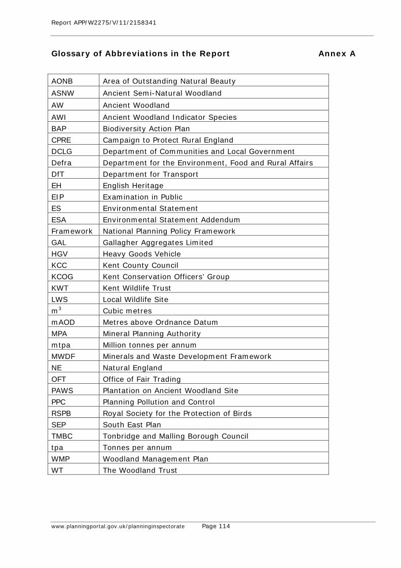
Report APP/W2275/V/11/2158341
www.planningportal.gov.uk/planninginspectorate Page 114
Glossary of Abbreviations in the Report Annex A
AONB Area of Outstanding Natural Beauty
ASNW Ancient Semi-Natural Woodland
AW Ancient Woodland
AWI Ancient Woodland Indicator Species
BAP Biodiversity Action Plan
CPRE Campaign to Protect Rural England
DCLG Department of Communities and Local Government
Defra Department for the Environment, Food and Rural Affairs
DfT Department for Transport
EH English Heritage
EIP Examination in Public
ES Environmental Statement
ESA Environmental Statement Addendum
Framework National Planning Policy Framework
GAL Gallagher Aggregates Limited
HGV Heavy Goods Vehicle
KCC Kent County Council
KCOG Kent Conservation Officers’ Group
KWT Kent Wildlife Trust
LWS Local Wildlife Site
m3 Cubic metres
mAOD Metres above Ordnance Datum
MPA Mineral Planning Authority
mtpa Million tonnes per annum
MWDF Minerals and Waste Development Framework
NE Natural England
OFT Office of Fair Trading
PAWS Plantation on Ancient Woodland Site
PPC Planning Pollution and Control
RSPB Royal Society for the Protection of Birds
SEP South East Plan
TMBC Tonbridge and Malling Borough Council
tpa Tonnes per annum
WMP Woodland Management Plan
WT The Woodland Trust
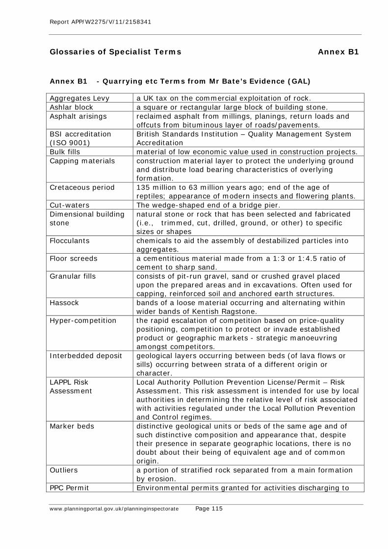
Report APP/W2275/V/11/2158341
www.planningportal.gov.uk/planninginspectorate Page 115
Glossaries of Specialist Terms Annex B1
Annex B1 - Quarrying etc Terms from Mr Bate’s Evidence (GAL) Aggregates Levy a UK tax on the commercial exploitation of rock. Ashlar block a square or rectangular large block of building stone. Asphalt arisings reclaimed asphalt from millings, planings, return loads and
offcuts from bituminous layer of roads/pavements. BSI accreditation (ISO 9001)
British Standards Institution – Quality Management System Accreditation
Bulk fills material of low economic value used in construction projects. Capping materials construction material layer to protect the underlying ground
and distribute load bearing characteristics of overlying formation.
Cretaceous period 135 million to 63 million years ago; end of the age of reptiles; appearance of modern insects and flowering plants.
Cut-waters The wedge-shaped end of a bridge pier. Dimensional building stone
natural stone or rock that has been selected and fabricated (i.e., trimmed, cut, drilled, ground, or other) to specific sizes or shapes
Flocculants chemicals to aid the assembly of destabilized particles into aggregates.
Floor screeds a cementitious material made from a 1:3 or 1:4.5 ratio of cement to sharp sand.
Granular fills consists of pit-run gravel, sand or crushed gravel placed upon the prepared areas and in excavations. Often used for capping, reinforced soil and anchored earth structures.
Hassock bands of a loose material occurring and alternating within wider bands of Kentish Ragstone.
Hyper-competition the rapid escalation of competition based on price-quality positioning, competition to protect or invade established product or geographic markets - strategic manoeuvring amongst competitors.
Interbedded deposit geological layers occurring between beds (of lava flows or sills) occurring between strata of a different origin or character.
LAPPL Risk Assessment
Local Authority Pollution Prevention License/Permit – Risk Assessment. This risk assessment is intended for use by local authorities in determining the relative level of risk associated with activities regulated under the Local Pollution Prevention and Control regimes.
Marker beds distinctive geological units or beds of the same age and of such distinctive composition and appearance that, despite their presence in separate geographic locations, there is no doubt about their being of equivalent age and of common origin.
Outliers a portion of stratified rock separated from a main formation by erosion.
PPC Permit Environmental permits granted for activities discharging to
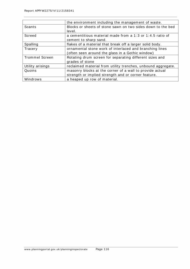
Report APP/W2275/V/11/2158341
www.planningportal.gov.uk/planninginspectorate Page 116
the environment including the management of waste. Scants Blocks or sheets of stone sawn on two sides down to the bed
level. Screed a cementitious material made from a 1:3 or 1:4.5 ratio of
cement to sharp sand. Spalling flakes of a material that break off a larger solid body. Tracery ornamental stone work of interlaced and branching lines
(often seen around the glass in a Gothic window) Trommel Screen Rotating drum screen for separating different sizes and
grades of stone Utility arisings reclaimed material from utility trenches, unbound aggregate. Quoins masonry blocks at the corner of a wall to provide actual
strength or implied strength and or corner feature. Windrows a heaped up row of material.
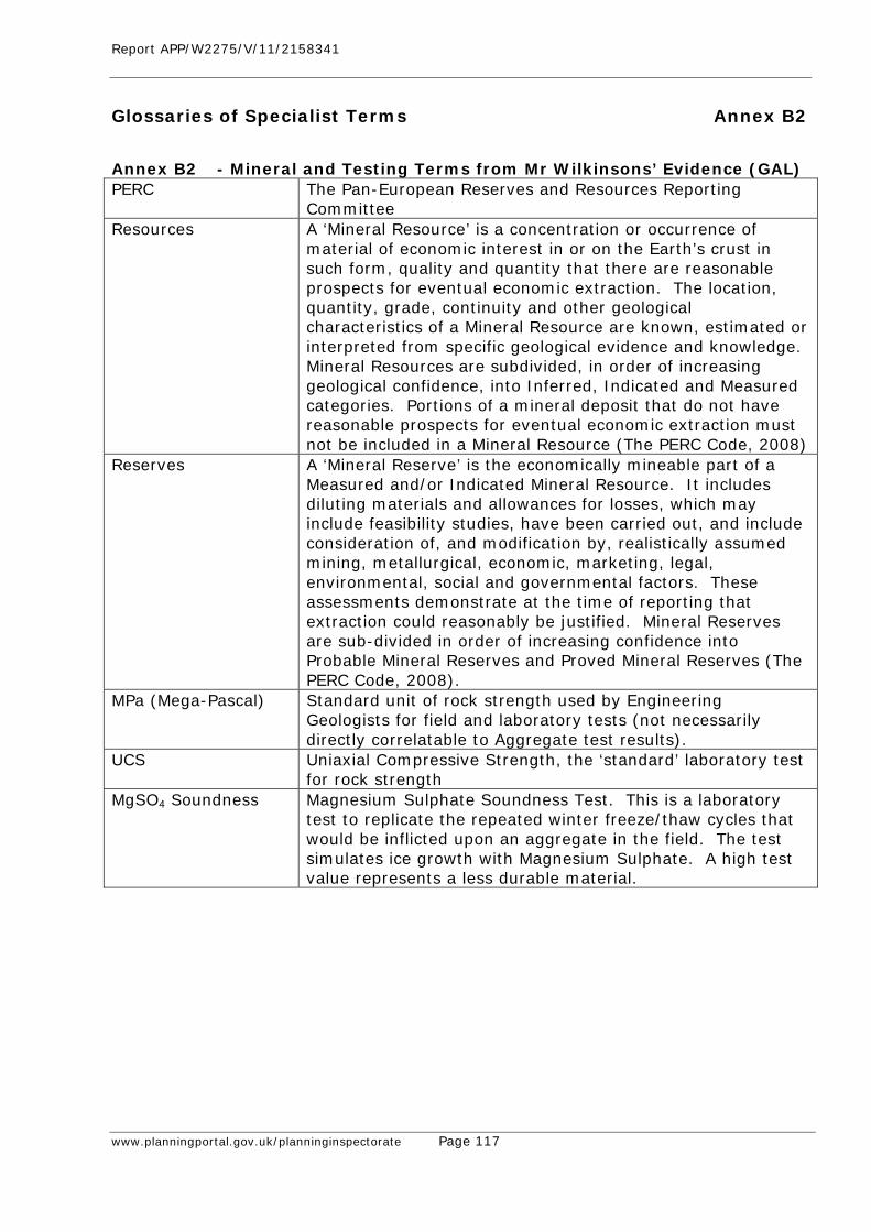
Report APP/W2275/V/11/2158341
www.planningportal.gov.uk/planninginspectorate Page 117
Glossaries of Specialist Terms Annex B2
Annex B2 - Mineral and Testing Terms from Mr Wilkinsons’ Evidence (GAL) PERC The Pan-European Reserves and Resources Reporting
Committee Resources A ‘Mineral Resource’ is a concentration or occurrence of
material of economic interest in or on the Earth’s crust in such form, quality and quantity that there are reasonable prospects for eventual economic extraction. The location, quantity, grade, continuity and other geological characteristics of a Mineral Resource are known, estimated or interpreted from specific geological evidence and knowledge. Mineral Resources are subdivided, in order of increasing geological confidence, into Inferred, Indicated and Measured categories. Portions of a mineral deposit that do not have reasonable prospects for eventual economic extraction must not be included in a Mineral Resource (The PERC Code, 2008)
Reserves A ‘Mineral Reserve’ is the economically mineable part of a Measured and/or Indicated Mineral Resource. It includes diluting materials and allowances for losses, which may include feasibility studies, have been carried out, and include consideration of, and modification by, realistically assumed mining, metallurgical, economic, marketing, legal, environmental, social and governmental factors. These assessments demonstrate at the time of reporting that extraction could reasonably be justified. Mineral Reserves are sub-divided in order of increasing confidence into Probable Mineral Reserves and Proved Mineral Reserves (The PERC Code, 2008).
MPa (Mega-Pascal) Standard unit of rock strength used by Engineering Geologists for field and laboratory tests (not necessarily directly correlatable to Aggregate test results).
UCS Uniaxial Compressive Strength, the ‘standard’ laboratory test for rock strength
MgSO4 Soundness Magnesium Sulphate Soundness Test. This is a laboratory test to replicate the repeated winter freeze/thaw cycles that would be inflicted upon an aggregate in the field. The test simulates ice growth with Magnesium Sulphate. A high test value represents a less durable material.
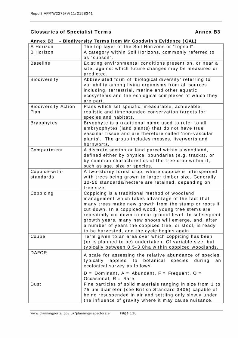
Report APP/W2275/V/11/2158341
www.planningportal.gov.uk/planninginspectorate Page 118
Glossaries of Specialist Terms Annex B3
Annex B3 - Biodiversity Terms from Mr Goodwin’s Evidence (GAL) A Horizon The top layer of the Soil Horizons or “topsoil”. B Horizon A category within Soil Horizons, commonly referred to
as “subsoil”. Baseline Existing environmental conditions present on, or near a
site, against which future changes may be measured or predicted.
Biodiversity Abbreviated form of ‘biological diversity’ referring to variability among living organisms from all sources including, terrestrial, marine and other aquatic ecosystems and the ecological complexes of which they are part.
Biodiversity Action Plan
Plans which set specific, measurable, achievable, realistic and timebounded conservation targets for species and habitats.
Bryophytes Bryophyte is a traditional name used to refer to all embryophytes (land plants) that do not have true vascular tissue and are therefore called 'non-vascular plants'. The group includes mosses, liverworts and hornworts.
Compartment A discrete section or land parcel within a woodland, defined either by physical boundaries (e.g. tracks), or by common characteristics of the tree crop within it, such as age, size or species.
Coppice-with-standards
A two-storey forest crop, where coppice is interspersed with trees being grown to larger timber size. Generally 30-50 standards/hectare are retained, depending on tree size.
Coppicing Coppicing is a traditional method of woodland management which takes advantage of the fact that many trees make new growth from the stump or roots if cut down. In a coppiced wood, young tree stems are repeatedly cut down to near ground level. In subsequent growth years, many new shoots will emerge, and, after a number of years the coppiced tree, or stool, is ready to be harvested, and the cycle begins again.
Coupe Term given to an area over which coppicing has been (or is planned to be) undertaken. Of variable size, but typically between 0.5-3.0ha within coppiced woodlands.
DAFOR A scale for assessing the relative abundance of species, typically applied to botanical species during an ecological survey as follows:
D = Dominant, A = Abundant, F = Frequent, O = Occasional, R = Rare
Dust Fine particles of solid materials ranging in size from 1 to 75 µm diameter (see British Standard 3405) capable of being resuspended in air and settling only slowly under the influence of gravity where it may cause nuisance.
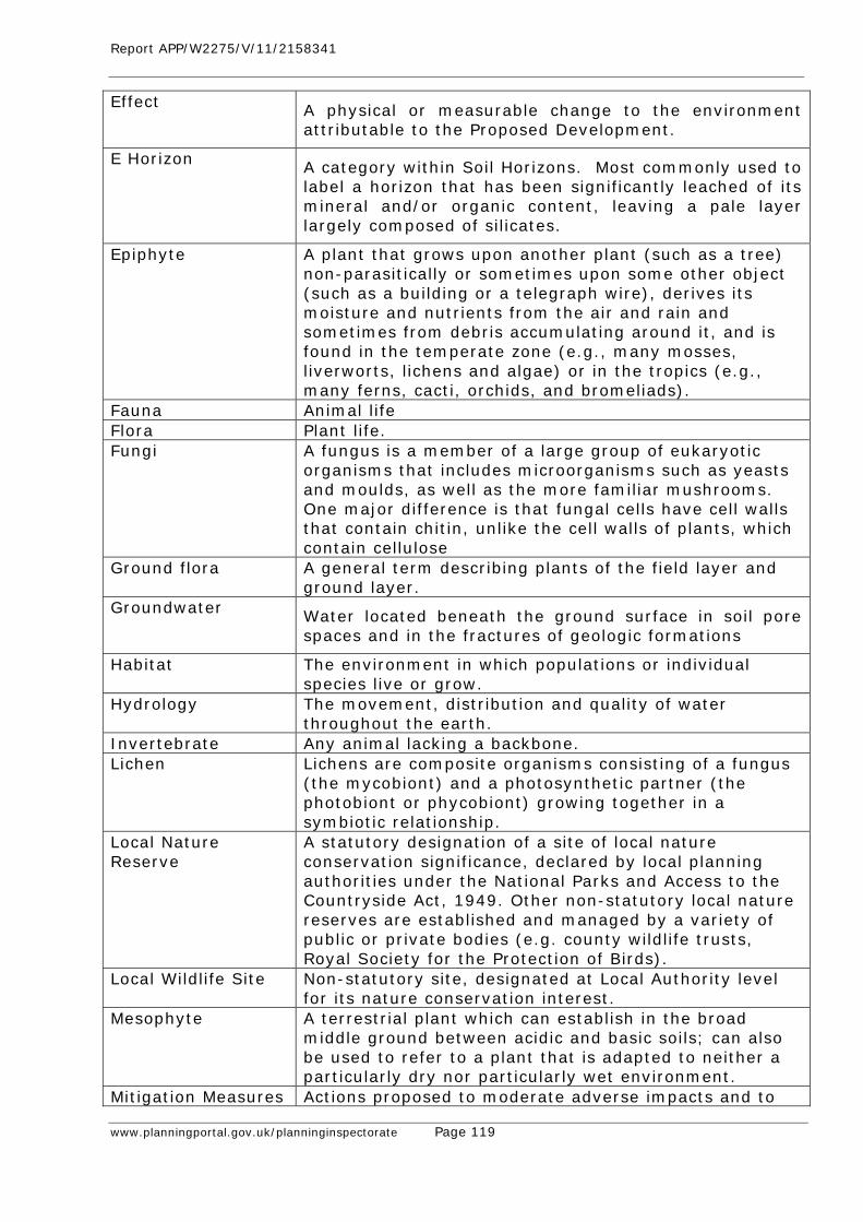
Report APP/W2275/V/11/2158341
www.planningportal.gov.uk/planninginspectorate Page 119
Effect A physical or measurable change to the environment attributable to the Proposed Development.
E Horizon A category within Soil Horizons. Most commonly used to label a horizon that has been significantly leached of its mineral and/or organic content, leaving a pale layer largely composed of silicates.
Epiphyte A plant that grows upon another plant (such as a tree) non-parasitically or sometimes upon some other object (such as a building or a telegraph wire), derives its moisture and nutrients from the air and rain and sometimes from debris accumulating around it, and is found in the temperate zone (e.g., many mosses, liverworts, lichens and algae) or in the tropics (e.g., many ferns, cacti, orchids, and bromeliads).
Fauna Animal life Flora Plant life. Fungi A fungus is a member of a large group of eukaryotic
organisms that includes microorganisms such as yeasts and moulds, as well as the more familiar mushrooms. One major difference is that fungal cells have cell walls that contain chitin, unlike the cell walls of plants, which contain cellulose
Ground flora A general term describing plants of the field layer and ground layer.
Groundwater Water located beneath the ground surface in soil pore spaces and in the fractures of geologic formations
Habitat The environment in which populations or individual species live or grow.
Hydrology The movement, distribution and quality of water throughout the earth.
Invertebrate Any animal lacking a backbone. Lichen Lichens are composite organisms consisting of a fungus
(the mycobiont) and a photosynthetic partner (the photobiont or phycobiont) growing together in a symbiotic relationship.
Local Nature Reserve
A statutory designation of a site of local nature conservation significance, declared by local planning authorities under the National Parks and Access to the Countryside Act, 1949. Other non-statutory local nature reserves are established and managed by a variety of public or private bodies (e.g. county wildlife trusts, Royal Society for the Protection of Birds).
Local Wildlife Site Non-statutory site, designated at Local Authority level for its nature conservation interest.
Mesophyte A terrestrial plant which can establish in the broad middle ground between acidic and basic soils; can also be used to refer to a plant that is adapted to neither a particularly dry nor particularly wet environment.
Mitigation Measures Actions proposed to moderate adverse impacts and to
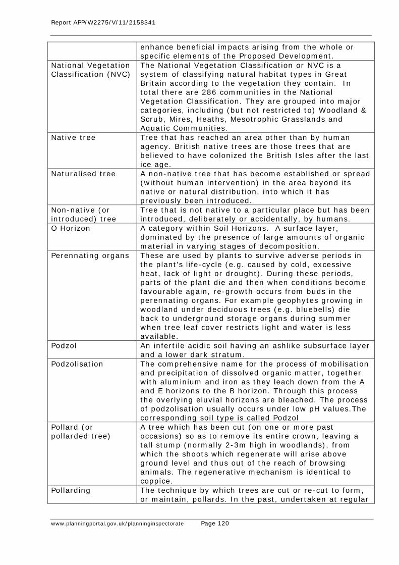
Report APP/W2275/V/11/2158341
www.planningportal.gov.uk/planninginspectorate Page 120
enhance beneficial impacts arising from the whole or specific elements of the Proposed Development.
National Vegetation Classification (NVC)
The National Vegetation Classification or NVC is a system of classifying natural habitat types in Great Britain according to the vegetation they contain. In total there are 286 communities in the National Vegetation Classification. They are grouped into major categories, including (but not restricted to) Woodland & Scrub, Mires, Heaths, Mesotrophic Grasslands and Aquatic Communities.
Native tree Tree that has reached an area other than by human agency. British native trees are those trees that are believed to have colonized the British Isles after the last ice age.
Naturalised tree A non-native tree that has become established or spread (without human intervention) in the area beyond its native or natural distribution, into which it has previously been introduced.
Non-native (or introduced) tree
Tree that is not native to a particular place but has been introduced, deliberately or accidentally, by humans.
O Horizon A category within Soil Horizons. A surface layer, dominated by the presence of large amounts of organic material in varying stages of decomposition.
Perennating organs These are used by plants to survive adverse periods in the plant's life-cycle (e.g. caused by cold, excessive heat, lack of light or drought). During these periods, parts of the plant die and then when conditions become favourable again, re-growth occurs from buds in the perennating organs. For example geophytes growing in woodland under deciduous trees (e.g. bluebells) die back to underground storage organs during summer when tree leaf cover restricts light and water is less available.
Podzol An infertile acidic soil having an ashlike subsurface layer and a lower dark stratum.
Podzolisation The comprehensive name for the process of mobilisation and precipitation of dissolved organic matter, together with aluminium and iron as they leach down from the A and E horizons to the B horizon. Through this process the overlying eluvial horizons are bleached. The process of podzolisation usually occurs under low pH values.The corresponding soil type is called Podzol
Pollard (or pollarded tree)
A tree which has been cut (on one or more past occasions) so as to remove its entire crown, leaving a tall stump (normally 2-3m high in woodlands), from which the shoots which regenerate will arise above ground level and thus out of the reach of browsing animals. The regenerative mechanism is identical to coppice.
Pollarding The technique by which trees are cut or re-cut to form, or maintain, pollards. In the past, undertaken at regular
Report APP/W2275/V/11/2158341
www.planningportal.gov.uk/planninginspectorate Page 121
intervals in the same way as coppice. A technique often used in urban areas to control or restrict the size of street trees on an ongoing basis.
Receptor A component of the natural, created or built environment such as human being, water, air, a building, or a plant that is effected by an impact.
Risk assessment An assessment of the likelihood and severity of an occurrence.
Ruderal Robust, sturdy and vigorous plant community inhabiting disturbed sites or growing amongst debris or rubbish.
Silviculture The practice of controlling the establishment, growth, composition, health, and quality of woods to meet diverse needs and values.
Soil Horizon A layer parallel to the soil surface, whose physical characteristics differ from the layers above and beneath. Each soil type has at least one, usually three or four horizons. Horizons are defined in most cases by obvious physical features, chiefly colour and texture. These may be described both in absolute terms (particle size distribution for texture, for instance) and in terms relative to the surrounding material, i.e. ‘coarser’ or ‘sandier’ than the horizons above and below.
Surface water Water collecting on the ground or in streams, rivers or lakes.
Subsoil Subsoil is the layer of soil under the topsoil on the surface of the ground.
Topography The natural or artificial features, level and surface form of the ground surface.
Topsoil Topsoil is the upper, outermost layer of soil, usually the top 5 cm to 20 cm. It has the highest concentration of organic matter and microorganisms and is where most of the Earth's biological soil activity occurs
Typical (Ecology) Exhibiting the qualities, traits, or characteristics that identify a kind, class, group, or category.
Understorey (Ecology)
The layer formed by grasses, shrubs, and small trees under the canopy of larger trees and plants.
Report APP/W2275/V/11/2158341
www.planningportal.gov.uk/planninginspectorate Page 122
Glossaries of Specialist Terms Annex B4
Annex B4 - Woodland Terms from Mr Mackworth-Praed’s Evidence (GAL)
Ancient tree
Term usually considered to be synonymous with ‘veteran tree’, but distinguished by some authors to refer specifically to trees in the final stage of their natural biological life.
Canopy The cover over the area of a woodland formed by the contiguous or intermeshing crowns of the taller trees within it.
Canopy closure
The stage of woodland growth at which the crowns of trees merge or intermesh to form a continuous (or nearly continuous) canopy.
Cant Local (S.E. England) term given to smaller working units within a larger coupe.
Clear-felling
Timber harvesting system whereby all trees within a given area are felled at the same time, and their stumps are either removed or killed (or alternatively left to decay in the case of species which do not produce coppice shoots), in order for the area to be replanted with a new timber crop. The normal harvesting system within commercial coniferous high forest.
Compartment A discrete section or land parcel within a woodland, defined either by physical boundaries (e.g. tracks), or by common characteristics of the tree crop within it, such as age, size or species.
Coppice A forest crop raised from shoots produced from the cut stumps of the previous crop.
Coppicing
The operation of felling and regenerating forest crops in this way; the silvicultural technique in which trees are cut at just above ground level and allowed to re-sprout to produce wood or timber for specific uses.
Coppice rotation or cycle
The interval of years between successive episodes of coppicing. This generally differs according the coppice species being grown, the desired size of the crop for its intended use(s), and the growth rate or performance of the crop according to site conditions.
Coppice stool (or stock)
The cut stump or stumps of a coppiced tree, from which the regenerating shoots emerge and grow.
Coppice-with-standards
A two-storey forest crop, where coppice is interspersed with trees being grown to larger timber size. Generally 30-50 standards/hectare are retained, depending on tree size.
Coupe Term given to an area over which coppicing has been (or is planned to be) undertaken. Of variable size, but typically between 0.5-3.0ha within coppiced woodlands.
Crown The entire branch framework and foliage of a tree.
Drawn up
Tree that has a height to diameter ratio that is increasingly large, typically appearing tall with a small crown, few or no lower branches, and with very little taper at the base. A phototropic response as a result of close competition by adjacent trees, often observed in a woodland situation.
Epicormic
Juvenile shoots arising from the trunk or main stems from latent buds or adventitious buds. Production can be triggered by pruning, wounding, fire, or root damage but may also be as a result of stress or decline.
Report APP/W2275/V/11/2158341
www.planningportal.gov.uk/planninginspectorate Page 123
Etiolated Excessively drawn up due to lack of light.
Field layer General term for all (normally non-woody) vegetation growing on the woodland floor, beneath the canopy and understorey.
High forest Woodland consisting predominantly of standard trees being grown to larger timber size, with underwood occupying a smaller or less significant proportion of the total woodland area and biomass.
Native tree Tree that has reached an area other than by human agency. British native trees are those trees that are believed to have colonized the British Isles after the last ice age.
Naturalized tree
A non-native tree that has become established or spread (without human intervention) in the area beyond its native or natural distribution, into which it has previously been introduced.
Non-native (or introduced) tree
Tree that is not native to a particular place but has been introduced, deliberately or accidentally, by humans.
Pollard (or pollarded tree)
A tree which has been cut (on one or more past occasions) so as to remove its entire crown, leaving a tall stump (normally 2-3m high in woodlands), from which the shoots which regenerate will arise above ground level and thus out of the reach of browsing animals. The regenerative mechanism is identical to coppice.
Pollarding
The technique by which trees are cut or re-cut to form, or maintain, pollards. In the past, undertaken at regular intervals in the same way as coppice. A technique often used in urban areas to control or restrict the size of street trees on an ongoing basis.
Protective fencing
Temporary fencing, erected for the duration of demolition and construction activities; designed to prevent access and disturbance to the trunks and root protection areas of trees.
Pruning The removal of living or dead parts of a tree, especially branches, to reduce size, to maintain shape, health, safety, or to regulate growth.
Ring shake The internal separation of wood within a tree’s trunk around the annual growth rings.
Root-plate
The central coherent heavy mass of interwoven roots and soil particles, shaped like a disc or inverted cone, extending around the base of the trunk, which provides much of a tree’s anchorage. Generally considered to be of a radius within the range of 1.5 to 4 times a tree’s trunk diameter, measured from trunk centre.
Root Protection Area (‘RPA’)
The area around a tree within which construction or development activities would be likely to cause unacceptable damage to the roots. Defined as the minimum area around a retained tree deemed to contain sufficient roots and rooting volume to maintain the tree’s viability, and where the protection of the roots and soil structure is treated as a priority. (per BS 5837:2012) Calculated as an area equivalent to that of a circle with a radius 12 times the stem diameter for single-stemmed trees, or the combined stem diameters of trees with more than one stem arising below 1.5m above ground level.
Report APP/W2275/V/11/2158341
www.planningportal.gov.uk/planninginspectorate Page 124
Root spread The total physical extent of a tree’s root system, often extending beyond the limit of its crown spread.
Shaw Local (S.E. England) term used to denote a narrow band or strip of woodland, normally forming a boundary between agricultural fields.
Shoot (or spring)
Term given to the young regenerating regrowth arising from a coppice stool.
Simple or pure coppice
A woodland in which the crop consists entirely of coppice, all of which is worked on the same cycle.
Standard
A tree which has been allowed to grow on as a single-trunked specimen to produce larger sized timber. Normally of seedling origin (known as ‘maidens’), but may have developed from a stump shoot intentionally left for the purpose.
Star shake The internal splitting of a tree’s trunk along the radial medullary rays from or through the trunk centre.
Stored coppice
A tree or stand of trees which has been coppiced in the past, but which has been left or retained (either intentionally or unintentionally) beyond the normal rotation interval, so that the regrown stems have developed to a greater size than the maximum which would be achieved within the normal coppicing cycle.
Sub-compartment
A discrete section or component part of a woodland compartment, normally defined by reference to differing characteristics of the tree crop within it from those of the compartment as a whole.
Understorey (or underwood)
General term for all coppice or woody saplings and shrubs occurring under the canopy of another tree crop.
Veteran tree
Tree that, by recognized criteria, shows features of biological, cultural or aesthetic value that are characteristic of, but not exclusive to, individuals surviving beyond the typical age range for the species concerned. (per BS 5837: 2012).
Wind snap The breaking of a tree’s trunk or main stems above ground level by wind.
Windthrow
Tree failure and collapse when the force exerted by wind against the crown and trunk overcomes resistance to that force in the root-plate, such that the root-plate is lifted from the soil on one side as the tree tips over.
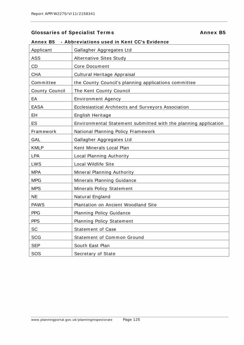
Report APP/W2275/V/11/2158341
www.planningportal.gov.uk/planninginspectorate Page 125
Glossaries of Specialist Terms Annex B5
Annex B5 - Abbreviations used in Kent CC’s Evidence
Applicant Gallagher Aggregates Ltd
ASS Alternative Sites Study
CD Core Document
CHA Cultural Heritage Appraisal
Committee the County Council’s planning applications committee
County Council The Kent County Council
EA Environment Agency
EASA Ecclesiastical Architects and Surveyors Association
EH English Heritage
ES Environmental Statement submitted with the planning application
Framework National Planning Policy Framework
GAL Gallagher Aggregates Ltd
KMLP Kent Minerals Local Plan
LPA Local Planning Authority
LWS Local Wildlife Site
MPA Mineral Planning Authority
MPG Minerals Planning Guidance
MPS Minerals Policy Statement
NE Natural England
PAWS Plantation on Ancient Woodland Site
PPG Planning Policy Guidance
PPS Planning Policy Statement
SC Statement of Case
SCG Statement of Common Ground
SEP South East Plan
SOS Secretary of State
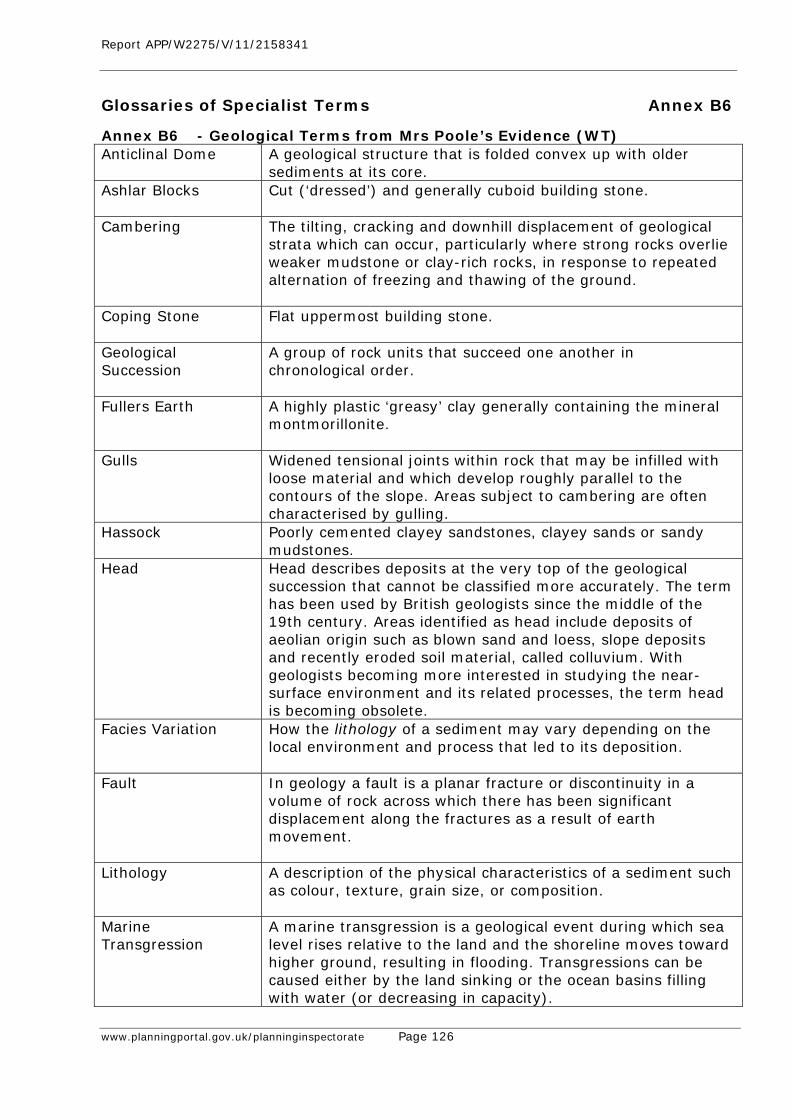
Report APP/W2275/V/11/2158341
www.planningportal.gov.uk/planninginspectorate Page 126
Glossaries of Specialist Terms Annex B6
Annex B6 - Geological Terms from Mrs Poole’s Evidence (WT) Anticlinal Dome
A geological structure that is folded convex up with older sediments at its core.
Ashlar Blocks
Cut (‘dressed’) and generally cuboid building stone.
Cambering The tilting, cracking and downhill displacement of geological strata which can occur, particularly where strong rocks overlie weaker mudstone or clay-rich rocks, in response to repeated alternation of freezing and thawing of the ground.
Coping Stone Flat uppermost building stone.
Geological Succession
A group of rock units that succeed one another in chronological order.
Fullers Earth
A highly plastic ‘greasy’ clay generally containing the mineral montmorillonite.
Gulls
Widened tensional joints within rock that may be infilled with loose material and which develop roughly parallel to the contours of the slope. Areas subject to cambering are often characterised by gulling.
Hassock Poorly cemented clayey sandstones, clayey sands or sandy mudstones.
Head
Head describes deposits at the very top of the geological succession that cannot be classified more accurately. The term has been used by British geologists since the middle of the 19th century. Areas identified as head include deposits of aeolian origin such as blown sand and loess, slope deposits and recently eroded soil material, called colluvium. With geologists becoming more interested in studying the near-surface environment and its related processes, the term head is becoming obsolete.
Facies Variation How the lithology of a sediment may vary depending on the local environment and process that led to its deposition.
Fault
In geology a fault is a planar fracture or discontinuity in a volume of rock across which there has been significant displacement along the fractures as a result of earth movement.
Lithology
A description of the physical characteristics of a sediment such as colour, texture, grain size, or composition.
Marine Transgression
A marine transgression is a geological event during which sea level rises relative to the land and the shoreline moves toward higher ground, resulting in flooding. Transgressions can be caused either by the land sinking or the ocean basins filling with water (or decreasing in capacity).
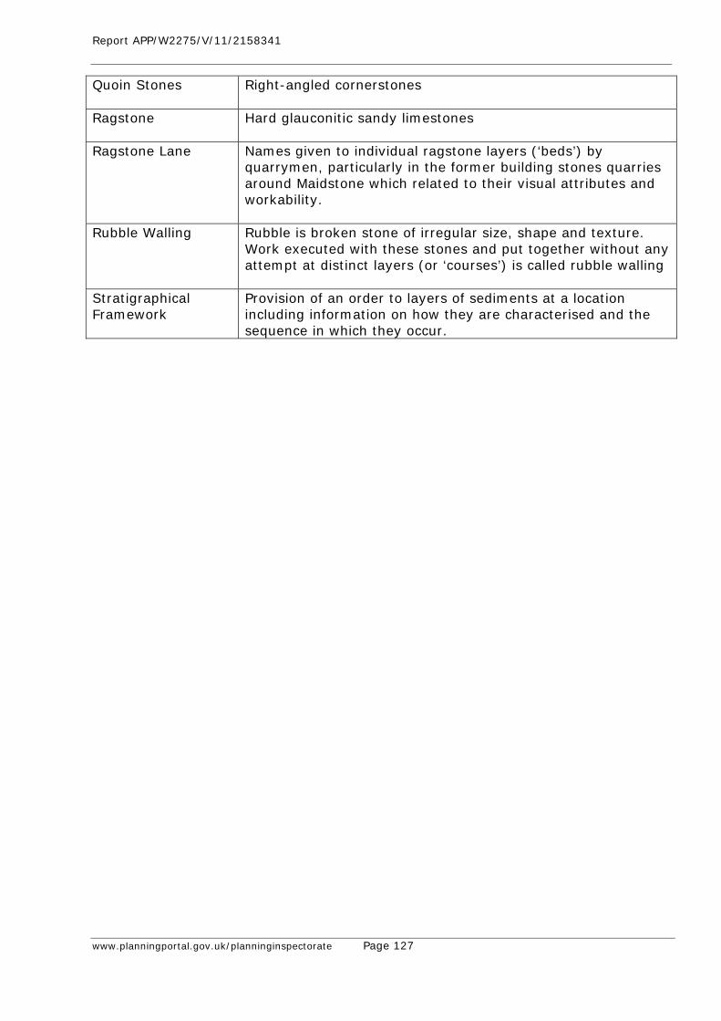
Report APP/W2275/V/11/2158341
www.planningportal.gov.uk/planninginspectorate Page 127
Quoin Stones
Right-angled cornerstones
Ragstone
Hard glauconitic sandy limestones
Ragstone Lane
Names given to individual ragstone layers (‘beds’) by quarrymen, particularly in the former building stones quarries around Maidstone which related to their visual attributes and workability.
Rubble Walling
Rubble is broken stone of irregular size, shape and texture. Work executed with these stones and put together without any attempt at distinct layers (or ‘courses’) is called rubble walling
Stratigraphical Framework
Provision of an order to layers of sediments at a location including information on how they are characterised and the sequence in which they occur.
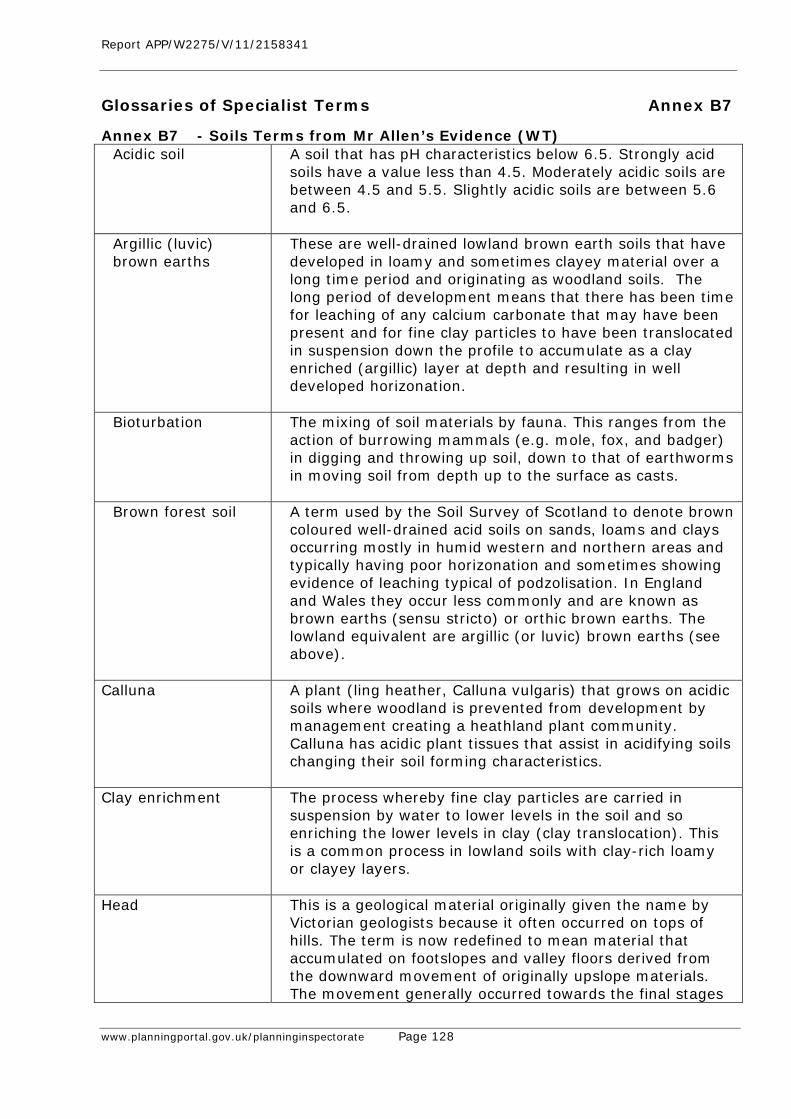
Report APP/W2275/V/11/2158341
www.planningportal.gov.uk/planninginspectorate Page 128
Glossaries of Specialist Terms Annex B7
Annex B7 - Soils Terms from Mr Allen’s Evidence (WT) Acidic soil
A soil that has pH characteristics below 6.5. Strongly acid soils have a value less than 4.5. Moderately acidic soils are between 4.5 and 5.5. Slightly acidic soils are between 5.6 and 6.5.
Argillic (luvic) brown earths
These are well-drained lowland brown earth soils that have developed in loamy and sometimes clayey material over a long time period and originating as woodland soils. The long period of development means that there has been time for leaching of any calcium carbonate that may have been present and for fine clay particles to have been translocated in suspension down the profile to accumulate as a clay enriched (argillic) layer at depth and resulting in well developed horizonation.
Bioturbation
The mixing of soil materials by fauna. This ranges from the action of burrowing mammals (e.g. mole, fox, and badger) in digging and throwing up soil, down to that of earthworms in moving soil from depth up to the surface as casts.
Brown forest soil
A term used by the Soil Survey of Scotland to denote brown coloured well-drained acid soils on sands, loams and clays occurring mostly in humid western and northern areas and typically having poor horizonation and sometimes showing evidence of leaching typical of podzolisation. In England and Wales they occur less commonly and are known as brown earths (sensu stricto) or orthic brown earths. The lowland equivalent are argillic (or luvic) brown earths (see above).
Calluna
A plant (ling heather, Calluna vulgaris) that grows on acidic soils where woodland is prevented from development by management creating a heathland plant community. Calluna has acidic plant tissues that assist in acidifying soils changing their soil forming characteristics.
Clay enrichment
The process whereby fine clay particles are carried in suspension by water to lower levels in the soil and so enriching the lower levels in clay (clay translocation). This is a common process in lowland soils with clay-rich loamy or clayey layers.
Head
This is a geological material originally given the name by Victorian geologists because it often occurred on tops of hills. The term is now redefined to mean material that accumulated on footslopes and valley floors derived from the downward movement of originally upslope materials. The movement generally occurred towards the final stages
Report APP/W2275/V/11/2158341
www.planningportal.gov.uk/planninginspectorate Page 129
of ice ages when the melting of frozen ground led to a slurry of mixed saturated material that easily slipped down slopes (a process technically called ‘solifluction’). Material that has been moved downslope following loosening by cultivation is called colluvium (the result of colluviation).
Horizonation
This term refers to the natural layering seen in vertical sections through a soil (the soil profile). The soil layers are technically called ‘horizons’ and horizonation refers to a vertical sequence of horizons. Soils that have developed over a long period of time (usually thousands of years) are affected by downward leaching and accumulation at depth variously of iron, organic carbon, fine clay particles, calcium carbonate and other substances. The differing amounts of leaching and accumulation at different depths in different types of soil leads to the development of different soil layers with differing properties. Generally, older soils with loamy or clayey profiles have well developed horizonation, sandy soils (that lack clay and silt particles) generally have poor horizonation and strongly leached soils (podzols) generally have extreme horizonation. The term can also be used in an archaeological sense in which vertical horizonation relates also to the differing layers created by man’s occupation on and use of soil materials.
Lithostratigraphic information
Information about the different layers (horizons) of geological and soil materials at a location and in particular how they are described, characterised and also of the sequence in which they occur. This information allows the interpretation of the layers in terms of geology, soil processes and history.
O horizon
These are peaty soil horizons accumulated under wet conditions. They are saturated with water for at least 30 consecutive days in most years and generally occur where permanent or prolonged waterlogging prevents oxidation of accumulating organic matter. Peat soils have thick O horizons. Mineral soils with prolonged waterlogging develop thinner O horizons at the surface.
pH (soil)
A measure of soil reaction according to a scale of acidity and alkalinity. A soil that has pH characteristics below 6.5 is considered acidic, between 6.6 and 7.5 as neutral, and above 7.5 as alkaline.
Podzolic soil
A type of soil in which an acid humus layer accumulates at the surface and black or dark brown or ochreous humus and iron-enriched subsoil layers form as a result of intense acid weathering conditions. There are many different types and they may be well-drained (podzols) or affected by water (gley or hydromorphic podzols). They are often
Report APP/W2275/V/11/2158341
www.planningportal.gov.uk/planninginspectorate Page 130
formed on sandy soil layers under heathland but podzol characteristics can also be more weakly expressed under some woodland conditions. A ‘peaty podzol’ is a podzol sufficiently affected by long term wetness to develop a peat upper layer.
Sandy soil
A soil material comprising a very high proportion of sand grade particles (0.06-2mm diameter) and minimal amounts of finer silt and clay particles. These soil materials are usually highly permeable and may be well drained or may be affected by high groundwater. Lack of clay and silt particles mean that different layers in sandy soil profiles may not be well developed and so difficult to identify.
Soil
That material in which plants root, gain physical support and draw on nutrients and water to enable them to grow. Soils have generally developed their characteristics naturally over many thousands of years by the action of soil forming processes on a pre-existing geological parent material. Some soils have formed more recently such as on salt marshes, mountain screes and recent lake or river sediments.
Soil profile
The soil as seen in vertical section to a depth usually of 1 -1.5m and as seen in the sides of a carefully excavated soil pit. The soil profile seen in this way will reveal the sequence of layers (horizons) and allow a technical layer by layer description to be made (soil profile description).
Soil Survey of England and Wales
An organisation originally funded by the Ministry of Agriculture, Fisheries and Food to described soil distribution and related land quality and which from 1979 to 1986 developed a systematic soil inventory and which was published as sets of six maps and six explanatory bulletins (books or memoirs) and based on updated surveys over the past 40 years.
Stony soil A soil material that contains stones. The stones may be hard and impermeable to water such as flint and chert, or may (in a suitable landscape) be softer and permeable such as chalk. Stones are soil materials greater than 2mm in diameter.
Well drained soil
A term used to describe soils that are permeable and not greatly affected by either groundwater or surface water.
Wind-throw
The process whereby trees become blown over in storms. Such trees may have grown tall and top heavy and may have weak root systems. The result is often that their shallow but extensive root systems become uplifted leaving a hollow in the ground. Loosened soil from around the roots

Report APP/W2275/V/11/2158341
www.planningportal.gov.uk/planninginspectorate Page 131
falls back into the hollow leading to mixing of soil materials. On slopes, the loosened material may be washed down slope. Over many generations of wind thrown trees, a whole area of woodland can be affected by this disturbance of the soil layers, and given any subsequent erosion, can lead to loss of the surface soil layers (truncation).
Report APP/W2275/V/11/2158341
www.planningportal.gov.uk/planninginspectorate Page 132
Glossaries of Specialist Terms Annex B8
Annex B8 - Woodland Terms from Mr Barnes’ Evidence (WT) Core Area The area that is unaffected by negative edge effects from
adjacent land-use. The core area of a woodland is a product of its shape, size and distance to which edge effects penetrate. Larger core areas contribute more to biodiversity.
Fragmentation Woodland forms part of a larger network of habitats over a landscape, but quality of the network is dependent on the hostility of surrounding habitats. Increasing the hostility of the habitats surrounding woodland has harmful consequences for the flora and fauna of the area due to the increase in habitat isolation. This is a particular threat to less mobile woodland species.
Translocation A term used to describe a compensation strategy which involves the physical removal of habitats from one location to another in an attempt to offset the impact of development on the wildlife interest of a site.
Mitigation Measures
Mitigation To mitigate is a verb meaning to ‘make less severe, serious or painful’. This is consistent with the Institute of Ecology and Environmental Management’s of mitigation ‘any deliberate action taken to alleviate adverse effects, whether by controlling the sources of impacts or the exposure of ecological receptors to them’ or, more simply, ‘measures taken to reduce adverse impacts’. ‘Mitigation’ has developed a wider meaning and common usage in environmental assessment, planning and management and can sometimes be used as a generic term for some kinds of ‘counter-acting measures’, all of which are intended to ‘prevent, reduce and where possible offset any significant adverse effect on the environment’ as a result of something, whether it be a strategy, plan, programme or project, or simply ongoing management of the environment. Mitigation can be used to encompass measures intended to avoid, cancel or reduce adverse effects.
Avoidance Measures Are intended to stop or prevent effects from occurring, or to eliminate the risk of them occurring, perhaps by relocating a project away from a sensitive area, or removing from a plan or project the element that may cause an adverse effect. Successful avoidance measures mean there would be no effect.
Cancellation Measures
Are intended to completely neutralise or fully negate the adverse nature of effects. There would be an effect, but its negative outcomes would be cancelled out by the measures.
Reduction Measures
These are mitigation measures in the narrower, but accurate, sense. They are intended to make effects smaller or less in amount, degree, size or likelihood, either by reducing the effect itself, or the likelihood of it occurring, or both. These
Report APP/W2275/V/11/2158341
www.planningportal.gov.uk/planninginspectorate Page 133
measures may so reduce the adversity of the effect, or they become so unlikely, that they are no longer of concern. There will nevertheless be a residual effect and it may be necessary to check that the residual effects of one proposed change do not exacerbate the effects of others, by way of cumulative, combined or synergistic processes.
Compensatory Measures
Are measures, only taken into account after a decision has been made, and are intended to at least try to recompense, or otherwise make up for, or off-set, the adverse effects of a proposed change that could or would occur and would be of concern. Again this is consistent with the Institute’s definition, ‘measures taken to offset significant residual adverse impacts, i.e. those that cannot be entirely avoided or mitigated to the point that they become insignificant’ and ‘measures taken to make up for the loss of, or permanent damage to, biological resources through the provision of replacement area’. Thus, an important negative effect is anticipated and ecological loss or harm is likely to occur. However, it has been decided that change should nevertheless go ahead, for whatever reasons, and the compensatory measures try to make amends. The objective should be that the recompense is made in time to make good the ecological function that would be affected.
The Distinction between Avoidance, Cancellation, Reduction and Compensatory Measures
Avoidance, cancellation and reduction measures are essentially aimed at making a change less damaging or not damaging at all (often generically referred to as ‘mitigation’). They are designed to address the potential harm to the natural environment, eliminating or minimising it, so that a decision maker is more inclined to allow or carry out the change. Compensatory measures, however, do not prevent or reduce the potential harm per se. They cannot alter the balance between the benefits of the change and the potential for in situ harm to ecological resources. They should not, therefore, be taken into account in the decision as to whether potentially damaging proposals should proceed. Rather, they are measures intended to at least try to offset the potential damage. They try to either repair the damage or provide something else. This could be something new, additional or different, or something to benefit the environment in some way. Compensatory measures aim to make the consequential damage more palatable, more acceptable.
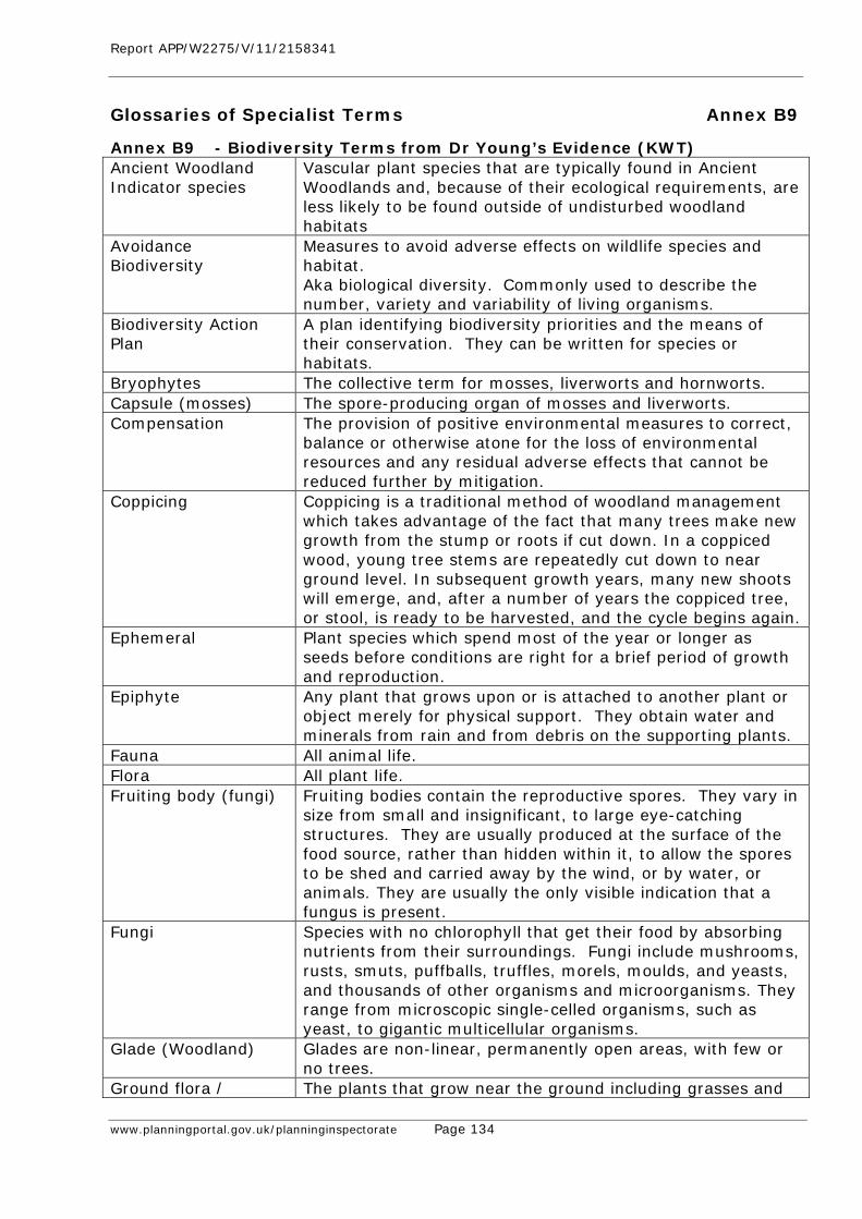
Report APP/W2275/V/11/2158341
www.planningportal.gov.uk/planninginspectorate Page 134
Glossaries of Specialist Terms Annex B9
Annex B9 - Biodiversity Terms from Dr Young’s Evidence (KWT) Ancient Woodland Indicator species
Vascular plant species that are typically found in Ancient Woodlands and, because of their ecological requirements, are less likely to be found outside of undisturbed woodland habitats
Avoidance Biodiversity
Measures to avoid adverse effects on wildlife species and habitat. Aka biological diversity. Commonly used to describe the number, variety and variability of living organisms.
Biodiversity Action Plan
A plan identifying biodiversity priorities and the means of their conservation. They can be written for species or habitats.
Bryophytes The collective term for mosses, liverworts and hornworts. Capsule (mosses) The spore-producing organ of mosses and liverworts. Compensation The provision of positive environmental measures to correct,
balance or otherwise atone for the loss of environmental resources and any residual adverse effects that cannot be reduced further by mitigation.
Coppicing Coppicing is a traditional method of woodland management which takes advantage of the fact that many trees make new growth from the stump or roots if cut down. In a coppiced wood, young tree stems are repeatedly cut down to near ground level. In subsequent growth years, many new shoots will emerge, and, after a number of years the coppiced tree, or stool, is ready to be harvested, and the cycle begins again.
Ephemeral Plant species which spend most of the year or longer as seeds before conditions are right for a brief period of growth and reproduction.
Epiphyte Any plant that grows upon or is attached to another plant or object merely for physical support. They obtain water and minerals from rain and from debris on the supporting plants.
Fauna All animal life. Flora All plant life. Fruiting body (fungi) Fruiting bodies contain the reproductive spores. They vary in
size from small and insignificant, to large eye-catching structures. They are usually produced at the surface of the food source, rather than hidden within it, to allow the spores to be shed and carried away by the wind, or by water, or animals. They are usually the only visible indication that a fungus is present.
Fungi Species with no chlorophyll that get their food by absorbing nutrients from their surroundings. Fungi include mushrooms, rusts, smuts, puffballs, truffles, morels, moulds, and yeasts, and thousands of other organisms and microorganisms. They range from microscopic single-celled organisms, such as yeast, to gigantic multicellular organisms.
Glade (Woodland) Glades are non-linear, permanently open areas, with few or no trees.
Ground flora / The plants that grow near the ground including grasses and
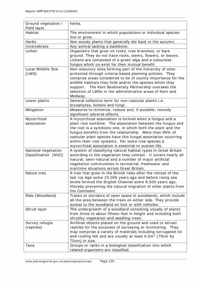
Report APP/W2275/V/11/2158341
www.planningportal.gov.uk/planninginspectorate Page 135
Ground vegetation / Field layer.
herbs.
Habitat The environment in which populations or individual species live or grow.
Herbs Non woody plants that generally die back in the autumn. Invertebrate Any animal lacking a backbone. Lichen Organisms that grow on rocks, tree branches, or bare
ground. They do not have roots, stems, flowers, or leaves. Lichens are composed of a green alga and a colourless fungus which co-exist for their mutual benefit.
Local Wildlife Site (LWS)
Non-statutory sites forming part of the hierarchy of sites protected through criteria-based planning policies. They comprise areas considered to be of county importance for the wildlife habitats they hold and/or the species which they support. The Kent Biodiversity Partnership oversees the selection of LWSs in the administrative areas of Kent and Medway.
Lower plants General collective term for non-vascular plants i.e. bryophytes, lichens and fungi.
Mitigation Measures to minimise, reduce and, if possible, remedy significant adverse effects.
Mycorrhizal association
A mycorrhizal association is formed when a fungus and a plant root combine. The association between the fungus and the root is a symbiotic one, in which both the plant and the fungus benefits from the relationship. More than 95% of vascular plant species have this fungal association occurring within their root systems. For some tree species a mycorrhizal association is essential to sustain life.
National Vegetation Classification (NVC)
A system of classifying natural habitat types in Great Britain according to the vegetation they contain. It covers nearly all natural, semi-natural and a number of major artificial vegetation communities in terrestrial, freshwater and maritime situations across Great Britain.
Native tree A tree that grew in the British Isles after the retreat of the last Ice Age some 10,000 years ago and before rising sea levels formed the English Channel some 8,500 years ago, thereby preventing the natural migration of other plants from the Continent.
Ride (Woodland) Tracks or corridors of open space in woodlands, which include all the area between the trees on either side. They provide access to the woodland on foot or with vehicles.
Shrub layer The undergrowth of a woodland consisting usually of plants from three to about fifteen feet in height and including both shrubby vegetation and seedling trees.
Survey refugia (reptiles)
Artificial objects placed on the ground and used to attract reptiles for the purposes of surveying or monitoring. They may comprise a variety of materials including corrugated tin and roofing felt and are usually at least 0.5m2 (70cm by 70cm) in size.
Taxa Groups or ranks in a biological classification into which related organisms are classified.

Report APP/W2275/V/11/2158341
www.planningportal.gov.uk/planninginspectorate Page 136
Translocation The movement of assemblages of species, mainly plants, (typically including the substrates, such as soil and water, on and in which these species occur) from their original site to a new location.
Understorey The layer formed by grasses, shrubs, and small trees under the canopy of larger trees and plants.
Vascular plant A general term for plants which have a vascular system transporting water, minerals, and photosynthetic materials throughout the plant’s roots, stems, and leaves.
W10 / W10a W10 = Oak/Bracken/Bramble woodland; one of the woodland communities in the National Vegetation Classification system. It is one of the six communities comprising the "mixed deciduous and oak/birch woodlands" group. W10a is the ‘typical sub-community’ of this particular woodland community.
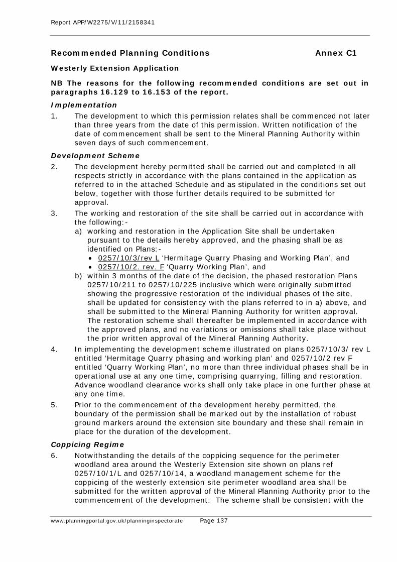
Report APP/W2275/V/11/2158341
www.planningportal.gov.uk/planninginspectorate Page 137
Recommended Planning Conditions Annex C1
Westerly Extension Application
NB The reasons for the following recommended conditions are set out in paragraphs 16.129 to 16.153 of the report.
Implementation 1. The development to which this permission relates shall be commenced not later
than three years from the date of this permission. Written notification of the date of commencement shall be sent to the Mineral Planning Authority within seven days of such commencement.
Development Scheme 2. The development hereby permitted shall be carried out and completed in all
respects strictly in accordance with the plans contained in the application as referred to in the attached Schedule and as stipulated in the conditions set out below, together with those further details required to be submitted for approval.
3. The working and restoration of the site shall be carried out in accordance with the following:- a) working and restoration in the Application Site shall be undertaken
pursuant to the details hereby approved, and the phasing shall be as identified on Plans:- • 0257/10/3/rev L ‘Hermitage Quarry Phasing and Working Plan’, and • 0257/10/2. rev. F ‘Quarry Working Plan’, and
b) within 3 months of the date of the decision, the phased restoration Plans 0257/10/211 to 0257/10/225 inclusive which were originally submitted showing the progressive restoration of the individual phases of the site, shall be updated for consistency with the plans referred to in a) above, and shall be submitted to the Mineral Planning Authority for written approval. The restoration scheme shall thereafter be implemented in accordance with the approved plans, and no variations or omissions shall take place without the prior written approval of the Mineral Planning Authority.
4. In implementing the development scheme illustrated on plans 0257/10/3/ rev L entitled ‘Hermitage Quarry phasing and working plan’ and 0257/10/2 rev F entitled ‘Quarry Working Plan’, no more than three individual phases shall be in operational use at any one time, comprising quarrying, filling and restoration. Advance woodland clearance works shall only take place in one further phase at any one time.
5. Prior to the commencement of the development hereby permitted, the boundary of the permission shall be marked out by the installation of robust ground markers around the extension site boundary and these shall remain in place for the duration of the development.
Coppicing Regime 6. Notwithstanding the details of the coppicing sequence for the perimeter
woodland area around the Westerly Extension site shown on plans ref 0257/10/1/L and 0257/10/14, a woodland management scheme for the coppicing of the westerly extension site perimeter woodland area shall be submitted for the written approval of the Mineral Planning Authority prior to the commencement of the development. The scheme shall be consistent with the
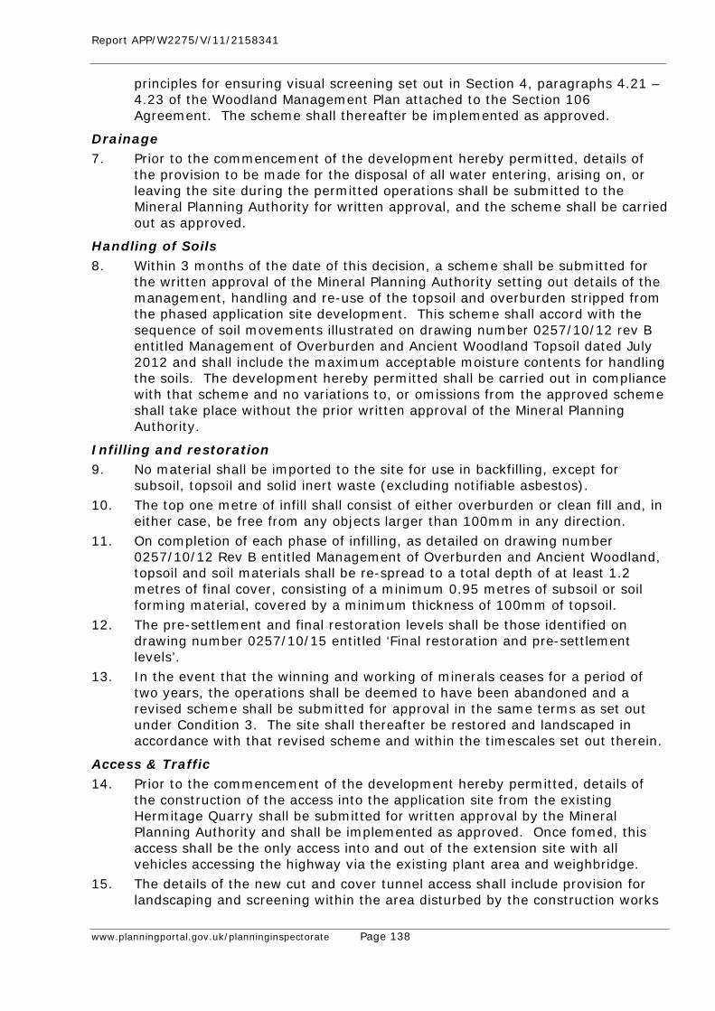
Report APP/W2275/V/11/2158341
www.planningportal.gov.uk/planninginspectorate Page 138
principles for ensuring visual screening set out in Section 4, paragraphs 4.21 – 4.23 of the Woodland Management Plan attached to the Section 106 Agreement. The scheme shall thereafter be implemented as approved.
Drainage 7. Prior to the commencement of the development hereby permitted, details of
the provision to be made for the disposal of all water entering, arising on, or leaving the site during the permitted operations shall be submitted to the Mineral Planning Authority for written approval, and the scheme shall be carried out as approved.
Handling of Soils 8. Within 3 months of the date of this decision, a scheme shall be submitted for
the written approval of the Mineral Planning Authority setting out details of the management, handling and re-use of the topsoil and overburden stripped from the phased application site development. This scheme shall accord with the sequence of soil movements illustrated on drawing number 0257/10/12 rev B entitled Management of Overburden and Ancient Woodland Topsoil dated July 2012 and shall include the maximum acceptable moisture contents for handling the soils. The development hereby permitted shall be carried out in compliance with that scheme and no variations to, or omissions from the approved scheme shall take place without the prior written approval of the Mineral Planning Authority.
Infilling and restoration 9. No material shall be imported to the site for use in backfilling, except for
subsoil, topsoil and solid inert waste (excluding notifiable asbestos). 10. The top one metre of infill shall consist of either overburden or clean fill and, in
either case, be free from any objects larger than 100mm in any direction. 11. On completion of each phase of infilling, as detailed on drawing number
0257/10/12 Rev B entitled Management of Overburden and Ancient Woodland, topsoil and soil materials shall be re-spread to a total depth of at least 1.2 metres of final cover, consisting of a minimum 0.95 metres of subsoil or soil forming material, covered by a minimum thickness of 100mm of topsoil.
12. The pre-settlement and final restoration levels shall be those identified on drawing number 0257/10/15 entitled ‘Final restoration and pre-settlement levels’.
13. In the event that the winning and working of minerals ceases for a period of two years, the operations shall be deemed to have been abandoned and a revised scheme shall be submitted for approval in the same terms as set out under Condition 3. The site shall thereafter be restored and landscaped in accordance with that revised scheme and within the timescales set out therein.
Access & Traffic 14. Prior to the commencement of the development hereby permitted, details of
the construction of the access into the application site from the existing Hermitage Quarry shall be submitted for written approval by the Mineral Planning Authority and shall be implemented as approved. Once fomed, this access shall be the only access into and out of the extension site with all vehicles accessing the highway via the existing plant area and weighbridge.
15. The details of the new cut and cover tunnel access shall include provision for landscaping and screening within the area disturbed by the construction works
Report APP/W2275/V/11/2158341
www.planningportal.gov.uk/planninginspectorate Page 139
designed to minimize potential views from Byway MR496 into the existing quarry to the east and the extension area to the west.
16. All vehicles, plant and machinery operating solely within the site shall be maintained in accordance with the manufacturers’ specifications at all times, and shall be fitted with, and shall use, effective silencers. All vehicles operating solely on the site shall be fitted with, and shall use, ‘white noise’ reversing warning systems.
Plant 17. No buildings shall be erected, or fixed materials processing plant shall operate,
within the area of the Application Site.
Hours of working 18. No operation other than essential maintenance shall take place on site except
between 0700 and 1800 hours Mondays to Fridays and 0700 and 1300 hours on Saturdays.
19. There shall be no operation of plant associated with the construction and removal of the soil screen bunds surrounding the site except between 0800 hours and 1600 hours on Mondays to Fridays inclusive.
Dust 20. Measures shall be taken to minimise dust emissions from quarrying operations
and they shall include the following:- (i) Soils and overburden shall not be handled during dry conditions likely to
give rise to fugitive dust emissions unless the working areas are damped down using water bowsers,
(ii) Drilling of shot holes shall be undertaken by an air flushed drilling rig fitted with a dust collection system,
(iii) Site haul roads within the quarry shall be dampened down in dry conditions using a water bowser,
(iv) Site haul roads shall be regularly maintained by grading to minimise dust generation,
(v) When loading vehicles, drop heights shall be kept to the maximum that has previously been approved in writing by the Mineral Planning Authority ,
(vi) All HGV’s travelling on internal haul roads shall be subject to a speed limit of 15mph,
(vii) Once loaded at the existing quarry plant site, all lorries shall pass through the existing vehicle wheel wash before exiting onto the public highway,
(viii) All aggregate lorries accessing the highway shall be sheeted, except for those carrying stone greater than 75mm, and
(ix) A minimum width of 50 metres of tree cover shall be maintained between the permissive path and the perimeter of the extraction area.
Blasting 21. Blasting shall not take place other than between the hours of 10.00 and 12.00
and 13.00 to 15.00 on Mondays to Fridays. No blasting shall take place on Saturdays, Sundays or Bank Holidays
22. No more than one blast shall take place in any one day.
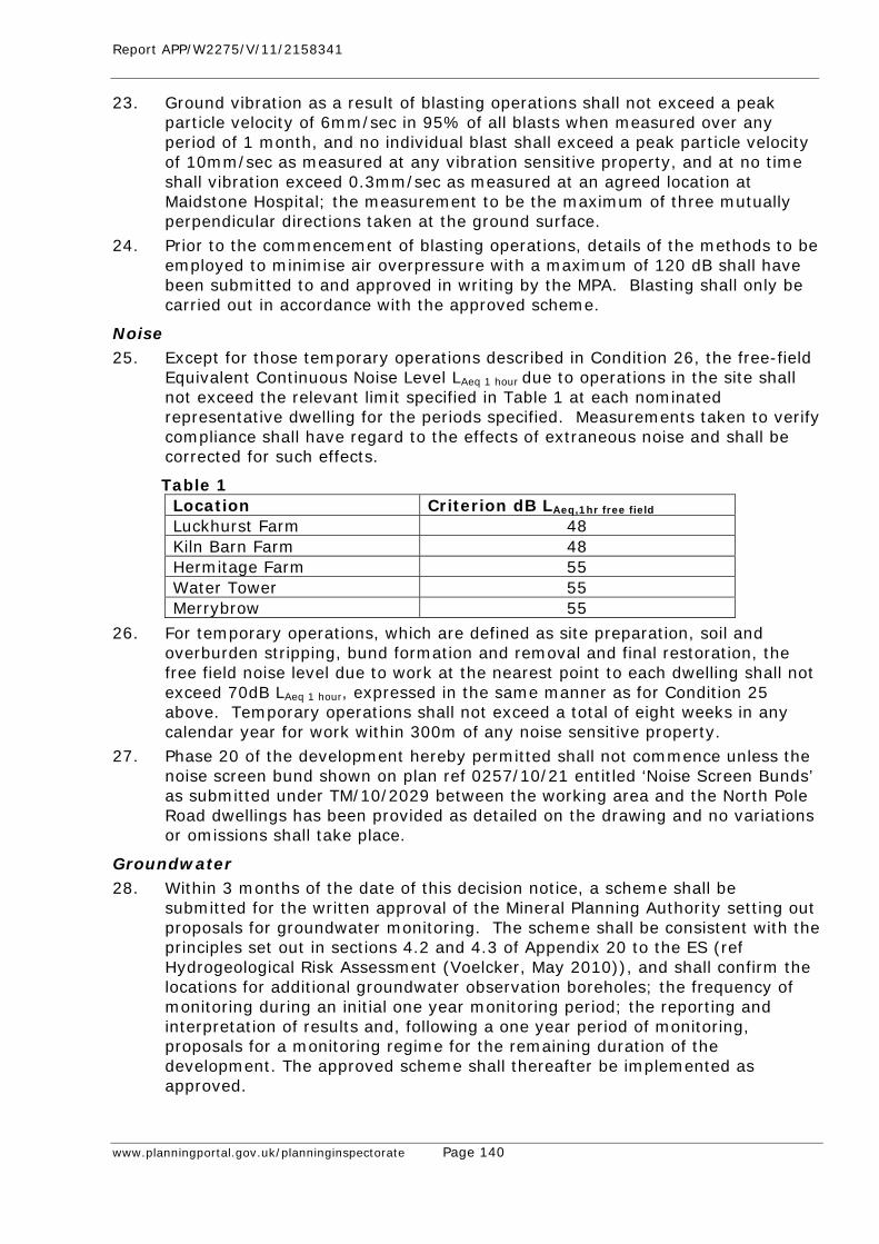
Report APP/W2275/V/11/2158341
www.planningportal.gov.uk/planninginspectorate Page 140
23. Ground vibration as a result of blasting operations shall not exceed a peak particle velocity of 6mm/sec in 95% of all blasts when measured over any period of 1 month, and no individual blast shall exceed a peak particle velocity of 10mm/sec as measured at any vibration sensitive property, and at no time shall vibration exceed 0.3mm/sec as measured at an agreed location at Maidstone Hospital; the measurement to be the maximum of three mutually perpendicular directions taken at the ground surface.
24. Prior to the commencement of blasting operations, details of the methods to be employed to minimise air overpressure with a maximum of 120 dB shall have been submitted to and approved in writing by the MPA. Blasting shall only be carried out in accordance with the approved scheme.
Noise 25. Except for those temporary operations described in Condition 26, the free-field
Equivalent Continuous Noise Level LAeq 1 hour due to operations in the site shall not exceed the relevant limit specified in Table 1 at each nominated representative dwelling for the periods specified. Measurements taken to verify compliance shall have regard to the effects of extraneous noise and shall be corrected for such effects.
Table 1 Location Criterion dB LAeq,1hr free field
Luckhurst Farm 48 Kiln Barn Farm 48 Hermitage Farm 55 Water Tower 55 Merrybrow 55
26. For temporary operations, which are defined as site preparation, soil and overburden stripping, bund formation and removal and final restoration, the free field noise level due to work at the nearest point to each dwelling shall not exceed 70dB LAeq 1 hour, expressed in the same manner as for Condition 25 above. Temporary operations shall not exceed a total of eight weeks in any calendar year for work within 300m of any noise sensitive property.
27. Phase 20 of the development hereby permitted shall not commence unless the noise screen bund shown on plan ref 0257/10/21 entitled ‘Noise Screen Bunds’ as submitted under TM/10/2029 between the working area and the North Pole Road dwellings has been provided as detailed on the drawing and no variations or omissions shall take place.
Groundwater 28. Within 3 months of the date of this decision notice, a scheme shall be
submitted for the written approval of the Mineral Planning Authority setting out proposals for groundwater monitoring. The scheme shall be consistent with the principles set out in sections 4.2 and 4.3 of Appendix 20 to the ES (ref Hydrogeological Risk Assessment (Voelcker, May 2010)), and shall confirm the locations for additional groundwater observation boreholes; the frequency of monitoring during an initial one year monitoring period; the reporting and interpretation of results and, following a one year period of monitoring, proposals for a monitoring regime for the remaining duration of the development. The approved scheme shall thereafter be implemented as approved.
Report APP/W2275/V/11/2158341
www.planningportal.gov.uk/planninginspectorate Page 141
29. The quarry floor shall not be excavated below 43m AOD or at least 2m above the highest recorded ground water levels, whichever is the higher. The depth of the quarry floor shall be subject to annual topographic surveys, and the results of such surveys shall be made available to the Mineral Planning Authority upon request.
30. Prior to the commencement of the development hereby permitted, a scheme shall be submitted for the written approval of the Mineral Planning Authtority to prevent tipping by unauthorized persons on the site. The scheme shall be implemented as approved and any unauthorized material tipped on the site shall be removed within 24 hours of such tipping taking place.
Archaeology 31. No groundworks shall take place within the area of the Application Site until a
programme of archaeological work has been approved in writing by the Mineral Planning Authority and that programme shall thereafter be implemented as approved.
Ecology 32. No removal of trees within the site of the development hereby permitted shall
take place between 1st March and 31st July inclusive in any year.
Building Stone 33. The operator of the hereby permitted Westerly Extension to Hermitage Quarry
shall make available for sale a minimum of 25,000 tonnes of building stone per annum throughout the operational life of the quarry. A stockpile of half this quantity shall be maintained on the site after the first year of operation for the duration of extraction operations. Records shall be submitted annually to the Mineral Planning Authority to confirm the sales of building stone in the preceding year and the amounts held on site.
34. The operation of the Westerly Extension development shall cease in the event that the stone cutting saw approved by KCC on 8th August 2012 (ref TM/88/295R) is not available (save for essential maintenance) at the Hermitage Quarry processing plant site for the processing of sawn six-sided stone.
Display of Permissions 35. The terms of this planning permission, and any schemes or details approved
pursuant there to, shall be displayed at the office on site, and shall be made known to any person(s) involved in the management or control of operations at the site.
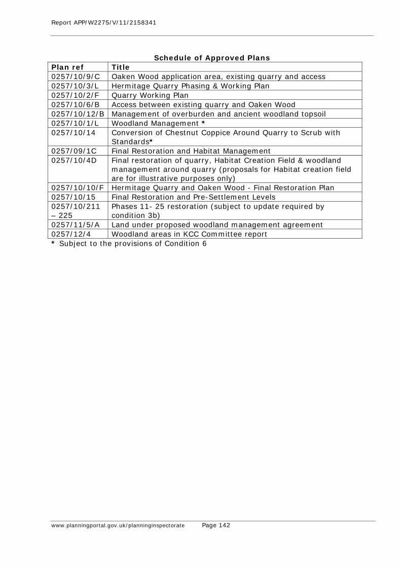
Report APP/W2275/V/11/2158341
www.planningportal.gov.uk/planninginspectorate Page 142
Schedule of Approved Plans
Plan ref Title 0257/10/9/C Oaken Wood application area, existing quarry and access 0257/10/3/L Hermitage Quarry Phasing & Working Plan 0257/10/2/F Quarry Working Plan 0257/10/6/B Access between existing quarry and Oaken Wood 0257/10/12/B Management of overburden and ancient woodland topsoil 0257/10/1/L Woodland Management * 0257/10/14 Conversion of Chestnut Coppice Around Quarry to Scrub with
Standards* 0257/09/1C Final Restoration and Habitat Management 0257/10/4D Final restoration of quarry, Habitat Creation Field & woodland
management around quarry (proposals for Habitat creation field are for illustrative purposes only)
0257/10/10/F Hermitage Quarry and Oaken Wood - Final Restoration Plan 0257/10/15 Final Restoration and Pre-Settlement Levels 0257/10/211 – 225
Phases 11- 25 restoration (subject to update required by condition 3b)
0257/11/5/A Land under proposed woodland management agreement 0257/12/4 Woodland areas in KCC Committee report * Subject to the provisions of Condition 6
Report APP/W2275/V/11/2158341
www.planningportal.gov.uk/planninginspectorate Page 143
Recommended Planning Conditions Annex C2
Original Quarry (Section 73 Application to vary Conditions) NB The reasons for the following recommended conditions are set out in paragraphs 16.158-16.164 of the report. Working Infill and Restoration 1. The development hereby permitted shall be carried out and completed in all
respects strictly in accordance with the plans referred to in the Schedule attached to this decision notice and as stipulated in the conditions set out below, together with those further details required to be submitted for approval; no variations or omissions shall take place without the prior approval in writing of the Mineral Planning Authority (MPA).
2. The working and restoration of the site shall be carried out in accordance with the following:- a. working and restoration shall be undertaken pursuant to the details hereby
approved, and the phasing shall be as identified on plan 0257/10/3/rev L entitled ‘Hermitage Quarry Phasing and Working Plan’ dated July 2012, and
b. within 3 months of the date of this decision, the phased restoration plans 0257/10/202 to 205 and 0257/10/226 to 0257/10/230 inclusive shall be updated for consistency with the plans referred to in a. above, and shall be submitted to the MPA for written approval: the restoration scheme shall thereafter be implemented in accordance with the approved plans, and no variations or omissions shall take place without the prior approval in writing of the MPA.
3. The site shall be worked and restored in accordance with the Quarry Working Plans numbers 0257/10/02 Rev F and 0257/10/03 Rev L and with the Restoration Drawings numbers 0257/10/202 to 0257/10/204 and 0257/10/226 to 0257/10/230 (subject to Condition 2b above), together with the final restoration plan number 0257/10/10 Rev F, and woodland management plans 0257/11/5/A and 0257/12/4.
4. The pre-settlement levels of the restored site and their merging with the adjoining ground levels, including those approved for the existing quarry permitted under reference TM/88/295 and TM/03/2785 (Western Extension), shall be in accordance with the details set out in Planning Design Solutions letter dated 20 June 2008 and drawing number 0108/08/01 approved on 6 October 2008, and no variations or omissions shall take place.
5. Topsoil and subsoil shall only be handled when their moisture contents are at least 5% and 3% below their respective plastic limits. The plastic limits shall be determined and the results notified to the Mineral Planning Authority at least one week before the soils are stripped.
6. No material shall be imported to the site for use in backfilling, except for subsoil, topsoil and solid inert waste (excluding notifiable asbestos).
7. The top one metre of infill shall consist of either overburden or clean fill and, in either case, be free from any objects larger than 100mm in any direction.
8. On completion of each phase of infilling, as detailed on drawing number 0257/10/12 Rev B entitled Management of Overburden and Ancient Woodland, topsoil and soil materials shall be re-spread to a total depth of at least 1.2
Report APP/W2275/V/11/2158341
www.planningportal.gov.uk/planninginspectorate Page 144
metres of final cover, consisting of a minimum 0.95 metres of subsoil or soil forming material, covered by a minimum thickness of 100mm of topsoil.
Traffic and Access 9. The highest average daily number of HGV movements both entering and leaving
the site during any one calendar month excluding non-working days shall not exceed a combined total of 300 movements per day and the number of movements on any single day shall not exceed 600 movements.
10. During the morning and evening peak periods of 0730 hours to 0930 hours and 1600 hours to 1800hours, the maximum number of HGVs entering and leaving the site shall not exceed 30 movements.
11. With effect from the date of the permission hereby granted, the operators shall submit to the Mineral Planning Authority six-monthly returns of all HGV movements to and from the site showing daily and peak hour movements.
12. Measures shall be taken to ensure that vehicles leaving the site do not deposit mud or other materials onto the public highway and such measures shall include the continued provision of wheel and chassis cleaning equipment at Hermitage Quarry.
13. The present visibility splays of 9 metres by 160 metres at the site entrance shall be maintained free of all obstruction to a height of 0.9 metres clear of the carriageway on Hermitage Lane throughout the life of the quarry, including that period of time during which final restoration works are being completed.
14. Upon cessation of all operations that are subject to this decision, the highway access shall be restored in accordance with the details approved under Condition 2.
Cessation and Aftercare 15. In the event that the winning and working of minerals ceases for a period of two
years, the operations shall be deemed to have been abandoned and a revised scheme shall be submitted for approval in the same terms as set out under Condition 2. The site shall be restored and landscaped in accordance with that revised scheme and within the timescales set out therein.
16. Notwithstanding the approval on 18th December 1990 of the details of aftercare management of the restored area, an updated aftercare management scheme shall be submitted for the written approval of the MPA prior to the commencement of restoration of infilling Phase 30. The scheme shall be implemented as approved.
Hours of Working 17. No operation other than essential maintenance shall take place on site except
between 0700 and 1800 hours Mondays to Fridays and 0700 and 1300 hours on Saturdays. No servicing, planned maintenance or testing of plant shall be undertaken outside these hours except between 1800 and 2000 hours Mondays to Fridays, 1300 to 1800 hours Saturdays and 0800 to 1800 hours Sundays and Bank Holidays.
18. There shall be no operation of plant associated with the construction and removal of the soil screen bunds surrounding the site except between 0800 hours and 1600 hours on Mondays to Fridays inclusive.
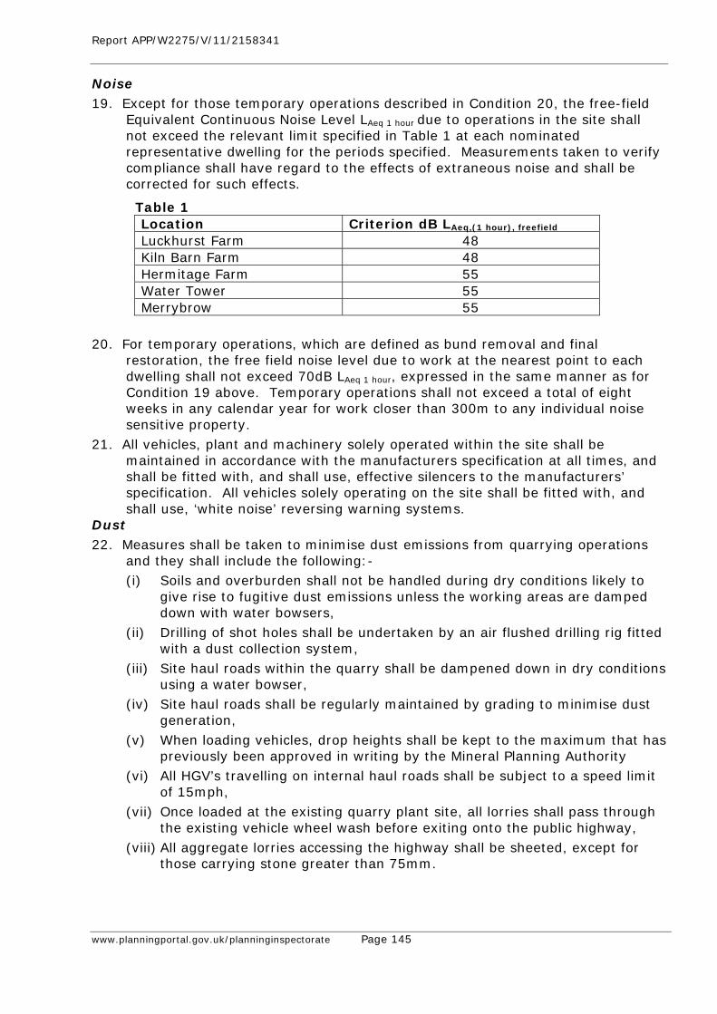
Report APP/W2275/V/11/2158341
www.planningportal.gov.uk/planninginspectorate Page 145
Noise 19. Except for those temporary operations described in Condition 20, the free-field
Equivalent Continuous Noise Level LAeq 1 hour due to operations in the site shall not exceed the relevant limit specified in Table 1 at each nominated representative dwelling for the periods specified. Measurements taken to verify compliance shall have regard to the effects of extraneous noise and shall be corrected for such effects.
Table 1 Location Criterion dB LAeq,(1 hour), freefield
Luckhurst Farm 48 Kiln Barn Farm 48 Hermitage Farm 55 Water Tower 55 Merrybrow 55
20. For temporary operations, which are defined as bund removal and final
restoration, the free field noise level due to work at the nearest point to each dwelling shall not exceed 70dB LAeq 1 hour, expressed in the same manner as for Condition 19 above. Temporary operations shall not exceed a total of eight weeks in any calendar year for work closer than 300m to any individual noise sensitive property.
21. All vehicles, plant and machinery solely operated within the site shall be maintained in accordance with the manufacturers specification at all times, and shall be fitted with, and shall use, effective silencers to the manufacturers’ specification. All vehicles solely operating on the site shall be fitted with, and shall use, ‘white noise’ reversing warning systems.
Dust 22. Measures shall be taken to minimise dust emissions from quarrying operations
and they shall include the following:- (i) Soils and overburden shall not be handled during dry conditions likely to
give rise to fugitive dust emissions unless the working areas are damped down with water bowsers,
(ii) Drilling of shot holes shall be undertaken by an air flushed drilling rig fitted with a dust collection system,
(iii) Site haul roads within the quarry shall be dampened down in dry conditions using a water bowser,
(iv) Site haul roads shall be regularly maintained by grading to minimise dust generation,
(v) When loading vehicles, drop heights shall be kept to the maximum that has previously been approved in writing by the Mineral Planning Authority
(vi) All HGV’s travelling on internal haul roads shall be subject to a speed limit of 15mph,
(vii) Once loaded at the existing quarry plant site, all lorries shall pass through the existing vehicle wheel wash before exiting onto the public highway,
(viii) All aggregate lorries accessing the highway shall be sheeted, except for those carrying stone greater than 75mm.
Report APP/W2275/V/11/2158341
www.planningportal.gov.uk/planninginspectorate Page 146
Drainage 23. Within three months of the date of this permission, details of the provision to be
made for the disposal of all water entering, arising on, or leaving the site during the permitted operations shall be submitted to the Mineral Planning Authority for written approval, and the scheme shall be carried out as approved.
Groundwater 24. Any facilities for storage of oils, fuels or chemicals on the site shall be sited in
impervious bases and surrounded by impervious bund walls. The volume of the bunded compound shall be at least equivalent to the capacity of the tank plus 10%. If there is multiple tankage, the compound shall be at least equivalent to the capacity of the largest tank, or the combined capacity of inter-connective tanks, plus 10%. All filling points, vents, gauges and site glasses shall be located within the bund. The drainage system of the bund shall be sealed with no discharge to any water course, land or underground strata. Associated pipework shall be located above ground and protected from accidental damage.
25. Prior to the commencement of the Westerly Extension, a scheme shall be submitted for the written approval of the Mineral Planning Authtority to prevent tipping by unauthorized persons on the site. The scheme shall be implemented as approved and any unauthorized material tipped on the site shall be removed within 24 hours of such tipping taking place.
Plant and Buildings 26. Notwithstanding the provisions of Part 19 of Schedule 2 of the Town and Country
Planning General Development Order 1995 as may be amended, no additional buildings, fixed plant or machinery shall be located on site without the prior approval in writing of the details of their siting, design and external appearance by the Mineral Planning Authority;
27. All plant, buildings, machinery and sanitary facilities and their foundations and bases, together with any internal access roads and vehicle parking shall be removed from the site at such time as they are no longer required for the working or restoration of the site, and the site shall be restored in accordance with the restoration scheme approved pursuant to Condition 2.
Display of Permissions 28. The terms of this planning permission, and any schemes or details approved
pursuant there to, shall be displayed at the office on site, and shall be made known to any person(s) involved in the management or control of operations at the site.
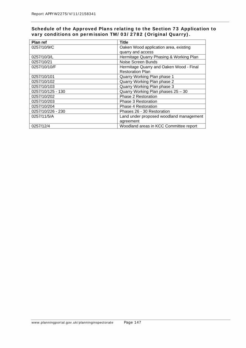
Report APP/W2275/V/11/2158341
www.planningportal.gov.uk/planninginspectorate Page 147
Schedule of the Approved Plans relating to the Section 73 Application to vary conditions on permission TM/03/2782 (Original Quarry).
Plan ref Title 0257/10/9/C Oaken Wood application area, existing
quarry and access 0257/10/3/L Hermitage Quarry Phasing & Working Plan 0257/10/21 Noise Screen Bunds 0257/10/10/F Hermitage Quarry and Oaken Wood - Final
Restoration Plan 0257/10/101 Quarry Working Plan phase 1 0257/10/102 Quarry Working Plan phase 2 0257/10/103 Quarry Working Plan phase 3 0257/10/125 - 130 Quarry Working Plan phases 25 – 30 0257/10/202 Phase 2 Restoration 0257/10/203 Phase 3 Restoration 0257/10/204 Phase 4 Restoration 0257/10/226 - 230 Phases 26 - 30 Restoration 0257/11/5/A Land under proposed woodland management
agreement 0257/12/4 Woodland areas in KCC Committee report
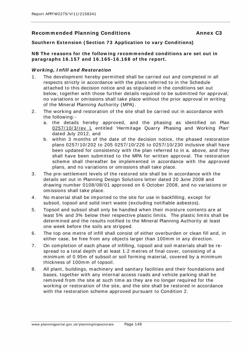
Report APP/W2275/V/11/2158341
www.planningportal.gov.uk/planninginspectorate Page 148
Recommended Planning Conditions Annex C3
Southern Extension (Section 73 Application to vary Conditions) NB The reasons for the following recommended conditions are set out in paragraphs 16.157 and 16.165-16.168 of the report.
Working, Infill and Restoration 1. The development hereby permitted shall be carried out and completed in all
respects strictly in accordance with the plans referred to in the Schedule attached to this decision notice and as stipulated in the conditions set out below, together with those further details required to be submitted for approval; no variations or omissions shall take place without the prior approval in writing of the Mineral Planning Authority (MPA).
2. The working and restoration of the site shall be carried out in accordance with the following:- a. the details hereby approved, and the phasing as identified on Plan
0257/10/3/rev L entitled ‘Hermitage Quarry Phasing and Working Plan’ dated July 2012, and
b. within 3 months of the date of the decision notice, the phased restoration plans 0257/10/202 to 205 0257/10/226 to 0257/10/230 inclusive shall have been updated for consistency with the plan referred to in a. above, and they shall have been submitted to the MPA for written approval. The restoration scheme shall thereafter be implemented in accordance with the approved plans, and no variations or omissions shall take place.
3. The pre-settlement levels of the restored site shall be in accordance with the details set out in Planning Design Solutions letter dated 20 June 2008 and drawing number 0108/08/01 approved on 6 October 2008, and no variations or omissions shall take place.
4. No material shall be imported to the site for use in backfilling, except for subsoil, topsoil and solid inert waste (excluding notifiable asbestos).
5. Topsoil and subsoil shall only be handled when their moisture contents are at least 5% and 3% below their respective plastic limits. The plastic limits shall be determined and the results notified to the Mineral Planning Authority at least one week before the soils are stripped.
6. The top one metre of infill shall consist of either overburden or clean fill and, in either case, be free from any objects larger than 100mm in any direction.
7. On completion of each phase of infilling, topsoil and soil materials shall be re-spread to a total depth of at least 1.2 metres of final cover, consisting of a minimum of 0.95m of subsoil or soil forming material, covered by a minimum thickness of 100mm of topsoil.
8. All plant, buildings, machinery and sanitary facilities and their foundations and bases, together with any internal access roads and vehicle parking shall be removed from the site at such time as they are no longer required for the working or restoration of the site, and the site shall be restored in accordance with the restoration scheme approved pursuant to Condition 2.
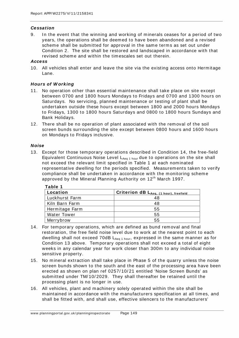
Report APP/W2275/V/11/2158341
www.planningportal.gov.uk/planninginspectorate Page 149
Cessation 9. In the event that the winning and working of minerals ceases for a period of two
years, the operations shall be deemed to have been abandoned and a revised scheme shall be submitted for approval in the same terms as set out under Condition 2. The site shall be restored and landscaped in accordance with that revised scheme and within the timescales set out therein.
Access 10. All vehicles shall enter and leave the site via the existing access onto Hermitage
Lane. Hours of Working 11. No operation other than essential maintenance shall take place on site except
between 0700 and 1800 hours Mondays to Fridays and 0700 and 1300 hours on Saturdays. No servicing, planned maintenance or testing of plant shall be undertaken outside these hours except between 1800 and 2000 hours Mondays to Fridays, 1300 to 1800 hours Saturdays and 0800 to 1800 hours Sundays and Bank Holidays.
12. There shall be no operation of plant associated with the removal of the soil screen bunds surrounding the site except between 0800 hours and 1600 hours on Mondays to Fridays inclusive.
Noise 13. Except for those temporary operations described in Condition 14, the free-field
Equivalent Continuous Noise Level LAeq 1 hour due to operations on the site shall not exceed the relevant limit specified in Table 1 at each nominated representative dwelling for the periods specified. Measurements taken to verify compliance shall be undertaken in accordance with the monitoring scheme approved by the Mineral Planning Authority on 12th March 1997.
Table 1 Location Criterion dB LAeq, (1 hour), freefield
Luckhurst Farm 48 Kiln Barn Farm 48 Hermitage Farm 55 Water Tower 55 Merrybrow 55
14. For temporary operations, which are defined as bund removal and final restoration, the free field noise level due to work at the nearest point to each dwelling shall not exceed 70dB LAeq 1 hour, expressed in the same manner as for Condition 13 above. Temporary operations shall not exceed a total of eight weeks in any calendar year for work closer than 300m to any individual noise sensitive property.
15. No mineral extraction shall take place in Phase 5 of the quarry unless the noise screen bunds shown to the south and the east of the processing area have been erected as shown on plan ref 0257/10/21 entitled ‘Noise Screen Bunds’ as submitted under TM/10/2029. They shall thereafter be retained until the processing plant is no longer in use.
16. All vehicles, plant and machinery solely operated within the site shall be maintained in accordance with the manufacturers specification at all times, and shall be fitted with, and shall use, effective silencers to the manufacturers’
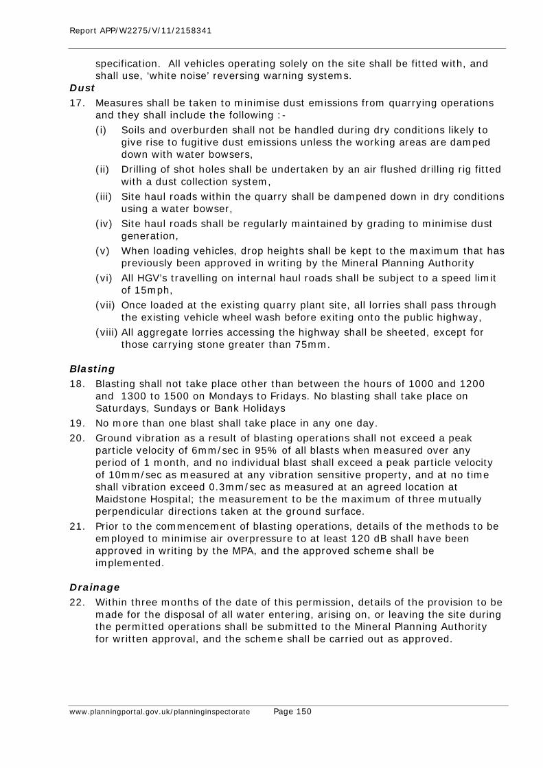
Report APP/W2275/V/11/2158341
www.planningportal.gov.uk/planninginspectorate Page 150
specification. All vehicles operating solely on the site shall be fitted with, and shall use, ‘white noise’ reversing warning systems.
Dust 17. Measures shall be taken to minimise dust emissions from quarrying operations
and they shall include the following :- (i) Soils and overburden shall not be handled during dry conditions likely to
give rise to fugitive dust emissions unless the working areas are damped down with water bowsers,
(ii) Drilling of shot holes shall be undertaken by an air flushed drilling rig fitted with a dust collection system,
(iii) Site haul roads within the quarry shall be dampened down in dry conditions using a water bowser,
(iv) Site haul roads shall be regularly maintained by grading to minimise dust generation,
(v) When loading vehicles, drop heights shall be kept to the maximum that has previously been approved in writing by the Mineral Planning Authority
(vi) All HGV’s travelling on internal haul roads shall be subject to a speed limit of 15mph,
(vii) Once loaded at the existing quarry plant site, all lorries shall pass through the existing vehicle wheel wash before exiting onto the public highway,
(viii) All aggregate lorries accessing the highway shall be sheeted, except for those carrying stone greater than 75mm.
Blasting 18. Blasting shall not take place other than between the hours of 1000 and 1200
and 1300 to 1500 on Mondays to Fridays. No blasting shall take place on Saturdays, Sundays or Bank Holidays
19. No more than one blast shall take place in any one day. 20. Ground vibration as a result of blasting operations shall not exceed a peak
particle velocity of 6mm/sec in 95% of all blasts when measured over any period of 1 month, and no individual blast shall exceed a peak particle velocity of 10mm/sec as measured at any vibration sensitive property, and at no time shall vibration exceed 0.3mm/sec as measured at an agreed location at Maidstone Hospital; the measurement to be the maximum of three mutually perpendicular directions taken at the ground surface.
21. Prior to the commencement of blasting operations, details of the methods to be employed to minimise air overpressure to at least 120 dB shall have been approved in writing by the MPA, and the approved scheme shall be implemented.
Drainage 22. Within three months of the date of this permission, details of the provision to be
made for the disposal of all water entering, arising on, or leaving the site during the permitted operations shall be submitted to the Mineral Planning Authority for written approval, and the scheme shall be carried out as approved.
Report APP/W2275/V/11/2158341
www.planningportal.gov.uk/planninginspectorate Page 151
Groundwater 23. The level of the quarry floor shall not be excavated below 47m AOD at grid
reference northing 155 965 (along an east west line) and below 55m AOD at grid reference northing 155 575 (along an east west line) and the gradient of the quarry floor between these two lines shall not be steeper than 1:51 with the gradient measured between the above grid reference points.
24. Arrangements for the monitoring of groundwater levels at the site shall be implemented in accordance with the scheme approved by the Mineral Planning Authority on 12th March 1997.
25. Any facilities for storage of oils, fuels or chemicals on the site shall be sited in impervious bases and surrounded by impervious bund walls. The volume of the bunded compound shall be at least equivalent to the capacity of the tank plus 10%. If there is multiple tankage, the compound shall be at least equivalent to the capacity of the largest tank, or the combined capacity of inter-connective tanks, plus 10%. All filling points, vents, gauges and site glasses shall be located within the bund. The drainage system of the bund shall be sealed with no discharge to any water course, land or underground strata. Associated pipe-work shall be located above ground and protected from accidental damage.
26. The recycling operation shall be undertaken in accordance with the scheme approved by the Mineral Planning Authority on 12th March 1997.
27. Prior to the commencement of the Westerly Extension, a scheme shall be submitted for the written approval of the Mineral Planning Authtority to prevent tipping by unauthorized persons on the site. The scheme shall be implemented as approved and any unauthorized material tipped on the site shall be removed within 24 hours of such tipping taking place.
Plant and Buildings 28. Notwithstanding the provisions of Part 19 of Schedule 2 of the Town and
Country Planning General Development Order 1995 as may be amended, no additional buildings, fixed plant or machinery shall be located on site without the prior approval in writing of the details of their siting, design and external appearance by the Mineral Planning Authority.
Display of Permissions 29. The terms of this planning permission and any schemes or details approved
pursuant there to shall be displayed at the office on site, and shall be made known to any person(s) involved in the management or control of operations at the site.
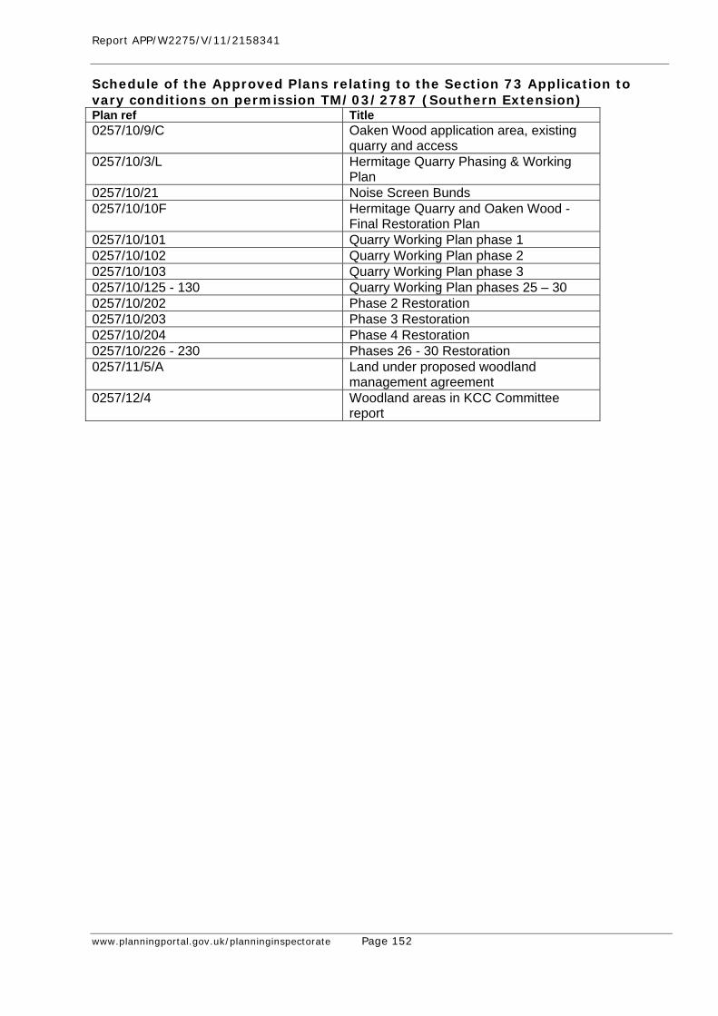
Report APP/W2275/V/11/2158341
www.planningportal.gov.uk/planninginspectorate Page 152
Schedule of the Approved Plans relating to the Section 73 Application to vary conditions on permission TM/03/2787 (Southern Extension) Plan ref Title 0257/10/9/C Oaken Wood application area, existing
quarry and access 0257/10/3/L Hermitage Quarry Phasing & Working
Plan 0257/10/21 Noise Screen Bunds 0257/10/10F Hermitage Quarry and Oaken Wood -
Final Restoration Plan 0257/10/101 Quarry Working Plan phase 1 0257/10/102 Quarry Working Plan phase 2 0257/10/103 Quarry Working Plan phase 3 0257/10/125 - 130 Quarry Working Plan phases 25 – 30 0257/10/202 Phase 2 Restoration 0257/10/203 Phase 3 Restoration 0257/10/204 Phase 4 Restoration 0257/10/226 - 230 Phases 26 - 30 Restoration 0257/11/5/A Land under proposed woodland
management agreement 0257/12/4 Woodland areas in KCC Committee
report
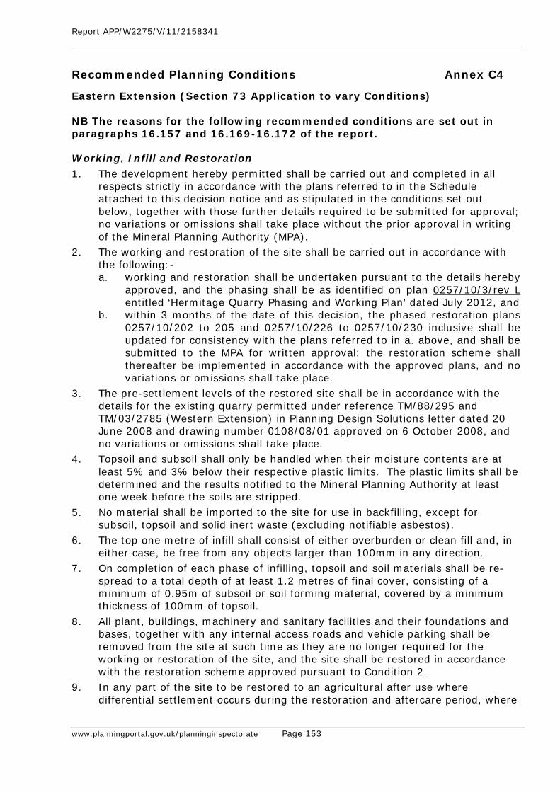
Report APP/W2275/V/11/2158341
www.planningportal.gov.uk/planninginspectorate Page 153
Recommended Planning Conditions Annex C4
Eastern Extension (Section 73 Application to vary Conditions) NB The reasons for the following recommended conditions are set out in paragraphs 16.157 and 16.169-16.172 of the report. Working, Infill and Restoration 1. The development hereby permitted shall be carried out and completed in all
respects strictly in accordance with the plans referred to in the Schedule attached to this decision notice and as stipulated in the conditions set out below, together with those further details required to be submitted for approval; no variations or omissions shall take place without the prior approval in writing of the Mineral Planning Authority (MPA).
2. The working and restoration of the site shall be carried out in accordance with the following:- a. working and restoration shall be undertaken pursuant to the details hereby
approved, and the phasing shall be as identified on plan 0257/10/3/rev L entitled ‘Hermitage Quarry Phasing and Working Plan’ dated July 2012, and
b. within 3 months of the date of this decision, the phased restoration plans 0257/10/202 to 205 and 0257/10/226 to 0257/10/230 inclusive shall be updated for consistency with the plans referred to in a. above, and shall be submitted to the MPA for written approval: the restoration scheme shall thereafter be implemented in accordance with the approved plans, and no variations or omissions shall take place.
3. The pre-settlement levels of the restored site shall be in accordance with the details for the existing quarry permitted under reference TM/88/295 and TM/03/2785 (Western Extension) in Planning Design Solutions letter dated 20 June 2008 and drawing number 0108/08/01 approved on 6 October 2008, and no variations or omissions shall take place.
4. Topsoil and subsoil shall only be handled when their moisture contents are at least 5% and 3% below their respective plastic limits. The plastic limits shall be determined and the results notified to the Mineral Planning Authority at least one week before the soils are stripped.
5. No material shall be imported to the site for use in backfilling, except for subsoil, topsoil and solid inert waste (excluding notifiable asbestos).
6. The top one metre of infill shall consist of either overburden or clean fill and, in either case, be free from any objects larger than 100mm in any direction.
7. On completion of each phase of infilling, topsoil and soil materials shall be re-spread to a total depth of at least 1.2 metres of final cover, consisting of a minimum of 0.95m of subsoil or soil forming material, covered by a minimum thickness of 100mm of topsoil.
8. All plant, buildings, machinery and sanitary facilities and their foundations and bases, together with any internal access roads and vehicle parking shall be removed from the site at such time as they are no longer required for the working or restoration of the site, and the site shall be restored in accordance with the restoration scheme approved pursuant to Condition 2.
9. In any part of the site to be restored to an agricultural after use where differential settlement occurs during the restoration and aftercare period, where

Report APP/W2275/V/11/2158341
www.planningportal.gov.uk/planninginspectorate Page 154
required by the Mineral Planning Authority, the Applicant shall fill the depression to the approved final specified settlement levels with suitable imported soils, to a specification previously approved by the Mineral Planning Authority.
Drainage 10. Within three months of the date of this permission, details of the provision to be
made for the disposal of all water entering, arising on, or leaving the site during the permitted operations shall be submitted to the Mineral Planning Authority for written approval, and the scheme shall be carried out as approved.
Cessation 11. In the event that the winning and working of minerals ceases for a period of two
years, the operations shall be deemed to have been abandoned and a revised scheme shall be submitted for approval in the same terms as set out under Condition 2. The site shall be restored and landscaped in accordance with that revised scheme and within the timescales set out therein.
Access 12. No vehicles shall enter and leave the site other than via the existing access onto
Hermitage Lane. Hours of Working 13. No operation other than essential maintenance shall take place on site except
between 0700 and 1800 hours Mondays to Fridays and 0700 and 1300 hours on Saturdays. No servicing, planned maintenance or testing of plant shall be undertaken outside these hours except between 1800 and 2000 hours Mondays to Fridays, 1300 to 1800 hours Saturdays and 0800 to 1800 hours Sundays and Bank Holidays.
14. There shall be no operation of plant associated with the removal of the soil screen bunds surrounding the site except between 0800 hours and 1600 hours on Mondays to Fridays inclusive.
Noise 15. Except for those temporary operations described in Condition 16, the free-field
Equivalent Continuous Noise Level LAeq 1 hour due to operations on the site shall not exceed the relevant limit specified in Table 1 at each nominated representative dwelling for the periods specified. Measurements taken to verify compliance shall be undertaken in accordance with the monitoring scheme approved by the Mineral Planning Authority on 12th March 1997.
Table 1 Location Criterion dB LAeq, (1 hour), freefield
Luckhurst Farm 48 Kiln Barn Farm 48 Hermitage Farm 55 Water Tower 55 Merrybrow 55
16. For temporary operations, which are defined as bund formation and removal and final restoration, the free field noise level due to work at the nearest point to each dwelling shall not exceed 70dB LAeq 1 hour, expressed in the same manner as for Condition 15 above. Temporary operations shall not exceed a total of
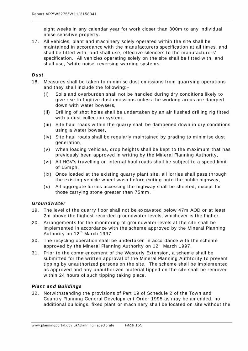
Report APP/W2275/V/11/2158341
www.planningportal.gov.uk/planninginspectorate Page 155
eight weeks in any calendar year for work closer than 300m to any individual noise sensitive property.
17. All vehicles, plant and machinery solely operated within the site shall be maintained in accordance with the manufacturers specification at all times, and shall be fitted with, and shall use, effective silencers to the manufacturers’ specification. All vehicles operating solely on the site shall be fitted with, and shall use, ‘white noise’ reversing warning systems.
Dust 18. Measures shall be taken to minimise dust emissions from quarrying operations
and they shall include the following:- (i) Soils and overburden shall not be handled during dry conditions likely to
give rise to fugitive dust emissions unless the working areas are damped down with water bowsers,
(ii) Drilling of shot holes shall be undertaken by an air flushed drilling rig fitted with a dust collection system,
(iii) Site haul roads within the quarry shall be dampened down in dry conditions using a water bowser,
(iv) Site haul roads shall be regularly maintained by grading to minimise dust generation,
(v) When loading vehicles, drop heights shall be kept to the maximum that has previously been approved in writing by the Mineral Planning Authority,
(vi) All HGV’s travelling on internal haul roads shall be subject to a speed limit of 15mph,
(ix) Once loaded at the existing quarry plant site, all lorries shall pass through the existing vehicle wheel wash before exiting onto the public highway,
(x) All aggregate lorries accessing the highway shall be sheeted, except for those carrying stone greater than 75mm.
Groundwater 19. The level of the quarry floor shall not be excavated below 47m AOD or at least
2m above the highest recorded groundwater levels, whichever is the higher. 20. Arrangements for the monitoring of groundwater levels at the site shall be
implemented in accordance with the scheme approved by the Mineral Planning Authority on 12th March 1997.
30. The recycling operation shall be undertaken in accordance with the scheme approved by the Mineral Planning Authority on 12th March 1997.
31. Prior to the commencement of the Westerly Extension, a scheme shall be submitted for the written approval of the Mineral Planning Authtority to prevent tipping by unauthorized persons on the site. The scheme shall be implemented as approved and any unauthorized material tipped on the site shall be removed within 24 hours of such tipping taking place.
Plant and Buildings 32. Notwithstanding the provisions of Part 19 of Schedule 2 of the Town and
Country Planning General Development Order 1995 as may be amended, no additional buildings, fixed plant or machinery shall be located on site without the
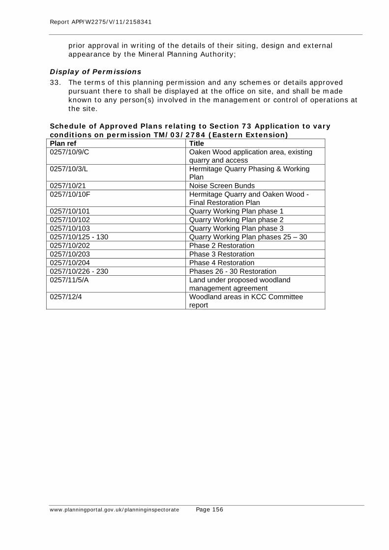
Report APP/W2275/V/11/2158341
www.planningportal.gov.uk/planninginspectorate Page 156
prior approval in writing of the details of their siting, design and external appearance by the Mineral Planning Authority;
Display of Permissions 33. The terms of this planning permission and any schemes or details approved
pursuant there to shall be displayed at the office on site, and shall be made known to any person(s) involved in the management or control of operations at the site.
Schedule of Approved Plans relating to Section 73 Application to vary conditions on permission TM/03/2784 (Eastern Extension) Plan ref Title 0257/10/9/C Oaken Wood application area, existing
quarry and access 0257/10/3/L Hermitage Quarry Phasing & Working
Plan 0257/10/21 Noise Screen Bunds 0257/10/10F Hermitage Quarry and Oaken Wood -
Final Restoration Plan 0257/10/101 Quarry Working Plan phase 1 0257/10/102 Quarry Working Plan phase 2 0257/10/103 Quarry Working Plan phase 3 0257/10/125 - 130 Quarry Working Plan phases 25 – 30 0257/10/202 Phase 2 Restoration 0257/10/203 Phase 3 Restoration 0257/10/204 Phase 4 Restoration 0257/10/226 - 230 Phases 26 - 30 Restoration 0257/11/5/A Land under proposed woodland
management agreement 0257/12/4 Woodland areas in KCC Committee
report
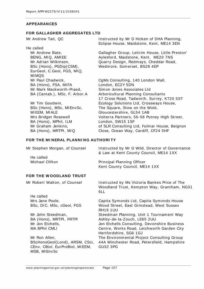
Report APP/W2275/V/11/2158341
www.planningportal.gov.uk/planninginspectorate Page 157
APPEARANCES FOR GALLAGHER AGGREGATES LTD
Mr Andrew Tait, QC Instructed by Mr D Hicken of DHA Planning, Eclipse House, Maidstone, Kent, ME14 3EN
He called Mr Andrew Bate, BENG, MIQ, AMIEE
Gallagher Group, Leitrim House, Little Preston’ Aylesford, Maidstone, Kent, ME20 7NS
Mr Adrian Wilkinson, BSc (Hons), PGDip(CSM), EurGeol, C.Geol, FGS, MIQ, MIMQS
Quarry Design, Redmays, Cheddar Road, Wedmore, Somerset, BS28 4EP
Mr Paul Chadwick, BA (Hons), FSA, MIFA
CgMs Consulting, 140 London Wall, London, EC2Y 5DN
Mr Mark Mackworth-Praed, BA (Cantab.), MSc, F. Arbor.A
Simon Jones Associates Ltd Arboricultural Planning Consultants 17 Cross Road, Tadworth, Surrey, KT20 5ST
Mr Tim Goodwin, BSc (Hons), MSc, MIEnvSc, MIEEM, MIALE
Ecology Solutions Ltd, Crossways House, The Square, Stow on the Wold, Gloucestershire, GL54 1AB
Mrs Bridget Rosewell BA (Hons), MPhil, ILM
Volterra Partners, 56-58 Putney High Street, London, SW15 1SF
Mr Graham Jenkins, BA (Hons), MRTPI, MIQ
of SLR Consulting Ltd, Fulmar House, Beignon Close, Ocean Way, Cardiff, CF24 5HF
FOR THE MINERAL PLANNING AUTHORITY
Mr Stephen Morgan, of Counsel
Instructed by Mr G Wild, Director of Governance & Law at Kent County Council, ME14 1XX
He called Michael Clifton
Principal Planning Officer Kent County Council, ME14 1XX
FOR THE WOODLAND TRUST
Mr Robert Walton, of Counsel
Instructed by Ms Victoria Bankes Price of The Woodland Trust, Kempton Way, Grantham, NG31 6LL
He called Mrs Jane Poole, BSc, DIC, MSc, cGeol, FGS
Capita Symonds Ltd, Capita Symonds House Wood Street, East Grinstead, West Sussex RH19 1UU
Mr John Steedman, BA (Hons), MRTPI, FRTPI
Steedman Planning, Unit 1 Tournament Way Ashby-de-la-Zouch, LE65 2UU
Mr Jon Etchells, MA BPhil CMLI
Jon Etchells Consulting, Devonshire Business Centre, Works Road, Letchworth Garden City Hertfordshire, SG6 1GJ
Mr Ron Allen, BScHonsGeol(Lond), ARSM, CSci, CEnv, CBiol, EurProBiol, MIEEM, MSB, MIEnvSc
The Environmental Project Consulting Group 44A Winchester Road, Petersfield, Hampshire GU32 3PG
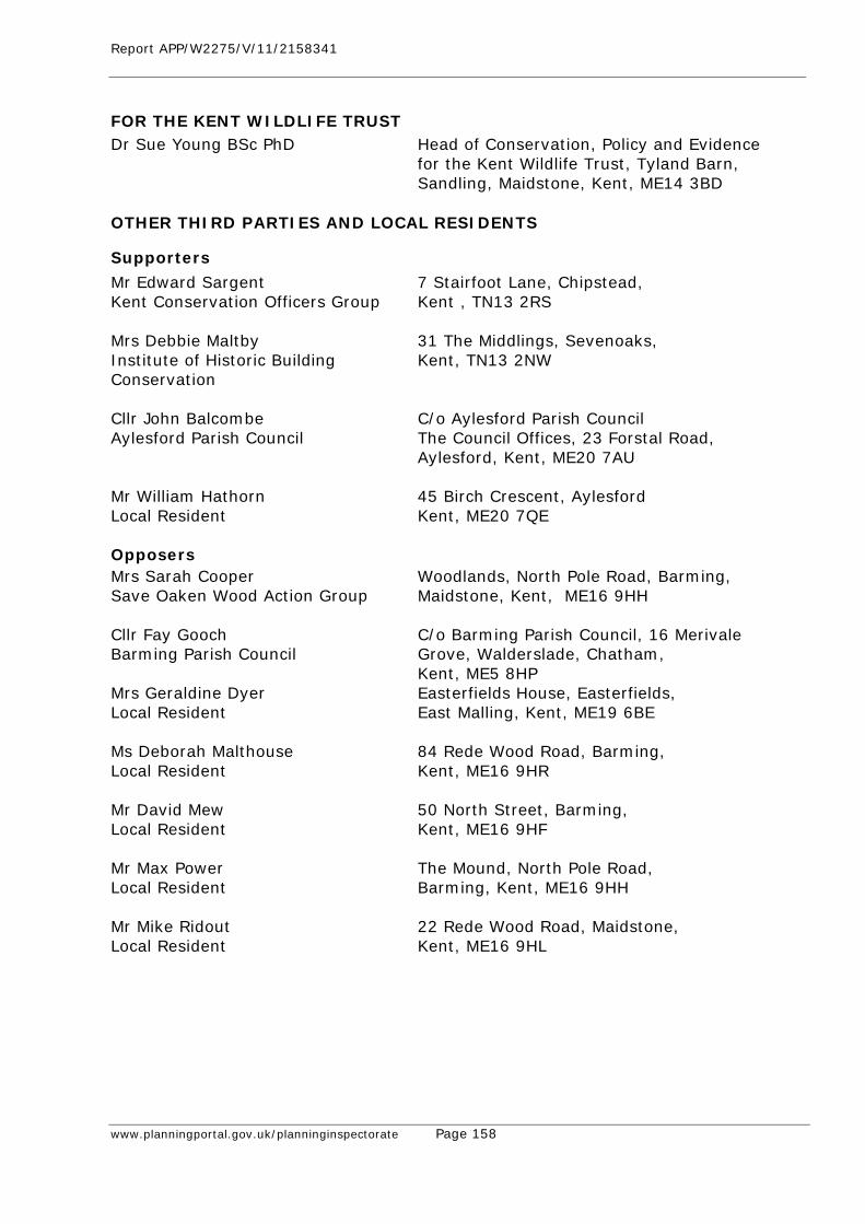
Report APP/W2275/V/11/2158341
www.planningportal.gov.uk/planninginspectorate Page 158
FOR THE KENT WILDLIFE TRUST Dr Sue Young BSc PhD
Head of Conservation, Policy and Evidence for the Kent Wildlife Trust, Tyland Barn, Sandling, Maidstone, Kent, ME14 3BD
OTHER THIRD PARTIES AND LOCAL RESIDENTS
Supporters
Mr Edward Sargent Kent Conservation Officers Group
7 Stairfoot Lane, Chipstead, Kent , TN13 2RS
Mrs Debbie Maltby Institute of Historic Building Conservation
31 The Middlings, Sevenoaks, Kent, TN13 2NW
Cllr John Balcombe Aylesford Parish Council
C/o Aylesford Parish Council The Council Offices, 23 Forstal Road, Aylesford, Kent, ME20 7AU
Mr William Hathorn Local Resident
45 Birch Crescent, Aylesford Kent, ME20 7QE
Opposers Mrs Sarah Cooper Save Oaken Wood Action Group
Woodlands, North Pole Road, Barming, Maidstone, Kent, ME16 9HH
Cllr Fay Gooch Barming Parish Council
C/o Barming Parish Council, 16 Merivale Grove, Walderslade, Chatham, Kent, ME5 8HP
Mrs Geraldine Dyer Local Resident
Easterfields House, Easterfields, East Malling, Kent, ME19 6BE
Ms Deborah Malthouse Local Resident
84 Rede Wood Road, Barming, Kent, ME16 9HR
Mr David Mew Local Resident
50 North Street, Barming, Kent, ME16 9HF
Mr Max Power Local Resident
The Mound, North Pole Road, Barming, Kent, ME16 9HH
Mr Mike Ridout Local Resident
22 Rede Wood Road, Maidstone, Kent, ME16 9HL
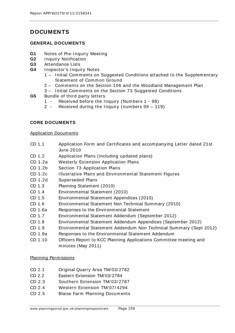
Report APP/W2275/V/11/2158341
www.planningportal.gov.uk/planninginspectorate Page 159
DOCUMENTS GENERAL DOCUMENTS G1 Notes of Pre-Inquiry Meeting G2 Inquiry Notification G3 Attendance Lists G4 Inspector’s Inquiry Notes
1 – Initial Comments on Suggested Conditions attached to the Supplementary Statement of Common Ground
2 – Comments on the Section 106 and the Woodland Management Plan 3 – Initial Comments on the Section 73 Suggested Conditions G5 Bundle of third party letters
1 - Received before the Inquiry (Numbers 1 - 98) 2 - Received during the Inquiry (numbers 99 – 119)
CORE DOCUMENTS Application Documents
CD 1.1 Application Form and Certificates and accompanying Letter dated 21st
June 2010 CD 1.2 Application Plans (including updated plans) CD 1.2a Westerly Extension Application Plans CD 1.2b Section 73 Application Plans CD 1.2c Illustrative Plans and Environmental Statement Figures CD 1.2d Superseded Plans CD 1.3 Planning Statement (2010) CD 1.4 Environmental Statement (2010) CD 1.5 Environmental Statement Appendices (2010) CD 1.6 Environmental Statement Non Technical Summary (2010) CD 1.6a Responses to the Environmental Statement CD 1.7 Environmental Statement Addendum (September 2012) CD 1.8 Environmental Statement Addendum Appendices (September 2012) CD 1.9 Environmental Statement Addendum Non Technical Summary (Sept 2012) CD 1.9a Responses to the Environmental Statement Addendum CD 1.10 Officers Report to KCC Planning Applications Committee meeting and
minutes (May 2011) Planning Permissions CD 2.1 Original Quarry Area TM/03/2782 CD 2.2 Eastern Extension TM/03/2784 CD 2.3 Southern Extension TM/03/2787 CD 2.4 Western Extension TM/07/4294 CD 2.5 Blaise Farm Planning Documents
Report APP/W2275/V/11/2158341
www.planningportal.gov.uk/planninginspectorate Page 160
National Policy, Guidance and Legislation CD 3.1 National Planning Policy Framework and supporting Technical Guidance
(March 2012) CD 3.2 Local Growth: Realising Every Place’s Potential, Cm 7961 (Oct 2010) CD 3.3 The Natural Choice: Securing the Value of Nature, DEFRA (June 2011) CD 3.4 Keepers of Time Statement of Policy for England’s Ancient & Native
Woodland, DEFRA and the Forestry Commission England (2005) CD 3.5 The Planning System, General Principles (2005) CD 3.6 DEFRA – Local Wildlife Sites, Guidance on the Identification, Selection
and Management (2006) CD 3.7 Letter to Planning Authorities from Steve Quartermain, the Governments
Chief Planner (6 July 2010) CD 3.8 Circular 06/05 (DEFRA/ODPM, 2005) CD 3.9 Planning and Minerals: Practice Guide (Nov 2006) CD 3.10 PPS4 Planning for Sustainable Economic Growth (2009) Superseded by
the NPPF (March 2012) CD 3.11 PPS5 Planning for the Historic Environment (2010) Superseded by the
NPPF (March 2012) CD 3.12 PPS5 Practice Guide (2010) CD 3.13 PPS7 Sustainable Development in Rural Areas (August 2004) Superseded
by the NPPF (March 2012) CD 3.14 PPS9 Biodiversity and Geological Conservation (August 2005) Superseded
by the NPPF (March 2012) CD 3.15 PPS10 Planning for Sustainable Waste Management (March 2011)
Superseded by the NPPF (March 2012) CD 3.16 Mineral Planning Guidance 7: Reclamation of Minerals Workings (May
2006) CD 3.17 Mineral Policy Statement 2: Controlling and Mitigating the Environmental
Effects of Minerals Extraction in England (March 2005) including Annex 1: Dust and Annex 2: Noise
CD 3.18 Written Ministerial Statement 3rd July 2012 CD 3.19 Mineral Policy Statement 1: Planning and Minerals (November 2006) CD 3.20 Guidance on the Managed Aggregate Supply System, DCLG (Oct 2012) Local Policy
CD 4.1 South East Plan (May 2009) CD 4.2 South East Plan – ‘Proposed Changes’ to the revision of Mineral Policy
MP3 (19 March 2010) CD 4.3 Kent Minerals and Waste Development Framework, Scheme 2010 –
2014 (December 2011) CD 4.4 Minerals & Waste Core Strategy, Strategy & Policy Directions
Consultation (May 2011) CD 4.5 Mineral Sites Development Plan Document, Options Consultation (May
2011) CD 4.6 Minerals Site Plan (MSP): Preferred Options Consultation (May 2012)
Report APP/W2275/V/11/2158341
www.planningportal.gov.uk/planninginspectorate Page 161
CD 4.7 Minerals Topic Report 1: Construction Aggregate Apportionment & Need: Draft Local Aggregate Assessment (May 2012)
CD 4.8 Minerals Topic Report 9: Mineral Sites Assessment Process (May 2012) CD 4.9 TMBC LDF Core Strategy (September 2007) CD 4.10 TMBC LDF Managing Development and the Environment (April 2010) CD 4.11 Saved Policies of the Kent Minerals Local Plan: Construction Aggregates
(1993) CD 4.12 Saved Policies of Tonbridge and Malling Local Plan (1998) CD 4.13 KCC report, ‘Unlocking Kent’s Potential’ (2009) CD 4.14 Kent Design Guide, Kent Design Initiative (2005) CD 4.15 Panel Report on the Examination in Public of the Modifications to Policy
M3 of the SEP CD 4.16 Kent Waste Local Plan Economic and Geological Documents CD 5.1 Strategic Stone Study: A Building Stone Atlas of Kent, J Blows (27
October 2011) CD 5.2 The OFT’s Reason for Making a Market investigation Reference to the
Competition Commission (2012) Office of Fair Trading CD 5.3 Aggregates: Report on the Market Study and proposed decision to make
a market investigation reference (2011) Office of Fair Trading CD 5.4 Stocker, M. Kentish Ragstone (March 2008) CD 5.5 2011 Guidelines to Defra /DECC’s GHG Conversion Factors for Company
Reporting (August 2011) CD 5.6 BS EN 12620:2002+A1:2008 Aggregates for Concrete CD 5.7 PD6682-1:2009 Aggregates Part 1: Concrete – Guidance on the use of
BS EN 12620 CD 5.8 BS EN 13043:2002 Aggregates for Bituminous Mixtures and Surface
Treatments for Roads, Airfields and other Trafficked Areas CD 5.9 PD6682-2:2009 Aggregates Part 2: Aggregates for Bituminous Mixtures
and Surface Treatments for Road, Airfields and other Trafficked Areas – guidance on the use of BS EN 13043
CD 5.10 BS EN 13242:2002+A1:2007 Aggregates for Unbound and Hydraulically Bound Materials for use in Civil Engineering Work and Road Construction
CD 5.11 PD 6682-6:2009 Aggregates Part 6: Aggregates for Unbound and Hydraulically Bound Materials for use in Civil Engineering Works and Road Construction – Guidance on the use of BS EN 13242
CD 5.12 BS EN Aggregates Part 9: Guidance on the use of European Test Method Standards
CD 5.13 BS EN 932-1:1997 Tests for General Properties of Aggregates, Part 1 Methods for Sampling
Ecological/Arboricultural Documents CD 6.1 Standing Advice for Ancient Woodland, Natural England (May 2012) CD 6.2 Kent Biodiversity Action Plan (current) CD 6.3 Kent Habitat Survey (2003) CD 6.4 British Standard 5837:2012 Trees in relation to design, demolition and
construction. Recommendations (April 2012) CD 6.5 Natural England – Assessment Checklist of Applications Affecting Ancient
Woodland (current)
Report APP/W2275/V/11/2158341
www.planningportal.gov.uk/planninginspectorate Page 162
CD 6.6 Natural England – State of the Natural Environment (2008) CD 6.7 Ancient Woodland Inventory for Tonbridge and Malling (March 2010) CD 6.8 Ancient Woodland Inventories for Ashford (March 2009) CD 6.9 Ancient Woodland Inventories for Tunbridge Wells (October 2007) CD 6.10 Local Wildlife Sites in Kent, Criteria for Selection and Delineation (2006)
Kent Biodiversity Partnership CD 6.12 MA/TM 12 Oaken Wood, Barming, Local Wildlife Site, circulation and
map CD 6.13 Waite, A (Ed). 2000. The Kent Red Data Book: A provisional guide to the
rare and threatened flora and fauna of Kent. KCC CD 6.14 Reptile Survey: An Introduction to planning, conducting and interpreting
surveys for snake and lizard conservation (1999) Froglife Advice Sheet 10. Froglife, Halesworth
CD 6.19 Buckley P and Howell R, (2004) The ecological impact of sweet chestnut coppice silviculture on former ancient, broadleaved woodland sites in south-east England, English Nature research (report no. 627, p 26)
CD 6.20 11. JNCC (2003) A Habitats Translocation Policy for Britain CD 6.21 K. Kirby, ‘Oakenwood near Maidstone, Kent TQ1715555 – query over
Ancient Woodland Status’ report (October 2010) ‘K Kirby email to N.Yandle of Gallagher Aggregates (10.11.2010)
CD 6.22 Kent Inventory of Ancient Woodland (Provisional) (1994 revision) (Pritchard, C. Phillips, P. Jones, A. & Reid C.), English Nature and KCC
CD 6.23 National Inventory of Woodland and Trees – England Inventory Report (2001) Forestry Commission
CD 6.24 National Inventory of Woodland and Trees – Kent County Report (2002) Forestry Commission
CD 6.25 The area and composition of plantations on ancient woodland sites (2002) (Pryor, S.N., and Smith, S.), Woodland Trust
CD 6.26 A review of the revision of the Ancient Woodland Inventory in the South East (2011) (McKernan, P. and Goldberg, E.), Natural England
CD 6.27 Cresswell Associates (2012) A2/M2 Cobham Junction 4 Widening Scheme: Ten-Year Ecological Monitoring Strategy 2000-2009, Final Monitoring Report. Cresswell Associates, Stroud
CD 6.28 Forestry Recommisioned: Bringing England’s woodlands back to life, Plant Life (2011)
CD 6.29 Glaves, P, I D Rotherham, B Wright, C Handley & J Birbeck (2009). The identification of ancient woodland: demonstrating antiquity and continuity – issues and approaches. A Report to the Woodland Trust. Hallam Environmental Consultants Ltd., Sheffield.
CD 6.30 Rotherham, I D, M Jones, L Smith & C Handley (eds.) The Woodland Heritage Manual: A Guide to Investigating Wooded Landscapes. Wildtrack Publishing, Sheffield
CD 6.31 Rotherham, I D (2011). New Insights into the Ancient Woodland Paradigm. Problems and possibilities on the border between historical ecology and environmental history and archaeology, Zurich, August – September, 2011
CD 6.32 Woodland Trust (2005) Guide to the conservation and restoration of plantations on ancient woodland sites
CD 6.33 Kent Wildlife Trust’s Planning & Development Policy Statement CD 6.34 J Hendey, Assessment of the Relative Value of Oaken Wood for
Bryophytes, 2012
Report APP/W2275/V/11/2158341
www.planningportal.gov.uk/planninginspectorate Page 163
CD 6.35 MA/TM12 Oaken Wood, Barming, (draft, revised) Local Wildlife Site, citation and map, 2012
CD 6.36 Pryor, Curtis and Peterken, Restoring plantations on ancient woodland sites, Woodland Trust
CD 6.37 Rodwell (ed), British Plant Communities, Vol 1, woodland & scrub, 1991 CD 6.38 Gent & Gibson, Herpetofauna Workers Manual, 2003 CD 6.39 Tonbridge & Malling Borough Council (Ditton No. 2) TPO 1993 CD 6.40 Maidstone Borough Council TPO No. 1 of 1993 CD 6.41 Indicators of Ancient Woodland (Rose), British Wildlife, Volume 10, April
1999 CD 6.42 Buckley, P & Hietalahti, M (2012). Responses of two woodland
geophytes, bluebell and anemone, to disturbance caused by soil translocation. (Unpublished draft) Hietalahti, M & Buckley, P (2012). Vegetation responses of the field layer of an ancient woodland to soil translocation: methods and timing. (Unpublished draft)
CD 6.43 Anderson, P (2003). A Review of Habitat Translocation. C601, CIRIA, London. [Excerpt]
CD 6.44 Hermitage Quarry Westerly Extension: Fieldwork and Environmental Archaeological Assessment Report for Blaise Quarry and Comparisons with the Findings from Oaken Wood and Cattering Wood, Quaternary Scientific (QUEST), October 2012
CD 6.45 Cattering Wood, Wateringbury, Kent: Fieldwork and Environmental Archaeological Assessment Report, Quaternary Scientific (QUEST), October 2012
Appeal Decisions CD 7.1 Appeal by Crest Nicholson (Bolmore Village, Phases 4/5, Haywards
Heath W Sussex, 2007) CD 7.2 Appeal decision APP/Y2003/A/09/2101852 Forest Pines Golf Club;
Lincolnshire, 2010 CD 7.3 Appeal decision APP/X0360/A/11/2159190 Redhatch Copse via Sibly
Hall, Redhatch Drive, Earley CD 7.4 Appeal decision APP/Y9507/A/11/2167570 Singing Hills Golf Course Rights of Way CD 8.1 PROW Oder MR108 CD 8.2 PROW Order MR496 Statements of Case/ Statements of Common Ground CD 9.1 GAL Statement of Case (July 2012) CD 9.2 KWT Statement of Case (July 2012) CD 9.3 WT Statement of Case (July 2012) CD 9.4 KCC Statement of Case (July 2012) CD 9.5 Statement of Common Ground KCC/GAL (July 2012) CD 9.6 Supplementary Statement of Common Ground KCC/GAL STATEMENTS OF COMMON GROUND (See CD 9.5 & 9.6)
Report APP/W2275/V/11/2158341
www.planningportal.gov.uk/planninginspectorate Page 164
DOCUMENTS SUBMITTED BY THE PARTIES PROOFS FROM GALLAGHER AGGREGATES LTD GAL/AJB/PS Summary Proof of Evidence of Andrew Bate in respect of
Operational Matters GAL/AJB/P Proof of Evidence of Andrew Bate in respect of Operational
Matters GAL/AJB/PA Appendices to Proof of Evidence of Andrew Bate in respect of
Operational Matters GAL/PRC/PS Summary Proof of Evidence of Paul Chadwick in respect of
Heritage, Archaeology & Historic Land-Use GAL/PRC/P Proof of Evidence of Paul Chadwick in respect of Heritage,
Archaeology & Historic Land-Use GAL/PRC/PA1 to 6 Appendices to Proof of Evidence of Paul Chadwick in
respect of Heritage, Archaeology & Historic Land-Use GAL/TG/SP Summary Proof of Evidence of Timothy Goodwin in respect of
Ecology and Nature Conservation GAL/TG/P Proof of Evidence of Timothy Goodwin in respect of Ecology and
Nature Conservation GAL/TG/A Appendices to Proof of Evidence of Timothy Goodwin in respect of
Ecology and Nature Conservation GAL/GJ/PS Summary Proof of Evidence of Graham Jenkins in respect of
Minerals Planning GAL/GJ/P Proof of Evidence of Graham Jenkins in respect of Minerals
Planning GAL/GJ/ROW/P Proof of Evidence of Graham Jenkins in respect of Rights of Way
Issues GAL/GJ/ROW/P/A Appendices to Proof of Evidence of Graham Jenkins in
respect of Rights of Way Issues GAL/MMP/PS Summary Proof of Evidence of Mark Makworth-Praed in respect of
Arboriculture GAL/MMP/P Proof of Evidence of Mark Mackworth-Praed in respect of
Arboriculture GAL/MMP/P/A Appendices to Proof of Evidence of Mark Mackworth-Praed in
respect of Arboriculture GAL/BR/PS Summary Proof of Evidence of Bridget Rosewell in respect of the
Socio-Economic Case GAL/BR/P Proof of Evidence of Bridget Rosewell in respect of the Socio-
Economic Case GAL/BR/PA Appendices to Proof of Evidence of Bridget Rosewell in respect of
the Socio-Economic Case GAL/AW/PS Summary Proof of Evidence of Adrian Wilkinson in respect of
Geology and Reserve Assessment GAL/AW/P Proof of Evidence of Adrian Wilkinson in respect of Geology and
Reserve Assessment GAL/AW/PA Appendices to Proof of Evidence of Adrian Wilkinson in respect of
Geology and Reserve Assessment
Report APP/W2275/V/11/2158341
www.planningportal.gov.uk/planninginspectorate Page 165
REBUTTAL PROOFS FROM GALLAGHER AGGREGATES LTD GAL/AJB/PR Rebuttal of Andrew Bate GALPRC/R Rebuttal of Paul Chadwick GAL/TG/R Rebuttal of Tim Goodwin GAL/GJ/PR Rebuttal of Graham Jenkins GAL/MMP/PR Rebuttal of Mark Mackworth-Praed GAL/AW/PR Rebuttal of Adrian Wilkinson OTHER DOCUMENTS FROM GALLAGHER AGGREGATES LTD GAL/1 Opening statement - Mr Andrew Tait QC GAL/2 Operational bar chart (revised 30th Nov 2012) GAL/3 3D block diagram of HQ strata (vertical exaggeration x 2.0) GAL/4 Adrian Wilkinson replacement appendices GAL/5 Planning application plan schedule GAL/6 Mark Mackworth-Praed glossary of terms GAL/7 Mark Mackworth-Praed replacement appendix 1of Environmental
Statement Addendum Appendix 13 GAL/8 Paul Chadwick historical map comparison sheet GAL/9 GAL response to IN2 dated 23 Nov 2012 GAL/10 Tim Goodwin glossary of terms GAL/11 Coping stone note GAL/12 Amended 3D block diagram of HQ strata (vertical exaggeration x 2.5) GAL/13 Note on the revision of the Ancient Woodland Inventory for Maidstone
Borough GAL/14 Andrew Bate glossary of terms GAL/15 QUEST rebuttal note re: R Allen’s Proof of Evidence GAL/16 Recycled Aggregates Note GAL/17 St Nicholas Church restoration stone GAL/18 Note on Building Stone Usage 28 11 12 GAL/19 The Barriers to Underground Mining of Aggregates - An Overview GAL/20 Note on Carbon Footprint GAL/21 Note on Consent for coppicing in TPO woodland GAL/22 GAL-AJB-PRA3 Revised during Inquiry GAL/23 Ditton & Langley Note GAL/24 KMSP SLA Policy Extract GAL/25 WT Comments 31Jan2011 GAL/26 Ancient Woods Translocation Policy WT2001 GAL/27 Note on Ragstone as a building stone GAL/28 Gallaghers opening statement on orders GAL/29 Plan showing bridleway in relation to Phase 11 GAL/30 Revisions to bridleway order GAL/31 Revisions to BOAT order GAL/31A Further revisions to BOAT order GAL/32 Note on woodland grants GAL/33 Note on KWT additional submission GAL/34 Plan showing distance to properties GAL/35 Revisions to woodland management plan GAL/36 Draft Section 106 GAL/36A Signed Section 106 GAL/36B 2005 Planning Obligation GAL/37 Draft conditions – westerly extension, eastern extension, original quarry,
southern extension
Report APP/W2275/V/11/2158341
www.planningportal.gov.uk/planninginspectorate Page 166
Schedule of changes – original quarry and southern extension Planning permission – original quarry and southern extension
GAL/38 Blast monitoring data GAL/39 Descriptions of the previous planning permissions GAL/40 Dates of blasting for twelve months GAL/41 Closing submissions PROOFS FROM KENT COUNTY COUNCIL KCC/MC/PS Summary Proof of Evidence of Michael Clifton KCC/MC/P Proof of Evidence of Michael Clifton REBUTTAL PROOFS FROM KENT COUNTY COUNCIL NONE OTHER DOCUMENTS FROM KENT COUNTY COUNCIL KCC/1 Opening statement - Mr Stephen Morgan KCC/2 Glossary of terms KCC/3 Environment Agency Permits KCC/4 Corrections to KCC/MC/P KCC/5 Biodiversity comments dated 23 Oct 2012 KCC/6 Letter from KCC Archaeological Officer dated 5 Oct 2012 KCC/7 Air Overpressure condition KCC/8 Closing submissions on main application KCC/9 Closing submissions on the orders PROOFS FROM THE WOODLAND TRUST WT/AB/PS Summary Proof of Evidence of Austin Brady WT/AB/P Proof of Evidence of Austin Brady WT/AB/PA Appendices to Proof of Evidence of Austin Brady WT/JE/P Proof of Evidence of John Etchells WT/JE/PA Appendices to Proof of Evidence of John Etchells WT/JP/PS Summary Proof of Evidence of Jane Poole WT/JP/P Proof of Evidence of Jane Poole WT/JS/PS Summary Proof of Evidence of John Steedman WT/JS/P Proof of Evidence of John Steedman REBUTTAL PROOFS FROM THE WOODLAND TRUST NONE OTHER DOCUMENTS FROM THE WOODLAND TRUST WT/1 Opening Statement – Mr Robert Walton WT/2 Ron Allen report on soils WT/3 Bolnore SOS letter pg 1, 5 WT/4 Landscape Baseline Measurement WT/5 Comment on GAL Paul Chadwick Rebuttal 30 11 12 WT/6 Ron Allen glossary of terms WT/7 Jane Poole proof revised figure 1 WT/8 Jane Poole proof figures 4 to 7 WT/9 GAL-AJB-PRA3 revised during inquiry WT/10 Glossary of terms Jane Poole WT/11 Sweet Chestnut coppice regrowth

Report APP/W2275/V/11/2158341
www.planningportal.gov.uk/planninginspectorate Page 167
WT/12 Richard Barnes replacement information WT/13 Richard Barnes glossary WT/14 Note on Forestry Commission grants and other income for coppicing WT/15 Closing submissions PROOFS FROM KENT WILDLIFE TRUST KWT/SY/PS Summary Proof of Evidence of Sue Young KWT/SY/P Proof of Evidence of Sue Young REBUTTAL PROOFS FROM KENT WILDLIFE TRUST KWT/SY/PR Rebuttal Proof of Evidence of Sue Young OTHER DOCUMENTS FROM KENT WILDLIFE TRUST KWT/1 Rebuttal Proof Appendices KWT/2 West Blean and Thornden Woods Site of Special Scientific
Interest citation. Natural England. KWT/3 Forestry Commission. 2005. Guide to Managing Woodland Rides
and Glades for Wildlife. EWGS Operations Note 011 KWT/4 A comparison of DEFRA Local Sites Guidance and the Kent LWS
Process, October 2012 KWT/5 Letter from Plantlife dated 1 Nov 2012 KWT/6a & 6b
2 pages from Oliver Rackham. 2003. Ancient Woodland its history, vegetation and uses in England. Castle Point Press, Kirkcudbrightshire
KWT/7 West Blean and Thornden Woods Site of Special Scientific Interest, condition report, 2012. Natural England
KWT/8 Opening Statement – Dr Sue Young KWT/9 Sue Young Glossary of terms KWT/10 Response to Inspector’s questions KWT/11 West Blean woods PAWS restoration KWT/12 Parsonage wood photos KWT/13 Sweet Chestnut Butterfly Conservation Trust factsheet KWT/14 Managing your woodland for wildlife Blakesley & Buckley 2010 KWT/15 Closing submissions
Report APP/W2275/V/11/2158341
www.planningportal.gov.uk/planninginspectorate Page 168
DOCUMENTS FROM THIRD PARTIES (NB Previous numbers are in the Third Parties bundle document G5/1) 99 Email submitted by Mr Steve Connolly dated 27 Nov 2012 100 Summary Statement submitted by Save Oaken Wood Action
Group 101 Statement submitted by Mrs Geraldine Dyer dated 28 Nov 2012 102 Email submitted by Ms Anne Connolly dated 1 Dec 2012 103 Summary Statement submitted by Mrs Geraldine Dyer dated 5
Dec 2012 104 Statement submitted by Institute for Historic Building
Conservation 105 Email submitted by Mr Max Power dated 23 Nov 2012 106 Summary Statement submitted by Mr David Mew dated 22 Nov
2012 107 Statement submitted by Mr Mike Ridout 108 Email submitted by Ms Stephanie Littlewood dated 27 Nov 2012
08:46 109 Email submitted by Ms Stephanie Littlewood dated 27 Nov 2012
12:02 110 Statement from Mr Jeff Wilkinson 111 Email submitted by Mrs Liz Day dated 13 Dec 2012 112 Statement from Mrs Deborah Malthouse dated 14 Dec 2012 113 Email submitted by Mr William Hathorn dated 12 Dec 2012 114 Letter submitted by Barming Primary School dated 13 Dec 2012 115 Statement submitted by Barming Parish Council dated 13 Dec
2012 116 Statement submitted by Mr David Mew 117 Statement submitted by Mr Max Power 118 Statement submitted by Save Oaken Wood Action Group dated
14 Dec 2012 119 Statement submitted by Mrs Geraldine Dyer 120 Evidence submitted by Mr David Mew – Environmental, Health
and Safety Guidelines for Construction Materials Extraction 121 Evidence submitted by Mr Max Power – Blast Monitoring results
taken between June 22nd 2010 to December 2010 122 Note from Sarah Cooper – Save Oaken Wood Action Group
dated 18 Dec 2012 123 Suggested condition from Mr Sargent – Kent Conservation
Officers Group
RIGHT TO CHALLENGE THE DECISION IN THE HIGH COURT
These notes are provided for guidance only and apply only to challenges under the legislation specified. If you require further advice on making any High Court challenge, or making an application for Judicial review, you should consult a solicitor or other advisor or contact the Crown Office at the Royal Courts of Justice, Queens Bench Division, Strand, London, WC2 2LL (0207 947 6000). The attached decision is final unless it is successfully challenged in the Courts. The Secretary of State cannot amend or interpret the decision. It may be redetermined by the Secretary of State only if the decision is quashed by the Courts. However, if it is redetermined, it does not necessarily follow that the original decision will be reversed. SECTION 1: PLANNING APPEALS AND CALLED-IN PLANNING APPLICATIONS; The decision may be challenged by making an application to the High Court under Section 288 of the Town and Country Planning Act 1990 (the TCP Act). Challenges under Section 288 of the TCP Act Decisions on called-in applications under section 77 of the TCP Act (planning), appeals under section 78 (planning) may be challenged under this section. Any person aggrieved by the decision may question the validity of the decision on the grounds that it is not within the powers of the Act or that any of the relevant requirements have not been complied with in relation to the decision. An application under this section must be made within six weeks from the date of the decision. SECTION 2: AWARDS OF COSTS There is no statutory provision for challenging the decision on an application for an award of costs. The procedure is to make an application for Judicial Review. SECTION 3: INSPECTION OF DOCUMENTS Where an inquiry or hearing has been held any person who is entitled to be notified of the decision has a statutory right to view the documents, photographs and plans listed in the appendix to the report of the Inspector’s report of the inquiry or hearing within 6 weeks of the date of the decision. If you are such a person and you wish to view the documents you should get in touch with the office at the address from which the decision was issued, as shown on the letterhead on the decision letter, quoting the reference number and stating the day and time you wish to visit. At least 3 days notice should be given, if possible.
https://www.gov.uk/government/organisations/department-for-communities-and-local-government