Embed Size (px)
Citation preview

California Water Issues and Wetlands
Good sources: aquifornia.com
http://www.water-ed.org/watersources/default.asp
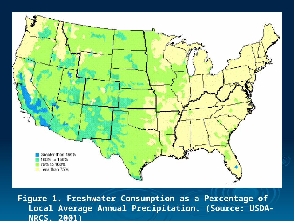
Figure 1. Freshwater Consumption as a Percentage of Local Average Annual Precipitation. (Source: USDA-NRCS, 2001)
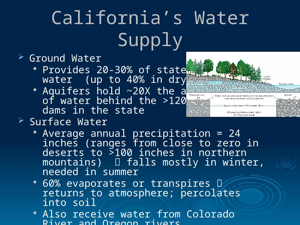
California’s Water Supply Ground Water
Provides 20-30% of state’s water (up to 40% in dry years)
Aquifers hold ~20X the amount of water behind the >1200 dams in the state
Surface Water Average annual precipitation = 24 inches (ranges
from close to zero in deserts to >100 inches in northern mountains) falls mostly in winter, needed in summer
60% evaporates or transpires returns to atmosphere; percolates into soil
Also receive water from Colorado River and Oregon rivers

California Water Supply California has been called “the most
hydrologically altered landmass on the planet”
We’ve transformed deserts into farmland and supported the development of large cities and towns
E.g. “Inland Empire” 70 percent of California’s runoff occurs
north of Sacramento; 75 percent of California’s urban and agricultural demands are to the south
Moving the water uses LOTS of energy The State Water Project is the largest
single user of energy in California Also lose water in process

Santa Clara County Water Supply
Less than half comes from local sources - aquifers
The rest is imported from the Sierra Nevada throughpumping stations in the Sacramento-San Joaquin River Delta
California Water Use
Agriculture is the largest use of California water supply
California is the largest producer of food and agriculture in the US
Droughts leads to mandatory water reductions (last year - 30%) pay penalty for non-compliance Lose crops Trees stop fruiting
Also need water for domestic and industrial uses AND environment
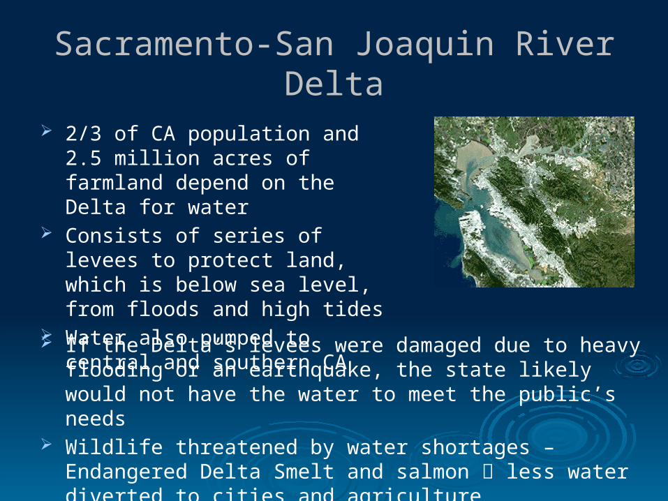
Sacramento-San Joaquin River Delta
2/3 of CA population and 2.5 million acres of farmland depend on the Delta for water
Consists of series of levees to protect land, which is below sea level, from floods and high tides
Water also pumped to central and southern CA
If the Delta’s levees were damaged due to heavy flooding or an earthquake, the state likely would not have the water to meet the public’s needs
Wildlife threatened by water shortages – Endangered Delta Smelt and salmon less water diverted to cities and agriculture
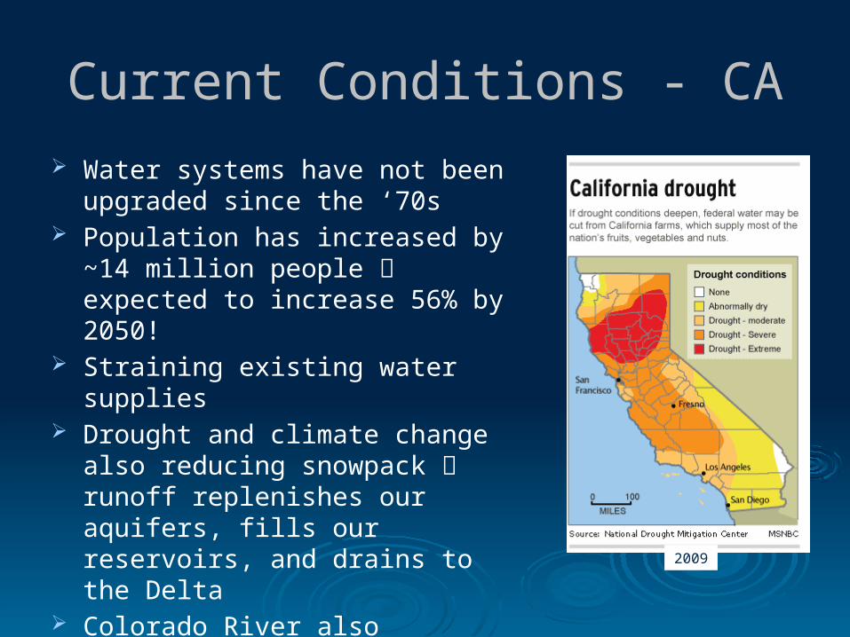
Current Conditions - CA
Water systems have not been upgraded since the ‘70s
Population has increased by ~14 million people expected to increase 56% by 2050!
Straining existing water supplies Drought and climate change also
reducing snowpack runoff replenishes our aquifers, fills our reservoirs, and drains to the Delta
Colorado River also increasingly stressed must share water resources! 2009

Current Conditions - Bay Area Experienced three consecutive year of
drought This year rainfall is “normal”, but
reservoirs still low Last year reservoirs were at lowest
levels since 1992 at 65% capacity in county; now at 73% capacity
Last year water district called for 15% mandatory reduction in water use – still in effect
How that is enforced depends on local water retailers Some retailers put restrictions on watering lawns and increases in water rates City of San Jose price of water dependent on how much you use
CA Water Video

Solutions
Urban water conservation
Agricultural water conservation
Increase surface storage areas - dams and reservoirs
Desalination Capture and retain
storm water and urban runoff
Recycle water

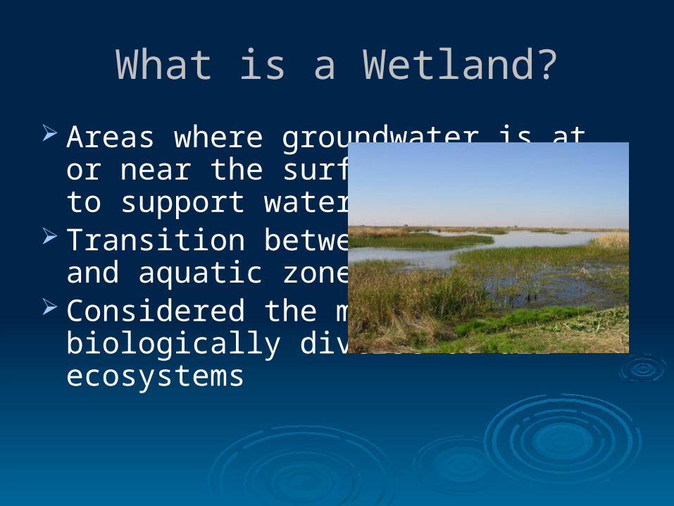
What is a Wetland?
Areas where groundwater is at or near the surface long enough to support water plants
Transition between terrestrial and aquatic zones
Considered the most biologically diverse of all ecosystems
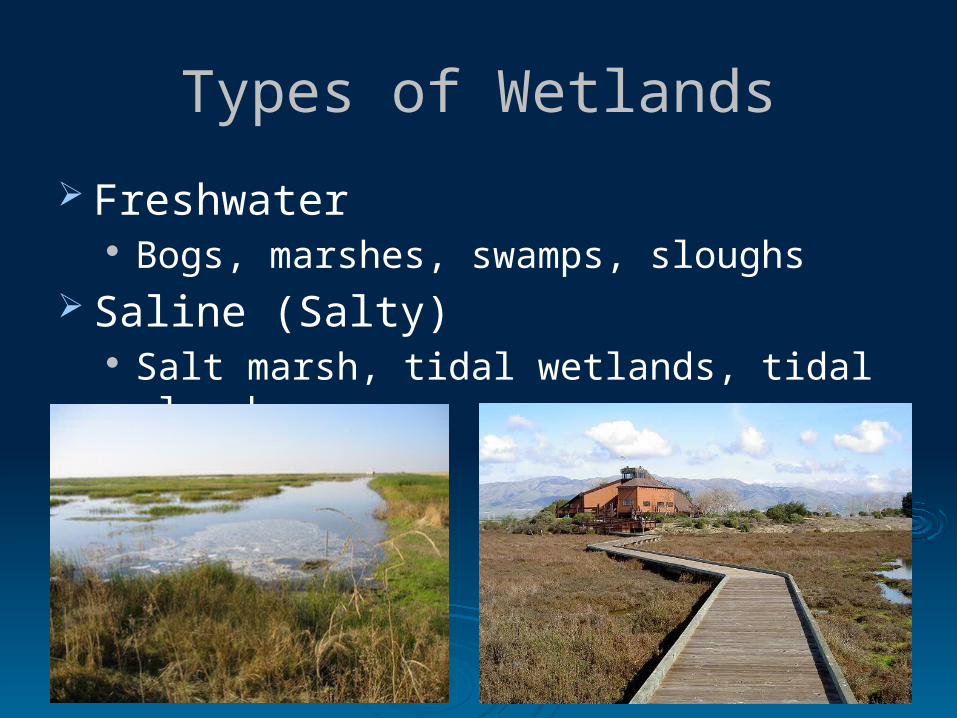
Types of Wetlands
Freshwater Bogs, marshes, swamps, sloughs
Saline (Salty) Salt marsh, tidal wetlands, tidal sloughs
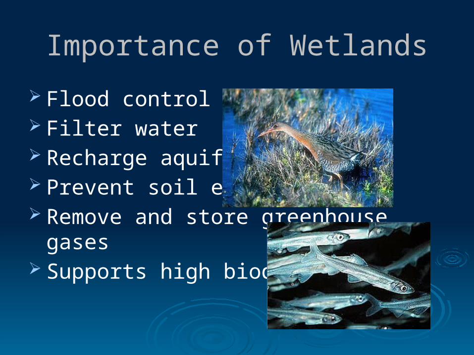
Importance of Wetlands
Flood control Filter water Recharge aquifers Prevent soil erosion Remove and store greenhouse gases Supports high biodiversity

Loss of Wetlands
Early 1600’s 220 million acres in US >50% have been destroyed 1950-1970 - ~59 million acres lost 91% lost in CA
http://www4.ncsu.edu/~tkwak/marsh.html

Wetland Loss and HurricanesKatrina Example
New Orleans in floodplain of Mississippi River inevitably floods Built elaborate system of levees to prevent flooding of communities
from river Increases risk of flooding from ocean storms in the process Wetlands provide first line of defense against hurricanes
Limit storms' access to the warm open ocean water that drives them
Create a physical barrier to the floodwaters Lack of river flooding = less sediment and nutrients to wetlands Coastal wetlands are deteriorating and shrinking makes ocean
communities exposed and vulnerable Witnessed consequences in Hurricane Katrina
Katrina Video

Wetland Conservation
SF Bay Salt Marsh Video Santa Clara Valley Freshwater Wetlands V
ideo


![[Archive] National Wetlands Inventory: A Strategy for the 21st …National-Wetlands... · 2016-07-15 · solutions to myriad resource management issues. This Strategy provides the](https://img.dokumen.tips/doc/110x75/5f0d5c627e708231d439f810/archive-national-wetlands-inventory-a-strategy-for-the-21st-national-wetlands.jpg)