Embed Size (px)
Citation preview
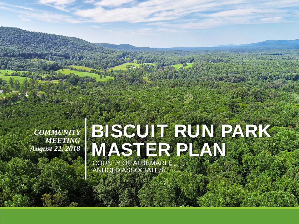
BISCUIT RUN PARKBISCUIT RUN PARKMASTER PLAN
COMMUNITY MEETING
August 22, 2018
COUNTY OF ALBEMARLE ANHOLD ASSOCIATES
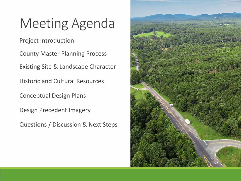
Meeting AgendaProject Introduction
County Master Planning Process
Existing Site & Landscape Character
Historic and Cultural Resources
Conceptual Design Plans
Design Precedent Imagery
Questions / Discussion & Next Steps
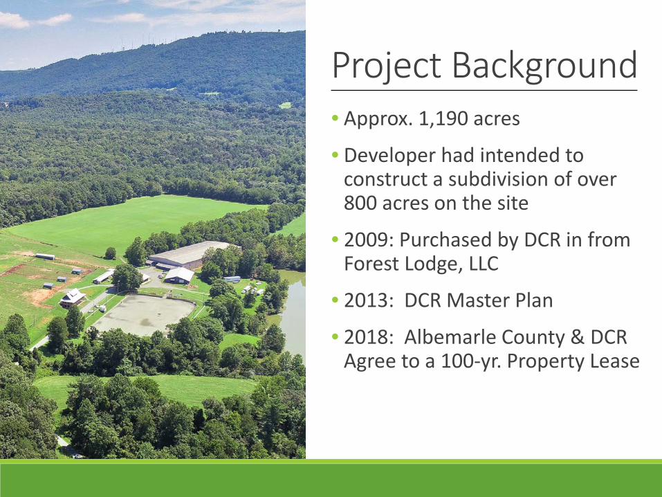
Project Background• Approx. 1,190 acres
• Developer had intended to construct a subdivision of over 800 acres on the site
• 2009: Purchased by DCR in from Forest Lodge, LLC
• 2013: DCR Master Plan
• 2018: Albemarle County & DCR Agree to a 100-yr. Property Lease
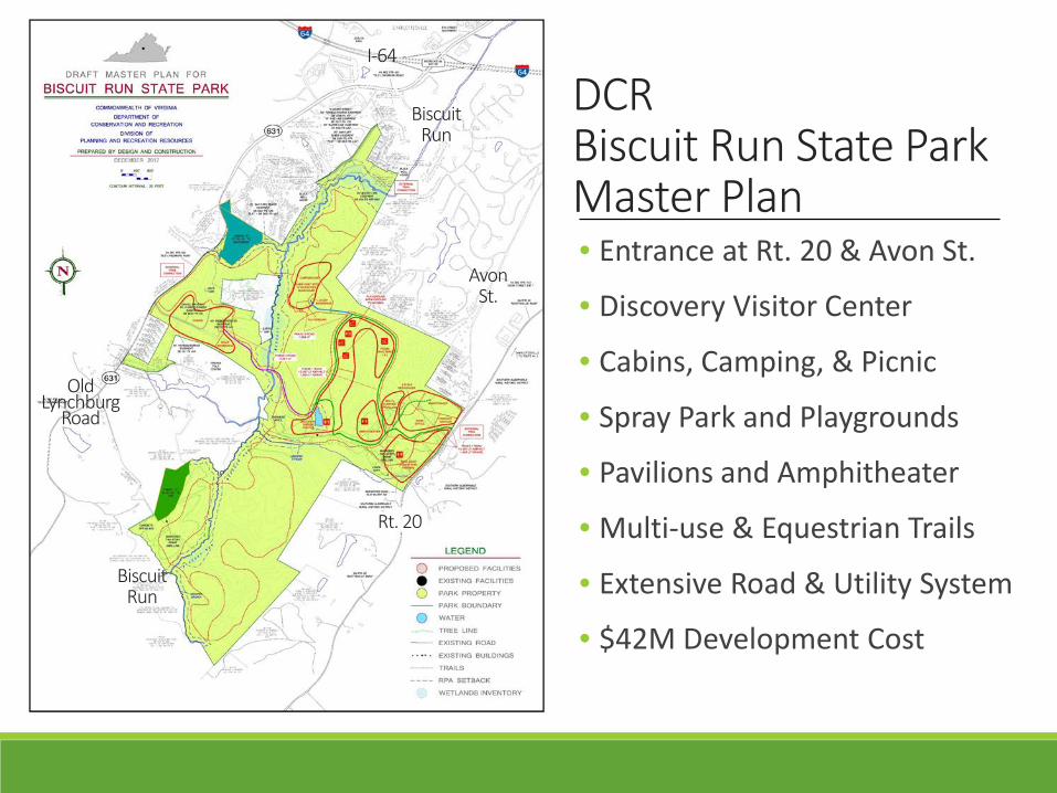
DCR Biscuit Run State Park Master Plan• Entrance at Rt. 20 & Avon St.
• Discovery Visitor Center
• Cabins, Camping, & Picnic
• Spray Park and Playgrounds
• Pavilions and Amphitheater
• Multi-use & Equestrian Trails
• Extensive Road & Utility System
• $42M Development Cost
I-64
Rt. 20
AvonSt.
Old Lynchburg
Road
BiscuitRun
BiscuitRun
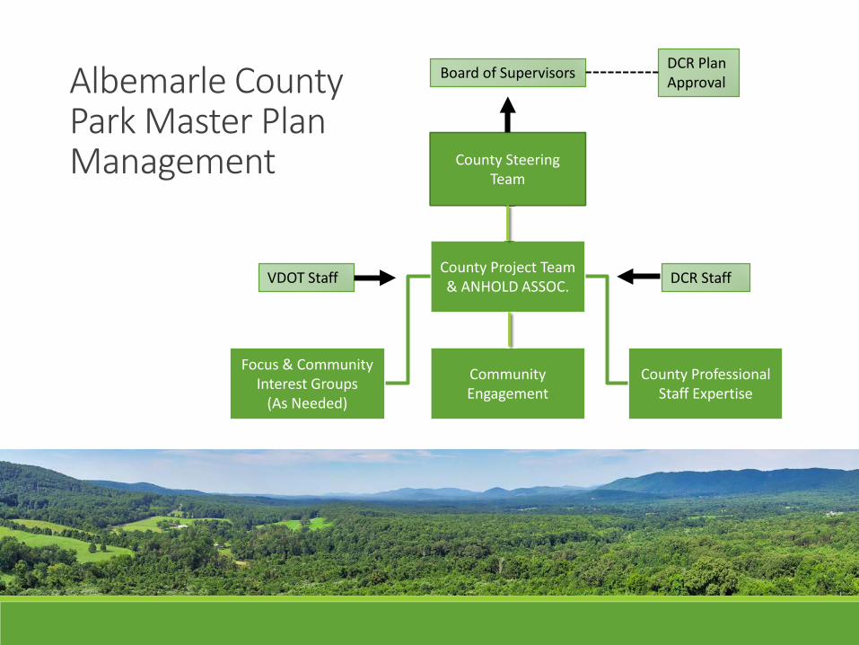
County Project Team & ANHOLD ASSOC.
County Professional Staff Expertise
Community Engagement
Focus & Community Interest Groups
(As Needed)
County Steering Team
Albemarle County Park Master PlanManagement
DCR StaffVDOT Staff
Board of Supervisors DCR Plan Approval
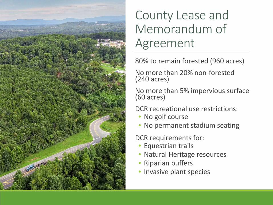
County Lease and Memorandum of Agreement 80% to remain forested (960 acres)No more than 20% non-forested (240 acres)No more than 5% impervious surface (60 acres)DCR recreational use restrictions:• No golf course• No permanent stadium seating
DCR requirements for:• Equestrian trails• Natural Heritage resources• Riparian buffers• Invasive plant species
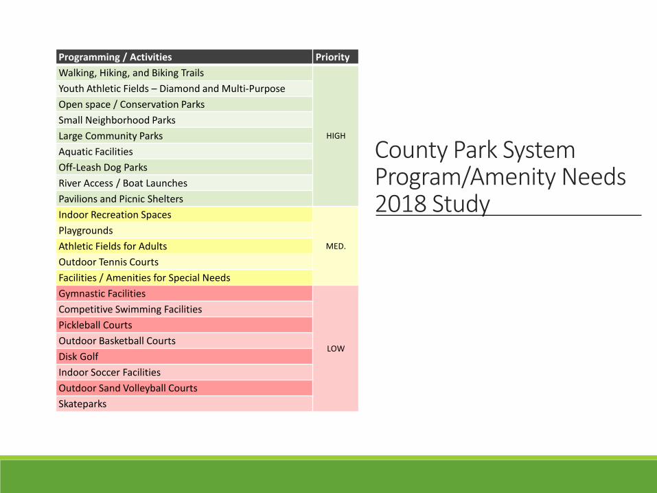
Programming / Activities PriorityWalking, Hiking, and Biking Trails
HIGH
Youth Athletic Fields – Diamond and Multi-PurposeOpen space / Conservation ParksSmall Neighborhood ParksLarge Community ParksAquatic FacilitiesOff-Leash Dog ParksRiver Access / Boat LaunchesPavilions and Picnic SheltersIndoor Recreation Spaces
MED.
PlaygroundsAthletic Fields for AdultsOutdoor Tennis CourtsFacilities / Amenities for Special NeedsGymnastic Facilities
LOW
Competitive Swimming FacilitiesPickleball CourtsOutdoor Basketball CourtsDisk GolfIndoor Soccer FacilitiesOutdoor Sand Volleyball CourtsSkateparks
County Park System Program/Amenity Needs2018 Study
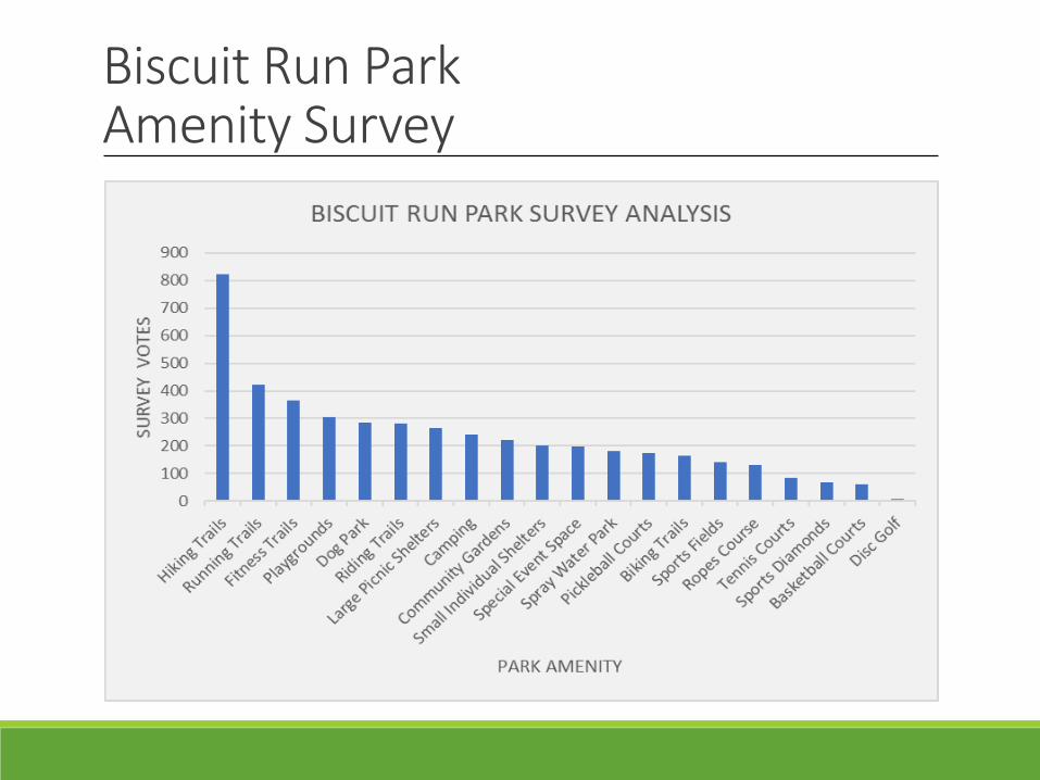
Biscuit Run Park Amenity Survey
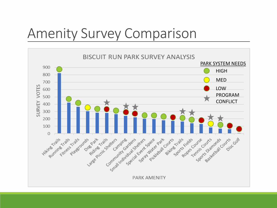
Amenity Survey Comparison
HIGH
MEDLOW
PARK SYSTEM NEEDS
PROGRAM CONFLICT
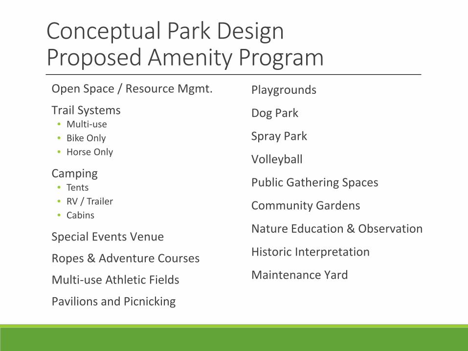
Conceptual Park DesignProposed Amenity ProgramOpen Space / Resource Mgmt.
Trail Systems• Multi-use• Bike Only• Horse Only
Camping• Tents• RV / Trailer • Cabins
Special Events Venue
Ropes & Adventure Courses
Multi-use Athletic Fields
Pavilions and Picnicking
Playgrounds
Dog Park
Spray Park
Volleyball
Public Gathering Spaces
Community Gardens
Nature Education & Observation
Historic Interpretation
Maintenance Yard
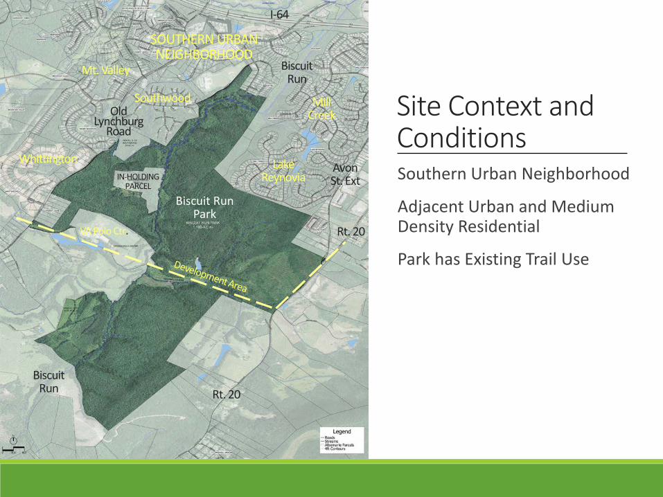
Site Context and Conditions
I-64
Rt. 20
AvonSt. Ext
Old Lynchburg
Road
BiscuitRun
BiscuitRun
IN-HOLDINGPARCEL
VA Polo Ctr. Rt. 20
Biscuit Run Park
LakeReynovia
MillCreek
Southwood
Whittington
Mt. Valley
SOUTHERN URBAN NEIGHBORHOOD
Southern Urban Neighborhood
Adjacent Urban and Medium Density Residential
Park has Existing Trail Use
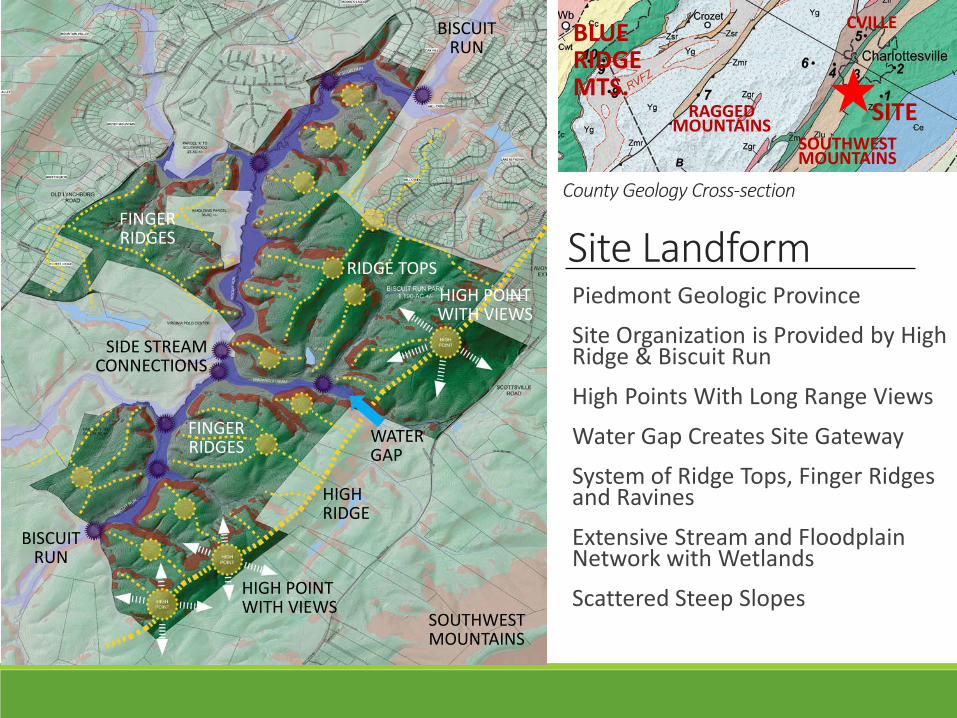
Site LandformCounty Geology Cross-section
SITE
BLUE RIDGEMTS.
CVILLE
SOUTHWESTMOUNTAINS
RAGGEDMOUNTAINS
SOUTHWEST MOUNTAINS
HIGH RIDGE
HIGH POINT WITH VIEWS
WATER GAP
BISCUIT RUN
BISCUIT RUN
FINGERRIDGES
SIDE STREAMCONNECTIONS
RIDGE TOPS
FINGERRIDGES
HIGH POINT WITH VIEWS
Piedmont Geologic ProvinceSite Organization is Provided by High Ridge & Biscuit Run
High Points With Long Range Views
Water Gap Creates Site GatewaySystem of Ridge Tops, Finger Ridges and Ravines
Extensive Stream and Floodplain Network with Wetlands
Scattered Steep Slopes
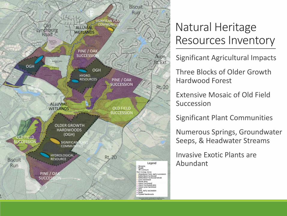
Natural Heritage Resources Inventory
Rt. 20
AvonSt. Ext
Old Lynchburg
Road
BiscuitRun
BiscuitRun
Rt. 20
OLDER GROWTH HARDWOODS
(OGH)
OLD FIELDSUCCESSION
PINE / OAKSUCCESSION
PINE / OAKSUCCESSION
PINE / OAKSUCCESSION
OLD FIELDSUCCESSION
OGHOGH
SIGNIFICAN PLANT COMMUNITIES
SIGNIFICAN PLANT COMMUNITIES
HYDROLOGICAL RESOURCE
HYDRO. RESOURCES
Significant Agricultural Impacts
Three Blocks of Older Growth Hardwood Forest
Extensive Mosaic of Old Field Succession
Significant Plant Communities
Numerous Springs, Groundwater Seeps, & Headwater Streams
Invasive Exotic Plants are Abundant
ALLUVIALWETLANDS
ALLUVIALWETLANDS
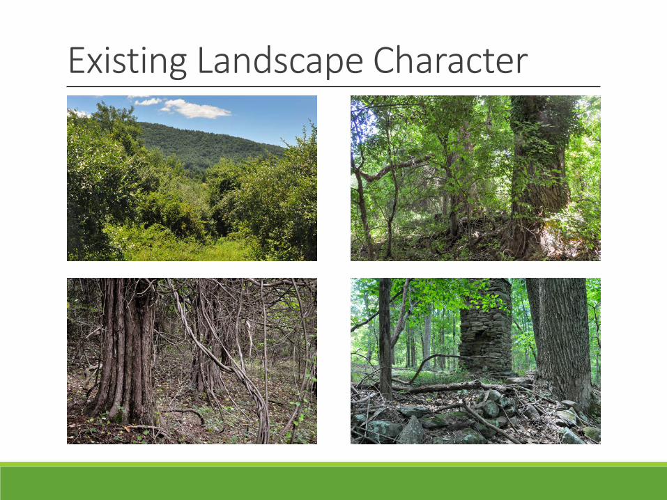
Existing Landscape Character
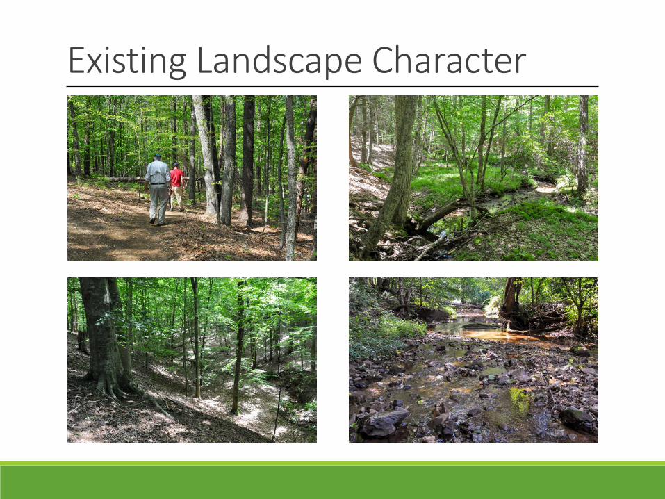
Existing Landscape Character
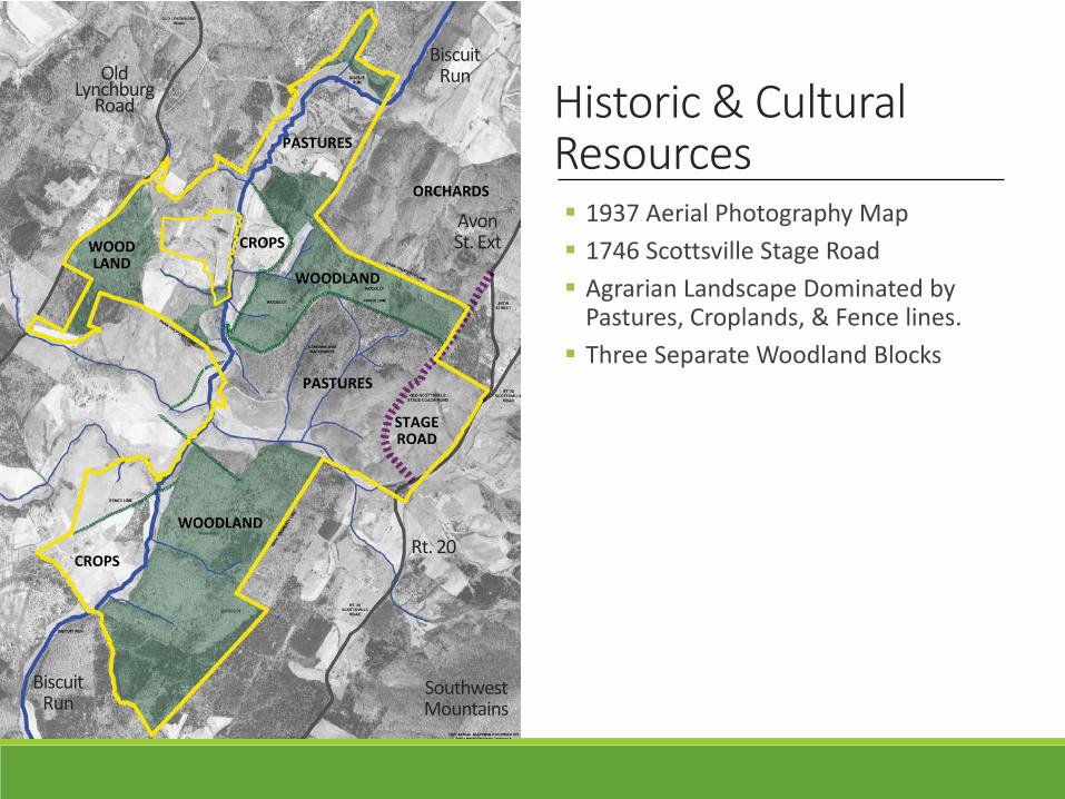
Historic & CulturalResources 1937 Aerial Photography Map 1746 Scottsville Stage Road Agrarian Landscape Dominated by
Pastures, Croplands, & Fence lines. Three Separate Woodland Blocks
STAGEROAD
WOODLAND
PASTURES
CROPS
CROPS
WOODLAND
WOODLAND
PASTURES
ORCHARDS
Rt. 20
AvonSt. Ext
Old Lynchburg
Road
BiscuitRun
BiscuitRun
SouthwestMountains
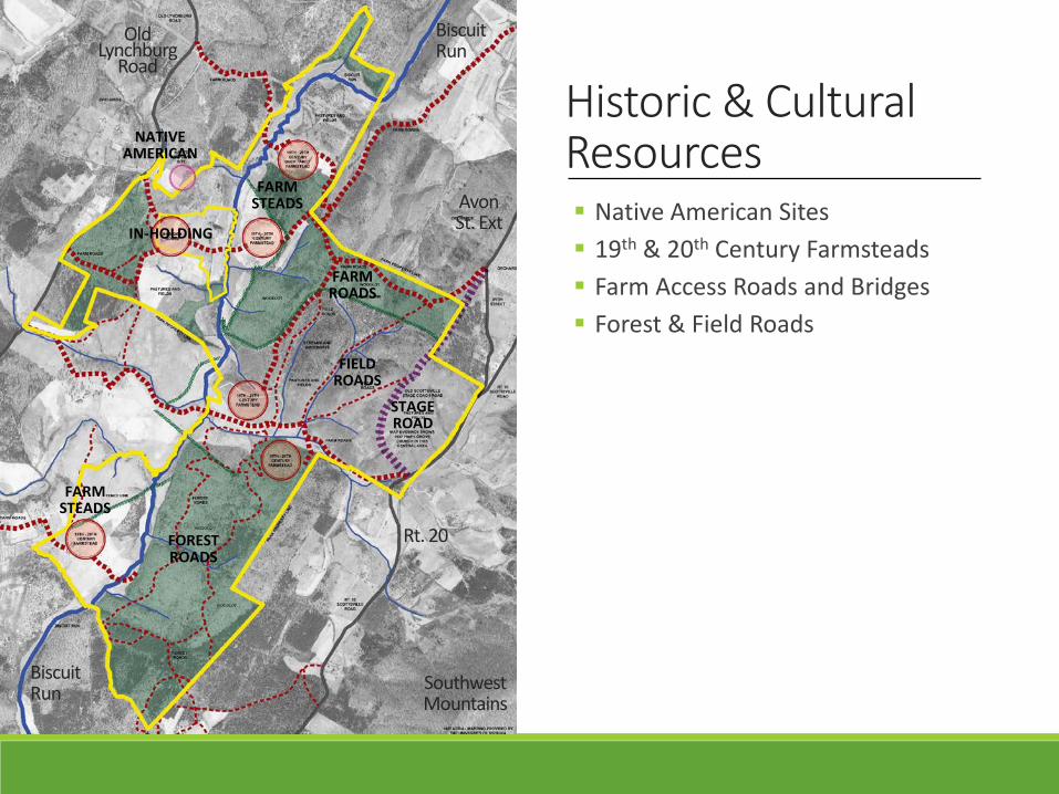
Historic & CulturalResources Native American Sites 19th & 20th Century Farmsteads Farm Access Roads and Bridges Forest & Field Roads
FARMSTEADS
FORESTROADS
FARMROADS
STAGEROAD
FIELDROADS
FARMSTEADS
NATIVEAMERICAN
IN-HOLDING
Rt. 20
Old Lynchburg
Road
BiscuitRun
BiscuitRun Southwest
Mountains
AvonSt. Ext
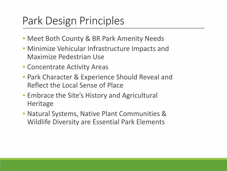
Park Design Principles• Meet Both County & BR Park Amenity Needs• Minimize Vehicular Infrastructure Impacts and
Maximize Pedestrian Use• Concentrate Activity Areas • Park Character & Experience Should Reveal and
Reflect the Local Sense of Place• Embrace the Site’s History and Agricultural
Heritage • Natural Systems, Native Plant Communities &
Wildlife Diversity are Essential Park Elements
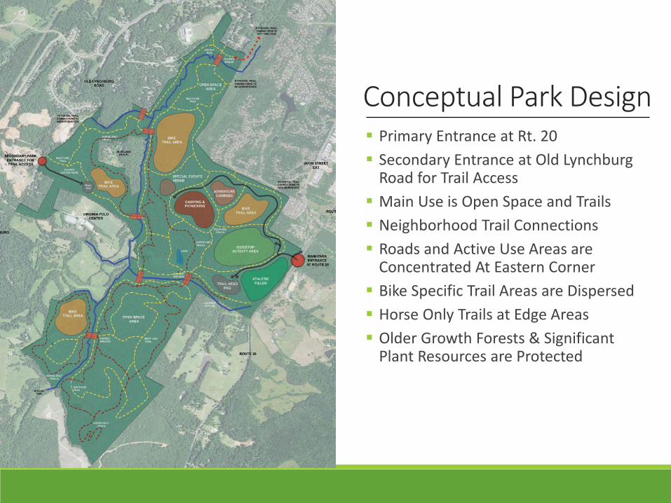
Conceptual Park Design Primary Entrance at Rt. 20 Secondary Entrance at Old Lynchburg
Road for Trail Access Main Use is Open Space and Trails Neighborhood Trail Connections Roads and Active Use Areas are
Concentrated At Eastern Corner Bike Specific Trail Areas are Dispersed Horse Only Trails at Edge Areas Older Growth Forests & Significant
Plant Resources are Protected
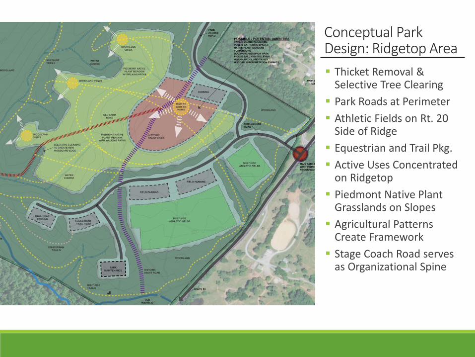
Conceptual Park Design: Ridgetop Area Thicket Removal &
Selective Tree Clearing Park Roads at Perimeter Athletic Fields on Rt. 20
Side of Ridge Equestrian and Trail Pkg. Active Uses Concentrated
on Ridgetop Piedmont Native Plant
Grasslands on Slopes Agricultural Patterns
Create Framework Stage Coach Road serves
as Organizational Spine
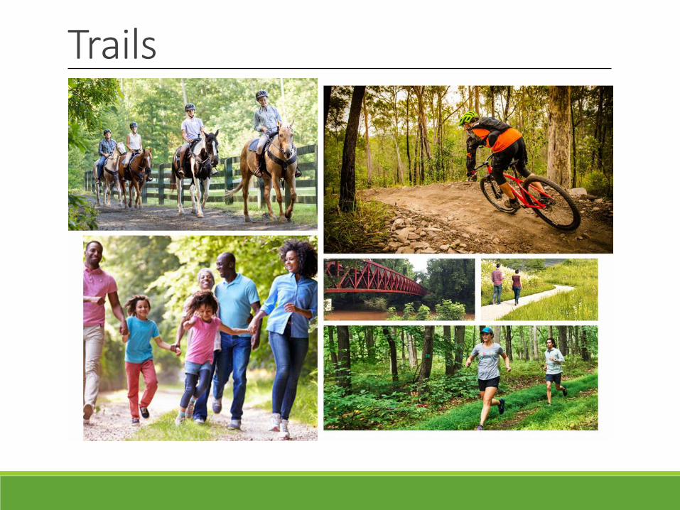
Trails
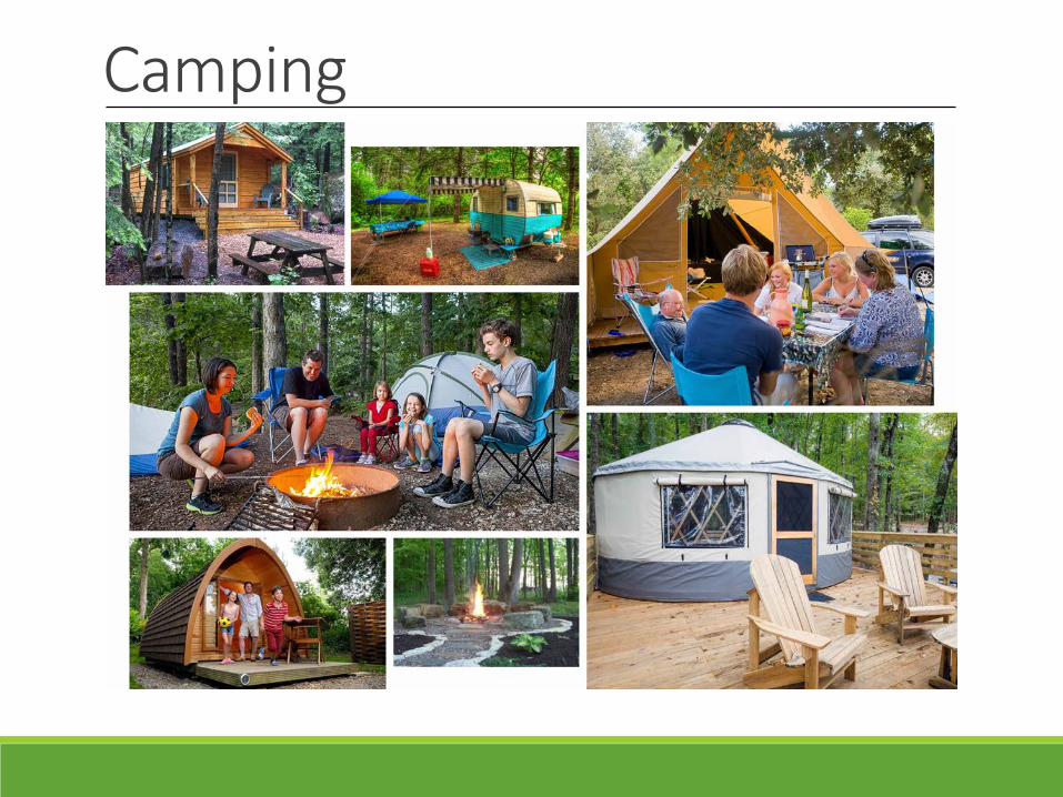
Camping
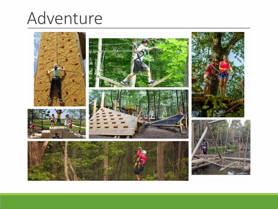
Adventure
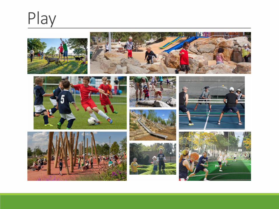
Play
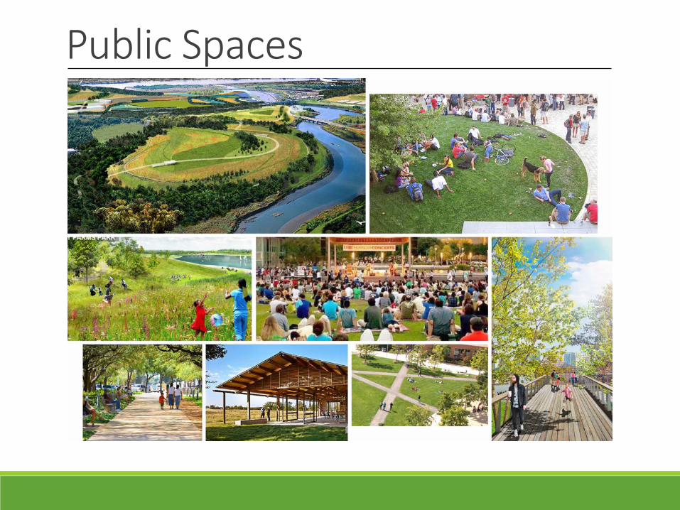
Public Spaces
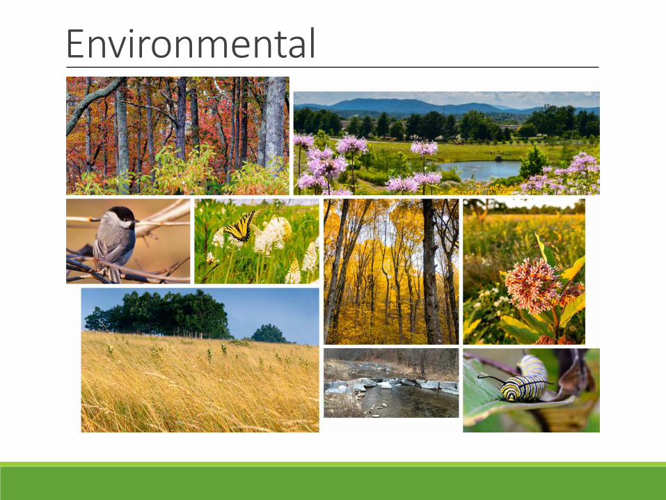
Environmental
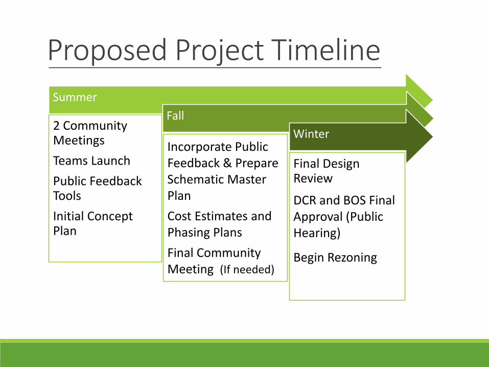
Proposed Project TimelineSummer
2 Community MeetingsTeams LaunchPublic Feedback ToolsInitial Concept Plan
Fall
Incorporate Public Feedback & Prepare Schematic Master PlanCost Estimates and Phasing PlansFinal Community Meeting (If needed)
Winter
Final Design Review
DCR and BOS Final Approval (Public Hearing)
Begin Rezoning
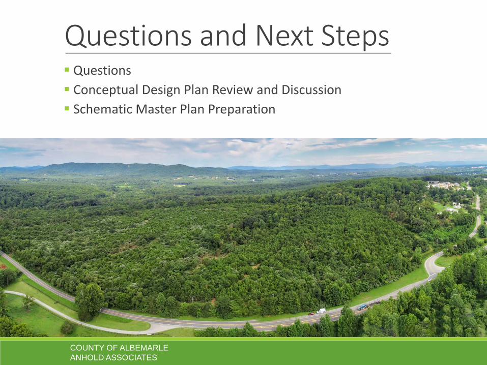
Questions and Next Steps Questions Conceptual Design Plan Review and Discussion Schematic Master Plan Preparation
COUNTY OF ALBEMARLEANHOLD ASSOCIATES