Embed Size (px)
Citation preview
Batch processing with sh_gamit
M. Floyd K. PalamartchoukMassachusetts Institute of Technology Newcastle University
GAMIT-GLOBK courseUniversity of Bristol, UK
12–16 January 2015
Material from R. King, T. Herring, M. Floyd (MIT) and S. McClusky (now ANU)
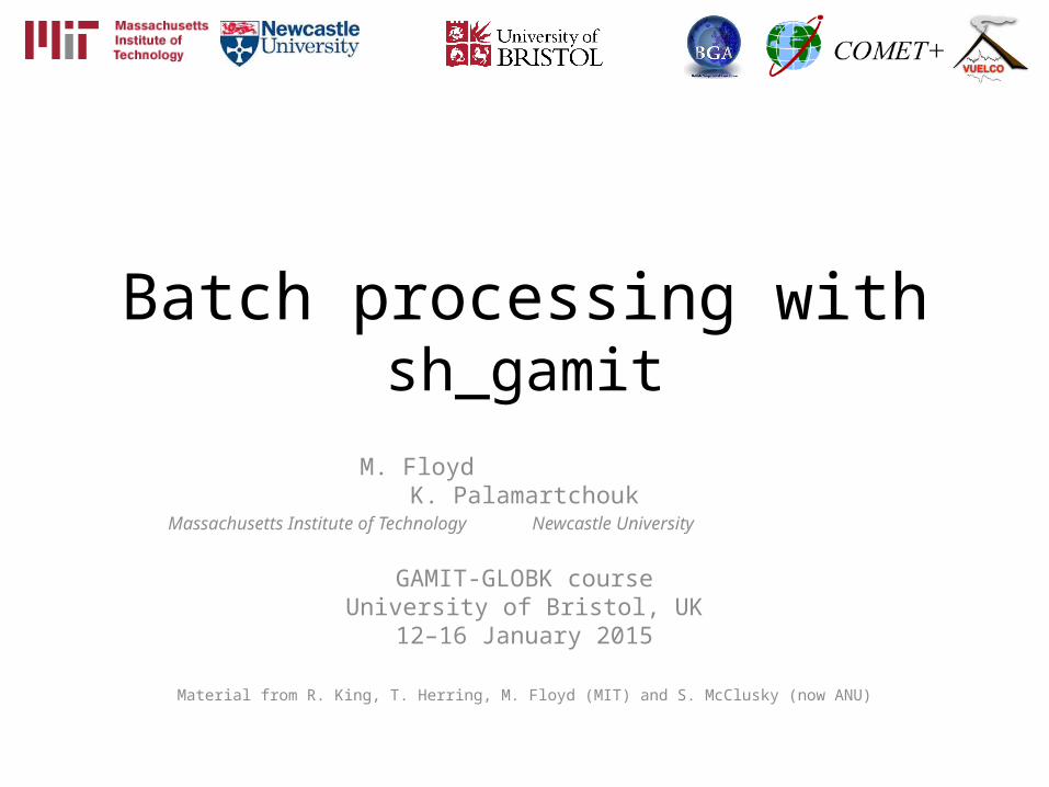
Outline
• Setup, operation and options for GAMIT processing with sh_gamit– Directory structures– Main functions in gamit
• Programs called that run the GAMIT processing
– Files that are important in processing– Summary files– Residual plots– Problems that can happen and suggestions
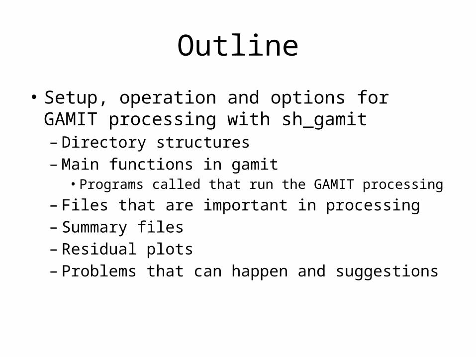
Overview of sh_gamit: Getting started
• To start sh_setup will create /tables, /rinex, /gsoln directories and then local specifics can be set.– in ./tables, process.defaults and sites.default are the two main files
that need to be edited; sittbl. may also need editing to ensure some constrained stations in the network to be processed; sestbl. is edited if non-standard processing.
– In ./tables, apriori coordinate file created (name in process.defaults). Additional coordinates are put into ./tables/lfile.
– in ./rinex, local rinex files need to be copied in; rinex data in archives will automatically be downloaded
• sh_gamit -expt [expt-name] -s [yr] [start-doy] [stop-doy]– Common options are: -dopt –copt –rx_doy_minus -netext
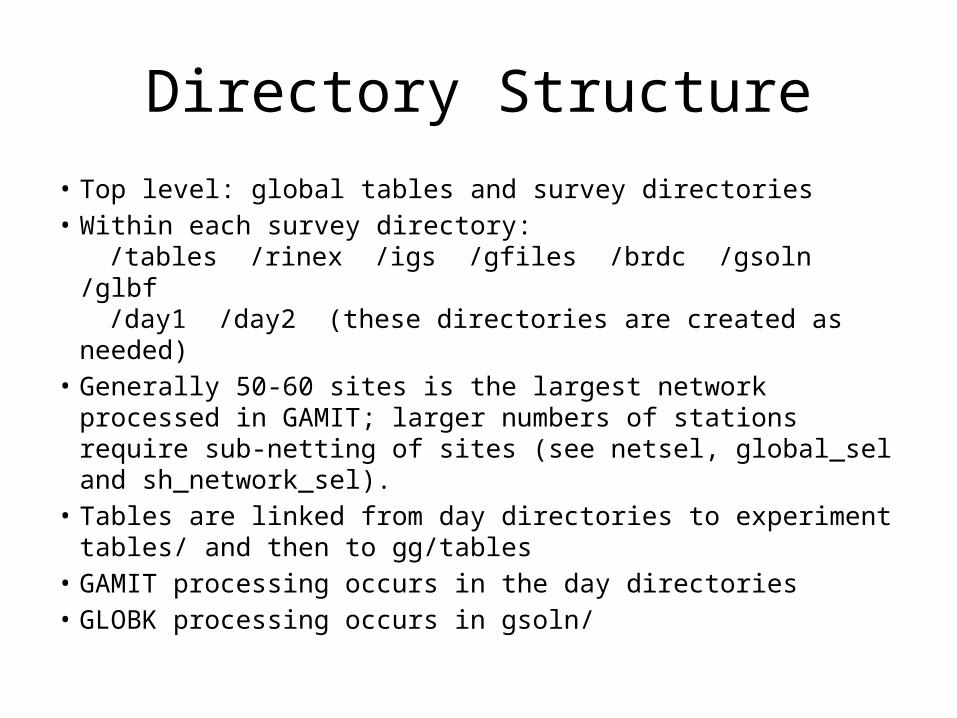
Directory Structure
• Top level: global tables and survey directories• Within each survey directory:
/tables /rinex /igs /gfiles /brdc /gsoln /glbf/day1 /day2 (these directories are created as
needed)• Generally 50-60 sites is the largest network processed in
GAMIT; larger numbers of stations require sub-netting of sites (see netsel, global_sel and sh_network_sel).
• Tables are linked from day directories to experiment tables/ and then to gg/tables
• GAMIT processing occurs in the day directories • GLOBK processing occurs in gsoln/

Important files
• autcln.cmd• process.defaults• sestbl.• sites.defaults• sittbl.• station.info• apr-file
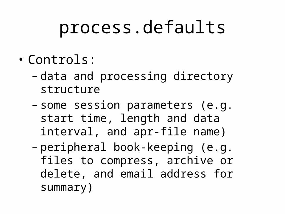
process.defaults
• Controls:– data and processing directory structure– some session parameters (e.g. start time, length
and data interval, and apr-file name)– peripheral book-keeping (e.g. files to compress,
archive or delete, and email address for summary)

sites.defaults
• Controls:– Sites to be in included in experiment of given
name
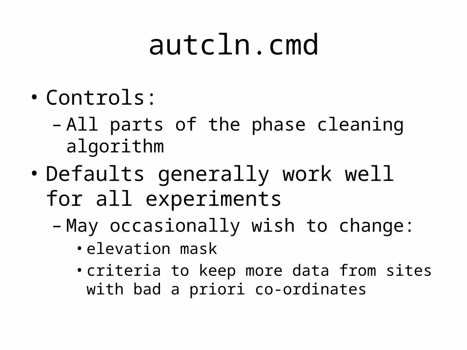
autcln.cmd
• Controls:– All parts of the phase cleaning algorithm
• Defaults generally work well for all experiments– May occasionally wish to change:
• elevation mask• criteria to keep more data from sites with bad a priori
co-ordinates
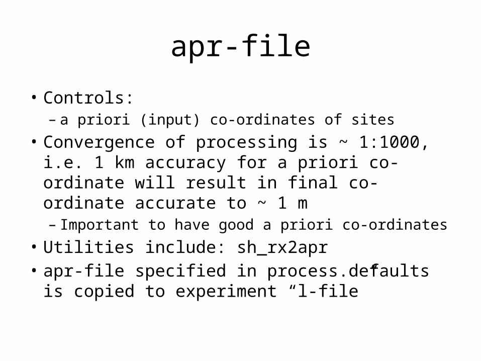
apr-file
• Controls:– a priori (input) co-ordinates of sites
• Convergence of processing is ~ 1:1000, i.e. 1 km accuracy for a priori co-ordinate will result in final co-ordinate accurate to ~ 1 m– Important to have good a priori co-ordinates
• Utilities include: sh_rx2apr• apr-file specified in process.defaults is copied
to experiment “l-file”
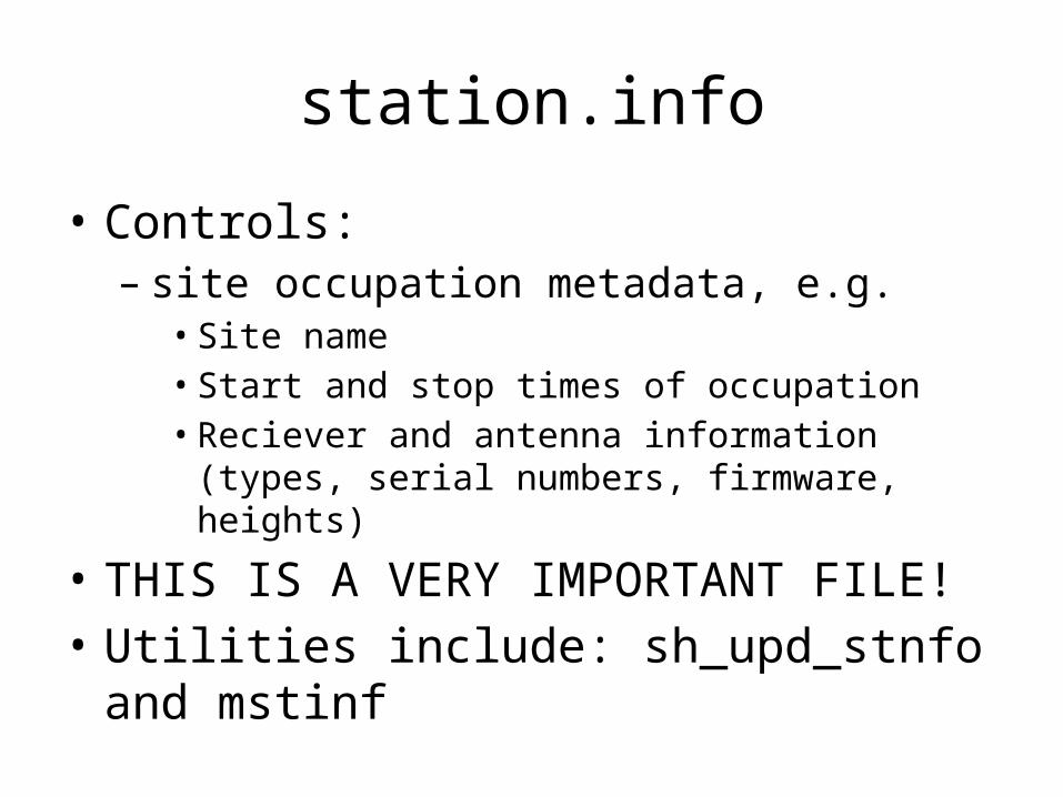
station.info
• Controls:– site occupation metadata, e.g.
• Site name• Start and stop times of occupation• Reciever and antenna information (types, serial
numbers, firmware, heights)
• THIS IS A VERY IMPORTANT FILE!• Utilities include: sh_upd_stnfo and mstinf
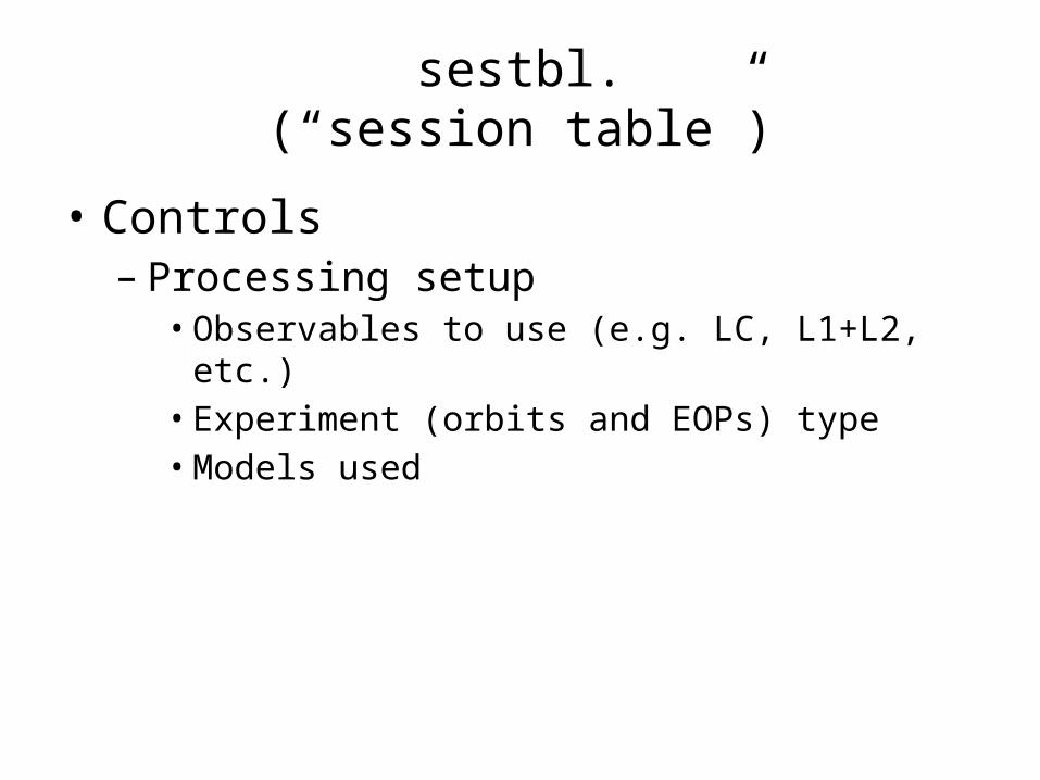
sestbl.(“session table”)
• Controls– Processing setup
• Observables to use (e.g. LC, L1+L2, etc.)• Experiment (orbits and EOPs) type• Models used

sittbl.(“sites table”)
• Controls:– Site-specific information for processing
• Constraint (~ accuracy) of a priori co-ordinates in apr-file
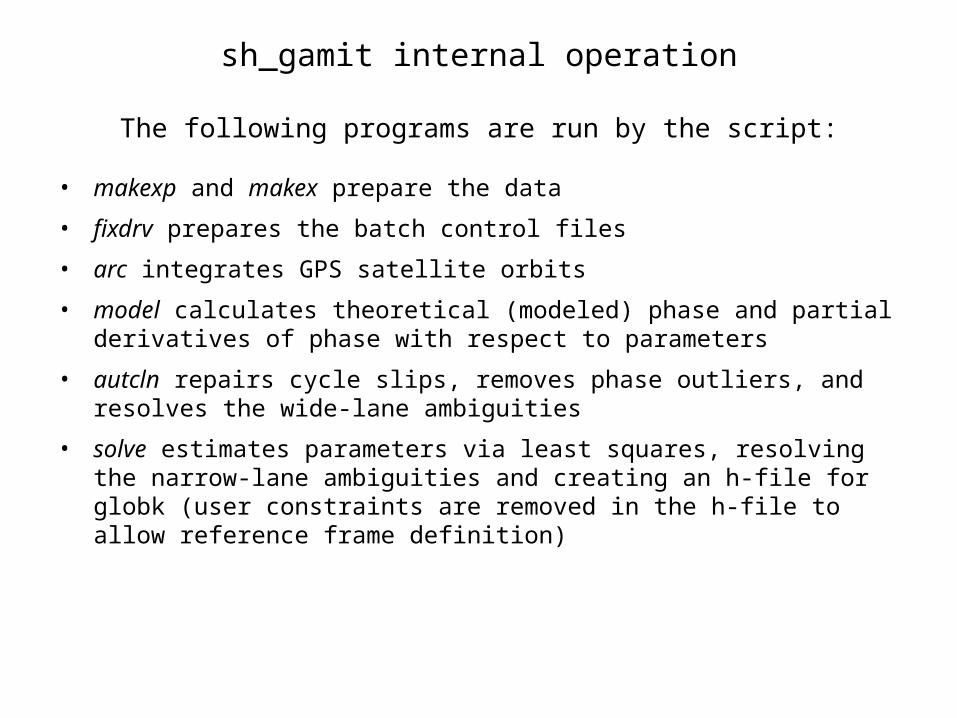
sh_gamit internal operation
The following programs are run by the script:
• makexp and makex prepare the data
• fixdrv prepares the batch control files
• arc integrates GPS satellite orbits
• model calculates theoretical (modeled) phase and partial derivatives of phase with respect to parameters
• autcln repairs cycle slips, removes phase outliers, and resolves the wide-lane ambiguities
• solve estimates parameters via least squares, resolving the narrow-lane ambiguities and creating an h-file for globk (user constraints are removed in the h-file to allow reference frame definition)

Steps in the standard GAMIT batch sequence
• arc, model, autcln, solve for initial solution
– 5-minute sampling, no ambiguity resolution (GCR only)
– update lfile. for coordinates adjusted > 30 cm
– look at --> autcln.prefit.sum, q<expt>p.ddd
• model, autcln, solve for final solution
– 2-minute sampling, ambiguity resolution
– Look at --> autcln.post.sum, q<expt>a.ddd
• Final solution repeated if nrms reduced by > 30% from initial solution, to assure good editing and linear adjustment of parameters (original final-solution files overwritten)

What SOLVE produces:
• Print output is the q-file, which records
in detail– a constrained solution without ambiguities resolved (GCR) – a constrained solution with ambiguities resolved (GCX)
These are the solutions you should examine, along with the autcln summary files, to assess the quality of the solution
And in summary only – a loose solution without ambiguities resolved (GLR) – A loose solution with ambiguities resolved (GLX)
• Updated l-file for successive iterations or days • Useful output for GLOBK is the h-file (analogous to the IGS-standard SINEX file),
which contains the parameters estimates and full covariance matrix.
(There is also an o-file, which is just the q-file but in more machine-readable form, and is seldom used; and, if orbits adjusted, an updated g-file)

Files you need to worry aboutRINEX files – local plus list in sites.defaults
Control files
process.defaults – minor edits for each survey
sites.defaults – sites to include/omit; source of metadata
sestbl. – unchanged for most processing
sittbl. – sites constrained for ambiguity resolution
globk_comb.cmd – use_site, apr_neu, apr_svs, apr_wob, apr_ut1, sig_neu, mar_neu
glorg_comb.cmd – apr_file, pos_org, stab_site
A priori coordinates ( apr-file, l-file )
Meta-data (station.info)
Differential code biases (dcb.dat) – download current values 1/month
Satellite characteristics (svnav.dat) – download current w/ each new launch

Files provided or created automatically • Satellite orbits
• IGS sp3-files (tabular) and/or g-files (ICs for GAMIT)
• ARC integrates to get t-files (tabular)
• Earth Orientation Parameters ( ut1., wob.) - downloaded if needed for current day
• Leap-second file -- linked to gg/tables (update ~yearly or when leap second)
• Satellite clock (j-) files – from RINEX navigation (brdc) file
• Rcvr/ant characteristics (rcvant.dat, hi.dat) – linked to gg/tables
• Differential code biases (dcb.dat)—update ~monthly
• Antenna phase center models (antmod.dat) – linked to gg/tables (also needs to be updated when new antennas added).
• Luni-solar ephemerides and nutation (soltab., luntab., nutabl.) linked to gg/tables (need to update yearly)
• Ocean tide grid (optional) – linked to gg/tables
• Atmospheric loading grid (optional) – need to update yearly
• Mapping function grid (optional) – need to update yearly
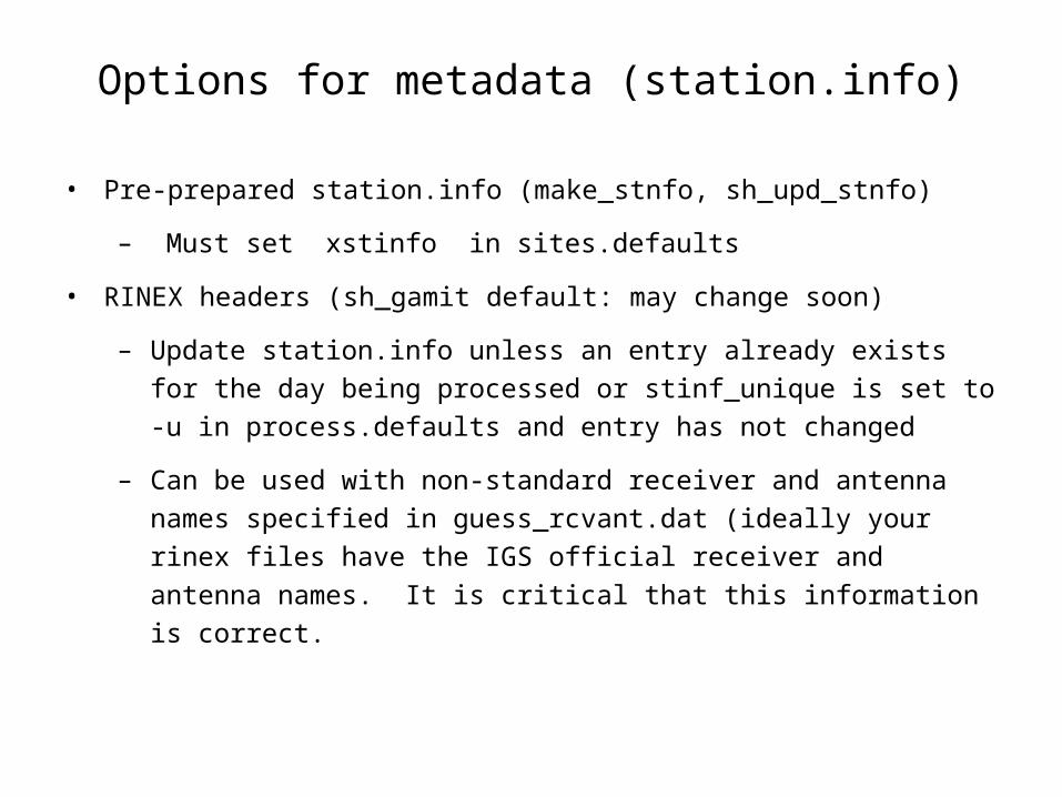
Options for metadata (station.info)
• Pre-prepared station.info (make_stnfo, sh_upd_stnfo)
– Must set xstinfo in sites.defaults
• RINEX headers (sh_gamit default: may change soon)
– Update station.info unless an entry already exists for the day being processed or stinf_unique is set to -u in process.defaults and entry has not changed
– Can be used with non-standard receiver and antenna names specified in guess_rcvant.dat (ideally your rinex files have the IGS official receiver and antenna names. It is critical that this information is correct.
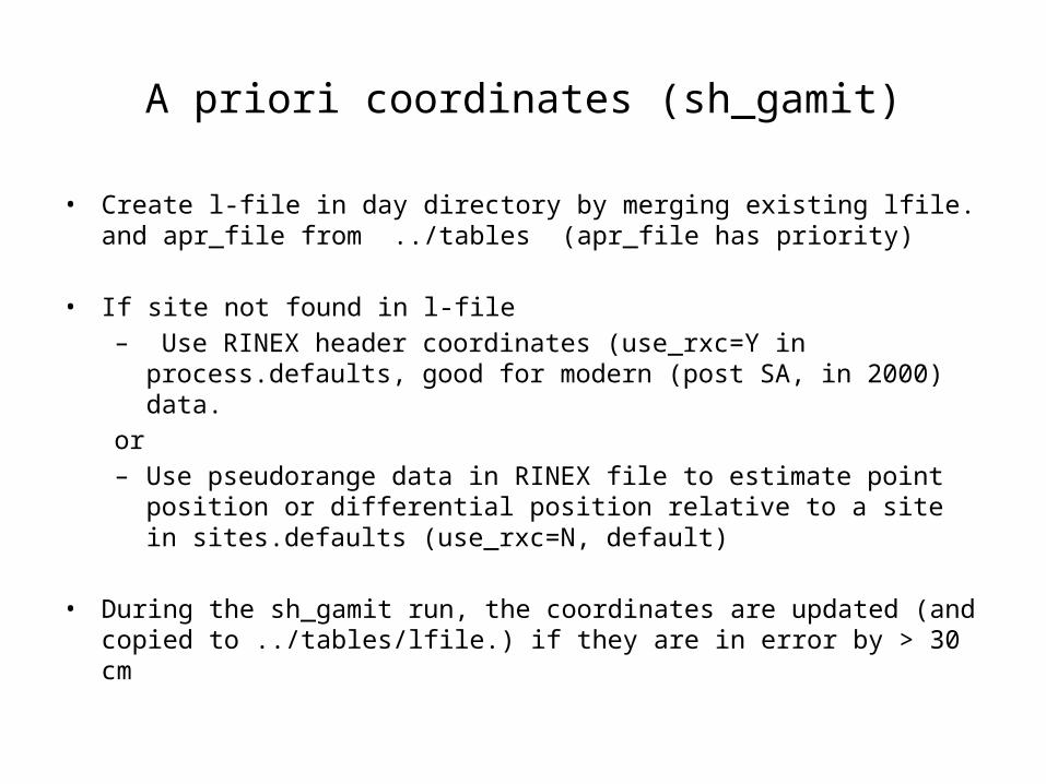
A priori coordinates (sh_gamit)
• Create l-file in day directory by merging existing lfile. and apr_file from ../tables (apr_file has priority)
• If site not found in l-file – Use RINEX header coordinates (use_rxc=Y in process.defaults, good for
modern (post SA, in 2000) data.or– Use pseudorange data in RINEX file to estimate point position or differential
position relative to a site in sites.defaults (use_rxc=N, default)
• During the sh_gamit run, the coordinates are updated (and copied to ../tables/lfile.) if they are in error by > 30 cm
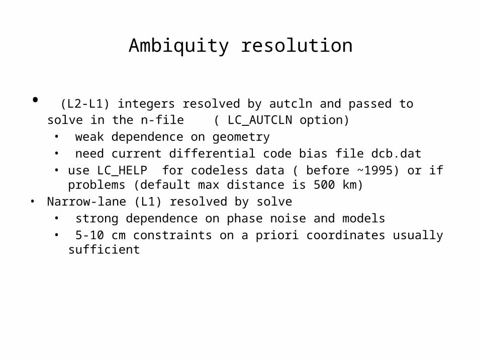
Ambiquity resolution
• (L2-L1) integers resolved by autcln and passed to solve in the n-file ( LC_AUTCLN option)• weak dependence on geometry• need current differential code bias file dcb.dat• use LC_HELP for codeless data ( before ~1995) or if problems (default max
distance is 500 km)• Narrow-lane (L1) resolved by solve
• strong dependence on phase noise and models• 5-10 cm constraints on a priori coordinates usually sufficient
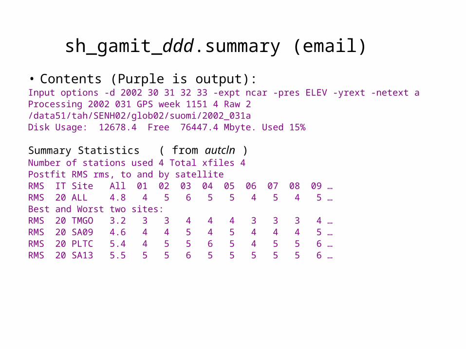
sh_gamit_ddd.summary (email) • Contents (Purple is output):Input options -d 2002 30 31 32 33 -expt ncar -pres ELEV -yrext -netext aProcessing 2002 031 GPS week 1151 4 Raw 2 /data51/tah/SENH02/glob02/suomi/2002_031aDisk Usage: 12678.4 Free 76447.4 Mbyte. Used 15%
Summary Statistics ( from autcln )Number of stations used 4 Total xfiles 4Postfit RMS rms, to and by satelliteRMS IT Site All 01 02 03 04 05 06 07 08 09 …RMS 20 ALL 4.8 4 5 6 5 5 4 5 4 5 …Best and Worst two sites:RMS 20 TMGO 3.2 3 3 4 4 4 3 3 3 4 …RMS 20 SA09 4.6 4 4 5 4 5 4 4 4 5 …RMS 20 PLTC 5.4 4 5 5 6 5 4 5 5 6 … RMS 20 SA13 5.5 5 5 6 5 5 5 5 5 6 …
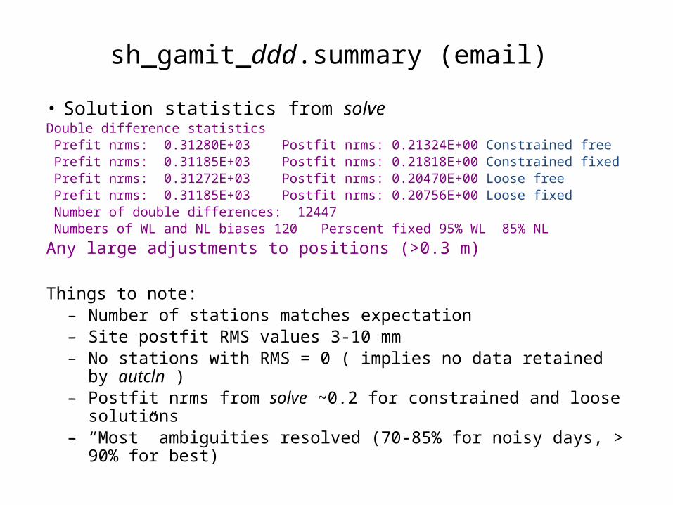
sh_gamit_ddd.summary (email)
• Solution statistics from solveDouble difference statistics Prefit nrms: 0.31280E+03 Postfit nrms: 0.21324E+00 Constrained free Prefit nrms: 0.31185E+03 Postfit nrms: 0.21818E+00 Constrained fixed Prefit nrms: 0.31272E+03 Postfit nrms: 0.20470E+00 Loose free Prefit nrms: 0.31185E+03 Postfit nrms: 0.20756E+00 Loose fixed Number of double differences: 12447 Numbers of WL and NL biases 120 Perscent fixed 95% WL 85% NL
Any large adjustments to positions (>0.3 m)
Things to note:– Number of stations matches expectation– Site postfit RMS values 3-10 mm– No stations with RMS = 0 ( implies no data retained by autcln ) – Postfit nrms from solve ~0.2 for constrained and loose solutions– “Most” ambiguities resolved (70-85% for noisy days, > 90% for best)
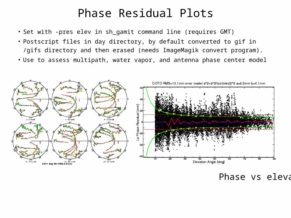
Phase Residual Plots
• Set with -pres elev in sh_gamit command line (requires GMT)
• Postscript files in day directory, by default converted to gif in /gifs directory and then erased (needs ImageMagik convert program).
• Use to assess multipath, water vapor, and antenna phase center model
“Sky plot” Phase vs elevation angle
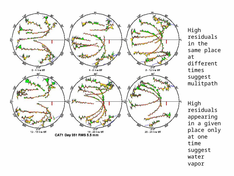
High residuals in the same place at different times suggest mulitpath
High residuals appearing in a given place only at one time suggest water vapor

Phase vs elevation angle
Normal pattern: bands are high-frequency multipath; red is smoothing of individual values, showing no strong systematics. Mid-elevation angle noise could be atmospheric delay errors?
Bad pattern: systematic signature of smoothed values indicates a poor model of the antenna phase pattern (perhaps a misidentified antenna in station.info)
Green lines show the elevation-dependent noise model shown at top and used to reweight the data in solve
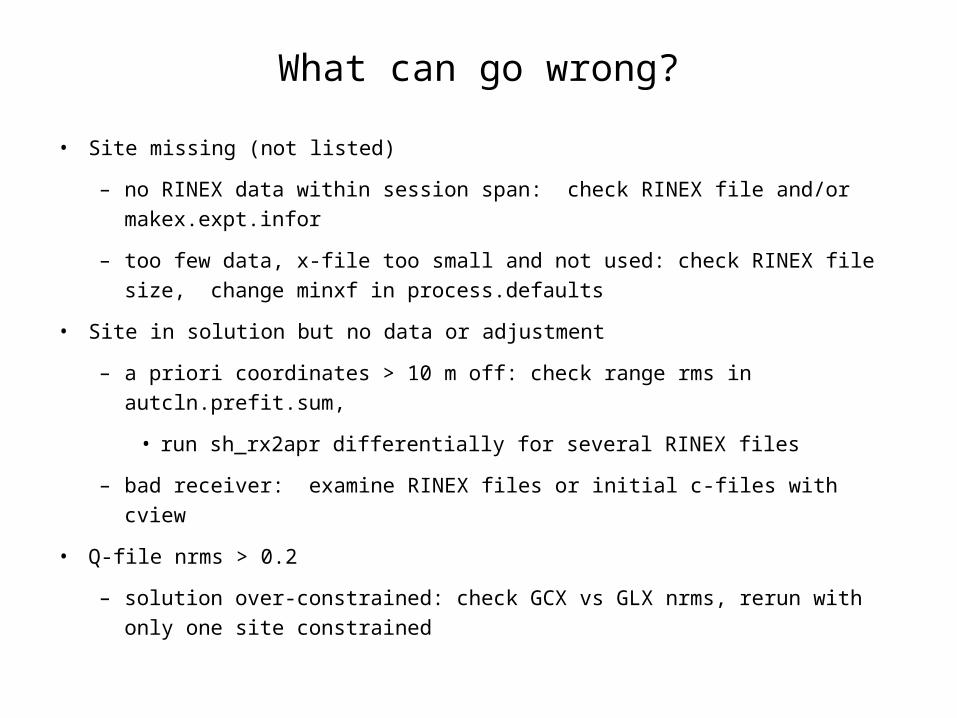
What can go wrong?
• Site missing (not listed)
– no RINEX data within session span: check RINEX file and/or makex.expt.infor
– too few data, x-file too small and not used: check RINEX file size, change minxf in process.defaults
• Site in solution but no data or adjustment
– a priori coordinates > 10 m off: check range rms in autcln.prefit.sum,
• run sh_rx2apr differentially for several RINEX files
– bad receiver: examine RINEX files or initial c-files with cview
• Q-file nrms > 0.2
– solution over-constrained: check GCX vs GLX nrms, rerun with only one site constrained
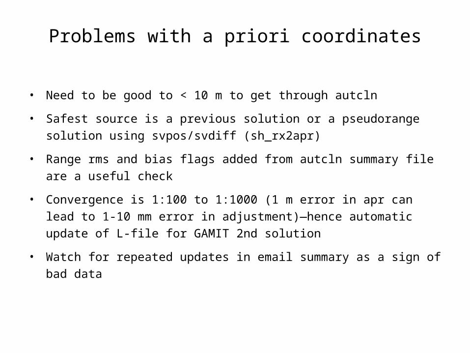
Problems with a priori coordinates
• Need to be good to < 10 m to get through autcln
• Safest source is a previous solution or a pseudorange solution using svpos/svdiff (sh_rx2apr)
• Range rms and bias flags added from autcln summary file are a useful check
• Convergence is 1:100 to 1:1000 (1 m error in apr can lead to 1-10 mm error in adjustment)—hence automatic update of L-file for GAMIT 2nd solution
• Watch for repeated updates in email summary as a sign of bad data

Constraining the GAMIT solution
• Minimal (single-station) constraint is all that’s needed for ambiguity resolution, but sittbl. can list several to assure one
• Orbits can be fixed or tightly constrained (.005 ppm) for IGS orbits since at least 1996. Use of baseline mode (no orbit estimated now recommended for regional processing.
• Look for good (~0.2) loose (GLR/GLX) nrms but elevated constrained nrms (GCR/GCX) as indication of an over-constrained solution
More Subtle Problems
• Site with high rms in autcln.post.sum
– high multipathing or water vapor: check sky plots of phase
– bad receiver: examine RINEX files or initial c-files with cview
• Phase vs elevation angle plot large and systematic
– misidentified antenna (wrong PCV model)
– coupling between antenna and mount
• GAMIT results within normal range but time series shows outlier
– survey-mode: antenna not leveled and centered over mark
– change in multipath (water, objects) or water vapor
– snow on antenna
– incorrect ambiguity resolution (east component except for high latitudes)
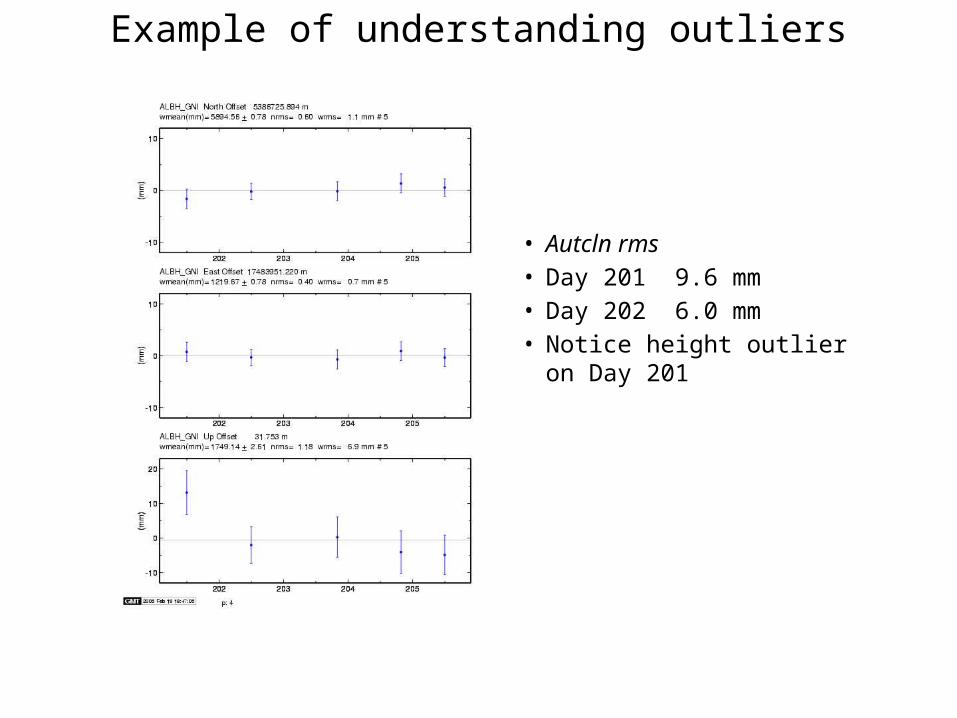
Example of understanding outliers
• Autcln rms• Day 201 9.6 mm• Day 202 6.0 mm• Notice height outlier on Day 201
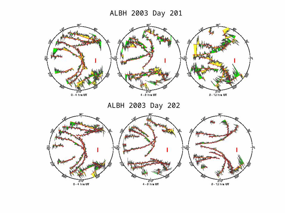
ALBH 2003 Day 201
ALBH 2003 Day 202