Embed Size (px)
Citation preview

Aviation Weather Hazardsin the
Southwest
Aviation Weather Hazardsin the
Southwest
David Craft
Aviation Products & Services
Program Co-leader
NWS Albuquerque
David Craft
Aviation Products & Services
Program Co-leader
NWS Albuquerque
Gregory Harris
Weather Forecaster
ZAB CWSU
Gregory Harris
Weather Forecaster
ZAB CWSU

ZAB CWSUZAB CWSU
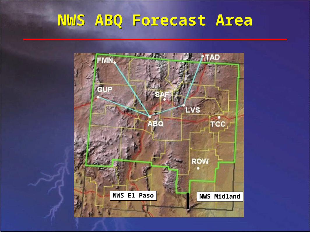
NWS ABQ Forecast AreaNWS ABQ Forecast Area
NWS El Paso NWS Midland

OverviewOverview• NWS ABQ TAFs & TWEBs
• Weather Hazards
– Smoke and haze obscurations
– Spring and east winds
– Low level wind shear
– Thunderstorms
• ZAB CWSU Forecast Products
– Center Weather Advisories
– Collaborative Convective Forecast Product
• Internet Resources for Aviators
• Summary
• NWS ABQ TAFs & TWEBs
• Weather Hazards
– Smoke and haze obscurations
– Spring and east winds
– Low level wind shear
– Thunderstorms
• ZAB CWSU Forecast Products
– Center Weather Advisories
– Collaborative Convective Forecast Product
• Internet Resources for Aviators
• Summary
– Turbulence
– Mountain obscuration
– Icing
– Turbulence
– Mountain obscuration
– Icing

Smoke & Haze ObscurationsSmoke & Haze Obscurations
NWSNWS6/24/02 1430Z6/24/02 1430Z
6/23/02 1430Z6/23/02 1430Z
Mogollon Rim WildfireMogollon Rim Wildfire Flagstaff Temperature & Wind ProfilesFlagstaff Temperature & Wind Profiles
6/23/02 12Z
FT AGL
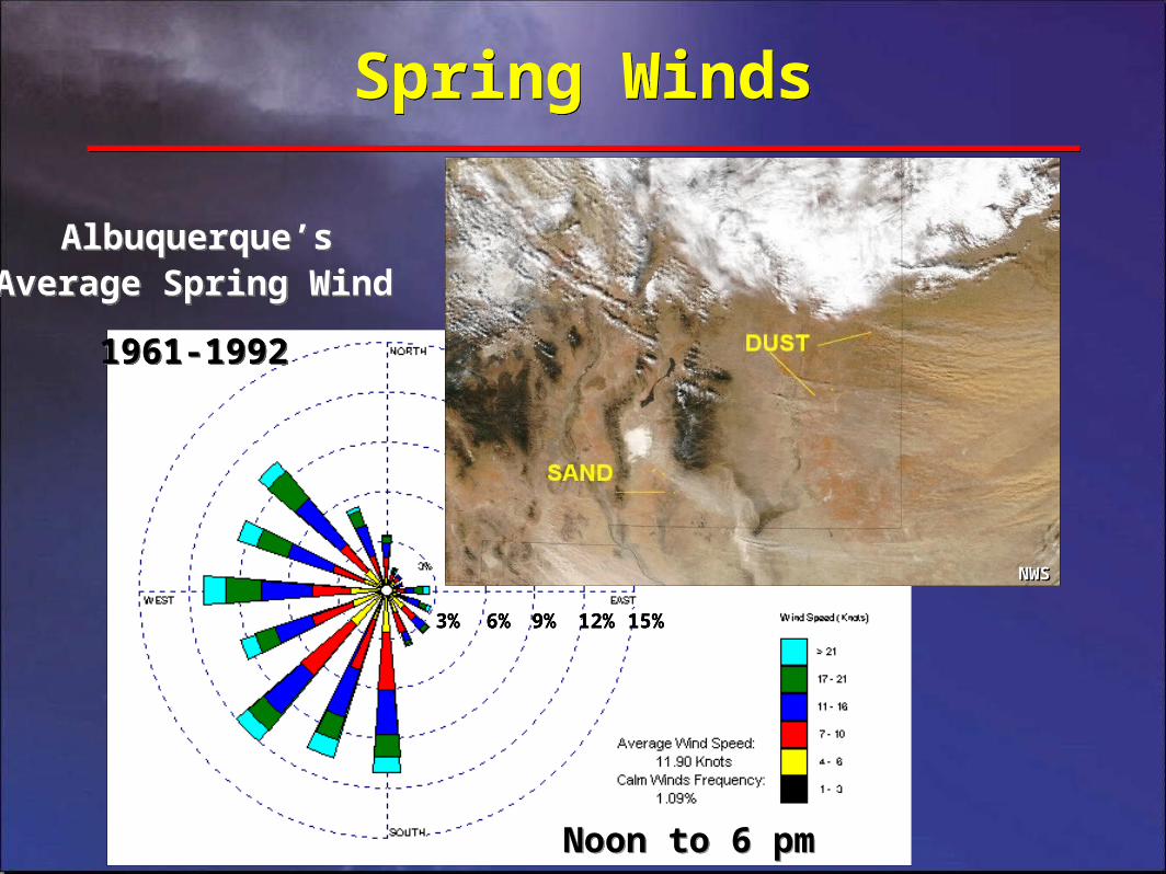
Spring WindsSpring Winds
Average Spring Wind
1961-1992
Average Spring Wind
1961-1992
Noon to 6 pmNoon to 6 pm
Albuquerque’sAlbuquerque’s
NWSNWS
3%3% 6%6% 9%9% 12%12% 15%15%
NWSNWS

Rio Grande Valley East WindsRio Grande Valley East Winds
• High impact on the ABQ Sunport and Santa Fe Airport
• Stronger events also reach Double Eagle, Taos, and Grants Airports
• Over-the-top events can cause hurricane-force winds in Albuquerque
– 124 mph - 1987 - tram base
– 108 mph - 1990 - Glenwood Hills
– 90 mph (sustained) - 1943 - Albuquerque Airport
*Santa Fe
TijerasCanyonTijerasCanyon
ABQ Airport
X 1200 FT drop1200 FT drop
Sandia
MtnsSandia
Mtns
NWSNWS

Low Level Wind ShearLow Level Wind Shear• Any change in wind speed or direction within 2,000 feet AGL
– Gap winds (eg. ABQ’s east winds)
– Thunderstorms
– Dryline
– Fronts
– Low level jet
– Mountain waves
– Land and sea breezes
• Example TAF forecast (nonconvective LLWS):
– FM0600 06015KT P6SM SKC WS018/24030KT
– “TS” in TAF implies the presence of strong LLWS
• Any change in wind speed or direction within 2,000 feet AGL
– Gap winds (eg. ABQ’s east winds)
– Thunderstorms
– Dryline
– Fronts
– Low level jet
– Mountain waves
– Land and sea breezes
• Example TAF forecast (nonconvective LLWS):
– FM0600 06015KT P6SM SKC WS018/24030KT
– “TS” in TAF implies the presence of strong LLWS

ThunderstormsThunderstorms
• TAF or TWEB forecast = TS, then expect:
– Severe icing and turbulence
– Lightning
– Microbursts
– Low level wind shear
– Potential for hail & tornadoes
• Beware of the freezing level
• Thunderstorm season
– March-September eastern NM, eastern CO and TX
– July-September western NM, western CO, AZ and UT
NWSNWS

Supercell ThunderstormsSupercell Thunderstorms
Looking WNW, Motion NELooking WNW, Motion NELooking NE, Motion NELooking NE, Motion NE
Looking E, Motion NELooking E, Motion NECopyright 2000 Corey MeadCopyright 2000 Corey Mead
NWSNWS
Back-sheared anvilBack-sheared anvil
Flanking LineFlanking Line
Overshooting TopOvershooting Top
Tropopause

Thunderstorms?Torrance County Tornado
Thunderstorms?Torrance County Tornado
Photo 1Photo 1 Photo 2Photo 2
Photo 3Photo 3 Photo 4Photo 4NWSNWS

HailHail
SocorroSocorro
October 2004October 2004 August 2004August 2004Sand Creek in Union CountySand Creek in Union County
NWSNWSNWSNWS

MicroburstMicroburst
NWSNWS

MicroburstMicroburst
NWSNWS

Microburst & Blowing DustMicroburst & Blowing Dust
NWSNWS

Wet MicroburstWet Microburst
Photo 1Photo 1 Photo 2Photo 2
Photo 3Photo 3

Dry MicroburstDry Microburst

Dry Microburst?Dry Microburst?
NWSNWS

DrylineDryline
www.tornadochaser.net/dryline.htmlwww.tornadochaser.net/dryline.html
USATODAY.COMUSATODAY.COM
DewpointsDewpoints
• Dry/moist convergence zone
• Flying hazards:
– Thunderstorms
– Low Level Wind Shear
• Most common and intense in spring and early summer
• Daytime advances east
• Nighttime usually retreats west
• Dry/moist convergence zone
• Flying hazards:
– Thunderstorms
– Low Level Wind Shear
• Most common and intense in spring and early summer
• Daytime advances east
• Nighttime usually retreats west

NEXRAD RADAR COVERAGENEXRAD RADAR COVERAGE
Courtesy of SRI International. Cited 2006. Available on-line at: http://www.sri.com/esd/envtek/clients-projects/doc-noaa/nws/roc.htmlCourtesy of SRI International. Cited 2006. Available on-line at: http://www.sri.com/esd/envtek/clients-projects/doc-noaa/nws/roc.html

Break Time?Break Time?
National Lightning Safety InstituteNational Lightning Safety Institute

Midpoint OverviewMidpoint Overview• NWS ABQ TAFs & TWEBs
• Weather Hazards
– Smoke and haze obscurations
– Spring and east winds
– Low level wind shear
– Thunderstorms
• ZAB CWSU Forecast Products
– Center Weather Advisories
– Collaborative Convective Forecast Product
• Internet Resources for Aviators
• Summary
• NWS ABQ TAFs & TWEBs
• Weather Hazards
– Smoke and haze obscurations
– Spring and east winds
– Low level wind shear
– Thunderstorms
• ZAB CWSU Forecast Products
– Center Weather Advisories
– Collaborative Convective Forecast Product
• Internet Resources for Aviators
• Summary
– Turbulence
– Mountain obscuration
– Icing
– Turbulence
– Mountain obscuration
– Icing

Turbulence TypesTurbulence Types
• Thermal
• Mechanical
• Mountain Wave
• High Altitude
• Thermal
• Mechanical
• Mountain Wave
• High Altitude
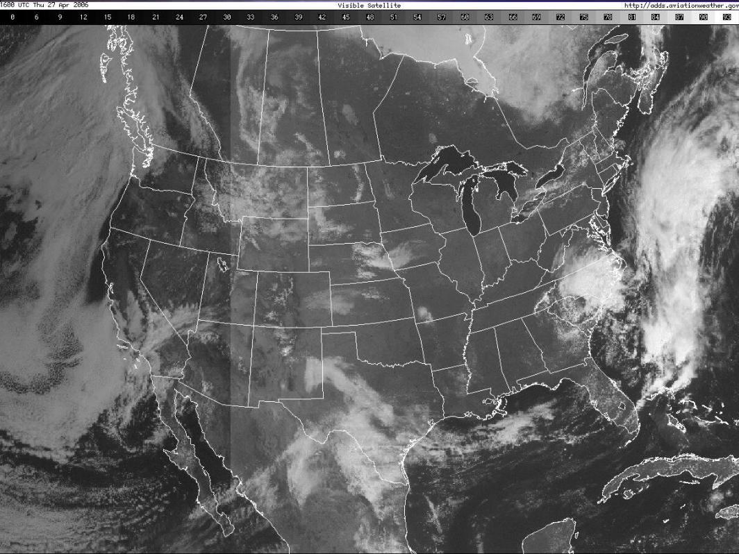
Mountain Waves on Visible Satellite ImageryMountain Waves on Visible Satellite Imagery
NWS

Thermal and MechanicalThermal and Mechanical
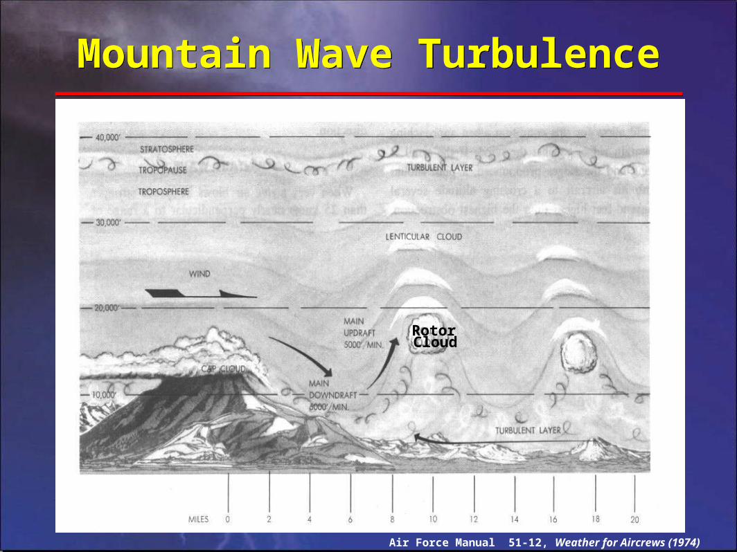
Mountain Wave TurbulenceMountain Wave Turbulence
Air Force Manual 51-12, Weather for Aircrews (1974)
RotorCloud

Visible Sign of Mountain WaveVisible Sign of Mountain Wave
NWS

Visible Sign of Mountain WaveVisible Sign of Mountain Wave
NWS
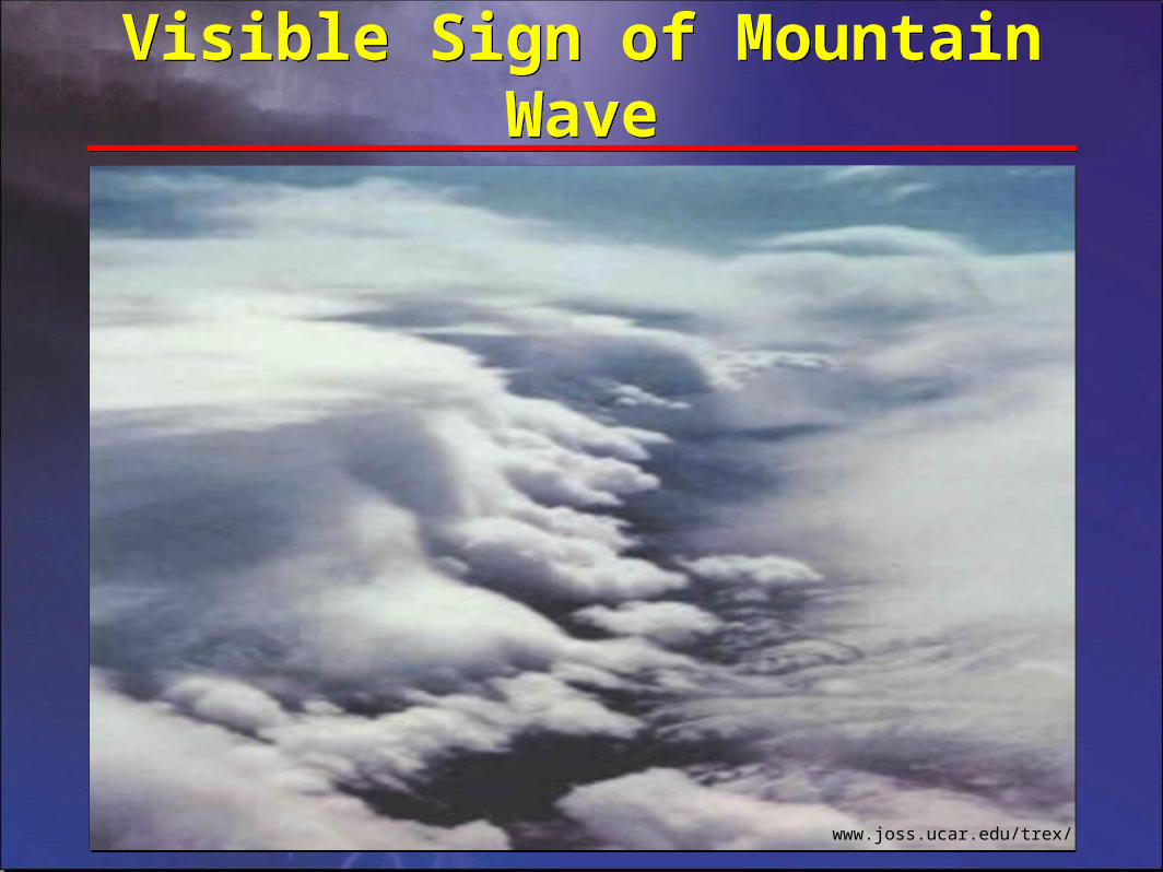
www.joss.ucar.edu/trex/
Visible Sign of Mountain WaveVisible Sign of Mountain Wave
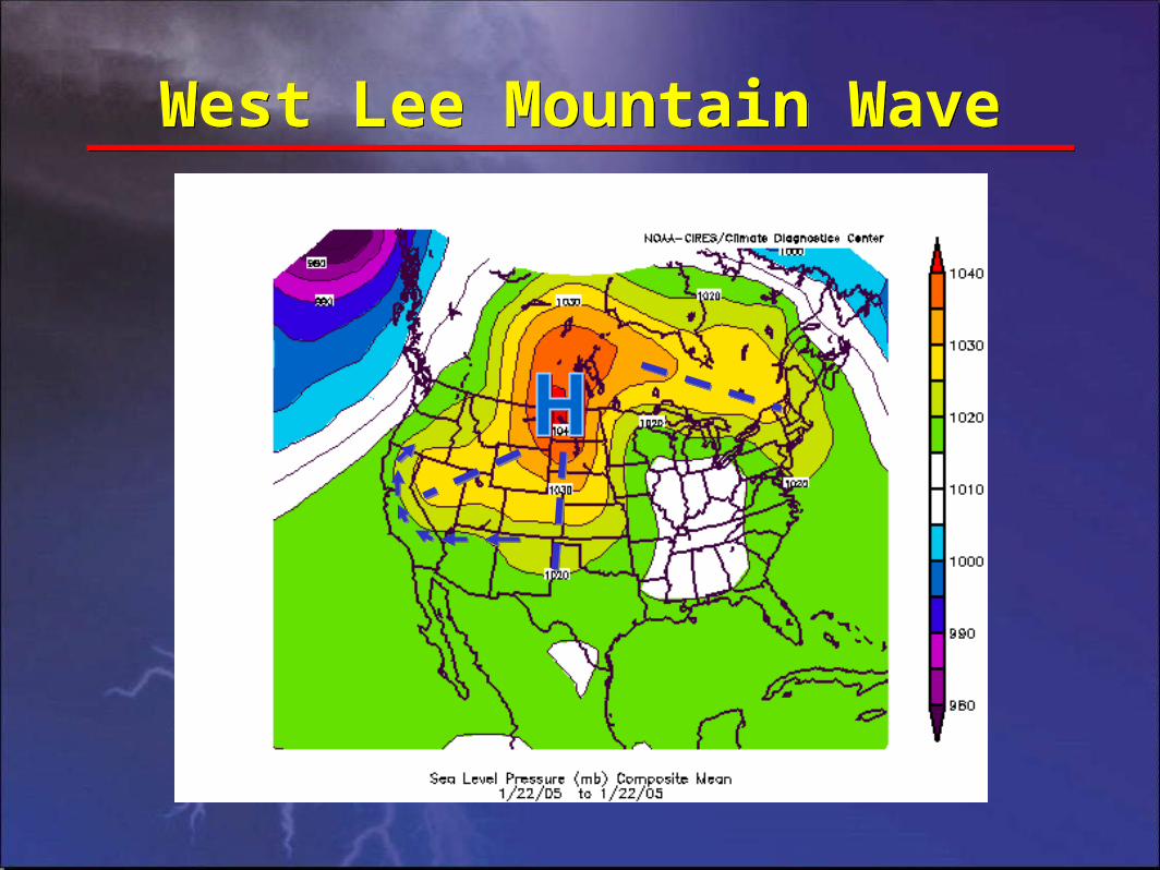
West Lee Mountain WaveWest Lee Mountain Wave

East Lee Mountain WaveEast Lee Mountain Wave

“Jet stream” vs. “Jet”“Jet stream” vs. “Jet”
• “Jet stream” is typically a narrow stream of wind that exceeds 50 knots, and is concentrated in the high troposphere (~FL340)
• “Jet” is a contraction for jet stream, but is commonly used to describe a relatively strong stream of winds from any direction and at any level (i.e. “southerly low level jet”)

High Altitude TurbulenceHigh Altitude Turbulence
Air Force Handbook 11-203 (Vol. 1) , Weather for Aircrews (1997)
TROPOPAUSETROPOPAUSE
JJ
J = Jet CoreJ = Jet Core
NORTHNORTH

Mountain Obscurations & IcingMountain Obscurations & Icing
0oC0oC
Jeppesen Sanderson Training ProductsJeppesen Sanderson Training Products


IcingIcing
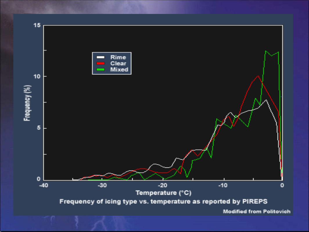
Clear Ice Rime Ice Mixed Ice

NASA – Lewis Research CenterNASA – Lewis Research Center


Freezing RainFreezing Rain
NASANASA

Areas of ZR/ZLAreas of ZR/ZL


IcingIcing
The COMET ProgramThe COMET Program
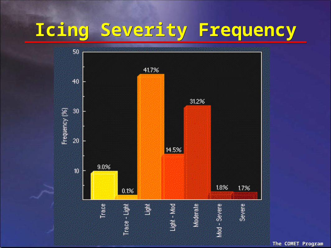
Icing Severity FrequencyIcing Severity Frequency
The COMET ProgramThe COMET Program


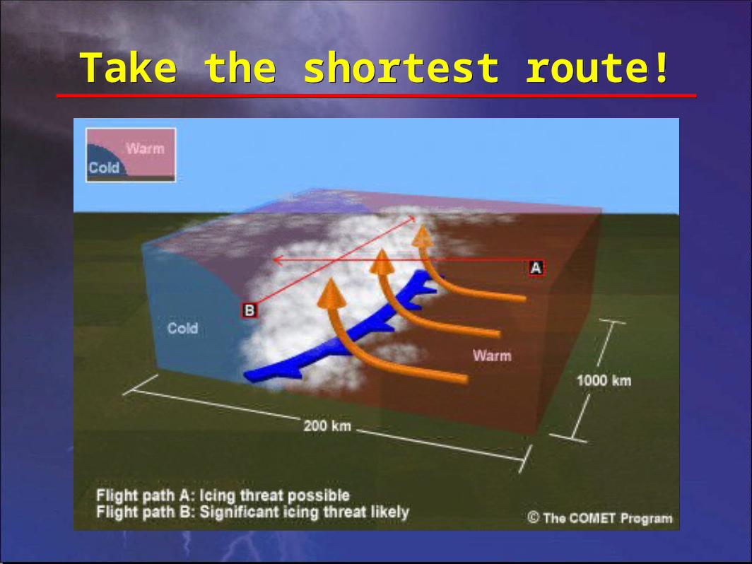
Take the shortest route!Take the shortest route!


Where is the main icing concern?Where is the main icing concern?
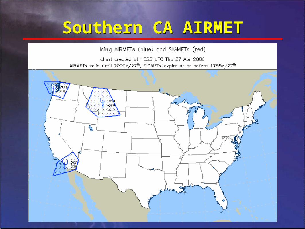
Southern CA AIRMETSouthern CA AIRMET

Collaborative ConvectiveForecast Product
Collaborative ConvectiveForecast Product
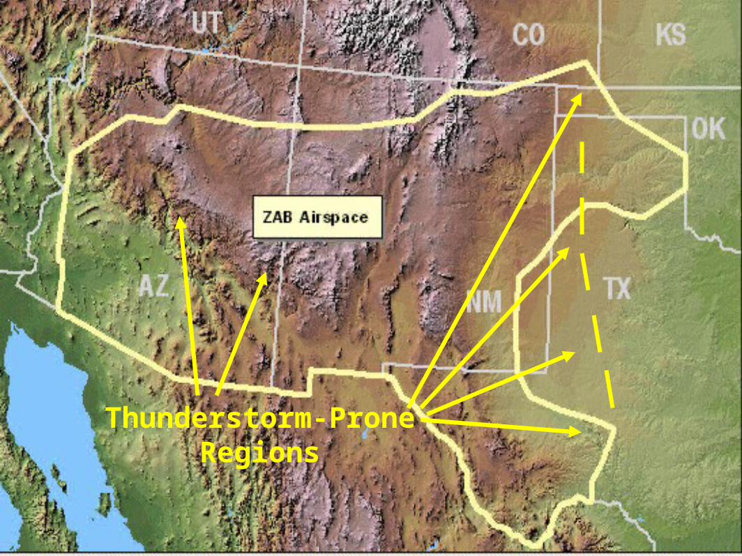
Thunderstorm-Prone Regions

Center Weather AdvisoryCenter Weather Advisory
ZAB1 CWA 292047
ZAB CWA 102 VALID UNTIL 292245
FROM 70N SJN TO ABQ TO 30S SJN TO INW TO 70W SJN
AREA OF ISOL SEV TURB BLW 140 WITH SW SFC WNDS
25-35 KTS WITH GUSTS 40-50KTS POSS.
ZAB1 CWA 292047
ZAB CWA 102 VALID UNTIL 292245
FROM 70N SJN TO ABQ TO 30S SJN TO INW TO 70W SJN
AREA OF ISOL SEV TURB BLW 140 WITH SW SFC WNDS
25-35 KTS WITH GUSTS 40-50KTS POSS.

Internet Resources for AviatorsInternet Resources for Aviators• Aviation Digital Data Service
– AIRMETs, SIGMETs, TURBC, ICG, PIREPs, flight-level winds, and more
– http://www.aviationweather.gov/
• RIDGE-Radar loops and overlays
– Warnings, topography, cities, counties, highways, rivers
– http://www.srh.noaa.gov/ridge/
• National Digital Forecast Database
– Graphical weather forecasts out 7 days
– http://www.weather.gov/forecasts/graphical/sectors/southrockies.php
• Hourly Weather Graph
– Graphs of hourly temperature, wind, RH precipitation, and more at a point location
– http://www.srh.noaa.gov/abq
• Cell phone and PDA weather
– Free 7-day forecasts, warnings, radar, satellite, TAFs/TWEBs, METARS, and more
– http://mobile.srh.weather.gov

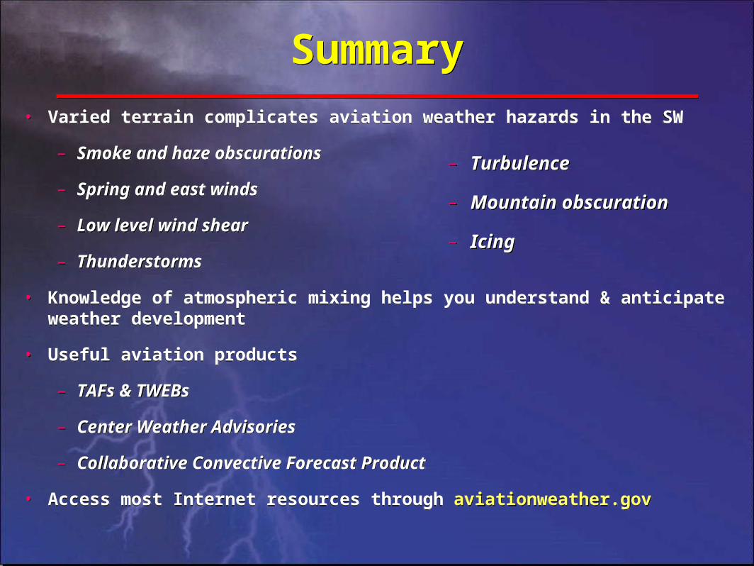
SummarySummary
• Varied terrain complicates aviation weather hazards in the SW
– Smoke and haze obscurations
– Spring and east winds
– Low level wind shear
– Thunderstorms
• Knowledge of atmospheric mixing helps you anticipate weather development and its impact on your operations
• Useful aviation products
– TAFs & TWEBs
– Center Weather Advisories
– Collaborative Convective Forecast Product
• Access most Internet resources through aviationweather.gov
– Turbulence
– Mountain obscuration
– Icing
– Turbulence
– Mountain obscuration
– Icing

Questions?Questions?
Aviation Weather Hazardsin the
Southwest
Aviation Weather Hazardsin the
Southwest
David Craft
NWS Albuquerque
David Craft
NWS Albuquerque
Gregory Harris
ZAB CWSU
Gregory Harris
ZAB CWSU

To access a convective forecast click here

To access a convective forecast click here


To access CWSU products click here
Now we’re back at the Convection Page

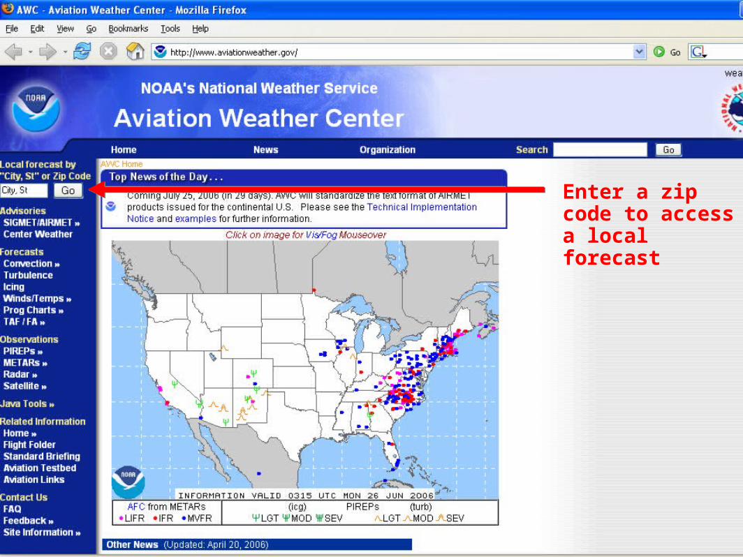
Enter a zip code to access a local forecast

Scroll down to access:
1. Ridge-Radar with overlays
2. Graphical forecasts
3. Hourly weather graph

To access RIDGE-Radar with overlays:
Double click this radar image
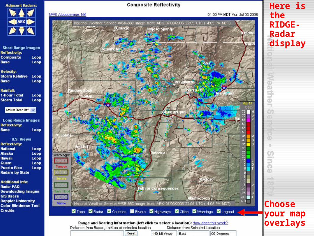
Here is the RIDGE-Radar display
Choose your map overlays
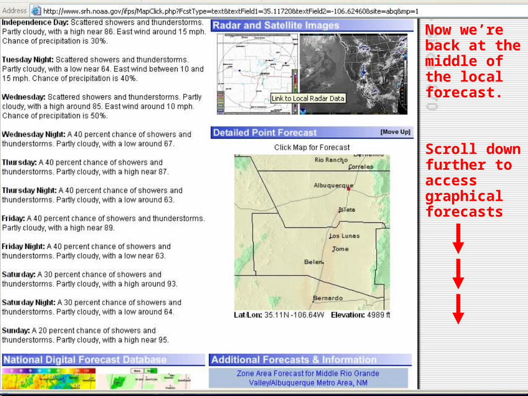
Now we’re back at the middle of the local forecast.
Scroll down further to access graphical forecasts

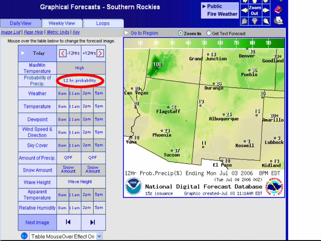
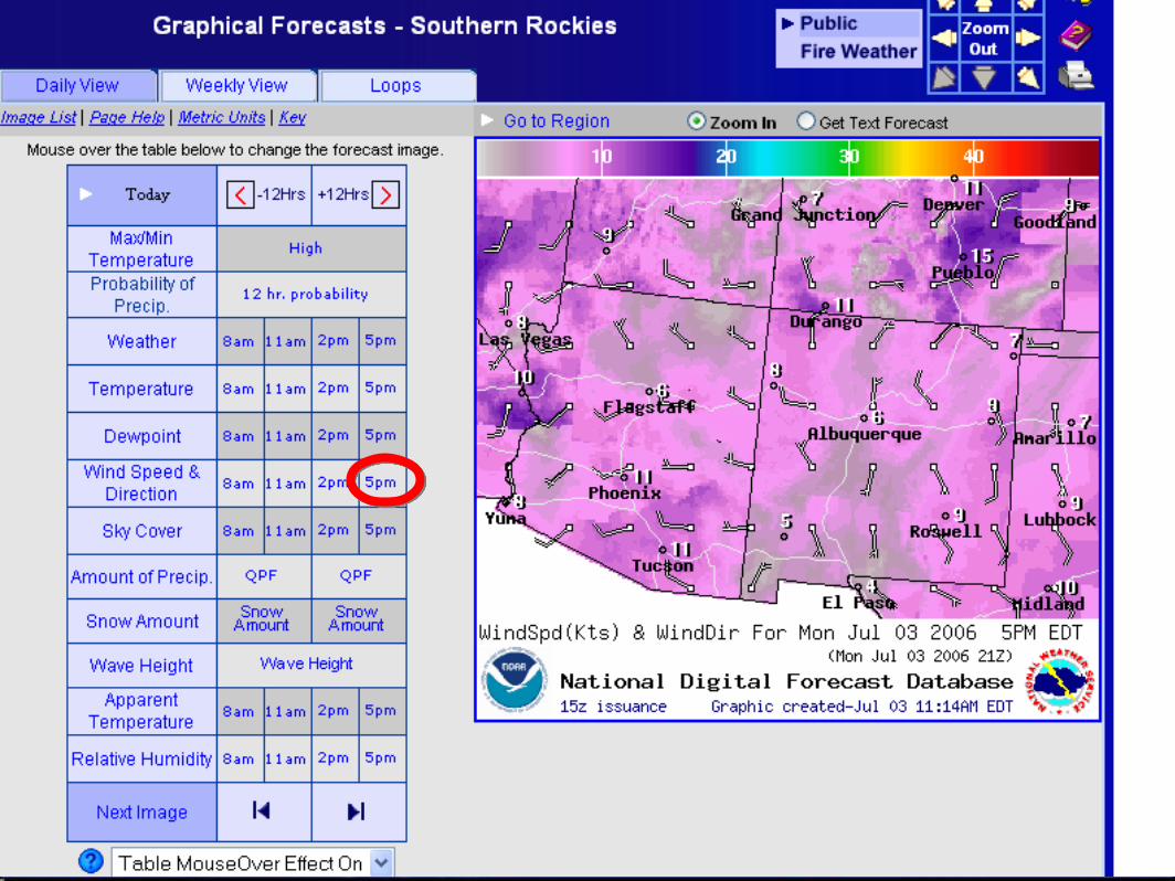
To access graphical forecasts:
Double click either of these images

Wave cursor over “High” to view this high temperature map
Use red arrows to move forward or backward in time
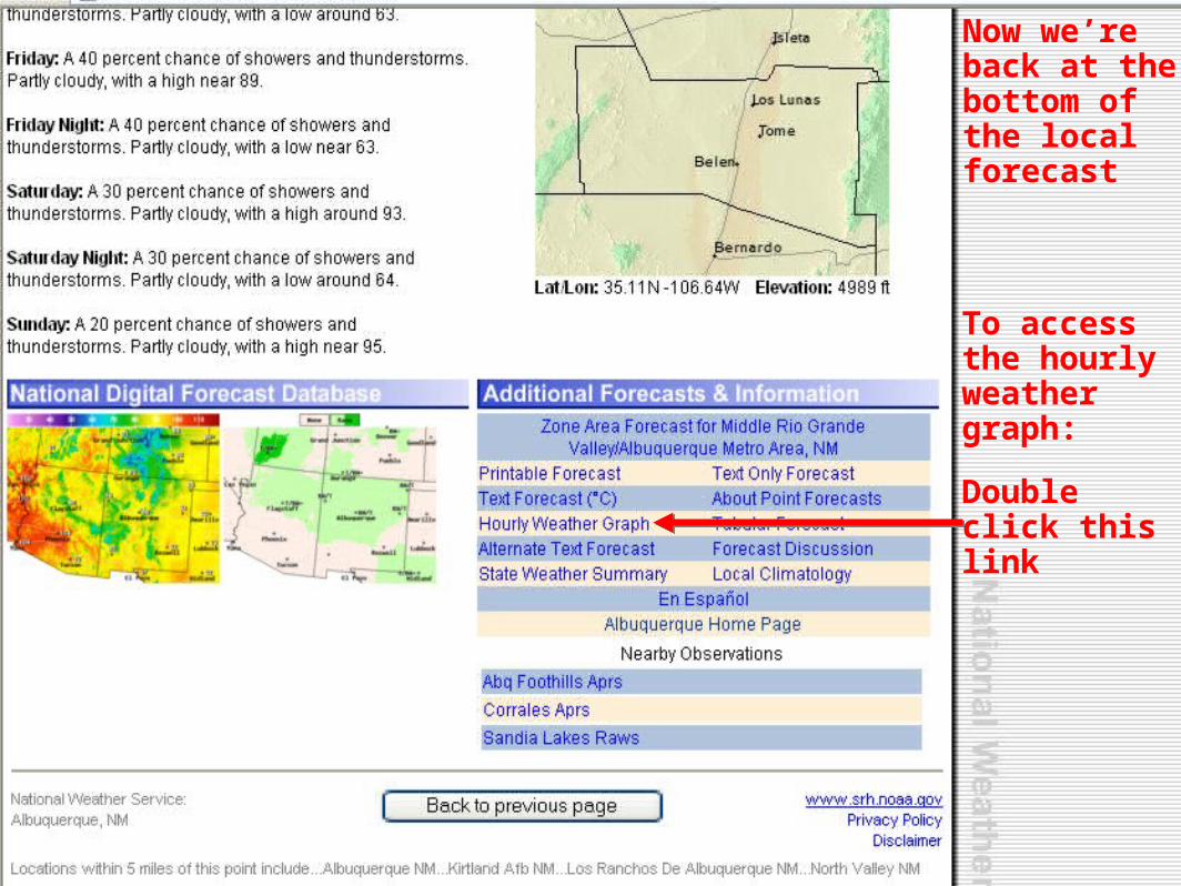
To access the hourly weather graph:
Double click this link
Now we’re back at the bottom of the local forecast

Select your parameters of interest and hit ‘Submit’

Cell phone and PDA weather:
http://mobile.srh.weather.gov
Top half of the screen

Bottom half of the screen
SummarySummary
• Varied terrain complicates aviation weather hazards in the SW
– Smoke and haze obscurations
– Spring and east winds
– Low level wind shear
– Thunderstorms
• Knowledge of atmospheric mixing helps you understand & anticipate weather development
• Useful aviation products
– TAFs & TWEBs
– Center Weather Advisories
– Collaborative Convective Forecast Product
• Access most Internet resources through aviationweather.gov
– Turbulence
– Mountain obscuration
– Icing
– Turbulence
– Mountain obscuration
– Icing

Questions?Questions?
Aviation Weather Hazardsin the
Southwest
Aviation Weather Hazardsin the
Southwest
David Craft
NWS Albuquerque
David Craft
NWS Albuquerque
Gregory Harris
ZAB CWSU
Gregory Harris
ZAB CWSU


![Aviation Data Mining - GitHub Pages · Classifying Aviation Incident Reports I. Persing and V. Ng. 2009 [6] Aviation Data Mining David Pagels Background Methods Multiple Kernel Learning](https://img.dokumen.tips/doc/110x75/5eaab6604619407f87253557/aviation-data-mining-github-pages-classifying-aviation-incident-reports-i-persing.jpg)