Embed Size (px)
Citation preview

Corporate GIS Team
Automated Data Capture (ADC) Tool
Jeffrey Van Etten, GIS Manager

Corporate GIS Team
ADC - Caveats
• The following is subject to change without warning
• We are currently testing in Alpha release
• Changes are being made daily

Corporate GIS Team
ADC
• What did you do this weekend?
•I managed to do the following:–Went out walking–Had a few drinks–Created over 75,000 BLPUs

Corporate GIS Team
Environment
• Northgate BS7666 (DTF 7.3) LLPG
• Cadcorp SIS – Corporate GIS
• Oracle 10G – Corporate Spatial Database
Constraints we operate:
• No Middleware
• Must use SDO_Geometry
• All spatial data stored in Oracle

Corporate GIS Team
Past Experience
• Lead a BLPU data capture exercise
• 5 GIS contractors
• 3+ months
• Cost over £25,000
• No metrics or confidence values produced
Corporate GIS Team
Requirements
A tool to do the following
• Help Borough of Poole capture BLPUs
• Store BLPUs in Oracle 10G
• Help capture and update BLPUs whenever a COU is applied from OS
• Identify TOIDs and their version for BLPUs when captured

Corporate GIS Team
ADC Screen Shot
Address seeds from LLPG (Oracle 9i)
OS Mastermap Topography (Oracle 10G)
Corporate GIS Team
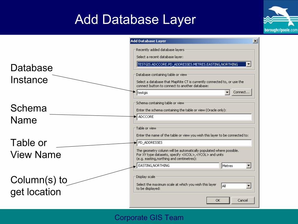
Add Database Layer
Database Instance
Schema Name
Table or View Name
Column(s) to get location

Corporate GIS Team
Generate BLPUs
Table in Oracle to create/add BLPUs
Mastermap columns
Address seeds from LLPG

Corporate GIS Team
BLPUs
Corporate GIS Team
Methods
Different ways to create BLPUs
• By Islands
• By Areas
• All Addresses

Corporate GIS Team
Islands
12
3
4
5
67
8
Corporate GIS Team
Advantages
• Speed to create BLPUs
• Update BLPUs from Mastermap COUs
• Edit BLPUs
• Confidence metrics to assist in Quality Control procedures
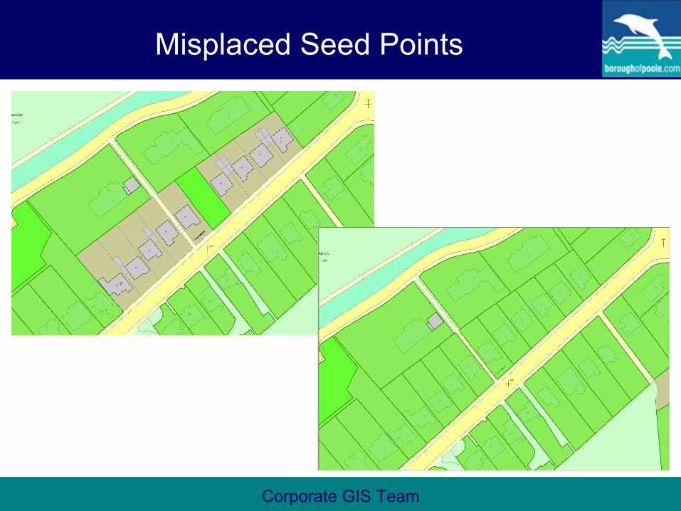
• Identification of misplaced seed points
Corporate GIS Team
Misplaced Seed Points
Corporate GIS Team
Some Early Stats
• Creates between 3-5 BLPUs per second
• Overall confidence is relatively high
• Upon closer inspection, most information is correct

Corporate GIS Team
Questions
Jeffrey Van Etten
GIS Manager
Borough of Poole
01202 633290