Embed Size (px)
Citation preview

Asian Landscapes
The Geography of Select Nations of South, East, and Southeast
Asia

China

Physical Map of China

•China is the second largest country in Asia and is located in east Asia
•China is bordered by numerous countries including India, Russia, Nepal, and North Korea
•China has a variety of climate zones including highland, desert, tropical, and continental
•Major geographical features include the Himalayas, the Tibetan Plateau, the Huang He and Chang Jiang Rivers, and the Gobi Desert
•Natural resources include coal, uranium, rare Earth elements, and a variety of minerals
•The North China Plain, home to the majority of China’s people, is a large fertile area located between the Huang He and Chang Jiang Rivers

The Chinese Island of Macau Gobi Desert

Beach on the island of Macau

Tibetan Plateau

Chang Jiang River

North China Plain


South China Sea
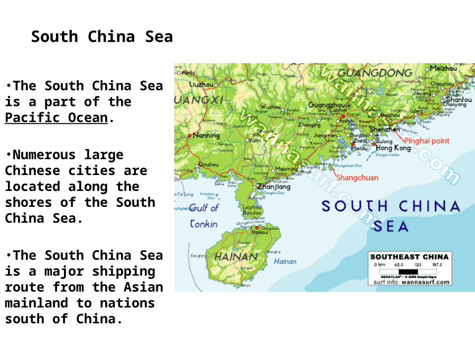
South China Sea
•The South China Sea is a part of the Pacific Ocean.
•Numerous large Chinese cities are located along the shores of the South China Sea.
•The South China Sea is a major shipping route from the Asian mainland to nations south of China.


Yellow Sea

Yellow Sea •The Yellow Sea is part of the Pacific Ocean.
•The majority of the sea is located between China and the Korean peninsula.
•The sea is a major shipping route for ships carrying cargo from Chinese and South Korean businesses.


Gobi Desert

Gobi Desert
•The Gobi Desert is located in southern Mongolia and northern China.
•One of the largest deserts in the world and the largest desert in Asia.
•Majority of the desert is bare rock and not sand.
•The desert is named for the Mongolian word gobi which means “waterless place”.


India

Physical Map of India

•India is a large country in south Asia
•India shares a border with China, Burma, Bhutan, Pakistan, Nepal, and Bangladesh
•India has a variety of climate zones including tropical, highland, and continental
•Major geographical features include the Ganges River, the Ganges River Valley, and the Hindu Kush and Himalayan Mountain Ranges
•Natural resources include coal, diamonds, natural gas, and a variety of minerals
•The majority of India’s people live along the Ganges River and the coastlines
Ganges River

Bay of Bengal

Bay of Bengal
•The Bay of Bengal is part of the Indian Ocean and is bordered by Sri Lanka, India, Bangladesh, Myanmar, and Malaysia.
•Numerous long rivers including the Ganges and Brahmaputra empty into the Bay of Bengal.
•The Bay of Bengal is major transportation route for shipping and many major cities are located along its shores.


Deccan Plateau Beach on the Arabian Sea

The Hindu Kush Mountains


Himalayas

Himalayas•The Himalayas are a mountain system that is located in China, India, Nepal, Tibet, and Bhutan.
•The majority of the world’s tallest mountains, including Mt. Everest, are a part of the Himalayan range.
•Over 100 peaks with elevations over 24,000 feet are a part of the Himalayas.
•Melting snow from the range’s mountains is the source for numerous Asian rivers including the Ganges, Indus, and Brahmaputra.

Mt. Everest

Mt. Everest •Mt. Everest is a part of the Himalayas.
•The mountain is located on the border of Nepal and Tibet (China).
•At 29,035 feet, it is the world’s tallest mountain.
•Due to plate tectonics, Mt. Everest grows a few millimeters every year.
•Thousands of people have attempted to climb Mt. Everest. The first to successful ascent was made in 1953. Hundreds of people have died attempting to climb Mt. Everest.

Mt. Everest Climbing route up Mt. Everest.

Thar Desert

Pakistan

Physical Map of Pakistan

•Pakistan is located in south Asia
•Pakistan shares a border with India, Afghanistan, China, and Iran
•Climates zones include desert, highland, and continental
•Major geographical features include the Hindu Kush Mountains, the Indus River, and the Indus River Valley
•Natural resources include petroleum, natural gas, coal, and variety of minerals
•The majority of Pakistan’s people live along the Indus River and in the Indus River Valley
Indus River

View of Indus River Valley from Space Indus River Valley

K2---Second Tallest Mountain in the World

Vietnam

Physical Map of Vietnam

•Vietnam is located in southeast Asia
•Vietnam is bordered by China, Laos, and Cambodia
•The majority of Vietnam has a tropical climate
•Major geographical features include the Mekong River and tropical rain forests
•Natural resources include a variety of minerals, fossil fuels, timber, and hydroelectric power
Mekong River Valley

Danang River Valley The mouth of the Mekong River


Japan

Physical Map of Japan

•Japan is an archipelago, a group of island, located in east Asia.
•The majority of Japan is covered by mountains and rugged terrain
•Japan’s climate zones include tropical and continental
•Major geographical features include Mount Fuji, the tallest mountain in Japan
•Natural resources are limited making Japan one of the world’s largest importers of fossil fuels and food
Japanese Alps
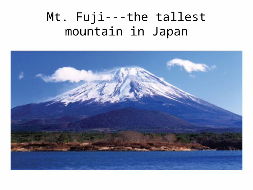
Mt. Fuji---the tallest mountain in Japan

Mt. Fuji Tone River
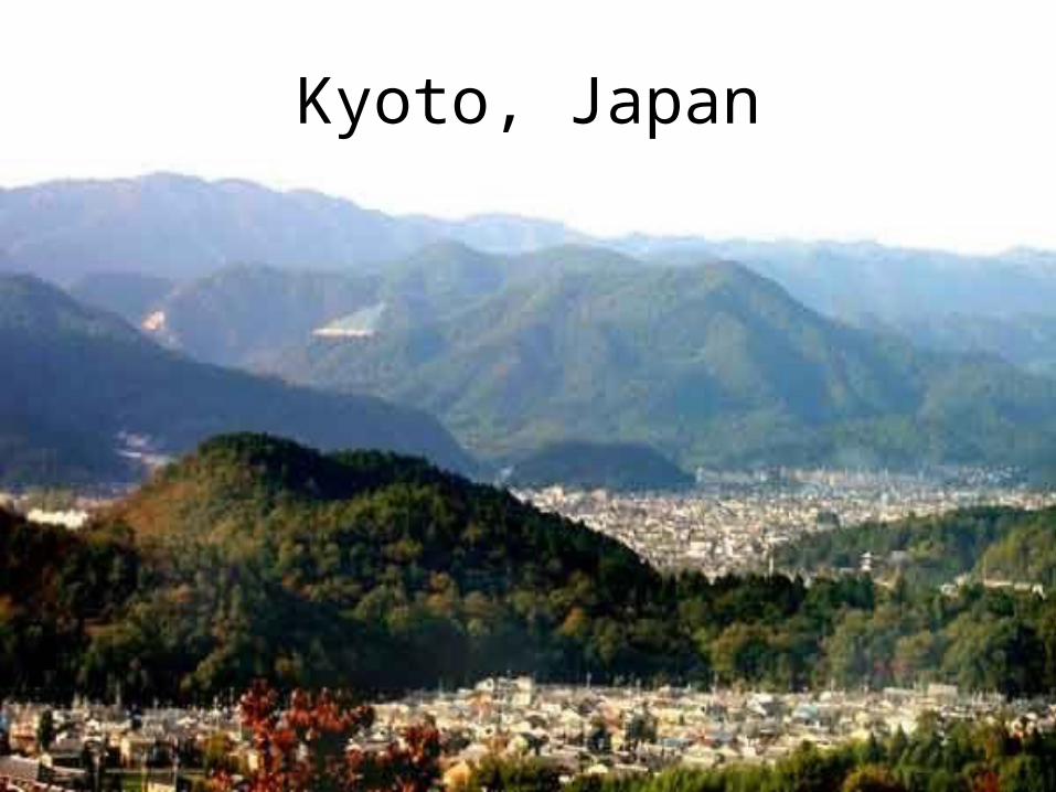
Kyoto, Japan

Sea of Japan


North Korea

Physical Map of North Korea

•North Korea is part of the Korean peninsula in east Asia
•North Korea is bordered by South Korea and China
•The majority of North Korea has a continental climate and is covered by hills and mountains
•North Korea has a variety of resources including coal, gold, hydroelectric power, and a variety of minerals

Mountains in North Korea along the border with South Korea

South Korea

Physical Map of South Korea

•South Korea is part of the Korean peninsula in east Asia
•South Korea is bordered by North Korea
•South Korea has a continental climate
•South Korea’s landscape includes mountains, hills, and coastal plains
•Natural resources include coal, hydroelectric power, and various minerals

Indonesia

Physical Map of Indonesia

•Indonesia is an archipelago in southeast Asia
•Indonesia is bordered by Malaysia and the Pacific and Indian Oceans
•Indonesia has tropical, continental, and highland climate zones
•The majority of Indonesia is covered by tropical rain forests, mountains, and volcanoes
•Natural resources include petroleum, natural gas, minerals, and timber

Tropical Rain Forest in Indonesia

Volcanoes in Indonesia
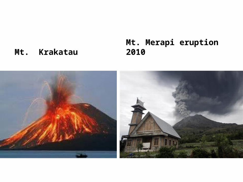
Mt. Krakatau Mt. Merapi eruption 2010