Embed Size (px)
Citation preview
i
ARKEOLOGI I NORR 10

i
ARKEOLOGI I NORR 10
UMEÅ UNIVERSITETInstitutionen för arkeologioch samiska studier
UMEÅ UNIVERSITYDepartment of Archaeology
and Sámi Studies
ii
ISSN 0284-558xTryck:Orginal, Umeå2007
Utgivare och distribution:Institutionen för arkeologi och samiska studier, Umeå universitetSE-901 87 Umeå, Sverige
Redaktör :Per H. Ramqvistepost: [email protected]
Grafisk form, lay-out och omslag:Per H. Ramqvist
Engelsk språkgranskning (ej Bergman och Loeffler):Sees-editing Ltd, UK.
Tryckt med bidrag från Vetenskapsrådet
Omslagsbild:Utlopp i sjö - där världar och resurser möttes.
iii
Innehåll
Per H. RamqvistFörord ........................................................................................................ v
Ingela Bergman Vessels and kettles.Socio-economic implications of the cessationof asbestos pottery in Northern Sweden ............................................. 1
Mirja Miettinen Fynd av senneolitiskasbestkeramik i Sydösterbotten ............................................................ 17
Asgeir Svestad ”Folk er vanligvis ikkesærlig villige til å snakke om de døde”.Synspunkter på materialitet og samisk gravskikk .............................. 41
Anders Huggert Fem vapenbilder ochdessutom en heraldisk örn i Mörtträsk-fyndet .................................. 77
Berit Andersson & Erik SandénEn boplatsvall från äldre järnålder i Torrböle,Nordmaling sn, Västerbotten ............................................................... 93
Lennart Klang Fattenborg somfornlämningsmiljö och forskningsobjekt .......................................... 105
David Loeffler Archaeological surveys- a few reflections. As exemplified by featuresand finds from Lake Hångstaörn, Medelpad ................................... 137
Per H. Ramqvist Fem Norrland.Om norrländska regioner och deras interaktion ............................. 153
137
Archaeological surveys
IntroductionArchaeological surveys are biased. Limited monetary resources onlycircumscribe the scope and duration of any one project. In the bestof cases, what is actually singled out and targeted for documentationis a reflection of the survey's explicit archaeological and/or antiquarianobjectives. If ill-defined, then other and unquestioned presumptionsand expectations concerning the what and where of ancient remainswill guide the attention of those participating in the survey. It is thislatter situation that is of interest here, the recursive interdependencebetween expectations, results and interpretations. This is exemplifiedby the six surveys undertaken around Hångstaörn, a lake which see-med to merit little attention, situated far from those areas traditionallyconsidered to be cultural hubs, both past and present.
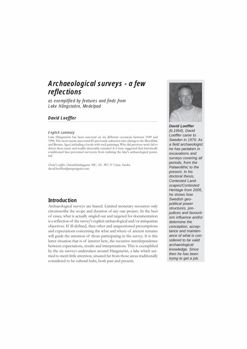
David Loeffler(b.1954), DavidLoeffler came toSweden in 1970. Asa field archaeologisthe has partaken inexcavations andsurveys covering allperiods, from thePalaeolithic to thepresent. In hisdoctoral thesis,Contested Land-scapes/ContestedHeritage from 2005,he shows howSwedish geo-political powerstructures, pre-judices and favourit-ism influence and/ordetermine theconception, accep-tance and mainten-ance of what is con-sidered to be validarchaeologicalknowledge. Sincethen he has beentrying to get a job.
Archaeological surveys - a fewreflections
David Loeffler
as exemplified by features and finds fromLake Hångstaörn, Medelpad
English summaryLake Hångstaörn has been surveyed on six different occasions between 1949 and1996. The most recent uncovered 81 previously unknown sites (dating to the Mesolithicand Bronze Ages) including a locale with rock paintings. Why did previous work fail todetect these many and readily detectable remains? It is here suggested that historicallyconditioned bias prevented surveyors from realising the lake's archaeological poten-tial.
David Loeffler, Häradshövdingegatan 30C, SE- 903 31 Umeå, [email protected]
138
David Loeffler
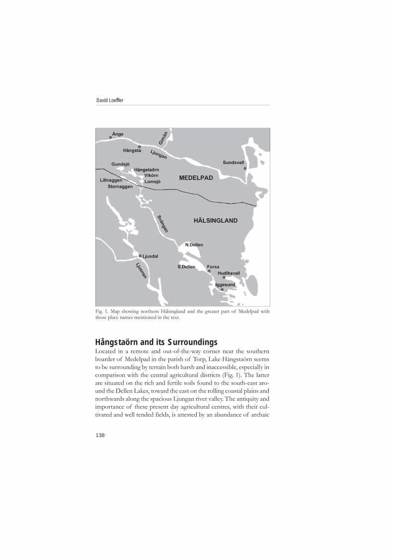
Hångstaörn and its SurroundingsLocated in a remote and out-of-the-way corner near the southernboarder of Medelpad in the parish of Torp, Lake Hångstaörn seemsto be surrounding by terrain both harsh and inaccessible, especially incomparison with the central agricultural districts (Fig. 1). The latterare situated on the rich and fertile soils found to the south-east aro-und the Dellen Lakes, toward the east on the rolling coastal plains andnorthwards along the spacious Ljungan river valley. The antiquity andimportance of these present day agricultural centres, with their cul-tivated and well tended fields, is attested by an abundance of archaic
Fig. 1. Map showing northern Hälsingland and the greater part of Medelpad withthose place names mentioned in the text.
139
Archaeological surveys
place names, earthen grave mounds, house foundations, fortifiedheights and rune stones, all of which date to different periods of theIron Age (Selinge 1979; Liedgren 1992; Ramqvist 1992:22pp). In con-trast, the narrow and stony shores of Hångstaörn are encircled bysteep and rugged hills covered by forests interspersed by wet boggytracts. The prevailing atmosphere of emptiness that hangs over thelake is enhanced by the remains of a few and long abandoned croftercottages edged around by meagre clearings, most of which have alreadybeen reclaimed by the forest.
Toponomy reveals that the suffix -örn is a corruption of the wordören which means ”angular or coarse gravel” (pers. com. Edlund2006). Hångsta is an agricultural village located on the southern slopesof the Ljungan river valley, a community that might well hark back tothe Iron Age as indicated by its -sta suffix (Selinge 1977:405; Ram-qvist 1992:22pp). Thus ”Hångsta's gravel deposit” is a name that couldbe understood as one further confirmation of Hångstaörn's peripheralposition. The appellation is, in either case, a fitting description of theQuaternary till that blankets the surrounding area, which consistsmainly of gravel, in places intermingled with sand, but more oftenwith stones and boulders, both small and large (Lundqvist 1987).
About 5 km long (NW-SE) and 1.5 km wide, Hångstaörn is a Y-shaped lake which, together with five others of comparable size,constitutes the main sources of the Svåga river (known by other namesin both its upper and lower regions). This minor river system is onlyabout 110 km long, which after leaving Medelpad transverses northernHälsingland in a south-easterly direction. On the first half of its jour-ney to the Baltic sea it passes regions sparsely inhabited. This changesas it reaches the Dellan lakes and coastal plains, both characterised byrich agricultural lands that have been continuously cultivated since c.400 BC (Liedgren 1992).
Hångstaörn SurveyedHångstaörn has been surveyed on six different occasions within thelast five decades. Plans to harness the lake's waters for the productionof hydro-electric power initiated the first survey, a one day affair thatwas carried out by Ingemar Atterman from the Regional Antiquarian
140
David Loeffler
Society of Medelpad in September of 1949. Similar investigations forsimilar reasons had been undertaken by personal from the CentralBoard of National Antiquities/Riksantikvarieämbetet (RAÄ), or theirrepresentatives, since 1942, work which had clearly demonstrated thatsites of Stone Age character did occur in Norrland. Atterman, whoconducted his search from a motorboat, especially targeted the sandystretches of the shoreline, deposits deemed most likely to harbourancient remains. Despite this, only one feature was recorded, a collec-tion of stones on the small island of Offerholmen (offer = sacrifice/victim, holm = islet) which, according to local legend, is the grave ofHångstaörn's first homesteader (Letter D.nr. 728/49; 2033/49; 4725/49).
Harald Hvarfner, while conducting a salvage survey for the RAÄalong the Ljungan river, visited lakes Hångstaörn and Lillnaggen inOctober 1956, but this did not result in the discovery of any new sites(Letter D.nr. 5817/57; F5817/57).
Hångstaörn was revisited in 1966, this time in connection with theRAÄ's ”first or prehistoric survey” which, in Medelpad, was rapidlyconcluded during three consecutive seasons starting in 1964. StoneAge sites were not then recorded, the result of a bureaucratic decisionthat only sanctioned the documentation of features which exhibitedperceptible remains on or above the surface of the ground. As far asHångstaörn is concerned, nothing new was noted nor documented.
The RAÄ returned to the parish of Torp in 1992 and 1993, duringwhich time 7, and then 3, Stone Age sites were registered along theshores of Hångstaörn. Their belated discovery and documentationwas the result of a much needed change of policy that had occurredin the interval between the end of the ”first survey” and beginning ofthis ”second, revised or cultural-historical survey”.
ReflectionsEven though Stone Age sites were systematically registered duringthe second cultural-historical survey, surveying strategies remainedbasically unaltered, being conducted in accordance with the prescribedand sanctioned ”ocular technique” which has been in use since thelate 1930's. Test pitting, despite successful exceptions to the contrary,
141
Archaeological surveys
was considered a hindrance and thus not officially encouraged(Meschke 1977:15pp; Loeffler 1999a:73pp). The ocular method isadequate when features are visible on or above the surface of theground. However, Stone Age sites are generally inconspicuous.Reconnaissance, when deprived of artificial aids, is severely restrictedto those few areas were the ground vegetation has been removed eitherby human or natural means (Loeffler 1999a:70). Needless to say, thisdoes not conveniently occur on a regular bases in coherence withthese sites, and when it does, is seldom to their advantage.Consequently, the ocular technique automatically favours the discoveryand documentation of ”highly visible” remains. Thus it is hardlysurprising that pre-historic graves and other readily perceptible features,either pre-historic or historic, located on, in or near the centralagricultural districts constitute the majority of features that have beenregistered (S. Jönsson 1985; Flink 1990; B. Jönsson 1991; Loeffler1999a:77). Features located further afield, such as hunting pits andiron-working sites, have traditionally been considered to be an exten-sion of, or to have arisen in response to, the needs and activities issuingfrom within the central farming communities (Selinge 1973;1977:399pp; 1979). In this light, the area around Hångstaörn seemsempty indeed. Even more so when one takes into consideration thefew hundred Stone Age sites recently discovered and documentedalong the Ljungan and Gimån rivers (Loeffler 1992a; 1994; 1999a) orthose found and/or excavated along the coastal areas of Helsinglandand Gästrikland (Holm 2006).
Hångstaörn RevealedFive decades of archaeological research seems to have invariablysubstantiated the marginal status of lake Hångstaörn and itssurroundings. There was no reason to call into question this commonlyaccepted inference, at least as it concerns the Iron Age and subsequentperiods, including our own. And yet, was it feasible to assume thatthis interpretation was equally valid for all proceeding periods, a timespan of some 6000 years? Results from the earlier surveys seemed tosuggest that this was indeed so. Experiences elsewhere have shownthat sites of Stone Age character are often and abundantly located on

142
David Loeffler
sandy sediments, either alluvial, lacustraine, marine or glaciofluvial(see Loeffler 1999 and references). According to available soil maps,Quaternary deposits of this type are entirely lacking in and aroundHångstaörn. In consequence, one would expect that a re-examinationwould not uncover anything of significance, great or small. With thesethoughts in mind we, Lena Frykholm and the author, decided to takea walk and re-survey the lake. We did so on our own time and at ourown expense. The drought summer of 1996 provided the idealopportunity. The surface of the lake had dropped to c 384.5 meters,not quite 2 meters below it's normal level when filled, consequentlyexposing areas above the original shoreline, now devoid of all vegeta-tion after fifty years of inundation and thus completely open toinspection.
Fig. 2. Map showing the 91 sites (dots) and the rock painting (star) situated in andaround lake Hångstaörn, Torp parish, Medelpad. The orginal surface of the lake was379 m.a.s.l. After completion of the damn, its water level was rised by just over 7meters (as depicted here) to 386.20 m.a.s.l.
143
Archaeological surveys
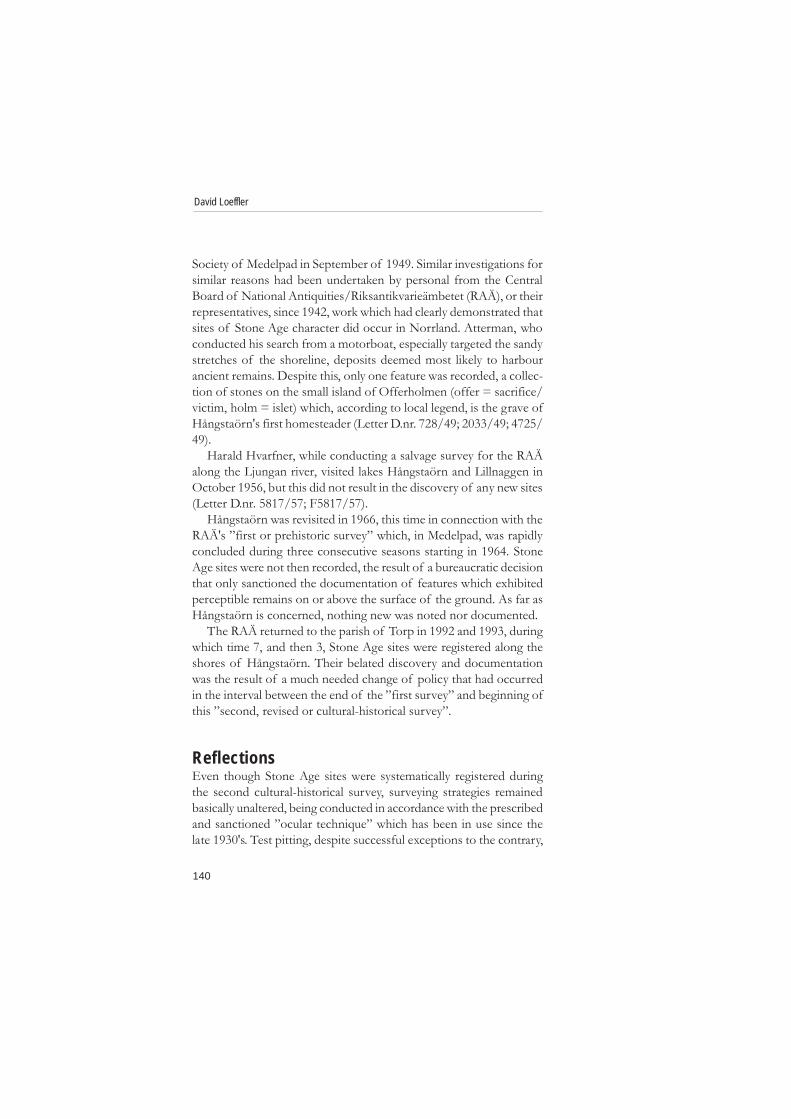
To our surprise, and con-trary to all prior assump-tions or expectations, wediscovered 81 new sites (Fig.2). Prominent features in-cluded hearths, one largesemi-subterranean house,two floor-like areas, three,possibly four, stone settingsand one site with paintedpictographs.
Most of these sites didnot harbour distinguishablefeatures that would havebeen visible on the originalground surface. Some con-sist of little more than a fewfire-cracked stones and/orwaste flakes scattering overa few square meters. Otherscontain an abundance ofrubbish spread out across afairly large area. Assem-blages of both types, whenfound in Norrland, areoften and carelessly referredto as ”sites of Stone Agecharacter”. This is an ill-defined term that conceals a range of unlike remains that date to diffe-rent times stretching over many thousands of years. The use of thislabel imparts more about the plight of research than it does about thesociety that produced these remains. Its use probably conceals a widerange of activities, for example; aggregation camps, base or residentialcamps, transient camps, different types of exploitation or field camps,hunting and fishing stations, kill and/or butchering sites, tool proces-sing sites, sacred and ceremonial sites and/or camps, quarries andcaches for food, equipment or materials (Forsberg 1985:10pp; Bin-
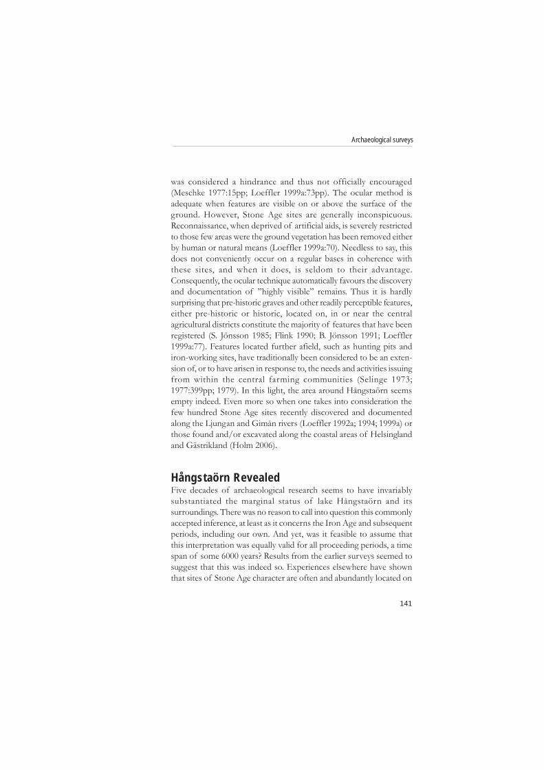
Fig. 3. Our survey, which took us right around thelake, was completed in 14 days during August of1996. This site, c 80 x 20 meters large, lies about 1kilometre east-north-east of the rock painting. Inits western half there are a number of hearths.Lena Frykholm points out a handle core andmicro-blade found close to a loose collection offire-cracked stones, the remains of a hearthdamaged by erosion. Behind her are the remainsof at least another two hearths. This site lies 1-2meters beneith the surface of the lake when it isfilled to capacity. Drawing made from aphotograph by the author.
144
David Loeffler
ford 1988:109pp; Gamble 1989:297pp; Loeffler 1999a:69p). Yet onesuspects that even these functional terms do not do justice to thesocial complexity that created these sites (see for example Strassburg2000).
The hearths occur singly or in clusters throughout the area. Circular,oval or of indeterminable shape, they vary in size from 1-2 meters inlength and 0.5-1 meters in width, consisting of a compact layer offire-cracked stones. Scattered around some of them lie flakes and/orartefacts. Loose aggregations of fire-cracked stones were also noted,most probably the remains of hearths or cooking pits severely afflictedby erosion. (Fig. 3).
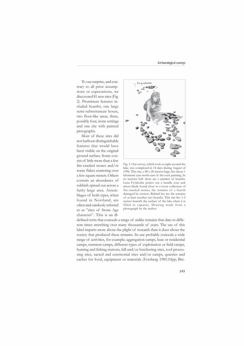
Fig. 4. Lena Frykholm's sharp eye could pick out ancient remains even in the mostdifficult of terrain. To the right of her there appears to be an area 4 x 2 meters in sizethat has, in part, been deliberately cleared of stones. Within this floor-like space thereare two indistinct concentrations of fire-cracked stones, possibly the remains of hearths,now damaged by erosion. When the lake is filled to capacity, this site is covered byabout 2 meters of water. Sketch made from a photograph by the author.
145
Archaeological surveys
The semi-subterranean house is situated on the western shore ofthe lake's northern fork. It appears as an oval or rectangular depres-sion c 7 x 3 meters in size and 0.6 meters deep. It is surrounded on allsides by a c 1 meter wide and 0.1-0.2 meter high embankment. Itsshape, if not its size, is very much like those found near the village ofVuollerim, in the parish of Jokkmokk, that date to about 4000 BCcalibrated (Loeffler 1998, 1999b).
At least two floor-like features were noted. In a region were theground surface abounds in stones and boulders of all sizes, they appearas small spaces relatively free of both, giving the impression that theywere intentionally cleared in order to provide a surface less
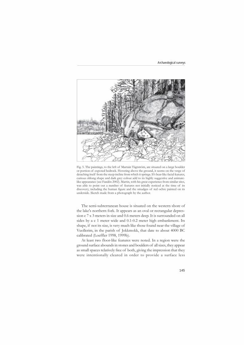
Fig. 5. The paintings, to the left of Martain Tägtström, are situated on a large boulderor portion of exposed bedrock. Hovering above the ground, it seems on the verge ofdetaching itself from the steep incline from which it springs. It's bear-like facial features,curious oblong shape and dark grey colour add to its highly suggestive and animate-like appearance (see Fandén 2002). Martin, with his great experience from similar sites,was able to point out a number of features not initially noticed at the time of itsdiscovery, including the human figure and the smudges of red ochre painted on itsunderside. Sketch made from a photograph by the author.
146
David Loeffler
unencumbered by obstacles (Fig. 4). One is round, 2 meters in diame-ter and the other rectangular, 2 x 4 meters large. Waist flakes andkeeled scrapers, both finished and un-finished, were found in andaround the former. Within the bounds of the latter are what appear tobe the remains of two hearths, each consisting of a loose collectionof fire-cracked stones.
Three, possibly four stone settings or stone setting-like featureswere recorded. The use of this term is problematic in that it is usuallyapplied to a type of grave common to the Bronze and Iron Ages.However, recent work in northern Norrland has revealed that thistype of grave was being built on ”sites of Stone Age character” seventhousand years ago (Liedgren 1994). Three of the four noted here are
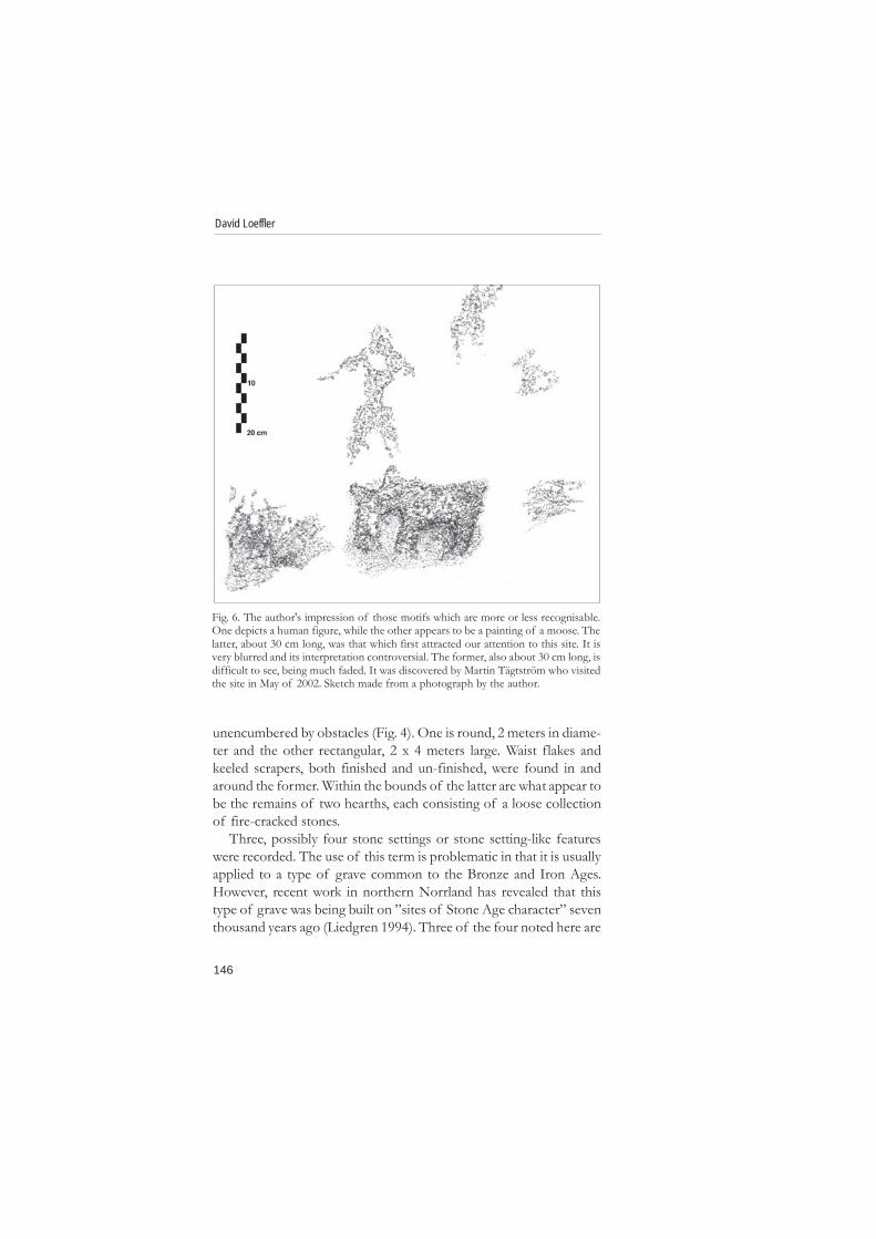
Fig. 6. The author's impression of those motifs which are more or less recognisable.One depicts a human figure, while the other appears to be a painting of a moose. Thelatter, about 30 cm long, was that which first attracted our attention to this site. It isvery blurred and its interpretation controversial. The former, also about 30 cm long, isdifficult to see, being much faded. It was discovered by Martin Tägtström who visitedthe site in May of 2002. Sketch made from a photograph by the author.
147
Archaeological surveys
oval, 2.5-3 meters long, 1.5-2 meters wide and 0.3-0.5 meters highwith a filling consisting of stones 0.1-0.5 meters large. Thus in sizeand shape they are similar to that previously noted on Offerholmen.The forth consists of an oval shaped layer of fire-cracked stones, 1-40 cm large, that covers an area 2.5 x 1 meter in size. This layer ofburnt stones is surround by a 1 meter wide collar or brim of unburntstones that are 1-5 cm large. Whether this is an elaborate hearth orgrave of some unfamiliar kind, or something else altogether, isunknown.
The pictographs are situated on a large boulder, or possibly a por-tion of exposed bedrock, that is about 5 meters long, 2-4 meters wideand 2-4 meters high, that juts out from the side of a steep slope just afew feet above the surface of the lake when filled to capacity (Fig. 5).About 20 patches of red ochre are visible along the bottom edge ofits south-eastern face and on it's underside. The first of these to attractour attention is very indistinct, but would seem to depict a moose.Just above it there is a human figure, very faded, yet much lessunambiguous (Fig. 6). The other paintings are no more than indistinctsmudges, their motif undetermined.
The age of these sites and features is problematic. However, theoccurrence of typologically datable artefacts gives a rough indication.The presence of keeled scrapers, handle cores and micro-blades showthat the area was inhabited during the Mesolithic (up until c 4000 BC).The bi-facial points attest to a human occupancy during the BronzeAge (c 2000-500 BC). The intervening period is only represented byone find, a tanged slate point with small oblique barbs that typologicallybelongs to the Early and Middle Neolithic 4000-2500 BC (Loeffler1992b).
Further ReflectionsWhatever its standing during the last two thousands years, Hångstaörn'smarginal status throughout the proceeding seven thousand years canno longer be assumed. This might prove equally true for other areas,small or large, that are today considered peripheral and thus, by exten-sion, pre-historically insignificant. It would be naive to expect thatsurveyors are immune to this type of historically conditioned bias.The meagre results from previous surveys suggests that they were
148
David Loeffler
not. This in turn casts serious doubts on the reliability of the RAÄ'scatalogue of ancient monuments as a representative source for re-search as concerns these earlier periods in Norrland.
Additional conclusions. It should now be obvious that the ”oculartechnique” is wholly inadequate as concerns the discovery of ”sitesof Stone Age character”. Unless, as in the case of Hångstaörn, wefirst allow them to be largely destroyed before conducting a survey.The only viable alternative is test-pitting, possibly in combination withother prospecting methods whenever feasible. In light of this, theseason during which this work is undertaken, its duration, and thesurveyor's expertise are consequential and must be taken into careful
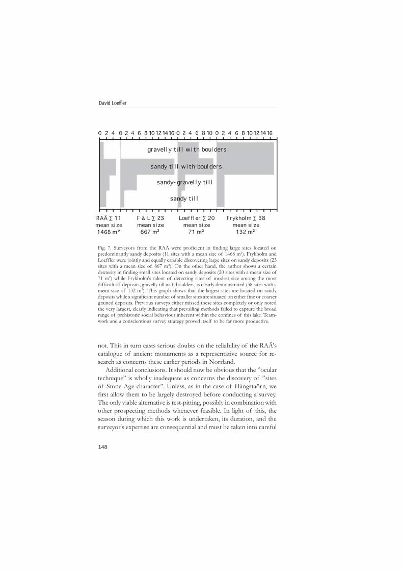
Fig. 7. Surveyors from the RAÄ were proficient in finding large sites located onpredominantly sandy deposits (11 sites with a mean size of 1468 m2). Frykholm andLoeffler were jointly and equally capable discovering large sites on sandy deposits (23sites with a mean size of 867 m2). On the other hand, the author shows a certaindexterity in finding small sites located on sandy deposits (20 sites with a mean size of71 m2) while Frykholm's talent of detecting sites of modest size among the mostdifficult of deposits, gravelly till with boulders, is clearly demonstrated (38 sites with amean size of 132 m2). This graph shows that the largest sites are located on sandydeposits while a significant number of smaller sites are situated on either fine or coarsergrained deposits. Previous surveys either missed these sites completely or only notedthe very largest, clearly indicating that prevailing methods failed to capture the broadrange of prehistoric social behaviour inherent within the confines of this lake. Team-work and a conscientious survey strategy proved itself to be far more productive.
149
Archaeological surveys
consideration (Meschke 1977:17pp). In conduction with this, threefurther points should be noted. The use of the soil-map as a predictiveinstrument as concerns the expected occurrence of sites is useful, butcannot be taken at face value, its diminutive scale circumventsexactitude. The second point encompasses a number of salientparticulars conveniently conveyed by the catch-phase ”four eyes arebetter two” as concerns any and all archaeological surveys (see fig. 7for details). Outwardly trivial, the third and last point is the mostimportant of all; questioning the obvious and/or accepted truths is asessential as searching for new ones.
ReferencesBinford, Lewis R. 1988. In Pursuit of the Past. Decoding the Archaeological Record.
Thames and Hudson. New York.Fandén, Anders 2002. Schamanens berghällar - nya tolkningsperspektiv på den
norrländska hällristnings- och hällmålningstraditionen. Lofterud Produktion HD.Östersund.
Flink, Gerhard 1990. Fornminnesinventeringen 1987 i Västernorrlands län.Arkeologi i Sverige 1987. Rapport Raä 1990:1:197-211. Riksantikvarieämbetetoch Statens Historiska Museer. Stockholm.
Forsberg, Lars L. 1985. Site Variability and Settlement Patterns. An analysis of theHunter-Gatherer Settlement System in the Lule River Valley, 1500 B.C. - B.C./A.D. Archaeology and Environment 5. Department of Archaeology,University of Umeå. umeå.
Gamble, Clive 1989. The Palaeolithic Settlement of Europe. Cambridge WorldArchaeology. Cambridge University Press. Cambridge.
Jönsson, Bosse 1991. Fornlämingar i ett norrländskt kust-, dal- och skogs-område - 1988 års inventeringsresultat. Arkeologi i Sverige. Ny följd del1:215-238. Riksantikvarieämbetet. Stockholm.
Jönsson, Sune 1985. Hälsingland runt på två år. Arkeologi i Sverige 1982-1983.Rapport Raä 1985:5:135-175. Riksantikvariämbetet och Statens HistoriskaMuseer. Stockholm.
Liedgren, Lars 1992. Hus och gård i Hälsingland. En studie av agrar bebyggelse ochbebyggelseutveckling i norra Hälsingland Kr.f.-600 e.Kr. Studia ArchaeologicaUniversitatis Umensis nr. 2. Institution för arkeologi, Umeå universitet.Umeå.
Liedgren, Lars 1994. De äldsta gravläggningarna i Norrlands förehistoria.Odlingslandskap och fångstmark. En vänbok till Klas-Göran Selinge s. 229-242(red. Ronnie Jensen). Riksantikvarieämbetet. Stockholm.
Loeffler, David 1992a. Niotusenfemhundra år i Haverö. Funderingar kringfornlämningar. Haverö Hembygdsförenings årsbok 1992:11-24. Haverö.
150
David Loeffler
Loeffler, David 1992b. Hembygdsgårdar + Arkeologi = Sant. Funderingarkring föremål. Ångermanland-Medelpad 1992-1993:8-22. Medelpads ochÅngermanlands hembygdsförbund. Härnösand.
Loeffler, David 1994. Längs Gimåns vattendrag under 8000 år. HolmsHembygdsförenings årsbok 1994:17-32. Holm.
Loeffler, David 1998. Arkeologisk Undersökning av Norpan 2 (J106A), Vuollerim,Raä 1292, Jokkmokks sn, Lappland, 1983-1987. UMARK nr. 13, del 1-8.Institutionen för Arkeologi, Umeå universitet. Umeå.
Loeffler, David 1999a. Inventeringsmetoder. Arkeologi i norr 1995/1996:69-92, nr. 8/9. Institution för arkeologi, Umeå universitet. Umeå.
Loeffler, David 1999b. Vuollerim. Six Thousand and Fifteen Years Ago. CurrentSwedish Archaeology 1999:89-106. Stockholm.
Lundqvist, Jan 1987. Beskrivning till jordartskarta över Västernorrlands län ochförutvarande Fjällsjö k:n. Sveriges geologiska undersökning. Uppsala.
Meschke, Christian 1977. Early Norrland Sites on the Umeälven. A Study of aCultural-historical Survey. Early Norrland 3. Kungl. Vitterhets Historie ochAntikvitets Akademien. Stockholm.
Ramqvist, Per H. 1992. Högom. Part I. The excavations 1949-1984. Archaeologyand Environment no. 13. Department of Archaeology at the Universityof Umeå, Riksantikvarieämbetet, Stockholm and the Department of Pre-and Protohistory at the University of Kiel.
Selinge, Klas-Göran 1973. Järnåldersbygd och fångstmark. Till frågan omarkeologisk lokalisering och ekologi i mellersta Norrland. Bonde-veidemann.Bofast-ikke bofast i nordisk forhistorie. Foredrag og diskusjoner fra XIII nordiskearkeologmøte i Tromsø 1970:218-234 (red. Simonsen, Povl & Stamsø Munch,Gerd). Tromsø Museums skrifter vol. XIV. . Universitetsforlaget. Tromsø.
Selinge, Klas-Göran 1977. Järnålderns bondekultur i Västernorrland.Västernorrlands Förhistoria s. 153-455. Västernorrlands läns landsting.Härnösand.
Selinge, Klas-Göran 1979. Agrarian Settlements and Hunting Grounds. A Study ofthe Prehistoric Culture Systems in a North Swedish River Valley. Theses andPapers in North-European Archaeology 8. Stockholm.
Strassburg, Jimmy 2000. Shamanic Shadows. One Hundred Generations of UndeadSubversion in Southern Scandinavia 7000-4000 BC. Stockholm Studies inArchaeology no. 20. Department of Archaeology, Stockholm University.Stockholm.
Unpublished SourcesEdlund, Lars-Erik. 2006. Linguist and Professor of Nordic Languages at the
University of Umeå, Sweden. Personal communication.Letter D.nr. 728/49 on record at the Antiquarian Topolographical Archives
(ATA) in Stockholm.Letter D.nr. 2033/49 on record at the Antiquarian Topolographical Archives

151
Archaeological surveys
(ATA) in Stockholm.Letter D.nr. 4725/49 on record at the Antiquarian Topolographical Archives
(ATA) in Stockholm.Letter D.nr. 5817/57 on record at the Antiquarian Topolographical Archives
(ATA) in Stockholm.Letter D.nr. F5817/57 on record at the Antiquarian Topolographical Archives
(ATA) in Stockholm.

152
David Loeffler