Embed Size (px)
Citation preview
Arctic astronomy Liviu Ivanescu, ESO ([email protected])
4 April 2003
Studies about the quality of the poles for astronomical observations are very recent and
only at the South Pole. There, the quality of the seeing at only 100-200 meters elevations
was found to be much better than anywhere else. More, there are new infrared windows
to the sky. In Antarctica there are no peaks, only domes and the bad seeing may
eventually go up if there are weather instabilities around. At the North Pole there is an
ocean and the little information about the quality of the sky comes from the ground or
ocean level only. Most of the information is for the summers that are characterized by
damp and foggy weather and weak cyclones with rain or snow. However, due to the
freezing of the ocean, the wintertime is very different. The most significant feature of the
polar night is a massive radiation inversion which allows a cold and very stable weather
with very clear skies. Absolute humidity tends to be quite low and the precipitations are
lower than that in Sahara or Chile. More, on the ocean border there are some interesting
high peaks (more than 2000 m) and quite close to the pole. The fact that winds are never
very strong is a good point not only for seeing reasons but in the case of building there a
large facility for astronomical purpose too.
Introduction The quality of a particular site for astronomical purpose may be affected by access facility or
by different interests to economically develop some remote areas. However, it focuses mostly
on the environment quality: meteorological and earthquakes parameters. The last ones are not
a big issue as long they are in normal range. The most important are the atmosphere
characteristics which affect the quality of astronomical images by the transparency of the sky
(less transparency, more noisy images) and by the turbulence (more turbulence, less angular
resolution). Some of the most important meteorological parameters laying in the first category
are: cloud amounts; cloud opacity; clouds altitude (to know what happens at different
elevations); absolute humidity; visibility; aerosols (haze); precipitations; precipitable water
vapor (this changes the observational parameter known “air mass”); aurora. For the second
category one may note: wind speed; gust speed; wind speed variations; wind direction
variations; wind, pressure and temperature altitude profiles; temperature variations. One
should note that all this parameters are most significant close to the ground level. The easiest
way to get out of them is to put astronomical observatories on the top of the mountains. For
this reason one starts with some topographic considerations and then a meteorological
analysis.
Topography
The atmosphere is thicker at the equator and thinner at the poles. One may expect that the
ground problematic layers of the atmosphere are even closer to the ground too. In this way,
even relatively low elevations near the poles become interesting. The Figure 1 shows a map of
the surrounding topography of the North Pole. One may see that the northern Canada and
Greenland (which are the closest to the North Pole) present unexpected high peaks for the
ones thinking that at the North Pole it’s just an ocean. The highest point in that area is
Barbeau peak of 2616 m (8544 feet) at 81o56’N, 75
o00’W, in the Canadian island Ellesmere.
Actually this northernmost island has some of the highest peaks in Canada (Figure 2). There
are there other peaks of more than 2000 m but no one as close to the pole as Barbeau.
However local weather conditions may make them eventually good astronomical sites as well
and should be investigated further. In the Figure 3 one may see some of these interesting tops
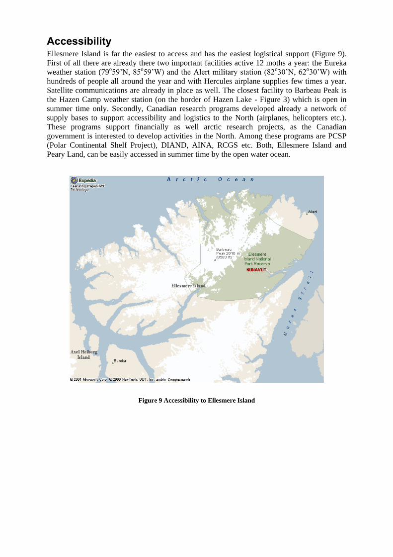
spotted out in red. The Figure 4 shows a view of the Barbeau Peak, while Figure 5 and Figure
6 show surrounding views from there.

Figure 1 North Pole topography
Figure 2 Relief of Canada
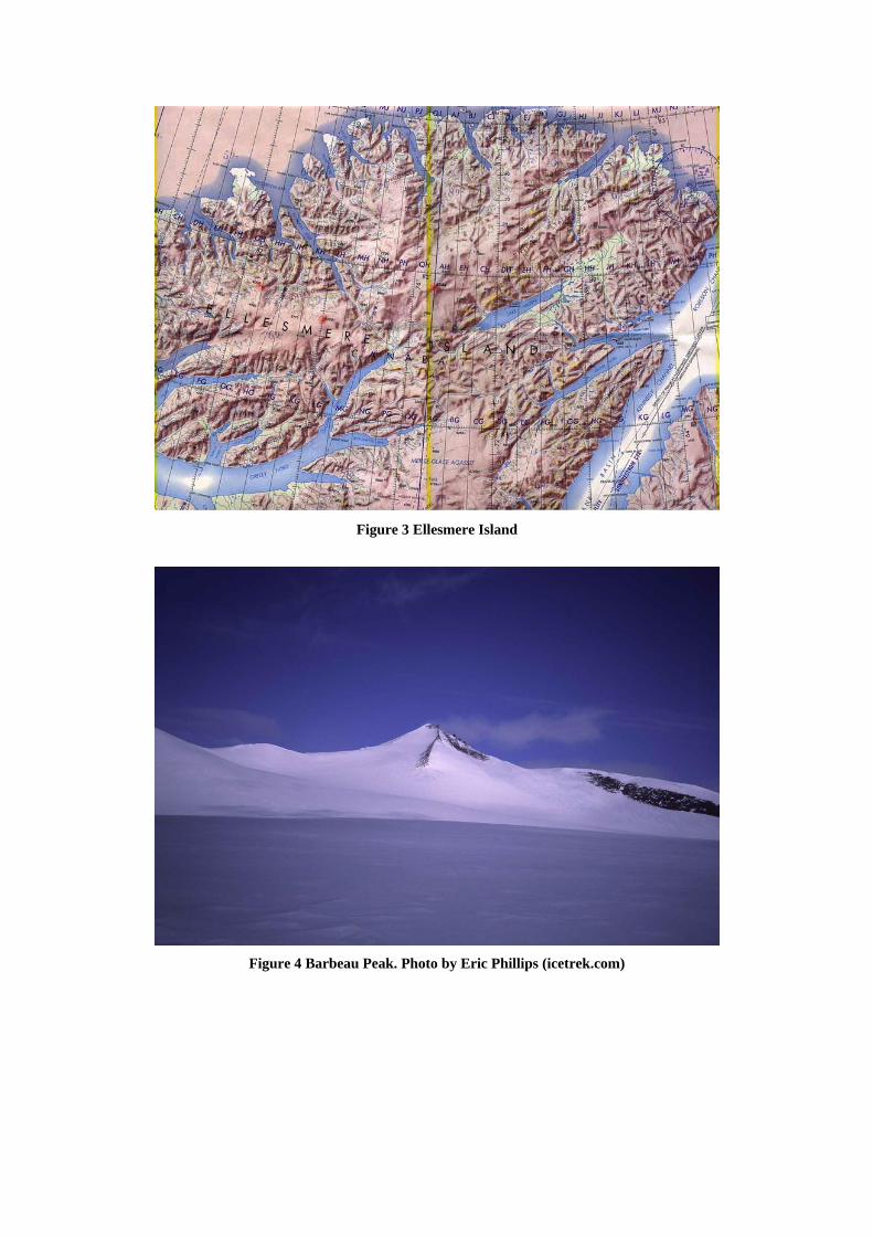
Figure 3 Ellesmere Island
Figure 4 Barbeau Peak. Photo by Eric Phillips (icetrek.com)
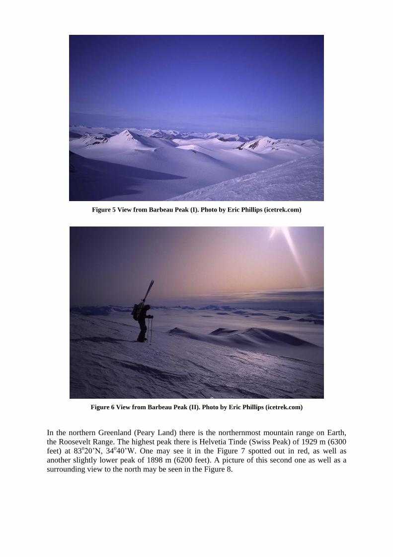
Figure 5 View from Barbeau Peak (I). Photo by Eric Phillips (icetrek.com)
Figure 6 View from Barbeau Peak (II). Photo by Eric Phillips (icetrek.com)
In the northern Greenland (Peary Land) there is the northernmost mountain range on Earth,
the Roosevelt Range. The highest peak there is Helvetia Tinde (Swiss Peak) of 1929 m (6300
feet) at 83o20’N, 34
o40’W. One may see it in the Figure 7 spotted out in red, as well as
another slightly lower peak of 1898 m (6200 feet). A picture of this second one as well as a
surrounding view to the north may be seen in the Figure 8.

Figure 7 Northern Greenland (Peary Land)
Figure 8 Second highest peak (1898 m) in Peary Land, Northern Greenland
Accessibility Ellesmere Island is far the easiest to access and has the easiest logistical support (Figure 9).
First of all there are already there two important facilities active 12 moths a year: the Eureka
weather station (79o59’N, 85
o59’W) and the Alert military station (82
o30’N, 62
o30’W) with
hundreds of people all around the year and with Hercules airplane supplies few times a year.
Satellite communications are already in place as well. The closest facility to Barbeau Peak is
the Hazen Camp weather station (on the border of Hazen Lake - Figure 3) which is open in
summer time only. Secondly, Canadian research programs developed already a network of
supply bases to support accessibility and logistics to the North (airplanes, helicopters etc.).
These programs support financially as well arctic research projects, as the Canadian
government is interested to develop activities in the North. Among these programs are PCSP
(Polar Continental Shelf Project), DIAND, AINA, RCGS etc. Both, Ellesmere Island and
Peary Land, can be easily accessed in summer time by the open water ocean.
Figure 9 Accessibility to Ellesmere Island

Figure 10 Camps and Supply stations near Grand Land Mountains (where is the Barbeau Peak)
Transparency of the sky
The most significant feature of the northern polar night, which is important for astronomy, is
a massive radiation inversion. This is a stable and deep feature which calms down most the
meteorological activity. At the Eureka station, as experienced during the LIDAR
measurements during the winter, there is very little cloud cover, and so useful observations
are possible on about 80% of the nights.
The sites of interest here are close to the magnetic North Pole, in the center of the auroral oval
(Figure 11). The brightness of the aurora is therefore a minor observational issue.
More, over the winter the ice in the Arctic produce a significant albedo which reflects back to
space about 90% of the incoming solar energy in late falls to early springs. This means that
the Earth will irradiate much less energy in the infrared. In the same time, the albedo drops
down the ground and atmosphere temperature of the polar nights.
The arctic haze, which is an important amount of aerosols coming from Eurasian industrial
areas, is clearly seen in this clean environment. It has an optical depth of 0.1 at most
(referenced to vertical, at 500 nm) and it’s observed especially in late winter, early spring
months. The wavelength dependence is about 1 over lambda. The haze is primarily below 1
km altitude, though one finds occasionally bands up to 5 km. Moreover, this is present mostly
along the costal borders. The Barbeau peak should not experience any such contamination.
In general poor visibility occurs more often in summer because of the more frequent
occurrences of the fog at low elevations. Poor visibility commonly occurs at higher elevations

just prior to the beginning of the melt. This is due to the blowing of the uncompacted snow
available in that period. To avoid such thing it may be possible to remove the small quantity
of multi-secular snow over the peak.
Near the North Pole one finds too a diminished ozone concentration, by 10 to 40% in some
areas. This may eventually allow ultra-violet astronomical observations.
The atmospheric water vapor makes important absorptions of the light, mostly in infrared. As
this parameter is not very significant in the Artic winter, new infrared windows are opened for
astronomy. Extremely, this water vapor allows clouds formation too, associated obviously
with a very important opacity effect. A first indirect indication of this basic parameter and its
effects is getting from the precipitations statistics.
The Astronomical Polar Night is a period of the arctic winter north of 84°33'N, when horizon
during astronomical twilight. The Nautical Polar Night is a period of the arctic winter north
of 78°33'N, when the most light is a faint glow in the southern sky, but it is impossible for an
observer to make out any horizon. Alert and Eureka stations experience Nautical Polar Night.
Precipitations
The Arctic is a cold desert and the northern areas are among the driest on Earth with less than
100 mm total precipitations per year, as in Ellesmere Island or Peary Land. Most of that is
received in the summer due to the increase in moisture capacity of the warmer air and an
increased area of open water in the Artic Ocean. For example, not far from the Barbeau Peak,
Eureka station (Figure 9), at an altitude of 10 m, has an average of only 18.6 mm for the 6
month period November to April. For the same period, at Alert, not very far from Barbeau
either (Figure 3, Figure 9), one has 45 mm precipitations. This is somehow more because of
the influence of the Arctic Ocean, but still very dry. Measurements well inside Pearly Land at
82o10’N, 30
o30’W shows 14 mm of precipitations for the same period.
It’s well known that good astronomical sites are at high elevations, slightly inside the land (as
the Chilean border) or inside islands (Hawaii). One needs high rising peaks to access high
atmospheric layers without changing them very much, but not exactly on the sea border
because there is too much moisture. The Roosevelt Range in Peary Land seems to be more
exposed to the moisture of the Arctic Ocean. Going more inside Greenland is definitely drier
but there one finds too the high and wide ice plateau which changes the stability of the
atmosphere (the top of this Plateau is a very windy place). However this should be
investigated further. On the other hand, the Barbeau Peak in Ellesmere Island has all the
characteristics of a good site. Actually, as a proof of very stable and dry weather conditions
inside the Ellesmere Island is Hazen Lake, very close to Barbeau Peak (Figure 3). The annual
precipitations there are 25 mm, 2.7 times less than Eureka. So, one may expect for the winter
period a total of less than 7 mm. This means that at the Barbeau elevation the precipitations
should be close to 0 mm for the winter nighttime, which makes it the driest astronomical site
known. By comparison, at Paranal peak in Chile at 2635 m altitude, considered to be the
actual best site, on has around 10 mm/year, so about 5 mm per annual nighttime.
Form a large scale statistical point of view, the northern Canadian islands, including the
Ellesmere Island, is the driest area in the Artic (Figure 12). On some parts of the land area,
there are a lot of interpolations because of the small number of weather stations.
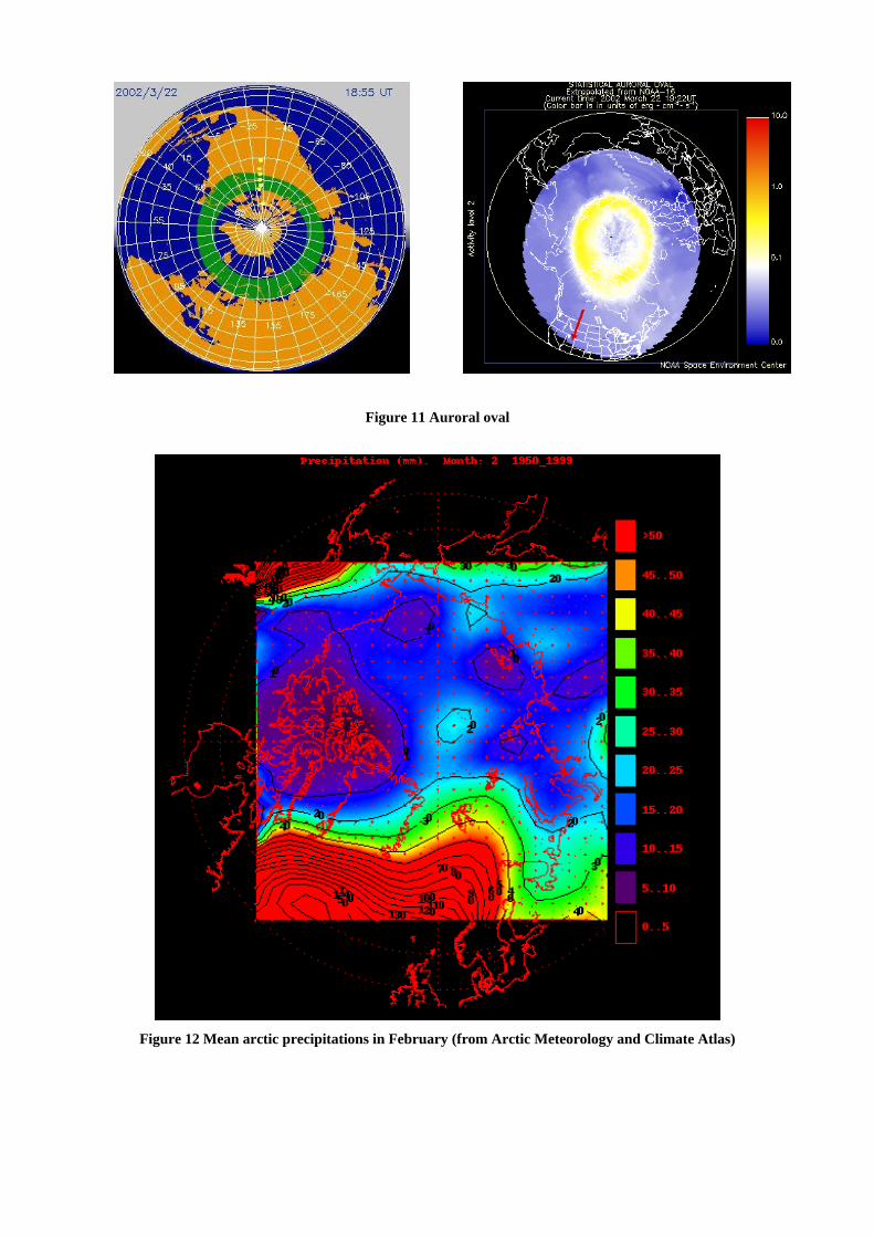
Figure 11 Auroral oval
Figure 12 Mean arctic precipitations in February (from Arctic Meteorology and Climate Atlas)

Satellite data analysis
The raw data was recorded with AVHRR (Advanced Very High Resolution Radiometer)
satellite sensor carried on NOAA polar-orbiting satellites, at 04:00 and 14:00 Local Time
(LT), from 1982 to 1999. There are three different data sets, at 1.25, 5 and 25 Km resolutions.
The atmospheric parameters where then retrieved by post-processing (CASPR program) and
they are available as monthly means with 25 Km resolution at:
http://stratus.ssec.wisc.edu/products/appx/. The algorithms used to obtain the results are
explained there as well.
On a 25 Km grid, the atmospheric parameters for sharp high peaks are averaged out. On a
future step, I will compute clear sky chart at 1.25 Km resolution as well. For the present study
I considered only the data at 04:00 LT, for January (winter) and July (summer).
The “clear sky” means percentage of time with no clouds of any kind, including cirrus. This is
what we call a “photometric sky”. The “mm precipitable water” is a vertical column of
precipitable water vapor present in the atmosphere, expressed in millimeters. The spatial
resolution here is lower. The “surface temperature C” is expressed in degrees Celsius (C).
As a comparison, in Paranal there are actually 76% photometric nights (averaged all over the
year), while the precipitable water vapor is 1.5 mm in the winter (in the summer is more).
Figure 13 Winter atmospheric conditions in the Arctic
BarbeauHelvetia Tinde
North Pole
January clear sky (LT 04:00)
0.1
0.2
0.3
0.4
0.5
0.6
BarbeauHelvetia Tinde
North Pole
January mm precipitable water (LT 04:00)
0
2
4
6
8
10
12
BarbeauHelvetia Tinde
North Pole
January surface temperature C (LT 04:00)
-40
-30
-20
-10
0

Figure 14 Summer atmospheric conditions in the Arctic
BarbeauHelvetia Tinde
North Pole
July clear sky (LT 04:00)
0.1
0.2
0.3
0.4
0.5
0.6
BarbeauHelvetia Tinde
North Pole
July mm precipitable water (LT 04:00)
5
10
15
20
25
30
BarbeauHelvetia Tinde
North Pole
July surface temperature C (LT 04:00)
-20
-15
-10
-5
0
5
10
15