Embed Size (px)
Citation preview
Approved by DC-E USCG AuxA, Inc
Boating Skills & Boating Skills & SeamanshipSeamanship
Boating Skills & Boating Skills & SeamanshipSeamanship
Lesson 9Introduction to
Navigation
2
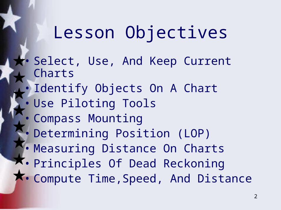
• Select, Use, And Keep Current Charts• Identify Objects On A Chart• Use Piloting Tools• Compass Mounting• Determining Position (LOP)• Measuring Distance On Charts• Principles Of Dead Reckoning• Compute Time,Speed, And Distance
Lesson ObjectivesLesson Objectives
3
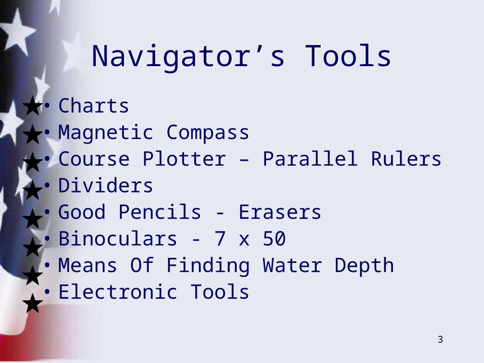
• Charts• Magnetic Compass• Course Plotter – Parallel Rulers• Dividers• Good Pencils - Erasers• Binoculars - 7 x 50• Means Of Finding Water Depth• Electronic Tools
Navigator’s ToolsNavigator’s Tools
4
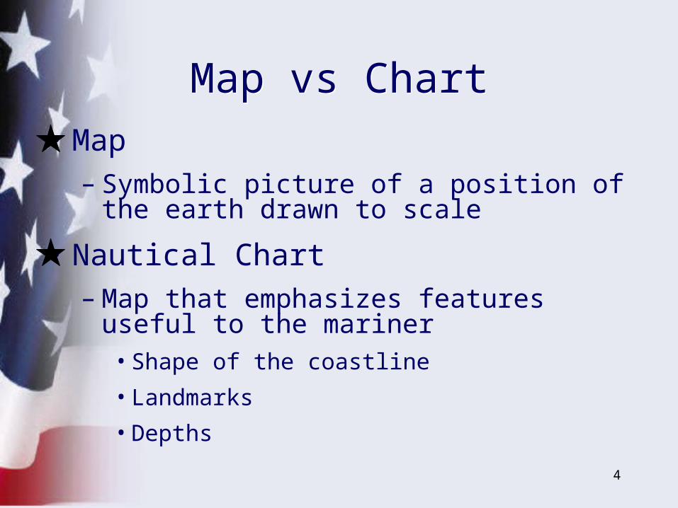
• Map– Symbolic picture of a position of the earth
drawn to scale
• Nautical Chart – Map that emphasizes features useful to the
mariner• Shape of the coastline
• Landmarks
• Depths
Map vs ChartMap vs Chart
5
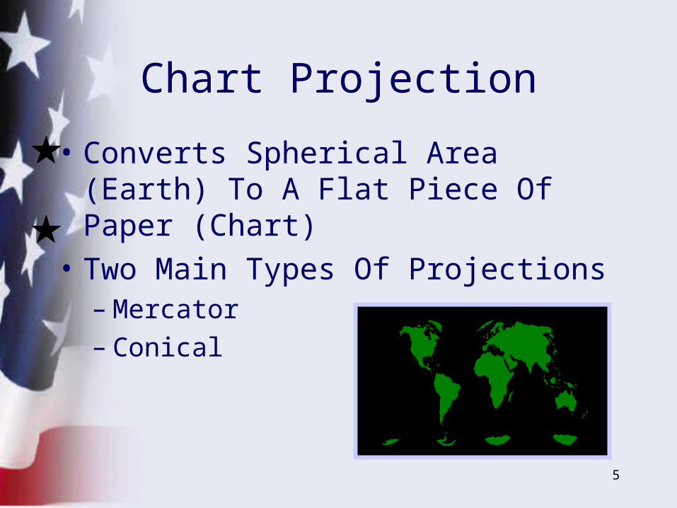
• Converts Spherical Area (Earth) To A Flat Piece Of Paper (Chart)
• Two Main Types Of Projections– Mercator– Conical
Chart ProjectionChart Projection
6
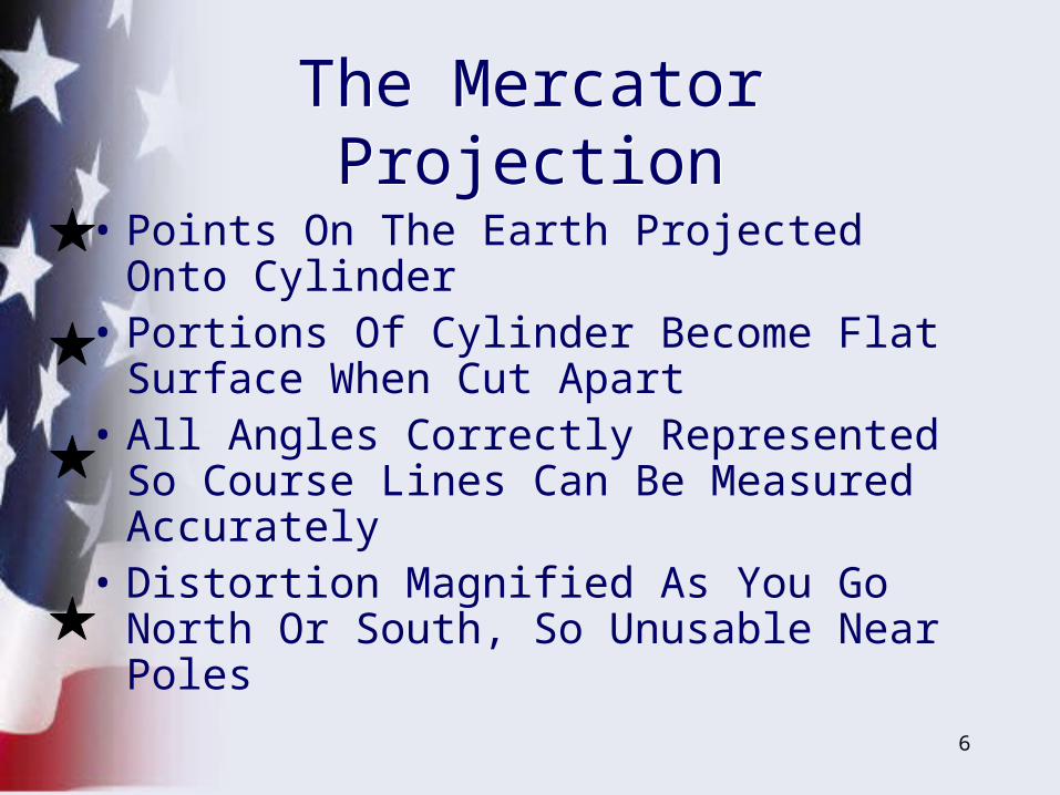
• Points On The Earth Projected Onto Cylinder
• Portions Of Cylinder Become Flat Surface When Cut Apart
• All Angles Correctly Represented So Course Lines Can Be Measured Accurately
• Distortion Magnified As You Go North Or South, So Unusable Near Poles
The Mercator ProjectionThe Mercator Projection
7
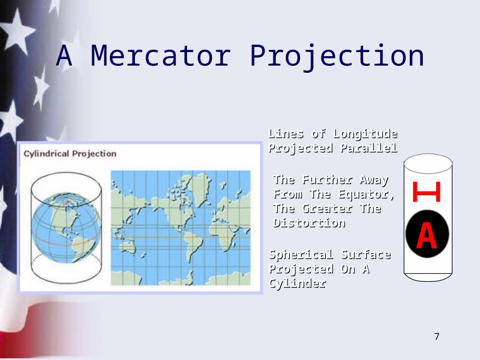
The Further AwayThe Further AwayFrom The Equator,From The Equator,The Greater TheThe Greater TheDistortionDistortion
Lines of Longitude Lines of Longitude Projected ParallelProjected Parallel
Spherical Surface Spherical Surface Projected On AProjected On ACylinderCylinder
AA
A Mercator ProjectionA Mercator Projection
8
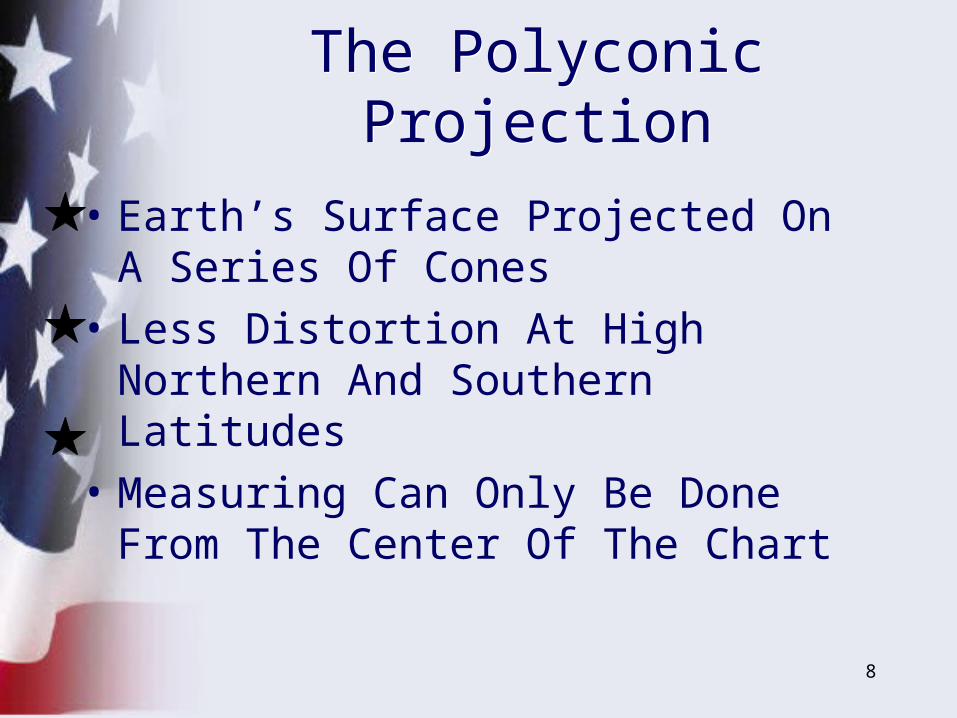
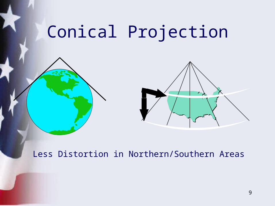
• Earth’s Surface Projected On A Series Of Cones
• Less Distortion At High Northern And Southern Latitudes
• Measuring Can Only Be Done From The Center Of The Chart
The Polyconic ProjectionThe Polyconic Projection
9
Less Distortion in Northern/Southern Areas
Conical ProjectionConical Projection
10
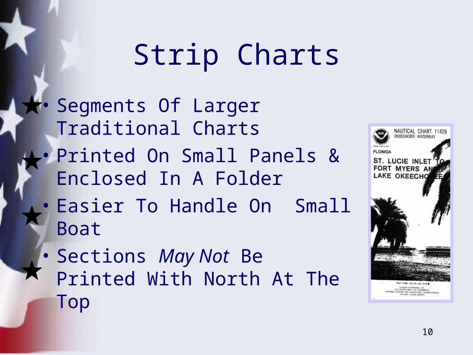
• Segments Of Larger Traditional Charts
• Printed On Small Panels & Enclosed In A Folder
• Easier To Handle On Small Boat
• Sections May Not Be Printed With North At The Top
Strip ChartsStrip Charts
11
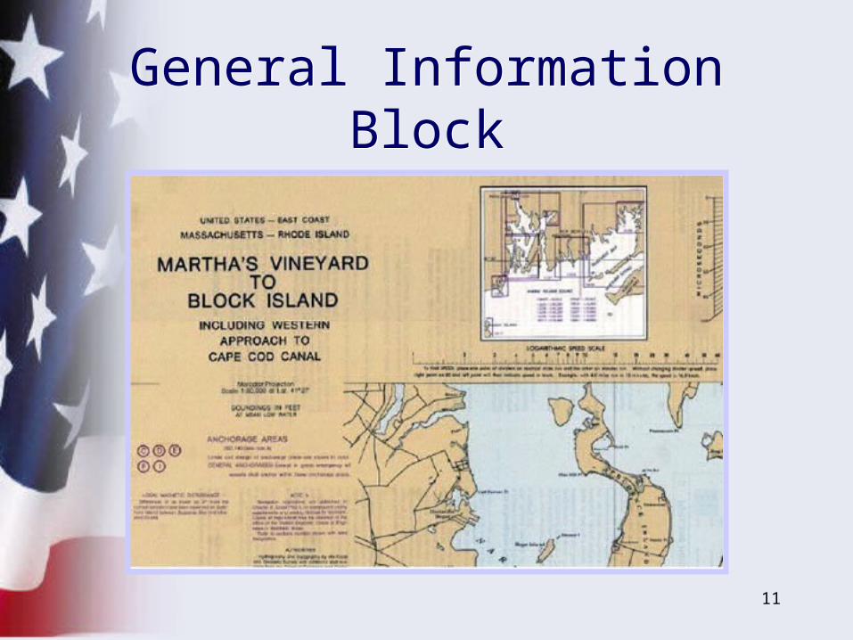
General Information BlockGeneral Information Block
12
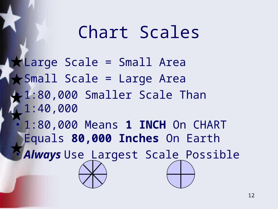
• Large Scale = Small Area
• Small Scale = Large Area
• 1:80,000 Smaller Scale Than 1:40,000
• 1:80,000 Means 1 INCH On CHART Equals 80,000 Inches On Earth
• Always Use Largest Scale Possible
Chart ScalesChart Scales
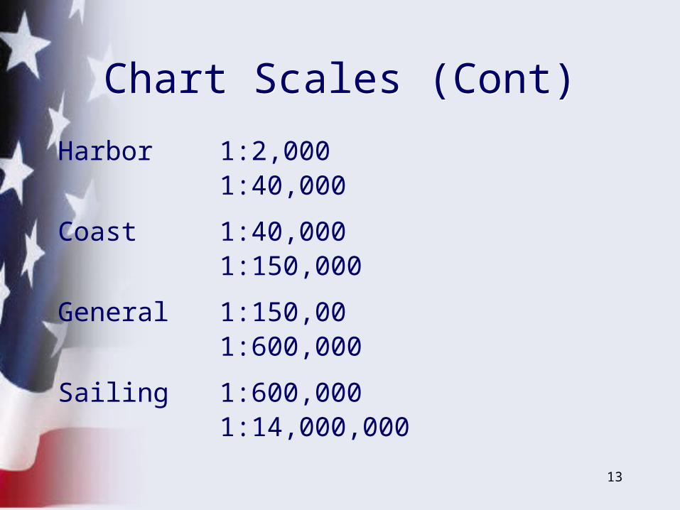
13
Harbor 1:2,000 1:40,000
Coast 1:40,000 1:150,000
General 1:150,00 1:600,000
Sailing 1:600,000 1:14,000,000
Chart Scales (Cont)Chart Scales (Cont)
14
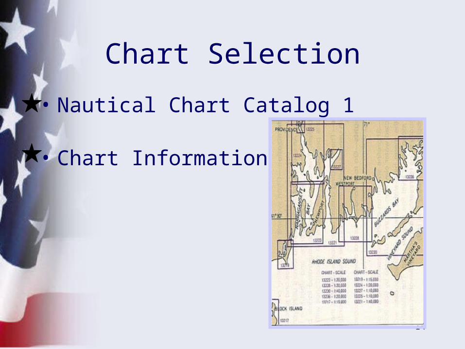
• Nautical Chart Catalog 1
• Chart Information
Chart SelectionChart Selection
15
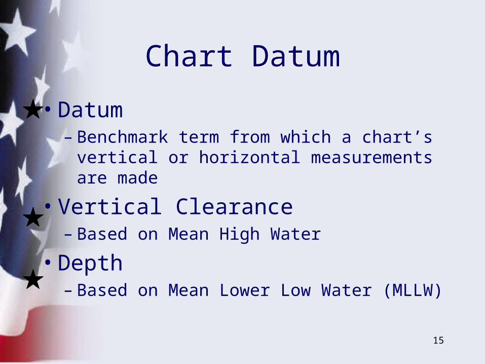
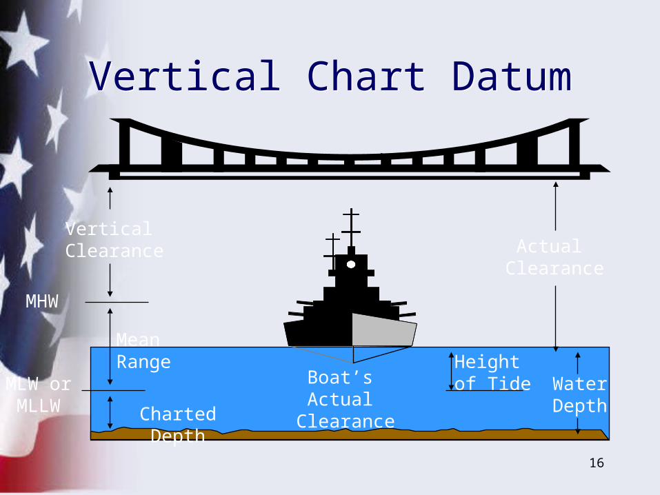
• Datum– Benchmark term from which a chart’s
vertical or horizontal measurements are made
• Vertical Clearance– Based on Mean High Water
• Depth– Based on Mean Lower Low Water (MLLW)
Chart DatumChart Datum
16
Vertical Chart DatumVertical Chart Datum
Boat’s Actual
Clearance
Mean Range
MHW
MLW orMLLW
Actual Clearance
Vertical Clearance
WaterDepth
Height of Tide
Charted Depth
17
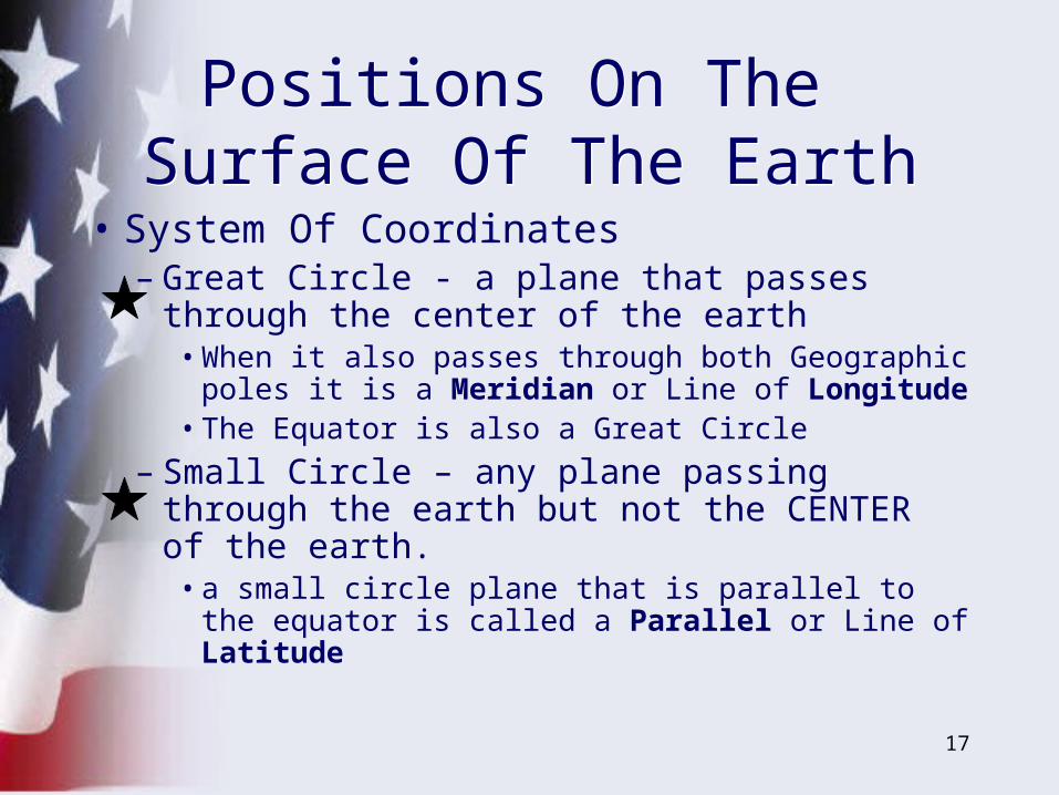
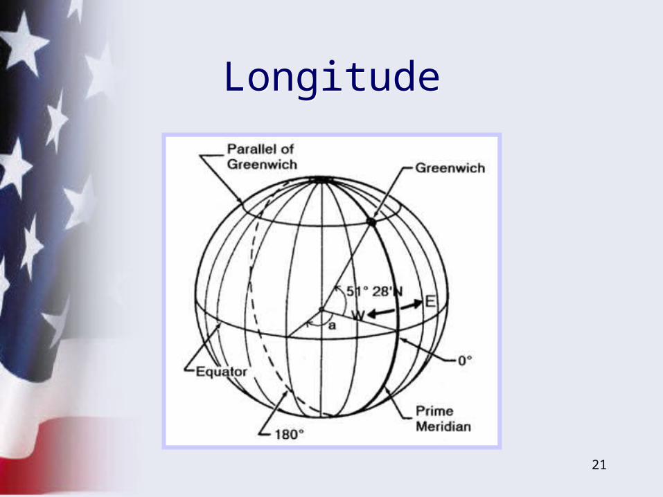
• System Of Coordinates– Great Circle - a plane that passes through
the center of the earth• When it also passes through both Geographic
poles it is a Meridian or Line of Longitude• The Equator is also a Great Circle
– Small Circle – any plane passing through the earth but not the CENTER of the earth.
• a small circle plane that is parallel to the equator is called a Parallel or Line of Latitude
Positions On The Surface Of The Earth
Positions On The Surface Of The Earth
18
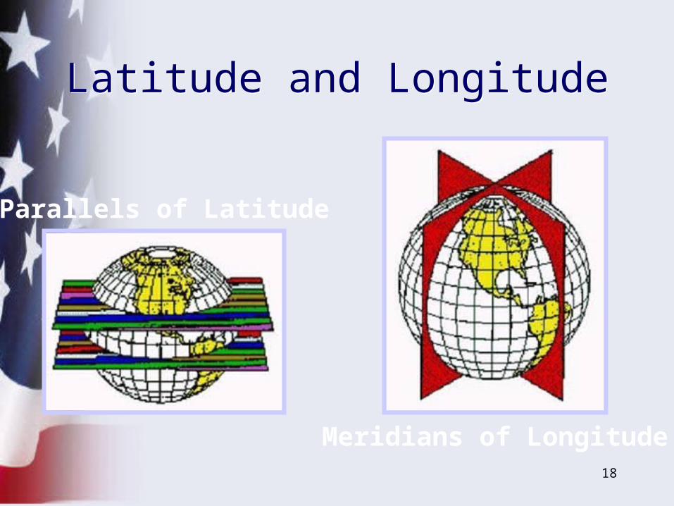
Parallels of Latitude
Meridians of Longitude
Latitude and LongitudeLatitude and Longitude
19
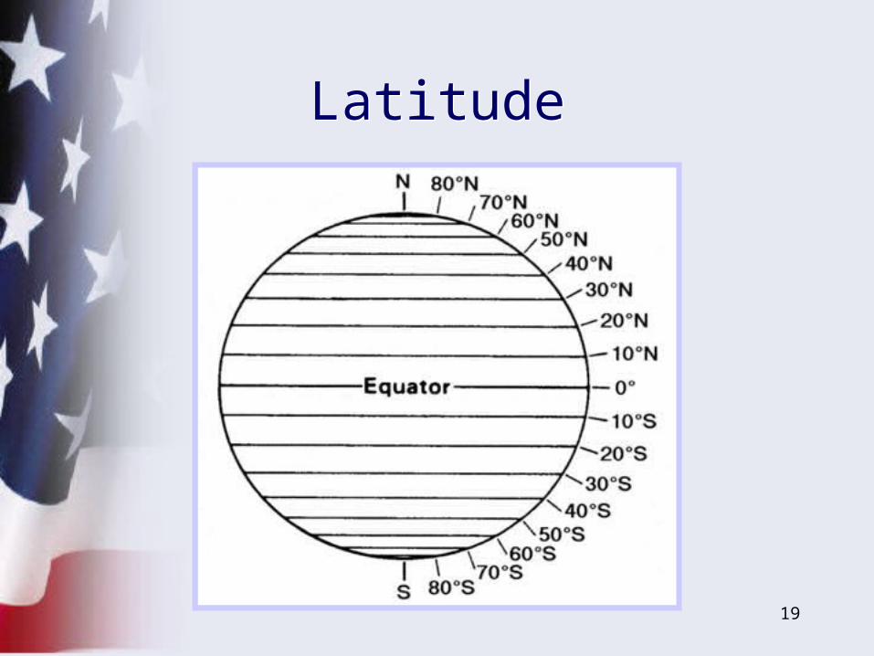
LatitudeLatitude
20
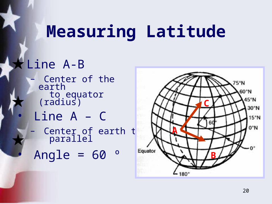
Measuring LatitudeMeasuring Latitude
• Line A-B– Center of the earth
to equator (radius)
• Line A – C
– Center of earth to parallel
• Angle = 60 ºA
B
C
21
LongitudeLongitude
22
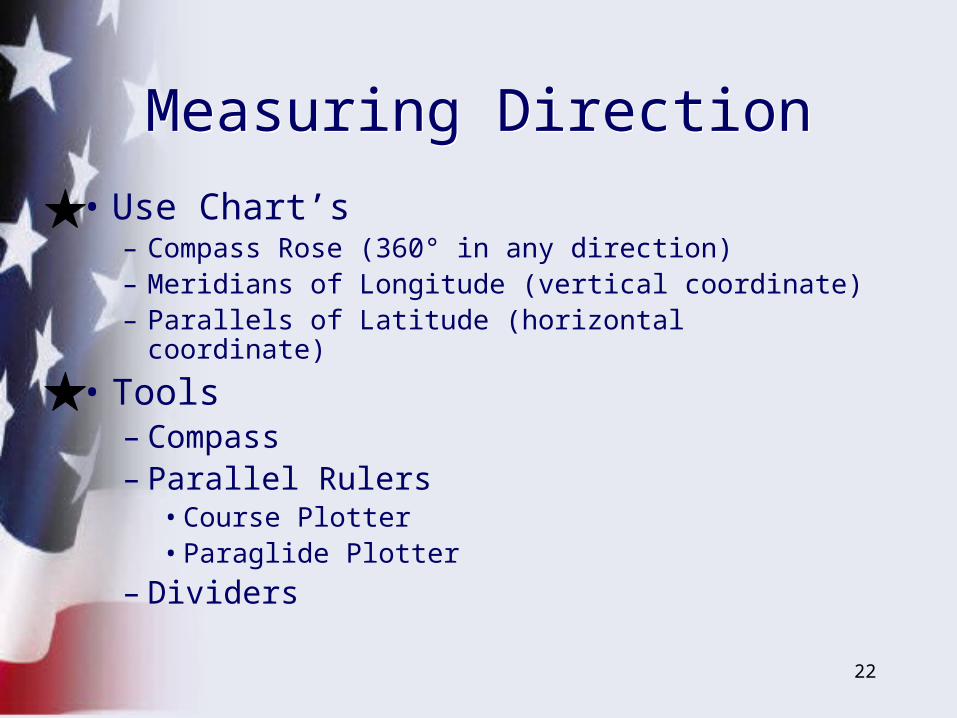
• Use Chart’s – Compass Rose (360° in any direction)– Meridians of Longitude (vertical coordinate)– Parallels of Latitude (horizontal coordinate)
• Tools– Compass– Parallel Rulers
• Course Plotter• Paraglide Plotter
– Dividers
Measuring DirectionMeasuring Direction
23
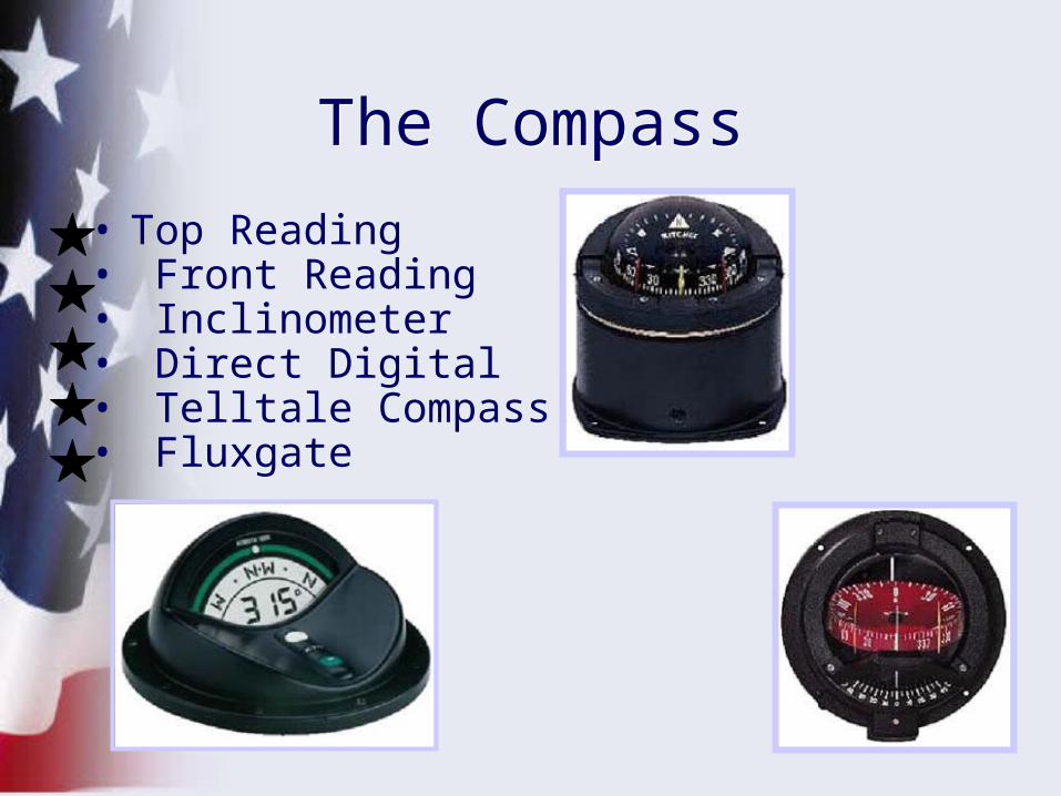
The CompassThe Compass
• Top Reading• Front Reading• Inclinometer• Direct Digital• Telltale Compass• Fluxgate
24
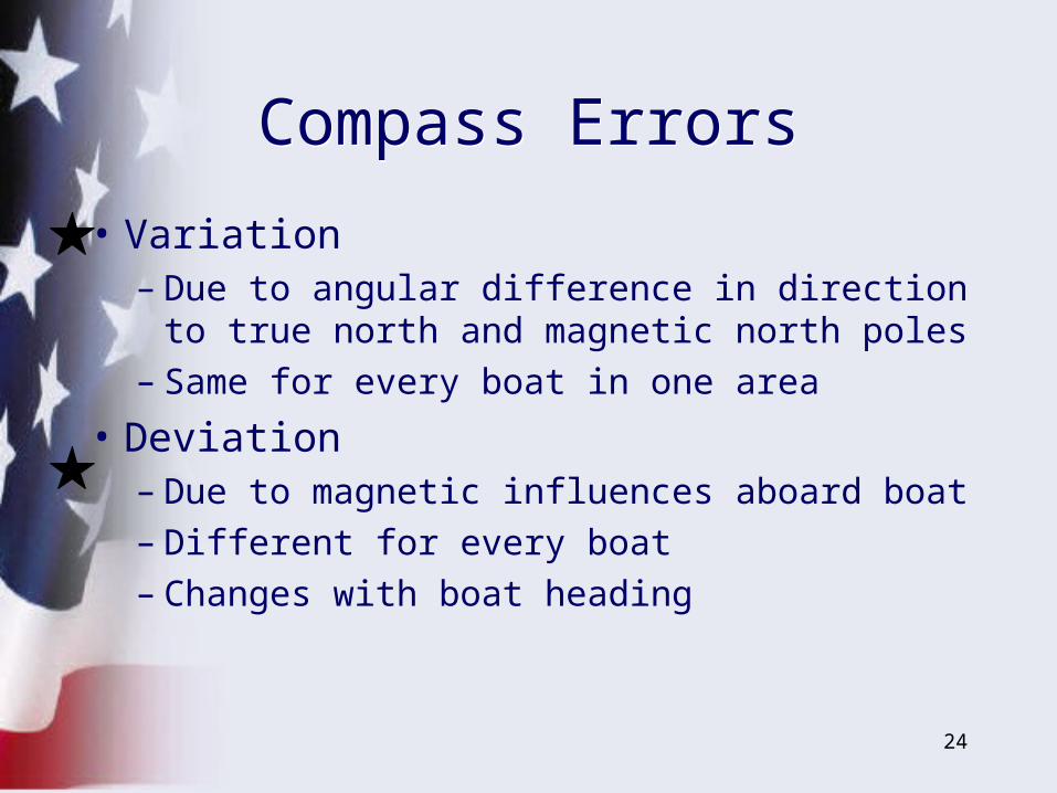
• Variation– Due to angular difference in direction to
true north and magnetic north poles– Same for every boat in one area
• Deviation– Due to magnetic influences aboard boat– Different for every boat– Changes with boat heading
Compass ErrorsCompass Errors
25
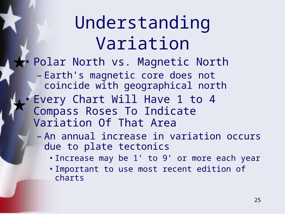
• Polar North vs. Magnetic North– Earth’s magnetic core does not coincide
with geographical north
• Every Chart Will Have 1 to 4 Compass Roses To Indicate Variation Of That Area– An annual increase in variation occurs due
to plate tectonics• Increase may be 1’ to 9’ or more each year• Important to use most recent edition of charts
Understanding VariationUnderstanding Variation
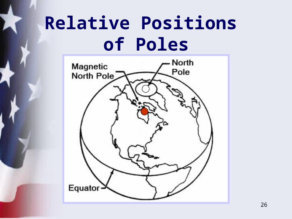
26
Relative Positions of Poles
Relative Positions of Poles
27
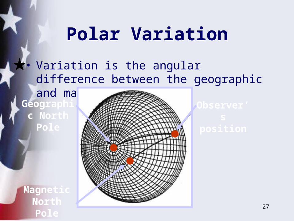
Polar VariationPolar Variation
• Variation is the angular difference between the geographic and magnetic meridians
Observer’s position
Geographic North Pole
Magnetic North Pole
28
• Points to North Magnetic Pole– Area that changes slightly– Far northern Canada
• True North– Earth’s axis– Base for latitude and longitude
CompassCompass
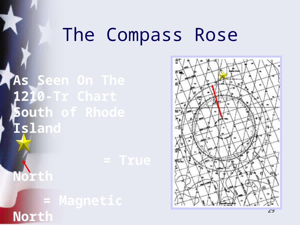
29
As Seen On The 1210-Tr ChartSouth of Rhode Island
= True North
= Magnetic North
The Compass RoseThe Compass Rose
30
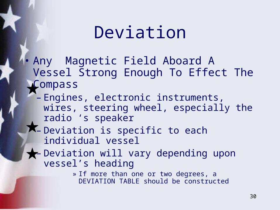
DeviationDeviation
• Any Magnetic Field Aboard A Vessel Strong Enough To Effect The Compass– Engines, electronic instruments, wires,
steering wheel, especially the radio ‘s speaker
– Deviation is specific to each individual vessel
– Deviation will vary depending upon vessel’s heading
» If more than one or two degrees, a DEVIATION TABLE should be constructed
31
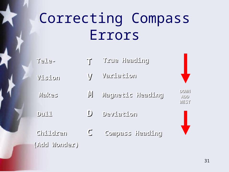
TT
VV
MM
DD
CC
Tele-Tele-
VisionVision
MakesMakes
DullDull
ChildrenChildren
True HeadingTrue Heading
VariationVariation
Magnetic HeadingMagnetic Heading
DeviationDeviation
Compass HeadingCompass Heading
DOWNDOWNADDADD
WESTWEST
(Add Wonder)(Add Wonder)
Correcting Compass ErrorsCorrecting Compass Errors
32
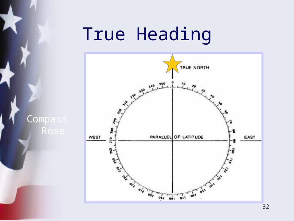
True HeadingTrue Heading
Compass Rose
33
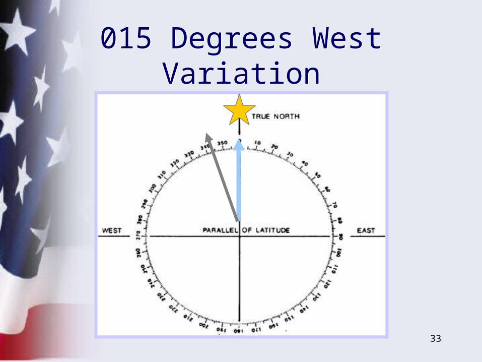
015 Degrees West Variation
015 Degrees West Variation

34
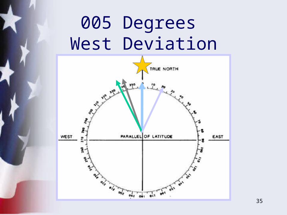
005 Degrees West Deviation005 Degrees
West Deviation
35
005 Degrees West Deviation005 Degrees
West Deviation
36
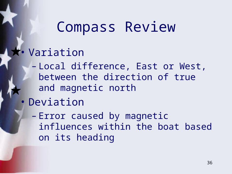
Compass ReviewCompass Review
• Variation– Local difference, East or West, between
the direction of true and magnetic north
• Deviation– Error caused by magnetic influences within
the boat based on its heading
37
• One Degree Of Latitude Equals 60 Nautical Miles
• One Minute Of Latitude Equals One Nautical Mile
• Use– Latitude scale at vertical side of chart, or– Distance scale
Measuring DistanceMeasuring Distance
38
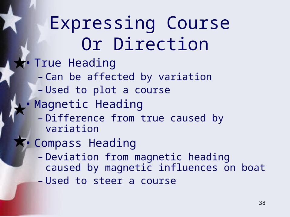
• True Heading– Can be affected by variation– Used to plot a course
• Magnetic Heading– Difference from true caused by variation
• Compass Heading– Deviation from magnetic heading caused
by magnetic influences on boat– Used to steer a course
Expressing Course Or Direction
Expressing Course Or Direction

39
Finding Your PositionFinding Your Position
• Line of position (LOP)– Range LOP– Bearing LOP– Loran time differential (TD) LOP
• Circle of position (COP)– Distance from an object– RADAR– GPS
40
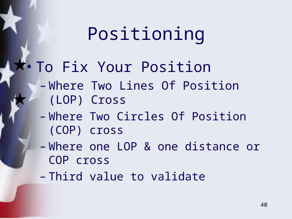
• To Fix Your Position– Where Two Lines Of Position (LOP)
Cross – Where Two Circles Of Position (COP)
cross– Where one LOP & one distance or COP
cross– Third value to validate
PositioningPositioning
41
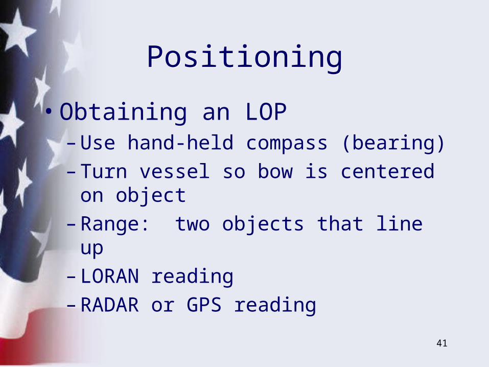
PositioningPositioning
• Obtaining an LOP– Use hand-held compass (bearing)
– Turn vessel so bow is centered on object
– Range: two objects that line up
– LORAN reading
– RADAR or GPS reading
42
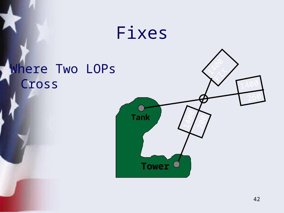
Tower
Tank
1400
260
1400
200
1400
FI
XWhere Two LOPs Cross
FixesFixes
43
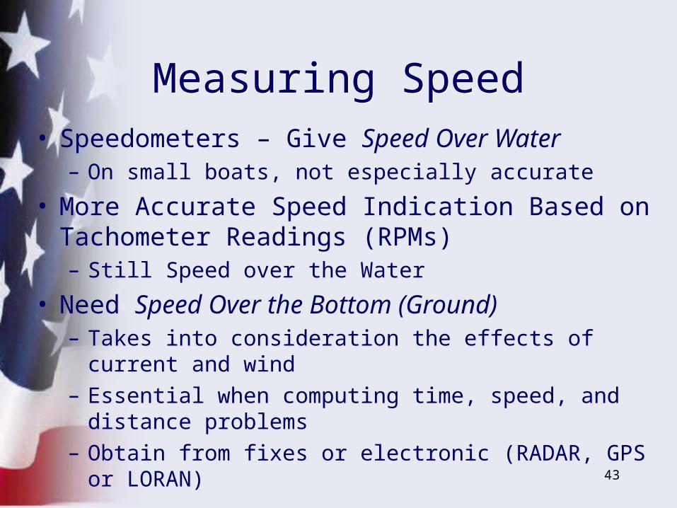
• Speedometers – Give Speed Over Water– On small boats, not especially accurate
• More Accurate Speed Indication Based on Tachometer Readings (RPMs)– Still Speed over the Water
• Need Speed Over the Bottom (Ground)– Takes into consideration the effects of current and wind– Essential when computing time, speed, and distance
problems– Obtain from fixes or electronic (RADAR, GPS or
LORAN)
Measuring SpeedMeasuring Speed
44
Speed TableSpeed Table
Determining Speed
Direction 1 Direction 2 Average
Speed
4 kts
5 kts
7.5 kts
8 kts
RPM
800
1000
1500
2000
3000
Time
12 m
10 m
7 m
6 m
5 m
Speed
5 kts
6 kts
8.5 kts
10 kts
12 kts
Time
15 m
12 m
8 m
7.5 m
6 m 10 kts
Speed
4.5 kts
6.5 kts
8 kts
9 kts
11 kts
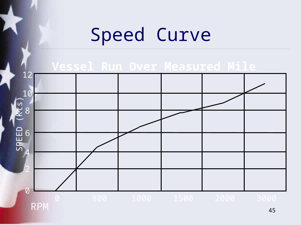
45RPM
SP
EE
D (
Kts
)
Vessel Run Over Measured Mile
0 800 1000 1500 2000 30000
2
4
6
8
10
12
Speed CurveSpeed Curve
46
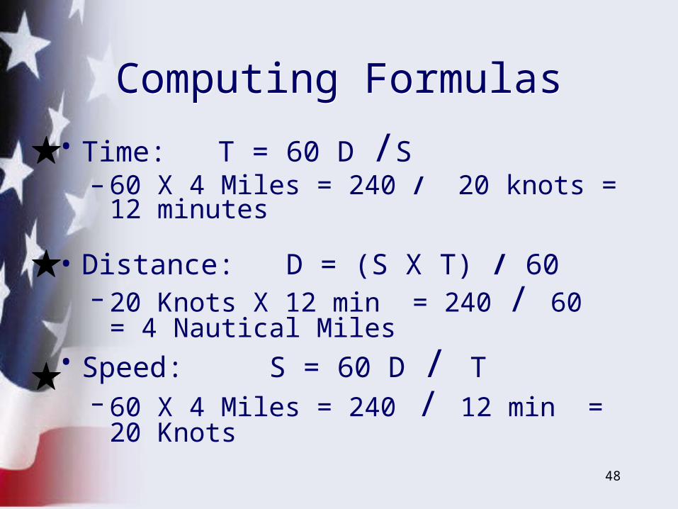
• Some Examples:– Suppose you drive your boat at a speed of
20 Knots for 12 minutes. How far have you gone?
– How long does it take to travel 4 Nautical Miles at a speed of 20 Knots?
– How fast are you going if you travel 4 Nautical Miles in 12 minutes?
Computing Distance Speed and Time
Computing Distance Speed and Time
47
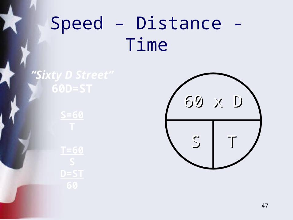
“Sixty D Street” 60D=ST
S=60T
T=60S
D=ST60
60 x D60 x D
SS TT
Speed – Distance - TimeSpeed – Distance - Time
48
• Time: T = 60 D /S– 60 X 4 Miles = 240 / 20 knots = 12
minutes
• Distance: D = (S X T) / 60– 20 Knots X 12 min = 240 / 60 = 4
Nautical Miles• Speed: S = 60 D / T
– 60 X 4 Miles = 240 / 12 min = 20 Knots
Computing FormulasComputing Formulas
49
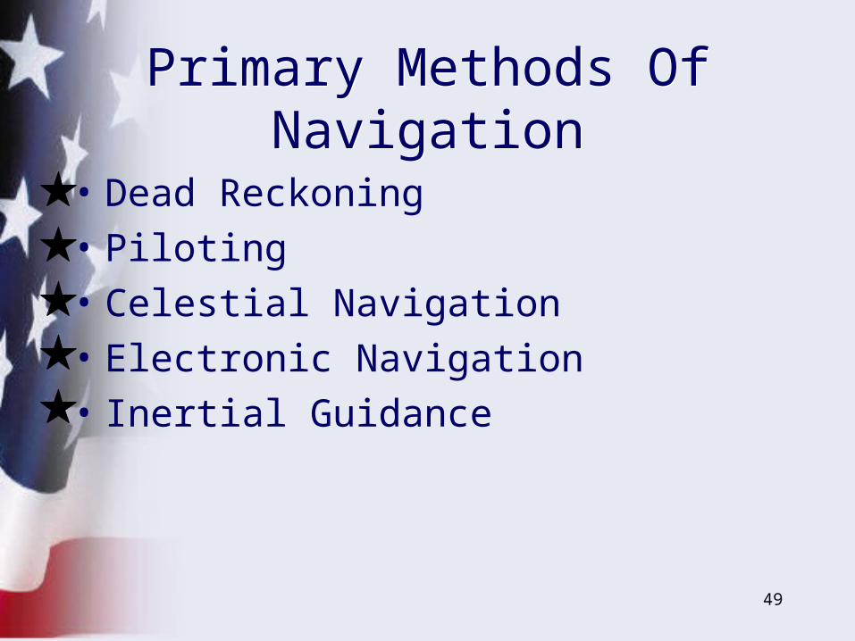
• Dead Reckoning
• Piloting
• Celestial Navigation
• Electronic Navigation
• Inertial Guidance
Primary Methods Of Navigation
Primary Methods Of Navigation
50
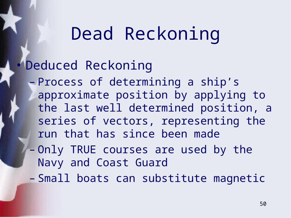
• Deduced Reckoning– Process of determining a ship’s approximate
position by applying to the last well determined position, a series of vectors, representing the run that has since been made
– Only TRUE courses are used by the Navy and Coast Guard
– Small boats can substitute magnetic
Dead ReckoningDead Reckoning
51
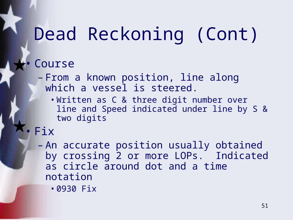
• Course – From a known position, line along which a
vessel is steered.• Written as C & three digit number over line and
Speed indicated under line by S & two digits
• Fix– An accurate position usually obtained by
crossing 2 or more LOPs. Indicated as circle around dot and a time notation
• 0930 Fix
Dead Reckoning (Cont)Dead Reckoning (Cont)
52
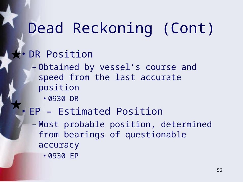
• DR Position– Obtained by vessel’s course and speed
from the last accurate position• 0930 DR
• EP – Estimated Position– Most probable position, determined from
bearings of questionable accuracy• 0930 EP
Dead Reckoning (Cont)Dead Reckoning (Cont)
53
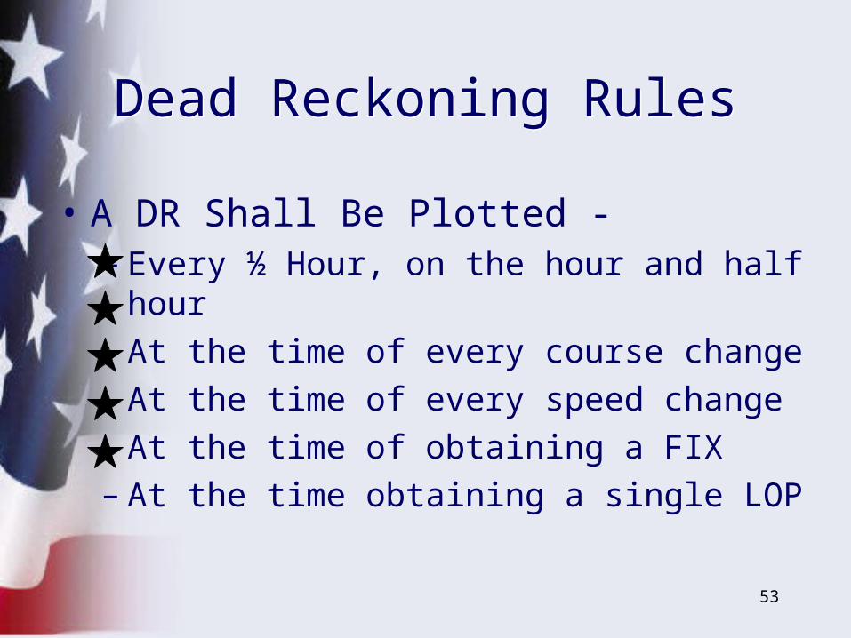
• A DR Shall Be Plotted - – Every ½ Hour, on the hour and half hour– At the time of every course change – At the time of every speed change– At the time of obtaining a FIX– At the time obtaining a single LOP
Dead Reckoning RulesDead Reckoning Rules
54
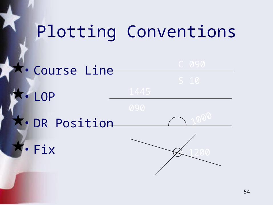
• Course Line
• LOP
• DR Position
• Fix 1200
C 090
S 101445
090
1000
Plotting ConventionsPlotting Conventions
55
0900
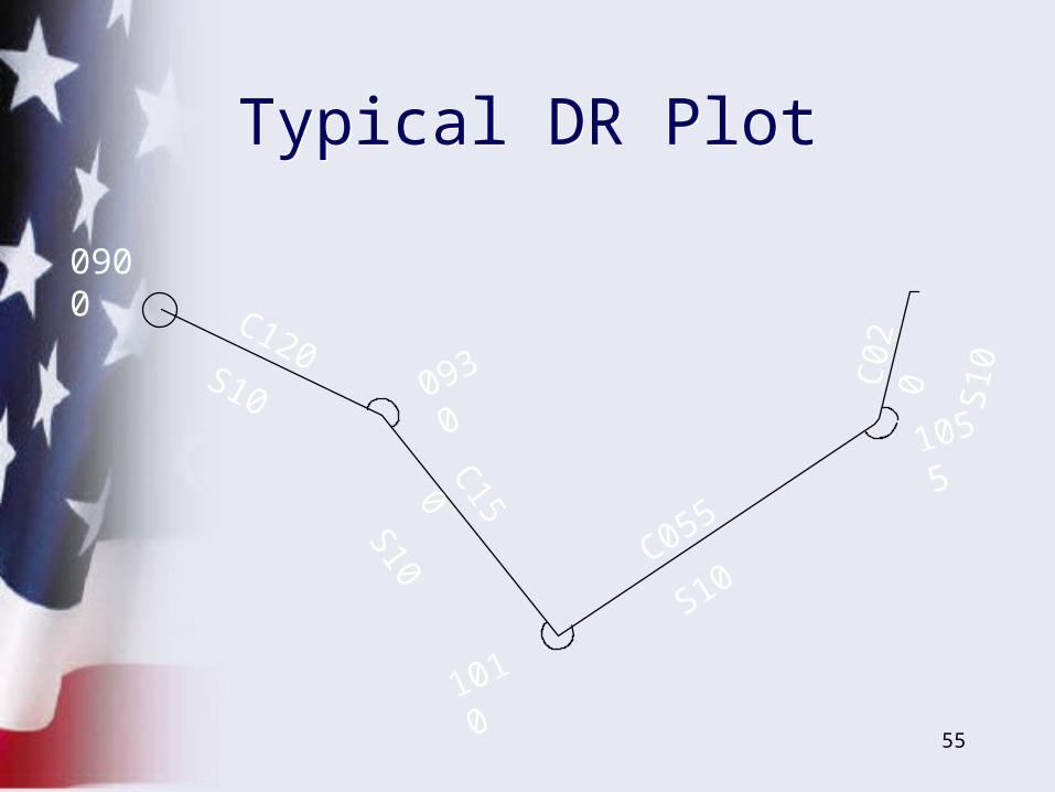
C120S10 0930
C150S10
1010
C055
S10
1055
C02
0S
10
Typical DR PlotTypical DR Plot
56
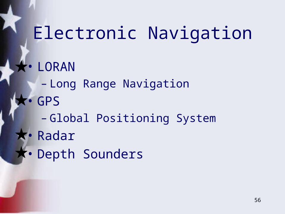
• LORAN– Long Range Navigation
• GPS– Global Positioning System
• Radar
• Depth Sounders
Electronic NavigationElectronic Navigation
57
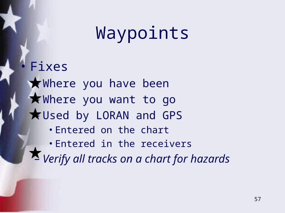
WaypointsWaypoints
• Fixes– Where you have been– Where you want to go– Used by LORAN and GPS
• Entered on the chart• Entered in the receivers
– Verify all tracks on a chart for hazards

58
• Radio Signals– Land based antennas
• Chains - masters and slaves
– Shipboard receivers
• AM signals– Degradation in bad weather– Some distortion– Some “holes” in coverage
LORANLORAN
59
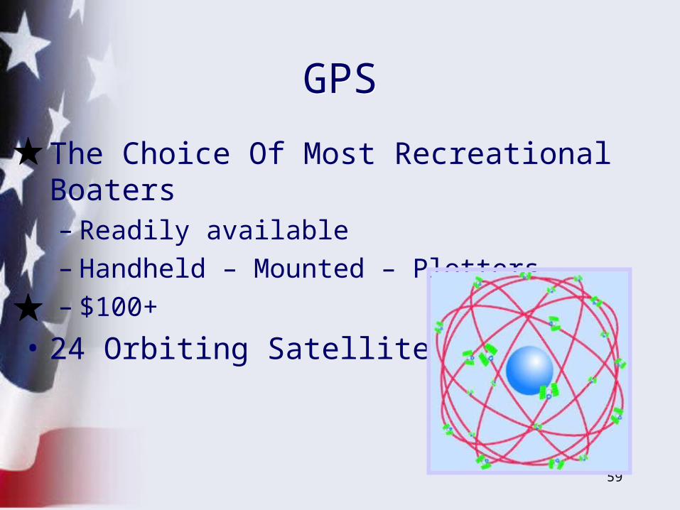
GPSGPS
• The Choice Of Most Recreational Boaters– Readily available – Handheld – Mounted – Plotters– $100+
• 24 Orbiting Satellites
60
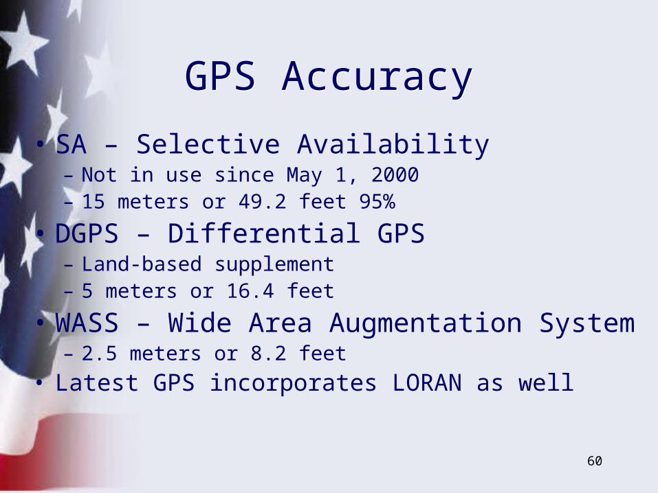
• SA – Selective Availability– Not in use since May 1, 2000– 15 meters or 49.2 feet 95%
• DGPS – Differential GPS– Land-based supplement– 5 meters or 16.4 feet
• WASS – Wide Area Augmentation System– 2.5 meters or 8.2 feet
• Latest GPS incorporates LORAN as well
GPS AccuracyGPS Accuracy

61
TidesTides
• Tides per day– Diurnal– Semi-diurnal– Mixed
• Monthly– Spring Tides– Neap Tides
62
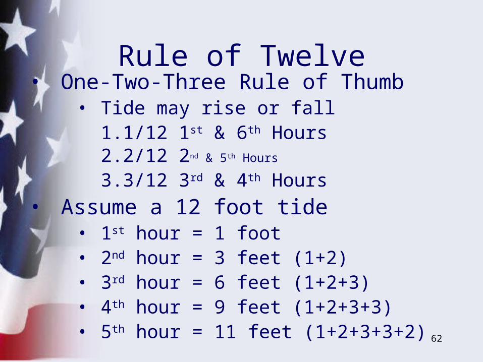
• One-Two-Three Rule of Thumb• Tide may rise or fall
1. 1/12 1st & 6th Hours2. 2/12 2nd & 5th Hours
3. 3/12 3rd & 4th Hours
• Assume a 12 foot tide• 1st hour = 1 foot• 2nd hour = 3 feet (1+2)• 3rd hour = 6 feet (1+2+3)• 4th hour = 9 feet (1+2+3+3)• 5th hour = 11 feet (1+2+3+3+2)
Rule of TwelveRule of Twelve

63
PRACTICE
PRACTICE
PRACTICE
Three Key WordsThree Key Words
64
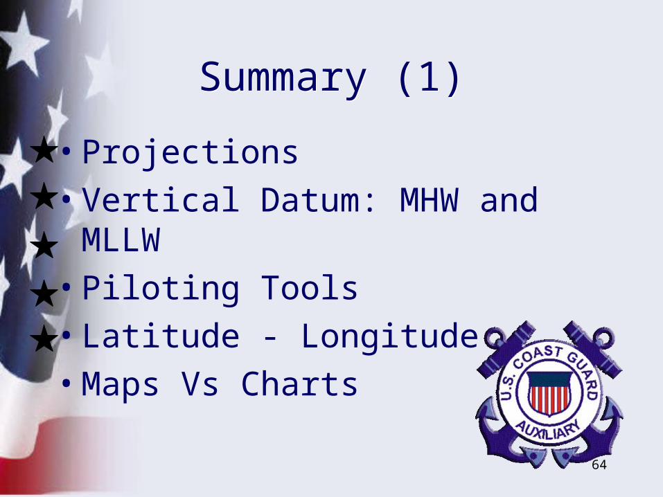
Summary (1)Summary (1)
• Projections
• Vertical Datum: MHW and MLLW
• Piloting Tools
• Latitude - Longitude
• Maps Vs Charts
65
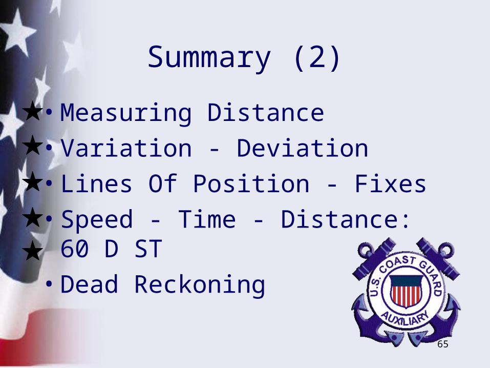
Summary (2)Summary (2)
• Measuring Distance
• Variation - Deviation
• Lines Of Position - Fixes
• Speed - Time - Distance: 60 D ST
• Dead Reckoning