Embed Size (px)
Citation preview
1
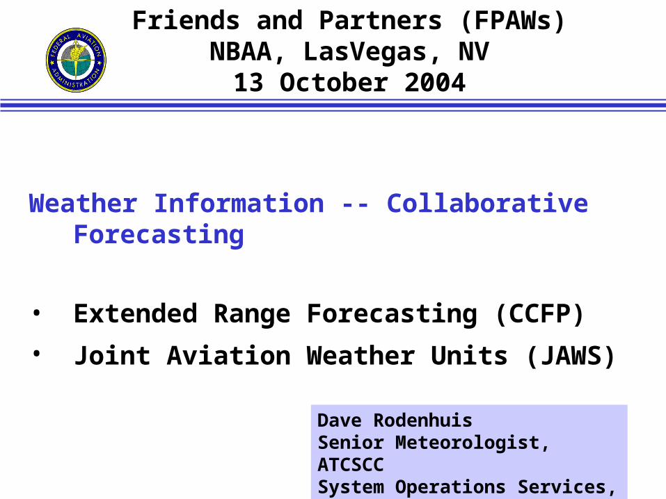
Weather Information -- Collaborative Forecasting
• Extended Range Forecasting (CCFP)
• Joint Aviation Weather Units (JAWS)
Friends and Partners (FPAWs)NBAA, LasVegas, NV
13 October 2004
Dave RodenhuisSenior Meteorologist, ATCSCCSystem Operations Services, ATO
2
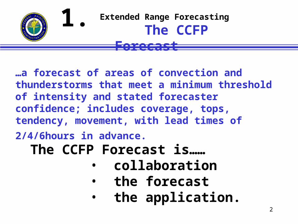
…a forecast of areas of convection and thunderstorms that meet a minimum threshold of intensity and stated forecaster confidence; includes coverage, tops, tendency, movement, with lead times of 2/4/6hours in
advance.
The CCFP Forecast is……• collaboration• the forecast• the application.
Extended Range Forecasting
The CCFP Forecast1.
3
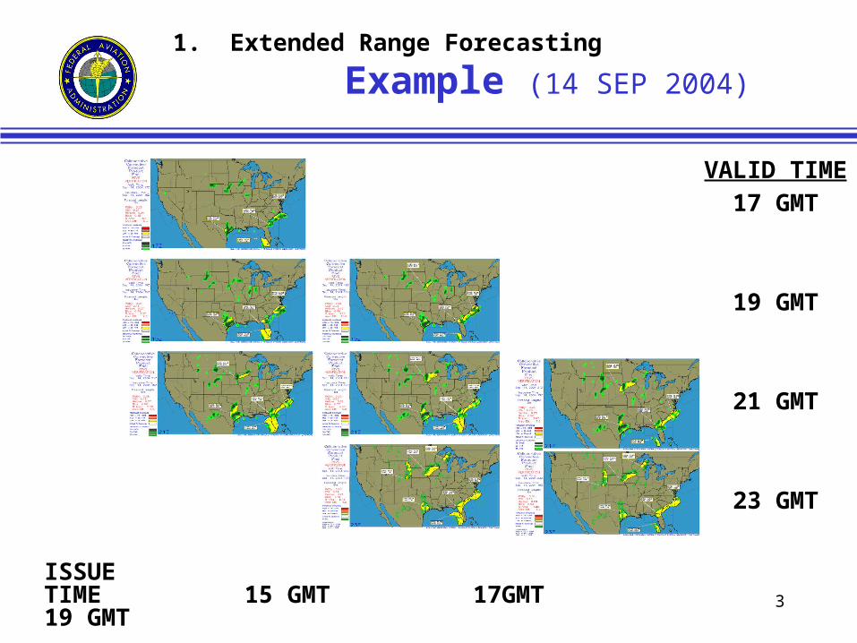
1. Extended Range Forecasting
Example (14 SEP 2004)
VALID TIME
17 GMT
19 GMT
21 GMT
23 GMT
ISSUETIME 15 GMT 17GMT 19 GMT
4
1. Extended Range Forecasting
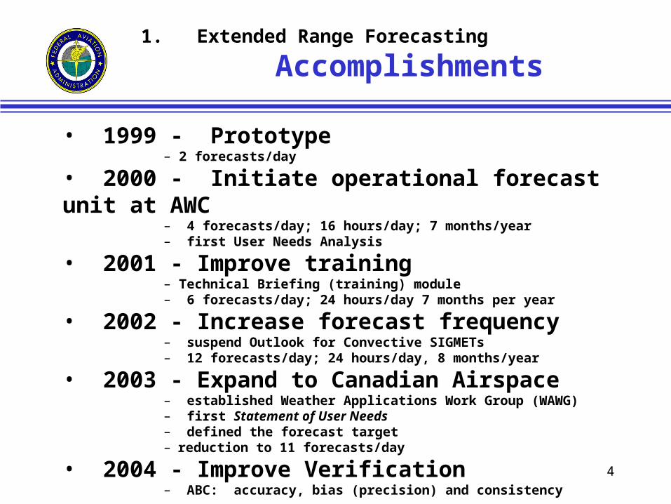
Accomplishments
• 1999 - Prototype– 2 forecasts/day
• 2000 - Initiate operational forecast unit at AWC– 4 forecasts/day; 16 hours/day; 7 months/year– first User Needs Analysis
• 2001 - Improve training– Technical Briefing (training) module– 6 forecasts/day; 24 hours/day 7 months per year
• 2002 - Increase forecast frequency– suspend Outlook for Convective SIGMETs– 12 forecasts/day; 24 hours/day, 8 months/year
• 2003 - Expand to Canadian Airspace– established Weather Applications Work Group (WAWG)– first Statement of User Needs– defined the forecast target– reduction to 11 forecasts/day
• 2004 - Improve Verification– ABC: accuracy, bias (precision) and consistency
5
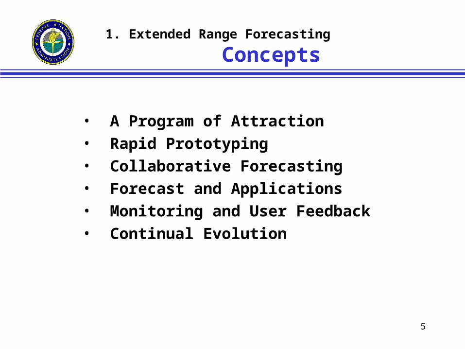
• A Program of Attraction• Rapid Prototyping• Collaborative Forecasting• Forecast and Applications• Monitoring and User Feedback• Continual Evolution
1. Extended Range Forecasting
Concepts
6
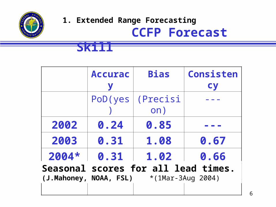
1. Extended Range Forecasting
CCFP Forecast Skill
Accuracy Bias Consistency
PoD(yes) (Precision) ---
2002 0.24 0.85 ---
2003 0.31 1.08 0.67
2004* 0.31 1.02 0.66
Seasonal scores for all lead times. (J.Mahoney, NOAA, FSL) *(1Mar-3Aug 2004)
7
1. Extended Range Forecasting
Contemporary Reports - CCFP
• Statement of User Needs, CCFP 2004. WAWG Report, V7.3, Rev., 15 April 2004, K.Mullen, Ed., 32 pp.
• Continual Evolution of CCFP - User Needs for Extended Range Prediction. T.Fahey and D.Rodenhuis, ARAM, Oct 2004.
• Program Management for the CCFP. D.Sims and D.Rodenhuis, ARAM, Oct. 2004.
• Operational Feedback Reports to Providers of Aviation’s CCFP. D.Torbert and D.Rodenhuis, ARAM, Oct. 2004.
• International Collaboration Providing Seamless, Cross-Border Aviation Weather Products to Facilitate Traffic Management. L.Mercier, et.al., ARAM, Oct. 2004.
• More Intuitive Graphics for the CCFP. D.Sims, et.al., ARAM, Oct 2004.
• Defining Observational Fields for Verification of the CCFP. J.Mahoney, et.al., ARAM, Oct 2004.
8
1. Extended Range Forecasting
Expectations (2005+)
Applications– More intuitive graphics (format)– CONOPS for weather and TFM (integration)– Evaluation (value)– (strengthen) Verification (quality)
• The Forecast– Automation of the short-range forecast– NWP for the extended range forecast.– Probabilistic forecast format
• Collaboration– Web conferencing
9
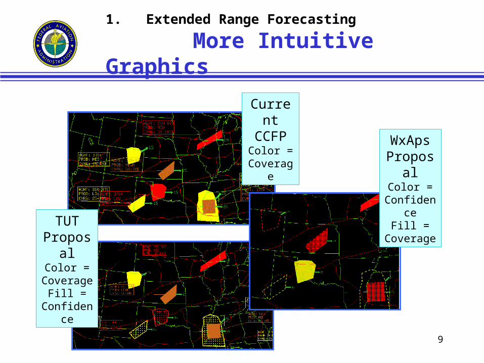
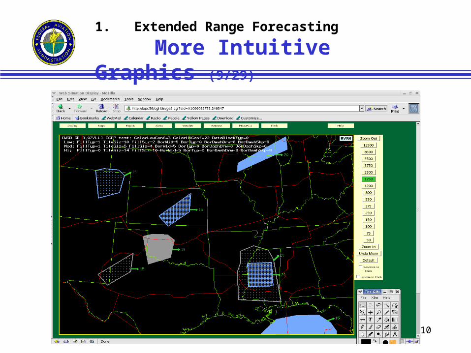
1. Extended Range Forecasting
More Intuitive Graphics
Current CCFPColor =
Coverage
TUT Proposal
Color = Coverage
Fill = Confidence
WxAps Proposal
Color = Confidence
Fill = Coverage
10
1. Extended Range Forecasting
More Intuitive Graphics (9/29)
11
Joint Aviation Weather Units
The CWSUs
• Initiated in 1979 (25 years old)• 20 units at ARTCCs in the CONUS (84 FTEs)• Operated by the NWS; funded by the FAA• Current mission is advisory and nowcasting to support the
ARTCC and operational sites • FAA evaluation (1993-5) • NWS modernization (1996)• NRC Recommendations (1995) • NTSB Recommendations (1995, 2001)
• FAA Functional Audit (site review; 2003)• Guidelines for Restructuring-CWSUs (ATT, 2003)• Assessment of Current Operations (ATT,2003)• A Concept of Operations for Enhancing Weather Support
to the NAS (NWS, 2003)
2.
12
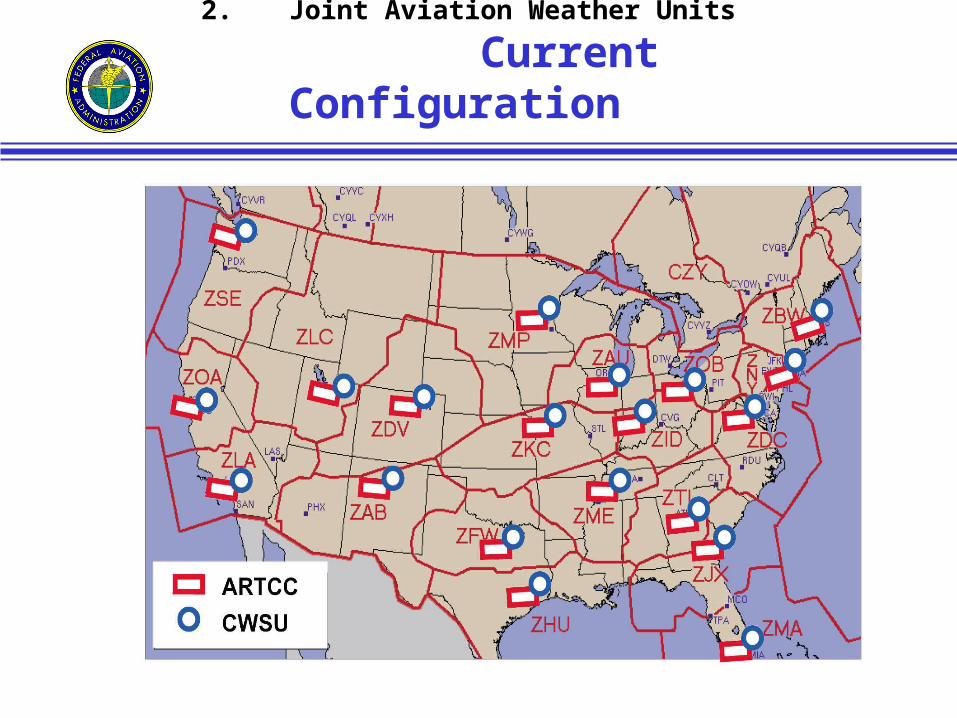
2. Joint Aviation Weather Units
Current Configuration
13
2. Joint Aviation Weather Units
New Mission
…to be cognizant of hazardous weather information covering all phases of flight, participate in strategic planning, and support the transition to tactical operations. The mission is defined by the needs of the national system of traffic management that meet objectives of safety, efficiency, and security.
14
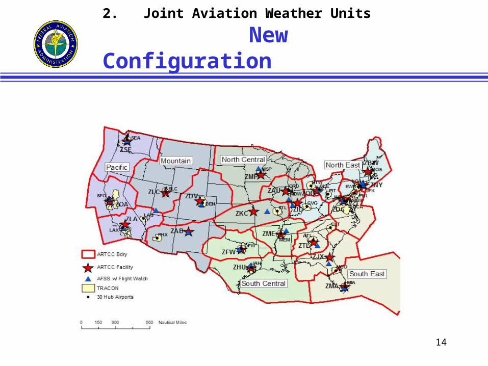
2. Joint Aviation Weather Units
New Configuration
15
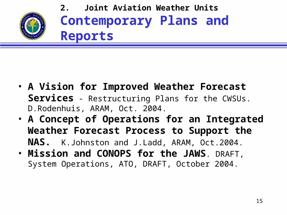
2. Joint Aviation Weather Units
Contemporary Plans and Reports
• A Vision for Improved Weather Forecast Services - Restructuring Plans for the CWSUs. D.Rodenhuis, ARAM, Oct. 2004.
• A Concept of Operations for an Integrated Weather Forecast Process to Support the NAS. K.Johnston and J.Ladd, ARAM, Oct.2004.
• Mission and CONOPS for the JAWS. DRAFT, System Operations, ATO, DRAFT, October 2004.
16
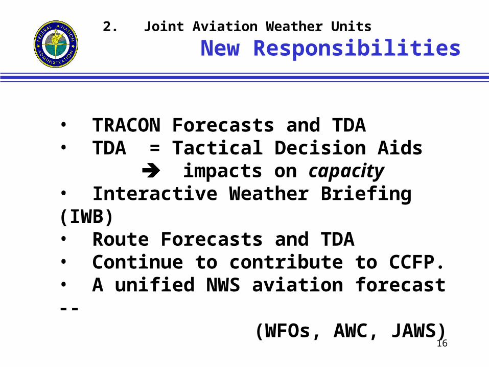
2. Joint Aviation Weather Units
New Responsibilities
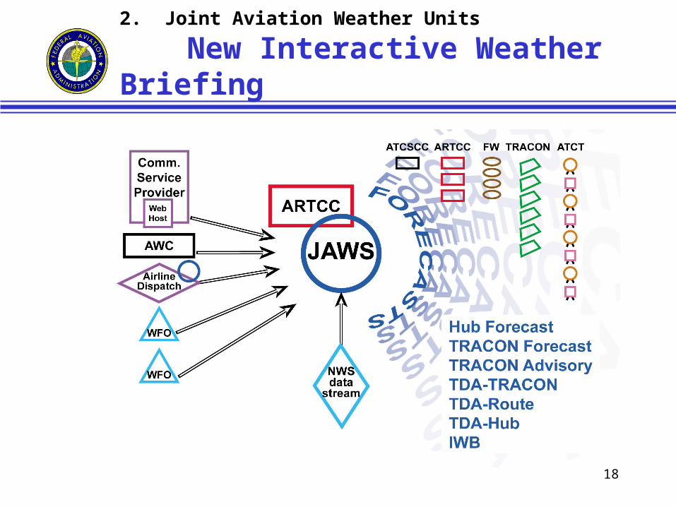
• TRACON Forecasts and TDA• TDA = Tactical Decision Aids
impacts on capacity• Interactive Weather Briefing (IWB)• Route Forecasts and TDA• Continue to contribute to CCFP.• A unified NWS aviation forecast --
(WFOs, AWC, JAWS)
17
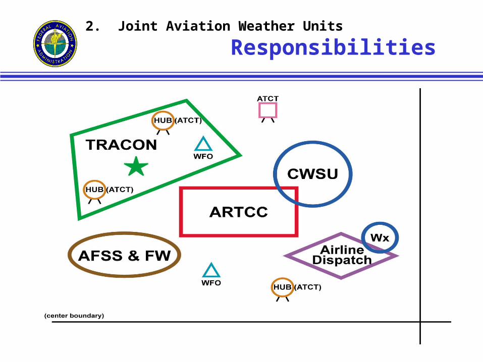
2. Joint Aviation Weather Units
Responsibilities
18
2. Joint Aviation Weather Units
New Interactive Weather Briefing
19
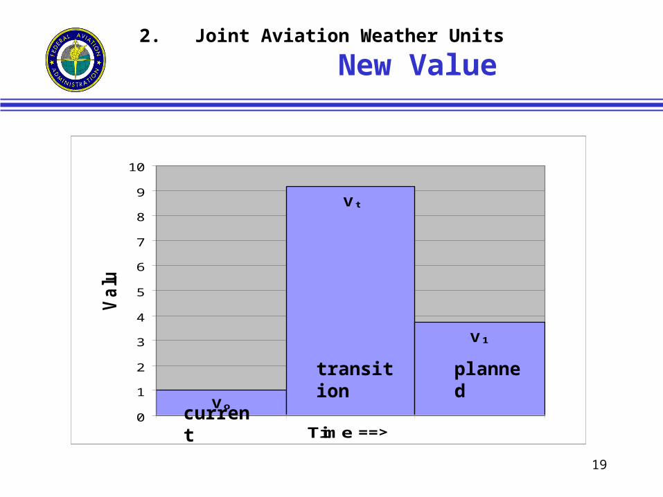
2. Joint Aviation Weather Units
New Value
Vt
V1
Vo0
1
2
3
4
5
6
7
8
9
10
Time ==>
Va
lue
current
plannedtransition
20
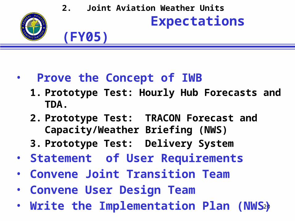
2. Joint Aviation Weather Units
Expectations (FY05)
• Prove the Concept of IWB1. Prototype Test: Hourly Hub Forecasts and TDA.2. Prototype Test: TRACON Forecast and
Capacity/Weather Briefing (NWS)3. Prototype Test: Delivery System
• Statement of User Requirements • Convene Joint Transition Team• Convene User Design Team• Write the Implementation Plan (NWS)
21
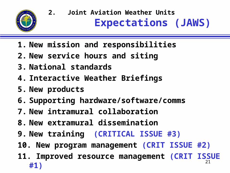
2. Joint Aviation Weather Units
Expectations (JAWS)
1. New mission and responsibilities
2. New service hours and siting
3. National standards
4. Interactive Weather Briefings
5. New products
6. Supporting hardware/software/comms
7. New intramural collaboration
8. New extramural dissemination
9. New training (CRITICAL ISSUE #3)
10. New program management (CRIT ISSUE #2)
11. Improved resource management (CRIT ISSUE #1)
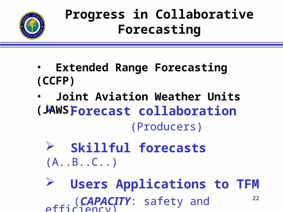
22
Progress in Collaborative Forecasting
• Extended Range Forecasting (CCFP)• Joint Aviation Weather Units (JAWS)
Forecast collaboration (Producers)
Skillful forecasts (A..B..C..)
Users Applications to TFM (CAPACITY: safety and efficiency)