Embed Size (px)
Citation preview
SOME OF THE MOST IMPORTANT PARKS AND RESERVATIONS IN ROMANIA….
1. Danube Delta2. Piatra Craiului National Park3. Retezat National Park4. Rodna National Park5. Cheile Bicazului National Park6. Trivale Forest
1. Danube Delta
The Danube Delta (Delta Dunării in Romanian, Дельта Дуная in Russian, Дельта Дунаю in Ukrainian) is the second largest delta in Europe, after the Volga Delta, and the best preserved on the continent [1]. The greater part of the Danube Delta lies in Romania (Tulcea county), while its northern part, on the left bank of the Chilia arm, is situated in Ukraine (Odessa Oblast). The approximate surface is 4152 km², of which 3446 km² are in Romania. If the lagoons of Razim-Sinoe (1015 km² of which 863km² water surface; situated in the south, but attached to the Danube Delta from geological and ecological perspectives, as well as being the combined territory of the World Heritage Site) are to be added, the considered area of the Danube Delta grows to 5165 km².
Danube Delta - Landsat satellite photo (2000)
The Danube Delta began forming around 11,000 B.C. in a gulf of the Black Sea, when the sea level was 50 to 60 m lower than today. An offshore
1
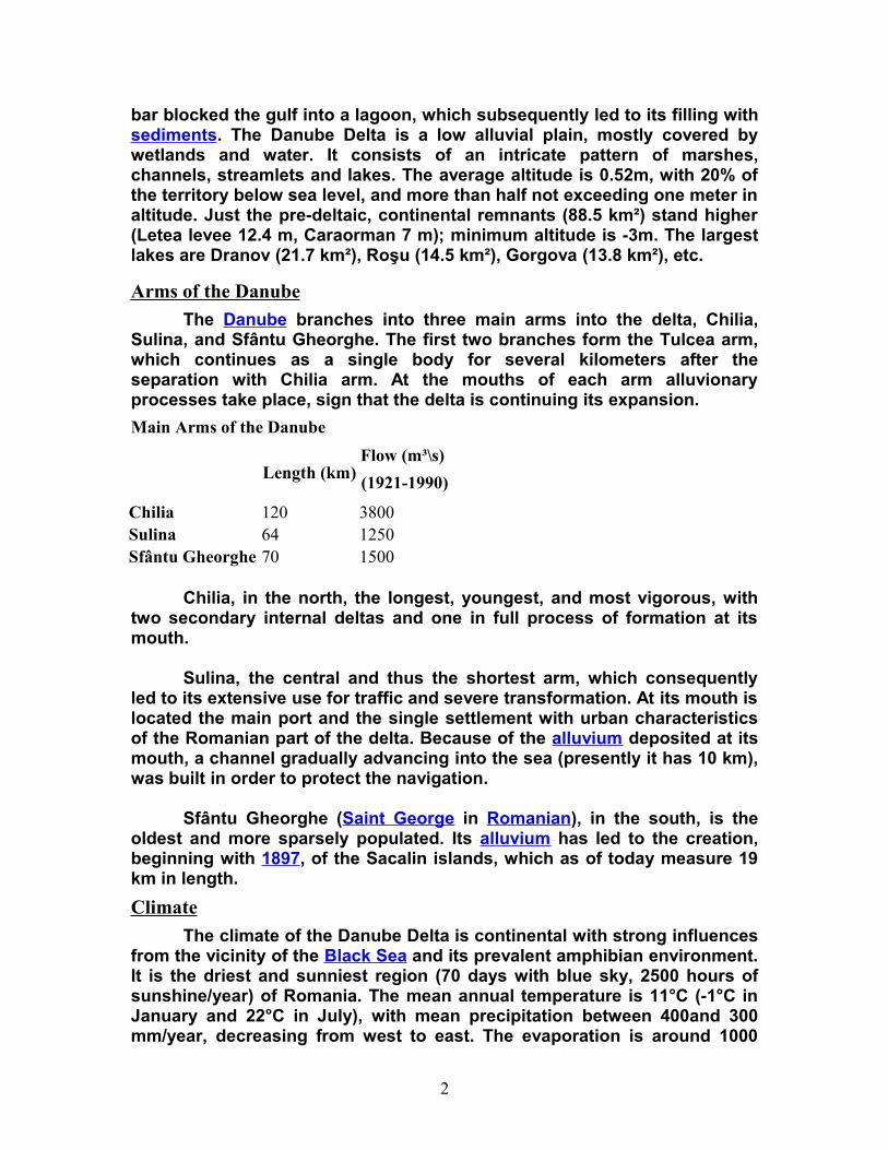
bar blocked the gulf into a lagoon, which subsequently led to its filling with sediments. The Danube Delta is a low alluvial plain, mostly covered by wetlands and water. It consists of an intricate pattern of marshes, channels, streamlets and lakes. The average altitude is 0.52m, with 20% of the territory below sea level, and more than half not exceeding one meter in altitude. Just the pre-deltaic, continental remnants (88.5 km²) stand higher (Letea levee 12.4 m, Caraorman 7 m); minimum altitude is -3m. The largest lakes are Dranov (21.7 km²), Roşu (14.5 km²), Gorgova (13.8 km²), etc.
Arms of the Danube
The Danube branches into three main arms into the delta, Chilia, Sulina, and Sfântu Gheorghe. The first two branches form the Tulcea arm, which continues as a single body for several kilometers after the separation with Chilia arm. At the mouths of each arm alluvionary processes take place, sign that the delta is continuing its expansion.
Main Arms of the Danube
Length (km)Flow (m³\s)
(1921-1990)
Chilia 120 3800Sulina 64 1250Sfântu Gheorghe 70 1500
Chilia, in the north, the longest, youngest, and most vigorous, with two secondary internal deltas and one in full process of formation at its mouth.
Sulina, the central and thus the shortest arm, which consequently led to its extensive use for traffic and severe transformation. At its mouth is located the main port and the single settlement with urban characteristics of the Romanian part of the delta. Because of the alluvium deposited at its mouth, a channel gradually advancing into the sea (presently it has 10 km), was built in order to protect the navigation.
Sfântu Gheorghe (Saint George in Romanian), in the south, is the oldest and more sparsely populated. Its alluvium has led to the creation, beginning with 1897, of the Sacalin islands, which as of today measure 19 km in length.
Climate
The climate of the Danube Delta is continental with strong influences from the vicinity of the Black Sea and its prevalent amphibian environment. It is the driest and sunniest region (70 days with blue sky, 2500 hours of sunshine/year) of Romania. The mean annual temperature is 11°C (-1°C in January and 22°C in July), with mean precipitation between 400and 300 mm/year, decreasing from west to east. The evaporation is around 1000
2
mm/year, favored and amplified by the strong and frequent winds, resulting in long periods of drought in the summer. The northwest winds cause frequent storms in spring and autumn. In the interior of the delta the continental character of the climate is very pronounced.
Main Ecosystems
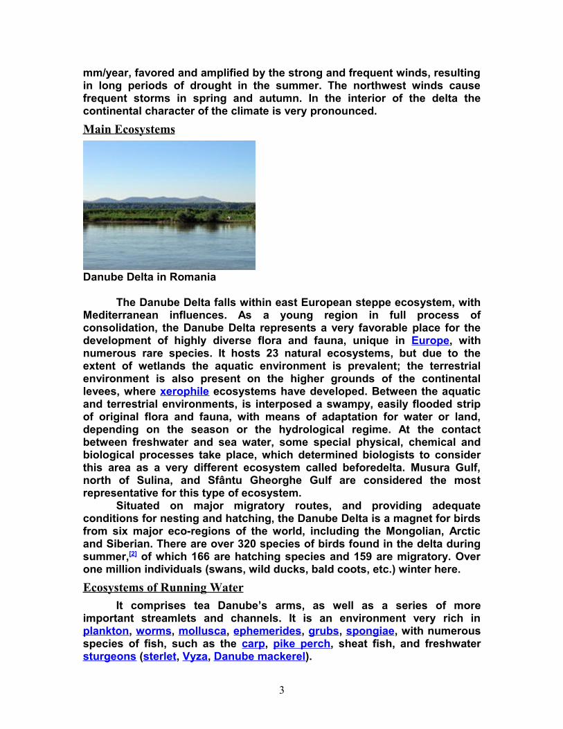
Danube Delta in Romania
The Danube Delta falls within east European steppe ecosystem, with Mediterranean influences. As a young region in full process of consolidation, the Danube Delta represents a very favorable place for the development of highly diverse flora and fauna, unique in Europe, with numerous rare species. It hosts 23 natural ecosystems, but due to the extent of wetlands the aquatic environment is prevalent; the terrestrial environment is also present on the higher grounds of the continental levees, where xerophile ecosystems have developed. Between the aquatic and terrestrial environments, is interposed a swampy, easily flooded strip of original flora and fauna, with means of adaptation for water or land, depending on the season or the hydrological regime. At the contact between freshwater and sea water, some special physical, chemical and biological processes take place, which determined biologists to consider this area as a very different ecosystem called beforedelta. Musura Gulf, north of Sulina, and Sfântu Gheorghe Gulf are considered the most representative for this type of ecosystem.
Situated on major migratory routes, and providing adequate conditions for nesting and hatching, the Danube Delta is a magnet for birds from six major eco-regions of the world, including the Mongolian, Arctic and Siberian. There are over 320 species of birds found in the delta during summer,[2] of which 166 are hatching species and 159 are migratory. Over one million individuals (swans, wild ducks, bald coots, etc.) winter here.
Ecosystems of Running Water
It comprises tea Danube’s arms, as well as a series of more important streamlets and channels. It is an environment very rich in plankton, worms, mollusca, ephemerides, grubs, spongiae, with numerous species of fish, such as the carp, pike perch, sheat fish, and freshwater sturgeons (sterlet, Vyza, Danube mackerel).
3
Ecosystem of Stangnant Water
Includes the lakes, to which various ponds, streamlets and channels are added. They are characterized by a rich floating and submerse flora (Myriophyllum, Ceratophyllum, Vallisneria etc. under the water; Nymphaea Alba, Nuphar luteum, Trapa natans, Alisma plantago etc., floating plants with roots near the lakes borders; Salvinia natans, Stratiotes aloides, Spirogyra etc., floating plants without roots, having negative effects for the aquatic bio-productivity). Of the fish, the most important are Tinca tinca, Abramis brama, Scardinius erytrophalmus, Carassius auratus gibelio, Silurus glanis, Perca fluviatilis, Exos lucius etc.
Ecosystems of Marshy and Flooding Areas
The reed plats and floating reed islands (called plaur in Romania are the most common and well known components of the Danube Delta. Vegetation of this ecosystem consists of common reed (Phragmites communis), and near river banks mace reed (Typha latifolia, Typha angustifolia), sedge (Carex dioica, Carex stricta), Dutch rush (Scirpus radicans, Scirpus lacustris), brook mint (Menta aquatica) etc. They constitute ideal spawning and nestling grounds. The plaur is a mixture of reed roots, grass and soil, usually floating or anchored on the bottom. As a rule, the reed surrounds the lakes and ponds, slowly invading the water surface. This type of ecosystem is noted for the variety and large populations of birds, some of them very rare. The most important are the tufted duck (Aythya fuligula, red crested pochard (Netta rufina), mallard (Anas platyrhincos), Greylag goose (Anser anser), Pygmy cormorant (Phalacrocorax pygmaeus), purple heron (Ardea purpurea), Great white egret (Egretta alba), little egret (Egretta garzetta), Spoon bill (Platalea leucorodia), White pelican (Pelecanus onocrotalus), Dalmatian pelican (Pelecanus crispus), Mute swan (Cygnus olor), Glossy ibis (Plegadis falcinellus). A recent and welcomed spreading has the pheasant (Phasianus colchicus). Among the mammals, there is the otter (Lutra lutra), mink (Mustela lutreola), little ermine (Mustela erminea aestiva), wild boar (Sus scrofa), wild cat (Felis silvestris), and in the winter, the hare (Lepus europaeus), and on the brink of disappearing from the delta, the wolf and the fox. The enot dog (Nyctereutes procynoides), bizam (Onda zibethica), and to some extent nutria (Myocastor coypus) are recent species successfully adapted.
River Banks and Levees Ecosystems
The firm land of the delta used to be covered with large groves of willow trees, cut almost entirely and replaced with Canadian poplars. On the riverbanks kept in natural state, small groves of willow trees (Salix alba, Salix fragilis, Salix purpurea, Salix petandra, Salix triandra etc.) can still be found, mixed with white poplar (Populus alba). Occasionally, the willow trees form corridors along the Danube’s arms and bigger channels. On the levees of Letea and Caraorman, mixed forests of oaks (Quercus robur,
4
Quercus pedunculiflora) with various trees (Fraxinus pallisae, Ulmus foliacea, Populus tremula), shrubs (Prunus spinosa, Crataegus monogyna, Rosa canina, Berberis vulgaris etc.), and liana (Vitis silvestris, Hedera helix, Humulus lupulus, Periploca graeca, which reaches up to 25m) grow on sand dunes. On the Letea levee, these exotic looking forests grow especially in the depressions between the sand dunes, in small groves called hasmace. Fauna of this region includes the meadow viper (Vipera renardi), osprey (Haliaetus albicella), eagle-owl (Bubo bubo), etc.
Inhabitants
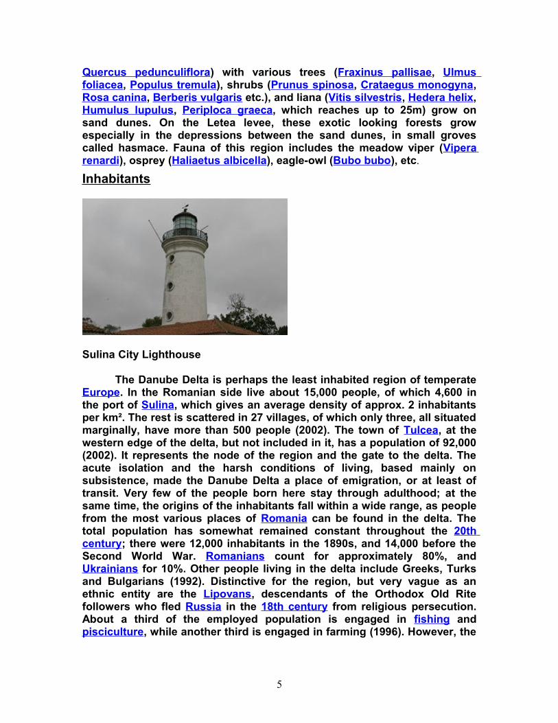
Sulina City Lighthouse
The Danube Delta is perhaps the least inhabited region of temperate Europe. In the Romanian side live about 15,000 people, of which 4,600 in the port of Sulina, which gives an average density of approx. 2 inhabitants per km². The rest is scattered in 27 villages, of which only three, all situated marginally, have more than 500 people (2002). The town of Tulcea, at the western edge of the delta, but not included in it, has a population of 92,000 (2002). It represents the node of the region and the gate to the delta. The acute isolation and the harsh conditions of living, based mainly on subsistence, made the Danube Delta a place of emigration, or at least of transit. Very few of the people born here stay through adulthood; at the same time, the origins of the inhabitants fall within a wide range, as people from the most various places of Romania can be found in the delta. The total population has somewhat remained constant throughout the 20th century; there were 12,000 inhabitants in the 1890s, and 14,000 before the Second World War. Romanians count for approximately 80%, and Ukrainians for 10%. Other people living in the delta include Greeks, Turks and Bulgarians (1992). Distinctive for the region, but very vague as an ethnic entity are the Lipovans, descendants of the Orthodox Old Rite followers who fled Russia in the 18th century from religious persecution. About a third of the employed population is engaged in fishing and pisciculture, while another third is engaged in farming (1996). However, the
5
quasi-totality practice fishing, more or less legally, as a means of subsistence or extra money.
The Ukrainian part of the delta is very well populated compared to the Romanian one. The town of Izmail has a population of 85,000, and Vilkovo, the main center of Lipovan community, 11,000 (2001).
History
Starting with the 15th century, the Danube Delta was part of the Ottoman Empire. In 1812, following the Russo-Turkish War the borders of Ottoman and Russian Empires were set by Kilia and Old Stambul Channels of Danube, and in 1829 by Georgievsky Channel. The Treaty of Paris of 1856 which ended the Crimean War, Danube Delta together with two districts of Southern Bessarabia was included in the Principality of Moldavia and was established an international commission which made a series of works to help navigation. In 1859, it became part of the United Principalities of Wallachia and Moldavia. In 1878, following the defeat of Ottoman Empire from Russia and Romania, the border between those two was set again by Kilia and Old Stambul Channels.
Environment and Issues
Large scale works began in the Danube Delta as early as the second half of the 19th century. First corrections of the Sulina arm began in 1862 and they continued throughout the 20th century. A a result, the length of the Sulina arm was reduced from 92 to 64 km, and its flow more than doubled, to make it suitable for large-vessel navigation. By correcting the six large meanders on its course, the length of the Sfântu Gheorghe was also reduced to 70 km from 108, and its flow slightly increased also. Both these increases were made to the detriment of the Chilia arm, which as of present remains the most unspoiled arm of the main three. These corrections, as well as the digging of various secondary channels throughout the body of the delta have a serious impact on the ecosystem. Natural environments are altered, the breeding pattern of fish especially is disrupted, the flow of the main arms is increased, with serious consequences regarding the discharge of the alluviums and the erosion of the banks.
Reed was intensively harvested during the Communist era. The regime had plans of transforming the delta into a large agro-industrial zone. Although the first modern agricultural exploitation dates form 1939 (Ostrovul Tãtaru), just from the 1960 on have large areas been drained and converted, to the detriment of wetlands. As of 1991 agricultural land in the delta surpassed 100,000 ha, and more than a third of its surface has been affected by crop cultivation, forest plantation or pisciculture arrangements. As a result of these changes, as well as the increasing pollution and eutrophication of the Danube waters, and decades overexploitation and
6
poor regulations on fishing (commercial and recreational), the fish population is in visible regress.
In 2004, Ukraine inaugurated work on the Bistroe Channel that would provide an additional navigable link from the Black Sea to the populous Ukrainian section of the Danube Delta. However, because of the negative impact which this new channel may have upon the fragile ecosystem of the Delta, the European Union advised Ukraine to shut down the works. Romanian officials threatened to sue Ukraine at the International Court of Justice. Under the presidency of Kuchma Ukraine had responded that Romania is just afraid of the competition that the new channel will bring, and continued working on the channel. Under the presidency of Yuschenko, who visited Romania in 2005, both sides agree that professionals should decide the fate of the channel. In the long-run, Ukraine plans to build a navigation channel, if not through Bistroe Channel then through another channel.
7
2. Piatra Craiului National Park
Main ridge of the Piatra Craiului mountains
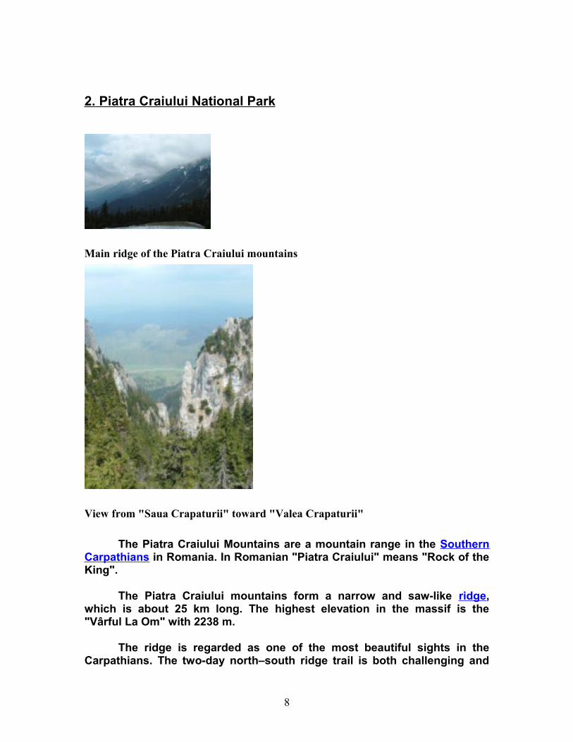
View from "Saua Crapaturii" toward "Valea Crapaturii"
The Piatra Craiului Mountains are a mountain range in the Southern Carpathians in Romania. In Romanian "Piatra Craiului" means "Rock of the King".
The Piatra Craiului mountains form a narrow and saw-like ridge, which is about 25 km long. The highest elevation in the massif is the "Vârful La Om" with 2238 m.
The ridge is regarded as one of the most beautiful sights in the Carpathians. The two-day north–south ridge trail is both challenging and
8
rewarding. Starting at either Plaiul Foii in the north-west or Curmătura in the north-east, walkers climb up to the ridge before following a somewhat precarious path along the narrow spine. The descent at the southern end leads into a karst landscape of deep gorges and pitted slopes where water penetrating the rock has carved a series of caves.
Localisation
The massif is bordered in the west by the Dâmboviţa Valley which separates it from the Păpuşa massif; in the north-west the river Bârsa and Curmătura Foii separates it from the Făgăraş Mountains and in the east the "Bran-Rucăr passage" delimits it from the Bucegi and Leaotă mountains. The southern border is the confluence of the valleys of Dâmboviţa and Dambovicioara rivers, in the "Podul Damboviţei" depression.
Nature protection
The whole range is included in the national park Parcul Naţional Piatra Craiului (Piatra Craiului National Park).
The first protection of this area started in 1938 when 4.4 km² were declared as a "Nature Reserve". The Law 5/2000 enlarged this area to 148 km². In 2003 the external limits and internal zoning were created. Since 1999 a park administration exists and since 2005 a management-plan is in place.
In the national park area about 300 fungi species, 220 lichen species, 100 different mosses, 1100 species of superior plants (a third of the number of all plant species found in Romania), 50 Carpathians endemic species and also two endemic species for Piatra Craiului can be found.
There are also 2 endemic species of spiders, 270 butterflies species, amphibians and reptiles, 110 birds species (50 listed in the Bern Convention and 6 in the Bonn Convention), 17 bats species, chamois and other large herbivores and also many large carnivores (wolfs, brown bears, lynx) living in the national park.
Access
Zărneşti is the most important town for visiting the national park. It is also an ideal starting point for approaches in the northern part of the massif. This town is lying at a distance of 28 km from the city of Braşov, by road, bus or railway. From Zărneşti, an 11 km long road makes the connection with the comfortable chalet "Plaiul Foii", which is a good starting point for climbing the ridge.From Zărneşti also a forest road starts from the south-western part of the town, leading through the Zărneşti Gorges (Prăpăstiile) and further up to the here up to the ridge.
9

In Zărneşti can also the office of the administration of the National Park be found. A a new visitor center had been built in this town which opened in spring 2007.
The traditional villages Măgura, Peştera, Ciocanu, Şirnea are interesting starting points for the routes on the eastern slope and for getting in touch with the traditional Romanian way of life.
10
3. Retezat National Park
Hiking in Retezat National Park you may well lose your breath, not from the climb, but the breath-taking views of nature at her wildest. Peaks of differing heights, many topping the 2,000m mark, make the park a true wilderness challenge. Visitors willing to tackle the "massive challenge" will discover their efforts are well rewarded. The lonely mountains rise and fall, and appear to change in shape as the sun casts an array of mountain shadows about the land from dawn to dusk.
Park’s location:Located in the Southern Carpathians
Area (ha):38 138
Wilderness zone:14 215 ha - 37,27% (of total area)
Number of visitors per year:15 000-22 000
Office location:M. Viteazu St. No. 10, 330091
Tel:+40 254 218829
Email:[email protected] Website:http://www.retezat.ro (Romanian language site)
Short history
The first idea of a preserved area in the Retezat occurred in 1923. Though the national park was designated in 1935, park management is still quite young, having been established in 1999. Still the Park is well preserved, due to its remoteness, but also because of the care foresters have shown for centuries to this valuable place.
11
Flora
More than 1/3 of Romanian flora can be found in the Retezat Mountains.
High meadows create a haven for rare alpine flora. In the mountain area, long, steep slopes are covered with different types of forest, especially beech, spruce and fir, with birch and rowen as pioneer species. At the sub-alpine level, slopes shaped by ice are often protected by dwarf pine. The forest line reaches 1900 m with some Spruce adapted to the harsh climate. Arola pine (Pinus Cembra) in the dwarf pine cover offer shelter and food to birds. Some areas are covered with rhododendron kotschy, and Alnus viridis can be found. The higher peaks of the alpine level are covered in scree and stones. The rich alpine flora was the main reason for designating Retezat as a national park. Some of the species are quite rare e.g. pink (Dianthus glacialis), endemic whitlow-grass (Draba dornerii), louse wort (Pedicularis exaltata), bird’s eye primrose (Primula minima), milk-wetch (Astragalus australis), alpine fleabane (Erigeron acer) , wormwood (Artemisia campestris), black vanille orchid (Nigritella rubra). Retezat National Park is a genetic center for two important mountain plant genus: Hieracium and Poa.
Fauna
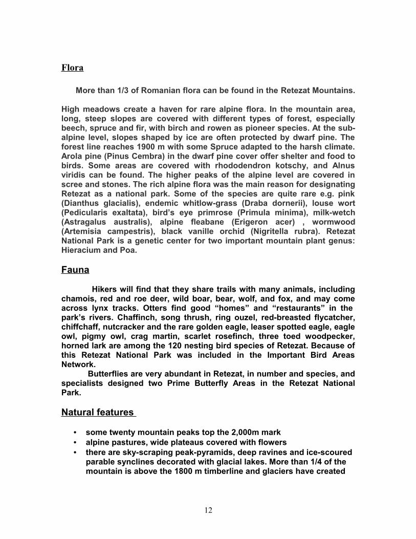
Hikers will find that they share trails with many animals, including chamois, red and roe deer, wild boar, bear, wolf, and fox, and may come across lynx tracks. Otters find good “homes” and “restaurants” in the park’s rivers. Chaffinch, song thrush, ring ouzel, red-breasted flycatcher, chiffchaff, nutcracker and the rare golden eagle, leaser spotted eagle, eagle owl, pigmy owl, crag martin, scarlet rosefinch, three toed woodpecker, horned lark are among the 120 nesting bird species of Retezat. Because of this Retezat National Park was included in the Important Bird Areas Network. Butterflies are very abundant in Retezat, in number and species, and specialists designed two Prime Butterfly Areas in the Retezat National Park.
Natural features
• some twenty mountain peaks top the 2,000m mark • alpine pastures, wide plateaus covered with flowers • there are sky-scraping peak-pyramids, deep ravines and ice-scoured
parable synclines decorated with glacial lakes. More than 1/4 of the mountain is above the 1800 m timberline and glaciers have created
12
terraced valleys that end in magnificent glacial bays, lakes and waterfalls.
• extraordinary passes, gorges, cavernous limestone caves and sinkholes can be found on the limestone area of the Retezat (the Small Retezat)
Cultural sights
Local communities and cultural sights from around the park area add a special value to that of the landscape and biodiversity inside the park. Three communes/communities are on the edge of the park, having also land-use rights in the alpine pastures for their livestock. These are Salasu de Sus, Rau de Mori and Campu lui Neag. People in these communities still practice traditional agriculture and preserve some of the traditional lifestyle of the area. 13th century churches, remains of a fortress Cetatea Colt (that has inspired Jules Verne in his novel “The Castle from the Carpathians”) and the sight of the Roman capital Sarmisegetusa Ulpia Traiana can be visited close to the Park.
• Densuş Church – 10th century, one of the oldest orthodox churches in Europe, still used for religious services
• Mălăieşti forth (14th century) • Sălaşu de Sus Church • Sântămăria Orlea Church (13th century) • Prislop Monastery (14th century)
Things to do
- hiking/walking/trekking, wildlife, camping, climbing, skiing, nordic ski, mountain biking, bird watching.
Guiding
- Qualified mountain guides - English, Hungarian speaking- Specialized guides (fauna & flora, wildlife watching) - English, Hungarian speaking- Mountain rescue, with watch points during tourism season
Trails
Marked trails are guiding visitors, who have to follow them both for security reasons, but also for conservation reasons. Maps can be bought at the entrance points at Gura Apei/Rotunda, Gura Zlata, Rausor, Carnic, Buta.
13
Educational trail at Râuşor, with an informational leaflet in Romanian and English.Tourist Retezat National Park Map can be bought at park entrances and accommodation sites.
Publication s
- Retezat National Park Newsletter: published on a quarterly basis, addressed to the general public, with parts dedicated to children and local people.
- Retezat National Park Scientist Newsletter: published twice a year in an electronic format, with brief information on park studies' results and planned research projects.
Volunteers
- Students from Hunedoara Faculty, through Ecosilva NGO- Students from Romanian schools and universities- Mountain Rescue volunteers- Retezat Junior Rangers- International volunteers, students from German universities
Park facilities
Tourists can use only designated camping sites inside Retezat National Park. Accommodation can be found in mountain cabins, Râuşor motel and local pensions. Booking in local pensions/cabins - contact: [email protected], or fax: 0040 254 218829.
Visitor centers
Two visitors centers will be opened in 2005, one in Nucşoara and the other one in Râu de Mori. Beside those there will be two tourism information points: one in the south (close to Câmpu lui Neag village) and the other one on Râu Mare Valley.Education facilities. The main visitor center in Nucşoara will have a display with information about Retezat National Park and an educational area.
14
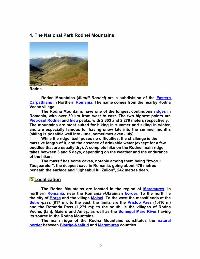
4. The National Park Rodnei Mountains
Rodna
Rodna Mountains (Munţii Rodnei) are a subdivision of the Eastern Carpathians in Northern Romania. The name comes from the nearby Rodna Veche village.
The Rodna Mountains have one of the longest continuous ridges in Romania, with over 50 km from west to east. The two highest points are Pietrosul Rodnei and Ineu peaks, with 2,303 and 2,279 meters respectively.The mountains are most suited for hiking in summer and skiing in winter, and are especially famous for having snow late into the summer months (skiing is possible well into June, sometimes even July).
While the ridge itself poses no difficulties, the challenge is the massive length of it, and the absence of drinkable water (except for a few puddles that are usually dry). A complete hike on the Rodnei main ridge takes between 3 and 5 days, depending on the weather and the endurance of the hiker.
The massif has some caves, notable among them being "Izvorul Tăuşoarelor", the deepest cave in Romania, going about 479 metres beneath the surface and "Jgheabul lui Zalion", 242 metres deep.
Localization
The Rodna Mountains are located in the region of Maramureş, in northern Romania, near the Romanian-Ukrainian border. To the north lie the city of Borşa and the village Moisei. To the west the massif ends at the Setref-pass (817 m); to the east, the limits are the Prislop Pass (1,416 m) and the Rotunda Pass (1,271 m); to the south lie the villages of Rodna Veche, Şanţ, Maieru and Anieş, as well as the Someşul Mare River having its source in the Rodna Mountains.
The main ridge of the Rodna Mountains constitutes the natural border between Bistriţa-Năsăud and Maramureş counties.
15
Access
The most used access points to the mountain are:
- Setref Pass, by car or train, from the Dealu Stefanitei train station- Borşa city, by car or bus; from the center of the city there is a path to the Iezer weather station and lake;
- Borşa ski resort, by car or bus; access is made from the top of the ski slope, directly to the main ridge at "Saua Gargalau"
- Prislop Pass, by car; from the pass there is a marked path that meets the one from the top of the ski slope, also leading to "Saua Gargalau"
- Rodna Veche village, by train or car; from the village there are two marked paths leading to the main ridge, one of them going directly to the Ineu peak.
Accommodation
There are a few resorts at the base of the mountain, notably Borşa ski resort, with a few hotels and many privately-run guesthouses, and also the new "Valea Basnei" resort, newly completed in 2007, near the village Sant. Up on the ridge there is no accommodation whatsoever, so tourists should bring tents.
Nature Reserve
The entire Rodna Mountain is included in the Rodna National Park and Biosphere Reserve, situated in the South-East of Maramures County and the North-East of Bistrita Nasaud County,in the high region of Rodnei Mountains occupying 46.399 hectares. Being part of the north group of the Carpathians Mountains,Rodnei Mountains are situated between the Tibles Massif in the West, Bucovina’s High Hills and Suhard Mountains in the East;Maramures Mountains in the North’ Nasaud’s Hills in the South;Bargau’s Mountains in the South-East. Rodnei Mountains represents the most important mountain group of the Eastern Carpathians. So, Rodnei Mountains are the highest mountains in the Eastern Carpathians and we find the highest glacial lake. Also in the area of Rodnei Mountains we can find one of the most important mountain resort from the north area of the country (Borsa),as well as an important national watering resort, Sangeorz Bai.
Protected Nature
16
The National Park Rodnei Mountains is situated in the central area of the Rodnei Mountains. The importance of this park is due to the geology and geomorphology of the mountains, as well as to the presence of a number of animals and plants species, glacial relicts and endemits. The park was established in 1990 when the Ministry of Environment put forward No. 7 Order concerning the foundation of 14 national parks, amongst these –The National Park Rodna. This Order provoked confusion because it referred only to the forests’ surfaces from the national parks, not to the surfaces that contain mountains gaps. The actual surface is the one established in 2002 by the Ministry of Environment. From the total surface of 46399 hectares of PNRM,3300 hectares have been declared Biosphere Reservation in 1979.
In the National Park Rodnei Mountains, a few natural areas have a special interest: The Scientific Reservation „Pietrosul Mare, 3300 ha-I category of IVCN, is situated in the north-west side of the Rodnei Mountains. This reservation can be found at 750 m altitude, from the 750m altitude to 2303m altitude ,containing reliefs belonging to different cycles of formation (especially glaciar and periglaciar),as well as sections of the most important parts of the vegetation of the Rodna Mountains. It was set up in 1932 and it also has an absolute protected scientific area. In this reservation you can find numerous species of rare plants, carpathians „endemisme”.
The „Piatra Rea” natural reservation, 50 ha-I category of IVCN, is protected especially for its numerous species of „floare de colt”.
The „Pestera si Izbucul Izvorul Albastru al Izei” mixt reservation, 100 ha, III category of IVCN ,situated in the eastern side of the Rodna Mountains on the south side of the Magura Mountains, was declared reservation in 1977.
17
5. Cheile Bicazului National Park
5.1. General Description of the National Park Cheile Bicazului - Hasmas
P.N.C.B - H is of a great geologic, geomorphologic and paleontologic interest. It is also interesting from the point of view of its landscapes, and biological diversity generated by the great variety of geoclimactic conditions. The Bicaz Gorges are famous in Romania also because of their impressive dimension. At the same time, the Red Lake, formed through the natural blocking of the Bicaz river's waters (1837) offers a lovely scenery to the eyes.
5. 1.1.Location
The park is located in the Hasmas mountains - (Haghimas), situated in the central group of Oriental Carpathians, also known as the Moldo - Transsylvanian Carpathians. The park is located in the central - north - eastern region of Romania, in the zone of Harghita and Neamt districts.
5. 1.2.Access The protected area of the Bicaz Gorges - Hasmas is crossed by the transcarpathian road DN12C, which connects the town of Gheorgheni - (situated in the Giurgeu Depression and drained by the Mures river) to Bicaz, a town situated on the Bistrita river. The access towards the Hasmasul (Haghimasul) Mare can be done from Balan, situated north of Sandominic, on DN12.
5. 1.3.Natural Reservations Included in the Park
The Bicaz Gorges (Neamţ district - 1,600 hectars and Harghita district - 2,128 hectars) and Lacu Rosu, Cheile Sugaului (10 hectars) Avenul Licas (5 hectars) the Hasmasul Mare - Piatra Singuratica (the Lonely Stone) and Hasmasul Negru (800 hectars).
5. 1.4.The surface of the PNCB - H : 6,575 hectars.
5. 1.5 Marks and touristic signs
• Information boards on PNCB – H ;
• The condition of tourist routes is permanently revised by the Park Administration;
• The Park Administration decides on adopting tourist sign norms as used at European level.
18
5.1.6. Touristic products
• tourist program offers of one or several days, including: walks of the tourist routes, equestrian tourism, photo tourism, with accommodation at the nearby boarding - houses, and those of the Silvic Direction - Miercurea Ciuc (see the USEFUL INFORMATION menu);
• trips with guides;
• easy trips with guides with the aim to visit local communities;
• trips specialised in observing the flora and fauna of the Park;
• winter tourism – cross country skiing, ski, walks with snow rockets.
The PNCB - H, with a surface of 6575 hectars, was built after the publication of Law nr 5/2000.
As a result of the Administration Contract nr 736/M.M.G.A./22.05.2004 between M.M.G.A. and R.N.P. Romsilva, there has been created the Park Administration, as a subunit of the Silvic Direction Miercurea Ciuc within the frame of the National Forest Administration Romsilva.The staff of the PNCB - H administration is as follows:
• The principal of the park - Cosmin Butnar, engineer;
• Economist - Lajos Kiss;
• Person in charge with the relationship with the communities and ecologic education - Teréz Laczkó, engineer;
• Person in charge with the technology of information - Nicu Bogdan Maris, engineer;
• Biologist - echologist, Barna Hegyi;
• Person in charge with watch and tourism, Angi Zoltán, college engineer;
• Field agents, Vitos Botond, th, Csergo Ottó, college engineer, Bereczki Reymont, th, Szakáli Ildikó, college engineer, Béla Gál;
19
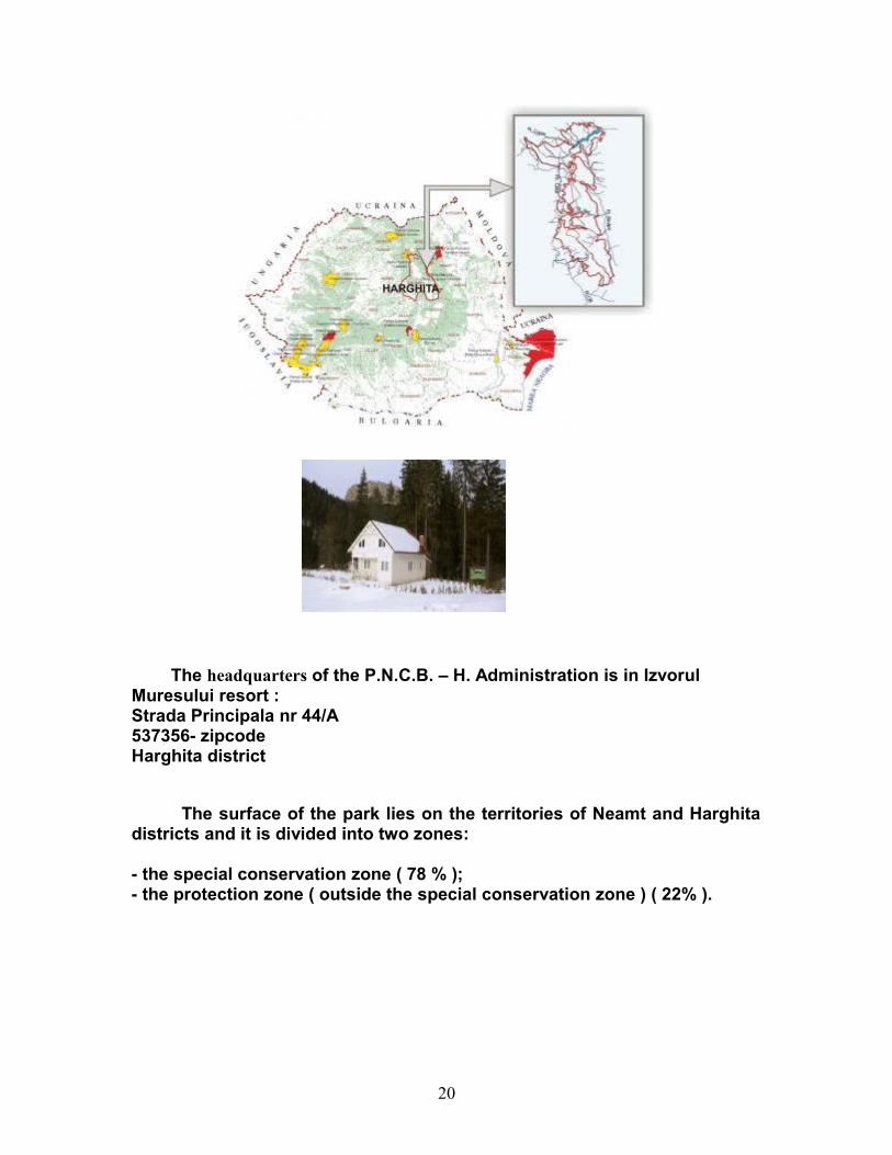
The headquarters of the P.N.C.B. – H. Administration is in Izvorul Muresului resort :Strada Principala nr 44/A537356- zipcodeHarghita district
The surface of the park lies on the territories of Neamt and Harghita districts and it is divided into two zones:
- the special conservation zone ( 78 % );- the protection zone ( outside the special conservation zone ) ( 22% ).
20
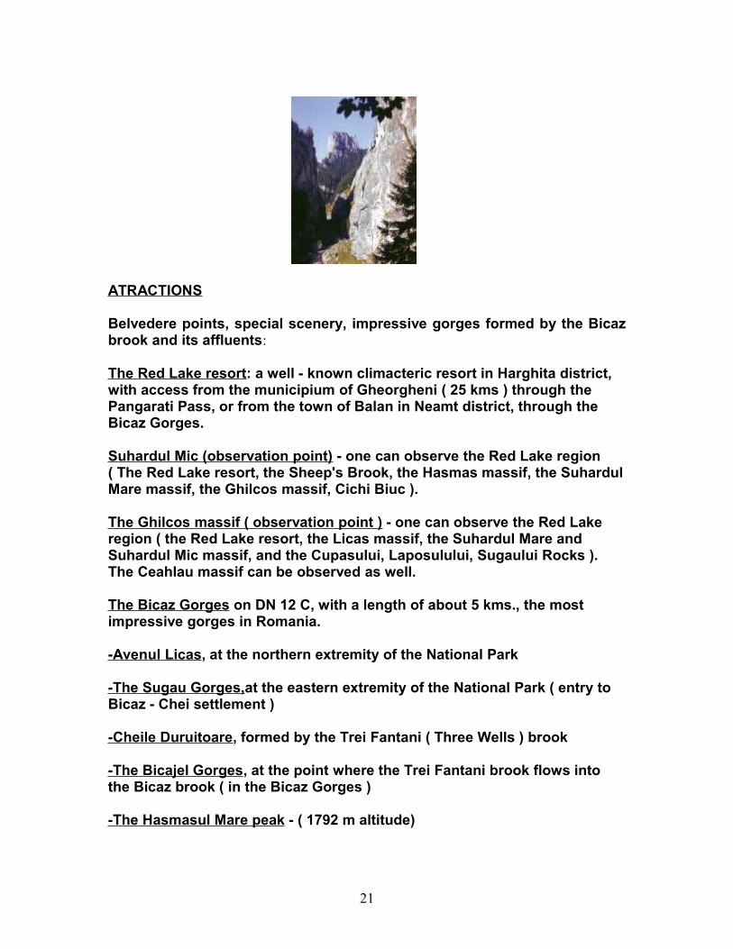
ATRACTIONS Belvedere points, special scenery, impressive gorges formed by the Bicaz brook and its affluents:
The Red Lake resort: a well - known climacteric resort in Harghita district, with access from the municipium of Gheorgheni ( 25 kms ) through the Pangarati Pass, or from the town of Balan in Neamt district, through the Bicaz Gorges.
Suhardul Mic (observation point) - one can observe the Red Lake region ( The Red Lake resort, the Sheep's Brook, the Hasmas massif, the Suhardul Mare massif, the Ghilcos massif, Cichi Biuc ).
The Ghilcos massif ( observation point ) - one can observe the Red Lake region ( the Red Lake resort, the Licas massif, the Suhardul Mare and Suhardul Mic massif, and the Cupasului, Laposulului, Sugaului Rocks ). The Ceahlau massif can be observed as well.
The Bicaz Gorges on DN 12 C, with a length of about 5 kms., the most impressive gorges in Romania.
-Avenul Licas, at the northern extremity of the National Park
-The Sugau Gorges,at the eastern extremity of the National Park ( entry to Bicaz - Chei settlement )
-Cheile Duruitoare, formed by the Trei Fantani ( Three Wells ) brook
-The Bicajel Gorges, at the point where the Trei Fantani brook flows into the Bicaz brook ( in the Bicaz Gorges )
-The Hasmasul Mare peak - ( 1792 m altitude)
21
- Patra Singuratica ( The Lonely Stone ) - Hasmasul Mare can be noticed from DN 12 from Miercurea Ciuc, and it can be accessed from the town of Balan ( with access from Sandominic )
- Poiana - Alba ( the White Clearing ) - Hasmasul Mare - from here one can follow any desired route to Hasmasul Mare - Piatra Singuratica - Hasmasul Mic ( Ocsem ) - the Tarcau massif ( at the southern extremity of the National Park ), in the direction of Paraul Oii ( the Sheep's Brook ) - Red Lake resort, or to the Ghilcos massif - Red Lake resort, to Hasmasul Negru, to the village of Trei Fantani, to Balan, to the Pangarati Pass...
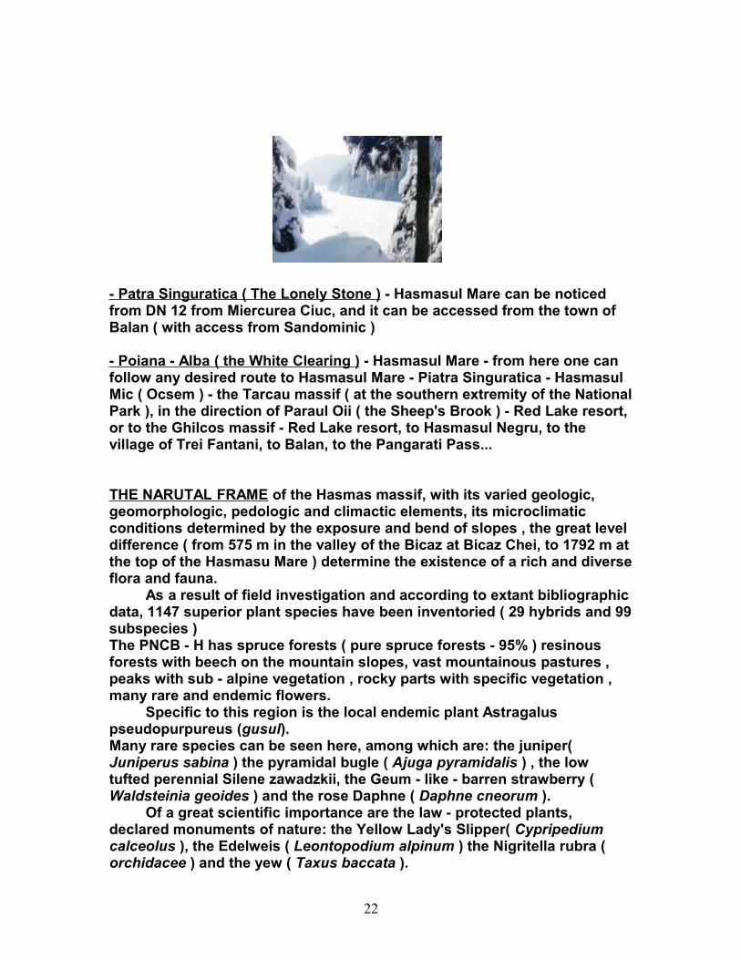
THE NARUTAL FRAME of the Hasmas massif, with its varied geologic, geomorphologic, pedologic and climactic elements, its microclimatic conditions determined by the exposure and bend of slopes , the great level difference ( from 575 m in the valley of the Bicaz at Bicaz Chei, to 1792 m at the top of the Hasmasu Mare ) determine the existence of a rich and diverse flora and fauna. As a result of field investigation and according to extant bibliographic data, 1147 superior plant species have been inventoried ( 29 hybrids and 99 subspecies ) The PNCB - H has spruce forests ( pure spruce forests - 95% ) resinous forests with beech on the mountain slopes, vast mountainous pastures , peaks with sub - alpine vegetation , rocky parts with specific vegetation , many rare and endemic flowers. Specific to this region is the local endemic plant Astragalus pseudopurpureus (gusul).Many rare species can be seen here, among which are: the juniper( Juniperus sabina ) the pyramidal bugle ( Ajuga pyramidalis ) , the low tufted perennial Silene zawadzkii, the Geum - like - barren strawberry ( Waldsteinia geoides ) and the rose Daphne ( Daphne cneorum ). Of a great scientific importance are the law - protected plants, declared monuments of nature: the Yellow Lady's Slipper( Cypripedium calceolus ), the Edelweis ( Leontopodium alpinum ) the Nigritella rubra ( orchidacee ) and the yew ( Taxus baccata ).
22
THE FAUNA of the park is very rich in rare and endangered species and also in other species characteristic for the mountain region.Here are some of these rare species, which are important links of a rich trophic network, pointing towards a still well - balanced echosystem : the Apollo butterfly ( Parnassius apollo )and the Polygonia alba. There are also amphibians and reptiles , such as Bombina variegata ( the yellow bellied toad ), Rana ridibunda ( the lake frog ) Triturus alpestris ( the Alpine newt ) , Triturus cristatus ( the crested newt ) , the Triturus montadoni ( the carpathian newt ) , the Salamandra salamandra ( salamander ) , the Bufo bufo ( the toad ) , the Rana temporaria ( the common frog ) the Lacerta vivipara ( the viviparous lizard ), the Vipera berus ( common viper ), the Coronella austriaca ( the smooth snake ). There are also birds such as Tichodroma muraria ( the wallcreeper ), Picoides tridactylus ( the woodpecker ) , Emberiza cia ( the rock Bunting ), Corvus corax ( common raven ) Tetrao urogallus ( Old World grouse ), Strix uralensis ( the Ural owl ) Aquila chrysaetos ( the golden eagle ). There can be found also some mammals in the region: Cervus elaphus ( the red deer ) Rupicapra rupicapra ( the wild alpine goat ) Ursus arctos ( the bear ) Lynx lynx ( lynx ) and Canis lupus.
6. Trivale Forest
23
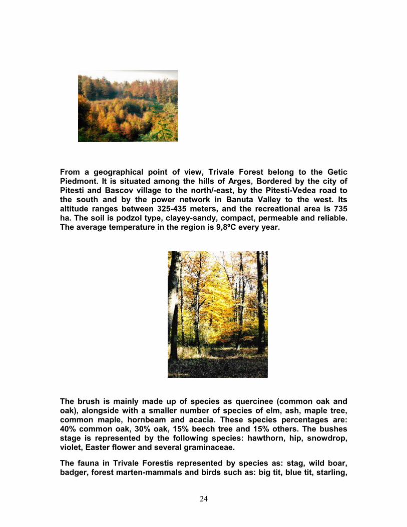
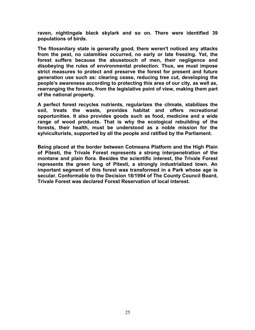
From a geographical point of view, Trivale Forest belong to the Getic Piedmont. It is situated among the hills of Arges, Bordered by the city of Pitesti and Bascov village to the north/-east, by the Pitesti-Vedea road to the south and by the power network in Banuta Valley to the west. Its altitude ranges between 325-435 meters, and the recreational area is 735 ha. The soil is podzol type, clayey-sandy, compact, permeable and reliable. The average temperature in the region is 9,8ºC every year.
The brush is mainly made up of species as quercinee (common oak and oak), alongside with a smaller number of species of elm, ash, maple tree, common maple, hornbeam and acacia. These species percentages are: 40% common oak, 30% oak, 15% beech tree and 15% others. The bushes stage is represented by the following species: hawthorn, hip, snowdrop, violet, Easter flower and several graminaceae.
The fauna in Trivale Forestis represented by species as: stag, wild boar, badger, forest marten-mammals and birds such as: big tit, blue tit, starling,
24
raven, nightingale black skylark and so on. There were identified 39 populations of birds.
The fitosanitary state is generally good, there weren't noticed any attacks from the pest, no calamities occurred, no early or late freezing. Yet, the forest suffers because the abusetouch of men, their negligence and disobeying the rules of environmental protection. Thus, we must impose strict measures to protect and preserve the forest for present and future generation use such as: clearing cease, reducing tree cut, developing the people's awareness according to protecting this area of our city, as well as, rearranging the forests, from the legislative point of view, making them part of the national property.
A perfect forest recycles nutrients, regularizes the climate, stabilizes the soil, treats the waste, provides habitat and offers recreational opportunities. It also provides goods such as food, medicine and a wide range of wood products. That is why the ecological rebuilding of the forests, their health, must be understood as a noble mission for the sylviculturists, supported by all the people and ratified by the Parliament.
Being placed at the border between Cotmeana Platform and the High Plain of Pitesti, the Trivale Forest represents a strong interpenetration of the montane and plain flora. Besides the scientific interest, the Trivale Forest represents the green lung of Pitesti, a strongly industrialized town. An important segment of this forest was transformed in a Park whose age is secular. Conformable to the Decision 18/1994 of The County Council Board, Trivale Forest was declared Forest Reservation of local interest.
25